interactive rendering and stylization of transportation networks using distance fields
TRANSCRIPT

Interactive Rendering and Stylization of Transportation Networks using Distance Fields
Matthias Trapp, Amir Semmo, Jürgen DöllnerHasso Plattner Institute, University of Potsdam, Germany

INTRODUCTION

Towards Cartography-oriented Stylization

Paris Street Map – 1780
P1: contour lines surround fine-textured fills or solid colors to add visual contrast and improve figure-ground perception
P2: primary streets overlap secondary or tertiary streets in hierarchical representations of street networks; wavy or fuzzy to express uncertainty
P3: names follow principal line directions and are placed within streets or outside line segments
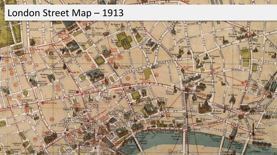
London Street Map – 1913

London Underground Map – 1933

Modern Tourist Map of Paris
P7: yellow established as a conventional color tone for main streets, with a discrete gradation towards grey and white shading for tertiary roads
P6: streets are tinted using qualitative color schemes to represent street classes and distinguish them from the underlying terrain
P5: a hierarchy of emphasis is drawn among reference elements, such as different line weights and colors to portray different grades of roads
P4: dynamic filtering and scaling of geometric features improves perception of roads at high view distances and avoids cluttering.

Conceptual and Technical Requirements
Pre-processing of discrete level-of-details consume additional memory and yield incoherent rendering when switching between these levels during zooming or within perspective projection.
Levels-of-Detail should be computed during rendering based on viewing settings
Increasingly detailed networks require high amounts of main/video memory.
Network representation should exhibit a small memory footprint and fast updates
View-dependent cartographic stylization of transportation networks are key features for a number of applications.
Rendering technique should provide a sufficient parameterization, i.e., covering level-of-detail rendering, interactive filtering, and highlighting

RELATED WORK

Related Work :: Overview
Street Rendering Approaches
Object-space Approaches
Geometry-based Approach
Texture-based Approach
Screen-Space Approaches
Stencil-based Approach
Discard-based Approach

Geometry-based Approach
Basic Principle:
Pre-compute geometry at different LoD
Forward rendering geometry
Most flexible approach w.r.t. stylization
Limitations:
High memory consumptions for complex networks
No transitions between static LoD
High rendering costs

Texture-based Approach
„Interactive 3D Visualization of Vector Data in GIS”O. Kersting, J. Döllner, ACM GIS 2002
Basic Principle:
Generate texture trees from geometry
Off-screen rendering at different resolutions
Use for texturing during scene rendering
Limitations:
Relies on data pre-processing
Requires intermediate representation
Suffers from texturing artifacts

Stencil-based Approach
„High-Quality Cartographic Roads on High-Resolution DEMs” M. Vaaraniemi, M. Treib, R. Westermann, WSCG Journal 2011
Basic Principle:
Generate shadow volume per street segment
Avoid cracks between segments using cap cones
Enables distance-based scaling of street segments
Rendering using shadow volume approach
Limitations:
Requires additional data structure (volumes)
Limited styling capabilities (color + outline)

Discard-based Approach
„A screen-space approach to rendering polylines on terrain”D. Ohlarik, P. Cozzi; SIGGRAPH Poster 2011
Basic Principle:
Extrude polylines to walls
Compute intersection with terrain
Discard fragments accordingly
Avoid dashing and smearing
Limitations:
Stylization with single color only
No distance-dependent segment width

Distance-fields for Stylization Parametrization
„ Real-Time Rendering of Water Surfaces with Cartography-Oriented Design” A. Semmo, J. E. Kyprianidis, M. Trapp, J. Döllner; CAe 2014

APPROACH

Overview of Approach
Forward Rendering Pass Deferred Rendering Pass

Open Street Map (OSM) Data Representation

Overview of Distance-Field Generation

Geometry Generation
Attributed Vertex Cloud+
Geometry Shader+
Vertex Pulling

Encoding of Distance using Texturing

dresult = min(dsource , ddestination)
Blending Modes
No Blending Min-Blending
Distance Field Colored Distance Field Colored

Result: 2D Texture-Array
Memory consumptions: #layer width height precision (3 * 32 Bit = 12 Byte)

Evaluation of Distance Fields :: Procedural Textures
Procedural textures evaluated on a per-fragment basis:
Deferred texturing based on distance fields
Application of procedural and image textures possible
Bottom-up compositing based on street rank
“Improved Alpha-Tested Magnificationfor Vector Textures and Special Effects”Chris Green; SIGGRAPH 2007

Final Compositing Step
Bottom-up evaluation of each layer (street category) and blending

RESULTS & DISCUSSION

Application Examples :: Distance-based Evaluation
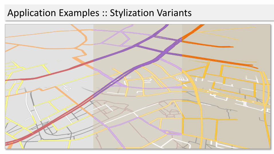
Application Examples :: Stylization Variants

Application Examples :: Regions-of-Interest

Application Examples :: Regions-of-Interest

Performance Evaluation
Test data sets of different complexityfrom Open Street Map (OSM) data base
Approach is fill-limited w.r.t. number ofstreet categories to render
ID Data Set # Nodes #Ways
A Berlin 1 5571 1028
B Istanbul 2004 263
C Berlin 2 9502 1766
A B C A B C A B C
390 x 260 670 x 450 1280 x 800
1 Category 3 2.9 3 3 2.9 3 25.5 25.4 25.3
2 Categories 3.2 3.3 3.4 3.2 3.3 3.4 29 29 29.2
4 Categories 4.1 4.1 4.2 4.1 4.2 4.2 36.1 26.2 36.2
8 Categories 5.5 5.4 5.5 5.7 5.6 5.8 50.1 50.1 50.2
0
10
20
30
40
50
60
Mill
ise
con
ds

Limitations
Distance-field generation:
Intrusion
Protrusion
Memory consumptions for large numbers of categories
Intrusion
Protrusion

Future Work :: Geometry Draping
Draping
Digital Elevation Model Result
Planar Network Geometry

Future Work :: Geometries
Generate alternative geometric representations
View-dependent adaptation of geometric representations

Conclusions
A concept for high-quality cartographic rendering exemplifiedfor complex street networks.
Interactive hardware-accelerated rendering technique havingminimal memory footprint for network representation.
Interactive stylization and colorization using deferred texturingbased on distance fields generated on per-frame basis
Potentials for future research

Questions & Comments ?
Contact:
Matthias Trapp / [email protected]
Amir Semmo / [email protected]
Jürgen Döllner / [email protected]
Publications: www.4dndvis.de/publikationen.html
This work was funded by the Federal Ministry of Education and Research (BMBF), Germany within the InnoProfile Transfer research group "4DnD-Vis".

Interactive Rendering and Stylization of Transportation Networks using Distance Fields
Matthias Trapp, Amir Semmo, Jürgen DöllnerHasso-Plattner-Institut, University of Potsdam, Germany