input2012 - logos loci - yet another strategic planning tool
DESCRIPTION
http://www.facebook.com/logosloci slideshare: http://goo.gl/bqBKY paper: http://goo.gl/CiIho The land use planning (which in this paper we call "LUPlanning") is a complex matter that needs of clearness and standardize methods. This work proposes an effective tool for strategic planning, which provides the use of informatic systems to aid the decision makers and insiders of public body that are not professionals. The use of informatics makes easier and real time the public participation, an important critical point of planning, often difficult to implement for scepticism and in many town hard to really carry out, due to inadequate means. The aim of the proposed tool is to furnish a way to simplification of LUPlanning process and decision, using available and cheap hardware and software solutions.TRANSCRIPT

Yet another strategic planning Tool
Remote sensingUAV
maps environmentalanalysis
UrbanPlanning
Investigation analysisgeographical
development PHPWebAPP/WebGIS
3D simulationland and buildings
Smart cities
db designenvironmental data
Tutorial GISOpenSource
Tool for StrategicLand Use Planning

Yet another strategic planning ToolTeory ofUrban
Planning
GIS
WEB
GPS
GeoDataBase
TOOLOF STRATEGIC
LandUsePLANNING
PUBLICPARTICIPATION

Yet another strategic planning Tool
SMART CITY
SMyLA
...
...
...
Mayor 3.0

Yet another strategic planning Tool
CMSContent Management System
OpenStreets
MapCommunity map
Wikipedia
ERPEnterprise Resource Planning
GISgeographic information system
MobileAPP
WIkitudeaugmented reality
FixMyStreet
GeoBlog
SocialNetwork
VirtualFacbook, Twitter
Google+
Reallocal associations
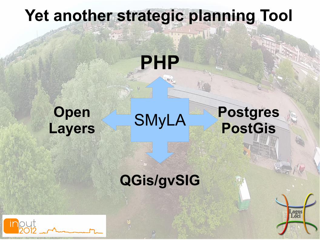
Yet another strategic planning Tool
PHP
PostgresPostGis
OpenLayers
QGis/gvSIG
SMyLA

Yet another strategic planning ToolSimMyLocalAround (SMyLA)
● Sim(ulation) we took from the popular game Sim City, which is the reference tool, hosting the entire idea;● My represents the social media logic,more generally, all of the applications hosted by the Web 2.0, that are customizable and suitable for everyone;● Local is identified with the territory and its projection on a geographical database by GIS;● Around means all that surrounds us, not only physically, but also what interests us, what we like to see in certain situations and in certain time of the day, during the study, at work and in leisure, in a few words, our needs.

Yet another strategic planning Tool

Yet another strategic planning Tool

Yet another strategic planning Tool
/home/pjh/Scrivania/ok/Schermata-00.png

Yet another strategic planning Tool
OpenData
OpenSource
OpenGovernment

Drone technologyRange of flyght: 0-200mGPS controlLoad weight 2,5kgFPV First Person View
3DR Quad FrameRCTimer 880kv motorsRCTimer 40amp ESC's12x4.5 Carbon/Nylon BladesAPM 2.0
GoPro HD Hero 2 or Reflex or CameraA lot of sensor can mountCustom camera mountArduinoArdupilot
Time of light max 30minInstant delivery
OPEN SOURCEHAND MADE

Drone technology + GIS
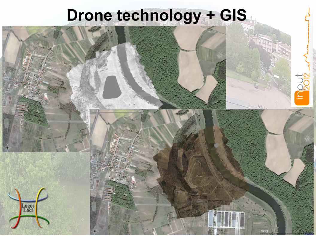
Drone technology + GIS

SocialAdvertising
Vehiclescontrol
Systemsverification
Monitoring sites
Panoramical photo
Monitoringvegetation
what can be achievedby a single photo?

Yet another strategic planning Tool
via Sante Duzioni 14 - 22063 Cantù (CO)Tel. +39 329 2211978Fax. 031 40 39 81 94
Email: [email protected]: Luca Costenaro