implementing an affordable, rapid deployment … paper... · deployment land records management...
TRANSCRIPT
IMPLEMENTING AN AFFORDABLE, RAPID DEPLOYMENT LAND RECORDS MANAGEMENT SOLUTION FOR LIBERIA
Frank Pichel, Thomson Reuters, Tax & Accounting, Government P. Bloh Sayeh, Center for National Documents and Records Agency Andrew Thriscutt, Thomson Reuters, Tax & Accounting, Government Ounzuba Kemeh-Gama, World Bank, Liberia
This white paper originally appeared at the Annual World Bank Conference on Land and Poverty in Washington, D.C. on April 23-26, 2012.
Abstract
“Implementing an Affordable, Rapid Deployment Land Records Management Solution for Liberia” provides insight into the context, unique challenges, and innovative solutions for the rehabilitation of land records and reconstruction of land rights in post-conflict Liberia. After nearly 25 years of civil strife, Liberia’s land records are missing, unreliable, and at risk of further deterioration. The nation requires a trusted land information management system to support the nation’s stability, security, and future economic growth. The Liberian Centre for National Documents and Records Agency (CNDRA) is responsible for the establishment of a governance and management system for land records. CNDRA’s affordable, rapid deployment approach provides the basis for a reliable land records management system in Liberia that can be applied in other countries and regions. With the collaboration of the World Bank, USAID, the MCC, Tetra Tech ARD, and Thomson Reuters, Liberia has implemented an affordable system for recording the documentary and geographic information relating to property rights that can be applied in other regions and countries. KEYWORDS: Center for National Deeds & Records Agency (CNDRA), Geographic Information System (GIS), Land Commission, Liberia, Social Tenure Domain Model (STDM), land registry, land information systems
INTRODUCTION The West African nation of Liberia is working to establish a secure foundation of law and order which will allow the country to rebuild the economy after two decades of civil unrest. The fighting in Liberia which spanned over two decades, destroyed much of the nation’s infrastructure and left an estimated 250,000 dead. Approximately two million refugees scattered across the sub region are now returning to the land they once occupied, in many cases only to find the land occupied by another party - and a judicial system and property records ill-equipped to address the resulting disputes. Land tenure security is a critical issue in this post-conflict state and is widely recognized as a potential catalyst for further civil disturbances if not dealt with proactively. In its 2008 final report, the Liberia Truth and Reconciliation Commission stated that land disputes are a threat to national peace. If the issue is not addressed, there is a strong likelihood of a return to violence. The years of conflict have left the Departments of Lands, Survey and Cartography (DLSC) and the Center for National Documents and Records Agency (CNDRA), the agencies responsible for verification, administration and management of land information, in poor condition. There is few trained and experienced staff, and both agencies lack the tools and equipment needed to effectively accomplish the tasks required of them. The nation’s land records remain largely in a state of disarray, with records missing, difficult to search and at risk of further deterioration. In recent years, CNDRA has made great strides in providing a sense of order to these vital records. However, like many institutions in Liberia, there is an acute lack of institutional knowledge and experienced staff, and much of the equipment required to fulfill the agency’s mandate is either outdated or absent. The importance of these historic records cannot be overstated. It is critical that the existing records be protected and maintained in a sustainable and transparent manner -- not only to protect the records, but to limit opportunities for fraud, allow for better service to citizens, and to promote investor confidence. In order to recognize the importance of having a digital archive of a land registry, one needs to look no further than Liberia’s Anglophone neighbors: Ghana and Sierra Leone, both of which suffered from suspicious fires at their national land registries in the last six months. Under the leadership of the Director of CNDRA, Ms. P. Bloh Sayeh, and with assistance from the World Bank, the United States Agency for International Development (USAID) and the Millennium Challenge Corporation (MCC), CNDRA has begun to acquire the tools and skills needed to once again become the steward of the nation’s records. The program to implement a digital land registry results from a partnership between CNDRA, the Land Commission, the MCC Threshold Program and the World Bank. This paper focuses on program implementation activities, over a six month period, with emphasis on the initiative to digitize and index the deeds currently held by CNDRA, while preparing for the creation of a digital land registry. This paper presents an overview of the solution implemented to rapidly digitize, index, and associate the records with spatial information, as well as the challenges faced in doing so.
LIBERIA’S LAND ADMINISTRATION CHALLENGES Secure land rights are essential to economic growth, providing stability and investment incentives to property holders while maximizing the efficient, equitable and sustainable use of land and natural resources. Due to a number of factors, land rights in Liberia, particularly in rural areas, are largely undocumented and insecure, and many citizens choose not to, or are unable to register their properties, reflected in the fact that in 2010, a total of only seven hundred and twenty seven (727) deeds were registered in the country of an estimated 3.8 million people. According to the 2011 World Bank Doing Business Report, Liberia is ranked among one of the most difficult countries to register property. In relation to the time, cost, and number of procedures required to register property, Liberia ranks 176 of the 183 countries reviewed. In 2009, Montserado and Margibi counties, (including the Liberian capital city of Monrovia and its environs), accounted for approximately 90% of all land transactions registered at the CNDRA. Comparatively, five other Liberian counties numbered in the single digits for land transactions filed within the county for the calendar year, and with the other nine counties having transactions in only the double digits. Clearly there is a need to increase public interest in registering their property rights, and in turn, making the national registry more accessible. Lack of secure, documented land rights is a continued drag on the Liberian economy, ensuring that land remains difficult to use as collateral. There were no mortgage deeds registered in all of 2010, and according to the registrar of CNDRA, financial institutions searching the deed registry in order to obtain information on property being used as collateral occurred only twice in 2010. Liberia faces numerous challenges as it works to improve its systems of land administration, including budget limitations, difficulties in locating experienced staff with a relevant background, lack of office space in a building not conducive to a modern IT infrastructure, and the challenge of managing a national level system in a country that suffers from a poor road network. Furthermore, land records are held at various government agencies. Historical archives are often stored in environments poorly suited for long-term preservation and lack indexes which allow for quick searching. With the exception of urban properties in Monrovia, which only occasionally reference a block and lot number, deeds lack spatial information, Deeds for rural areas often do not have boundaries, or are described only in metes and bounds. While many of these problems have been exacerbated by the years of civil unrest, the root of the problems predate this recent period of lawlessness. The framework for land administration and access to land rights was one of the catalysts of the Liberian Civil War. In order to understand why many Liberians felt disenfranchised by the system of property rights and their government in general, one must first be familiar with Liberia’s history.
HISTORICAL LAND ADMINISTRATION CHALLENGES IN LIBERIA
In the early 1820s, private colonization societies, the largest of which was The American Colonization Society, composed of abolitionists supporting the return of freed slaves from North America and the Caribbean to Africa began to promote and sponsor settlement in Liberia. The colonization societies negotiated with the existing indigenous occupants of modern day Liberia to purchase land for these new settlements, mostly in coastal areas. The established settlements became the independent state of Liberia in 1847. From the outset, the Government of Liberia operated under dual systems of laws and policies; one for the coastal Americo-Liberians and the other for indigenous Africans living in the hinterlands. Land tenure for settlements by Americo-Liberians were based on English common law and the American deed system, while indigenous people governed themselves using their own customary systems based on community rights. This was similar to colonial systems implemented throughout Africa, with differing sets of laws for the elite living in the capital cities and another for the customary groups living in the interior. In fact, one could argue that the reason approximately 98% of land in West Africa lacks any formal paper documentation (Toulmin, 2006) is because colonial institutions, and colonial policies, were never intended to govern all lands within a country. For example, the British had a policy of governing through traditional chiefs who were free to maintain traditional tenure practices within their domain. During the 1960s, as many African colonies became independent nations, they lacked the expertise or experience to adapt these tenure systems to their specific needs, and instead were left with legacy systems more fitting in Europe than the traditional tenure systems of Africa. Initially, customary rights were recognized by the Government of Liberia as full ownership rights, regardless of formal titling and documentation. State policies evolved so that the earlier Hinterland Law with full ownership rights was modified. The
1956 Aborigines Law changed the wording of the preceding law relating to indigenous lands, stating that tribes had the “right of use and possession of the land,” instead of the “right and title to the land.” This wording in effect converted all indigenous lands to state lands with natives the only users of that land. This slight modification allowed the government to begin to allocate large land concessions in the 1960s to timber, mining, and agriculture firms with little to no input from, or benefit to, the individuals living on the land. The Aborigines Law remains largely unchanged and all land outside of the coastal strip is considered public land. Customary groups have a right to use the land but do not actually own it. Customary lands are generally only recognized on a collective basis, oftentimes through an Aboriginal Deed. There is limited individual ownership, although individual families often have usufruct rights to areas as recognized by their community. The dual tenure system and bias towards the statutory system continues to divide the rural traditional societies from the urban Liberian educated elites, who have in the past utilized numerous weaknesses in the customary systems. These systematic flaws provide the legal basis for land and natural recourse concessions in the hinterlands, allowing timber, mining, and rubber companies to operate with scant regard for the existing occupants. These concessions largely exclude the rural communities from the territory they have occupied for generations, damage the land, and generally fail to financially benefit the native communities. Because rural inhabitants had historically suffered from weaker land security, displacement and allocation of the land to others created resentment, and a feeling of inferiority. As T.L. Anderson noted, “without property rights, no other rights are possible.”
INSTITUTIONAL CHALLENGES WITHIN LAND ADMINISTRATION
Land tenure issues are a potential flashpoint for the country, which could lead to another civil war if not quickly addressed. Individual and small scale land conflicts in Liberia have erupted for a variety of reasons, but most frequently between social and ethnic groups, displaced citizens returning to claimed land following the civil war, families disputing inheritances and due to poorly demarcated and documented land rights. All of this contributes to a high occurrence of land disputes, with an estimated 90% of civil court cases being related to land. According to a recent survey, violent conflicts in Liberia have their root in land rights issues 63% of the time, significantly more than political, ethnic, or religious differences (Paczynska, 2010). Research has also shown that over the past four decades, land rights inequalities may spawn a sense of injustice, entailing risks of land occupations and even violent clashes over land (Cotula,Toulmin, Quan 2006). In President Sirleaf’s 2006 inaugural address, land reform was mentioned as being one of the priorities of government. Indeed this has been recognized by the donor community, and numerous agencies, including UN HABITAT, the World Bank, the Norwegian Refugee Council, the Carter Center, and the United States Agency for International Development (USAID), the Millennium Challenge Corporation, and the European Union. Given the number of agencies involved, the risk of a duplication of efforts and activities, or working at cross purposes is of great concern. Due to the complexity of land issues in the country and the number of land interventions, as well as the number of government agencies and ministries involved in land administration, the Liberia Land Commission was formed by an Act of Legislature in August 2009, as an autonomous government body. The purpose of the Commission is to propose reforms to land polices and laws as well as to coordinate the various land activities underway in the country. Under the Leadership of Dr. Othello Brandy, the Land Commission has proven to be a success, despite operating under tremendous pressure. In its brief existence, the Land Commission has proven to be the organizing force behind land activities, ensuring that interventions are aligned with the needs and realities on the ground in Liberia, as opposed to being dictated from afar. Major accomplishments of the Land Commission include: recommendations on legislation modernization and establishment of organized approach to the resolution of land disputes – both through alternative dispute resolution and formal statutory approaches, establishment of a steering committee, policy guidance, and the establishment of training programs. Most importantly, the Land Commission has ensured that the various donor agencies working to provide assistance to the Government of Liberia are acting in a coordinated manner and working towards a common goal. A challenge of so many organizations working on land issues within Liberia is however, the limited information regarding land rights and the lack of system and data standards for collecting spatial and tabular information regarding land rights. In order for Liberia to develop as a nation and offer a better sense of land tenure security to citizens, it must improve the land administration framework, particularly its systems for managing land information.
The Center for National Documents and Records Agency, with the support of the Land Commission, is working to lead the way towards providing a framework for collecting and recording land information, and providing a solution to manage the scanning of records and the indexing to allow for the documents and user rights to be queried, recorded and updated easily. Within CNDRA however, there are a number of issues which limit the ability to implement a land information system.
CHALLENGES WITHIN THE CENTER FOR NATIONAL DOCUMENTS AND RECORDS AGENCY (CNDRA)
The Center for National Documents and Records Agency (CNDRA), was created by an act of legislature in November of 1977. Its mission is to collect, organize, preserve, and make available to the public all documents of historical importance to Liberia, and maintain land and marriage registries throughout the country. Starting in the midst of the civil crisis in 1990, activities at CNDRA were halted and then reactivated, continuing sporadically throughout the unrest. During the hiatus, many records were damaged or lost due to exposure to the elements and deliberate ransacking of the CNDRA building. Records were transferred from CNDRA headquarters in Sinkor, Monrovia to the National Public Library on Ashmun Street in central Monrovia. In 2009, CNDRA was able to return to its purpose-built building, which, as originally planned, is well suited to serve as a repository for documents of national importance. However, the National Investment Commission (NIC) temporarily occupies roughly one half of the building, limiting the space available for CNDRA to store records and conduct business. Despite the challenges faced by CNDRA, the organization has done an impressive job rebuilding the institution in a relatively short time frame. Personnel are once again performing their duties, forms for registering deeds and marriage have been reintroduced, county offices have been reactivated, and the existing archive is being rehabilitated. Most importantly, registration of marriages and land deeds is occurring in a regular, consistent and transparent manner. The greatest remaining challenges relate to internal capacity building particularly for information technology (IT), records management, conservation of records and the rehabilitation of the CNDRA building, which will allow the records to be organized and stored properly.
Physical Location and Infrastructure
During the conflict, building maintenance was not a priority. Furthermore, the building was not designed with the modern IT infrastructure in mind. Overburdened electrical circuits, a lack of working air conditioners, and minor roof leaks present a problem, both to record storage and to the staff. As the building usually operates on a generator, office hours are limited due to the high cost of operating the system.
Staffing
CNDRA, like many Liberian institutions, has difficulty recruiting staff with relevant skills and experience. The government’s single spine salary structure results in relatively low wages for the work performed, leading some to seek ways to supplement their income. The majority of employees at CNDRA are relatively young and lack experience and institutional knowledge relating to the processes commonly found in an archive and registry office. Prior to joining CNDRA, few had significant experience with information technology or in working within a modern civil institution. This has been improved through short-term training courses on a variety of subjects, including information technology and records management, to build up the skill sets of the employees.
Remote County Offices
With an area slightly larger than that of Portugal, Liberia has a mere 657 kilometers of paved roads (compared to 72,000 in Portugal), making county capitals and rural districts very difficult to access. The poor road network and overall transportation infrastructure are challenges for Liberia’s overall recovery. The road network limits effective governance, access to health and education, and farm produce delivery. The CNDRA offices located in county capitals are hard to reach, particularly in the rainy season, requiring a trip of two to three days from Monrovia – each way. As a result, the detail of transactions occurring in each county remain less accessible,
as they are recorded at the CNDRA headquarters once a year. Though in the past year, CNDRA has made great strides in ensuring monthly reports from county offices detailing the number and specifics of the deeds recorded. Following the transfer of the county records to the headquarters, the county might not keep its own copy of the records, limiting the ability for locals to conduct a search of properties in their immediate vicinity. This transfer process puts the records at risk and makes it difficult to access timely accurate records in both the CNDRA headquarters and from the county offices.
Location of National Land Records
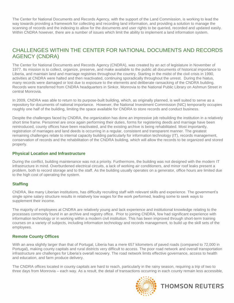
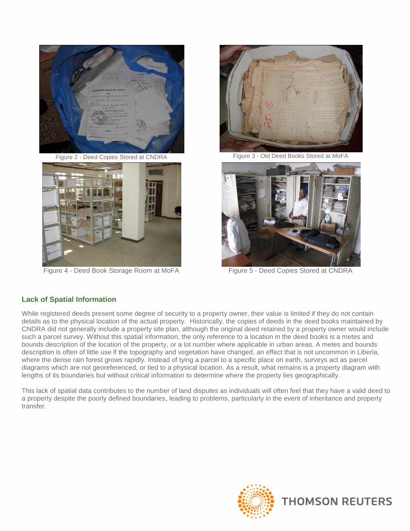
While land records are generally recognized to be under the mandate of CNDRA, it is known that there are land records in at least two other locations in Liberia: the Ministry of Foreign Affairs (MoFA), the Executive Mansion and the Department of Lands, Surveys and Cartography (DLSC). These records are stored in various ways; however they should be preserved and organized at a central location with suitable infrastructure – ideally CNDRA. Records include the deed ledger books, originals and copies of actual deeds, as well as property adjudication files remaining from the World Bank pilot title registration project dating back to the 1970s. The deed ledger books at CNDRA and MoFA are composed of chronologically entered hand-written copies of the original probated deed, with the original deed customarily remaining with the grantee. The parcel diagram from the original deed is not replicated in the deed book. For a period during President Samuel Doe’s administration in the 1980s, deed holders were requested to bring their deeds for photocopying. These copies are stored at both the CNDRA and DLSC offices. Prior to the creation of CNDRA in 1977, archives and deed registries were located in the Department of State, which later became the Ministry of Foreign Affairs (MoFA). All land documents predating the creation of CNDRA, and dating back to the mid 1800s, have remained in possession of MoFA, which recently agreed that all deed books will eventually be transferred to CNDRA. Nevertheless, until CNDRA is able to occupy the full extent of its building, and establish the proper infrastructure inclusive of climate control and fire suppression systems, the records cannot be properly stored. In the meantime, it is important that those records, particularly deeds, be digitized and indexed so as to allow access to both the land agencies and the general public.
Condition of Land Records
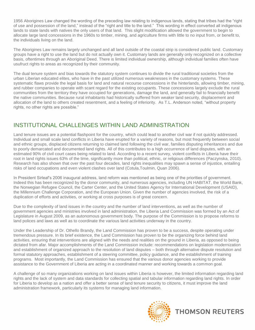
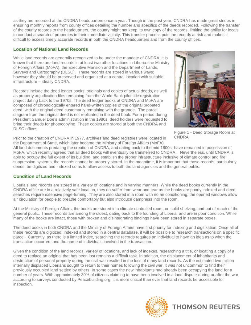
Liberia’s land records are stored in a variety of locations and in varying manners. While the deed books currently in the CNDRA office are in a relatively safe location, they do suffer from wear and tear as the books are poorly indexed and deed searches require extensive page-turning. They are also stored in a room with no air conditioning; the opened windows allow air circulation for people to breathe comfortably but also introduce dampness into the room. At the Ministry of Foreign Affairs, the books are stored in a climate controlled room, on solid shelving, and out of reach of the general public. These records are among the oldest, dating back to the founding of Liberia, and are in poor condition. While many of the books are intact, those with broken and disintegrating bindings have been stored in separate boxes. The deed books in both CNDRA and the Ministry of Foreign Affairs have first priority for indexing and digitization. Once all of these records are digitized, indexed and stored in a central database, it will be possible to research transactions on a specific parcel. Currently, as there is a limited index, searching the records requires an individual to have an idea as to when the transaction occurred, and the name of individuals involved in the transaction. Given the condition of the land records, variety of locations, and lack of indexes, researching a title, or locating a copy of a deed to replace an original that has been lost remains a difficult task. In addition, the displacement of inhabitants and destruction of personal property during the civil war resulted in the loss of many land records. As the estimated two million internally displaced Liberians sought to return to their homes following the civil war, it was not uncommon to find their previously occupied land settled by others. In some cases the new inhabitants had already been occupying the land for a number of years. With approximately 30% of citizens claiming to have been involved in a land dispute during or after the war, according to surveys conducted by Peacebuilding.org, it is more critical than ever that land records be accessible for inspection.
Figure 1 - Deed Storage Room at CNDRA
Lack of Spatial Information
While registered deeds present some degree of security to a property owner, their value is limited if they do not contain details as to the physical location of the actual property. Historically, the copies of deeds in the deed books maintained by CNDRA did not generally include a property site plan, although the original deed retained by a property owner would include such a parcel survey. Without this spatial information, the only reference to a location in the deed books is a metes and bounds description of the location of the property, or a lot number where applicable in urban areas. A metes and bounds description is often of little use if the topography and vegetation have changed, an effect that is not uncommon in Liberia, where the dense rain forest grows rapidly. Instead of tying a parcel to a specific place on earth, surveys act as parcel diagrams which are not georeferenced, or tied to a physical location. As a result, what remains is a property diagram with lengths of its boundaries but without critical information to determine where the property lies geographically. This lack of spatial data contributes to the number of land disputes as individuals will often feel that they have a valid deed to a property despite the poorly defined boundaries, leading to problems, particularly in the event of inheritance and property transfer.
Figure 2 - Deed Copies Stored at CNDRA
Figure 3 - Old Deed Books Stored at MoFA
Figure 4 - Deed Book Storage Room at MoFA
Figure 5 - Deed Copies Stored at CNDRA
Barriers to Formalizing Property
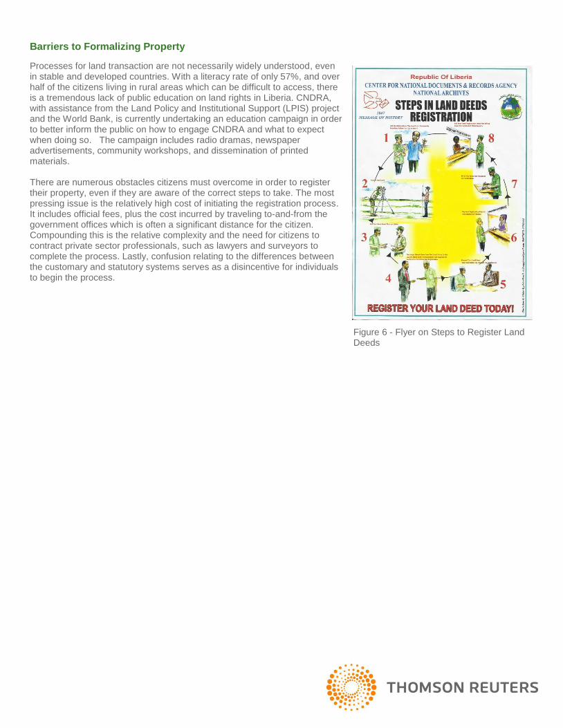
Processes for land transaction are not necessarily widely understood, even in stable and developed countries. With a literacy rate of only 57%, and over half of the citizens living in rural areas which can be difficult to access, there is a tremendous lack of public education on land rights in Liberia. CNDRA, with assistance from the Land Policy and Institutional Support (LPIS) project and the World Bank, is currently undertaking an education campaign in order to better inform the public on how to engage CNDRA and what to expect when doing so. The campaign includes radio dramas, newspaper advertisements, community workshops, and dissemination of printed materials. There are numerous obstacles citizens must overcome in order to register their property, even if they are aware of the correct steps to take. The most pressing issue is the relatively high cost of initiating the registration process. It includes official fees, plus the cost incurred by traveling to-and-from the government offices which is often a significant distance for the citizen. Compounding this is the relative complexity and the need for citizens to contract private sector professionals, such as lawyers and surveyors to complete the process. Lastly, confusion relating to the differences between the customary and statutory systems serves as a disincentive for individuals to begin the process.
Figure 6 - Flyer on Steps to Register Land Deeds
THE SOLUTION FOR MANAGING LAND INFORMATION
Given the challenges in land administration and land information management, a technologically appropriate solution for managing the country’s land information is a high priority. This system must meet the realities of the country and the constraints faced by the nation, and particularly the Center for National Deeds and Records Agency described earlier. The solution for managing property information within Liberia needed to be:
Appropriate for the Infrastructure – Because CNDRA lacked a local area network or server room, and suffered from frequent power outages, the system needs to operate in the absence of an advanced network infrastructure. Furthermore, as CNDRA had computers of varying ages and standards, the solution needed to operate on new and old machines alike.
Easy to use – Given the IT experience of many of CNDRA staff members, it was critical that the land information management system be designed to manage both registry and spatial data and be relatively easy to operate. This would ensure that training could occur quickly and for as large a segment of the CNDRA staff as possible, even though with little in the way of IT experience.
Mobile – Because land records are stored in various places within the country, or held only by the grantee, it was important that the system for capturing and integrating the property records be mobile. This could allow scanning teams to go into the field in order to collect documents which otherwise might not come into CNDA, such as records at the Ministry of Foreign Affairs, or Tribal Certificates held by individuals in rural parts of the country.
Spatially Enabled – As recognized in the 1970s by the World Bank’s Title Registry Project, which sought to demarcate and allocate properties within Monrovia, the registry is of limited value without a spatial component. Any proposed system for CNDRA needed to be able to tie property records to a location in order to better ascertain overlaps and areas of possible dispute.
Flexible – The Senior Staff of CNDRA and those within the Land Commission recognized that the modern land administration framework of the country is still evolving. Any proposed system would need to adapt to the changes being implemented, such as a pilot program to identify the existence and spatial information relating to Tribal Certificates.
Quick to Implement – Liberia recognized that the land records were under threat and that digitizing them was a priority. The system needed to be rapidly implemented and configured for quick use. A system which might take years in analysis and configuration was neither needed nor technologically appropriate.
Scalable – While CNDRA and the Land Commission recognize that in the immediate future having a computerized registry system in every county office replicating data to the headquarters in real-time with a workflow driven system that allows for myriad transactions, their vision for the future includes more advanced solutions. Therefore, a system must be easily upgraded and support data transfer as new county offices come online.
Proven and Maintained – CNDRA and the Land Commission did not have the time to develop a custom built solution. The system also needed to access updates and technical support.
Cost Effective – As Liberia continues its economic growth, CNDRA and other land agencies will continue to increase their use of the land information system. But, it must be done so at reasonable costs and within limited government budgets.
Under these considerations, CNDRA, in conjunction with the Land Commission and the World Bank, began to look at various systems which might be utilized within the Agency.

What is the Social Tenure Domain Model?
STDM is a subset of the Land Administration Domain Model (LADM) which is currently undergoing International Standards Organization (ISO) certification. It is an initiative of UN Habitat, the International Federation of Surveyors (FIG) and a number of universities, and is designed to serve as a standard for the recording of property rights that may not fall directly under statutory law, including customary rights and a range of use rights.
OPENTITLE
In August 2011, OpenTitle™ was selected as the solution that CNDRA would utilize as it began a scanning and digitization program of the various deed records maintained within the agency. The OpenTitle software was downloaded in Monrovia, despite the limited bandwidth, and installed on a basic local area network by the CNDRA IT Consultant, Mr. Ounzuba Kemeh-Gama. Mr. Kemeh-Gama also completed the initial configuration of OpenTitle, and began to test the software on the scanning production line in order to verify its effectiveness and better understand configuration needs. In September 2011, an analyst from Thomson Reuters arrived in Monrovia to finalize the configuration of OpenTitle, and to train CNDRA
staff.
WHY OPENTITLE?
OpenTitle was selected for use by CNDRA because it met the demands of the agency and adhering to international best practices.
OpenTitle from Thomson Reuters, is an affordable tool that combines Esri’s ArcGIS mapping components with an integrated and robust document management system for the capture and maintenance of land and property information, such as documents and videos. Esri’s ArcGIS delivers essential mapping tools, including the ability to digitize new features and link spatial units to documentary evidence on the owner/occupier and their rights. OpenTitle’s document storage system (which combines secure file and relational database storage based on SQL Server Express) includes version control to track changes in land rights over time. OpenTitle adheres to Social Tenure Domain Model (STDM) configuring the required data model entities (Persons, Non-Natural Persons, Social Tenure Relationships, Spatial Units and Mortgages) on installation. The solution proved to be appropriate for the infrastructure available in Liberia, as OpenTitle is available in both desktop and workgroup offerings. The workgroup version allows up to five computers to be connected on a local area network, with all records being saved to a central database. Given the limited infrastructure available during the activity start-up, the computers were connected via a wireless network, with one of the desktop computers acting as the server for the data production line. This was recently upgraded to a more robust, wired local area network, allowing for more rapid data transfer.
OpenTitle proved to be easy to use, particularly given its robust document and spatial management capabilities. In Liberia, it was found that staff members could be trained in the process for integration of paper records, indexing, and storing in the database in a single day. The modular design with key functional areas, such as indexing and searching, scanning and image manipulation, mapping and importing spatial data and manipulating spatial data, allows individuals to learn tasks that will only apply to them, or the details of the entire system. While the mapping system is a bit more complex, basic tasks, such as geo-referencing a sketch or site plan of a property, importing GIS data and linking property records to a point or parcel, only required an additional two to three days. In all, individuals were able to become conversant with OpenTitle in about a week, inclusive of time spent during on-the-job training as staff members began to work with the system to complete their assigned tasks. The initial installation and configuration of the workgroup was completed entirely in country, without onsite assistance from product engineers.
Figure 7 - The Scanning Room of CNDRA
OpenTitle is now being used in the field, in a mobile capacity, as the Land Commission, with the support of DLSC and CNDRA, have begun a two week pilot exercise to inventory the tribal certificates in Fissebu, Zorzor District and Lofa counties. The exercise will help to better understand the number of tribal certificates, the location of the land they reference and the total land area covered by these certificates. This knowledge will inform future policy decisions to be pursued by the Land Commission. As Tribal Certificates are only held by individual grantees, it is largely unknown how many certificates may exist, and how spatially accurate they might be. The Land Commission has launched a mobile team to collect information regarding Tribal Certificates in the field. The Tribal Certificates are being scanned, a photo of the Certificate holder is taken, and data is being indexed in locations convenient to individuals. Spatial information is being collected using geographic positioning systems (GPS) devised in order to ascertain the locations of the parcels, and identify any overlaps. Since OpenTitle is spatially enabled, it serves as more than just a database for digital information. OpenTitle also allows the records to be associated with geographic information, in the form of points and parcels. These can be collected with GPS devices, formal surveys, or merely identifying locations on satellite imagery. Under a pilot program within the Land Policy and Institutional Support Project (LPIS), spatial data for various parts of Monrovia is being collected and linked with the deeds stored at the data registry, creating an integrated registry and cadastre. The Mapping tab enables users to digitize new spatial units and link these to natural/non-natural persons or rights. Users can also use geo-referencing tools to reference raster data as a backdrop against which spatial units can be captured (e.g. survey plans can be scanned and digitized and geo-referenced all within the OpenTitle application environment). For CNDRA, OpenTitle has proved to be flexible and quick to implement. As the Land Commission and CNDRA have begun to look at different activities necessary to capture the myriad types of property rights within the country, there is a realization that software needs to be adapted to collect various types of rights, and reflect the overall legal value of various use rights. OpenTitle has been quickly configured to meet the needs of various programs under the auspices of the Land Commission. OpenTitle has also proven to be secure, and through versioning, can track changes to a record over time, as well as the individual who made the changes. The relevance of versioning is that the STDM caters for changing social tenure relations, as rights move from conflict to resolution, as temporal rights are extinguished and re-established, and as persons and non-natural persons change in relation to a spatial object, resulting in changes to data and data quality. In this way, OpenTitle is more than just inventory tool offering support for a proto-transactional land database in informal areas, but also a history of changing records.
CONCLUSION
Collaboration within the donor community involved in land issues in Liberia, coordinated by the Land Commission, has ensured that there has been little duplication of effort within the country. This cooperation has allowed the LPIS project to work closely with the World Bank consultant working within CNDRA and enabled the software solution to be implemented and put to use quickly. While the World Bank funded the initial assessment of the needs of a registry information system, and the initial hardware such as computers and scanners, USAID supplemented the project with servers, subject matter experts, and a local area network. This cooperation allowed CNDRA to move rapidly from an analysis and design phase, to an implementation phase, ensuring that CNDRA’s needs for digitizing and archiving its records could happen quickly. As a result of the cooperation, fourteen (14) CNDRA staff members were trained in the use of OpenTitle, initially. Since September 2011, staff members have scanned and indexed more than fifty (50) deed books and approximately five thousand (5000) records. CNDRA is now scanning approximately fifteen hundred (1500) records per month, as efficiency gains have been made with the establishment of a proper local area network, and operators becoming more proficient. CNDRA, with help from USAID and the World Bank, is also establishing a customer service center, which will access the records held in OpenTitle. This customer service center, opening in June, will ensure customers at the agency are able to quickly search the indexed records quickly and efficiently, as opposed to being required to request a search of the paper records by CNDRA staff – a task that is time consuming and inefficient. Manual entry of deed copies will at that point cease, and all records will instead be scanned and entered into the digital registry.
REFERENCES
Anderson, T. L., & Huggins, L. E. (2003). Property Rights: A Practical Guide to Freedom and Prosperity. Stanford, CA: Hoover Institution Press.
Central Intelligence Agency. (2012, February 2). In CIA - The World Factbook: Liberia. Retrieved October 1, 2011, from
https://www.cia.gov/library/publications/the-world-factbook/geos/li.html. Cotula, L., Toulmin, C., & Quan, J. (2006, March). “Policies and Practices for Securing and Improving Access to Land.”
Presented at the International Conference on Agrarian Reform and Rural Development. Land Commission of Liberia. (2010). Annual Report: January – December, 2010. Retrieved January 5, 2012 from
http://www.lc.gov.lr/doc/annuareport2010.pdf. Paczynska, A. (2010). Liberia Interagency Conflict Assessment Framework Report. Office of Conflict Prevention, Office of
the Coordinator for Stabilization and Reconstruction, U.S. Department of State. Retrieved January 5, 2012 from http://icar.gmu.edu/sites/default/files/Final_ICAF_Report_0.pdf.
Truth and Reconciliation Commission of Liberia. (2008). Final Report Volume I: Findings and Determinations. Retrieved
January 5, 2012 from http://trcofliberia.org/resources/reports/final/trc-final-report-volume-1-full.pdf. Unruh, J. D. (2007). Postwar land tenure in Liberia: the intersection of customary and statutory land laws. Report to the
World Bank, Washington DC. US Agency for International Development. (2010). Country Profile: Liberia - Property Rights and Recourse Governance.
Report by USAID, Washington, DC. Wily, L. A. (2007). “So Who Owns the Forest – An Investigation into Forest Ownership and Customary Land Rights in
Liberia.” Brussels, Belguim: Sustainable Development Institute / Forest Ecosystem Research Network FERN. World Bank. (2010). Doing Business 2011: Liberia - Making a Difference for Entrepreneurs (58856). Retrieved January 5,
2012, from http://documents.worldbank.org/curated/en/2010/01/13359504/doing-business-2011-liberia-making-difference-entrepreneurs-comparing-business-regulation-183-economies.