impact of urban land transformation on water bodies in ...wetlands and open space conversion for...
TRANSCRIPT

Journal of Environmental Protection, 2011, 2, 142-153 doi:10.4236/jep.2011.22016 Published Online April 2011 (http://www.SciRP.org/journal/jep)
Copyright © 2011 SciRes. JEP
Impact of Urban Land Transformation on Water Bodies in Srinagar City, India
Shahab Fazal, Arshad Amin
Department of Geography, Aligarh Muslim University, Aligarh, India. Email: [email protected] Received November 8th, 2010; revised December 24th, 2010; accepted February 19th, 2011.
ABSTRACT
Human actions rather than natural forces are the source of most contemporary changes in the state and flows of the biosphere. Understanding these actions and the social forces that drive them is crucial to understanding, modelling and predicting local, regional as well as global environmental change and also for managing and responding to such change. The present study investigates the patterns of urban land transformation in Srinagar City, which lies in fragile hill eco-system of Kashmir valley. The results points towards unplanned and haphazard urban expansion and transfor-mation. These transformations have severely destroyed the water bodies both in terms of area as well as its quality. Keywords: Urban, Land Transformation, Water Bodies, Agriculture, Marshy
1. Introduction
Land transformation is one of the most important fields of human induced environmental transformation, with an extensive history dating back to antiquity [1]. Land transformation accelerated and diversified with the onset of the Industrial Revolution, the globalization of the world economy and the expansion of population and technological capacity. Land transformations, although localized, contribute to wider reaching, regional systemic processes. The demand for the products of the land is likely to continue growing in the foreseeable future. Maintaining the capacity of the land to sustain that de-mand will remain of fundamental importance. The level of concern elicited by current trends reflects the possibil-ity that much land transformation in some sense consti-tutes land degradation [2]. As land cover, settlement represents the most profound alteration of the natural environment by people, through the imposition of struc-tures, buildings, paved surfaces, and compacted bare soils on the ground surface. Settlements also create de-mands that lead to other land-cover changes, such as the removal of vegetation and soil to extract sand, gravel, brick clays, and rock; the replacement of vegetation by planted cover in gardens, parks, sports grounds; the alienation of ground for landfill and waste treatment; wetlands and open space conversion for settlements and the use of land for transportation routes.
Alteration is nearly inseparable from human occupa-
tion and use, and the goal is to encourage improvement and to counter forces that encourage degradation [3]. To assess what effect a particular land transformation and its consequences will have involves difficult issues of fore-casting (future resource demands and opportunities as affected by technical and socioeconomic change) and evaluation (distribution and the rights of future genera-tions). However, we now possess a better scientific knowledge of the physical extent, character and conse-quences of land transformation, which serves as the foundation for any such assessment.
The simultaneous rapid growth in both population and economic output per capita, and the consequent changes in land use pattern come at a cost to the natural environ-ment [4-6]. Demographic growth stimulates structural change through multiplier effects and behavioural changes attract immigrants. Urban areas have become the centre of all the activities - they are expanding in size, land use is changing quickly, constantly intensifying ur-ban lands and large-scale land transformation is taking place due to substantial increases in urban land value and thus these areas have acquired centre stage. Cities are man – made physical structure, placed in natural settings. If the cities are well placed, well planned, well built, they remain in aesthetic harmony with nature. But cities with rapid growth (mostly in developing countries) grow without planning and relationship between urban form (the built environment) and nature generates an unending source of tensions and controversies. Cities need more
Impact of Urban Land Transformation on Water Bodies in Srinagar City, India 143
resources and thus constantly keep on expanding, from the urban core into suburbs in exurbs, separating people more and more distantly from natural landscape.
The present study focuses on to study the general pat-tern of urban expansion and land transformation in Sri-nagar city, further it also try to investigate specifically the impact of these land transformation on city’s water bodies, considered as lifeline of the city. The rivers and lakes are notable not only for their size and volume, but also for providing habitats for aquatic fauna and flora, especially for a number of endemic species. Unfortu-nately, these bodies of water have been greatly affected by human-induced land use changes. The degradation of these bodies are largely attributed to extensive agricul-tural reclamation, resulting in negative ecological con-sequences, such as frequent flooding, a decline in biodi-versity and the extinction of a number of endemic species [7]. In addition, water quality in most wetlands has also been heavily degraded, mainly due to wastewater dis-charges, all of which cause widespread eutrophication [8-10]. The Indian cities are found to be discharging up to 95% of wastewater directly into rivers, lakes and streams without any treatment at all. Consequently, the bacterial level resulting from human waste found in these water bodies are threefold higher than the world average and 50-fold higher than World Health Organization
guidelines [11]. Moreover, land use activities such as deforestation and wetland reclamation also affect the quality and condition of freshwater bodies [12,13]. These land use activities are widespread across the Asian con-tinent and are particularly pervasive in India.
1.1. Study Area
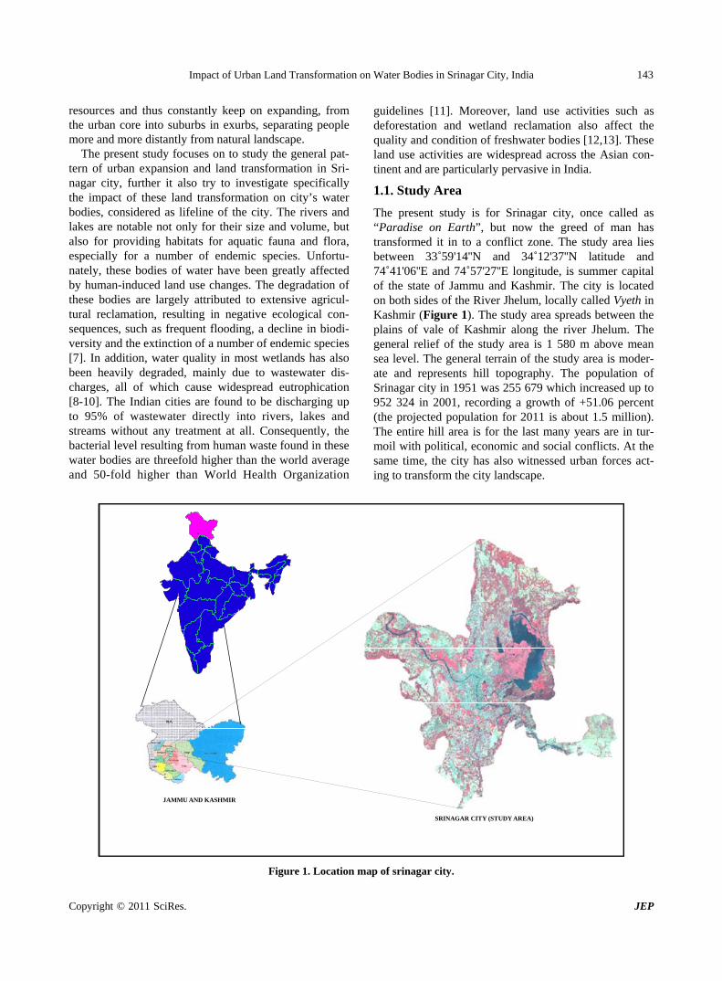
The present study is for Srinagar city, once called as “Paradise on Earth”, but now the greed of man has transformed it in to a conflict zone. The study area lies between 33˚59'14''N and 34˚12'37''N latitude and 74˚41'06''E and 74˚57'27''E longitude, is summer capital of the state of Jammu and Kashmir. The city is located on both sides of the River Jhelum, locally called Vyeth in Kashmir (Figure 1). The study area spreads between the plains of vale of Kashmir along the river Jhelum. The general relief of the study area is 1 580 m above mean sea level. The general terrain of the study area is moder-ate and represents hill topography. The population of Srinagar city in 1951 was 255 679 which increased up to 952 324 in 2001, recording a growth of +51.06 percent (the projected population for 2011 is about 1.5 million). The entire hill area is for the last many years are in tur-moil with political, economic and social conflicts. At the same time, the city has also witnessed urban forces act-ing to transform the city landscape.
SRINAGAR CITY (STUDY AREA)
INDIA
JAMMU AND KASHMIR
#
Figure 1. Location map of srinagar city.
Copyright © 2011 SciRes. JEP

Impact of Urban Land Transformation on Water Bodies in Srinagar City, India 144
2. Methods
The study is mainly based on secondary sources of data, the data used for the preparation of Land use land cover of the study area is Town planning map of Srinagar city 1971 on 1:15000 scale. Similarly, the land use land cover for the later date was carried out using IRS-1D LISS III + PAN 2008 merged satellite imagery. Both the images were first geo-corrected and geo-referenced in Earth Re-source Data Analysis System (ERDAS) Imagine 9.0 software, assigning Universal Transverse Mercator with World Geocoded system (UTM WGS 84) projection pa-rameters. Further for assistance in the process of inter-pretation SOI toposheet was also geo-referenced and was given similar projection and datum. The area of interest (Municipal limits of Srinagar city) was extracted by sub-setting of the town planning map. Satellite imagery was stacked into different bands to produce a false color composite, the area of interest was extracted by sub-setting of the image. These images were digitized in GIS environment using ArcView 3.2a software in the form of polygons representing different land use land cover categories. The data was classified into 14 land use land cover classes spread over a total area of 23 446.5 hectares of the Srinagar city (which incidentally is also the Municipal limits). The trend and pattern of urban expansion was calculated and every polygon representing the particular class was quantified and displayed in re-spective maps.
3. Results and Discussion
The present study for Srinagar city is focused to analyze spatial and temporal information of land cover and land use patterns as well as the transformations therein. Re-mote sensing, although challenged by the spatial and spectral heterogeneity of urban environments [14,15] was used for the study as these sources are found to be an appropriate source of urban data to investigate such studies [16,17].
The present study is spread over 23 446.5 hectares of land, which is also the municipal limit of the Srinagar city. From the perusal of Table 1 and Figures 2 and 3, it is evident that Srinagar city has witnessed large-scale changes in land use in and around the city. The statistics shows that urban area has increased from 2410 hectare in 1971 (Box 1) to 6 224 hectare in 2008 (an increase of 158 percent). Similarly built up area has increased from 2556.5 hectare to 6 623.5 hectare (159 percent). All these increases are at the expense of non – built up area, which shrunk from 20 890 hectare to 16 823 hectare (a decrease of 19 percent) during the study period. Significantly, the city has witnessed major land use changes among classes such as residential area, commercial area, parks and gar-dens and industrial area. These changes were basically
swallowed the agricultural and forest land as well as wa-ter bodies of the study area. Significantly, the water bod-ies and marshy lands loses 1 449 hectares to the urban expansion of Srinagar city.
The salient feature of this land transformation is that Srinagar city has recorded a significant increase in built up area and this is mainly because of population growth and development in secondary and tertiary occupation structure. But this built up expansion was haphazard and without much planning. The down town area of the city is characterized by narrow lanes, open drains , poor solid waste collection and dumping facilities, lack of open spaces, poor infrastructural facilities etc. Expansion has taken place largely in a radial manner along the roads. However because of the topographical limitations the expansion is restricted in the hilly areas of Alestang in the north, the mountain peaks of Zabarwan and Basiwan in the east and the hilly tracks of Khrew and Khanmou in the south east, also the marshy area of the once Anchar Lake in the north west of the city, the general trend of expansion remained confined to the north south and west direction because of the leveled plain.
3.1. Land Transformation in Srinagar City
Land transformation is the process of identifying differ-ences in the state of any phenomenon by observing it at different time periods. Land is in a continuous state of transformation as a result of various natural and man- made processes. During the study period, Srinagar city has not only expanded from its original size but there was significant interchange of land among various land use/cover classes. During the study period Srinagar city has under gone substantial land transformation, but only in some specific areas, which is the out come of social, economic, religious and cultural factors.
Table 2, and Figure 4, which are prepared applying G.I.S. technique, shows the changes in various urban land use class of the city. These changes are because of the development of city resulting in increased demand of land for residential, commercial, industrial etc. purposes. This demand of land along with site attraction, functional convenience, functional magnetism and the land value of that particular area ultimately influence the pace and di-rection of urban land transformation. The important land transformation was witnessed among residential, vacant, plantation/orchards, agriculture and water bodies/marshy lands. The residential area has increased by 2 776 hectare, capturing land mainly from agriculture, vacant land, plantation and villages. Residential area also lost area for commercial development. Plantation/orchards land has reduced by 1 395 hectare this loss was gain for residen-tial, parks and orchards, restricted and vacant and other area. Vacant land has lost 262 hectares of land; it loses to residential class and exchanged land from agriculture and
Copyright © 2011 SciRes. JEP

Impact of Urban Land Transformation on Water Bodies in Srinagar City, India 145
Table 1. Land use land cover of Srinagar city (1971 and 2008).
Land use 1971 2008 Change % age Change
1. Residential 1074.5 (4.58%) 3851 (16.42%) 2776.5 258.3
2. Semi-urban Village 146 (0.62%) 399 (1.7%) 253 173.2
3. Commercial 143.5 (0.61%) 268.5 (1.14%) 125 87.1
4. Industrial 90.5 (0.39%) 226.5 (0.97%) 136 150.2
5. Parks/Gardens & P.G 140 (0.59%) 372 (1.59%) 232 165.7
6. Restricted Area 446 (1.9%) 715 (3.04%) 269 60.3
7. Vacant 517 (2.2%) 255 (1.08%) -262 -50.6
8. Agriculture 14408 (61.45%) 10949 (46.7%) -3459 -24
9. Plantation/Orchard 1266.5 (5.40%) 2622 (11.18%) 1395.5 110.1
10. Forest 346.5 (1.47%) 153.5 (0.65%) -193 -55
11. Barren 539.5 (2.3%) 480 (2.05%) -59.5 -11
12. Marshy 1667 (7.1%) 468.5 (2%) -1198.5 -71.8
13. Water body 2145.5 (9.15%) 1895 (8.08%) -250.5 -11.6
14. Others (Edu,Govt,Hosp,Relig) 516 (2.2%) 791.5 (3.37%) 275 53
TOTAL 23446.5 23446.5 --- ---
Total Built Up 2556.5 6623.5 4067 159
Total Non Built Up 20890 16823 -4067 -19.46
Total Urban Area 2410.5 6224.5 3814 158.2
Note: Area in hectares. SOURCE: Based on Town planning map of Srinagar city 1971 on 1:15000 scale and IRS-1D LISS; III + PAN 2008 merged satellite imagery of Srinagar city.
ROAD TO DACHIGAM
ROAD TO BARAMULLA
ROAD TO PULWAMA
ROAD TO PAMPORE
CITY BYPASS ROAD
ard
ROAD TO GANDERBAL
Figure 2. Land use land cover of srinagar city 1971.
Copyright © 2011 SciRes. JEP

Impact of Urban Land Transformation on Water Bodies in Srinagar City, India 146
ROAD TO GANDERBAL
ROAD TO DACHIGAM
ROAD TO BARAMULLA
ROAD TO PULWAMA ROAD TO PAMPORE
CITY BYPASS ROAD
ard
Figure 3. Land use land cover of srinagar city 2008.
Table 2. Srinagar city, land transformation (1971 - 2008).
Land Use 1
Res 2
Vil 3
Com 4
Ind5
Prk/gr6
Rest7
Vac8
Agr9
Pl/Orc10
For11
Mar12
Bar 13
Was 14
Oth TOTAL
Area (2008)
1. Residential 1074.5 146 210 2145 152.5 77 60 3851
2. Semi-urban Village 146 5.5 322.5 71 399
3. Commercial 14 143.5 111 268.5
4. Industrial 90.5 136 226.5
5. Parks/Gardens & P.g 140 150 40 42 372
6. Restricted 446 33.5 175.5 60 715
7. Vacant 517 185 68.5 255
8. Agriculture 109 14408 214 1081.5 148 10949
9. Plantation/Orchard 21.5 1787 1266.5 39 108 47 43 2622.5
10. Forest 346.5 153.5
11. Marshy 60 1667 92 468.5
12. Barren 74 43 539.5 480
13. Water body 35 2145.5 1894.5
14. Others (Edu,Govt, Hosp,Relig,.)
25 126.5 44.5 49 27.5 3 516 791.5
Notes: Area in hectares. Figures in bold (diagonally) are area under that particular land use in 1971, while the figures in the same column represent the conversion in area to other land uses. Similarly, figures in the same row are increases in area, captured from other land uses. SOURCE: Based on IRS-1D LISS+PAN Satellite imagery (2008) and Town planning map (1971) of Srinagar city.
Copyright © 2011 SciRes. JEP

Impact of Urban Land Transformation on Water Bodies in Srinagar City, India
Copyright © 2011 SciRes. JEP
147
Main Roads
Residential to Commercial
Vacant to Residential
Agriculture to Plantation/Orchard
Agriculture to Residential
Marshy to Agriculture
Marshy to Plantation/Orchard
Marshy to Residential
Marshy to Others
Village to Residential
Water body to Agriculture
Water body to Marshy
Water body to Others
Other changes
No change
ROAD TO GANDERBAL
ROAD TO DACHIGAM
ROAD TO BARAMULLA
ROAD TO PULWAMA ROAD TO PAMPORE
CITY BYPASS ROAD
Figure 4. Land transformation in Srinagar city 1971-2008.
plantation/orchards. Another noticeable land transforma-tion was in water bodies and marshy land, these two land
use classes collectively lost 1449 hectares of land mainly to agriculture, residential and plantation/orchards.
Box 1. Transformation of water bodies and marshy areas in srinagar city 1971 – 2008.
S.no Land cover Area in 1971 (hectares) Transformation Area in 2008 (hectares)
1. Dal
Lake
Water body (1538)
Marshy area (1009.5)
Water body to Agriculture (148) Water body to Marsh - (85)
Marshy to Agriculture - (650) Marshy to plantation/Orchard (24.5)
Marshy to others – (20) Marshy to Residential-(35)
Water body (1305)
Marsh (315)
2. Nigeen Lake
Water body – (110) Water body to Plantation – (7) Water body (103)
3. Brari
Nambal Water body – (28) Marshy area – (72)
Water body to Marsh – (7) Marsh to Plantation/ Orchard – (16)
Water body (21) Marsh (56)
4. Khushalsar Water body – (15) Marshy area – (91)
Marshy to Plantation/ Or-chard-(33.5)
Water body (15) Marsh (57.5)
5. Rakh-i-
Gandakshah Marshy-(494.5)
Marshy to Agriculture – (431.5) Marshy to Plantation/Orchard – (34)
Marshy to others – (29) Completely Transformed

Impact of Urban Land Transformation on Water Bodies in Srinagar City, India 148
3.2. Water Bodies of Srinagar City
The Srinagar city has some very famous water bodies, which are not only tourist attractions but in many ways act as lifeline to the city. The water bodies include river Jhelum, Dal lake, Nigeen lake, Brari Nambal, and Khushalsar (Figure 5).
River Jhelum: River Jhelum rises from a beautiful spring called Verinag south east of Srinagar city. It drains the whole of the study area while flowing diago-nally in south east to North West direction. It is spread over 454 hectares of the study area. Jhelum had numer-ous tributaries which included Kuth-i-kol, Tsont-i-kol, Mar or snake canal etc. the river Jhelum is also under urban anthropogenic pressure and there are evidences of deterioration in water quality.
Dal Lake: This lake is located on the east and north eastern part of the city, on the right bank of Jhelum, the lake is fed by the “Arrah” river, flows in a northerly ex-tremity through a dark and deep channel called Tel Bal or
river of oil. Dal Lake is the largest water body of Srina-gar city and has been divided into three parts 1) Gagribal, 2) Lokut-Dal, and 3) Bud-Dal. Presently the lake is spread over 1 620 hectares, consisting 1305 hectares of water body and 315 hectares of marshy area.
Nigeen Lake: Nigeen Lake is located to the west of Dal Lake about 9 kms in the north of the city center and is connected to the lake by a narrow water channel at Ashai bagh. The area under this lake is 103 hectares. This is the only lake which did not have marshy banks.
Brari Nambal: Brari Nambal is located about 2 kms in the north of Lal Chowk (CBD). Its northern part con-stitutes of water while its southern part is inundated with the marshy lands. The lake is spread over 77 hectares, consisting of 21 hectares water body and 56 hectares of marshy area.
Khushalsar: It is located about 6-7 kms away from the city center in the north. Khushalsar is a fresh water lake spread over 67 hectares.
NIGEEN LAKE
HAZRATBAL BASIN
BUD DAL
LOKUT DAL
GAGRIBAL BASIN
RAINAWARI
KHANYAR
BARBARSHAH LAL CHOWK KHUMANI CHOWK
RAKH-I-GANDAKSHAH
BEMINA WEST
BRARI NAMBAL KHUSHALSAR
RIVER JHELUM
Figure 5. Location of water badies and marshy areas in srinagay city.
Copyright © 2011 SciRes. JEP

Impact of Urban Land Transformation on Water Bodies in Srinagar City, India 149
Rakh-i-Gandakshah: Rakh-i-Gandakshah is located
about 7 kms from the city center in the western part of the study area where presently Bemina and Khumani Chowk exists. The area under this marsh was 494.5 hec-tares in the year 1971 and up to the year 2008 (Box 2) it got completely transformed to other land uses.
3.3. Transformation of Water Bodies in Srinagar City
The main focus of the present study is to investigate the impact of land transformation on water bodies, which is ecological critical land cover class of Srinagar city. The water bodies of the city are characterized by shallow banks, termed as marshy land, locally known as (dal-dal). Srinagar city currently has a total of 1895 hectares of land under water bodies and another 468 hectares of marshy lands (the shallow banks). Both of these land
cover class have recorded decreases in their coverage area during the study period (Figure 6).
Water bodies have suffered degradation in both the area as well as in the quality of water, whereas marshy areas have been converted either into built-up land or floating vegetable gardens/floating gardens (locally known as Rad). The total area under water bodies was 2 145.5 hectares in 1971, which decreased to 1895 hectares in the year 2008 i.e., decreased by 250.5 hectares, losing its area to agriculture (148 hectares), marshy (92 hectares) and others (3 hectares). whereas, water bodies gained area from marsh (35 hectares). Similarly, Marshy area has decreased from 1667 hectares to 468.5 hectares dur-ing the study period, recording a decrease of 1198.5 hec-tares, it lost area to agriculture (1081.5 hectares), planta-tion/orchards (108 hectares), residential (77 hectares), others (49 hectares) and water body (35 hectares).
Box 2. Causes and consequences of transformation of water bodies and marshy areas in srinagar.
Nature and location of Transfor-mation
Area transformed(1971-2008)
Main activities Impacts
Water body to Agriculture: 1. West of Dal Lake: adjoining
Hazratbal (25 hectares) 2. Rainawari (40 hectares) 3. Lokut Dal (83 hectares)
148 hectares
Illegal encroachments of the lake area and practicing of agricultural activi-ties especially, floating gardens pro-ducing mainly vegetables.
Shrinking of the Lake, sedi-mentation and pollution.
Water body to Marshy: 1. East of Dal Lake (58 hectares) 2. Gagribal (17 hectares) 3. Lokut Dal adjacent to Gagribal
(10 hectares) 4. Brari nambal (7 hectares)
92 hectares Effluents from houses, hotels, restau-rants and especially the house boats lead to over growth of dense weed.
Conversion of Water body to Marsh.
Water body to plantation: 1. West of Nigeen lake
7 hectares Tourist related activities Shrinking along the western side of the lake
Marshy to Agriculture: 1. Both in Lokut and Bud Dal basins
in West of Dal Lake (621 hec-tares)
2. Dal Lake adjoining to Jogi lankar (15 hectares) and Rainawari (12 hectares)
3. Rakh-i-Gandakshah- Bemina (198 hectares)
4. Khumani Chowk (243.5 hectares)
1081.5 hectares Marshy lands are filled to convert into floating gardens to produce crops and vegetables.
Complete conversion of Marshy areas to Agriculture, leading to water logging and flooding.
Marshy to Plantation/Orchard: 1. Southern Khuhalsar (33.5 hec-
tares) 2. In Rakh-i-Gandakshah (34 hec-
tares) 3. Lokut Dal (24.5 hectares)
Brari nambal (16 hectares)
108 hectares Urban forestry Significant area under marsh got shrunk leading to water logging and flooding.
Marshy to others: 1. Rakh-i-Gandakshah (29 hectares) 2. Some patches in the west of Dal
lake at Hazratbal (20 hectares)
49 hectares Conversion into built-up land Complete transformation of marshy area leading to ex-tinction of this marsh
Copyright © 2011 SciRes. JEP

Impact of Urban Land Transformation on Water Bodies in Srinagar City, India150
Figure 6. Location of water badies and marshy areas in srinagay city (1971-2008).
However, it gained land from water body (92 hectares) and agriculture (60 hectares).
Water body to Agriculture: During the study period 148 hectares of area under water was transformed to ag-riculture. The significant transformation of water bodies to agriculture has been observed in the west of the Dal Lake, the area adjoining to the Hazratbal (25 hectares), Rainawari (40 hectares) and in the southern part or Lokut Dal area of Dal Lake (83 hectares). Here the Dal dwellers (Hanjis) have illegally encroached upon the lake area and practicing various agricultural activities especially, floating gardens producing mainly vegetables. This vegetable cultivation is to cater the city demand, which is also crucial to city economy as an estimated vegetable worth 35 crores are produced and supplied from these floating gardens every year.
Water body to Marshy: The Srinagar city has ob-served 92 hectares of area under water was transformed to marshy lands. This transformation was mainly along the eastern part of Dal Lake (58 hectares), some scattered patches in Gagribal basin (17), adjoining Lokut Dal basin (10 hectares), where rapid undergrowth of weeds, espe-cially the recent grown up weed Azolla Pinnata has con-verted the water into dense marsh. This growth of weeds
was mainly because of various nitrogen and phosphorous effluent discharge from houses, hotels, restaurants and the house boats. Also this type of conversion has been experienced in the Brari Nambal water body (7 hectares) where people have illegally converted water into floating gardens.
Water body to Plantation/Orchard: This transforma-tion has been observed on the east and the west banks of the Nigeen Lake where 7 hectares of water area has been converted into plantation.
Marshy to Agriculture: The Srinagar city has wit-nessed large scale land transformation of shallow marshy area. The Srinagar city has lost 1081 hectares of marshy area to agricultural lands. This transformation was prominent at Bud and Lokut Dal region of western Dal Lake (621 hectares), some patches in Nigeen Lake, and Dal waters adjacent to Jogi lankar (15 hectares) and Rainawari (12 hectares) etc. Here marshy area was con-verted into the Floating/vegetable gardens (Rad) by the boat man people (Hanjis) of the lake which is the major source of their income. Similarly, Rakh-i- Gandakshah marsh at Bemina (198 hectares) and Khumani Chowk (243.5hectares) in the west of Srinagar got completely converted into agricultural land because this is a leveled
Copyright © 2011 SciRes. JEP

Impact of Urban Land Transformation on Water Bodies in Srinagar City, India 151
plain with good road accessibility. Marshy to Plantation/Orchard: The Srinagar city has
recorded 108 hectares of marshy land transformed plan-tation/ orchard class. This was mainly in the south of Khushalsar Lake in the north (33.5 hectares), south of Rakh-i- Gandakshah (34 hectares). Some patches have also been transformed in Lokut Dal area of south Dal Lake (24.5 hectares) and 16 hectares in Brari Nambal.
Marshy to others: Marshy land got also transformed to other class i.e., Educational, Governmental, Hospital and Religious class mostly, in the west of the study area at Bemina (29 hectares) and in the west Dal Lake (20 hectares).
3.4. Urban Land Transformation and Its Impact on Water Bodies of Srinagar City
The water bodies of Srinagar city are important land-scapes of the city because they are not only tourist attrac-tions but are embedded with city’s economic, social and cultural existence. These water bodies are also crucial for ecological balance of the city. The present study reveals that the expansion of Srinagar city and land transforma-tion therein has severely affected the aerial extent of wa-ter bodies as well as the quality of water. The noticeable impacts and their consequences are as follows:
Settlements around water bodies: The water bodies of Srinagar city is experiencing mushrooming of settle-ments around the water bodies. The prime victim of this trend is Dal lake which is being occupied by people for residence and over the years it has expanded as well as became denser. At present Dal lake provides shelter to about 50 hamlets with a population of over 50 000 peo-ple, who have property rights over 300 hectares (6 000 kanals) of agricultural land and 670 hectares (13 400 kanals) of water area. Besides this, a large number of commercial and residential buildings such as hotels, guest houses and restaurants have sprung up in and around the Dal lake. These settlements spill all their wastes into the lakes. This results in increasing levels of
pollution because of the ingress of untreated sewage and solid waste from the peripheral areas and from the ham-lets into the lake resulting in sedimentation and excessive weed growth. Moreover, reduction and clogging of water channels within the lake because of encroachments leads to reduction of fresh water inflow into the lake.
House boats in water bodies: House boats are one of the most preferred attractions of Srinagar city, presently there are more than 1 200 house boats inside the Dal Lake. These house boats also eject out their wastes di-rectly into lake again resulting in sedimentation and ex-cessive weed growth. Presently the 1 200 house boats inside the Dal Lake and an estimated 9 000 metric tons of waste annually disposed directly into Dal Lake.
Agricultural activity in and around water bodies: The hanjis (Dal dwellers) belong to poor socio-economic class of the city and they draw their livelihood from ag-ricultural activities. These hanjis have illegally en-croached upon the lake area by filling up the lake and transforming the lake in to floating gardens. These float-ing gardens are engaged for vegetable cultivation. This transformation leads not only to shrinking of lake area but agricultural activity also results in increased sedi-mentation of soil and chemicals in to the lake.
Rise in the influx of nutrients: The water bodies are also subject to pollution with influx of chemicals in them. Studies reveals that there are 15 major drains get emptied into the lake waters which are charged with nutrients and carry about 18.17 tons of phosphorous and 25 tons of inorganic nitrogen, enriching the lake waters and the sediments [18]. Even the water quality of river Jhelum has also got deteriorated due to the direct discharge of urban waste including both domestic and human excreta and almost every water body has now turned into the “Reservoir of Sewage” wastes and effluents [19]. The water tests have also found high level of pH value, total alkalinity, nitrogen and total phosphorous in the waters of Dal lake [20] (Box 3).
Box 3. Chemical effluents in water bodies of srinagar city.
Hazratbal Basin Lokut Dal Basin Gagribal Basin Nigeen Basin Parameters
1977 2007 1977 2007 1977 2007 1977 2007
pH 7.7-9.5 6.9-9.5 7.4-9.5 7.9-9.2 7.5-9.5 7.3-9.4 7.7-9.5 7.2-9.0
Total Alkalinity (mg 1-1)
70-120 44-164 22-210 29-160 70-125 20-126 80-134 22-204
Nitrate- Nitrogen (µg 1-1)
80-650 100- 3680
95-691 150- 2800
80-603 80-3360 90-632 90-
3700
Total Phosphorous (µg 1-1)
62-623 76-820 65-620 48-750 70-506 100-840 90-873 96-580
Copyright © 2011 SciRes. JEP

Impact of Urban Land Transformation on Water Bodies in Srinagar City, India 152
Growth of weeds in water bodies: The land trans-
formations and activities in and around the water bodies have resulted in rapid undergrowth of weeds in all the water bodies in Srinagar city, especially the recent grown up weed Azolla Pinnata. This has converted the water into dense marsh because of various nitrogen and phos-phorous effluents dumped by houses, hotels, restaurants and the house boats, which act as the fertilizer to these weeds. Studies have found that there is an explosive growth of duckweed, water ferns, and algae in the water bodies of Srinagar city [21].
Shrinking of water bodies: This is the most glaring outcome of land transformations in Srinagar city. The present study shows that water bodies/marsh are reduced by nearly 1450 hectares during the study period of 1971 to 2008. Other studies have found this loss even more severe, which suggest that more than 50 percent of the water bodies have been lost in the suburbs of Srinagar city during the last century [22].
Local climatic change: There are also evidences of rise in the mean maximum temperatures of Srinagar city. The main reason attributed to this local microclimatic variation is again large scale land transformation and shrinking water bodies in the city. Studies suggest that mean maximum temperatures during summers shows a rising trend [22]. A perusal of average temperature data in the month of July during the study period have in-creased by almost 4 degree celsius.
Occurrence of floods and water logging: The shrinking and the squeezing of water bodies and marsh in Srinagar city has also resulted in higher and increased incidence of floods and water logging especially in and after rainy season. The main reason is again the land transformation, since, these marshy areas and water bod-ies used to act as the sponge and take in water, prevent-ing it to spill in low-lying areas of the city. Now with lesser area under water bodies and marsh, the flood haz-ard is a regular feature.
4. Conclusions
The above analysis clearly points towards the fact that urban expansion has swallowed a significant proportion of the water bodies and the marshy areas of Srinagar city during the study period of 37 years (1971 - 2008) and the process is still continuing. Moreover, the quality of water is also deteriorating at an alarming rate. There is an ur-gent need to protect and preserve, once the “Paradise on Earth” for future generations. These water bodies are precious because they are not only tourist attractions but they also act as lifeline to the city as it provides liveli-hood to a large population, directly or indirectly. Thus, proper management is the need of the hour for both maintaining ecological balance as well as sustainability
of Srinagar city. The study suggests three important measures for the
sustainable management of water bodies in Srinagar city: 1) The foremost remedy lies in restricting any increase
in the settlements in and around these water bodies and marshy lands. In this perspective, the governments’ pro-active approach is essential because state high court in 2003 has already banned all kinds of constructional ac-tivities within 200 meters from the periphery of Dal Lake.
2) Further, the already settled population in and around the lake area should be relocated and rehabilitated out-side the Dal Lake periphery. In this context some efforts have already been made by some agencies (Jammu and Kashmir lakes and Water Ways Authority), where some 1221 families living in 441 houses have been resettled but their total rehabilitation is still pending. Government again requires taking initiative to relocate and rehabilitate the remaining 5 029 families left there.
3) Another important task for preserving the water bodies is to get rid from duckweed, water ferns, and al-gae. There must be sincere efforts to perform deweeding and dredging activities on periodic basis in the affected water bodies to maintain water clean. Further, Srinagar city requires operational sewage treatment plants so that no untreated sewage is disposed off in any of the water bodies. Studies have also suggested using weed as raw material to produces organic manure; this will serve dual purpose of cleaning of water and utilizing the waste.
REFERENCES [1] M. G. Wolman and F. G. A. Fournier, “Land Transforma-
tion in Agriculture,” John Wiley and Sons, Chi Chester, UK, 1987.
[2] P. Blaikie and H. C. Brookfield, “Land Degradation and Society,” Methuen, London, 1987.
[3] S. Fazal, “Urban Expansion and Loss of Agricultural Land,” A GIS Based Study of Saharanpur City, India. En-vironment and Urbanization, Vol. 12. No. 2, 2000, pp 133-149. doi:10.1177/095624780001200211
[4] J. E. Cohen, “How Many People Can the Earth Support?” W.W. Norton & Co., New York, 2004.
[5] O. O. Ifatimehin and M. E. Ufuah, “An Analysis of Urban Expansion and Lost of Vegetation Cover in Lokoja Using GIS Techniques,” Journal of Environmental Studies and Human Development, Vol. 17, No. 1, 2006b, pp. 28-36.
[6] O. O. Ifatimehin and S. D. Musa, “Application of Geoin-formatic Technology in Evaluating Urban Agriculture and Urban Poverty in Lokoja,” Nigerian Journal of Geogra-phy and the Environment, 2008.
[7] S. Q. Zhao, J. Y. Fang, S. L. Miao, B. Gu, S. Tao, C. H. Peng and Z. Y. Tang, “The 7-Decade Degradation of a Large Freshwater Lake in Central Yangtze River,” Envi-ronmental Science & Technology, Vol. 39, No. 2, 2005,
Copyright © 2011 SciRes. JEP

Impact of Urban Land Transformation on Water Bodies in Srinagar City, India 153
pp. 431-436. doi:10.1021/es0490875
[8] S. K. Karn and H. Harada, “Surface Water Pollution in Three Urban Territories of Nepal,” India, and Bangladesh. Environ Manage, Vol. 28, No. 4, 2001, pp. 483-496.
[9] B. A. M. Bouman, A. R. Castaneda and S. I. Bhuiyan, “Nitrate and Pesticide Contamination of Groundwater under Rice-Based Cropping Systems: Past and Current Evidence from the Philippines,” Agriculture, Ecosystems & Environment, Vol. 92, No. 2, 2002, pp. 185-199. doi:10.1016/S0167-8809(01)00297-3
[10] J. G. Liu and J. Diamond, “China’s Environment in a Globalizing World,” Nature, Vol. 435, No. 7046, 2005, pp. 1179-1186. doi:10.1038/4351179a
[11] UN Environment Programme, “Global Environment Out-look 2000,” Earthscan, London, 1999.
[12] D. Dudgeon, “Endangered Ecosystems – a Review of the Conservation Status of Tropical Asian Rivers,” Hydro-biology, Vol. 248, 1992, pp. 167-191
[13] S. Earle, “The Preservation of Asian Wetlands-Birds and Their Problems,” Interdisciplinary Science Reviews, Vol. 19, 1994, pp. 149-165.
[14] J. R. Jensen and D. C. Cowen, “Remote Sensing of Ur-ban/Suburban Infrastructure and Socioeconomic Attrib-utes,” Photogrammetric Engineering and Remote Sensing, Vol. 65, No. 5, 1999, pp. 611-622.
[15] M. Herold, D. Roberts, M. Gardner and P. Dennison, “Spectrometry for Urban Area Remote Sensing - Devel-opment and Analysis of a Spectral Library from 350 to 2
400 nm,” Remote Sensing of Environment, Vol. 91, No. 3-4, 2004, pp. 304-319. doi:10.1016/j.rse.2004.02.013
[16] M. Herold, H. Couclelis and K. C. Clarke, “The Role of Spatial Metrics in the Analysis and Modeling of Land Use Change,” Computers, Environment and Urban Sys-tems, Vol. 29, No. 4, 2005, pp. 369-399. doi:10.1016/j.compenvurbsys.2003.12.001
[17] LAWDA, “Jammu and Kashmir Lakes and Water Ways Authority: Technical Reports on Dal Lake, Srinagar,” 1998, 1999, 2000.
[18] G. M. Rather, M. S. Bhat and T. A. Kanth, “Impact of Urban Waste of Srinagar City on the Quality of Water of River Jehlum,” International Journal of Lakes and Rivers, Vol. 3, No. 1, 2010, pp. 17-24.
[19] R. Gangwar, “Education and Participation Help Conserve the Dal Lake,” Article in Ideas and Experiences for Edu-cation for Sustainable Development, Environmental In-formation System, India, 2008.
[20] H. Rashid and G. Naseem, “Quantification of Loss in Spatial Extent and Wetlands in the Suburbs of Srinagar City during Last Century Using Geospatial Approach,” In: M. Sengupta and R. Dalwani, Eds., Proceedings of Taal2007: The 12th World Lake Conference, 2008, pp, 653- 658.
[21] G. Singh, et al., “Climate Change Impact and Awareness. Peoples Empowerment Mission,” Srinagar and UNESCO, New Delhi, 2000.
Copyright © 2011 SciRes. JEP