how to pick a gis getting started with gis chapter 8
Post on 21-Dec-2015
227 views
TRANSCRIPT

How to Pick a GIS
Getting Started With GISGetting Started With GIS
Chapter 8Chapter 8
8 How to Pick a GIS
8.1 The Evolution of GIS Software8.2 GIS and Operating Systems8.3 GIS Software Capabilities8.4 GIS Software and Data Structures8.5 Choosing the Best GIS
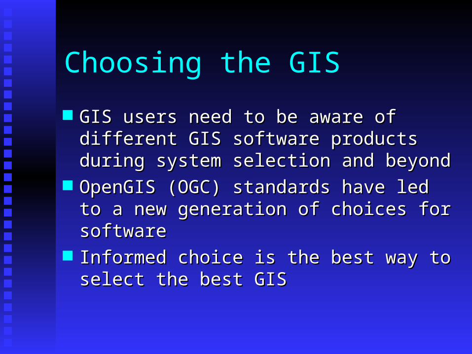
Choosing the GIS
GIS users need to be aware of different GIS GIS users need to be aware of different GIS software products during system selection software products during system selection and beyondand beyond
OpenGIS (OGC) standards have led to a OpenGIS (OGC) standards have led to a new generation of choices for softwarenew generation of choices for software
Informed choice is the best way to select Informed choice is the best way to select the best GISthe best GIS

Functionality
What functions must GIS perform?What functions must GIS perform? What functions can it perform?What functions can it perform? What software has what functions?What software has what functions? First management step is often to make a First management step is often to make a
requirements matrix: needs vs. capabilitiesrequirements matrix: needs vs. capabilities

A functional definition of GIS
A GIS is often defined not for what it is but A GIS is often defined not for what it is but for what it can do.for what it can do.
If the GIS does not match the requirements If the GIS does not match the requirements for a problem, no GIS solution will be for a problem, no GIS solution will be forthcoming.forthcoming.
A GIS may have overcapacity.A GIS may have overcapacity.

GIS as a toolbox…
How did functions develop over time?How did functions develop over time? What are the differences among software What are the differences among software
packages?packages? What are any given packages strengths and What are any given packages strengths and
weaknesses?weaknesses? What other factors come into play, cost, What other factors come into play, cost,
training, maintenance, robustness, etc. training, maintenance, robustness, etc.

GIS software in 1979
A historical GIS “snapshot” was the IGC A historical GIS “snapshot” was the IGC survey conducted in 1979survey conducted in 1979
In the 1979 survey, most GISs were sets of In the 1979 survey, most GISs were sets of loosely linked FORTRAN programs loosely linked FORTRAN programs performing spatial operationsperforming spatial operations
Computer mapping programs had evolved Computer mapping programs had evolved GIS functionalityGIS functionality
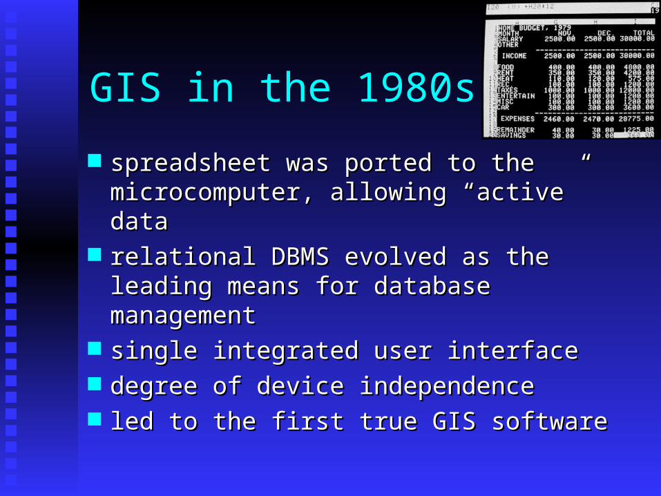
GIS in the 1980s
spreadsheet was ported to the spreadsheet was ported to the microcomputer, allowing “active” datamicrocomputer, allowing “active” data
relational DBMS evolved as the leading relational DBMS evolved as the leading means for database managementmeans for database management
single integrated user interface single integrated user interface degree of device independence degree of device independence led to the first true GIS softwareled to the first true GIS software

GIS in the 90s
used graphical user interfaces and the used graphical user interfaces and the desktop/WIMP modeldesktop/WIMP model
Unix workstations integrated GIS with the Unix workstations integrated GIS with the X-windows GUIX-windows GUI
GISs began to use the OS GUI instead of GISs began to use the OS GUI instead of their owntheir own
PCs integrated GIS with the variants of PCs integrated GIS with the variants of Windows and other OSsWindows and other OSs

X windows and the GUI

GIS in the 2000s
Mobile systemsMobile systems Web-based extensionsWeb-based extensions Distributed systems and dataDistributed systems and data Most software now object-orientedMost software now object-oriented New competition: OpenSourceNew competition: OpenSource Web servicesWeb services Location-based servicesLocation-based services

Trends still under way
Open Source development tools now Open Source development tools now ubiquitous, e.g. geotools librariesubiquitous, e.g. geotools libraries
GoogleEarth, Virtual Earth, etc.GoogleEarth, Virtual Earth, etc. Mash-up solutionsMash-up solutions

The “critical six” functional capabilities data capturedata capture storagestorage managementmanagement retrievalretrieval analysisanalysis displaydisplay

Data capture functions
digitizingdigitizing scanningscanning mosaicingmosaicing editingediting generalizationgeneralization topological cleaningtopological cleaning

Steps in mosaicing

Rubber sheeting
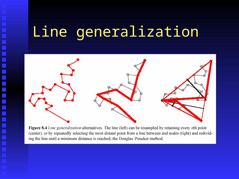
Line generalization

Storage functions
compressioncompression metadata handlingmetadata handling control via macros or languagescontrol via macros or languages format supportformat support

Compression
By data structureBy data structure quad treesquad trees run length encodingrun length encoding
By data formatBy data format compressed TIFcompressed TIF jpegjpeg
By physical compressionBy physical compression digit handlingdigit handling

Data management functions
physical model supportphysical model support DBMSDBMS address matchingaddress matching maskingmasking cookie cuttingcookie cutting

Cookie cutting
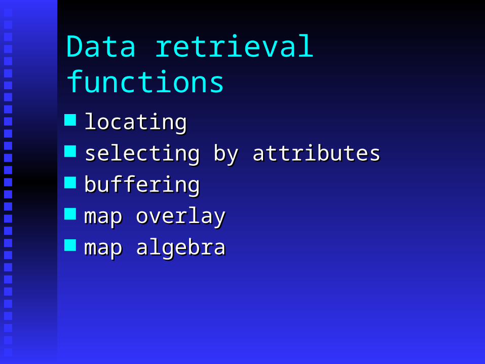
Data retrieval functions
locatinglocating selecting by attributesselecting by attributes bufferingbuffering map overlaymap overlay map algebramap algebra

Map algebra

Data analysis functions
interpolationinterpolation optimal path selectionoptimal path selection geometric testsgeometric tests slope calculationslope calculation
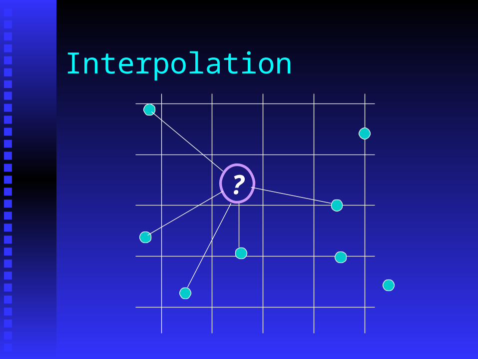
Interpolation
?

Data display functions
desktop mappingdesktop mapping interactive modification of cartographic interactive modification of cartographic
elementselements graphic file exportgraphic file export

Functional capabilities are by-products of data structure Raster systems work best in forestry, Raster systems work best in forestry,
photogrammetry, remote sensing, terrain photogrammetry, remote sensing, terrain analysis, and hydrology.analysis, and hydrology.
Vector systems work best for land parcels, Vector systems work best for land parcels, census data, precise positional data, and census data, precise positional data, and networks.networks.

Vector
Precision intactPrecision intact Used when individual coordinates are Used when individual coordinates are
importantimportant More concise spatial descriptionMore concise spatial description Assumes feature model of landscapeAssumes feature model of landscape Easy to transform data e.g. map projectionsEasy to transform data e.g. map projections

Raster Better for field dataBetter for field data Used by most imaging systemsUsed by most imaging systems Can be compressedCan be compressed Easy to display and analyzeEasy to display and analyze Many common formatsMany common formats However, most systems now use bothHowever, most systems now use both Raster layer often backdrop-onscreen editingRaster layer often backdrop-onscreen editing

The Big Eight
Form the bulk of operational GIS in Form the bulk of operational GIS in professional and educational environmentsprofessional and educational environments
There are some significant differences There are some significant differences between these “big eight” systems.between these “big eight” systems.
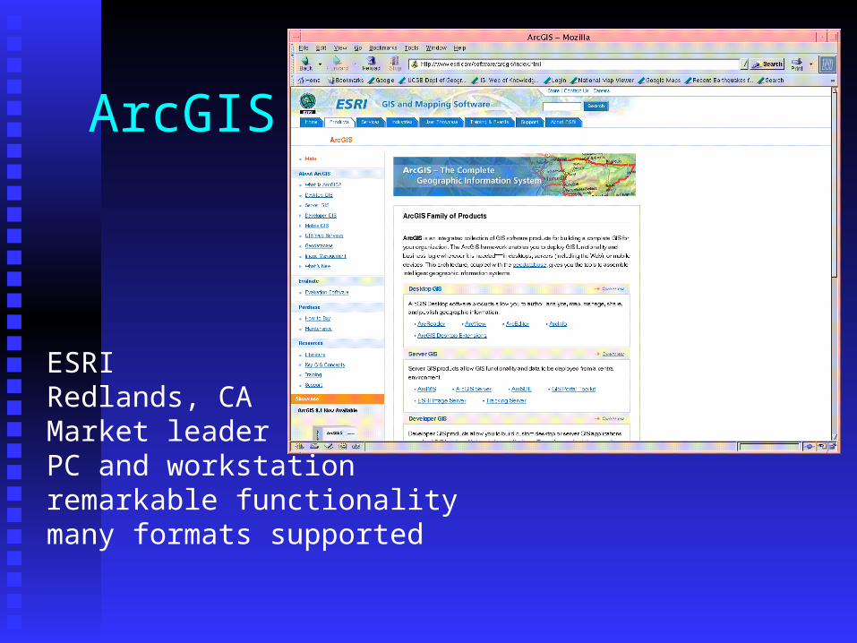
ArcGIS
ESRIRedlands, CAMarket leaderPC and workstationremarkable functionalitymany formats supported

ArcPad
Mobile GISDesigned for GPS and PDADeveloper packageUses Windows CE
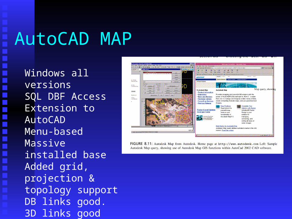
AutoCAD MAP
Windows all versionsSQL DBF AccessExtension to AutoCADMenu-basedMassive installed baseAdded grid, projection & topology supportDB links good.3D links good

GRASS
First UNIX GISDeveloped by ArmyCorps of EngineersUNIX functionalityMany unique functionsFree until recentlyMany data setsBaylor University now supports
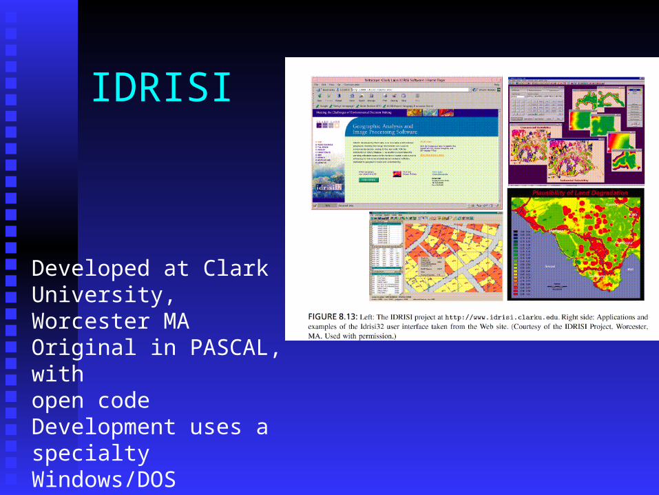
IDRISI
Developed at ClarkUniversity, Worcester MAOriginal in PASCAL, withopen codeDevelopment uses a specialtyWindows/DOSSpatial analysis/stats extensions

Maptitude
Caliper CorporationConsultancyTRANSCAD and GIS+Many network solutionsWindowsImport/ExportAddress matching

GeoMedia
CAD software with GISextensionsIntergraph Corp, Huntsville ALUses Windows NTMany parcel applicationsWeb extensions, server tools etc.

MapInfoBased in Troy, NYMapping functionsUses Visual BasicMany applicationsFavored for 911, field

New entry: Manifold

A variety of issues should be considered in system selection: costcost upgradesupgrades LAN configuration supportLAN configuration support training needstraining needs ease of installationease of installation maintenancemaintenance documentation and manualsdocumentation and manuals help-line and vendor supporthelp-line and vendor support means of making patchesmeans of making patches
workforceworkforce

Selecting a GIS can be a complex and confusing process.
The intelligent GIS consumer should The intelligent GIS consumer should research, select, test, and question systems research, select, test, and question systems before purchase.before purchase.

Coming next…..
GIS in ActionGIS in Action