how prague is opening data
TRANSCRIPT

Opening spatial data in Prague
Jachym Cepicky1
FOSS4G-Europe 2015
Opening spatial data in Prague
Jachym Cepicky1
FOSS4G-Europe 2015
2015
-07-
17Opening spatial data in Prague
Hi

2015
-07-
17Opening spatial data in Prague
my name is Jachym Cepicky, and I’ve been involved for longer the 10years in developent of the open source software for geospatial. Istarted on the desktop and server side, last years I’m involved morewith development of JavaScript based client applications.In this talk, I would like to give you brief report about how city ofPrague opened their spatial data

Open GeoInfrastructure http://osgeo.cz
Open GeoInfrastructure http://osgeo.cz
2015
-07-
17Opening spatial data in Prague
In Czech republic, we formed an association called ’OpenGeoInfrastructure’ and we are trying to push open source softwareand open data to the public administration, education and supportprivate business on their way to the open source software.

http://geoportalpraha.cz
http://geoportalpraha.cz
2015
-07-
17Opening spatial data in Prague
I’m not representative of Prague, but we were asked byrepresentatives of Planing and development institute of Prague,whether we could help to define the way and search for bestpractices, how geospatial data could be opened.You are all aware about OGC and INSPIRE initiative, which are givingus solid technological and standard background for openinggeospatial data.

2015
-07-
17Opening spatial data in Prague
You are all aware about OGC and INSPIRE initiative, which are givingus solid technological, software and standard background for openinggeospatial data.Before Prague started to really open the data, several actions weretaken.

http://praguehacks.cz
http://praguehacks.cz
2015
-07-
17Opening spatial data in Prague
With help of several non-governmental organisations and bigcompanies, such as Microsoft, IBM, Vodafone and city of Pragueitself, already two open data hackathons were organised. This helpsto evaluate the data as well as the way, they are opened. It’s alwaysvery nice event, where we have fun and personally I, being a mentor,have opportunity to lay my hands down on technologies, which Iusually know only from stories, but the attendees of the hackathonneed to use it for whatever reasons (like putting big raster data intopostgis database). I probably do not need to describe to you, howastonishing for some of the real programmers is, that there is morethen one map projection.

2015
-07-
17Opening spatial data in Prague
and we setuped pool, asking the future users of open data, how dothey like to have them. We might be searching wrong, but results ofsuch pool could be be found anywhere.The pool was filled by more then 100 people, and it’s far from beingobjective, they were mostly students of various geospatial studies.But it showed at least something. Among other interestingly highnumber of users of desktop open source GIS and preference to OGCstandards over proprietary.

2015
-07-
17Opening spatial data in Prague
The whole study is heavy INSPIRE-inspired - where appropriate, westick to INSPIRE implementation rules, advice to use OGC OWSs.Generally speaking, we prefer to use OGC services over file formats.
http://vdp.cuzk.cz/
http://vdp.cuzk.cz/
2015
-07-
17Opening spatial data in Prague
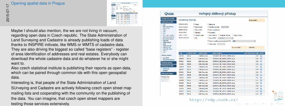
Maybe I should also mention, the we are not living in vacuum,regarding open data in Czech republic. The State Administration ofLand Surveying and Cadastre is already publishing loads of datathanks to INSPIRE initivate, like WMS or WMTS of cadastre data.They are also driving the biggest so called ”base registers” - registerof area identification of addresses and real estates. Everybody candownload the whole cadastre data and do whatever he or she mightwant to.Also czech statistical institute is publishing their reports as open data,which can be paired through common ids with this open geospatialdata.Interesting is, that people of the State Administration of LandSUrveying and Cadastre are actively following czech open street mapmailing lists and cooperating with the community on the publishing ofthe data. You can imagine, that czech open street mappers aretesting those services extensively.
Opening of spatial data case study,http://opengeolabs.cz/publikace
Opening of spatial data case study,http://opengeolabs.cz/publikace
2015
-07-
17Opening spatial data in Prague
But this talk is supposed to be about Prague.Thanks to fundings from Prague, we started to work on case studyabout how spatial data could be opened. It’s currently available onlyin czech but, we released it under creative commons license so thateverybody can add new updated informations. The case study itselfdivided into 3 sections - Introduction, Technical and Law aspects ofdata opening and Opening of geospatial data itself. It also hasseveral attachments, which are mentioning useful open sourcesoftware tools, how to deal with temporary data, or for exampledescription of Atom format.

https://github.com/OpenGeoLabs/otevrena-geodata
https://github.com/OpenGeoLabs/otevrena-geodata
2015
-07-
17Opening spatial data in Prague
we ask you to fork it on github and help with it’s development. Now ithas about 60 pages in pdf file.

2015
-07-
17Opening spatial data in Prague
Based on this study, people from Institute for planning andDevelopment of Prague started to setup their whole environment, topublish step-by-step the spatial data. It’s worth to mention, that thewhole environment is based on the classical public administrationstack - Oracle database and Esri ArcGIS servers and clients.
Pre-generated files × spatial data services
Pre-generated files × spatial data services
2015
-07-
17Opening spatial data in Prague
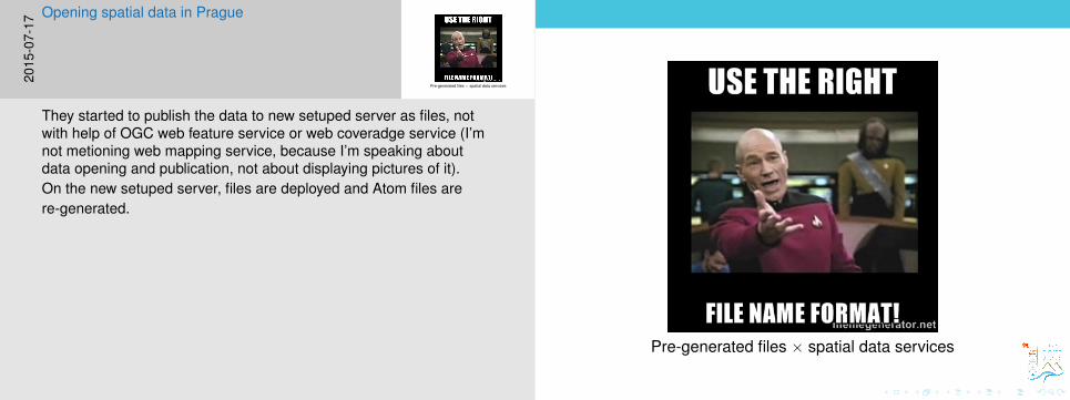
They started to publish the data to new setuped server as files, notwith help of OGC web feature service or web coveradge service (I’mnot metioning web mapping service, because I’m speaking aboutdata opening and publication, not about displaying pictures of it).On the new setuped server, files are deployed and Atom files arere-generated.

2015
-07-
17Opening spatial data in Prague
The whole script, which enables to publish the data in open way, ispython based, written for ArcGIS and it was open sourced. Butauthors of the script are not native coders, so please be kind, if youlook at the code.

http://opendata.iprpraha.cz/feed.xml
http://opendata.iprpraha.cz/feed.xml
2015
-07-
17Opening spatial data in Prague
What is possible now, beside standard ogc catalogue service for webinterface, but to browse the data in the atom files - they are linkedtogether in tree structure, it’s very effective to navigate a scriptthrough them.
http://opendata.iprpraha.cz/feed.xml
http://opendata.iprpraha.cz/feed.xml
2015
-07-
17Opening spatial data in Prague
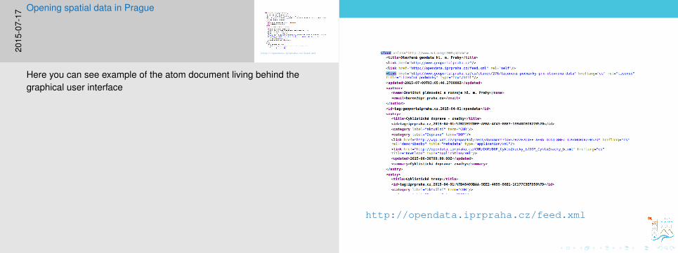
Here you can see example of the atom document living behind thegraphical user interface

2015
-07-
17Opening spatial data in Prague
Data were published inline with Creative Commons CC BY-SA, withno restrictions for commercial usage.
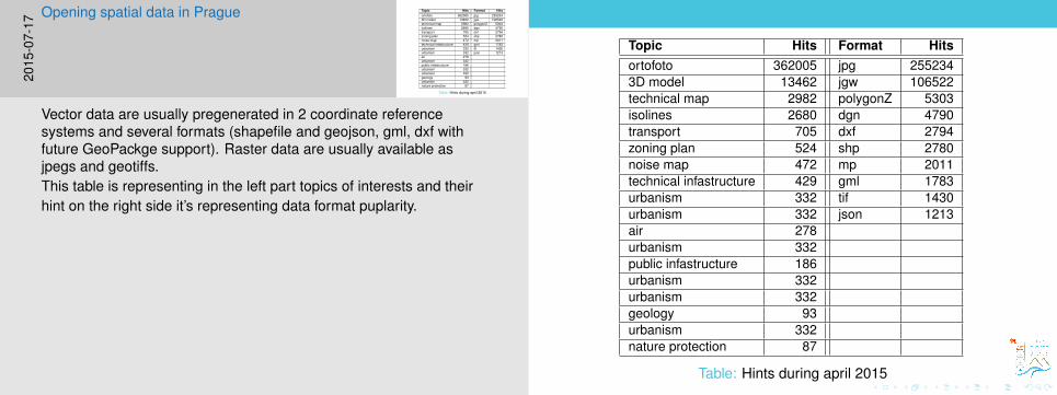
Topic Hits Format Hitsortofoto 362005 jpg 2552343D model 13462 jgw 106522technical map 2982 polygonZ 5303isolines 2680 dgn 4790transport 705 dxf 2794zoning plan 524 shp 2780noise map 472 mp 2011technical infastructure 429 gml 1783urbanism 332 tif 1430urbanism 332 json 1213air 278urbanism 332public infastructure 186urbanism 332urbanism 332geology 93urbanism 332nature protection 87
Table: Hints during april 2015
2015
-07-
17Opening spatial data in Prague
Vector data are usually pregenerated in 2 coordinate referencesystems and several formats (shapefile and geojson, gml, dxf withfuture GeoPackge support). Raster data are usually available asjpegs and geotiffs.This table is representing in the left part topics of interests and theirhint on the right side it’s representing data format puplarity.

2015
-07-
17Opening spatial data in Prague
I’m absolutely not able to interpret this image, I took it from thepresentation of mr. Ctyroky, head of the GIS department of institute ofplaning and development of Prague, it’s supposed illustrate statisticsof data dispension and money income from various sources for theinstitute, which they charged for the data.You can see that in the last month - believe me, it’s the month, whenthey opened the data, there is like no money income from the e-shop.People started to download the data for free.What was not going down is ammount of data, handed out on theshelter - those are usually architecs, who need something special.

2015
-07-
17Opening spatial data in Prague
Zaver
Big thanks to city of Prague and it’s institute for development andplaning, for actively supporting open data and for actively cooperatingwith the community

Questions?
[email protected]://opengeolabs.cz@jachymc
Questions?
[email protected]://opengeolabs.cz@jachymc20
15-0
7-17
Opening spatial data in PragueZaver