hong kong 2030+ - lands department€¦ · spatial data play an essential role in driving hong kong...
TRANSCRIPT
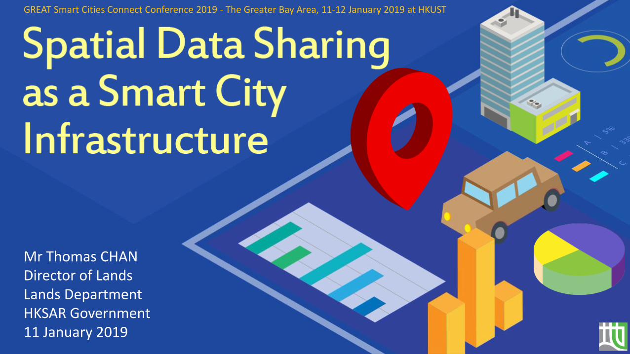
Mr Thomas CHANDirector of LandsLands DepartmentHKSAR Government11 January 2019
GREAT Smart Cities Connect Conference 2019 - The Greater Bay Area, 11-12 January 2019 at HKUST
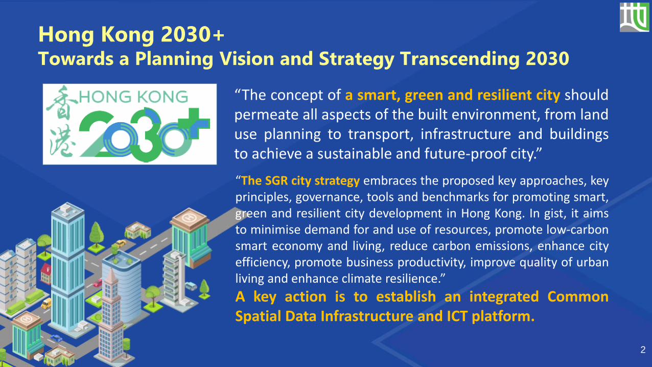
Hong Kong 2030+Towards a Planning Vision and Strategy Transcending 2030
“The concept of a smart, green and resilient city shouldpermeate all aspects of the built environment, from landuse planning to transport, infrastructure and buildingsto achieve a sustainable and future-proof city.”
2
“The SGR city strategy embraces the proposed key approaches, keyprinciples, governance, tools and benchmarks for promoting smart,green and resilient city development in Hong Kong. In gist, it aimsto minimise demand for and use of resources, promote low-carbonsmart economy and living, reduce carbon emissions, enhance cityefficiency, promote business productivity, improve quality of urbanliving and enhance climate resilience.”
A key action is to establish an integrated CommonSpatial Data Infrastructure and ICT platform.

Hong Kong Smart City Blueprint
Smart Mobility
Smart Living
Smart Environment
Smart People
Smart Government
Smart Economy
The Innovation and Technology Bureau published in Dec 2017 theSmart City Blueprint for Hong Kong setting out the overallframework and strategy for developing Hong Kong into a Smart City
3
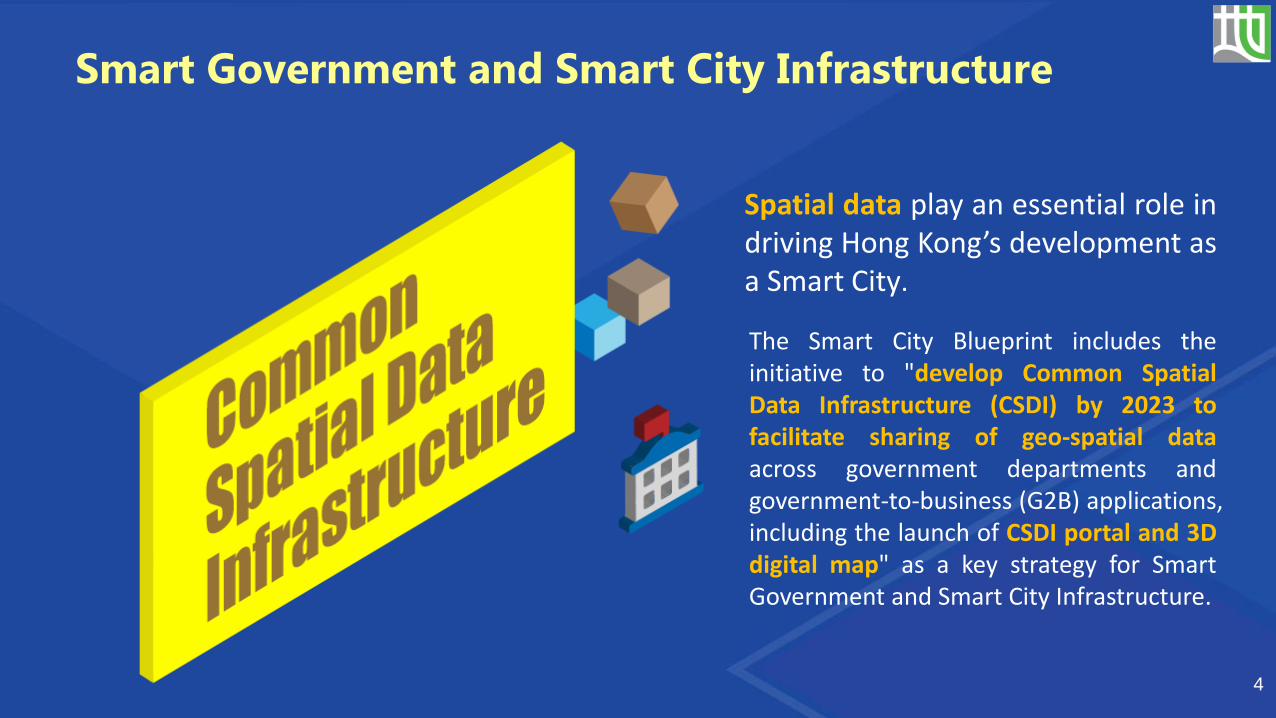
Spatial data play an essential role indriving Hong Kong’s development asa Smart City.
4
Smart Government and Smart City Infrastructure
The Smart City Blueprint includes theinitiative to "develop Common SpatialData Infrastructure (CSDI) by 2023 tofacilitate sharing of geo-spatial dataacross government departments andgovernment-to-business (G2B) applications,including the launch of CSDI portal and 3Ddigital map" as a key strategy for SmartGovernment and Smart City Infrastructure.
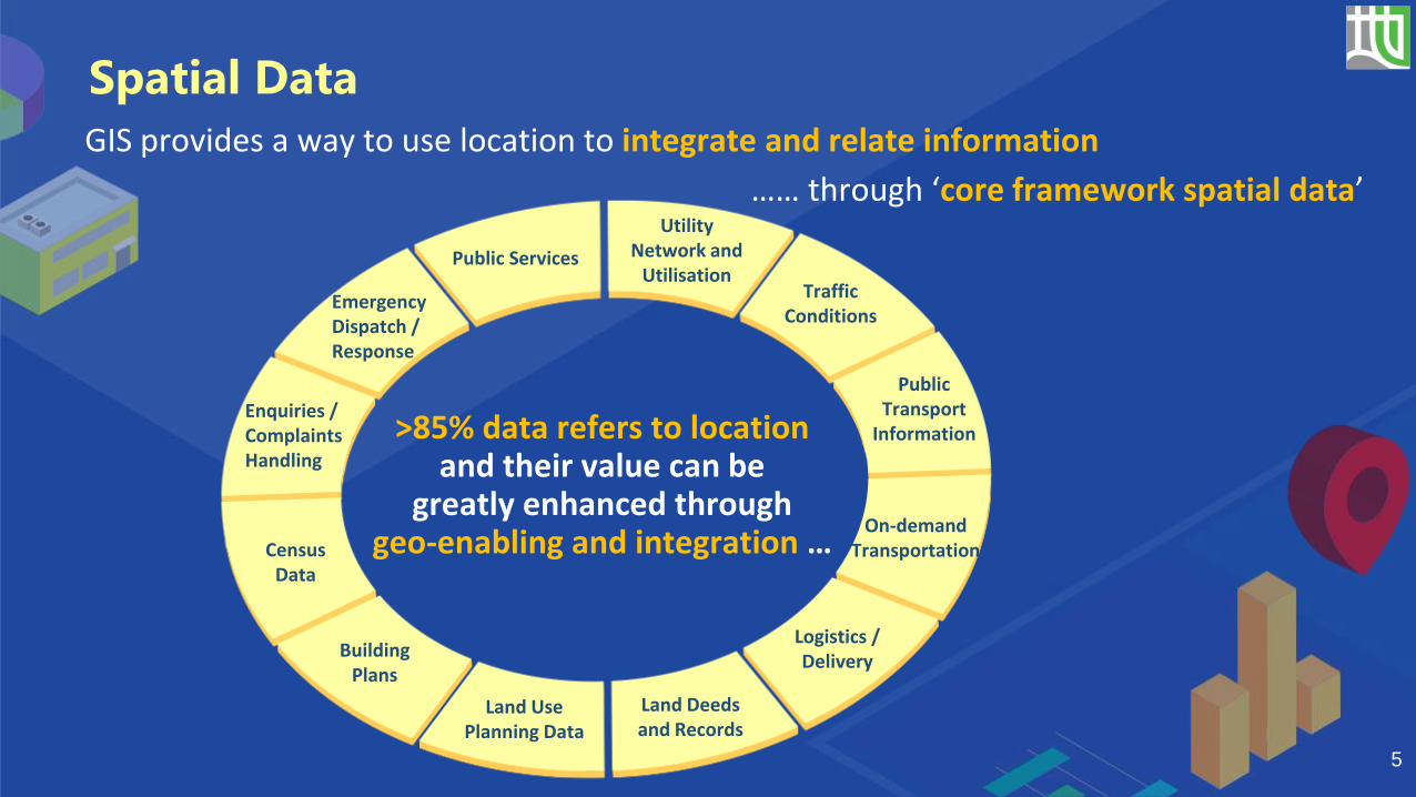
…… through ‘core framework spatial data’
Emergency Dispatch / Response
Enquiries / Complaints Handling
Census Data
Building Plans
Land Use Planning Data
Logistics / Delivery
On-demand Transportation
Public Transport
Information
Traffic Conditions
Utility Network and
UtilisationPublic Services
>85% data refers to location and their value can be
greatly enhanced through geo-enabling and integration …
Land Deeds and Records
5
GIS provides a way to use location to integrate and relate information
Spatial Data

Support applications across virtually all sectors of human activities…...
Topographic Basemaps Land Records
Utility Management Telecommunications
Disaster Management
Urban & Regional Planning Census
Environmental Management
Health Care Education LogisticsEconomic Development
6
Spatial Data
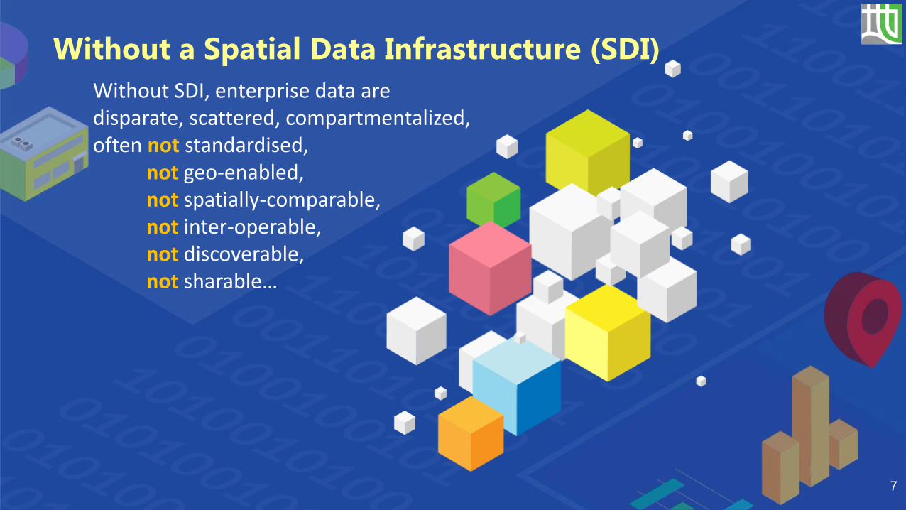
Without SDI, enterprise data are disparate, scattered, compartmentalized, often not standardised,
not geo-enabled, not spatially-comparable, not inter-operable, not discoverable, not sharable…
Without a Spatial Data Infrastructure (SDI)
7
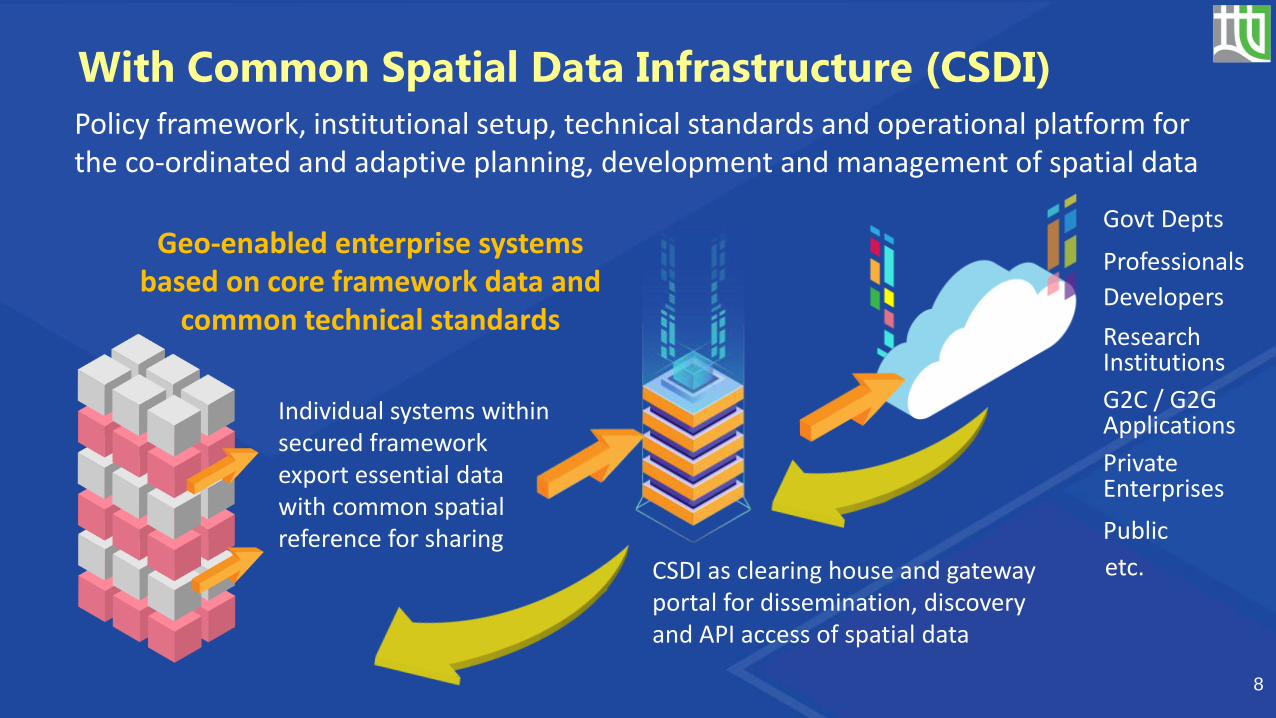
CSDI as clearing house and gateway portal for dissemination, discovery and API access of spatial data
Public
G2C / G2G Applications
Research Institutions
etc.
With Common Spatial Data Infrastructure (CSDI)
Policy framework, institutional setup, technical standards and operational platform for the co-ordinated and adaptive planning, development and management of spatial data
8
Professionals
Private Enterprises
Geo-enabled enterprise systems based on core framework data and
common technical standards
Individual systems within secured framework export essential data with common spatial reference for sharing
Govt Depts
Developers

SDI Example – National SDI (NSDI) for the United States
9

10
SDI Example – INSPIRE for the European Union

11
SDI Example – Abu Dhabi SDI

12
SDI Example – National SDI for Singapore
13
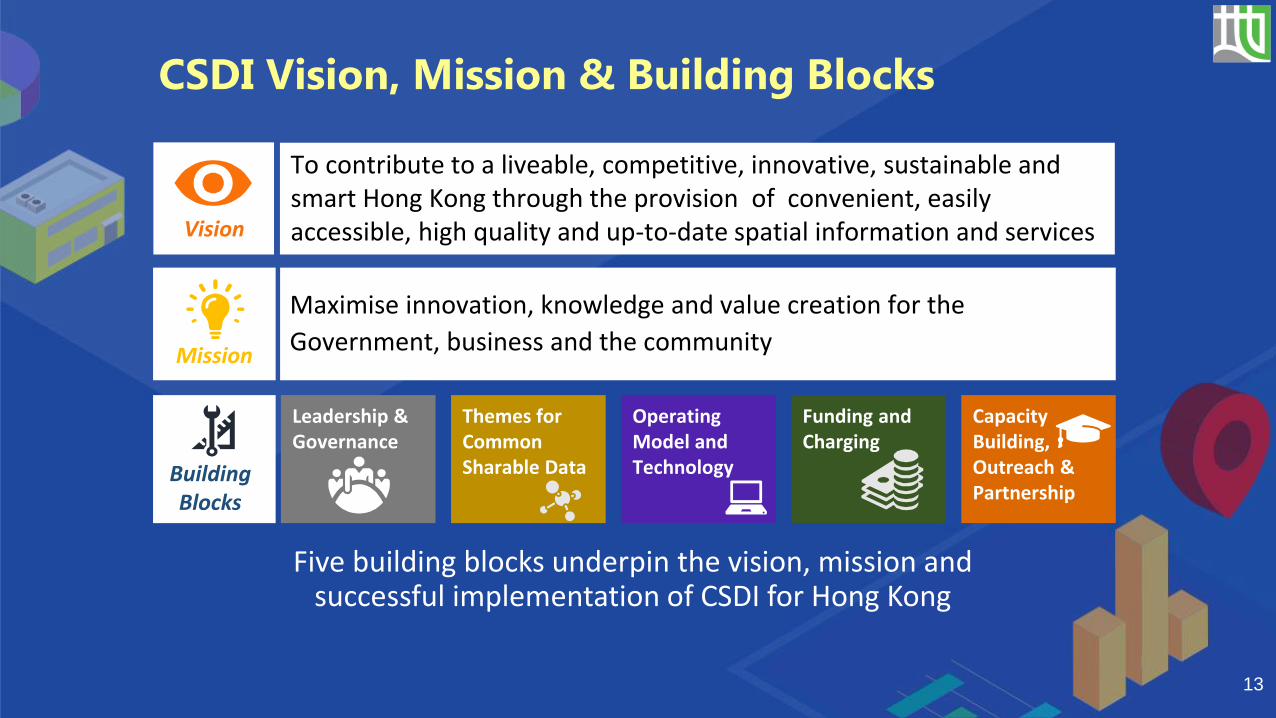
CSDI Vision, Mission & Building Blocks
Building Blocks
Leadership & Governance
Themes for Common Sharable Data
Funding and Charging
Operating Model and Technology
Capacity Building, Outreach & Partnership
Vision
Mission
To contribute to a liveable, competitive, innovative, sustainable and smart Hong Kong through the provision of convenient, easily accessible, high quality and up-to-date spatial information and services
Maximise innovation, knowledge and value creation for the
Government, business and the community
Five building blocks underpin the vision, mission and successful implementation of CSDI for Hong Kong
14
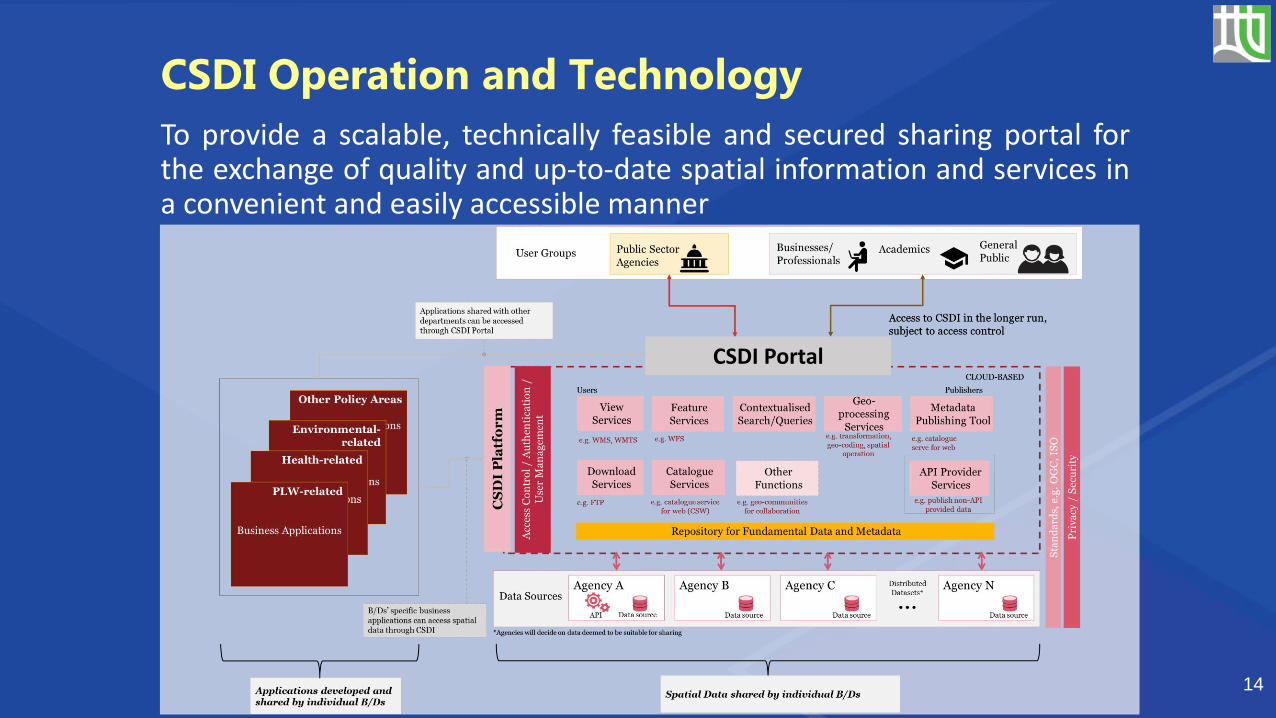
CSDI Operation and Technology
CSDI Portal
To provide a scalable, technically feasible and secured sharing portal forthe exchange of quality and up-to-date spatial information and services ina convenient and easily accessible manner

CSDI Digital Framework
Smart Economy
Smart Mobility
Smart Environment
Smart People
Smart Living
Smart Government
SMARTSERVICES
DIG
ITA
LIN
FRA
STR
UC
TUR
E Data Layer Big Data Open Data Common Spatial Data
Integration Layer
Identity and Access Control
IoT/SCADA Network
Sensor Asset Management
Data Interconnect (Message Bus/API) Administration
Connectivity Layer Fixed Networks Mobile Networks Wi-Fi RF Mesh LPWAN
DATASOURCES
Data from Sensors and Actuators Data from CitizensData from B/D or Public/Private Databases
RoadsBuilt Environment Power Water Public Spaces Transport
Social Infrastructure
Digital Enablers
Dat
a C
entr
e (C
lou
d &
A
pp
licat
ion
Arc
hit
ectu
re)
Dig
ital
Per
son
a
Stan
dar
ds
Secu
rity
/ P
riva
cy P
rote
ctio
n
15
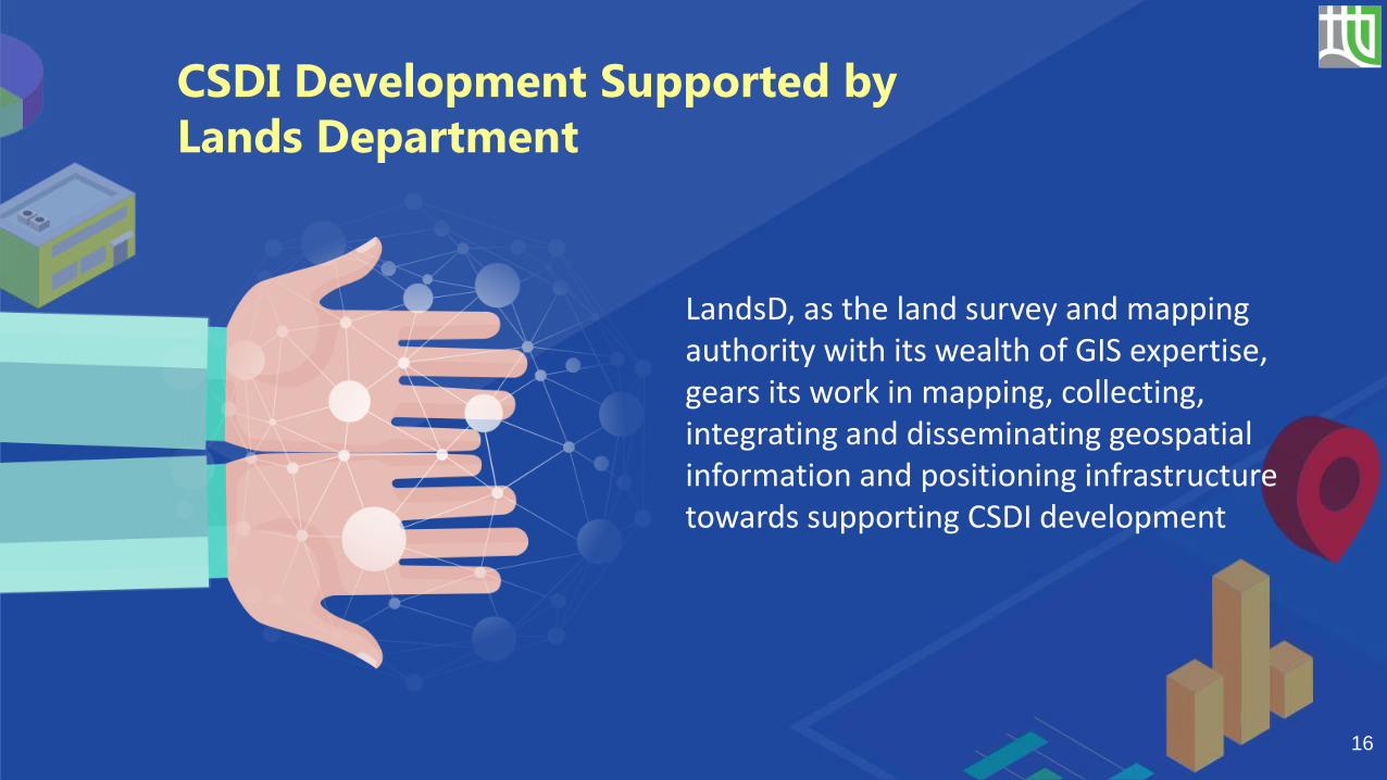
LandsD, as the land survey and mapping authority with its wealth of GIS expertise, gears its work in mapping, collecting, integrating and disseminating geospatial information and positioning infrastructure towards supporting CSDI development
16
CSDI Development Supported by
Lands Department

CSDI Development - 3 Essential Areas
1. Establishing Data & Technical Standards
3. Capacity Building & Outreach
2. Platform Development & Application Facilitation
17

LandsD leads the Data and TechnicalStandard Working Group
18
1. Establishing Data & Technical Standards
Consultancy study underway to establishthe data exchange standards for coreframework spatial data, and to devise thearchitecture and workflow of CSDI portalto facilitate spatial data sharing
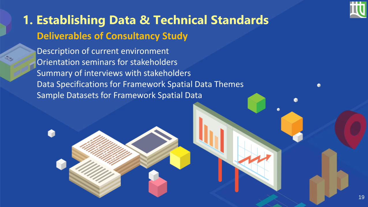
Description of current environmentOrientation seminars for stakeholdersSummary of interviews with stakeholdersData Specifications for Framework Spatial Data Themes Sample Datasets for Framework Spatial Data
Deliverables of Consultancy Study
19
1. Establishing Data & Technical Standards

20
Land Information System (LIS)
Land InformationSystem (LIS)
Desktop Editing Field Survey Photogrammetry
Geospatial Information Hub
A unified GIS backbone for the current 2D digital map
• Maintain large-scale 2D topographic map data and land boundary records
• Provide platform for survey data processing, data updating, spatial analysis, and plan production
• Support 400+ concurrent users in virtual desktop infrastructure
• Facilitate 500+ concurrent users in retrieving spatial data information on web
2. Platform Development & Application Facilitation
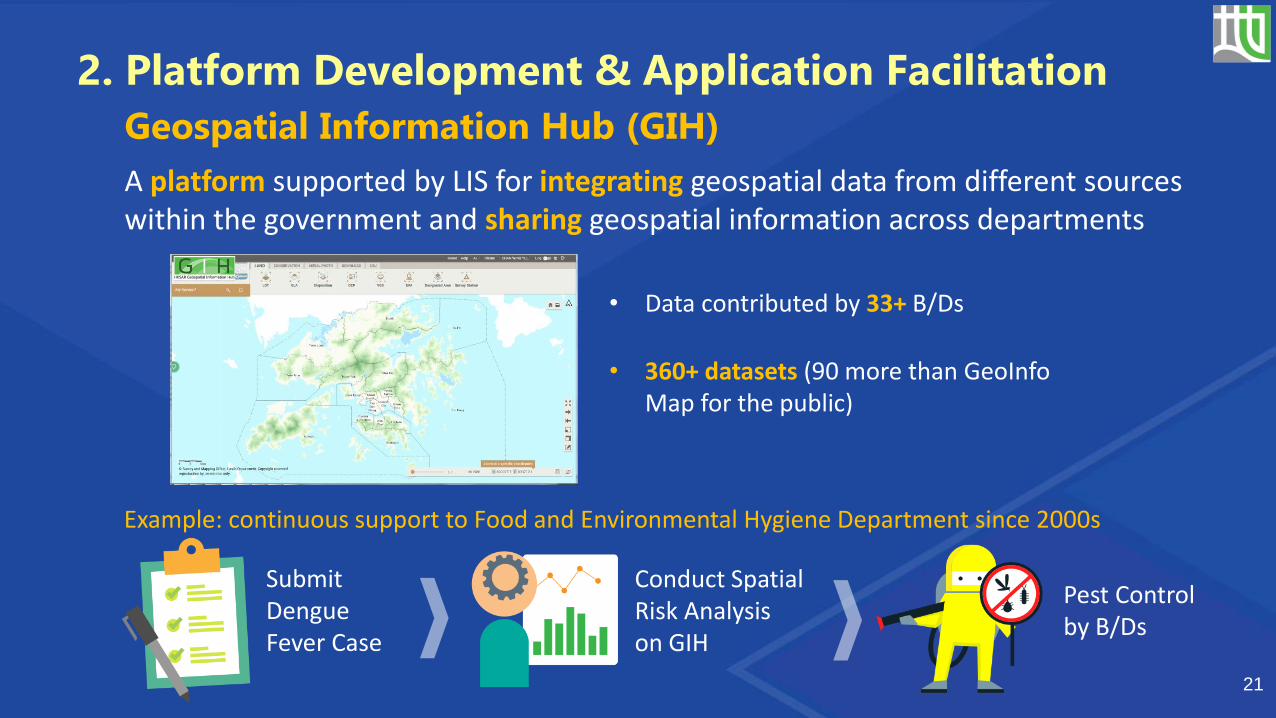
• Data contributed by 33+ B/Ds
• 360+ datasets (90 more than GeoInfoMap for the public)
Geospatial Information Hub (GIH)
21
Submit Dengue Fever Case
Conduct Spatial Risk Analysis on GIH
Pest Control by B/Ds
Example: continuous support to Food and Environmental Hygiene Department since 2000s
2. Platform Development & Application Facilitation
A platform supported by LIS for integrating geospatial data from different sources within the government and sharing geospatial information across departments
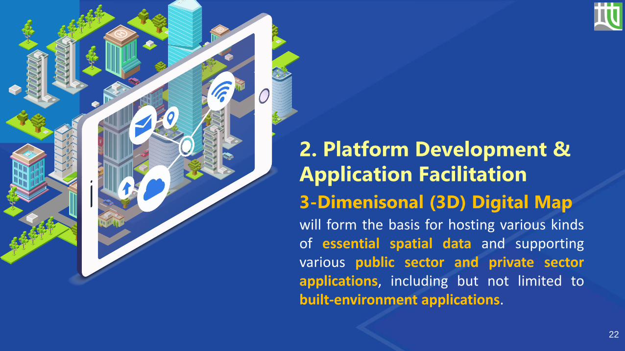
will form the basis for hosting various kindsof essential spatial data and supportingvarious public sector and private sectorapplications, including but not limited tobuilt-environment applications.
2. Platform Development &
Application Facilitation
22
3-Dimenisonal (3D) Digital Map
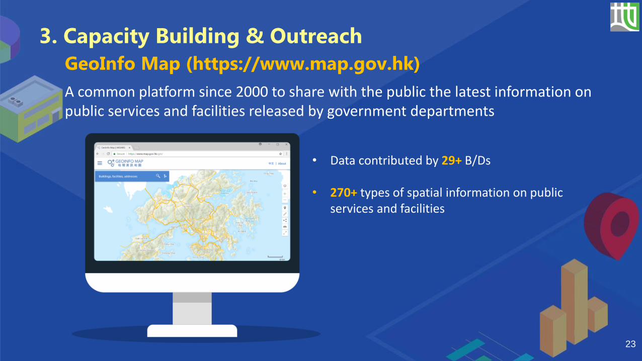
23
• Data contributed by 29+ B/Ds
• 270+ types of spatial information on public services and facilities
GeoInfo Map (https://www.map.gov.hk)
3. Capacity Building & Outreach
A common platform since 2000 to share with the public the latest information on public services and facilities released by government departments
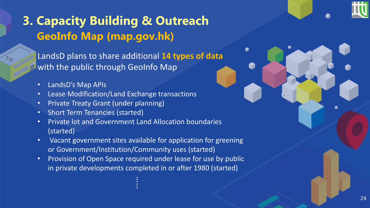
• LandsD’s Map APIs• Lease Modification/Land Exchange transactions• Private Treaty Grant (under planning)• Short Term Tenancies (started)• Private lot and Government Land Allocation boundaries
(started)• Vacant government sites available for application for greening
or Government/Institution/Community uses (started)• Provision of Open Space required under lease for use by public
in private developments completed in or after 1980 (started)
24
……
3. Capacity Building & Outreach
GeoInfo Map (map.gov.hk)
LandsD plans to share additional 14 types of data with the public through GeoInfo Map
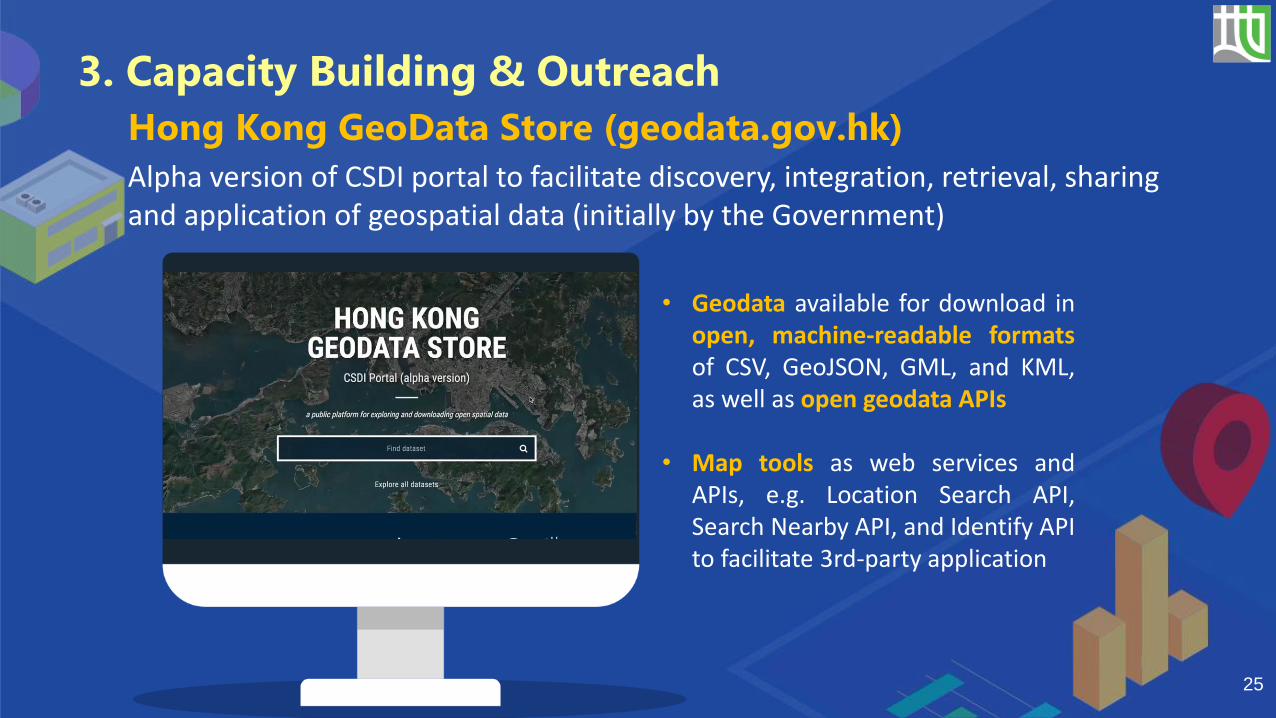
Alpha version of CSDI portal to facilitate discovery, integration, retrieval, sharing and application of geospatial data (initially by the Government)
25
Hong Kong GeoData Store (geodata.gov.hk)
3. Capacity Building & Outreach
• Geodata available for download inopen, machine-readable formatsof CSV, GeoJSON, GML, and KML,as well as open geodata APIs
• Map tools as web services andAPIs, e.g. Location Search API,Search Nearby API, and Identify APIto facilitate 3rd-party application
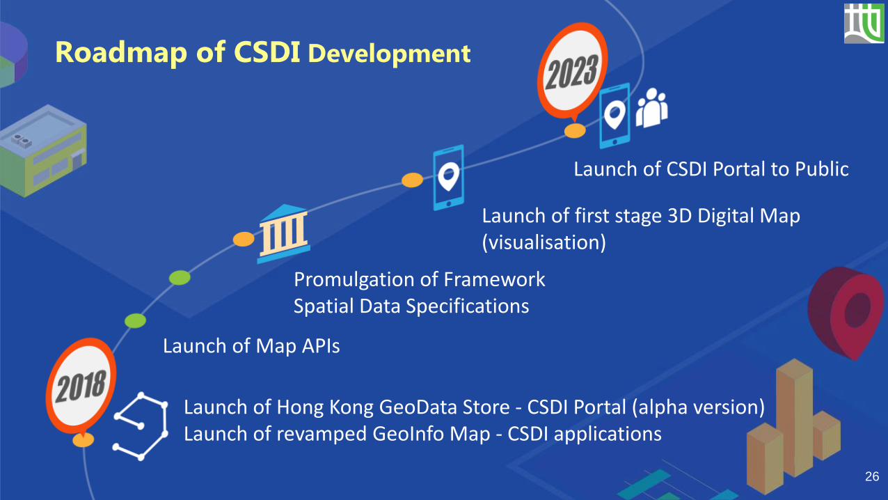
Launch of Hong Kong GeoData Store - CSDI Portal (alpha version)Launch of revamped GeoInfo Map - CSDI applications
Launch of CSDI Portal to Public
Launch of Map APIs
26
Roadmap of CSDI Development
Promulgation of Framework Spatial Data Specifications
Launch of first stage 3D Digital Map (visualisation)

• Embracing new surveying, mapping and geospatial information technologies
• Collaborating with stakeholders within government and the industry/community
• Establishing necessary standards for spatial data exchange and 3D digital map
• Collating and integrating more spatial data to enrich GeoInfo Map and GeoData Store
• Building up the 3D city model progressively to facilitate applications of spatial data
27
Looking forward, we will support CSDI and
Smart City development by …

28