historical resources analysis with supplementary...
TRANSCRIPT

Historical Resources Analysis
with supplementary photos
Proposed Olive Drive Area Building Demolition 115 Hickory Lane and 1233 Olive Drive
Davis, California
Garage, 115 Hickory Lane
prepared by
Dennis J. Dahlin
Dahlin and Essex, Inc.
2120 Loyola Drive, Davis CA 95618
February 23, 2015
revised September 5, 2015

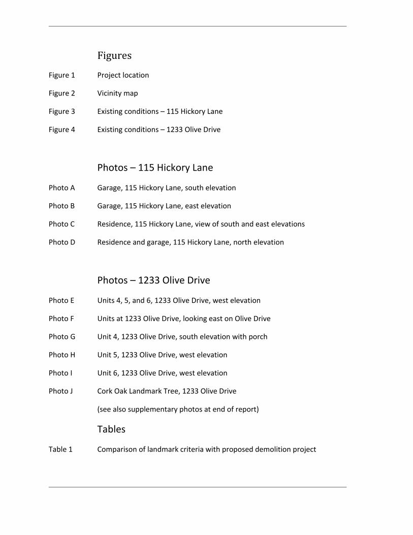
Figures
Figure 1 Project location
Figure 2 Vicinity map
Figure 3 Existing conditions – 115 Hickory Lane
Figure 4 Existing conditions – 1233 Olive Drive
Photos – 115 Hickory Lane
Photo A Garage, 115 Hickory Lane, south elevation
Photo B Garage, 115 Hickory Lane, east elevation
Photo C Residence, 115 Hickory Lane, view of south and east elevations
Photo D Residence and garage, 115 Hickory Lane, north elevation
Photos – 1233 Olive Drive
Photo E Units 4, 5, and 6, 1233 Olive Drive, west elevation
Photo F Units at 1233 Olive Drive, looking east on Olive Drive
Photo G Unit 4, 1233 Olive Drive, south elevation with porch
Photo H Unit 5, 1233 Olive Drive, west elevation
Photo I Unit 6, 1233 Olive Drive, west elevation
Photo J Cork Oak Landmark Tree, 1233 Olive Drive
(see also supplementary photos at end of report)
Tables
Table 1 Comparison of landmark criteria with proposed demolition project

Contents
Introduction and project description ....................................................................... 33
Resources .................................................................................................................................................................... 1
Context and existing conditions ........................................................................................................................ 2
115 Hickory Lane property ............................................................................................................................ 5
1233 Olive Drive property ........................................................................................................................... 10
City regulations and policies ........................................................................................ 17
Surveys of historical resources ....................................................................................................................... 17
Gateway Olive Drive Specific Plan ................................................................................................................. 17
Zoning code ............................................................................................................................................................. 18
The Davis Register of Designated Historical Resources ....................................................................... 18
Landmark Trees .................................................................................................................................................... 19
Analysis ................................................................................................................................. 19
A Are the buildings proposed for demolition
historically significant resources? ................................................................................................... 19
B Does the proposed project adversely affect
existing or potential designated historical resources? ........................................................... 21
C Could the proposed project adversely affect
a potential Lincoln Highway District? ............................................................................................ 22
Summary............................................................................................................................... 24
References ............................................................................................................................ 25
Author qualifications ....................................................................................................... 27
Supplementary photos

[this page left blank]

1
Introduction and project description The owners of property along Olive Drive, Robert Jordan et al., are proposing demolition of five existing structures on two separate parcels at 115 Hickory Lane and 1233 Olive Drive. The purpose of the demolition is to remove unsafe and substandard structures and to provide space for future efficient development of the properties, in keeping with City goals and policies for the area. A demolition certificate from the City of Davis is required before a demolition permit can be issued, with special provisions for structures that are more than fifty years old.1 This report describes the setting, summarizes the proposed project, and provides an analysis of the project in relation to the City of Davis historical resource regulations and guidelines. The analysis focuses on three issues: A. Are the structures historically significant resources?
B. Does the proposed project adversely affect nearby Davis Historical Landmarks or Landmark Trees?
C. Could the proposed project adversely affect a potential Lincoln Highway District?
This report has been prepared in keeping with the standards established by the State of
California Office of Historic Preservation, 2 the City of Davis Municipal Code,3 and the California
Environmental Quality Act Guidelines.4
Resources The following resources have been used in the preparation of this report. Interviews with Robert Jordan, owner representative and former long-time resident of
Olive Drive area. Jordan’s grandfather, Giuseppe “Joe” Callori, owned the property and arranged for construction of the buildings proposed for demolition.
Review of existing documents related to the Olive Drive properties. Field work, including site information, evaluation of existing structures and
comparison of air photos with current conditions. Documentation of the subject properties, including digital photos of the structures
proposed for demolition. Photos were taken in December 2014. Review of other relevant reference works (see references). Review of City of Davis and other government regulations, documents and reports
including previous surveys of historical resources, the Davis zoning code, and the Gateway Olive Drive Specific Plan.

2
Context and existing conditions
The proposed demolition projects are located in Davis, California, between the Union Pacific Railroad and Interstate 80, in the East Olive Drive corridor. Figures 1 and 2 indicate the location and vicinity map of the properties. All of the subject buildings were constructed under the direction of Giuseppe ‘Joe’ Callori (1874-1957),5 an Italian immigrant who arrived in California in 1906, and settled in Davis in about 1925. Callori, his descendants and extended family have owned the subject properties from the late 1920s until the present. The Callori family engaged in truck gardening, property rental, and other economic activities.6
East Olive Drive The Olive Drive corridor is isolated from the rest of Davis by Interstate 80 to the south and the Union Pacific Railroad tracks to the north. This part of Davis has a distinctive character, with remnants of early auto-oriented vernacular architecture from the pre-World-War II era, when Highway 40 / Lincoln Highway followed Olive Drive to the Richards Boulevard underpass. The Olive Drive corridor is described in more detail in Part C of this analysis.
Area land use and characteristics The project is located in a mixed-use neighborhood interspersed with vacant parcels. Structures have a variety of architectural styles and eras, characterized by one and two story structures and mature landscaping. Overhead utility lines are a land use constraint. The area east of the 1233 Olive Drive site is a narrow triangular parcel bordered by the railroad on the north and Olive Drive on the south. The property is vacant. An apartment complex has been constructed across the street from the project properties, south of Olive Drive. Self-storage buildings are located west of the apartments. The Kober Apartments are located at 1225 Olive Drive, between Hickory Lane and the proposed demolition at 1233 Olive Drive. This building complex was originally a motel, constructed under the direction of Frank Kober in about 1957.7 A number of other small one-story single family residences are located in the vicinity.
Slatter’s Court Slatter’s Court (pronounced slate’-ers) is located west of the Hickory Lane property. The original complex of buildings included a service station, grocery store, and overnight accommodations in the form of cabins and space for trailers. The service station is now a barbershop. The auto court cabins are small clapboarded gabled cabins typical of the early auto era.8 Slatter’s Court has been the subject of several investigations to determine its historical significance. Part B of the analysis discusses Slatter’s Court in more detail.

3
Figure 1. Project location, 115 Hickory Lane and 1233 Olive Drive.
Source: adapted from City of Davis base map.

4
Figure 2. Vicinity map, 115 Hickory Lane and 1233 Olive Drive.
Source: adapted from City of Davis assessor’s parcel map.

5
115 Hickory Lane property This property was included in the original 1868 plat for Davisville,9 although lots south of the railroad apparently were not recorded.10 The current Hickory Lane was originally named Pine Street, and then was renamed I Street (aligned with the current I Street north of the railroad) before receiving its present name. 11 Hickory Lane is unpaved, with a 40’ right of way. A former house and barn on the Hickory Lane property may have dated back to the nineteenth century.12 The property was purchased by Joe Callori from J. W. Marshall.13 The house and barn subsequently were demolished.14 The two structures at 115 Hickory Lane reportedly were built in the late 1920s.15 The site is nearly level. The structures are surrounded by mature informal landscaping. A walnut tree is located just west of the existing residence, with a citrus tree along the south wall. A deodar cedar (Cedrus deodara) is located near the southeast corner of the house, with an oak (Quercus sp.) to the east. An informal gravel driveway extends from the garage toward Olive Drive. The assessor’s parcel number for the 115 Hickory Lane property is 070-280-14. Figure 3 shows the context of the Hickory Lane property. 115 Hickory Lane garage Photos A and B show the current condition of this structure, a rectangular building previously used as a garage. The gable roof is surfaced with asphalt roll roofing in poor condition (Photo B). Two wood doors are located on the east elevation, with two double hung windows on the north side. Walls are sheathed with horizontal wood clapboard siding. The garage door on the south elevation has narrow vertical wood sheathing. The garage can be characterized as early twentieth-century vernacular architecture, constructed for utilitarian use. The structure was reportedly built in the late 1920s.16 There is no ornamentation or stylistic treatment. The garage does not show any evidence or history of auto-oriented use related to Highway 40 or the Lincoln Highway. The building has been used for storage in recent years. Building area is approximately 460 square feet. Condition. Structural problems are evident in Photos A and B. A structural engineering evaluation was completed by Pemberton Engineering in June 2014. The summary report notes that the wood structure is leaning heavily. The roof and siding have many gaps that have allowed water intrusion. The report concludes that the garage structure is posing a safety threat and should be demolished. 17 Integrity. The structure retains historic integrity in terms of its original materials, setting, and association. Minor structural improvements in 1990 did not affect the exterior. However, the garage has substantial structural problems and visible deterioration.

6
115 Hickory Lane residence Photos C and D show the residence at 115 Hickory Lane. As with the garage, the house can be characterized as early twentieth-century vernacular architecture. There is no significant ornamentation or stylistic treatment. The primary structure has a half-hipped roof, featuring a predominant gable roof shape with hip treatment at the ends. A covered porch is located at the southeast corner. The structure currently is used as a single family residence. Main floor building area is approximately 1,080 square feet, plus a porch and basement. Condition. Remedial interior structural work was completed in 2010. A subsequent structural engineering evaluation was completed by Pemberton Engineering in June 2014. The summary report notes that at some point in the near future, the structure will be considered unsafe and will likely need to be demolished. The report notes that it is unlikely that the structure can be feasibly repaired and salvaged.18 Integrity. The structure has been altered substantially from its original construction, with an addition on the north. Extensive renovation work was completed in 1990, including a composition shingle roof.19 The structure has substantial structural deficiencies.

7
Figure 3. Existing conditions – 115 Hickory Lane, showing residence and garage proposed for demolition. Source: Adapted from City of Davis assessor’s map.

8
Photo A. South elevation of garage, 115 Hickory Lane.
Note leaning wall at left.
Photo B. East elevation of garage, 115 Hickory Lane. Roof and walls show evidence of structural
deterioration. North wall of residence at 115 Hickory Lane is at far left.

9
Photo D. North elevation, residence and garage, 115 Hickory Lane. Walls are surfaced with wood
clapboard siding, except for the primary residential structure which has stucco treatment.
Photo C. Porch on southeast corner of residence, 115 Hickory Lane.

10
1233 Olive Drive property The three structures at this location are the remnants of Callori Court, a group of seven residential structures built under the direction of Giuseppe “Joe” Callori in the 1930s and 1940s. The units were arranged around a central driveway. The structures are located on APN 070-290-01. According to a family member and former area resident, the buildings were constructed using inexpensive and salvaged materials. Their purpose and use was to provide housing for farm hands and others with limited incomes, not for transient overnight lodging. The four units on the west side of the driveway deteriorated and were subsequently removed.20 The building layout is shown in Figure 4. The three wood frame structures proposed for demolition have been designated by the owners as Units 4, 5, and 6, with Unit 4 closest to Olive Drive. These three one-story buildings are characterized as twentieth century vernacular architecture, with simple shapes and lack of ornamentation. The buildings have been vacant since 2011.21 Construction materials and methods are typical of the period. The facades of the three structures include residential window and door openings. Louvered roof vents are located on gable ends. The roof surface treatment is asphalt roll roofing. Electrical utility service for the three buildings is located on the east wall of Unit 5. Walls are finished with stucco (cement plaster), added in the 1950s over the original horizontal wood siding.22 Most of the stucco walls have a finish featuring an expression of trowel work, with deliberate raised edges on each trowel stroke. While different from the more common flat surface stucco treatment of the era, this technique is not particularly unusual. The site is nearly level. The structures are surrounded by mature informal landscaping. Ground cover is primarily annual grasses, with no irrigated turf. Concrete sidewalks extend from each building out to a narrow concrete walk along the gravel driveway. Sidewalk remnants on the west side of the drive also are evidence of previous structures. A wood fence in poor condition is located east of Units 4-6. Trees and shrubs on the site are typical of ornamental landscaping in the region. Plane trees (Platanus sp.) and an olive tree (Olea europea) are located in the front yards west of Units 5 and 6, with tamarisks (Tamarix sp.) north of Unit 6. Other than the sidewalk layout, there is no evidence of planned treatment of the cultural landscape. Typical shrubs and vines include nightshade (Solanum jasminoides) and mock orange (Pittosporum tobira).

11
Unit 4 This structure was built in about 1944.23 The building has a porch on the south side, facing Olive Drive (Photo F). Unit 4 is surrounded by dense landscaping, including euonymus and other shrubs. Three walnut trees (Juglans sp.) with approximately 20” diameter trunks are located south of this unit, near the Olive Drive property line. A low picket fence is located west of Unit 4. Building area is approximately 480 square feet plus a porch of 94 square feet. Condition. The deteriorated condition of the existing roof is shown in Photo G. A structural inspection of Unit 4 was completed in November 2010. The structural engineer noted that the exposed rafter tails and roof sheathing at the eaves are in varying stages of damage due to moss and root growth. The gravity load path for the roof rafters has likely been compromised at this point by the rot damage along the eaves, and continued damage could result in partial roof collapse. The porch roof is unstable at this point and poses a life safety threat. Other issues include likely weakening of wall framing by continual water intrusion, stucco cracks, and inadequacy of existing roof sheathing. The existing electrical system poses several safety hazards, and mold was noted on walls. The structure is nearing the end of its useful life span, and it may not be economically feasible to upgrade this home to an appropriate level of comfort and safety.24 Integrity. The setting for this unit has been altered by the removal of four Callori Court units. The original construction was altered in the 1950s by surfacing stucco over the original wood siding. Unit 4 has a seriously damaged roof and other building components.
Unit 5 This building was constructed in about 1937.25 The entrance is on the west elevation (Photo G). Building area is approximately 460 square feet. Condition. A structural inspection of Unit 5 was completed in November 2010. The structural engineer noted that the exposed rafter tails and roof sheathing at the eaves are in varying stages of damage. The gravity load path for the roof rafters has likely been compromised at this point by the rot damage along the eaves, and continued damage could result in partial roof collapse. Other issues include cracking of stucco, separation of interior wall sheathing, and a large crack in the foundation. Existing roof sheathing is likely inadequate for code level gravity and lateral loads. The existing electrical system poses several safety hazards. The structure is nearing the end of its useful life span, and it may not be economically feasible to upgrade this building to an appropriate level of comfort and safety.26 Integrity. The setting for this unit has been altered by the removal of four Callori Court units. Modifications have been made to the original structure, and its condition has deteriorated. The original wood siding has been surfaced with stucco. The structure has a recently-replaced asphalt roll roof. Original windows and the entrance door have been replaced. Electrical panels recently have been installed on the east wall.

12
Unit 6 Also built in about 1937,27 this building has an entrance on the west side, with a recent asphalt roll roof. (Photo H). Building area is approximately 460 square feet.
Condition. A structural inspection of Unit 5 was completed in November 2010. The structural
engineer noted evidence of water intrusion in the attic. The base of the exterior wall has a
large bulge at the top of the foundation. Floor framing has deteriorated. The exposed rafter
tails and roof sheathing at the eaves are in varying stages of damage. The gravity load path for
the roof rafters has likely been compromised at this point by the rot damage along the eaves,
and continued damage could result in partial roof collapse. Other issues include cracking of
stucco and separation of interior wall sheathing. Existing roof sheathing is likely inadequate
for code level gravity and lateral loads. The existing electrical system poses several safety
hazards, and mold is present on interior walls. The structure is nearing the end of its useful life
span, and it may not be economically feasible to upgrade this home to an appropriate level of
comfort and safety.28
Integrity. The setting for this unit has been altered by the removal of four Callori Court units.
The structure has a recently-replaced asphalt roll roof, and the original wood siding has been
surfaced with stucco.

13
Figure 4. Existing conditions – 1233 Olive Drive, showing vacant structures proposed for demolition. Source: Adapted from City of Davis assessor’s map.

14
Photo E. From left to right: west elevation of Units 6, 5, and 4, 1233 Olive Drive. Sidewalk remnants
extend from the gravel driveway in foreground to the entrances for Units 5 and 6.
Photo F. East elevations of units at 1233 Olive Drive, looking west along Olive Drive. Unit 4 next to
the street is hidden by foliage. A recently-constructed chain link fence on the railroad property line is
visible on the far right.

15
Photo H. West elevation of Unit 5. Original windows and the entrance door have been replaced,
with stucco added over the original wood siding.
Photo G. South elevation of Unit 4, with entrance and porch facing Olive Drive. Roof is in poor
condition. The porch has been identified as a safety hazard.

16
Photo I. West elevation of Unit 6. Stucco has been added over the original wood siding.
Photo J. Cork oak along Olive Drive, a designated City of Davis Landmark Tree.
Unit 4 in the background is nearly hidden by foliage.
17
City regulations and policies City of Davis surveys and the Davis Municipal Code provide detailed guidance to evaluate and determine whether a particular structure is historically significant. The Gateway Olive Drive Specific Plan addresses future development and conservation in this area.
Surveys of historical resources As a basis for planning efforts, historical resource surveys of Davis have been undertaken in recent decades. Two additional detailed studies of Slatter’s Court have been completed. Historic Environmental Consultants of Sacramento conducted a 1980 survey that encompassed central Davis and some other areas. This survey identified many of the city’s oldest and largest buildings, as well as other structures that were examples of important architectural styles and trends. No properties along East Olive Drive were identified in this survey.29 In 1996, Architectural Resources Group of San Francisco undertook a survey within the city limits. The survey identified resources based on potential historic or architectural significance for further intensive evaluation. Ninety-seven residential and commercial properties were identified and recorded, including Slatter’s Court. This survey analysis and subsequent reviews of Slatter’s Court are discussed in the analysis section of this report. A subsequent 2002 historical resource survey did not include this area of the City.
Gateway Olive Drive Specific Plan Adopted in 1996 and amended in 2002, this City document provides guidance for appropriate uses on vacant property, as well as reuse and revitalization of improved parcels and various public improvements in the areas along Olive Drive and other properties to the west. The proposed demolitions are in the East Olive Drive subarea. A summary of the vision for this subarea is described as follows:
The vision for both the East and West Olive Drive areas is to maintain and enhance their existing unique character and mix of needed uses. The vision for East Olive Drive…is to maintain the fine-grained mix of uses and small-scale character of this historic area, while allowing vacant and underutilized parcels to build-out.30 Several buildings and site areas have potential historical significance. Though not all historical resources have been fully characterized, the cottages at Slatter’s Court and the two buildings at the entrance to the East Olive Drive area have substantial historical value. In addition, features contributing to the historical significance of East Olive Drive, such as trees and Lincoln Highway markers, should be preserved and might become part of an historical district.31

18
Davis Municipal Code Section 40.23 of the Davis Municipal Code sets up standards and administration of the City’s historic resources. The City of Davis Historical Resources Management Commission is responsible for designating historical resources in the City. Section 8.19.040 of the Davis Municipal Code requires that demolition of all structures built fifty or more years from the date of demolition application submittal shall be subject to Article 40.23 of Chapter 40 of the Davis Municipal Code. Procedures are established as follows.
(b) If a demolition permit application is received and the property is not designated under Article 40.23 of this Code, city staff shall have a maximum of thirty days to determine if the structure should be considered for historic designation consistent with the standards established in Article 40.23 of the Davis Municipal Code… The city shall make a determination whether or not to issue a demolition permit within this thirty-day period based on the potential historic value of the property in accordance with the criteria established in Article 40.23 of this Code. If the building is deemed to have a potential historic value, the city shall have, at its discretion, a maximum of ninety additional days to complete all necessary hearings to determine whether the property should be designated as a resource consistent with Article 40.23 of this Code. If, after review, the building is not designated as a historic resource, a demolition permit shall be issued.32
The Davis Register of Designated Historical Resources The City of Davis maintains a register of designated historical resources. This register includes two levels of designation: landmark and merit resource.33
“Landmark” means buildings, structures, objects, signs, features, sites, places, areas, cultural landscapes or other improvements of the highest scientific, aesthetic, educational, cultural, archaeological, architectural, or historical value to the citizens of the City of Davis and designated as such by the City Council pursuant to the provisions of Article 40.23 of the city's Municipal Code. A landmark is deemed to be so important to the historical and architectural fabric of the community that its loss would be deemed a major loss to the community. 34 “Merit Resource” means buildings, structures, objects, signs, features, sites, places, areas, cultural landscapes or other improvements with scientific, aesthetic, educational, cultural, archaeological, architectural, or historical value to the citizens of the City of Davis and designated as such by the City Council pursuant to the provisions of Article 40.23. 35
A review of the Register indicates that there are no designated historical resources within three hundred feet of the proposed demolition sites. The nearest resources are the Richards Underpass and the Southern Pacific Station.

19
Landmark Trees
The City of Davis designates Landmark Trees, based one or more criteria, including an outstanding specimen of a desirable species; one of the largest or oldest trees in Davis; historical interest; distinctive form; unusual species; significant grove; or is otherwise unique.36
Photo J illustrates the cork oak (Quercus suber) at 1233 Olive Drive. This tree is listed as a
Landmark Tree.37
Analysis This section analyzes the three issues presented at the beginning of this report. Part A focuses on the buildings proposed for demolition. Part B covers the potential effect on specific buildings and landmark trees in the vicinity, while Part C looks at the wider question of potential effects on the East Olive Drive corridor. This analysis is based on criteria established by the State of California Office of Historic Preservation and the City of Davis Municipal Code. The Municipal Code requires evaluation of a resource for its potential to meet criteria for historic significance as defined in the Code and by the California Environmental Quality Act (CEQA).38 Table 1 of this report identifies criteria, with discussion and an evaluation of significance.
A Are the buildings proposed for demolition
historically significant resources? The City of Davis Historical Resources Management Zoning Code defines criteria for a Landmark.39 Table 1 below compares each of the criteria with the proposed demolition.
Table 1
Comparison of landmark criteria with proposed demolition project code section description
40.23.060 (a)(1) Associated with events that have made a significant contribution to the broad
patterns in the history of Davis, California, or the nation;
DISCUSSION A review of City of Davis documents and other references do not indicate that these buildings were associated with any significant events that contributed to local, state, or national cultural patterns. The buildings served as low-income housing and associated use, but were not “pioneer” or noteworthy structures in this regard.40
CONCLUSION
The buildings are not historically significant because of association with notable events.

20
40.23.060 (a)(2) Associated with the lives of significant persons in the history of Davis,
California, or the nation;
DISCUSSION
A review of relevant reference material does not show that any significant individuals, groups, or events are associated with the buildings in terms of local, state, or national history. Joe Callori, the original owner, does not appear in any reviewed references except for interment records of the Davis Cemetery.
CONCLUSION The buildings are not historically significant because of association with notable individuals, groups, or events
40.23.060(a)(3) Embodies the distinctive characteristics of a type, period, architectural style
or method of construction; or that represents the work of a master designer; or that possesses high artistic values; or that represents a significant and distinguishable entity whose components may lack individual distinction.
DISCUSSION
ARCHITECTURAL STYLE. The buildings do not have any distinguishing characteristics to be considered as a noteworthy example of vernacular architecture. DESIGNER. No designer of record. The buildings were constructed under the direction of Joe Callori, a local resident. CHARACTER-DEFINING FEATURES. Character-defining features can include craft details and materials, fenestration, and other building characteristics. Evidence of craft details, whether handmade or machine made, will contribute to the character of a building because it is a manifestation of the materials, of the times in which the work was done, and of the tools and processes that were used. It further reflects the effects of time, of maintenance (and/or neglect) that the building has received over the years. All of these aspects are a part of the surface qualities that are seen only at close range.41 The wood frame buildings have exterior wall finishes of stucco and clapboard siding. The asphalt roll roofing on the structures was a common building material of the era. The remaining single-pane, double-hung windows on the structures were widely used in the twentieth century. The remaining doors are typical of the era. The buildings are devoid of ornamentation. In summary, standard inexpensive materials and methods were used for construction of the buildings. Similar structures of the era can be found throughout Yolo County and the Northern California region.
CONCLUSION The buildings are not historically significant because of innovative or noteworthy expression of an architectural style. The buildings do not have historical significance because of their association with a notable architect or design firm.

21
The buildings are not historically significant because of craft details or use of materials.
40.23.060 (a)(4)
Has yielded or may likely yield archaeological or anthropological information important in the study of history, prehistory, or human culture.
DISCUSSION There are no records of archaeological artifacts on the site. The Gateway Specific Plan includes a section on historical resources, with no reference to any known archaeological resources in the vicinity.42 Section B of this analysis addresses specific historical resources in the area.
CONCLUSION The structures proposed for demolition are not likely to yield information important in the study of history, prehistory, or human culture.
PART A DETERMINATION 1 (local, state and national level). The subject buildings have not been recognized as having any historic significance, and have not been identified as significant resources in previous studies commissioned by the City of Davis. The buildings proposed for demolition do not qualify as significant historical resources at the local, state or national level, for the reasons identified in Table 1. PART A DETERMINATION 2 (CEQA review): California Government Code Section 21084.1 states in part that “the fact that a resource is not listed in, or determined to be eligible for listing in, the California Register of Historical Resources, not included in a local register of historical resources, or not deemed significant pursuant to criteria set forth in subdivision (g) of Section 5024.1 shall not preclude a lead agency from determining whether the resource may be an historical resource for purposes of this section.” 43 The subject buildings have no historical significance at the local level, for the reasons listed in Table 1, and they do not have historical integrity to be considered potentially eligible for listing in the City of Davis. The proposed project thus does not require CEQA review due to identification of the subject buildings as historical resources.
B Does the proposed project adversely affect existing
or potential designated historical resources? This section focuses on the possible effect of the project on specific historical resources in the vicinity. Section 40.23 of the Davis Municipal Code sets up standards and administration of the City’s historic resources. The City of Davis Historical Resources Management Commission is responsible for designating historical resources in the City, performing advisory review of “significant renovation projects…within three hundred feet of designated individual landmarks” and “within adopted conservation overlay districts.” As noted, there are no existing Davis Historical Landmarks in the vicinity of the project, and the project is not in a currently-designated Historic District. However, the 1996 Davis cultural resource survey identifies two resources that have the potential for inclusion on the Register. The potential Lincoln Highway District resource is analyzed in Section C.

22
Slatter’s Court This complex of buildings is located about 70 feet west of the 115 Hickory Lane garage. The 1996 Davis cultural resource survey describes this feature.
Slatter’s Court is Davis’ most intact example of an auto-oriented service facility. Such complexes are becoming increasingly rare in other locales as well. The mature landscaping which includes very large protective trees, enhances the architectural imagery of the installation… The complex has a very strong sense of a past time and place. This complex of buildings contributes to the Lincoln Highway in Davis and is a significant group of buildings from the era of the Lincoln Highway in Davis.44
Two additional studies have been completed to evaluate the potential significance of Slatter’s Court. The first study, by JRP Historical Consulting Services, concludes that this building complex does not meet City of Davis standards for significance.45 A subsequent analysis concluded that Slatter’s Court is eligible for listing under Criterion 1/C in the California Register as a rare surviving example of the tourist court form of the motel, a motel type common in the 1920s and 1930s, which has virtually disappeared today.46 The proposed demolition project would not adversely affect Slatter’s Court. The nearest proposed demolition, the garage at 115 Hickory Lane, is about seventy feet east of the Court. Set back from East Olive Drive, this structure is not part of the highway-oriented context of Slatter’s Court, and has been identified as a safety hazard.
Cork oaks A 40” diameter cork oak Landmark Tree is located about 100’ southwest of the proposed demolition at 1233 Olive Drive (Photo J). The cork oaks along Olive Drive are noted as a cultural resource in the 1996 City inventory of historical resources. The proposed demolition area of activity would not adversely impact the existing Landmark Tree or other cork oaks along East Olive Drive. PART B DETERMINATION: The project would not adversely affect the existing Cork Oak Landmark Tree at 1233 Olive Drive. The project would not reduce the potential for designation of Slatter’s Court or the other Olive Drive cork oaks as Landmarks or Merit Resources.
C Could the proposed project adversely affect a
potential Lincoln Highway District? This section looks at the wider question of potential effects of the project on a potential Lincoln Highway District. The City has not formally designated such a district to date. However, in January 1995, the Historical Resources Management Commission determined that the Lincoln Highway route through Davis is eligible for designation as an historical resource, with the boundaries of the resource extending from the east end of Olive Drive to Russell Boulevard at the west boundary of the city.47 Photo J shows the character of Olive Drive in this area.

23
The City of Davis has four classes of historic cultural resource designation. “Contributing” means a structure would contribute to a designated Historic District or neighborhood. The 1996 Cultural Resources Inventory notes the potential significance of the former Lincoln Highway corridor, and proposes a Lincoln Highway District.
The Lincoln Highway had major effects in the city of Davis. The Richards Boulevard Underpass is one of the major elements of the district. Constructed in 1917, this structure allowed motorists to easily and safely travel under the railroad tracks intersecting in Davis.48 State Route 6 was completed through the City of Davis in 1918…the highway passed along the southern edge of the city limits following the modern alignment of Olive Drive, entered the city under the Southern Pacific tracks at the Richard’s Boulevard underpass, traveled west along First Street and then north along B Street to the intersection of Russell Boulevard. This route became a part of the Lincoln Highway, the first coast-to-coast travel route across the country.49
The Lincoln Highway Association was disbanded in 1927, ending the formal designation of this route,50 but the name has persisted in popular use. In 1943 U. S. Highway 40 was rerouted from Olive Drive to the current freeway alignment, later designated as Interstate 80. A 1951 record of survey identified the current Olive Drive as “Old California State Highway, Route 6.”51
The Gateway Olive Drive Specific Plan includes the following statement regarding the use of Olive Drive as the Lincoln Highway [editorial notes are in brackets].52
In northern California, buildings along the Lincoln Highway were developed to meet the needs of travelers and included bungalows and small residential courts for overnight stays and gas stations for fueling. The buildings [typically] were freestanding, small-scale wooden structures. Architectural elements included large porches and overhangs. Large shade trees lined [parts of] the Lincoln Highway, providing shade and visually enhancing the experience of the traveler. The building sites were landscaped with informal groupings of shade trees.53
The five buildings proposed for demolition have not been identified as contributing to a potential Lincoln Highway District. The structures proposed for demolition were built and have been used for long-term residential and associated use, not auto-oriented and transient uses associated with the Lincoln Highway. Section 40.23.130 of the Davis Municipal Code identifies specific procedures for issuance of a demolition certificate in historic districts. If this area would be designated as an historic district, the proposed project meets the requirements of this section of the Municipal Code, including removal of safety hazards. PART C DETERMINATION: The proposed demolition project would not adversely affect a potentially designated Lincoln Highway District. The structures have not been identified as contributing to this potential district. The buildings do not have a history of highway orientation or highway-related use, which would be a primary focus of the district.

24
Summary Property owners along Olive Drive are proposing demolition of five structures. Based on this evaluation, the following conclusions are made about the potential effect of the project on historical resources.
Historical significance of structures. The buildings have not previously been recognized as having any historic significance, and have not been identified as potential significant resources in previous studies commissioned by the City of Davis. The buildings are not historically significant in terms of the designer, architectural style, character-defining features, or cultural meaning. Detailed analysis supporting this conclusion is provided in Table 1. The buildings therefore are not eligible for designation as national, state, or local historical resources, and are not subject to CEQA review for this reason.
Effect on existing or potential historical resources. The proposed building
demolitions would not have a significant adverse effect on any resources listed on the Davis Register of Designated Historical Resources. The demolition project would not adversely affect the adjacent Slatter’s Court, identified as a potentially-significant historical resource. The project would not adversely affect the cork oak at 1233 Olive Drive, identified as a Landmark Tree.
Effect on a potential Lincoln Highway District. The proposed demolition project
would not have a negative effect on the qualities of this potential Historic District. The structures have not been identified as contributing to this potential district. The buildings do not have a history of highway orientation or highway-related use, which would be a primary focus of the district.
Conversely, the demolitions would remove deteriorated buildings that present safety hazards, as identified in structural engineering inspections. The proposed project would not adversely affect the historical resources of the City of Davis, and the structures to be demolished are not eligible for listing as local, state or national landmarks.

25
References
California Building Code, Sec-1133B.1.1.1.1-2.
California Code of Regulations Title 14, Section 15000 et seq., California Environmental Quality
Act Guidelines.
California State Parks, Office of Historic Preservation, “Historic Context & Surveys for Local
Planning,” http://ohp.parks.ca.gov/?page_id=23317, accessed February 9, 2015.
Davis Cemetery records of interment: http://www.interment.net/data/us/ca/yolo/davis/davis_ac.htm
Accessed January 21, 2015.
Davis Historical and Landmarks Commission, Davisville ’68: The History and Heritage of the City
of Davis, Yolo County, California. City of Davis, 1969.
Dingemans, Dennis, Yolo County Historical Society. Interview, January 2015.
Duncan, Jack E. To Donner Pass from the Pacific: A Map History Covering 150 Years of
California’s Lincoln Highway. Author, 2002. Available at Hattie Weber Museum, Davis, CA.
Gebhard, David, and others, A Guide to Architecture in San Francisco and Northern California.
Santa Barbara: Peregrine Smith, 1973.
JRP Historical Consulting Services, “Slatter’s Court, Davis, California,” Submitted to City of Davis,
Parks and Community Services, Cultural Resources Department, Davis, California, July 2002.
Jordan, Robert. Property owner and long-time resident of Olive Drive area. Interviews,
December 2014 - January 2015.
Hattie Weber Museum. Olive Drive and Lincoln Highway reference files, accessed December 2014.
Historic Environmental Consultants, City of Davis Cultural Resources Inventory: Historic and
Architectural Resources of the City. Davis, CA, 1980.
Lofland, John, and Haig, Phyllis. Images of America: Davis, California, 1910s – 1940s. Charleston,
SC: Arcadia Publishing, 2000. Early air photos of Davis are found on pages 9-13, and photos of the
Olive Drive area also are included on pages 44-45.
Lofland, John. Davis: Radical Changes, Deep Constants. Charleston, SC: Arcadia Publishing, 2004.
Photos and maps including the Olive Drive area are included on pages 66, 72, 81, and 82.
Lofland, John. “The East-West Highway through Davis, California: 1910s-30s: History as Seen in
Davis Enterprise Clippings.” Memo to Davis Historical Society, August 2003.
Nelson, Lee H., FAIA, “Architectural Character: Identifying the Visual Aspects of Historic
Buildings as an Aid to Preserving their Character.” Preservation Briefs 17, Technical Preservation
Services, National Park Service, U. S. Department of the Interior.

26
Njoku, Ike. Planner / Historic Resources Manager, Community Development and Sustainability
Department, City of Davis. Personal communications, December 2014 - January 2015.
Pemberton, Mark, S. E. Principal Engineer, Pemberton Engineering, Davis, CA. Memo re 115
Hickory Lane, Davis, California, June 18, 2014.
Pemberton, Mark, S. E. Principal Engineer, Pemberton Engineering, Davis, CA. Memo re 1233
Olive Drive, Unit 4, Davis California, November 10, 2010,
Pemberton, Mark, S. E. Principal Engineer, Pemberton Engineering, Davis, CA. Memo re 1233
Olive Drive, Unit 5, Davis California, November 10, 2010,
Pemberton, Mark, S. E. Principal Engineer, Pemberton Engineering, Davis, CA. Memo re 1233
Olive Drive, Unit 6, Davis California, November 10, 2010,
Roland-Nawi Associates: Preservation Consultants, “Report and Evaluation: Slatter’s Court,
1075 Olive Drive, Davis, California,” June 2005.
Stewart, George R., U. S. 40: Cross Section of the United States of America. Boston: Houghton
Mifflin Company, 1953.
U.S. Department of the Interior, National Park Service. Preservation Brief 22: The Preservation and
Repair of Historic Stucco. http://www.nps.gov/tps/how-to-preserve/briefs/22-stucco.htm. Accessed
January 9, 2015.
U. S. Department of the Interior, The Secretary of the Interior’s Standards for the Treatment of
Historic Properties, with Guidelines for the Treatment of Cultural Landscapes. U.S. Department of
the Interior, National Park Service, Cultural Resource Stewardship and Partnerships, Heritage
Preservation Services, Historic Landscape Initiative. Washington, D.C., 1996.
Vaught, David. After the Gold Rush: Tarnished Dreams in the Sacramento Valley. Baltimore: Johns
Hopkins University Press, 2007.
Weeks, Kay D, and Grimmer, Anne E. The Secretary of the Interior’s Standards for the Treatment of
Historic Properties, with Guidelines for Preserving, Rehabilitating, Restoring & Reconstructing
Historic Buildings. U.S. Department of the Interior, National Park Service, Cultural Resource
Stewardship and Partnerships, Heritage Preservation Services. Washington, D.C., 1995.
Yolo Engineers and Surveyors, “Record of Survey for Joe Callori, Davis, Yolo County, California.
February 1951.” Survey of property now designated as 115 Hickory Lane and nearby properties.
Yolo Engineers and Surveyors, “Record of Survey for Joe Callori, Davis, Yolo County, California.
June 25, 1951.” Survey of property where 1233 Olive Drive structures are located.
References: City of Davis plans and documents
Davis City Engineering, “Map of Davisville, Yolo County Cal.” Copy of the original Town Plat of
Davisville, filed with Yolo County Recorder, November 24, 1868. In Davis Historical and
Landmarks Commission, Davisville ’68: The History and Heritage of the City of Davis, Yolo County,
California. City of Davis, 1969, page 50.

27
Architectural Resources Group, “City of Davis Cultural Resources Inventory and Context
Statement.” Davis Parks and Community Services Department, 1996.
EDAW, Inc. “Gateway Olive Drive Specific Plan, City of Davis, California.” Adopted July 10,
1996; amended March 13, 2002 and May 1, 2002.
City of Davis Planning and Building Department, “Draft EIR for the Gateway / Olive Drive Specific
Plan,” January 1996.
City of Davis, “Landmark Trees in the City of Davis.”
http://trees.cityofdavis.org/landmark-tree-list. Accessed January 15, 2015.
City of Davis, “The Official Map of the City of Davis,” 1928. On file at Hattie Weber Museum.
City of Davis Municipal Code Ordinance #2099, Tree Planting, Preservation and Protection
(Article 37.03).
City of Davis Municipal Code Section 40.23.030 (Zoning), Section 40.23.100 (Demolition of
potential historical resources), and Article 8.19 (Demolition).
City of Davis, 1937 air photo. http://maps.cityofdavis.org/davis1937/
Sophia Pagoulatos, Administrative Analyst, memo to Davis City Council members, January 27,
1995 regarding Gateway / Olive Drive Specific Plan / Richards Underpass.
Author qualifications
This report has been prepared by Dennis J. Dahlin, architectural historian. The author’s training and
experience in the field include a B. A. in Architecture from Iowa State University, with a
specialization in architectural history, and an M. L. A. in Landscape Architecture from the
University of California, Berkeley, with a thesis focusing on the history of cultural landscapes. In
addition, the author has studied history of European architecture at the Royal Academy in
Copenhagen, Denmark. Other credentials include the Matthew Kearney Fellowship from Harvard
University for research of cultural landscapes in Great Britain.
The author’s work experience includes coordinating a survey of historical resources for San Luis
Obispo County, as part of work on the Conservation Element of the County General Plan. He has
prepared numerous environmental impact reports, including analysis of historical resources.
The author has received awards from the American Society of Landscape Architects for research and
design of the McHenry Mansion cultural landscape in Modesto, California, and the design of the
Cesar Chavez Memorial Garden at the Cesar Chavez National Monument in Keene, California.
Recently, he has served as coordinator between the National Park Service and the Cesar Chavez
Foundation on evaluation and designation of two properties as National Historic Landmarks related
to the life of Cesar Chavez. In addition, he was a project team member for the Historic American
Building Survey documentation of the Forty Acres National Historic Landmark in Delano,
California.
The author serves on the board of directors of the Yolo County Historical Society, and has been
active in research and documentation of other historic properties in the City of Davis.

27
Endnotes 1 Davis Municipal Code Section 8.19.040 addresses City requirements for demolition of structures that are fifty or more years old. 2 California State Parks, Office of Historic Preservation, “Historic Context & Surveys for Local Planning,”
http://ohp.parks.ca.gov/?page_id=23317, accessed February 9, 2015. 3 Davis Municipal Code. 40.23.100 (b).
4 California Environmental Quality Act Guidelines Section 21084.1.
5 Davis Cemetery records of interment: www.interment.net/data/us/ca/yolo/davis/davis_ac.htm
Accessed January 21, 2015. 6 Robert Jordan interview, December 2014.
7 Robert Jordan interview, December 2014.
8 Architectural Resources Group, “City of Davis Cultural Resources Inventory and Context Statement.”
Davis Parks and Community Services Department, 1996. 9 Davis City Engineering, “Map of Davisville, Yolo County Cal.” Copy of the original Town Plat of Davisville, filed with Yolo County Recorder, November 24, 1868. In Davis Historical and Landmarks Commission, Davisville ’68: The History and Heritage of the City of Davis, Yolo County, California. City of Davis, 1969, page 50. 10
Yolo Engineers and Surveyors, “Record of Survey for Joe Callori, Davis, Yolo County, California. February 1951.” Survey of property now designated as 115 Hickory Lane, and nearby properties. Hickory Lane is labeled “I Street.” as part of the original Davis town plat. 11
Yolo Engineers and Surveyors, “Record of Survey for Joe Callori, Davis, Yolo County, California. February 1951.” Survey of property now designated as 115 Hickory Lane and nearby properties. 12
An excerpt from the 1905 United States Geological Survey, California, Swingle Quadrangle shows two structures in this approximate location. See Lofland, John. Davis: Radical Changes, Deep Constants. Charleston, SC: Arcadia Publishing, 2004, page 72. 13 Robert Jordan interview, December 2014. See also City of Davis, “The Official Map of the City of Davis,” 1928, on file at Hattie Weber Museum. 14
Robert Jordan interview, December 2014. 15
Robert Jordan interview, December 2014. 16
Robert Jordan interview, December 2014. 17
Mark Pemberton, S. E. Principal Engineer, Pemberton Engineering, Davis, CA. Memo re 115 Hickory Lane, Davis California, June 18, 2014, page 2. 18
Mark Pemberton, S. E. Principal Engineer, Pemberton Engineering, Davis, CA. Memo re 115 Hickory Lane, Davis California, June 18, 2014, page 2. 19
Robert Jordan interview, December 2014.

28
20
Robert Jordan interview, December 2014. 21
Robert Jordan interview, December 2014. 22
Robert Jordan interview, January 2015. 23
Robert Jordan interview, December 2014. Date of construction is based on property tax records. 24
Mark Pemberton, S. E. Principal Engineer, Pemberton Engineering, Davis, CA. Memo re 1233 Olive Drive, Unit 4, Davis California, November 10, 2010. 25
Robert Jordan interview, December 2014. Date of construction is based on property tax records. 26
Mark Pemberton, S. E. Principal Engineer, Pemberton Engineering, Davis, CA. Memos re 1233 Olive Drive, Unit 5, Davis California, November 10, 2010. 27
Robert Jordan interview, December 2014. Date of construction is based on property tax records. 28
Mark Pemberton, S. E. Principal Engineer, Pemberton Engineering, Davis, CA. Memos re 1233 Olive Drive, Unit 6, Davis California, November 10, 2010. 29
Historic Environmental Consultants, City of Davis Cultural Resources Inventory: Historic and Architectural Resources of the City. Davis, CA, 1980. 30
EDAW, Inc. “Gateway Olive Drive Specific Plan,” City of Davis, California, page 1. 31
EDAW, Inc. “Gateway Olive Drive Specific Plan,” City of Davis, California. 32
Davis Municipal Code Section 8.19.040. 33
City of Davis, “Designated Historical Resources: The Davis Register.” March 23, 2010. 34
City of Davis, “Designated Historical Resources: The Davis Register,” page 1. 35
City of Davis, “Designated Historical Resources: The Davis Register,” page 1. 36
City of Davis, “Landmark Trees in the City of Davis.” http://trees.cityofdavis.org/landmark-tree-list. Accessed January 15, 2015. 37
City of Davis, “Landmark Trees in the City of Davis.” 38
CEQA Guidelines Section 21084.1. 39
Davis Municipal Code Sec. 40.23.060.
40
By way of comparison, some units in the adjacent Slatter’s Court predated the buildings proposed for demolition and have retained their integrity, as examples of early low-income housing in Davis. See Roland-Nawi Associates: Preservation Consultants, “Report and Evaluation: Slatter’s Court, 1075 Olive Drive, Davis, California,” June 2005. 41 Lee H. Nelson, FAIA, “Architectural Character: Identifying the Visual Aspects of Historic Buildings as an
Aid to Preserving their Character.” Preservation Briefs 17, Technical Preservation Services, National Park
Service, U. S. Department of the Interior.

29
42
EDAW, Inc. “Gateway Olive Drive Specific Plan,” City of Davis, California, page 44. 43
California Government Code Section 21084.1. 44
Architectural Resources Group, “City of Davis Cultural Resources Inventory and Context Statement.” Davis Parks and Community Services Department, 1996. 45
JRP Historical Consulting Services, “Slatter’s Court, Davis, California,” Submitted to City of Davis, Parks and Community Services, Cultural Resources Department, Davis, California, July 2002. 46
Roland-Nawi Associates: Preservation Consultants, “Report and Evaluation: Slatter’s Court, 1075 Olive Drive, Davis, California,” June 2005. 47
Sophia Pagoulatos, Administrative Analyst, memo to Davis City Council members, January 27, 1995. 48
Architectural Resources Group, “City of Davis Cultural Resources Inventory and Context Statement.” Davis Parks and Community Services Department, 1996. 49
Roland-Nawi Associates: Preservation Consultants, “Report and Evaluation: Slatter’s Court, 1075 Olive Drive, Davis, California,” June 2005. 50
Lofland, John. “The East-West Highway through Davis, California: 1910s-30s: History as Seen in Davis Enterprise Clippings.” Memo to members of the Board of Directors, Davis Historical Society, August 2003. quoting Drake Hokanan, The Lincoln Highway. 51 Yolo Engineers and Surveyors, “Record of Survey for Joe Callori, Davis, Yolo County, California.” June 25, 1951. 52
The definition and route designation of the Lincoln Highway varied during the period of the 1920s-1940s. 53
EDAW, Inc. “Gateway Olive Drive Specific Plan,” City of Davis, California, page 56.

30

supplement to
Historical Resources Analysis
Proposed Olive Drive Area Building Demolition
115 Hickory Lane and 1233 Olive Drive
Davis, California
prepared by
Dennis J. Dahlin
Dahlin and Essex, Inc.
2120 Loyola Drive, Davis CA 95618
September 5, 2015

This supplement to the Historical Resources Analysis provides additional
photographs of the structures at 115 Hickory Lane and 1233 Olive Drive.
Photos were taken in December 2014.
Photos – 115 Hickory Lane
Photo S-1 Residence, 115 Hickory Lane, south elevation.
Photo S-2 Residence, 115 Hickory Lane, east elevation.
Photo S-3 Residence, 115 Hickory Lane, west elevation.
Photo S-4 Residence, 115 Hickory Lane, north elevation.
Photo S-5 Garage, 115 Hickory Lane, north elevation.
Photo S-6 Garage, 115 Hickory Lane, west elevation.
Photos – 1233 Olive Drive
Photo S-7 1233 Olive Drive, Unit 4, east elevation.
Photo S-8 1233 Olive Drive, Unit 4, south elevation.
Photo S-9 1233 Olive Drive, Unit 4, south elevation.
Photo S-10 1233 Olive Drive, Unit 4, view of southeast corner with vacant lot to east.
Photo S-11. 1233 Olive Drive, Unit 5, north elevation.
Photo S-12. 1233 Olive Drive, Unit 5, west elevation.
Photo S-13. 1233 Olive Drive, Unit 5, east elevation.
Photo S-14. 1233 Olive Drive, Unit 6, south elevation.
Photo S-15. 1233 Olive Drive, Unit 6, west elevation.
Photo S-16. 1233 Olive Drive, Unit 6, east elevation.

Photo S-1. Residence, 115 Hickory Lane, south elevation.
Photo S-2. Residence, 115 Hickory Lane, east elevation.

Photo S-4. Residence, 115 Hickory Lane, north elevation.
Photo S-3. Residence, 115 Hickory Lane, west elevation.

Photo S-5. Garage, 115 Hickory Lane, north elevation.
Photo S-6. Garage, 115 Hickory Lane, west elevation.

Photo S-7. 1233 Olive Drive, Unit 4, east elevation.
Photo S-8. 1233 Olive Drive, Unit 4, south elevation.

Photo S-9. 1233 Olive Drive, Unit 4, south elevation.
Photo S-10. 1233 Olive Drive, Unit 4, southeast elevation with vacant lot to right (east).

Photo S-11. 1233 Olive Drive, Unit 5, north elevation.
Photo S-12. 1233 Olive Drive, Unit 5, west elevation.

Photo S-13. 1233 Olive Drive, Unit 5, east elevation.
Photo S-14. 1233 Olive Drive, Unit 6, south elevation.

Photo S-15. 1233 Olive Drive, Unit 6, west elevation.
Photo S-16. 1233 Olive Drive, Unit 6, east elevation.