historic resources eligibility survey … · (757) 824-1309 prepared by: ... the national advisory...
TRANSCRIPT

HISTORIC RESOURCES ELIGIBILITY SURVEY
WALLOPS FLIGHT FACILITY
ACCOMACK COUNTY, VIRGINIA
FINAL REPORT
August 2011

This Page Intentionally Left Blank.

HISTORIC RESOURCES ELIGIBLITY SURVEY
WALLOPS FLIGHT FACILITY
ACCOMACK COUNTY, VIRGINIA
Prepared for:
National Aeronautics and Space Administration Goddard Space Flight Center
Wallops Flight Facility Wallops Island, VA 23337
(757) 824-1309
Prepared by:
TEC Inc. 619 Severn Avenue, Suite 202
Annapolis, MD 21403 (410) 990-0299
Lori O. Thursby, M.A.H., Principal Investigator Kimberly Martin, M.S., Architectural Historian
August 2011
DHR File No. 2010-2274

This Page Intentionally Left Blank.
ABSTRACT
Under contract to the National Aeronautics and Space Administration (NASA) Goddard Space Flight
Center, TEC Inc. conducted a Phase I reconnaissance-level architectural survey of early Cold War-era
buildings and structures at Wallops Flight Facility (WFF), Wallops Island, Virginia. This survey is a
continuation of NASA’s phased program of identifying, evaluating, and protecting cultural resources at
WFF. The survey built upon work undertaken in 2004 that recorded resources built before 1956.
WFF is located in Accomack County, on the Delmarva Peninsula. It is divided into three distinct areas,
Wallops Main Base, Wallops Mainland, and Wallops Island. During World War II, the Main Base was
home to the Chincoteague Naval Auxiliary Air Station (CNAAS). CNAAS developed the base and
constructed three runways and numerous buildings. Following World War II, a Naval Air Ordnance Test
Station joined CNAAS on the Main Base and used the north end of Wallops Island for ordnance testing.
The National Advisory Committee for Aeronautics (NACA) leased land on the south end of the island
and conducted pilotless aircraft testing there. NACA was a precursor to NASA, which was created with
the signing of the Space Act in 1958. In 1959, CNAAS closed and NASA acquired the land and facilities
on the Main Base and north half of Wallops Island from the United States (U.S.) Navy. NASA also
purchased land on the Mainland to add to the facility. NASA performed testing at Wallops on a multitude
of programs ranging from missile development to weather research. Initial tests on the design of the
Mercury Capsule were conducted at the facility in the late 1950s.
The survey was completed in three stages. First, archival research was conducted to create a historic
context of the facility; second, a field survey was completed to gather information on the architectural
design, construction, and integrity of the resources; and third, archival research and field survey
information were analyzed to determine the eligibility of each resource for inclusion in the National
Register of Historic Places (NRHP), both individually and as a historic district. All buildings and
structures were documented in accordance with the Virginia Department of Historic Resource’s (VDHR)
standards and guidelines and evaluated to determine potential significance in accordance with the
National Register Criteria for Evaluation (36 Code of Federal Regulations Part 60.4).
The survey documented a total of 76 facilities at WFF dating between 1956 and 1965. The survey did not
identify any National Register-eligible districts. The surveyed resources are recommended not
individually eligible for inclusion in the National Register because each lacks significance and/or
integrity.

This Page Intentionally Left Blank.

Historic Resources Eligibility Survey, Wallops Flight Facility
i
TABLE OF CONTENTS
1.0 INTRODUCTION .............................................................................................................................................1-1
1.1 Project Location ..................................................................................................................................... 1-1
1.2 Project Purpose ...................................................................................................................................... 1-1
2.0 Historic Content ................................................................................................................................................2-1
2.1 Wallops Island - Early Settlement to Government Use ...................................................................... 2-1
2.1.1 The Coast Guard’s Presence on the Island ............................................................................. 2-1
2.1.2 Naval Presence on the Island: Establishment of Chincoteague Naval Auxiliary
Air Station .............................................................................................................................. 2-2
2.2 The New Dominion (1945 – Present) .................................................................................................... 2-3
2.2.1 CNAAS and the Naval Air Ordnance Test Station, 1945–1959 ............................................ 2-3
2.2.2 The National Advisory Committee for Aeronautics .............................................................. 2-4
2.2.3 The Auxiliary Flight Research Station, 1945–1946 ............................................................... 2-5
2.2.4 The Pilotless Aircraft Research Station, 1946–1958 ............................................................. 2-6
2.2.5 NASA and Wallops Station, 1959–1961 ............................................................................... 2-7
2.2.6 Wallops Station’s New Direction: Space Science Research, 1961–1974 ........................... 2-11
2.2.7 Wallops Flight Center, 1974–1981 ...................................................................................... 2-12
2.2.8 Wallops Flight Facility, 1981–Present ................................................................................. 2-12
2.3 Previous Architectural Surveys at WFF ............................................................................................ 2-12
3.0 Research Design ................................................................................................................................................3-1
3.1 Survey Objectives ................................................................................................................................... 3-1
3.2 Methods ................................................................................................................................................... 3-1
3.2.1 Background Research ............................................................................................................ 3-1
3.2.2 Field Survey ........................................................................................................................... 3-2
3.2.3 Analysis ................................................................................................................................. 3-2
3.3 Expected Results..................................................................................................................................... 3-4
4.0 Survey Results and Evaluations .......................................................................................................................4-1
4.1 Main Base................................................................................................................................................ 4-1
4.1.1 Historic District Evaluation ................................................................................................... 4-5
4.1.2 Individual Resource Evaluations ........................................................................................... 4-7
Historic Resources Eligibility Survey, Wallops Flight Facility
ii
4.2 Wallops Mainland ................................................................................................................................ 4-43
4.2.1 Historic District Evaluation ................................................................................................. 4-47
4.2.2 Individual Resource Evaluations ......................................................................................... 4-48
4.3 Wallops Island ...................................................................................................................................... 4-80
4.3.1 Historic District Evaluation ................................................................................................. 4-84
4.3.2 Individual Resource Evaluations ......................................................................................... 4-86
5.0 References Cited ................................................................................................................................................5-1
Appendix A Qualifications of Preparers ............................................................................................................... A-1
Appendix B Basic Inventory List Arranged by VDHR Number ......................................................................... B-1
Appendix C NRHP Eligibility of Surveyed Resources Arranged by Facility Number ...................................... C-1
Appendix D VDHR Reconnaissance Survey Forms ............................................................................................. D-1
Figures
Figure 1. Wallops Flight Facility Location Map .................................................................................................. 1-2
Figure 2. Map of the general Wallops area showing the Main Base, Mainland, and Island areas of Wallops Station. (Source: Shortal 1978, 632) ............................................................................................................ 2-9
Figure 3. Resources Surveyed on the Main Base ................................................................................................. 4-3
Figure 4. Resources Surveyed on Wallops Mainland ........................................................................................ 4-45
Figure 5. Resources Surveyed on Wallops Island .............................................................................................. 4-82
Tables
Table 1. Resources Surveyed on the Main Base .................................................................................................... 4-2
Table 2. Storage Buildings Surveyed on Main Base with Same Type of Standardized Design ...................... 4-20
Table 3. Resources Surveyed on Wallops Mainland ........................................................................................... 4-43
Table 4. Resources Surveyed on Wallops Island ................................................................................................. 4-80
Table 5. Storage Buildings Surveyed on Wallops Island with Same Type of Standardized Design ............. 4-112

Historic Structures Study, Wallops Flight Facility
iii
ACRONYMS
AFRS Auxiliary Flight Research Station
AN/FPQ Army/Navy Fixed Radar-Q seems to stand for special
AN/FPS Army/Navy Fixed Radar Surveillance
ASR Airport Surveillance Radar
CAP Civilian Air Patrol
CNAAS Chincoteague Naval Auxiliary Air Station
DOD Department of Defense
DSS Data Sharing System
EIFS Exterior Insulation Finishing System
ft feet
HVAC Heating, Ventilation, & Air Conditioning
MIT Massachusetts Institute of Technology
NACA National Advisory Committee for Aeronautics
NAOTS Naval Air Ordnance Test Station
NASA National Aeronautics and Space Administration
NRHP National Register of Historic Places
PARS Pilotless Aircraft Research Station
POMB Plant Operations and Maintenance Branch
SCOUT Solid Controlled Orbital Test System
sq square
TIROS Television Infra-Red Observation Satellite
U.S. United States
VDHR Virginia Department of Historic Resources
WFF Wallops Flight Facility

Historic Resources Eligibility Survey, Wallops Flight Facility
iv
This Page Intentionally Left Blank.

Historic Resources Eligibility Survey, Wallops Flight Facility
1-1
1.0 INTRODUCTION
Under contract to NASA Goddard Space Flight Center, TEC Inc. conducted a reconnaissance-level
architectural survey of early Cold War-era buildings and structures at WFF, Wallops Island, Virginia.
The survey documented a total of 76 facilities dating between 1956 and 1965.
This report presents the results of the survey, which was conducted to evaluate the resources for their
eligibility for inclusion in the NRHP. Accordingly, the project included developing a historic context of
the missions and activities of the agencies that occupied this installation. They include the U.S. Navy,
which established a naval airfield on Wallops Neck and Wallops Island during World War II, NACA,
which operated a rocket test station on Wallops Island, and NASA, which took over the NACA property
and accepted the transfer from the U.S. Navy of its air station in 1959. The historic context concentrates
on the early Cold War period to correlate with the subject properties of the survey.
1.1 Project Location
WFF is located in northeastern Accomack County on the Delmarva Peninsula. The facility is comprised
of three separate land masses: the Main Base, Wallops Mainland, and Wallops Island (Figure 1). These
three parcels together encompass 6,500 acres. The Main Base comprises 1,800 acres. Main Base
facilities include offices, laboratories, maintenance and service facilities, a NASA-owned airport, air
traffic control facilities, hangars, runways, and aircraft maintenance and ground support buildings. In
addition, there are water and sewage treatment plants, rocket motor storage magazines, U.S. Navy
administration and housing as well as U.S. Coast Guard housing, and other miscellaneous structures. No
Navy or Coast Guard properties were included in this survey.
Wallops Mainland consists of 100 acres with long-range radar, communications, and optical tracking
installations. Wallops Island comprises 4,600 acres, most of which is marshland, and includes launch and
testing facilities, blockhouses, rocket storage buildings, assembly shops, dynamic balancing facilities,
tracking facilities, U.S. Navy facilities, and other related support structures.
1.2 Project Purpose
NASA sponsored this architectural survey to meet its obligations under Section 110 of the National
Historic Preservation Act of 1966, as amended, which mandates federal agencies the responsibility to
protect, preserve, and use historic properties under its possession or control to the maximum extent
feasible. The purpose of this survey is to identify, document, and evaluate the significance of early Cold
War-era architectural resources at WFF for listing on the NRHP. The results of this survey will be used
for future planning projects at WFF. This survey does not address archaeological resources.

Historic Resources Eligibility Survey, Wallops Flight Facility
1-2
Figure 1. Wallops Flight Facility Location Map

Historic Resources Eligibility Survey, Wallops Flight Facility
1-3
Scope of Work
The Scope of Work provided by NASA for this survey specified documenting buildings and structures at
WFF built between 1956 and 1965 at the reconnaissance level. Using its real property records, WFF
provided a working list of the resources to include in the survey. The tasks involved in completing the
survey were developed by NASA in consultation with VDHR. They included:
Documentation of each resource on the list using a VDHR Reconnaissance Inventory
Form, including the requisite photographs, site plan, and location map;
Preparation of an intensive-level historic context;
Evaluation of each resource individually and as part of a possible historic district;
Preparation of a technical report that that provides the research design, historic
context, survey results, and NRHP evaluations; and
Update the Data Sharing System (DSS) record on WFF (VDHR ID #001-0027) and
create tertiary records for the architectural resources included in this survey.
The survey was performed in accordance with the professional standards set forth in the Archeology and
Historic Preservation: Secretary of the Interior’s Standards and Guidelines (48 Federal Register 44742)
and with VDHR’s Guidelines for Conducting Cultural Resource Survey in Virginia (2003).
The survey was completed in two stages. Two buildings dating to 1961, Z-20 and Z-25, were surveyed
and evaluated in November 2010 because they were scheduled for demolition in the near future. A
separate report was completed on the results of the survey of these two buildings (TEC Inc. 2011). The
remaining 74 buildings and structures dating between 1956 and 1965 were surveyed in January 2011. This
report presents the detailed results of the survey and evaluation of these 74 resources plus summary
descriptions and evaluations of Z-20 and Z-25.
Architectural historian Lori Thursby served as the Principal Investigator for the survey, and Chareé
Hoffman was the Project Manager. Historian Jennifer Bryant conducted the field survey of buildings Z-20
and Z-25, and Ms. Thursby conducted the field survey of the other resources on January 3–7, 2011. Junior
planner Sarah Murray assisted Ms. Thursby with the project research, which was conducted in January and
February 2011. Ms. Thursby and architectural historian Kimberly Martin wrote the report. Ms. Martin
also organized and compiled the DSS forms, photographs, and maps; the latter were produced by Paul
Rittenhouse and Meredith Sherrill. The qualifications of the TEC historians and architectural historians
are presented in Appendix A.

Historic Resources Eligibility Survey, Wallops Flight Facility
1-4
This Page Intentionally Left Blank.

Historic Resources Eligibility Survey, Wallops Flight Facility
2-1
2.0 HISTORIC CONTENT
2.1 Wallops Island - Early Settlement to Government Use
Settlement began on Wallops Island in 1664, when King Charles II granted John Wallop 1,000 acres on
Virginia’s Eastern Shore. Wallop was a farmer, sailor, and eventually, Surveyor-General of the Eastern
Shore. His original 1,000-acre land grant was decreased by the Crown to 700 acres, but through both
purchases and the grant, John Wallop had accumulated a total 2,385 acres by the time of his death in 1693
(DeVincent-Hayes and Bennett 2001).
John Wallops used the barrier islands of his property to raise cattle and pigs. As was common in those
days, barrier islands that were removed from active, settled portions of the peninsula were used for
grazing. Wallops’ remaining land was used to grow tobacco and corn and to harvest lumber (URS 2006).
Wallops exported these goods to the West Indies, increasing his wealth. Just prior to his death in 1693,
John Wallops divided his land among his two children; the land amassed by John Wallops remained in
the Wallops family into end of the nineteenth century (DeVincent-Hayes and Bennett 2001).
In 1889, a 2,000 acre tract of land on Wallops Island was purchased by Wesley K. Woodbury for a
hunting club named the Wallops Island Association (URS 2006). The island became a summer
playground where wealthy families from Pennsylvania, Delaware, and West Virginia could hunt, fish,
swim, and play on the beach. Between 1889 and 1933, the Association built a clubhouse, cottage,
attendant cottages, and several secondary buildings on the property. Many of these buildings were
damaged in the Chesapeake-Potomac Hurricane, which hit Wallops Island on August 23, 1933. During
the Hurricane, members of Wallops Island Association hid in the woods to avoid harm. This was done
under the direction of the U.S. Coast Guard (URS Group and EG&G Technical Services [hereafter URS
and EG&G] 2004). Also in 1933, the Wallops Island Association became the Wallops Island Club. The
Club remained on Wallops Island until 1947, when, after some dispute, the Club sold its property to
NACA (URS and EG&G 2004).
2.1.1 The Coast Guard’s Presence on the Island
The Federal Government’s presence on the island can be traced back to 1883, when a life-saving station
was constructed on Wallops Island. After several disasters on the Atlantic Ocean in the early nineteenth
century, a need was identified for the aid and protection of sailors. As a response to that need, lifesaving
stations were constructed along the East Coast of the U.S. These stations were run autonomously with
little regulation or oversight. In 1871, Sumner Increase Kimball convinced Congress to supply $200,000
for the construction of new stations and equipment with the stipulation that performance standards be
developed for crew members (URS and EG&G 2004). By 1878, all life-saving stations were centralized
under the Life-Saving Service.
The Wallops Beach Station was one of four stations built in Virginia after the creation of the Life-Saving
Service and was intended to add support to the six existing stations in the state. The station on Wallops
Island represented a shift in the architectural style of life-saving stations. The first life-saving stations

Historic Resources Eligibility Survey, Wallops Flight Facility
2-2
were 42 by 18 feet utilitarian buildings; by the 1880s, life-saving stations were built in period
architectural styles and designed by architects. The station at Wallops Island was described as a mixture
of the Gothic Revival and Stick styles (URS and EG&G 2004). The Life-Saving Service operated only
until 1915, when it, along with the Cutter Revenue Service and the Steam Boat Inspection Service, were
merged to create the U.S. Coast Guard (URS and EG&G 2004). Congress decided to merge these three
agencies into one body, both because their duties overlapped to some degree and Congress wanted one
agency that could aid and protect sailors and vessels while also enforcing the U.S.’ maritime laws. Life-
saving stations were now the property of the U.S. Coast Guard, marking the beginning of the military
presence on Wallops Island. The Wallops Island Coast Guard Station served as a support station to the
main Coast Guard Station on Chincoteague Island (URS and EG&G 2004). Essentially, the Wallops
Island station functioned as it had from its construction in 1883 as a life-saving station. The station was
manned by eight surf men that launched rescue boats from the beach to the water. The station was
unfortunately destroyed in the Chesapeake-Potomac Hurricane of 1933.
The U.S. Coast Guard immediately began plans to build a new facility. In the process of building a new
facility, the U.S. Coast Guard conveyed the original site, except a 50 ft beach access, to the Wallops
Island Club, in exchange for a 3.22 acre tract farther inland. The inland location also marked a departure
from the “open surf” boat launch. At the new station, rescue boats reached the ocean through an inlet to
the rear of the island (URS and EG&G 2004). The new station, completed in 1936, remained within the
U.S. Coast Guard until 1947, when it was decommissioned. The station was later used by the U.S. Navy
and NASA.
2.1.2 Naval Presence on the Island: Establishment of Chincoteague Naval Auxiliary Air Station
Following the attack on Pearl Harbor on December 7, 1941, and the entry of the U.S. into World War II,
there was a massive buildup of the U.S. military. The Navy purchased 2,230 acres on Wallops Neck and
Island in 1942, from local farmers Jetter Savage and William H. Hickman, for the purpose of creating the
Chincoteague Naval Auxiliary Air Station (CNAAS). CNAAS was one of five auxiliary airfields created
under the Norfolk Naval Station during World War II. CNAAS was officially commissioned in March
1943 (URS and EG&G 2004).
Development began with demolition of the farmsteads in the area. Following demolition, temporary
buildings were constructed on the base by the Virginia Engineering Company of Newport News, Virginia.
The company was a major contractor for the Federal Government and was also utilized on the Norfolk
Naval Station. By 1944, there were 74 structures listed on the base and at least 60 buildings not listed,
including Quonset and Victory huts (URS and EG&G 2004). The base had 62,000 square feet (sq ft) of
enlisted quarters, 42,000 sq ft of officer’s quarters, a 10,388 sq ft squadron office, and a 20,024 sq ft
instruction building. There were no schools and no chapel. By 1945, the main cluster of buildings was
located around the present day intersection of Stubbs Boulevard and Fulton Street (URS and EG&G
2004).

Historic Resources Eligibility Survey, Wallops Flight Facility
2-3
CNAAS utilized three hangars in the World War II period: two small hangers that are no longer extant
and a larger hanger (D-001; VDHR ID #001-0027-0011). The three runways on the base today were
constructed in this period. Runways 10-28 and 17-35 remain much the same as constructed. Runway 4-
22 was lengthened from 5,100 ft to 8,750 ft. The original control tower was moved from this area and
later demolished. The present control tower was constructed in 1957.
The initial mission of CNAAS was to provide aircraft carrier squadron training. Training included
torpedo and composite operations. CNAAS’s mission changed in 1943 with the introduction of patrol
bomber operations training. Known as PB4Y Privateers, these patrol bombers were trained to use B-24D
Liberator aircraft to patrol the Pacific Ocean. B-24D Liberators were used in every theater of the war
(URS and EG&G 2004).
CNAAS was also briefly used for operations training of the Civilian Air Patrol (CAP). CAP was created
to address civilian concerns about submarine activity in the Atlantic Ocean. After several tankers and
freighters were attacked by submarines, in 1941, a group of civilians came together, providing their own
planes and equipment, to patrol the ocean for enemy submarines. CAP was mainly a patrolling
organization, but did receive bombs and depth charges after an enemy submarine off the coast of Cape
Canaveral, Florida, escaped before the military could respond. CAP used CNAAS from January to March
1943 (URS and EG&G 2004).
2.2 The New Dominion (1945 – Present)
2.2.1 CNAAS and the Naval Air Ordnance Test Station, 1945–1959
By the end of World War II, German advancements in ballistic missiles and flight speeds prompted the
U.S. to focus on improving their technology in these fields. CNAAS expanded their mission from aircraft
carrier squadron training to naval aviation ordnance testing (Shortal 1978). In 1946, the Navy began
plans to establish the Naval Air Ordnance Test Station (NAOTS). The NAOTS was a research and
development facility aimed at arming navy ships and aircraft, fulfilling the needs identified at the end of
World War II (URS and EG&G 2004). Before and during the war, missile testing was conducted in
California; with the creation of NAOTS, the entire operation was transferred to Wallops Main Base,
solidifying the Navy’s relationship with the area (URS and EG&G 2004).
NOATS shared the Main Base with CNAAS, conducting research on guided missiles, and used areas on
the island for testing of bombs and other weaponry. With all of NAOTS activity, the airspace over the
island became known as a four ring circus. At one point, an air squadron flew targets, drones, and
banners, another squadron flew targets for new weapon research, and two guided missile training units
tested guided air-to-water missiles in the same airspace simultaneously. The Navy utilized its isolated
location, performing classified tests for the Operational Development Force, Atlantic. Testing for the
Grumman F8F Bearcat, a single engine fighter plane, was carried out at Wallops Island.
The Navy’s commitment to Wallops Island was demonstrated not only in the creation of NAOTS, but
also in the development of the base. From 1945 to 1953, married and family housing along with a

Historic Resources Eligibility Survey, Wallops Flight Facility
2-4
kindergarten building were built on Wallops Island. An elementary school was also being planned.
Temporary structures from the World War II period were also discarded. Of the 74 structures listed in
1944 only 19 remained in 1957; 16 of the 60 ancillary structures were extant at this time. This
transformation in building permanence and type expressed the intentions of the Navy to stay at Wallops
for a period of time. In 1953, runway 4-22 was extended and by 1957, a new research hangar was
constructed (N-159; VDHR #001-0027-0141) along with the telecommunications building (N-162;
VDHR #001-0027-0143).
Development of the island reflected the mission of the NAOTS and was mostly temporary in nature.
Several aerial bombardment targets were constructed on the island, the most elaborate of which was
located on the north-central part of the island. It consisted of a system of ground markers for pilots.
Additional targets were constructed on the beach for firings out to sea. Observation towers were
constructed along the shoreline for photography and theodolite stations (a survey instrument placed on an
elevated shore based vantage point). One tower from this period remains on the north end of the island
(V-130; VDHR ID #001-0027-0103).
Unfortunately, Wallops Island began to be passed over for other more desirable locations for ordnance
testing. By 1948 and 1949, the Navy began investing in testing ranges in Point Mugu and Point Arguello,
California, resulting in a lack of interest in CNAAS/NAOTS (URS and EG&G 2004). By 1949, the Navy
began the ground work for the NACA, which had been leasing land on the south side of the island since
1945 for a flight research station, to purchase the island.
In 1951, the base was re-designated a Naval Air Facility with a primarily research based mission more
compatible with NAOTS mission. Weapons testing continued into this period. The base was also used to
train Ordnance Reserve Officers and hosted gunnery exercises and planning conferences. The Navy
retained ownership of the facility until 1959 when it transferred the base to NASA.
2.2.2 The National Advisory Committee for Aeronautics
When the Navy created the NAOTS and expanded the CNAAS base in 1945, another government entity
came to Wallops Island: the NACA. NACA was created in 1915, during World War I. With the outbreak
of the war, Americans were confronted with their growing deficiencies in aviation. A large gap in
capabilities had opened after the Wright Brothers flight in 1903 (Wallace 1997). NACA was created as a
rider to a naval approbation bill in March 1915 to address these concerns. The bill provided that five of
the twelve seats on the committee would be reserved for military aviation personnel, so while the
committee was civilian, it retained close ties with the military. This relationship followed NACA and its
successor NASA through the years.
Gathering information and developing new technology in the aviation field required a research facility.
Committee members believed that “a modern facility and motivated personnel” would provide them with
the tools they needed to compete with Europe (Wallace 1997, 3). Because NACA was granted $53,580 to
build a research laboratory, but no money to purchase property, location on an existing military base was
necessary. Hampton, Virginia was suggested as a location for the research laboratory. Its short distance

Historic Resources Eligibility Survey, Wallops Flight Facility
2-5
from Washington and industry in Virginia, coupled with the privacy offered by the location, made the site
ideal. In 1920, NACA was assigned a portion of land on a new Army Airfield in Hampton. The
laboratory was named for Dr. Samuel Pierpont Langley, Secretary of the Smithsonian Institute and
considered at the time to be the father of aviation. Langley’s mission was to utilize scientific and
methodical investigations to solve problems in aircraft design (Dutton and Taylor 2010).
As time passed and the research center developed, a core group of researchers solidified at Langley. The
relationship with the community also solidified with time, providing jobs to the residents of Hampton.
The laboratory began to stake out its independence, performing most tests in house, away from the
scrutiny of NACA’s Washington headquarters.
The onset of World War II increased Langley’s role in NACA. Just as European progress in aviation had
prompted Congress to create NACA, German achievement in research and development of high speed
designs, drove NACA to open two new laboratories to compete with these advancements: the Ames
Laboratory was opened in Sunnyvale, California in 1940, serving as a test facility to West Coast aircraft
manufactures; and the Lewis Laboratory opened in Cleveland, Ohio to provide data on aircraft engines
(Wallace 1997). The new laboratories were planned by and staffed with Langley personnel and reflected
Langley’s mission of scholarly, autonomous research. Flight speed research and missile development
became urgent areas of research during and after World War II. With Ames and Lewis Laboratories still
in their infancy, Langley was primarily responsible for these tasks. The discussion about exceeding Mach
I speed (the speed of sound), begged the question of aircraft performance at transonic speeds (close to the
speed of sound). Wind tunnels, used to test performance, provided inaccurate data. Three new methods
were developed to address this problem: designing and flying experimental aircraft, the use of rocket
motors to reach these speeds, and dropping instrumented devices from high flying planes (Wallace 1997).
The first method was addressed by the creation of the High Speed Flight Station, located next to Edwards
Air Force Base in California. Research into the remaining two methods, along with the need for a site
amenable to missile testing, set in motion the procurement of land on Wallops Island for the Auxiliary
Flight Research Station (AFRS).
2.2.3 The Auxiliary Flight Research Station, 1945–1946
The AFRS (also referred to simply as Wallops) mission of missile and rocket testing required several
characteristics in a location. The site needed to be isolated to ensure privacy and security. An extensive
range for the launch of missiles and rocket motors and several locations parallel to flight trajectory were
required for tracking (Wallace 1997). Close proximity to both Langley and a military airfield were also
necessary.
The preferred location was Cherry Point, North Carolina. The site offered a long launch range over the
Atlantic Ocean, a nearby Marine base, and an hour flight from Langley. The site was ultimately
eliminated as an option when difficulties were discovered in reaching barrier islands essential to tracking
flights, as well as an unwillingness on the part of officers on the base to share the space with a civilian

Historic Resources Eligibility Survey, Wallops Flight Facility
2-6
operation (Wallace 1997). Consequently, researchers at Langley reconsidered a site they had formerly
rejected, Wallops Island.
NACA had discounted Wallops Island because it lacked the infrastructure needed to support both the
experiments and the staff of the research station. Upon reconsideration, Wallops Island possessed all the
key elements required by NACA. The planned NAOTS on the north end of the island, made Wallops
Island even more enticing. On May 11, 1945, NACA began to lease 1,000 acres on the south end of the
island from the Wallops Island Club. On June 27, 1945, launch operations began (Wallace 1997). The
NAOTS’ location nearby proved extremely helpful, as the Navy offered assistance to NACA’s
researchers until they became proficient in rocket operations.
The first years on Wallops Island were a whirlwind of projects. A drop zone was created on the south end
of the island to begin testing the effects of transonic speeds on aircraft (Wallace 1997). Balloons were
also launched to gather important information about the atmosphere and its effects on aircraft. The
research center also began hosting civilian projects.
Early operations were performed from temporary structures, which were used longer than NACA had
intended. The Navy planned to purchase the entire island after World War II. These plans were delayed
following the end of the war. NACA was unable to purchase lands under military appropriations, so as
the Navy delayed its purchase of the island, NACA’s permanent construction plans were delayed as well.
2.2.4 The Pilotless Aircraft Research Station, 1946–1958
On June 10, 1946, the Wallops Island site of the AFRS was officially designated the Pilotless Aircraft
Research Station (PARS) after a reorganization of Langley Laboratory created the Pilotless Aircraft
Research Division. Wallops served as a testing facility to Langley Laboratories, a relationship that would
continue for some time. The term “pilotless aircraft” referred to missiles and rockets. By calling these
devices pilotless aircraft rather than ordnance, research was able to remain under the oversight of NACA
rather than the military (Wallace 1997).
NACA maintained a close working relationship with every branch of the military, providing missile
testing on Wallops Island. The first project test conducted was for the Army Air Force’s first air-to-air
missile, the Tiamet. This program was ultimately unsuccessful and interest was shifted to supersonic
(greater than the speed of sound) missiles. The Navy’s Lark missile was also tested at Wallops. Research
focused on solid fuel rocket motors and bomb aerodynamics (URS and EG&G 2004).
The objectives of the PARS were expanded when Robert L. Krieger was assigned to the base in 1948.
Krieger began at Langley performing various tasks and was eventually assigned to the Photo Lab, where
he worked under Edmund C. Buckley. Buckley urged Krieger to earn a degree in engineering, which
Krieger obtained from the Georgia Institute of Technology in 1943. Upon graduation, Krieger returned to
work at Langley. Buckley received the Chief Assistant position at Wallops in 1948 and immediately
assigned Krieger to take charge of operations. Krieger’s background was in radar tracking, telemetry, and
photographic techniques. He quickly implemented these techniques at Wallops, creating a more

Historic Resources Eligibility Survey, Wallops Flight Facility
2-7
comprehensive research facility. Construction of photograph platforms began and continued on Wallops
Island as a result of Krieger’s influence (Wallace 1997).
German ballistic missiles and the Soviets’ successful detonation of an atomic bomb in 1949 put pressure
on the U.S. to retain their leading position in weaponry. As a response to this demand, Wallops began
work on hypersonic (equal to or exceeding Mach V) missiles in the early 1950s. Research focused on
both manned and unmanned aircraft. This line of research would lead to both the development of the X-
15 and the Apollo program (Wallace 1997).
The desire to fly higher and faster led to additional research projects at PARS, Wallops Island. Forays
into the effects of wind, generated from the detonation of atomic bombs, on aircraft, began, as did
weather data collection. PARS partnered with the University of Michigan to create Deacon-Nike rockets,
creating a cost effective means of developing rockets that could reach high altitudes (Wallace 1997).
Unfortunately the equipment at Wallops was not large enough for the rockets and missiles being launched
and higher altitude and speeds presented new problems in material durability. The base underwent
another round of construction in the early- and mid-1950s to address these difficulties. Large launch pads
were constructed and more sensitive radar and tracking devices were developed in these years. Evolving
research carried Wallops into the Space Age.
2.2.5 NASA and Wallops Station, 1959–1961
Sputnik I was launched by the Soviet Union on October 4, 1957, marking the beginning of the “Space
Race.” American citizens were shocked by the orbiting satellite and fearful that they were becoming
technologically disadvantaged. Although public outcry called for a more aggressive approach, President
Eisenhower was only mildly concerned with Sputnik and did not intend to increase budgets for pilotless
aircraft. Eisenhower’s position changed, however, after the Soviet’s launched Sputnik II in November
1957 and the explosion of the Vanguard rocket about one month later (DeVincent-Hayes and Bennett
2001). The Vanguard was intended to be the first launch vehicle for placing a U.S. satellite in orbit, and
thus, would keep the U.S. competitive with Russia. The occurrence of the Vanguard explosion one
month after the launch of Sputnik II, a satellite weighing a half a ton and carrying a dog named Laika,
highlighted the perception of American technological failure in the wake of a Russian victory. The
political fallout from these two events forced Eisenhower’s hand and pushed the U.S. into Space.
The chance to increase their budgets and play the role of “space defenders” was extremely attractive to
each branch of the military and each began to vie for the task (Wallace 1997). The Air Force maintained
that space was a natural extension of their area of expertise and the Army contended that missiles were
really just long range artillery. President Eisenhower had become weary of the “military-industrial
complex” and insisted on a civilian space program to complement any military programs (Wallace 1997).
The natural civilian organization for space research was NACA.
NACA had initially shied away from connection with Space research, but faced with the potential to
receive an increased budget, exert more independence in research, and the threat of being deemed

Historic Resources Eligibility Survey, Wallops Flight Facility
2-8
obsolete by not investigating space, they began to jockey for position. Where before NACA had
distanced itself from the missile research it conducted, it now began to highlight these endeavors. Their
efforts paid off; NACA convinced the president that it should be assigned the space program. NACA
became the nucleus for a new, larger agency: NASA. NASA was created with the signing of the Space
Act on July 29, 1958. This was not simply a name change; NACA was merged with the Vanguard
division of the Naval Research Laboratory, the Army’s contract with the Jet Propulsion Laboratory in
California, and the von Braun team from the Army Ballistic Missile Agency and brought under closer
executive control and legislative scrutiny (Wallace 1997).
The separate backgrounds and cultures of each organization, paired with the appointment of a non-NACA
affiliated person to direct NASA, led to some chaotic early days. The Wallops Island facility experienced
this chaos as well. It, along with the facility at Cape Canaveral, Florida, was considered a service station,
used to conduct experiments for other NASA facilities, not research of their own. The service stations
were placed on equal footing with the new space research center being constructed outside of Washington
DC, and removed from Langley’s direct oversight. Nonetheless, Wallops relationship with Langley as a
testing facility, continued in much the way it had prior to the change in organization.
Congress and the president had differing views on spending for the Space Program. The drive to stay
competitive in the Space Race prompted Congress to appropriate $1,000,000 for the purchase of enough
rockets to keep Wallop’s operations on schedule, but President Eisenhower’s fiscal conservatism checked
Congress’s willingness to invest freely in NASA and by late 1959, the Wallops Island facility found itself
in need of land, offices, shops, tracking stations, and housing, with little hope of a budget to acquire these
things.
Fortunately, the Navy was in the process of closing the Chincoteague Naval Air Facility and facilitated
the transfer of the 2,000 acre installation to NASA. The base was in the midst of a renovation at the time,
including the lengthening of one of its three runways and construction of new test facilities, buildings,
including the telecommunications building (N-162; VDHR ID #001-0027-0143), and a hangar (N-159;
VDHR ID #001-0027-0141) (URS and EG&G 2004). The base provided NASA with much needed
facilities and also staved off the economic downturn facing the community if the base closed. The initial
tepid welcome of the residents to NASA quickly changed with the transfer of the base.
The acquisition of the former naval air facility allowed for spending on things other than buildings, such
as infrastructure and new research equipment. In 1959, Wallops facility, now called Wallops Station,
received the largest portion of the NASA budget. The first construction was on a causeway and bridge (I-
004; VDHR ID #001-0027-0152) to connect the island to the Mainland. After becoming a NASA
facility, the expansion of Wallops Station included acquisition of 216.6 acres on the Mainland in 1959
(Figure 2). Prior to the causeway, ferries and seaplanes were used to access the island. These were
difficult modes of transportation that resulted in more than a few injures. Personnel would have to gather
at the dock on the Mainland and take the ferry to the island. Mail would have to be transported this way as
well. The causeway enabled personnel to drive straight from their homes to the location of their
particular job in private automobiles, transferring the cost of transportation to work from employer to
Historic Resources Eligibility Survey, Wallops Flight Facility
2-9
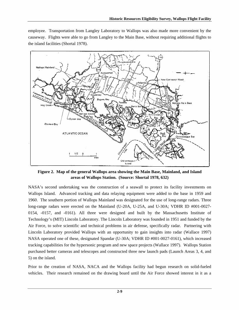
employee. Transportation from Langley Laboratory to Wallops was also made more convenient by the
causeway. Flights were able to go from Langley to the Main Base, without requiring additional flights to
the island facilities (Shortal 1978).
Figure 2. Map of the general Wallops area showing the Main Base, Mainland, and Island
areas of Wallops Station. (Source: Shortal 1978, 632)
NASA’s second undertaking was the construction of a seawall to protect its facility investments on
Wallops Island. Advanced tracking and data relaying equipment were added to the base in 1959 and
1960. The southern portion of Wallops Mainland was designated for the use of long-range radars. Three
long-range radars were erected on the Mainland (U-20A, U-25A, and U-30A; VDHR ID #001-0027-
0154, -0157, and -0161). All three were designed and built by the Massachusetts Institute of
Technology’s (MIT) Lincoln Laboratory. The Lincoln Laboratory was founded in 1951 and funded by the
Air Force, to solve scientific and technical problems in air defense, specifically radar. Partnering with
Lincoln Laboratory provided Wallops with an opportunity to gain insights into radar (Wallace 1997)
NASA operated one of these, designated Spandar (U-30A; VDHR ID #001-0027-0161), which increased
tracking capabilities for the hypersonic program and new space projects (Wallace 1997). Wallops Station
purchased better cameras and telescopes and constructed three new launch pads (Launch Areas 3, 4, and
5) on the island.
Prior to the creation of NASA, NACA and the Wallops facility had begun research on solid-fueled
vehicles. Their research remained on the drawing board until the Air Force showed interest in it as a

Historic Resources Eligibility Survey, Wallops Flight Facility
2-10
sounding rocket. Sounding rockets carry scientific instruments to high altitudes, below orbital level.
These rockets are cost effective and time efficient because large payloads are not required to reach
suborbital heights. Wallops presented its ability to support both sounding rockets and orbital launch. The
“Solid Controlled Orbital Test System” or SCOUT was launched from Wallops Island on July 1, 1960
SCOUT was one of the most reliable and successful launch vehicles, with the capability of launching a
385 pound satellite in a 500-mile orbit (NASA 2008). To launch the vehicle and record data, Launch Pad
No. 3 was constructed, as well as a control center (W-20; VDHR ID #001-0027-0182) and upgraded
tracking systems (Wallace 1997). The SCOUT testing ultimately led to the launch of Explore IX, an
inflatable sphere designed to gather atmospheric data, on February 16, 1961 (Wallace 1997). Explore IX
was the first satellite to go into orbit atop a solid fueled vehicle, making Wallops Island the third U.S.
range capable of orbit.
While orbital capability put America back in the Space Race, the real goal was to launch a piloted
spacecraft. Putting a human into orbit was considered the only way to advance past the Russians and
fortify the public’s pride in the nation. Plans for piloted orbit were being considered at Wallops as early
as 1958. Driven by the military’s intention to keep piloted spacecraft under their own jurisdiction,
representatives from Langley’s Research Laboratory approached the president about a piloted space
program. The president agreed to place this research under the new space agency in late 1958. The
Space Task Group was created and Project Mercury began (Wallace 1997).
Wallops Island provided much needed privacy to conduct testing on Project Mercury. America’s
perceived lag in the Space Race magnified any failure, even during testing. The trial and error tests on
Wallops Island did not need to be highly visible. Research was conducted on the Mercury capsule’s
stability (this model capsule would become the orbiting vehicle for the first U.S.-piloted space flight) and
its reaction to aerodynamic heating. Between 1958 and 1959, 26 full size capsules and 28 scale models
were launched at Wallops Island (DeVincent-Hayes and Bennett 2001).
The interest and enthusiasm for piloted spacecraft drew people to Wallops Station. Surprisingly, the
facility welcomed the visitors, and even set up bleachers near the launch site. The spectacle reached its
pinnacle when Sam and Miss Sam, a pair of chimpanzees were launched from Launch Area 1 in the
Mercury capsule (Shortal 1978). Sam was launched to an altitude of 53 miles and Miss Sam was used to
test the reactions and stress caused by a launch aborted through the escape tower (Wallace 1997). Sam
was launched on December 4, 1959 and Miss Sam was launched on January 21, 1960. One hundred
photographers and celebrities watched the launch, including the astronauts scheduled to fly in a Mercury
Capsule in April 1961.
The last Mercury test at Wallops took place on April 28, 1961; one week later, Alan Sheppard Jr. became
the first American space traveler. Unfortunately, Sheppard’s sub-orbital flight came on the heels of
another Russian victory. Yuri A. Gagarin orbited the earth on April 12th of that year. The only way for
the U.S. to surpass Russia was to put a man on the moon.

Historic Resources Eligibility Survey, Wallops Flight Facility
2-11
2.2.6 Wallops Station’s New Direction: Space Science Research, 1961–1974
In the race to get a man on the moon, NASA opened a new facility in Houston, Texas and transferred the
Space Task Group, originally housed at Langley, to Houston. Since Space Task Group transferred to
Houston, testing relating to Space Task Group missions including Project Gemini and later the Apollo
Program, were transferred from Wallops to White Sands, New Mexico. White Sands offered wide
expanses of ground for landing and was in close proximity to both Houston and to NASA scientists
researching manned flight to the moon in California and Louisiana. Wallops Station was also incapable
of handling the large payloads needed to reach the moon. At this time the Tracking and Ground
Instrumentation Unit was also transferred from Langley to the new Goddard Facility, near Washington,
DC and training was consolidated to this facility. Initial Tracking and Ground Instrument training,
originally held at Wallops, was consolidated at Goddard (Wallace 1997).
This reorganization of responsibilities resulted in a period of transition for Wallops in 1961–1962. It was
at this time that Wallops began focusing on space science research, opening up a new range of research
topics and ultimately creating new research partnerships. Space Science, as defined by NASA, was
“theoretical and experimental research on the ground and in the earth's atmosphere” (Wallace 1997, 80).
Wallops experience with the sounding rocket brought universities and government agencies outside of the
Department of Defense (DOD) to the island. Satellites could only be used above 100 miles; if they
dropped below this point, the earth’s atmosphere dragged them down (Wallace 1997). Sounding rockets
allowed researchers to gather data on the interim space between the earth’s surface and 100 miles above
it.
Government agencies that utilized the base included the Federal Aviation Administration, the National
Bureau of Standards, and most importantly, the Weather Bureau. The Weather Bureau had been
interested in the usefulness of Wallops Island for gathering atmospheric data since 1958 or earlier, but the
sounding rocket allowed them a more reliable means of gathering information. Sounding rockets
launched balloons to high altitudes, allowing the balloon to record data on its slow descent (Wallace
1997). By 1965, the Weather Bureau had a regular launch schedule at Wallops Station.
The use of satellites in gathering atmospheric data was also employed at Wallops Facility. The
Television Infra-Red Observation Satellite (TIROS) was initially launched at Fort Monmouth, New
Jersey, but the placement of Fixed Radar Surveillance 16 (FPS-16) Radar (Y-55; VDHR ID #001-0027-
0198) encouraged the move of TIROS to Wallops Island. TIROS allowed pictures of weather systems to
be generated and enable the Weather Bureau to track storms. The second TIROS satellite was launched
from Wallops Island in June 1961 (Wallace 1997).
Wallops Station’s shift to space science research and its partnership with new clients brought an increase
in budget to the base. A portion of the budget was used to repair damage caused by a hurricane, known as
the Ash Wednesday Storm, in 1962 (Wallace 1997). The remaining money bought tracking equipment
and vehicle handling facilities. Vehicle handling facilities built in this period and surveyed include the
Rocket Inspection & Storage Building (M-15; VDHR ID #001-0027-0133), Inert Rocket Hardware

Historic Resources Eligibility Survey, Wallops Flight Facility
2-12
Storage & Hardware Inspection Shelter No. 2 (M-16; VDHR ID #001-0027-0134), the Rocket Motor
Ready Storage Building (V-80; VDHR ID #001-0027-0178), and Checkout and Assembly Shop No. 3
(W-65; VDHR ID #001-0027-0188). Eleven of the 14 antennas included in the survey were constructed
at this time, reflecting the station’s emphasis on tracking. Additionally, five tracking buildings were also
surveyed. These are the Mobile Radar Laboratory (U-40; VDHR ID #001-0027-0162), the Transmitter
Building (U-55; VDHR ID #001-0027-0163), the Atmospheric Physics Measurement Laboratory (U-80;
VDHR ID #001-0027-0169); and two camera platforms (Y-95; VDHR ID #001-0027-0199 and Y-110;
VDHR ID #001-0027-0200).
The increased budget also accommodated an increase in the number of employees at Wallops Station. By
mid-1963 the number of employees at Wallops Station was almost 500, double the number in 1960 (URS
and EG&G 2004). Expansion increased until the 1970s.
2.2.7 Wallops Flight Center, 1974–1981
In 1974, NASA changed the name of its Wallops facility to Wallops Flight Center, reflecting its new
foray into runway surface and aircraft noise reduction research, while continuing its role as a launch site
for orbital and suborbital flights (a flight in which a spacecraft follows a trajectory of less than one orbit).
In fact the mission of Wallops Flight Center expanded in the 1970s to included management of suborbital
projects. Additionally, the facility also added earth studies of ocean processes to its research program.
2.2.8 Wallops Flight Facility, 1981–Present
In 1981, Wallops Flight Center was consolidated with the Goddard Space Flight Facility and renamed the
Wallops Flight Facility. WFF became NASA’s primary facility on suborbital programs. In the 1990s, the
facility’s mission expanded to include shuttle-based and small orbital projects. It continued its
relationships with universities, government programs, and commercial clients, and also continued its
research into atmospheric conditions and weather (URS and EG&G 2004).
WFF identified three themes in its 2005 Mission Plan that were to guide the focus of the facility:
Enabling Scientific Research, Enabling Aerospace Technology and Facilitating the Commercial
Development of Space, and Enabling Education, Outreach, and Innovative Partnerships” (WFF 2005).
Specific programs under these themes include “developing new technologies and applications for WFF
cameras, developing, manage, and employ new suborbital missions, and developing earth science
measurements to support global climate change and coast research” (WFF 2005).
2.3 Previous Architectural Surveys at WFF
In 2003, NASA completed a reconnaissance-level assessment of cultural resources (archaeological and
architectural) on WFF (URS and EG&G 2003). Background research confirmed that no NRHP-listed or
eligible resources and no Virginia Historic Landmarks are at WFF. The assessment included a historic
context of the WFF and an architectural reconnaissance survey of buildings, structures, and objects 50
years old and older on the installation. The survey identified 99 properties built between 1936 and 1949
and 67 properties dating from 1950 to 1955. Of the total 166 architectural resources, the survey
Historic Resources Eligibility Survey, Wallops Flight Facility
2-13
determined that two of them, a former Coast Guard station and associated observation tower, had the
potential to be eligible for the NRHP and recommended them for further study. The remaining resources
had sustained additions and alterations, many of them mission-related that compromised their historic
integrity.
One year after the cultural resources assessment, NASA conducted a survey and evaluation of 124
buildings, structures, and objects at WFF that were built before 1955 (URS and EG&G 2004). Each
resource was recorded on a VDHR survey form and in the DSS and evaluated for eligibility for listing on
the NRHP both individual and collectively as a historic district (VDHR ID #001-0027). The survey
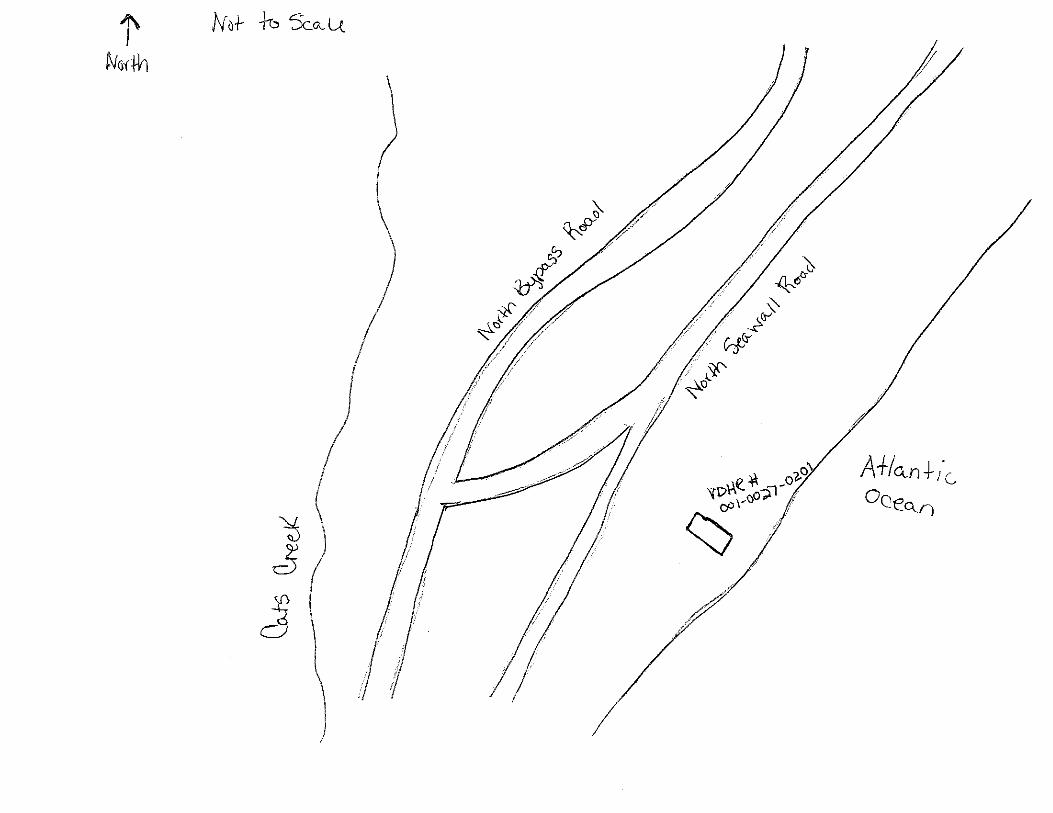
concluded that the Wallops Coast Guard Life-Saving Station (VDHR ID #001-0027-0100) is eligible for
listing on the NRHP and the Virginia Landmarks Register, and the associated Observation Tower (VDHR
ID #001-0027-0101) is a contributing structure of the station. The station was recommended eligible for
local significance under Criterion A for its association with the Coast Guard, which had a vital role in
protecting shipping and human lives along Virginia’s Eastern Shore, and under Criterion C for
exemplifying the Colonial Revival style. The remaining 122 architectural resources were determined to
be not eligible because of a lack significance and/or integrity. Additionally, a historic district was not
identified (URS and EG&G 2004). The VDHR concurred with the report’s eligibility determinations
(Holma 2004).
A cultural resources survey for a proposed Unmanned Aerial Systems airstrip on the north end of Wallops
Island identified and evaluated a 1952 observation post (Espenshade and Lockerman 2009). The North
Observation Mound (VDHR ID #001-0027-0125) consists of a constructed earthen mound with a wood
deck on top. The mound was recommended not eligible for listing on the NRHP because of a lack of
significance and integrity. Upon the request of the VDHR, additional documentation on the mound was
submitted. VDHR subsequently concluded that the mound was not eligible for inclusion in the NRHP
(Lee 2011a).

Historic Resources Eligibility Survey, Wallops Flight Facility
2-14
This Page Intentionally Left Blank.

Historic Resources Eligibility Survey, Wallops Flight Facility
3-1
3.0 RESEARCH DESIGN
3.1 Survey Objectives
The purpose of this survey is to provide information for compliance with Section 110 of the National
Historic Preservation Act, as amended. The goal of this survey is to identify and document architectural
resources at WFF that were built between 1956 and 1965 and evaluate whether they are eligible for
inclusion in the NRHP.
3.2 Methods
Three tasks were required to achieve the survey objectives: 1) archival research; 2) field survey; and 3)
data analysis. Archival research was conducted to identify the appropriate historic context(s) for the
evaluation of architectural resources. The field survey collected information on the architectural design,
construction, and integrity of the buildings. The archival and field data were then synthesized and
analyzed to evaluate the eligibility of the resources for inclusion in the NRHP.
3.2.1 Background Research
Background research was undertaken to compile sufficient data to develop a historic context for evaluating
the architectural resources recorded in the survey. The Historic Resources Survey and Eligibility Report for
Wallops Flight Facility, Accomack County, Virginia that was prepared for the 2004 survey of pre-1956
architectural resources at WFF (URS and EG&G 2004) presents a historic context on the use and
development of an installation on Wallops Neck and Island first for a naval auxiliary air station, and then
for a research and test station for NACA. The context provides a comprehensive look at the trends and
patterns of development by the Federal agencies for the subject area during the twentieth century. It
concentrates on the period 1936–1955 to provide a framework for evaluating the properties included in
the survey. The historic context for the 2004 survey was used for the present survey, but was augmented
with additional contextual history pertinent to the period (1956–1965) of the resources documented for
the present survey. The background research for the augmented context consulted many of the same
sources that were used to develop the historic context in 2004, including Joseph Shortal’s A New
Dimension, Wallops Island Flight Test Range: The First Fifteen Years (1978), Harold D. Wallace’s
Wallops Station and the Creation of an American Space Program (1997), and historical maps. In
addition, Wallops Island (DeVincent-Hayes and Bennet 2001) was also used.
Background research also included consulting various sources to obtain information specific to the
buildings and structures in the survey. Prior to the field work, electronic copies of as-built drawings were
provided by WFF. During the field survey, real property records, which included floor plans and
historical photographs, were reviewed. These records provided information on the original construction
and design of the buildings, and aided in evaluating their integrity.

Historic Resources Eligibility Survey, Wallops Flight Facility
3-2
3.2.2 Field Survey
The field survey at WFF was conducted on November 2, 2010, and January 3–7, 2011. A total of 76
resources built between 1956 and 1965 were examined and documented. The survey was limited to
exterior inspections of the buildings. Field notes were taken on the current use, architectural style,
building materials, building alterations, setting, and existing condition of each resource. All surveyed
resources were identified according to existing installation-generated facility numbers to facilitate the
integration of survey data with existing facility planning documents, cartographic materials, and
databases.
The survey supplemented the written data with photographs of each resource. Digital photographs were
taken to record principal facades, architectural or structural details, or other notable features that were
deemed relevant to the historical evaluation of the property. The photographs were formatted according to
photographic documentation standards of the VDHR for digital images.
The research and field data for each property were recorded on reconnaissance survey forms for
submission to the VDHR. The data on each resource was entered into the DSS online survey database and
the resultant site forms printed from the database. The archival copy of each form includes a site plan and
a U.S. Geological Survey topographic map showing the resource location. Appendix D contains copies of
these forms.
3.2.3 Analysis
The objective of this study is to determine whether the surveyed buildings and structures are eligible for
inclusion in the NRHP. The NRHP, administered by the National Park Service, is an inventory of the
districts, sites, buildings, structures, and objects that are significant in American history, architecture,
archaeology, engineering, and culture. The evaluations proceeded by applying the NRHP Criteria for
Evaluation, which are set forth in 36 Code of Federal Regulations Part 60.4, and by following the
guidelines established in National Register Bulletin 15: How to Apply the National Register Criteria for
Evaluation (National Park Service 1997).
The significance of a property can be determined only when it is evaluated within its historic context.
NRHP guidance defines historic contexts as “those patterns or trends in history by which a specific
occurrence, property, or site is understood and its meaning (and ultimately its significance) within history
or prehistory is made clear” (National Park Service 1997, 7). Historic contexts compile information about
the time period, the place, and the events that created, influenced, or formed the backdrop to the historical
resources. A single property may represent more than one historic context, and conversely, numerous
property types may represent a single historic context.
In order to be considered eligible, a property must demonstrate significance within its historic context.
Significance is evaluated by applying the four NRHP criteria, which define the kind of significance that a
property can represent. A property need only meet one criterion to be eligible for listing on the NRHP.
These criteria are:

Historic Resources Eligibility Survey, Wallops Flight Facility
3-3
A. Association with events that have made a significant contribution to the broad patterns of our history;
B. Association with the lives of persons significant in our past; C. Embodiment of the distinctive characteristics of a type, period, or method of construction, or
that represent the work of a master, or that possess high artistic values, or that represent a significant or distinguishable entity whose components may lack individual distinction; or
D. Have yielded, or may be likely to yield, information important in prehistory or history.
The NRHP Criteria for Evaluation also include seven criteria considerations that apply to properties that
ordinarily are not considered for inclusion in the NRHP. The following categories of properties can be
eligible for the NRHP if they meet their respective criteria consideration in addition to the other
requirements in the Criteria for Evaluation:
A. Religious properties; B. Moved properties; C. Birthplaces or graves; D. Cemeteries; E. Reconstructed properties; F. Commemorative properties; G. Properties that have achieved significance within the past 50 years.
Two of the criteria considerations apply to the properties in this survey. Of the 76 resources documented
in this survey, 27 are less than 50 years old and were evaluated under Criteria Consideration G. NRHP
Criteria Consideration G states that properties that have achieved significance within the last 50 years
may be considered eligible for the NRHP if they are of “exceptional importance” or “if they are integral
parts of districts that are eligible” (National Park Service 1998, 3). National Register Bulletin No. 22:
Guidelines for Evaluating and Nominating Properties that have Achieved Significance Within the Last
Fifty Years (National Park Service 1998) provides guidelines for assessing exceptional significance. The
bulletin indicates that exceptional significance is measured within the appropriate historic context,
whether on a local, state, or national scale.
Several of the resources documented in the survey were evaluated under Criterion Consideration B for
moved properties. Typically a property that has been moved from its original site or historically
significant location does not qualify for listing on the NRHP because moving a property destroys its
relationship to its setting and associations with historic events or persons, and may even result in the loss
of historic physical features and the potential for associated archaeological deposits. However, under
Criteria Consideration B, a property may be eligible for the NRHP if it is significant primarily for its
architectural merit or if it is the surviving property most importantly associated with a historic event or
person (National Park Service 1997).
The resources in this survey were evaluated within the framework of the historic context for the level (i.e.,
local, state, or national) and type (Criteria A, B, C, and/or D) of significance and for integrity. The
evaluations considered the individual eligibility of the resources as well as their eligibility collectively as

Historic Resources Eligibility Survey, Wallops Flight Facility
3-4
a possible historic district. A historic district is a “significant concentration, linkage, or continuity of sites,
buildings, structures, or objects united historically or aesthetically by plan or physical development”
(National Park Service 1997, 5). As a test facility, the evaluation considered all the components necessary
to carry out a successful test, such as the launch pads and equipment, in addition to the buildings and
structures to determine whether a historic district is present. Information relevant to the history of the
facility, its land use, and the history of the surveyed buildings and structures was included in the
evaluations, based on the NRHP Criteria for Evaluation.
The final step in the evaluation process is to determine whether the property possesses sufficient integrity
to convey its period of significance. The National Park Service defines period of significance as “the
length of time when a property was associated with important events, activities, or persons, or attained the
characteristics which qualify it for National Register listing” (National Park Service 1997, 42). A
property that retains architectural integrity will embody several of the following seven qualities of
integrity: location, design, setting, materials, workmanship, feeling, and association (National Park
Service 1997, 44–45). An assessment of integrity considers the degree to which a property retains original
fabric and design elements and the impact of changes made to the property. It is used to evaluate the
extent to which a property can convey its significance in relationship to its period of significance. Due to
the highly technical nature of the architectural resources at the WFF, these properties often are continually
upgraded with the latest technology and, as a result, may no longer retain those qualities or physical
features that convey their significance. For example, if a resource is significant for its association with a
defined period or specific event, modifications made after-the-fact may have compromised its integrity.
Alternatively, if a property’s period of significance extends over a longer period of time and the property
continues to perform its original function, later modifications may illustrate the evolution of the property.
3.3 Expected Results
The survey includes architectural resources constructed between 1956 and 1965. Resources dating prior
to 1959 will be associated either with CNAAS/NAOTS or NACA’s PARS. Between 1946 and 1959,
CNAAS/NAOTS was charged with researching and testing naval aviation weapons and ordnance.
Facilities were located on Main Base and on the northern portion of Wallops Island, which was used as a
test range for the ordnance. NACA operated PARS on the southern half of Wallops Island for
aeronautical research of high-speed rockets. Resources dating after 1959 will be associated with NASA’s
Wallops Station. Wallops Station initially supported manned space flight programs for the newly formed
NASA, which had absorbed NACA. Beginning around 1960 and continuing through 1974, Wallops
Station’s primary mission was as a launch center for suborbital and orbital vehicles such as sounding
rockets and satellites. NASA took over the land and facilities of the decommissioned CNAAS and
NAOTS in 1959 and acquired Mainland property across from Wallops Island.
The architectural resources in the survey are expected to be components of the aviation and aeronautical
research and testing missions of Wallops. The associated property types are likely to be various types of
testing and launch facilities, research laboratories, antennas and observation towers, and ancillary support

Historic Resources Eligibility Survey, Wallops Flight Facility
3-5
facilities such as storage. Based on the 2004 survey of pre-1956 buildings and structures at WFF (URS
and EG&G 2004), architecturally the resources are probably simple and plain concrete or concrete block
structures with little to no stylistic embellishments. Therefore, it is assumed that the function of the
building will be what primarily defines the property type of the building. The development of the historic
context demonstrates that the architectural resources at WFF have been in continuous use by the
installation since they were built. The nature of the research and testing conducted at this site is one of
continuous change as technologies evolve. It is expected that the built environment would reflect the
changes of the work conducted here at the installation by exhibiting material upgrades or additions related
to modernization, mission changes, and/or equipment improvements.
For this same reason, it is unlikely that any of the architectural resources in this survey will qualify for
listing on the NRHP. The 2004 architectural survey of pre-1956 resources found that the historic integrity
of the Main Base, Mainland, and most of Wallops Island had been substantially altered as a result of
demolition, building replacement, and individual building alterations. Furthermore, the current built
environment of WFF primarily represents the use of the site by NASA during the past 20 years (URS and
EG&G 2004).
Historic Resources Eligibility Survey, Wallops Flight Facility
3-6
This Page Intentionally Left Blank.
Historic Resources Eligibility Survey, Wallops Flight Facility
4-1
4.0 SURVEY RESULTS AND EVALUATIONS
The purposes of the architectural survey were to document the buildings and structures constructed
between 1956 and 1965 at WFF and evaluate whether any of the documented resources are eligible for
listing on the NRHP either individually or as contributing resources in a historic district. These
evaluations are based upon the specific methodology described in Section 3.2. Specifically, the surveyed
buildings and structures were evaluated using the NRHP Criteria for Evaluation (see Section 3.2.3).
NRHP Criteria Consideration B was applied for resources that have been removed from their original
location, and Criteria Consideration G was applied for buildings and structures less than 50 years old.
The following section divides the survey findings into three geographic areas: the Main Base, Wallops
Mainland, and Wallops Island. A map of each area showing the locations of the surveyed properties and
a table listing the property name, date of construction, and WFF and VDHR identification numbers are
provided at the beginning of each section. These are followed by the NRHP evaluation of a historic
district within or encompassing the particular geographic area, and then the narrative descriptions,
photographs, and individual eligibility assessments of each resource documented in the survey. Appendix
B includes a list of all the surveyed resources by VDHR number and Appendix C lists the results of the
NRHP evaluations of the individual resources by facility number.
4.1 Main Base
A total of 76 buildings and structures built between 1956 and 1965 were documented at WFF. Of these,
24 are located on the Main Base (Figure 3; Table 1). Four are antennas and 20 are buildings. These
facilities represent seven property types: nine are storage; six are communications; four are research,
development, and testing; two are industrial; one is infrastructure; one is administration; and one is
personnel support. Of the 24 resources surveyed, 15 are 50 years or older and nine are less than 50 years
old. Three of the four antennas are less than 50 years old. An Instrument Landing System antenna tower
(A-036), which was erected in 1959 in the northeastern portion of the Main Base, was found to have been
demolished.

Historic Resources Eligibility Survey, Wallops Flight Facility
4-2
Table 1. Resources Surveyed on the Main Base VDHR ID Number
WFF ID Number
Property Name Date of Construction
001-0027-0128 E-144 Ionosphere Sounding & Solar Data Center 1959 001-0027-0129 F-157 Office Furniture Supply Warehouse 1957 001-0027-0130 F-160 Health/Quality Verification
Lab/Environmental Building 1957
001-0027-0131 F-163 Chemical Storage Building 1963 001-0027-0132 F-170 Plant Operations and Maintenance Branch
(POMB) Storage Building 1957
001-0027-0133 M-15 Rocket Inspection & Storage Building 1963 001-0027-0134 M-16 Inert Rocket Hardware Storage & Hardware
Inspection Shelter No. 2 1963
001-0027-0135 M-17 Heating Plant Building 1963 001-0027-0136 M-25 Ready Issue Minor Hazard Explosives
Magazine 1957
001-0027-0137 M-183 Ready Service Pyrotechnics Storage Magazine
1957
001-0027-0138 M-184 Ready Issue Explosive Storage Magazine 1958 001-0027-0139 N-133 NASA Federal Credit Union 1956 001-0027-0140 N-134 VA Commercial Space Flight Authority and
Mid-Atlantic Regional Spaceport Office 1956
001-0027-0141 N-159 Research Aircraft and Observation Science Lab
1957
001-0027-0142 N-159E Airport Surveillance Radar 7 (ASR-7) Radar Antenna Tower
1961
001-0027-0143 N-162 Telecommunications Facility Building 1957 001-0027-0144 N-162B Frequency Monitoring Antenna Tower 1963 001-0027-0145 N-163 Antenna Calibration Measurement Facility 1963 001-0027-0146 N-164 High Frequency Receiver Antenna No. 2-
Rotating 1965
001-0027-0147 N-166 Explosives Handling Equipment Storage Building
1957
001-0027-0148 N-167 X-Band Antenna Central Control Building 1965 001-0027-0149 N-174 Boresight & Calibration Tower 1962 001-0027-0150 N-218 Chemical Storage Building 1957 001-0027-0151 N-222 Surplus Utilization and Disposal Building 1957

Historic Resources Eligibility Survey, Wallops Flight Facility
4-3
Figure 3. Resources Surveyed on the Main Base

Historic Resources Eligibility Survey, Wallops Flight Facility
4-4
This Page Intentionally Left Blank.

Historic Resources Eligibility Survey, Wallops Flight Facility
4-5
4.1.1 Historic District Evaluation
The surveyed buildings on Main Base have been evaluated as contributing resources in a historic district.
Issues of significance, integrity, and boundaries were carefully considered for a proposed district. The
evaluation of a historic district considered a period of significance from 1936 to 1965 by building upon
(and reexamining) the results and analysis of the 2004 survey. As such, the analysis examined the
possibility of a historic district associated with the Navy’s CNAAS/NAOTS in addition to one associated
with the early period of NASA’s Wallops Station.
The evaluation determined that a historic district associated with the CNAAS/NAOTS is not present
because of a lack of integrity. Numerous buildings and structures constructed by the Navy before the
decommissioning of the base and its transfer to NASA in 1959 have been removed. According to the
results of the 2004 survey, extant resources have been altered by additions and/or material changes (URS
and EG&G 2004). A windshield survey of some of the pre-1956 resources during this survey confirms
that the majority has been substantially altered. The altered state of the resources inhibits their ability to
collectively convey the early history of the site. In addition, many buildings have been added to the
facility after 1965. These resources are interspersed with the older facilities, including several
concentrated on Stubbs Boulevard and at the north end of Wormhoudt Street. Collectively, these changes
have compromised the integrity of setting, design, materials, and feeling from the World War II and early
Cold War eras.
The architectural resources were evaluated collectively as contributing resources of a historic district
associated with NASA’s early operations in manned space flight and space science research at Wallops
Station. The Main Base does not constitute a NRHP-eligible historic district because of a lack of
significance and integrity. A historic district at the Main Base is not eligible under Criterion A because
WFF is not associated with events that have made a significant contribution to the broad patterns of our
history. Wallops served an important role as the NASA rocket test range, enabling the facility to fulfill its
mission for NASA programs as well as expand its scientific research capabilities to non-military and non-
government entities. However, the Wallops facility and the operations that occurred here between 1959
and 1965 were not central to the NASA organization. Wallops did not have a leading role in the research
and development of major NASA programs. For a brief period, Wallops was involved in Project Mercury
by testing hardware, training support personnel, and being the launch site for two unmanned flights;
however, the most important developments of this major mission, particularly astronauts ascending into
orbit, occurred at other facilities. From its start in 1959, Wallops was a “service center” in the NASA
organization, supporting the projects of the NASA “field centers” such as Houston and Cape Canaveral,
for instance, which had the high priority NASA missions. Furthermore, the projects performed at
Wallops that involved the launching, tracking, and acquisition of data from rockets using radar and radio-
telemetry techniques “could have been, and often were, conducted from other facilities” (Wallace 1997,
108). Thus, the mission and activities of Wallops Station were not singular or exceptional to the history
of NASA in this period.

Historic Resources Eligibility Survey, Wallops Flight Facility
4-6
Documentary research has not revealed information that a historic district at the Main Base of WFF is
eligible for the NRHP under Criterion B for association with persons significant in our past.
The resources on the Main Base of WFF do not constitute a historic district under Criterion C because
they do not embody the distinctive characteristics of a type, period, or method of construction; represent
the work of a master; possess high artistic value; or represent a significant or distinguishable entity whose
components may lack individual distinction. NASA took over an older naval installation and renovated
the existing facilities to meet its functional and space requirements and added its own buildings and
structures to the base over time. Design and development of individual components was typically based
on expediency and did not follow a master plan. The result is an irregular layout of buildings and features
and an incohesive mix of massing, forms, and surface materials. In fact, during a 1964 review of
planning and construction of existing NASA facilities, the House Committee of Science and Aeronautics
called Wallops’ layout “confused and congested” and concluded that “[NASA] builds no monuments
here” (Wallace 1997, 110, 111). None of the buildings evaluated in this survey and in the 2004 survey
possesses architectural significance for their building type, period, or method of construction.
A historic district eligible under Criterion D is not present on the Main Base because no surveyed
architectural resources were found to have the potential to yield additional information important in
history or prehistory.
Additionally, the WFF Main Base does not constitute or contain a NRHP-eligible historic district because
of a loss of integrity. The aspect of integrity of location remains intact because only a small percentage of
the resources have been moved. The integrity of setting has been compromised by the demolition of
many pre-1965 buildings and structures and the addition of a few dozen post-1965 resources to the base.
The layout of the roads and the spatial relationships between major features such as the runways appears
to be intact, so integrity of design has not been negatively affected. There is a lack of integrity of
materials and workmanship as a result of substantial alterations that have been made to the majority of the
pre-1965 resources, including several of the primary ones directly associated with the historical mission
of the facility. The alterations include replacement of exterior cladding, doors, and windows, and
additions. These renovations, undertaken within the past 20 to 30 years, have changed the overall design,
form, and/or massing of the buildings and structures. The cumulative changes in setting, materials, and
workmanship have adversely affected the integrity of feeling and association of the site.

Historic Resources Eligibility Survey, Wallops Flight Facility
4-7
4.1.2 Individual Resource Evaluations
001-0027-0128
Facility Number: E-144
Construction Date: 1959
DHR Time Period: New
Dominion (1945–Present)
Property Name:
Ionosphere Sounding and
Solar Data Center
Property Type: Research,
Development and Testing
DHR Historic Context:
Military/Defense,
Technology/Engineering
DHR Historic Context:
Technology/Engineering
Eligibility: Not Eligible
Setting and Description: The Ionosphere Sounding and Solar Data Center is located in the center of
WFF Main Base, west of runway 4-22. Fulton Street runs to the south of the building. The area is flat
and open with a gravel road and parking lot in front of the building.
The Ionosphere Sounding and Solar Data Center is a simple one-story concrete block building with a flat
roof and replacement metal fascia. The building rests on a concrete slab. The main entrance is a half
glazed metal door with a metal awning hood on the west elevation. There are three awning windows,
placed high in the wall, to its north. A concrete sidewalk and stoop lie in front of the main entrance. The
south elevation has three windows of the same type, on its west end. The windows were installed in 1980
(WFF 2011). The south end of the east elevation has a single hollow steel door with a metal awning
hood. Three heating, ventilation, and air conditioning (HVAC) units are attached to the north elevation.
Eligibility: This building is representative of a secondary Research, Development and Testing resource
built near the beginning of the New Dominion period (1945–present) at a Technology/Engineering
research facility. The building was constructed as part of an expansion of facilities at the installation after
the establishment of NASA and the incorporation of Wallops Station as one of its operational facilities.
Initially, Wallops Station’s new mission under NASA was to develop and test various components related
to manned space flight. This mission was short-lived, however, as Wallops became a test range and
launch site for suborbital and orbital rockets and satellites beginning in the early 1960s. The Ionosphere

Historic Resources Eligibility Survey, Wallops Flight Facility
4-8
Sounding Station was established in 1959 to monitor the constantly changing condition of the ionosphere,
an atmospheric region that begins at 43 miles above the ground and extends to indefinite height. The
name of the building was changed to Ionosphere Sounding and Solar Data Center in January 1967 (WFF
2011).
E-144 has been evaluated both as a contributing resource in a historic district and as an individual
resource. No historic district on the Main Base was identified because of a lack of significance and
integrity (refer to Section 4.1.1).
The building is not individually eligible for listing on the NRHP because it lacks significance and
integrity. The building is recommended not eligible under Criterion A because it is not associated with an
event or pattern of events of local, state, or national significance. It is not associated with the life of a
person significant in our past; therefore, it is recommended not eligible under Criterion B. E-144 is
recommended not eligible under Criterion C because it does not embody the distinctive characteristics of
a type, period, or method of construction; represent the work of a master; possess high artistic value; or
represent a significant or distinguishable entity whose components may lack individual distinction. It is
recommended not eligible under Criterion D because it does not have the potential to yield information
important in history or prehistory.
E-144 retains its integrity of location. The integrity of design and workmanship has been diminished by
the replacement of the original doors and windows and the removal of three windows on the south
elevation. The building is in its historical location, but the setting has changed by the addition of several
post-1965 buildings nearby. The feeling and association of the building have been negatively affected by
the changes made to the building itself and to its setting.
001-0027-0129
Facility Number: F-157
Construction Date: 1957
DHR Time Period: New
Dominion (1945–Present)
Property Name: Office
Furniture Supply Warehouse
Property Type: Storage
DHR Historic Context:
Military/Defense,
Technology/Engineering
Eligibility: Not Eligible

Historic Resources Eligibility Survey, Wallops Flight Facility
4-9
Setting and Description: The Office Furniture Supply Warehouse is located on Wormhoudt Street north
of Rickette Street on the northern half of WFF Main Base. The area around the building is flat and open.
There is a concrete paved loading area in front of the building and a gravel driveway north of the
building, which leads east to another building (F-007).
The Office Furniture Supply Warehouse is a prefabricated metal building with a shallow pitched, front
gabled roof covered in corrugated metal. The building rests on a concrete slab and is sheathed in
corrugated steel siding. The original siding, as well as the doors and windows, was removed and replaced
in 1986 (WFF 2011). The main entrance is located on the west elevation and consists of an overhead
steel door and a single half-glazed metal door. A louvered window with a screen surmounts the half-
glazed door. The east elevation has a single half-glazed door, surmounted by a louvered window with a
screen. There are no openings on the north or south elevations.
Eligibility: The Office Furniture Supply Warehouse represents a secondary resource built near the
beginning of the New Dominion period (1945–present) at a Military/Defense research facility. The U.S.
Navy expanded the mission of the CNAAS in 1946 to include the NAOTS, which was charged with
research and testing of naval aviation weapons and ordnance. The CNAAS/NAOTS retained this mission
until the base was closed in 1959 and transferred to NASA. During the period of 1946–1959, most of the
development that occurred on the Main Base was related to housing and services. However, several new
buildings were constructed on Main Base within the three years leading up to the closure of the Navy
station. The Navy erected this building in 1957; it has been used for storage since its construction.
F-157 has been evaluated both as a contributing resource in a historic district and as an individual
resource. No historic district on the Main Base was identified because of a lack of significance and
integrity (refer to Section 4.1.1).
The building is not individually eligible for listing on the NRHP because it lacks significance and
integrity. The building is recommended not eligible under Criterion A because it is not associated with an
event or pattern of events of local, state, or national significance. It is not associated with the life of a
person significant in our past; therefore, it is recommended not eligible under Criterion B. F-157 is
recommended not eligible under Criterion C because it does not embody the distinctive characteristics of
a type, period, or method of construction; represent the work of a master; possess high artistic value; or
represent a significant or distinguishable entity whose components may lack individual distinction. It is
recommended not eligible under Criterion D because it does not have the potential to yield information
important in history or prehistory.
This building retains integrity of location, but its setting has substantially changed by the demolition of
many buildings to the south and the construction of several post-165 buildings to the north. The building
has no integrity of design, materials, or workmanship as a result of the removal and replacement of the
exterior siding, doors, and windows within the past 25 years. As a result of the loss of setting, design,
materials, and workmanship, F-157 no longer retains integrity of feeling and association.

Historic Resources Eligibility Survey, Wallops Flight Facility
4-10
001-0027-0130
Facility Number: F-160
Construction Date: 1957
DHR Time Period: New
Dominion (1945–Present)
Property Name:
Health/Quality Verification
Lab/Environmental
Building
Property Type: Health
Care; Research,
Development and Testing
DHR Historic Context:
Military/Defense,
Technology/Engineering
Eligibility: Not Eligible
Setting and Description: The Health/Quality Verification Lab/Environmental Building is located on the
north half of WFF Main Base, west of runway 4-28. Bliss Street bounds the building on the west and
Avery Street bounds it on the north. The area is flat and sidewalks and parking lots are on each side of
the building. F-165, a tower with the NASA logo, is across the street. Another building (F-162) is to the
southeast.
The Health/Quality Verification Lab/Environmental Building is composed of three parts, the central
building, a north wing, and a south wing. It is a one-story building with a flat built-up roof and metal
fascia, gutters, and down spouts. It rests on a reinforced concrete slab. The exterior is finished with an
exterior insulation finishing system (EIFS) on the bottom half of the walls and metal panels on the top
half; it was originally finished in brick (WFF 2011). All entrances are elevated, with access from
concrete stairs with metal tube railings. All windows are replacement one-over-one aluminum-sash
windows. All doors are glazed aluminum with sidelights and transoms.
The west elevation consists of a central entrance with a flat roofed canopy supported by corner posts. The
canopy provides cover to two separate single glazed aluminum doors, each one with sidelights and a
transom. Windows are regularly spaced sets of double and triple pairings. The north and south wings
project beyond the central wing and have single glazed doors with three sidelights and a transom,
protected by cantilevered flat hoods. The windows on these wings are either single, paired, or in groups of
three.

Historic Resources Eligibility Survey, Wallops Flight Facility
4-11
The south elevation consists of a row of single windows and a central entrance. This entrance features a
flat roofed canopy supported by two posts; the canopy protects a set of double glazed metal doors. To the
east, a concrete ramp with metal tube handrails leads to a set of double glazed metal doors. These doors
lead to the health unit.
Two sets of half-glazed double doors on the east elevation provide rear entry to the north and south
wings. Concrete stairs with metal tube railings lead to each doorway. The south wing has one single and
one set of double windows south of the door. Single or paired windows run along the east elevation of
the central wing and side elevations of the north and south wings.
Eligibility: This building is an example of a Research, Development and Testing resource built near the
beginning of the New Dominion period (1945–present) at a Military/Defense research facility. The U.S.
Navy expanded the mission of the CNAAS in 1946 to include the NAOTS, which was charged with
research and testing of naval aviation weapons and ordnance. The CNAAS/NAOTS retained this mission
until the base was closed in 1959 and transferred to NASA. During the period of 1946–1959, most of the
development that occurred on the Main Base was related to housing and services. However, several new
buildings were constructed on the Main Base within the three years leading up to the closure of the Navy
station. The Navy erected this building as the base hospital in 1957. After the base was transferred to
NASA, F-160 housed various types of laboratories and, as of 1991, a health care unit. It received its
current name of Health/Quality Verification Lab/Environmental Building in 2005 (WFF 2011).
The Health/Quality Verification Lab/Environmental Building has been evaluated both as a contributing
resource in a historic district and as an individual resource. No historic district on the Main Base was
identified because of a lack of significance and integrity (refer to Section 4.1.1).
F-160 is not individually eligible for listing on the NRHP because it lacks significance and integrity. The
building is recommended not eligible under Criterion A because it is not associated with an event or
pattern of events of local, state, or national significance. It is not associated with the life of a person
significant in our past; therefore, it is recommended not eligible under Criterion B. The building is
recommended not eligible under Criterion C because it does not embody the distinctive characteristics of
a type, period, or method of construction; represent the work of a master; possess high artistic value; or
represent a significant or distinguishable entity whose components may lack individual distinction. It is
recommended not eligible under Criterion D because it does not have the potential to yield information
important in history or prehistory.
The building is in its historical location. The setting has been compromised by the demolition of
historical Navy buildings to the west and the post-1965 construction of a couple of buildings in the
immediate vicinity. No additions have been made to the building; however, its integrity of design,
materials, and workmanship have been negatively impacted by the installation of EIFS and metal panels
over the historical brick exterior and the removal and replacement of the doors and windows. The
integrity of feeling and association of F-160 is lacking due to the multiple physical changes that removed
the historic character of the building.

Historic Resources Eligibility Survey, Wallops Flight Facility
4-12
001-0027-0131
Facility Number: F-163
Construction Date: 1963
DHR Time Period: New
Dominion (1945–Present)
Property Name: Chemical
Storage Building
Property Type: Storage
DHR Historic Context:
Technology/Engineering
Eligibility: Not Eligible
Setting and Description: The Chemical Storage Building is located on the northern half of the Main
Base west of runway 4-28. It is bordered by Fulton Street to the south and Avery Street to the north. The
Health/Quality Verification Lab/Environmental Building (F-160) is to the northwest. The building is
situated between a chemical storage building (N-218) and a High Frequency Antenna (F-164).
The Chemical Storage Building is a 12 by 15 ft building clad with EIFS and terminating in a flat roof and
metal fascia. The building originally featured a brick veneer on concrete block walls (WFF 2011). It rests
on a concrete slab. Its only opening is located on the north elevation and consists of a set of double half-
glazed metal doors with three lights.
Eligibility: This building is representative of a secondary resource built towards the beginning of the
New Dominion period (1945–present) at a Technology/Engineering research facility. This is one of
approximately 50 buildings and structures that were erected within six years of the establishment of
NASA and the incorporation of Wallops Station as one of its operational facilities in 1959. Initially,
Wallops Station’s new mission under NASA was to develop and test various components related to
manned space flight. This mission was short-lived, however, as Wallops became a test range and launch
site for suborbital and orbital rockets and satellites beginning in the early 1960s. NASA constructed this
building in 1963. Within a year, it was renovated for office and shop space. In 1971 it was converted to a
bulk storage building for the Calibration Laboratory (F-160) (WFF 2011). It currently serves as chemical
storage building.
The Chemical Storage Building has been evaluated both as a contributing resource in a historic district
and as an individual resource. No historic district on the Main Base was identified because of a lack of
significance and integrity (refer to Section 4.1.1).
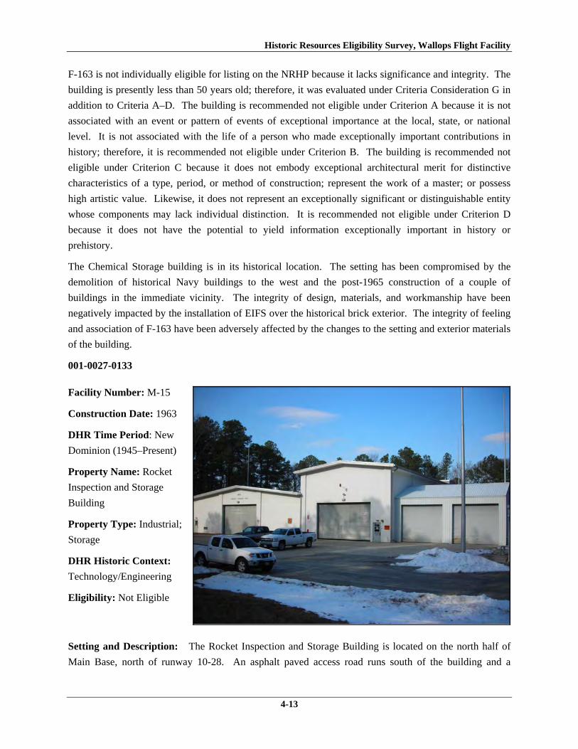
Historic Resources Eligibility Survey, Wallops Flight Facility
4-13
F-163 is not individually eligible for listing on the NRHP because it lacks significance and integrity. The
building is presently less than 50 years old; therefore, it was evaluated under Criteria Consideration G in
addition to Criteria A–D. The building is recommended not eligible under Criterion A because it is not
associated with an event or pattern of events of exceptional importance at the local, state, or national
level. It is not associated with the life of a person who made exceptionally important contributions in
history; therefore, it is recommended not eligible under Criterion B. The building is recommended not
eligible under Criterion C because it does not embody exceptional architectural merit for distinctive
characteristics of a type, period, or method of construction; represent the work of a master; or possess
high artistic value. Likewise, it does not represent an exceptionally significant or distinguishable entity
whose components may lack individual distinction. It is recommended not eligible under Criterion D
because it does not have the potential to yield information exceptionally important in history or
prehistory.
The Chemical Storage building is in its historical location. The setting has been compromised by the
demolition of historical Navy buildings to the west and the post-1965 construction of a couple of
buildings in the immediate vicinity. The integrity of design, materials, and workmanship have been
negatively impacted by the installation of EIFS over the historical brick exterior. The integrity of feeling
and association of F-163 have been adversely affected by the changes to the setting and exterior materials
of the building.
001-0027-0133
Facility Number: M-15
Construction Date: 1963
DHR Time Period: New
Dominion (1945–Present)
Property Name: Rocket
Inspection and Storage
Building
Property Type: Industrial;
Storage
DHR Historic Context:
Technology/Engineering
Eligibility: Not Eligible
Setting and Description: The Rocket Inspection and Storage Building is located on the north half of
Main Base, north of runway 10-28. An asphalt paved access road runs south of the building and a
Historic Resources Eligibility Survey, Wallops Flight Facility
4-14
security fence extends along the north property line. A wooded area and Little Mosquito Creek lie north
beyond the security fence. A concrete paved parking lot is located on the south side of the building, with
the Heating Plant Building (M-17) situated to the southeast and a Ready Service Magazine (M-183) to the
northeast.
The Rocket Inspection and Storage Building is composed of three main parts, all of which rest on a
reinforced concrete slab foundation. The original building was constructed in 1963 and consists of
concrete block wings with front gabled roofs and aluminum fascia. The east wing of the building was
constructed in 1995 as forklift storage space. It is a post and frame prefabricated aluminum building with
a side gabled standing seam metal roof. Two overhead rolling metal doors are centered in its south
elevation. The one-story west wing has a 15 ft overhead rolling aluminum door between projecting
concrete block columns on the south elevation. A half-glazed metal door with three lights is located at
the southwest corner. The two-story middle portion of the building features a central 15 ft overhead
rolling aluminum door and a half-glazed metal door with three lights.
The west elevation is composed of six bays of aluminum-frame fixed windows, separated by projecting
concrete block columns that extend along the top of wall. Two small openings with concrete sills and
lintels are located in the middle of the elevation, centered between columns. The north elevation of the
west wing of the building has four projecting concrete block columns that divide the elevation into thirds.
A half-glazed metal door with three lights is located on the northwest corner and two metal louvers with
precast concrete sills are located on the lower half of the wall in the center of the eastern third and western
third of the elevation. A concrete panel in the center was originally intended to be replaced by rolling
metal doors.
The middle wing’s north elevation consists of a single hollow steel door with a concrete canopy on the
east side, directly beside a lean-to addition. The addition, which was built in 1984 for an office, is
constructed of concrete block and has a shed roof with aluminum fascia (WFF 2010). Another concrete
block lean-to was constructed in 1974 to connect the rocket storage area (west half of building) and
materials inspection area (east half) (WFF 2010). This addition has a single hollow steel door with a
large aluminum awning on its north elevation and a fixed aluminum frame window with three lights on
the east elevation. In 1998, a third lean-to addition was appended to the east side of the middle wing
(WFF 2011). Providing a rocket motor assembly area, this addition is concrete block and has a shed roof
and half-glazed metal door.
The east elevation consists of one half-glazed metal door with three lights to the north of the 1984
addition, rolling overhead metal doors centered in the 1984 addition, and a single hollow steel door on the
northernmost corner of the 1995 prefabricated addition.
Eligibility: This building represents an Industrial property type built towards the beginning of the New
Dominion period (1945–present) at a Technology/Engineering research facility. This is one of
approximately 50 buildings and structures that were erected within six years of the establishment of
NASA and the incorporation of Wallops Station as one of its operational facilities in 1959. Initially,

Historic Resources Eligibility Survey, Wallops Flight Facility
4-15
Wallops Station’s new mission under NASA was to develop and test various components related to
manned space flight. This mission was short-lived, however, as Wallops became a test range and launch
site for suborbital and orbital rockets and satellites beginning in the early 1960s. M-15 is one of two
rocket storage buildings (the other is M-16) that NASA constructed in 1963 on the north side of the
former NAOTS munitions magazine area. It retains its original use.
M-15 has been evaluated both as a contributing resource in a historic district and as an individual
resource. No historic district on the Main Base was identified because of a lack of significance and
integrity (refer to Section 4.1.1).
The Rocket Inspection and Storage Building is not individually eligible for listing on the NRHP because
it lacks significance and integrity. The building is presently less than 50 years old; therefore, it was
evaluated under Criteria Consideration G in addition to Criteria A–D. The building is recommended not
eligible under Criterion A because it is not associated with an event or pattern of events of exceptional
importance at the local, state, or national level. It is not associated with the life of a person who made
exceptionally important contributions in history; therefore, it is recommended not eligible under Criterion
B. The building is recommended not eligible under Criterion C because it does not embody exceptional
architectural merit for distinctive characteristics of a type, period, or method of construction; represent the
work of a master; or possess high artistic value. Likewise, it does not represent an exceptionally
significant or distinguishable entity whose components may lack individual distinction. It is
recommended not eligible under Criterion D because it does not have the potential to yield information
exceptionally important in history or prehistory.
This building retains its integrity of location, setting, and feeling. However, it has no integrity of design,
materials, and workmanship, as the building has had multiple additions, including two major extensions
on the east side that altered its historical massing and scale, end, and full-scale replacement of windows
and all doors. Consequently, these alterations have compromised the integrity of association.

Historic Resources Eligibility Survey, Wallops Flight Facility
4-16
001-0027-0134
Facility Number: M-16
Construction Date: 1963
DHR Time Period: New
Dominion (1945–Present)
Property Name: Inert
Rocket Hardware and
Hardware Inspection
Shelter No. 2
Property Type: Industrial
DHR Historic Context:
Technology/Engineering
Eligibility: Not Eligible
Setting and Description: The Inert Rocket Hardware and Hardware Inspection Shelter is located on the
north half of the Main Base, north of runway 10-28. The site is wooded with Little Mosquito Creek
beyond the woods to the north. Concrete pavement surrounds the building. Two asphalt paved roads
provide access. A security fence runs along the north perimeter of the property.
The Inert Rocket Hardware and Hardware Inspection Shelter is a one-story concrete block utilitarian style
building. It rests on a reinforced concrete slab and has a corrugated metal side-gabled roof. The building
originally was open-sided, as the real property records indicate that the building was enclosed with
concrete masonry units and interior spaces were partitioned in 1967 (WFF 2011). Two additions were
constructed on the building. The first was a 74 by 80 ft addition on west end in 1986. The second was a
lean-to, also on the west end, was constructed in 1999 (WFF 2011).
The south elevation consists of three half-glazed metal doors, two replacement overhead steel doors, and
two sets of 4 ft-wide double doors. One half-glazed door with sidelights is located on the west end and is
flanked by the 4 ft-wide double doors. The 1999 lean-to features a single half-glazed metal door with
concrete steps and metal tube railing. Light fixtures are hung over every door.
The west elevation of the lean-to has three bays: a single half-glazed metal door and two fixed aluminum-
frame windows. The west elevation of the main building has a single half-glazed metal door with three
lights and a set of metal double doors, each with a concrete stoop. The north elevation has one single
half-glazed metal door on the west end and hollow steel doors on the east end. A three-sided wood lean-
to was added on the rear in 1981. The north end of the east elevation has one half-glazed metal door with
three lights. All the windows and personnel doors were replaced in 1999 (WFF 2011).

Historic Resources Eligibility Survey, Wallops Flight Facility
4-17
Eligibility: This building represents an Industrial property type built towards the beginning of the New
Dominion period (1945–present) at a Technology/Engineering research facility. This is one of
approximately 50 buildings and structures that were erected within six years of the establishment of
NASA and the incorporation of Wallops Station as one of its operational facilities in 1959. Initially,
Wallops Station’s new mission under NASA was to develop and test various components related to
manned space flight. This mission was short-lived, however, as Wallops became a test range and launch
site for suborbital and orbital rockets and satellites beginning in the early 1960s. M-16 is one of two
rocket storage buildings (the other is M-15) that NASA constructed in 1963 on the north side of the
former NAOTS munitions magazine area. It retains its original use.
The Inert Rocket Hardware and Hardware Inspection Shelter has been evaluated both as a contributing
resource in a historic district and as an individual resource. No historic district on the Main Base was
identified because of a lack of significance and integrity (refer to Section 4.1.1).
M-16 is not individually eligible for listing on the NRHP because it lacks significance and integrity. The
building is presently less than 50 years old; therefore, it was evaluated under Criteria Consideration G in
addition to Criteria A–D. The building is recommended not eligible under Criterion A because it is not
associated with an event or pattern of events of exceptional importance at the local, state, or national
level. It is not associated with the life of a person who made exceptionally important contributions in
history; therefore, it is recommended not eligible under Criterion B. The building is recommended not
eligible under Criterion C because it does not embody exceptional architectural merit for distinctive
characteristics of a type, period, or method of construction; represent the work of a master; or possess
high artistic value. Likewise, it does not represent an exceptionally significant or distinguishable entity
whose components may lack individual distinction. It is recommended not eligible under Criterion D
because it does not have the potential to yield information exceptionally important in history or
prehistory.
This building retains its integrity of location, setting, and feeling. However, it has no integrity of design,
materials, and workmanship, as the building has had multiple additions, including two major extensions
on the west end, and full-scale replacement of windows and all doors. Consequently, these alterations
have compromised the integrity of association.

Historic Resources Eligibility Survey, Wallops Flight Facility
4-18
001-0027-0135
Facility Number: M-17
Construction Date: 1963
DHR Time Period: New
Dominion (1945–Present)
Property Name: Heating
Plant Building
Property Type:
Infrastructure
DHR Historic Context:
Technology/Engineering
Eligibility: Not Eligible
Setting and Description: The Heating Plant Building is located on the north half of the Main Base,
north of runway 10-28. An asphalt paved access rood runs south of the building and a security fence
extends along the north boundary of the property. A wooded area and the Little Mosquito Creek lie north
of the security fence. Buildings Rocket Inspection and Storage Building (M-15) and the Ready Service
Pyrotechnics Storage Magazine (M-183) are situated northwest of it.
The Heating Plant Building is a simple, one-story concrete block building, resting on a concrete slab. The
flat roof, replaced in 1981 with a four-ply built up roof, has an aluminum fascia. The only entrance is on
the south elevation, consisting of a set of double metal doors with three lights and louvered panels. The
doors have a steel lintel and concrete threshold. The west elevation has two metal vents below the fascia
with metal covers. Exterior utility lines are present on the north and east elevations of the building.
Eligibility: This building is a secondary resource built towards the beginning of the New Dominion
period (1945–present) at a Technology/Engineering research facility. This is one of approximately 50
buildings and structures that were erected within six years of the establishment of NASA and the
incorporation of Wallops Station as one of its operational facilities in 1959. Initially, Wallops Station’s
new mission under NASA was to develop and test various components related to manned space flight.
This mission was short-lived, however, as Wallops became a test range and launch site for suborbital and
orbital rockets and satellites beginning in the early 1960s. M-17 was built in 1963 as a heating plant; it
continues to serve this purpose. M-17 was built adjacent to M-15, one of two rocket storage buildings
(the other is M-16) that NASA constructed in 1963 on the north side of the former NAOTS munitions
magazine area.

Historic Resources Eligibility Survey, Wallops Flight Facility
4-19
M-17 has been evaluated both as a contributing resource in a historic district and as an individual
resource. No historic district on the Main Base was identified because of a lack of significance and
integrity (refer to Section 4.1.1).
The heating plant is not individually eligible for listing on the NRHP because it lacks significance. The
building is presently less than 50 years old; therefore, it was evaluated under Criteria Consideration G in
addition to Criteria A–D. The building is recommended not eligible under Criterion A because it is not
associated with an event or pattern of events of exceptional importance at the local, state, or national
level. It is not associated with the life of a person who made exceptionally important contributions in
history; therefore, it is recommended not eligible under Criterion B. The resource retains integrity, but it
is a secondary resource of simple design and common construction; thus, it is recommended not eligible
under Criterion C because it does not embody exceptional architectural merit for distinctive
characteristics of a type, period, or method of construction; represent the work of a master; or possess
high artistic value. Likewise, it does not represent an exceptionally significant or distinguishable entity
whose components may lack individual distinction. It is recommended not eligible under Criterion D
because it does not have the potential to yield information exceptionally important in history or
prehistory.
001-0027-0137
Facility Number: M-183
Construction Date: 1957
DHR Time Period: New
Dominion (1945–Present)
Property Name:
Ready Service
Pyrotechnics Storage
Magazine
Property Type: Storage
DHR Historic Context:
Military/Defense,
Technology/Engineering
Eligibility: Not Eligible
Setting and Description: The Ready Service Pyrotechnics Storage Magazine is located on the north half
of the Main Base, north of runway 10-28. The building was moved from its location by the Ready Issue
Explosive Storage Magazine (M-184). It was placed directly north of the Rocket Inspection and Storage

Historic Resources Eligibility Survey, Wallops Flight Facility
4-20
Building (M-15). A security fence is north of the property, beyond which are a wooded area and the
Little Mosquito Creek.
This single-story reinforced concrete building rests on a concrete slab. It has only one point of entry, a
single steel door on the east elevation. The central door is flanked by two vents with metal covers. On
the opposite elevation, in this case the west elevation, there are two small vents with metal covers in the
top part of the wall. Four metal eye hooks are located on each corner of the roof.
M-183 represents a Navy standardized building design for storage of small materials. At Wallops, it is
typically utilized for storage of hazardous materials. The Navy built numerous buildings of this type on
the Main Base and Wallops Island between 1957 and 1958. As of 2011, 14 buildings of this type are
extant. Table 2 lists the four other buildings on the Main Base of this same design, and notes any
variances in the standard design, which typically involve the number and placement of vents in the walls.
Table 2. Storage Buildings Surveyed on Main Base with Same Type of Standardized Design VDHR ID Number
WFF ID Number
Date of Construction
Description
001-0027-0132 F-170 1957 Faces south; only 1 vent on left side of door
001-0027-0136 M-25 1957 Faces west 001-0027-0138 M-184 1958 Faces east 001-0027-0150 N-218 1957 Faces northeast
Eligibility: M-183 and the other four buildings on the Main Base of this same type represent a secondary
resource built near the beginning of the New Dominion period (1945–present) at a Military/Defense
research facility. The U.S. Navy expanded the mission of the CNAAS in 1946 to include the NAOTS,
which was charged with research and testing of naval aviation weapons and ordnance. The
CNAAS/NAOTS retained this mission until the base was closed in 1959 and transferred to NASA.
During the period of 1946–1959, most of the development that occurred on the Main Base was related to
housing and services. However, several new buildings were constructed on Main Base within the three
years leading up to the closure of the Navy station. The Navy erected the same type of storage buildings
as M-183 in 1957 and 1958 (see Table 2).
Each of these five storage buildings has been evaluated both as a contributing resource in a historic
district and as an individual resource. No historic district on the Main Base was identified because of a
lack of significance and integrity (refer to Section 4.1.1).
This resource type is not individually eligible for listing on the NRHP because it lacks significance, and
also in some cases, integrity. Each building in Table 2 is recommended not eligible under Criterion A
because it is not associated with an event or pattern of events of local, state, or national significance. It is
not associated with the life of a person significant in our past; therefore, it is recommended not eligible
under Criterion B. Each of these storage buildings is a secondary resource of simple design and common

Historic Resources Eligibility Survey, Wallops Flight Facility
4-21
construction and, therefore, is recommended not eligible under Criterion C because it does not embody
the distinctive characteristics of a type, period, or method of construction; represent the work of a master;
possess high artistic value; or represent a significant or distinguishable entity whose components may
lack individual distinction. It is recommended not eligible under Criterion D because it does not have the
potential to yield information important in history or prehistory.
Buildings M-25 and M-184 retain their integrity. Buildings F-170, M-183, and N-218 were moved
during the period of significance; therefore, none of them possess integrity of location. Each also has no
integrity of setting: in each case, the setting of the current location is not comparable to the historical
setting. The removal of each of these buildings from their original location and setting has destroyed its
integrity of feeling and association. The resources retain their respective integrity of design, materials,
and workmanship.
001-0027-0139
Facility Number:
N-133
Construction Date: 1956
DHR Time Period: New
Dominion (1945–Present)
Property Name: NASA
Federal Credit Union
Property Type: Personnel
Support
DHR Historic Context:
Military/Defense,
Technology/Engineering
Eligibility: Not Eligible
Setting and Description: The NASA Federal Credit Union is located in the center of the Main Base on
Fulton Street, west of runway 4-22. The area is flat and open with some trees to the south. There is a
parking lot in front. The Virginia Communications Space Flight Authority Office (N-134) is adjacent to
the building.
The Credit Union is a simple concrete block building with a flat roof and metal fascia, resting on a
concrete slab. The building was originally used as a filling station. In 1980, the building was divided in
two; in 1983 the use changed to a credit union (WFF 2011). The west half of the building is slightly taller
than the east half, which has wide metal eaves. The main entrance is through a flat roofed, glass and
aluminum vestibule on the north elevation. The vestibule contains a glazed door with sidelights and a

Historic Resources Eligibility Survey, Wallops Flight Facility
4-22
transom. A set of three aluminum frame fixed windows with precast concrete slip sills are located east of
the vestibule. A glass and aluminum framed ATM shelter is located on the east end. A single glazed
door is located between the ATM shelter and three windows. The east elevation consists of a set of three
metal frame fixed windows and a hollow steel door at the southeast corner. The south and west
elevations have no openings.
Eligibility: N-133 represents a secondary resource built near the beginning of the New Dominion period
(1945–present) at a Military/Defense research facility. The U.S. Navy expanded the mission of the
CNAAS in 1946 to include the NAOTS, which was charged with research and testing of naval aviation
weapons and ordnance. The CNAAS/NAOTS retained this mission until the base was closed in 1959 and
transferred to NASA. During the period of 1946–1959, most of the development that occurred on the
Main Base was related to housing and services, including the construction of N-133 in 1956 as a filling
station. In 1980, a portion of N-133 was removed to divide the structure into two separate buildings, N-
133 and N-134, each used for different purposes; N-133 remained a filling station. A few years later, N-
133 was renovated and converted to a credit union office, which opened in May 1986 (WFF 2011).
N-133 has been evaluated both as a contributing resource in a historic district and as an individual
resource. No historic district on the Main Base was identified because of a lack of significance and
integrity (refer to Section 4.1.1).
This building is not individually eligible for listing on the NRHP because it lacks significance and
integrity. The building is recommended not eligible under Criterion A because it is not associated with an
event or pattern of events of local, state, or national significance. It is not associated with the life of a
person significant in our past; therefore, it is recommended not eligible under Criterion B. The building is
recommended not eligible under Criterion C because it does not embody the distinctive characteristics of
a type, period, or method of construction; represent the work of a master; possess high artistic value; or
represent a significant or distinguishable entity whose components may lack individual distinction. It is
recommended not eligible under Criterion D because it does not have the potential to yield information
important in history or prehistory.
N-133 lacks integrity due to extensive changes to the building itself and to its setting. The building is in
its historical location, but its setting has been altered by the demolition of buildings that were to the north
and northwest. The building was extensively altered to divide it into two buildings and convert N-133
from a filling station into a credit union. Consequently, the building has no integrity of design, materials,
or workmanship. With the changes to its setting and the lack of its original design features and most of its
historical materials, this building has no integrity of feeling or association.

Historic Resources Eligibility Survey, Wallops Flight Facility
4-23
001-0027-0140
Facility Number: N-134
Construction Date: 1956
DHR Time Period: New
Dominion (1945–Present)
Property Name: VA
Commercial Space Flight
Authority and Mid-Atlantic
Regional Spaceport Office
Property Type:
Administration
DHR Historic Context:
Military/Defense,
Technology/Engineering
Eligibility: Not Eligible
Setting and Description: The Virginia Commercial Space Flight Authority and Mid-Atlantic Regional
Spaceport Office is located in the center of the Main Base on Fulton Street, west of runway 4-22. The
area surrounding the building is flat and open with trees to the south. There is a parking lot in front of the
building. The NASA Federal Credit Union building (N-133) is adjacent to it. It originally comprised the
west end of N-133, which was a filling station. In 1980, N-133 was divided in two, creating N-134 (WFF
2011).
This is a simple building with a flat roof and metal fascia. The exterior consists of exposed-aggregate
precast concrete curtain wall panels. Wide eave overhangs cover concrete sidewalks on the north and
west sides. The main entrance is a central glazed door flanked by picture windows on the north elevation.
The west elevation has a single hollow steel door at the southwest corner. There are no openings on the
south or east elevations.
Eligibility: N-134 represents a secondary resource built near the beginning of the New Dominion period
(1945–present) at a Military/Defense research facility. The U.S. Navy expanded the mission of the
CNAAS in 1946 to include the NAOTS, which was charged with research and testing of naval aviation
weapons and ordnance. The CNAAS/NAOTS retained this mission until the base was closed in 1959 and
transferred to NASA. During the period of 1946–1959, most of the development that occurred on the
Main Base was related to housing and services, including the construction of N-133 in 1956 as a filling
station. In 1980, a portion of N-133 was removed to divide the structure into two separate buildings, N-
133 and N-134, each used for different purposes; N-133 remained a filling station and N-134 served as
the Wallops Federal Credit Union. N-134 became the Wallops Exchange Office in May 1986 when the

Historic Resources Eligibility Survey, Wallops Flight Facility
4-24
credit union moved to N-133. The building became the Virginia Commercial Space Flight Authority
Office in 1998 (WFF 2011).
N-134 has been evaluated both as a contributing resource in a historic district and as an individual
resource. No historic district on the Main Base was identified because of a lack of significance and
integrity (refer to Section 4.1.1).
This building is not individually eligible for listing on the NRHP because it lacks significance and
integrity. The building is recommended not eligible under Criterion A because it is not associated with an
event or pattern of events of local, state, or national significance. It is not associated with the life of a
person significant in our past; therefore, it is recommended not eligible under Criterion B. The building is
recommended not eligible under Criterion C because it does not embody the distinctive characteristics of
a type, period, or method of construction; represent the work of a master; possess high artistic value; or
represent a significant or distinguishable entity whose components may lack individual distinction. It is
recommended not eligible under Criterion D because it does not have the potential to yield information
important in history or prehistory.
N-134 lacks integrity due to extensive changes to the building itself and to its setting. The building is in
its historical location, but its setting has been altered by the demolition of buildings that were to the north
and northwest. N-134, originally part of N-133, was created in 1980 when N-133 was altered and divided
into two buildings. Consequently, the building was extensively altered and has no integrity of design,
materials, or workmanship. With the changes to its setting and the lack of its original design features and
most of its historical materials, this building has no integrity of feeling or association.
001-0027-0141
Facility Number: N-159
Construction Date: 1957
DHR Time: New
Dominion (1945–Present)
Property Name: Research
Aircraft and Observation
Science Lab
Property Type: Research,
Development, and Testing
DHR Historic Context:
Military/Defense,
Technology/Engineering
Eligibility: Not Eligible

Historic Resources Eligibility Survey, Wallops Flight Facility
4-25
Setting and Description: The Research Aircraft and Observation Science Lab is located on the southern
portion of the Main Base, west of runway 4-22. Stubbs Boulevard runs along the west side of the
building and Fulton Street runs along the north. There are concrete aprons on all sides of the building,
except the west. Drainage channels with concrete headwall culverts run through flat grass areas on three
sides of the building. A wood footbridge spans a drainage channel and leads to a parking lot to the west.
There are three large propane tanks to the south of the building and the Explosives Handling Storage
Building (N-166) to the southwest.
The Research Aircraft and Observation Science Lab consist of three parts: a large hanger bay in the center
and two-story wings on the east and west sides. The hangar is supported by nine steel trusses and the
wings are built of reinforced concrete. The central hanger has a front gabled roof clad in standing seam
metal and features its original metal doors on the north and south elevations. Each hangar door consists
of six leafs that when opened, roll on metal tracks into a door pocket on the west side. The doors feature
two bands of steel-sash, divided-light windows. The hangar door pockets, gable faces and sides visible
above the wings appear to be clad in the original corrugated cement asbestos board panels (WFF 2011).
The building rests on a reinforced concrete slab foundation.
The east and west wings are rectangular in plan and have flat built-up roofs with metal fascia. Both have
a mix of replacement metal frame fixed windows and bands of metal frame windows comprised of fixed
over awning units; the fenestration pattern is irregular. Most of the bands of windows include one or
more units covered by panels. Multiple entrances to the wings include a mix of single and double hollow
steel or half-glazed metal doors. The northwest elevation of the west wing also features a two-story steel
rolling overhead door.
The original boiler house is at the north end of the east wing. The boiler house is three stories tall and
includes an external round chimney near the south corner. A two-story addition was appended to the
northeast side of the east wing. The north end of the west wing is pierced by two taller, windowless
structures, which are mechanical penthouses. Two small one-story additions were built on the northwest
side of the west wing, including one with a hollow steel overhead door.
The building has been altered several times since its construction. In 1959, alterations included
partitioning the hangar into four model assembly shops and reconfiguring some interior spaces in the east
wing in order to add two mechanical penthouses there. The alterations were designed by the Norfolk
architecture-engineering firm of Clark, Buhr and Nexsen, which designed several new buildings at
Wallops Station in the first few years after it became a NASA facility. A row of offices was added along
two of the model assembly shops a few years later. The offices and assembly shops were removed by
1976, converting the space into a hangar once again. At various times, including 1979, 1983, and 1992,
interior spaces within the east and west wings were reconfigured for changing needs (WFF 2010). In
1980, all existing windows and exterior personnel doors were removed and replaced. Fixed and fixed-
over-hopper windows and insulated panels replaced the original bands of three-light steel-sash windows
(WFF 2010, 2011). In July 2000, an elevator was added to the north face of the east wing (Stanley,
personal communication May 12, 2011).

Historic Resources Eligibility Survey, Wallops Flight Facility
4-26
Eligibility: This building is representative of a Research, Development and Testing resource built near
the beginning of the New Dominion period (1945–present) at a Military/Defense research facility. The
U.S. Navy expanded the mission of the CNAAS in 1946 to include the NAOTS, which was charged with
research and testing of naval aviation weapons and ordnance. The CNAAS/NAOTS retained this mission
until the base was closed in 1959 and transferred to NASA. During the period of 1946–1959, most of the
development that occurred on the Main Base was related to housing and services. However, several new
buildings were constructed on Main Base within the three years leading up to the closure of the Navy
station. The Navy erected this building in 1957. After the base was transferred to NASA, Wallops
converted the building into a range control center and model assembly area (Shortal 1978). By 1973, it
was the Environmental Lab. It was known as the Control Center by 1985 (WFF 2011). It is currently the
Research Aircraft and Observation Science Lab.
N-159 has been evaluated both as a contributing resource in a historic district and as an individual
resource. No historic district on the Main Base was identified because of a lack of significance and
integrity (refer to Section 4.1.1).
This building is not individually eligible for listing on the NRHP because it lacks significance. The
building is recommended not eligible under Criterion A because it is not associated with an event or
pattern of events of local, state, or national significance. It is not associated with the life of a person
significant in our past; therefore, it is recommended not eligible under Criterion B. The building is
recommended not eligible under Criterion C because it does not embody the distinctive characteristics of
a type, period, or method of construction; represent the work of a master; possess high artistic value; or
represent a significant or distinguishable entity whose components may lack individual distinction. It is
recommended not eligible under Criterion D because it does not have the potential to yield information
important in history or prehistory.
The integrity of N-159 has been diminished by material alterations. The resource is in its historical
location. Its historical setting in an open area on an aircraft parking apron next to the runway is largely
intact, although several large post-1965 buildings are located to the northeast. No additions have been
made to the building; however, its integrity of design, materials, and workmanship has been adversely
impacted by the removal and replacement of the original windows and personnel doors. The removal of
original building materials changed the historic character of the building, thereby diminishing its feeling
and association.

Historic Resources Eligibility Survey, Wallops Flight Facility
4-27
001-0027-0142
Facility Number:
N-159E
Construction Date: 1961
DHR Time Period: New
Dominion (1945–Present)
Property Name: ASR-7
Radar Antenna Tower
Property Type:
Communications
DHR Historic Context:
Technology/Engineering
Eligibility: Not Eligible
Setting and Description:
The ASR-7 Radar Antenna Tower was erected on the roof of N-159, the Research Aircraft and
Observation Science Laboratory. Both facilities are located in the east-central part of the Main Base. N-
159 stands on an L-shaped aircraft parking apron that is located next to a taxiway to runway 4-22. Being
next to the runway, the area is flat and primarily open, although a forest is to the southwest.
N-159E stands at the southwest end of the flat-roofed, two-story wing of N-159. The rotating radar stands
at the top of a three-story steel tower, which is 20 ft long, 18 ft wide, and 39 ft high. The tower, supported
by corner posts and a frame of paired angle chords on four sides, tapers inward slightly as it rises. It was
constructed in 1964 on Wallops Island and later moved to this location in 1970 (WFF 2011). The tower
includes two square platforms, one at the top and a second one a half story below. The perimeters of both
platforms have steel tube handrails. A steel L-shaped staircase with a landing on three levels of the tower
is located at the southeast section of the tower.
The antenna consists two parts, a primary and secondary antenna. The primary antenna is doubly curved
reflector with a cosecant squared vertical pattern. The secondary antenna is a monopulse, Large Vertical
Aperture antenna (Winkler 1997). The secondary component rests on the primary.
Eligibility: This radar antenna tower is representative of a Communications resource type built near the
beginning of the New Dominion period (1945–present) at a Military/Defense research facility. The
structure was originally located on the northeast corner of the roof of Building F-10, an aircraft
maintenance hangar built in 1944 for the CNAAS that was used by NAOTS after World War II as a
hangar and offices (URS and EG&G 2004). No information identifying when the tower was erected on

Historic Resources Eligibility Survey, Wallops Flight Facility
4-28
F-10 was found. The radar tower was modified and relocated to the roof of N-159, the range control
center and model assembly area, in 1961 as part of an overall facility expansion and modification
program at Wallops Station after it became an operational facility of the newly-established NASA.
Initially, Wallops Station’s new mission under NASA was to develop and test various components related
to manned space flight. This mission was short-lived, however, as Wallops became a test range and
launch site for suborbital and orbital rockets and satellites beginning in the early 1960s. An ASR-7 radar
is mounted to the top of the tower. ASR-7 is one type of airport surveillance radar. This older type of
radar uses analog technology to detect aircraft position and weather conditions (Federal Aviation
Administration 2007).
N-159E has been evaluated both as a contributing resource in a historic district and as an individual
resource. No historic district on the Main Base was identified because of a lack of significance and
integrity (refer to Section 4.1.1).
This structure is not individually eligible for listing on the NRHP because it lacks significance and
integrity. Because it was moved from its original site to its current location on the roof of N-159, the
tower was evaluated under Criteria Consideration B in addition to Criteria A–D. N-159E is
recommended not eligible under Criterion A because it is not associated with an event or pattern of events
of local, state, or national significance. It is not associated with the life of a person significant in our past;
therefore, it is recommended not eligible under Criterion B. The building is recommended not eligible
under Criterion C because it does not embody the distinctive characteristics of a type, period, or method
of construction; represent the work of a master; possess high artistic value; or represent a significant or
distinguishable entity whose components may lack individual distinction. It is recommended not eligible
under Criterion D because it does not have the potential to yield information important in history or
prehistory.
The antenna tower was moved during the period of significance; therefore, it does not possess integrity of
location. It does, however, have integrity of setting because its placement on the roof of a large hangar
that is in proximity to a major runway is comparable to its original site. The design of the structure has
been modified by the addition of a second platform near the top of the tower. The resource retains its
integrity of materials, workmanship, feeling, and setting.

Historic Resources Eligibility Survey, Wallops Flight Facility
4-29
001-0027-0143
Facility Number:
N-162
Construction Date: 1957
DHR Time Period: New
Dominion (1945–Present)
Property Name:
Telecommunications
Facility Building
Property Type:
Communications
DHR Historic Context:
Military/Defense,
Technology/Engineering
Setting and Description: The Telecommunications Facility Building is located on the southern portion
of the Main Base, west of runway 4-22. An asphalt paved road runs along the north and west sides of the
building connecting it to other buildings on the base. Situated on a flat, open section of the base, the
building is surrounded by antennas, mechanical equipment, and an oil tank. Several of the antennas are
included in this survey. Electrical equipment is contained in a chain-link fence at the south corner. There
are concrete parking lots on the east and west sides of the building.
The two-and-a-half-story north wing of the building was constructed in 1959 in a simple utilitarian style.
It is composed of concrete walls and rests on a reinforced concrete slab. Metal tube railing runs along the
perimeter of the shallow side-gabled metal and concrete roof. Two metal platforms with satellite dishes
are situated on the northeast and southeast corners of the roof, with a free standing antenna on the
northwest corner. The two-story south wing of the building was constructed in 1963 (WFF 2011). Like
the north wing, the south wing rests on a reinforced concrete slab and has a flat roof. The south wing,
however, is built of concrete block (WFF 2010). Metal tube railing runs along the perimeter of the roof.
The roof was replaced most recently in 1981 with a four-ply built-up roof (WFF 2011).
The main entrance to the building is on the west elevation, situated between the north and south wings.
The entryway is through a metal and glass vestibule with a standing seam metal shed roof. A concrete
ramp with metal tube railing leads to the entrance. Double half-glazed hollow metal doors are located
north of center on the south wing.
The south elevation contains two small aluminum frame fixed windows on the second story, which were
added at an unknown time. A pipe protrudes from the first story and pierces the roofline. A small metal
Historic Resources Eligibility Survey, Wallops Flight Facility
4-30
vent is located to the right of the pipe. The east elevation provides additional points of entry to the
building. Two double overhead metal doors are located on the north corner, a set of double half-glazed
metal doors are situated on the south corner, and a single half-glazed metal door is in the center of the
south wing. A small metal and glass vestibule with a flat roof and single glazed door is located in the
center of the two wings. Both this metal vestibule and the one on the west elevation replaced the original
wood ones. There are two bays of triple aluminum-frame fixed windows on the first and second stories of
the north wing. There is a new window (second story) and louver on the south wing and two original
windows removed (first story) on southeast elevation. Two metal vents are located in the south corner of
the south wing.
The north elevation has a set of metal double doors on the second story, used as an exit. Metal exterior
stairs with metal tube railing extend from the exit to the ground. The entry and staircase are not original
to the building. A storage room addition was appended to northeast elevation in 1986 (WFF 2011).
Eligibility: This building is representative of a dual-function Research, Development and Testing and
Communications resource built near the beginning of the New Dominion period (1945–present) at a
Military/Defense research facility. The U.S. Navy expanded the mission of the CNAAS in 1946 to
include the NAOTS, which was charged with research and testing of naval aviation weapons and
ordnance. The CNAAS/NAOTS retained this mission until the base was closed in 1959 and transferred to
NASA. During the period of 1946–1959, most of the development that occurred on the Main Base was
related to housing and services. However, several new buildings were constructed on Main Base within
the three years leading up to the closure of the Navy station. The Navy constructed N-162 in 1957. After
the base was transferred to NASA, Wallops converted the building into a telemetry building. Within a
few years (1963), the building was expanded with a 61 by 82 ft (full-width) addition on the southwest end
(WFF 2010). It became the Telecommunications Facility in 1984 (WFF 2011).
N-162 has been evaluated both as a contributing resource in a historic district and as an individual
resource. No historic district on the Main Base was identified because of a lack of significance and
integrity (refer to Section 4.1.1).
This building is not individually eligible for listing on the NRHP because it lacks significance. The
building is recommended not eligible under Criterion A because it is not associated with an event or
pattern of events of local, state, or national significance. It is not associated with the life of a person
significant in our past; therefore, it is recommended not eligible under Criterion B. The building is
recommended not eligible under Criterion C because it does not embody the distinctive characteristics of
a type, period, or method of construction; represent the work of a master; possess high artistic value; or
represent a significant or distinguishable entity whose components may lack individual distinction. It is
recommended not eligible under Criterion D because it does not have the potential to yield information
important in history or prehistory.
The building has a moderate level of integrity. It is in its historical location and its setting is largely
intact, although a few small buildings and a couple of antenna towers, all post-dating 1965, have been
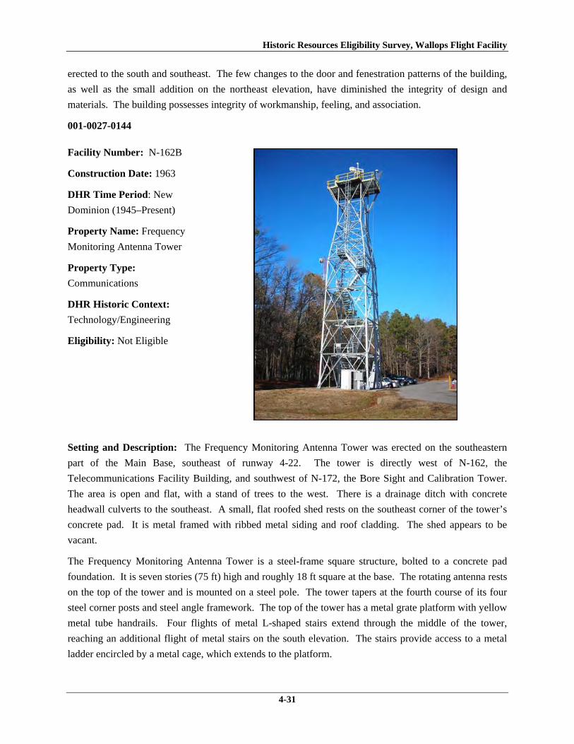
Historic Resources Eligibility Survey, Wallops Flight Facility
4-31
erected to the south and southeast. The few changes to the door and fenestration patterns of the building,
as well as the small addition on the northeast elevation, have diminished the integrity of design and
materials. The building possesses integrity of workmanship, feeling, and association.
001-0027-0144
Facility Number: N-162B
Construction Date: 1963
DHR Time Period: New
Dominion (1945–Present)
Property Name: Frequency
Monitoring Antenna Tower
Property Type:
Communications
DHR Historic Context:
Technology/Engineering
Eligibility: Not Eligible
Setting and Description: The Frequency Monitoring Antenna Tower was erected on the southeastern
part of the Main Base, southeast of runway 4-22. The tower is directly west of N-162, the
Telecommunications Facility Building, and southwest of N-172, the Bore Sight and Calibration Tower.
The area is open and flat, with a stand of trees to the west. There is a drainage ditch with concrete
headwall culverts to the southeast. A small, flat roofed shed rests on the southeast corner of the tower’s
concrete pad. It is metal framed with ribbed metal siding and roof cladding. The shed appears to be
vacant.
The Frequency Monitoring Antenna Tower is a steel-frame square structure, bolted to a concrete pad
foundation. It is seven stories (75 ft) high and roughly 18 ft square at the base. The rotating antenna rests
on the top of the tower and is mounted on a steel pole. The tower tapers at the fourth course of its four
steel corner posts and steel angle framework. The top of the tower has a metal grate platform with yellow
metal tube handrails. Four flights of metal L-shaped stairs extend through the middle of the tower,
reaching an additional flight of metal stairs on the south elevation. The stairs provide access to a metal
ladder encircled by a metal cage, which extends to the platform.

Historic Resources Eligibility Survey, Wallops Flight Facility
4-32
Eligibility: This antenna tower is representative of a Communications resource type built near the
beginning of the New Dominion period (1945–present) at a Technology/Engineering research facility.
This is one of approximately 50 buildings and structures that were erected within six years of the
establishment of NASA and the incorporation of Wallops Station as one of its operational facilities in
1959. Initially, Wallops Station’s new mission under NASA was to develop and test various components
related to manned space flight. This mission was short-lived, however, as Wallops became a test range
and launch site for suborbital and orbital rockets and satellites beginning in the early 1960s. NASA
erected this Frequency Monitoring Antenna Tower in 1963.
N-162B has been evaluated both as a contributing resource in a historic district and as an individual
resource. No historic district on the Main Base was identified because of a lack of significance and
integrity (refer to Section 4.1.1).
This antenna tower is not individually eligible for listing on the NRHP because it lacks significance. The
structure is presently less than 50 years old; therefore, it was evaluated under Criteria Consideration G in
addition to Criteria A–D. The tower is recommended not eligible under Criterion A because it is not
associated with an event or pattern of events of exceptional importance at the local, state, or national
level. It is not associated with the life of a person who made exceptionally important contributions in
history; therefore, it is recommended not eligible under Criterion B. The structure retains its integrity;
however, it is recommended not eligible under Criterion C because it does not embody exceptional
architectural merit for distinctive characteristics of a type, period, or method of construction; represent the
work of a master; or possess high artistic value. Likewise, it does not represent an exceptionally
significant or distinguishable entity whose components may lack individual distinction. It is
recommended not eligible under Criterion D because it does not have the potential to yield information
exceptionally important in history or prehistory.

Historic Resources Eligibility Survey, Wallops Flight Facility
4-33
001-0027-0145
Facility Number:
N-163
Construction Date: 1963
DHR Time Period: New
Dominion (1945–Present)
Property Name: Antenna
Calibration Measurement
Facility
Property Type: Research,
Development, and Testing
DHR Historic Context:
Technology/Engineering
Eligibility: Not Eligible
Setting and Description: The Antenna Calibration Measurement Facility is located on the southern
portion of the Main Base, immediately west of runway 4-22. The building stands at the edge of an
isolated, flat open field. A concrete pad leads from N-163 to the runway and in the other direction, a row
of concrete pads extends to an abandoned wooden platform and concrete footings of a demolished
building. Remnants of another foundation are in the vicinity of the runway. A raised cable track extends
from the southeast corner of the building. It has toppled over.
This one-story concrete block building was constructed in 1963 and is a small utilitarian structure.
Portions of the concrete block exterior have been covered with stucco. The building rests on a concrete
slab foundation and has a platform on top of the flat roof with an aluminum fascia. The platform is
surrounded by a wooden railing. A wooden staircase, leading to the roof, is located on the east elevation.
The wood platform, railing, and staircase are all additions (WFF 2011). The only entrance is on the south
elevation, consisting of a single hollow steel door. Concrete steps with metal tube railing leads to the
door. The west elevation features a single metal sash fixed over awning window with concrete lug lintel
and slip sill. The north elevation has an original two-over-two, double-hung, wood sash window with
concrete slip sill and no lintel.
Eligibility: This building represents a secondary Research, Development and Testing resource built
towards the beginning of the New Dominion period (1945–present) at a Technology/Engineering research
facility. This is one of approximately 50 buildings and structures that were erected within six years of the
establishment of NASA and the incorporation of Wallops Station as one of its operational facilities in
1959. Initially, Wallops Station’s new mission under NASA was to develop and test various components

Historic Resources Eligibility Survey, Wallops Flight Facility
4-34
related to manned space flight. This mission was short-lived, however, as Wallops became a test range
and launch site for suborbital and orbital rockets and satellites beginning in the early 1960s. N-163 was
originally an Air to Ground Blockhouse, and included two radio frequency electronics van trailers. In
1971 the trailers and all piers, jacks, conduits, and connections were removed and the building changed to
an antenna calibration measurement facility. As a result of the removal of the van trailers, new concrete
block walls for N-163 were installed in 1973 (WFF 2011).
N-163 has been evaluated both as a contributing resource in a historic district and as an individual
resource. No historic district on the Main Base was identified because of a lack of significance and
integrity (refer to Section 4.1.1).
The Antenna Calibration Measurement Facility is not individually eligible for listing on the NRHP
because it lacks significance and integrity. The building is presently less than 50 years old; therefore, it
was evaluated under Criteria Consideration G in addition to Criteria A–D. The building is recommended
not eligible under Criterion A because it is not associated with an event or pattern of events of exceptional
importance at the local, state, or national level. It is not associated with the life of a person who made
exceptionally important contributions in history; therefore, it is recommended not eligible under Criterion
B. The building is recommended not eligible under Criterion C because it does not embody exceptional
architectural merit for distinctive characteristics of a type, period, or method of construction; represent the
work of a master; or possess high artistic value. Likewise, it does not represent an exceptionally
significant or distinguishable entity whose components may lack individual distinction. It is
recommended not eligible under Criterion D because it does not have the potential to yield information
exceptionally important in history or prehistory.
Changes to the building and its surroundings have negatively affected several aspects of the integrity of
N-163. The building is in its historical location. The setting is diminished by the removal of two to three
other buildings or structures that were in the proximity to N-163 and probably once associated with it.
The design and materials of the building have been compromised by the installation of new concrete
block walls in 1973, the replacement of one of the windows, and the installation of a wood platform on
the roof and the stairs that lead to it. The physical changes to the building and its setting have removed
the historical association of the building. However, it does retain integrity of feeling and workmanship.

Historic Resources Eligibility Survey, Wallops Flight Facility
4-35
001-0027-0146
Facility Number: N-164
Construction Date: 1965
DHR Time Period: New
Dominion (1945–Present)
Property Name: High Frequency
Receiver Antenna -No. 2-
Rotating
Property Type: Communications
DHR Historic Context:
Technology/Engineering
Eligibility: Not Eligible
Setting and Description: The High Frequency Receiver Antenna is located on the southern portion of
the Main Base, to the southwest of runway 4-22. An observation tower and two antennas are located to
the north. The area is mostly an open, flat field. There are pine trees to the west of the antenna.
This High Frequency Receiver Antenna consists of a steel pole supported by two triangular, steel framed
towers. The support towers extend three quarters of the height of pole and are fortified by four guy wires.
The pole is raised about 2 ft off the ground and has a round antenna attached to the top. The central pole
and support towers are bolted to a concrete pad. Cables extend up the southern support tower and wrap
around the top quarter of the pole. The antenna stands 105 ft high and was relocated to this site in 1981.
As-built drawings indicate that it was originally affixed to a concrete pedestal with a spiral staircase
(WFF 2011). Its configuration is similar to an Omni Transmitter Antenna, which was used by the Navy
for short range communications (Best et al. 1997).
Eligibility: This High Frequency Receiver Antenna is representative of a Communications resource type
built towards the beginning of the New Dominion period (1945–present) at a Technology/Engineering
research facility. This is one of approximately 50 buildings and structures that were erected within six
years of the establishment of NASA and the incorporation of Wallops Station as one of its operational
facilities in 1959. Initially, Wallops Station’s new mission under NASA was to develop and test various
components related to manned space flight. This mission was short-lived, however, as Wallops became a

Historic Resources Eligibility Survey, Wallops Flight Facility
4-36
test range and launch site for suborbital and orbital rockets and satellites beginning in the early 1960s.
NASA erected this antenna in 1965.
N-164 has been evaluated both as a contributing resource in a historic district and as an individual
resource. No historic district on the Main Base was identified because of a lack of significance and
integrity (refer to Section 4.1.1).
This antenna is not individually eligible for listing on the NRHP because it lacks significance. The
structure is presently less than 50 years old; therefore, it was evaluated under Criteria Consideration G in
addition to Criteria A–D. The tower is recommended not eligible under Criterion A because it is not
associated with an event or pattern of events of exceptional importance at the local, state, or national
level. It is not associated with the life of a person who made exceptionally important contributions in
history; therefore, it is recommended not eligible under Criterion B. The structure retains its integrity, but
it is recommended not eligible under Criterion C because it does not embody exceptional architectural
merit for distinctive characteristics of a type, period, or method of construction; represent the work of a
master; or possess high artistic value. Likewise, it does not represent an exceptionally significant or
distinguishable entity whose components may lack individual distinction. It is recommended not eligible
under Criterion D because it does not have the potential to yield information exceptionally important in
history or prehistory.
001-0027-0147
Facility Number: N-166
Construction Date: 1957
DHR Time Period: New
Dominion (1945–Present)
Property Name:
Explosives Handling
Equipment Storage
Building
Property Type: Storage
DHR Historic Context:
Military/Defense,
Technology/Engineering
Eligibility: Not Eligible
Setting and Description: The Explosives Handling Equipment Storage Building is located on the
southern half of the Main Base, west of runway 4-22. Stubbs Boulevard runs along the west side of the

Historic Resources Eligibility Survey, Wallops Flight Facility
4-37
building. The area around the building is flat and open with forest to the south and west. A gravel road
leads to it.
This is a simple concrete block building with a flat roof and aluminum fascia. The building rests on a
raised concrete foundation. A hollow steel door on the east elevation is the only point of entry. This door
replaces the original paneled and louvered door (WFF 2011). A single metal louvered window with a
precast concrete slip sill is located in the center of both the north and south elevations. The west elevation
has no openings.
Eligibility: The Explosives Handling Equipment Storage Building represents a secondary resource built
near the beginning of the New Dominion period (1945–present) at a Military/Defense research facility.
The U.S. Navy expanded the mission of the CNAAS in 1946 to include the NAOTS, which was charged
with research and testing of naval aviation weapons and ordnance. The CNAAS/NAOTS retained this
mission until the base was closed in 1959 and transferred to NASA. During the period of 1946–1959,
most of the development that occurred on the Main Base was related to housing and services. However,
several new buildings were constructed on Main Base within the three years leading up to the closure of
the Navy station. The Navy erected this building in 1957; it has been used for storage since its
construction.
N-166 has been evaluated both as a contributing resource in a historic district and as an individual
resource. No historic district on the Main Base was identified because of a lack of significance and
integrity (refer to Section 4.1.1).
The building is not individually eligible for listing on the NRHP because it lacks significance. The
building is recommended not eligible under Criterion A because it is not associated with an event or
pattern of events of local, state, or national significance. It is not associated with the life of a person
significant in our past; therefore, it is recommended not eligible under Criterion B. N-166 retains
integrity, but it is a secondary resource of simple design and common construction; thus, it is
recommended not eligible under Criterion C because it does not embody the distinctive characteristics of
a type, period, or method of construction; represent the work of a master; possess high artistic value; or
represent a significant or distinguishable entity whose components may lack individual distinction. It is
recommended not eligible under Criterion D because it does not have the potential to yield information
important in history or prehistory.

Historic Resources Eligibility Survey, Wallops Flight Facility
4-38
001-0027-0148
Facility Number: N-167
Construction Date: 1965
DHR Time Period: New
Dominion (1945–Present)
Property Name: X-Band
Antenna Central Control
Building
Property Type:
Communications
DHR Historic Context:
Technology/Engineering
Eligibility: Not Eligible
Setting and Description: The X-Band Antenna Central Control Building is located on the southern
portion of the Main Base, southwest of runway 4-22. This building is one component of a cluster of six to
eight buildings situated on a flat open area of grass. A satellite antenna is visible from the building. A
raised metal track runs eastward from the southeastern corner of the building. A small substation is
situated on the building’s south side.
This single-story metal building was constructed in 1965 and is of a simple utilitarian style. It is a basic
rectangular form, resting on a reinforced concrete foundation, with a front gabled, standing seam metal
roof. The walls are sheathed with ribbed metal panels. The façade of the building faces west and is
composed of a single door and a set of double doors. Two light fixtures frame the double doorway.
Vents are situated in the east and west gables. A raised concrete stoop, reached via three stairs, leads to
the entrance. A metal tube railing surrounds the porch.
The north elevation consists of three bays of steel sash fixed and awning windows with large sills. Each
window has four lights. The south elevation is composed of two bays with windows of the same type. A
400 square-foot addition was completed on the southeastern corner of the building in 1974 (WFF 2011),
resulting in a distinct change to the east elevation of the building. The addition has metal plates in the
gable peaks with the name “Armco,” a company that manufactures steel products (AK Steel Corporation
2011). The original east elevation is composed of a double window of the same type described above.
There are two bays in the addition: one fixed aluminum over awning window and a glazed door. A
Historic Resources Eligibility Survey, Wallops Flight Facility
4-39
concrete stoop, with three stairs facing east, leads to the door. The stoop is surrounded by metal tube
railing.
Eligibility: The X-Band Antenna Central Control Building is a Communications property type built
towards the beginning of the New Dominion period (1945–present) at a Technology/Engineering research
facility. This is one of approximately 50 buildings and structures that were erected within six years of the
establishment of NASA and the incorporation of Wallops Station as one of its operational facilities in
1959. Initially, Wallops Station’s new mission under NASA was to develop and test various components
related to manned space flight. This mission was short-lived, however, as Wallops became a test range
and launch site for suborbital and orbital rockets and satellites beginning in the early 1960s. NASA
constructed this building in 1965. It retains its original use.
N-167 has been evaluated both as a contributing resource in a historic district and as an individual
resource. No historic district on the Main Base was identified because of a lack of significance and
integrity (refer to Section 4.1.1).
The building is not individually eligible for listing on the NRHP because it lacks significance and
integrity. The building is presently less than 50 years old; therefore, it was evaluated under Criteria
Consideration G in addition to Criteria A–D. The building is recommended not eligible under Criterion A
because it is not associated with an event or pattern of events of exceptional importance at the local, state,
or national level. It is not associated with the life of a person who made exceptionally important
contributions in history; therefore, it is recommended not eligible under Criterion B. The building is
recommended not eligible under Criterion C because it does not embody exceptional architectural merit
for distinctive characteristics of a type, period, or method of construction; represent the work of a master;
or possess high artistic value. Likewise, it does not represent an exceptionally significant or
distinguishable entity whose components may lack individual distinction. It is recommended not eligible
under Criterion D because it does not have the potential to yield information exceptionally important in
history or prehistory.
The building retains integrity of location, as it is in its historical location. The setting of the resource has
been adversely impacted by the construction of a few post-1965 buildings and concrete paved areas to the
north and northeast. The building’s integrity of design was diminished by the addition at the southeast
end, which nearly doubled the size of the building. The resource retains integrity of materials,
workmanship, and feeling. It lacks integrity of association, however, because of the changes to its
surrounding and to the original design.

Historic Resources Eligibility Survey, Wallops Flight Facility
4-40
001-0027-0149
Facility Number: N-174
Construction Date: 1962
DHR Time Period: New
Dominion (1945–Present)
Property Name: Bore Sight and
Calibration Tower
Property Type: Communications
DHR Historic Context:
Technology/Engineering
Eligibility: Not Eligible
Setting and Description: The Bore Sight and Calibration Tower was erected on the southeastern part of
the Main Base, southeast of runway 4-22. The tower is in a densely forested area, next to a second
unmarked tower. Cables attach it a small flat roofed building (N-174B).
This is a 150 ft galvanized steel tower bolted to concrete footings at each corner. The tower, which is
supported by steel posts and angles, tapers slightly. Metal stairs with metal tube handrails climb around
the exterior of the tower to reach a metal grate platform with metal tube railing at the top. Cables run
through the center of the tower, attaching to N-174B. A metal pull down ladder directly behind the
building reaches the first flight of stairs on the tower. There are several antennas attached to the tower,
including parabolic dishes and double curved types.
Eligibility: The Bore Sight and Calibration Tower is representative of a Communications resource type
built towards the beginning of the New Dominion period (1945–present) at a Technology/Engineering
research facility. This is one of approximately 50 buildings and structures that were erected within six
years of the establishment of NASA and the incorporation of Wallops Station as one of its operational
facilities in 1959. Initially, Wallops Station’s new mission under NASA was to develop and test various
components related to manned space flight. This mission was short-lived, however, as Wallops became a
test range and launch site for suborbital and orbital rockets and satellites beginning in the early 1960s.
NASA erected this tower in 1965. The tower was used to track the direction of all telemetry antennas in
the area.
N-174 has been evaluated both as a contributing resource in a historic district and as an individual
resource. No historic district on the Main Base was identified because of a lack of significance and
integrity (refer to Section 4.1.1).

Historic Resources Eligibility Survey, Wallops Flight Facility
4-41
This tower is not individually eligible for listing on the NRHP because it lacks significance. The
structure is presently less than 50 years old; therefore, it was evaluated under Criteria Consideration G in
addition to Criteria A–D. The tower is recommended not eligible under Criterion A because it is not
associated with an event or pattern of events of exceptional importance at the local, state, or national
level. It is not associated with the life of a person who made exceptionally important contributions in
history; therefore, it is recommended not eligible under Criterion B. The structure retains its integrity, but
it is recommended not eligible under Criterion C because it does not embody exceptional architectural
merit for distinctive characteristics of a type, period, or method of construction; represent the work of a
master; or possess high artistic value. Likewise, it does not represent an exceptionally significant or
distinguishable entity whose components may lack individual distinction. It is recommended not eligible
under Criterion D because it does not have the potential to yield information exceptionally important in
history or prehistory.
001-0027-0151
Facility Number:
N-222
Construction Date: 1957
DHR Time Period: New
Dominion (1945–Present)
Property Name: Surplus
Utilization and Disposal
Building
Property Type: Storage
DHR Historic Context:
Military/Defense,
Technology/Engineering
Eligibility: Not Eligible
Setting and Description: The Surplus Utilization and Disposal Building is located on the southern half
of the Main Base, at the south end of Wormhoudt Street. A gravel road leads from Wormhoudt Street to a
graveled area around the building, except on the west side, which is paved with asphalt. There is a
separate fenced area for vehicle storage and equipment on site. A concrete pad with wood stairs houses
an oil tank, which is located at the southeast corner of the building.
This is a one-story, utilitarian, concrete block building with a barrel arched standing seam metal roof. It
has a concrete block lean-to on the north elevation and a six-bay wood framed porch supported by seven
concrete block posts on the south elevation. The porch has exposed rafters and a standing seam metal

Historic Resources Eligibility Survey, Wallops Flight Facility
4-42
shed roof. It shelters a hollow steel door in the second bay from the west end. A wood framed lean-to
with a shed roof is affixed to the east elevation. It is constructed of painted plywood or pressboard. The
south elevation of the wood framed lean-to has a set of double wood doors.
The west elevation has a central overhead aluminum door and a single hollow steel door to the south.
Two awning windows underneath fixed metal framed windows are located in the southwest corner. The
east elevation has a set of double hollow steel doors on the southeast corner, next to the wood framed
lean-to, and a single door on the northeast corner. The north elevation features four overhead steel doors,
evenly spaced in the concrete block lean-to.
Eligibility: The Surplus Utilization and Storage Building represents a secondary resource built near the
beginning of the New Dominion period (1945–present) at a Military/Defense research facility. The U.S.
Navy expanded the mission of the CNAAS in 1946 to include the NAOTS, which was charged with
research and testing of naval aviation weapons and ordnance. The CNAAS/NAOTS retained this mission
until the base was closed in 1959 and transferred to NASA. During the period of 1946–1959, most of the
development that occurred on the Main Base was related to housing and services. However, several new
buildings were constructed on Main Base within the three years leading up to the closure of the Navy
station. The Navy erected this building in 1957; it has been used for storage since its construction.
N-222 has been evaluated both as a contributing resource in a historic district and as an individual
resource. No historic district on the Main Base was identified because of a lack of significance and
integrity (refer to Section 4.1.1).
The building is not individually eligible for listing on the NRHP because it lacks significance and
integrity. The building is recommended not eligible under Criterion A because it is not associated with an
event or pattern of events of local, state, or national significance. It is not associated with the life of a
person significant in our past; therefore, it is recommended not eligible under Criterion B. N-222 is
recommended not eligible under Criterion C because it does not embody the distinctive characteristics of
a type, period, or method of construction; represent the work of a master; possess high artistic value; or
represent a significant or distinguishable entity whose components may lack individual distinction. It is
recommended not eligible under Criterion D because it does not have the potential to yield information
important in history or prehistory.
The building has moderate historic integrity. It is in its historical location and the immediate setting of
the building retains its historical character except for the addition of a small post-1965 shed to the
southeast. The integrity of design has been diminished by the full-length lean-to addition on the rear and
there has been a minor adverse effect to the materials of the building due to the replacement of an
overhead door and the personnel doors. The building retains integrity of workmanship, feeling, and
association.

Historic Resources Eligibility Survey, Wallops Flight Facility
4-43
4.2 Wallops Mainland
Eighteen of the 76 resources surveyed are located on Wallops Mainland (Figure 4; Table 3). Seven of
these are antennas, nine are buildings, and one is a causeway and bridge. These resources represent six
property types: eight are communications; five are research, development, and testing; two are
infrastructure; one is industrial; one is transportation; and one is storage. Seven of the resources,
including five antennas, are less than 50 years old. The survey revealed that U-66, a transmitting antenna
that was erected in 1965 at the north end of Mainland Road, has been dismantled and removed. Only two
triangular concrete footings remain.
Table 3. Resources Surveyed on Wallops Mainland VDHR ID Number
WFF ID Number
Property Name Date of Construction
001-0027-0152 I-004 Wallops Island Causeway and Cat Creek Bridge
1960
001-0027-0153 U-005 Mainland Terminal Building 1961 001-0027-0154 U-20A Radar Antenna Pedestal Tower "B" 1959 001-0027-0155 U-20B Electric Power Control Building 1959 001-0027-0156 U-25 Radar Operations Building 1959 001-0027-0157 U-25A Radar Antenna Pedestal Tower "A" 1959 001-0027-0158 U-26 Projects Maintenance Shop 1960 001-0027-0159 U-27 Spare Parts Storage Building 1961 001-0027-0160 U-30 Spandar Radar Operations Building 1960 001-0027-0161 U-30A Spandar Radar Pedestal Tower 1960 001-0027-0162 U-40 Mobile Radar Laboratory 1961 001-0027-0163 U-55 Transmitter Building 1964 001-0027-0164 U-55A High Frequency Antenna Tower 1965 001-0027-0165 U-60 Army/Navy Fixed Radar Q-6 (AN/FPQ-6)
Collimations Beacon & Tower 1964
001-0027-0166 U-64 Communications Antenna Support Tower 1965 001-0027-0167 U-70 AN/FPQ-6 Radar Building 1964 001-0027-0168 U-70A AN/FPQ-6 Radar Antenna Pedestal Tower 1964 001-0027-0169 U-80 Atmospheric Physics Measurement
Laboratory 1965

Historic Resources Eligibility Survey, Wallops Flight Facility
4-44
This Page Intentionally Left Blank.

Historic Resources Eligibility Survey, Wallops Flight Facility
4-45
Figure 4. Resources Surveyed on Wallops Mainland

Historic Resources Eligibility Survey, Wallops Flight Facility
4-46
This Page Intentionally Left Blank.

Historic Resources Eligibility Survey, Wallops Flight Facility
4-47
4.2.1 Historic District Evaluation
The surveyed buildings on Wallops Mainland have been evaluated as contributing resources of a historic
district associated with NASA’s early operations in manned space flight and space science research at
Wallops Station. Issues of significance, integrity, and boundaries were carefully considered for a
proposed district. On Wallops Mainland there are 10 resources greater than 50 years old and 19 resources
less than 50 years old (12 of the 19 are not included in the survey because they were built after 1965).
Because the majority of the resources in a historic district on Wallops Mainland are less than 50 years old,
the district was evaluated under Criteria Consideration G in addition to Criteria A–D.
Wallops Mainland does not constitute a NRHP-eligible historic district because of a lack of significance.
A historic district on the Mainland is not eligible under Criterion A because WFF is not associated with
events that have made exceptionally important contributions to the broad patterns of our history at the
local, state, or national level. Wallops served an important role as the NASA rocket test range, enabling
the facility to fulfill its mission for NASA programs as well as expand its scientific research capabilities
to non-military and non-government entities. However, the Wallops facility and the operations that
occurred here between 1959 and 1965 were not central to the NASA organization. Wallops did not have
a leading role in the research and development of major NASA programs. For a brief period, Wallops
was involved in Project Mercury by testing hardware, training support personnel, and being the site for
two unmanned flights; however, the most important developments of this major mission, particularly
astronauts ascending into orbit, occurred at other facilities. From its start in 1959, Wallops was a “service
center” in the NASA organization, supporting the projects of the NASA “field centers” such as Houston
and Cape Canaveral, for instance, which had the high priority NASA missions. Furthermore, the projects
performed at Wallops that involved the launching, tracking, and acquisition of data from rockets using
radar and radio-telemetry techniques “could have been, and often were, conducted from other facilities”
(Wallace 1997, 108). Thus, the mission and activities of Wallops Station were not singular or exceptional
to the history of NASA in this period.
Documentary research has not revealed information that a historic district at the Mainland of WFF is
eligible for the NRHP under Criterion B for association with the life of a person who made exceptionally
important contributions in history.
The resources on Wallops Mainland do not constitute a historic district under Criterion C because they do
not embody exceptional architectural merit for distinctive characteristics of a type, period, or method of
construction; represent the work of a master; or possess high artistic value. Likewise, it does not
represent an exceptionally significant or distinguishable entity whose components may lack individual
distinction. Although a district on the Mainland largely retains integrity, the pattern of development of
the Mainland was of an additive nature based on program needs rather than on an overarching master
plan. NASA added buildings and structures to this area over time based on necessity. The result is an
irregular layout of buildings and features and an incohesive mix of massing, forms, and surface materials.
Furthermore, the individual components represent utilitarian design based on functional requirements, and

Historic Resources Eligibility Survey, Wallops Flight Facility
4-48
employ common materials and methods of construction. During a 1964 review of planning and
construction of existing NASA facilities, the House Committee of Science and Aeronautics called
Wallops’ layout “confused and congested” and concluded that “[NASA] builds no monuments here”
(Wallace 1997, 110, 111). None of the buildings evaluated in this survey and in the 2004 survey
possesses architectural significance for their building type, period, or method of construction.
A historic district eligible under Criterion D is not present on the Mainland because no surveyed
architectural resources were found to have the potential to yield additional information exceptionally
important in history or prehistory.
4.2.2 Individual Resource Evaluations
001-0027-0152
Facility Number: I-004
Construction Date: 1960
DHR Time Period: New
Dominion (1945–Present)
Property Name: Wallops
Island Causeway and Cat
Creek Bridge
Property Type:
Transportation
DHR Historic Context:
Technology/Engineering
Eligibility: Not Eligible
Setting and Description: The Wallops Island Causeway and Cat Creek Bridge links NASA facilities on
Wallops Island with the Mainland. The road runs northwest-southeast across an open and flat expanse of
marshes. At the northwest end of the causeway, near the boundary of the NASA property on Wallops
Mainland, is a gate house; a NASA security force controls access to the Wallops Island facility from the
Mainland.
The Wallops Island Causeway is 2.25 miles long and 20 ft wide. The two-lane road (there are no
shoulders) was built on fill and originally paved with asphalt cement. Before its intersection with North
Seawall Road on Wallops Island, the road splits and curves in two directions to provide a continuous turn
to and from North Seawall Road; this feature is original to the design of the causeway (WFF 2011).

Historic Resources Eligibility Survey, Wallops Flight Facility
4-49
The Cat Creek Bridge is 1,320 ft long and consists of four prestressed precast concrete beams supported
on 20 pairs of reinforced concrete rigid piers founded on prestressed concrete piles. The piers themselves
comprise prestressed hollow cylindrical piles (WFF 2011). The reinforced concrete bridge deck carries
two, 10 ft wide, concrete-paved traffic lanes with aluminum guardrails. The abutments are also
reinforced concrete. Runoff from the bridge is conveyed by two channels below each abutment; the
channels under the southeast abutment are paved in concrete and those under the northwest abutment are
lined by two rows of hardened sand bags. The embankment along Cat Creek below the southeast
abutment is also lined with hardened sand bags. The bridge was constructed with a 6 percent grade in
order to provide a 40 ft minimum clearance from mean high tide level to the bottom of the bridge deck
(WFF 2011). The 6 percent profile extends from sloped fill approaches on both ends of the bridge.
Conduits carrying various utility lines are attached to both sides of the bridge and on top of the concrete
curb next to the Mainland-bound traffic lane. In the area between the center two pairs of bridge piers,
wood piers and galvanized metal sheathing were installed in 1999 to protect the bridge piles adjacent to
the intracoastal waterway passage.
Because of traffic loads and environmental exposure, the causeway and bridge have received numerous
resurfacing and repairs over time. Total resurfacing of the causeway was completed in 1967 and 1983
(WFF 2011). Major repairs to the bridge have occurred in 1988 and 1993. The work in 1988 included
repairing detached and spalled concrete surfaces on bridge piers, beams, and diaphragms; repairing
spalled and delaminated areas of bridge deck; sealing bridge deck joints; strengthening the beams of two
of the spans; and restoring lost beam prestress force by post-tensioning methods. In 1993, piers,
abutments, curbs, parapets, and broken railings were repaired; the bridge beams were coated with epoxy;
and the guard rails at the bridge approaches were upgraded to meet current safety standards (WFF 2011).
Most recently, in late 2009 and early 2010, joints on the bridge deck were reconstructed and other
patchwork was completed. Additional maintenance projects are planned to be undertaken in the coming
years.
Eligibility: The causeway and bridge represent a Transportation resource type built towards the
beginning of the New Dominion period (1945–present) at a Technology/Engineering research facility.
These structures are one of several dozens of buildings and structures that were erected within six years of
the establishment of NASA and the incorporation of Wallops Station as one of its operational facilities.
The facilities expansion of Wallops Station also included acquisition of 216.6 acres on the Mainland, plus
1,031.4 acres of marsh between the Mainland and island, in 1959 (Shortal 1978). Initially, Wallops
Station’s new mission under NASA was to develop and test various components related to manned space
flight. This mission was short-lived, however, as Wallops became NASA’s test range and launch site for
suborbital and orbital rockets and satellites beginning in the early 1960s.
NACA, the predecessor to NASA, had wanted to have a causeway between the Mainland and Wallops
Island since it had established a testing site on the island in 1945. NACA had even chosen a route for a
causeway. Without a road between the island and Mainland, construction costs on Wallops Island were
higher because of the island’s isolation and transportation difficulties (Shortal 1978). One of NASA’s

Historic Resources Eligibility Survey, Wallops Flight Facility
4-50
priorities for the expansion of Wallops Station was construction of a causeway to the Mainland. NASA
contracted the Baltimore, Maryland, architecture-engineering firm of J. E. Greiner Company to design the
causeway and bridge and Tidewater Construction Company from Norfolk, Virginia, to build them (WFF
2011). The causeway route followed an existing power line across the marsh, which was the same route
that was selected in 1945 (Shortal 1978). Upon completion, the causeway and bridge carried Wallops
Island’s power and water lines (Goddard News 1988). Construction of both structures began on January
2, 1959 and was completed on April 2, 1960. The cost of the project was just under $1.48 million (WFF
2011). When completed, the causeway and bridge not only provided vehicular access to Wallops Island,
but also carried the water and electrical lines serving the island facilities (Goddard News 1988).
I-004 has been evaluated both as a contributing resource in a historic district and as an individual
resource. No historic district on Wallops Mainland was identified because of a lack of significance (refer
to Section 4.2.1).
The Wallops Island Causeway and Cat Creek Bridge are recommended not individually eligible for listing
on the NRHP because they lack of significance. Under Criterion A the structure were important for
facilitating the physical development of Wallops Island, but the resources built here were not part of
major NASA research and development programs. Wallops continued to be a service center in support of
the NASA organization. The causeway and bridge are not associated with the life of a person significant
in our past; therefore, they are recommended not eligible under Criterion B. The structures retain their
integrity overall; however, they are recommended not eligible under C because they are not early or
unique examples of a type, period, or method of construction for a road or bridge. Precast prestressed
concrete beam bridges like the Cat Creek Bridge are ubiquitous after the mid-1950s. I-004 is
recommended not eligible under Criterion D because it does not have the potential to yield information
important in history or prehistory.
Historic Resources Eligibility Survey, Wallops Flight Facility
4-51
001-0027-0153
Facility Number:
U-005
Construction Date: 1961
DHR Time Period: New
Dominion (1945–Present)
Property Name: Mainland
Terminal Building
Property Type:
Infrastructure
DHR Historic Context:
Technology/Engineering
Eligibility: Not Eligible
Setting and Description: The Mainland Terminal Building is located on Wallops Mainland at the east
corner of Causeway and Mainland Roads. The area is flat and open. The AN/FRQ-6 Collimation Beacon
and Tower (U-060) is visible to the northeast.
The Mainland Terminal Building is a simple, one-story concrete block building with a reinforced concrete
slab foundation and a flat roof deck and metal fascia. A wood handrail runs the perimeter of the roof. A
metal staircase with metal tube railing on the north elevation provides access to the roof. The only
entrance is a set of steel double doors with view windows on the west elevation. A concrete ramp is in
front of the doors. There are no other openings in the building.
Eligibility: This building is representative of an Infrastructure resource type built at a
Technology/Engineering research facility towards the beginning of the New Dominion period (1945–
present). This is one of approximately 50 buildings and structures that were erected within six years of
the establishment of NASA and the incorporation of Wallops Station as one of its operational facilities in
1959. Initially, Wallops Station’s new mission under NASA was to develop and test various components
related to manned space flight. This mission was short-lived, however, as Wallops became a test range
and launch site for suborbital and orbital rockets and satellites beginning in the early 1960s. The
expansion of Wallops Station after becoming a NASA facility included acquisition of 216.6 acres on the
Mainland in 1959 (Shortal 1978). NASA constructed this building in 1960; it has been used as the
Mainland terminal facility since its construction.

Historic Resources Eligibility Survey, Wallops Flight Facility
4-52
The Mainland Terminal Building has been evaluated both as a contributing resource in a historic district
and as an individual resource. No historic district on Wallops Mainland was identified because of a lack
of significance (refer to Section 4.2.1).
The Mainland Terminal Building is not individually eligible for listing on the NRHP because it lacks
significance. The building is recommended not eligible under Criterion A because it is not associated
with an event or pattern of events of local, state, or national significance. It is not associated with the life
of a person significant in our past; therefore, it is recommended not eligible under Criterion B. The
building retains integrity, but is of simple design and common construction and, therefore, is
recommended not eligible under Criterion C because it does not embody the distinctive characteristics of
a type, period, or method of construction; represent the work of a master; possess high artistic value; or
represent a significant or distinguishable entity whose components may lack individual distinction. It is
recommended not eligible under Criterion D because it does not have the potential to yield information
important in history or prehistory.
001-0027-0154
Facility Number: U-20A
Construction Date: 1959
DHR Time Period: New
Dominion (1945–Present)
Property Name: Radar
Antenna Pedestal Tower “B”
Property Type:
Communications
DHR Historic Context:
Technology/Engineering
Eligibility: Not Eligible
Setting and Description: Radar Antenna Pedestal Tower “B” is located on Wallops Mainland, south of
Causeway Road. A creek lies to the east with tall grass surrounding it and an agricultural field is to the
west of the NASA property. The tower stands in the second cluster of buildings and structures at the end
of Mainland Road. The Electric Power Control Building (U-20B) is connected to the antenna with cables.
The Radar Antenna Pedestal Tower “B” is one of three developed by NASA in partnership with MIT’s
Lincoln Laboratory, an early departure from DOD contracts (Wallace 1997). The other two are the Radar
Pedestal Tower “A” (U-25A) and the Spandar Radar Pedestal Tower (U-30A). It consists of a reinforced

Historic Resources Eligibility Survey, Wallops Flight Facility
4-53
concrete cylinder, 35 ft, 6 inches in height and 12 ft in diameter, and the antenna arm. A photograph
taken in 1980 shows a large dish-shaped antenna attached to the arm, about 50 ft in diameter, and two
circular platforms around the top and middle of the cylinder (WFF 2011). These platforms have since
been removed and a parabolic dish antenna was removed from the pedestal on January 4, 2011. A square
steel platform was erected in 1992 at the top of the pedestal and is supported by four steel posts bolted to
concrete footings and framing built of steel angles. The platform has a metal tube railing. A landing is
about midway up the northeast elevation of the platform tower. A metal staircase extends to the platform
on the northwest and northeast elevations.
Eligibility: This antenna tower is representative of a Communications resource type built at a
Technology/Engineering research facility towards the beginning of the New Dominion period (1945–
present). This is one of approximately 50 buildings and structures that were erected within six years of
the establishment of NASA and the incorporation of Wallops Station as one of its operational facilities in
1959. Initially, Wallops Station’s new mission under NASA was to develop and test various components
related to manned space flight. This mission was short-lived, however, as Wallops became a test range
and launch site for suborbital and orbital rockets and satellites beginning in the early 1960s. The
expansion of Wallops Station after becoming a NASA facility included acquisition of 216.6 acres on the
Mainland in 1959. NASA designated the southern portion of the Mainland area for the use of long-range
radars, and leased a parcel of land to MIT, which wanted to install two large, long-range radars (U-20A
and U-25A) for its Lincoln Laboratory to use for a DOD antimissile program (the D58 Trailblazer reentry
project) (Shortal 1978). Both radars and associated pedestal towers were installed in 1959.
U-20A has been evaluated both as a contributing resource in a historic district and as an individual
resource. No historic district on Wallops Mainland was identified because of a lack of significance (refer
to Section 4.2.1).
The Radar Antenna Pedestal Tower “B” is not individually eligible for listing on the NRHP because it
lacks significance and integrity. The structure is recommended not eligible under Criterion A because it
is not associated with an event or pattern of events of local, state, or national significance. It is not
associated with the life of a person significant in our past; therefore, it is recommended not eligible under
Criterion B. The tower is recommended not eligible under Criterion C because it does not embody the
distinctive characteristics of a type, period, or method of construction; represent the work of a master;
possess high artistic value; or represent a significant or distinguishable entity whose components may
lack individual distinction. It is recommended not eligible under Criterion D because it does not have the
potential to yield information important in history or prehistory.
The integrity of the tower has been adversely affected by alterations that have been completed within the
past 20 years. The structure is in its historical location. The setting has been changed somewhat by the
removal of a hemispherical dome structure that once stood adjacent to the tower and the addition of a
post-1965 building next to it. The design and materials of the tower have been diminished by the removal
of the parabolic dish antenna and circular metal platforms around the pedestal, and the addition of steel

Historic Resources Eligibility Survey, Wallops Flight Facility
4-54
framework around the entire concrete pedestal. Although the workmanship and association remain
relatively intact, the integrity of feeling has been compromised by the alterations and changes in setting.
001-0027-0155
Facility Number:
U-20B
Construction Date: 1959
DHR Time Period: New
Dominion (1945–Present)
Property Name: Electrical
Power Control Building
Property Type:
Infrastructure
DHR Historic Context:
Technology/Engineering
Eligibility: Not Eligible
Setting and Description: The Electric Power Control Building is located on Wallops Mainland, south of
Causeway Road. A creek lies to the east with tall grass surrounding it and an agricultural field is to the
west of the NASA property. The building resides in the second cluster of buildings and structures at the
end of Mainland Road. Radar Antenna Pedestal Tower “B” (U-20A) is connected to the building.
The Electric Power Control Building is a small, rectangular, wood framed building on a concrete slab.
The sides are sheathed in painted composition board with wood corner boards and fascia. The roof is flat
with corrugated metal decking. The only opening is a set of replacement double hollow steel doors in the
southwest elevation. There are six metal conduits on the southeast, two of which connect the building to
antenna U-20A.
Eligibility: This building represents an Infrastructure resource type built at a Technology/Engineering
research facility towards the beginning of the New Dominion period (1945–present). This is one of
approximately 50 buildings and structures that were erected within six years of the establishment of
NASA and the incorporation of Wallops Station as one of its operational facilities in 1959. Initially,
Wallops Station’s new mission under NASA was to develop and test various components related to
manned space flight. This mission was short-lived, however, as Wallops became a test range and launch
site for suborbital and orbital rockets and satellites beginning in the early 1960s. The expansion of
Wallops Station after becoming a NASA facility included acquisition of 216.6 acres on the Mainland in
1959. NASA designated the southern portion of the Mainland area for the use of long-range radars. The
Historic Resources Eligibility Survey, Wallops Flight Facility
4-55
Electrical Power Control Building is associated with U-20A, one of the two large, long-range radars (U-
25A is the other) that MIT’s Lincoln Laboratory installed in 1959 to use for a DOD antimissile program
(the D58 Trailblazer reentry project) (Shortal 1978). U-20B was built in 1959.
U-20B has been evaluated both as a contributing resource in a historic district and as an individual
resource. No historic district on Wallops Mainland was identified because of a lack of significance (refer
to Section 4.2.1).
The Electrical Power Control Building is not individually eligible for listing on the NRHP because it
lacks significance. The building is recommended not eligible under Criterion A because it is not
associated with an event or pattern of events of local, state, or national significance. It is not associated
with the life of a person significant in our past; therefore, it is recommended not eligible under Criterion
B. The building retains integrity, but is a secondary resource of simple design and common construction
and, therefore, is recommended not eligible under Criterion C because it does not embody the distinctive
characteristics of a type, period, or method of construction; represent the work of a master; possess high
artistic value; or represent a significant or distinguishable entity whose components may lack individual
distinction. It is recommended not eligible under Criterion D because it does not have the potential to
yield information important in history or prehistory.
001-0027-0156
Facility Number: U-25
Construction Date: 1959
DHR Time Period: New
Dominion (1945–Present)
Property Name: Radar
Operations Building
Property Type: Research,
Development, and Testing
DHR Historic Context:
Technology/Engineering
Eligibility: Not Eligible
Setting and Description: The Radar Operations Building is located on Wallops Mainland, south of
Causeway Road. A creek lies to the east with tall grass surrounding it and an agricultural field is to the
west of the NASA property. There are three clusters of buildings and structures near it. A one lane
asphalt-paved road (Mainland Road) provides access to the building, which is surrounded by an asphalt-

Historic Resources Eligibility Survey, Wallops Flight Facility
4-56
paved parking area. The building is connected to the Radar Antenna Pedestal Tower “A” (U-25A) by a
metal track, which carries cables.
The Radar Operations Building is a one-story, prefabricated metal building with a side gable corrugated
metal roof and concrete slab foundation. The sides are sheathed in ribbed metal siding, which was
installed in 1987 (WFF 2011). There are shed roofed lean-to additions on the southeast and southwest
elevations.
The southwest elevation has a single door entry southeast of the lean-to with a single and pair of one-
over-one double-hung wood-sash windows. There are no openings southwest of the lean-to. The
northeast elevation has central double doors with view windows and a concrete ramp. It has a slightly
off-center single hollow steel door flanked by four one-over-one double-hung wood-sash windows. The
lower sashes have screens. An overhead metal door and single hollow steel door are located on the east
end. The building’s original windows and doors were replaced in 1987 (WFF 2011).
The southeast lean-to has a single hollow steel door leading into a hallway and entry. The lean-to was
added in 2001 (WFF 2011). Two fixed windows are on either side of the lean-to. Two one-over-one
double-hung wood-sash windows flank the lean-to. The southwest lean-to, which was added in 1966
(WFF 2011), has a half-glazed single door on its northwest elevation and a fixed window on the
southwest.
Eligibility: This building represents a Research, Development and Testing resource type built at a
Technology/Engineering research facility towards the beginning of the New Dominion period (1945–
present). This is one of approximately 50 buildings and structures that were erected within six years of
the establishment of NASA and the incorporation of Wallops Station as one of its operational facilities in
1959. Initially, Wallops Station’s new mission under NASA was to develop and test various components
related to manned space flight. This mission was short-lived, however, as Wallops became a test range
and launch site for suborbital and orbital rockets and satellites beginning in the early 1960s. The
expansion of Wallops Station after becoming a NASA facility included acquisition of 216.6 acres on the
Mainland in 1959. NASA designated the southern portion of the Mainland area for the use of long-range
radars. The Radar Operations Building is associated with the two large, long-range radars (U-20A and U-
25A) that MIT’s Lincoln Laboratory installed in 1959 to use for a DOD antimissile program (the D58
Trailblazer reentry project) (Shortal 1978). U-25 was built in 1959.
U-25 has been evaluated both as a contributing resource in a historic district and as an individual
resource. No historic district on Wallops Mainland was identified because of a lack of significance (refer
to Section 4.2.1).
The Radar Operations Building is not individually eligible for listing on the NRHP because it lacks
significance and integrity. The building is recommended not eligible under Criterion A because it is not
associated with an event or pattern of events of local, state, or national significance. It is not associated
with the life of a person significant in our past; therefore, it is recommended not eligible under Criterion
B. The building retains integrity, but is a secondary resource of simple design and common construction

Historic Resources Eligibility Survey, Wallops Flight Facility
4-57
and, therefore, is recommended not eligible under Criterion C because it does not embody the distinctive
characteristics of a type, period, or method of construction; represent the work of a master; possess high
artistic value; or represent a significant or distinguishable entity whose components may lack individual
distinction. It is recommended not eligible under Criterion D because it does not have the potential to
yield information important in history or prehistory.
Multiple alterations to U-25 have compromised the integrity of the building. The building is in its
historical location. Few changes have occurred to the surrounding environment, so U-25 retains integrity
of setting. The building lacks integrity of design, materials, and workmanship because of multiple
alterations to historical features and materials, including the installation of new exterior siding, the
removal and replacement of all windows and doors, and the recent construction of an addition on the
southeast elevation. These changes have also impacted the integrity of feeling of the building; however,
integrity of association is intact.
001-0027-0157
Facility Number: U-25A
Construction Date: 1959
DHR Time Period: New
Dominion (1945–Present)
Property Name: Radar
Antenna Pedestal Tower “A”
Property Type:
Communications
DHR Historic Context:
Technology/Engineering
Eligibility: Not Eligible
Setting and Description: The Radar Antenna Pedestal Tower “A” is located on Wallops Mainland, on
Mainland Road south of Causeway Road. A creek lies to the east with tall grass surrounding it and an
agricultural field is to the west of the NASA property. There are three clusters of buildings and structures
near the tower, which is surrounded by an asphalt-paved parking area. A raised metal track, carrying
cables, connects it to the Radar Operations Building (U-25).

Historic Resources Eligibility Survey, Wallops Flight Facility
4-58
The Radar Antenna Pedestal Tower “A” is one of three developed in by NASA partnership with MIT’s
Lincoln Laboratory, an early departure from DOD contracts (Best et al. 1997). The other two are the
Radar Pedestal Tower “B” (U-20A) and the Spandar Radar Pedestal Tower (U-30A). It consists of a
pedestal, 35 ft 6 inches in height and 12 ft in diameter, and the antenna itself. The entire structure rests on
a concrete pylon about 12 ft in diameter. The antenna is a parabolic dish about 50 ft in diameter. It is
framed with metal bars and cross bars and has a solid metal center. A pyramid of metal bars rests atop the
center. The antenna is attached to the pedestal with a mechanical arm that allows it to change position.
The pedestal is a reinforced concrete cylinder with two metal framed catwalks with metal handrails. One
catwalk runs along the perimeter of the cylinder about half way up, the other extends along the top of the
northeast elevation. A metal ladder with a steel cage around it provides access to both platforms. There
is one point of entry to the pedestal, through a single half-glazed door on the southwest elevation.
Eligibility: This antenna tower is representative of a Communications resource type built at a
Technology/Engineering research facility towards the beginning of the New Dominion period (1945–
present). This is one of approximately 50 buildings and structures that were erected within six years of
the establishment of NASA and the incorporation of Wallops Station as one of its operational facilities in
1959. Initially, Wallops Station’s new mission under NASA was to develop and test various components
related to manned space flight. This mission was short-lived, however, as Wallops became a test range
and launch site for suborbital and orbital rockets and satellites beginning in the early 1960s. The
expansion of Wallops Station after becoming a NASA facility included acquisition of 216.6 acres on the
Mainland in 1959. NASA designated the southern portion of the Mainland area for the use of long-range
radars, and leased a parcel of land to MIT, which wanted to install two large, long-range radars (U-20A
and U-25A) for its Lincoln Laboratory to use for a DOD antimissile program (the D58 Trailblazer reentry
project) (Shortal 1978). Both radars and associated pedestal towers were installed in 1959.
U-25A has been evaluated both as a contributing resource in a historic district and as an individual
resource. No historic district on Wallops Mainland was identified because of a lack of significance (refer
to Section 4.2.1).
The Radar Antenna Pedestal Tower “A” is not individually eligible for listing on the NRHP because it
lacks significance. The structure is recommended not eligible under Criterion A because it is not
associated with an event or pattern of events of local, state, or national significance. It is not associated
with the life of a person significant in our past; therefore, it is recommended not eligible under Criterion
B. The tower retains integrity, however, it is recommended not eligible under Criterion C because it does
not embody the distinctive characteristics of a type, period, or method of construction; represent the work
of a master; possess high artistic value; or represent a significant or distinguishable entity whose
components may lack individual distinction. It is recommended not eligible under Criterion D because it
does not have the potential to yield information important in history or prehistory.
Historic Resources Eligibility Survey, Wallops Flight Facility
4-59
001-0027-0158
Facility Number: U-26
Construction Date: 1961
DHR Time Period: New
Dominion (1945–Present)
Property Name: Projects
Maintenance Shop
Property Type: Industrial
DHR Historic Context:
Technology/Engineering
Eligibility: Not Eligible
Setting and Description: The Projects Maintenance Shop is located on Wallops Mainland, on Mainland
Road south of Causeway Road. A creek lies to the east with tall grass surrounding it and an agricultural
field is to the west of the NASA property. There are three clusters of buildings and structures near it.
The Projects Maintenance Shop is a simple, one-story rectangular building with a metal barrel arched roof
and a concrete foundation. Three courses of concrete block meet corrugated metal siding on the
northwest and southeast elevations. The northeast and southwest elevations are faced with plywood and
wood battens. The southwest elevation contains the only entrance, a replacement overhead door with two
lights. This is flanked by two six-over-six double-hung wood-sash windows. An entrance in the
northeast elevation has been covered with plywood.
Eligibility: This building is an Industrial resource type built at a Technology/Engineering research
facility towards the beginning of the New Dominion period (1945–present). This is one of approximately
50 buildings and structures that were erected within six years of the establishment of NASA and the
incorporation of Wallops Station as one of its operational facilities in 1959. Initially, Wallops Station’s
new mission under NASA was to develop and test various components related to manned space flight.
This mission was short-lived, however, as Wallops became a test range and launch site for suborbital and
orbital rockets and satellites beginning in the early 1960s. The expansion of Wallops Station after
becoming a NASA facility included acquisition of 216.6 acres on the Mainland in 1959. NASA
designated the southern portion of the Mainland area for the use of long-range radars (Shortal 1978). U-
26 was constructed in 1960.

Historic Resources Eligibility Survey, Wallops Flight Facility
4-60
U-26 has been evaluated both as a contributing resource in a historic district and as an individual
resource. No historic district on Wallops Mainland was identified because of a lack of significance (refer
to Section 4.2.1).
The Projects Maintenance Shop is not individually eligible for listing on the NRHP because it lacks
significance. The building is recommended not eligible under Criterion A because it is not associated
with an event or pattern of events of local, state, or national significance. It is not associated with the life
of a person significant in our past; therefore, it is recommended not eligible under Criterion B. The
building retains integrity, but is a secondary resource of simple design and common construction and,
therefore, is recommended not eligible under Criterion C because it does not embody the distinctive
characteristics of a type, period, or method of construction; represent the work of a master; possess high
artistic value; or represent a significant or distinguishable entity whose components may lack individual
distinction. It is recommended not eligible under Criterion D because it does not have the potential to
yield information important in history or prehistory.
001-0027-0159
Facility Number: U-27
Construction Date: 1961
DHR Time Period: New
Dominion (1945–Present)
Property Name: Spare
Parts Storage Building
Property Type: Storage
DHR Historic Context:
Technology/Engineering
Eligibility: Not Eligible
Setting and Description: The Spare Parts Storage Building is located on Wallops Mainland, south of
Causeway Road. A creek lies to the east, with tall grass surrounding it, and an agricultural field is to the
west of the NASA property. A one lane asphalt-paved road (Mainland Road) provides access to the
building. There are three clusters of buildings and structures near it.
The Spare Parts Storage Building is a simple, one-story wood frame Quonset hut. The barrel arched roof,
which is clad in corrugated metal, meets the concrete slab foundation. The southwest and northeast ends
are sheathed in plywood with battens. The only entrance is a replacement aluminum overhead door with
Historic Resources Eligibility Survey, Wallops Flight Facility
4-61
two lights on the southwest elevation. The overhead door is flanked by two, two-over-two double-hung
wood-sash windows. The northeast elevation has two windows of the same type flanking an entryway
that has been covered by plywood.
Eligibility: This building is representative of a Storage resource type built at a Technology/Engineering
research facility towards the beginning of the New Dominion period (1945–present). This is one of
approximately 50 buildings and structures that were erected within six years of the establishment of
NASA and the incorporation of Wallops Station as one of its operational facilities in 1959. Initially,
Wallops Station’s new mission under NASA was to develop and test various components related to
manned space flight. This mission was short-lived, however, as Wallops became a test range and launch
site for suborbital and orbital rockets and satellites beginning in the early 1960s. The expansion of
Wallops Station after becoming a NASA facility included acquisition of 216.6 acres on the Mainland in
1959. NASA designated the southern portion of the Mainland area for the use of long-range radars
(Shortal 1978). U-27 was constructed in 1961.
U-27 has been evaluated both as a contributing resource in a historic district and as an individual
resource. No historic district on Wallops Mainland was identified because of a lack of significance (refer
to Section 4.2.1).
The Spare Parts Storage Building is not individually eligible for listing on the NRHP because it lacks
significance. The building is recommended not eligible under Criterion A because it is not associated
with an event or pattern of events of local, state, or national significance. It is not associated with the life
of a person significant in our past; therefore, it is recommended not eligible under Criterion B. The
building retains integrity, but is a secondary resource of simple, utilitarian design and construction and,
therefore, is recommended not eligible under Criterion C because it does not embody the distinctive
characteristics of a type, period, or method of construction; represent the work of a master; possess high
artistic value; or represent a significant or distinguishable entity whose components may lack individual
distinction. Quonset huts were routinely used for storage and ubiquitous to federal installations,
particularly DOD installations, during and after World War II. U-27 is recommended not eligible under
Criterion D because it does not have the potential to yield information important in history or prehistory.
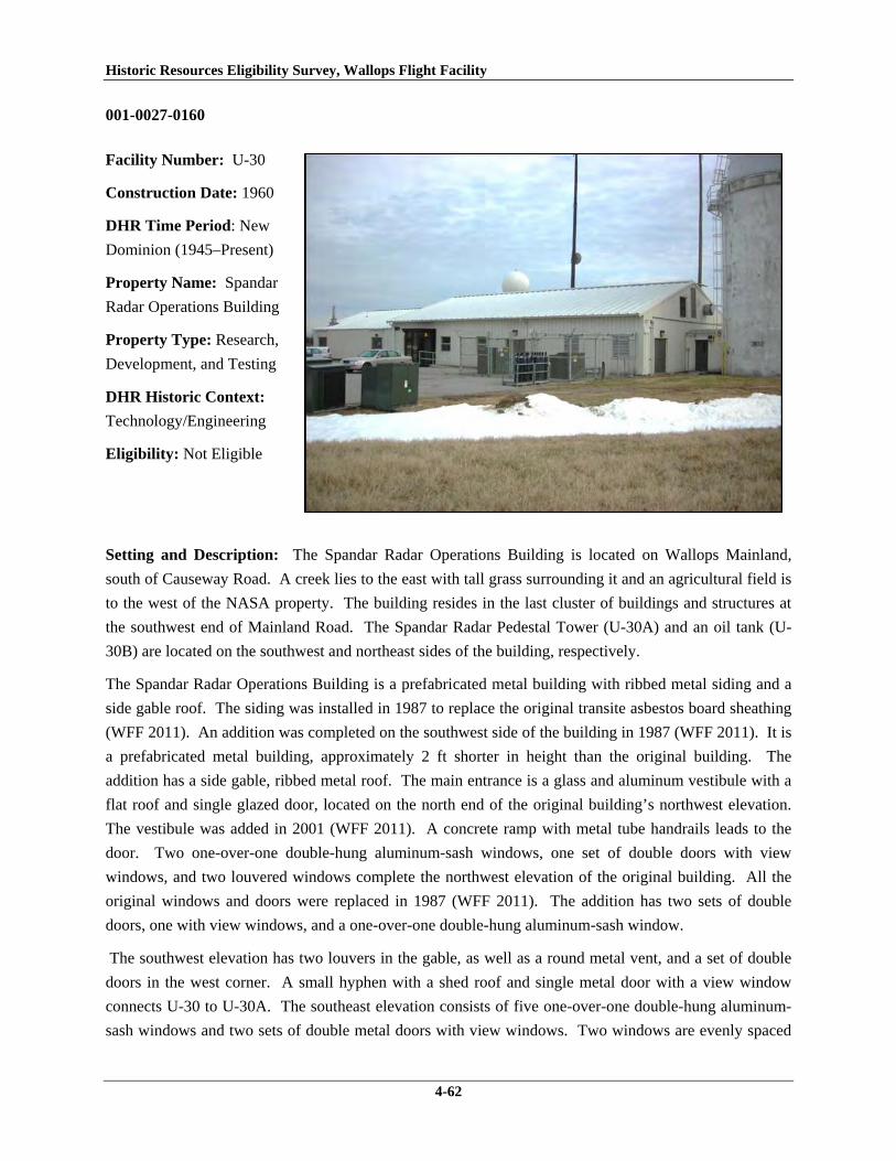
Historic Resources Eligibility Survey, Wallops Flight Facility
4-62
001-0027-0160
Facility Number: U-30
Construction Date: 1960
DHR Time Period: New
Dominion (1945–Present)
Property Name: Spandar
Radar Operations Building
Property Type: Research,
Development, and Testing
DHR Historic Context:
Technology/Engineering
Eligibility: Not Eligible
Setting and Description: The Spandar Radar Operations Building is located on Wallops Mainland,
south of Causeway Road. A creek lies to the east with tall grass surrounding it and an agricultural field is
to the west of the NASA property. The building resides in the last cluster of buildings and structures at
the southwest end of Mainland Road. The Spandar Radar Pedestal Tower (U-30A) and an oil tank (U-
30B) are located on the southwest and northeast sides of the building, respectively.
The Spandar Radar Operations Building is a prefabricated metal building with ribbed metal siding and a
side gable roof. The siding was installed in 1987 to replace the original transite asbestos board sheathing
(WFF 2011). An addition was completed on the southwest side of the building in 1987 (WFF 2011). It is
a prefabricated metal building, approximately 2 ft shorter in height than the original building. The
addition has a side gable, ribbed metal roof. The main entrance is a glass and aluminum vestibule with a
flat roof and single glazed door, located on the north end of the original building’s northwest elevation.
The vestibule was added in 2001 (WFF 2011). A concrete ramp with metal tube handrails leads to the
door. Two one-over-one double-hung aluminum-sash windows, one set of double doors with view
windows, and two louvered windows complete the northwest elevation of the original building. All the
original windows and doors were replaced in 1987 (WFF 2011). The addition has two sets of double
doors, one with view windows, and a one-over-one double-hung aluminum-sash window.
The southwest elevation has two louvers in the gable, as well as a round metal vent, and a set of double
doors in the west corner. A small hyphen with a shed roof and single metal door with a view window
connects U-30 to U-30A. The southeast elevation consists of five one-over-one double-hung aluminum-
sash windows and two sets of double metal doors with view windows. Two windows are evenly spaced

Historic Resources Eligibility Survey, Wallops Flight Facility
4-63
in the addition, two are centered between the sets of double doors, and one is located on the south end.
The northeast elevation has two louvers in the gable; one is larger than the other.
Eligibility: This building represents a Research, Development and Testing resource type built at a
Technology/Engineering research facility towards the beginning of the New Dominion period (1945–
present). This is one of approximately 50 buildings and structures that were erected within six years of
the establishment of NASA and the incorporation of Wallops Station as one of its operational facilities in
1959. Initially, Wallops Station’s new mission under NASA was to develop and test various components
related to manned space flight. This mission was short-lived, however, as Wallops became a test range
and launch site for suborbital and orbital rockets and satellites beginning in the early 1960s. The
expansion of Wallops Station after becoming a NASA facility included acquisition of 216.6 acres on the
Mainland in 1959. NASA designated the southern portion of the Mainland area for the use of long-range
radars. The Spandar Radar Operations Building is associated with the Spandar radar (U-30A), a long-
range radar. NASA contracted MIT to develop this radar for NASA to use in satellite and reentry vehicle
tracking (Shortal 1978). U-30 was built in 1960.
U-30 has been evaluated both as a contributing resource in a historic district and as an individual
resource. No historic district on Wallops Mainland was identified because of a lack of significance (refer
to Section 4.2.1).
The Spandar Radar Operations Building is not individually eligible for listing on the NRHP because it
lacks significance and integrity. The building is recommended not eligible under Criterion A because it is
not associated with an event or pattern of events of local, state, or national significance. It is not
associated with the life of a person significant in our past; therefore, it is recommended not eligible under
Criterion B. The building retains integrity, but is a secondary resource of simple design and common
construction and, therefore, is recommended not eligible under Criterion C because it does not embody
the distinctive characteristics of a type, period, or method of construction; represent the work of a master;
possess high artistic value; or represent a significant or distinguishable entity whose components may
lack individual distinction. It is recommended not eligible under Criterion D because it does not have the
potential to yield information important in history or prehistory.
This building lacks integrity due to multiple alterations. The building is in its historical location. The
setting has changed somewhat with the addition of a couple of small post-1965 buildings in the vicinity,
but they have not adversely impacted the overall character of the surroundings. The building possesses
no integrity of design, materials, and workmanship due to several substantive alterations, including
removal and replacement of all original doors and windows, the reconfiguration of fenestration on the
primary elevations, the replacement of the original exterior siding, and the construction of a large
prefabricated metal addition on the north end of the building. These changes have also adversely
impacted the integrity of feeling of the building; however, integrity of association is intact.

Historic Resources Eligibility Survey, Wallops Flight Facility
4-64
001-0027-0161
Facility Number: U-30A
Construction Date: 1960
DHR Time Period: New
Dominion (1945–Present)
Property Name: Spandar
Radar Tower Pedestal
Property Type:
Communications
DHR Historic Context:
Technology/Engineering
Eligibility: Not Eligible
Setting and Description: The Spandar Radar Pedestal Tower is located on Wallops Mainland, south of
Causeway Road. A creek lies to the east with tall grass surrounding it and an agricultural field is to the
west of the NASA property. The antenna is within the last cluster of buildings and structures at the
southwest end of Mainland Road. A hyphen attaches it to the Spandar Radar Operations building (U-30).
U-30B, an oil tank, is located on the northeast side of the building.
The Spandar Radar Antenna Pedestal Tower is the last of three developed by NASA in partnership with
MIT’s Lincoln Laboratory and the only one operated solely by NASA (Wallace 1997). The other two are
Radar Antenna Pedestal Towers “B” (U-20A) and “A” (U-25A). U-30A consists of a pedestal 90 ft in
height and 60 ft in diameter resting on concrete piles. A parabolic dish antenna about 50 ft in diameter is
attached to the pedestal with a mechanical arm that allows it to change position. The antenna is framed
with metal bars and cross bars and has a solid metal center. A pyramid of metal bars rests atop the center.
The pedestal is composed of two parts, a reinforced concrete base and a tapered upper half, sheathed in
metal siding. It has a metal framed platform on the top of the cone, a metal framed catwalk just below the
platform, and two metal framed landings; one is located in the center of the tapered section on the north
elevation and the other is on northwest side of the concrete cylinder. A metal ladder surrounded by a
metal cage extends from the ground to the platform along the north elevation. There is one metal
louvered window with a concrete sill near the ground on the east elevation.
Historic Resources Eligibility Survey, Wallops Flight Facility
4-65
Eligibility: This antenna tower is representative of a Communications resource type built at a
Technology/Engineering research facility towards the beginning of the New Dominion period (1945–
present). This is one of approximately 50 buildings and structures that were erected within six years of
the establishment of NASA and the incorporation of Wallops Station as one of its operational facilities in
1959. Initially, Wallops Station’s new mission under NASA was to develop and test various components
related to manned space flight. This mission was short-lived, however, as Wallops became a test range
and launch site for suborbital and orbital rockets and satellites beginning in the early 1960s. The
expansion of Wallops Station after becoming a NASA facility included acquisition of 216.6 acres on the
Mainland in 1959. NASA designated the southern portion of the Mainland area for the use of long-range
radars, and leased a parcel of land to MIT, which wanted to install two large, long-range radars (U-20A
and U-25A) for its Lincoln Laboratory to use for a DOD antimissile program (the D58 Trailblazer reentry
project). NASA subsequently contracted MIT to develop a long-range radar for NASA to use in satellite
and reentry vehicle tracking (Shortal 1978). This Spandar radar, so-called because it is an S-band radar,
and the associated pedestal tower was erected in 1960.
U-30A has been evaluated both as a contributing resource in a historic district and as an individual
resource. No historic district on Wallops Mainland was identified because of a lack of significance (refer
to Section 4.2.1).
The Spandar Radar Antenna Pedestal Tower is not individually eligible for listing on the NRHP because
it lacks significance. The structure is recommended not eligible under Criterion A because it is not
associated with an event or pattern of events of local, state, or national significance. It is not associated
with the life of a person significant in our past; therefore, it is recommended not eligible under Criterion
B. The tower retains integrity, however, it is recommended not eligible under Criterion C because it does
not embody the distinctive characteristics of a type, period, or method of construction; represent the work
of a master; possess high artistic value; or represent a significant or distinguishable entity whose
components may lack individual distinction. It is recommended not eligible under Criterion D because it
does not have the potential to yield information important in history or prehistory.

Historic Resources Eligibility Survey, Wallops Flight Facility
4-66
001-0027-0162
Facility Number: U-40
Construction Date: 1961
DHR Time Period: New
Dominion (1945–Present)
Property Name: Mobile
Radar Laboratory
Property Type: Research,
Development, and Testing
DHR Historic Context:
Technology/Engineering
Eligibility: Not Eligible
Setting and Description: The Mobile Radar Laboratory is located on Wallops Mainland, south of
Causeway Road. A paved access road is to the west. A creek lies to the east with tall grass surrounding
it. Mainland Road, a one lane asphalt-paved road, provides access to the building. There is an antenna
array to the northeast of the building. A series of monopole antennas are arranged in a straight line with
wires connecting them and adding support. A concrete pad flush with the ground is located to the
southwest of U-40.
The Mobile Radar Laboratory is a two-story concrete block building with a flat built-up roof. The north
half of the building is 2½ ft taller than the south half and has metal tube railing along the perimeter of the
roof. A reinforced concrete radar pedestal and platform was built at the southeast corner of the roof in
1993 (WFF 2011). Metal switch back stairs with metal tube railing on the southeast elevation provide
access to the platform and the set of half-glazed double metal doors. A band of three aluminum frame
fixed windows are to the east of the double doors. The southwest elevation has one set of hollow steel
doors in the north half of the building. The northwest elevation has two single hollow steel doors, evenly
spaced, with metal channel lintels. A louvered window is next to one of the doors. The northeast
elevation has one opening, a louvered window on the north corner. The building is currently mothballed
(WFF 2011).
Eligibility: This building is representative of a Research, Development and Testing resource type built at
a Technology/Engineering research facility towards the beginning of the New Dominion period (1945–
present). This is one of approximately 50 buildings and structures that were erected within six years of
the establishment of NASA and the incorporation of Wallops Station as one of its operational facilities in

Historic Resources Eligibility Survey, Wallops Flight Facility
4-67
1959. Initially, Wallops Station’s new mission under NASA was to develop and test various components
related to manned space flight. This mission was short-lived, however, as Wallops became a test range
and launch site for suborbital and orbital rockets and satellites beginning in the early 1960s. The
expansion of Wallops Station after becoming a NASA facility included acquisition of 216.6 acres on the
Mainland in 1959 (Shortal 1978). NASA constructed U-40 in 1961 as a telescope and laboratory
building. Its use and name changed to Structural Firefighting Training Building in 1986. Three years
later, the building’s use and name changed to the Mobile Radar Laboratory, which is its current function
(WFF 2011).
U-40 has been evaluated both as a contributing resource in a historic district and as an individual
resource. No historic district on Wallops Mainland was identified because of a lack of significance (refer
to Section 4.2.1).
The Mobile Radar Laboratory is not individually eligible for listing on the NRHP because it lacks
significance. The building is recommended not eligible under Criterion A because it is not associated
with an event or pattern of events of local, state, or national significance. It is not associated with the life
of a person significant in our past; therefore, it is recommended not eligible under Criterion B. The
building retains integrity, but is a secondary resource of simple design and common construction and,
therefore, is recommended not eligible under Criterion C because it does not embody the distinctive
characteristics of a type, period, or method of construction; represent the work of a master; possess high
artistic value; or represent a significant or distinguishable entity whose components may lack individual
distinction. It is recommended not eligible under Criterion D because it does not have the potential to
yield information important in history or prehistory.
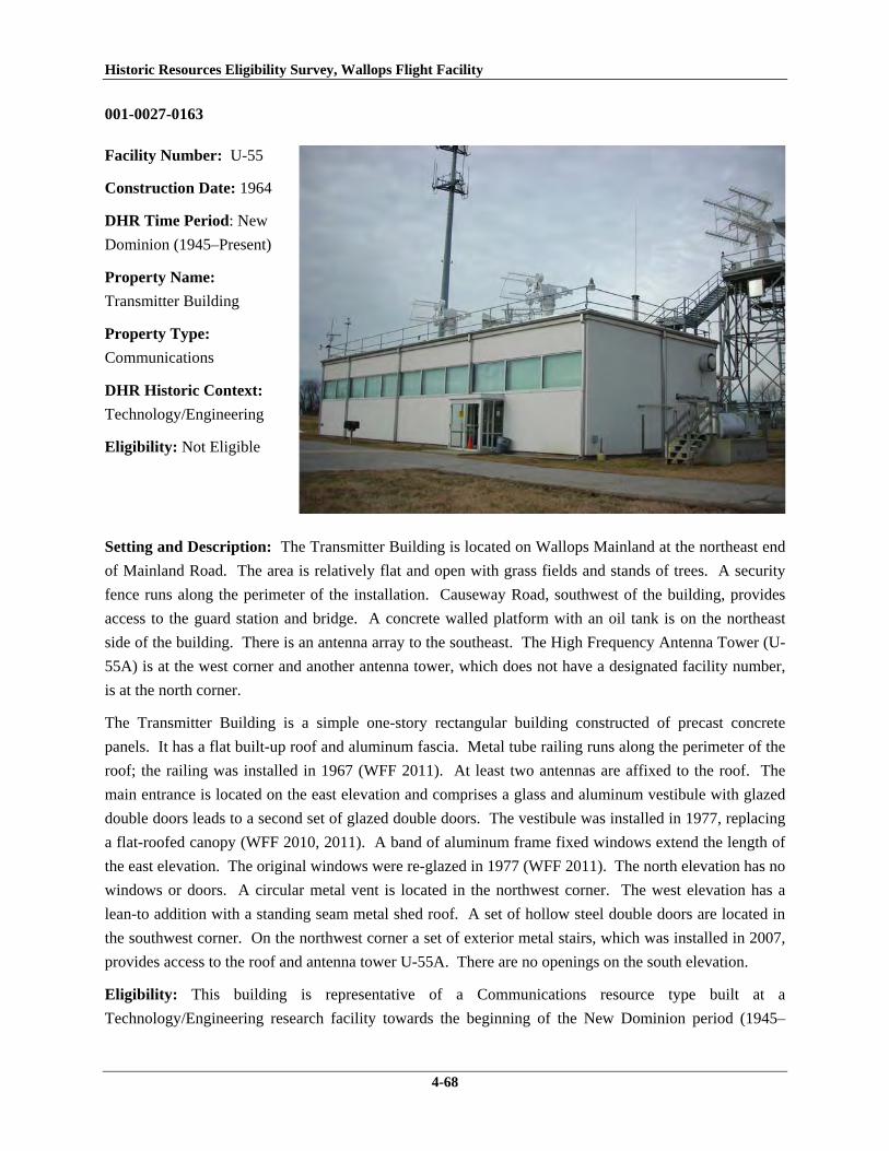
Historic Resources Eligibility Survey, Wallops Flight Facility
4-68
001-0027-0163
Facility Number: U-55
Construction Date: 1964
DHR Time Period: New
Dominion (1945–Present)
Property Name:
Transmitter Building
Property Type:
Communications
DHR Historic Context:
Technology/Engineering
Eligibility: Not Eligible
Setting and Description: The Transmitter Building is located on Wallops Mainland at the northeast end
of Mainland Road. The area is relatively flat and open with grass fields and stands of trees. A security
fence runs along the perimeter of the installation. Causeway Road, southwest of the building, provides
access to the guard station and bridge. A concrete walled platform with an oil tank is on the northeast
side of the building. There is an antenna array to the southeast. The High Frequency Antenna Tower (U-
55A) is at the west corner and another antenna tower, which does not have a designated facility number,
is at the north corner.
The Transmitter Building is a simple one-story rectangular building constructed of precast concrete
panels. It has a flat built-up roof and aluminum fascia. Metal tube railing runs along the perimeter of the
roof; the railing was installed in 1967 (WFF 2011). At least two antennas are affixed to the roof. The
main entrance is located on the east elevation and comprises a glass and aluminum vestibule with glazed
double doors leads to a second set of glazed double doors. The vestibule was installed in 1977, replacing
a flat-roofed canopy (WFF 2010, 2011). A band of aluminum frame fixed windows extend the length of
the east elevation. The original windows were re-glazed in 1977 (WFF 2011). The north elevation has no
windows or doors. A circular metal vent is located in the northwest corner. The west elevation has a
lean-to addition with a standing seam metal shed roof. A set of hollow steel double doors are located in
the southwest corner. On the northwest corner a set of exterior metal stairs, which was installed in 2007,
provides access to the roof and antenna tower U-55A. There are no openings on the south elevation.
Eligibility: This building is representative of a Communications resource type built at a
Technology/Engineering research facility towards the beginning of the New Dominion period (1945–

Historic Resources Eligibility Survey, Wallops Flight Facility
4-69
present). This is one of approximately 50 buildings and structures that were erected within six years of
the establishment of NASA and the incorporation of Wallops Station as one of its operational facilities in
1959. Initially, Wallops Station’s new mission under NASA was to develop and test various components
related to manned space flight. This mission was short-lived, however, as Wallops became a test range
and launch site for suborbital and orbital rockets and satellites beginning in the early 1960s. The
expansion of Wallops Station after becoming a NASA facility included acquisition of 216.6 acres on the
Mainland in 1959 (Shortal 1978). NASA constructed this building in 1964. It retains its original use as a
transmitter building.
U-55 has been evaluated both as a contributing resource in a historic district and as an individual
resource. No historic district on Wallops Mainland was identified because of a lack of significance (refer
to Section 4.2.1).
The Transmitter Building is not individually eligible for listing on the NRHP because it lacks significance
and integrity. The building is presently less than 50 years old; therefore, it was evaluated under Criteria
Consideration G in addition to Criteria A–D. The building is recommended not eligible under Criterion A
because it is not associated with an event or pattern of events of exceptional importance at the local, state,
or national level. It is not associated with the life of a person who made exceptionally important
contributions in history; therefore, it is recommended not eligible under Criterion B. U-55 is
recommended not eligible under Criterion C because it does not embody exceptional architectural merit
for distinctive characteristics of a type, period, or method of construction; represent the work of a master;
or possess high artistic value. Likewise, it does not represent an exceptionally significant or
distinguishable entity whose components may lack individual distinction. It is recommended not eligible
under Criterion D because it does not have the potential to yield information exceptionally important in
history or prehistory.
The overall integrity of the building has been compromised by several alterations. The building is in its
historical location. A second antenna tower has been erected at the north corner of the U-55 and a 1965
transmitting antenna (U-66) to the northwest has been dismantled; however, all other aspects of the
surrounding environment remain unchanged so the setting has not been adversely impacted. The design
and materials of the building have been compromised by alterations such as the installation of the
aluminum entry vestibule, re-glazing the windows, and the addition of a rear lean-to. These changes also
negatively impact the integrity of feeling, but not, however its workmanship and association.

Historic Resources Eligibility Survey, Wallops Flight Facility
4-70
001-0027-0164
Facility Number: U-55A
Construction Date: 1965
DHR Time Period: New
Dominion (1945–Present)
Property Name: High
Frequency Antenna Tower
Property Type:
Communications
DHR Historic Context:
Technology/Engineering
Eligibility: Not Eligible
Setting and Description: The High Frequency Antenna Tower is located on Wallops Mainland at the
northeast end of Mainland Road. The area is relatively flat and open with grass fields and stands of trees.
A security fence runs along the perimeter of the installation. To the southwest of the tower is Causeway
Road, which provides access to the guard station and bridge. U-55A is adjacent to the west corner of U-
55, its associated transmitter building. A concrete walled platform with an oil tank is on the northeast
side of the building and an antenna array is to the southeast.
The High Frequency Antenna Tower is a metal framed structure with four steel posts bolted to concrete
footings. It tapers at the third tier. Intersecting diagonal steel angles reinforce the metal corner posts. It
has two metal grated platforms: one on the top with metal tube handrails, and the other immediately
below it, accessed on the north by a metal ladder through the floor of the platform above. Metal stairs
with a metal tube handrail extend from the roof of U-55 to the top platform. The antenna rests on this
platform and along with two pieces of control equipment. A raised metal track, carrying cables, extends
from U-55. The antenna itself has seven metal mesh dishes with metal cylinders extending from them;
the three central units are smaller than the outer four. The metal cylinders are encircled by metal wires or
cables. A balancing or directional element extends to the rear.
Eligibility: This antenna tower is representative of a Communications resource type built at a
Technology/Engineering research facility towards the beginning of the New Dominion period (1945–
present). This is one of several dozens of buildings and structures erected within six years of the
Historic Resources Eligibility Survey, Wallops Flight Facility
4-71
establishment of NASA and the incorporation of Wallops Station as one of its operational facilities. The
facilities expansion included acquisition of 216.6 acres on the Mainland in 1959 (Shortal 1978). Initially,
Wallops Station’s new mission under NASA was to develop and test various components related to
manned space flight. This mission was short-lived, however, as Wallops became NASA’s test range and
launch site for suborbital and orbital rockets and satellites beginning in the early 1960s. NASA erected
this tower in 1965.
U-55A has been evaluated both as a contributing resource in a historic district and as an individual
resource. No historic district on Wallops Mainland was identified because of a lack of significance (refer
to Section 4.2.1).
The High Frequency Antenna Tower is not individually eligible for listing on the NRHP because it lacks
significance. The structure is presently less than 50 years old; therefore, it was evaluated under Criteria
Consideration G in addition to Criteria A–D. The tower is recommended not eligible under Criterion A
because it is not associated with an event or pattern of events of exceptional importance at the local, state,
or national level. It is not associated with the life of a person who made exceptionally important
contributions in history; therefore, it is recommended not eligible under Criterion B. U-55A retains
historic integrity; nonetheless, it is recommended not eligible under Criterion C because it does not
embody exceptional engineering merit for distinctive characteristics of a type, period, or method of
construction; represent the work of a master; or possess high artistic value. Likewise, it does not
represent an exceptionally significant or distinguishable entity whose components may lack individual
distinction. It is recommended not eligible under Criterion D because it does not have the potential to
yield information exceptionally important in history or prehistory.

Historic Resources Eligibility Survey, Wallops Flight Facility
4-72
001-0027-0165
Facility Number: U-60
Construction Date: 1964
DHR Time Period: New
Dominion (1945–Present)
Property Name: Collimation
Beacon and Tower
Property Type:
Communications
DHR Historic Context:
Technology/Engineering
Eligibility: Not Eligible
Setting and Description: The Collimation Beacon and Tower are located on Wallops Mainland, north of
Causeway Road on the west side of Mainland Road. The area is relatively flat and open with grass fields
and stands of trees. A security fence runs along the perimeter of the installation. A transmitter building
(U-60A) is at the tower’s base.
The Collimation Beacon and Tower is very similar to an Omni Transmitter Antenna, which was used by
the Navy for short range communications (Best et al. 1997). It consists of three metal poles, arranged in a
triangular configuration, connected by cross bars. The metal poles are bolted to square steel plates, which
are welded to a triangular steel base. A conducting wire, attached to the associated transmitter building
(U-60A), runs vertically through the middle. Diagonal wires extend from three sections of the structure to
the ground, creating a cross-shaped configuration. A small metal ladder extends to a small metal grated
platform at the top of the tower.
Eligibility: This tower is representative of a Communications resource type built at a
Technology/Engineering research facility towards the beginning of the New Dominion period (1945–
present). This is one of several dozens of buildings and structures erected within six years of the
establishment of NASA and the incorporation of Wallops Station as one of its operational facilities. The
facilities expansion included acquisition of 216.6 acres on the Mainland in 1959 (Shortal 1978). Initially,
Wallops Station’s new mission under NASA was to develop and test various components related to
manned space flight. This mission was short-lived, however, as Wallops became NASA’s test range and

Historic Resources Eligibility Survey, Wallops Flight Facility
4-73
launch site for suborbital and orbital rockets and satellites beginning in the early 1960s. This tower,
erected in 1964, was part of the AN/FPQ-6 radar system, which at the time was a modern long-range,
high-precision tracking radar (WFF 2011).
U-60 has been evaluated both as a contributing resource in a historic district and as an individual
resource. No historic district on Wallops Mainland was identified because of a lack of significance (refer
to Section 4.2.1).
The Collimation Beacon and Tower is not individually eligible for listing on the NRHP because it lacks
significance. The structure is presently less than 50 years old; therefore, it was evaluated under Criteria
Consideration G in addition to Criteria A–D. The tower is recommended not eligible under Criterion A
because it is not associated with an event or pattern of events of exceptional importance at the local, state,
or national level. It is not associated with the life of a person who made exceptionally important
contributions in history; therefore, it is recommended not eligible under Criterion B. U-55A retains
historic integrity; nonetheless, it is recommended not eligible under Criterion C because it does not
embody exceptional engineering merit for distinctive characteristics of a type, period, or method of
construction; represent the work of a master; or possess high artistic value. Likewise, it does not
represent an exceptionally significant or distinguishable entity whose components may lack individual
distinction. It is recommended not eligible under Criterion D because it does not have the potential to
yield information exceptionally important in history or prehistory.
001-0027-0166
Facility Number: U-64
Construction Date: 1965
DHR Time Period: New
Dominion (1945–Present)
Property Name:
Communications Antenna
Support Tower
Property Type:
Communications
DHR Historic Context:
Technology/Engineering
Eligibility: Not Eligible

Historic Resources Eligibility Survey, Wallops Flight Facility
4-74
Setting and Description: The Communications Antenna Support Tower is located on Wallops Mainland
at the northeast end of Mainland Road. The area is relatively flat and open with grass fields and stands of
trees. A security fence runs along the perimeter of the installation. To the southwest of the tower is
Causeway Road, which provides access to the guard station and bridge. There is a small temporary shed
at the south corner.
The Communications Antenna Support Tower is a tapered triangular metal tower with a vertical
cylindrical antenna. The antenna has a disc-shaped base. The 90 ft-tall tower has three steel posts
connected with steel cross bars. The posts are bolted to steel plates, which have been bolted to concrete
footings. Vertical wires run through the center and connect to the antenna.
Eligibility: This antenna tower is representative of a Communications resource type built at a
Technology/Engineering research facility towards the beginning of the New Dominion period (1945–
present). This is one of several dozens of buildings and structures erected within six years of the
establishment of NASA and the incorporation of Wallops Station as one of its operational facilities. The
facilities expansion included acquisition of 216.6 acres on the Mainland in 1959 (Shortal 1978). Initially,
Wallops Station’s new mission under NASA was to develop and test various components related to
manned space flight. This mission was short-lived, however, as Wallops became NASA’s test range and
launch site for suborbital and orbital rockets and satellites beginning in the early 1960s. NASA erected
this tower in 1965.
U-64 has been evaluated both as a contributing resource in a historic district and as an individual
resource. No historic district on Wallops Mainland was identified because of a lack of significance (refer
to Section 4.2.1).
The Communications Antenna Support Tower is not individually eligible for listing on the NRHP
because it lacks significance. The structure is presently less than 50 years old; therefore, it was evaluated
under Criteria Consideration G in addition to Criteria A–D. The tower is recommended not eligible under
Criterion A because it is not associated with an event or pattern of events of exceptional importance at the
local, state, or national level. It is not associated with the life of a person who made exceptionally
important contributions in history; therefore, it is recommended not eligible under Criterion B. U-55A
retains historic integrity; nonetheless, it is recommended not eligible under Criterion C because it does not
embody exceptional engineering merit for distinctive characteristics of a type, period, or method of
construction; represent the work of a master; or possess high artistic value. Likewise, it does not
represent an exceptionally significant or distinguishable entity whose components may lack individual
distinction. It is recommended not eligible under Criterion D because it does not have the potential to
yield information exceptionally important in history or prehistory.

Historic Resources Eligibility Survey, Wallops Flight Facility
4-75
001-0027-0167
Facility Number: U-70
Construction Date: 1964
DHR Time Period: New
Dominion (1945–Present)
Property Name: AN/FPQ-
6 Radar Building
Property Type: Research,
Development, and Testing
DHR Historic Context:
Technology/Engineering
Eligibility: Not Eligible
Setting and Description: The AN/FPQ-6 Radar Building is located on Wallops Mainland south of
Causeway Road, on the east side of Mainland Road. A paved access road is to the west of the building.
A creek lies to the east with tall grass surrounding it. A stand of trees is the west. A concrete parking lot
is in front of the building.
The AN/FPQ-6 Radar Building is a simple, one-story building with a flat roof and metal fascia and
concrete pile foundation (WFF 2011). EIFS covers the original brick exterior (WFF 2011). The main
entrance is on the southeast elevation and consists of a glass and aluminum vestibule with a single glazed
door, which leads to double glazed doors. Concrete stairs and a ramp with metal tube railing provide
access to the vestibule. Four one-over-one aluminum windows complete the openings on the elevation.
Two are located on either side of the vestibule. A brick knee wall extends from near the west end of the
southeast wall towards a concrete sidewalk. The southwest elevation has three entrances: two sets of
hollow steel double doors and a single hollow steel door in the center. Two entrances are raised with
concrete stairs leading to them. The northeast elevation has one single and one set of double hollow steel
doors. The northwest elevation has no openings.
The entire building was renovated in 2001. EIFS was installed over the brick exterior, original metal
frame windows set within a system of exterior panels were removed and new windows were installed in a
completely different fenestration pattern. All doors were replaced (the original doors had been replaced
in 1979 with new hollow metal doors) and a vestibule installed at the main entrance, which enclosed what
was a recessed entry. The built-up roofing system was also replaced (WFF 2011).
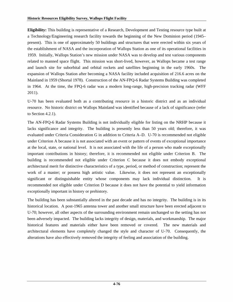
Historic Resources Eligibility Survey, Wallops Flight Facility
4-76
Eligibility: This building is representative of a Research, Development and Testing resource type built at
a Technology/Engineering research facility towards the beginning of the New Dominion period (1945–
present). This is one of approximately 50 buildings and structures that were erected within six years of
the establishment of NASA and the incorporation of Wallops Station as one of its operational facilities in
1959. Initially, Wallops Station’s new mission under NASA was to develop and test various components
related to manned space flight. This mission was short-lived, however, as Wallops became a test range
and launch site for suborbital and orbital rockets and satellites beginning in the early 1960s. The
expansion of Wallops Station after becoming a NASA facility included acquisition of 216.6 acres on the
Mainland in 1959 (Shortal 1978). Construction of the AN-FPQ-6 Radar Systems Building was completed
in 1964. At the time, the FPQ-6 radar was a modern long-range, high-precision tracking radar (WFF
2011).
U-70 has been evaluated both as a contributing resource in a historic district and as an individual
resource. No historic district on Wallops Mainland was identified because of a lack of significance (refer
to Section 4.2.1).
The AN-FPQ-6 Radar Systems Building is not individually eligible for listing on the NRHP because it
lacks significance and integrity. The building is presently less than 50 years old; therefore, it was
evaluated under Criteria Consideration G in addition to Criteria A–D. U-70 is recommended not eligible
under Criterion A because it is not associated with an event or pattern of events of exceptional importance
at the local, state, or national level. It is not associated with the life of a person who made exceptionally
important contributions in history; therefore, it is recommended not eligible under Criterion B. The
building is recommended not eligible under Criterion C because it does not embody exceptional
architectural merit for distinctive characteristics of a type, period, or method of construction; represent the
work of a master; or possess high artistic value. Likewise, it does not represent an exceptionally
significant or distinguishable entity whose components may lack individual distinction. It is
recommended not eligible under Criterion D because it does not have the potential to yield information
exceptionally important in history or prehistory.
The building has been substantially altered in the past decade and has no integrity. The building is in its
historical location. A post-1965 antenna tower and another small structure have been erected adjacent to
U-70; however, all other aspects of the surrounding environment remain unchanged so the setting has not
been adversely impacted. The building lacks integrity of design, materials, and workmanship. The major
historical features and materials either have been removed or covered. The new materials and
architectural elements have completely changed the style and character of U-70. Consequently, the
alterations have also effectively removed the integrity of feeling and association of the building.
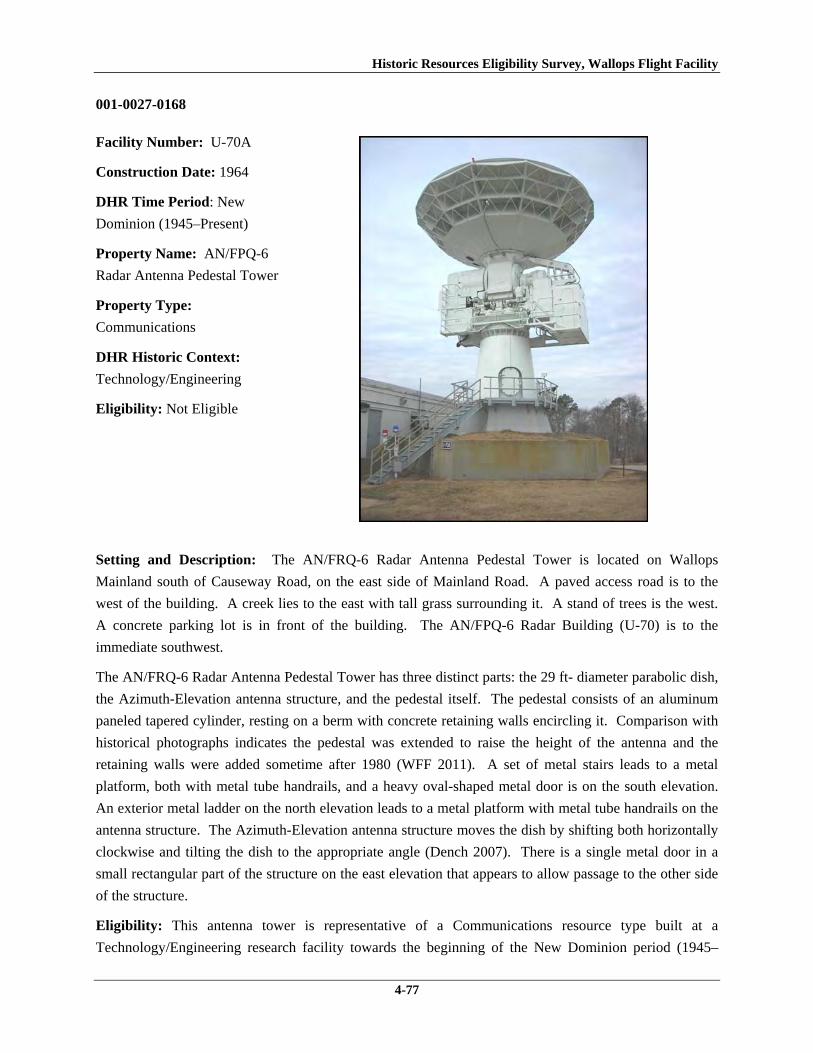
Historic Resources Eligibility Survey, Wallops Flight Facility
4-77
001-0027-0168
Facility Number: U-70A
Construction Date: 1964
DHR Time Period: New
Dominion (1945–Present)
Property Name: AN/FPQ-6
Radar Antenna Pedestal Tower
Property Type:
Communications
DHR Historic Context:
Technology/Engineering
Eligibility: Not Eligible
Setting and Description: The AN/FRQ-6 Radar Antenna Pedestal Tower is located on Wallops
Mainland south of Causeway Road, on the east side of Mainland Road. A paved access road is to the
west of the building. A creek lies to the east with tall grass surrounding it. A stand of trees is the west.
A concrete parking lot is in front of the building. The AN/FPQ-6 Radar Building (U-70) is to the
immediate southwest.
The AN/FRQ-6 Radar Antenna Pedestal Tower has three distinct parts: the 29 ft- diameter parabolic dish,
the Azimuth-Elevation antenna structure, and the pedestal itself. The pedestal consists of an aluminum
paneled tapered cylinder, resting on a berm with concrete retaining walls encircling it. Comparison with
historical photographs indicates the pedestal was extended to raise the height of the antenna and the
retaining walls were added sometime after 1980 (WFF 2011). A set of metal stairs leads to a metal
platform, both with metal tube handrails, and a heavy oval-shaped metal door is on the south elevation.
An exterior metal ladder on the north elevation leads to a metal platform with metal tube handrails on the
antenna structure. The Azimuth-Elevation antenna structure moves the dish by shifting both horizontally
clockwise and tilting the dish to the appropriate angle (Dench 2007). There is a single metal door in a
small rectangular part of the structure on the east elevation that appears to allow passage to the other side
of the structure.
Eligibility: This antenna tower is representative of a Communications resource type built at a
Technology/Engineering research facility towards the beginning of the New Dominion period (1945–

Historic Resources Eligibility Survey, Wallops Flight Facility
4-78
present). This is one of several dozens of buildings and structures erected within six years of the
establishment of NASA and the incorporation of Wallops Station as one of its operational facilities. The
facilities expansion included acquisition of 216.6 acres on the Mainland in 1959 (Shortal 1978). Initially,
Wallops Station’s new mission under NASA was to develop and test various components related to
manned space flight. This mission was short-lived, however, as Wallops became NASA’s test range and
launch site for suborbital and orbital rockets and satellites beginning in the early 1960s. NASA erected
this AN/FPQ-6 radar tower in 1964. At the time, the FPQ-6 radar was a modern long-range, high-
precision tracking radar (WFF 2011).
U-70A has been evaluated both as a contributing resource in a historic district and as an individual
resource. No historic district on Wallops Mainland was identified because of a lack of significance (refer
to Section 4.2.1).
The AN/FPQ-6 Radar Antenna Pedestal Tower is not individually eligible for listing on the NRHP
because it lacks significance. The structure is presently less than 50 years old; therefore, it was evaluated
under Criteria Consideration G in addition to Criteria A–D. The tower is recommended not eligible under
Criterion A because it is not associated with an event or pattern of events of exceptional importance at the
local, state, or national level. It is not associated with the life of a person who made exceptionally
important contributions in history; therefore, it is recommended not eligible under Criterion B. U-55A
retains historic integrity; nonetheless, it is recommended not eligible under Criterion C because it does not
embody exceptional engineering merit for distinctive characteristics of a type, period, or method of
construction; represent the work of a master; or possess high artistic value. Likewise, it does not
represent an exceptionally significant or distinguishable entity whose components may lack individual
distinction. It is recommended not eligible under Criterion D because it does not have the potential to
yield information exceptionally important in history or prehistory.
001-0027-0169
Facility Number: U-80
Construction Date: 1965
DHR Time Period: New
Dominion (1945–Present)
Property Name: Atmospheric
Physics Measurement Lab
Property Type: Research,
Development, and Testing
DHR Historic Context:
Technology/Engineering
Eligibility:

Historic Resources Eligibility Survey, Wallops Flight Facility
4-79
Setting and Description: The Atmospheric Physics Measurement Lab is located on Wallops Mainland
south of Causeway Road, on the east side of Mainland Road. A paved access road is to the west. A creek
lies to the east with tall grass surrounding it. There is a stand of trees to the west. A concrete parking lot
is in front of the building.
The Atmospheric Physics Measurement Lab is composed of several parts: the original building, the
observatory shelter, and an addition. The original building, constructed in 1965, and the addition,
constructed in 1967 (WFF 2011), are simple one-story concrete block buildings with flat roofs and metal
fascia. They rest on a concrete slab and their exterior finish is stucco. Both have one entrance through a
hollow steel door; the original building’s entrance is on the west elevation and the addition’s is on the
east. The addition originally had an overhead door on the east elevation (WFF 2010). Two one-over-one
aluminum frame windows with precast concrete sills are located on the south elevation of the original
building and the west elevation of the addition. The windows were originally two-over-two, double-
hung-sash units (WFF 2010). The addition has a satellite or additional observatory on its roof, which is
surrounding by metal tube railing. A metal staircase on the south elevation provides access to the roof.
The observatory shelter was erected in 1966 on a reinforced concrete continuous footing (WFF 2010).
The shelter comprises a hemispherical aluminum dome 24 ft in diameter on an aluminum base cylinder.
The exterior finish of the entire structure is a natural polished aluminum (WFF 2011). The dome opens to
the east sky by moving on a track mounted on the top of the dome. The observatory is connected to the
original building and the addition by two concrete block hyphens. U-80 has been mothballed since 1999
(WFF 2011).
Eligibility: This building is representative of a Research, Development and Testing resource type built at
a Technology/Engineering research facility towards the beginning of the New Dominion period (1945–
present). This is one of approximately 50 buildings and structures that were erected within six years of
the establishment of NASA and the incorporation of Wallops Station as one of its operational facilities in
1959. Initially, Wallops Station’s new mission under NASA was to develop and test various components
related to manned space flight. This mission was short-lived, however, as Wallops became a test range
and launch site for suborbital and orbital rockets and satellites beginning in the early 1960s. The
expansion of Wallops Station after becoming a NASA facility included acquisition of 216.6 acres on the
Mainland in 1959 (Shortal 1978). NASA constructed this building in 1965 as the Special Optics Building
and Observatory Dome. The building contained long-range photo-optical equipment and a special TV
system to track launched vehicles. The building received its current name as the Atmospheric Physics
Measurement Laboratory in 1979 (WFF 2011).
U-80 has been evaluated both as a contributing resource in a historic district and as an individual
resource. No historic district on Wallops Mainland was identified because of a lack of significance (refer
to Section 4.2.1).
The Atmospheric Physics Measurement Laboratory is not individually eligible for listing on the NRHP
because it lacks significance. The building is presently less than 50 years old; therefore, it was evaluated
under Criteria Consideration G in addition to Criteria A–D. U-80 is recommended not eligible under

Historic Resources Eligibility Survey, Wallops Flight Facility
4-80
Criterion A because it is not associated with an event or pattern of events of exceptional importance at the
local, state, or national level. It is not associated with the life of a person who made exceptionally
important contributions in history; therefore, it is recommended not eligible under Criterion B. The
building is recommended not eligible under Criterion C because it does not embody exceptional
architectural merit for distinctive characteristics of a type, period, or method of construction; represent the
work of a master; or possess high artistic value. Likewise, it does not represent an exceptionally
significant or distinguishable entity whose components may lack individual distinction. It is
recommended not eligible under Criterion D because it does not have the potential to yield information
exceptionally important in history or prehistory.
4.3 Wallops Island
Thirty-four of the 76 resources surveyed are on Wallops Island (Figures 5a and 5b; Table 4). Two are
antennas, 27 are buildings, and five are structures. These resources represent six property types: 13 are
storage; seven are research, development, and testing; seven are infrastructure; five are industrial; and two
are communications. Eleven resources are less than 50 years old, including one antenna.
Table 4. Resources Surveyed on Wallops Island VDHR ID Number
WFF ID Number
Property Name Date of Construction
001-0027-0170 V-25 Inert Payload Assembly & Checkout Building
1957
001-0027-0171 V-30 Ammunition Magazine 1958
001-0027-0172 V-42 Ready Service Chemical Storage Magazine
1956
001-0027-0173 V-45 Horizontal Dynamic Balance Test Building
1963
001-0027-0174 V-50 Dynamic Balance Control Center 1963 001-0027-0175 V-50A Utility Canopy 1963
001-0027-0176 V-52 Ready Service Chemical Storage Magazine
1956
001-0027-0177 V-55 Vertical Dynamic Balance Test Building 1963 001-0027-0178 V-80 Rocket Motor Ready Storage Building 1963 001-0027-0179 W-10 Launch Area Terminal Building 1960 001-0027-0180 W-15 Assembly Shop No. 4 1957 001-0027-0181 W-16 Ready Storage Cubicle 1957 001-0027-0182 W-20 Blockhouse No. 3 1960 001-0027-0183 W-35 Terminal Building Launch Area 4 1960 001-0027-0184 W-40 Assembly Shop No. 5 1960 001-0027-0185 W-50 Launch Area Cable Terminal Building 1960 001-0027-0186 W-51 Flammables Storehouse Ready Magazine 1956 001-0027-0187 W-57 Microwave Rain Attenuation Tower 1961 001-0027-0188 W-65 Checkout and Assembly Shop No. 3 1963 001-0027-0189 W-67 Ready Issue Explosives Storage Cubicle 1957 001-0027-0190 X-005A Pathfinder Radar Antenna Tower 1966 001-0027-0191 X-75 Island Terminal Building 1960 001-0027-0192 X-85 Special Projects Building 1963 001-0027-0193 Y-10 Fuel Storage Magazine 1957 001-0027-0194 Y-16 Flammables Storehouse Ready Magazine 1957

Historic Resources Eligibility Survey, Wallops Flight Facility
4-81
Table 4. Resources Surveyed on Wallops Island (cont) VDHR ID Number
WFF ID Number
Property Name Date of Construction
001-0027-0195 Y-20 Ordnance and Explosives Ready Issue Storage Magazine
1957
001-0027-0196 Y-37 Firing Cubicle 1956
001-0027-0197 Y-38 Launcher Equipment Shelter Hydraulic Pump House
1965
001-0027-0198 Y-55 Army/Navy Fixed Radar Surveillance 16 (AN/FPS-16) Radar Operations Building
1958
001-0027-0199 Y-95 Camera Platform 1964 001-0027-0200 Y-110 Camera Platform with 10 ft Astrodome 1964 001-0027-0126* Z-20 Liquid Propellant Storage 1961 001-0027-0127* Z-25 Liquid Propellant Storage 1961 001-0027-0201 Z-40 Launch Area 0 Service Building 1960
* Z-20 and Z-25 were surveyed in November 2010, in advance of this larger survey effort due to proposed demolition of the two buildings.

Historic Resources Eligibility Survey, Wallops Flight Facility
4-82
Figure 5a. Resources Surveyed on Wallops Island
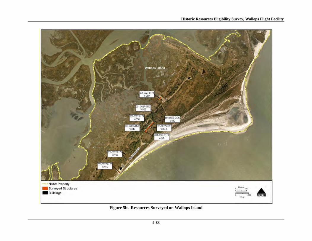
Historic Resources Eligibility Survey, Wallops Flight Facility
4-83
Figure 5b. Resources Surveyed on Wallops Island

Historic Resources Eligibility Survey, Wallops Flight Facility
4-84
4.3.1 Historic District Evaluation
The surveyed buildings on Wallops Island have been evaluated as contributing resources in a historic
district. Issues of significance, integrity, and boundaries were carefully considered for a proposed district.
The evaluation of a historic district considered a period of significance from 1936 to 1965 by building
upon (and reexamining) the results and analysis of the 2004 survey. As such, in addition to a historic
district associated with the early period of NASA’s Wallops Station, the analysis also examined the
possibility of a historic district associated with the Navy’s NAOTS and one associated with NACA’s
PARS.
The evaluation determined that a historic district associated with the NAOTS is not present because of an
absence of historical resources and elements. Between 1946 and 1959, the Navy used the north end of
Wallops Island as a target range. Other than the road network, no buildings, structures, or features remain
from the period of occupation by the Navy. With no major buildings or features extant, a historic district
associated with the NAOTS is not present.
The evaluation determined that a historic district associated with NACA is not present because of a lack
of integrity. NACA developed the south half of Wallops Island between 1945 and 1958 as a rocket
testing facility. PARS included launch facilities, control centers, shops, camera stations, and explosives
magazines. Only two buildings from approximately 20 buildings and structures built during the earliest
period (1946–1947) are extant. Although many resources constructed between 1948 and 1958 survive,
the majority of these have received substantial alterations, including façade reconfigurations, window and
door replacement, installation of contemporary roof and siding materials, and removal of historic
instruments and equipment. The altered state of the resources inhibits their ability to collectively convey
the early history of the site. Changes to the setting of the facility also adversely affect the integrity of the
district. Several post-1965 resources have been constructed on the island, including two very tall
buildings north of Launch Area 5 (all other facilities on the island are one to three stories). Three launch
pads have been added, one south of Launch Area 3b and two south of Launch Area 2, and Launch Areas
1, 2, and 3b have been enlarged, the two former ones substantially so, by extended launch pads. Launch
Area 5 is no longer in use, as it is currently the site of a construction project. The road network has been
changed by the addition of North Bypass Road. Most recently, the historical timber pile seawall and
groins have been removed and replaced with large riprap. Collectively, the changes in setting as well as
the substantial alterations to historical resources have compromised the integrity of setting, design,
materials, workmanship, and feeling from the early Cold War era. Lacking integrity, a PARS historic
district in the south part of Wallops Island does not meet the NRHP Criteria for Evaluation; therefore, it is
not eligible for listing on the NRHP.
The architectural resources were evaluated collectively as contributing resources of a historic district
associated with NASA’s early operations in manned space flight and space science research at Wallops
Station. Wallops Island does not constitute a NRHP-eligible historic district because of a lack of
significance and integrity. A historic district on the island is not eligible under Criterion A because WFF
Historic Resources Eligibility Survey, Wallops Flight Facility
4-85
is not associated with events that have made a significant contribution to the broad patterns of our history.
Wallops served an important role as the NASA rocket test range, enabling the facility to fulfill its mission
for NASA programs as well as expand its scientific research capabilities to non-military and non-
government entities. However, the Wallops facility and the operations that occurred here between 1959
and 1965 were not central to the NASA organization. Wallops did not have a leading role in the research
and development of major NASA programs. For a brief period, Wallops was involved in Project Mercury
by testing hardware, training support personnel, and being the site for two unmanned flights; however, the
most important developments of this major mission, particularly astronauts ascending into orbit, occurred
at other facilities. From its start in 1959, Wallops was a “service center” in the NASA organization,
supporting the projects of the NASA “field centers” such as Houston and Cape Canaveral, for instance,
which had the high priority NASA missions. Furthermore, the projects performed at Wallops that
involved the launching, tracking, and acquisition of data from rockets using radar and radio-telemetry
techniques “could have been, and often were, conducted from other facilities” (Wallace 1997, 108).
Thus, the mission and activities of Wallops Station were not singular or exceptional to the history of
NASA in this period.
Documentary research has not revealed information that a historic district on Wallops Island is eligible
for the NRHP under Criterion B for association with persons significant in our past.
The resources on Wallops Island do not constitute a historic district under Criterion C because they do not
embody the distinctive characteristics of a type, period, or method of construction; represent the work of a
master; possess high artistic value; or represent a significant or distinguishable entity whose components
may lack individual distinction. NASA took over an older installation and renovated the existing
facilities to meet its functional and space requirements and added its own buildings and structures to the
base over time. Design and development of individual components was typically based on expediency
and did not follow a master plan. The result is an irregular layout of buildings and features and an
incohesive mix of massing, forms, and surface materials. In fact, during a 1964 review of planning and
construction of existing NASA facilities, the House Committee of Science and Aeronautics called
Wallops’ layout “confused and congested” and concluded that “[NASA] builds no monuments here”
(Wallace 1997, 110, 111). None of the buildings evaluated in this survey and in the 2004 survey
possesses architectural significance for their building type, period, or method of construction.
A historic district eligible under Criterion D is not present on the island because no surveyed architectural
resources were found to have the potential to yield additional information important in history or
prehistory.
Additionally, Wallops Island does not constitute or contain a NRHP-eligible historic district because of a
loss of integrity. The aspect of integrity of location remains intact because only a small percentage of the
resources have been moved. The integrity of setting has been compromised by the addition of several
post-1965 resources to the base, including two very tall buildings north of Launch Area 5 (all other
facilities on the island are one to three stories). Additionally, three launch pads have been added, one
south of Launch Area 3b and two south of Launch Area 2, and Launch Areas 1, 2, and 3b have been

Historic Resources Eligibility Survey, Wallops Flight Facility
4-86
enlarged, the two former ones substantially so, by extended launch pads. Launch Area 5 is no longer in
use, as it is currently the site of a construction project. Most recently, the historical timber pile seawall
and groins have been removed and replaced with large riprap. The integrity of design has not been
reduced by the addition of North Bypass Road to the historical road network. Spatial relationships
between major features, however, appear to be intact. There is a lack of integrity of materials and
workmanship as a result of substantial alterations that have been made to the majority of the pre-1965
resources, including several of the primary ones directly associated with the historical mission of the
facility. The alterations include façade reconfigurations, window and door replacement, and installation
of contemporary roof and siding materials. These renovations, undertaken within the past 20 to 30 years,
have changed the overall design and form of the buildings and structures. The cumulative changes in
setting, materials, and workmanship have adversely affected the integrity of feeling and association of the
site.
4.3.2 Individual Resource Evaluations
001-0027-0170
Facility Number: V-25
Construction Date: 1957
DHR Time Period: New
Dominion (1945–Present)
Property Name: Inert
Payload Assembly and
Checkout Building
Property Type: Industrial
DHR Historic Context:
Military/Defense,
Technology/Engineering
Eligibility: Not Eligible
Setting and Description: The Inert Payload Assembly and Checkout Building is located on the north
half of Wallops Island, immediately west of North Seawall Road. The building is adjacent to the Atlantic
Ocean and large riprap along the shore is visible from the site. The area immediately around the building
is characterized by mown grass, but farther out there is tall sea grass. The building is surrounded by a
concrete pad and a gravel parking lot is across the street.
The Inert Payload Assembly and Checkout Building is a simple, one-story concrete block building with a
flat built-up roof and aluminum fascia. The northeast portion of the building was added in 1968, and is

Historic Resources Eligibility Survey, Wallops Flight Facility
4-87
about 3 ½ ft taller than the rest of the building (WFF 2011). There are two shed-roofed lean-tos on the
northwest side of the building; no information indicating when these were built was found. The building
rests on a reinforced concrete foundation.
The southeast elevation consists of four openings. A replacement overhead steel rolling door is centered
in the taller portion of the building. The other portion is divided into three bays by two projecting
concrete block columns. The first bay has a window opening covered by plywood, the second contains a
single hollow steel door, and the third has a set of double hollow steel doors. The northeast elevation has
a single hollow steel door in the north corner and two large openings, divided by a concrete block column.
The opening is covered by a translucent panel, which is also used on the northwest elevation. The
northeast elevation of the building has one set of double hollow steel doors with a concrete stoop. All the
personnel doors are replacements.
Openings on the northwest elevation are located in the lean-tos. The 1968 lean-to has a single hollow
steel door; the other lean-to has a double hollow steel door. The northeast elevation of this lean-to has a
six-light aluminum window with a precast concrete sill.
Eligibility: This building is representative of an Industrial resource type built near the beginning of the
New Dominion period (1945–present) at a Technology/Engineering research facility. NACA established
the Auxiliary Flight Research Station in the southern portion of Wallops Island in 1945 for aeronautical
research. In mid-1946, this facility was renamed the Pilotless Aircraft Research Station (PARS) and
functioned as a rocket testing facility. By the mid-1950s, the testing program at PARS concentrated on
hypersonic missiles. Substantial development occurred at PARS between 1946 and 1954. After 1954,
buildings and structures generally were constructed as needed to meet workload and research program
requirements. NACA constructed this building in 1957; its original use was not found. After the base
was transferred to NASA, the building was an auxiliary range facility. It was designated the Inert
Payload Assembly and Checkout Building in 1968. The building has been mothballed since 2000 (WFF
2011).
V-25 has been evaluated both as a contributing resource in a historic district and as an individual
resource. No historic district on Wallops Island was identified because of a lack of significance and
integrity (refer to Section 4.3.1).
The Inert Payload Assembly and Checkout Building is not individually eligible for listing on the NRHP
because it lacks significance and integrity. The building is recommended not eligible under Criterion A
because it is not associated with an event or pattern of events of local, state, or national significance. It is
not associated with the life of a person significant in our past; therefore, it is recommended not eligible
under Criterion B. The building is of simple design and common construction and, therefore, is
recommended not eligible under Criterion C because it does not embody the distinctive characteristics of
a type, period, or method of construction; represent the work of a master; possess high artistic value; or
represent a significant or distinguishable entity whose components may lack individual distinction. It is

Historic Resources Eligibility Survey, Wallops Flight Facility
4-88
recommended not eligible under Criterion D because it does not have the potential to yield information
important in history or prehistory.
The building is in its historical location. A large post-1965 building has been constructed adjacent to the
east of V-25, thus diminishing the setting of the property. The design, materials, and workmanship of the
building has been negatively impacted by the large 1968 addition on the northeast end, two smaller lean-
to additions on the rear, the replacement of original personnel and overhead doors, and the obstruction of
a window with plywood. The integrity of feeling and association have been diminished by the cumulative
changes in setting, design, materials, and workmanship.
001-0027-0171
Facility Number: V-30
Construction Date: 1958
DHR Time Period: New
Dominion (1945–Present)
Property Name:
Ammunition Magazine
Property Type: Storage
DHR Historic Context:
Military/Defense,
Technology/Engineering
Eligibility: Not Eligible
Setting and Description: The Ammunition Magazine is located on the north half of Wallops Island,
immediately west of North Seawall Road. The structure is adjacent to the ocean; large riprap along the
shore is visible from the site. The grass immediately around the building is mowed, but farther out there
is tall grass and trees. A concrete paved lane provides access to the building.
The Ammunition Magazine is a magazine built into an earthen berm. The opening faces northeast and
consists of a steel plate face bolted to a concrete arch. Metal channels, bolted to the face, act as
buttresses. Two tall and wide steel doors, centered in the steel face, provide access to the magazine.
Wood posts and planks act as a retaining wall on both sides of the steel face. The wood posts are set in
sand and fastened to the steel face with nuts and bolts. A metal tube vent pierces the southwest part of the
earthen berm.
Eligibility: This building is representative of an Industrial resource type built near the beginning of the
New Dominion period (1945–present) at a Technology/Engineering research facility. NACA established
Historic Resources Eligibility Survey, Wallops Flight Facility
4-89
the Auxiliary Flight Research Station in the southern portion of Wallops Island in 1945 for aeronautical
research. In mid-1946, this facility was renamed the Pilotless Aircraft Research Station (PARS) and
functioned as a rocket testing facility. By the mid-1950s, the testing program at PARS concentrated on
hypersonic missiles. Substantial development occurred at PARS between 1946 and 1954. After 1954,
buildings and structures generally were constructed as needed to meet workload and research program
requirements. NACA built this storage magazine in 1958. After the base was transferred to NASA, the
structure was used for explosives handling and storage. It may also have been used for electric power
equipment storage (WFF 2011). It currently stores ammunition.
V-30 has been evaluated both as a contributing resource in a historic district and as an individual
resource. No historic district on Wallops Island was identified because of a lack of significance and
integrity (refer to Section 4.3.1).
The Ammunition Magazine is not individually eligible for listing on the NRHP because it lacks
significance. The structure is recommended not eligible under Criterion A because it is not associated
with an event or pattern of events of local, state, or national significance. It is not associated with the life
of a person significant in our past; therefore, it is recommended not eligible under Criterion B. The
structure is recommended not eligible under Criterion C because earthen-bermed magazines were built by
the thousands at military installations across the U.S. (U.S. Army Corps of Engineers 1997). V-30 is not
a rare or prototype ammunition magazine. Therefore, it does not embody the distinctive characteristics of
a type, period, or method of construction; represent the work of a master; possess high artistic value; or
represent a significant or distinguishable entity whose components may lack individual distinction. It is
recommended not eligible under Criterion D because it does not have the potential to yield information
important in history or prehistory.

Historic Resources Eligibility Survey, Wallops Flight Facility
4-90
001-0027-0173
Facility Number: V-45
Construction Date: 1963
DHR Time Period: New
Dominion (1945–Present)
Property Name:
Horizontal Dynamic
Balance Test Building
Property Type: Research,
Development, and Testing
DHR Historic Context:
Technology/Engineering
Eligibility: Not Eligible
Setting and Description: The Horizontal Dynamic Balance Test Building is located on the north half of
Wallops Island, southeast of North Seawall Road. The area is rural and isolated, surrounded by mostly
pine trees. It is connected to the central Dynamic Balance Control Center (V-50) and the Vertical
Dynamic Balance Test Building (V-55) by a covered walkway (V-50A). V-50A connects to the northeast
elevation; beyond the walkway is an asphalt access road.
The Horizontal Dynamic Balance Test Building is a utilitarian building, resting on a reinforced concrete
slab foundation that extends beyond the wall and has chamfered edges. The walls are built of precast
concrete panels, with the top third constructed of translucent metal panels. The building terminates in a
flat built-up roof and metal fascia. There is a lean-to on the northeast elevation that is also constructed of
precast concrete panels and a flat roof and metal fascia. An exterior ladder extends from the roof of the
lean-to the roof of the main building.
The main point of access is on the northwest elevation through a central overhead rolling door. The
northeast elevation has a single hollow steel door in the north corner, under the covered walkway (V-
50A). The northeast elevation of the lean-to has a single half-glazed metal door and a single hollow steel
door. The southeast elevation has a central metal door and is sheathed in corrugated metal. The
southwest elevation has no openings.
Eligibility: This building is representative of a Research, Development and Testing resource type built at
a Technology/Engineering research facility towards the beginning of the New Dominion period (1945–
present). This is one of approximately 50 buildings and structures that were erected within six years of
the establishment of NASA and the incorporation of Wallops Station as one of its operational facilities in

Historic Resources Eligibility Survey, Wallops Flight Facility
4-91
1959. Initially, Wallops Station’s new mission under NASA was to develop and test various components
related to manned space flight. This mission was short-lived, however, as Wallops became a test range
and launch site for suborbital and orbital rockets and satellites beginning in the early 1960s. NASA
erected this building in 1963 as part of the Dynamic Balance Facility.
The Horizontal Dynamic Balance Test Building has been evaluated both as a contributing resource in a
historic district and as an individual resource. No historic district on Wallops Island was identified
because of a lack of significance and integrity (refer to Section 4.3.1).
V-45 is not individually eligible for listing on the NRHP because it lacks significance. The building is
presently less than 50 years old; therefore, it was evaluated under Criteria Consideration G in addition to
Criteria A–D. The building is recommended not eligible under Criterion A because it is not associated
with an event or pattern of events of exceptional importance at the local, state, or national level. It is not
associated with the life of a person who made exceptionally important contributions in history; therefore,
it is recommended not eligible under Criterion B. The building retains its historic integrity; nonetheless,
it is recommended not eligible under Criterion C because it does not embody exceptional architectural
merit for distinctive characteristics of a type, period, or method of construction; represent the work of a
master; or possess high artistic value. Likewise, it does not represent an exceptionally significant or
distinguishable entity whose components may lack individual distinction. It is recommended not eligible
under Criterion D because it does not have the potential to yield information exceptionally important in
history or prehistory.
001-0027-0174
Facility Number: V-50
Construction Date: 1963
DHR Time Period: New
Dominion (1945–Present)
Property Name: Dynamic
Balance Control Center
Property Type: Research,
Development, and Testing
DHR Historic Context:
Technology/Engineering
Eligibility: Not Eligible

Historic Resources Eligibility Survey, Wallops Flight Facility
4-92
Setting and Description: The Dynamic Balance Control Center is located on the north half of Wallops
Island, southeast of North Seawall Road. The area is rural and isolated, surrounded by mostly pine trees.
V-50 is connected to two flanking buildings, V-45 and V-55, by a covered walkway, V-50A. V-50A runs
along the northwest elevation of the building; beyond the walkway is an asphalt parking lot and a paved
lane leading from an access road to the building. There is a concrete walled structure on the north side of
the building that contains an oil tank and a raised concrete pad for a generator or utility box.
The Dynamic Balance Control Center is a simple, one-story rectangular concrete building with a flat
built-up roof and metal fascia. The walls are 10-inch-thick reinforced concrete with an EIFS exterior
finish, which was installed in 1989 (WFF 2011). The main entrance is on the northwest elevation, under
the covered walkway (V-50A), and consists of a central single hollow steel door with an aluminum frame.
There is a secondary entrance through a set of double solid steel doors on the southeast elevation. There
are no other openings.
Eligibility: This building is representative of a Research, Development and Testing resource type built at
a Technology/Engineering research facility towards the beginning of the New Dominion period (1945–
present). This is one of approximately 50 buildings and structures that were erected within six years of
the establishment of NASA and the incorporation of Wallops Station as one of its operational facilities in
1959. Initially, Wallops Station’s new mission under NASA was to develop and test various components
related to manned space flight. This mission was short-lived, however, as Wallops became a test range
and launch site for suborbital and orbital rockets and satellites beginning in the early 1960s. NASA
erected this building in 1963 to serve as the control center for the tests that were performed in the
horizontal and vertical dynamic test buildings (V-45 and V-55).
V-50 has been evaluated both as a contributing resource in a historic district and as an individual
resource. No historic district on Wallops Island was identified because of a lack of significance and
integrity (refer to Section 4.3.1).
The Dynamic Balance Control Center is not individually eligible for listing on the NRHP because it lacks
significance. The building is presently less than 50 years old; therefore, it was evaluated under Criteria
Consideration G in addition to Criteria A–D. The building is recommended not eligible under Criterion A
because it is not associated with an event or pattern of events of exceptional importance at the local, state,
or national level. It is not associated with the life of a person who made exceptionally important
contributions in history; therefore, it is recommended not eligible under Criterion B. The building retains
its historic integrity; nonetheless, it is recommended not eligible under Criterion C because it does not
embody exceptional architectural merit for distinctive characteristics of a type, period, or method of
construction; represent the work of a master; or possess high artistic value. Likewise, it does not
represent an exceptionally significant or distinguishable entity whose components may lack individual
distinction. It is recommended not eligible under Criterion D because it does not have the potential to
yield information exceptionally important in history or prehistory.

Historic Resources Eligibility Survey, Wallops Flight Facility
4-93
001-0027-0175
Facility Number: V-
50A
Construction Date:
1963
DHR Time Period:
New Dominion (1945–
Present)
Property Name: Utility
Canopy
Property Type:
Infrastructure
DHR Historic Context:
Technology/Engineering
Eligibility: Not Eligible
Setting and Description: The Utility Canopy is located on the north half of Wallops Island, southeast of
North Seawall Road. The area is rural and isolated, surrounded by mostly pine trees. V-50A is a covered
walkway connecting the Dynamic Balance Control Center (V-50) to two flanking buildings, V-45 and V-
55. V-45 is on the southwest and V-55 is on the northeast.
The covered walkway consists of hollow steel columns, spaced 15 ft apart, supporting steel I beams that
frame the roof structure. A corrugated aluminum butterfly roof provides a canopy. Four galvanized
metal channels on the southeast elevation, located about 4 ft off the ground, extend to all three buildings,
carrying cables. These channels are screened on the southeast by corrugated-transite (asbestos-cement)
boards. The canopy structure covers a 4 ft-wide concrete sidewalk.
Eligibility: This structure is a secondary resource type built at a Technology/Engineering research
facility towards the beginning of the New Dominion period (1945–present). This is one of approximately
50 buildings and structures that were erected within six years of the establishment of NASA and the
incorporation of Wallops Station as one of its operational facilities in 1959. Initially, Wallops Station’s
new mission under NASA was to develop and test various components related to manned space flight.
This mission was short-lived, however, as Wallops became a test range and launch site for suborbital and
orbital rockets and satellites beginning in the early 1960s. NASA erected this structure in 1963 as part of
the Dynamic Balance Facility. It provides a covered walkway and supports a series of utility conduits
that extend between the horizontal and vertical dynamic test buildings (V-45 and V-55) and control center
(V-50).

Historic Resources Eligibility Survey, Wallops Flight Facility
4-94
V-50A has been evaluated both as a contributing resource in a historic district and as an individual
resource. No historic district on Wallops Island was identified because of a lack of significance and
integrity (refer to Section 4.3.1).
This utility canopy is not individually eligible for listing on the NRHP because it lacks significance. The
structure is presently less than 50 years old; therefore, it was evaluated under Criteria Consideration G in
addition to Criteria A–D. It is recommended not eligible under Criterion A because it is not associated
with an event or pattern of events of exceptional importance at the local, state, or national level. The
structure is not associated with the life of a person who made exceptionally important contributions in
history; therefore, it is recommended not eligible under Criterion B. The structure retains historic
integrity; nonetheless, it is recommended not eligible under Criterion C because it does not embody
exceptional architectural merit for distinctive characteristics of a type, period, or method of construction;
represent the work of a master; or possess high artistic value. Likewise, it does not represent an
exceptionally significant or distinguishable entity whose components may lack individual distinction. It
is recommended not eligible under Criterion D because it does not have the potential to yield information
exceptionally important in history or prehistory.
001-0027-0177
Facility Number: V-55
Construction Date: 1963
DHR Time Period: New
Dominion (1945–Present)
Property Name: Vertical
Dynamic Balance Test
Building
Property Type: Research,
Development, and Testing
DHR Historic Context:
Technology/Engineering
Eligibility: Not Eligible
Setting and Description: The Vertical Dynamic Balance Test Building is located on the north half of
Wallops Island, southeast of North Seawall Road. The area is rural and isolated, surrounded by mostly
pine trees. It is connected to a central building, V-50, and another building, V-45, by a covered walkway,
V-50A. V-50A connects to the southwest elevation; beyond the walkway is an asphalt-paved access road.
Historic Resources Eligibility Survey, Wallops Flight Facility
4-95
The Dynamic Balance Test Building is a utilitarian building, resting on a reinforced concrete slab
foundation that extends beyond the walls and has chamfered edges. The walls are built of precast
concrete panels, with the top third constructed of translucent metal panels. The building terminates in a
flat built-up roof and metal fascia. It is almost identical to V-45, except that it is several feet taller. There
is a lean-to on the northeast elevation that is also constructed of precast concrete panels and a flat roof and
metal fascia. An exterior ladder extends from the roof of the lean-to to the roof of the main building.
The main point of entry is on the northwest elevation through a large central overhead canvas door. The
northeast elevation has a single hollow steel door in the north corner, under the covered walkway (V-
50A). The northeast elevation of the lean-to has a single half-glazed metal door and a single hollow steel
door. The southeast elevation has a central metal door and is sheathed in corrugated metal. The
southwest elevation has no openings.
Eligibility: This building is representative of a Research, Development and Testing resource type built at
a Technology/Engineering research facility towards the beginning of the New Dominion period (1945–
present). This is one of approximately 50 buildings and structures that were erected within six years of
the establishment of NASA and the incorporation of Wallops Station as one of its operational facilities in
1959. Initially, Wallops Station’s new mission under NASA was to develop and test various components
related to manned space flight. This mission was short-lived, however, as Wallops became a test range
and launch site for suborbital and orbital rockets and satellites beginning in the early 1960s. NASA
erected this building in 1963 as part of the Dynamic Balance Facility.
The Vertical Dynamic Balance Test Building has been evaluated both as a contributing resource in a
historic district and as an individual resource. No historic district on Wallops Island was identified
because of a lack of significance and integrity (refer to Section 4.3.1).
V-55 is not individually eligible for listing on the NRHP because it lacks significance. The building is
presently less than 50 years old; therefore, it was evaluated under Criteria Consideration G in addition to
Criteria A–D. The building is recommended not eligible under Criterion A because it is not associated
with an event or pattern of events of exceptional importance at the local, state, or national level. It is not
associated with the life of a person who made exceptionally important contributions in history; therefore,
it is recommended not eligible under Criterion B. The building retains its historic integrity; nonetheless,
it is recommended not eligible under Criterion C because it does not embody exceptional architectural
merit for distinctive characteristics of a type, period, or method of construction; represent the work of a
master; or possess high artistic value. Likewise, it does not represent an exceptionally significant or
distinguishable entity whose components may lack individual distinction. It is recommended not eligible
under Criterion D because it does not have the potential to yield information exceptionally important in
history or prehistory.

Historic Resources Eligibility Survey, Wallops Flight Facility
4-96
001-0027-0178
Facility Number: V-80
Construction Date: 1963
DHR Time Period: New
Dominion (1945–Present)
Property Name: Rocket
Motor Ready Storage
Property Type: Industrial
DHR Historic Context:
Technology/Engineering
Eligibility: Not Eligible
Setting and Description: The Rocket Motor Ready Storage is located on the north half of Wallops
Island, northwest of North Seawall Road. The area is rural and isolated. The building is southeast of a
tributary of Ballast Narrows, and wetland grasses, trees, and shrubs are in the immediate vicinity. There
is a concrete paved parking lot to the front of the building and an asphalt paved road running along the
northeast side.
The Rocket Motor Ready Storage is a metal-frame building with a flat built-up roof and aluminum fascia.
The roof was originally clad in metal (WFF 2010). The building rests on a reinforced concrete slab and is
sheathed in corrugated metal siding. A section of the building on the southwest end is about a 1 ½ ft
taller. The southwest half of the building projects about 3 ft to the southeast.
The building is defined by six bays of overhead steel rolling doors on the northwest elevation. The
original overhead doors were replaced in 1970 (WFF 2011). Two doors on the southwest end are slightly
taller than the rest. The northeast elevation consists of a central six-light awning window with a single
hollow steel door on the north corner. The projecting portion of the building has a single hollow steel
door on its northeast elevation. The southeast elevation has a single six-light awning window. The
southwest elevation mirrors the northwest elevation with a central six-light awning window flanked by a
hollow steel door.
Eligibility: This building is an example of an Industrial resource type built at a Technology/Engineering
research facility towards the beginning of the New Dominion period (1945–present). This is one of
approximately 50 buildings and structures that were erected within six years of the establishment of
NASA and the incorporation of Wallops Station as one of its operational facilities in 1959. Initially,

Historic Resources Eligibility Survey, Wallops Flight Facility
4-97
Wallops Station’s new mission under NASA was to develop and test various components related to
manned space flight. This mission was short-lived, however, as Wallops became a test range and launch
site for suborbital and orbital rockets and satellites beginning in the early 1960s. NASA erected this
building in 1963 as a vehicle checkout facility. Within two years it changed to rocket motor ready storage
(WFF 2011).
V-80 has been evaluated both as a contributing resource in a historic district and as an individual
resource. No historic district on Wallops Island was identified because of a lack of significance and
integrity (refer to Section 4.3.1).
The Rocket Motor Ready Storage building is not individually eligible for listing on the NRHP because it
lacks significance. The building is presently less than 50 years old; therefore, it was evaluated under
Criteria Consideration G in addition to Criteria A–D. The building is recommended not eligible under
Criterion A because it is not associated with an event or pattern of events of exceptional importance at the
local, state, or national level. It is not associated with the life of a person who made exceptionally
important contributions in history; therefore, it is recommended not eligible under Criterion B. The
building retains its historic integrity; nonetheless, it is recommended not eligible under Criterion C
because it does not embody exceptional architectural merit for distinctive characteristics of a type, period,
or method of construction; represent the work of a master; or possess high artistic value. Likewise, it
does not represent an exceptionally significant or distinguishable entity whose components may lack
individual distinction. It is recommended not eligible under Criterion D because it does not have the
potential to yield information exceptionally important in history or prehistory.
001-0027-0179
Facility Number: W-10
Construction Date: 1960
DHR Time Period: New
Dominion (1945–Present)
Property Name: Launch
Area Terminal Building
Property Type:
Infrastructure
DHR Historic Context:
Technology/Engineering
Eligibility: Not Eligible
Historic Resources Eligibility Survey, Wallops Flight Facility
4-98
Setting and Description: The Terminal Building is located adjacent to Launch Area 3b, which is on the
north half of Wallops Island, east of North Bypass Road. It is near the shore in an open and flat area. A
concrete paved area is in front of the building.
The Launch Area Terminal Building is a simple, one-story concrete building with a flat roof and metal
fascia. It rests on a concrete slab and has only one opening: a set of hollow steel double doors with view
windows on the northwest elevation. A concrete stoop is in front of the entrance. A large metal conduit
box is affixed at the corner of the southeast elevation that contains cables extending from Blockhouse No.
3 (W-20). A raised metal track that carries cables extends from the northeast elevation.
Eligibility: This building represents an Infrastructure resource type built at a Technology/Engineering
research facility near the beginning of the New Dominion period (1945–present). This is one of
approximately 50 buildings and structures that were erected within six years of the establishment of
NASA and the incorporation of Wallops Station as one of its operational facilities in 1959. Initially,
Wallops Station’s new mission under NASA was to develop and test various components related to
manned space flight. This mission was short-lived, however, as Wallops became a test range and launch
site for suborbital and orbital rockets and satellites beginning in the early 1960s. The planned expansion
of Wallops Station after becoming a NASA facility included construction of two launch pads (3b and 5), a
blockhouse between them (W-20), and terminal buildings at each launch pad (W-10 and W-50). W-10 is
the terminal building for Launch Pad 3b. Construction of the terminal building was completed in 1960.
The Launch Area Terminal Building has been evaluated both as a contributing resource in a historic
district and as an individual resource. No historic district on Wallops Island was identified because of a
lack of significance and integrity (refer to Section 4.3.1).
W-10 is not individually eligible for listing on the NRHP because it lacks significance. The building is
recommended not eligible under Criterion A because it is not associated with an event or pattern of events
of local, state, or national significance. It is not associated with the life of a person significant in our past;
therefore, it is recommended not eligible under Criterion B. The building retains integrity, but is of
simple design and common construction and, therefore, is recommended not eligible under Criterion C
because it does not embody the distinctive characteristics of a type, period, or method of construction;
represent the work of a master; possess high artistic value; or represent a significant or distinguishable
entity whose components may lack individual distinction. It is recommended not eligible under Criterion
D because it does not have the potential to yield information important in history or prehistory.

Historic Resources Eligibility Survey, Wallops Flight Facility
4-99
001-0027-0180
Facility Number: W-15
Construction Date: 1957
DHR Time Period: New
Dominion (1945–Present)
Property Name:
Assembly Shop No. 4
Property Type: Industrial
DHR Historic Context:
Military/Defense,
Technology/Engineering
Eligibility: Not Eligible
Setting and Description: Assembly Shop No. 4 is located on the north half of Wallops Island, east of
North Bypass Road. Across the street by approximately 600 ft is the ocean shore, which is lined by large
riprap. A concrete pad in front of the building is used for equipment storage and vehicle parking. The
immediate surrounding area is grass, but there is tall grass and trees beyond to the rear and side of the
building.
Assembly Shop No. 4 is a composed of two parts: the original building and a 60 ft by 20 ft addition on the
northeast side, which was completed after the original building was moved to this site in 1964 (WFF
2011). The original building is constructed of concrete block and sheathed with ribbed metal panels. The
addition is prefabricated metal construction. Both components stand on a reinforced concrete foundation
and terminate in front gable roofs clad in metal. The metal roofing and siding were installed in 1996
(WFF 2011). The southeast elevation has a central overhead steel door and a single hollow steel door
with a view window on the original building. The original overhead door and all personnel doors were
removed and replaced in 1977 and then again in 1996 (WFF 2011). The 1964 addition has a set of double
hollow steel doors with view windows and a pair of one-over-one aluminum windows. The northeast
elevation of the original building has no openings. The addition has two sets of triple and one set of
double one-over-one aluminum windows. All the windows were installed in 1996, replacing the original
ones. The southwest elevation has no openings. The northwest elevation features two single hollow steel
doors. A wood platform on a concrete pad is located between the original building and the 1964 addition;
this platform provides storage for an HVAC unit. A small lean-to with a shed roof is also on the
northwest side of the building. The lean-to has a single hollow steel door on the southwest elevation and
an external concrete block chimney on the northeast elevation.
Historic Resources Eligibility Survey, Wallops Flight Facility
4-100
Eligibility: This building is representative of an Industrial resource type built near the beginning of the
New Dominion period (1945–present) at a Military/Defense research facility. The U.S. Navy expanded
the mission of the CNAAS in 1946 to include the NAOTS, which was charged with research and testing
of naval aviation weapons and ordnance. The CNAAS/NAOTS retained this mission until the base was
closed in 1959 and transferred to NASA. During the period of 1946–1959, development on the north part
of Wallops Island primarily consisted of target installations. W-15 was one of the few buildings erected
on the island in this period. The Navy constructed this building in 1957 in an area designated for
maintenance, which was generally in the area of the present Dynamic Balance Facility. In 1964, five
years after the base was transferred to NASA, the building was moved to its present location, expanded
with a prefabricated metal addition, and used as an assembly shop (WFF 2011).
W-15 has been evaluated both as a contributing resource in a historic district and as an individual
resource. No historic district on Wallops Island was identified because of a lack of significance and
integrity (refer to Section 4.3.1).
Assembly Shop No. 4 is not individually eligible for listing on the NRHP because it lacks significance
and integrity. Because it was moved from its original site to its current location, W-15 was evaluated
under Criteria Consideration B in addition to Criteria A–D. The building is recommended not eligible
under Criterion A because it is not associated with an event or pattern of events of local, state, or national
significance. It is not associated with the life of a person significant in our past; therefore, it is
recommended not eligible under Criterion B. The building is of simple design and common construction
and, therefore, is recommended not eligible under Criterion C because it does not embody the distinctive
characteristics of a type, period, or method of construction; represent the work of a master; possess high
artistic value; or represent a significant or distinguishable entity whose components may lack individual
distinction. It is recommended not eligible under Criterion D because it does not have the potential to
yield information important in history or prehistory.
The building was moved during the period of significance; therefore, it does not possess integrity of
location. It also has no integrity of setting because the surroundings of the current location are not
comparable to those of the historical setting. The removal of the building from its original location and
setting has destroyed its integrity of feeling and association. The resource retains its integrity of design.
The materials and workmanship have been compromised by removal and replacement of the historical
siding, roofing, doors, and windows.

Historic Resources Eligibility Survey, Wallops Flight Facility
4-101
001-0027-0182
Facility Number: W-20
Construction Date: 1960
DHR Time Period: New
Dominion (1945–Present)
Property Name:
Blockhouse No. 3
Property Type: Research,
Development, and Testing
DHR Historic Context:
Technology/Engineering
Eligibility: Not Eligible
Setting and Description: Blockhouse No. 3 is located on the north half of Wallops Island, east of North
Bypass Road. It is situated close to Mainland Road, in a flat, open area. Tall grass and shrubs grow on
the southwest side of the buildings. Elevated metal tracks that carry cables run parallel to the road and
then extend from the northeast and southwest, into the building. A fuel tank, resting on a concrete base, is
located at the front corner of the building.
Blockhouse No. 3 is composed of two parts, a one-story, rectangular, concrete portion on the front and
two-story, hemispherical, reinforced concrete structure on the back. The dome was covered with
protective sand and then sprayed with a layer of gunite concrete. The roofing membrane system of the
dome has been replaced three different times, most recently in 2002 with the installation of a new
modified bitumen system with rigid insulation (WFF 2011). The rectangular part has a flat built-up roof
and metal fascia. The entire building rests on a reinforced concrete slab.
The northwest elevation features a concrete loading dock or platform in front of four bays of openings.
The platform has a set of metal stairs on one end with a metal tube railing surrounding it. There are two
sets of double hollow steel doors interspersed with two pairs of double aluminum fixed over awning
windows. The south half of the northwest elevation originally contained two bays of overhead doors.
The original multi-light, steel-sash awning windows were replaced with the current ones in 1987 (WFF
2011).
A pair of windows appears to have been filled in on the southwest elevation. A louvered window is
located directly beneath a metal stair with metal tube railing, which leads to the roof. A second set of
metal stairs leads to a round observation deck on the roof of the dome.

Historic Resources Eligibility Survey, Wallops Flight Facility
4-102
The northeast elevation has a pair of replacement aluminum fixed over awning windows. Two wood
frame decks, supporting mechanical equipment, rest on a concrete pad. The dome has 4 ft-tall walls
around its perimeter and rubble concrete stairs extending to the northeast and southwest. A metal vent
pierces the southeast side of the dome and a large crack, which has been covered with asphalt roll, can be
seen on the same elevation.
Eligibility: This building is representative of a Research, Development and Testing resource type built
near the beginning of the New Dominion period (1945–present) at a Technology/Engineering research
facility. This is one of approximately 50 buildings and structures that were erected within six years of the
establishment of NASA and the incorporation of Wallops Station as one of its operational facilities in
1959. Initially, Wallops Station’s new mission under NASA was to develop and test various components
related to manned space flight. This mission was short-lived, however, as Wallops became a test range
and launch site for suborbital and orbital rockets and satellites beginning in the early 1960s. The planned
expansion of Wallops Station after becoming a NASA facility included construction of two launch pads
(3b and 5), a blockhouse between them (W-20), and terminal buildings at each launch pad (W-10 and W-
50). Construction of this blockhouse was completed in 1960. It houses control equipment used during
the launchings of large rockets from Launch Areas 3b, 4, and 5. A closed-circuit television camera at the
apex of the dome provides surveillance of each of the three launch areas (WFF 2011).
Blockhouse No. 3 has been evaluated both as a contributing resource in a historic district and as an
individual resource. No historic district on Wallops Island was identified because of a lack of
significance and integrity (refer to Section 4.3.1).
W-20 is not individually eligible for listing on the NRHP because it lacks significance and integrity. The
building is recommended not eligible under Criterion A because it is not associated with an event or
pattern of events of local, state, or national significance. It is not associated with the life of a person
significant in our past; therefore, it is recommended not eligible under Criterion B. The building retains
integrity, but is of simple design and common construction and, therefore, is recommended not eligible
under Criterion C because it does not embody the distinctive characteristics of a type, period, or method
of construction; represent the work of a master; possess high artistic value; or represent a significant or
distinguishable entity whose components may lack individual distinction. It is recommended not eligible
under Criterion D because it does not have the potential to yield information important in history or
prehistory.
Blockhouse No. 3 has diminished integrity. The building is in its historical location. The setting of the
site, however, has experienced several recent changes that have altered the historical character of the
surroundings. They include the addition of a few post-1965 buildings across the street, the addition of an
extended launch slab northeast of the adjacent Launch Area 3b, the addition of a post-1965 launch area to
the southwest of Launch Area 3b, and the removal of the historical timber pile seawall and groins. The
building’s integrity of design, materials, and workmanship have been compromised by the removal of two
bays of overhead doors that faced the loading dock, the removal and replacement of all windows and
personnel doors, and the replacement of the historical roofing system. The design and material changes to
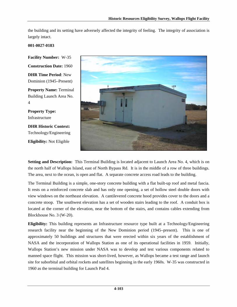
Historic Resources Eligibility Survey, Wallops Flight Facility
4-103
the building and its setting have adversely affected the integrity of feeling. The integrity of association is
largely intact.
001-0027-0183
Facility Number: W-35
Construction Date: 1960
DHR Time Period: New
Dominion (1945–Present)
Property Name: Terminal
Building Launch Area No.
4
Property Type:
Infrastructure
DHR Historic Context:
Technology/Engineering
Eligibility: Not Eligible
Setting and Description: This Terminal Building is located adjacent to Launch Area No. 4, which is on
the north half of Wallops Island, east of North Bypass Rd. It is in the middle of a row of three buildings.
The area, next to the ocean, is open and flat. A separate concrete access road leads to the building.
The Terminal Building is a simple, one-story concrete building with a flat built-up roof and metal fascia.
It rests on a reinforced concrete slab and has only one opening, a set of hollow steel double doors with
view windows on the northeast elevation. A cantilevered concrete hood provides cover to the doors and a
concrete stoop. The southwest elevation has a set of wooden stairs leading to the roof. A conduit box is
located at the corner of the elevation, near the bottom of the stairs, and contains cables extending from
Blockhouse No. 3 (W-20).
Eligibility: This building represents an Infrastructure resource type built at a Technology/Engineering
research facility near the beginning of the New Dominion period (1945–present). This is one of
approximately 50 buildings and structures that were erected within six years of the establishment of
NASA and the incorporation of Wallops Station as one of its operational facilities in 1959. Initially,
Wallops Station’s new mission under NASA was to develop and test various components related to
manned space flight. This mission was short-lived, however, as Wallops became a test range and launch
site for suborbital and orbital rockets and satellites beginning in the early 1960s. W-35 was constructed in
1960 as the terminal building for Launch Pad 4.

Historic Resources Eligibility Survey, Wallops Flight Facility
4-104
The Terminal Building Launch Area 4 has been evaluated both as a contributing resource in a historic
district and as an individual resource. No historic district on Wallops Island was identified because of a
lack of significance and integrity (refer to Section 4.3.1).
W-10 is not individually eligible for listing on the NRHP because it lacks significance. The building is
recommended not eligible under Criterion A because it is not associated with an event or pattern of events
of local, state, or national significance. It is not associated with the life of a person significant in our past;
therefore, it is recommended not eligible under Criterion B. The building retains integrity, but is of
simple design and common construction and, therefore, is recommended not eligible under Criterion C
because it does not embody the distinctive characteristics of a type, period, or method of construction;
represent the work of a master; possess high artistic value; or represent a significant or distinguishable
entity whose components may lack individual distinction. It is recommended not eligible under Criterion
D because it does not have the potential to yield information important in history or prehistory.
001-0027-0184
Facility Number: W-40
Construction Date: ca.
1960
DHR Time Period: New
Dominion (1945–Present)
Property Name:
Assembly Shop No. 5
Property Type: Industrial
DHR Historic Context:
Military/Defense,
Technology/Engineering
Eligibility: Not Eligible
Setting and Description: Assembly Shop No. 5 is located on the north half of Wallops Island, east of
North Bypass Road. Across the street by approximately 600 ft is the ocean shore, which is lined by large
riprap. A new building was recently constructed to its northeast. There is a concrete pad in front of the
building used for equipment storage and vehicle parking and an asphalt parking lot behind it for a new
building. The immediate surrounding area is grass, but there is tall grass and trees beyond to the rear and
side of the building.
Assembly Shop No. 5 is a composed of two parts, the original building and a 60 ft by 20 ft addition on the
northeast side, which was completed after the original building was moved to this site in 1964 (WFF

Historic Resources Eligibility Survey, Wallops Flight Facility
4-105
2011). There is a discrepancy in the real property records concerning the date of construction of Building
W-40 as either 1957 or 1960 (WFF 2011). The original building is constructed of concrete block and
sheathed with insulated metal panels. The addition is prefabricated metal construction. Both components
stand on a reinforced concrete foundation and terminate in front gable roofs clad in metal. The metal
roofing and siding were installed in 1996 (WFF 2011). The southeast elevation has a central overhead
steel door and a single hollow steel door on the original building. The 1964 addition has a set of double
hollow steel doors and a pair of one-over-one aluminum windows. The northeast elevation has no
openings on the original building. The addition has two sets of triple and one set of double one-over-one
aluminum windows. The southwest elevation consists of two sets of triple one-over-one aluminum
windows. The northwest elevations features two single hollow steel doors, with one situated in each part.
All windows and doors are replacements. The windows were originally either six-light fixed units or
horizontal sliding units (WFF 2010). Two metal hoods are affixed to the building; the hood on the
original building provides cover to the door, but the hood on the addition is on the opposite side from the
door. Two wood decks on concrete pads are located on the northwest elevation; these provide storage to
HVAC units. A small lean-to with a shed roof is also on the northwest side of the building. The lean-to
has a single hollow steel door and a metal stack that pierces the corner of the roof.
Eligibility: This building is representative of an Industrial resource type built near the beginning of the
New Dominion period (1945–present) at a Military/Defense research facility. Different real property
records list the date of construction of this building as 1957 or 1960. The building is not identified on a
1957 map of Wallops Island; however, it is nearly identical in design to W-15, which was built by the
Navy in 1957 for the NAOTS. The Navy expanded the mission of the CNAAS in 1946 to include the
NAOTS, which was charged with research and testing of naval aviation weapons and ordnance. The
CNAAS/NAOTS retained this mission until the base was closed in 1959 and transferred to NASA.
During the period of 1946–1959, development on the north part of Wallops Island primarily consisted of
target installations. In 1964, five years after the base was transferred to NASA, the building was moved
to its present location, expanded with a prefabricated metal addition, and used as an assembly shop (WFF
2011). Available sources did not indicate the original location of the building.
W-40 has been evaluated both as a contributing resource in a historic district and as an individual
resource. No historic district on Wallops Island was identified because of a lack of significance and
integrity (refer to Section 4.3.1).
Assembly Shop No. 5 is not individually eligible for listing on the NRHP because it lacks significance
and integrity. Because it was moved from its original site to its current location, W-40 was evaluated
under Criteria Consideration B in addition to Criteria A–D. The building is recommended not eligible
under Criterion A because it is not associated with an event or pattern of events of local, state, or national
significance. It is not associated with the life of a person significant in our past; therefore, it is
recommended not eligible under Criterion B. The building is of simple design and common construction
and, therefore, is recommended not eligible under Criterion C because it does not embody the distinctive
characteristics of a type, period, or method of construction; represent the work of a master; possess high

Historic Resources Eligibility Survey, Wallops Flight Facility
4-106
artistic value; or represent a significant or distinguishable entity whose components may lack individual
distinction. It is recommended not eligible under Criterion D because it does not have the potential to
yield information important in history or prehistory.
The building was moved during the period of significance; therefore, it does not possess integrity of
location. It also has no integrity of setting because the surroundings of the current location are not
comparable to those of the historical setting. The removal of the building from its original location and
setting has destroyed its integrity of feeling and association. The resource retains its integrity of design.
The materials and workmanship have been compromised by removal and replacement of the historical
siding, roofing, doors, and windows.
001-0027-0185
Facility Number: W-50
Construction Date: 1960
DHR Time Period: New
Dominion (1945–Present)
Property Name: Launch
Area Cable Terminal
Building
Property Type:
Infrastructure
DHR Historic Context:
Technology/Engineering
Eligibility: Not Eligible
Setting and Description: The Launch Area Cable Terminal Building is located on the north half of
Wallops Island, east of North Bypass Road. It is set back from an access road in a grass field. A large
new building was constructed across the street. Behind the building is the riprap-lined seashore.
The Terminal Building is a simple, one-story concrete and concrete block building with a flat built-up
roof and metal fascia. A thin metal membrane has been placed over the fascia and is in poor condition.
The building rests on a reinforced concrete slab and has only one opening, located on the northwest
elevation. The opening consists of a central set of double hollow steel doors with a concrete stoop. There
is window structure visible beside the door, but it has been filled in. Additional evidence of openings,
now filled in, can be seen on the southwest elevation. According to the real property records, the building
had louvered windows installed in 1976; none remain today (WFF 2011). There are two metal conduits

Historic Resources Eligibility Survey, Wallops Flight Facility
4-107
on the southwest elevation. The southeast elevation has no opening and the northeast elevation was
inaccessible.
Eligibility: This building represents an Infrastructure resource type built at a Technology/Engineering
research facility near the beginning of the New Dominion period (1945–present). This is one of
approximately 50 buildings and structures that were erected within six years of the establishment of
NASA and the incorporation of Wallops Station as one of its operational facilities in 1959. Initially,
Wallops Station’s new mission under NASA was to develop and test various components related to
manned space flight. This mission was short-lived, however, as Wallops became a test range and launch
site for suborbital and orbital rockets and satellites beginning in the early 1960s. The planned expansion
of Wallops Station after becoming a NASA facility included construction of two launch pads (3b and 5), a
blockhouse between them (W-20), and terminal buildings at each launch pad (W-10 and W-50). W-50 is
the terminal building for Launch Pad 5. Construction of the terminal building was completed in 1960.
The Launch Area Cable Terminal Building has been evaluated both as a contributing resource in a
historic district and as an individual resource. No historic district on Wallops Island was identified
because of a lack of significance and integrity (refer to Section 4.3.1).
W-50 is not individually eligible for listing on the NRHP because it lacks significance. The building is
recommended not eligible under Criterion A because it is not associated with an event or pattern of events
of local, state, or national significance. It is not associated with the life of a person significant in our past;
therefore, it is recommended not eligible under Criterion B. The building retains integrity, but is of
simple design and common construction and, therefore, is recommended not eligible under Criterion C
because it does not embody the distinctive characteristics of a type, period, or method of construction;
represent the work of a master; possess high artistic value; or represent a significant or distinguishable
entity whose components may lack individual distinction. It is recommended not eligible under Criterion
D because it does not have the potential to yield information important in history or prehistory.
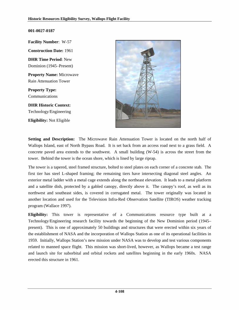
Historic Resources Eligibility Survey, Wallops Flight Facility
4-108
001-0027-0187
Facility Number: W-57
Construction Date: 1961
DHR Time Period: New
Dominion (1945–Present)
Property Name: Microwave
Rain Attenuation Tower
Property Type:
Communications
DHR Historic Context:
Technology/Engineering
Eligibility: Not Eligible
Setting and Description: The Microwave Rain Attenuation Tower is located on the north half of
Wallops Island, east of North Bypass Road. It is set back from an access road next to a grass field. A
concrete paved area extends to the southwest. A small building (W-54) is across the street from the
tower. Behind the tower is the ocean shore, which is lined by large riprap.
The tower is a tapered, steel framed structure, bolted to steel plates on each corner of a concrete stab. The
first tier has steel L-shaped framing; the remaining tiers have intersecting diagonal steel angles. An
exterior metal ladder with a metal cage extends along the northeast elevation. It leads to a metal platform
and a satellite dish, protected by a gabled canopy, directly above it. The canopy’s roof, as well as its
northwest and southeast sides, is covered in corrugated metal. The tower originally was located in
another location and used for the Television Infra-Red Observation Satellite (TIROS) weather tracking
program (Wallace 1997).
Eligibility: This tower is representative of a Communications resource type built at a
Technology/Engineering research facility towards the beginning of the New Dominion period (1945–
present). This is one of approximately 50 buildings and structures that were erected within six years of
the establishment of NASA and the incorporation of Wallops Station as one of its operational facilities in
1959. Initially, Wallops Station’s new mission under NASA was to develop and test various components
related to manned space flight. This mission was short-lived, however, as Wallops became a test range
and launch site for suborbital and orbital rockets and satellites beginning in the early 1960s. NASA
erected this structure in 1961.

Historic Resources Eligibility Survey, Wallops Flight Facility
4-109
This tower has been evaluated both as a contributing resource in a historic district and as an individual
resource. No historic district on Wallops Island was identified because of a lack of significance and
integrity (refer to Section 4.3.1).
W-10 is not individually eligible for listing on the NRHP because it lacks significance. The structure is
recommended not eligible under Criterion A because it is not associated with an event or pattern of events
of local, state, or national significance. It is not associated with the life of a person significant in our past;
therefore, it is recommended not eligible under Criterion B. W-57 retains integrity, but it is
recommended not eligible under Criterion C because it does not embody the distinctive characteristics of
a type, period, or method of construction; represent the work of a master; possess high artistic value; or
represent a significant or distinguishable entity whose components may lack individual distinction. It is
recommended not eligible under Criterion D because it does not have the potential to yield information
important in history or prehistory.
001-0027-0188
Facility Number: W-65
Construction Date: 1963
DHR Time Period: New
Dominion (1945–Present)
Property Name: Checkout
and Assembly Shop No. 3
Property Type: Industrial
DHR Historic Context:
Technology/Engineering
Eligibility: Not Eligible
Setting and Description: Checkout and Assembly Shop No. 3 is located on the north half of Wallops
Island, northwest of North Bypass Road. A concrete pad surrounds the building. The immediate area
around the building is grass, but there is tall grass beyond to the rear. Across the street by approximately
600 ft is the shoreline, which is covered by large riprap.
Checkout and Assembly Shop No. 3 is a reinforced concrete building with a flat built-up roof and
aluminum fascia. The building originally consisted of five bays of shops; a sixth bay was appended to the
southeast end of the building in 1965 (WFF 2010, 2011). Dividing each of the five original bays are
tapered, sand-filled blast walls. The walls are reinforced concrete (WFF 2010). Generally, sand is better

Historic Resources Eligibility Survey, Wallops Flight Facility
4-110
blast absorber than concrete because sand is a better insulator than concrete and it will have a little give to
allow for impact absorption that concrete does not have. As such the impact of an explosion would cause
less damage in a building with sand-compressed walls versus solid concrete walls. The northwest (rear)
elevation includes a central lean-to clad in metal siding; the lean-to is original to the building. A concrete
block lean-to was affixed to the southeast side of the 1965 addition in 1976 (WFF 2011).
The southeast elevation has six bays of overhead doors. The four south bays have insulated coiling
overhead doors the full height of the building; the remaining two bays have shorter steel rolling doors.
Translucent panels act as sidelights to the doors. Single hollow steel doors with view windows are
situated to the southwest of each overhead door, with the exception of the overhead doors on the end,
which each has a door to the northeast. All the personnel and overhead doors were removed and replaced
in 1999 (WFF 2011). Translucent insulated blast panels sheath the entire northwest and southeast
elevations; these replaced the original translucent panel wall system in 1999 (WFF 2010, 2011).
The northwest elevation has two overhead doors: a steel rolling door in the southeast corner and a canvas
door in the center of the elevation. There is one single hollow steel door with a view window on the
northwest corner and a set of double doors with view windows. The 1965 addition has three sets of
double windows that have been filled in with ribbed metal: one set is located next to the door and the
remaining two sets are above the door. There is a louvered aluminum window in the original lean-to.
The northeast elevation of the original lean-to contains a set of double half-glazed metal doors. There are
three evenly spaced single hollow steel doors in the concrete block portion and a large one-over-one
window in the 1965 addition. The top pane has been filled with ribbed metal.
Eligibility: This building is an example of an Industrial resource type built at a Technology/Engineering
research facility towards the beginning of the New Dominion period (1945–present). This is one of
approximately 50 buildings and structures that were erected within six years of the establishment of
NASA and the incorporation of Wallops Station as one of its operational facilities in 1959. Initially,
Wallops Station’s new mission under NASA was to develop and test various components related to
manned space flight. This mission was short-lived, however, as Wallops became a test range and launch
site for suborbital and orbital rockets and satellites beginning in the early 1960s. Construction of
Assembly Shop No. 3 was completed in 1963.
W-65 has been evaluated both as a contributing resource in a historic district and as an individual
resource. No historic district on Wallops Island was identified because of a lack of significance and
integrity (refer to Section 4.3.1).
Assembly Shop No. 3 is not individually eligible for listing on the NRHP because it lacks significance
and integrity. The building is presently less than 50 years old; therefore, it was evaluated under Criteria
Consideration G in addition to Criteria A–D. The building is recommended not eligible under Criterion A
because it is not associated with an event or pattern of events of exceptional importance at the local, state,
or national level. It is not associated with the life of a person who made exceptionally important
contributions in history; therefore, it is recommended not eligible under Criterion B. The building has an

Historic Resources Eligibility Survey, Wallops Flight Facility
4-111
interesting, and perhaps unique, structural system of tapered sand-filled blast walls; however, it is
recommended not eligible under Criterion C because it does not embody exceptional architectural merit
for distinctive characteristics of a type, period, or method of construction. Instead, the sand-filled walls
appear to be a sound resolution for lessening the impact of an accidental explosion during rocket
assembly operations. However, a re-evaluation of this method of construction, as employed in this
Industrial type building, may be warranted when the building reaches 50 years of age. W-65 is
recommended not eligible under Criterion D because it does not have the potential to yield information
exceptionally important in history or prehistory.
001-0027-0189
Facility Number:
W-67
Construction Date: 1957
DHR Time Period: New
Dominion (1945–Present)
Property Name:
Ready Issue Explosives
Storage Cubicle
Property Type: Storage
DHR Historic Context:
Military/Defense,
Technology/Engineering
Eligibility: Not Eligible
Setting and Description: The Ready Issue Explosives Storage Cubical is located on the north half of
Wallops Island, northwest of North Bypass Road. It is adjacent to Checkout and Assembly Shop No. 3
(W-65). The area in front of the building is paved in asphalt, and behind the building are tall grasses.
Across the street by approximately 600 ft is the shoreline, which is covered by large riprap.
This single-story reinforced concrete building rests on a concrete slab. It has only one point of entry, a
single steel door on the southwest elevation. The central door has a projecting metal lintel. It is flanked
by two vents with metal covers. On the opposite elevation (northeast), there are two small vents with
metal covers in the top of the wall. Four steel eye hooks are embedded in each corner of the roof.
W-67 represents a Navy standardized building design for storage of small materials. At Wallops, it is
typically utilized for storage of hazardous materials. The Navy built numerous buildings of this type on
the Main Base and Wallops Island between 1956 and 1965. As of 2011, 14 buildings of this type are

Historic Resources Eligibility Survey, Wallops Flight Facility
4-112
extant. Table 5 lists the other eight buildings on Wallops Island of this same design, and notes any
variances in the standard design, which typically involve the number and placement of vents in the walls.
Table 5. Storage Buildings Surveyed on Wallops Island with Same Type of Standardized Design
VDHR ID Number
WFF ID Number
Date of Construction
Description
001-0027-0172 V-42 1956 Faces northeast; missing metal covers on rear vents
001-0027-0176 V-52 1956 Faces southwest; does not have eye hooks 001-0027-0181 W-16 1957 Faces northeast; cables through eye hooks
connect it to another building (W-15) 001-0027-0186 W-51 1956 Faces northwest; missing metal covers on rear
vents, metal plate added to center of rear wall, eye hooks have been removed, no lintel over door
001-0027-0194 Y-16 1957 Faces southwest; three eye hooks have been removed, no metal covers on vents
001-0027-0195 Y-20 1957 Faces northwest 001-0027-0196 Y-37 1956 Faces northwest; one small wood frame fixed
window in northeast elevation, another window of same type replaces one of the covered vents on the southeast elevation
001-0027-0197 Y-38 1965 Faces northwest; steel double doors on northwest elevation, no vents on northwest elevation, one vent with metal cover on southeast elevation near ground
Eligibility: W-67 and the other eight buildings on Wallops Island of this same type represent a secondary
resource built near the beginning of the New Dominion period (1945–present) at a Military/Defense
research facility. The U.S. Navy expanded the mission of the CNAAS in 1946 to include the NAOTS,
which was charged with research and testing of naval aviation weapons and ordnance. The
CNAAS/NAOTS retained this mission until the base was closed in 1959 and transferred to NASA.
During the period of 1946–1959, most of the development that occurred on the Main Base was related to
housing and services. However, several new buildings were constructed on Main Base within the three
years leading up to the closure of the Navy station. The Navy erected the same type of storage buildings
as W-67 between 1956 and 1965 (see Table 5).
Each of these nine storage buildings has been evaluated both as a contributing resource in a historic
district and as an individual resource. No historic district on Wallops Island was identified because of a
lack of significance and integrity (refer to Section 4.3.1).
This resource type is not individually eligible for listing on the NRHP because it lacks significance, and
also in some cases, integrity. Each building in Table 6 is recommended not eligible under Criterion A
because it is not associated with an event or pattern of events of local, state, or national significance. It is
not associated with the life of a person significant in our past; therefore, it is recommended not eligible
under Criterion B. Each of these storage buildings is a secondary resource of simple design and common

Historic Resources Eligibility Survey, Wallops Flight Facility
4-113
construction and, therefore, is recommended not eligible under Criterion C because it does not embody
the distinctive characteristics of a type, period, or method of construction; represent the work of a master;
possess high artistic value; or represent a significant or distinguishable entity whose components may
lack individual distinction. It is recommended not eligible under Criterion D because it does not have the
potential to yield information important in history or prehistory.
Building W-67 retains its integrity. Buildings V-42, V-52, W-16, W-51, Y-16, and Y-20 were moved
during the period of significance; therefore, none of them possess integrity of location. Each also has no
integrity of setting: in each case, the setting of the current location is not comparable to the historical
setting, which for some of them, was on the Main Base. The removal of each of these buildings from its
original location and setting has destroyed its integrity of feeling and association. These resources retain
their respective integrity of design, materials, and workmanship. Available information indicates that Y-
37 and Y-38 have not been moved; therefore, they have integrity of location. The surroundings of each
building have changed a bit, but the changes do not adversely affect their respective setting. Both
buildings lack integrity of design and materials. Both exhibit multiple alterations from the historical
standardized design, which in turn, diminish the integrity of feeling. The resources retain integrity of
association.
001-0027-0190
Facility Number: X-05A
Construction Date:1966
DHR Time Period: New
Dominion (1945–Present)
Property Name: Path
Finder Radar Antenna
Tower
Property Type:
Communications
DHR Historic Context:
Technology/Engineering
Eligibility: Not Eligible
Setting and Description: The Path Finder Radar Antenna Tower is located on the southern half of
Wallops Island on the east side of North Seawall Road, south of Causeway Road. It is attached to the
southwest corner of the roof of Building X-05, which is close to the shore and an earthen berm. Large

Historic Resources Eligibility Survey, Wallops Flight Facility
4-114
riprap extends farther down the shoreline. The area is open and flat. There is a prefabricated metal
building across the street.
The Path Finder Radar Antenna Tower is a four-tiered, steel frame structure mounted to the roof of a
concrete block building (X-05). The tower is 18 ft in height and 12 ft in width at the base. It is
constructed of four steel posts and diagonal intersecting steel angles. A small exterior metal ladder
encircled by a metal cage is on the southwest elevation. A T-shaped, counterclockwise rotating antenna is
attached to the top of the tower. The antenna was relocated to this site in 1983 (WFF 2011).
Eligibility: This tower is representative of a Communications resource type built at a
Technology/Engineering research facility towards the beginning of the New Dominion period (1945–
present). This is one of approximately 50 buildings and structures that were erected within six years of
the establishment of NASA and the incorporation of Wallops Station as one of its operational facilities in
1959. Initially, Wallops Station’s new mission under NASA was to develop and test various components
related to manned space flight. This mission was short-lived, however, as Wallops became a test range
and launch site for suborbital and orbital rockets and satellites beginning in the early 1960s. NASA
erected this antenna tower in 1966.
The Path Finder Radar Antenna Tower has been evaluated both as a contributing resource in a historic
district and as an individual resource. No historic district on Wallops Island was identified because of a
lack of significance and integrity (refer to Section 4.3.1).
X-05A is not individually eligible for listing on the NRHP because it lacks significance and integrity.
The tower moved to its current location and is presently less than 50 years old; therefore, it was evaluated
under Criteria Considerations B and G in addition to Criteria A–D. The structure is recommended not
eligible under Criterion A because it is not associated with an event or pattern of events of exceptional
importance at the local, state, or national level. It is not associated with the life of a person who made
exceptionally important contributions in history; therefore, it is recommended not eligible under Criterion
B. The tower is recommended not eligible under Criterion C because it does not embody exceptional
engineering merit for distinctive characteristics of a type, period, or method of construction; represent the
work of a master; or possess high artistic value. Likewise, it does not represent an exceptionally
significant or distinguishable entity whose components may lack individual distinction. It is
recommended not eligible under Criterion D because it does not have the potential to yield information
exceptionally important in history or prehistory.
The tower was moved after the period of significance; therefore, it does not possess integrity of location.
It also has no integrity of setting because the surroundings of the current location are not comparable to
those of the historical setting. The removal of the structure from its original location and setting has
destroyed its integrity of feeling and association. The resource retains its integrity of design, materials,
and workmanship.
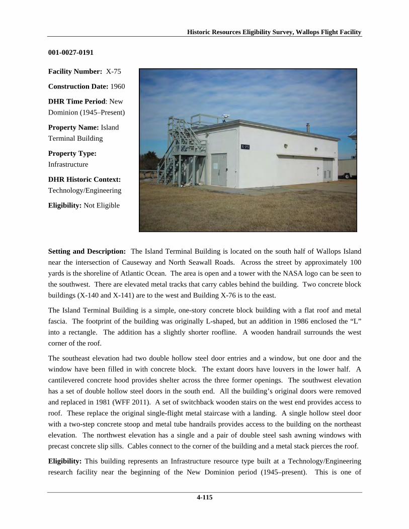
Historic Resources Eligibility Survey, Wallops Flight Facility
4-115
001-0027-0191
Facility Number: X-75
Construction Date: 1960
DHR Time Period: New
Dominion (1945–Present)
Property Name: Island
Terminal Building
Property Type:
Infrastructure
DHR Historic Context:
Technology/Engineering
Eligibility: Not Eligible
Setting and Description: The Island Terminal Building is located on the south half of Wallops Island
near the intersection of Causeway and North Seawall Roads. Across the street by approximately 100
yards is the shoreline of Atlantic Ocean. The area is open and a tower with the NASA logo can be seen to
the southwest. There are elevated metal tracks that carry cables behind the building. Two concrete block
buildings (X-140 and X-141) are to the west and Building X-76 is to the east.
The Island Terminal Building is a simple, one-story concrete block building with a flat roof and metal
fascia. The footprint of the building was originally L-shaped, but an addition in 1986 enclosed the “L”
into a rectangle. The addition has a slightly shorter roofline. A wooden handrail surrounds the west
corner of the roof.
The southeast elevation had two double hollow steel door entries and a window, but one door and the
window have been filled in with concrete block. The extant doors have louvers in the lower half. A
cantilevered concrete hood provides shelter across the three former openings. The southwest elevation
has a set of double hollow steel doors in the south end. All the building’s original doors were removed
and replaced in 1981 (WFF 2011). A set of switchback wooden stairs on the west end provides access to
roof. These replace the original single-flight metal staircase with a landing. A single hollow steel door
with a two-step concrete stoop and metal tube handrails provides access to the building on the northeast
elevation. The northwest elevation has a single and a pair of double steel sash awning windows with
precast concrete slip sills. Cables connect to the corner of the building and a metal stack pierces the roof.
Eligibility: This building represents an Infrastructure resource type built at a Technology/Engineering
research facility near the beginning of the New Dominion period (1945–present). This is one of

Historic Resources Eligibility Survey, Wallops Flight Facility
4-116
approximately 50 buildings and structures that were erected within six years of the establishment of
NASA and the incorporation of Wallops Station as one of its operational facilities in 1959. Initially,
Wallops Station’s new mission under NASA was to develop and test various components related to
manned space flight. This mission was short-lived, however, as Wallops became a test range and launch
site for suborbital and orbital rockets and satellites beginning in the early 1960s. NASA erected this
terminal building in 1960.
The Island Terminal Building has been evaluated both as a contributing resource in a historic district and
as an individual resource. No historic district on Wallops Island was identified because of a lack of
significance and integrity (refer to Section 4.3.1).
X-75 is not individually eligible for listing on the NRHP because it lacks significance and integrity. The
building is recommended not eligible under Criterion A because it is not associated with an event or
pattern of events of local, state, or national significance. It is not associated with the life of a person
significant in our past; therefore, it is recommended not eligible under Criterion B. The building retains
integrity, but is of simple design and common construction and, therefore, is recommended not eligible
under Criterion C because it does not embody the distinctive characteristics of a type, period, or method
of construction; represent the work of a master; possess high artistic value; or represent a significant or
distinguishable entity whose components may lack individual distinction. It is recommended not eligible
under Criterion D because it does not have the potential to yield information important in history or
prehistory.
The building is in its historical location. The setting of the building has been adversely affected by the
addition of a few post-1965 buildings nearby and substantial material changes to a primary pre-1966
resource in the vicinity. The design of X-75 has been compromised by the removal and enclosure of
original openings on the façade (southeast elevation). The building has reduced integrity of materials and
workmanship due to the replacement of historical doors and windows and the metal staircase with a wood
one. The changes in setting, design, materials, and workmanship have negatively impacted the integrity
of feeling and association.

Historic Resources Eligibility Survey, Wallops Flight Facility
4-117
001-0027-0192
Facility Number: X-85
Construction Date: 1963
DHR Time Period: New
Dominion (1945–Present)
Property Name: Special
Projects Building
Property Type: Research,
Development, and Testing
DHR Historic Context:
Technology/Engineering
Eligibility: Not Eligible
Setting and Description: The Special Projects Building is on the south half of Wallops Island, on the
south side of Causeway Road, northwest of its intersection with North Seawall Road. There is an asphalt
paved parking lot in front of it and tall grass and shrubs behind it. Building X-86 is next door. An oil
tank surrounded by four concrete walls is located on the southwest elevation. Wooded stairs provide
access to the tank.
The Special Projects Building is a steel-frame building with a flat built-up roof and metal fascia.
Originally, the steel frame was exposed on the exterior and the walls clad with metal panels (WFF 2011).
The building now primarily displays a ribbed split-face concrete block exterior and stucco-clad fascia; the
exterior of the two tallest bays at the northwest end are clad with panels of an unknown material. No
information identifying when these changes were made was found. The two-bay main entrance on the
northeast elevation is situated between three bays on one side and four bays on the other side that are
divided by concrete block columns. The entrance is a raised and consists of double glazed doors with a
transom. A set of concrete stairs and ramp with metal tube railing are in front of the door. One bay
houses a divided-light fixed picture window. The two entrance bays project and have a taller fascia than
the other bays. The northwest section of the building is taller with two bays of canvas overhead doors and
a central single glazed door with sidelights and transoms. A wood handrail extends along the perimeter of
the roof, which houses a dome and satellite; a set of wood switchback stairs lead to them. There are no
openings in the northwest or southeast elevations. An elevated track, carrying cables, extends from the
northwest elevation. The southwest elevation has two single hollow steel doors and two double hollow
steel doors. The southwest elevation of the taller section has one central single glazed door with
Historic Resources Eligibility Survey, Wallops Flight Facility
4-118
sidelights and transom and one overhead canvas door. A metal staircase meets the wood staircase on the
roof of the building.
Eligibility: This building is representative of a Research, Development and Testing resource type built at
a Technology/Engineering research facility towards the beginning of the New Dominion period (1945–
present). This is one of approximately 50 buildings and structures that were erected within six years of
the establishment of NASA and the incorporation of Wallops Station as one of its operational facilities in
1959. Initially, Wallops Station’s new mission under NASA was to develop and test various components
related to manned space flight. This mission was short-lived, however, as Wallops became a test range
and launch site for suborbital and orbital rockets and satellites beginning in the early 1960s. NASA
erected this building in 1963 as the Meteorological Observation Center. The use of the building changed
to special projects near the end of 1984 (WFF 2011).
The Special Projects Building has been evaluated both as a contributing resource in a historic district and
as an individual resource. No historic district on Wallops Island was identified because of a lack of
significance and integrity (refer to Section 4.3.1).
X-85 is not individually eligible for listing on the NRHP because it lacks significance and integrity. The
building is presently less than 50 years old; therefore, it was evaluated under Criteria Consideration G in
addition to Criteria A–D. The building is recommended not eligible under Criterion A because it is not
associated with an event or pattern of events of exceptional importance at the local, state, or national
level. It is not associated with the life of a person who made exceptionally important contributions in
history; therefore, it is recommended not eligible under Criterion B. X-85 is recommended not eligible
under Criterion C because it does not embody exceptional architectural merit for distinctive
characteristics of a type, period, or method of construction; represent the work of a master; or possess
high artistic value. Likewise, it does not represent an exceptionally significant or distinguishable entity
whose components may lack individual distinction. It is recommended not eligible under Criterion D
because it does not have the potential to yield information exceptionally important in history or
prehistory.
The building is in its historical location. The integrity of setting has been altered by the addition of a few
post-1965 buildings nearby and a new roadway (North Bypass Road) to the northwest. The building has
no integrity of design, materials, or workmanship: the entire exterior has been changed from metal
siding, exposed steel frame, and few openings to concrete block, stucco, and façade of picture windows.
Lacking design, materials, or workmanship and a diminished historical setting, the building has no
integrity of feeling or association.
Historic Resources Eligibility Survey, Wallops Flight Facility
4-119
001-0027-0193
Facility Number: Y-10
Construction Date: 1957
DHR Time Period: New
Dominion (1945–Present)
Property Name: Fuel
Storage Magazine
Property Type: Storage
DHR Historic Context:
Military/Defense,
Technology/Engineering
Eligibility: Not Eligible
Setting and Description: The Fuel Storage Magazine is located on the south half of Wallops Island, on
North Seawall Road south of Causeway Road. The magazine is set back approximately 275 ft from North
Seawall Road. The area around it is open with taller grass on the northwest and southwest sides. An
antenna tower is behind the magazine. Two to three magazines, constructed after Y-10, are located to the
north and northeast.
The Fuel Storage Magazine is built into an earthen berm. The top halves of its reinforced concrete walls
are exposed on the northeast and southwest elevations. A metal capped vent pierces the roofline on the
southwest. The building faces northwest and consists of a reinforced concrete façade with rebar
extending to the north and west, indicating that it was originally tied to another element. The roofline of
the façade is a shallow gable. The entrance includes large double steel doors surmounted by a rolling
steel door. A cantilevered concrete canopy provides cover to the entrance. A concrete loading dock, with
stairs on the south end, is in front of the steel doors. Three wood planks measuring 2 by 8 inches are
bolted to the front of the loading dock to act as a bumper. Two horizontal steel beams extend northeast
from each side of the doorway and meet two vertical I-beams set in concrete piers. Another steel beam
spans between the two vertical I-beams.
Eligibility: This structure is an example of an earth-covered storage magazine built near the beginning of
the New Dominion period (1945–present) at a Technology/Engineering research facility. NACA
established the Auxiliary Flight Research Station in the southern portion of Wallops Island in 1945 for
aeronautical research. In mid-1946, this facility was renamed the Pilotless Aircraft Research Station
(PARS) and functioned as a rocket testing facility. By the mid-1950s, the testing program at PARS
Historic Resources Eligibility Survey, Wallops Flight Facility
4-120
concentrated on hypersonic missiles. Substantial development occurred at PARS between 1946 and
1954. After 1954, buildings and structures generally were constructed as needed to meet workload and
research program requirements. NACA contracted the Sullivan Engineering Company to build this fuel
magazine, the second of its kind at the facility. In the mid 1950s, Wallops Station added more rocket
motors to its inventory for the hypersonic research program, which necessitated more storage space for
rocket propellants (Shortal 1978). Y-10 was constructed in 1957. The structure has been used for fuel
storage since its construction.
Y-10 has been evaluated both as a contributing resource in a historic district and as an individual
resource. No historic district on Wallops Island was identified because of a lack of significance and
integrity (refer to Section 4.3.1).
The Fuel Storage Magazine is not individually eligible for listing on the NRHP because it lacks
significance. The structure is recommended not eligible under Criterion A because it is not associated
with an event or pattern of events of local, state, or national significance. It is not associated with the life
of a person significant in our past; therefore, it is recommended not eligible under Criterion B. The
structure is recommended not eligible under Criterion C because earthen-bermed magazines were built by
the thousands at military installations across the U.S. Y-10 is not a rare or prototype magazine.
Therefore, it does not embody the distinctive characteristics of a type, period, or method of construction;
represent the work of a master; possess high artistic value; or represent a significant or distinguishable
entity whose components may lack individual distinction. It is recommended not eligible under Criterion
D because it does not have the potential to yield information important in history or prehistory.
001-0027-0198
Facility Number: Y-55
Construction Date: 1958
DHR Time Period: New
Dominion (1945–Present)
Property Name: AN/FPS-
16 Radar Operations
Building
Property Type: Research,
Development, and Testing
DHR Historic Context:
Military/Defense,
Technology/Engineering
Eligibility: Not Eligible

Historic Resources Eligibility Survey, Wallops Flight Facility
4-121
Setting and Description: The AN/FPS-16 Radar Operations Building is located on the south half of
Wallops Island on the southeast side of North Bypass Road, south of Causeway Road. Concrete
pavement surrounds the building on three sides. The fourth side is grass. The raised roadbed of North
Bypass Road is visible behind the building. A raised metal track that carries cables extends along the
northwest side of the building and enters the building near the center of this elevation.
The AN/FPS-16 Radar Operations Building is a two-story, concrete frame building with concrete block
walls and a flat built-up roof and metal fascia. A wood handrail runs along the perimeter of the roof and a
dish satellite rests on its west corner. The building rests on a reinforced concrete slab foundation. The
northeast elevation has two sets of double hollow steel doors with view windows on each floor. A
concrete balcony with a metal tube railing leads from the second floor doors to a set of metal stairs on the
northwest elevation. These metal stairs provide access to the roof and satellite. A small opening, covered
by an aluminum hood is the port for cables extending along a raised metal track. The southwest elevation
has a single hollow steel door with a view window. A three-step concrete stoop with metal tube handrails
leads to the door. The southeast elevation has a metal staircase with metal tube handrails leading to a
wood-framed platform, also with metal tube handrails, and a single hollow steel door with view windows.
The steel stairway replaced the historical concrete platform (WFF 2011). Conduits attached to the middle
of the wall, extend to a raised, wood frame deck to the northwest. Power equipment and fans sit on the
deck.
Eligibility: This building is representative of a Research, Development and Testing resource type built
near the beginning of the New Dominion period (1945–present) at a Technology/Engineering research
facility. NACA established the Auxiliary Flight Research Station in the southern portion of Wallops
Island in 1945 for aeronautical research. In mid-1946, this facility was renamed the Pilotless Aircraft
Research Station (PARS) and functioned as a rocket testing facility. By the mid-1950s, the testing
program at PARS concentrated on hypersonic missiles. Substantial development occurred at PARS
between 1946 and 1954. After 1954, buildings and structures generally were constructed as needed to
meet workload and research program requirements. NACA constructed this building in 1958 for the FPS-
16 radar, which is mounted to its roof. A long-range radar, the FPS-16 was loaned to Wallops Station by
the U.S. Air Force to track multistage rocket vehicles. The 12-foot dish of this C-band radar can track a
target to approximately 190 miles (Shortal 1978).
Y-55 has been evaluated both as a contributing resource in a historic district and as an individual
resource. No historic district on Wallops Island was identified because of a lack of significance and
integrity (refer to Section 4.3.1).
The AN/FPS-16 Radar Operations Building is not individually eligible for listing on the NRHP because it
lacks significance and integrity. The building is recommended not eligible under Criterion A because it is
not associated with an event or pattern of events of local, state, or national significance. It is not
associated with the life of a person significant in our past; therefore, it is recommended not eligible under
Criterion B. The building is recommended not eligible under Criterion C because it does not embody the
distinctive characteristics of a type, period, or method of construction; represent the work of a master;

Historic Resources Eligibility Survey, Wallops Flight Facility
4-122
possess high artistic value; or represent a significant or distinguishable entity whose components may
lack individual distinction. It is recommended not eligible under Criterion D because it does not have the
potential to yield information important in history or prehistory.
The building is in its historical location. The integrity of setting is diminished by the addition of the
raised roadbed of North Bypass Road behind the building. The building retains integrity of design and
workmanship. The integrity of materials has been reduced by the replacement of the concrete platform on
the southeast elevation and the removal of some exterior equipment and/or openings from the southeast
and northeast elevations. The building retains integrity of feeling and association.
001-0027-0199
Facility Number: Y-95
Construction Date: 1964
DHR Time Period: New
Dominion (1945-Present)
Property Name: Camera
Platform
Property Type: Infrastructure
DHR Historic Context:
Technology/Engineering
Eligibility: Not Eligible
Setting and Description: This Camera Tower is located on the south half of Wallops Island, south of
Causeway Road and southeast of North Bypass Road. The area is flat and open with grass surrounding
the structure. The AN/FPS-16 Radar Operations Building (Building Y-55) is to the southwest.
The Camera Tower is a four tiered steel structure. It is constructed of four steel corner posts, attached to
17-inch by 17-inch concrete footings and steel intersecting diagonal steel angles. A spiral steel stair case
on the southeast corner extends to a metal framed platform with metal tube handrails. Steel bars spring
from the middle of the second tier to support the platform on all four corners of the tower. The Camera
Tower once supported a 12 ft cylinder and dome, but these were removed in the 1990s (WFF 2011).
Wood stairs lead to a concrete platform supporting mechanical equipment on the southwest corner.
Eligibility: This structure represents an Infrastructure resource type built at a Technology/Engineering
research facility towards the beginning of the New Dominion period (1945–present). This is one of
approximately 50 buildings and structures that were erected within six years of the establishment of

Historic Resources Eligibility Survey, Wallops Flight Facility
4-123
NASA and the incorporation of Wallops Station as one of its operational facilities in 1959. Initially,
Wallops Station’s new mission under NASA was to develop and test various components related to
manned space flight. This mission was short-lived, however, as Wallops became a test range and launch
site for suborbital and orbital rockets and satellites beginning in the early 1960s. NASA erected this
camera platform in 1964 (WFF 2011).
Y-95 has been evaluated both as a contributing resource in a historic district and as an individual
resource. No historic district on Wallops Island was identified because of a lack of significance and
integrity (refer to Section 4.3.1).
This Camera Tower is not individually eligible for listing on the NRHP because it lacks significance. The
structure is presently less than 50 years old; therefore, it was evaluated under Criteria Consideration G in
addition to Criteria A–D. Y-95 is recommended not eligible under Criterion A because it is not
associated with an event or pattern of events of exceptional importance at the local, state, or national
level. It is not associated with the life of a person who made exceptionally important contributions in
history; therefore, it is recommended not eligible under Criterion B. The structure is recommended not
eligible under Criterion C because it does not embody exceptional engineering merit for distinctive
characteristics of a type, period, or method of construction; represent the work of a master; or possess
high artistic value. Likewise, it does not represent an exceptionally significant or distinguishable entity
whose components may lack individual distinction. It is recommended not eligible under Criterion D
because it does not have the potential to yield information exceptionally important in history or
prehistory.
001-0027-0200
Facility Number: Y-110
Construction Date: 1964
DHR Time Period: New
Dominion (1945-Present)
Property Name: Camera
Platform and 10 ft Astrodome
Property Type: Infrastructure
DHR Historic Context:
Technology/Engineering
Eligibility: Not Eligible

Historic Resources Eligibility Survey, Wallops Flight Facility
4-124
Setting and Description: This Camera Platform and 10 ft Astrodome is located on the south half of
Wallops Island, southeast of North Seawall Road, next to large riprap that lines the shore of the Atlantic
Ocean. The riprap bounds the eastern side and grass surrounds the platform on all the remaining sides.
The Camera Platform is an L-shaped, one tiered wooden structure. Wood posts are set in concrete
footings; wood diagonal intersecting members provide additional structural support. Stairs extend to the
platform and the dome on the south side. Handrails run along the perimeter of the platform. The camera
equipment consists of a 10 ft-diameter cylinder with a 10 ft- diameter dome atop it (WFF 2011). A track
runs along the east-west axis of the dome.
Eligibility: This structure represents an Infrastructure resource type built at a Technology/Engineering
research facility towards the beginning of the New Dominion period (1945–present). This is one of
approximately 50 buildings and structures that were erected within six years of the establishment of
NASA and the incorporation of Wallops Station as one of its operational facilities in 1959. Initially,
Wallops Station’s new mission under NASA was to develop and test various components related to
manned space flight. This mission was short-lived, however, as Wallops became a test range and launch
site for suborbital and orbital rockets and satellites beginning in the early 1960s. NASA erected this
camera platform in 1964 (WFF 2011).
Y-110 has been evaluated both as a contributing resource in a historic district and as an individual
resource. No historic district on Wallops Island was identified because of a lack of significance and
integrity (refer to Section 4.3.1).
The camera platform is not individually eligible for listing on the NRHP because it lacks significance.
The structure is presently less than 50 years old; therefore, it was evaluated under Criteria Consideration
G in addition to Criteria A–D. Y-110 is recommended not eligible under Criterion A because it is not
associated with an event or pattern of events of exceptional importance at the local, state, or national
level. It is not associated with the life of a person who made exceptionally important contributions in
history; therefore, it is recommended not eligible under Criterion B. The structure is recommended not
eligible under Criterion C because it does not embody exceptional engineering merit for distinctive
characteristics of a type, period, or method of construction; represent the work of a master; or possess
high artistic value. Likewise, it does not represent an exceptionally significant or distinguishable entity
whose components may lack individual distinction. It is recommended not eligible under Criterion D
because it does not have the potential to yield information exceptionally important in history or
prehistory.
Historic Resources Eligibility Survey, Wallops Flight Facility
4-125
001-0027-0126
Facility Number: Z-20
Construction Date: 1961
DHR Time Period: New
Dominion (1945–Present)
Property Name: Liquid
Propellant Storage
Property Type: Storage
DHR Historic Context:
Technology/Engineering
Eligibility: Not Eligible
Setting and Description: The Liquid Propellant Storage building is located on the south half of Wallops
Island on the north side of North Bypass Road. A paved access road leads to the building, which is
surrounded by tall grass and weeds.
Z-20 is a one-story, corrugated asbestos-clad building with a reinforced concrete foundation. The
building has a nearly square footprint and terminates in a front-gable roof covered in asbestos board. The
northeast facing façade consists of two steel doors with top and bottom steel channels. These doors serve
as a loading bay for the building and a wood bumper is located on the concrete foundation below the
doors. The southwest façade contains the primary entrance to this building, which is situated roughly 3½
ft above ground on the east end of the facade. The entrance is accessed using a set of six concrete stairs
with a metal handrail. The stairs lead to a concrete platform, which holds an exterior chemical wash
shower and eye-wash. This building was moved to its current location in 1969.
Eligibility: Z-20 and Z-25 were surveyed in November 2010, in advance of this larger survey effort due
to proposed demolition of the two buildings. The survey recommended both buildings are not
individually eligible for nomination to the NRHP (TEC Inc. 2011). The VDHR concurred that
neither Z-20 nor Z-25 are eligible for listing on the NRHP (Lee 2011b).
Z-20 also has been evaluated as a contributing resource in a historic district. No historic district on
Wallops Island was identified because of a lack of significance and integrity (refer to Section 4.3.1).
Historic Resources Eligibility Survey, Wallops Flight Facility
4-126
001-0027-0127
Facility Number: Z-25
Construction Date: 1961
DHR Time Period: New
Dominion (1945–Present)
Property Name: Liquid
Propellant Storage
Property Type: Storage
DHR Historic Context:
Technology/Engineering
Eligibility: Not Eligible
Setting and Description: The Liquid Propellant Storage building is located on the south half of Wallops
Island on the north side of North Bypass Road. A paved access road leads to the building, which is
surrounded by tall grass and weeds.
Z-25 is a one-story, corrugated asbestos-clad building with a reinforced concrete foundation. The
building has a nearly square footprint and terminates in a front-gable roof covered in asbestos board. The
east facing façade consists of two steel doors with top and bottom steel channels. These doors serve as a
loading bay for the building and a wood bumper is located on the concrete foundation below the doors.
The southwest façade contains the primary entrance to this building, which is located roughly 3½ ft above
ground on the south end of the facade. The entrance is accessed using a set of six concrete stairs with a
metal handrail, which are entered from the north. The stairs lead to a concrete platform, which holds an
exterior chemical wash shower and eye-wash. A second set of five wood stairs is located on the south
end of the concrete platform and are more easily accessed than the concrete stairs. This building was
moved to its current location in 1969.
Eligibility: Z-20 and Z-25 were surveyed in November 2010, in advance of this larger survey effort due
to proposed demolition of the two buildings. The survey recommended both buildings are not
individually eligible for nomination to the NRHP (TEC Inc. 2011). The VDHR concurred that
neither Z-20 nor Z-25 are eligible for listing on the NRHP (Lee 2011b).
Z-25 also has been evaluated as a contributing resource in a historic district. No historic district on
Wallops Island was identified because of a lack of significance and integrity (refer to Section 4.3.1).

Historic Resources Eligibility Survey, Wallops Flight Facility
4-127
001-0027-0201
Facility Number: Z-40
Construction Date: 1960
DHR Time Period: New
Dominion (1945–Present)
Property Name: Launch
Area 0 Service Building
Property Type: Research,
Development, and Testing
DHR Historic Context:
Technology/Engineering
Eligibility: Not Eligible
Setting and Description: The Launch Area 0 Service Building is located on the south half of Wallops
Island near the southwest end of North Seawall Road. The riprap-lined seashore is behind the building. It
is surrounded by gravel, dirt, and sand and has a large concrete sidewalk running along the southwest
side. Shoreline erosion has led to subsidence and the sidewalk has slipped down on one side and broken
into pieces. Building Z-35 is behind the building.
The Launch Area 0 Service Building is a composed of two parts, the original concrete block structure,
which is now clad in precast concrete panels, and a concrete block addition on the southeast, completed in
1969 (WFF 2011). Both are one-story and have flat precast concrete, built-up roofs with metal fascia.
The northwest elevation has a set of replacement double metal doors with view windows and a transom.
Two concrete steps with metal tube railing lead to the door and a cantilevered concrete hood provides
cover. The southwest elevation of the addition has two double metal doors with cantilevered concrete
hoods. The westernmost doors have view windows and a concrete ramp with metal tube railing. Two
openings in the southeast elevation have been filled in with concrete block. The northeast elevation of the
addition has four windows with precast concrete slip sills. Two have clear glazing and two have
translucent glazing. There are two sets of vertical metal conduits affixed to the wall.
Eligibility: This building represents a Research, Development and Testing resource type built at a
Technology/Engineering research facility near the beginning of the New Dominion period (1945–
present). This is one of approximately 50 buildings and structures that were erected within six years of
the establishment of NASA and the incorporation of Wallops Station as one of its operational facilities in
1959. Initially, Wallops Station’s new mission under NASA was to develop and test various components

Historic Resources Eligibility Survey, Wallops Flight Facility
4-128
related to manned space flight. This mission was short-lived, however, as Wallops became a test range
and launch site for suborbital and orbital rockets and satellites beginning in the early 1960s. NASA
constructed this building in 1960 as the Aerobee Telemetry Building. It was converted to the Launch
Control Center Building in 1969. The name of the building changed to Launch Area 0 Service Building
in 1993 (WFF 2011).
Z-40 has been evaluated both as a contributing resource in a historic district and as an individual resource.
No historic district on Wallops Island was identified because of a lack of significance and integrity (refer
to Section 4.3.1).
The Launch Area 0 Service Building is not individually eligible for listing on the NRHP because it lacks
significance and integrity. The building is recommended not eligible under Criterion A because it is not
associated with an event or pattern of events of local, state, or national significance. It is not associated
with the life of a person significant in our past; therefore, it is recommended not eligible under Criterion
B. The building is of simple design and common construction and, therefore, is recommended not
eligible under Criterion C because it does not embody the distinctive characteristics of a type, period, or
method of construction; represent the work of a master; possess high artistic value; or represent a
significant or distinguishable entity whose components may lack individual distinction. It is
recommended not eligible under Criterion D because it does not have the potential to yield information
important in history or prehistory.
The building is in its historical location. It lacks integrity of setting because of the addition of post-1965
buildings, launch pads, and associated network of access roads. The building lacks integrity of design,
materials, and workmanship because of the alterations that have been completed after the period of
significance, including covering the original concrete block exterior, the construction of a large addition
on the southeast, the replacement of all personnel doors, and the removal and enclosure of a couple of
windows. These alterations and the changes to the setting have negatively affected the integrity of feeling
and association.

Historic Resources Eligibility Survey, Wallops Flight Facility
5-1
5.0 REFERENCES CITED
AK Steel Corporation
2011 Corporate Profile, AK Steel. Available on-line at: http://www.aksteel.com/company/corporate-
profile/. Accessed 4 April 2011.
Best, Brooke V., Katherine Grandine, and Stacie Y. Webb
1997 Navy Cold War Communications Context: 1946–1989. Prepared for Atlantic Division, Naval
Facilities Engineering Command, 1510 Gilbert Street, Norfolk, VA. 12 December.
Dench, Paul
2007 Carnarvon Space: FPQ-6 Radar. Electronic document available on-line at:
http://www.carnarvonspace.com/wiki/index.php?title=FPQ-6_Radar. Accessed 15 March 2011.
DeVincent-Hayes, Nan and Bo Bennett
2001 Images of America: Wallops Island. Charleston, SC: Arcadia Publishing
Dutton, David H. and Robert J. Taylor
2010 Phase I Reconnaissance Survey of Architectural Resources at the National Aeronautics and Space
Administration, Langley Research Center. Prepared for NASA, Langley Research Center, and
Science Applications International Corporation, Hampton, VA. May.
Espenshade, Christopher T., and Kristie Lockerman
2009 Cultural Resources Investigations of the Proposed Uninhabited Aerial Systems Airstrip, Wallops
Flight Facility, Accomack County, Virginia. Draft Report. Prepared for NASA, Goddard Space
Flight Center, Wallops Flight Facility, Wallops Island, VA, by New South Associates, Stone
Mountain, GA, and Greensboro, NC. August.
Federal Aviation Administration
2007 ASR-11 Factsheet. Electronic document available at:
http://www.faa.gov/about/office_org/headquarters_offices/ato/service_units/terminal/surveillance
/asr11/factsheets/#Primary_Secondary_Radar. Accessed 11 March 2011.

Historic Resources Eligibility Survey, Wallops Flight Facility
5-2
Goddard News
1988 Wallops Island Causeway Bridge. Newsletter of NASA’s Goddard Space Flight Center. May.
Holma, Marc
2004 Letter to Barbara Lusby, National Aeronautics and Space Administration, Goddard Space Flight
Center, Wallops Flight Facility, Wallops Island, VA, from Virginia Department of Historic
Resources, Office of Review and Compliance, Richmond. 4 November.
Lee, M. Amanda
2011a Letter to Randall M. Stanley, Historic Preservation Officer, NASA Goddard Space Flight Center,
Wallops Flight Facility, Wallops Island, VA, from Virginia Department of Historic Resources,
Office of Review and Compliance, Richmond. 10 January.
2011b Letter to Randall M. Stanley, Historic Preservation Officer, NASA Goddard Space Flight Center,
Wallops Flight Facility, Wallops Island, VA, from Virginia Department of Historic Resources,
Office of Review and Compliance, Richmond. 28 February.
National Park Service
1997 National Register Bulletin 15: How to Apply the National Register Criteria for Evaluation.
Washington, D.C.: U.S. Government Printing Office.
1998 National Register Bulletin No. 22: Guidelines for Evaluating and Nominating Properties that
have Achieved Significance Within the Last Fifty Years. Washington, D.C.: U.S. Government
Printing Office.
National Aeronautics and Space Administration (NASA)
2008 SCOUT Vehicle Launch Program Fact Sheet. Electronic document available on-line at: http://www.nasa.gov/centers/langley/news/factsheets/Scout.html. Accessed 31 March 2011.
Shortal, Joseph Adams
1978 A New Dimension Wallops Island Flight Test Range: The First Fifteen Years. Washington D.C.:
NASA Scientific and Technical Information Office.

Historic Resources Eligibility Survey, Wallops Flight Facility
5-3
TEC Inc.
2011 Historic Resources Survey and Eligibility Report for Buildings Z-20 and Z-25, Wallops Flight
Facility, Accomack County, Virginia. Prepared for NASA Goddard Space Flight Center,
Wallops Flight Facility, Wallops Island, VA. January.
U.S. Army Corps of Engineers
1997 Historic Context for Department of Defense World War II Permanent Construction. Prepared for
U.S. Army Corps of Engineers, Baltimore District by R. Christopher Goodwin and Associates,
Frederick, Maryland. June.
URS Group and EG&G Technical Services (URS and EG&G)
2003 Final Cultural Resources Assessment of Wallops Flight Facility, Accomack County, Virginia.
Prepared for NASA, Goddard Space Flight Center, Wallops Flight Facility, Wallops, VA.
November.
2004 Historic Resources Survey and Eligibility Report for Wallops Flight Facility, Accomack County,
Virginia. Prepared for National Aeronautics and Space Administration, Goddard Space Flight
Center, Wallops Flight Facility, Wallops Island, VA. 20 December.
2006 Integrated Cultural Resources Management Plan (ICRMP): Wallops Flight Facility, Accomack
County, Virginia. Prepared for NASA, Goddard Space Flight Center, Wallops Flight Facility,
Wallops Island, VA. November.
Virginia Department of Historic Resources
2003 Guidelines for Conducting Cultural Resource Survey in Virginia. Richmond, VA.
Wallace, Harold D.
1997 Wallops Station and the Creation of an American Space Program. Washington D.C.: NASA
History Office.

Historic Resources Eligibility Survey, Wallops Flight Facility
5-4
Wallops Flight Facility (WFF)
2002 Wallops Flight Facility Mission 2005. Electronic document available on-line at:
http://www.nasa.gov/centers/wallops/pdf/168675main_MissionPlan2005.pdf . Accessed 15
March 2011.
2010 As-built drawings of individual facilities at Wallops Flight Facility. On file at Wallops Flight
Facility, Wallops Island, VA.
2011 Real property records. On file at Wallops Flight Facility, Wallops Island, VA.
Winkler, David F.
1997 Searching the Skies: The Legacy of the U.S. Cold War Defense Radar Program. Electronic
document available on-line at:
http://www.globalsecurity.org/military/library/policy/navy/ntsp/NASMOD-D.htm. Accessed 15
March 2011.

Appendix A Qualifications of Preparers


LORI THURSBY SENIOR ARCHITECTURAL HISTORIAN
TEC INC. - ANNAPOLIS, MD
EDUCATION 1999/M.Arch. History/Architectural History and Historic Preservation/University of Virginia 1993/B.E.D./Environmental Design in Architecture/Miami University YEARS EXPERIENCE: 16
PROFESSIONAL EXPERIENCE Ms. Thursby is a highly experienced architectural historian who, as a Project Manager and Principal Investigator, has conducted and directed more than 230 historic resource projects, including Section 106 and Section 110 surveys, Historic American Buildings Survey (HABS) and Historic American Engineering Record (HAER) documentations, and historic context development. She has completed numerous inventories, determinations of eligibility, and assessments of effect on a diversity of property types. She has also directed or prepared several Memoranda of Agreement and Section 4(f) evaluations, and coordinated with Federal agencies, State Historic Preservation Offices (SHPOs), and consulting parties at various stages of the Section 106 process. Ms. Thursby's technical experience also includes National Environmental Policy Act (NEPA) projects. In the past five years, he has been a key contributor in the preparation of more than 20 environmental assessments and environmental impact statements for a number of different federal and state agencies. Architectural Surveys and Pennsylvania Historic Resources Survey Forms, Pennsylvania Department of Transportation, Various Counties, PA - Prepared a Pennsylvania Historic Resource Survey Form on three different historic resources, each of which were within the rights-of-way of three separate proposed bridge replacement projects. The resources included a mid-19th to mid-20th century farmstead in Cumberland County, a mid-19th to late-20th century farmstead in Huntingdon County, and an early-20th century mill in Cambria County. For the farmsteads, the survey form documented the history and chain of ownership of each farmstead in relation to the regional agricultural history and evaluated the property for its National Register eligibility. Neither property was recommended as eligible. Preparation of the survey form on the Lantzy Mill, a ca. 1921 feed mill, involved a thorough physical investigation of the building, a historical narrative, and National Register evaluation. The mill was recommended eligible under Criteria C and D for its significance in engineering and potential to yield information important in the local history of mills and milling. Each survey form also included color digital photographs, a location map, and a site plan keyed with the photographs. Architectural Surveys of Historic Properties, Pennsylvania Department of Transportation, Various Counties, PA - Prepared a Pennsylvania Historic Bridge Survey form on each of three bridges that are scheduled for replacement. All three bridges are located in Lehigh County and are mid-1950s precast, prestressed concrete adjacent box beam structures. Documentation of the bridges on the survey forms involved detailed physical descriptions, historical narratives, and National Register evaluations. Each survey form also includes color digital photographs, a location map, and a site plan keyed with the photographs. Cultural Resources and Historic Context Surveys, Multiple Air National Guard Installations, AL - Architectural historian on a cultural resources team that conducted Section 110 surveys of six Air National Guard stations in Alabama: one each in Birmingham, Gadsden, and Dothan, and three in Montgomery. The project included developing a statewide historic context of the Alabama Air National Guard. For each installation, on-site research and interviews were conducted to gather information on the history and historical mission(s) of the ANG unit and the history and development of the installation and its buildings and structures. Conducted a field survey to photograph and inventory every building constructed before 1990 on state inventory forms. Prepared a technical report that
outlined the survey methods, described each of the surveyed properties, and evaluated the National Register eligibility of the buildings individually and collectively as a historic district within the statewide historic context. (9052) Cultural Resources Investigation, Bainbridge Road Project, Solon, OH - Senior Architectural Historian contracted by Lawhon and Associates, Westerville, OH, to provide technical services in support of National Register of Historic Places (NRHP) evaluations of five residential properties for the Bainbridge Road Improvement Project in Solon, Cuyahoga County, Ohio. The services included technical guidance on the methodology, analysis, and report preparation and a QA review of the draft report. The technical guidance ensured that the data collection and the draft report met the standards of the reviewing agency. The reviewing agency accepted and approved the draft report without comment. Cultural Resources Survey, Riddlesburg Bridge, PennDOT, Bedford County, PA - Conducted an architectural survey for the proposed bridge replacement over Raystown Branch of the Juniata River in the town of Riddlesburg in Broad Top Township, Bedford County, PA. Prepared a Pennsylvania Historic Resource Survey Form on Italianate-style store that was bought and managed by a prominent coal and iron company just a few years after it was built in 1869. The survey form documented the history and chain of ownership of the store and evaluated the property for its National Register eligibility. The survey form also includes color digital photographs, a location map, and a site plan keyed with the photographs. Cultural Resources Survey, Rosecrans Memorial Airport, St. Joseph, MO - Architectural historian on a cultural resources team that conducted a Section 110 survey of the Air National Guard base at Rosecrans Memorial Airport. Conducted the architectural survey, which recorded all buildings, structures, and objects built before the end of the Cold War (pre-1990). Performed on-site research of real property records, unit histories, and as-built drawings to develop a history of the Air National Guard unit and to chronicle the physical evolution of the installation. The field survey photographed and inventoried the resources on Missouri inventory forms. Prepared a technical report that outlined the survey methods, described each of the surveyed properties, and evaluated the National Register eligibility of the buildings individually and collectively as a historic district. Environmental Assessment and Archaeological Survey, Naval Support Activity Philadelphia, PA - Senior Architectural Historian assisting the Navy in fulfilling its NHPA Section 106 compliance obligations for a Public/Private Venture (PPV) Housing program at NSA Philadelphia, located in North Philadelphia, PA. The PPV project involved leasing the land and transferring the ownership of 14 housing units and associated outbuildings and utilities to a PPV partner; one of the housing units is eligible for the National Register of Historic Places. Co-wrote on behalf of the Navy the Section 106 consultation letter that presented the definition of the project’s Area of Potential Effects and the finding of effect to the PA SHPO. Environmental Assessment for Aircraft Carrier Aviation Integrated Test Facility, NAES Lakehurst, NJ - Principal Investigator and architectural historian for the intensive-level survey of 24 buildings located in the project area for the proposed ACAIT/ALRE Facility at NAES Lakehurst. Twenty-two of the buildings are from the Cold War-era and 16 of these are 50 years old or older. The inventoried properties are facilities associated with testing and evaluation of aircraft carrier launch and recovery systems. Therefore, the survey included development of a Cold War historic context of carrier aviation research, development, testing, and evaluation. The report presented this historic context and the survey data and findings. Accompanying documentation included a New Jersey Historic Preservation Office Survey Form of each Cold War-era resource. The results of the historic resource survey were incorporated into the Environmental Assessment for the project. Environmental Assessment for Commissary Construction at Mitchel Field, Hempstead, NY - Architectural Historian on a multi-discipline team preparing an EA for the proposed construction of a new commissary and Navy Exchange at Mitchel Field, Long Island, New York. Wrote the cultural resources sections of the EA. Analyzed the potential impacts of the No Action Alternative and two different action alternatives on cultural resources. One of the

action alternatives involves the demolition of several buildings that are eligible for listing on the NRHP. Assisted the Navy in Section 106 consultation with the New York SHPO. Environmental Assessment for Demolition of Building C, Naval Station Norfolk, Lafayette River Annex, Norfolk, VA - Architectural historian on a team of planners that prepared an EA to address the impacts resulting from demolition of Building C, a historic property, and relocation of the personnel from the substandard facility to Naval Station Norfolk. Built in 1922, Building C is a contributing resource in a historic district. Prepared a Historic Preservation Alternatives Analysis (HPAA) Report as part of the technical studies for the EA to analyze historic preservation alternatives for Building C. The HPAA report described the architectural character of the building, its history and significance, and current structural conditions, and detailed six treatment options, including renovation, adaptive reuse, mothballing, leasing/selling, relocation, and demolition of the building. Environmental Assessment, Biological Assessments, and Related Studies for Enhanced Range Operations, Marine Corps Air Station Cherry Point and Marine Corps Base Camp Lejeune, NC - Deputy Project Manager on the preparation of an EA evaluating the potential impacts associated with supporting and conducting current and increasing training operations at the range complex at MCAS Cherry Point, North Carolina. Responsible for coordinating with team members on the preparation of EA sections, coordinating with the government, preparing monthly progress reports, attending public meetings, and quality control review of document. Assisted with the preparation of the Description of the Proposed Action and Alternatives. Prepared the architectural resource sections of the EA, detailing the historic architectural resources in the range complex and the potential impacts of training operations on these resources. Also prepared the architectural resource sections of the Range Operations EA for MCB Camp Lejeune, North Carolina, which was prepared simultaneously to the EA for the range operations at MCAS Cherry Point. Both EAs were completed under an aggressive schedule. Environmental Assessment, Navy/Marine Corps Readiness Center Relocation, Lehigh, PA - Cultural Resource Specialist on a multi-discipline team that prepared an EA to evaluate the potential impacts associated with the proposed acquisition of 4.8 ha (11.8 ac) of land adjacent to the NMCRC Lehigh Valley and subsequent construction, operation, and maintenance of additional facilities to support personnel that are relocating from NMCRC Reading, PA to NMCRC Lehigh Valley. Defined the area of potential effects (APE) to take into account the project's potential to cause both direct and indirect effects on significant archaeological and architectural resources. Conducted research to identify any known cultural resources in the APE. Analyzed the data to determine the potential impacts of the project on known historic architectural resources and documented the results in the EA. Co-wrote on behalf of the Navy the Section 106 consultation letter to the PA SHPO presenting the finding of effect for the project. Environmental Documentation for Environmental Assessment and Section 106 Compliance for PPV Navy Family Housing, Naval District Washington, Washington, DC - Senior Architectural Historian on a multi-discipline team assisting the Navy in fulfilling its NEPA and NHPA Section 106 compliance obligations for implementation of a Public-Private Venture (PPV) housing initiative at 11 locations within Naval District Washington. The project involves privatization of 269 Navy family housing units, many of which are in National Historic Landmarks or NRHP-eligible historic districts. Prepared a Section 106 consultation letter to each (DC, MD, and VA) SHPO that presents the proposed action, the area of potential effect of each site in their respective state, the efforts to identify historic properties, and the findings of effect. Conducted additional research and documentation of the housing units at two of the Maryland sites for the MD SHPO. Wrote the cultural resources sections of the EA. Environmental Due Diligence for Public Health and Safety Communications Facility, New Market, MD - Conducted the cultural resources survey for the proposed construction and operation of an emergency services tower and facilities, which would be part of a network of State-owned radio towers to support current operations for various state and Federal government radio systems. The survey included a delineation of the APEs for the tower, which included one for direct effects associated with construction of the tower and one for indirect, or visual, effects to the setting of historic properties. Conducted background research and a reconnaissance survey to identify historic properties within the APEs. Documented the results of the survey and a determination of effect in a Section 106

consultation package that was submitted to the Maryland Historical Trust, Maryland's SHPO, for review and comment. The results of the cultural resources survey were incorporated into the Environmental Assessment. Environmental Due Diligence, NEPA, and Cultural Resource Studies for Proposed Social Security Administration Site (Lexington Rd.), Woodlawn, MD - Senior Architectural Historian for a cultural resources survey of a 1-acre site proposed for acquisition for the Social Security Administration in Baltimore County, MD. Completed a determination of eligibility for an early-nineteenth century residence located on the proposed site. A technical report detailed the results of the DOE and a Phase IA archaeological investigation. In accordance with Maryland Historical Trust guidelines, both a Maryland Inventory of Historic Properties form and a DOE form were prepared on the property. MHT concurred with the results and recommendations of the survey. Environmental Impact Statement and Integrated Project Report for Dallas Floodway Balanced Vision Plan, Dallas, TX - Senior member on a team of architectural historians that conducted an intensive engineering inventory and evaluation of the Dallas Floodway in Dallas, Texas. The survey was a technical study related to the EIS being prepared by the U.S. Army Corps of Engineers to consider potential environmental consequences for all of its related proposed undertakings within the Dallas Trinity River Floodway. The intensive engineering survey recorded the appropriate structural components of the floodway and evaluated the collective historical significance of these components. The survey inventoried a total of 55 engineering resources comprising 10 different types of hydraulic physical features (levees, diversion channels, overbanks, pumping plants, pressure sewers, outlet gate structures, intakes, sluices, sumps, and emergency control structures). The survey report included a historic context of the floodway as a flood control system and as the outgrowth of community planning. The results of the survey were incorporated into the EIS for the project. Environmental Impact Statement for Dredging of Norfolk Harbor Channel, NAVFAC Atlantic, Norfolk, VA - Architectural Historian on a multi-discipline team that prepared an EIS for the Navy on the proposed deepening of approximately five miles of the Federal navigation channel (Norfolk Harbor Channel) located in the Southern Branch of the Elizabeth River in Southeastern Virginia, which would provide Nuclear Powered Aircraft Carriers (CVN) improved access/egress to Lamberts Point Deperming Station and Norfolk Naval Shipyard. Prepared prehistoric and historic contexts on the action area and presented information on known and recorded cultural resources located in two action alternative areas. Analyzed the potential impacts of the No Action and two proposed action alternatives on cultural resources. Environmental Impact Statement for Criminal Alien Requirement 9, Federal Bureau of Prisons, Washington, DC - Architectural historian on a team that prepared an EIS that analyzed the environmental impacts of the Bureau of Prisons to contract private contractors to house close to 2,000 criminal aliens at a contractor-owned and operated correctional facility located in Baldwin, MI, or Lake City, FL. Collected the data and wrote the cultural resources sections in the EIS. These sections identified the known and recorded cultural resources located in the two alternative project sites and analyzed the potential impacts by the proposed action on cultural resources. HAER Documentation, Ohio Department of Transportation, Napoleon, OH - Principal Investigator and architectural historian for the HAER documentation of a 1929– 30 closed spandrel concrete arch bridge in northwestern Ohio. Areas of significance included its concrete arch construction, City Beautiful design principles, and its role in the late 1920s highway program of the Ohio Department of Highways, Bureau of Bridges. The documentation included copies of the bridge plans and numerous large format black-and-white photographs. Historic Properties Documentation, Countiss Tenant House, St. Mary's County MD - Completed a reconnaissance-level documentation of a private historic residence near the rural community of Mechanicsville. The goal of the documentation was to determine whether the property may meet the NRHP criteria for eligibility. With this goal in mind, the results of the field examination of the house and the history and possible area of significance were organized and written in a format to conform to an NRHP nomination form. The late-nineteenth century vernacular, wood-frame house was enlarged in the 1930s and again in the 1950s and was the center of a diversified farm.

Historical Architecture Survey and Section 106 Consultation, The Banks Development Area, Cincinnati, OH - Project Manager and Senior Architectural Historian for the proposed construction of a riverfront intermodal transit facility, extension of the street grid network, and realignment of a connector road on the Ohio riverfront in Cincinnati, Ohio. Responsible for delineating the project's Area of Potential Effects (APE), which includes a National Historic Landmark bridge and is adjacent to two historic districts. Developed a historic context to evaluate the National Register of Historic Places eligibility of all built resources within the APE and evaluated the project's potential effects on historic properties in accordance with Section 106 implementing regulations (36 CFR 800). Prepared a technical report outlining the survey's methods, results, and management recommendations. Assisted in Section 106 consultation with the Ohio SHPO. The work was conducted as a subcontractor to HNTB for the Federal Transit Administration, the Federal Highway Administration, the U.S. Army Corps of Engineers, the Ohio Department of Transportation, and several regional and local agencies. National Register of Historic Places Multiple Properties Documentation, Tobacco Barns in Southern Maryland - Architectural Historian and Principal Investigator for the development of a National Register Multiple Properties Documentation (MPD) nomination form on tobacco barns built in Southern Maryland between the 1790s and 1957. Archival research included review of primary and secondary sources at a number of libraries and archives in Maryland and Washington, D.C. The MPD Nomination Form includes historic contexts on the history of tobacco production in Southern Maryland and the architectural evolution of the state's tobacco barns, and defines the tobacco barn property types that are associated with these contexts. The Maryland Historical Trust reviewed and approved the first draft of the MPD form without comment. The project also involved documenting five tobacco barns for individual nomination to the National Register. Accompanying the individual nominations were black-and-white photographs, color slides, and measured floor plans. NEPA and Cultural Resources Studies for Proposed Demolition and Lease Construction, U.S. Citizenship and Immigration Services Building, Norfolk, VA - Senior Architectural Historian for an intensive-level survey for the proposed lease construction of a new building for the U.S. CIS on a 2-acre site in southeast Norfolk, VA. The survey researched and documented two ca. 1930 residences. The buildings were evaluated for their NRHP eligibility and the results were presented in a technical report. Virginia Department of Historic Resources intensive survey forms for both buildings supplemented the report. NEPA CATEX Checklist and Phase I Archaeological Survey, NOAA Fairmont Remote Backup Facility, Fairmont, WV - Directed and conducted the cultural resources investigations for the proposed construction of a remote backup facility for the National Oceanic and Atmospheric Administration. The investigations included historical research and reconnaissance survey of architectural properties and a Phase Ia archaeological study. Delineated the project's APE and collected information on previously inventoried and surveyed cultural resources at the WV SHPO. Conducted a site visit to document existing conditions and photograph views from each of four proposed sites for the facility and of previously inventoried properties. Oversaw the development of the Phase Ia archaeological study. Phase I Environmental Site Assessments and Cultural Resources Reports for Proposed Acquisition, U.S. Courts, Harrisburg, PA - Senior Architectural Historian for a cultural resources survey of two potential sites for a new, stand-alone U.S. Courthouse in downtown Harrisburg, PA. The architectural survey inventoried a total of 18 buildings on both sites. Among the documented properties included mid-nineteenth to early-twentieth century rowhouses and an Art Deco skyscraper. The development history of each project site was documented to the construction of the properties within the appropriate context. Only one of the buildings, the skyscraper, was recommended as eligible for the NRHP. The survey also involved reexamining the historic integrity of an institutional building in the APE that had been altered since its initial determination of eligibility in 2000. Pennsylvania Historic Resource Survey forms were prepared for the 18 newly inventoried properties and the one for the institutional building was updated.

Reconnaissance Level Survey and Historic Documentation of Two Properties, Albemarle County, VA - Principal Investigator and Architectural Historian on a reconnaissance-level architectural survey for a proposed housing development project in central Albemarle County, Virginia. AHIP proposed a mixed-income development of 90 units of rental housing on 6.6 acres of land on the periphery of the city of Charlottesville. The architectural survey recorded two early-twentieth-century single-family residences located in the project area. The interior and exteriors of the buildings were examined for their stylistic features, building materials, alterations, and condition, and photographed using 35-mm black-and-white film. Along with the data collected during the field survey, previous research was utilized to consider the potential of each building for eligibility in the National Register of Historic Places and to make recommendations on the need for further investigation. Section 106 Consultation and Request for Determination of Eligibility for National Register of Historic Places, 158th Fighter Wing, Burlington, VT - Assisted the National Guard Bureau (NGB) in preparing documentation to submit to the Keeper of the NRHP for a federal Determination of Eligibility for Building 130 at the Burlington International Airport. Gathered information on Building 130, a mid-1950s alert aircraft ready shelter, within the historic context of Cold War air defense infrastructure and used it to adequately evaluate the historic integrity of the building. Wrote a narrative of the findings, which supported the NGB’s recommendation that Building 130 is not eligible. Upon review of the documentation, the Keeper determined the property is not eligible. Unmanned Aerial Systems (UAS) Airstrip Environmental Assessment, Wallops Flight Facility (WFF), Wallops Island, VA – Senior Cultural Resources Specialist on a multi-discipline team that prepared an EA to analyze the potential environmental consequences resulting from the construction and operation of a new UAS airstrip at the north end of Wallops Island in Accomack County, VA. Responsible for preparing a Section 106 consultation letter to the National Park Service regarding potential indirect effects of the proposed undertaking on the National Register-eligible Assateague Beach Life-Saving Station, which is located within Assateague Island National Seashore and under NASA-controlled restricted airspace. Prepared the cultural resources section of the EA. PUBLICATIONS The Art of Commemoration: The General William T. Sherman Statue, Washington, D.C. – M. of Architectural History Thesis, University of Virginia. President's Park Notes: General William T. Sherman Statue – Educational and interpretive fact booklet. Huntington, Indiana National Register Properties – Brochure. ADDITIONAL TRAINING Advanced Section 4(f) Workshop, Federal Highway Administration Resource Center in Baltimore – Pre-conference workshop to Byways to the Past: The Fourth Annual Conference on Historic Preservation and Transportation Projects, Indiana, Pennsylvania Section 4(f) Training Workshop, Ohio Department of Transportation, Office of Environmental Services, Columbus, OH Victorian Society Summer School, Newport, RI MEMBERSHIPS AND ACTIVITIES National Trust for Historic Preservation EMPLOYMENT HISTORY TEC Inc., Annapolis, MD, 2006 - present Archaeological Services Consultants, Inc., Columbus, OH, 1999 - 2006 National Park Service, Office of White House Liaison, Washington, DC, 1998 R. Christopher Goodwin & Associates, Frederick, MD, 1996 - 1997 Archaeological Services Consultants, Inc., Columbus, OH, 1993 - 1996
KIMBERLY MARTIN ARCHITECTURAL HISTORIAN
TEC INC. - ANNAPOLIS, MD
EDUCATION 2010/M.S./Historic Preservation/Clemson University/ College of Charleston-Charleston SC 2008/B.A./History/Cedar Crest College YEARS EXPERIENCE: 2 PROFESSIONAL EXPERIENCE Ms. Martin is an architectural historian with experience in both surveying and material conservation. She has taken in part in projects ranging from wood window sash restoration and paint sampling to historic building descriptions and preservation planning recommendations. She has created measured drawings, treatment plans, historic contexts, and a historic structures report and feasibility study for various organizations in Charleston and completed an extended internship with the National Center for Preservation Technology and Training, a National Park Service facility in Natchitoches, LA. Her graduate studies at Clemson University combined preservation law, economics, politics and planning, with architectural history, documentation and conservation, creating a multi-faceted understand of historic preservation and architectural history. Architectural Resources Reconnaissance Survey, Letcher County, KY- Refined the Area of Potential Effect based on the height of the proposed building, topography, and building patterns of the region. Record structures older than 50 years and filled out inventory forms on those structures that were both 50 years or older and were in good condition. Recommendations were provided as to the impacts on architectural resources in each of the three proposed sites. Cultural Resource Survey, Air National Guard Stations, Atlantic City, NJ, and Syracuse, NY- Prepared New Jersey and New York State survey forms for 49 buildings predating 1990. Surveys included detailed building descriptions, digital photography, and National Register assessment. Buildings younger than 50 years old were assessed based on their significance to the Cold War under Criteria Consideration G. Cultural Resource Survey, Lincoln Air National Guard Station, NE - Prepared Nebraska State survey forms for ten buildings predating 1990. Surveys included detailed building descriptions, digital photography, and National Register assessment. Buildings younger than 50 years old were assessed based on their significance to the Cold War under Criteria Consideration G. Facility Condition Assessment, Marine Barracks Washington, Washington, D.C.- Assessed interior and exterior architectural elements. Completed inventories of architectural elements and narratives describing the features of the buildings. Created estimates for the deficiencies identified within each building. Survey of Historic Structures, Upper Saucon Township, PA - Created and conducted a survey for the Environmental Advisory Committee, tracking remaining historic buildings from the 1976 township history. Digital photography and descriptions were used to assess how each building had changed over the past 30 years. Research was conducted on preservation techniques that would preserve both the buildings and the undeveloped land in the township. Ms. Martin provided the township with an assessment of their best options. 45 Hasell House History, Charleston, SC - Completed a chain of title and extensive research on a tract of land to determine when the current building was constructed and if it was connected to any important people or historic events. Research included deeds, Sanborn Maps, various historical maps, city directories, and hurricane vouchers.

History, Documentation, and Paint Analysis of the Joseph Manigault House, Charleston, SC - Member of a eleven person team that created a historic context and measured drawings of the third floor of the Manigault House. Measured drawings included a plan of the third floor and elevations of every room. Paint analysis was conducted on the southwest room. Samples were taken from every elevation. The team prepared and analyzed the samples to create a paint history of the room. Cultural Landscape Report: Wragg Square, Charleston, SC - Member of a three person team that documented and assessed the importance of Wragg Square to Charleston SC. The team conducted research on the plot of land and the date it became Wragg Square. They determine that the square was one example of a limited number of urban open spaces on the Charleston Peninsula. Historic photographs, including HABS photographs were consulted to assess changes in the landscape. The square was documents through measure AutoCAD drawings, depicting the plan with dimensions of tree canopies, and three elevations. Sweet grass Basket Corridor Survey, Georgetown, SC - Member of a three person team, surveying the 15 mile section of the Sweet grass basket corridor. Survey included sketches of roof plans and brief building description. The survey’s purpose was to document an area with great cultural significance that had been disappearing as a result of the expansion of Mt Pleasant, SC and development. Eternal Father of the Sea Naval Chapel Historic Structures Report and Feasibility Study, North Charleston, SC - Member of eleven person team that assessed the condition, integrity, character defining features, and possibility for inclusion on the National Register., as well as devised a possible adaptive use. The team was divided into three groups to research the North Charleston Naval Base, the Chapel itself, and changes to building. These three teams also assessed the exterior, the interior apse, and the interior nave. Legal, economic, community, and code considerations were examined to devise an adaptive use. The local government and community were consulted about the importance of the chapel and needs of the community. Repair and Restoration of Lawson’s Pond’s 1830s Original Cypress Window Sash and Sills, Holly Hill, SC-Member of a three person crew that assessed sash and sill condition, and completed necessary interventions. All windows were removed from the building, pointed, re-glazed, scrapped, sanded, and painted. Several sash and sills required wood consolidant to treat wood deterioration and a few sash and sills required wood epoxy build up or replacement. New stops, created from Spanish cedar, were screwed into place to prevent damage to the wood framing behind it. All interventions were recorded in a work journal and on a sketch of the building. Treatment Assessment of Terrestrial Metal Architectural Elements, Charleston, SC - Created a treatment plan, based on the type of metal, the terrestrial corrosion process, and types of interventions available. Corrosion that takes place in the ground is more progressive and requires interventions that will draw the salts out of the base metal. If salts are not controlled, corrosion will progress until the base metal has been eaten away. Ms. Martin consulted with Warren Lasch Research Laboratories, where she X-rayed the elements to determine the state of the base metal, and discussed the Research Laboratories new method of treatment, the subcritical method. Electrolyte Reduction and the Subcritical Method were selected as the two most viable treatment options. Ms. Martin performed Electrolyte Reduction on a sacrificial element and determined that this treatment did not address the salt issue. Conditions Assessment of 34 George Street, Charleston, SC - Examined three accessible elevations to determine condition of materials and interventions needed to stabilize the building. A basic history and assessment of the architectural style was conducted to determine the building’s importance to Charleston, which guided the recommendations of interventions. Ms. Martin produced approximated AutoCAD drawings and photographs, depicting areas of deterioration, biological growth, weathering, and missing elements. Comparative Study of Six Paint Removers, National Center for Preservation Technology and Training, Natchitoches, LA - Performed scientific testing on historic and modern brick core samples to determine which of six products tested were most effective on historic and modern bricks. Samples were painted with five and eight layers

of latex paint and designated samples were weathered using an artificial weathering instrument known as a QUV. Paint removers were applied to samples using product directions. Samples were weighed in triplicate, photographed, and placed under the colorimeter and a Laser Profilimeter, an instrument used to map the surface of a sample. Ms. Martin recorded and analyzed the data to determine which of the products performed the best under the varying circumstances. A report was produced and presented at the Association for Preservation Technology’s October 2010 Conference in Denver. PUBLICATIONS Community and Place: A study of four African American Cemeteries in Charleston – Masters of Science in Historic Preservation Thesis, Clemson University/College of Charleston Eternal Father of the Sea-Historic Structures Report and Feasibility Study –Study produced for the City of North Charleston and the Clemson University Restoration Institute Comparative Study of Six Commercial Paint Removers-presented by Sarah Jackson (NCPTT) at the 2010 APT Conference in Denver EMPLOYMENT HISTORY TEC Inc., Annapolis, MD, 2011- Present National Center for Preservation Technology and Training, Natchitoches, LA, 2010 Edgewood Builders, Charleston, SC, 2009

This Page Intentionally Left Blank.

Appendix B Basic Inventory List Arranged by VDHR Number


Historic Resources Eligibility Survey, Wallops Flight Facility
B-1
Appendix B - Basic Inventory List Arranged by VDHR Number
VDHR ID Number
Property ID Number
Property Name Address USGS Quadrangle
001-0027-0126 Z-20* Liquid Propellant Storage North Bypass Road Wallops Island 001-0027-0127 Z-25* Liquid Propellant Storage North Bypass Road Wallops Island
001-0027-0128 E-144 Ionosphere Sounding & Solar Data Center
Fulton Street Chincoteague West
001-0027-0129 F-157 Office Furniture Supply Warehouse
Wormhoudt Street Chincoteague West
001-0027-0130 F-160 Health/Quality Verification Lab/Environmental Building
Bliss Street Chincoteague West
001-0027-0131 F-163 Chemical Storage Building Bliss Street Chincoteague West 001-0027-0132 F-170 POMB Storage Building Wormhoudt Street Chincoteague West
001-0027-0133 M-15 Rocket Inspection & Storage Building
--- Chincoteague West
001-0027-0134 M-16 Inert Rocket Hardware Storage & Hardware Inspection Shelter No. 2
--- Chincoteague West
001-0027-0135 M-17 Heating Plant Building --- Chincoteague West
001-0027-0136 M-25 Ready Issue Minor Hazard Explosives Magazine
--- Chincoteague West
001-0027-0137 M-183 Ready Service Pyrotechnics Storage Magazine
--- Chincoteague West
001-0027-0138 M-184 Ready Issue Explosive Storage Magazine
--- Chincoteague West
001-0027-0139 N-133 NASA Federal Credit Union Fulton Street Chincoteague West
001-0027-0140 N-134 VA Commercial Space Flight Authority and Mid-Atlantic Regional Spaceport Office
Fulton Street Chincoteague West
001-0027-0141 N-159 Research Aircraft and Observation Science Lab
Stubbs Boulevard Chincoteague West
001-0027-0142 N-159E ASR-7 Radar Antenna Tower Stubbs Boulevard Chincoteague West
001-0027-0143 N-162 Telecommunications Facility Building
N-162 Road Chincoteague West
001-0027-0144 N-162B Frequency Monitoring Antenna Tower
N-162 Road Chincoteague West
001-0027-0145 N-163 Antenna Calibration Measurement Facility
--- Chincoteague West
001-0027-0146 N-164 High Frequency Receiver Antenna No. 2- Rotating
N-162 Road Chincoteague West
001-0027-0147 N-166 Explosives Handling Equipment Storage Building
Stubbs Boulevard Chincoteague West
001-0027-0148 N-167 X-Band Antenna Central Control Building
N-162 Road Chincoteague West
001-0027-0149 N-174 Boresight & Calibration Tower N-162 Road Chincoteague West 001-0027-0150 N-218 Chemical Storage Building Bliss Street Chincoteague West
001-0027-0151 N-222 Surplus Utilization and Disposal Building
Fulton Street Chincoteague West
001-0027-0152 I-004 Wallops Island Causeway and Cat Creek Bridge
Causeway Road Bloxom and Wallops Island
001-0027-0153 U-005 Mainland Terminal Building Mainland Road Bloxom
001-0027-0154 U-20A Radar Antenna Pedestal Tower "B"
Mainland Road Bloxom

Historic Resources Eligibility Survey, Wallops Flight Facility
B-2
VDHR ID Number
Property ID Number
Property Name Address USGS Quadrangle
001-0027-0155 U-20B Electric Power Control Building Mainland Road Bloxom 001-0027-0156 U-25 Radar Operations Building Mainland Road Bloxom
001-0027-0157 U-25A Radar Antenna Pedestal Tower "A"
Mainland Road Bloxom
001-0027-0158 U-26 Projects Maintenance Shop Mainland Road Bloxom 001-0027-0159 U-27 Spare Parts Storage Building Mainland Road Bloxom
001-0027-0160 U-30 Spandar Radar Operations Building
Mainland Road Bloxom
001-0027-0161 U-30A Spandar Radar Pedestal Tower Mainland Road Bloxom 001-0027-0162 U-40 Mobile Radar Laboratory Mainland Road Bloxom 001-0027-0163 U-55 Transmitter Building Mainland Road Bloxom 001-0027-0164 U-55A High Frequency Antenna Tower Mainland Road Bloxom
001-0027-0165 U-60 AN/FPQ-6 Collimations Beacon & Tower
Mainland Road Bloxom
001-0027-0166 U-64 Communications Antennas Support Tower
Mainland Road Bloxom
001-0027-0167 U-70 AN/FPQ-6 Radar Building Mainland Road Bloxom
001-0027-0168 U-70A AN/FPQ-6 Radar Antenna Pedestal Tower
Mainland Road Bloxom
001-0027-0169 U-80 Atmospheric Physics Measurement Laboratory
Mainland Road Bloxom
001-0027-0170 V-25 Inert Payload Assembly & Checkout Building
North Seawall Road Wallops Island
001-0027-0171 V-30 Ammunition Magazine North Seawall Road Wallops Island
001-0027-0172 V-42 Ready Service Chemical Storage Magazine
North Seawall Road Wallops Island
001-0027-0173 V-45 Horizontal Dynamic Balance Test Building
North Seawall Road Wallops Island
001-0027-0174 V-50 Dynamic Balance Control Center North Seawall Road Wallops Island 001-0027-0175 V-50A Utility Canopy North Seawall Road Wallops Island
001-0027-0176 V-52 Ready Service Chemical Storage Magazine
North Seawall Road Wallops Island
001-0027-0177 V-55 Vertical Dynamic Balance Test Building
North Seawall Road Wallops Island
001-0027-0178 V-80 Rocket Motor Ready Storage Building
North Seawall Road Chincoteague West
001-0027-0179 W-10 Launch Area Terminal Building North Seawall Road Wallops Island 001-0027-0180 W-15 Assembly Shop No. 4 North Seawall Road Wallops Island 001-0027-0181 W-16 Ready Storage Cubicle North Seawall Road Wallops Island 001-0027-0182 W-20 Blockhouse No. 3 North Seawall Road Wallops Island 001-0027-0183 W-35 Terminal Building Launch Area 4 North Seawall Road Wallops Island 001-0027-0184 W-40 Assembly Shop No. 5 North Seawall Road Wallops Island
001-0027-0185 W-50 Launch Area Cable Terminal Building
North Seawall Road Wallops Island
001-0027-0186 W-51 Flammables Storehouse Ready Magazine
North Seawall Road Wallops Island
001-0027-0187 W-57 Microwave Rain Attenuation Tower
North Seawall Road Wallops Island
001-0027-0188 W-65 Checkout and Assembly Shop No. 3
North Seawall Road Wallops Island
001-0027-0189 W-67 Ready Issue Explosives Storage Cubicle
North Seawall Road Wallops Island
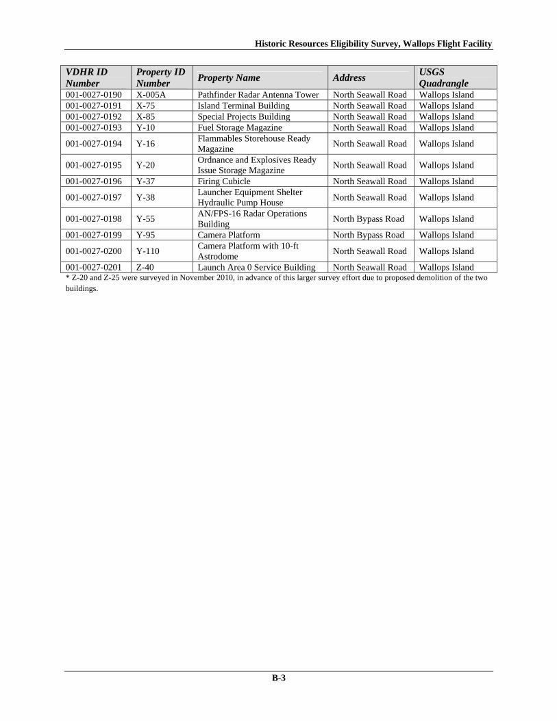
Historic Resources Eligibility Survey, Wallops Flight Facility
B-3
VDHR ID Number
Property ID Number
Property Name Address USGS Quadrangle
001-0027-0190 X-005A Pathfinder Radar Antenna Tower North Seawall Road Wallops Island 001-0027-0191 X-75 Island Terminal Building North Seawall Road Wallops Island 001-0027-0192 X-85 Special Projects Building North Seawall Road Wallops Island 001-0027-0193 Y-10 Fuel Storage Magazine North Seawall Road Wallops Island
001-0027-0194 Y-16 Flammables Storehouse Ready Magazine
North Seawall Road Wallops Island
001-0027-0195 Y-20 Ordnance and Explosives Ready Issue Storage Magazine
North Seawall Road Wallops Island
001-0027-0196 Y-37 Firing Cubicle North Seawall Road Wallops Island
001-0027-0197 Y-38 Launcher Equipment Shelter Hydraulic Pump House
North Seawall Road Wallops Island
001-0027-0198 Y-55 AN/FPS-16 Radar Operations Building
North Bypass Road Wallops Island
001-0027-0199 Y-95 Camera Platform North Bypass Road Wallops Island
001-0027-0200 Y-110 Camera Platform with 10-ft Astrodome
North Seawall Road Wallops Island
001-0027-0201 Z-40 Launch Area 0 Service Building North Seawall Road Wallops Island * Z-20 and Z-25 were surveyed in November 2010, in advance of this larger survey effort due to proposed demolition of the two buildings.

This Page Intentionally Left Blank.
Appendix C NRHP Eligibility of Surveyed Resources Arranged by Facility Number


Historic Resources Eligibility Survey, Wallops Flight Facility
C-1
Appendix C - NRHP Eligibility of Surveyed Resources Arranged by Facility Number
Property ID Number
VDHR Property Number
Property Name Date of Construction
NRHP-Eligibility
E-144 001-0027-0128 Ionosphere Sounding & Solar Data Center
1959 Not Eligible
F-157 001-0027-0129 Office Furniture Supply Warehouse 1957 Not Eligible
F-160 001-0027-0130 Health/Quality Verification Lab/Environmental Building
1957 Not Eligible
F-163 001-0027-0131 Chemical Storage Building 1963 Not Eligible F-170 001-0027-0132 POMB Storage Building 1957 Not Eligible
I-004 001-0027-0152 Wallops Island Causeway and Cat Creek Bridge
1960 Not Eligible
M-15 001-0027-0133 Rocket Inspection & Storage Building 1963 Not Eligible
M-16 001-0027-0134 Inert Rocket Hardware Storage & Hardware Inspection Shelter No. 2
1963 Not Eligible
M-17 001-0027-0135 Heating Plant Building 1963 Not Eligible
M-25 001-0027-0136 Ready Issue Minor Hazard Explosives Magazine
1957 Not Eligible
M-183 001-0027-0137 Ready Service Pyrotechnics Storage Magazine
1957 Not Eligible
M-184 001-0027-0138 Ready Issue Explosive Storage Magazine 1958 Not Eligible N-133 001-0027-0139 NASA Federal Credit Union 1956 Not Eligible
N-134 001-0027-0140 VA Commercial Space Flight Authority and Mid-Atlantic Regional Spaceport Office
1956 Not Eligible
N-159 001-0027-0141 Research Aircraft and Observation Science Lab
1957 Not Eligible
N-159E 001-0027-0142 ASR-7 Radar Antenna Tower 1961 Not Eligible N-162 001-0027-0143 Telecommunications Facility Building 1957 Not Eligible N-162B 001-0027-0144 Frequency Monitoring Antenna Tower 1963 Not Eligible
N-163 001-0027-0145 Antenna Calibration Measurement Facility
1963 Not Eligible
N-164 001-0027-0146 High Frequency Receiver Antenna No. 2- Rotating
1965 Not Eligible
N-166 001-0027-0147 Explosives Handling Equipment Storage Building
1957 Not Eligible
N-167 001-0027-0148 X-Band Antenna Central Control Building
1965 Not Eligible
N-174 001-0027-0149 Boresight & Calibration Tower 1962 Not Eligible N-218 001-0027-0150 Chemical Storage Building 1957 Not Eligible N-222 001-0027-0151 Surplus Utilization and Disposal Building 1957 Not Eligible U-005 001-0027-0153 Mainland Terminal Building 1961 Not Eligible U-20A 001-0027-0154 Radar Antenna Pedestal Tower "B" 1959 Not Eligible U-20B 001-0027-0155 Electric Power Control Building 1959 Not Eligible U-25 001-0027-0156 Radar Operations Building 1959 Not Eligible U-25A 001-0027-0157 Radar Antenna Pedestal Tower "A" 1959 Not Eligible U-26 001-0027-0158 Projects Maintenance Shop 1960 Not Eligible U-27 001-0027-0159 Spare Parts Storage Building 1961 Not Eligible U-30 001-0027-0160 Spandar Radar Operations Building 1960 Not Eligible U-30A 001-0027-0161 Spandar Radar Pedestal Tower 1960 Not Eligible U-40 001-0027-0162 Mobile Radar Laboratory 1961 Not Eligible U-55 001-0027-0163 Transmitter Building 1964 Not Eligible U-55A 001-0027-0164 High Frequency Antenna Tower 1965 Not Eligible

Historic Resources Eligibility Survey, Wallops Flight Facility
C-2
Property ID Number
VDHR Property Number
Property Name Date of Construction
NRHP-Eligibility
U-60 001-0027-0165 AN/FPQ-6 Collimations Beacon & Tower
1964 Not Eligible
U-64 001-0027-0166 Communications Antennas Support Tower
1965 Not Eligible
U-70 001-0027-0167 AN/FPQ-6 Radar Building 1964 Not Eligible
U-70A 001-0027-0168 AN/FPQ-6 Radar Antenna Pedestal Tower
1964 Not Eligible
U-80 001-0027-0169 Atmospheric Physics Measurement Laboratory
1965 Not Eligible
V-25 001-0027-0170 Inert Payload Assembly & Checkout Building
1957 Not Eligible
V-30 001-0027-0171 Ammunition Magazine 1958 Not Eligible
V-42 001-0027-0172 Ready Service Chemical Storage Magazine
1956 Not Eligible
V-45 001-0027-0173 Horizontal Dynamic Balance Test Building
1963 Not Eligible
V-50 001-0027-0174 Dynamic Balance Control Center 1963 Not Eligible V-50A 001-0027-0175 Utility Canopy 1963 Not Eligible
V-52 001-0027-0176 Ready Service Chemical Storage Magazine
1956 Not Eligible
V-55 001-0027-0177 Vertical Dynamic Balance Test Building 1963 Not Eligible V-80 001-0027-0178 Rocket Motor Ready Storage Building 1963 Not Eligible W-10 001-0027-0179 Launch Area Terminal Building 1960 Not Eligible W-15 001-0027-0180 Assembly Shop No. 4 1957 Not Eligible W-16 001-0027-0181 Ready Storage Cubicle 1957 Not Eligible W-20 001-0027-0182 Blockhouse No. 3 1960 Not Eligible W-35 001-0027-0183 Terminal Building Launch Area 4 1960 Not Eligible W-40 001-0027-0184 Assembly Shop No. 5 1960 Not Eligible W-50 001-0027-0185 Launch Area Cable Terminal Building 1960 Not Eligible W-51 001-0027-0186 Flammables Storehouse Ready Magazine 1956 Not Eligible W-57 001-0027-0187 Microwave Rain Attenuation Tower 1961 Not Eligible W-65 001-0027-0188 Checkout and Assembly Shop No. 3 1963 Not Eligible W-67 001-0027-0189 Ready Issue Explosives Storage Cubicle 1957 Not Eligible X-005A 001-0027-0190 Pathfinder Radar Antenna Tower 1966 Not Eligible X-75 001-0027-0191 Island Terminal Building 1960 Not Eligible X-85 001-0027-0192 Special Projects Building 1963 Not Eligible Y-10 001-0027-0193 Fuel Storage Magazine 1957 Not Eligible Y-16 001-0027-0194 Flammables Storehouse Ready Magazine 1957 Not Eligible
Y-20 001-0027-0195 Ordnance and Explosives Ready Issue Storage Magazine
1957 Not Eligible
Y-37 001-0027-0196 Firing Cubicle 1956 Not Eligible
Y-38 001-0027-0197 Launcher Equipment Shelter Hydraulic Pump House
1965 Not Eligible
Y-55 001-0027-0198 AN/FPS-16 Radar Operations Building 1958 Not Eligible Y-95 001-0027-0199 Camera Platform 1964 Not Eligible Y-110 001-0027-0200 Camera Platform with 10 ft Astrodome 1964 Not Eligible Z-20* 001-0027-0126 Liquid Propellant Storage 1961 Not Eligible Z-25* 001-0027-0127 Liquid Propellant Storage 1961 Not Eligible Z-40 001-0027-0201 Launch Area 0 Service Building 1960 Not Eligible
* Z-20 and Z-25 were surveyed in November 2010, in advance of this larger survey effort due to proposed demolition of the two
buildings.

Appendix D VDHR Reconnaissance Survey Forms

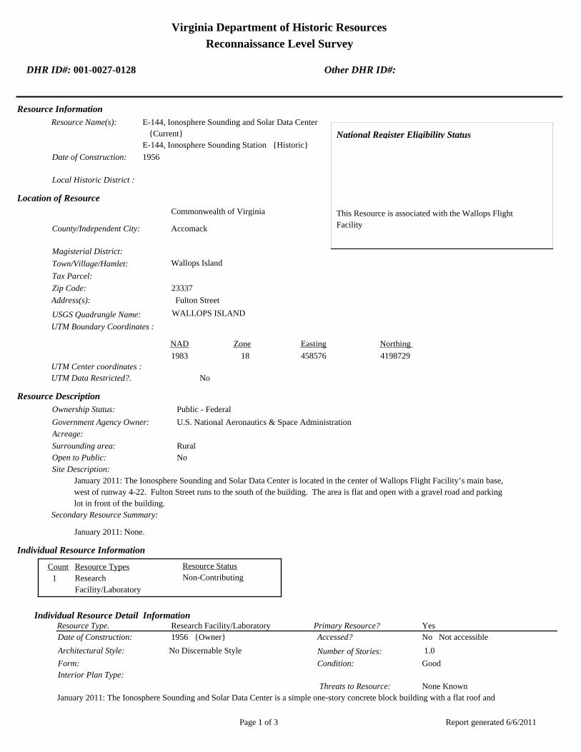
Virginia Department of Historic Resources
Reconnaissance Level Survey
DHR ID#: 001-0027-0128 Other DHR ID#:
Resource Information
National Register Eligibility Status
This Resource is associated with the Wallops Flight
Facility
Resource Name(s): E-144, Ionosphere Sounding and Solar Data Center
{Current}
E-144, Ionosphere Sounding Station {Historic}
Date of Construction: 1956
Local Historic District :
Location of Resource
County/Independent City:
Commonwealth of Virginia
Accomack
Magisterial District:
Town/Village/Hamlet: Wallops Island
Tax Parcel:
Zip Code: 23337
Address(s): Fulton Street
USGS Quadrangle Name: WALLOPS ISLAND
UTM Boundary Coordinates :
Northing EastingZone NAD
1983 18 458576 4198729
UTM Center coordinates :
NoUTM Data Restricted?.
Resource Description
Ownership Status: Public - Federal
Government Agency Owner: U.S. National Aeronautics & Space Administration
Acreage:
Surrounding area: Rural
Open to Public: No
January 2011: The Ionosphere Sounding and Solar Data Center is located in the center of Wallops Flight Facility’s main base,
west of runway 4-22. Fulton Street runs to the south of the building. The area is flat and open with a gravel road and parking
lot in front of the building.
Site Description:
Secondary Resource Summary:
January 2011: None.
Resource StatusResource TypesCount
Research
Facility/Laboratory
Non-Contributing 1
Individual Resource Information
Research Facility/LaboratoryResource Type. Primary Resource? Yes
Individual Resource Detail Information
Date of Construction: Accessed? 1956 {Owner} No Not accessible
1.0 Number of Stories:Architectural Style: No Discernable Style
Good
Interior Plan Type:
Form: Condition:
Threats to Resource: None Known
January 2011: The Ionosphere Sounding and Solar Data Center is a simple one-story concrete block building with a flat roof and
Report generated 6/6/2011Page 1 of 3

Virginia Department of Historic Resources
Reconnaissance Level Survey
DHR ID#: 001-0027-0128 Other DHR ID#:
replacement metal fascia. The building rests on a concrete slab. The main entrance is a half-glazed metal door with a metal awning
hood on the west elevation. There are three awning windows, placed high in the wall, to its north. A concrete sidewalk and stoop
lie in front of the main entrance. The south elevation has three windows of the same type, on its west end. The windows were
installed in 1980 (WFF 2011). The south end of the east elevation has a single hollow steel door with a metal awning hood. Three
heating, ventilation, and air conditioning (HVAC) units are attached to the north elevation.
Primary Resource Exterior Component Description:
Material TreatmentMaterialComp Type/FormComponent
Roof Roof - Flat Asphalt
Foundation Foundation - Slab Concrete Foundation - Poured
Structural System Structural System - Masonry Concrete Structural System - Block
Porch Porch - Stoop Concrete
Windows Windows - Awning Windows - 1-light
Historic Time Period(s):S- The New Dominion (1946- Present)
Historic Context(s): Military/Defense
Technology/Engineering
Significance Statement
January 2011: This building is representative of a secondary Research, Development and Testing resource built near the beginning of the
New Dominion period (1945–present) at a Technology/Engineering research facility. The building was constructed as part of an
expansion of facilities at the installation after the establishment of NASA and the incorporation of Wallops Station as one of its
operational facilities. Initially, Wallops Station’s new mission under NASA was to develop and test various components related to
manned space flight. This mission was short-lived, however, as Wallops became a test range and launch site for suborbital and orbital
rockets and satellites beginning in the early 1960s. The Ionosphere Sounding Station was established in 1959 to monitor the constantly
changing condition of the ionosphere, an atmospheric region that begins at 43 miles above the ground and extends to indefinite height.
The name of the building was changed to Ionosphere Sounding and Solar Data Center in January 1967 (WFF 2011).
E-144 has been evaluated both as a contributing resource in a historic district and as an individual resource. No historic district on the
main base was identified because of a lack of significance and integrity.
The building is not individually eligible for listing on the NRHP because it lacks significance and integrity. The building is recommended
not eligible under Criterion A because it is not associated with an event or pattern of events of local, state, or national significance. It is
not associated with the life of a person significant in our past; therefore, it is recommended not eligible under Criterion B. E-144 is
recommended not eligible under Criterion C because it does not embody the distinctive characteristics of a type, period, or method of
construction; represent the work of a master; possess high artistic value; or represent a significant or distinguishable entity whose
components may lack individual distinction. It is recommended not eligible under Criterion D because it does not have the potential to
yield information important in history or prehistory.
E-144 retains its integrity of location. The integrity of design and workmanship has been diminished by the replacement of the original
doors and windows and the removal of three windows on the south elevation. The building is in its historical location, but the setting has
changed by the addition of several post-1965 buildings nearby. The feeling and association of the building have been negatively affected
by the changes made to the building itself and to its setting.
National Register Eligibility Information (Intensive Level Survey):
NR Resource StatusNR Resource TypeNR Count
Building Non-contributing 1
1 Non-Contributing:
National Register Criteria:
Report generated 6/6/2011Page 2 of 3

Virginia Department of Historic Resources
Reconnaissance Level Survey
DHR ID#: 001-0027-0128 Other DHR ID#:
Level of Significance:
Period of Significance:
Graphic Media Documentation
PhotographerPhoto DateNegative RepositoryDHR Negative # Photographic Media
Digital Image L.ThursbyJanuary 2011
Bibliographic Documentation
Reference #: 1
Bibliographic RecordType: Local Records
Author:
DHR CRM Report Number:
Notes:
Wallops Flight Facility Real Property Records
Cultural Resource Management (CRM) Events
CRM Event # 1,
Cultural Resource Management Event: Survey:Phase I/Reconnaissance
Date of CRM Event: January 2011
CRM Person: TEC Inc
VDHR Project ID # Associated with Event: 2010-2274
CRM Event Notes or Comments:
Lori Thursby and Kimberly Martin
Bridge Information
Cemetery Information
Ownership Information
Unknown Unknown Name: .................................
NASA Wallops Flight FaciltiyCompany: ..........................
Wallops Flight FacilityAddress: .............................
Wallops IslandCity: ...................................
23337Zip: ....................................... VirginiaState: USACountry:
000-000-0000757-824-1000Phone/Extension: ..............
0000/ 0000
Relation to the Property: Owner of property
Report generated 6/6/2011Page 3 of 3

001-0027-0141N-159
001-0027-0130F-160
001-0027-0134M-016
001-0027-0133M-015
001-0027-0143N-162
001-0027-0151N-222
001-0027-0129F-157
001-0027-0139N-133
001-0027-0128E-144
001-0027-0148N-167
001-0027-0145N-163
001-0027-0149N-174
001-0027-0138M-184
001-0027-0140N-134
001-0027-0144N-162B
001-0027-0142N-159E
001-0027-0135M-017
001-0027-0147N-166
001-0027-0131F-163
001-0027-0137M-183
001-0027-0136M-025
001-0027-0150N-218
001-0027-0146N-164
001-0027-0132F-170
Chi
ncot
eagu
e R
d.Wo
rmho
ud
t S
t.Rickette St.
Bl is s St.
Fulton St.S
tubb
es B
lvd.
NASA Property
Surveyed Structures
Buildings
0 250Meters
0 1,000Feet


Virginia Department of Historic Resources
Reconnaissance Level Survey
DHR ID#: 001-0027-0129 Other DHR ID#:
Resource Information
National Register Eligibility Status
This Resource is associated with the Wallops Flight
Facility
Resource Name(s): F-157, Office Furniture Supply {Current}
Date of Construction: 1957
Local Historic District :
Location of Resource
County/Independent City:
Commonwealth of Virginia
Accomack
Magisterial District:
Town/Village/Hamlet: Wallops Island
Tax Parcel:
Zip Code: 23337
Address(s): Wormhoudt Street
USGS Quadrangle Name: WALLOPS ISLAND
UTM Boundary Coordinates :
Northing EastingZone NAD
1983 18 458088 4199052
1983 18 4199052458088UTM Center coordinates :
NoUTM Data Restricted?.
Resource Description
Ownership Status: Public - Federal
Government Agency Owner: U.S. National Aeronautics & Space Administration
Acreage:
Surrounding area: Rural
Open to Public: No
January 2011: The Office Furniture Supply Warehouse is located on Wormhoudt Street north of Rickette Street on the northern
half of Wallops Flight Facility’s main base. The area around the building is flat and open. There is a concrete paved loading
area in front of the building and a gravel driveway north of the building, which leads east to another building (F-007).
Site Description:
Secondary Resource Summary:
January 2011: none
Resource StatusResource TypesCount
Storage Non-Contributing 1
Individual Resource Information
StorageResource Type. Primary Resource? Yes
Individual Resource Detail Information
Date of Construction: Accessed? 1957 {Owner} No Not accessible
1.0 Number of Stories:Architectural Style: No Discernable Style
Good
Interior Plan Type:
PrefabForm: Condition:
Threats to Resource: None Known
January 2011: The Office Furniture Supply Warehouse is a pre-fabricated metal building with a shallow pitched, front gab roof
covered in corrugated metal. The original siding, as well as the doors and windows, was removed and replaced in 1986 (WFF 2011).
The building rests on a concrete slab and is sheathed in corrugated steel siding. The main entrance is located on the west elevation
and consists of an overhead steel door and a single half-glazed metal door. A louvered window with a screen surmounts the
Report generated 6/6/2011Page 1 of 3

Virginia Department of Historic Resources
Reconnaissance Level Survey
DHR ID#: 001-0027-0129 Other DHR ID#:
half-glazed door. The east elevation has a single half-glazed door, surmounted by a louvered window with a screen. There are no
openings on the north or south elevations.
Primary Resource Exterior Component Description:
Material TreatmentMaterialComp Type/FormComponent
Windows Windows - Louvered/Jalousied Metal Windows - Louvered
Structural System Structural System - Frame Metal Structural System - Corrugated
Roof Roof - Gable, Front Metal Roof - V-Crimp
Foundation Foundation - Slab Concrete Foundation - Poured
Historic Time Period(s):S- The New Dominion (1946- Present)
Historic Context(s): Military/Defense
Technology/Engineering
Significance Statement
January 2011: The Office Furniture Supply Warehouse represents a secondary resource built near the beginning of the New Dominion
period (1945–present) at a Military/Defense research facility. The U.S. Navy expanded the mission of the CNAAS in 1946 to include the
NAOTS, which was charged with research and testing of naval aviation weapons and ordnance. The CNAAS/NAOTS retained this
mission until the base was closed in 1959 and transferred to NASA. During the period of 1946–1959, most of the development that
occurred on the main base was related to housing and services. However, several new buildings were constructed on main base within
the three years leading up to the closure of the Navy station. The Navy erected this building in 1957; it has been used for storage since
its construction.
F-157 has been evaluated both as a contributing resource in a historic district and as an individual resource. No historic district on the
main base was identified because of a lack of significance and integrity.
The building is not individually eligible for listing on the NRHP because it lacks significance and integrity. The building is recommended
not eligible under Criterion A because it is not associated with an event or pattern of events of local, state, or national significance. It is
not associated with the life of a person significant in our past; therefore, it is recommended not eligible under Criterion B. F-157 is
recommended not eligible under Criterion C because it does not embody the distinctive characteristics of a type, period, or method of
construction; represent the work of a master; possess high artistic value; or represent a significant or distinguishable entity whose
components may lack individual distinction. It is recommended not eligible under Criterion D because it does not have the potential to
yield information important in history or prehistory.
This building retains integrity of location, but its setting has substantially changed by the demolition of many buildings to the south and
the construction of several post-165 buildings to the north. The building has no integrity of design, materials, or workmanship as a result
of the removal and replacement of the exterior siding, doors, and windows within the past 25 years. As a result of the loss of setting,
design, materials, and workmanship, F-157 no longer retains integrity of feeling and association.
National Register Eligibility Information (Intensive Level Survey):
NR Resource StatusNR Resource TypeNR Count
Building Non-contributing 1
1 Non-Contributing:
National Register Criteria:
Level of Significance:
Period of Significance:
Graphic Media Documentation
PhotographerPhoto DateNegative RepositoryDHR Negative # Photographic Media
Digital Images L.ThursbyJanuary 2011
Report generated 6/6/2011Page 2 of 3

Virginia Department of Historic Resources
Reconnaissance Level Survey
DHR ID#: 001-0027-0129 Other DHR ID#:
Bibliographic Documentation
Reference #: 1
Bibliographic RecordType: Local Records
Author:
DHR CRM Report Number:
Notes:
Wallops Flight Facility Real Property Records
Cultural Resource Management (CRM) Events
CRM Event # 1,
Cultural Resource Management Event: Survey:Phase I/Reconnaissance
Date of CRM Event: January 2011
CRM Person: TEC Inc
VDHR Project ID # Associated with Event: 2010-2274
CRM Event Notes or Comments:
Lori Thursby and Kimberly Martin
Bridge Information
Cemetery Information
Ownership Information
Unknown Unknown Name: .................................
NASA Wallops Flight FacilityCompany: ..........................
Wallops Flight FacilityAddress: .............................
Wallops IslandCity: ...................................
2333Zip: ....................................... VirginiaState: USACountry:
000-000-0000757-824-1000Phone/Extension: ..............
0000/ 0000
Relation to the Property: Owner of property
Report generated 6/6/2011Page 3 of 3

001-0027-0141N-159
001-0027-0130F-160
001-0027-0134M-016
001-0027-0133M-015
001-0027-0143N-162
001-0027-0151N-222
001-0027-0129F-157
001-0027-0139N-133
001-0027-0128E-144
001-0027-0148N-167
001-0027-0145N-163
001-0027-0149N-174
001-0027-0138M-184
001-0027-0140N-134
001-0027-0144N-162B
001-0027-0142N-159E
001-0027-0135M-017
001-0027-0147N-166
001-0027-0131F-163
001-0027-0137M-183
001-0027-0136M-025
001-0027-0150N-218
001-0027-0146N-164
001-0027-0132F-170
Chi
ncot
eagu
e R
d.Wo
rmho
ud
t S
t.Rickette St.
Bl is s St.
Fulton St.S
tubb
es B
lvd.
NASA Property
Surveyed Structures
Buildings
0 250Meters
0 1,000Feet


Virginia Department of Historic Resources
Reconnaissance Level Survey
DHR ID#: 001-0027-0130 Other DHR ID#:
Resource Information
National Register Eligibility Status
Resource has not been evaluated.*
This Resource is associated with the Wallops Flight
Facility
* Resource has not been formally evaluated by DHR or
eligibility information has not been documented in DSS
at this time.
Resource Name(s): F-160, Quality Verification Laboratories Building
{Historic}
F-160, Health/Quality Verification
Lab/Environmental Building {Current}
F-160, Personnel/Environmental /Health &
Safety/Quality Verification Lab Building
{Historic}
F-160, Calibration Lab, EICS {Historic}
F-160, Instrument Service, Calibration & Chemistry
Labs {Historic}
Base Hospital {Historic}
Date of Construction: 1957
Local Historic District :
Location of Resource
County/Independent City:
Commonwealth of Virginia
Accomack
Magisterial District:
Town/Village/Hamlet: Wallops Island
Tax Parcel:
Zip Code: 23337
Address(s): Bliss Street
USGS Quadrangle Name: WALLOPS ISLAND
UTM Boundary Coordinates :
Northing EastingZone NAD
1983 18 458353 4198882
1983 18 4198882458353UTM Center coordinates :
NoUTM Data Restricted?.
Resource Description
Ownership Status: Public - Federal
Government Agency Owner: U.S. National Aeronautics & Space Administration
Acreage:
Surrounding area: Rural
Open to Public: No
January 2011: The Health/Quality Verification Lab;Environmental Building is located on the north half of Wallops Flight
Facility’s main base, west of runway 4-28. Bliss Street bounds the building on the west and Avery Street bounds it on the
north. The area is flat and sidewalks and parking lots are on each side of the building. F-165, a tower with the NASA logo, is
across the street. Another building (F-162) is to the southeast
Site Description:
Secondary Resource Summary:
January 2011: none
Resource StatusResource TypesCount
Research
Facility/Laboratory
Non-Contributing 1
Individual Resource Information
Report generated 6/6/2011Page 1 of 4
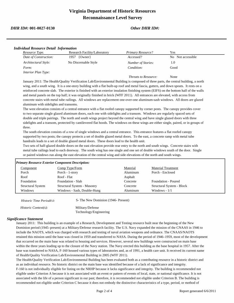
Virginia Department of Historic Resources
Reconnaissance Level Survey
DHR ID#: 001-0027-0130 Other DHR ID#:
Research Facility/LaboratoryResource Type. Primary Resource? Yes
Individual Resource Detail Information
Date of Construction: Accessed? 1957 {Owner} No Not accessible
1.0 Number of Stories:Architectural Style: No Discernable Style
Good
Interior Plan Type:
Form: Condition:
Threats to Resource: None
January 2011: The Health/Quality Verification Lab/Environmental Building is composed of three parts, the central building, a north
wing, and a south wing. It is a one-story building with a flat built-up roof and metal fascia, gutters, and down spouts. It rests on a
reinforced concrete slab. The exterior is finished with an exterior insulation finishing system (EIFS) on the bottom half of the walls
and metal panels on the top half; it was originally finished in brick (WFF 2011). All entrances are elevated, with access from
concrete stairs with metal tube railings. All windows are replacement one-over-one aluminum-sash windows. All doors are glazed
aluminum with sidelights and transoms.
The west elevation consists of a central entrance with a flat roofed canopy supported by corner posts. The canopy provides cover
to two separate single glazed aluminum doors, each one with sidelights and a transom. Windows are regularly spaced sets of
double and triple pairings. The north and south wings project beyond the central wing and have single glazed doors with three
sidelights and a transom, protected by cantilevered flat hoods. The windows on these wings are either single, paired, or in groups of
three.
The south elevation consists of a row of single windows and a central entrance. This entrance features a flat roofed canopy
supported by two posts; the canopy protects a set of double glazed metal doors. To the east, a concrete ramp with metal tube
handrails leads to a set of double glazed metal doors. These doors lead to the health unit.
Two sets of half-glazed double doors on the east elevation provide rear entry to the north and south wings. Concrete stairs with
metal tube railings lead to each doorway. The south wing has one single and one set of double windows south of the door. Single
or paired windows run along the east elevation of the central wing and side elevations of the north and south wings.
Primary Resource Exterior Component Description:
Material TreatmentMaterialComp Type/FormComponent
Porch Porch - 1-story Aluminum Porch - Enclosed
Roof Roof - Flat Asphalt
Foundation Foundation - Slab Concrete Foundation - Poured
Structural System Structural System - Masonry Concrete Structural System - Block
Windows Windows - Sash, Double-Hung Aluminum Windows - 1/1
Historic Time Period(s):S- The New Dominion (1946- Present)
Historic Context(s): Military/Defense
Technology/Engineering
Significance Statement
January 2011: This building is an example of a Research, Development and Testing resource built near the beginning of the New
Dominion period (1945–present) at a Military/Defense research facility. The U.S. Navy expanded the mission of the CNAAS in 1946 to
include the NAOTS, which was charged with research and testing of naval aviation weapons and ordnance. The CNAAS/NAOTS
retained this mission until the base was closed in 1959 and transferred to NASA. During the period of 1946–1959, most of the development
that occurred on the main base was related to housing and services. However, several new buildings were constructed on main base
within the three years leading up to the closure of the Navy station. The Navy erected this building as the base hospital in 1957. After the
base was transferred to NASA, F-160 housed various types of laboratories and, as of 1991, a health care unit. It received its current name
of Health/Quality Verification Lab/Environmental Building in 2005 (WFF 2011).
The Health/Quality Verification Lab/Environmental Building has been evaluated both as a contributing resource in a historic district and
as an individual resource. No historic district on the main base was identified because of a lack of significance and integrity.
F-160 is not individually eligible for listing on the NRHP because it lacks significance and integrity. The building is recommended not
eligible under Criterion A because it is not associated with an event or pattern of events of local, state, or national significance. It is not
associated with the life of a person significant in our past; therefore, it is recommended not eligible under Criterion B. The building is
recommended not eligible under Criterion C because it does not embody the distinctive characteristics of a type, period, or method of
Report generated 6/6/2011Page 2 of 4

Virginia Department of Historic Resources
Reconnaissance Level Survey
DHR ID#: 001-0027-0130 Other DHR ID#:
construction; represent the work of a master; possess high artistic value; or represent a significant or distinguishable entity whose
components may lack individual distinction. It is recommended not eligible under Criterion D because it does not have the potential to
yield information important in history or prehistory.
The building is in its historical location. The setting has been compromised by the demolition of historical Navy buildings to the west and
the post-1965 construction of a couple of buildings in the immediate vicinity. No additions have been made to the building; however, its
integrity of design, materials, and workmanship have been negatively impacted by the installation of EIFS and metal panels over the
historical brick exterior and the removal and replacement of the doors and windows. The integrity of feeling and association of F-160 is
lacking due to the multiple physical changes that removed the historic character of the building.
National Register Eligibility Information (Intensive Level Survey):
NR Resource StatusNR Resource TypeNR Count
Building Non-contributing 1
1 Non-Contributing:
National Register Criteria:
Level of Significance:
Period of Significance:
Graphic Media Documentation
PhotographerPhoto DateNegative RepositoryDHR Negative # Photographic Media
Digital Image L. ThursbyJanuary 2011
Bibliographic Documentation
Reference #: 1
Bibliographic RecordType: Local Records
Author:
DHR CRM Report Number:
Notes:
Wallops Flight Facility Real Property Records
Cultural Resource Management (CRM) Events
CRM Event # 1,
Cultural Resource Management Event: Survey:Phase I/Reconnaissance
Date of CRM Event: January 2011
CRM Person: TEC Inc
VDHR Project ID # Associated with Event: 2010-2274
CRM Event Notes or Comments:
Lori Thursby and Kimberly Martin
Bridge Information
Cemetery Information
Ownership Information
Unknown Unknown Name: .................................
NASA Wallops Flight FacilityCompany: ..........................
Wallops Flight FacilityAddress: .............................
Wallops IslandCity: ...................................
Report generated 6/6/2011Page 3 of 4

Virginia Department of Historic Resources
Reconnaissance Level Survey
DHR ID#: 001-0027-0130 Other DHR ID#:
23337Zip: ....................................... VirginiaState: USACountry:
000-000-0000757-824-1000Phone/Extension: ..............
0000/ 0000
Relation to the Property: Owner of property
Report generated 6/6/2011Page 4 of 4

001-0027-0141N-159
001-0027-0130F-160
001-0027-0134M-016
001-0027-0133M-015
001-0027-0143N-162
001-0027-0151N-222
001-0027-0129F-157
001-0027-0139N-133
001-0027-0128E-144
001-0027-0148N-167
001-0027-0145N-163
001-0027-0149N-174
001-0027-0138M-184
001-0027-0140N-134
001-0027-0144N-162B
001-0027-0142N-159E
001-0027-0135M-017
001-0027-0147N-166
001-0027-0131F-163
001-0027-0137M-183
001-0027-0136M-025
001-0027-0150N-218
001-0027-0146N-164
001-0027-0132F-170
Chi
ncot
eagu
e R
d.Wo
rmho
ud
t S
t.Rickette St.
Bl is s St.
Fulton St.S
tubb
es B
lvd.
NASA Property
Surveyed Structures
Buildings
0 250Meters
0 1,000Feet

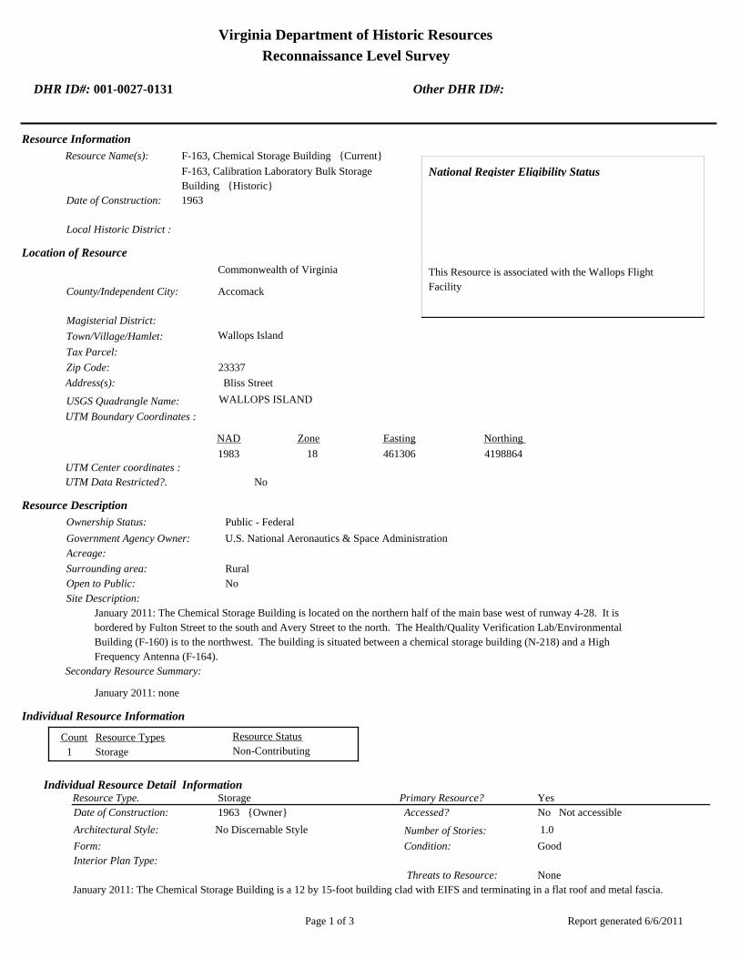
Virginia Department of Historic Resources
Reconnaissance Level Survey
DHR ID#: 001-0027-0131 Other DHR ID#:
Resource Information
National Register Eligibility Status
This Resource is associated with the Wallops Flight
Facility
Resource Name(s): F-163, Chemical Storage Building {Current}
F-163, Calibration Laboratory Bulk Storage
Building {Historic}
Date of Construction: 1963
Local Historic District :
Location of Resource
County/Independent City:
Commonwealth of Virginia
Accomack
Magisterial District:
Town/Village/Hamlet: Wallops Island
Tax Parcel:
Zip Code: 23337
Address(s): Bliss Street
USGS Quadrangle Name: WALLOPS ISLAND
UTM Boundary Coordinates :
Northing EastingZone NAD
1983 18 461306 4198864
UTM Center coordinates :
NoUTM Data Restricted?.
Resource Description
Ownership Status: Public - Federal
Government Agency Owner: U.S. National Aeronautics & Space Administration
Acreage:
Surrounding area: Rural
Open to Public: No
January 2011: The Chemical Storage Building is located on the northern half of the main base west of runway 4-28. It is
bordered by Fulton Street to the south and Avery Street to the north. The Health/Quality Verification Lab/Environmental
Building (F-160) is to the northwest. The building is situated between a chemical storage building (N-218) and a High
Frequency Antenna (F-164).
Site Description:
Secondary Resource Summary:
January 2011: none
Resource StatusResource TypesCount
Storage Non-Contributing 1
Individual Resource Information
StorageResource Type. Primary Resource? Yes
Individual Resource Detail Information
Date of Construction: Accessed? 1963 {Owner} No Not accessible
1.0 Number of Stories:Architectural Style: No Discernable Style
Good
Interior Plan Type:
Form: Condition:
Threats to Resource: None
January 2011: The Chemical Storage Building is a 12 by 15-foot building clad with EIFS and terminating in a flat roof and metal fascia.
Report generated 6/6/2011Page 1 of 3

Virginia Department of Historic Resources
Reconnaissance Level Survey
DHR ID#: 001-0027-0131 Other DHR ID#:
The building originally featured a brick veneer on concrete block walls (WFF 2011). It rests on a concrete slab. Its only opening is
located on the north elevation and consists of a set of double half-glazed metal doors with three lights.
Primary Resource Exterior Component Description:
Material TreatmentMaterialComp Type/FormComponent
Structural System Structural System - Masonry Concrete Structural System - Block
Roof Roof - Flat Asphalt
Foundation Foundation - Slab Concrete Foundation - Poured
Historic Time Period(s):S- The New Dominion (1946- Present)
Historic Context(s): Military/Defense
Technology/Engineering
Significance Statement
January 2011: This building is representative of a secondary resource built towards the beginning of the New Dominion period
(1945–present) at a Technology/Engineering research facility. This is one of approximately 50 buildings and structures that were erected
within six years of the establishment of NASA and the incorporation of Wallops Station as one of its operational facilities in 1959.
Initially, Wallops Station’s new mission under NASA was to develop and test various components related to manned space flight. This
mission was short-lived, however, as Wallops became a test range and launch site for suborbital and orbital rockets and satellites
beginning in the early 1960s. NASA constructed this building in 1963. Within a year, it was renovated for office and shop space. In 1971
it was converted to a bulk storage building for the Calibration Laboratory (F-160) (WFF 2011). It currently serves as chemical storage.
The Chemical Storage Building has been evaluated both as a contributing resource in a historic district and as an individual resource. No
historic district on the main base was identified because of a lack of significance and integrity.
F-163 is not individually eligible for listing on the NRHP because it lacks significance and integrity. The building is presently less than 50
years old; therefore, it was evaluated under Criteria Consideration G in addition to Criteria A–D. The building is recommended not eligible
under Criterion A because it is not associated with an event or pattern of events of exceptional importance at the local, state, or national
level. It is not associated with the life of a person who made exceptionally important contributions in history; therefore, it is recommended
not eligible under Criterion B. The building is recommended not eligible under Criterion C because it does not embody exceptional
architectural merit for distinctive characteristics of a type, period, or method of construction; represent the work of a master; or possess
high artistic value. Likewise, it does not represent an exceptionally significant or distinguishable entity whose components may lack
individual distinction. It is recommended not eligible under Criterion D because it does not have the potential to yield information
exceptionally important in history or prehistory.
The chemical storage building is in its historical location. The setting has been compromised by the demolition of historical Navy
buildings to the west and the post-1965 construction of a couple of buildings in the immediate vicinity. The integrity of design, materials,
and workmanship have been negatively impacted by the installation of EIFS over the historical brick exterior. The integrity of feeling and
association of F-163 have been adversely affected by the changes to the setting and exterior materials of the building.
National Register Eligibility Information (Intensive Level Survey):
NR Resource StatusNR Resource TypeNR Count
Building Non-contributing 1
1 Non-Contributing:
National Register Criteria:
Level of Significance:
Period of Significance:
Graphic Media Documentation
PhotographerPhoto DateNegative RepositoryDHR Negative # Photographic Media
Report generated 6/6/2011Page 2 of 3
Virginia Department of Historic Resources
Reconnaissance Level Survey
DHR ID#: 001-0027-0131 Other DHR ID#:
Digital Images L. ThursbyJanuary 2011
Bibliographic Documentation
Reference #: 1
Bibliographic RecordType: Local Records
Author:
DHR CRM Report Number:
Notes:
Wallops Flight Facility Real Property Records
Cultural Resource Management (CRM) Events
CRM Event # 1,
Cultural Resource Management Event: Survey:Phase I/Reconnaissance
Date of CRM Event: January 2011
CRM Person: TEC Inc
VDHR Project ID # Associated with Event: 2010-2274
CRM Event Notes or Comments:
Lori Thursby and Kimberly Martin
Bridge Information
Cemetery Information
Ownership Information
Unknown Unknown Name: .................................
NASA Wallops Flight FacilityCompany: ..........................
Wallops Flight FaclityAddress: .............................
Wallops IslandCity: ...................................
23337Zip: ....................................... VirginiaState: USACountry:
000-000-0000757-824-1000Phone/Extension: ..............
0000/ 0000
Relation to the Property: Owner of property
Report generated 6/6/2011Page 3 of 3

001-0027-0141N-159
001-0027-0130F-160
001-0027-0134M-016
001-0027-0133M-015
001-0027-0143N-162
001-0027-0151N-222
001-0027-0129F-157
001-0027-0139N-133
001-0027-0128E-144
001-0027-0148N-167
001-0027-0145N-163
001-0027-0149N-174
001-0027-0138M-184
001-0027-0140N-134
001-0027-0144N-162B
001-0027-0142N-159E
001-0027-0135M-017
001-0027-0147N-166
001-0027-0131F-163
001-0027-0137M-183
001-0027-0136M-025
001-0027-0150N-218
001-0027-0146N-164
001-0027-0132F-170
Chi
ncot
eagu
e R
d.Wo
rmho
ud
t S
t.Rickette St.
Bl is s St.
Fulton St.S
tubb
es B
lvd.
NASA Property
Surveyed Structures
Buildings
0 250Meters
0 1,000Feet


Virginia Department of Historic Resources
Reconnaissance Level Survey
DHR ID#: 001-0027-0132 Other DHR ID#:
Resource Information
National Register Eligibility Status
This Resource is associated with the Wallops Flight
Facility
Resource Name(s): F-170, Plant Operations and Maintenance Branch
(POMB) Storage Building {Current}
Date of Construction: 1957
Local Historic District :
Location of Resource
County/Independent City:
Commonwealth of Virginia
Accomack
Magisterial District:
Town/Village/Hamlet: Wallops Island
Tax Parcel:
Zip Code: 23337
Address(s):
USGS Quadrangle Name: WALLOPS ISLAND
UTM Boundary Coordinates :
Northing EastingZone NAD
1983 18 457942 4199302
UTM Center coordinates :
NoUTM Data Restricted?.
Resource Description
Ownership Status: Public - Federal
Government Agency Owner: U.S. National Aeronautics & Space Administration
Acreage: 1,800.00
Surrounding area: Rural
Open to Public: No
January 2011: The POMB Storage Building is located on Wormhoudt Street north of Rickette Street on the northern half of
Wallops Flight Facility’s main base. The area is composed of many large buildings and extensive paved areas. F-170 stands
next to the southeast corner of F-020.
Site Description:
Secondary Resource Summary:
January 2011: none
Resource StatusResource TypesCount
Storage Non-Contributing 1
Individual Resource Information
StorageResource Type. Primary Resource? Yes
Individual Resource Detail Information
Date of Construction: Accessed? 1957 {Owner} No Not accessible
1.0 Number of Stories:Architectural Style: No Discernable Style
Good
Interior Plan Type:
Form: Condition:
Threats to Resource: None Known
January 2011: This single-story reinforced concrete building rests on a concrete slab. It has only one point of entry, a single steel
door on the south elevation. The central door is flanked by one vent with a metal cover. On the opposite elevation there are two
small vents with metal covers in the top part of the wall. Four metal eye hooks are located on each corner of the roof.
Report generated 6/6/2011Page 1 of 3

Virginia Department of Historic Resources
Reconnaissance Level Survey
DHR ID#: 001-0027-0132 Other DHR ID#:
F-170 represents a Navy standardized building design for storage of small materials. At Wallops, it is typically utilized for storage of
hazardous materials. The Navy built numerous buildings of this type on the main base and Wallops Island between 1957 and 1958.
As of 2011, 14 buildings of this type were extant.
Primary Resource Exterior Component Description:
Material TreatmentMaterialComp Type/FormComponent
Roof Porch - Flat Concrete
Foundation Foundation - Slab Concrete Foundation - Poured
Structural System Structural System - Masonry Concrete
Historic Time Period(s):S- The New Dominion (1946- Present)
Historic Context(s): Military/Defense
Technology/Engineering
Significance Statement
January 2011: F-170 and the other four buildings (M-25, M-183, M-184, and N-218) on the main base of this same type represent a
secondary resource built near the beginning of the New Dominion period (1945–present) at a Military/Defense research facility. The U.S.
Navy expanded the mission of the CNAAS in 1946 to include the NAOTS, which was charged with research and testing of naval aviation
weapons and ordnance. The CNAAS/NAOTS retained this mission until the base was closed in 1959 and transferred to NASA. During
the period of 1946–1959, most of the development that occurred on the main base was related to housing and services. However, several
new buildings were constructed on main base within the three years leading up to the closure of the Navy station. The Navy erected the
same type of storage buildings as F-170 in 1957 and 1958.
Each of these five storage buildings has been evaluated both as a contributing resource in a historic district and as an individual resource.
No historic district on the main base was identified because of a lack of significance and integrity.
This resource type is not individually eligible for listing on the NRHP because it lacks significance, and also in some cases, integrity. Each
building is recommended not eligible under Criterion A because it is not associated with an event or pattern of events of local, state, or
national significance. It is not associated with the life of a person significant in our past; therefore, it is recommended not eligible under
Criterion B. Each of these storage buildings is a secondary resource of simple design and common construction and, therefore, is
recommended not eligible under Criterion C because it does not embody the distinctive characteristics of a type, period, or method of
construction; represent the work of a master; possess high artistic value; or represent a significant or distinguishable entity whose
components may lack individual distinction. It is recommended not eligible under Criterion D because it does not have the potential to
yield information important in history or prehistory.
Building F-170 was moved during the period of significance; therefore, it does not possess integrity of location. It also has no integrity of
setting: the setting of the current location is not comparable to the historical setting. The removal of the building from its original location
and setting has destroyed its integrity of feeling and association. The resource retains its integrity of design, materials, and workmanship.
National Register Eligibility Information (Intensive Level Survey):
NR Resource StatusNR Resource TypeNR Count
Building Non-contributing 1
1 Non-Contributing:
National Register Criteria:
Level of Significance:
Period of Significance:
Graphic Media Documentation
PhotographerPhoto DateNegative RepositoryDHR Negative # Photographic Media
Digital Images L.ThursbyJanuary 2011
Report generated 6/6/2011Page 2 of 3

Virginia Department of Historic Resources
Reconnaissance Level Survey
DHR ID#: 001-0027-0132 Other DHR ID#:
Bibliographic Documentation
Reference #: 1
Bibliographic RecordType: Local Records
Author:
DHR CRM Report Number:
Notes:
Wallops Flight Facility Real Property Records
Reference #: 2
Bibliographic RecordType: Drawings
Author:
DHR CRM Report Number:
Notes:
As Built Drawings
Cultural Resource Management (CRM) Events
CRM Event # 1,
Cultural Resource Management Event: Survey:Phase I/Reconnaissance
Date of CRM Event: January 2011
CRM Person: TEC Inc
VDHR Project ID # Associated with Event: 2010-2274
CRM Event Notes or Comments:
Lori Thursby and Kimberly Martin
Bridge Information
Cemetery Information
Ownership Information
Unknown Unknown Name: .................................
NASA Wallops Flight FacilityCompany: ..........................
Wallops Flight FacilityAddress: .............................
Wallops IslandCity: ...................................
23337Zip: ....................................... VirginiaState: USACountry:
000-000-0000757-824-1000Phone/Extension: ..............
0000/ 0000
Relation to the Property: Owner of property
Report generated 6/6/2011Page 3 of 3

001-0027-0141N-159
001-0027-0130F-160
001-0027-0134M-016
001-0027-0133M-015
001-0027-0143N-162
001-0027-0151N-222
001-0027-0129F-157
001-0027-0139N-133
001-0027-0128E-144
001-0027-0148N-167
001-0027-0145N-163
001-0027-0149N-174
001-0027-0138M-184
001-0027-0140N-134
001-0027-0144N-162B
001-0027-0142N-159E
001-0027-0135M-017
001-0027-0147N-166
001-0027-0131F-163
001-0027-0137M-183
001-0027-0136M-025
001-0027-0150N-218
001-0027-0146N-164
001-0027-0132F-170
Chi
ncot
eagu
e R
d.Wo
rmho
ud
t S
t.Rickette St.
Bl is s St.
Fulton St.S
tubb
es B
lvd.
NASA Property
Surveyed Structures
Buildings
0 250Meters
0 1,000Feet

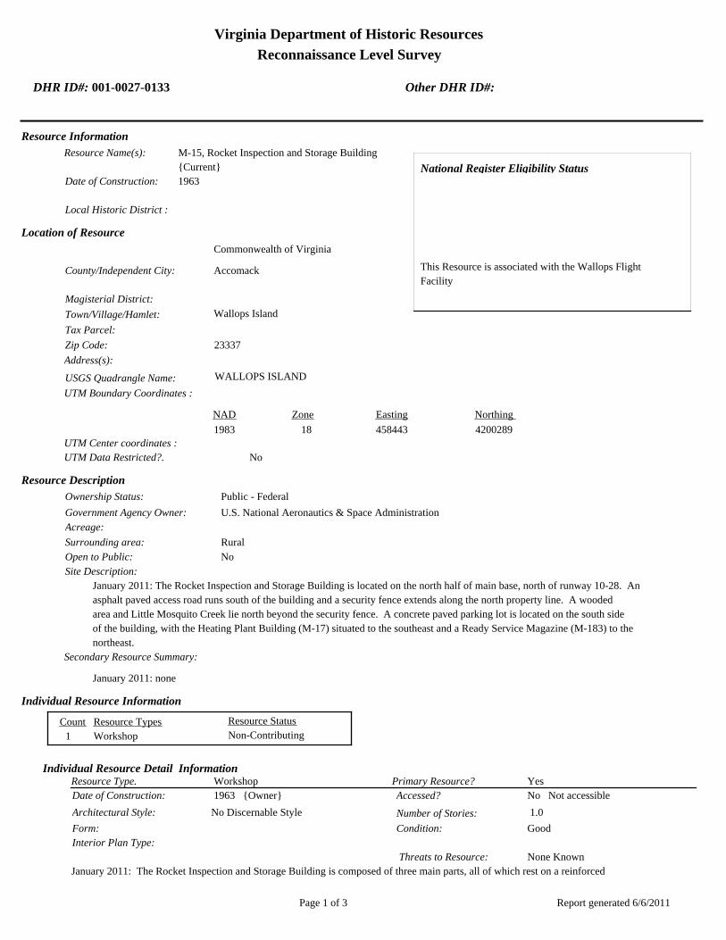
Virginia Department of Historic Resources
Reconnaissance Level Survey
DHR ID#: 001-0027-0133 Other DHR ID#:
Resource Information
National Register Eligibility Status
This Resource is associated with the Wallops Flight
Facility
Resource Name(s): M-15, Rocket Inspection and Storage Building
{Current}
Date of Construction: 1963
Local Historic District :
Location of Resource
County/Independent City:
Commonwealth of Virginia
Accomack
Magisterial District:
Town/Village/Hamlet: Wallops Island
Tax Parcel:
Zip Code: 23337
Address(s):
USGS Quadrangle Name: WALLOPS ISLAND
UTM Boundary Coordinates :
Northing EastingZone NAD
1983 18 458443 4200289
UTM Center coordinates :
NoUTM Data Restricted?.
Resource Description
Ownership Status: Public - Federal
Government Agency Owner: U.S. National Aeronautics & Space Administration
Acreage:
Surrounding area: Rural
Open to Public: No
January 2011: The Rocket Inspection and Storage Building is located on the north half of main base, north of runway 10-28. An
asphalt paved access road runs south of the building and a security fence extends along the north property line. A wooded
area and Little Mosquito Creek lie north beyond the security fence. A concrete paved parking lot is located on the south side
of the building, with the Heating Plant Building (M-17) situated to the southeast and a Ready Service Magazine (M-183) to the
northeast.
Site Description:
Secondary Resource Summary:
January 2011: none
Resource StatusResource TypesCount
Workshop Non-Contributing 1
Individual Resource Information
WorkshopResource Type. Primary Resource? Yes
Individual Resource Detail Information
Date of Construction: Accessed? 1963 {Owner} No Not accessible
1.0 Number of Stories:Architectural Style: No Discernable Style
Good
Interior Plan Type:
Form: Condition:
Threats to Resource: None Known
January 2011: The Rocket Inspection and Storage Building is composed of three main parts, all of which rest on a reinforced
Report generated 6/6/2011Page 1 of 3

Virginia Department of Historic Resources
Reconnaissance Level Survey
DHR ID#: 001-0027-0133 Other DHR ID#:
concrete slab foundation. The original building was constructed in 1963 and consists of concrete block wings with front gabled
roofs and aluminum fascia. The east wing of the building was constructed in 1995 as forklift storage space. It is a post and frame
prefabricated aluminum building with a side gabled standing seam metal roof. Two overhead rolling metal doors are centered in its
south elevation. The one-story west wing has a 15 ft overhead rolling aluminum door between projecting concrete block columns
on the south elevation. A half-glazed metal door with three lights is located at the southwest corner. The two-story middle portion
of the building features a central 15 ft overhead rolling aluminum door and a half-glazed metal door with three lights.
The west elevation is composed of six bays of aluminum-frame fixed windows, separated by projecting concrete block columns, that
extend along the top of wall. Two small openings with concrete sills and lintels are located in the middle of the elevation, centered
between columns. The north elevation of the west wing of the building has four projecting concrete block columns that divide the
elevation into thirds. A half-glazed metal door with three lights is located on the northwest corner and two metal louvers with
precast concrete sills are located on the lower half of the wall in the center of the eastern third and western third of the elevation. A
concrete panel in the center was originally intended to be replaced by rolling metal doors.
The middle wing’s north elevation consists of a single hollow steel door with a concrete canopy on the east side, directly beside a
lean-to addition. The addition, which was built in 1984 for an office, is constructed of concrete block and has a shed roof with
aluminum fascia (WFF 2010). Another concrete block lean-to was constructed in 1974 to connect the rocket storage area (west half
of building) and materials inspection area (east half) (WFF 2010). This addition has a single hollow steel door with a large aluminum
awning on its north elevation and a fixed aluminum frame window with three lights on the east elevation. In 1998, a third lean-to
addition was appended to the east side of the middle wing (WFF 2011). Providing a rocket motor assembly area, this addition is
concrete block and has a shed roof and half-glazed metal door.
The east elevation consists of one half-glazed metal door with three lights to the north of the 1984 addition, rolling overhead metal
doors centered in the 1984 addition, and a single hollow steel door on the northernmost corner of the 1995 prefabricated addition.
Primary Resource Exterior Component Description:
Material TreatmentMaterialComp Type/FormComponent
Structural System Structural System - Masonry Concrete Structural System - Block
Structural System Structural System - Frame Metal Structural System - Siding
Windows Windows - Fixed Aluminum Windows - 1-light
Roof Roof - Gable, Side Metal Roof - Standing Seam
Roof Roof - Gable, Front Aluminum Roof - Corrugated
Foundation Foundation - Slab Concrete Foundation - Poured
Historic Time Period(s):S- The New Dominion (1946- Present)
Historic Context(s): Military/Defense
Technology/Engineering
Significance Statement
January 2011: This building represents an Industrial property type built towards the beginning of the New Dominion period
(1945–present) at a Technology/Engineering research facility. This is one of approximately 50 buildings and structures that were erected
within six years of the establishment of NASA and the incorporation of Wallops Station as one of its operational facilities in 1959.
Initially, Wallops Station’s new mission under NASA was to develop and test various components related to manned space flight. This
mission was short-lived, however, as Wallops became a test range and launch site for suborbital and orbital rockets and satellites
beginning in the early 1960s. M-15 is one of two rocket storage buildings (the other is M-16) that NASA constructed in 1963 on the north
side of the former NAOTS munitions magazine area. It retains its original use.
M-15 has been evaluated both as a contributing resource in a historic district and as an individual resource. No historic district on the
main base was identified because of a lack of significance and integrity.
The Rocket Inspection and Storage Building is not individually eligible for listing on the NRHP because it lacks significance and integrity.
The building is presently less than 50 years old; therefore, it was evaluated under Criteria Consideration G in addition to Criteria A–D.
The building is recommended not eligible under Criterion A because it is not associated with an event or pattern of events of exceptional
importance at the local, state, or national level. It is not associated with the life of a person who made exceptionally important
contributions in history; therefore, it is recommended not eligible under Criterion B. The building is recommended not eligible under
Criterion C because it does not embody exceptional architectural merit for distinctive characteristics of a type, period, or method of
construction; represent the work of a master; or possess high artistic value. Likewise, it does not represent an exceptionally significant or
distinguishable entity whose components may lack individual distinction. It is recommended not eligible under Criterion D because it
Report generated 6/6/2011Page 2 of 3
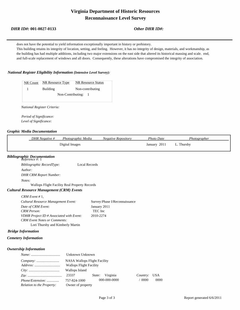
Virginia Department of Historic Resources
Reconnaissance Level Survey
DHR ID#: 001-0027-0133 Other DHR ID#:
does not have the potential to yield information exceptionally important in history or prehistory.
This building retains its integrity of location, setting, and feeling. However, it has no integrity of design, materials, and workmanship, as
the building has had multiple additions, including two major extensions on the east side that altered its historical massing and scale. end,
and full-scale replacement of windows and all doors. Consequently, these alterations have compromised the integrity of association.
National Register Eligibility Information (Intensive Level Survey):
NR Resource StatusNR Resource TypeNR Count
Building Non-contributing 1
1 Non-Contributing:
National Register Criteria:
Level of Significance:
Period of Significance:
Graphic Media Documentation
PhotographerPhoto DateNegative RepositoryDHR Negative # Photographic Media
Digital Images L. ThursbyJanuary 2011
Bibliographic Documentation
Reference #: 1
Bibliographic RecordType: Local Records
Author:
DHR CRM Report Number:
Notes:
Wallops Flight Facility Real Property Records
Cultural Resource Management (CRM) Events
CRM Event # 1,
Cultural Resource Management Event: Survey:Phase I/Reconnaissance
Date of CRM Event: January 2011
CRM Person: TEC Inc
VDHR Project ID # Associated with Event: 2010-2274
CRM Event Notes or Comments:
Lori Thursby and Kimberly Martin
Bridge Information
Cemetery Information
Ownership Information
Unknown Unknown Name: .................................
NASA Wallops Flight FacilityCompany: ..........................
Wallops Flight FacilityAddress: .............................
Wallops IslandCity: ...................................
23337Zip: ....................................... VirginiaState: USACountry:
000-000-0000757-824-1000Phone/Extension: ..............
0000/ 0000
Relation to the Property: Owner of property
Report generated 6/6/2011Page 3 of 3

001-0027-0141N-159
001-0027-0130F-160
001-0027-0134M-016
001-0027-0133M-015
001-0027-0143N-162
001-0027-0151N-222
001-0027-0129F-157
001-0027-0139N-133
001-0027-0128E-144
001-0027-0148N-167
001-0027-0145N-163
001-0027-0149N-174
001-0027-0138M-184
001-0027-0140N-134
001-0027-0144N-162B
001-0027-0142N-159E
001-0027-0135M-017
001-0027-0147N-166
001-0027-0131F-163
001-0027-0137M-183
001-0027-0136M-025
001-0027-0150N-218
001-0027-0146N-164
001-0027-0132F-170
Chi
ncot
eagu
e R
d.Wo
rmho
ud
t S
t.Rickette St.
Bl is s St.
Fulton St.S
tubb
es B
lvd.
NASA Property
Surveyed Structures
Buildings
0 250Meters
0 1,000Feet


Virginia Department of Historic Resources
Reconnaissance Level Survey
DHR ID#: 001-0027-0134 Other DHR ID#:
Resource Information
National Register Eligibility Status
This Resource is associated with the Wallops Flight
Facility
Resource Name(s): M-16, Inert Rocket Hardware and Hardware
Inspection Shelter {Current}
Date of Construction: 1963
Local Historic District :
Location of Resource
County/Independent City:
Commonwealth of Virginia
Accomack
Magisterial District:
Town/Village/Hamlet: Wallops Island
Tax Parcel:
Zip Code: 23337
Address(s):
USGS Quadrangle Name: WALLOPS ISLAND
UTM Boundary Coordinates :
Northing EastingZone NAD
1983 18 458655 4200289
UTM Center coordinates :
NoUTM Data Restricted?.
Resource Description
Ownership Status: Public - Federal
Government Agency Owner: U.S. National Aeronautics & Space Administration
Acreage:
Surrounding area: Rural
Open to Public: No
January 2011: The Inert Rocket Hardware and HWDE Hardware Inspection Shelter is located on the north half of the main base,
north of runway 10-28. The site is wooded with Little Mosquito Creek beyond the woods to the north. Concrete pavement
surrounds the building. Two asphalt paved roads provide access. A security fence runs along the north perimeter of the
property
Site Description:
Secondary Resource Summary:
January 2011: none
Resource StatusResource TypesCount
Workshop Non-Contributing 1
Individual Resource Information
WorkshopResource Type. Primary Resource? Yes
Individual Resource Detail Information
Date of Construction: Accessed? 1963 {Owner} No Not accessible
1.0 Number of Stories:Architectural Style: No Discernable Style
Good
Interior Plan Type:
Form: Condition:
Threats to Resource: None Known
January 2011: The Inert Rocket Hardware and Hardware Inspection Shelter is a one-story concrete block utilitarian style building. It
rests on a reinforced concrete slab and has a corrugated metal side-gabled roof. The building originally was open-sided, as the real
Report generated 6/6/2011Page 1 of 3
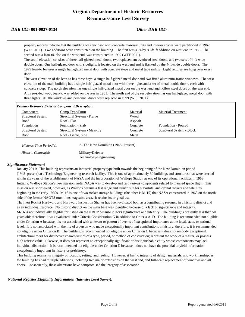
Virginia Department of Historic Resources
Reconnaissance Level Survey
DHR ID#: 001-0027-0134 Other DHR ID#:
property records indicate that the building was enclosed with concrete masonry units and interior spaces were partitioned in 1967
(WFF 2011). Two additions were constructed on the building. The first was a 74 by 80-ft ft addition on west end in 1986. The
second was a lean-to, also on the west end, was constructed in 1999 (WFF 2011).
The south elevation consists of three half-glazed metal doors, two replacement overhead steel doors, and two sets of 4-ft-wide
double doors. One half-glazed door with sidelights is located on the west end and is flanked by the 4-ft-wide double doors. The
1999 lean-to features a single half-glazed metal door with concrete steps and metal tube railing. Light fixtures are hung over every
door.
The west elevation of the lean-to has three bays: a single half-glazed metal door and two fixed aluminum-frame windows. The west
elevation of the main building has a single half-glazed metal door with three lights and a set of metal double doors, each with a
concrete stoop. The north elevation has one single half-glazed metal door on the west end and hollow steel doors on the east end.
A three-sided wood lean-to was added on the rear in 1981. The north end of the east elevation has one half-glazed metal door with
three lights. All the windows and personnel doors were replaced in 1999 (WFF 2011).
Primary Resource Exterior Component Description:
Material TreatmentMaterialComp Type/FormComponent
Structural System Structural System - Frame Wood
Roof Roof - Flat Asphalt
Foundation Foundation - Slab Concrete Foundation - Poured
Structural System Structural System - Masonry Concrete Structural System - Block
Roof Roof - Gable, Side Metal
Historic Time Period(s):S- The New Dominion (1946- Present)
Historic Context(s): Military/Defense
Technology/Engineering
Significance Statement
January 2011: This building represents an Industrial property type built towards the beginning of the New Dominion period
(1945–present) at a Technology/Engineering research facility. This is one of approximately 50 buildings and structures that were erected
within six years of the establishment of NASA and the incorporation of Wallops Station as one of its operational facilities in 1959.
Initially, Wallops Station’s new mission under NASA was to develop and test various components related to manned space flight. This
mission was short-lived, however, as Wallops became a test range and launch site for suborbital and orbital rockets and satellites
beginning in the early 1960s. M-16 is one of two rocket storage buildings (the other is M-15) that NASA constructed in 1963 on the north
side of the former NAOTS munitions magazine area. It retains its original use.
The Inert Rocket Hardware and Hardware Inspection Shelter has been evaluated both as a contributing resource in a historic district and
as an individual resource. No historic district on the main base was identified because of a lack of significance and integrity.
M-16 is not individually eligible for listing on the NRHP because it lacks significance and integrity. The building is presently less than 50
years old; therefore, it was evaluated under Criteria Consideration G in addition to Criteria A–D. The building is recommended not eligible
under Criterion A because it is not associated with an event or pattern of events of exceptional importance at the local, state, or national
level. It is not associated with the life of a person who made exceptionally important contributions in history; therefore, it is recommended
not eligible under Criterion B. The building is recommended not eligible under Criterion C because it does not embody exceptional
architectural merit for distinctive characteristics of a type, period, or method of construction; represent the work of a master; or possess
high artistic value. Likewise, it does not represent an exceptionally significant or distinguishable entity whose components may lack
individual distinction. It is recommended not eligible under Criterion D because it does not have the potential to yield information
exceptionally important in history or prehistory.
This building retains its integrity of location, setting, and feeling. However, it has no integrity of design, materials, and workmanship, as
the building has had multiple additions, including two major extensions on the west end, and full-scale replacement of windows and all
doors. Consequently, these alterations have compromised the integrity of association.
National Register Eligibility Information (Intensive Level Survey):
Report generated 6/6/2011Page 2 of 3

Virginia Department of Historic Resources
Reconnaissance Level Survey
DHR ID#: 001-0027-0134 Other DHR ID#:
NR Resource StatusNR Resource TypeNR Count
Building Non-contributing 1
1 Non-Contributing:
National Register Criteria:
Level of Significance:
Period of Significance:
Graphic Media Documentation
PhotographerPhoto DateNegative RepositoryDHR Negative # Photographic Media
Digitial Images L.ThursbyJanuary 2011
Bibliographic Documentation
Reference #: 1
Bibliographic RecordType: Local Records
Author:
DHR CRM Report Number:
Notes:
Wallops Flight Facility Real Property Records
Cultural Resource Management (CRM) Events
CRM Event # 1,
Cultural Resource Management Event: Survey:Phase I/Reconnaissance
Date of CRM Event: January 2011
CRM Person: TEC Inc
VDHR Project ID # Associated with Event: 2010-2274
CRM Event Notes or Comments:
Lori Thursby and Kimberly Martin
Bridge Information
Cemetery Information
Ownership Information
Unknown Unknown Name: .................................
NASA Wallops Flight FacilityCompany: ..........................
Wallops Flight FacilityAddress: .............................
Wallops IslandCity: ...................................
23337Zip: ....................................... VirginiaState: USACountry:
000-000-0000757-824-1000Phone/Extension: ..............
0000/ 0000
Relation to the Property: Owner of property
Report generated 6/6/2011Page 3 of 3

001-0027-0141N-159
001-0027-0130F-160
001-0027-0134M-016
001-0027-0133M-015
001-0027-0143N-162
001-0027-0151N-222
001-0027-0129F-157
001-0027-0139N-133
001-0027-0128E-144
001-0027-0148N-167
001-0027-0145N-163
001-0027-0149N-174
001-0027-0138M-184
001-0027-0140N-134
001-0027-0144N-162B
001-0027-0142N-159E
001-0027-0135M-017
001-0027-0147N-166
001-0027-0131F-163
001-0027-0137M-183
001-0027-0136M-025
001-0027-0150N-218
001-0027-0146N-164
001-0027-0132F-170
Chi
ncot
eagu
e R
d.Wo
rmho
ud
t S
t.Rickette St.
Bl is s St.
Fulton St.S
tubb
es B
lvd.
NASA Property
Surveyed Structures
Buildings
0 250Meters
0 1,000Feet


Virginia Department of Historic Resources
Reconnaissance Level Survey
DHR ID#: 001-0027-0135 Other DHR ID#:
Resource Information
National Register Eligibility Status
This Resource is associated with the Wallops Flight
Facility
Resource Name(s): M-17, Heating Plant Building {Current}
Date of Construction: 1963
Local Historic District :
Location of Resource
County/Independent City:
Commonwealth of Virginia
Accomack
Magisterial District:
Town/Village/Hamlet: Wallops Island
Tax Parcel:
Zip Code: 23337
Address(s):
USGS Quadrangle Name: WALLOPS ISLAND
UTM Boundary Coordinates :
Northing EastingZone NAD
1983 18 4200258 458484
UTM Center coordinates :
NoUTM Data Restricted?.
Resource Description
Ownership Status: Public - Federal
Government Agency Owner: U.S. National Aeronautics & Space Administration
Acreage:
Surrounding area: Rural
Open to Public: No
January 2011: The Heating Plant Building is located on the north half of the main base, north of runway 10-28. An asphalt
paved access rood runs south of the building and a security fence extends along the north boundary of the property. A
wooded area and the Little Mosquito Creek lie north of the security fence. Buildings Rocket Inspection and Storage Building
No. 1 (M-15) and the Ready Service Pyrotechnics Storage Magazine (M-183) are situated northwest of it.
Site Description:
Secondary Resource Summary:
January 2011: none
Resource StatusResource TypesCount
Energy Facility Non-Contributing 1
Individual Resource Information
Energy FacilityResource Type. Primary Resource? Yes
Individual Resource Detail Information
Date of Construction: Accessed? 1963 {Owner} No Not accessible
1.0 Number of Stories:Architectural Style: No Discernable Style
Good
Interior Plan Type:
Form: Condition:
Threats to Resource: None Known
January 2011: The Heating Plant Building is a simple, one- story concrete block building, resting on a concrete slab. The flat roof,
replaced in 1981 with a four-ply built up roof, has an aluminum fascia. The only entrance is on the south elevation, consisting of a
set of double metal doors with three lights and louvered panels. The doors have a steel lintel and concrete threshold. The west
Report generated 6/6/2011Page 1 of 3

Virginia Department of Historic Resources
Reconnaissance Level Survey
DHR ID#: 001-0027-0135 Other DHR ID#:
elevation has two metal vents below the fascia with metal covers. Exterior utility lines are present on the north and east elevations
of the building.
Primary Resource Exterior Component Description:
Material TreatmentMaterialComp Type/FormComponent
Structural System Structural System - Masonry Concrete Structural System - Block
Foundation Foundation - Slab Concrete Foundation - Poured
Roof Roof - Flat Asphalt
Historic Time Period(s):S- The New Dominion (1946- Present)
Historic Context(s): Military/Defense
Technology/Engineering
Significance Statement
January 2011: This building is a secondary resource built towards the beginning of the New Dominion period (1945–present) at a
Technology/Engineering research facility. This is one of approximately 50 buildings and structures that were erected within six years of
the establishment of NASA and the incorporation of Wallops Station as one of its operational facilities in 1959. Initially, Wallops
Station’s new mission under NASA was to develop and test various components related to manned space flight. This mission was
short-lived, however, as Wallops became a test range and launch site for suborbital and orbital rockets and satellites beginning in the
early 1960s. M-17 was built in 1963 as a heating plant; it continues to serve this purpose. M-17 was built adjacent to M-15, one of two
rocket storage buildings (the other is M-16) that NASA constructed in 1963 on the north side of the former NAOTS munitions magazine
area.
M-17 has been evaluated both as a contributing resource in a historic district and as an individual resource. No historic district on the
main base was identified because of a lack of significance and integrity.
The heating plant is not individually eligible for listing on the NRHP because it lacks significance. The building is presently less than 50
years old; therefore, it was evaluated under Criteria Consideration G in addition to Criteria A–D. The building is recommended not eligible
under Criterion A because it is not associated with an event or pattern of events of exceptional importance at the local, state, or national
level. It is not associated with the life of a person who made exceptionally important contributions in history; therefore, it is recommended
not eligible under Criterion B. The resource retains integrity, but it is a secondary resource of simple design and common construction;
thus, it is recommended not eligible under Criterion C because it does not embody exceptional architectural merit for distinctive
characteristics of a type, period, or method of construction; represent the work of a master; or possess high artistic value. Likewise, it
does not represent an exceptionally significant or distinguishable entity whose components may lack individual distinction. It is
recommended not eligible under Criterion D because it does not have the potential to yield information exceptionally important in history
or prehistory.
National Register Eligibility Information (Intensive Level Survey):
NR Resource StatusNR Resource TypeNR Count
Building Non-contributing 1
1 Non-Contributing:
National Register Criteria:
Level of Significance:
Period of Significance:
Graphic Media Documentation
PhotographerPhoto DateNegative RepositoryDHR Negative # Photographic Media
Digital Images L. ThursbyJanuary 2011
Report generated 6/6/2011Page 2 of 3

Virginia Department of Historic Resources
Reconnaissance Level Survey
DHR ID#: 001-0027-0135 Other DHR ID#:
Bibliographic Documentation
Reference #: 1
Bibliographic RecordType: Local Records
Author:
DHR CRM Report Number:
Notes:
Wallops Flight Facility Real Property Records
Cultural Resource Management (CRM) Events
CRM Event # 1,
Cultural Resource Management Event: Survey:Phase I/Reconnaissance
Date of CRM Event: January 2011
CRM Person: TEC Inc
VDHR Project ID # Associated with Event: 2010-2274
CRM Event Notes or Comments:
Lori Thursby and Kimberly Martin
Bridge Information
Cemetery Information
Ownership Information
Unknown Unknown Name: .................................
NASA Wallops Flight FacilityCompany: ..........................
Wallops Flight FacilityAddress: .............................
Wallops IslandCity: ...................................
23337Zip: ....................................... VirginiaState: USACountry:
000-000-0000757-824-1000Phone/Extension: ..............
0000/ 0000
Relation to the Property: Owner of property
Report generated 6/6/2011Page 3 of 3

001-0027-0141N-159
001-0027-0130F-160
001-0027-0134M-016
001-0027-0133M-015
001-0027-0143N-162
001-0027-0151N-222
001-0027-0129F-157
001-0027-0139N-133
001-0027-0128E-144
001-0027-0148N-167
001-0027-0145N-163
001-0027-0149N-174
001-0027-0138M-184
001-0027-0140N-134
001-0027-0144N-162B
001-0027-0142N-159E
001-0027-0135M-017
001-0027-0147N-166
001-0027-0131F-163
001-0027-0137M-183
001-0027-0136M-025
001-0027-0150N-218
001-0027-0146N-164
001-0027-0132F-170
Chi
ncot
eagu
e R
d.Wo
rmho
ud
t S
t.Rickette St.
Bl is s St.
Fulton St.S
tubb
es B
lvd.
NASA Property
Surveyed Structures
Buildings
0 250Meters
0 1,000Feet


Virginia Department of Historic Resources
Reconnaissance Level Survey
DHR ID#: 001-0027-0136 Other DHR ID#:
Resource Information
National Register Eligibility Status
This Resource is associated with the Wallops Flight
Facility
Resource Name(s): M-25, Ready Issue Minor Hazard Explosives
Magazine {Current}
Date of Construction: 1957
Local Historic District :
Location of Resource
County/Independent City:
Commonwealth of Virginia
Accomack
Magisterial District:
Town/Village/Hamlet: Wallops Island
Tax Parcel:
Zip Code: 23337
Address(s):
USGS Quadrangle Name: WALLOPS ISLAND
UTM Boundary Coordinates :
Northing EastingZone NAD
1983 18 458462 4200310
UTM Center coordinates :
NoUTM Data Restricted?.
Resource Description
Ownership Status: Public - Federal
Government Agency Owner: U.S. National Aeronautics & Space Administration
Acreage:
Surrounding area: Rural
Open to Public: No
January 2011: Ready Issue Minor Hazard Explosives Magazine is located on the north half of the main base, north of runway
10-28. The building was moved from its location by the Ready Issue Explosive Storage Magazine (M-184). It was placed
directly north of the Rocket Inspection and Storage Building No. 1 (M-15). A security fence is north of the property, beyond
which are a wooded area and the Little Mosquito Creek.
Site Description:
Secondary Resource Summary:
January 2011: none
Resource StatusResource TypesCount
Magazine Non-Contributing 1
Individual Resource Information
MagazineResource Type. Primary Resource? Yes
Individual Resource Detail Information
Date of Construction: Accessed? 1957 {Owner} No Not accessible
1.0 Number of Stories:Architectural Style: No Discernable Style
Good
Interior Plan Type:
Form: Condition:
Threats to Resource: None Known
January 2011: This single-story reinforced concrete building rests on a concrete slab. It has only one point of entry, a single steel
door on the west elevation. The central door is flanked by two vents with metal covers. On the opposite elevation, there are two
Report generated 6/6/2011Page 1 of 3
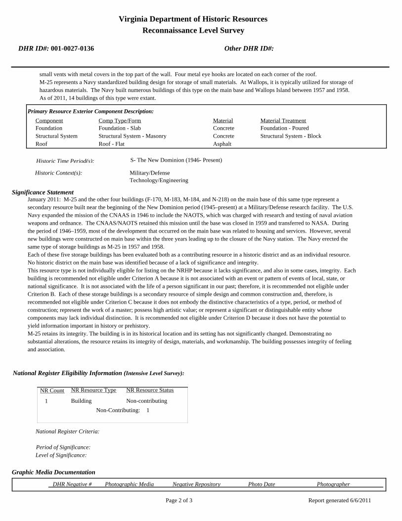
Virginia Department of Historic Resources
Reconnaissance Level Survey
DHR ID#: 001-0027-0136 Other DHR ID#:
small vents with metal covers in the top part of the wall. Four metal eye hooks are located on each corner of the roof.
M-25 represents a Navy standardized building design for storage of small materials. At Wallops, it is typically utilized for storage of
hazardous materials. The Navy built numerous buildings of this type on the main base and Wallops Island between 1957 and 1958.
As of 2011, 14 buildings of this type were extant.
Primary Resource Exterior Component Description:
Material TreatmentMaterialComp Type/FormComponent
Foundation Foundation - Slab Concrete Foundation - Poured
Structural System Structural System - Masonry Concrete Structural System - Block
Roof Roof - Flat Asphalt
Historic Time Period(s):S- The New Dominion (1946- Present)
Historic Context(s): Military/Defense
Technology/Engineering
Significance Statement
January 2011: M-25 and the other four buildings (F-170, M-183, M-184, and N-218) on the main base of this same type represent a
secondary resource built near the beginning of the New Dominion period (1945–present) at a Military/Defense research facility. The U.S.
Navy expanded the mission of the CNAAS in 1946 to include the NAOTS, which was charged with research and testing of naval aviation
weapons and ordnance. The CNAAS/NAOTS retained this mission until the base was closed in 1959 and transferred to NASA. During
the period of 1946–1959, most of the development that occurred on the main base was related to housing and services. However, several
new buildings were constructed on main base within the three years leading up to the closure of the Navy station. The Navy erected the
same type of storage buildings as M-25 in 1957 and 1958.
Each of these five storage buildings has been evaluated both as a contributing resource in a historic district and as an individual resource.
No historic district on the main base was identified because of a lack of significance and integrity.
This resource type is not individually eligible for listing on the NRHP because it lacks significance, and also in some cases, integrity. Each
building is recommended not eligible under Criterion A because it is not associated with an event or pattern of events of local, state, or
national significance. It is not associated with the life of a person significant in our past; therefore, it is recommended not eligible under
Criterion B. Each of these storage buildings is a secondary resource of simple design and common construction and, therefore, is
recommended not eligible under Criterion C because it does not embody the distinctive characteristics of a type, period, or method of
construction; represent the work of a master; possess high artistic value; or represent a significant or distinguishable entity whose
components may lack individual distinction. It is recommended not eligible under Criterion D because it does not have the potential to
yield information important in history or prehistory.
M-25 retains its integrity. The building is in its historical location and its setting has not significantly changed. Demonstrating no
substantial alterations, the resource retains its integrity of design, materials, and workmanship. The building possesses integrity of feeling
and association.
National Register Eligibility Information (Intensive Level Survey):
NR Resource StatusNR Resource TypeNR Count
Building Non-contributing 1
1 Non-Contributing:
National Register Criteria:
Level of Significance:
Period of Significance:
Graphic Media Documentation
PhotographerPhoto DateNegative RepositoryDHR Negative # Photographic Media
Report generated 6/6/2011Page 2 of 3

Virginia Department of Historic Resources
Reconnaissance Level Survey
DHR ID#: 001-0027-0136 Other DHR ID#:
Digital Images L. ThursbyJanuary 2011
Bibliographic Documentation
Reference #: 1
Bibliographic RecordType: Local Records
Author:
DHR CRM Report Number:
Notes:
Wallops Flight Facility Real Property Records
Cultural Resource Management (CRM) Events
CRM Event # 1,
Cultural Resource Management Event: Survey:Phase I/Reconnaissance
Date of CRM Event: January 2011
CRM Person: TEC Inc
VDHR Project ID # Associated with Event: 2010-2274
CRM Event Notes or Comments:
Lori Thursby and Kimberly Martin
Bridge Information
Cemetery Information
Ownership Information
Unknown Unknown Name: .................................
NASA Wallops Flight FacilityCompany: ..........................
Wallops Flight FacilityAddress: .............................
Wallops IslandCity: ...................................
23337Zip: ....................................... VirginiaState: USACountry:
000-000-0000757-824-1000Phone/Extension: ..............
0000/ 0000
Relation to the Property: Owner of property
Report generated 6/6/2011Page 3 of 3

001-0027-0141N-159
001-0027-0130F-160
001-0027-0134M-016
001-0027-0133M-015
001-0027-0143N-162
001-0027-0151N-222
001-0027-0129F-157
001-0027-0139N-133
001-0027-0128E-144
001-0027-0148N-167
001-0027-0145N-163
001-0027-0149N-174
001-0027-0138M-184
001-0027-0140N-134
001-0027-0144N-162B
001-0027-0142N-159E
001-0027-0135M-017
001-0027-0147N-166
001-0027-0131F-163
001-0027-0137M-183
001-0027-0136M-025
001-0027-0150N-218
001-0027-0146N-164
001-0027-0132F-170
Chi
ncot
eagu
e R
d.Wo
rmho
ud
t S
t.Rickette St.
Bl is s St.
Fulton St.S
tubb
es B
lvd.
NASA Property
Surveyed Structures
Buildings
0 250Meters
0 1,000Feet
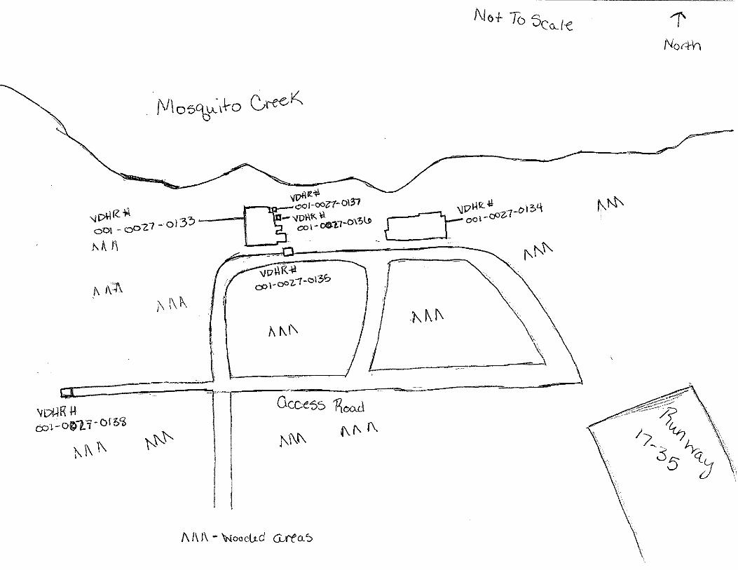

Virginia Department of Historic Resources
Reconnaissance Level Survey
DHR ID#: 001-0027-0137 Other DHR ID#:
Resource Information
National Register Eligibility Status
This Resource is associated with the Wallops Flight
Facility
Resource Name(s): M-183, Ready Service Pyrotechnics Storage
Magazine {Current}
Date of Construction: 1958
Local Historic District :
Location of Resource
County/Independent City:
Commonwealth of Virginia
Accomack
Magisterial District:
Town/Village/Hamlet: Wallops Island
Tax Parcel:
Zip Code: 23337
Address(s):
USGS Quadrangle Name: WALLOPS ISLAND
UTM Boundary Coordinates :
Northing EastingZone NAD
1983 18 458462 4200310
UTM Center coordinates :
NoUTM Data Restricted?.
Resource Description
Ownership Status: Public - Federal
Government Agency Owner: U.S. National Aeronautics & Space Administration
Acreage:
Surrounding area: Rural
Open to Public: No
January 2011: The Ready Service Pyrotechnics Storage Magazine is located on the north half of the main base, north of runway
10-28. The building was moved from its location by the Ready Issue Explosive Storage Magazine (M-184). It was placed
directly north of the Rocket Inspection and Storage Building No. 1 (M-15). A security fence is north of the property, beyond
which are a wooded area and the Little Mosquito Creek.
Site Description:
Secondary Resource Summary:
January 2011: none
Resource StatusResource TypesCount
Magazine Non-Contributing 1
Individual Resource Information
MagazineResource Type. Primary Resource? Yes
Individual Resource Detail Information
Date of Construction: Accessed? 1958 {Owner} No Not accessible
1.0 Number of Stories:Architectural Style: No Discernable Style
Good
Interior Plan Type:
Form: Condition:
Threats to Resource: None Known
January 2011: This single-story reinforced concrete building rests on a concrete slab. It has only one point of entry, a single steel
door on the east elevation. The central door is flanked by two vents with metal covers. On the opposite elevation, there are two
Report generated 6/6/2011Page 1 of 3

Virginia Department of Historic Resources
Reconnaissance Level Survey
DHR ID#: 001-0027-0137 Other DHR ID#:
small vents with metal covers in the top part of the wall. Four metal eye hooks are located on each corner of the roof.
M-183 represents a Navy standardized building design for storage of small materials. At Wallops, it is typically utilized for storage
of hazardous materials. The Navy built numerous buildings of this type on the main base and Wallops Island between 1957 and
1958. As of 2011, 14 buildings of this type were extant.
Primary Resource Exterior Component Description:
Material TreatmentMaterialComp Type/FormComponent
Structural System Structural System - Masonry Concrete Structural System - Block
Roof Roof - Flat Concrete
Foundation Foundation - Slab Concrete Foundation - Poured
Historic Time Period(s):S- The New Dominion (1946- Present)
Historic Context(s): Military/Defense
Technology/Engineering
Significance Statement
January 2011: M-183 and the other four buildings (F-170, M-25, M-184, and N-218) on the main base of this same type represent a
secondary resource built near the beginning of the New Dominion period (1945–present) at a Military/Defense research facility. The U.S.
Navy expanded the mission of the CNAAS in 1946 to include the NAOTS, which was charged with research and testing of naval aviation
weapons and ordnance. The CNAAS/NAOTS retained this mission until the base was closed in 1959 and transferred to NASA. During
the period of 1946–1959, most of the development that occurred on the main base was related to housing and services. However, several
new buildings were constructed on main base within the three years leading up to the closure of the Navy station. The Navy erected the
same type of storage buildings as M-183 in 1957 and 1958.
Each of these five storage buildings has been evaluated both as a contributing resource in a historic district and as an individual resource.
No historic district on the main base was identified because of a lack of significance and integrity.
This resource type is not individually eligible for listing on the NRHP because it lacks significance, and also in some cases, integrity. It is
not associated with the life of a person significant in our past; therefore, it is recommended not eligible under Criterion B. Each of these
storage buildings is a secondary resource of simple design and common construction and, therefore, is recommended not eligible under
Criterion C because it does not embody the distinctive characteristics of a type, period, or method of construction; represent the work of a
master; possess high artistic value; or represent a significant or distinguishable entity whose components may lack individual distinction.
It is recommended not eligible under Criterion D because it does not have the potential to yield information important in history or
prehistory.
M-183 was moved during the period of significance; therefore, it does not possess integrity of location. It also has no integrity of setting:
the setting of the current location is not comparable to the historical setting. The removal of each of this building from its original location
and setting has destroyed its integrity of feeling and association. The resource retains its integrity of design, materials, and workmanship.
National Register Eligibility Information (Intensive Level Survey):
NR Resource StatusNR Resource TypeNR Count
Building Non-contributing 1
1 Non-Contributing:
National Register Criteria:
Level of Significance:
Period of Significance:
Graphic Media Documentation
PhotographerPhoto DateNegative RepositoryDHR Negative # Photographic Media
Digital Images L.ThursbyJanuary 2011
Report generated 6/6/2011Page 2 of 3

Virginia Department of Historic Resources
Reconnaissance Level Survey
DHR ID#: 001-0027-0137 Other DHR ID#:
Bibliographic Documentation
Reference #: 1
Bibliographic RecordType: Local Records
Author:
DHR CRM Report Number:
Notes:
Wallops Flight Facility Real Property Records
Cultural Resource Management (CRM) Events
CRM Event # 1,
Cultural Resource Management Event: Survey:Phase I/Reconnaissance
Date of CRM Event: January 2011
CRM Person: TEC Inc
VDHR Project ID # Associated with Event: 2010-2274
CRM Event Notes or Comments:
Lori Thursby and Kimberly Martin
Bridge Information
Cemetery Information
Ownership Information
Unknown Unknown Name: .................................
NASA Wallops Flight FacilityCompany: ..........................
Wallops Flight FacilityAddress: .............................
Wallops IslandCity: ...................................
23337Zip: ....................................... VirginiaState: USACountry:
000-000-0000757-824-1000Phone/Extension: ..............
0000/ 0000
Relation to the Property: Owner of property
Report generated 6/6/2011Page 3 of 3

001-0027-0141N-159
001-0027-0130F-160
001-0027-0134M-016
001-0027-0133M-015
001-0027-0143N-162
001-0027-0151N-222
001-0027-0129F-157
001-0027-0139N-133
001-0027-0128E-144
001-0027-0148N-167
001-0027-0145N-163
001-0027-0149N-174
001-0027-0138M-184
001-0027-0140N-134
001-0027-0144N-162B
001-0027-0142N-159E
001-0027-0135M-017
001-0027-0147N-166
001-0027-0131F-163
001-0027-0137M-183
001-0027-0136M-025
001-0027-0150N-218
001-0027-0146N-164
001-0027-0132F-170
Chi
ncot
eagu
e R
d.Wo
rmho
ud
t S
t.Rickette St.
Bl is s St.
Fulton St.S
tubb
es B
lvd.
NASA Property
Surveyed Structures
Buildings
0 250Meters
0 1,000Feet


Virginia Department of Historic Resources
Reconnaissance Level Survey
DHR ID#: 001-0027-0138 Other DHR ID#:
Resource Information
National Register Eligibility Status
This Resource is associated with the Wallops Flight
Facility
Resource Name(s): M-184, Ready Issue Explosive Storage Magazine
{Current}
Date of Construction: 1958
Local Historic District :
Location of Resource
County/Independent City:
Commonwealth of Virginia
Accomack
Magisterial District:
Town/Village/Hamlet: Wallops Island
Tax Parcel:
Zip Code: 23337
Address(s):
USGS Quadrangle Name: WALLOPS ISLAND
UTM Boundary Coordinates :
Northing EastingZone NAD
1983 18 458462 4200258
UTM Center coordinates :
NoUTM Data Restricted?.
Resource Description
Ownership Status: Public - Federal
Government Agency Owner: U.S. National Aeronautics & Space Administration
Acreage:
Surrounding area: Rural
Open to Public: No
January 2011: The Ready Issue Explosive Storage Magazine
is located on the north half of the main base, north of runway 10-28. A security fence is north of the property, beyond which
are a wooded area and the Little Mosquito Creek. M-184 is isolated in a wooded area near an ammunition magazine. The area
immediately surrounding the building is mown grass.
Site Description:
Secondary Resource Summary:
January 2011: none
Resource StatusResource TypesCount
Storage Non-Contributing 1
Individual Resource Information
BankResource Type. Primary Resource? Yes
Individual Resource Detail Information
Date of Construction: Accessed? 1958 {Owner} No Not accessible
1.0 Number of Stories:Architectural Style: No Discernable Style
Good
Interior Plan Type:
Form: Condition:
Threats to Resource: None Known
January 2011: This single-story reinforced concrete building rests on a concrete slab. It has only one point of entry, a single steel
door on the east elevation. The central door is flanked by two vents with metal covers. On the opposite elevation, there are two
Report generated 6/6/2011Page 1 of 3

Virginia Department of Historic Resources
Reconnaissance Level Survey
DHR ID#: 001-0027-0138 Other DHR ID#:
small vents with metal covers in the top part of the wall. Four metal eye hooks are located on each corner of the roof.
M-184 represents a Navy standardized building design for storage of small materials. At Wallops, it is typically utilized for storage
of hazardous materials. The Navy built numerous buildings of this type on the main base and Wallops Island between 1957 and
1958. As of 2011, 14 buildings of this type were extant.
Primary Resource Exterior Component Description:
Material TreatmentMaterialComp Type/FormComponent
Foundation Foundation - Slab Concrete Foundation - Poured
Roof Roof - Flat Concrete
Structural System Structural System - Masonry Concrete
Historic Time Period(s):S- The New Dominion (1946- Present)
Historic Context(s): Military/Defense
Technology/Engineering
Significance Statement
January 2011: M-184 and the other four buildings (F-170, M-25, M-183, N-218) on the main base of this same type represent a secondary
resource built near the beginning of the New Dominion period (1945–present) at a Military/Defense research facility. The U.S. Navy
expanded the mission of the CNAAS in 1946 to include the NAOTS, which was charged with research and testing of naval aviation
weapons and ordnance. The CNAAS/NAOTS retained this mission until the base was closed in 1959 and transferred to NASA. During
the period of 1946–1959, most of the development that occurred on the main base was related to housing and services. However, several
new buildings were constructed on main base within the three years leading up to the closure of the Navy station. The Navy erected the
same type of storage buildings as M-18 in 1957 and 1958.
Each of these five storage buildings has been evaluated both as a contributing resource in a historic district and as an individual resource.
No historic district on the main base was identified because of a lack of significance and integrity.
This resource type is not individually eligible for listing on the NRHP because it lacks significance, and also in some cases, integrity. Each
building is recommended not eligible under Criterion A because it is not associated with an event or pattern of events of local, state, or
national significance. It is not associated with the life of a person significant in our past; therefore, it is recommended not eligible under
Criterion B. Each of these storage buildings is a secondary resource of simple design and common construction and, therefore, is
recommended not eligible under Criterion C because it does not embody the distinctive characteristics of a type, period, or method of
construction; represent the work of a master; possess high artistic value; or represent a significant or distinguishable entity whose
components may lack individual distinction. It is recommended not eligible under Criterion D because it does not have the potential to
yield information important in history or prehistory.
M-184 retain its integrity. The building is in its historical location and its setting has not substantially changed. Demonstrating no
substantial alterations, the resource retains its integrity of design, materials, and workmanship. The building possesses integrity of feeling
and association.
National Register Eligibility Information (Intensive Level Survey):
NR Resource StatusNR Resource TypeNR Count
Building Non-contributing 1
1 Non-Contributing:
National Register Criteria:
Level of Significance:
Period of Significance:
Graphic Media Documentation
PhotographerPhoto DateNegative RepositoryDHR Negative # Photographic Media
Report generated 6/6/2011Page 2 of 3

Virginia Department of Historic Resources
Reconnaissance Level Survey
DHR ID#: 001-0027-0138 Other DHR ID#:
Digital Images L.ThursbyJanuary 2011
Bibliographic Documentation
Reference #: 1
Bibliographic RecordType: Local Records
Author:
DHR CRM Report Number:
Notes:
Wallops Flight Facility Real Property Records
Cultural Resource Management (CRM) Events
CRM Event # 1,
Cultural Resource Management Event: Survey:Phase I/Reconnaissance
Date of CRM Event: January 2011
CRM Person: TEC Inc
VDHR Project ID # Associated with Event: 2010-2274
CRM Event Notes or Comments:
Lori Thursby and Kimberly Martin
Bridge Information
Cemetery Information
Ownership Information
Unknown Unknown Name: .................................
NASA Wallops Flight FacilityCompany: ..........................
Wallops Flight FacilityAddress: .............................
Wallops IslandCity: ...................................
23337Zip: ....................................... VirginiaState: USACountry:
000-000-0000757-824-1000Phone/Extension: ..............
0000/ 0000
Relation to the Property: Owner of property
Report generated 6/6/2011Page 3 of 3

001-0027-0141N-159
001-0027-0130F-160
001-0027-0134M-016
001-0027-0133M-015
001-0027-0143N-162
001-0027-0151N-222
001-0027-0129F-157
001-0027-0139N-133
001-0027-0128E-144
001-0027-0148N-167
001-0027-0145N-163
001-0027-0149N-174
001-0027-0138M-184
001-0027-0140N-134
001-0027-0144N-162B
001-0027-0142N-159E
001-0027-0135M-017
001-0027-0147N-166
001-0027-0131F-163
001-0027-0137M-183
001-0027-0136M-025
001-0027-0150N-218
001-0027-0146N-164
001-0027-0132F-170
Chi
ncot
eagu
e R
d.Wo
rmho
ud
t S
t.Rickette St.
Bl is s St.
Fulton St.S
tubb
es B
lvd.
NASA Property
Surveyed Structures
Buildings
0 250Meters
0 1,000Feet


Virginia Department of Historic Resources
Reconnaissance Level Survey
DHR ID#: 001-0027-0139 Other DHR ID#:
Resource Information
National Register Eligibility Status
This Resource is associated with the Wallops Flight
Facility
Resource Name(s): N-133, NASA Federal Credit Union {Current}
N-133, Gov't Vehicle Filling Station {Historic}
Date of Construction: 1956
Local Historic District :
Location of Resource
County/Independent City:
Commonwealth of Virginia
Accomack
Magisterial District:
Town/Village/Hamlet: Wallops Island
Tax Parcel:
Zip Code: 23337
Address(s): Fulton Street
USGS Quadrangle Name: WALLOPS ISLAND
UTM Boundary Coordinates :
Northing EastingZone NAD
1983 18 458275 4198606
UTM Center coordinates :
NoUTM Data Restricted?.
Resource Description
Ownership Status: Public - Federal
Government Agency Owner: U.S. National Aeronautics & Space Administration
Acreage:
Surrounding area: Rural
Open to Public: No
January 2011: The NASA Federal Credit Union is located in the center of the main base on Fulton Street, west of runway 4-22.
The area is flat and open with some trees to the south. There is a parking lot in front. The Virginia Communications Space
Flight Authority Office (N-134) is adjacent to the building.
Site Description:
Secondary Resource Summary:
January 2011: None.
Resource StatusResource TypesCount
Administration Bldg. Non-Contributing 1
Individual Resource Information
Administration Bldg.Resource Type. Primary Resource? Yes
Individual Resource Detail Information
Date of Construction: Accessed? 1956 {Owner} No Not accessible
1.0 Number of Stories:Architectural Style: No Discernable Style
Good
Interior Plan Type:
Form: Condition:
Threats to Resource: None Known
January 2011: The Credit Union is a simple concrete block building with a flat roof and metal fascia, resting on a concrete slab. The
building was originally used as a filling station. In 1980, the building was divided in two; in 1983 the use changed to a credit union
(WFF 2011). The west half of the building is slightly taller than the east half, which has wide metal eaves. The main entrance is
Report generated 6/6/2011Page 1 of 3
Virginia Department of Historic Resources
Reconnaissance Level Survey
DHR ID#: 001-0027-0139 Other DHR ID#:
through a flat roofed, glass and aluminum vestibule on the north elevation. The vestibule contains a glazed door with sidelights and
a transom. A set of three aluminum frame fixed windows with precast concrete slip sills are located east of the vestibule. A glass
and aluminum framed ATM shelter is located on the east end. A single glazed door is located between the ATM shelter and three
windows. The east elevation consists of a set of three metal frame fixed windows and a hollow steel door at the southeast corner.
The south and west elevations have no openings.
Primary Resource Exterior Component Description:
Material TreatmentMaterialComp Type/FormComponent
Foundation Foundation - Slab Concrete Foundation - Poured
Structural System Structural System - Masonry Concrete Structural System - Block
Windows Windows - Fixed Metal Windows - 1-light
Roof Roof - Flat Asphalt
Structural System Structural System - Masonry Concrete Structural System - Block
Porch Porch - 1-story Aluminum Porch - Enclosed
Historic Time Period(s):S- The New Dominion (1946- Present)
Historic Context(s): Military/Defense
Technology/Engineering
Significance Statement
January 2011: N-133 represents a secondary resource built near the beginning of the New Dominion period (1945–present) at a
Military/Defense research facility. The U.S. Navy expanded the mission of the CNAAS in 1946 to include the NAOTS, which was charged
with research and testing of naval aviation weapons and ordnance. The CNAAS/NAOTS retained this mission until the base was closed
in 1959 and transferred to NASA. During the period of 1946–1959, most of the development that occurred on the main base was related to
housing and services, including the construction of N-133 in 1956 as a filling station. In 1980, a portion of N-133 was removed to divide
the structure into two separate buildings, N-133 and N-134, each used for different purposes; N-133 remained a filling station. A few years
later, N-133 was renovated and converted to a credit union office, which opened in May 1986 (WFF 2011).
N-133 has been evaluated both as a contributing resource in a historic district and as an individual resource. No historic district on the
main base was identified because of a lack of significance and integrity.
This building is not individually eligible for listing on the NRHP because it lacks significance and integrity. The building is recommended
not eligible under Criterion A because it is not associated with an event or pattern of events of local, state, or national significance. It is
not associated with the life of a person significant in our past; therefore, it is recommended not eligible under Criterion B. The building is
recommended not eligible under Criterion C because it does not embody the distinctive characteristics of a type, period, or method of
construction; represent the work of a master; possess high artistic value; or represent a significant or distinguishable entity whose
components may lack individual distinction. It is recommended not eligible under Criterion D because it does not have the potential to
yield information important in history or prehistory.
N-133 lacks integrity due to extensive changes to the building itself and to its setting. The building is in its historical location, but its
setting has been altered by the demolition of buildings that were to the north and northwest. The building was extensively altered to
divide it into two buildings and convert N-133 from a filling station into a credit union. Consequently, the building has no integrity of
design, materials, or workmanship. With the changes to its setting and the lack of its original design features and most of its historical
materials, this building has no integrity of feeling or association.
National Register Eligibility Information (Intensive Level Survey):
NR Resource StatusNR Resource TypeNR Count
Building Non-contributing 1
1 Non-Contributing:
National Register Criteria:
Report generated 6/6/2011Page 2 of 3

Virginia Department of Historic Resources
Reconnaissance Level Survey
DHR ID#: 001-0027-0139 Other DHR ID#:
Level of Significance:
Period of Significance:
Graphic Media Documentation
PhotographerPhoto DateNegative RepositoryDHR Negative # Photographic Media
Digital Images L.ThursbyJanuary 2011
Bibliographic Documentation
Reference #: 1
Bibliographic RecordType: Local Records
Author:
DHR CRM Report Number:
Notes:
Wallops Flight Facility Real Property Records
Cultural Resource Management (CRM) Events
CRM Event # 1,
Cultural Resource Management Event: Survey:Phase I/Reconnaissance
Date of CRM Event: January 2011
CRM Person: TEC Inc
VDHR Project ID # Associated with Event: 2010-2274
CRM Event Notes or Comments:
Lori Thursby and Kimberly Martin
Bridge Information
Cemetery Information
Ownership Information
Unknown Unknown Name: .................................
NASA Wallops Flight FacilityCompany: ..........................
Wallops Flight FacilityAddress: .............................
Wallops IslandCity: ...................................
23337Zip: ....................................... VirginiaState: USACountry:
000-000-0000757-824-1000Phone/Extension: ..............
0000/ 0000
Relation to the Property: Owner of property
Report generated 6/6/2011Page 3 of 3

001-0027-0141N-159
001-0027-0130F-160
001-0027-0134M-016
001-0027-0133M-015
001-0027-0143N-162
001-0027-0151N-222
001-0027-0129F-157
001-0027-0139N-133
001-0027-0128E-144
001-0027-0148N-167
001-0027-0145N-163
001-0027-0149N-174
001-0027-0138M-184
001-0027-0140N-134
001-0027-0144N-162B
001-0027-0142N-159E
001-0027-0135M-017
001-0027-0147N-166
001-0027-0131F-163
001-0027-0137M-183
001-0027-0136M-025
001-0027-0150N-218
001-0027-0146N-164
001-0027-0132F-170
Chi
ncot
eagu
e R
d.Wo
rmho
ud
t S
t.Rickette St.
Bl is s St.
Fulton St.S
tubb
es B
lvd.
NASA Property
Surveyed Structures
Buildings
0 250Meters
0 1,000Feet


Virginia Department of Historic Resources
Reconnaissance Level Survey
DHR ID#: 001-0027-0140 Other DHR ID#:
Resource Information
National Register Eligibility Status
This Resource is associated with the Wallops Flight
Facility
Resource Name(s): N-134, VA Commercial Space Flight Authority and
Mid-Atlantic Regional Spaceport Office {Current}
N-133, Gov't Vehicle Filling Station {Historic}
N-134, Wallops Federal Credit Union {Historic}
N-134, Wallops Exchange Office {Historic}
Date of Construction: 1956
Local Historic District :
Location of Resource
County/Independent City:
Commonwealth of Virginia
Accomack
Magisterial District:
Town/Village/Hamlet: Wallops Island
Tax Parcel:
Zip Code: 23337
Address(s):
USGS Quadrangle Name: WALLOPS ISLAND
UTM Boundary Coordinates :
Northing EastingZone NAD
1983 18 458275 4198606
UTM Center coordinates :
NoUTM Data Restricted?.
Resource Description
Ownership Status: Public - Federal
Government Agency Owner: U.S. National Aeronautics & Space Administration
Acreage:
Surrounding area: Rural
Open to Public: No
January 2011: The Virginia Commercial Space Flight Authority and Mid-Atlantic Regional Spaceport Office is located in the
center of the main base on Fulton Street, west of runway 4-22. The area surrounding the building is flat and open with trees to
the south. There is a parking lot in front of the building. The NASA Federal Credit Union building (N-133) is adjacent to it.
N-134 originally comprised the west end of N-133, which was a filling station. In 1980, N-133 was divided in two, creating N-134
(WFF 2011).
Site Description:
Secondary Resource Summary:
January 2011: none
Resource StatusResource TypesCount
Administration Bldg. Non-Contributing 1
Individual Resource Information
Report generated 6/6/2011Page 1 of 3

Virginia Department of Historic Resources
Reconnaissance Level Survey
DHR ID#: 001-0027-0140 Other DHR ID#:
Administration Bldg.Resource Type. Primary Resource? Yes
Individual Resource Detail Information
Date of Construction: Accessed? 1956 {Owner} No Not accessible
1.0 Number of Stories:Architectural Style: No Discernable Style
Good
Interior Plan Type:
Form: Condition:
Threats to Resource: None Known
January 2011: This is a simple building with a flat roof and metal fascia. The exterior consists of exposed-aggregate precast concrete
curtain wall panels. Wide eave overhangs cover concrete sidewalks on the north and west sides. The main entrance is a central
glazed door flanked by picture windows on the north elevation. The west elevation has a single hollow steel door at the southwest
corner. There are no openings on the south or east elevations.
Primary Resource Exterior Component Description:
Material TreatmentMaterialComp Type/FormComponent
Foundation Foundation - Slab Concrete Foundation - Poured
Structural System Structural System - Masonry Concrete Structural System - Block
Windows Windows - Fixed Metal
Roof Porch - Flat Asphalt
Historic Time Period(s):S- The New Dominion (1946- Present)
Historic Context(s): Military/Defense
Technology/Engineering
Significance Statement
January 2011: N-134 represents a secondary resource built near the beginning of the New Dominion period (1945–present) at a
Military/Defense research facility. The U.S. Navy expanded the mission of the CNAAS in 1946 to include the NAOTS, which was charged
with research and testing of naval aviation weapons and ordnance. The CNAAS/NAOTS retained this mission until the base was closed
in 1959 and transferred to NASA. During the period of 1946–1959, most of the development that occurred on the main base was related to
housing and services, including the construction of N-133 in 1956 as a filling station. In 1980, a portion of N-133 was removed to divide
the structure into two separate buildings, N-133 and N-134, each used for different purposes; N-133 remained a filling station and N-134
served as the Wallops Federal Credit Union. N-134 became the Wallops Exchange Office in May 1986 when the credit union moved to
N-133. The building became the Virginia Commercial Space Flight Authority Office in 1998 (WFF 2011).
N-134 has been evaluated both as a contributing resource in a historic district and as an individual resource. No historic district on the
main base was identified because of a lack of significance and integrity.
This building is not individually eligible for listing on the NRHP because it lacks significance and integrity. The building is recommended
not eligible under Criterion A because it is not associated with an event or pattern of events of local, state, or national significance. It is
not associated with the life of a person significant in our past; therefore, it is recommended not eligible under Criterion B. The building is
recommended not eligible under Criterion C because it does not embody the distinctive characteristics of a type, period, or method of
construction; represent the work of a master; possess high artistic value; or represent a significant or distinguishable entity whose
components may lack individual distinction. It is recommended not eligible under Criterion D because it does not have the potential to
yield information important in history or prehistory.
N-134 lacks integrity due to extensive changes to the building itself and to its setting. The building is in its historical location, but its
setting has been altered by the demolition of buildings that were to the north and northwest. N-134, originally part of N-133, was created
in 1980 when N-133 was altered and divided into two buildings. Consequently, the building was extensively altered and has no integrity
of design, materials, or workmanship. With the changes to its setting and the lack of its original design features and most of its historical
materials, this building has no integrity of feeling or association.
National Register Eligibility Information (Intensive Level Survey):
Report generated 6/6/2011Page 2 of 3

Virginia Department of Historic Resources
Reconnaissance Level Survey
DHR ID#: 001-0027-0140 Other DHR ID#:
NR Resource StatusNR Resource TypeNR Count
Building Non-contributing 1
1 Non-Contributing:
National Register Criteria:
Level of Significance:
Period of Significance:
Graphic Media Documentation
PhotographerPhoto DateNegative RepositoryDHR Negative # Photographic Media
Digital Images L. ThursbyJanuary 2011
Bibliographic Documentation
Reference #: 1
Bibliographic RecordType: Local Records
Author:
DHR CRM Report Number:
Notes:
Wallops Flight Facility Real Property Records
Cultural Resource Management (CRM) Events
CRM Event # 1,
Cultural Resource Management Event: Survey:Phase I/Reconnaissance
Date of CRM Event: January 2011
CRM Person: TEC Inc
VDHR Project ID # Associated with Event: 2010-2274
CRM Event Notes or Comments:
Lori Thursby and Kimberly Martin
Bridge Information
Cemetery Information
Ownership Information
Unknown Unknown Name: .................................
NASA Wallops Flight FacilityCompany: ..........................
Wallops Flight FacilityAddress: .............................
Wallops IslandCity: ...................................
23337Zip: ....................................... VirginiaState: USACountry:
000-000-0000757-824-1000Phone/Extension: ..............
0000/ 0000
Relation to the Property: Owner of property
Report generated 6/6/2011Page 3 of 3

001-0027-0141N-159
001-0027-0130F-160
001-0027-0134M-016
001-0027-0133M-015
001-0027-0143N-162
001-0027-0151N-222
001-0027-0129F-157
001-0027-0139N-133
001-0027-0128E-144
001-0027-0148N-167
001-0027-0145N-163
001-0027-0149N-174
001-0027-0138M-184
001-0027-0140N-134
001-0027-0144N-162B
001-0027-0142N-159E
001-0027-0135M-017
001-0027-0147N-166
001-0027-0131F-163
001-0027-0137M-183
001-0027-0136M-025
001-0027-0150N-218
001-0027-0146N-164
001-0027-0132F-170
Chi
ncot
eagu
e R
d.Wo
rmho
ud
t S
t.Rickette St.
Bl is s St.
Fulton St.S
tubb
es B
lvd.
NASA Property
Surveyed Structures
Buildings
0 250Meters
0 1,000Feet


Virginia Department of Historic Resources
Reconnaissance Level Survey
DHR ID#: 001-0027-0141 Other DHR ID#:
Resource Information
National Register Eligibility Status
This Resource is associated with the Wallops Flight
Facility
Resource Name(s): N-159, Research Aircraft and Observation Science
Lab {Current}
Fasron Hangar {Historic}
N-159, Range Control Center and Model Assembly
Area {Historic}
Date of Construction: 1957
Local Historic District :
Location of Resource
County/Independent City:
Commonwealth of Virginia
Accomack
Magisterial District:
Town/Village/Hamlet: Wallops Island
Tax Parcel:
Zip Code: 23337
Address(s):
USGS Quadrangle Name: WALLOPS ISLAND
UTM Boundary Coordinates :
Northing EastingZone NAD
1983 18 461456 4198453
UTM Center coordinates :
NoUTM Data Restricted?.
Resource Description
Ownership Status: Public - Federal
Government Agency Owner: U.S. National Aeronautics & Space Administration
Acreage:
Surrounding area: Rural
Open to Public: No
January 2011: The Research Aircraft and Observation Science Lab is located on the southern portion of the main base, west of
runway 4-22. Stubbs Boulevard runs along the west side of the building and Fulton Street runs along the north. There are
concrete aprons on all sides of the building, except the west. Drainage channels with concrete headwall culverts run through
flat grass areas on three sides of the building. A wood footbridge spans a drainage channel and leads to a parking lot to the
west. There are three large propane tanks to the south of the building and the Explosives Handling Storage Building (N-166) to
the southwest.
Site Description:
Secondary Resource Summary:
January 2011: ASR-7 Radar Antenna/Pedestal Tower (N-159E)(see 001-0027-0142).
Resource StatusResource TypesCount
Research
Facility/Laboratory
Non-Contributing 1
Individual Resource Information
Report generated 6/6/2011Page 1 of 4
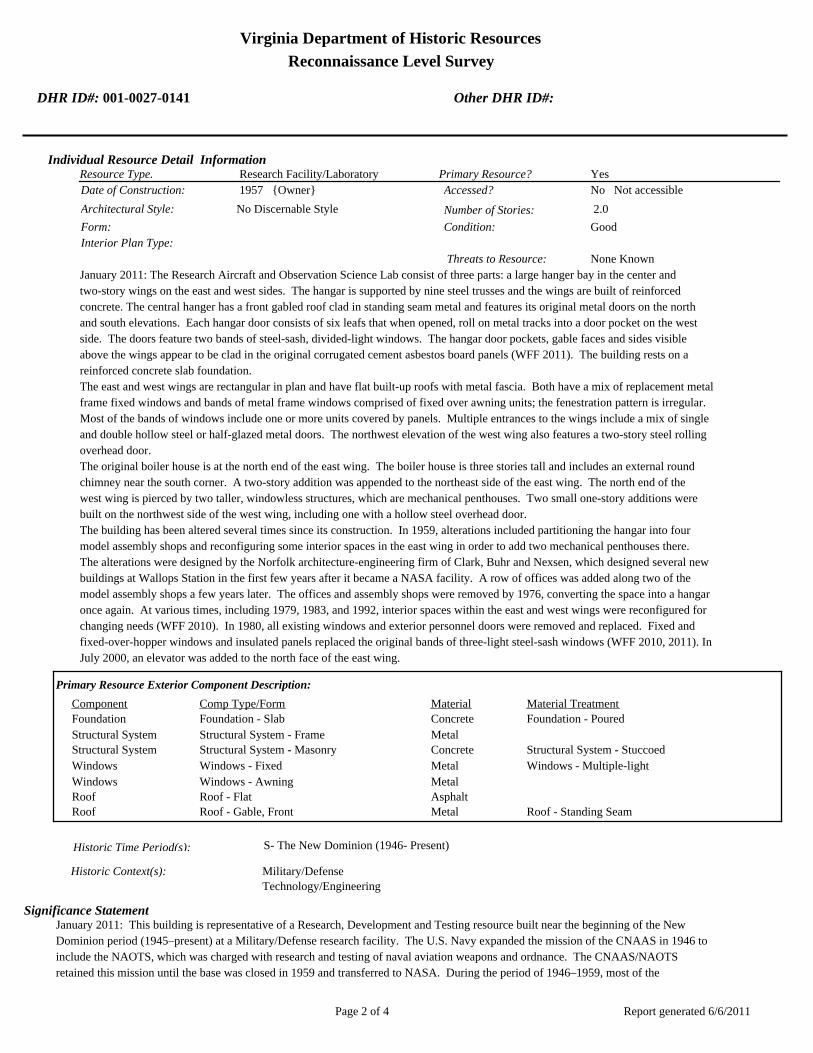
Virginia Department of Historic Resources
Reconnaissance Level Survey
DHR ID#: 001-0027-0141 Other DHR ID#:
Research Facility/LaboratoryResource Type. Primary Resource? Yes
Individual Resource Detail Information
Date of Construction: Accessed? 1957 {Owner} No Not accessible
2.0 Number of Stories:Architectural Style: No Discernable Style
Good
Interior Plan Type:
Form: Condition:
Threats to Resource: None Known
January 2011: The Research Aircraft and Observation Science Lab consist of three parts: a large hanger bay in the center and
two-story wings on the east and west sides. The hangar is supported by nine steel trusses and the wings are built of reinforced
concrete. The central hanger has a front gabled roof clad in standing seam metal and features its original metal doors on the north
and south elevations. Each hangar door consists of six leafs that when opened, roll on metal tracks into a door pocket on the west
side. The doors feature two bands of steel-sash, divided-light windows. The hangar door pockets, gable faces and sides visible
above the wings appear to be clad in the original corrugated cement asbestos board panels (WFF 2011). The building rests on a
reinforced concrete slab foundation.
The east and west wings are rectangular in plan and have flat built-up roofs with metal fascia. Both have a mix of replacement metal
frame fixed windows and bands of metal frame windows comprised of fixed over awning units; the fenestration pattern is irregular.
Most of the bands of windows include one or more units covered by panels. Multiple entrances to the wings include a mix of single
and double hollow steel or half-glazed metal doors. The northwest elevation of the west wing also features a two-story steel rolling
overhead door.
The original boiler house is at the north end of the east wing. The boiler house is three stories tall and includes an external round
chimney near the south corner. A two-story addition was appended to the northeast side of the east wing. The north end of the
west wing is pierced by two taller, windowless structures, which are mechanical penthouses. Two small one-story additions were
built on the northwest side of the west wing, including one with a hollow steel overhead door.
The building has been altered several times since its construction. In 1959, alterations included partitioning the hangar into four
model assembly shops and reconfiguring some interior spaces in the east wing in order to add two mechanical penthouses there.
The alterations were designed by the Norfolk architecture-engineering firm of Clark, Buhr and Nexsen, which designed several new
buildings at Wallops Station in the first few years after it became a NASA facility. A row of offices was added along two of the
model assembly shops a few years later. The offices and assembly shops were removed by 1976, converting the space into a hangar
once again. At various times, including 1979, 1983, and 1992, interior spaces within the east and west wings were reconfigured for
changing needs (WFF 2010). In 1980, all existing windows and exterior personnel doors were removed and replaced. Fixed and
fixed-over-hopper windows and insulated panels replaced the original bands of three-light steel-sash windows (WFF 2010, 2011). In
July 2000, an elevator was added to the north face of the east wing.
Primary Resource Exterior Component Description:
Material TreatmentMaterialComp Type/FormComponent
Foundation Foundation - Slab Concrete Foundation - Poured
Structural System Structural System - Frame Metal
Structural System Structural System - Masonry Concrete Structural System - Stuccoed
Windows Windows - Fixed Metal Windows - Multiple-light
Windows Windows - Awning Metal
Roof Roof - Flat Asphalt
Roof Roof - Gable, Front Metal Roof - Standing Seam
Historic Time Period(s):S- The New Dominion (1946- Present)
Historic Context(s): Military/Defense
Technology/Engineering
Significance Statement
January 2011: This building is representative of a Research, Development and Testing resource built near the beginning of the New
Dominion period (1945–present) at a Military/Defense research facility. The U.S. Navy expanded the mission of the CNAAS in 1946 to
include the NAOTS, which was charged with research and testing of naval aviation weapons and ordnance. The CNAAS/NAOTS
retained this mission until the base was closed in 1959 and transferred to NASA. During the period of 1946–1959, most of the
Report generated 6/6/2011Page 2 of 4
Virginia Department of Historic Resources
Reconnaissance Level Survey
DHR ID#: 001-0027-0141 Other DHR ID#:
development that occurred on the main base was related to housing and services. However, several new buildings were constructed on
main base within the three years leading up to the closure of the Navy station. The Navy erected this building in 1957. After the base was
transferred to NASA, Wallops converted the building into a range control center and model assembly area (Shortal 1978). By 1973, it was
the Environmental Lab. It was known as the Control Center by 1985 (WFF 2011). It is currently the Research Aircraft and Observation
Science Lab.
N-159 has been evaluated both as a contributing resource in a historic district and as an individual resource. No historic district on the
main base was identified because of a lack of significance and integrity.
This building is not individually eligible for listing on the NRHP because it lacks significance. The building is recommended not eligible
under Criterion A because it is not associated with an event or pattern of events of local, state, or national significance. It is not
associated with the life of a person significant in our past; therefore, it is recommended not eligible under Criterion B. The building is
recommended not eligible under Criterion C because it does not embody the distinctive characteristics of a type, period, or method of
construction; represent the work of a master; possess high artistic value; or represent a significant or distinguishable entity whose
components may lack individual distinction. It is recommended not eligible under Criterion D because it does not have the potential to
yield information important in history or prehistory.
The integrity of N-159 has been diminished by material alterations. The resource is in its historical location. Its historical setting in an
open area on an aircraft parking apron next to the runway is largely intact, although several large post-1965 buildings are located to the
northeast. No additions have been made to the building; however, its integrity of design, materials, and workmanship has been adversely
impacted by the removal and replacement of the original windows and personnel doors. The removal of original building materials
changed the historic character of the building, thereby diminishing its feeling and association.
National Register Eligibility Information (Intensive Level Survey):
NR Resource StatusNR Resource TypeNR Count
Building Non-contributing 1
1 Non-Contributing:
National Register Criteria:
Level of Significance:
Period of Significance:
Graphic Media Documentation
PhotographerPhoto DateNegative RepositoryDHR Negative # Photographic Media
Digital Images L. ThursbyJanuary 2011
Bibliographic Documentation
Reference #: 1
Bibliographic RecordType: Local Records
Author:
DHR CRM Report Number:
Notes:
Wallops Flight Facility Real Property Records
Cultural Resource Management (CRM) Events
CRM Event # 1,
Report generated 6/6/2011Page 3 of 4

Virginia Department of Historic Resources
Reconnaissance Level Survey
DHR ID#: 001-0027-0141 Other DHR ID#:
Cultural Resource Management Event: Survey:Phase I/Reconnaissance
Date of CRM Event: January 2011
CRM Person: TEC Inc
VDHR Project ID # Associated with Event: 2010-2274
CRM Event Notes or Comments:
Lori Thursby and Kimberly Martin
Bridge Information
Cemetery Information
Ownership Information
Unknown Unknown Name: .................................
NASA Wallops Flight FacilityCompany: ..........................
Wallops Flight FacilityAddress: .............................
Wallops IslandCity: ...................................
23337Zip: ....................................... VirginiaState: USACountry:
000-000-0000757-824-1000Phone/Extension: ..............
0000/ 0000
Relation to the Property: Owner of property
Report generated 6/6/2011Page 4 of 4

001-0027-0141N-159
001-0027-0130F-160
001-0027-0134M-016
001-0027-0133M-015
001-0027-0143N-162
001-0027-0151N-222
001-0027-0129F-157
001-0027-0139N-133
001-0027-0128E-144
001-0027-0148N-167
001-0027-0145N-163
001-0027-0149N-174
001-0027-0138M-184
001-0027-0140N-134
001-0027-0144N-162B
001-0027-0142N-159E
001-0027-0135M-017
001-0027-0147N-166
001-0027-0131F-163
001-0027-0137M-183
001-0027-0136M-025
001-0027-0150N-218
001-0027-0146N-164
001-0027-0132F-170
Chi
ncot
eagu
e R
d.Wo
rmho
ud
t S
t.Rickette St.
Bl is s St.
Fulton St.S
tubb
es B
lvd.
NASA Property
Surveyed Structures
Buildings
0 250Meters
0 1,000Feet

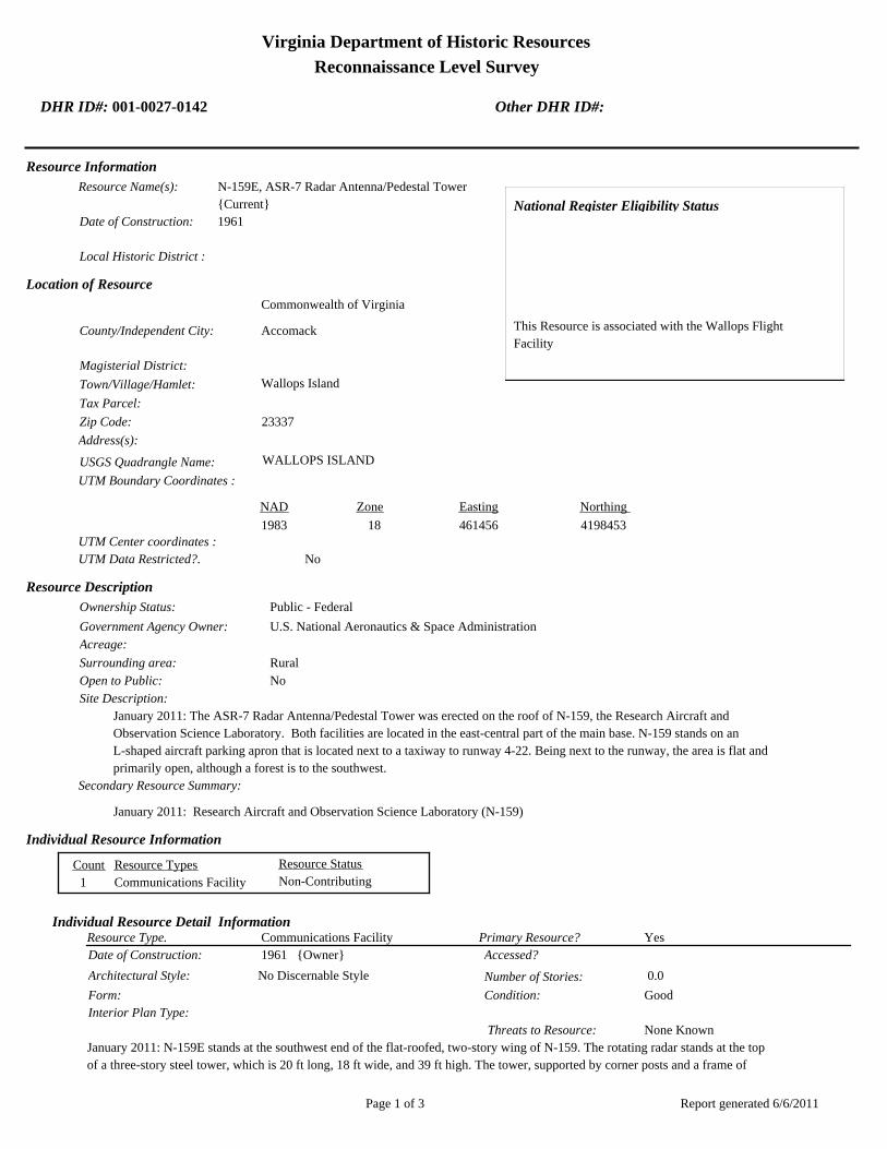
Virginia Department of Historic Resources
Reconnaissance Level Survey
DHR ID#: 001-0027-0142 Other DHR ID#:
Resource Information
National Register Eligibility Status
This Resource is associated with the Wallops Flight
Facility
Resource Name(s): N-159E, ASR-7 Radar Antenna/Pedestal Tower
{Current}
Date of Construction: 1961
Local Historic District :
Location of Resource
County/Independent City:
Commonwealth of Virginia
Accomack
Magisterial District:
Town/Village/Hamlet: Wallops Island
Tax Parcel:
Zip Code: 23337
Address(s):
USGS Quadrangle Name: WALLOPS ISLAND
UTM Boundary Coordinates :
Northing EastingZone NAD
1983 18 461456 4198453
UTM Center coordinates :
NoUTM Data Restricted?.
Resource Description
Ownership Status: Public - Federal
Government Agency Owner: U.S. National Aeronautics & Space Administration
Acreage:
Surrounding area: Rural
Open to Public: No
January 2011: The ASR-7 Radar Antenna/Pedestal Tower was erected on the roof of N-159, the Research Aircraft and
Observation Science Laboratory. Both facilities are located in the east-central part of the main base. N-159 stands on an
L-shaped aircraft parking apron that is located next to a taxiway to runway 4-22. Being next to the runway, the area is flat and
primarily open, although a forest is to the southwest.
Site Description:
Secondary Resource Summary:
January 2011: Research Aircraft and Observation Science Laboratory (N-159)
Resource StatusResource TypesCount
Communications Facility Non-Contributing 1
Individual Resource Information
Communications FacilityResource Type. Primary Resource? Yes
Individual Resource Detail Information
Date of Construction: Accessed? 1961 {Owner}
0.0 Number of Stories:Architectural Style: No Discernable Style
Good
Interior Plan Type:
Form: Condition:
Threats to Resource: None Known
January 2011: N-159E stands at the southwest end of the flat-roofed, two-story wing of N-159. The rotating radar stands at the top
of a three-story steel tower, which is 20 ft long, 18 ft wide, and 39 ft high. The tower, supported by corner posts and a frame of
Report generated 6/6/2011Page 1 of 3

Virginia Department of Historic Resources
Reconnaissance Level Survey
DHR ID#: 001-0027-0142 Other DHR ID#:
paired angle chords on four sides, tapers inward slightly as it rises. It was constructed in 1964 on Wallops Island and later moved to
this location in 1970 (WFF 2011). The tower includes two square platforms, one at the top and a second one a half story below. The
perimeters of both platforms have steel tube handrails. A steel L-shaped staircase with a landing on three levels of the tower is
located at the southeast section of the tower.
The antenna consists two parts, a primary and secondary antenna. The primary antenna is doubly curved reflector with a cosecant
squared vertical pattern. The secondary antenna is a monopulse, Large Vertical Aperture antenna (Winkler 1997). The secondary
component rests on the primary.
Primary Resource Exterior Component Description:
Material TreatmentMaterialComp Type/FormComponent
Structural System Structural System - Frame Steel
Foundation Foundation - Slab Concrete Foundation - Poured
Historic Time Period(s):S- The New Dominion (1946- Present)
Historic Context(s): Military/Defense
Technology/Engineering
Significance Statement
January 2011: This radar antenna tower is representative of a Communications resource type built near the beginning of the New
Dominion period (1945–present) at a Military/Defense research facility. The structure was originally located on the northeast corner of the
roof of Building F-10, an aircraft maintenance hangar built in 1944 for the CNAAS that was used by NAOTS after World War II as a
hangar and offices (URS and EG&G 2004). No information identifying when the tower was erected on F-10 was found. The radar tower
was modified and relocated to the roof of N-159, the range control center and model assembly area, in 1961 as part of an overall facility
expansion and modification program at Wallops Station after it became an operational facility of the newly-established NASA. Initially,
Wallops Station’s new mission under NASA was to develop and test various components related to manned space flight. This mission
was short-lived, however, as Wallops became a test range and launch site for suborbital and orbital rockets and satellites beginning in the
early 1960s. An ASR-7 radar is mounted to the top of the tower. ASR-7 is one type of airport surveillance radar. This older type of radar
uses analog technology to detect aircraft position and weather conditions (Federal Aviation Administration 2007).
N-159E has been evaluated both as a contributing resource in a historic district and as an individual resource. No historic district on the
main base was identified because of a lack of significance and integrity.
This structure is not individually eligible for listing on the NRHP because it lacks significance and integrity. Because it was moved from
its original site to its current location on the roof of N-159, the tower was evaluated under Criteria Consideration B in addition to Criteria
A–D. N-159E is recommended not eligible under Criterion A because it is not associated with an event or pattern of events of local, state,
or national significance. It is not associated with the life of a person significant in our past; therefore, it is recommended not eligible under
Criterion B. The building is recommended not eligible under Criterion C because it does not embody the distinctive characteristics of a
type, period, or method of construction; represent the work of a master; possess high artistic value; or represent a significant or
distinguishable entity whose components may lack individual distinction. It is recommended not eligible under Criterion D because it
does not have the potential to yield information important in history or prehistory.
The antenna tower was moved during the period of significance; therefore, it does not possess integrity of location. It does, however,
have integrity of setting because its placement on the roof of a large hangar that is in proximity to a major runway is comparable to its
original site. The design of the structure has been modified by the addition of a second platform near the top of the tower. The resource
retains its integrity of materials, workmanship, feeling, and setting.
National Register Eligibility Information (Intensive Level Survey):
NR Resource StatusNR Resource TypeNR Count
Building Non-contributing 1
1 Non-Contributing:
National Register Criteria:
Report generated 6/6/2011Page 2 of 3
Virginia Department of Historic Resources
Reconnaissance Level Survey
DHR ID#: 001-0027-0142 Other DHR ID#:
Level of Significance:
Period of Significance:
Graphic Media Documentation
PhotographerPhoto DateNegative RepositoryDHR Negative # Photographic Media
Digital Images L. ThursbyJanuary 2011
Bibliographic Documentation
Reference #: 1
Bibliographic RecordType: Local Records
Author:
DHR CRM Report Number:
Notes:
Wallops Flight Facility Real Property Records
Reference #: 2
Bibliographic RecordType: Article
Author: David F Winkler
DHR CRM Report Number:
Notes:
1997 Searching the Skies: The Legacy of the United States Cold War Defense Radar Program. Electronic document
available on-line at: http://www.globalsecurity.org/military/library/policy/navy/ntsp/NASMOD-D.htm. Accessed March 15,
2011
Cultural Resource Management (CRM) Events
CRM Event # 1,
Cultural Resource Management Event: Survey:Phase I/Reconnaissance
Date of CRM Event: January 2011
CRM Person: TEC Inc
VDHR Project ID # Associated with Event: 2010-2274
CRM Event Notes or Comments:
Lori Thursby and Kimberly Martin
Bridge Information
Cemetery Information
Ownership Information
Unknown Unknown Name: .................................
NASA Wallops Flight FacilityCompany: ..........................
Wallops Flight FacilityAddress: .............................
Wallops IslandCity: ...................................
23337Zip: ....................................... VirginiaState: USACountry:
000-000-0000757-824-1000Phone/Extension: ..............
0000/ 0000
Relation to the Property: Owner of property
Report generated 6/6/2011Page 3 of 3

001-0027-0141N-159
001-0027-0130F-160
001-0027-0134M-016
001-0027-0133M-015
001-0027-0143N-162
001-0027-0151N-222
001-0027-0129F-157
001-0027-0139N-133
001-0027-0128E-144
001-0027-0148N-167
001-0027-0145N-163
001-0027-0149N-174
001-0027-0138M-184
001-0027-0140N-134
001-0027-0144N-162B
001-0027-0142N-159E
001-0027-0135M-017
001-0027-0147N-166
001-0027-0131F-163
001-0027-0137M-183
001-0027-0136M-025
001-0027-0150N-218
001-0027-0146N-164
001-0027-0132F-170
Chi
ncot
eagu
e R
d.Wo
rmho
ud
t S
t.Rickette St.
Bl is s St.
Fulton St.S
tubb
es B
lvd.
NASA Property
Surveyed Structures
Buildings
0 250Meters
0 1,000Feet


Virginia Department of Historic Resources
Reconnaissance Level Survey
DHR ID#: 001-0027-0143 Other DHR ID#:
Resource Information
National Register Eligibility Status
This Resource is associated with the Wallops Flight
Facility
Resource Name(s): N-162, Telecommunications Facility Building
{Current}
N-162, Telemetry Building {Historic}
Date of Construction: 1957
Local Historic District :
Location of Resource
County/Independent City:
Commonwealth of Virginia
Accomack
Magisterial District:
Town/Village/Hamlet: Wallops Island
Tax Parcel:
Zip Code: 23337
Address(s):
USGS Quadrangle Name: WALLOPS ISLAND
UTM Boundary Coordinates :
Northing EastingZone NAD
1983 18 458184 4197954
UTM Center coordinates :
NoUTM Data Restricted?.
Resource Description
Ownership Status: Public - Federal
Government Agency Owner: U.S. National Aeronautics & Space Administration
Acreage:
Surrounding area: Rural
Open to Public: No
January 2011: The Telecommunications Facility Building is located on the southern portion of the main base, west of runway
4-22. An asphalt paved road runs along the north and west sides of the building connecting it to other buildings on the base.
Situated on a flat, open section of the base, the building is surrounded by antennas, mechanical equipment, and an oil tank.
Several of the antennas are included in this survey. Electrical equipment is contained in a chain-link fence at the south corner.
There are concrete parking lots on the east and west sides of the building.
Site Description:
Secondary Resource Summary:
January 2011: none
Resource StatusResource TypesCount
Communications Facility Non-Contributing 1
Individual Resource Information
Communications FacilityResource Type. Primary Resource? Yes
Individual Resource Detail Information
Date of Construction: Accessed? 1957 {Owner} No Not accessible
2.0 Number of Stories:Architectural Style: No Discernable Style
Good
Interior Plan Type:
Form: Condition:
Threats to Resource: None Known
Report generated 6/6/2011Page 1 of 4

Virginia Department of Historic Resources
Reconnaissance Level Survey
DHR ID#: 001-0027-0143 Other DHR ID#:
January 2011: The two-and-a-half-story north wing of the building was constructed in 1959 in a simple utilitarian style. It is
composed of concrete walls and rests on a reinforced concrete slab. Metal tube railing runs along the perimeter of the shallow
side-gabled metal and concrete roof. Two metal platforms with satellite dishes are situated on the northeast and southeast corners
of the roof, with a free standing antenna on the northwest corner. The two-story south wing of the building was constructed in
1963 (WFF 2011). Like the north wing, the south wing rests on a reinforced concrete slab and has a flat roof. The south wing,
however, is built of concrete block (WFF 2010). Metal tube railing runs along the perimeter of the roof. The roof was replaced most
recently in 1981 with a four-ply built-up roof (WFF 2011).
The main entrance to the building is on the west elevation, situated between the north and south wings. The entryway is through a
metal and glass vestibule with a standing seam metal shed roof. A concrete ramp with metal tube railing leads to the entrance.
Double half-glazed hollow metal doors are located north of center on the south wing.
The south elevation contains two small aluminum frame fixed windows on the second story, which were added at an unknown time.
A pipe protrudes from the first story and pierces the roofline. A small metal vent is located to the right of the pipe. The east
elevation provides additional points of entry to the building. Two double overhead metal doors are located on the north corner, a
set of double half-glazed metal doors are situated on the south corner, and a single half-glazed metal door is in the center of the
south wing. A small metal and glass vestibule with a flat roof and single glazed door is located in the center of the two wings. Both
this metal vestibule and the one on the west elevation replaced the original wood ones. There are two bays of triple aluminum-frame
fixed windows on the first and second stories of the north wing. There is a new window (second story) and louver on the south
wing and two original windows removed (first story) on southeast elevation. Two metal vents are located in the south corner of the
south wing.
The north elevation has a set of metal double doors on the second story, used as an exit. Metal exterior stairs with metal tube railing
extend from the exit to the ground. The entry and staircase are not original to the building. A storage room addition was appended
to northeast elevation in 1986 (WFF 2011).
Primary Resource Exterior Component Description:
Material TreatmentMaterialComp Type/FormComponent
Roof Roof - Gable, Front Metal
Structural System Structural System - Masonry Concrete Structural System - Stuccoed
Foundation Foundation - Slab Concrete Foundation - Poured
Porch Porch - 1-story Aluminum Porch - Enclosed
Windows Windows - Fixed Metal Windows - 1-light
Roof Roof - Flat Asphalt
Historic Time Period(s):S- The New Dominion (1946- Present)
Historic Context(s): Military/Defense
Technology/Engineering
Significance Statement
January 2011: This building is representative of a dual-function Research, Development and Testing and Communications resource built
near the beginning of the New Dominion period (1945–present) at a Military/Defense research facility. The U.S. Navy expanded the
mission of the CNAAS in 1946 to include the NAOTS, which was charged with research and testing of naval aviation weapons and
ordnance. The CNAAS/NAOTS retained this mission until the base was closed in 1959 and transferred to NASA. During the period of
1946–1959, most of the development that occurred on the main base was related to housing and services. However, several new buildings
were constructed on main base within the three years leading up to the closure of the Navy station. The Navy constructed N-162 in 1957.
After the base was transferred to NASA, Wallops converted the building into a telemetry building. Within a few years (1963), the building
was expanded with a 61 by 82- ft (full-width) addition on the southwest end (WFF 2010). It became the Telecommunications Facility in
1984 (WFF 2011).
N-162 has been evaluated both as a contributing resource in a historic district and as an individual resource. No historic district on the
main base was identified because of a lack of significance and integrity.
This building is not individually eligible for listing on the NRHP because it lacks significance. The building is recommended not eligible
under Criterion A because it is not associated with an event or pattern of events of local, state, or national significance. It is not
associated with the life of a person significant in our past; therefore, it is recommended not eligible under Criterion B. The building is
recommended not eligible under Criterion C because it does not embody the distinctive characteristics of a type, period, or method of
construction; represent the work of a master; possess high artistic value; or represent a significant or distinguishable entity whose
Report generated 6/6/2011Page 2 of 4
Virginia Department of Historic Resources
Reconnaissance Level Survey
DHR ID#: 001-0027-0143 Other DHR ID#:
components may lack individual distinction. It is recommended not eligible under Criterion D because it does not have the potential to
yield information important in history or prehistory.
The building has a moderate level of integrity. It is in its historical location and its setting is largely intact, although a few small buildings
and a couple of antenna towers, all post-dating 1965, have been erected to the south and southeast. The few changes to the door and
fenestration patterns of the building, as well as the small addition on the northeast elevation, have diminished the integrity of design and
materials. The building possesses integrity of workmanship, feeling, and association.
National Register Eligibility Information (Intensive Level Survey):
NR Resource StatusNR Resource TypeNR Count
Building Non-contributing 1
1 Non-Contributing:
National Register Criteria:
Level of Significance:
Period of Significance:
Graphic Media Documentation
PhotographerPhoto DateNegative RepositoryDHR Negative # Photographic Media
Digital Images L. ThursbyJanuary 2011
Bibliographic Documentation
Reference #: 1
Bibliographic RecordType: Local Records
Author:
DHR CRM Report Number:
Notes:
Wallops Flight Facility Real Property Records
Cultural Resource Management (CRM) Events
CRM Event # 1,
Cultural Resource Management Event: Survey:Phase I/Reconnaissance
Date of CRM Event: January 2011
CRM Person: TEC Inc
VDHR Project ID # Associated with Event: 2010-2274
CRM Event Notes or Comments:
Lori Thursby and Kimberly Martin
Bridge Information
Cemetery Information
Ownership Information
Unknown Unknown Name: .................................
NASA Wallops Flight FacilityCompany: ..........................
Wallops Flight FacilityAddress: .............................
Wallops IslandCity: ...................................
23337Zip: ....................................... VirginiaState: USACountry:
000-000-0000757-824-1000Phone/Extension: ..............
0000/ 0000
Report generated 6/6/2011Page 3 of 4
Virginia Department of Historic Resources
Reconnaissance Level Survey
DHR ID#: 001-0027-0143 Other DHR ID#:
Relation to the Property: Owner of property
Report generated 6/6/2011Page 4 of 4

001-0027-0141N-159
001-0027-0130F-160
001-0027-0134M-016
001-0027-0133M-015
001-0027-0143N-162
001-0027-0151N-222
001-0027-0129F-157
001-0027-0139N-133
001-0027-0128E-144
001-0027-0148N-167
001-0027-0145N-163
001-0027-0149N-174
001-0027-0138M-184
001-0027-0140N-134
001-0027-0144N-162B
001-0027-0142N-159E
001-0027-0135M-017
001-0027-0147N-166
001-0027-0131F-163
001-0027-0137M-183
001-0027-0136M-025
001-0027-0150N-218
001-0027-0146N-164
001-0027-0132F-170
Chi
ncot
eagu
e R
d.Wo
rmho
ud
t S
t.Rickette St.
Bl is s St.
Fulton St.S
tubb
es B
lvd.
NASA Property
Surveyed Structures
Buildings
0 250Meters
0 1,000Feet

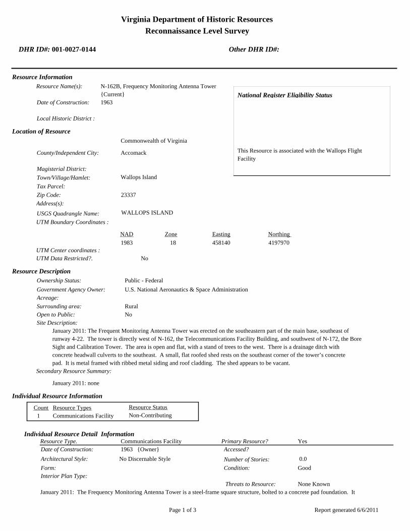
Virginia Department of Historic Resources
Reconnaissance Level Survey
DHR ID#: 001-0027-0144 Other DHR ID#:
Resource Information
National Register Eligibility Status
This Resource is associated with the Wallops Flight
Facility
Resource Name(s): N-162B, Frequency Monitoring Antenna Tower
{Current}
Date of Construction: 1963
Local Historic District :
Location of Resource
County/Independent City:
Commonwealth of Virginia
Accomack
Magisterial District:
Town/Village/Hamlet: Wallops Island
Tax Parcel:
Zip Code: 23337
Address(s):
USGS Quadrangle Name: WALLOPS ISLAND
UTM Boundary Coordinates :
Northing EastingZone NAD
1983 18 458140 4197970
UTM Center coordinates :
NoUTM Data Restricted?.
Resource Description
Ownership Status: Public - Federal
Government Agency Owner: U.S. National Aeronautics & Space Administration
Acreage:
Surrounding area: Rural
Open to Public: No
January 2011: The Frequent Monitoring Antenna Tower was erected on the southeastern part of the main base, southeast of
runway 4-22. The tower is directly west of N-162, the Telecommunications Facility Building, and southwest of N-172, the Bore
Sight and Calibration Tower. The area is open and flat, with a stand of trees to the west. There is a drainage ditch with
concrete headwall culverts to the southeast. A small, flat roofed shed rests on the southeast corner of the tower’s concrete
pad. It is metal framed with ribbed metal siding and roof cladding. The shed appears to be vacant.
Site Description:
Secondary Resource Summary:
January 2011: none
Resource StatusResource TypesCount
Communications Facility Non-Contributing 1
Individual Resource Information
Communications FacilityResource Type. Primary Resource? Yes
Individual Resource Detail Information
Date of Construction: Accessed? 1963 {Owner}
0.0 Number of Stories:Architectural Style: No Discernable Style
Good
Interior Plan Type:
Form: Condition:
Threats to Resource: None Known
January 2011: The Frequency Monitoring Antenna Tower is a steel-frame square structure, bolted to a concrete pad foundation. It
Report generated 6/6/2011Page 1 of 3
Virginia Department of Historic Resources
Reconnaissance Level Survey
DHR ID#: 001-0027-0144 Other DHR ID#:
is seven stories (75 ft) high and roughly 18 ft square at the base. The rotating antenna rests on the top of the tower and is mounted
on a steel pole. The tower tapers at the fourth course of its four steel corner posts and steel angle framework. The top of the tower
has a metal grate platform with yellow metal tube handrails. Four flights of metal L-shaped stairs extend through the middle of the
tower, reaching an additional flight of metal stairs on the south elevation. The stairs provide access to a metal ladder encircled by a
metal cage, which extends to the platform.
Primary Resource Exterior Component Description:
Material TreatmentMaterialComp Type/FormComponent
Foundation Foundation - Slab Concrete Foundation - Poured
Structural System Structural System - Frame Steel
Historic Time Period(s):S- The New Dominion (1946- Present)
Historic Context(s): Military/Defense
Technology/Engineering
Significance Statement
January 2011: This antenna tower is representative of a Communications resource type built near the beginning of the New Dominion
period (1945–present) at a Technology/Engineering research facility. This is one of approximately 50 buildings and structures that were
erected within six years of the establishment of NASA and the incorporation of Wallops Station as one of its operational facilities in 1959.
Initially, Wallops Station’s new mission under NASA was to develop and test various components related to manned space flight. This
mission was short-lived, however, as Wallops became a test range and launch site for suborbital and orbital rockets and satellites
beginning in the early 1960s. NASA erected this frequent monitoring antenna tower in 1963.
N-162B has been evaluated both as a contributing resource in a historic district and as an individual resource. No historic district on the
main base was identified because of a lack of significance and integrity.
This antenna tower is not individually eligible for listing on the NRHP because it lacks significance. The structure is presently less than
50 years old; therefore, it was evaluated under Criteria Consideration G in addition to Criteria A–D. The tower is recommended not eligible
under Criterion A because it is not associated with an event or pattern of events of exceptional importance at the local, state, or national
level. It is not associated with the life of a person who made exceptionally important contributions in history; therefore, it is recommended
not eligible under Criterion B. The structure retains its integrity; however, it is recommended not eligible under Criterion C because it does
not embody exceptional architectural merit for distinctive characteristics of a type, period, or method of construction; represent the work
of a master; or possess high artistic value. Likewise, it does not represent an exceptionally significant or distinguishable entity whose
components may lack individual distinction. It is recommended not eligible under Criterion D because it does not have the potential to
yield information exceptionally important in history or prehistory.
National Register Eligibility Information (Intensive Level Survey):
NR Resource StatusNR Resource TypeNR Count
Building Non-contributing 1
1 Non-Contributing:
National Register Criteria:
Level of Significance:
Period of Significance:
Graphic Media Documentation
PhotographerPhoto DateNegative RepositoryDHR Negative # Photographic Media
Digital Images L. ThursbyJanuary 2011
Report generated 6/6/2011Page 2 of 3

Virginia Department of Historic Resources
Reconnaissance Level Survey
DHR ID#: 001-0027-0144 Other DHR ID#:
Bibliographic Documentation
Reference #: 1
Bibliographic RecordType: Local Records
Author:
DHR CRM Report Number:
Notes:
Wallops Flight Facility Real Property Records
Cultural Resource Management (CRM) Events
CRM Event # 1,
Cultural Resource Management Event: Survey:Phase I/Reconnaissance
Date of CRM Event: January 2011
CRM Person: TEC Inc
VDHR Project ID # Associated with Event: 2010-2274
CRM Event Notes or Comments:
Lori Thursby and Kimberly Martin
Bridge Information
Cemetery Information
Ownership Information
Unknown Unknown Name: .................................
NASA Wallops Flight FacilityCompany: ..........................
Wallops Flight FacilityAddress: .............................
Wallops IslandCity: ...................................
23337Zip: ....................................... VirginiaState: USACountry:
000-000-0000757-824-1000Phone/Extension: ..............
0000/ 0000
Relation to the Property: Owner of property
Report generated 6/6/2011Page 3 of 3

001-0027-0141N-159
001-0027-0130F-160
001-0027-0134M-016
001-0027-0133M-015
001-0027-0143N-162
001-0027-0151N-222
001-0027-0129F-157
001-0027-0139N-133
001-0027-0128E-144
001-0027-0148N-167
001-0027-0145N-163
001-0027-0149N-174
001-0027-0138M-184
001-0027-0140N-134
001-0027-0144N-162B
001-0027-0142N-159E
001-0027-0135M-017
001-0027-0147N-166
001-0027-0131F-163
001-0027-0137M-183
001-0027-0136M-025
001-0027-0150N-218
001-0027-0146N-164
001-0027-0132F-170
Chi
ncot
eagu
e R
d.Wo
rmho
ud
t S
t.Rickette St.
Bl is s St.
Fulton St.S
tubb
es B
lvd.
NASA Property
Surveyed Structures
Buildings
0 250Meters
0 1,000Feet

Virginia Department of Historic Resources
Reconnaissance Level Survey
DHR ID#: 001-0027-0145 Other DHR ID#:
Resource Information
National Register Eligibility Status
This Resource is associated with the Wallops Flight
Facility
Resource Name(s): N-163, Antenna Calibration Measurement Facility
{Current}
N-163, Air to Ground Blockhouse {Historic}
Date of Construction: 1963
Local Historic District :
Location of Resource
County/Independent City:
Commonwealth of Virginia
Accomack
Magisterial District:
Town/Village/Hamlet: Wallops Island
Tax Parcel:
Zip Code: 23337
Address(s):
USGS Quadrangle Name: WALLOPS ISLAND
UTM Boundary Coordinates :
Northing EastingZone NAD
1983 18 458586 4198168
UTM Center coordinates :
NoUTM Data Restricted?.
Resource Description
Ownership Status: Public - Federal
Government Agency Owner: U.S. National Aeronautics & Space Administration
Acreage:
Surrounding area: Rural
Open to Public: No
January 2011: The Antenna Calibration Measurement Facility is located on the southern portion of the main base, immediately
west of runway 4-22. The building stands at the edge of an isolated, flat open field. A concrete pad leads from N-163 to the
runway and in the other direction, a row of concrete pads extends to an abandoned wooden platform and concrete footings of a
demolished building. Remnants of another foundation are in the vicinity of the runway. A raised cable track extends from the
southeast corner of the building. It has toppled over.
Site Description:
Secondary Resource Summary:
January 2011: none
Resource StatusResource TypesCount
Research
Facility/Laboratory
Non-Contributing 1
Individual Resource Information
Report generated 6/6/2011Page 1 of 3

Virginia Department of Historic Resources
Reconnaissance Level Survey
DHR ID#: 001-0027-0145 Other DHR ID#:
Research Facility/LaboratoryResource Type. Primary Resource? Yes
Individual Resource Detail Information
Date of Construction: Accessed? 1963 {Owner} No Not accessible
1.0 Number of Stories:Architectural Style: No Discernable Style
Good
Interior Plan Type:
Form: Condition:
Threats to Resource: None Known
January 2011: This one-story concrete block building was constructed in 1963 and is a small utilitarian structure. Portions of the
concrete block exterior have been covered with stucco. The building rests on a concrete slab foundation and has a platform on top
of the flat roof with an aluminum fascia. The platform is surrounded by a wooden railing. A wooden staircase, leading to the roof, is
located on the east elevation. The only entrance is on the south elevation, consisting of a single hollow steel door. Concrete steps
with metal tube railing leads to the door. The west elevation features a single metal sash fixed over awning window with concrete
lug lintel and slip sill. The north elevation has an original two-over-two, double-hung, wood sash windows with concrete slip sill
and no lintel.
Primary Resource Exterior Component Description:
Material TreatmentMaterialComp Type/FormComponent
Foundation Foundation - Slab Concrete Foundation - Poured
Structural System Structural System - Masonry Concrete Structural System - Block
Windows Windows - Sash, Double-Hung Wood Windows - 2/2
Roof Roof - Flat Asphalt
Historic Time Period(s):S- The New Dominion (1946- Present)
Historic Context(s): Military/Defense
Technology/Engineering
Significance Statement
January 2011: This building represents a secondary Research, Development and Testing resource built towards the beginning of the New
Dominion period (1945–present) at a Technology/Engineering research facility. This is one of approximately 50 buildings and structures
that were erected within six years of the establishment of NASA and the incorporation of Wallops Station as one of its operational
facilities in 1959. Initially, Wallops Station’s new mission under NASA was to develop and test various components related to manned
space flight. This mission was short-lived, however, as Wallops became a test range and launch site for suborbital and orbital rockets and
satellites beginning in the early 1960s. N-163 was originally an Air to Ground Blockhouse, and included two radio frequency electronics
van trailers. In 1971 the trailers and all piers, jacks, conduits, and connections were removed and the building changed to an antenna
calibration measurement facility. As a result of the removal of the van trailers, new concrete block walls for N-163 were installed in 1973
(WFF 2011).
N-163 has been evaluated both as a contributing resource in a historic district and as an individual resource. No historic district on the
main base was identified because of a lack of significance and integrity.
The Antenna Calibration Measurement Facility is not individually eligible for listing on the NRHP because it lacks significance and
integrity. The building is presently less than 50 years old; therefore, it was evaluated under Criteria Consideration G in addition to Criteria
A–D. The building is recommended not eligible under Criterion A because it is not associated with an event or pattern of events of
exceptional importance at the local, state, or national level. It is not associated with the life of a person who made exceptionally important
contributions in history; therefore, it is recommended not eligible under Criterion B. The building is recommended not eligible under
Criterion C because it does not embody exceptional architectural merit for distinctive characteristics of a type, period, or method of
construction; represent the work of a master; or possess high artistic value. Likewise, it does not represent an exceptionally significant or
distinguishable entity whose components may lack individual distinction. It is recommended not eligible under Criterion D because it
does not have the potential to yield information exceptionally important in history or prehistory.
Changes to the building and its surroundings have negatively affected several aspects of the integrity of N-163. The building is in its
historical location. The setting is diminished by the removal of two to three other buildings or structures that were in the proximity to
N-163 and probably once associated with it. The design and materials of the building have been compromised by the installation of new
concrete block walls in 1973, the replacement of one of the windows, and the installation of a wood platform on the roof and the stairs that
lead to it. The physical changes to the building and its setting have removed the historical association of the building. However, it does
Report generated 6/6/2011Page 2 of 3

Virginia Department of Historic Resources
Reconnaissance Level Survey
DHR ID#: 001-0027-0145 Other DHR ID#:
retain integrity of feeling and workmanship.
National Register Eligibility Information (Intensive Level Survey):
NR Resource StatusNR Resource TypeNR Count
Building Non-contributing 1
1 Non-Contributing:
National Register Criteria:
Level of Significance:
Period of Significance:
Graphic Media Documentation
PhotographerPhoto DateNegative RepositoryDHR Negative # Photographic Media
Digital Images L.ThursbyJanuary 2011
Bibliographic Documentation
Reference #: 1
Bibliographic RecordType: Local Records
Author:
DHR CRM Report Number:
Notes:
Wallops Flight Facility Real Property Records
Cultural Resource Management (CRM) Events
CRM Event # 1,
Cultural Resource Management Event: Survey:Phase I/Reconnaissance
Date of CRM Event: January 2011
CRM Person: TEC Inc
VDHR Project ID # Associated with Event: 2010-2274
CRM Event Notes or Comments:
Lori Thursby and Kimberly Martin
Bridge Information
Cemetery Information
Ownership Information
Unknown Unknown Name: .................................
NASA Wallops Flight FacilityCompany: ..........................
Wallops Flight FacilityAddress: .............................
Wallops IslandCity: ...................................
23337Zip: ....................................... VirginiaState: USACountry:
000-000-0000757-824-1000Phone/Extension: ..............
0000/ 0000
Relation to the Property: Owner of property
Report generated 6/6/2011Page 3 of 3

001-0027-0141N-159
001-0027-0130F-160
001-0027-0134M-016
001-0027-0133M-015
001-0027-0143N-162
001-0027-0151N-222
001-0027-0129F-157
001-0027-0139N-133
001-0027-0128E-144
001-0027-0148N-167
001-0027-0145N-163
001-0027-0149N-174
001-0027-0138M-184
001-0027-0140N-134
001-0027-0144N-162B
001-0027-0142N-159E
001-0027-0135M-017
001-0027-0147N-166
001-0027-0131F-163
001-0027-0137M-183
001-0027-0136M-025
001-0027-0150N-218
001-0027-0146N-164
001-0027-0132F-170
Chi
ncot
eagu
e R
d.Wo
rmho
ud
t S
t.Rickette St.
Bl is s St.
Fulton St.S
tubb
es B
lvd.
NASA Property
Surveyed Structures
Buildings
0 250Meters
0 1,000Feet

Virginia Department of Historic Resources
Reconnaissance Level Survey
DHR ID#: 001-0027-0146 Other DHR ID#:
Resource Information
National Register Eligibility Status
This Resource is associated with the Wallops Flight
Facility
Resource Name(s): N-164, Explosives Handling Equipment Storage
Building {Current}
Date of Construction: 1965
Local Historic District :
Location of Resource
County/Independent City:
Commonwealth of Virginia
Accomack
Magisterial District:
Town/Village/Hamlet: Wallops Island
Tax Parcel:
Zip Code: 23337
Address(s): N-162 Access Road
USGS Quadrangle Name: WALLOPS ISLAND
UTM Boundary Coordinates :
Northing EastingZone NAD
1983 18 458126 4197918
UTM Center coordinates :
NoUTM Data Restricted?.
Resource Description
Ownership Status: Public - Federal
Government Agency Owner: U.S. National Aeronautics & Space Administration
Acreage:
Surrounding area: Rural
Open to Public: No
January 2011: The High Frequency Receiver Antenna is located on the southern portion of the main base, to the southwest of
runway 4-22. An observation tower and two antennas are located to the north. The area is mostly an open, flat field. There are
pine trees to the west of the antenna.
Site Description:
Secondary Resource Summary:
January 2011: none
Resource StatusResource TypesCount
Communications Facility Non-Contributing 1
Individual Resource Information
Communications FacilityResource Type. Primary Resource? Yes
Individual Resource Detail Information
Date of Construction: Accessed? 1965 {Owner}
0.0 Number of Stories:Architectural Style: No Discernable Style
Good
Interior Plan Type:
Form: Condition:
Threats to Resource: None Known
January 2011: This High Frequency Receiver Antenna consists of a steel pole supported by two triangular, steel framed towers.
The support towers extend three quarters of the height of pole and are fortified by four guy wires. The pole is raised about 2 ft off
the ground and has a round antenna attached to the top. The central pole and support towers are bolted to a concrete pad. Cables
Report generated 6/6/2011Page 1 of 3

Virginia Department of Historic Resources
Reconnaissance Level Survey
DHR ID#: 001-0027-0146 Other DHR ID#:
extend up the southern support tower and wrap around the top quarter of the pole. The antenna stands 105 ft high and was
relocated to this site in 1981. As-built drawings indicate that it was originally affixed to a concrete pedestal with a spiral staircase
(WFF 2011).
Primary Resource Exterior Component Description:
Material TreatmentMaterialComp Type/FormComponent
Foundation Foundation - Slab Concrete Foundation - Poured
Structural System Structural System - Frame Metal
Historic Time Period(s):S- The New Dominion (1946- Present)
Historic Context(s): Military/Defense
Technology/Engineering
Significance Statement
January 2011: This high frequency receiver antenna is representative of a Communications resource type built towards the beginning of
the New Dominion period (1945–present) at a Technology/Engineering research facility. This is one of approximately 50 buildings and
structures that were erected within six years of the establishment of NASA and the incorporation of Wallops Station as one of its
operational facilities in 1959. Initially, Wallops Station’s new mission under NASA was to develop and test various components related to
manned space flight. This mission was short-lived, however, as Wallops became a test range and launch site for suborbital and orbital
rockets and satellites beginning in the early 1960s. NASA erected this antenna in 1965.
N-164 has been evaluated both as a contributing resource in a historic district and as an individual resource. No historic district on the
main base was identified because of a lack of significance and integrity.
This antenna is not individually eligible for listing on the NRHP because it lacks significance. The structure is presently less than 50 years
old; therefore, it was evaluated under Criteria Consideration G in addition to Criteria A–D. The tower is recommended not eligible under
Criterion A because it is not associated with an event or pattern of events of exceptional importance at the local, state, or national level. It
is not associated with the life of a person who made exceptionally important contributions in history; therefore, it is recommended not
eligible under Criterion B. The structure retains its integrity, but it is recommended not eligible under Criterion C because it does not
embody exceptional architectural merit for distinctive characteristics of a type, period, or method of construction; represent the work of a
master; or possess high artistic value. Likewise, it does not represent an exceptionally significant or distinguishable entity whose
components may lack individual distinction. It is recommended not eligible under Criterion D because it does not have the potential to
yield information exceptionally important in history or prehistory.
National Register Eligibility Information (Intensive Level Survey):
NR Resource StatusNR Resource TypeNR Count
Building Non-contributing 1
1 Non-Contributing:
National Register Criteria:
Level of Significance:
Period of Significance:
Graphic Media Documentation
PhotographerPhoto DateNegative RepositoryDHR Negative # Photographic Media
Digital Images L. ThursbyJanuary 2011
Bibliographic Documentation
Reference #: 1
Report generated 6/6/2011Page 2 of 3
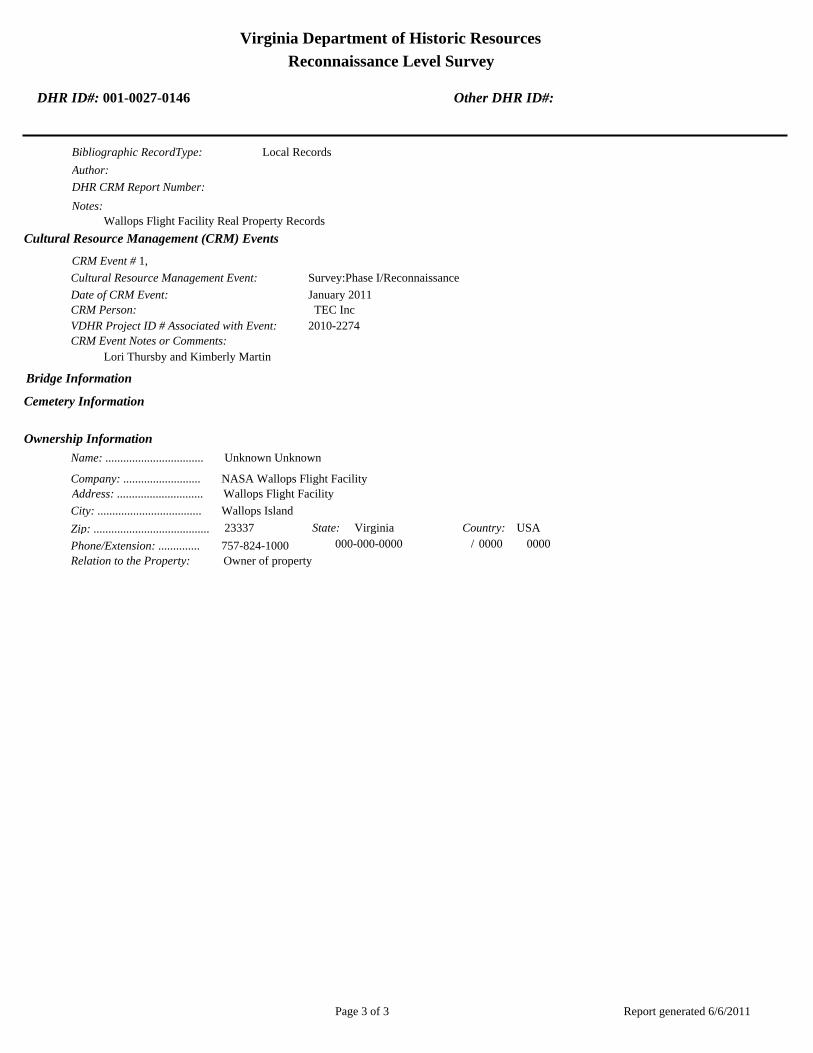
Virginia Department of Historic Resources
Reconnaissance Level Survey
DHR ID#: 001-0027-0146 Other DHR ID#:
Bibliographic RecordType: Local Records
Author:
DHR CRM Report Number:
Notes:
Wallops Flight Facility Real Property Records
Cultural Resource Management (CRM) Events
CRM Event # 1,
Cultural Resource Management Event: Survey:Phase I/Reconnaissance
Date of CRM Event: January 2011
CRM Person: TEC Inc
VDHR Project ID # Associated with Event: 2010-2274
CRM Event Notes or Comments:
Lori Thursby and Kimberly Martin
Bridge Information
Cemetery Information
Ownership Information
Unknown Unknown Name: .................................
NASA Wallops Flight FacilityCompany: ..........................
Wallops Flight FacilityAddress: .............................
Wallops IslandCity: ...................................
23337Zip: ....................................... VirginiaState: USACountry:
000-000-0000757-824-1000Phone/Extension: ..............
0000/ 0000
Relation to the Property: Owner of property
Report generated 6/6/2011Page 3 of 3

001-0027-0141N-159
001-0027-0130F-160
001-0027-0134M-016
001-0027-0133M-015
001-0027-0143N-162
001-0027-0151N-222
001-0027-0129F-157
001-0027-0139N-133
001-0027-0128E-144
001-0027-0148N-167
001-0027-0145N-163
001-0027-0149N-174
001-0027-0138M-184
001-0027-0140N-134
001-0027-0144N-162B
001-0027-0142N-159E
001-0027-0135M-017
001-0027-0147N-166
001-0027-0131F-163
001-0027-0137M-183
001-0027-0136M-025
001-0027-0150N-218
001-0027-0146N-164
001-0027-0132F-170
Chi
ncot
eagu
e R
d.Wo
rmho
ud
t S
t.Rickette St.
Bl is s St.
Fulton St.S
tubb
es B
lvd.
NASA Property
Surveyed Structures
Buildings
0 250Meters
0 1,000Feet
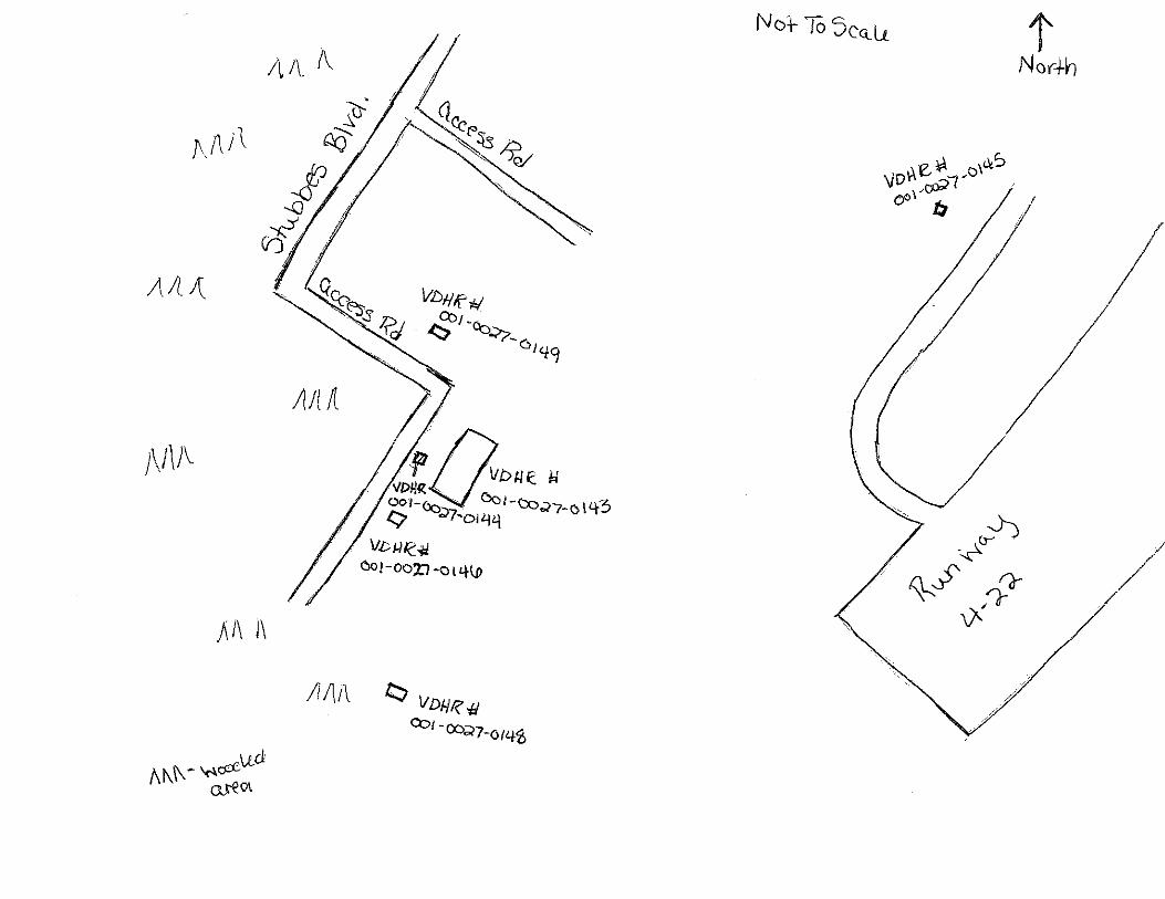

Virginia Department of Historic Resources
Reconnaissance Level Survey
DHR ID#: 001-0027-0147 Other DHR ID#:
Resource Information
National Register Eligibility Status
This Resource is associated with the Wallops Flight
Facility
Resource Name(s): N-166, Explosives Handling Equipment Storage
Building {Current}
Date of Construction: 1957
Local Historic District :
Location of Resource
County/Independent City:
Commonwealth of Virginia
Accomack
Magisterial District:
Town/Village/Hamlet: Wallops Island
Tax Parcel:
Zip Code: 23337
Address(s): Stubbes Boulevard
USGS Quadrangle Name: WALLOPS ISLAND
UTM Boundary Coordinates :
Northing EastingZone NAD
1983 18 458387 4198462
UTM Center coordinates :
NoUTM Data Restricted?.
Resource Description
Ownership Status: Public - Federal
Government Agency Owner: U.S. National Aeronautics & Space Administration
Acreage:
Surrounding area: Rural
Open to Public: No
January 2011: The Explosives Handling Equipment Storage Building is located on the southern half of the main base, west of
runway 4-22. Stubbs Boulevard runs along the west side of the building. The area around the building is flat and open with
forest to the south and west. A gravel road leads to it.
Site Description:
Secondary Resource Summary:
January 2011: none
Resource StatusResource TypesCount
Magazine Non-Contributing 1
Individual Resource Information
MagazineResource Type. Primary Resource? Yes
Individual Resource Detail Information
Date of Construction: Accessed? 1957 {Owner} No Not accessible
1.0 Number of Stories:Architectural Style: No Discernable Style
Good
Interior Plan Type:
Form: Condition:
Threats to Resource: None Known
January 2011: This is a simple concrete block building with a flat roof and aluminum fascia. The building rests on a raised concrete
foundation. A hollow steel door on the east elevation is the only point of entry. A single metal louvered window with a precast
concrete slip sill is located in the center of both the north and south elevations. The west elevation has no openings.
Report generated 6/6/2011Page 1 of 3

Virginia Department of Historic Resources
Reconnaissance Level Survey
DHR ID#: 001-0027-0147 Other DHR ID#:
Primary Resource Exterior Component Description:
Material TreatmentMaterialComp Type/FormComponent
Roof Roof - Flat Asphalt
Foundation Foundation - Raised Concrete Foundation - Poured
Structural System Structural System - Masonry Concrete Structural System - Block
Windows Windows - Louvered/Jalousied Metal Windows - Louvered
Historic Time Period(s):S- The New Dominion (1946- Present)
Historic Context(s): Military/Defense
Technology/Engineering
Significance Statement
January 2011: The Explosives Handling Equipment Storage Building represents a secondary resource built near the beginning of the New
Dominion period (1945–present) at a Military/Defense research facility. The U.S. Navy expanded the mission of the CNAAS in 1946 to
include the NAOTS, which was charged with research and testing of naval aviation weapons and ordnance. The CNAAS/NAOTS
retained this mission until the base was closed in 1959 and transferred to NASA. During the period of 1946–1959, most of the
development that occurred on the main base was related to housing and services. However, several new buildings were constructed on
main base within the three years leading up to the closure of the Navy station. The Navy erected this building in 1957; it has been used
for storage since its construction.
N-166 has been evaluated both as a contributing resource in a historic district and as an individual resource. No historic district on the
main base was identified because of a lack of significance and integrity.
The building is not individually eligible for listing on the NRHP because it lacks significance. The building is recommended not eligible
under Criterion A because it is not associated with an event or pattern of events of local, state, or national significance. It is not
associated with the life of a person significant in our past; therefore, it is recommended not eligible under Criterion B. N-166 retains
integrity, but it is a secondary resource of simple design and common construction; thus, it is recommended not eligible under Criterion C
because it does not embody the distinctive characteristics of a type, period, or method of construction; represent the work of a master;
possess high artistic value; or represent a significant or distinguishable entity whose components may lack individual distinction. It is
recommended not eligible under Criterion D because it does not have the potential to yield information important in history or prehistory.
National Register Eligibility Information (Intensive Level Survey):
NR Resource StatusNR Resource TypeNR Count
Building Non-contributing 1
1 Non-Contributing:
National Register Criteria:
Level of Significance:
Period of Significance:
Graphic Media Documentation
PhotographerPhoto DateNegative RepositoryDHR Negative # Photographic Media
Digital Images L. ThursbyJanuary 2011
Bibliographic Documentation
Reference #: 1
Bibliographic RecordType: Local Records
Author:
DHR CRM Report Number:
Report generated 6/6/2011Page 2 of 3

Virginia Department of Historic Resources
Reconnaissance Level Survey
DHR ID#: 001-0027-0147 Other DHR ID#:
Notes:
Wallops Flight Facility Real Property Records
Cultural Resource Management (CRM) Events
CRM Event # 1,
Cultural Resource Management Event: Survey:Phase I/Reconnaissance
Date of CRM Event: January 2011
CRM Person: TEC Inc
VDHR Project ID # Associated with Event: 2010--2274
CRM Event Notes or Comments:
Lori Thursby and Kimberly Martin
Bridge Information
Cemetery Information
Ownership Information
Unknown Unknown Name: .................................
NASA Wallops Flight FacilityCompany: ..........................
Wallops Flight FacilityAddress: .............................
Wallops IslandCity: ...................................
23337Zip: ....................................... VirginiaState: USACountry:
000-000-0000757-824-1000Phone/Extension: ..............
0000/ 0000
Relation to the Property: Owner of property
Report generated 6/6/2011Page 3 of 3

001-0027-0141N-159
001-0027-0130F-160
001-0027-0134M-016
001-0027-0133M-015
001-0027-0143N-162
001-0027-0151N-222
001-0027-0129F-157
001-0027-0139N-133
001-0027-0128E-144
001-0027-0148N-167
001-0027-0145N-163
001-0027-0149N-174
001-0027-0138M-184
001-0027-0140N-134
001-0027-0144N-162B
001-0027-0142N-159E
001-0027-0135M-017
001-0027-0147N-166
001-0027-0131F-163
001-0027-0137M-183
001-0027-0136M-025
001-0027-0150N-218
001-0027-0146N-164
001-0027-0132F-170
Chi
ncot
eagu
e R
d.Wo
rmho
ud
t S
t.Rickette St.
Bl is s St.
Fulton St.S
tubb
es B
lvd.
NASA Property
Surveyed Structures
Buildings
0 250Meters
0 1,000Feet

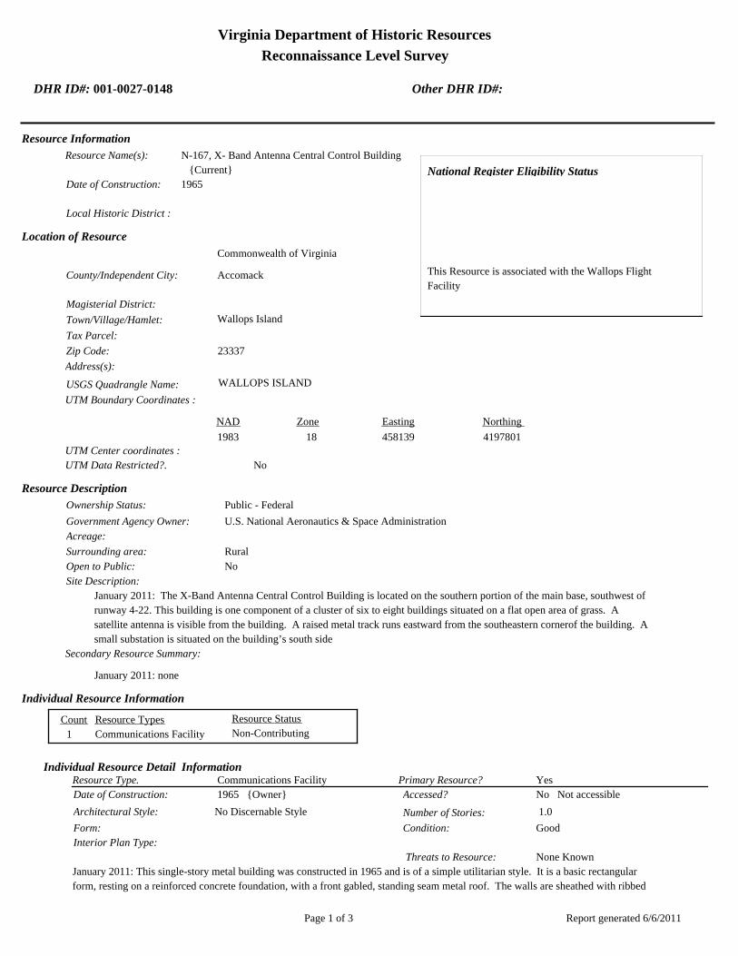
Virginia Department of Historic Resources
Reconnaissance Level Survey
DHR ID#: 001-0027-0148 Other DHR ID#:
Resource Information
National Register Eligibility Status
This Resource is associated with the Wallops Flight
Facility
Resource Name(s): N-167, X- Band Antenna Central Control Building
{Current}
Date of Construction: 1965
Local Historic District :
Location of Resource
County/Independent City:
Commonwealth of Virginia
Accomack
Magisterial District:
Town/Village/Hamlet: Wallops Island
Tax Parcel:
Zip Code: 23337
Address(s):
USGS Quadrangle Name: WALLOPS ISLAND
UTM Boundary Coordinates :
Northing EastingZone NAD
1983 18 458139 4197801
UTM Center coordinates :
NoUTM Data Restricted?.
Resource Description
Ownership Status: Public - Federal
Government Agency Owner: U.S. National Aeronautics & Space Administration
Acreage:
Surrounding area: Rural
Open to Public: No
January 2011: The X-Band Antenna Central Control Building is located on the southern portion of the main base, southwest of
runway 4-22. This building is one component of a cluster of six to eight buildings situated on a flat open area of grass. A
satellite antenna is visible from the building. A raised metal track runs eastward from the southeastern cornerof the building. A
small substation is situated on the building’s south side
Site Description:
Secondary Resource Summary:
January 2011: none
Resource StatusResource TypesCount
Communications Facility Non-Contributing 1
Individual Resource Information
Communications FacilityResource Type. Primary Resource? Yes
Individual Resource Detail Information
Date of Construction: Accessed? 1965 {Owner} No Not accessible
1.0 Number of Stories:Architectural Style: No Discernable Style
Good
Interior Plan Type:
Form: Condition:
Threats to Resource: None Known
January 2011: This single-story metal building was constructed in 1965 and is of a simple utilitarian style. It is a basic rectangular
form, resting on a reinforced concrete foundation, with a front gabled, standing seam metal roof. The walls are sheathed with ribbed
Report generated 6/6/2011Page 1 of 3

Virginia Department of Historic Resources
Reconnaissance Level Survey
DHR ID#: 001-0027-0148 Other DHR ID#:
metal panels. The façade of the building faces west and is composed of a single door and a set of double doors. Two light fixtures
frame the double doorway. Vents are situated in the east and west gables. A raised concrete stoop, reached via three stairs, leads
to the entrance. A metal tube railing surrounds the porch.
The north elevation consists of three bays of steel sash fixed and awning windows with large sills. Each window has four lights.
The south elevation is composed of two bays with windows of the same type. A 400 square-foot addition was completed on the
southeastern corner of the building in 1974 (WFF 2011), resulting in a distinct change to the east elevation of the building. The
addition has metal plates in the gable peaks with the name “Armco,” a company that manufactures steel products (AK Steel
Corporation 2011). The original east elevation is composed of a double window of the same type described above. There are two
bays in the addition: one aluminum sash fixed and awning window and a glazed door. A concrete stoop, with three stairs facing
east, leads to the door. The stoop is surrounded by metal tube railing.
Primary Resource Exterior Component Description:
Material TreatmentMaterialComp Type/FormComponent
Foundation Foundation - Slab Concrete Foundation - Poured
Structural System Structural System - Frame Metal Structural System - Siding
Porch Porch - Stoop Concrete
Windows Windows - Awning Aluminum Windows - 1-light
Windows Windows - Fixed Aluminum
Roof Roof - Gable, Side Aluminum Roof - V-Crimp
Historic Time Period(s):S- The New Dominion (1946- Present)
Historic Context(s): Military/Defense
Technology/Engineering
Significance Statement
January 2011: The X-Band Antenna Central Control Building is a Communications property type built towards the beginning of the New
Dominion period (1945–present) at a Technology/Engineering research facility. This is one of approximately 50 buildings and structures
that were erected within six years of the establishment of NASA and the incorporation of Wallops Station as one of its operational
facilities in 1959. Initially, Wallops Station’s new mission under NASA was to develop and test various components related to manned
space flight. This mission was short-lived, however, as Wallops became a test range and launch site for suborbital and orbital rockets and
satellites beginning in the early 1960s. NASA constructed this building in 1965. It retains its original use.
N-167 has been evaluated both as a contributing resource in a historic district and as an individual resource. No historic district on the
main base was identified because of a lack of significance and integrity.
The building is not individually eligible for listing on the NRHP because it lacks significance and integrity. The building is presently less
than 50 years old; therefore, it was evaluated under Criteria Consideration G in addition to Criteria A–D. The building is recommended not
eligible under Criterion A because it is not associated with an event or pattern of events of exceptional importance at the local, state, or
national level. It is not associated with the life of a person who made exceptionally important contributions in history; therefore, it is
recommended not eligible under Criterion B. The building is recommended not eligible under Criterion C because it does not embody
exceptional architectural merit for distinctive characteristics of a type, period, or method of construction; represent the work of a master; or
possess high artistic value. Likewise, it does not represent an exceptionally significant or distinguishable entity whose components may
lack individual distinction. It is recommended not eligible under Criterion D because it does not have the potential to yield information
exceptionally important in history or prehistory.
The building retains integrity of location, as it is in its historical location. The setting of the resource has been adversely impacted by the
construction of a few post-1965 buildings and concrete paved areas to the north and northeast. The building’s integrity of design was
diminished by the addition at the southeast end, which nearly doubled the size of the building. The resource retains integrity of materials,
workmanship, and feeling. It lacks integrity of association, however, because of the changes to its surrounding and to the original design.
National Register Eligibility Information (Intensive Level Survey):
Report generated 6/6/2011Page 2 of 3

Virginia Department of Historic Resources
Reconnaissance Level Survey
DHR ID#: 001-0027-0148 Other DHR ID#:
NR Resource StatusNR Resource TypeNR Count
Building Non-contributing 1
1 Non-Contributing:
National Register Criteria:
Level of Significance:
Period of Significance:
Graphic Media Documentation
PhotographerPhoto DateNegative RepositoryDHR Negative # Photographic Media
Digital Images L. ThursbyJanuary 2011
Bibliographic Documentation
Reference #: 1
Bibliographic RecordType: Local Records
Author:
DHR CRM Report Number:
Notes:
Wallops Flight Facility Real Property Records
Cultural Resource Management (CRM) Events
CRM Event # 1,
Cultural Resource Management Event: Survey:Phase I/Reconnaissance
Date of CRM Event: January 2011
CRM Person: TEC Inc
VDHR Project ID # Associated with Event: 2010-2274
CRM Event Notes or Comments:
Lori Thursby and Kimberly Martin
Bridge Information
Cemetery Information
Ownership Information
Unknown Unknown Name: .................................
NASA Wallops Flight FacilityCompany: ..........................
Wallops Flight FacilityAddress: .............................
Wallops IslandCity: ...................................
23337Zip: ....................................... VirginiaState: USACountry:
000-000-0000757-824-1000Phone/Extension: ..............
0000/ 0000
Relation to the Property: Owner of property
Report generated 6/6/2011Page 3 of 3

001-0027-0141N-159
001-0027-0130F-160
001-0027-0134M-016
001-0027-0133M-015
001-0027-0143N-162
001-0027-0151N-222
001-0027-0129F-157
001-0027-0139N-133
001-0027-0128E-144
001-0027-0148N-167
001-0027-0145N-163
001-0027-0149N-174
001-0027-0138M-184
001-0027-0140N-134
001-0027-0144N-162B
001-0027-0142N-159E
001-0027-0135M-017
001-0027-0147N-166
001-0027-0131F-163
001-0027-0137M-183
001-0027-0136M-025
001-0027-0150N-218
001-0027-0146N-164
001-0027-0132F-170
Chi
ncot
eagu
e R
d.Wo
rmho
ud
t S
t.Rickette St.
Bl is s St.
Fulton St.S
tubb
es B
lvd.
NASA Property
Surveyed Structures
Buildings
0 250Meters
0 1,000Feet


Virginia Department of Historic Resources
Reconnaissance Level Survey
DHR ID#: 001-0027-0149 Other DHR ID#:
Resource Information
National Register Eligibility Status
This Resource is associated with the Wallops Flight
Facility
Resource Name(s): N-174, Bore Sight and Calibration Tower
{Current}
Date of Construction: 1962
Local Historic District :
Location of Resource
County/Independent City:
Commonwealth of Virginia
Accomack
Magisterial District:
Town/Village/Hamlet: Wallops Island
Tax Parcel:
Zip Code: 23337
Address(s):
USGS Quadrangle Name: WALLOPS ISLAND
UTM Boundary Coordinates :
Northing EastingZone NAD
1983 18 458151 4198075
UTM Center coordinates :
NoUTM Data Restricted?.
Resource Description
Ownership Status: Public - Federal
Government Agency Owner: U.S. National Aeronautics & Space Administration
Acreage:
Surrounding area: Rural
Open to Public: No
January 2011: The Bore Sight and Calibration Tower was erected on the southeastern part of the main base, southeast of
runway 4-22. The tower is in a densely forested area, next to a second unmarked tower. Cables attach it a small flat roofed
building (N-174B).
Site Description:
Secondary Resource Summary:
January 2011: small flat roofed building (N-174B)
Resource StatusResource TypesCount
Communications Facility Non-Contributing 1
Individual Resource Information
Communications FacilityResource Type. Primary Resource? Yes
Individual Resource Detail Information
Date of Construction: Accessed? 1962 {Owner}
0.0 Number of Stories:Architectural Style: No Discernable Style
Good
Interior Plan Type:
Form: Condition:
Threats to Resource: None Known
January 2011: N-174 is a 150 ft galvanized steel tower bolted to concrete footings at each corner. The tower, which is supported by
steel posts and angles, tapers slightly. Metal stairs with metal tube handrails climb around the exterior of the tower to reach a metal
grate platform with metal tube railing at the top. Cables run through the center of the tower, attaching to N-174B. A metal pull down
Report generated 6/6/2011Page 1 of 3
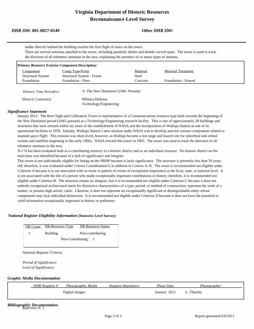
Virginia Department of Historic Resources
Reconnaissance Level Survey
DHR ID#: 001-0027-0149 Other DHR ID#:
ladder directly behind the building reaches the first flight of stairs on the tower.
There are several antennas attached to the tower, including parabolic dishes and double curved types. The tower is used to track
the direction of all telemetry antennas in the area, explaining the presence of so many types of antenna.
Primary Resource Exterior Component Description:
Material TreatmentMaterialComp Type/FormComponent
Structural System Structural System - Frame Steel
Foundation Foundation - Piers Concrete Foundation - Poured
Historic Time Period(s):S- The New Dominion (1946- Present)
Historic Context(s): Military/Defense
Technology/Engineering
Significance Statement
January 2011: The Bore Sight and Calibration Tower is representative of a Communications resource type built towards the beginning of
the New Dominion period (1945–present) at a Technology/Engineering research facility. This is one of approximately 50 buildings and
structures that were erected within six years of the establishment of NASA and the incorporation of Wallops Station as one of its
operational facilities in 1959. Initially, Wallops Station’s new mission under NASA was to develop and test various components related to
manned space flight. This mission was short-lived, however, as Wallops became a test range and launch site for suborbital and orbital
rockets and satellites beginning in the early 1960s. NASA erected this tower in 1965. The tower was used to track the direction of all
telemetry antennas in the area.
N-174 has been evaluated both as a contributing resource in a historic district and as an individual resource. No historic district on the
main base was identified because of a lack of significance and integrity.
This tower is not individually eligible for listing on the NRHP because it lacks significance. The structure is presently less than 50 years
old; therefore, it was evaluated under Criteria Consideration G in addition to Criteria A–D. The tower is recommended not eligible under
Criterion A because it is not associated with an event or pattern of events of exceptional importance at the local, state, or national level. It
is not associated with the life of a person who made exceptionally important contributions in history; therefore, it is recommended not
eligible under Criterion B. The structure retains its integrity, but it is recommended not eligible under Criterion C because it does not
embody exceptional architectural merit for distinctive characteristics of a type, period, or method of construction; represent the work of a
master; or possess high artistic value. Likewise, it does not represent an exceptionally significant or distinguishable entity whose
components may lack individual distinction. It is recommended not eligible under Criterion D because it does not have the potential to
yield information exceptionally important in history or prehistory.
National Register Eligibility Information (Intensive Level Survey):
NR Resource StatusNR Resource TypeNR Count
Building Non-contributing 1
1 Non-Contributing:
National Register Criteria:
Level of Significance:
Period of Significance:
Graphic Media Documentation
PhotographerPhoto DateNegative RepositoryDHR Negative # Photographic Media
Digital Images L. ThursbyJanuary 2011
Bibliographic Documentation
Reference #: 1
Report generated 6/6/2011Page 2 of 3

Virginia Department of Historic Resources
Reconnaissance Level Survey
DHR ID#: 001-0027-0149 Other DHR ID#:
Bibliographic RecordType: Local Records
Author:
DHR CRM Report Number:
Notes:
Wallops Flight Facility Real Property Records
Cultural Resource Management (CRM) Events
CRM Event # 1,
Cultural Resource Management Event: Survey:Phase I/Reconnaissance
Date of CRM Event: January 2011
CRM Person: TEC Inc
VDHR Project ID # Associated with Event: 2010-2274
CRM Event Notes or Comments:
Lori Thursby and Kimberly Martin
Bridge Information
Cemetery Information
Ownership Information
Unknown Unknown Name: .................................
NASA Wallops Flight FacilityCompany: ..........................
Wallops Flight FacilityAddress: .............................
Wallops IslandCity: ...................................
23337Zip: ....................................... VirginiaState: USACountry:
000-000-0000757-824-1000Phone/Extension: ..............
0000/ 0000
Relation to the Property: Owner of property
Report generated 6/6/2011Page 3 of 3

001-0027-0141N-159
001-0027-0130F-160
001-0027-0134M-016
001-0027-0133M-015
001-0027-0143N-162
001-0027-0151N-222
001-0027-0129F-157
001-0027-0139N-133
001-0027-0128E-144
001-0027-0148N-167
001-0027-0145N-163
001-0027-0149N-174
001-0027-0138M-184
001-0027-0140N-134
001-0027-0144N-162B
001-0027-0142N-159E
001-0027-0135M-017
001-0027-0147N-166
001-0027-0131F-163
001-0027-0137M-183
001-0027-0136M-025
001-0027-0150N-218
001-0027-0146N-164
001-0027-0132F-170
Chi
ncot
eagu
e R
d.Wo
rmho
ud
t S
t.Rickette St.
Bl is s St.
Fulton St.S
tubb
es B
lvd.
NASA Property
Surveyed Structures
Buildings
0 250Meters
0 1,000Feet

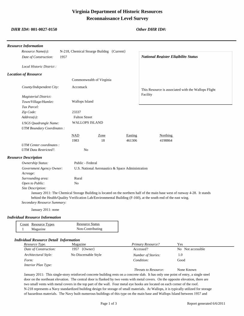
Virginia Department of Historic Resources
Reconnaissance Level Survey
DHR ID#: 001-0027-0150 Other DHR ID#:
Resource Information
National Register Eligibility Status
This Resource is associated with the Wallops Flight
Facility
Resource Name(s): N-218, Chemical Stoarge Buildng {Current}
Date of Construction: 1957
Local Historic District :
Location of Resource
County/Independent City:
Commonwealth of Virginia
Accomack
Magisterial District:
Town/Village/Hamlet: Wallops Island
Tax Parcel:
Zip Code: 23337
Address(s): Fulton Street
USGS Quadrangle Name: WALLOPS ISLAND
UTM Boundary Coordinates :
Northing EastingZone NAD
1983 18 461306 4198864
UTM Center coordinates :
NoUTM Data Restricted?.
Resource Description
Ownership Status: Public - Federal
Government Agency Owner: U.S. National Aeronautics & Space Administration
Acreage:
Surrounding area: Rural
Open to Public: No
January 2011: The Chemical Storage Building is located on the northern half of the main base west of runway 4-28. It stands
behind the Health/Quality Verification Lab/Environmental Building (F-160), at the south end of the east wing.
Site Description:
Secondary Resource Summary:
January 2011: none
Resource StatusResource TypesCount
Magazine Non-Contributing 1
Individual Resource Information
MagazineResource Type. Primary Resource? Yes
Individual Resource Detail Information
Date of Construction: Accessed? 1957 {Owner} No Not accessible
1.0 Number of Stories:Architectural Style: No Discernable Style
Good
Interior Plan Type:
Form: Condition:
Threats to Resource: None Known
January 2011: This single-story reinforced concrete building rests on a concrete slab. It has only one point of entry, a single steel
door on the northeast elevation. The central door is flanked by two vents with metal covers. On the opposite elevation, there are
two small vents with metal covers in the top part of the wall. Four metal eye hooks are located on each corner of the roof.
N-218 represents a Navy standardized building design for storage of small materials. At Wallops, it is typically utilized for storage
of hazardous materials. The Navy built numerous buildings of this type on the main base and Wallops Island between 1957 and
Report generated 6/6/2011Page 1 of 3

Virginia Department of Historic Resources
Reconnaissance Level Survey
DHR ID#: 001-0027-0150 Other DHR ID#:
1958. As of 2011, 14 buildings of this type were extant.
Primary Resource Exterior Component Description:
Material TreatmentMaterialComp Type/FormComponent
Foundation Foundation - Slab Concrete Foundation - Poured
Structural System Structural System - Masonry Concrete Structural System - Block
Roof Roof - Flat Concrete
Historic Time Period(s):S- The New Dominion (1946- Present)
Historic Context(s): Military/Defense
Technology/Engineering
Significance Statement
January 2011: N-218 and the other four buildings (F-170, M-25, M-183, and M-184) on the main base of this same type represent a
secondary resource built near the beginning of the New Dominion period (1945–present) at a Military/Defense research facility. The U.S.
Navy expanded the mission of the CNAAS in 1946 to include the NAOTS, which was charged with research and testing of naval aviation
weapons and ordnance. The CNAAS/NAOTS retained this mission until the base was closed in 1959 and transferred to NASA. During
the period of 1946–1959, most of the development that occurred on the main base was related to housing and services. However, several
new buildings were constructed on main base within the three years leading up to the closure of the Navy station. The Navy erected the
same type of storage buildings as N-218 in 1957 and 1958.
Each of these five storage buildings has been evaluated both as a contributing resource in a historic district and as an individual resource.
No historic district on the main base was identified because of a lack of significance and integrity.
This resource type is not individually eligible for listing on the NRHP because it lacks significance, and also in some cases, integrity. Each
building is recommended not eligible under Criterion A because it is not associated with an event or pattern of events of local, state, or
national significance. It is not associated with the life of a person significant in our past; therefore, it is recommended not eligible under
Criterion B. Each of these storage buildings is a secondary resource of simple design and common construction and, therefore, is
recommended not eligible under Criterion C because it does not embody the distinctive characteristics of a type, period, or method of
construction; represent the work of a master; possess high artistic value; or represent a significant or distinguishable entity whose
components may lack individual distinction. It is recommended not eligible under Criterion D because it does not have the potential to
yield information important in history or prehistory.
N-218 was moved during the period of significance; therefore, it does not possess integrity of location. It also has no integrity of setting:
the setting of the current location is not comparable to the historical setting. The removal the building from its original location and
setting has destroyed its integrity of feeling and association. The resource retains integrity of design, materials, and workmanship.
National Register Eligibility Information (Intensive Level Survey):
NR Resource StatusNR Resource TypeNR Count
Building Non-contributing 1
1 Non-Contributing:
National Register Criteria:
Level of Significance:
Period of Significance:
Graphic Media Documentation
PhotographerPhoto DateNegative RepositoryDHR Negative # Photographic Media
Digital Images L. ThursbyJanuary 2011
Report generated 6/6/2011Page 2 of 3

Virginia Department of Historic Resources
Reconnaissance Level Survey
DHR ID#: 001-0027-0150 Other DHR ID#:
Bibliographic Documentation
Reference #: 1
Bibliographic RecordType: Local Records
Author:
DHR CRM Report Number:
Notes:
Wallops Flight Facility Real Property Records
Cultural Resource Management (CRM) Events
CRM Event # 1,
Cultural Resource Management Event: Survey:Phase I/Reconnaissance
Date of CRM Event: January 2011
CRM Person: TEC Inc
VDHR Project ID # Associated with Event: 2010-2274
CRM Event Notes or Comments:
Lori Thursby and Kimberly Martin
Bridge Information
Cemetery Information
Ownership Information
Unknown Unknown Name: .................................
NASA Wallops Flight FacilityCompany: ..........................
Wallops Flight FacilityAddress: .............................
Wallops IslandCity: ...................................
23337Zip: ....................................... VirginiaState: USACountry:
000-000-0000757-824-1000Phone/Extension: ..............
0000/ 0000
Relation to the Property: Owner of property
Report generated 6/6/2011Page 3 of 3

001-0027-0141N-159
001-0027-0130F-160
001-0027-0134M-016
001-0027-0133M-015
001-0027-0143N-162
001-0027-0151N-222
001-0027-0129F-157
001-0027-0139N-133
001-0027-0128E-144
001-0027-0148N-167
001-0027-0145N-163
001-0027-0149N-174
001-0027-0138M-184
001-0027-0140N-134
001-0027-0144N-162B
001-0027-0142N-159E
001-0027-0135M-017
001-0027-0147N-166
001-0027-0131F-163
001-0027-0137M-183
001-0027-0136M-025
001-0027-0150N-218
001-0027-0146N-164
001-0027-0132F-170
Chi
ncot
eagu
e R
d.Wo
rmho
ud
t S
t.Rickette St.
Bl is s St.
Fulton St.S
tubb
es B
lvd.
NASA Property
Surveyed Structures
Buildings
0 250Meters
0 1,000Feet
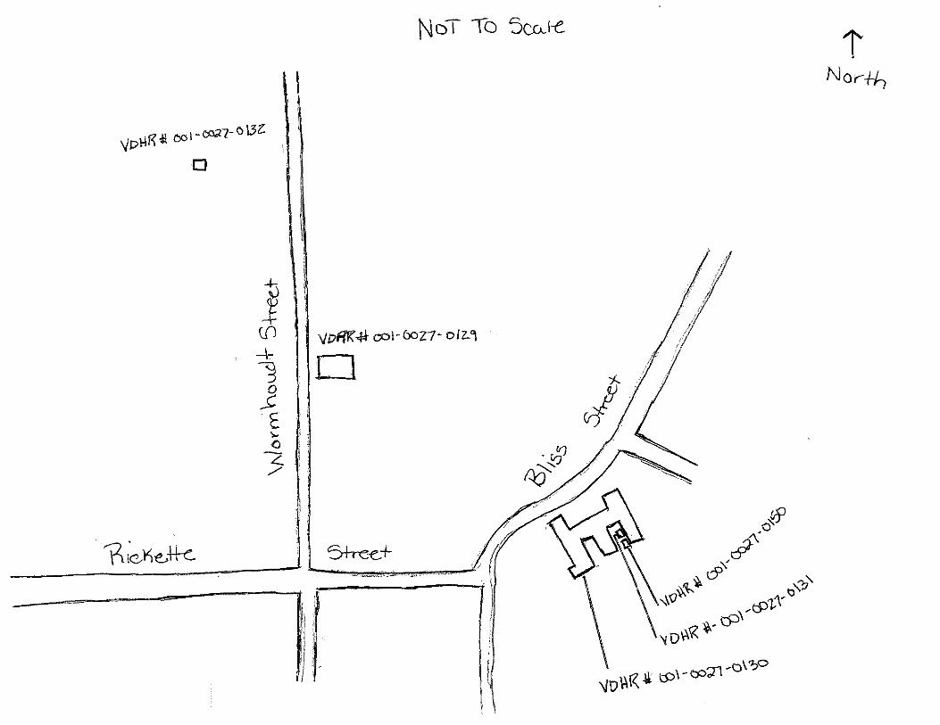
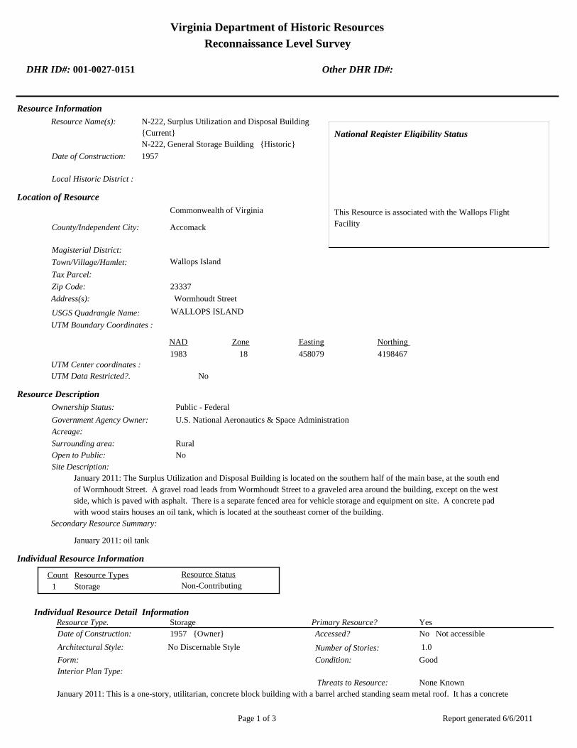
Virginia Department of Historic Resources
Reconnaissance Level Survey
DHR ID#: 001-0027-0151 Other DHR ID#:
Resource Information
National Register Eligibility Status
This Resource is associated with the Wallops Flight
Facility
Resource Name(s): N-222, Surplus Utilization and Disposal Building
{Current}
N-222, General Storage Building {Historic}
Date of Construction: 1957
Local Historic District :
Location of Resource
County/Independent City:
Commonwealth of Virginia
Accomack
Magisterial District:
Town/Village/Hamlet: Wallops Island
Tax Parcel:
Zip Code: 23337
Address(s): Wormhoudt Street
USGS Quadrangle Name: WALLOPS ISLAND
UTM Boundary Coordinates :
Northing EastingZone NAD
1983 18 458079 4198467
UTM Center coordinates :
NoUTM Data Restricted?.
Resource Description
Ownership Status: Public - Federal
Government Agency Owner: U.S. National Aeronautics & Space Administration
Acreage:
Surrounding area: Rural
Open to Public: No
January 2011: The Surplus Utilization and Disposal Building is located on the southern half of the main base, at the south end
of Wormhoudt Street. A gravel road leads from Wormhoudt Street to a graveled area around the building, except on the west
side, which is paved with asphalt. There is a separate fenced area for vehicle storage and equipment on site. A concrete pad
with wood stairs houses an oil tank, which is located at the southeast corner of the building.
Site Description:
Secondary Resource Summary:
January 2011: oil tank
Resource StatusResource TypesCount
Storage Non-Contributing 1
Individual Resource Information
StorageResource Type. Primary Resource? Yes
Individual Resource Detail Information
Date of Construction: Accessed? 1957 {Owner} No Not accessible
1.0 Number of Stories:Architectural Style: No Discernable Style
Good
Interior Plan Type:
Form: Condition:
Threats to Resource: None Known
January 2011: This is a one-story, utilitarian, concrete block building with a barrel arched standing seam metal roof. It has a concrete
Report generated 6/6/2011Page 1 of 3

Virginia Department of Historic Resources
Reconnaissance Level Survey
DHR ID#: 001-0027-0151 Other DHR ID#:
block lean-to on the north elevation and a six-bay wood framed porch supported by seven concrete block posts on the south
elevation. The porch has exposed rafters and a standing seam metal shed roof. It shelters a hollow steel door in the second bay
from the west end. A wood framed lean-to with a shed roof is a fixed to the east elevation. It is constructed of painted plywood or
pressboard. The south elevation of the wood framed lean-to has a set of double wood doors.
The west elevation has a central overhead aluminum door and a single hollow steel door to the south. Two awning windows
underneath fixed metal framed windows are located in the southwest corner. The east elevation has a set of double hollow steel
doors on the southeast corner, next to the wood framed lean-to, and a single door on the northeast corner. The north elevation
features four overhead steel doors, evenly spaced in the concrete block lean-to.
Primary Resource Exterior Component Description:
Material TreatmentMaterialComp Type/FormComponent
Windows Windows - Awning Metal Windows - 1-light
Windows Windows - Fixed Metal Windows - 1-light
Porch Porch - 1-story, 6-bay Wood Porch - Posts
Roof Metal Roof - Standing Seam
Foundation Foundation - Slab Concrete Foundation - Poured
Structural System Structural System - Frame Wood Structural System - Siding, Composition
Structural System Structural System - Masonry Concrete Structural System - Block
Historic Time Period(s):S- The New Dominion (1946- Present)
Historic Context(s): Military/Defense
Technology/Engineering
Significance Statement
January 2011: The Surplus Utilization and Storage Building represents a secondary resource built near the beginning of the New
Dominion period (1945–present) at a Military/Defense research facility. The U.S. Navy expanded the mission of the CNAAS in 1946 to
include the NAOTS, which was charged with research and testing of naval aviation weapons and ordnance. The CNAAS/NAOTS
retained this mission until the base was closed in 1959 and transferred to NASA. During the period of 1946–1959, most of the
development that occurred on the main base was related to housing and services. However, several new buildings were constructed on
main base within the three years leading up to the closure of the Navy station. The Navy erected this building in 1957; it has been used
for storage since its construction.
F-222 has been evaluated both as a contributing resource in a historic district and as an individual resource. No historic district on the
main base was identified because of a lack of significance and integrity.
The building is not individually eligible for listing on the NRHP because it lacks significance and integrity. The building is recommended
not eligible under Criterion A because it is not associated with an event or pattern of events of local, state, or national significance. It is
not associated with the life of a person significant in our past; therefore, it is recommended not eligible under Criterion B. N-222 is
recommended not eligible under Criterion C because it does not embody the distinctive characteristics of a type, period, or method of
construction; represent the work of a master; possess high artistic value; or represent a significant or distinguishable entity whose
components may lack individual distinction. It is recommended not eligible under Criterion D because it does not have the potential to
yield information important in history or prehistory.
The building has moderate historic integrity. It is in its historical location and the immediate setting of the building retains its historical
character except for the addition of a small post-1965 shed to the southeast. The integrity of design has been diminished by the
full-length lean-to addition on the rear and there has been a minor adverse effect to the materials of the building due to the replacement of
an overhead door and the personnel doors. The building retains integrity of workmanship, feeling, and association.
National Register Eligibility Information (Intensive Level Survey):
NR Resource StatusNR Resource TypeNR Count
Building Non-contributing 1
1 Non-Contributing:
Report generated 6/6/2011Page 2 of 3
Virginia Department of Historic Resources
Reconnaissance Level Survey
DHR ID#: 001-0027-0151 Other DHR ID#:
National Register Criteria:
Level of Significance:
Period of Significance:
Graphic Media Documentation
PhotographerPhoto DateNegative RepositoryDHR Negative # Photographic Media
Digital Images L. ThursbyJanuary 2011
Bibliographic Documentation
Reference #: 1
Bibliographic RecordType: Local Records
Author:
DHR CRM Report Number:
Notes:
Wallops Flight Facility Real Property Records
Cultural Resource Management (CRM) Events
CRM Event # 1,
Cultural Resource Management Event: Survey:Phase I/Reconnaissance
Date of CRM Event: January 2011
CRM Person: TEC Inc
VDHR Project ID # Associated with Event: 2010-2274
CRM Event Notes or Comments:
Lori Thursby and Kimberly Martin
Bridge Information
Cemetery Information
Ownership Information
Unknown Unknown Name: .................................
NASA Wallops Flight FacilityCompany: ..........................
Wallops Flight FacilityAddress: .............................
Wallops IslandCity: ...................................
23337Zip: ....................................... VirginiaState: USACountry:
000-000-0000757-824-1000Phone/Extension: ..............
0000/ 0000
Relation to the Property: Owner of property
Report generated 6/6/2011Page 3 of 3
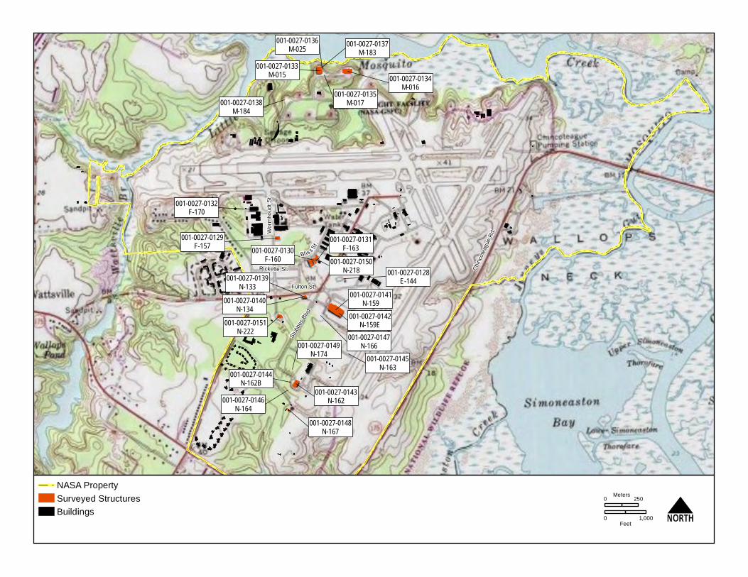
001-0027-0141N-159
001-0027-0130F-160
001-0027-0134M-016
001-0027-0133M-015
001-0027-0143N-162
001-0027-0151N-222
001-0027-0129F-157
001-0027-0139N-133
001-0027-0128E-144
001-0027-0148N-167
001-0027-0145N-163
001-0027-0149N-174
001-0027-0138M-184
001-0027-0140N-134
001-0027-0144N-162B
001-0027-0142N-159E
001-0027-0135M-017
001-0027-0147N-166
001-0027-0131F-163
001-0027-0137M-183
001-0027-0136M-025
001-0027-0150N-218
001-0027-0146N-164
001-0027-0132F-170
Chi
ncot
eagu
e R
d.Wo
rmho
ud
t S
t.Rickette St.
Bl is s St.
Fulton St.S
tubb
es B
lvd.
NASA Property
Surveyed Structures
Buildings
0 250Meters
0 1,000Feet

Virginia Department of Historic Resources
Reconnaissance Level Survey
DHR ID#: 001-0027-0152 Other DHR ID#:
Resource Information
National Register Eligibility Status
This Resource is associated with the Wallops Flight
Facility
Resource Name(s): I-004, Wallops Island Causeway and Cat Creek
Bridge {Current}
Date of Construction: 1960
Local Historic District :
Location of Resource
County/Independent City:
Commonwealth of Virginia
Accomack
Magisterial District:
Town/Village/Hamlet: Wallops Island
Tax Parcel:
Zip Code: 23337
Address(s): Causeway Road
USGS Quadrangle Name: WALLOPS ISLAND
UTM Boundary Coordinates :
Northing EastingZone NAD
1983 18 456900 4190887
UTM Center coordinates :
NoUTM Data Restricted?.
Resource Description
Ownership Status: Public - Federal
Government Agency Owner: U.S. National Aeronautics & Space Administration
Acreage:
Surrounding area: Rural
Open to Public: No
January 2011: The Wallops Island Causeway and Cat Creek Bridge links NASA facilities on Wallops Island with the mainland.
The road runs northwest-southeast across an open and flat expanse of marshes. At the northwest end of the causeway, near
the boundary of the NASA property on Wallops Mainland, is a gate house; a NASA security force controls access to the
Wallops Island facility from the mainland.
Site Description:
Secondary Resource Summary:
January 2011: none
Resource StatusResource TypesCount
Road/Road Trace Non-Contributing 1
Bridge Non-Contributing 1
Individual Resource Information
BridgeResource Type. Primary Resource? No
Individual Resource Detail Information
Date of Construction: Accessed? 1960 {Written Data}
0.0 Number of Stories:Architectural Style: No Discernable Style
Fair
Interior Plan Type:
Form: Condition:
Threats to Resource: Demolition
The Cat Creek Bridge is 1,320 ft long and consists of four prestressed precast concrete beams supported on 20 pairs of reinforced
Report generated 6/7/2011Page 1 of 4
Virginia Department of Historic Resources
Reconnaissance Level Survey
DHR ID#: 001-0027-0152 Other DHR ID#:
concrete rigid piers founded on prestressed concrete piles. The piers themselves comprise prestressed hollow cylindrical piles
(WFF 2011). The reinforced concrete bridge deck carries two, 10 ft wide, concrete-paved traffic lanes with aluminum guardrails. The
abutments are also reinforced concrete. Runoff from the bridge is conveyed by two channels below each abutment; the channels
under the southeast abutment are paved in concrete and those under the northwest abutment are lined by two rows of hardened
sand bags. The embankment along Cat Creek below the southeast abutment is also lined with hardened sand bags. The bridge was
constructed with a 6 percent grade in order to provide a 40 ft minimum clearance from mean high tide level to the bottom of the
bridge deck (WFF 2011). The 6 percent profile extends from sloped fill approaches on both ends of the bridge. Conduits carrying
various utility lines are attached to both sides of the bridge and on top of the concrete curb next to the Mainland-bound traffic lane.
In the area between the center two pairs of bridge piers, wood piers and galvanized metal sheathing were installed in 1999 to protect
the bridge piles adjacent to the intracoastal waterway passage.
Because of traffic loads and environmental exposure, the bridge has received numerous resurfacing and repairs over time. Major
repairs to the bridge have occurred in 1988 and 1993. The work in 1988 included repairing detached and spalled concrete surfaces
on bridge piers, beams, and diaphragms; repairing spalled and delaminated areas of bridge deck; sealing bridge deck joints;
strengthening the beams of two of the spans; and restoring lost beam prestress force by post-tensioning methods. In 1993, piers,
abutments, curbs, parapets, and broken railings were repaired; the bridge beams were coated with epoxy; and the guard rails at the
bridge approaches were upgraded to meet current safety standards (WFF 2011). Most recently, in late 2009 and early 2010, joints on
the bridge deck were reconstructed and other patchwork was completed. Additional maintenance projects are planned to be
undertaken in the coming years. The bridge may be replaced within the next decade.
Road/Road TraceResource Type. Primary Resource? Yes
Individual Resource Detail Information
Date of Construction: Accessed? 1960 {Owner}
0.0 Number of Stories:Architectural Style: No Discernable Style
Good
Interior Plan Type:
Form: Condition:
Threats to Resource: None Known
January 2011: The Wallops Island Causeway is 2.25 miles long and 20 ft wide. The two-lane road (there are no shoulders) was built
on fill and originally paved with asphalt cement. Before its intersection with North Seawall Road on Wallops Island, the road splits
and curves in two directions to provide a continuous turn to and from North Seawall Road; this feature is original to the design of
the causeway (WFF 2011).
Because of traffic loads and environmental exposure, the causeway has been resurfaced and repaired over time. Total resurfacing of
the causeway was completed in 1967 and 1983 (WFF 2011). Additional maintenance projects are planned to be undertaken in the
coming years.
Primary Resource Exterior Component Description:
Material TreatmentMaterialComp Type/FormComponent
Structural System Structural System - Masonry Asphalt
Foundation Foundation - Slab Earth
Structural System Structural System - Masonry Concrete
Historic Time Period(s):S- The New Dominion (1946- Present)
Historic Context(s): Military/Defense
Technology/Engineering
Significance Statement
January 2011: The causeway and bridge represent a Transportation resource type built towards the beginning of the New Dominion
period (1945–present) at a Technology/Engineering research facility. These structures are one of several dozens of buildings and
structures that were erected within six years of the establishment of NASA and the incorporation of Wallops Station as one of its
operational facilities. The facilities expansion of Wallops Station also included acquisition of 216.6 acres on the mainland, plus 1,031.4
acres of marsh between the mainland and island, in 1959 (Shortal 1978). Initially, Wallops Station’s new mission under NASA was to
develop and test various components related to manned space flight. This mission was short-lived, however, as Wallops became
NASA’s test range and launch site for suborbital and orbital rockets and satellites beginning in the early 1960s.
NACA, the predecessor to NASA, had wanted to have a causeway between the mainland and Wallops Island since it had established a
Report generated 6/7/2011Page 2 of 4
Virginia Department of Historic Resources
Reconnaissance Level Survey
DHR ID#: 001-0027-0152 Other DHR ID#:
testing site on the island in 1945. NACA had even chosen a route for a causeway. Without a road between the island and mainland,
construction costs on Wallops Island were higher because of the island’s isolation and transportation difficulties (Shortal 1978). One of
NASA’s priorities for the expansion of Wallops Station was construction of a causeway to the mainland. NASA contracted the Baltimore,
Maryland, architecture-engineering firm of J. E. Greiner Company to design the causeway and bridge and Tidewater Construction
Company from Norfolk, Virginia, to build them (WFF 2011). The causeway route followed an existing power line across the marsh, which
was the same route that was selected in 1945 (Shortal 1978). When completed, the causeway and bridge not only provided vehicular
access to Wallops Island, but also carried the water and electrical lines serving the island facilities (Goddard News 1988). Construction of
both structures began on January 2, 1959 and was completed on April 2, 1960. The cost of the project was just under $1.48 million (WFF
2011).
I-004 has been evaluated both as a contributing resource in a historic district and as an individual resource. No historic district on
Wallops Mainland was identified because of a lack of significance.
The Wallops Island Causeway and Cat Creek Bridge are recommended not individually eligible for listing on the NRHP because they lack
of significance. Under Criterion A the structures were important for facilitating the physical development of Wallops Island, but the
resources built here were not part of major NASA research and development programs. Wallops continued to be a service center in
support of the NASA organization. The causeway and bridge are not associated with the life of a person significant in our past; therefore,
they are recommended not eligible under Criterion B. The structures retain their integrity overall; however, they are recommended not
eligible under C because they are not early or unique examples of a type, period, or method of construction for a road or bridge. Precast
prestressed concrete beam bridges like the Cat Creek Bridge are ubiquitous after the mid-1950s. I-004 is recommended not eligible under
Criterion D because it does not have the potential to yield information important in history or prehistory.
National Register Eligibility Information (Intensive Level Survey):
NR Resource StatusNR Resource TypeNR Count
Building Non-contributing 1
1 Non-Contributing:
National Register Criteria:
Level of Significance:
Period of Significance:
Graphic Media Documentation
PhotographerPhoto DateNegative RepositoryDHR Negative # Photographic Media
Digital Images L. ThursbyJanuary 2011
Bibliographic Documentation
Reference #: 1
Bibliographic RecordType: Local Records
Author:
DHR CRM Report Number:
Notes:
Wallops Flight Facility Real Property Records
Reference #: 2
Bibliographic RecordType: Article
Author: Joseph Adams Shortall
DHR CRM Report Number:
Notes:
1978 A New Dimension Wallops Island Flight Test Range: The First Fifteen Years. Washington D.C.: NASA Scientific
Report generated 6/7/2011Page 3 of 4

Virginia Department of Historic Resources
Reconnaissance Level Survey
DHR ID#: 001-0027-0152 Other DHR ID#:
and Technical Information Office.
Reference #: 3
Bibliographic RecordType: Newsletter
Author: Goddard News
DHR CRM Report Number:
Notes:
1988 Wallops Island Causeway Bridge. Newsletter of NASA’s Goddard Space Flight Center. May.
Cultural Resource Management (CRM) Events
CRM Event # 1,
Cultural Resource Management Event: Survey:Phase I/Reconnaissance
Date of CRM Event: January 2011
CRM Person: TEC Inc
VDHR Project ID # Associated with Event: 2010-2274
CRM Event Notes or Comments:
Lori Thursby and Kimberly Martin
Bridge Information
Cemetery Information
Ownership Information
Unknown Unknown Name: .................................
NASA Wallops Flight FacilityCompany: ..........................
Wallops Flight FacilityAddress: .............................
Wallops IslandCity: ...................................
23337Zip: ....................................... VirginiaState: USACountry:
000-000-0000757-824-1000Phone/Extension: ..............
0000/ 0000
Relation to the Property: Owner of property
Report generated 6/7/2011Page 4 of 4

001-0027-0152I-004
Mai
nlan
d R
d.
Causeway Rd.
North
Sea
wall R
d.
North
Byp
ass
Rd.
001-0027-0182W-020
001-0027-0188W-065
001-0027-0160U-030
001-0027-0184W-040
001-0027-0167U-070
001-0027-0156U-025
001-0027-0192X-085
001-0027-0163U-055
001-0027-0201Z-040
001-0027-0198Y-055
001-0027-0193Y-010
001-0027-0170V-025
001-0027-0190X-005A
001-0027-0187W-057
001-0027-0153U-005
001-0027-0197Y-038
001-0027-0194Y-016
001-0027-0180W-015
001-0027-0162U-040
001-0027-0191X-075
001-0027-0159U-027
001-0027-0158U-026
001-0027-0168U-070A
001-0027-0185W-050
001-0027-0179W-010
001-0027-0155U-020B
001-0027-0161U-030A
001-0027-0183W-035
001-0027-0169U-080
001-0027-0165U-060
001-0027-0164U-055A
001-0027-0154U-020A
001-0027-0157U-025A
001-0027-0166U-064
001-0027-0189W-067
001-0027-0195Y-020
001-0027-0181W-016
001-0027-0186W-051
001-0027-0199Y-095
001-0027-0200Y-110
001-0027-0196Y-037
NASA Property
Surveyed Structures
Buildings
0 300Meters
0 1,500Feet


Virginia Department of Historic Resources
Reconnaissance Level Survey
DHR ID#: 001-0027-0153 Other DHR ID#:
Resource Information
National Register Eligibility Status
Resource has not been evaluated.*
This Resource is associated with the Wallops Flight
Facility
* Resource has not been formally evaluated by DHR or
eligibility information has not been documented in DSS
at this time.
Resource Name(s): U-005, Mainland Terminal Building {Current}
Date of Construction: 1961
Local Historic District :
Location of Resource
County/Independent City:
Commonwealth of Virginia
Accomack
Magisterial District:
Town/Village/Hamlet: Wallops Island
Tax Parcel:
Zip Code: 23337
Address(s): Mainland Road
USGS Quadrangle Name: WALLOPS ISLAND
UTM Boundary Coordinates :
Northing EastingZone NAD
1983 18 456892 4189508
UTM Center coordinates :
NoUTM Data Restricted?.
Resource Description
Ownership Status: Public - Federal
Government Agency Owner: U.S. National Aeronautics & Space Administration
Acreage:
Surrounding area: Rural
Open to Public: No
January 2011: The Mainland Terminal Building is located on Wallops Mainland at the east corner of Causeway and Mainland
Roads. The area is flat and open. The AN/FRQ 6 Collimation Beacon and Tower (U-060) is visible to the northeast
Site Description:
Secondary Resource Summary:
January 2011: AN/FRQ-6 Collimation Beacon and Tower (u-60)
Resource StatusResource TypesCount
Communications Facility Non-Contributing 1
Individual Resource Information
Communications FacilityResource Type. Primary Resource? Yes
Individual Resource Detail Information
Date of Construction: Accessed? 1961 {Owner} No Not accessible
1.0 Number of Stories:Architectural Style: No Discernable Style
Good
Interior Plan Type:
Form: Condition:
Threats to Resource: None Known
January 2011: The Mainland Terminal Building is a simple, one-story concrete block building with a reinforced concrete slab
foundation and a flat roof deck and metal fascia. A wood handrail runs the perimeter of the roof. A metal staircase with metal tube
railing on the north elevation provides access to the roof. The only entrance is a set of steel double doors with view windows on
the west elevation. A concrete ramp is in front of the doors. There are no other openings in the building.
Report generated 6/6/2011Page 1 of 3

Virginia Department of Historic Resources
Reconnaissance Level Survey
DHR ID#: 001-0027-0153 Other DHR ID#:
Primary Resource Exterior Component Description:
Material TreatmentMaterialComp Type/FormComponent
Roof Roof - Flat Asphalt
Foundation Foundation - Slab Concrete Foundation - Poured
Structural System Structural System - Masonry Concrete Structural System - Block
Historic Time Period(s):S- The New Dominion (1946- Present)
Historic Context(s): Military/Defense
Technology/Engineering
Significance Statement
January 2011: This building is representative of an Infrastructure resource type built at a Technology/Engineering research facility
towards the beginning of the New Dominion period (1945–present). This is one of approximately 50 buildings and structures that were
erected within six years of the establishment of NASA and the incorporation of Wallops Station as one of its operational facilities in 1959.
Initially, Wallops Station’s new mission under NASA was to develop and test various components related to manned space flight. This
mission was short-lived, however, as Wallops became a test range and launch site for suborbital and orbital rockets and satellites
beginning in the early 1960s. The expansion of Wallops Station after becoming a NASA facility included acquisition of 216.6 acres on the
mainland in 1959 (Shortal 1978). NASA constructed this building in 1960; it has been used as the mainland terminal facility since its
construction.
The Mainland Terminal Building has been evaluated both as a contributing resource in a historic district and as an individual resource.
No historic district on Wallops Mainland was identified because of a lack of significance.
The Mainland Terminal Building is not individually eligible for listing on the NRHP because it lacks significance. The building is
recommended not eligible under Criterion A because it is not associated with an event or pattern of events of local, state, or national
significance. It is not associated with the life of a person significant in our past; therefore, it is recommended not eligible under Criterion
B. The building retains integrity, but is of simple design and common construction and, therefore, is recommended not eligible under
Criterion C because it does not embody the distinctive characteristics of a type, period, or method of construction; represent the work of a
master; possess high artistic value; or represent a significant or distinguishable entity whose components may lack individual distinction.
It is recommended not eligible under Criterion D because it does not have the potential to yield information important in history or
prehistory.
National Register Eligibility Information (Intensive Level Survey):
NR Resource StatusNR Resource TypeNR Count
Building Non-contributing 1
1 Non-Contributing:
National Register Criteria:
Level of Significance:
Period of Significance:
Graphic Media Documentation
PhotographerPhoto DateNegative RepositoryDHR Negative # Photographic Media
Digital Images L. ThursbyJanuary 2011
Bibliographic Documentation
Reference #: 1
Bibliographic RecordType: Local Records
Author:
Report generated 6/6/2011Page 2 of 3

Virginia Department of Historic Resources
Reconnaissance Level Survey
DHR ID#: 001-0027-0153 Other DHR ID#:
DHR CRM Report Number:
Notes:
Wallops Flight Facility Real Property Records
Cultural Resource Management (CRM) Events
CRM Event # 1,
Cultural Resource Management Event: Survey:Phase I/Reconnaissance
Date of CRM Event: January 2011
CRM Person: TEC Inc
VDHR Project ID # Associated with Event: 2010-2274
CRM Event Notes or Comments:
Lori Thursby and Kimberly Martin
Bridge Information
Cemetery Information
Ownership Information
Unknown Unknown Name: .................................
NASA Wallops Flight FacilityCompany: ..........................
Wallops Flight FacilityAddress: .............................
Wallops IslandCity: ...................................
23337Zip: ....................................... VirginiaState: USACountry:
000-000-0000757-824-1000Phone/Extension: ..............
0000/ 0000
Relation to the Property: Owner of property
Report generated 6/6/2011Page 3 of 3

001-0027-0152I-004
Mai
nlan
d R
d.
Causeway Rd.
North
Sea
wall R
d.
North
Byp
ass
Rd.
001-0027-0182W-020
001-0027-0188W-065
001-0027-0160U-030
001-0027-0184W-040
001-0027-0167U-070
001-0027-0156U-025
001-0027-0192X-085
001-0027-0163U-055
001-0027-0201Z-040
001-0027-0198Y-055
001-0027-0193Y-010
001-0027-0170V-025
001-0027-0190X-005A
001-0027-0187W-057
001-0027-0153U-005
001-0027-0197Y-038
001-0027-0194Y-016
001-0027-0180W-015
001-0027-0162U-040
001-0027-0191X-075
001-0027-0159U-027
001-0027-0158U-026
001-0027-0168U-070A
001-0027-0185W-050
001-0027-0179W-010
001-0027-0155U-020B
001-0027-0161U-030A
001-0027-0183W-035
001-0027-0169U-080
001-0027-0165U-060
001-0027-0164U-055A
001-0027-0154U-020A
001-0027-0157U-025A
001-0027-0166U-064
001-0027-0189W-067
001-0027-0195Y-020
001-0027-0181W-016
001-0027-0186W-051
001-0027-0199Y-095
001-0027-0200Y-110
001-0027-0196Y-037
NASA Property
Surveyed Structures
Buildings
0 300Meters
0 1,500Feet

Virginia Department of Historic Resources
Reconnaissance Level Survey
DHR ID#: 001-0027-0154 Other DHR ID#:
Resource Information
National Register Eligibility Status
This Resource is associated with the Wallops Flight
Facility
Resource Name(s): U-20A, Radar Antenna Pedestal Tower “B"
{Current}
Date of Construction: 1959
Local Historic District :
Location of Resource
County/Independent City:
Commonwealth of Virginia
Accomack
Magisterial District:
Town/Village/Hamlet: Wallops Island
Tax Parcel:
Zip Code: 23337
Address(s): Mainland Road
USGS Quadrangle Name: WALLOPS ISLAND
UTM Boundary Coordinates :
Northing EastingZone NAD
1983 18 455006 4190001
UTM Center coordinates :
NoUTM Data Restricted?.
Resource Description
Ownership Status: Public - Federal
Government Agency Owner: U.S. National Aeronautics & Space Administration
Acreage:
Surrounding area: Rural
Open to Public: No
January 2011: Radar Antenna Pedestal Tower “B” is located on Wallops Mainland, south of Causeway Road. A creek lies to
the east with tall grass surrounding it and an agricultural field is to the west of the NASA property. The tower stands in the
second cluster of buildings and structures at the end of Mainland Road. The Electric Power Control Building (U-20B) is
connected to the antenna with cables.
Site Description:
Secondary Resource Summary:
January 2011: Electrical Power Control Building (U-20B)
Resource StatusResource TypesCount
Communications Facility Non-Contributing 1
Individual Resource Information
Communications FacilityResource Type. Primary Resource? Yes
Individual Resource Detail Information
Date of Construction: Accessed? 1959 {Owner} No Not accessible
0.0 Number of Stories:Architectural Style: No Discernable Style
Good
Interior Plan Type:
Form: Condition:
Threats to Resource: None Known
January 2011: The Radar Antenna Pedestal Tower “B” is one of three developed by NASA in partnership with MIT’s Lincoln
Laboratory, an early departure from Department of Defense contracts (Wallace 1997). The other two are the Radar Pedestal Tower
Report generated 6/6/2011Page 1 of 3
Virginia Department of Historic Resources
Reconnaissance Level Survey
DHR ID#: 001-0027-0154 Other DHR ID#:
“A” (U-25A) and the Spandar Radar Pedestal Tower (U-30A). U-20A consists of a reinforced concrete cylinder, 35 ft, 6 inches in
height and 12 ft in diameter, and the antenna arm. A photograph taken in 1980 shows a large dish-shaped antenna attached to arm,
about 50 ft in diameter, and two circular platforms around the top and middle of the cylinder (WFF 2011). These platforms have
since been removed and a parabolic dish antenna was removed from the pedestal on January 4, 2011. A square steel platform was
erected in 1992 at the top of the pedestal and is supported by four steel posts bolted to concrete footings and framing built of steel
angles. The platform has a metal tube railing. A landing is about midway up the northeast elevation of the platform tower. A metal
staircase extends to the platform on the northwest and northeast elevations.
Primary Resource Exterior Component Description:
Material TreatmentMaterialComp Type/FormComponent
Structural System Structural System - Frame Steel
Foundation Foundation - Slab Concrete Foundation - Poured
Structural System Structural System - Masonry Concrete
Historic Time Period(s):S- The New Dominion (1946- Present)
Historic Context(s): Military/Defense
Technology/Engineering
Significance Statement
January 2011: This antenna tower is representative of a Communications resource type built at a Technology/Engineering research facility
towards the beginning of the New Dominion period (1945–present). This is one of approximately 50 buildings and structures that were
erected within six years of the establishment of NASA and the incorporation of Wallops Station as one of its operational facilities in 1959.
Initially, Wallops Station’s new mission under NASA was to develop and test various components related to manned space flight. This
mission was short-lived, however, as Wallops became a test range and launch site for suborbital and orbital rockets and satellites
beginning in the early 1960s. The expansion of Wallops Station after becoming a NASA facility included acquisition of 216.6 acres on the
mainland in 1959. NASA designated the southern portion of the mainland area for the use of long-range radars, and leased a parcel of
land to MIT, which wanted to install two large, long-range radars (U-20A and U-25A) for its Lincoln Laboratory to use for a Department of
Defense antimissile program (the D58 Trailblazer reentry project) (Shortal 1978). Both radars and associated pedestal towers were installed
in 1959.
U-20A has been evaluated both as a contributing resource in a historic district and as an individual resource. No historic district on
Wallops Mainland was identified because of a lack of significance.
The Radar Antenna Pedestal Tower “B” is not individually eligible for listing on the NRHP because it lacks significance and integrity. The
structure is recommended not eligible under Criterion A because it is not associated with an event or pattern of events of local, state, or
national significance. It is not associated with the life of a person significant in our past; therefore, it is recommended not eligible under
Criterion B. The tower is recommended not eligible under Criterion C because it does not embody the distinctive characteristics of a type,
period, or method of construction; represent the work of a master; possess high artistic value; or represent a significant or distinguishable
entity whose components may lack individual distinction. It is recommended not eligible under Criterion D because it does not have the
potential to yield information important in history or prehistory.
The integrity of the tower has been adversely affected by alterations that have been completed within the past 20 years. The structure is
in its historical location. The setting has been changed somewhat by the removal of a hemispherical dome structure that once stood
adjacent to the tower and the addition of a post-1965 building next to it. The design and materials of the tower have been diminished by
the removal of the parabolic dish antenna and circular metal platforms around the pedestal, and the addition of steel framework around the
entire concrete pedestal. Although the workmanship and association remain relatively intact, the integrity of feeling has been
compromised by the alterations and changes in setting
National Register Eligibility Information (Intensive Level Survey):
NR Resource StatusNR Resource TypeNR Count
Building Non-contributing 1
1 Non-Contributing:
Report generated 6/6/2011Page 2 of 3

Virginia Department of Historic Resources
Reconnaissance Level Survey
DHR ID#: 001-0027-0154 Other DHR ID#:
National Register Criteria:
Level of Significance:
Period of Significance:
Graphic Media Documentation
PhotographerPhoto DateNegative RepositoryDHR Negative # Photographic Media
Digital Images L. ThursbyJanuary 2011
Bibliographic Documentation
Reference #: 1
Bibliographic RecordType: Local Records
Author:
DHR CRM Report Number:
Notes:
Wallops Flight Facility Real Property Records
Reference #: 2
Bibliographic RecordType: Article
Author: Joseph Adams Shortal
DHR CRM Report Number:
Notes:
1978 A New Dimension Wallops Island Flight Test Range: The First Fifteen Years. Washington D.C.: NASA Scientific
and Technical Information Office.
Cultural Resource Management (CRM) Events
CRM Event # 1,
Cultural Resource Management Event: Survey:Phase I/Reconnaissance
Date of CRM Event: January 2011
CRM Person: TEC Inc
VDHR Project ID # Associated with Event: 2010-2274
CRM Event Notes or Comments:
Lori Thursby and Kimberly Martin
Bridge Information
Cemetery Information
Ownership Information
Unknown Unknown Name: .................................
NASA Wallops Flgiht FacilityCompany: ..........................
Wallops Flight FacilityAddress: .............................
Wallops IslandCity: ...................................
23337Zip: ....................................... VirginiaState: USACountry:
000-000-0000757-824-1000Phone/Extension: ..............
0000/ 0000
Relation to the Property: Owner of property
Report generated 6/6/2011Page 3 of 3

001-0027-0152I-004
Mai
nlan
d R
d.
Causeway Rd.
North
Sea
wall R
d.
North
Byp
ass
Rd.
001-0027-0182W-020
001-0027-0188W-065
001-0027-0160U-030
001-0027-0184W-040
001-0027-0167U-070
001-0027-0156U-025
001-0027-0192X-085
001-0027-0163U-055
001-0027-0201Z-040
001-0027-0198Y-055
001-0027-0193Y-010
001-0027-0170V-025
001-0027-0190X-005A
001-0027-0187W-057
001-0027-0153U-005
001-0027-0197Y-038
001-0027-0194Y-016
001-0027-0180W-015
001-0027-0162U-040
001-0027-0191X-075
001-0027-0159U-027
001-0027-0158U-026
001-0027-0168U-070A
001-0027-0185W-050
001-0027-0179W-010
001-0027-0155U-020B
001-0027-0161U-030A
001-0027-0183W-035
001-0027-0169U-080
001-0027-0165U-060
001-0027-0164U-055A
001-0027-0154U-020A
001-0027-0157U-025A
001-0027-0166U-064
001-0027-0189W-067
001-0027-0195Y-020
001-0027-0181W-016
001-0027-0186W-051
001-0027-0199Y-095
001-0027-0200Y-110
001-0027-0196Y-037
NASA Property
Surveyed Structures
Buildings
0 300Meters
0 1,500Feet


Virginia Department of Historic Resources
Reconnaissance Level Survey
DHR ID#: 001-0027-0155 Other DHR ID#:
Resource Information
National Register Eligibility Status
Resource has not been evaluated.*
This Resource is associated with the Wallops Flight
Facility
* Resource has not been formally evaluated by DHR or
eligibility information has not been documented in DSS
at this time.
Resource Name(s): U-20B, Electrical Power Control Building
{Current}
Date of Construction: 1959
Local Historic District :
Location of Resource
County/Independent City:
Commonwealth of Virginia
Accomack
Magisterial District:
Town/Village/Hamlet: Wallops Island
Tax Parcel:
Zip Code: 23337
Address(s): Mainland Road
USGS Quadrangle Name: WALLOPS ISLAND
UTM Boundary Coordinates :
Northing EastingZone NAD
1983 18 455009 4190004
UTM Center coordinates :
NoUTM Data Restricted?.
Resource Description
Ownership Status: Public - Federal
Government Agency Owner: U.S. National Aeronautics & Space Administration
Acreage:
Surrounding area: Rural
Open to Public: No
January 2011: The Electric Power Control Building is located on Wallops Mainland, south of Causeway Road. A creek lies to
the east with tall grass surrounding it and an agricultural field is to the west of the NASA property. The building resides in the
second cluster of buildings and structures at the end of Mainland Road. Radar Antenna Pedestal Tower “B” (U-20A) is
connected to the building.
Site Description:
Secondary Resource Summary:
January 2011: Radar Antenna Pedestal Tower "B"
Resource StatusResource TypesCount
Power Plant Non-Contributing 1
Individual Resource Information
Power PlantResource Type. Primary Resource? Yes
Individual Resource Detail Information
Date of Construction: Accessed? 1959 {Owner} No Not accessible
1.0 Number of Stories:Architectural Style: No Discernable Style
Good
Interior Plan Type:
Form: Condition:
Threats to Resource: None Known
January 2011: The Electric Power Control Building is a small, rectangular, wood framed building on a concrete slab. The sides are
sheathed in painted composition board with wood corner boards and fascia. The roof is flat with corrugated metal decking. The
Report generated 6/6/2011Page 1 of 3
Virginia Department of Historic Resources
Reconnaissance Level Survey
DHR ID#: 001-0027-0155 Other DHR ID#:
only opening is a set of double hollow steel doors in the southwest elevation. There are six metal conduits on the southeast, two of
which connect the building to antenna U-20A.
Primary Resource Exterior Component Description:
Material TreatmentMaterialComp Type/FormComponent
Foundation Foundation - Slab Concrete Foundation - Poured
Roof Roof - Flat Aluminum
Structural System Structural System - Frame Wood Structural System - Siding, Composition
Historic Time Period(s):S- The New Dominion (1946- Present)
Historic Context(s): Military/Defense
Technology/Engineering
Significance Statement
January 2011: This building represents an Infrastructure resource type built at a Technology/Engineering research facility towards the
beginning of the New Dominion period (1945–present). This is one of approximately 50 buildings and structures that were erected within
six years of the establishment of NASA and the incorporation of Wallops Station as one of its operational facilities in 1959. Initially,
Wallops Station’s new mission under NASA was to develop and test various components related to manned space flight. This mission
was short-lived, however, as Wallops became a test range and launch site for suborbital and orbital rockets and satellites beginning in the
early 1960s. The expansion of Wallops Station after becoming a NASA facility included acquisition of 216.6 acres on the mainland in 1959.
NASA designated the southern portion of the mainland area for the use of long-range radars. The Electrical Power Control Building is
associated with U-20A, one of the two large, long-range radars (U-25A is the other) that MIT’s Lincoln Laboratory installed in 1959 to use
for a DOD antimissile program (the D58 Trailblazer reentry project) (Shortal 1978). U-20B was built in 1959.
U-20B has been evaluated both as a contributing resource in a historic district and as an individual resource. No historic district on
Wallops Mainland was identified because of a lack of significance.
The Electrical Power Control Building is not individually eligible for listing on the NRHP because it lacks significance. The building is
recommended not eligible under Criterion A because it is not associated with an event or pattern of events of local, state, or national
significance. It is not associated with the life of a person significant in our past; therefore, it is recommended not eligible under Criterion
B. The building retains integrity, but is a secondary resource of simple design and common construction and, therefore, is recommended
not eligible under Criterion C because it does not embody the distinctive characteristics of a type, period, or method of construction;
represent the work of a master; possess high artistic value; or represent a significant or distinguishable entity whose components may
lack individual distinction. It is recommended not eligible under Criterion D because it does not have the potential to yield information
important in history or prehistory.
National Register Eligibility Information (Intensive Level Survey):
NR Resource StatusNR Resource TypeNR Count
Building Non-contributing 1
1 Non-Contributing:
National Register Criteria:
Level of Significance:
Period of Significance:
Graphic Media Documentation
PhotographerPhoto DateNegative RepositoryDHR Negative # Photographic Media
Digital Images L. ThursbyJanuary 2011
Report generated 6/6/2011Page 2 of 3

Virginia Department of Historic Resources
Reconnaissance Level Survey
DHR ID#: 001-0027-0155 Other DHR ID#:
Bibliographic Documentation
Reference #: 1
Bibliographic RecordType: Local Records
Author:
DHR CRM Report Number:
Notes:
Wallops Flight Facility Real Property Records
Reference #: 2
Bibliographic RecordType: Article
Author: Joseph Adams Shortal
DHR CRM Report Number:
Notes:
1978 A New Dimension Wallops Island Flight Test Range: The First Fifteen Years. Washington D.C.: NASA Scientific
and Technical Information Office.
Cultural Resource Management (CRM) Events
CRM Event # 1,
Cultural Resource Management Event: Survey:Phase I/Reconnaissance
Date of CRM Event: January 2011
CRM Person: TEC Inc
VDHR Project ID # Associated with Event: 2010-2274
CRM Event Notes or Comments:
Lori Thursby and Kimberly Martin
Bridge Information
Cemetery Information
Ownership Information
Unknown Unknown Name: .................................
NASA Wallops Flight FacilityCompany: ..........................
Wallops Flight FacilityAddress: .............................
Wallops IslandCity: ...................................
23337Zip: ....................................... VirginiaState: USACountry:
000-000-0000757-824-1000Phone/Extension: ..............
0000/ 0000
Relation to the Property: Owner of property
Report generated 6/6/2011Page 3 of 3

001-0027-0152I-004
Mai
nlan
d R
d.
Causeway Rd.
North
Sea
wall R
d.
North
Byp
ass
Rd.
001-0027-0182W-020
001-0027-0188W-065
001-0027-0160U-030
001-0027-0184W-040
001-0027-0167U-070
001-0027-0156U-025
001-0027-0192X-085
001-0027-0163U-055
001-0027-0201Z-040
001-0027-0198Y-055
001-0027-0193Y-010
001-0027-0170V-025
001-0027-0190X-005A
001-0027-0187W-057
001-0027-0153U-005
001-0027-0197Y-038
001-0027-0194Y-016
001-0027-0180W-015
001-0027-0162U-040
001-0027-0191X-075
001-0027-0159U-027
001-0027-0158U-026
001-0027-0168U-070A
001-0027-0185W-050
001-0027-0179W-010
001-0027-0155U-020B
001-0027-0161U-030A
001-0027-0183W-035
001-0027-0169U-080
001-0027-0165U-060
001-0027-0164U-055A
001-0027-0154U-020A
001-0027-0157U-025A
001-0027-0166U-064
001-0027-0189W-067
001-0027-0195Y-020
001-0027-0181W-016
001-0027-0186W-051
001-0027-0199Y-095
001-0027-0200Y-110
001-0027-0196Y-037
NASA Property
Surveyed Structures
Buildings
0 300Meters
0 1,500Feet
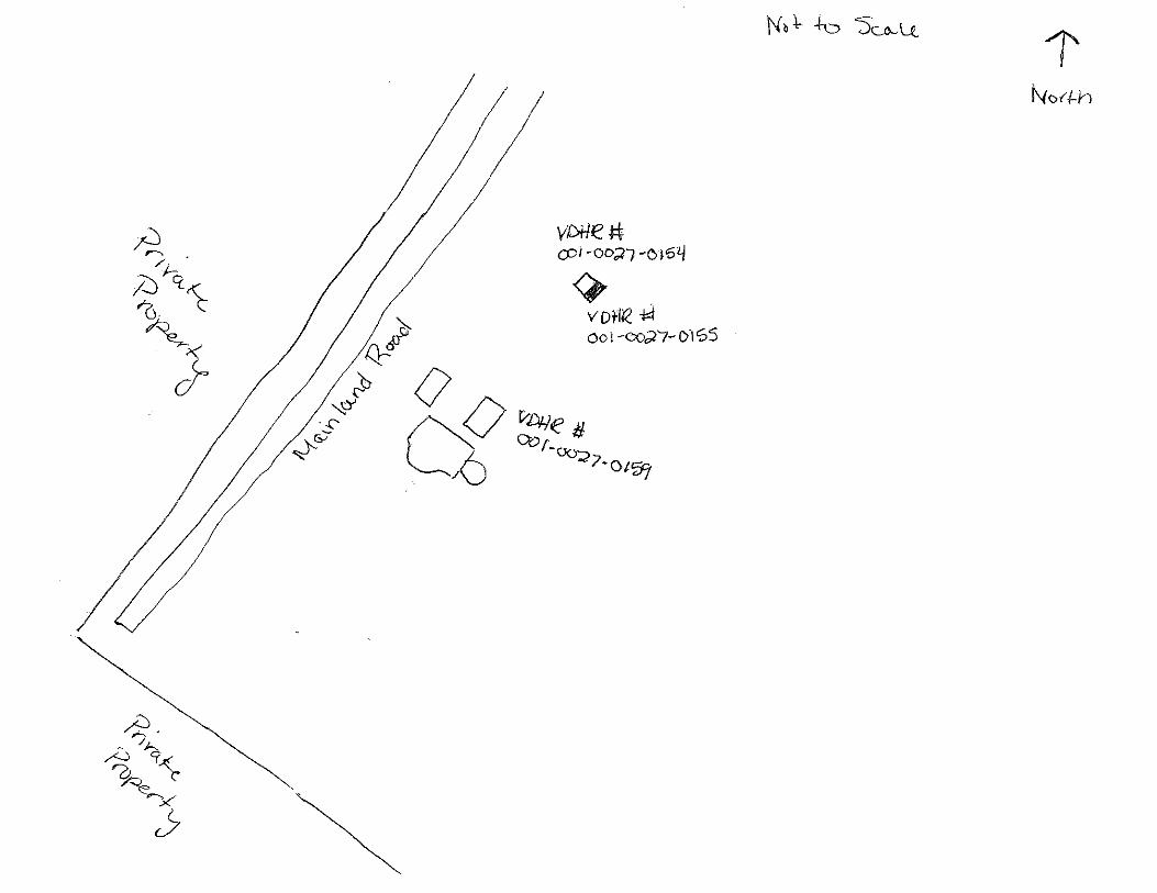

Virginia Department of Historic Resources
Reconnaissance Level Survey
DHR ID#: 001-0027-0156 Other DHR ID#:
Resource Information
National Register Eligibility Status
This Resource is associated with the Wallops Flight
Facility
Resource Name(s): U-25, Radar Operations Building {Current}
Date of Construction: 1959
Local Historic District :
Location of Resource
County/Independent City:
Commonwealth of Virginia
Accomack
Magisterial District:
Town/Village/Hamlet: Wallops Island
Tax Parcel:
Zip Code: 23337
Address(s): Mainland Road
USGS Quadrangle Name: WALLOPS ISLAND
UTM Boundary Coordinates :
Northing EastingZone NAD
1983 18 454932 4189942
UTM Center coordinates :
NoUTM Data Restricted?.
Resource Description
Ownership Status: Public - Federal
Government Agency Owner: U.S. National Aeronautics & Space Administration
Acreage:
Surrounding area: Rural
Open to Public: No
January 2011: The Radar Operations Building is located on Wallops Mainland, south of Causeway Road. A creek lies to the
east with tall grass surrounding it and an agricultural field is to the west of the NASA property. There are three clusters of
buildings and structures near it. A one lane asphalt-paved road (Mainland Road) provides access to the building, which is
surrounded by an asphalt-paved parking area. The building is connected to the Radar Antenna Pedestal Tower “A” (U-25A)
by a metal track, which carries cables.
Site Description:
Secondary Resource Summary:
January 2011: Radar Antenna Pedestal Tower "A" (U-25A)
Resource StatusResource TypesCount
Research
Facility/Laboratory
Non-Contributing 1
Individual Resource Information
Research Facility/LaboratoryResource Type. Primary Resource? Yes
Individual Resource Detail Information
Date of Construction: Accessed? 1959 {Owner} No Not accessible
1.0 Number of Stories:Architectural Style: No Discernable Style
Good
Interior Plan Type:
Form: Condition:
Threats to Resource: None Known
January 2011: The Radar Operations Building is a one-story, prefabricated metal building with a side gable corrugated metal roof
Report generated 6/6/2011Page 1 of 3
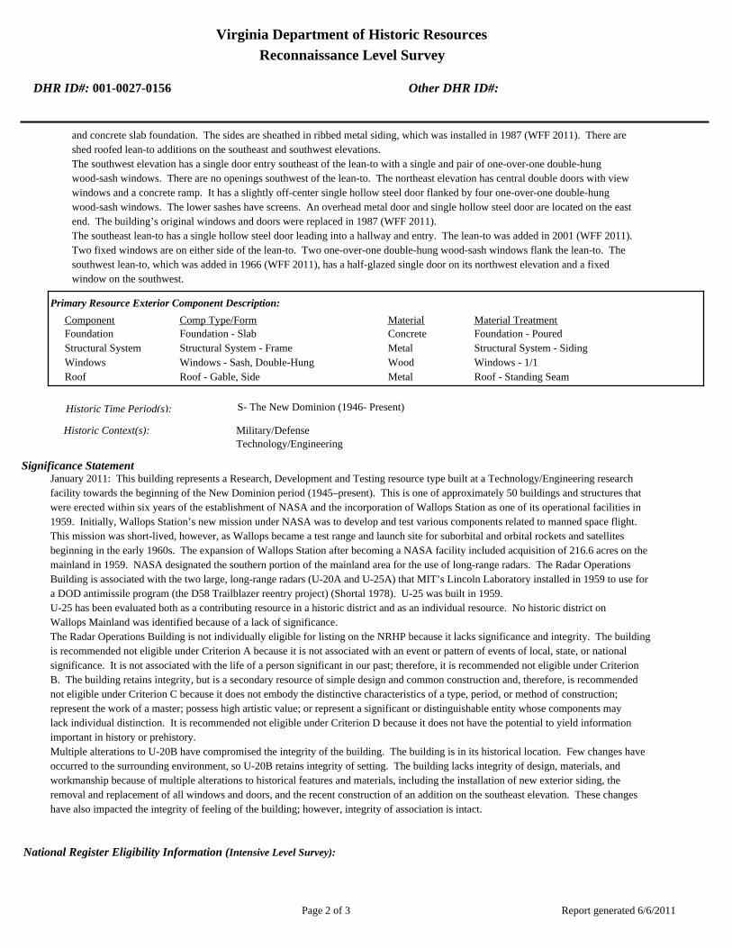
Virginia Department of Historic Resources
Reconnaissance Level Survey
DHR ID#: 001-0027-0156 Other DHR ID#:
and concrete slab foundation. The sides are sheathed in ribbed metal siding, which was installed in 1987 (WFF 2011). There are
shed roofed lean-to additions on the southeast and southwest elevations.
The southwest elevation has a single door entry southeast of the lean-to with a single and pair of one-over-one double-hung
wood-sash windows. There are no openings southwest of the lean-to. The northeast elevation has central double doors with view
windows and a concrete ramp. It has a slightly off-center single hollow steel door flanked by four one-over-one double-hung
wood-sash windows. The lower sashes have screens. An overhead metal door and single hollow steel door are located on the east
end. The building’s original windows and doors were replaced in 1987 (WFF 2011).
The southeast lean-to has a single hollow steel door leading into a hallway and entry. The lean-to was added in 2001 (WFF 2011).
Two fixed windows are on either side of the lean-to. Two one-over-one double-hung wood-sash windows flank the lean-to. The
southwest lean-to, which was added in 1966 (WFF 2011), has a half-glazed single door on its northwest elevation and a fixed
window on the southwest.
Primary Resource Exterior Component Description:
Material TreatmentMaterialComp Type/FormComponent
Foundation Foundation - Slab Concrete Foundation - Poured
Structural System Structural System - Frame Metal Structural System - Siding
Windows Windows - Sash, Double-Hung Wood Windows - 1/1
Roof Roof - Gable, Side Metal Roof - Standing Seam
Historic Time Period(s):S- The New Dominion (1946- Present)
Historic Context(s): Military/Defense
Technology/Engineering
Significance Statement
January 2011: This building represents a Research, Development and Testing resource type built at a Technology/Engineering research
facility towards the beginning of the New Dominion period (1945–present). This is one of approximately 50 buildings and structures that
were erected within six years of the establishment of NASA and the incorporation of Wallops Station as one of its operational facilities in
1959. Initially, Wallops Station’s new mission under NASA was to develop and test various components related to manned space flight.
This mission was short-lived, however, as Wallops became a test range and launch site for suborbital and orbital rockets and satellites
beginning in the early 1960s. The expansion of Wallops Station after becoming a NASA facility included acquisition of 216.6 acres on the
mainland in 1959. NASA designated the southern portion of the mainland area for the use of long-range radars. The Radar Operations
Building is associated with the two large, long-range radars (U-20A and U-25A) that MIT’s Lincoln Laboratory installed in 1959 to use for
a DOD antimissile program (the D58 Trailblazer reentry project) (Shortal 1978). U-25 was built in 1959.
U-25 has been evaluated both as a contributing resource in a historic district and as an individual resource. No historic district on
Wallops Mainland was identified because of a lack of significance.
The Radar Operations Building is not individually eligible for listing on the NRHP because it lacks significance and integrity. The building
is recommended not eligible under Criterion A because it is not associated with an event or pattern of events of local, state, or national
significance. It is not associated with the life of a person significant in our past; therefore, it is recommended not eligible under Criterion
B. The building retains integrity, but is a secondary resource of simple design and common construction and, therefore, is recommended
not eligible under Criterion C because it does not embody the distinctive characteristics of a type, period, or method of construction;
represent the work of a master; possess high artistic value; or represent a significant or distinguishable entity whose components may
lack individual distinction. It is recommended not eligible under Criterion D because it does not have the potential to yield information
important in history or prehistory.
Multiple alterations to U-20B have compromised the integrity of the building. The building is in its historical location. Few changes have
occurred to the surrounding environment, so U-20B retains integrity of setting. The building lacks integrity of design, materials, and
workmanship because of multiple alterations to historical features and materials, including the installation of new exterior siding, the
removal and replacement of all windows and doors, and the recent construction of an addition on the southeast elevation. These changes
have also impacted the integrity of feeling of the building; however, integrity of association is intact.
National Register Eligibility Information (Intensive Level Survey):
Report generated 6/6/2011Page 2 of 3

Virginia Department of Historic Resources
Reconnaissance Level Survey
DHR ID#: 001-0027-0156 Other DHR ID#:
NR Resource StatusNR Resource TypeNR Count
Building Non-contributing 1
1 Non-Contributing:
National Register Criteria:
Level of Significance:
Period of Significance:
Graphic Media Documentation
PhotographerPhoto DateNegative RepositoryDHR Negative # Photographic Media
Digital Images L. ThursbyJanuary 2011
Bibliographic Documentation
Reference #: 1
Bibliographic RecordType: Local Records
Author:
DHR CRM Report Number:
Notes:
Wallops Flight Facility Real Property Records
Reference #: 2
Bibliographic RecordType: Article
Author: Joseph Adams Shortal
DHR CRM Report Number:
Notes:
1978 A New Dimension Wallops Island Flight Test Range: The First Fifteen Years. Washington D.C.: NASA Scientific
and Technical Information Office.
Cultural Resource Management (CRM) Events
CRM Event # 1,
Cultural Resource Management Event: Survey:Phase I/Reconnaissance
Date of CRM Event: January 2011
CRM Person: TEC Inc
VDHR Project ID # Associated with Event: 2010-2274
CRM Event Notes or Comments:
Lori Thursby and Kimberly Martin
Bridge Information
Cemetery Information
Ownership Information
Unknown Unknown Name: .................................
NASA Wallops Flight FacilityCompany: ..........................
Wallops Flight FacilityAddress: .............................
Wallops IslandCity: ...................................
23337Zip: ....................................... VirginiaState: USACountry:
000-000-0000757-824-1000Phone/Extension: ..............
0000/ 0000
Relation to the Property: Owner of property
Report generated 6/6/2011Page 3 of 3

001-0027-0152I-004
Mai
nlan
d R
d.
Causeway Rd.
North
Sea
wall R
d.
North
Byp
ass
Rd.
001-0027-0182W-020
001-0027-0188W-065
001-0027-0160U-030
001-0027-0184W-040
001-0027-0167U-070
001-0027-0156U-025
001-0027-0192X-085
001-0027-0163U-055
001-0027-0201Z-040
001-0027-0198Y-055
001-0027-0193Y-010
001-0027-0170V-025
001-0027-0190X-005A
001-0027-0187W-057
001-0027-0153U-005
001-0027-0197Y-038
001-0027-0194Y-016
001-0027-0180W-015
001-0027-0162U-040
001-0027-0191X-075
001-0027-0159U-027
001-0027-0158U-026
001-0027-0168U-070A
001-0027-0185W-050
001-0027-0179W-010
001-0027-0155U-020B
001-0027-0161U-030A
001-0027-0183W-035
001-0027-0169U-080
001-0027-0165U-060
001-0027-0164U-055A
001-0027-0154U-020A
001-0027-0157U-025A
001-0027-0166U-064
001-0027-0189W-067
001-0027-0195Y-020
001-0027-0181W-016
001-0027-0186W-051
001-0027-0199Y-095
001-0027-0200Y-110
001-0027-0196Y-037
NASA Property
Surveyed Structures
Buildings
0 300Meters
0 1,500Feet


Virginia Department of Historic Resources
Reconnaissance Level Survey
DHR ID#: 001-0027-0157 Other DHR ID#:
Resource Information
National Register Eligibility Status
This Resource is associated with the Wallops Flight
Facility
Resource Name(s): U-25A, Radar Antenna Pedestal Tower “A”
{Current}
Date of Construction: 1959
Local Historic District :
Location of Resource
County/Independent City:
Commonwealth of Virginia
Accomack
Magisterial District:
Town/Village/Hamlet: Wallops Island
Tax Parcel:
Zip Code: 23337
Address(s): Mainland Road
USGS Quadrangle Name: WALLOPS ISLAND
UTM Boundary Coordinates :
Northing EastingZone NAD
1983 18 454944 4189927
UTM Center coordinates :
NoUTM Data Restricted?.
Resource Description
Ownership Status: Public - Federal
Government Agency Owner: U.S. National Aeronautics & Space Administration
Acreage:
Surrounding area: Rural
Open to Public: No
January 2011: The Radar Antenna Pedestal Tower “A” is located on Wallops Mainland, on Mainland Road south of Causeway
Road. A creek lies to the east with tall grass surrounding it and an agricultural field is to the west of the NASA property. There
are three clusters of buildings and structures near the tower, which is surrounded by an asphalt-paved parking area. A raised
metal track, carrying cables, connects it to the Radar Operations Building (U-25).
Site Description:
Secondary Resource Summary:
January 2011: Radar Operations Building (U-25)
Resource StatusResource TypesCount
Communications Facility Non-Contributing 1
Individual Resource Information
Communications FacilityResource Type. Primary Resource? Yes
Individual Resource Detail Information
Date of Construction: Accessed? 1959 {Owner} No Not accessible
0.0 Number of Stories:Architectural Style: No Discernable Style
Good
Interior Plan Type:
Form: Condition:
Threats to Resource: None Known
January 2011: The Radar Antenna Pedestal Tower “A” is one of three developed in by NASA partnership with MIT’s Lincoln
Laboratory, an early departure from Department of Defense contracts (Best et al. 1997). The other two are the Radar Pedestal Tower
Report generated 6/6/2011Page 1 of 3

Virginia Department of Historic Resources
Reconnaissance Level Survey
DHR ID#: 001-0027-0157 Other DHR ID#:
“B” (U-20A) and the Spandar Radar Pedestal Tower (U-30A). It consists of a pedestal, 35 ft 6 inches in height and 12 ft in diameter,
and the antenna itself. The entire structure rests on a concrete pylon about 12 ft in diameter. The antenna is a parabolic dish about
50 ft in diameter. It is framed with metal bars and cross bars and has a solid metal center. A pyramid of metal bars rests atop the
center. The antenna is attached to the pedestal with a mechanical arm that allows it to change position. The pedestal is a reinforced
concrete cylinder with two metal framed catwalks with metal handrails. One catwalk runs along the perimeter of the cylinder about
half way up, the other extends along the top of the northeast elevation. A metal ladder with a steel cage around it provides access
to both platforms. There is one point of entry to the pedestal, through a single half-glazed door on the southwest elevation
Primary Resource Exterior Component Description:
Material TreatmentMaterialComp Type/FormComponent
Foundation Foundation - Piers w/ infill Concrete Foundation - Poured
Structural System Structural System - Masonry Concrete
Porch Porch - Deck Metal
Historic Time Period(s):S- The New Dominion (1946- Present)
Historic Context(s): Military/Defense
Technology/Engineering
Significance Statement
This antenna tower is representative of a Communications resource type built at a Technology/Engineering research facility towards the
beginning of the New Dominion period (1945–present). This is one of approximately 50 buildings and structures that were erected within
six years of the establishment of NASA and the incorporation of Wallops Station as one of its operational facilities in 1959. Initially,
Wallops Station’s new mission under NASA was to develop and test various components related to manned space flight. This mission
was short-lived, however, as Wallops became a test range and launch site for suborbital and orbital rockets and satellites beginning in the
early 1960s. The expansion of Wallops Station after becoming a NASA facility included acquisition of 216.6 acres on the Mainland in
1959. NASA designated the southern portion of the Mainland area for the use of long-range radars, and leased a parcel of land to MIT,
which wanted to install two large, long-range radars (U-20A and U-25A) for its Lincoln Laboratory to use for a Department of Defense
antimissile program (the D58 Trailblazer reentry project) (Shortal 1978). Both radars and associated pedestal towers were installed in 1959.
U-25A has been evaluated both as a contributing resource in a historic district and as an individual resource. No historic district on
Wallops Mainland was identified because of a lack of significance.
The Radar Antenna Pedestal Tower “A” is not individually eligible for listing on the NRHP because it lacks significance. The structure is
recommended not eligible under Criterion A because it is not associated with an event or pattern of events of local, state, or national
significance. It is not associated with the life of a person significant in our past; therefore, it is recommended not eligible under Criterion
B. The tower retains integrity, however, it is recommended not eligible under Criterion C because it does not embody the distinctive
characteristics of a type, period, or method of construction; represent the work of a master; possess high artistic value; or represent a
significant or distinguishable entity whose components may lack individual distinction. It is recommended not eligible under Criterion D
because it does not have the potential to yield information important in history or prehistory.
National Register Eligibility Information (Intensive Level Survey):
NR Resource StatusNR Resource TypeNR Count
Building Non-contributing 1
1 Non-Contributing:
National Register Criteria:
Level of Significance:
Period of Significance:
Report generated 6/6/2011Page 2 of 3

Virginia Department of Historic Resources
Reconnaissance Level Survey
DHR ID#: 001-0027-0157 Other DHR ID#:
Graphic Media Documentation
PhotographerPhoto DateNegative RepositoryDHR Negative # Photographic Media
Digital Images L. ThursbyJanuary 2011
Bibliographic Documentation
Reference #: 1
Bibliographic RecordType: Local Records
Author:
DHR CRM Report Number:
Notes:
Wallops Flight Facility Real Property Records
Reference #: 2
Bibliographic RecordType: Article
Author: Joseph Adams Shortal
DHR CRM Report Number:
Notes:
1978 A New Dimension Wallops Island Flight Test Range: The First Fifteen Years. Washington D.C.: NASA Scientific
and Technical Information Office.
Cultural Resource Management (CRM) Events
CRM Event # 1,
Cultural Resource Management Event: Survey:Phase I/Reconnaissance
Date of CRM Event: January 2011
CRM Person: TEC Inc
VDHR Project ID # Associated with Event: 2010-2274
CRM Event Notes or Comments:
Lori Thursby and Kimberly Martin
Bridge Information
Cemetery Information
Ownership Information
Unknown Unknown Name: .................................
NASA Wallops Flight FacilityCompany: ..........................
Wallops Flight FacilityAddress: .............................
Wallops IslandCity: ...................................
23337Zip: ....................................... VirginiaState: USACountry:
000-000-0000757-824-1000Phone/Extension: ..............
0000/ 0000
Relation to the Property: Owner of property
Report generated 6/6/2011Page 3 of 3

001-0027-0152I-004
Mai
nlan
d R
d.
Causeway Rd.
North
Sea
wall R
d.
North
Byp
ass
Rd.
001-0027-0182W-020
001-0027-0188W-065
001-0027-0160U-030
001-0027-0184W-040
001-0027-0167U-070
001-0027-0156U-025
001-0027-0192X-085
001-0027-0163U-055
001-0027-0201Z-040
001-0027-0198Y-055
001-0027-0193Y-010
001-0027-0170V-025
001-0027-0190X-005A
001-0027-0187W-057
001-0027-0153U-005
001-0027-0197Y-038
001-0027-0194Y-016
001-0027-0180W-015
001-0027-0162U-040
001-0027-0191X-075
001-0027-0159U-027
001-0027-0158U-026
001-0027-0168U-070A
001-0027-0185W-050
001-0027-0179W-010
001-0027-0155U-020B
001-0027-0161U-030A
001-0027-0183W-035
001-0027-0169U-080
001-0027-0165U-060
001-0027-0164U-055A
001-0027-0154U-020A
001-0027-0157U-025A
001-0027-0166U-064
001-0027-0189W-067
001-0027-0195Y-020
001-0027-0181W-016
001-0027-0186W-051
001-0027-0199Y-095
001-0027-0200Y-110
001-0027-0196Y-037
NASA Property
Surveyed Structures
Buildings
0 300Meters
0 1,500Feet


Virginia Department of Historic Resources
Reconnaissance Level Survey
DHR ID#: 001-0027-0158 Other DHR ID#:
Resource Information
National Register Eligibility Status
This Resource is associated with the Wallops Flight
Facility
Resource Name(s): U-26, Projects Maintenance Shop {Current}
Date of Construction: 1961
Local Historic District :
Location of Resource
County/Independent City:
Commonwealth of Virginia
Accomack
Magisterial District:
Town/Village/Hamlet: Wallops Island
Tax Parcel:
Zip Code: 23337
Address(s): Mainland Road
USGS Quadrangle Name: WALLOPS ISLAND
UTM Boundary Coordinates :
Northing EastingZone NAD
1983 18 454930 4189977
UTM Center coordinates :
NoUTM Data Restricted?.
Resource Description
Ownership Status: Public - Federal
Government Agency Owner: U.S. National Aeronautics & Space Administration
Acreage:
Surrounding area: Rural
Open to Public: No
January 2011: The Projects Maintenance Shop is located on Wallops Mainland, on Mainland Road south of Causeway Road.
A creek lies to the east with tall grass surrounding it and an agricultural field is to the west of the NASA property. There are
three clusters of buildings and structures near it.
Site Description:
Secondary Resource Summary:
January 2011: none
Resource StatusResource TypesCount
Workshop Non-Contributing 1
Individual Resource Information
WorkshopResource Type. Primary Resource? Yes
Individual Resource Detail Information
Date of Construction: Accessed? 1961 {Owner} No Not accessible
1.0 Number of Stories:Architectural Style: No Discernable Style
Good
Interior Plan Type:
Form: Condition:
Threats to Resource: None Known
January 2011: The Projects Maintenance Shop is a simple, one-story rectangular building with a metal barrel arched roof and a
concrete foundation. Three courses of concrete block meet corrugated metal siding on the northwest and southeast elevations.
The northeast and southwest elevations are faced with plywood and wood battens. The southwest elevation contains the only
entrance, a replacement overhead door with two lights. This is flanked by two six-over-six double-hung wood-sash windows. An
Report generated 6/6/2011Page 1 of 3

Virginia Department of Historic Resources
Reconnaissance Level Survey
DHR ID#: 001-0027-0158 Other DHR ID#:
entrance in the northeast elevation has been covered with plywood.
Primary Resource Exterior Component Description:
Material TreatmentMaterialComp Type/FormComponent
Windows Windows - Sash, Double-Hung Wood Windows - 2/2, Horizontal
Roof Metal Roof - Corrugated
Foundation Foundation - Slab Concrete Foundation - Poured
Structural System Structural System - Frame Metal Structural System - Corrugated
Structural System Structural System - Frame Wood Structural System - Siding, Composition
Historic Time Period(s):S- The New Dominion (1946- Present)
Historic Context(s): Military/Defense
Technology/Engineering
Significance Statement
January 2011: This building is an Industrial resource type built at a Technology/Engineering research facility towards the beginning of
the New Dominion period (1945–present). This is one of approximately 50 buildings and structures that were erected within six years of
the establishment of NASA and the incorporation of Wallops Station as one of its operational facilities in 1959. Initially, Wallops
Station’s new mission under NASA was to develop and test various components related to manned space flight. This mission was
short-lived, however, as Wallops became a test range and launch site for suborbital and orbital rockets and satellites beginning in the
early 1960s. The expansion of Wallops Station after becoming a NASA facility included acquisition of 216.6 acres on the mainland in 1959.
NASA designated the southern portion of the mainland area for the use of long-range radars (Shortal 1978). U-26 was constructed in
1960.
U-26 has been evaluated both as a contributing resource in a historic district and as an individual resource. No historic district on
Wallops Mainland was identified because of a lack of significance.
The Projects Maintenance Shop is not individually eligible for listing on the NRHP because it lacks significance. The building is
recommended not eligible under Criterion A because it is not associated with an event or pattern of events of local, state, or national
significance. It is not associated with the life of a person significant in our past; therefore, it is recommended not eligible under Criterion
B. The building retains integrity, but is a secondary resource of simple design and common construction and, therefore, is recommended
not eligible under Criterion C because it does not embody the distinctive characteristics of a type, period, or method of construction;
represent the work of a master; possess high artistic value; or represent a significant or distinguishable entity whose components may
lack individual distinction. It is recommended not eligible under Criterion D because it does not have the potential to yield information
important in history or prehistory.
National Register Eligibility Information (Intensive Level Survey):
NR Resource StatusNR Resource TypeNR Count
Building Non-contributing 1
1 Non-Contributing:
National Register Criteria:
Level of Significance:
Period of Significance:
Graphic Media Documentation
PhotographerPhoto DateNegative RepositoryDHR Negative # Photographic Media
Digital Images L. ThursbyJanuary 2011
Report generated 6/6/2011Page 2 of 3

Virginia Department of Historic Resources
Reconnaissance Level Survey
DHR ID#: 001-0027-0158 Other DHR ID#:
Bibliographic Documentation
Reference #: 1
Bibliographic RecordType: Local Records
Author:
DHR CRM Report Number:
Notes:
Wallops Flight Facility Real Property Records
Reference #: 2
Bibliographic RecordType: Article
Author: Joseph Adams Shortal
DHR CRM Report Number:
Notes:
1978 A New Dimension Wallops Island Flight Test Range: The First Fifteen Years. Washington D.C.: NASA Scientific
and Technical Information Office.
Cultural Resource Management (CRM) Events
CRM Event # 1,
Cultural Resource Management Event: Survey:Phase I/Reconnaissance
Date of CRM Event: January 2011
CRM Person: TEC Inc
VDHR Project ID # Associated with Event: 2010-2274
CRM Event Notes or Comments:
Lori Thursby and Kimberly Martin
Bridge Information
Cemetery Information
Ownership Information
Unknown Unknown Name: .................................
NASA Wallops Flight FacilityCompany: ..........................
Wallops Flight FaciltyAddress: .............................
Wallops IslandCity: ...................................
23337Zip: ....................................... VirginiaState: USACountry:
000-000-0000757-824-1000Phone/Extension: ..............
0000/ 0000
Relation to the Property: Owner of property
Report generated 6/6/2011Page 3 of 3

001-0027-0152I-004
Mai
nlan
d R
d.
Causeway Rd.
North
Sea
wall R
d.
North
Byp
ass
Rd.
001-0027-0182W-020
001-0027-0188W-065
001-0027-0160U-030
001-0027-0184W-040
001-0027-0167U-070
001-0027-0156U-025
001-0027-0192X-085
001-0027-0163U-055
001-0027-0201Z-040
001-0027-0198Y-055
001-0027-0193Y-010
001-0027-0170V-025
001-0027-0190X-005A
001-0027-0187W-057
001-0027-0153U-005
001-0027-0197Y-038
001-0027-0194Y-016
001-0027-0180W-015
001-0027-0162U-040
001-0027-0191X-075
001-0027-0159U-027
001-0027-0158U-026
001-0027-0168U-070A
001-0027-0185W-050
001-0027-0179W-010
001-0027-0155U-020B
001-0027-0161U-030A
001-0027-0183W-035
001-0027-0169U-080
001-0027-0165U-060
001-0027-0164U-055A
001-0027-0154U-020A
001-0027-0157U-025A
001-0027-0166U-064
001-0027-0189W-067
001-0027-0195Y-020
001-0027-0181W-016
001-0027-0186W-051
001-0027-0199Y-095
001-0027-0200Y-110
001-0027-0196Y-037
NASA Property
Surveyed Structures
Buildings
0 300Meters
0 1,500Feet

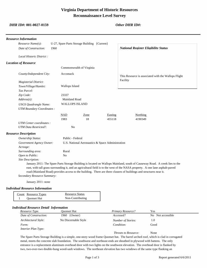
Virginia Department of Historic Resources
Reconnaissance Level Survey
DHR ID#: 001-0027-0159 Other DHR ID#:
Resource Information
National Register Eligibility Status
This Resource is associated with the Wallops Flight
Facility
Resource Name(s): U-27, Spare Parts Storage Building {Current}
Date of Construction: 1960
Local Historic District :
Location of Resource
County/Independent City:
Commonwealth of Virginia
Accomack
Magisterial District:
Town/Village/Hamlet: Wallops Island
Tax Parcel:
Zip Code: 23337
Address(s): Mainland Road
USGS Quadrangle Name: WALLOPS ISLAND
UTM Boundary Coordinates :
Northing EastingZone NAD
1983 18 455118 4190349
UTM Center coordinates :
NoUTM Data Restricted?.
Resource Description
Ownership Status: Public - Federal
Government Agency Owner: U.S. National Aeronautics & Space Administration
Acreage:
Surrounding area: Rural
Open to Public: No
January 2011: The Spare Parts Storage Building is located on Wallops Mainland, south of Causeway Road. A creek lies to the
east, with tall grass surrounding it, and an agricultural field is to the west of the NASA property. A one lane asphalt-paved
road (Mainland Road) provides access to the building. There are three clusters of buildings and structures near it.
Site Description:
Secondary Resource Summary:
January 2011: none
Resource StatusResource TypesCount
Quonset Hut Non-Contributing 1
Individual Resource Information
Quonset HutResource Type. Primary Resource? Yes
Individual Resource Detail Information
Date of Construction: Accessed? 1960 {Owner} No Not accessible
1.0 Number of Stories:Architectural Style: No Discernable Style
Good
Interior Plan Type:
Form: Condition:
Threats to Resource: None
The Spare Parts Storage Building is a simple, one-story wood frame Quonset hut. The barrel arched roof, which is clad in corrugated
metal, meets the concrete slab foundation. The southwest and northeast ends are sheathed in plywood with battens. The only
entrance is a replacement aluminum overhead door with two lights on the southwest elevation. The overhead door is flanked by
two, two-over-two double-hung wood-sash windows. The northeast elevation has two windows of the same type flanking an
Report generated 6/6/2011Page 1 of 3

Virginia Department of Historic Resources
Reconnaissance Level Survey
DHR ID#: 001-0027-0159 Other DHR ID#:
entryway that has been covered by plywood.
Primary Resource Exterior Component Description:
Material TreatmentMaterialComp Type/FormComponent
Structural System Structural System - Frame Wood Structural System - Siding
Windows Windows - Sash, Double-Hung Wood Windows - 2/2
Roof Metal Roof - Corrugated
Foundation Foundation - Slab Concrete Foundation - Poured
Historic Time Period(s):S- The New Dominion (1946- Present)
Historic Context(s): Military/Defense
Technology/Engineering
Significance Statement
January 2011: This building is representative of a Storage resource type built at a Technology/Engineering research facility towards the
beginning of the New Dominion period (1945–present). This is one of approximately 50 buildings and structures that were erected within
six years of the establishment of NASA and the incorporation of Wallops Station as one of its operational facilities in 1959. Initially,
Wallops Station’s new mission under NASA was to develop and test various components related to manned space flight. This mission
was short-lived, however, as Wallops became a test range and launch site for suborbital and orbital rockets and satellites beginning in the
early 1960s. The expansion of Wallops Station after becoming a NASA facility included acquisition of 216.6 acres on the mainland in 1959.
NASA designated the southern portion of the mainland area for the use of long-range radars (Shortal 1978). U-27 was constructed in
1961.
U-27 has been evaluated both as a contributing resource in a historic district and as an individual resource. No historic district on
Wallops Mainland was identified because of a lack of significance.
The Spare Parts Storage Building is not individually eligible for listing on the NRHP because it lacks significance. The building is
recommended not eligible under Criterion A because it is not associated with an event or pattern of events of local, state, or national
significance. It is not associated with the life of a person significant in our past; therefore, it is recommended not eligible under Criterion
B. The building retains integrity, but is a secondary resource of simple, utilitarian design and construction and, therefore, is recommended
not eligible under Criterion C because it does not embody the distinctive characteristics of a type, period, or method of construction;
represent the work of a master; possess high artistic value; or represent a significant or distinguishable entity whose components may
lack individual distinction. Quonset huts were routinely used for storage and ubiquitous to federal installations, particularly DOD
installations, during and after World War II. U-27 is recommended not eligible under Criterion D because it does not have the potential to
yield information important in history or prehistory.
National Register Eligibility Information (Intensive Level Survey):
NR Resource StatusNR Resource TypeNR Count
Building Non-contributing 1
1 Non-Contributing:
National Register Criteria:
Level of Significance:
Period of Significance:
Graphic Media Documentation
PhotographerPhoto DateNegative RepositoryDHR Negative # Photographic Media
Digital Images L. ThursbyJanuary 2011
Report generated 6/6/2011Page 2 of 3

Virginia Department of Historic Resources
Reconnaissance Level Survey
DHR ID#: 001-0027-0159 Other DHR ID#:
Bibliographic Documentation
Reference #: 1
Bibliographic RecordType: Local Records
Author:
DHR CRM Report Number:
Notes:
Wallops Flight Facility Real Property Records
Cultural Resource Management (CRM) Events
CRM Event # 1,
Cultural Resource Management Event: Survey:Phase I/Reconnaissance
Date of CRM Event: January 2011
CRM Person: TEC Inc
VDHR Project ID # Associated with Event: 2010-2274
CRM Event Notes or Comments:
Lori Thursby and Kimberly Martin
Bridge Information
Cemetery Information
Ownership Information
Unknown Unknown Name: .................................
NASA Wallops Flight FacilityCompany: ..........................
Wallops Flight FacilityAddress: .............................
Wallops IslandCity: ...................................
23337Zip: ....................................... VirginiaState: USACountry:
000-000-0000757-824-1000Phone/Extension: ..............
0000/ 0000
Relation to the Property: Owner of property
Report generated 6/6/2011Page 3 of 3

001-0027-0152I-004
Mai
nlan
d R
d.
Causeway Rd.
North
Sea
wall R
d.
North
Byp
ass
Rd.
001-0027-0182W-020
001-0027-0188W-065
001-0027-0160U-030
001-0027-0184W-040
001-0027-0167U-070
001-0027-0156U-025
001-0027-0192X-085
001-0027-0163U-055
001-0027-0201Z-040
001-0027-0198Y-055
001-0027-0193Y-010
001-0027-0170V-025
001-0027-0190X-005A
001-0027-0187W-057
001-0027-0153U-005
001-0027-0197Y-038
001-0027-0194Y-016
001-0027-0180W-015
001-0027-0162U-040
001-0027-0191X-075
001-0027-0159U-027
001-0027-0158U-026
001-0027-0168U-070A
001-0027-0185W-050
001-0027-0179W-010
001-0027-0155U-020B
001-0027-0161U-030A
001-0027-0183W-035
001-0027-0169U-080
001-0027-0165U-060
001-0027-0164U-055A
001-0027-0154U-020A
001-0027-0157U-025A
001-0027-0166U-064
001-0027-0189W-067
001-0027-0195Y-020
001-0027-0181W-016
001-0027-0186W-051
001-0027-0199Y-095
001-0027-0200Y-110
001-0027-0196Y-037
NASA Property
Surveyed Structures
Buildings
0 300Meters
0 1,500Feet


Virginia Department of Historic Resources
Reconnaissance Level Survey
DHR ID#: 001-0027-0160 Other DHR ID#:
Resource Information
National Register Eligibility Status
This Resource is associated with the Wallops Flight
Facility
Resource Name(s): U-30, Spandar Radar Operations Building
{Current}
Date of Construction: 1960
Local Historic District :
Location of Resource
County/Independent City:
Commonwealth of Virginia
Accomack
Magisterial District:
Town/Village/Hamlet: Wallops Island
Tax Parcel:
Zip Code: 23337
Address(s): Mainland Road
USGS Quadrangle Name: WALLOPS ISLAND
UTM Boundary Coordinates :
Northing EastingZone NAD
1983 18 454876 4189842
UTM Center coordinates :
NoUTM Data Restricted?.
Resource Description
Ownership Status: Public - Federal
Government Agency Owner: U.S. National Aeronautics & Space Administration
Acreage:
Surrounding area: Rural
Open to Public: No
January 2011: The Spandar Radar Operations Building is located on Wallops Mainland, south of Causeway Road. A creek lies
to the east with tall grass surrounding it and an agricultural field is to the west of the NASA property. The building resides in
the last cluster of buildings and structures at the southwest end of Mainland Road. The Spandar Radar Pedestal Tower
(U-30A) and an oil tank (U-30B) are located on the southwest and northeast sides of the building, respectively.
Site Description:
Secondary Resource Summary:
January 2011: U-30B-oil tank, Spandar Radar Pedestal Tower (u-30A)
Resource StatusResource TypesCount
Research
Facility/Laboratory
Non-Contributing 1
Individual Resource Information
Research Facility/LaboratoryResource Type. Primary Resource? Yes
Individual Resource Detail Information
Date of Construction: Accessed? 1960 {Owner} No Not accessible
1.0 Number of Stories:Architectural Style: No Discernable Style
Good
Interior Plan Type:
Form: Condition:
Threats to Resource: None Known
January 2011: The Spandar Radar Operations Building is a prefabricated metal building with ribbed metal siding and a side gable
Report generated 6/6/2011Page 1 of 3
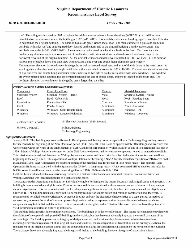
Virginia Department of Historic Resources
Reconnaissance Level Survey
DHR ID#: 001-0027-0160 Other DHR ID#:
roof. The siding was installed in 1987 to replace the original transite asbestos board sheathing (WFF 2011). An addition was
completed on the southwest side of the building in 1987 (WFF 2011). It is a prefabricated metal building, approximately 2 ft shorter
in height than the original building. The addition has a side gable, ribbed metal roof. The main entrance is a glass and aluminum
vestibule with a flat roof and single glazed door, located on the north end of the original building’s northwest elevation. The
vestibule was added in 2001 (WFF 2011). A concrete ramp with metal tube handrails leads to the door. Two one-over-one
double-hung aluminum-sash windows, one set of double doors with view windows, and two louvered windows complete the
northwest elevation of the original building. All the original windows and doors were replaced in 1987 (WFF 2011). The addition
has two sets of double doors, one with view windows, and a one-over-one double-hung aluminum-sash window.
The southwest elevation has two louvers in the gable, as well as a round metal vent, and a set of double doors in the west corner. A
small hyphen with a shed roof and single metal door with a view window connects U-30 to U-30A. The southeast elevation consists
of five one-over-one double-hung aluminum-sash windows and two sets of double metal doors with view windows. Two windows
are evenly spaced in the addition, two are centered between the sets of double doors, and one is located on the south end. The
northeast elevation has two louvers in the gable; one is larger than the other.
Primary Resource Exterior Component Description:
Material TreatmentMaterialComp Type/FormComponent
Structural System Structural System - Frame Metal Structural System - Siding
Roof Roof - Gable, Side Metal Roof - Standing Seam
Foundation Foundation - Slab Concrete Foundation - Poured
Porch Porch - 1-story Aluminum Porch - Enclosed
Windows Windows - Sash, Double-Hung Aluminum Windows - 1/1
Windows Windows - Louvered/Jalousied Aluminum Windows - Louvered
Historic Time Period(s):S- The New Dominion (1946- Present)
Historic Context(s): Military/Defense
Technology/Engineering
Significance Statement
January 2011: This building represents a Research, Development and Testing resource type built at a Technology/Engineering research
facility towards the beginning of the New Dominion period (1945–present). This is one of approximately 50 buildings and structures that
were erected within six years of the establishment of NASA and the incorporation of Wallops Station as one of its operational facilities in
1959. Initially, Wallops Station’s new mission under NASA was to develop and test various components related to manned space flight.
This mission was short-lived, however, as Wallops became a test range and launch site for suborbital and orbital rockets and satellites
beginning in the early 1960s. The expansion of Wallops Station after becoming a NASA facility included acquisition of 216.6 acres on the
mainland in 1959. NASA designated the southern portion of the mainland area for the use of long-range radars. The Spandar Radar
Operations Building is associated with the Spandar radar (U-30A), a long-range radar. NASA contracted MIT to develop this radar for
NASA to use in satellite and reentry vehicle tracking (Shortal 1978). U-30 was built in 1960.
U-30 has been evaluated both as a contributing resource in a historic district and as an individual resource. No historic district on
Wallops Mainland was identified because of a lack of significance.
The Spandar Radar Operations Building is not individually eligible for listing on the NRHP because it lacks significance and integrity. The
building is recommended not eligible under Criterion A because it is not associated with an event or pattern of events of local, state, or
national significance. It is not associated with the life of a person significant in our past; therefore, it is recommended not eligible under
Criterion B. The building retains integrity, but is a secondary resource of simple design and common construction and, therefore, is
recommended not eligible under Criterion C because it does not embody the distinctive characteristics of a type, period, or method of
construction; represent the work of a master; possess high artistic value; or represent a significant or distinguishable entity whose
components may lack individual distinction. It is recommended not eligible under Criterion D because it does not have the potential to
yield information important in history or prehistory.
This building lacks integrity due to multiple alterations. The building is in its historical location. The setting has changed somewhat with
the addition of a couple of small post-1965 buildings in the vicinity, but they have not adversely impacted the overall character of the
surroundings. The building possesses no integrity of design, materials, and workmanship due to several substantive alterations,
including removal and replacement of all original doors and windows, the reconfiguration of fenestration on the primary elevations, the
replacement of the original exterior siding, and the construction of a large prefabricated metal addition on the north end of the building.
These changes have also adversely impacted the integrity of feeling of the building; however, integrity of association is intact.
Report generated 6/6/2011Page 2 of 3
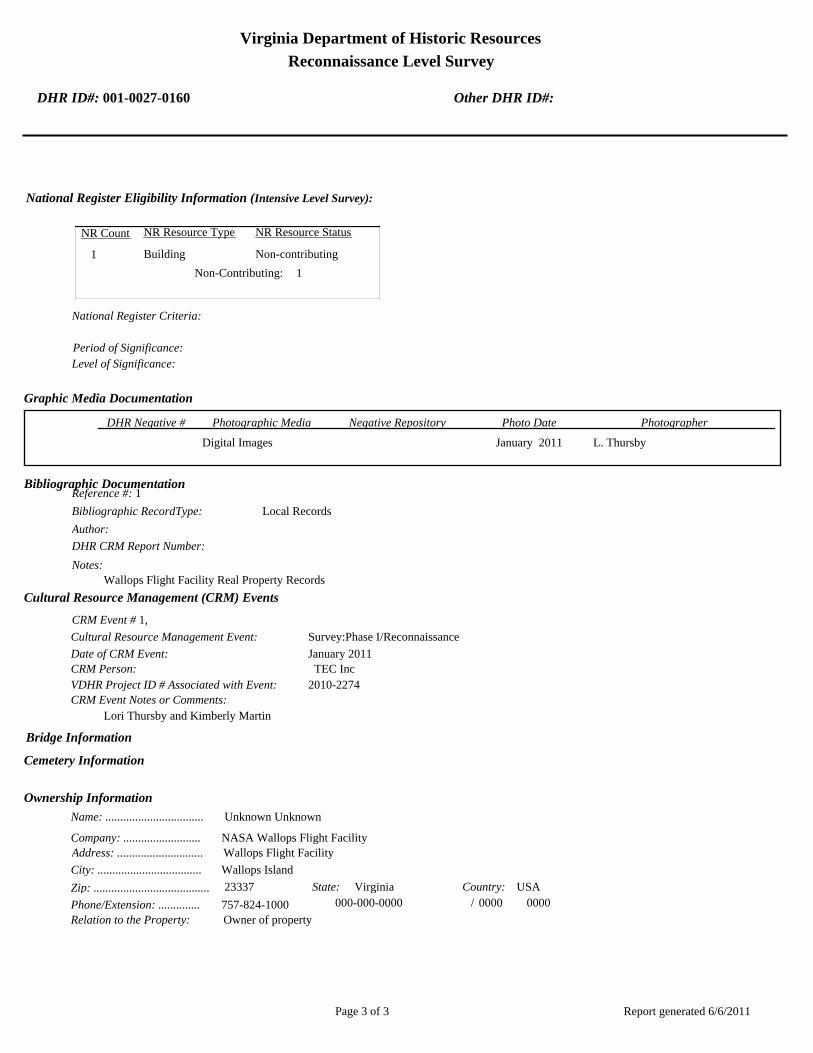
Virginia Department of Historic Resources
Reconnaissance Level Survey
DHR ID#: 001-0027-0160 Other DHR ID#:
National Register Eligibility Information (Intensive Level Survey):
NR Resource StatusNR Resource TypeNR Count
Building Non-contributing 1
1 Non-Contributing:
National Register Criteria:
Level of Significance:
Period of Significance:
Graphic Media Documentation
PhotographerPhoto DateNegative RepositoryDHR Negative # Photographic Media
Digital Images L. ThursbyJanuary 2011
Bibliographic Documentation
Reference #: 1
Bibliographic RecordType: Local Records
Author:
DHR CRM Report Number:
Notes:
Wallops Flight Facility Real Property Records
Cultural Resource Management (CRM) Events
CRM Event # 1,
Cultural Resource Management Event: Survey:Phase I/Reconnaissance
Date of CRM Event: January 2011
CRM Person: TEC Inc
VDHR Project ID # Associated with Event: 2010-2274
CRM Event Notes or Comments:
Lori Thursby and Kimberly Martin
Bridge Information
Cemetery Information
Ownership Information
Unknown Unknown Name: .................................
NASA Wallops Flight FacilityCompany: ..........................
Wallops Flight FacilityAddress: .............................
Wallops IslandCity: ...................................
23337Zip: ....................................... VirginiaState: USACountry:
000-000-0000757-824-1000Phone/Extension: ..............
0000/ 0000
Relation to the Property: Owner of property
Report generated 6/6/2011Page 3 of 3

001-0027-0152I-004
Mai
nlan
d R
d.
Causeway Rd.
North
Sea
wall R
d.
North
Byp
ass
Rd.
001-0027-0182W-020
001-0027-0188W-065
001-0027-0160U-030
001-0027-0184W-040
001-0027-0167U-070
001-0027-0156U-025
001-0027-0192X-085
001-0027-0163U-055
001-0027-0201Z-040
001-0027-0198Y-055
001-0027-0193Y-010
001-0027-0170V-025
001-0027-0190X-005A
001-0027-0187W-057
001-0027-0153U-005
001-0027-0197Y-038
001-0027-0194Y-016
001-0027-0180W-015
001-0027-0162U-040
001-0027-0191X-075
001-0027-0159U-027
001-0027-0158U-026
001-0027-0168U-070A
001-0027-0185W-050
001-0027-0179W-010
001-0027-0155U-020B
001-0027-0161U-030A
001-0027-0183W-035
001-0027-0169U-080
001-0027-0165U-060
001-0027-0164U-055A
001-0027-0154U-020A
001-0027-0157U-025A
001-0027-0166U-064
001-0027-0189W-067
001-0027-0195Y-020
001-0027-0181W-016
001-0027-0186W-051
001-0027-0199Y-095
001-0027-0200Y-110
001-0027-0196Y-037
NASA Property
Surveyed Structures
Buildings
0 300Meters
0 1,500Feet


Virginia Department of Historic Resources
Reconnaissance Level Survey
DHR ID#: 001-0027-0161 Other DHR ID#:
Resource Information
National Register Eligibility Status
This Resource is associated with the Wallops Flight
Facility
Resource Name(s): U-30A, Spandar Radar Tower Pedestal {Current}
Date of Construction: 1961
Local Historic District :
Location of Resource
County/Independent City:
Commonwealth of Virginia
Accomack
Magisterial District:
Town/Village/Hamlet: Wallops Island
Tax Parcel:
Zip Code: 23337
Address(s): Mainland Road
USGS Quadrangle Name: WALLOPS ISLAND
UTM Boundary Coordinates :
Northing EastingZone NAD
1983 18 454843 4189820
UTM Center coordinates :
NoUTM Data Restricted?.
Resource Description
Ownership Status: Public - Federal
Government Agency Owner: U.S. National Aeronautics & Space Administration
Acreage:
Surrounding area: Rural
Open to Public: No
January 2011: The Spandar Radar Pedestal Tower is located on Wallops Mainland, south of Causeway Road. A creek lies to
the east with tall grass surrounding it and an agricultural field is to the west of the NASA property. The antenna is within the
last cluster of buildings and structures at the southwest end of Mainland Road. A hyphen attaches it to the Spandar Radar
Operations building (U-30). U-30B, an oil tank, is located on the northeast side of the building.
Site Description:
Secondary Resource Summary:
January 2011: Spandar Operatons Building (U-30)
Resource StatusResource TypesCount
Communications Facility Non-Contributing 1
Individual Resource Information
Communications FacilityResource Type. Primary Resource? Yes
Individual Resource Detail Information
Date of Construction: Accessed? 1961 {Owner} No Not accessible
0.0 Number of Stories:Architectural Style: No Discernable Style
Good
Interior Plan Type:
Form: Condition:
Threats to Resource: None Known
January 2011: The Spandar Radar Antenna Pedestal Tower is the last of three developed by NASA in partnership with MIT’s
Lincoln Laboratory and the only one operated solely by NASA (Wallace 1997). The other two are Radar Antenna Pedestal Towers
“B” (U-20A) and “A” (U-25A). U-30A consists of a pedestal 90 ft in height and 60 ft in diameter resting on concrete piles. A
Report generated 6/6/2011Page 1 of 3

Virginia Department of Historic Resources
Reconnaissance Level Survey
DHR ID#: 001-0027-0161 Other DHR ID#:
parabolic dish antenna about 50 ft in diameter is attached to the pedestal with a mechanical arm that allows it to change position.
The antenna is framed with metal bars and cross bars and has a solid metal center. A pyramid of metal bars rests atop the center.
The pedestal is composed of two parts, a reinforced concrete base and a tapered upper half, sheathed in metal siding. It has a metal
framed platform on the top of the cone, a metal framed catwalk just below the platform, and two metal framed landings; one is located
in the center of the tapered section on the north elevation and the other is on northwest side of the concrete cylinder. A metal
ladder surrounded by a metal cage extends from the ground to the platform along the north elevation. There is one metal louvered
window with a concrete sill near the ground on the east elevation.
Primary Resource Exterior Component Description:
Material TreatmentMaterialComp Type/FormComponent
Structural System Structural System - Masonry Concrete
Windows Windows - Louvered/Jalousied Aluminum Windows - Louvered
Structural System Structural System - Frame Aluminum Structural System - Siding, Aluminum
Porch Porch - Deck Metal
Foundation Foundation - Piers w/ infill Concrete Foundation - Poured
Historic Time Period(s):S- The New Dominion (1946- Present)
Historic Context(s): Military/Defense
Technology/Engineering
Significance Statement
January 2011: This antenna tower is representative of a Communications resource type built at a Technology/Engineering research facility
towards the beginning of the New Dominion period (1945–present). This is one of approximately 50 buildings and structures that were
erected within six years of the establishment of NASA and the incorporation of Wallops Station as one of its operational facilities in 1959.
Initially, Wallops Station’s new mission under NASA was to develop and test various components related to manned space flight. This
mission was short-lived, however, as Wallops became a test range and launch site for suborbital and orbital rockets and satellites
beginning in the early 1960s. The expansion of Wallops Station after becoming a NASA facility included acquisition of 216.6 acres on the
mainland in 1959. NASA designated the southern portion of the mainland area for the use of long-range radars, and leased a parcel of
land to MIT, which wanted to install two large, long-range radars (U-20A and U-25A) for its Lincoln Laboratory to use for a Department of
Defense antimissile program (the D58 Trailblazer reentry project). NASA subsequently contracted MIT to develop a long-range radar for
NASA to use in satellite and reentry vehicle tracking (Shortal 1978). This Spandar radar, so-called because it is an S-band radar, and the
associated pedestal tower was erected in 1960.
U-30A has been evaluated both as a contributing resource in a historic district and as an individual resource. No historic district on
Wallops Mainland was identified because of a lack of significance.
The Spandar Radar Antenna Pedestal Tower is not individually eligible for listing on the NRHP because it lacks significance. The
structure is recommended not eligible under Criterion A because it is not associated with an event or pattern of events of local, state, or
national significance. It is not associated with the life of a person significant in our past; therefore, it is recommended not eligible under
Criterion B. The tower retains integrity, however, it is recommended not eligible under Criterion C because it does not embody the
distinctive characteristics of a type, period, or method of construction; represent the work of a master; possess high artistic value; or
represent a significant or distinguishable entity whose components may lack individual distinction. It is recommended not eligible under
Criterion D because it does not have the potential to yield information important in history or prehistory.
National Register Eligibility Information (Intensive Level Survey):
NR Resource StatusNR Resource TypeNR Count
Building Non-contributing 1
1 Non-Contributing:
National Register Criteria:
Report generated 6/6/2011Page 2 of 3

Virginia Department of Historic Resources
Reconnaissance Level Survey
DHR ID#: 001-0027-0161 Other DHR ID#:
Level of Significance:
Period of Significance:
Graphic Media Documentation
PhotographerPhoto DateNegative RepositoryDHR Negative # Photographic Media
Digital Images L. ThursbyJanuary 2011
Bibliographic Documentation
Reference #: 1
Bibliographic RecordType: Local Records
Author:
DHR CRM Report Number:
Notes:
Wallops Flight Facility Real Property Records
Reference #: 2
Bibliographic RecordType: Article
Author: Joseph Adams Shortal
DHR CRM Report Number:
Notes:
1978 A New Dimension Wallops Island Flight Test Range: The First Fifteen Years. Washington D.C.: NASA Scientific
and Technical Information Office.
Cultural Resource Management (CRM) Events
CRM Event # 1,
Cultural Resource Management Event: Survey:Phase I/Reconnaissance
Date of CRM Event: January 2011
CRM Person: TEC Inc
VDHR Project ID # Associated with Event: 2010-2274
CRM Event Notes or Comments:
Lori Thursby and Kimberly Martin
Bridge Information
Cemetery Information
Ownership Information
Unknown Unknown Name: .................................
NASA Wallops Flight FacilityCompany: ..........................
Wallops Flight FacilityAddress: .............................
Wallops IslandCity: ...................................
23337Zip: ....................................... VirginiaState: USACountry:
000-000-0000757-824-1000Phone/Extension: ..............
0000/ 0000
Relation to the Property: Owner of property
Report generated 6/6/2011Page 3 of 3

001-0027-0152I-004
Mai
nlan
d R
d.
Causeway Rd.
North
Sea
wall R
d.
North
Byp
ass
Rd.
001-0027-0182W-020
001-0027-0188W-065
001-0027-0160U-030
001-0027-0184W-040
001-0027-0167U-070
001-0027-0156U-025
001-0027-0192X-085
001-0027-0163U-055
001-0027-0201Z-040
001-0027-0198Y-055
001-0027-0193Y-010
001-0027-0170V-025
001-0027-0190X-005A
001-0027-0187W-057
001-0027-0153U-005
001-0027-0197Y-038
001-0027-0194Y-016
001-0027-0180W-015
001-0027-0162U-040
001-0027-0191X-075
001-0027-0159U-027
001-0027-0158U-026
001-0027-0168U-070A
001-0027-0185W-050
001-0027-0179W-010
001-0027-0155U-020B
001-0027-0161U-030A
001-0027-0183W-035
001-0027-0169U-080
001-0027-0165U-060
001-0027-0164U-055A
001-0027-0154U-020A
001-0027-0157U-025A
001-0027-0166U-064
001-0027-0189W-067
001-0027-0195Y-020
001-0027-0181W-016
001-0027-0186W-051
001-0027-0199Y-095
001-0027-0200Y-110
001-0027-0196Y-037
NASA Property
Surveyed Structures
Buildings
0 300Meters
0 1,500Feet


Virginia Department of Historic Resources
Reconnaissance Level Survey
DHR ID#: 001-0027-0162 Other DHR ID#:
Resource Information
National Register Eligibility Status
This Resource is associated with the Wallops Flight
Facility
Resource Name(s): U-40, Mobile Radar Laboratory {Current}
U-40, Structural Firefighting Training Building
{Historic}
U-40, Telescope and Laboratory {Historic}
Date of Construction: 1961
Local Historic District :
Location of Resource
County/Independent City:
Commonwealth of Virginia
Accomack
Magisterial District:
Town/Village/Hamlet: Wallops Island
Tax Parcel:
Zip Code: 23337
Address(s): Mainland Road
USGS Quadrangle Name: WALLOPS ISLAND
UTM Boundary Coordinates :
Northing EastingZone NAD
1983 18 455080 4190099
UTM Center coordinates :
NoUTM Data Restricted?.
Resource Description
Ownership Status: Public - Federal
Government Agency Owner: U.S. National Aeronautics & Space Administration
Acreage:
Surrounding area: Rural
Open to Public: No
January 2011: The Mobile Radar Laboratory is located on Wallops Mainland, south of Causeway Road. A paved access road is
to the west. A creek lies to the east with tall grass surrounding it. Mainland Road, a one lane asphalt-paved road, provides
access to the building. There is an antenna array to the northeast of the building. A series of monopole antennas are arranged
in a straight line with wires connecting them and adding support. A concrete pad flush with the ground is located to the
southwest of U-40.
Site Description:
Secondary Resource Summary:
January 2011: none
Resource StatusResource TypesCount
Research
Facility/Laboratory
Non-Contributing 1
Individual Resource Information
Report generated 6/6/2011Page 1 of 3

Virginia Department of Historic Resources
Reconnaissance Level Survey
DHR ID#: 001-0027-0162 Other DHR ID#:
Research Facility/LaboratoryResource Type. Primary Resource? Yes
Individual Resource Detail Information
Date of Construction: Accessed? 1961 {Owner} No Not accessible
1.0 Number of Stories:Architectural Style: No Discernable Style
Good
Interior Plan Type:
Form: Condition:
Threats to Resource: None Known
January 2011: The Mobile Radar Laboratory is a two-story concrete block building with a flat built-up roof. The north half of the
building is 2 ½ ft taller than the south half and has metal tube railing along the perimeter of the roof. A reinforced concrete radar
pedestal and platform was built at the southeast corner of the roof in 1993 (WFF 2011). Metal switch back stairs with metal tube
railing on the southeast elevation provide access to the platform and the set of half-glazed double metal doors. A band of three
aluminum frame fixed windows are to the east of the double doors. The southwest elevation has one set of hollow steel doors in the
north half of the building. The northwest elevation has two single hollow steel doors, evenly spaced, with metal channel lintels. A
louvered window is next to one of the doors. The northeast elevation has one opening, a louvered window on the north corner.
The building is currently mothballed (WFF 2011).
Primary Resource Exterior Component Description:
Material TreatmentMaterialComp Type/FormComponent
Windows Windows - Fixed Aluminum Windows - 1-light
Roof Roof - Flat Asphalt
Windows Windows - Louvered/Jalousied Aluminum Windows - Louvered
Foundation Foundation - Slab Concrete Foundation - Poured
Structural System Structural System - Masonry Concrete Structural System - Block
Historic Time Period(s):S- The New Dominion (1946- Present)
Historic Context(s): Military/Defense
Technology/Engineering
Significance Statement
January 2011: This building is representative of a Research, Development and Testing resource type built at a Technology/Engineering
research facility towards the beginning of the New Dominion period (1945–present). This is one of approximately 50 buildings and
structures that were erected within six years of the establishment of NASA and the incorporation of Wallops Station as one of its
operational facilities in 1959. Initially, Wallops Station’s new mission under NASA was to develop and test various components related to
manned space flight. This mission was short-lived, however, as Wallops became a test range and launch site for suborbital and orbital
rockets and satellites beginning in the early 1960s. The expansion of Wallops Station after becoming a NASA facility included acquisition
of 216.6 acres on the mainland in 1959 (Shortal 1978). NASA constructed U-40 in 1961 as a telescope and laboratory building. Its use and
name changed to Structural Firefighting Training Building in 1986. Three years later, the building’s use and name changed to the Mobile
Radar Laboratory, which is its current function (WFF 2011).
U-40 has been evaluated both as a contributing resource in a historic district and as an individual resource. No historic district on
Wallops Mainland was identified because of a lack of significance.
The Mobile Radar Laboratory is not individually eligible for listing on the NRHP because it lacks significance. The building is
recommended not eligible under Criterion A because it is not associated with an event or pattern of events of local, state, or national
significance. It is not associated with the life of a person significant in our past; therefore, it is recommended not eligible under Criterion
B. The building retains integrity, but is a secondary resource of simple design and common construction and, therefore, is recommended
not eligible under Criterion C because it does not embody the distinctive characteristics of a type, period, or method of construction;
represent the work of a master; possess high artistic value; or represent a significant or distinguishable entity whose components may
lack individual distinction. It is recommended not eligible under Criterion D because it does not have the potential to yield information
important in history or prehistory.
National Register Eligibility Information (Intensive Level Survey):
Report generated 6/6/2011Page 2 of 3

Virginia Department of Historic Resources
Reconnaissance Level Survey
DHR ID#: 001-0027-0162 Other DHR ID#:
NR Resource StatusNR Resource TypeNR Count
Building Non-contributing 1
1 Non-Contributing:
National Register Criteria:
Level of Significance:
Period of Significance:
Graphic Media Documentation
PhotographerPhoto DateNegative RepositoryDHR Negative # Photographic Media
Digital Images L. ThursbyJanuary 2011
Bibliographic Documentation
Reference #: 1
Bibliographic RecordType: Local Records
Author:
DHR CRM Report Number:
Notes:
Wallops Flight Facility Real Property Records
Reference #: 2
Bibliographic RecordType: Article
Author: Joseph Adams Shortal
DHR CRM Report Number:
Notes:
1978 A New Dimension Wallops Island Flight Test Range: The First Fifteen Years. Washington D.C.: NASA Scientific
and Technical Information Office.
Cultural Resource Management (CRM) Events
CRM Event # 1,
Cultural Resource Management Event: Survey:Phase I/Reconnaissance
Date of CRM Event: January 2011
CRM Person: TEC Inc
VDHR Project ID # Associated with Event: 2010-2274
CRM Event Notes or Comments:
Lori Thursby and Kimberly Martin
Bridge Information
Cemetery Information
Ownership Information
Unknown Unknown Name: .................................
NASA Wallops Flight FacilityCompany: ..........................
Wallops Flight FacilityAddress: .............................
Wallops IslandCity: ...................................
23337Zip: ....................................... VirginiaState: USACountry:
000-000-0000757-824-1000Phone/Extension: ..............
0000/ 0000
Relation to the Property: Owner of property
Report generated 6/6/2011Page 3 of 3

001-0027-0152I-004
Mai
nlan
d R
d.
Causeway Rd.
North
Sea
wall R
d.
North
Byp
ass
Rd.
001-0027-0182W-020
001-0027-0188W-065
001-0027-0160U-030
001-0027-0184W-040
001-0027-0167U-070
001-0027-0156U-025
001-0027-0192X-085
001-0027-0163U-055
001-0027-0201Z-040
001-0027-0198Y-055
001-0027-0193Y-010
001-0027-0170V-025
001-0027-0190X-005A
001-0027-0187W-057
001-0027-0153U-005
001-0027-0197Y-038
001-0027-0194Y-016
001-0027-0180W-015
001-0027-0162U-040
001-0027-0191X-075
001-0027-0159U-027
001-0027-0158U-026
001-0027-0168U-070A
001-0027-0185W-050
001-0027-0179W-010
001-0027-0155U-020B
001-0027-0161U-030A
001-0027-0183W-035
001-0027-0169U-080
001-0027-0165U-060
001-0027-0164U-055A
001-0027-0154U-020A
001-0027-0157U-025A
001-0027-0166U-064
001-0027-0189W-067
001-0027-0195Y-020
001-0027-0181W-016
001-0027-0186W-051
001-0027-0199Y-095
001-0027-0200Y-110
001-0027-0196Y-037
NASA Property
Surveyed Structures
Buildings
0 300Meters
0 1,500Feet
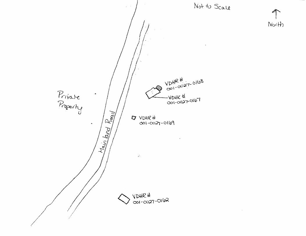

Virginia Department of Historic Resources
Reconnaissance Level Survey
DHR ID#: 001-0027-0163 Other DHR ID#:
Resource Information
National Register Eligibility Status
This Resource is associated with the Wallops Flight
Facility
Resource Name(s): U-55, Transmitter Building {Current}
Date of Construction: 1964
Local Historic District :
Location of Resource
County/Independent City:
Commonwealth of Virginia
Accomack
Magisterial District:
Town/Village/Hamlet: Wallops Island
Tax Parcel:
Zip Code: 23337
Address(s): Mainland Road
USGS Quadrangle Name: WALLOPS ISLAND
UTM Boundary Coordinates :
Northing EastingZone NAD
1983 18 455581 4191129
UTM Center coordinates :
NoUTM Data Restricted?.
Resource Description
Ownership Status: Public - Federal
Government Agency Owner: U.S. National Aeronautics & Space Administration
Acreage:
Surrounding area: Rural
Open to Public: No
January 2011: The Transmitter Building is located on Wallops Mainland at the northeast end of Mainland Road. The area is
relatively flat and open with grass fields and stands of trees. A security fence runs along the perimeter of the installation.
Causeway Road, southwest of the building, provides access to the guard station and bridge. A concrete walled platform with
an oil tank is on the northeast side of the building. There is an antenna array to the southeast. The High Frequency Antenna
Tower (U-55A) is at the west corner and another antenna tower, which does not have a designated facility number, is at the
north corner.
Site Description:
Secondary Resource Summary:
January 2011: U-55A High Frequency Antenna
Resource StatusResource TypesCount
Communications Facility Non-Contributing 1
Individual Resource Information
Communications FacilityResource Type. Primary Resource? Yes
Individual Resource Detail Information
Date of Construction: Accessed? 1964 {Owner} No Not accessible
1.0 Number of Stories:Architectural Style: No Discernable Style
Good
Interior Plan Type:
Form: Condition:
Threats to Resource: None Known
January 2011: The Transmitter Building is a simple one-story rectangular building constructed of precast concrete panels. It has a
Report generated 6/6/2011Page 1 of 3

Virginia Department of Historic Resources
Reconnaissance Level Survey
DHR ID#: 001-0027-0163 Other DHR ID#:
flat built-up roof and aluminum fascia. Metal tube railing runs along the perimeter of the roof; the railing was installed in 1967 (WFF
2011). At least two antennas are affixed to the roof. The main entrance is located on the east elevation and comprises a glass and
aluminum vestibule with glazed double doors leads to a second set of glazed double doors. The vestibule was installed in 1977,
replacing a flat-roofed canopy (WFF 2010, 2011). A band of aluminum frame fixed windows extend the length of the east elevation.
The original windows were re-glazed in 1977 (WFF 2011). The north elevation has no windows or doors. A circular metal vent is
located in the northwest corner. The west elevation has a lean-to addition with a standing seam metal shed roof. A set of hollow
steel double doors are located in the southwest corner. On the northwest corner a set of exterior metal stairs, which was installed in
2007, provides access to the roof and antenna tower U-55A. There are no openings on the south elevation
Primary Resource Exterior Component Description:
Material TreatmentMaterialComp Type/FormComponent
Roof Roof - Flat Asphalt
Foundation Foundation - Slab Concrete Foundation - Poured
Structural System Structural System - Masonry Concrete
Porch Porch - 1-story Aluminum Porch - Enclosed
Windows Windows - Fixed Aluminum Windows - 1-light
Historic Time Period(s):S- The New Dominion (1946- Present)
Historic Context(s): Military/Defense
Technology/Engineering
Significance Statement
January 2011: This building is representative of a Communications resource type built at a Technology/Engineering research facility
towards the beginning of the New Dominion period (1945–present). This is one of approximately 50 buildings and structures that were
erected within six years of the establishment of NASA and the incorporation of Wallops Station as one of its operational facilities in 1959.
Initially, Wallops Station’s new mission under NASA was to develop and test various components related to manned space flight. This
mission was short-lived, however, as Wallops became a test range and launch site for suborbital and orbital rockets and satellites
beginning in the early 1960s. The expansion of Wallops Station after becoming a NASA facility included acquisition of 216.6 acres on the
mainland in 1959 (Shortal 1978). NASA constructed this building in 1964. It retains its original use as a transmitter building.
U-55 has been evaluated both as a contributing resource in a historic district and as an individual resource. No historic district on
Wallops Mainland was identified because of a lack of significance.
The Transmitter Building is not individually eligible for listing on the NRHP because it lacks significance and integrity. The building is
presently less than 50 years old; therefore, it was evaluated under Criteria Consideration G in addition to Criteria A–D. The building is
recommended not eligible under Criterion A because it is not associated with an event or pattern of events of exceptional importance at
the local, state, or national level. It is not associated with the life of a person who made exceptionally important contributions in history;
therefore, it is recommended not eligible under Criterion B. U-55 is recommended not eligible under Criterion C because it does not
embody exceptional architectural merit for distinctive characteristics of a type, period, or method of construction; represent the work of a
master; or possess high artistic value. Likewise, it does not represent an exceptionally significant or distinguishable entity whose
components may lack individual distinction. It is recommended not eligible under Criterion D because it does not have the potential to
yield information exceptionally important in history or prehistory.
The overall integrity of the building has been compromised by several alterations. The building is in its historical location. A second
antenna tower has been erected at the north corner of the U-55 and a 1965 transmitting antenna (U-66) to the northwest has been
dismantled; however, all other aspects of the surrounding environment remain unchanged so the setting has not been adversely impacted.
The design and materials of the building have been compromised by alterations such as the installation of the aluminum entry vestibule,
re-glazing the windows, and the addition of a rear lean-to. These changes also negatively impact the integrity of feeling, but not, however
its workmanship and association
National Register Eligibility Information (Intensive Level Survey):
Report generated 6/6/2011Page 2 of 3

Virginia Department of Historic Resources
Reconnaissance Level Survey
DHR ID#: 001-0027-0163 Other DHR ID#:
NR Resource StatusNR Resource TypeNR Count
Building Non-contributing 1
1 Non-Contributing:
National Register Criteria:
Level of Significance:
Period of Significance:
Graphic Media Documentation
PhotographerPhoto DateNegative RepositoryDHR Negative # Photographic Media
Digital Images L. ThursbyJanuary 2011
Bibliographic Documentation
Reference #: 1
Bibliographic RecordType: Local Records
Author:
DHR CRM Report Number:
Notes:
Wallops Flight Facility Real Property Records
Reference #: 2
Bibliographic RecordType: Article
Author: Joseph Adams Shortal
DHR CRM Report Number:
Notes:
1978 A New Dimension Wallops Island Flight Test Range: The First Fifteen Years. Washington D.C.: NASA Scientific
and Technical Information Office.
Cultural Resource Management (CRM) Events
CRM Event # 1,
Cultural Resource Management Event: Survey:Phase I/Reconnaissance
Date of CRM Event: January 2011
CRM Person: TEC Inc
VDHR Project ID # Associated with Event: 2010-2274
CRM Event Notes or Comments:
Lori Thursby and Kimberly Martin
Bridge Information
Cemetery Information
Ownership Information
Unknown Unknown Name: .................................
NASA Wallops Flight FacilityCompany: ..........................
Wallops Flight FacilityAddress: .............................
Wallops IslandCity: ...................................
23337Zip: ....................................... VirginiaState: USACountry:
000-000-0000757-824-1000Phone/Extension: ..............
0000/ 0000
Relation to the Property: Owner of property
Report generated 6/6/2011Page 3 of 3

001-0027-0152I-004
Mai
nlan
d R
d.
Causeway Rd.
North
Sea
wall R
d.
North
Byp
ass
Rd.
001-0027-0182W-020
001-0027-0188W-065
001-0027-0160U-030
001-0027-0184W-040
001-0027-0167U-070
001-0027-0156U-025
001-0027-0192X-085
001-0027-0163U-055
001-0027-0201Z-040
001-0027-0198Y-055
001-0027-0193Y-010
001-0027-0170V-025
001-0027-0190X-005A
001-0027-0187W-057
001-0027-0153U-005
001-0027-0197Y-038
001-0027-0194Y-016
001-0027-0180W-015
001-0027-0162U-040
001-0027-0191X-075
001-0027-0159U-027
001-0027-0158U-026
001-0027-0168U-070A
001-0027-0185W-050
001-0027-0179W-010
001-0027-0155U-020B
001-0027-0161U-030A
001-0027-0183W-035
001-0027-0169U-080
001-0027-0165U-060
001-0027-0164U-055A
001-0027-0154U-020A
001-0027-0157U-025A
001-0027-0166U-064
001-0027-0189W-067
001-0027-0195Y-020
001-0027-0181W-016
001-0027-0186W-051
001-0027-0199Y-095
001-0027-0200Y-110
001-0027-0196Y-037
NASA Property
Surveyed Structures
Buildings
0 300Meters
0 1,500Feet


Virginia Department of Historic Resources
Reconnaissance Level Survey
DHR ID#: 001-0027-0164 Other DHR ID#:
Resource Information
National Register Eligibility Status
This Resource is associated with the Wallops Flight
Facility
Resource Name(s): U-55A, High Frequency Antenna Tower
{Current}
Date of Construction: 1965
Local Historic District :
Location of Resource
County/Independent City:
Commonwealth of Virginia
Accomack
Magisterial District:
Town/Village/Hamlet: Wallops Island
Tax Parcel:
Zip Code: 23337
Address(s): Mainland Road
USGS Quadrangle Name: WALLOPS ISLAND
UTM Boundary Coordinates :
Northing EastingZone NAD
1983 18 455569 4191129
UTM Center coordinates :
NoUTM Data Restricted?.
Resource Description
Ownership Status: Public - Federal
Government Agency Owner: U.S. National Aeronautics & Space Administration
Acreage:
Surrounding area: Rural
Open to Public: No
January 2011: The High Frequency Antenna Tower is located on Wallops Mainland at the northeast end of Mainland Road.
The area is relatively flat and open with grass fields and stands of trees. A security fence runs along the perimeter of the
installation. To the southwest of the tower is Causeway Road, which provides access to the guard station and bridge. U-55A
is adjacent to the west corner of U-55, its associated transmitter building. A concrete walled platform with an oil tank is on the
northeast side of the building and an antenna array is to the southeast.
Site Description:
Secondary Resource Summary:
January 2011: U-55 Transmitter Building
Resource StatusResource TypesCount
Communications Facility Non-Contributing 1
Individual Resource Information
Communications FacilityResource Type. Primary Resource? Yes
Individual Resource Detail Information
Date of Construction: Accessed? 1965 {Owner} No Not accessible
1.0 Number of Stories:Architectural Style: No Discernable Style
Good
Interior Plan Type:
Form: Condition:
Threats to Resource: None Known
January 2011: The High Frequency Antenna Tower is a metal framed structure with four steel posts bolted to concrete footings. It
Report generated 6/6/2011Page 1 of 3

Virginia Department of Historic Resources
Reconnaissance Level Survey
DHR ID#: 001-0027-0164 Other DHR ID#:
tapers at the third tier. Intersecting diagonal steel angles reinforce the metal corner posts. It has two metal grated platforms: one on
the top with metal tube handrails, and the other immediately below it, accessed on the north by a metal ladder through the floor of
the platform above. Metal stairs with a metal tube handrail extend from the roof of U-55 to the top platform. The antenna rests on
this platform and along with two pieces of control equipment. A raised metal track, carrying cables, extends from U-55. The antenna
itself has seven metal mesh dishes with metal cylinders extending from them; the three central units are smaller than the outer four.
The metal cylinders are encircled by metal wires or cables. A balancing or directional element extends to the rear.
Primary Resource Exterior Component Description:
Material TreatmentMaterialComp Type/FormComponent
Structural System Structural System - Frame Metal
Foundation Foundation - Piers Concrete Foundation - Poured
Historic Time Period(s):S- The New Dominion (1946- Present)
Historic Context(s): Military/Defense
Technology/Engineering
Significance Statement
January 2011: This antenna tower is representative of a Communications resource type built at a Technology/Engineering research facility
towards the beginning of the New Dominion period (1945–present). This is one of several dozens of buildings and structures erected
within six years of the establishment of NASA and the incorporation of Wallops Station as one of its operational facilities. The facilities
expansion included acquisition of 216.6 acres on the mainland in 1959 (Shortal 1978). Initially, Wallops Station’s new mission under
NASA was to develop and test various components related to manned space flight. This mission was short-lived, however, as Wallops
became NASA’s test range and launch site for suborbital and orbital rockets and satellites beginning in the early 1960s. NASA erected
this tower in 1965.
U-55A has been evaluated both as a contributing resource in a historic district and as an individual resource. No historic district on
Wallops Mainland was identified because of a lack of significance.
The High Frequency Antenna Tower is not individually eligible for listing on the NRHP because it lacks significance. The structure is
presently less than 50 years old; therefore, it was evaluated under Criteria Consideration G in addition to Criteria A–D. The tower is
recommended not eligible under Criterion A because it is not associated with an event or pattern of events of exceptional importance at
the local, state, or national level. It is not associated with the life of a person who made exceptionally important contributions in history;
therefore, it is recommended not eligible under Criterion B. U-55A retains historic integrity; nonetheless, it is recommended not eligible
under Criterion C because it does not embody exceptional engineering merit for distinctive characteristics of a type, period, or method of
construction; represent the work of a master; or possess high artistic value. Likewise, it does not represent an exceptionally significant or
distinguishable entity whose components may lack individual distinction. It is recommended not eligible under Criterion D because it
does not have the potential to yield information exceptionally important in history or prehistory.
National Register Eligibility Information (Intensive Level Survey):
NR Resource StatusNR Resource TypeNR Count
Building Non-contributing 1
1 Non-Contributing:
National Register Criteria:
Level of Significance:
Period of Significance:
Graphic Media Documentation
PhotographerPhoto DateNegative RepositoryDHR Negative # Photographic Media
Digital Images L. ThursbyJanuary 2011
Report generated 6/6/2011Page 2 of 3
Virginia Department of Historic Resources
Reconnaissance Level Survey
DHR ID#: 001-0027-0164 Other DHR ID#:
Bibliographic Documentation
Reference #: 1
Bibliographic RecordType: Local Records
Author:
DHR CRM Report Number:
Notes:
Wallops Flight Facility Real Property Records
Reference #: 2
Bibliographic RecordType: Article
Author: Joseph Adams Shortal
DHR CRM Report Number:
Notes:
1978 A New Dimension Wallops Island Flight Test Range: The First Fifteen Years. Washington D.C.: NASA Scientific
and Technical Information Office.
Cultural Resource Management (CRM) Events
CRM Event # 1,
Cultural Resource Management Event: Survey:Phase I/Reconnaissance
Date of CRM Event: January 2011
CRM Person: TEC Inc
VDHR Project ID # Associated with Event: 2010-2274
CRM Event Notes or Comments:
Lori Thursby and Kimberly Martin
Bridge Information
Cemetery Information
Ownership Information
Unknown Unknown Name: .................................
NASA Wallops Flight FacilityCompany: ..........................
Wallops Flight FacilityAddress: .............................
Wallops IslandCity: ...................................
23337Zip: ....................................... VirginiaState: USACountry:
000-000-0000757-824-1000Phone/Extension: ..............
0000/ 0000
Relation to the Property: Owner of property
Report generated 6/6/2011Page 3 of 3

001-0027-0152I-004
Mai
nlan
d R
d.
Causeway Rd.
North
Sea
wall R
d.
North
Byp
ass
Rd.
001-0027-0182W-020
001-0027-0188W-065
001-0027-0160U-030
001-0027-0184W-040
001-0027-0167U-070
001-0027-0156U-025
001-0027-0192X-085
001-0027-0163U-055
001-0027-0201Z-040
001-0027-0198Y-055
001-0027-0193Y-010
001-0027-0170V-025
001-0027-0190X-005A
001-0027-0187W-057
001-0027-0153U-005
001-0027-0197Y-038
001-0027-0194Y-016
001-0027-0180W-015
001-0027-0162U-040
001-0027-0191X-075
001-0027-0159U-027
001-0027-0158U-026
001-0027-0168U-070A
001-0027-0185W-050
001-0027-0179W-010
001-0027-0155U-020B
001-0027-0161U-030A
001-0027-0183W-035
001-0027-0169U-080
001-0027-0165U-060
001-0027-0164U-055A
001-0027-0154U-020A
001-0027-0157U-025A
001-0027-0166U-064
001-0027-0189W-067
001-0027-0195Y-020
001-0027-0181W-016
001-0027-0186W-051
001-0027-0199Y-095
001-0027-0200Y-110
001-0027-0196Y-037
NASA Property
Surveyed Structures
Buildings
0 300Meters
0 1,500Feet


Virginia Department of Historic Resources
Reconnaissance Level Survey
DHR ID#: 001-0027-0165 Other DHR ID#:
Resource Information
National Register Eligibility Status
This Resource is associated with the Wallops Flight
Facility
Resource Name(s): U-60, Collimation Beacon and Tower {Current}
Date of Construction: 1965
Local Historic District :
Location of Resource
County/Independent City:
Commonwealth of Virginia
Accomack
Magisterial District:
Town/Village/Hamlet: Wallops Island
Tax Parcel:
Zip Code: 23337
Address(s): Mainland Road
USGS Quadrangle Name: WALLOPS ISLAND
UTM Boundary Coordinates :
Northing EastingZone NAD
1983 18 455449 4190994
UTM Center coordinates :
NoUTM Data Restricted?.
Resource Description
Ownership Status: Public - Federal
Government Agency Owner: U.S. National Aeronautics & Space Administration
Acreage:
Surrounding area: Rural
Open to Public: No
January 2011: The Collimation Beacon and Tower are located on Wallops Mainland, north of Causeway Road on the west side
of Mainland Road. The area is relatively flat and open with grass fields and stands of trees. A security fence runs along the
perimeter of the installation. A transmitter building (U-60A) is at the tower’s base.
Site Description:
Secondary Resource Summary:
January 2011: none
Resource StatusResource TypesCount
Communications Facility Non-Contributing 2
Individual Resource Information
Communications FacilityResource Type. Primary Resource? Yes
Individual Resource Detail Information
Date of Construction: Accessed? 1965 {Owner}
0.0 Number of Stories:Architectural Style: No Discernable Style
Good
Interior Plan Type:
Form: Condition:
Threats to Resource: None Known
January 2011: The Collimation Beacon and Tower is very similar to an Omni Transmitter Antenna, which was used by the Navy for
short range communications (Best et al. 1997). It consists of three metal poles, arranged in a triangular configuration, connected by
cross bars. The metal poles are bolted to square steel plates, which are welded to a triangular steel base. A conducting wire,
attached to the associated transmitter building (U-60A), runs vertically through the middle. Diagonal wires extend from three
Report generated 6/6/2011Page 1 of 3
Virginia Department of Historic Resources
Reconnaissance Level Survey
DHR ID#: 001-0027-0165 Other DHR ID#:
sections of the structure to the ground, creating a cross-shaped configuration. A small metal ladder extends to a small metal grated
platform at the top of the tower.
Primary Resource Exterior Component Description:
Material TreatmentMaterialComp Type/FormComponent
Foundation Foundation - Piers Concrete Foundation - Piers
Structural System Structural System - Frame Metal
Historic Time Period(s):S- The New Dominion (1946- Present)
Historic Context(s): Military/Defense
Technology/Engineering
Significance Statement
January 2011: This tower is representative of a Communications resource type built at a Technology/Engineering research facility towards
the beginning of the New Dominion period (1945–present). This is one of several dozens of buildings and structures erected within six
years of the establishment of NASA and the incorporation of Wallops Station as one of its operational facilities. The facilities expansion
included acquisition of 216.6 acres on the mainland in 1959 (Shortal 1978). Initially, Wallops Station’s new mission under NASA was to
develop and test various components related to manned space flight. This mission was short-lived, however, as Wallops became
NASA’s test range and launch site for suborbital and orbital rockets and satellites beginning in the early 1960s. This tower, erected in
1964, was part of the AN/FPQ-6 radar system, which at the time was a modern long-range, high-precision tracking radar (WFF 2011).
U-60 has been evaluated both as a contributing resource in a historic district and as an individual resource. No historic district on
Wallops Mainland was identified because of a lack of significance.
The Collimation Beacon and Tower is not individually eligible for listing on the NRHP because it lacks significance. The structure is
presently less than 50 years old; therefore, it was evaluated under Criteria Consideration G in addition to Criteria A–D. The tower is
recommended not eligible under Criterion A because it is not associated with an event or pattern of events of exceptional importance at
the local, state, or national level. It is not associated with the life of a person who made exceptionally important contributions in history;
therefore, it is recommended not eligible under Criterion B. U-55A retains historic integrity; nonetheless, it is recommended not eligible
under Criterion C because it does not embody exceptional engineering merit for distinctive characteristics of a type, period, or method of
construction; represent the work of a master; or possess high artistic value. Likewise, it does not represent an exceptionally significant or
distinguishable entity whose components may lack individual distinction. It is recommended not eligible under Criterion D because it
does not have the potential to yield information exceptionally important in history or prehistory.
National Register Eligibility Information (Intensive Level Survey):
NR Resource StatusNR Resource TypeNR Count
Building Non-contributing 1
1 Non-Contributing:
National Register Criteria:
Level of Significance:
Period of Significance:
Graphic Media Documentation
PhotographerPhoto DateNegative RepositoryDHR Negative # Photographic Media
Digital Images L. ThursbyJanuary 2011
Bibliographic Documentation
Reference #: 1
Report generated 6/6/2011Page 2 of 3

Virginia Department of Historic Resources
Reconnaissance Level Survey
DHR ID#: 001-0027-0165 Other DHR ID#:
Bibliographic RecordType: Local Records
Author:
DHR CRM Report Number:
Notes:
Wallops Flight Facility Real Property Records
Reference #: 2
Bibliographic RecordType: Report
Author: Brooke Best
DHR CRM Report Number:
Notes:
Best, Brooke V, Katherine Grandine and Stacie Y Webbs.
1997. Navy Cold War Communications Context: 1946-1989. Prepared for Atlantic Division, Naval
Facilities Engineering Command, 1510 Gilbert Street, Norfolk, VA, 23511-2699. 12 December
Reference #: 3
Bibliographic RecordType: Article
Author: Joseph Adams Shortal
DHR CRM Report Number:
Notes:
1978 A New Dimension Wallops Island Flight Test Range: The First Fifteen Years. Washington D.C.: NASA Scientific
and Technical Information Office.
Cultural Resource Management (CRM) Events
CRM Event # 1,
Cultural Resource Management Event: Survey:Phase I/Reconnaissance
Date of CRM Event: January 2011
CRM Person: TEC Inc
VDHR Project ID # Associated with Event: 2010-2274
CRM Event Notes or Comments:
Lori Thursby and Kimberly Martin
Bridge Information
Cemetery Information
Ownership Information
Unknown Unknown Name: .................................
NASA Wallops Flight FacilityCompany: ..........................
Wallops Flight FacilityAddress: .............................
Wallops IslandCity: ...................................
23337Zip: ....................................... VirginiaState: USACountry:
000-000-0000757-824-1000Phone/Extension: ..............
0000/ 0000
Relation to the Property: Owner of property
Report generated 6/6/2011Page 3 of 3

001-0027-0152I-004
Mai
nlan
d R
d.
Causeway Rd.
North
Sea
wall R
d.
North
Byp
ass
Rd.
001-0027-0182W-020
001-0027-0188W-065
001-0027-0160U-030
001-0027-0184W-040
001-0027-0167U-070
001-0027-0156U-025
001-0027-0192X-085
001-0027-0163U-055
001-0027-0201Z-040
001-0027-0198Y-055
001-0027-0193Y-010
001-0027-0170V-025
001-0027-0190X-005A
001-0027-0187W-057
001-0027-0153U-005
001-0027-0197Y-038
001-0027-0194Y-016
001-0027-0180W-015
001-0027-0162U-040
001-0027-0191X-075
001-0027-0159U-027
001-0027-0158U-026
001-0027-0168U-070A
001-0027-0185W-050
001-0027-0179W-010
001-0027-0155U-020B
001-0027-0161U-030A
001-0027-0183W-035
001-0027-0169U-080
001-0027-0165U-060
001-0027-0164U-055A
001-0027-0154U-020A
001-0027-0157U-025A
001-0027-0166U-064
001-0027-0189W-067
001-0027-0195Y-020
001-0027-0181W-016
001-0027-0186W-051
001-0027-0199Y-095
001-0027-0200Y-110
001-0027-0196Y-037
NASA Property
Surveyed Structures
Buildings
0 300Meters
0 1,500Feet


Virginia Department of Historic Resources
Reconnaissance Level Survey
DHR ID#: 001-0027-0166 Other DHR ID#:
Resource Information
National Register Eligibility Status
This Resource is associated with the Wallops Flight
Facility
Resource Name(s): U-64, Communications Antenna Support
TowerTower {Current}
Date of Construction: 1965
Local Historic District :
Location of Resource
County/Independent City:
Commonwealth of Virginia
Accomack
Magisterial District:
Town/Village/Hamlet: Wallops Island
Tax Parcel:
Zip Code: 23337
Address(s): Mainland Road
USGS Quadrangle Name: WALLOPS ISLAND
UTM Boundary Coordinates :
Northing EastingZone NAD
1983 18 455633 4191150
UTM Center coordinates :
NoUTM Data Restricted?.
Resource Description
Ownership Status: Public - Federal
Government Agency Owner: U.S. National Aeronautics & Space Administration
Acreage:
Surrounding area: Rural
Open to Public: No
January 2011: The Communications Antenna is located on Wallops Mainland at the northeast end of Mainland Road. The area
is relatively flat and open with grass fields and stands of trees. A security fence runs along the perimeter of the installation. To
the southwest of the tower is Causeway Road, which provides access to the guard station and bridge. There is a small
temporary shed at the south corner.
Site Description:
Secondary Resource Summary:
January 2011: none
Resource StatusResource TypesCount
Communications Facility Non-Contributing 1
Individual Resource Information
Communications FacilityResource Type. Primary Resource? Yes
Individual Resource Detail Information
Date of Construction: Accessed? 1965 {Owner}
0.0 Number of Stories:Architectural Style: No Discernable Style
Demolished
Interior Plan Type:
Form: Condition:
Threats to Resource: None Known
January 2011: The Communications Antenna is a tapered triangular metal tower with a vertical cylindrical antenna. The antenna has
a disc-shaped base. The 90-ft-tall tower has three steel posts connected with steel cross bars. The posts are bolted to steel plates,
Report generated 6/6/2011Page 1 of 3

Virginia Department of Historic Resources
Reconnaissance Level Survey
DHR ID#: 001-0027-0166 Other DHR ID#:
which have been bolted to concrete footings. Vertical wires run through the center and connect to the antenna.
Primary Resource Exterior Component Description:
Material TreatmentMaterialComp Type/FormComponent
Foundation Foundation - Piers Concrete Foundation - Piers
Structural System Structural System - Frame Steel
Historic Time Period(s):S- The New Dominion (1946- Present)
Historic Context(s): Military/Defense
Technology/Engineering
Significance Statement
January 2011: This antenna tower is representative of a Communications resource type built at a Technology/Engineering research facility
towards the beginning of the New Dominion period (1945–present). This is one of several dozens of buildings and structures erected
within six years of the establishment of NASA and the incorporation of Wallops Station as one of its operational facilities. The facilities
expansion included acquisition of 216.6 acres on the mainland in 1959 (Shortal 1978). Initially, Wallops Station’s new mission under
NASA was to develop and test various components related to manned space flight. This mission was short-lived, however, as Wallops
became NASA’s test range and launch site for suborbital and orbital rockets and satellites beginning in the early 1960s. NASA erected
this tower in 1965.
U-64 has been evaluated both as a contributing resource in a historic district and as an individual resource. No historic district on
Wallops Mainland was identified because of a lack of significance.
The Communications Antenna Support Tower is not individually eligible for listing on the NRHP because it lacks significance. The
structure is presently less than 50 years old; therefore, it was evaluated under Criteria Consideration G in addition to Criteria A–D. The
tower is recommended not eligible under Criterion A because it is not associated with an event or pattern of events of exceptional
importance at the local, state, or national level. It is not associated with the life of a person who made exceptionally important
contributions in history; therefore, it is recommended not eligible under Criterion B. U-55A retains historic integrity; nonetheless, it is
recommended not eligible under Criterion C because it does not embody exceptional engineering merit for distinctive characteristics of a
type, period, or method of construction; represent the work of a master; or possess high artistic value. Likewise, it does not represent an
exceptionally significant or distinguishable entity whose components may lack individual distinction. It is recommended not eligible
under Criterion D because it does not have the potential to yield information exceptionally important in history or prehistory.
National Register Eligibility Information (Intensive Level Survey):
NR Resource StatusNR Resource TypeNR Count
Building Non-contributing 1
1 Non-Contributing:
National Register Criteria:
Level of Significance:
Period of Significance:
Graphic Media Documentation
PhotographerPhoto DateNegative RepositoryDHR Negative # Photographic Media
Digital Images L. ThursbyJanuary 2011
Bibliographic Documentation
Reference #: 1
Bibliographic RecordType: Local Records
Report generated 6/6/2011Page 2 of 3

Virginia Department of Historic Resources
Reconnaissance Level Survey
DHR ID#: 001-0027-0166 Other DHR ID#:
Author:
DHR CRM Report Number:
Notes:
Wallops Flight Facility Real Property Records
Reference #: 2
Bibliographic RecordType: Article
Author: Joseph Adams Shortal
DHR CRM Report Number:
Notes:
1978 A New Dimension Wallops Island Flight Test Range: The First Fifteen Years. Washington D.C.: NASA Scientific
and Technical Information Office.
Cultural Resource Management (CRM) Events
CRM Event # 1,
Cultural Resource Management Event: Survey:Phase I/Reconnaissance
Date of CRM Event: January 2011
CRM Person: TEC Inc
VDHR Project ID # Associated with Event: 2010-2274
CRM Event Notes or Comments:
Lori Thursby and Kimberly Martin
Bridge Information
Cemetery Information
Ownership Information
Unknown Unknown Name: .................................
NASA Wallops Flight FacilityCompany: ..........................
Wallops Flight FacilityAddress: .............................
Wallops IslandCity: ...................................
23337Zip: ....................................... VirginiaState: USACountry:
000-000-0000757-824-1000Phone/Extension: ..............
0000/ 0000
Relation to the Property: Owner of property
Report generated 6/6/2011Page 3 of 3

001-0027-0152I-004
Mai
nlan
d R
d.
Causeway Rd.
North
Sea
wall R
d.
North
Byp
ass
Rd.
001-0027-0182W-020
001-0027-0188W-065
001-0027-0160U-030
001-0027-0184W-040
001-0027-0167U-070
001-0027-0156U-025
001-0027-0192X-085
001-0027-0163U-055
001-0027-0201Z-040
001-0027-0198Y-055
001-0027-0193Y-010
001-0027-0170V-025
001-0027-0190X-005A
001-0027-0187W-057
001-0027-0153U-005
001-0027-0197Y-038
001-0027-0194Y-016
001-0027-0180W-015
001-0027-0162U-040
001-0027-0191X-075
001-0027-0159U-027
001-0027-0158U-026
001-0027-0168U-070A
001-0027-0185W-050
001-0027-0179W-010
001-0027-0155U-020B
001-0027-0161U-030A
001-0027-0183W-035
001-0027-0169U-080
001-0027-0165U-060
001-0027-0164U-055A
001-0027-0154U-020A
001-0027-0157U-025A
001-0027-0166U-064
001-0027-0189W-067
001-0027-0195Y-020
001-0027-0181W-016
001-0027-0186W-051
001-0027-0199Y-095
001-0027-0200Y-110
001-0027-0196Y-037
NASA Property
Surveyed Structures
Buildings
0 300Meters
0 1,500Feet

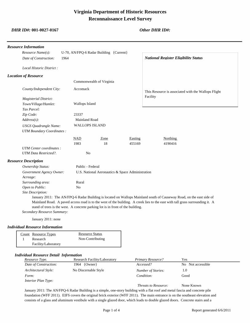
Virginia Department of Historic Resources
Reconnaissance Level Survey
DHR ID#: 001-0027-0167 Other DHR ID#:
Resource Information
National Register Eligibility Status
This Resource is associated with the Wallops Flight
Facility
Resource Name(s): U-70, AN/FPQ-6 Radar Building {Current}
Date of Construction: 1964
Local Historic District :
Location of Resource
County/Independent City:
Commonwealth of Virginia
Accomack
Magisterial District:
Town/Village/Hamlet: Wallops Island
Tax Parcel:
Zip Code: 23337
Address(s): Mainland Road
USGS Quadrangle Name: WALLOPS ISLAND
UTM Boundary Coordinates :
Northing EastingZone NAD
1983 18 455169 4190416
UTM Center coordinates :
NoUTM Data Restricted?.
Resource Description
Ownership Status: Public - Federal
Government Agency Owner: U.S. National Aeronautics & Space Administration
Acreage:
Surrounding area: Rural
Open to Public: No
January 2011: The AN/FPQ-6 Radar Building is located on Wallops Mainland south of Causeway Road, on the east side of
Mainland Road. A paved access road is to the west of the building. A creek lies to the east with tall grass surrounding it. A
stand of trees is the west. A concrete parking lot is in front of the building.
Site Description:
Secondary Resource Summary:
January 2011: none
Resource StatusResource TypesCount
Research
Facility/Laboratory
Non-Contributing 1
Individual Resource Information
Research Facility/LaboratoryResource Type. Primary Resource? Yes
Individual Resource Detail Information
Date of Construction: Accessed? 1964 {Owner} No Not accessible
1.0 Number of Stories:Architectural Style: No Discernable Style
Good
Interior Plan Type:
Form: Condition:
Threats to Resource: None Known
January 2011: The AN/FPQ-6 Radar Building is a simple, one-story building with a flat roof and metal fascia and concrete pile
foundation (WFF 2011). EIFS covers the original brick exterior (WFF 2011). The main entrance is on the southeast elevation and
consists of a glass and aluminum vestibule with a single glazed door, which leads to double glazed doors. Concrete stairs and a
Report generated 6/6/2011Page 1 of 4
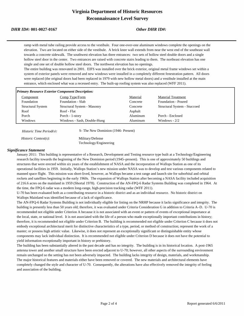
Virginia Department of Historic Resources
Reconnaissance Level Survey
DHR ID#: 001-0027-0167 Other DHR ID#:
ramp with metal tube railing provide access to the vestibule. Four one-over-one aluminum windows complete the openings on the
elevation. Two are located on either side of the vestibule. A brick knee wall extends from near the west end of the southeast wall
towards a concrete sidewalk. The southwest elevation has three entrances: two sets of hollow steel double doors and a single
hollow steel door in the center. Two entrances are raised with concrete stairs leading to them. The northeast elevation has one
single and one set of double hollow steel doors. The northwest elevation has no openings.
The entire building was renovated in 2001. EIFS was installed over the brick exterior, original metal frame windows set within a
system of exterior panels were removed and new windows were installed in a completely different fenestration pattern. All doors
were replaced (the original doors had been replaced in 1979 with new hollow metal doors) and a vestibule installed at the main
entrance, which enclosed what was a recessed entry. The built-up roofing system was also replaced (WFF 2011).
Primary Resource Exterior Component Description:
Material TreatmentMaterialComp Type/FormComponent
Foundation Foundation - Slab Concrete Foundation - Poured
Structural System Structural System - Masonry Concrete Structural System - Stuccoed
Roof Roof - Flat Asphalt
Porch Porch - 1-story Aluminum Porch - Enclosed
Windows Windows - Sash, Double-Hung Aluminum Windows - 2/2
Historic Time Period(s):S- The New Dominion (1946- Present)
Historic Context(s): Military/Defense
Technology/Engineering
Significance Statement
January 2011: This building is representative of a Research, Development and Testing resource type built at a Technology/Engineering
research facility towards the beginning of the New Dominion period (1945–present). This is one of approximately 50 buildings and
structures that were erected within six years of the establishment of NASA and the incorporation of Wallops Station as one of its
operational facilities in 1959. Initially, Wallops Station’s new mission under NASA was to develop and test various components related to
manned space flight. This mission was short-lived, however, as Wallops became a test range and launch site for suborbital and orbital
rockets and satellites beginning in the early 1960s. The expansion of Wallops Station after becoming a NASA facility included acquisition
of 216.6 acres on the mainland in 1959 (Shortal 1978). Construction of the AN-FPQ-6 Radar Systems Building was completed in 1964. At
the time, the FPQ-6 radar was a modern long-range, high-precision tracking radar (WFF 2011).
U-70 has been evaluated both as a contributing resource in a historic district and as an individual resource. No historic district on
Wallops Mainland was identified because of a lack of significance.
The AN-FPQ-6 Radar Systems Building is not individually eligible for listing on the NRHP because it lacks significance and integrity. The
building is presently less than 50 years old; therefore, it was evaluated under Criteria Consideration G in addition to Criteria A–D. U-70 is
recommended not eligible under Criterion A because it is not associated with an event or pattern of events of exceptional importance at
the local, state, or national level. It is not associated with the life of a person who made exceptionally important contributions in history;
therefore, it is recommended not eligible under Criterion B. The building is recommended not eligible under Criterion C because it does not
embody exceptional architectural merit for distinctive characteristics of a type, period, or method of construction; represent the work of a
master; or possess high artistic value. Likewise, it does not represent an exceptionally significant or distinguishable entity whose
components may lack individual distinction. It is recommended not eligible under Criterion D because it does not have the potential to
yield information exceptionally important in history or prehistory.
The building has been substantially altered in the past decade and has no integrity. The building is in its historical location. A post-1965
antenna tower and another small structure have been erected adjacent to U-70; however, all other aspects of the surrounding environment
remain unchanged so the setting has not been adversely impacted. The building lacks integrity of design, materials, and workmanship.
The major historical features and materials either have been removed or covered. The new materials and architectural elements have
completely changed the style and character of U-70. Consequently, the alterations have also effectively removed the integrity of feeling
and association of the building.
Report generated 6/6/2011Page 2 of 4

Virginia Department of Historic Resources
Reconnaissance Level Survey
DHR ID#: 001-0027-0167 Other DHR ID#:
National Register Eligibility Information (Intensive Level Survey):
NR Resource StatusNR Resource TypeNR Count
Building Non-contributing 1
1 Non-Contributing:
National Register Criteria:
Level of Significance:
Period of Significance:
Graphic Media Documentation
PhotographerPhoto DateNegative RepositoryDHR Negative # Photographic Media
Digital Images L.ThursbyJanuary 2011
Bibliographic Documentation
Reference #: 1
Bibliographic RecordType: Local Records
Author:
DHR CRM Report Number:
Notes:
Wallops Flight Facility Real Property Records
Reference #: 2
Bibliographic RecordType: Article
Author: Joseph Adams Shortal
DHR CRM Report Number:
Notes:
1978 A New Dimension Wallops Island Flight Test Range: The First Fifteen Years. Washington D.C.: NASA Scientific
and Technical Information Office.
Cultural Resource Management (CRM) Events
CRM Event # 1,
Cultural Resource Management Event: Survey:Phase I/Reconnaissance
Date of CRM Event: January 2011
CRM Person: TEC Inc
VDHR Project ID # Associated with Event: 2010-2274
CRM Event Notes or Comments:
Lori Thursby and Kimberly Martin
Bridge Information
Cemetery Information
Ownership Information
Unknown Unknown Name: .................................
NASA Wallops Flight FacilityCompany: ..........................
Wallops Flight FacilityAddress: .............................
Wallops IslandCity: ...................................
23337Zip: ....................................... VirginiaState: USACountry:
000-000-0000757-824-1000Phone/Extension: ..............
0000/ 0000
Report generated 6/6/2011Page 3 of 4

Virginia Department of Historic Resources
Reconnaissance Level Survey
DHR ID#: 001-0027-0167 Other DHR ID#:
Relation to the Property: Owner of property
Report generated 6/6/2011Page 4 of 4

001-0027-0152I-004
Mai
nlan
d R
d.
Causeway Rd.
North
Sea
wall R
d.
North
Byp
ass
Rd.
001-0027-0182W-020
001-0027-0188W-065
001-0027-0160U-030
001-0027-0184W-040
001-0027-0167U-070
001-0027-0156U-025
001-0027-0192X-085
001-0027-0163U-055
001-0027-0201Z-040
001-0027-0198Y-055
001-0027-0193Y-010
001-0027-0170V-025
001-0027-0190X-005A
001-0027-0187W-057
001-0027-0153U-005
001-0027-0197Y-038
001-0027-0194Y-016
001-0027-0180W-015
001-0027-0162U-040
001-0027-0191X-075
001-0027-0159U-027
001-0027-0158U-026
001-0027-0168U-070A
001-0027-0185W-050
001-0027-0179W-010
001-0027-0155U-020B
001-0027-0161U-030A
001-0027-0183W-035
001-0027-0169U-080
001-0027-0165U-060
001-0027-0164U-055A
001-0027-0154U-020A
001-0027-0157U-025A
001-0027-0166U-064
001-0027-0189W-067
001-0027-0195Y-020
001-0027-0181W-016
001-0027-0186W-051
001-0027-0199Y-095
001-0027-0200Y-110
001-0027-0196Y-037
NASA Property
Surveyed Structures
Buildings
0 300Meters
0 1,500Feet

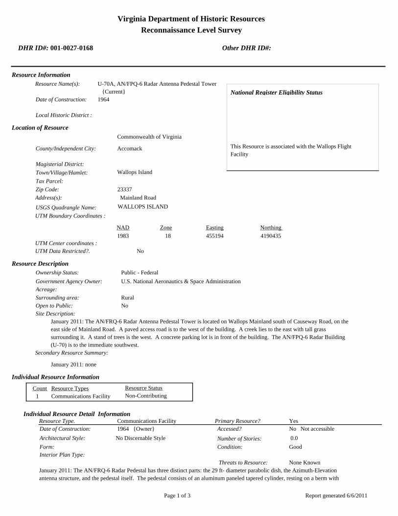
Virginia Department of Historic Resources
Reconnaissance Level Survey
DHR ID#: 001-0027-0168 Other DHR ID#:
Resource Information
National Register Eligibility Status
This Resource is associated with the Wallops Flight
Facility
Resource Name(s): U-70A, AN/FPQ-6 Radar Antenna Pedestal Tower
{Current}
Date of Construction: 1964
Local Historic District :
Location of Resource
County/Independent City:
Commonwealth of Virginia
Accomack
Magisterial District:
Town/Village/Hamlet: Wallops Island
Tax Parcel:
Zip Code: 23337
Address(s): Mainland Road
USGS Quadrangle Name: WALLOPS ISLAND
UTM Boundary Coordinates :
Northing EastingZone NAD
1983 18 455194 4190435
UTM Center coordinates :
NoUTM Data Restricted?.
Resource Description
Ownership Status: Public - Federal
Government Agency Owner: U.S. National Aeronautics & Space Administration
Acreage:
Surrounding area: Rural
Open to Public: No
January 2011: The AN/FRQ-6 Radar Antenna Pedestal Tower is located on Wallops Mainland south of Causeway Road, on the
east side of Mainland Road. A paved access road is to the west of the building. A creek lies to the east with tall grass
surrounding it. A stand of trees is the west. A concrete parking lot is in front of the building. The AN/FPQ-6 Radar Building
(U-70) is to the immediate southwest.
Site Description:
Secondary Resource Summary:
January 2011: none
Resource StatusResource TypesCount
Communications Facility Non-Contributing 1
Individual Resource Information
Communications FacilityResource Type. Primary Resource? Yes
Individual Resource Detail Information
Date of Construction: Accessed? 1964 {Owner} No Not accessible
0.0 Number of Stories:Architectural Style: No Discernable Style
Good
Interior Plan Type:
Form: Condition:
Threats to Resource: None Known
January 2011: The AN/FRQ-6 Radar Pedestal has three distinct parts: the 29 ft- diameter parabolic dish, the Azimuth-Elevation
antenna structure, and the pedestal itself. The pedestal consists of an aluminum paneled tapered cylinder, resting on a berm with
Report generated 6/6/2011Page 1 of 3
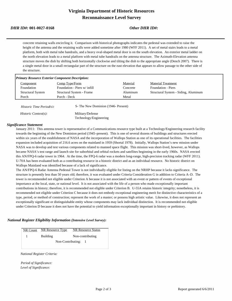
Virginia Department of Historic Resources
Reconnaissance Level Survey
DHR ID#: 001-0027-0168 Other DHR ID#:
concrete retaining walls encircling it. Comparison with historical photographs indicates the pedestal was extended to raise the
height of the antenna and the retaining walls were added sometime after 1980 (WFF 2011). A set of metal stairs leads to a metal
platform, both with metal tube handrails, and a heavy oval-shaped metal door is on the south elevation. An exterior metal ladder on
the north elevation leads to a metal platform with metal tube handrails on the antenna structure. The Azimuth-Elevation antenna
structure moves the dish by shifting both horizontally clockwise and tilting the dish to the appropriate angle (Dench 2007). There is
a single metal door in a small rectangular part of the structure on the east elevation that appears to allow passage to the other side of
the structure.
Primary Resource Exterior Component Description:
Material TreatmentMaterialComp Type/FormComponent
Foundation Foundation - Piers w/ infill Concrete Foundation - Piers
Structural System Structural System - Frame Aluminum Structural System - Siding, Aluminum
Porch Porch - Deck Metal
Historic Time Period(s):S- The New Dominion (1946- Present)
Historic Context(s): Military/Defense
Technology/Engineering
Significance Statement
January 2011: This antenna tower is representative of a Communications resource type built at a Technology/Engineering research facility
towards the beginning of the New Dominion period (1945–present). This is one of several dozens of buildings and structures erected
within six years of the establishment of NASA and the incorporation of Wallops Station as one of its operational facilities. The facilities
expansion included acquisition of 216.6 acres on the mainland in 1959 (Shortal 1978). Initially, Wallops Station’s new mission under
NASA was to develop and test various components related to manned space flight. This mission was short-lived, however, as Wallops
became NASA’s test range and launch site for suborbital and orbital rockets and satellites beginning in the early 1960s. NASA erected
this AN/FPQ-6 radar tower in 1964. At the time, the FPQ-6 radar was a modern long-range, high-precision tracking radar (WFF 2011).
U-70A has been evaluated both as a contributing resource in a historic district and as an individual resource. No historic district on
Wallops Mainland was identified because of a lack of significance.
The AN/FPQ-6 Radar Antenna Pedestal Tower is not individually eligible for listing on the NRHP because it lacks significance. The
structure is presently less than 50 years old; therefore, it was evaluated under Criteria Consideration G in addition to Criteria A–D. The
tower is recommended not eligible under Criterion A because it is not associated with an event or pattern of events of exceptional
importance at the local, state, or national level. It is not associated with the life of a person who made exceptionally important
contributions in history; therefore, it is recommended not eligible under Criterion B. U-55A retains historic integrity; nonetheless, it is
recommended not eligible under Criterion C because it does not embody exceptional engineering merit for distinctive characteristics of a
type, period, or method of construction; represent the work of a master; or possess high artistic value. Likewise, it does not represent an
exceptionally significant or distinguishable entity whose components may lack individual distinction. It is recommended not eligible
under Criterion D because it does not have the potential to yield information exceptionally important in history or prehistory.
National Register Eligibility Information (Intensive Level Survey):
NR Resource StatusNR Resource TypeNR Count
Building Non-contributing 1
1 Non-Contributing:
National Register Criteria:
Level of Significance:
Period of Significance:
Report generated 6/6/2011Page 2 of 3

Virginia Department of Historic Resources
Reconnaissance Level Survey
DHR ID#: 001-0027-0168 Other DHR ID#:
Graphic Media Documentation
PhotographerPhoto DateNegative RepositoryDHR Negative # Photographic Media
Digital Images L. ThursbyJanuary 2011
Bibliographic Documentation
Reference #: 1
Bibliographic RecordType: Local Records
Author:
DHR CRM Report Number:
Notes:
Wallops Flight Facility Real Property Records
Reference #: 2
Bibliographic RecordType: Article
Author: Joseph Adams Shortal
DHR CRM Report Number:
Notes:
1978 A New Dimension Wallops Island Flight Test Range: The First Fifteen Years. Washington D.C.: NASA Scientific
and Technical Information Office.
Cultural Resource Management (CRM) Events
CRM Event # 1,
Cultural Resource Management Event: Survey:Phase I/Reconnaissance
Date of CRM Event: January 2011
CRM Person: TEC Inc
VDHR Project ID # Associated with Event: 2010-2274
CRM Event Notes or Comments:
Lori Thursby and Kimberly Martin
Bridge Information
Cemetery Information
Ownership Information
Unknown Unknown Name: .................................
NASA Flight FacilityCompany: ..........................
Wallops Flight FacilityAddress: .............................
Wallops IslandCity: ...................................
23337Zip: ....................................... VirginiaState: USACountry:
000-000-0000757-824-1000Phone/Extension: ..............
0000/ 0000
Relation to the Property: Owner of property
Report generated 6/6/2011Page 3 of 3

001-0027-0152I-004
Mai
nlan
d R
d.
Causeway Rd.
North
Sea
wall R
d.
North
Byp
ass
Rd.
001-0027-0182W-020
001-0027-0188W-065
001-0027-0160U-030
001-0027-0184W-040
001-0027-0167U-070
001-0027-0156U-025
001-0027-0192X-085
001-0027-0163U-055
001-0027-0201Z-040
001-0027-0198Y-055
001-0027-0193Y-010
001-0027-0170V-025
001-0027-0190X-005A
001-0027-0187W-057
001-0027-0153U-005
001-0027-0197Y-038
001-0027-0194Y-016
001-0027-0180W-015
001-0027-0162U-040
001-0027-0191X-075
001-0027-0159U-027
001-0027-0158U-026
001-0027-0168U-070A
001-0027-0185W-050
001-0027-0179W-010
001-0027-0155U-020B
001-0027-0161U-030A
001-0027-0183W-035
001-0027-0169U-080
001-0027-0165U-060
001-0027-0164U-055A
001-0027-0154U-020A
001-0027-0157U-025A
001-0027-0166U-064
001-0027-0189W-067
001-0027-0195Y-020
001-0027-0181W-016
001-0027-0186W-051
001-0027-0199Y-095
001-0027-0200Y-110
001-0027-0196Y-037
NASA Property
Surveyed Structures
Buildings
0 300Meters
0 1,500Feet

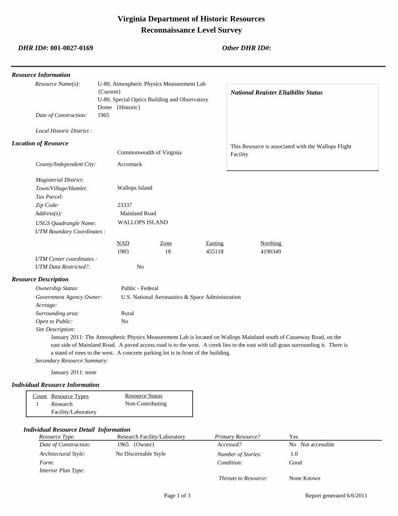
Virginia Department of Historic Resources
Reconnaissance Level Survey
DHR ID#: 001-0027-0169 Other DHR ID#:
Resource Information
National Register Eligibility Status
This Resource is associated with the Wallops Flight
Facility
Resource Name(s): U-80, Atmospheric Physics Measurement Lab
{Current}
U-80, Special Optics Building and Observatory
Dome {Historic}
Date of Construction: 1965
Local Historic District :
Location of Resource
County/Independent City:
Commonwealth of Virginia
Accomack
Magisterial District:
Town/Village/Hamlet: Wallops Island
Tax Parcel:
Zip Code: 23337
Address(s): Mainland Road
USGS Quadrangle Name: WALLOPS ISLAND
UTM Boundary Coordinates :
Northing EastingZone NAD
1983 18 455118 4190349
UTM Center coordinates :
NoUTM Data Restricted?.
Resource Description
Ownership Status: Public - Federal
Government Agency Owner: U.S. National Aeronautics & Space Administration
Acreage:
Surrounding area: Rural
Open to Public: No
January 2011: The Atmospheric Physics Measurement Lab is located on Wallops Mainland south of Causeway Road, on the
east side of Mainland Road. A paved access road is to the west. A creek lies to the east with tall grass surrounding it. There is
a stand of trees to the west. A concrete parking lot is in front of the building.
Site Description:
Secondary Resource Summary:
January 2011: none
Resource StatusResource TypesCount
Research
Facility/Laboratory
Non-Contributing 1
Individual Resource Information
Research Facility/LaboratoryResource Type. Primary Resource? Yes
Individual Resource Detail Information
Date of Construction: Accessed? 1965 {Owner} No Not accessible
1.0 Number of Stories:Architectural Style: No Discernable Style
Good
Interior Plan Type:
Form: Condition:
Threats to Resource: None Known
Report generated 6/6/2011Page 1 of 3

Virginia Department of Historic Resources
Reconnaissance Level Survey
DHR ID#: 001-0027-0169 Other DHR ID#:
January 2011: The Atmospheric Physics Measurement Lab is composed of several parts: the original building, the observatory
shelter, and an addition. The original building, constructed in 1965, and the addition, constructed in 1967 (WFF 2011), are simple
one-story concrete block buildings with flat roofs and metal fascia. They rest on a concrete slab and their exterior finish is stucco.
Both have one entrance through a hollow steel door; the original building’s entrance is on the west elevation and the addition’s is
on the east. The addition originally had an overhead door on the east elevation (WFF 2010). Two one-over-one aluminum frame
windows with precast concrete sills are located on the south elevation of the original building and the west elevation of the
addition. The windows were originally two-over-two, double-hung-sash units (WFF 2010). The addition has a satellite or additional
observatory on its roof, which is surrounding by metal tube railing. A metal staircase on the south elevation provides access to the
roof. The observatory shelter was erected in 1966 on a reinforced concrete continuous footing (WFF 2010). The shelter comprises a
hemispherical aluminum dome 24 ft in diameter on an aluminum base cylinder. The exterior finish of the entire structure is a natural
polished aluminum (WFF 2011). The dome opens to the east sky by moving on a track mounted on the top of the dome. The
observatory is connected to the original building and the addition by two concrete block hyphens. U-80 has been mothballed since
1999 (WFF 2011).
Primary Resource Exterior Component Description:
Material TreatmentMaterialComp Type/FormComponent
Foundation Foundation - Slab Concrete Foundation - Poured
Structural System Structural System - Masonry Concrete Structural System - Block
Structural System Structural System - Frame Aluminum Structural System - Siding, Aluminum
Roof Roof - Flat Asphalt
Roof Aluminum
Historic Time Period(s):S- The New Dominion (1946- Present)
Historic Context(s): Military/Defense
Technology/Engineering
Significance Statement
January 2011: This building is representative of a Research, Development and Testing resource type built at a Technology/Engineering
research facility towards the beginning of the New Dominion period (1945–present). This is one of approximately 50 buildings and
structures that were erected within six years of the establishment of NASA and the incorporation of Wallops Station as one of its
operational facilities in 1959. Initially, Wallops Station’s new mission under NASA was to develop and test various components related to
manned space flight. This mission was short-lived, however, as Wallops became a test range and launch site for suborbital and orbital
rockets and satellites beginning in the early 1960s. The expansion of Wallops Station after becoming a NASA facility included acquisition
of 216.6 acres on the mainland in 1959 (Shortal 1978). NASA constructed this building in 1965 as the Special Optics Building and
Observatory Dome. The building contained long-range photo-optical equipment and a special TV system to track launched vehicles. The
building received its current name as the Atmospheric Physics Measurement Laboratory in 1979 (WFF 2011).
U-80 has been evaluated both as a contributing resource in a historic district and as an individual resource. No historic district on
Wallops Mainland was identified because of a lack of significance.
The Atmospheric Physics Measurement Laboratory is not individually eligible for listing on the NRHP because it lacks significance. The
building is presently less than 50 years old; therefore, it was evaluated under Criteria Consideration G in addition to Criteria A–D. U-80 is
recommended not eligible under Criterion A because it is not associated with an event or pattern of events of exceptional importance at
the local, state, or national level. It is not associated with the life of a person who made exceptionally important contributions in history;
therefore, it is recommended not eligible under Criterion B. The building is recommended not eligible under Criterion C because it does not
embody exceptional architectural merit for distinctive characteristics of a type, period, or method of construction; represent the work of a
master; or possess high artistic value. Likewise, it does not represent an exceptionally significant or distinguishable entity whose
components may lack individual distinction. It is recommended not eligible under Criterion D because it does not have the potential to
yield information exceptionally important in history or prehistory.
National Register Eligibility Information (Intensive Level Survey):
Report generated 6/6/2011Page 2 of 3

Virginia Department of Historic Resources
Reconnaissance Level Survey
DHR ID#: 001-0027-0169 Other DHR ID#:
NR Resource StatusNR Resource TypeNR Count
Building Non-contributing 1
1 Non-Contributing:
National Register Criteria:
Level of Significance:
Period of Significance:
Graphic Media Documentation
PhotographerPhoto DateNegative RepositoryDHR Negative # Photographic Media
Digital Images L. ThursbyJanuary 2011
Bibliographic Documentation
Reference #: 1
Bibliographic RecordType: Local Records
Author:
DHR CRM Report Number:
Notes:
Wallops Flight Facility Real Property Records
Reference #: 2
Bibliographic RecordType: Article
Author: Joseph Adams Shortal
DHR CRM Report Number:
Notes:
1978 A New Dimension Wallops Island Flight Test Range: The First Fifteen Years. Washington D.C.: NASA Scientific
and Technical Information Office.
Cultural Resource Management (CRM) Events
CRM Event # 1,
Cultural Resource Management Event: Survey:Phase I/Reconnaissance
Date of CRM Event: January 2011
CRM Person: TEC Inc
VDHR Project ID # Associated with Event: 2010-2274
CRM Event Notes or Comments:
Lori Thursby and Kimberly Martin
Bridge Information
Cemetery Information
Ownership Information
Unknown Unknown Name: .................................
NASA Wallops Flight FacilityCompany: ..........................
Wallops Flight FacilityAddress: .............................
Wallops IslandCity: ...................................
23337Zip: ....................................... VirginiaState: USACountry:
000-000-0000757-824-1000Phone/Extension: ..............
0000/ 0000
Relation to the Property: Owner of property
Report generated 6/6/2011Page 3 of 3

001-0027-0152I-004
Mai
nlan
d R
d.
Causeway Rd.
North
Sea
wall R
d.
North
Byp
ass
Rd.
001-0027-0182W-020
001-0027-0188W-065
001-0027-0160U-030
001-0027-0184W-040
001-0027-0167U-070
001-0027-0156U-025
001-0027-0192X-085
001-0027-0163U-055
001-0027-0201Z-040
001-0027-0198Y-055
001-0027-0193Y-010
001-0027-0170V-025
001-0027-0190X-005A
001-0027-0187W-057
001-0027-0153U-005
001-0027-0197Y-038
001-0027-0194Y-016
001-0027-0180W-015
001-0027-0162U-040
001-0027-0191X-075
001-0027-0159U-027
001-0027-0158U-026
001-0027-0168U-070A
001-0027-0185W-050
001-0027-0179W-010
001-0027-0155U-020B
001-0027-0161U-030A
001-0027-0183W-035
001-0027-0169U-080
001-0027-0165U-060
001-0027-0164U-055A
001-0027-0154U-020A
001-0027-0157U-025A
001-0027-0166U-064
001-0027-0189W-067
001-0027-0195Y-020
001-0027-0181W-016
001-0027-0186W-051
001-0027-0199Y-095
001-0027-0200Y-110
001-0027-0196Y-037
NASA Property
Surveyed Structures
Buildings
0 300Meters
0 1,500Feet


Virginia Department of Historic Resources
Reconnaissance Level Survey
DHR ID#: 001-0027-0170 Other DHR ID#:
Resource Information
National Register Eligibility Status
Resource has not been evaluated.*
This Resource is associated with the Wallops Flight
Facility
* Resource has not been formally evaluated by DHR or
eligibility information has not been documented in DSS
at this time.
Resource Name(s): V-25, Inert Payload Assembly and Checkout
Building {Current}
V-25, Auxiliary Range Building {Historic}
Date of Construction: 1957
Local Historic District :
Location of Resource
County/Independent City:
Commonwealth of Virginia
Accomack
Magisterial District:
Town/Village/Hamlet: Wallops Island
Tax Parcel:
Zip Code: 23337
Address(s): North Bypass Road
USGS Quadrangle Name: WALLOPS ISLAND
UTM Boundary Coordinates :
Northing EastingZone NAD
1983 18 459818 4190574
UTM Center coordinates :
NoUTM Data Restricted?.
Resource Description
Ownership Status: Public - Federal
Government Agency Owner: U.S. National Aeronautics & Space Administration
Acreage:
Surrounding area: Rural
Open to Public: No
January 2011: The Inert Payload Assembly and Checkout Building is located on the north half of Wallops Island, immediately
west of North Seawall Road. The building is adjacent to the Atlantic Ocean and large riprap along the shore is visible from the
site. The area immediately around the building is characterized by mown grass, but farther out there is tall sea grass. The
building is surrounded by a concrete pad and a gravel parking lot is across the street.
Site Description:
Secondary Resource Summary:
January 2011: none
Resource StatusResource TypesCount
Workshop Non-Contributing 1
Individual Resource Information
WorkshopResource Type. Primary Resource? Yes
Individual Resource Detail Information
Date of Construction: Accessed? 1957 {Owner} No Not accessible
1.0 Number of Stories:Architectural Style: No Discernable Style
Good
Interior Plan Type:
Form: Condition:
Threats to Resource: None Known
January 2011: The Inert Payload Assembly and Checkout Building is a simple, one-story concrete block building with a flat built-up
Report generated 6/7/2011Page 1 of 3

Virginia Department of Historic Resources
Reconnaissance Level Survey
DHR ID#: 001-0027-0170 Other DHR ID#:
roof and aluminum fascia. The northeast portion of the building was added in 1968, and is about 3 ½ ft taller than the rest of the
building (WFF 2011). There are two shed-roofed lean-tos on the northwest side of the building; no information indicating when
these were built was found. The building rests on a reinforced concrete foundation.
The southeast elevation consists of four openings. A replacement overhead steel rolling door is centered in the taller portion of the
building. The other portion is divided into three bays by two projecting concrete block columns. The first bay has a window
opening covered by plywood, the second contains a single hollow steel door, and the third has a set of double hollow steel doors.
The northeast elevation has a single hollow steel door in the north corner and two large openings, divided by a concrete block
column. The opening is covered by a translucent panel, which is also used on the northwest elevation. The northeast elevation of
the building has one set of double hollow steel doors with a concrete stoop. All the personnel doors are replacements.
Openings on the northwest elevation are located in the lean-tos. The 1968 lean-to has a single hollow steel door; the other lean-to
has a double hollow steel door. The northeast elevation of this lean-to has a six-light aluminum window with a precast concrete sill.
Primary Resource Exterior Component Description:
Material TreatmentMaterialComp Type/FormComponent
Foundation Foundation - Slab Concrete Foundation - Poured
Structural System Structural System - Masonry Concrete Structural System - Block
Windows Windows - Boarded Up/Covered Metal other
Roof Roof - Flat Asphalt
Historic Time Period(s):S- The New Dominion (1946- Present)
Historic Context(s): Military/Defense
Technology/Engineering
Significance Statement
January 2011: This building is representative of an Industrial resource type built near the beginning of the New Dominion period
(1945–present) at a Technology/Engineering research facility. NACA established the Auxiliary Flight Research Station in the southern
portion of Wallops Island in 1945 for aeronautical research. In mid-1946, this facility was renamed the Pilotless Aircraft Research Station
(PARS) and functioned as a rocket testing facility. By the mid-1950s, the testing program at PARS concentrated on hypersonic missiles.
Substantial development occurred at PARS between 1946 and 1954. After 1954, buildings and structures generally were constructed as
needed to meet workload and research program requirements. NACA constructed this building in 1957; its original use was not found.
After the base was transferred to NASA, the building was an auxiliary range facility. It was designated the Inert Payload Assembly and
Checkout Building in 1968. The building has been mothballed since 2000 (WFF 2011).
V-25 has been evaluated both as a contributing resource in a historic district and as an individual resource. No historic district on
Wallops Island was identified because of a lack of significance and integrity.
The Inert Payload Assembly and Checkout Building is not individually eligible for listing on the NRHP because it lacks significance and
integrity. The building is recommended not eligible under Criterion A because it is not associated with an event or pattern of events of
local, state, or national significance. It is not associated with the life of a person significant in our past; therefore, it is recommended not
eligible under Criterion B. The building is of simple design and common construction and, therefore, is recommended not eligible under
Criterion C because it does not embody the distinctive characteristics of a type, period, or method of construction; represent the work of a
master; possess high artistic value; or represent a significant or distinguishable entity whose components may lack individual distinction.
It is recommended not eligible under Criterion D because it does not have the potential to yield information important in history or
prehistory.
The building is in its historical location. A large post-1965 building has been constructed adjacent to the east of V-025, thus diminishing
the setting of the property. The design, materials, and workmanship of the building has been negatively impacted by the large 1968
addition on the northeast end, two smaller lean-to additions on the rear, the replacement of original personnel and overhead doors, and
the obstruction of a window with plywood. The integrity of feeling and association have been diminished by the cumulative changes in
setting, design, materials, and workmanship.
National Register Eligibility Information (Intensive Level Survey):
Report generated 6/7/2011Page 2 of 3
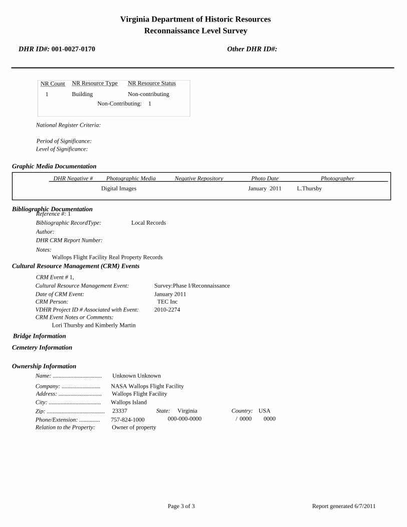
Virginia Department of Historic Resources
Reconnaissance Level Survey
DHR ID#: 001-0027-0170 Other DHR ID#:
NR Resource StatusNR Resource TypeNR Count
Building Non-contributing 1
1 Non-Contributing:
National Register Criteria:
Level of Significance:
Period of Significance:
Graphic Media Documentation
PhotographerPhoto DateNegative RepositoryDHR Negative # Photographic Media
Digital Images L.ThursbyJanuary 2011
Bibliographic Documentation
Reference #: 1
Bibliographic RecordType: Local Records
Author:
DHR CRM Report Number:
Notes:
Wallops Flight Facility Real Property Records
Cultural Resource Management (CRM) Events
CRM Event # 1,
Cultural Resource Management Event: Survey:Phase I/Reconnaissance
Date of CRM Event: January 2011
CRM Person: TEC Inc
VDHR Project ID # Associated with Event: 2010-2274
CRM Event Notes or Comments:
Lori Thursby and Kimberly Martin
Bridge Information
Cemetery Information
Ownership Information
Unknown Unknown Name: .................................
NASA Wallops Flight FacilityCompany: ..........................
Wallops Flight FacilityAddress: .............................
Wallops IslandCity: ...................................
23337Zip: ....................................... VirginiaState: USACountry:
000-000-0000757-824-1000Phone/Extension: ..............
0000/ 0000
Relation to the Property: Owner of property
Report generated 6/7/2011Page 3 of 3

Nor
th S
eawal
l Rd.
001-0027-0175V-050A
001-0027-0178V-080
001-0027-0173V-045
001-0027-0177V-055
001-0027-0170V-025
001-0027-0171V-030
001-0027-0174V-050
001-0027-0172V-042
001-0027-0176V-052
NASA Property
Surveyed Structures
Buildings
0 250Meters
0 1,000Feet


Virginia Department of Historic Resources
Reconnaissance Level Survey
DHR ID#: 001-0027-0171 Other DHR ID#:
Resource Information
National Register Eligibility Status
This Resource is associated with the Wallops Flight
Facility
Resource Name(s): V-30, Electric Power Equipment Storage {Historic}
V-30, Ammunition Magazine {Historic/Current}
Date of Construction: 1958
Local Historic District :
Location of Resource
County/Independent City:
Commonwealth of Virginia
Accomack
Magisterial District:
Town/Village/Hamlet: Wallops Island
Tax Parcel:
Zip Code: 23337
Address(s): North Seawall Road
USGS Quadrangle Name: WALLOPS ISLAND
UTM Boundary Coordinates :
Northing EastingZone NAD
1983 18 459975 4190802
UTM Center coordinates :
NoUTM Data Restricted?.
Resource Description
Ownership Status: Public - Federal
Government Agency Owner: U.S. National Aeronautics & Space Administration
Acreage:
Surrounding area: Rural
Open to Public: No
January 2011: The Ammunition Magazine is located on the north half of Wallops Island, immediately west of North Seawall
Road. The structure is adjacent to the ocean; large riprap along the shore is visible from the site. The grass immediately around
the building is mowed, but farther out there is tall grass and trees. A concrete paved lane provides access to the building.
Site Description:
Secondary Resource Summary:
January 2011: none
Resource StatusResource TypesCount
Magazine Non-Contributing 1
Individual Resource Information
MagazineResource Type. Primary Resource? Yes
Individual Resource Detail Information
Date of Construction: Accessed? 1958 {Owner} No Not accessible
1.0 Number of Stories:Architectural Style: No Discernable Style
Good
Interior Plan Type:
Form: Condition:
Threats to Resource: None Known
January 2011: The Ammunition Magazine is a magazine built into an earthen berm. The opening faces northeast and consists of a
steel plate face bolted to a concrete arch. Metal channels, bolted to the face, act as buttresses. Two tall and wide steel doors,
centered in the steel face, provide access to the magazine. Wood posts and planks act as a retaining wall on both sides of the steel
Report generated 6/7/2011Page 1 of 3

Virginia Department of Historic Resources
Reconnaissance Level Survey
DHR ID#: 001-0027-0171 Other DHR ID#:
face. The wood posts are set in sand and fastened to the steel face with nuts and bolts. A metal tube vent pierces the southwest
part of the earthen berm.
Primary Resource Exterior Component Description:
Material TreatmentMaterialComp Type/FormComponent
Foundation Foundation - Slab Concrete Foundation - Poured
Structural System Structural System - Masonry Concrete
Structural System Structural System - Frame Wood
Roof Roof - Gable, Front Concrete
Historic Time Period(s):S- The New Dominion (1946- Present)
Historic Context(s): Military/Defense
Technology/Engineering
Significance Statement
January 2011: This building is representative of an Industrial resource type built near the beginning of the New Dominion period
(1945–present) at a Technology/Engineering research facility. NACA established the Auxiliary Flight Research Station in the southern
portion of Wallops Island in 1945 for aeronautical research. In mid-1946, this facility was renamed the Pilotless Aircraft Research Station
(PARS) and functioned as a rocket testing facility. By the mid-1950s, the testing program at PARS concentrated on hypersonic missiles.
Substantial development occurred at PARS between 1946 and 1954. After 1954, buildings and structures generally were constructed as
needed to meet workload and research program requirements. NACA built this storage magazine in 1958. After the base was transferred
to NASA, the structure was used for explosives handling and storage. It may also have been used for electric power equipment storage
(WFF 2011). It currently stores ammunition.
V-30 has been evaluated both as a contributing resource in a historic district and as an individual resource. No historic district on
Wallops Island was identified because of a lack of significance and integrity.
The Ammunition Magazine is not individually eligible for listing on the NRHP because it lacks significance. The structure is
recommended not eligible under Criterion A because it is not associated with an event or pattern of events of local, state, or national
significance. It is not associated with the life of a person significant in our past; therefore, it is recommended not eligible under Criterion
B. The structure is recommended not eligible under Criterion C because earthen-bermed magazines were built by the thousands at military
installations across the U.S. (U.S. Army Corps of Engineers 1997). V-30 is not a rare or prototype ammunition magazine. Therefore, it does
not embody the distinctive characteristics of a type, period, or method of construction; represent the work of a master; possess high
artistic value; or represent a significant or distinguishable entity whose components may lack individual distinction. It is recommended
not eligible under Criterion D because it does not have the potential to yield information important in history or prehistory.
National Register Eligibility Information (Intensive Level Survey):
NR Resource StatusNR Resource TypeNR Count
Non-contributing 1
1 Non-Contributing:
National Register Criteria:
Level of Significance:
Period of Significance:
Graphic Media Documentation
PhotographerPhoto DateNegative RepositoryDHR Negative # Photographic Media
Digital Images L.ThursbyJanuary 2011
Report generated 6/7/2011Page 2 of 3

Virginia Department of Historic Resources
Reconnaissance Level Survey
DHR ID#: 001-0027-0171 Other DHR ID#:
Bibliographic Documentation
Reference #: 1
Bibliographic RecordType: Local Records
Author:
DHR CRM Report Number:
Notes:
Wallops Flight Facility Real Property Records
Reference #: 2
Bibliographic RecordType: Drawings
Author:
DHR CRM Report Number:
Notes:
Wallops Flight Facility As Built Drawings
Cultural Resource Management (CRM) Events
CRM Event # 1,
Cultural Resource Management Event: Survey:Phase I/Reconnaissance
Date of CRM Event: January 2011
CRM Person: TEC Inc
VDHR Project ID # Associated with Event: 2010-2274
CRM Event Notes or Comments:
Lori Thursby and Kimberly Martin
Bridge Information
Cemetery Information
Ownership Information
Unknown Unknown Name: .................................
NASA Wallops Flight FacililityCompany: ..........................
Wallops Flight FacilityAddress: .............................
Wallops IslandCity: ...................................
23337Zip: ....................................... VirginiaState: USACountry:
000-000-0000757-824-1000Phone/Extension: ..............
0000/ 0000
Relation to the Property: Owner of property
Report generated 6/7/2011Page 3 of 3

Nor
th S
eawal
l Rd.
001-0027-0175V-050A
001-0027-0178V-080
001-0027-0173V-045
001-0027-0177V-055
001-0027-0170V-025
001-0027-0171V-030
001-0027-0174V-050
001-0027-0172V-042
001-0027-0176V-052
NASA Property
Surveyed Structures
Buildings
0 250Meters
0 1,000Feet
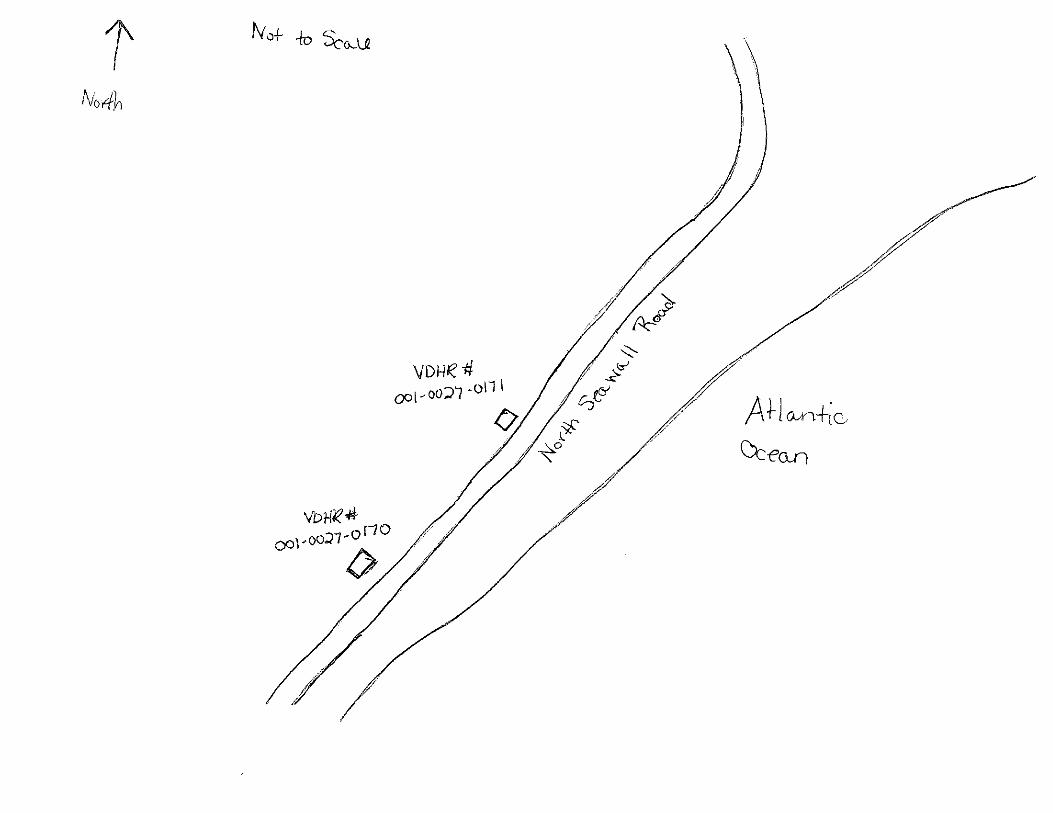

Virginia Department of Historic Resources
Reconnaissance Level Survey
DHR ID#: 001-0027-0172 Other DHR ID#:
Resource Information
National Register Eligibility Status
This Resource is associated with the Wallops Flight
Facility
Resource Name(s): Ready Service Chemical Storage Magazine
{Current}
Y-26 {Historic}
Date of Construction: 1956
Local Historic District :
Location of Resource
County/Independent City:
Commonwealth of Virginia
Accomack
Magisterial District:
Town/Village/Hamlet: Wallops Island
Tax Parcel:
Zip Code: 23337
Address(s): North Seawall Road
USGS Quadrangle Name: WALLOPS ISLAND
UTM Boundary Coordinates :
Northing EastingZone NAD
1983 18 460421 4191480
UTM Center coordinates :
NoUTM Data Restricted?.
Resource Description
Ownership Status: Public - Federal
Government Agency Owner: U.S. National Aeronautics & Space Administration
Acreage:
Surrounding area: Rural
Open to Public: No
January 2011: The Ready Service Chemical Storage Magazine is located on the north half of Wallops Island, southeast of North
Seawall Road. The area is rural and isolated, surrounded mostly by pine trees. The building is part of the Dynamic Balance
Facility. It is next to V-045, Horizontal Dynamic Balance Test Facility.
Site Description:
Secondary Resource Summary:
January 2011: none
Resource StatusResource TypesCount
Magazine Non-Contributing 1
Individual Resource Information
MagazineResource Type. Primary Resource? Yes
Individual Resource Detail Information
Date of Construction: Accessed? 1956 {Owner} No Not accessible
1.0 Number of Stories:Architectural Style: No Discernable Style
Good
Interior Plan Type:
Form: Condition:
Threats to Resource: None Known
January 2011: This single-story reinforced concrete building rests on a concrete slab. It has only one point of entry, a single steel
door on the northeast elevation. The central door has a projecting metal lintel. It is flanked by two vents with metal covers. On the
Report generated 6/7/2011Page 1 of 3

Virginia Department of Historic Resources
Reconnaissance Level Survey
DHR ID#: 001-0027-0172 Other DHR ID#:
opposite elevation (southwest), there are two small vents in the top of the wall; metal covers for the vents are missing. Four steel
eye hooks are embedded in each corner of the roof.
V-42 represents a Navy standardized building design for storage of small materials. At Wallops, it is typically utilized for storage of
hazardous materials. The Navy built numerous buildings of this type on the main base and Wallops Island between 1956 and 1965.
As of 2011, 14 buildings of this type were extant.
Primary Resource Exterior Component Description:
Material TreatmentMaterialComp Type/FormComponent
Foundation Foundation - Slab Concrete Foundation - Poured
Structural System Structural System - Masonry Concrete Structural System - Block
Roof Roof - Flat Concrete
Historic Time Period(s):S- The New Dominion (1946- Present)
Historic Context(s): Military/Defense
Technology/Engineering
Significance Statement
January 2011: V-42 and the other eight buildings on Wallops Island of this same type (V-52, W-16, W-51, W-67, Y-16, Y-20, Y-37, and
Y-38) represent a secondary resource built near the beginning of the New Dominion period (1945–present) at a Military/Defense research
facility. The U.S. Navy expanded the mission of the CNAAS in 1946 to include the NAOTS, which was charged with research and testing
of naval aviation weapons and ordnance. The CNAAS/NAOTS retained this mission until the base was closed in 1959 and transferred to
NASA. During the period of 1946–1959, most of the development that occurred on the main base was related to housing and services.
However, several new buildings were constructed on main base within the three years leading up to the closure of the Navy station. The
Navy erected the same type of storage buildings as V-42 between 1956 and 1965. Each of these nine storage buildings has been evaluated
both as a contributing resource in a historic district and as an individual resource. No historic district on Wallops Island was identified
because of a lack of significance and integrity.
This resource type is not individually eligible for listing on the NRHP because it lacks significance, and also in some cases, integrity. Each
building is recommended not eligible under Criterion A because it is not associated with an event or pattern of events of local, state, or
national significance. It is not associated with the life of a person significant in our past; therefore, it is recommended not eligible under
Criterion B. Each of these storage buildings is a secondary resource of simple design and common construction and, therefore, is
recommended not eligible under Criterion C because it does not embody the distinctive characteristics of a type, period, or method of
construction; represent the work of a master; possess high artistic value; or represent a significant or distinguishable entity whose
components may lack individual distinction. It is recommended not eligible under Criterion D because it does not have the potential to
yield information important in history or prehistory.
V-42 was moved during the period of significance; therefore, it does not possess integrity of location. It also has no integrity of setting:
the setting of the current location is not comparable to the historical setting. The removal of the building from its original location and
setting has destroyed its integrity of feeling and association. The resource retains its integrity of design, materials, and workmanship.
National Register Eligibility Information (Intensive Level Survey):
NR Resource StatusNR Resource TypeNR Count
Building Non-contributing 1
1 Non-Contributing:
National Register Criteria:
Level of Significance:
Period of Significance:
Report generated 6/7/2011Page 2 of 3

Virginia Department of Historic Resources
Reconnaissance Level Survey
DHR ID#: 001-0027-0172 Other DHR ID#:
Graphic Media Documentation
PhotographerPhoto DateNegative RepositoryDHR Negative # Photographic Media
Digital Images L. ThursbyJanuary 2011
Bibliographic Documentation
Reference #: 1
Bibliographic RecordType: Local Records
Author:
DHR CRM Report Number:
Notes:
Wallops Flight Facility As Built Drawings
Cultural Resource Management (CRM) Events
CRM Event # 1,
Cultural Resource Management Event: Survey:Phase I/Reconnaissance
Date of CRM Event: January 2011
CRM Person: TEC Inc
VDHR Project ID # Associated with Event: 2010-2274
CRM Event Notes or Comments:
Lori Thursby and Kimberly Martin
Bridge Information
Cemetery Information
Ownership Information
Unknown Unknown Name: .................................
NASA Wallops Flight FacilityCompany: ..........................
Wallops Flight FacilityAddress: .............................
Wallops IslandCity: ...................................
23337Zip: ....................................... VirginiaState: USACountry:
000-000-0000757-824-1000Phone/Extension: ..............
0000/ 0000
Relation to the Property: Owner of property
Report generated 6/7/2011Page 3 of 3

Nor
th S
eawal
l Rd.
001-0027-0175V-050A
001-0027-0178V-080
001-0027-0173V-045
001-0027-0177V-055
001-0027-0170V-025
001-0027-0171V-030
001-0027-0174V-050
001-0027-0172V-042
001-0027-0176V-052
NASA Property
Surveyed Structures
Buildings
0 250Meters
0 1,000Feet


Virginia Department of Historic Resources
Reconnaissance Level Survey
DHR ID#: 001-0027-0173 Other DHR ID#:
Resource Information
National Register Eligibility Status
This Resource is associated with the Wallops Flight
Facility
Resource Name(s): V-45, Horizontal Dynamic Balance Test Building
{Current}
Date of Construction: 1963
Local Historic District :
Location of Resource
County/Independent City:
Commonwealth of Virginia
Accomack
Magisterial District:
Town/Village/Hamlet: Wallops Island
Tax Parcel:
Zip Code: 23337
Address(s): North Seawall Road
USGS Quadrangle Name: WALLOPS ISLAND
UTM Boundary Coordinates :
Northing EastingZone NAD
1983 18 460531 4191470
UTM Center coordinates :
NoUTM Data Restricted?.
Resource Description
Ownership Status: Public - Federal
Government Agency Owner: U.S. National Aeronautics & Space Administration
Acreage:
Surrounding area: Rural
Open to Public: No
January 2011: The Horizontal Dynamic Balance Test Building is located on the north half of Wallops Island, southeast of North
Seawall Road. The area is rural and isolated, surrounded mostly by pine trees. It is connected to the central Dynamic Balance
Control Center Building (V-50) and the Vertical Dynamic Balance Test Building (V-55) by a covered walkway (V-50A). V-50A
connects to the northwest elevation; beyond the walkway is an asphalt access road.
Site Description:
Secondary Resource Summary:
January 2011: Utility Canopy (V-50A)
Resource StatusResource TypesCount
Research
Facility/Laboratory
Non-Contributing 1
Individual Resource Information
Research Facility/LaboratoryResource Type. Primary Resource? Yes
Individual Resource Detail Information
Date of Construction: Accessed? 1963 {Owner} No Not accessible
1.0 Number of Stories:Architectural Style: No Discernable Style
Good
Interior Plan Type:
Form: Condition:
Threats to Resource: None Known
January 2011: The Horizontal Dynamic Balance Test Building is a utilitarian building, resting on a reinforced concrete slab
Report generated 6/7/2011Page 1 of 3
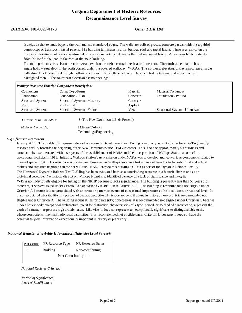
Virginia Department of Historic Resources
Reconnaissance Level Survey
DHR ID#: 001-0027-0173 Other DHR ID#:
foundation that extends beyond the wall and has chamfered edges. The walls are built of precast concrete panels, with the top third
constructed of translucent metal panels. The building terminates in a flat built-up roof and metal fascia. There is a lean-to on the
northeast elevation that is also constructed of precast concrete panels and a flat roof and metal fascia. An exterior ladder extends
from the roof of the lean-to the roof of the main building.
The main point of access is on the northwest elevation through a central overhead rolling door. The northeast elevation has a
single hollow steel door in the north corner, under the covered walkway (V-50A). The northeast elevation of the lean-to has a single
half-glazed metal door and a single hollow steel door. The southeast elevation has a central metal door and is sheathed in
corrugated metal. The southwest elevation has no openings.
Primary Resource Exterior Component Description:
Material TreatmentMaterialComp Type/FormComponent
Foundation Foundation - Slab Concrete Foundation - Poured
Structural System Structural System - Masonry Concrete
Roof Roof - Flat Asphalt
Structural System Structural System - Frame Metal Structural System - Unknown
Historic Time Period(s):S- The New Dominion (1946- Present)
Historic Context(s): Military/Defense
Technology/Engineering
Significance Statement
January 2011: This building is representative of a Research, Development and Testing resource type built at a Technology/Engineering
research facility towards the beginning of the New Dominion period (1945–present). This is one of approximately 50 buildings and
structures that were erected within six years of the establishment of NASA and the incorporation of Wallops Station as one of its
operational facilities in 1959. Initially, Wallops Station’s new mission under NASA was to develop and test various components related to
manned space flight. This mission was short-lived, however, as Wallops became a test range and launch site for suborbital and orbital
rockets and satellites beginning in the early 1960s. NASA erected this building in 1963 as part of the Dynamic Balance Facility.
The Horizontal Dynamic Balance Test Building has been evaluated both as a contributing resource in a historic district and as an
individual resource. No historic district on Wallops Island was identified because of a lack of significance and integrity.
V-45 is not individually eligible for listing on the NRHP because it lacks significance. The building is presently less than 50 years old;
therefore, it was evaluated under Criteria Consideration G in addition to Criteria A–D. The building is recommended not eligible under
Criterion A because it is not associated with an event or pattern of events of exceptional importance at the local, state, or national level. It
is not associated with the life of a person who made exceptionally important contributions in history; therefore, it is recommended not
eligible under Criterion B. The building retains its historic integrity; nonetheless, it is recommended not eligible under Criterion C because
it does not embody exceptional architectural merit for distinctive characteristics of a type, period, or method of construction; represent the
work of a master; or possess high artistic value. Likewise, it does not represent an exceptionally significant or distinguishable entity
whose components may lack individual distinction. It is recommended not eligible under Criterion D because it does not have the
potential to yield information exceptionally important in history or prehistory.
National Register Eligibility Information (Intensive Level Survey):
NR Resource StatusNR Resource TypeNR Count
Building Non-contributing 1
1 Non-Contributing:
National Register Criteria:
Level of Significance:
Period of Significance:
Report generated 6/7/2011Page 2 of 3

Virginia Department of Historic Resources
Reconnaissance Level Survey
DHR ID#: 001-0027-0173 Other DHR ID#:
Graphic Media Documentation
PhotographerPhoto DateNegative RepositoryDHR Negative # Photographic Media
Digital Images L.ThursbyJanuary 2011
Bibliographic Documentation
Reference #: 1
Bibliographic RecordType: Local Records
Author:
DHR CRM Report Number:
Notes:
Wallops Flight Facility Real Property Records
Cultural Resource Management (CRM) Events
CRM Event # 1,
Cultural Resource Management Event: Survey:Phase I/Reconnaissance
Date of CRM Event: January 2011
CRM Person: TEC Inc
VDHR Project ID # Associated with Event: 2010-2274
CRM Event Notes or Comments:
Lori Thursby and Kimberly Martin
Bridge Information
Cemetery Information
Ownership Information
Unknown Unknown Name: .................................
NASA Wallops Flight FacilityCompany: ..........................
Wallops Flight FacilityAddress: .............................
Wallops IslandCity: ...................................
23337Zip: ....................................... VirginiaState: USACountry:
000-000-0000757-824-1000Phone/Extension: ..............
0000/ 0000
Relation to the Property: Owner of property
Report generated 6/7/2011Page 3 of 3

Nor
th S
eawal
l Rd.
001-0027-0175V-050A
001-0027-0178V-080
001-0027-0173V-045
001-0027-0177V-055
001-0027-0170V-025
001-0027-0171V-030
001-0027-0174V-050
001-0027-0172V-042
001-0027-0176V-052
NASA Property
Surveyed Structures
Buildings
0 250Meters
0 1,000Feet
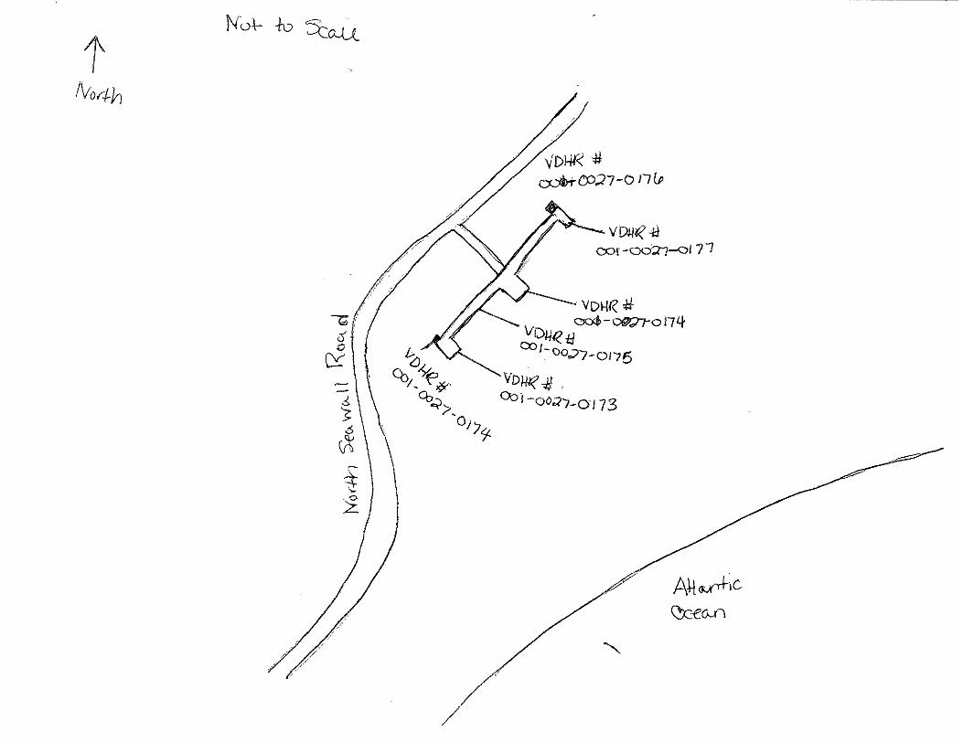

Virginia Department of Historic Resources
Reconnaissance Level Survey
DHR ID#: 001-0027-0174 Other DHR ID#:
Resource Information
National Register Eligibility Status
This Resource is associated with the Wallops Flight
Facility
Resource Name(s): V-50, Dynamic Balance Control Center Building
{Current}
Date of Construction: 1963
Local Historic District :
Location of Resource
County/Independent City:
Commonwealth of Virginia
Accomack
Magisterial District:
Town/Village/Hamlet: Wallops Island
Tax Parcel:
Zip Code: 23337
Address(s): North Seawall Road
USGS Quadrangle Name: WALLOPS ISLAND
UTM Boundary Coordinates :
Northing EastingZone NAD
1983 18 460530 4191578
UTM Center coordinates :
NoUTM Data Restricted?.
Resource Description
Ownership Status: Public - Federal
Government Agency Owner: U.S. National Aeronautics & Space Administration
Acreage:
Surrounding area: Rural
Open to Public: No
January 2011: The Dynamic Balance Control Center Building is located on the north half of Wallops Island, southeast of North
Seawall Road. The area is rural and isolated, surrounded mostly by pine trees. V-50 is connected to two flanking buildings,
V-45 and V-55, by a covered walkway, V-50A. V-50A runs along the northwest elevation of the building; beyond the walkway
is an asphalt parking lot and a paved lane leading from an access road to the building. There is a concrete walled structure on
the north side of the building that contains an oil tank and a raised concrete pad for a generator or utility box.
Site Description:
Secondary Resource Summary:
January 2011: Utility Canopy (V-50A), oil tank
Resource StatusResource TypesCount
Research
Facility/Laboratory
Non-Contributing 1
Individual Resource Information
Research Facility/LaboratoryResource Type. Primary Resource? Yes
Individual Resource Detail Information
Date of Construction: Accessed? 1963 {Owner} No Not accessible
1.0 Number of Stories:Architectural Style: No Discernable Style
Good
Interior Plan Type:
Form: Condition:
Threats to Resource: None Known
Report generated 6/7/2011Page 1 of 3
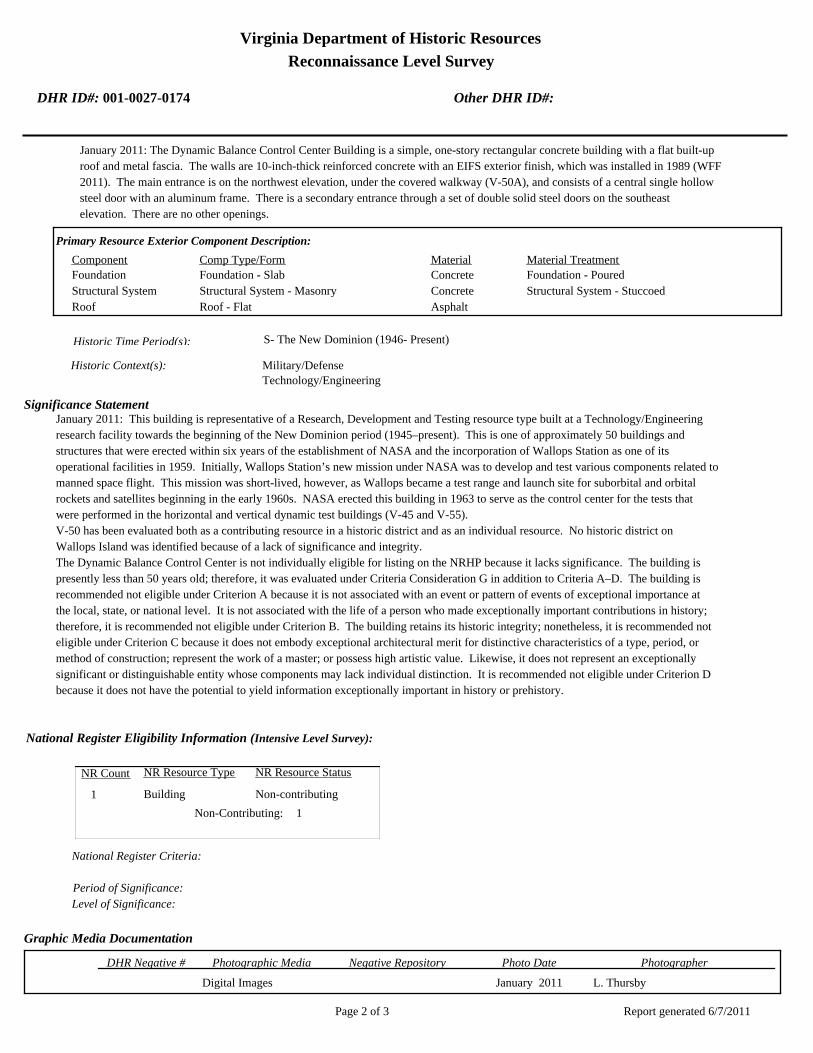
Virginia Department of Historic Resources
Reconnaissance Level Survey
DHR ID#: 001-0027-0174 Other DHR ID#:
January 2011: The Dynamic Balance Control Center Building is a simple, one-story rectangular concrete building with a flat built-up
roof and metal fascia. The walls are 10-inch-thick reinforced concrete with an EIFS exterior finish, which was installed in 1989 (WFF
2011). The main entrance is on the northwest elevation, under the covered walkway (V-50A), and consists of a central single hollow
steel door with an aluminum frame. There is a secondary entrance through a set of double solid steel doors on the southeast
elevation. There are no other openings.
Primary Resource Exterior Component Description:
Material TreatmentMaterialComp Type/FormComponent
Foundation Foundation - Slab Concrete Foundation - Poured
Structural System Structural System - Masonry Concrete Structural System - Stuccoed
Roof Roof - Flat Asphalt
Historic Time Period(s):S- The New Dominion (1946- Present)
Historic Context(s): Military/Defense
Technology/Engineering
Significance Statement
January 2011: This building is representative of a Research, Development and Testing resource type built at a Technology/Engineering
research facility towards the beginning of the New Dominion period (1945–present). This is one of approximately 50 buildings and
structures that were erected within six years of the establishment of NASA and the incorporation of Wallops Station as one of its
operational facilities in 1959. Initially, Wallops Station’s new mission under NASA was to develop and test various components related to
manned space flight. This mission was short-lived, however, as Wallops became a test range and launch site for suborbital and orbital
rockets and satellites beginning in the early 1960s. NASA erected this building in 1963 to serve as the control center for the tests that
were performed in the horizontal and vertical dynamic test buildings (V-45 and V-55).
V-50 has been evaluated both as a contributing resource in a historic district and as an individual resource. No historic district on
Wallops Island was identified because of a lack of significance and integrity.
The Dynamic Balance Control Center is not individually eligible for listing on the NRHP because it lacks significance. The building is
presently less than 50 years old; therefore, it was evaluated under Criteria Consideration G in addition to Criteria A–D. The building is
recommended not eligible under Criterion A because it is not associated with an event or pattern of events of exceptional importance at
the local, state, or national level. It is not associated with the life of a person who made exceptionally important contributions in history;
therefore, it is recommended not eligible under Criterion B. The building retains its historic integrity; nonetheless, it is recommended not
eligible under Criterion C because it does not embody exceptional architectural merit for distinctive characteristics of a type, period, or
method of construction; represent the work of a master; or possess high artistic value. Likewise, it does not represent an exceptionally
significant or distinguishable entity whose components may lack individual distinction. It is recommended not eligible under Criterion D
because it does not have the potential to yield information exceptionally important in history or prehistory.
National Register Eligibility Information (Intensive Level Survey):
NR Resource StatusNR Resource TypeNR Count
Building Non-contributing 1
1 Non-Contributing:
National Register Criteria:
Level of Significance:
Period of Significance:
Graphic Media Documentation
PhotographerPhoto DateNegative RepositoryDHR Negative # Photographic Media
Digital Images L. ThursbyJanuary 2011
Report generated 6/7/2011Page 2 of 3

Virginia Department of Historic Resources
Reconnaissance Level Survey
DHR ID#: 001-0027-0174 Other DHR ID#:
Bibliographic Documentation
Reference #: 1
Bibliographic RecordType: Local Records
Author:
DHR CRM Report Number:
Notes:
Wallops Flight Facility Real Property Records
Cultural Resource Management (CRM) Events
CRM Event # 1,
Cultural Resource Management Event: Survey:Phase I/Reconnaissance
Date of CRM Event: January 2011
CRM Person: TEC Inc
VDHR Project ID # Associated with Event: 2010-2274
CRM Event Notes or Comments:
Lori Thursby and Kimberly Martin
Bridge Information
Cemetery Information
Ownership Information
Unknown Unknown Name: .................................
NASA Wallops Flight FacilityCompany: ..........................
Wallops Flgiht FacilityAddress: .............................
Wallops IslandCity: ...................................
23337Zip: ....................................... VirginiaState: USACountry:
000-000-0000757-824-1000Phone/Extension: ..............
0000/ 0000
Relation to the Property: Owner of property
Report generated 6/7/2011Page 3 of 3

Nor
th S
eawal
l Rd.
001-0027-0175V-050A
001-0027-0178V-080
001-0027-0173V-045
001-0027-0177V-055
001-0027-0170V-025
001-0027-0171V-030
001-0027-0174V-050
001-0027-0172V-042
001-0027-0176V-052
NASA Property
Surveyed Structures
Buildings
0 250Meters
0 1,000Feet


Virginia Department of Historic Resources
Reconnaissance Level Survey
DHR ID#: 001-0027-0175 Other DHR ID#:
Resource Information
National Register Eligibility Status
This Resource is associated with the Wallops Flight
Facility
Resource Name(s): V-050A, Utility Canopy {Current}
Date of Construction: 1963
Local Historic District :
Location of Resource
County/Independent City:
Commonwealth of Virginia
Accomack
Magisterial District:
Town/Village/Hamlet: Wallops Island
Tax Parcel:
Zip Code: 23337
Address(s): North Seawall Road
USGS Quadrangle Name: WALLOPS ISLAND
UTM Boundary Coordinates :
Northing EastingZone NAD
1983 18 460526 4191581
UTM Center coordinates :
NoUTM Data Restricted?.
Resource Description
Ownership Status: Public - Federal
Government Agency Owner: U.S. National Aeronautics & Space Administration
Acreage:
Surrounding area: Rural
Open to Public: No
January 2011: The Utility Canopy is located on the north half of Wallops Island, southeast of North Seawall Road. The area is
rural and isolated, surrounded mostly by pine trees. V-50A is a covered walkway connecting the Dynamic Balance Control
Center (V-50) to two flanking buildings, V-45 and V-55. V-45 is on the southwest and V-55 is on the northeast. V-50A extends
across the northwest faces of the buildings.
Site Description:
Secondary Resource Summary:
January 2011: Dynamic Balance Control Center (V-50)
Resource StatusResource TypesCount
Electrical Transmission
Line
Non-Contributing 1
Individual Resource Information
Electrical Transmission LineResource Type. Primary Resource? Yes
Individual Resource Detail Information
Date of Construction: Accessed? 1963 {Owner}
1.0 Number of Stories:Architectural Style: No Discernable Style
Good
Interior Plan Type:
Form: Condition:
Threats to Resource: None Known
January 2011: The covered walkway consists of hollow steel columns, spaced 15 ft apart, supporting steel I beams that frame the
roof structure. A corrugated aluminum butterfly roof provides a canopy. Four galvanized metal channels on the southeast
Report generated 6/7/2011Page 1 of 3

Virginia Department of Historic Resources
Reconnaissance Level Survey
DHR ID#: 001-0027-0175 Other DHR ID#:
elevation, located about 4 ft off the ground, extend to all three buildings, carrying cables. These channels are screened on the
southeast by corrugated transite (asbestos-cement) boards. The canopy structure covers a 4 ft-wide concrete sidewalk.
Primary Resource Exterior Component Description:
Material TreatmentMaterialComp Type/FormComponent
Foundation Foundation - Slab Concrete Foundation - Poured
Structural System Structural System - Frame Steel Structural System - Corrugated
Roof Steel Roof - Corrugated
Historic Time Period(s):S- The New Dominion (1946- Present)
Historic Context(s): Military/Defense
Technology/Engineering
Significance Statement
January 2011: This structure is a secondary resource type built at a Technology/Engineering research facility towards the beginning of
the New Dominion period (1945–present). This is one of approximately 50 buildings and structures that were erected within six years of
the establishment of NASA and the incorporation of Wallops Station as one of its operational facilities in 1959. Initially, Wallops
Station’s new mission under NASA was to develop and test various components related to manned space flight. This mission was
short-lived, however, as Wallops became a test range and launch site for suborbital and orbital rockets and satellites beginning in the
early 1960s. NASA erected this structure in 1963 as part of the Dynamic Balance Facility. It provides a covered walkway and supports a
series of utility conduits that extend between the horizontal and vertical dynamic test buildings (V-45 and V-55) and control center (V-50).
V-50A has been evaluated both as a contributing resource in a historic district and as an individual resource. No historic district on
Wallops Island was identified because of a lack of significance and integrity.
This utility canopy is not individually eligible for listing on the NRHP because it lacks significance. The structure is presently less than 50
years old; therefore, it was evaluated under Criteria Consideration G in addition to Criteria A–D. It is recommended not eligible under
Criterion A because it is not associated with an event or pattern of events of exceptional importance at the local, state, or national level.
The structure is not associated with the life of a person who made exceptionally important contributions in history; therefore, it is
recommended not eligible under Criterion B. The structure retains historic integrity; nonetheless, it is recommended not eligible under
Criterion C because it does not embody exceptional architectural merit for distinctive characteristics of a type, period, or method of
construction; represent the work of a master; or possess high artistic value. Likewise, it does not represent an exceptionally significant or
distinguishable entity whose components may lack individual distinction. It is recommended not eligible under Criterion D because it
does not have the potential to yield information exceptionally important in history or prehistory.
National Register Eligibility Information (Intensive Level Survey):
NR Resource StatusNR Resource TypeNR Count
Building Non-contributing 1
1 Non-Contributing:
National Register Criteria:
Level of Significance:
Period of Significance:
Graphic Media Documentation
PhotographerPhoto DateNegative RepositoryDHR Negative # Photographic Media
Digitial Images L ThursbyJanuary 2011
Bibliographic Documentation
Reference #: 1
Report generated 6/7/2011Page 2 of 3

Virginia Department of Historic Resources
Reconnaissance Level Survey
DHR ID#: 001-0027-0175 Other DHR ID#:
Bibliographic RecordType: Local Records
Author:
DHR CRM Report Number:
Notes:
Wallops Flight Facility Real Property Records
Cultural Resource Management (CRM) Events
CRM Event # 1,
Cultural Resource Management Event: Survey:Phase I/Reconnaissance
Date of CRM Event: January 2011
CRM Person: TEC Inc
VDHR Project ID # Associated with Event: 2010-2274
CRM Event Notes or Comments:
Lori Thursby and Kimberly Martin
Bridge Information
Cemetery Information
Ownership Information
Unknown Unknown Name: .................................
NASA Wallops Flight FacilityCompany: ..........................
Wallops Flight FacilityAddress: .............................
Wallops IslandCity: ...................................
23337Zip: ....................................... VirginiaState: USACountry:
000-000-0000757-824-1000Phone/Extension: ..............
0000/ 0000
Relation to the Property: Owner of property
Report generated 6/7/2011Page 3 of 3
Nor
th S
eawal
l Rd.
001-0027-0175V-050A
001-0027-0178V-080
001-0027-0173V-045
001-0027-0177V-055
001-0027-0170V-025
001-0027-0171V-030
001-0027-0174V-050
001-0027-0172V-042
001-0027-0176V-052
NASA Property
Surveyed Structures
Buildings
0 250Meters
0 1,000Feet


Virginia Department of Historic Resources
Reconnaissance Level Survey
DHR ID#: 001-0027-0176 Other DHR ID#:
Resource Information
National Register Eligibility Status
Resource has not been evaluated.*
This Resource is associated with the Wallops Flight
Facility
* Resource has not been formally evaluated by DHR or
eligibility information has not been documented in DSS
at this time.
Resource Name(s): V-52, Ready Service Chemical Storage Magazine
{Current}
N-175 and Y-27 {Historic}
Date of Construction: 1956
Local Historic District :
Location of Resource
County/Independent City:
Commonwealth of Virginia
Accomack
Magisterial District:
Town/Village/Hamlet: Wallops Island
Tax Parcel:
Zip Code: 23337
Address(s): North Seawall Road
USGS Quadrangle Name: WALLOPS ISLAND
UTM Boundary Coordinates :
Northing EastingZone NAD
1983 18 460622 4191688
UTM Center coordinates :
NoUTM Data Restricted?.
Resource Description
Ownership Status: Public - Federal
Government Agency Owner: U.S. National Aeronautics & Space Administration
Acreage:
Surrounding area: Rural
Open to Public: No
January 2011: The Ready Service Chemical Storage Magazine is located on the north half of Wallops Island, southeast of North
Seawall Road. The area is rural and isolated. The building is part of the Dynamic Balance Facility. It is next to the Vertical
Dynamic Balance Test Building (V-055).
Site Description:
Secondary Resource Summary:
January 2011: none
Resource StatusResource TypesCount
Magazine Non-Contributing 1
Individual Resource Information
MagazineResource Type. Primary Resource? Yes
Individual Resource Detail Information
Date of Construction: Accessed? 1956 {Owner} No Not accessible
1.0 Number of Stories:Architectural Style: No Discernable Style
Good
Interior Plan Type:
Form: Condition:
Threats to Resource: None Known
This single story concrete block building rests on a concrete slab. It has only one point of entry, a single steel door, on the
southwest elevation. The central door is flanked by two vents with metal covers. On the opposite elevation, there are two small
Report generated 6/7/2011Page 1 of 3

Virginia Department of Historic Resources
Reconnaissance Level Survey
DHR ID#: 001-0027-0176 Other DHR ID#:
vents with metal covers in the top part of the wall. The building has no metal eye hooks; this building type typically has four metal
eye hooks located on each corner of the roof.
Primary Resource Exterior Component Description:
Material TreatmentMaterialComp Type/FormComponent
Roof Roof - Flat Concrete
Foundation Foundation - Slab Concrete Foundation - Poured
Structural System Structural System - Masonry Concrete Structural System - Block
Historic Time Period(s):S- The New Dominion (1946- Present)
Historic Context(s): Military/Defense
Technology/Engineering
Significance Statement
January 2011: V-52 and the other eight buildings on Wallops Island of this same type (V-42, W-16, W-51, W-67, Y-16, Y-20, Y-37, and Y-38)
represent a secondary resource built near the beginning of the New Dominion period (1945–present) at a Military/Defense research
facility. The U.S. Navy expanded the mission of the CNAAS in 1946 to include the NAOTS, which was charged with research and testing
of naval aviation weapons and ordnance. The CNAAS/NAOTS retained this mission until the base was closed in 1959 and transferred to
NASA. During the period of 1946–1959, most of the development that occurred on the main base was related to housing and services.
However, several new buildings were constructed on main base within the three years leading up to the closure of the Navy station. The
Navy erected the same type of storage buildings as V-52 between 1956 and 1965. Each of these nine storage buildings has been evaluated
both as a contributing resource in a historic district and as an individual resource. No historic district on Wallops Island was identified
because of a lack of significance and integrity.
This resource type is not individually eligible for listing on the NRHP because it lacks significance, and also in some cases, integrity. Each
building is recommended not eligible under Criterion A because it is not associated with an event or pattern of events of local, state, or
national significance. It is not associated with the life of a person significant in our past; therefore, it is recommended not eligible under
Criterion B. Each of these storage buildings is a secondary resource of simple design and common construction and, therefore, is
recommended not eligible under Criterion C because it does not embody the distinctive characteristics of a type, period, or method of
construction; represent the work of a master; possess high artistic value; or represent a significant or distinguishable entity whose
components may lack individual distinction. It is recommended not eligible under Criterion D because it does not have the potential to
yield information important in history or prehistory.
V-52 was moved during the period of significance; therefore, it does not possess integrity of location. It also has no integrity of setting:
the setting of the current location is not comparable to the historical setting. The removal of the building from its original location and
setting has destroyed its integrity of feeling and association. The resource retains its integrity of design, materials, and workmanship.
National Register Eligibility Information (Intensive Level Survey):
NR Resource StatusNR Resource TypeNR Count
Building Non-contributing 1
1 Non-Contributing:
National Register Criteria:
Level of Significance:
Period of Significance:
Graphic Media Documentation
PhotographerPhoto DateNegative RepositoryDHR Negative # Photographic Media
Digitial Images L ThursbyJanuary 2011
Report generated 6/7/2011Page 2 of 3

Virginia Department of Historic Resources
Reconnaissance Level Survey
DHR ID#: 001-0027-0176 Other DHR ID#:
Bibliographic Documentation
Reference #: 1
Bibliographic RecordType: Local Records
Author:
DHR CRM Report Number:
Notes:
Wallops Flight Facility Real Property Records
Cultural Resource Management (CRM) Events
CRM Event # 1,
Cultural Resource Management Event: Survey:Phase I/Reconnaissance
Date of CRM Event: January 2011
CRM Person: TEC Inc
VDHR Project ID # Associated with Event: 2010-2274
CRM Event Notes or Comments:
Lori Thursby and Kimberly Martin
Bridge Information
Cemetery Information
Ownership Information
Unknown Unknown Name: .................................
NASA Wallops Flight FacilityCompany: ..........................
Wallops Flight FacilityAddress: .............................
Wallops IslandCity: ...................................
23337Zip: ....................................... VirginiaState: USACountry:
000-000-0000757-824-1000Phone/Extension: ..............
0000/ 0000
Relation to the Property: Owner of property
Report generated 6/7/2011Page 3 of 3

Nor
th S
eawal
l Rd.
001-0027-0175V-050A
001-0027-0178V-080
001-0027-0173V-045
001-0027-0177V-055
001-0027-0170V-025
001-0027-0171V-030
001-0027-0174V-050
001-0027-0172V-042
001-0027-0176V-052
NASA Property
Surveyed Structures
Buildings
0 250Meters
0 1,000Feet


Virginia Department of Historic Resources
Reconnaissance Level Survey
DHR ID#: 001-0027-0177 Other DHR ID#:
Resource Information
National Register Eligibility Status
This Resource is associated with the Wallops Flight
Facility
Resource Name(s): V-55, Vertical Dynamic Balance Test Building
{Current}
Date of Construction: 1963
Local Historic District :
Location of Resource
County/Independent City:
Commonwealth of Virginia
Accomack
Magisterial District:
Town/Village/Hamlet: Wallops Island
Tax Parcel:
Zip Code: 23337
Address(s): North Seawall Road
USGS Quadrangle Name: WALLOPS ISLAND
UTM Boundary Coordinates :
Northing EastingZone NAD
1983 18 460629 4191673
UTM Center coordinates :
NoUTM Data Restricted?.
Resource Description
Ownership Status: Public - Federal
Government Agency Owner: U.S. National Aeronautics & Space Administration
Acreage:
Surrounding area: Rural
Open to Public: No
January 2011: The Vertical Dynamic Balance Test Building is located on the north half of Wallops Island, southeast of North
Seawall Road. The area is rural and isolated, surrounded mostly by pine trees. V-55 is connected to a central building, V-50,
and another building, V-45, by a covered walkway, V-50A. V-50A connects to the northwest elevation; beyond the walkway is
an asphalt-paved access road.
Site Description:
Secondary Resource Summary:
January 2011: Utllity Canopy (U-50A)
Resource StatusResource TypesCount
Research
Facility/Laboratory
Non-Contributing 1
Individual Resource Information
Research Facility/LaboratoryResource Type. Primary Resource? Yes
Individual Resource Detail Information
Date of Construction: Accessed? 1963 {Owner} No Not accessible
1.0 Number of Stories:Architectural Style: No Discernable Style
Good
Interior Plan Type:
Form: Condition:
Threats to Resource: None Known
January 2011: The Dynamic Balance Test Building is a utilitarian building, resting on a reinforced concrete slab foundation that
Report generated 6/7/2011Page 1 of 3

Virginia Department of Historic Resources
Reconnaissance Level Survey
DHR ID#: 001-0027-0177 Other DHR ID#:
extends beyond the walls and has chamfered edges. The walls are built of precast concrete panels, with the top third constructed of
translucent metal panels. The building terminates in a flat built-up roof and metal fascia. It is almost identical to V-45, except that it
is several feet taller. There is a lean-to on the northeast elevation that is also constructed of precast concrete panels and a flat roof
and metal fascia. An exterior ladder extends from the roof of the lean-to to the roof of the main building.
The main point of entry is on the northwest elevation through a large central overhead canvas door. The northeast elevation has a
single hollow steel door in the north corner, under the covered walkway (V-50A). The northeast elevation of the lean-to has a single
half-glazed metal door and a single hollow steel door. The southeast elevation has a central metal door and is sheathed in
corrugated metal. The southwest elevation has no openings.
Primary Resource Exterior Component Description:
Material TreatmentMaterialComp Type/FormComponent
Foundation Foundation - Slab Concrete Foundation - Poured
Structural System Structural System - Masonry Concrete
Structural System Structural System - Frame Metal Structural System - Unknown
Roof Roof - Flat Asphalt
Historic Time Period(s):S- The New Dominion (1946- Present)
Historic Context(s): Military/Defense
Technology/Engineering
Significance Statement
January 2011: This building is representative of a Research, Development and Testing resource type built at a Technology/Engineering
research facility towards the beginning of the New Dominion period (1945–present). This is one of approximately 50 buildings and
structures that were erected within six years of the establishment of NASA and the incorporation of Wallops Station as one of its
operational facilities in 1959. Initially, Wallops Station’s new mission under NASA was to develop and test various components related to
manned space flight. This mission was short-lived, however, as Wallops became a test range and launch site for suborbital and orbital
rockets and satellites beginning in the early 1960s. NASA erected this building in 1963 as part of the Dynamic Balance Facility.
The Vertical Dynamic Balance Test Building has been evaluated both as a contributing resource in a historic district and as an individual
resource. No historic district on Wallops Island was identified because of a lack of significance and integrity.
V-55 is not individually eligible for listing on the NRHP because it lacks significance. The building is presently less than 50 years old;
therefore, it was evaluated under Criteria Consideration G in addition to Criteria A–D. The building is recommended not eligible under
Criterion A because it is not associated with an event or pattern of events of exceptional importance at the local, state, or national level. It
is not associated with the life of a person who made exceptionally important contributions in history; therefore, it is recommended not
eligible under Criterion B. The building retains its historic integrity; nonetheless, it is recommended not eligible under Criterion C because
it does not embody exceptional architectural merit for distinctive characteristics of a type, period, or method of construction; represent the
work of a master; or possess high artistic value. Likewise, it does not represent an exceptionally significant or distinguishable entity
whose components may lack individual distinction. It is recommended not eligible under Criterion D because it does not have the
potential to yield information exceptionally important in history or prehistory.
National Register Eligibility Information (Intensive Level Survey):
NR Resource StatusNR Resource TypeNR Count
Building Non-contributing 1
1 Non-Contributing:
National Register Criteria:
Level of Significance:
Period of Significance:
Report generated 6/7/2011Page 2 of 3

Virginia Department of Historic Resources
Reconnaissance Level Survey
DHR ID#: 001-0027-0177 Other DHR ID#:
Graphic Media Documentation
PhotographerPhoto DateNegative RepositoryDHR Negative # Photographic Media
Digital Images L. ThursbyJanuary 2011
Bibliographic Documentation
Reference #: 1
Bibliographic RecordType: Local Records
Author:
DHR CRM Report Number:
Notes:
Wallops Flight Facility Real Property Records
Cultural Resource Management (CRM) Events
CRM Event # 1,
Cultural Resource Management Event: Survey:Phase I/Reconnaissance
Date of CRM Event: January 2011
CRM Person: TEC Inc
VDHR Project ID # Associated with Event: 2010-2274
CRM Event Notes or Comments:
Lori Thursby and Kimberly Martin
Bridge Information
Cemetery Information
Ownership Information
Unknown Unknown Name: .................................
NASA Wallops Flight FaciityCompany: ..........................
Wallops Flight FacilityAddress: .............................
Wallops IslandCity: ...................................
23337Zip: ....................................... VirginiaState: USACountry:
000-000-0000757-824-1000Phone/Extension: ..............
0000/ 0000
Relation to the Property: Owner of property
Report generated 6/7/2011Page 3 of 3

Nor
th S
eawal
l Rd.
001-0027-0175V-050A
001-0027-0178V-080
001-0027-0173V-045
001-0027-0177V-055
001-0027-0170V-025
001-0027-0171V-030
001-0027-0174V-050
001-0027-0172V-042
001-0027-0176V-052
NASA Property
Surveyed Structures
Buildings
0 250Meters
0 1,000Feet


Virginia Department of Historic Resources
Reconnaissance Level Survey
DHR ID#: 001-0027-0178 Other DHR ID#:
Resource Information
National Register Eligibility Status
This Resource is associated with the Wallops Flight
Facility
Resource Name(s): V-80, Rocket Motor Ready Storage {Current}
V-80, Vehicle Checkout Facility {Historic}
Date of Construction: 1963
Local Historic District :
Location of Resource
County/Independent City:
Commonwealth of Virginia
Accomack
Magisterial District:
Town/Village/Hamlet: Wallops Island
Tax Parcel:
Zip Code: 23337
Address(s): North Seawall Road
USGS Quadrangle Name: WALLOPS ISLAND
UTM Boundary Coordinates :
Northing EastingZone NAD
1983 18 460801 4192225
UTM Center coordinates :
NoUTM Data Restricted?.
Resource Description
Ownership Status: Public - Federal
Government Agency Owner: U.S. National Aeronautics & Space Administration
Acreage:
Surrounding area: Rural
Open to Public: No
January 2011: The Rocket Motor Ready Storage is located on the north half of Wallops Island, northwest of North Seawall
Road. The area is rural and isolated. The building is southeast of a tributary of Ballast Narrows, and wetland grasses, trees,
and shrubs are in the immediate vicinity. There is a concrete paved parking lot to the front of the building and an asphalt paved
road running along the northeast side.
Site Description:
Secondary Resource Summary:
January 2011: none
Resource StatusResource TypesCount
Storage Non-Contributing 1
Individual Resource Information
StorageResource Type. Primary Resource? Yes
Individual Resource Detail Information
Date of Construction: Accessed? 1963 {Owner} No Not accessible
1.0 Number of Stories:Architectural Style: No Discernable Style
Good
Interior Plan Type:
Form: Condition:
Threats to Resource: None Known
January 2011: The Rocket Motor Ready Storage is a metal-frame building with a flat built-up roof and aluminum fascia. The roof was
originally clad in metal (WFF 2010). The building rests on a reinforced concrete slab and is sheathed in corrugated metal siding. A
Report generated 6/7/2011Page 1 of 3

Virginia Department of Historic Resources
Reconnaissance Level Survey
DHR ID#: 001-0027-0178 Other DHR ID#:
section of the building on the southwest end is about a 1 ½ ft taller. The southwest half of the building projects about 3 ft to the
southeast.
The building is defined by six bays of overhead steel rolling doors on the northwest elevation. The original overhead doors were
replaced in 1970 (WFF 2011). Two doors on the southwest end are slightly taller than the rest. The northeast elevation consists of
a central six-light awning window with a single hollow steel door on the north corner. The projecting portion of the building has a
single hollow steel door on its northeast elevation. The southeast elevation has a single six-light awning window. The southwest
elevation mirrors the northwest elevation with a central six-light awning window flanked by a hollow steel door.
Primary Resource Exterior Component Description:
Material TreatmentMaterialComp Type/FormComponent
Foundation Foundation - Slab Concrete Foundation - Poured
Structural System Structural System - Frame Aluminum Structural System - Siding, Aluminum
Windows Windows - Awning Aluminum Windows - 6-light
Roof Roof - Flat Asphalt
Historic Time Period(s):S- The New Dominion (1946- Present)
Historic Context(s): Military/Defense
Technology/Engineering
Significance Statement
January 2011: This building is an example of an Industrial resource type built at a Technology/Engineering research facility towards the
beginning of the New Dominion period (1945–present). This is one of approximately 50 buildings and structures that were erected within
six years of the establishment of NASA and the incorporation of Wallops Station as one of its operational facilities in 1959. Initially,
Wallops Station’s new mission under NASA was to develop and test various components related to manned space flight. This mission
was short-lived, however, as Wallops became a test range and launch site for suborbital and orbital rockets and satellites beginning in the
early 1960s. NASA erected this building in 1963 as a vehicle checkout facility. Within two years it changed to rocket motor ready storage
(WFF 2011).
V-80 has been evaluated both as a contributing resource in a historic district and as an individual resource. No historic district on
Wallops Island was identified because of a lack of significance and integrity.
The Rocket Motor Ready Storage building is not individually eligible for listing on the NRHP because it lacks significance. The building
is presently less than 50 years old; therefore, it was evaluated under Criteria Consideration G in addition to Criteria A–D. The building is
recommended not eligible under Criterion A because it is not associated with an event or pattern of events of exceptional importance at
the local, state, or national level. It is not associated with the life of a person who made exceptionally important contributions in history;
therefore, it is recommended not eligible under Criterion B. The building retains its historic integrity; nonetheless, it is recommended not
eligible under Criterion C because it does not embody exceptional architectural merit for distinctive characteristics of a type, period, or
method of construction; represent the work of a master; or possess high artistic value. Likewise, it does not represent an exceptionally
significant or distinguishable entity whose components may lack individual distinction. It is recommended not eligible under Criterion D
because it does not have the potential to yield information exceptionally important in history or prehistory.
National Register Eligibility Information (Intensive Level Survey):
NR Resource StatusNR Resource TypeNR Count
Building Non-contributing 1
1 Non-Contributing:
National Register Criteria:
Level of Significance:
Period of Significance:
Report generated 6/7/2011Page 2 of 3
Virginia Department of Historic Resources
Reconnaissance Level Survey
DHR ID#: 001-0027-0178 Other DHR ID#:
Graphic Media Documentation
PhotographerPhoto DateNegative RepositoryDHR Negative # Photographic Media
Digitial Images L ThursbyJanuary 2011
Bibliographic Documentation
Reference #: 1
Bibliographic RecordType: Local Records
Author:
DHR CRM Report Number:
Notes:
Wallops Flight Facility Real Property Records
Cultural Resource Management (CRM) Events
CRM Event # 1,
Cultural Resource Management Event: Survey:Phase I/Reconnaissance
Date of CRM Event: January 2011
CRM Person: TEC Inc
VDHR Project ID # Associated with Event: 2010-2274
CRM Event Notes or Comments:
Lori Thursby and Kimberly Martin
Bridge Information
Cemetery Information
Ownership Information
Unknown Unknown Name: .................................
NASA Wallops Flight FacilityCompany: ..........................
Wallops Flight FacilityAddress: .............................
Wallops IslandCity: ...................................
23337Zip: ....................................... VirginiaState: USACountry:
000-000-0000757-824-1000Phone/Extension: ..............
0000/ 0000
Relation to the Property: Owner of property
Report generated 6/7/2011Page 3 of 3

Nor
th S
eawal
l Rd.
001-0027-0175V-050A
001-0027-0178V-080
001-0027-0173V-045
001-0027-0177V-055
001-0027-0170V-025
001-0027-0171V-030
001-0027-0174V-050
001-0027-0172V-042
001-0027-0176V-052
NASA Property
Surveyed Structures
Buildings
0 250Meters
0 1,000Feet


Virginia Department of Historic Resources
Reconnaissance Level Survey
DHR ID#: 001-0027-0179 Other DHR ID#:
Resource Information
National Register Eligibility Status
This Resource is associated with the Wallops Flight
Facility
Resource Name(s): W-10, Launch Area Cable Terminal Building
{Current}
Date of Construction: 1960
Local Historic District :
Location of Resource
County/Independent City:
Commonwealth of Virginia
Accomack
Magisterial District:
Town/Village/Hamlet: Wallops Island
Tax Parcel:
Zip Code: 23337
Address(s): North Bypass Road
USGS Quadrangle Name: WALLOPS ISLAND
UTM Boundary Coordinates :
Northing EastingZone NAD
1983 18 460787 4189219
UTM Center coordinates :
NoUTM Data Restricted?.
Resource Description
Ownership Status: Public - Federal
Government Agency Owner: U.S. National Aeronautics & Space Administration
Acreage:
Surrounding area: Rural
Open to Public: No
January 2011: The Terminal Building is located adjacent to Launch Area 3b, which is on the north half of Wallops Island, east
of North Bypass Road. It is near the shore in an open and flat area. A concrete paved area is in front of the building.
Site Description:
Secondary Resource Summary:
January 2011: none
Resource StatusResource TypesCount
Research
Facility/Laboratory
Non-Contributing 1
Individual Resource Information
Research Facility/LaboratoryResource Type. Primary Resource? Yes
Individual Resource Detail Information
Date of Construction: Accessed? 1960 {Owner} No Not accessible
1.0 Number of Stories:Architectural Style: No Discernable Style
Good
Interior Plan Type:
Form: Condition:
Threats to Resource: None Known
January 2011: The Launch Area Terminal Building is a simple, one-story concrete building with a flat roof and metal fascia. It rests
on a concrete slab and has only one opening: a set of hollow steel double doors with view windows on the northwest elevation. A
concrete stoop is in front of the entrance. A large metal conduit box is affixed at the corner of the southeast elevation that contains
Report generated 6/7/2011Page 1 of 3

Virginia Department of Historic Resources
Reconnaissance Level Survey
DHR ID#: 001-0027-0179 Other DHR ID#:
cables extending from Blockhouse No. 3 (W-20). A raised metal track that carries cables extends from the northeast elevation
Primary Resource Exterior Component Description:
Material TreatmentMaterialComp Type/FormComponent
Roof Roof - Flat Asphalt
Foundation Foundation - Slab Concrete Foundation - Poured
Structural System Structural System - Masonry Concrete Structural System - Stuccoed
Historic Time Period(s):S- The New Dominion (1946- Present)
Historic Context(s): Military/Defense
Technology/Engineering
Significance Statement
January 2011: This building represents an Infrastructure resource type built at a Technology/Engineering research facility near the
beginning of the New Dominion period (1945–present). This is one of approximately 50 buildings and structures that were erected within
six years of the establishment of NASA and the incorporation of Wallops Station as one of its operational facilities in 1959. Initially,
Wallops Station’s new mission under NASA was to develop and test various components related to manned space flight. This mission
was short-lived, however, as Wallops became a test range and launch site for suborbital and orbital rockets and satellites beginning in the
early 1960s. The planned expansion of Wallops Station after becoming a NASA facility included construction of two launch pads (3b and
5), a blockhouse between them (W-20), and terminal buildings at each launch pad (W-10 and W-50). W-10 is the terminal building for
Launch Pad 3b. Construction of the terminal building was completed in 1960.
The Launch Area Terminal Building has been evaluated both as a contributing resource in a historic district and as an individual resource.
No historic district on Wallops Island was identified because of a lack of significance and integrity.
W-10 is not individually eligible for listing on the NRHP because it lacks significance. The building is recommended not eligible under
Criterion A because it is not associated with an event or pattern of events of local, state, or national significance. It is not associated with
the life of a person significant in our past; therefore, it is recommended not eligible under Criterion B. The building retains integrity, but is
of simple design and common construction and, therefore, is recommended not eligible under Criterion C because it does not embody the
distinctive characteristics of a type, period, or method of construction; represent the work of a master; possess high artistic value; or
represent a significant or distinguishable entity whose components may lack individual distinction. It is recommended not eligible under
Criterion D because it does not have the potential to yield information important in history or prehistory.
National Register Eligibility Information (Intensive Level Survey):
NR Resource StatusNR Resource TypeNR Count
Building Non-contributing 1
1 Non-Contributing:
National Register Criteria:
Level of Significance:
Period of Significance:
Graphic Media Documentation
PhotographerPhoto DateNegative RepositoryDHR Negative # Photographic Media
Digitial Images L ThursbyJanuary 2011
Bibliographic Documentation
Reference #: 1
Bibliographic RecordType: Local Records
Report generated 6/7/2011Page 2 of 3

Virginia Department of Historic Resources
Reconnaissance Level Survey
DHR ID#: 001-0027-0179 Other DHR ID#:
Author:
DHR CRM Report Number:
Notes:
Wallops Flight Facility Real Property Records
Cultural Resource Management (CRM) Events
CRM Event # 1,
Cultural Resource Management Event: Survey:Phase I/Reconnaissance
Date of CRM Event: January 2011
CRM Person: TEC Inc
VDHR Project ID # Associated with Event: 2010-2274
CRM Event Notes or Comments:
Lori Thursby and Kimberly Martin
Bridge Information
Cemetery Information
Ownership Information
Unknown Unknown Name: .................................
NASA Wallops Flight FacilityCompany: ..........................
Wallops Flight FacilityAddress: .............................
Wallops IslandCity: ...................................
23337Zip: ....................................... VirginiaState: USACountry:
000-000-0000757-824-1000Phone/Extension: ..............
0000/ 0000
Relation to the Property: Owner of property
Report generated 6/7/2011Page 3 of 3

001-0027-0152I-004
Mai
nlan
d R
d.
Causeway Rd.
North
Sea
wall R
d.
North
Byp
ass
Rd.
001-0027-0182W-020
001-0027-0188W-065
001-0027-0160U-030
001-0027-0184W-040
001-0027-0167U-070
001-0027-0156U-025
001-0027-0192X-085
001-0027-0163U-055
001-0027-0201Z-040
001-0027-0198Y-055
001-0027-0193Y-010
001-0027-0170V-025
001-0027-0190X-005A
001-0027-0187W-057
001-0027-0153U-005
001-0027-0197Y-038
001-0027-0194Y-016
001-0027-0180W-015
001-0027-0162U-040
001-0027-0191X-075
001-0027-0159U-027
001-0027-0158U-026
001-0027-0168U-070A
001-0027-0185W-050
001-0027-0179W-010
001-0027-0155U-020B
001-0027-0161U-030A
001-0027-0183W-035
001-0027-0169U-080
001-0027-0165U-060
001-0027-0164U-055A
001-0027-0154U-020A
001-0027-0157U-025A
001-0027-0166U-064
001-0027-0189W-067
001-0027-0195Y-020
001-0027-0181W-016
001-0027-0186W-051
001-0027-0199Y-095
001-0027-0200Y-110
001-0027-0196Y-037
NASA Property
Surveyed Structures
Buildings
0 300Meters
0 1,500Feet

Virginia Department of Historic Resources
Reconnaissance Level Survey
DHR ID#: 001-0027-0180 Other DHR ID#:
Resource Information
National Register Eligibility Status
This Resource is associated with the Wallops Flight
Facility
Resource Name(s): W-15, Assembly Shop No. 4 {Current}
Maintenance Building {Historic}
Date of Construction: 1964
Local Historic District :
Location of Resource
County/Independent City:
Commonwealth of Virginia
Accomack
Magisterial District:
Town/Village/Hamlet: Wallops Island
Tax Parcel:
Zip Code: 23337
Address(s): North Bypass Road
USGS Quadrangle Name: WALLOPS ISLAND
UTM Boundary Coordinates :
Northing EastingZone NAD
1983 18 458446 4189351
UTM Center coordinates :
NoUTM Data Restricted?.
Resource Description
Ownership Status: Public - Federal
Government Agency Owner: U.S. National Aeronautics & Space Administration
Acreage:
Surrounding area: Rural
Open to Public: No
January 2011: Assembly Shop No. 4 is located on the north half of Wallops Island, east of North Bypass Road. Across the
street by approximately 600 ft is the ocean shore, which is lined by large riprap. A concrete pad in front of the building is used
for equipment storage and vehicle parking. The immediate surrounding area is grass, but there is tall grass and trees beyond to
the rear and side of the building.
Site Description:
Secondary Resource Summary:
January 2011: none
Resource StatusResource TypesCount
Workshop Non-Contributing 1
Individual Resource Information
WorkshopResource Type. Primary Resource? Yes
Individual Resource Detail Information
Date of Construction: Accessed? 1964 {Owner} No Not accessible
1.0 Number of Stories:Architectural Style: No Discernable Style
Good
Interior Plan Type:
Form: Condition:
Threats to Resource: None Known
January 2011: Assembly Shop No. 4 is a composed of two parts: the original building and a 60 ft by 20 ft addition on the northeast
side, which was completed after the original building was moved to this site in 1964 (WFF 2011). The original building is
Report generated 6/7/2011Page 1 of 3

Virginia Department of Historic Resources
Reconnaissance Level Survey
DHR ID#: 001-0027-0180 Other DHR ID#:
constructed of concrete block and sheathed with ribbed metal panels. The addition is prefabricated metal construction. Both
components stand on a reinforced concrete foundation and terminate in front gable roofs clad in metal. The metal roofing and
siding were installed in 1996 (WFF 2011). The southeast elevation has a central overhead steel door and a single hollow steel door
with a view window on the original building. The original overhead door and all personnel doors were removed and replaced in 1977
and then again in 1996 (WFF 2011). The 1964 addition has a set of double hollow steel doors with view windows and a pair of
one-over-one aluminum windows. The northeast elevation of the original building has no openings. The addition has two sets of
triple and one set of double one-over-one aluminum windows. All the windows were installed in 1996, replacing the original ones.
The southwest elevation has no openings. The northwest elevation features two single hollow steel doors. A wood platform on a
concrete pad is located between the original building and the 1964 addition; this platform provides storage for an HVAC unit. A
small lean-to with a shed roof is also on the northwest side of the building. The lean-to has a single hollow steel door on the
southwest elevation and an external concrete block chimney on the northeast elevation
Primary Resource Exterior Component Description:
Material TreatmentMaterialComp Type/FormComponent
Structural System Structural System - Frame Metal Structural System - Siding
Structural System Structural System - Log Concrete Structural System - Block
Porch Porch - Stoop Concrete
Windows Windows - Sash, Double-Hung Aluminum Windows - 1/1
Roof Roof - Gable, Front Metal Roof - Corrugated
Foundation Foundation - Slab Concrete Foundation - Poured
Historic Time Period(s):S- The New Dominion (1946- Present)
Historic Context(s): Military/Defense
Technology/Engineering
Significance Statement
January 2011: This building is representative of an Industrial resource type built near the beginning of the New Dominion period
(1945–present) at a Military/Defense research facility. The U.S. Navy expanded the mission of the CNAAS in 1946 to include the NAOTS,
which was charged with research and testing of naval aviation weapons and ordnance. The CNAAS/NAOTS retained this mission until
the base was closed in 1959 and transferred to NASA. During the period of 1946–1959, development on the north part of Wallops Island
primarily consisted of target installations. W-15 was one of the few buildings erected on the island in this period. The Navy constructed
this building in 1957 in an area designated for maintenance, which was generally in the area of the present Dynamic Balance Facility. In
1964, five years after the base was transferred to NASA, the building was moved to its present location, expanded with a prefabricated
metal addition, and used as an assembly shop (WFF 2011).
W-15 has been evaluated both as a contributing resource in a historic district and as an individual resource. No historic district on
Wallops Island was identified because of a lack of significance and integrity.
Assembly Shop No. 4 is not individually eligible for listing on the NRHP because it lacks significance and integrity. Because it was moved
from its original site to its current location, W-15 was evaluated under Criteria Consideration B in addition to Criteria A–D. The building is
recommended not eligible under Criterion A because it is not associated with an event or pattern of events of local, state, or national
significance. It is not associated with the life of a person significant in our past; therefore, it is recommended not eligible under Criterion
B. The building is of simple design and common construction and, therefore, is recommended not eligible under Criterion C because it
does not embody the distinctive characteristics of a type, period, or method of construction; represent the work of a master; possess high
artistic value; or represent a significant or distinguishable entity whose components may lack individual distinction. It is recommended
not eligible under Criterion D because it does not have the potential to yield information important in history or prehistory.
The building was moved during the period of significance; therefore, it does not possess integrity of location. It also has no integrity of
setting because the surroundings of the current location are not comparable to those of the historical setting. The removal of the building
from its original location and setting has destroyed its integrity of feeling and association. The resource retains its integrity of design.
The materials and workmanship have been compromised by removal and replacement of the historical siding, roofing, doors, and
windows.
Report generated 6/7/2011Page 2 of 3

Virginia Department of Historic Resources
Reconnaissance Level Survey
DHR ID#: 001-0027-0180 Other DHR ID#:
National Register Eligibility Information (Intensive Level Survey):
NR Resource StatusNR Resource TypeNR Count
Building Non-contributing 1
1 Non-Contributing:
National Register Criteria:
Level of Significance:
Period of Significance:
Graphic Media Documentation
PhotographerPhoto DateNegative RepositoryDHR Negative # Photographic Media
Digitial Images L ThursbyJanuary 2011
Bibliographic Documentation
Reference #: 1
Bibliographic RecordType: Local Records
Author:
DHR CRM Report Number:
Notes:
Wallops Flight Facility Real Property Records
Cultural Resource Management (CRM) Events
CRM Event # 1,
Cultural Resource Management Event: Survey:Phase I/Reconnaissance
Date of CRM Event: January 2011
CRM Person: TEC Inc
VDHR Project ID # Associated with Event: 2010-2274
CRM Event Notes or Comments:
Lori Thursby and Kimberly Martin
Bridge Information
Cemetery Information
Ownership Information
Unknown Unknown Name: .................................
NASA Wallops Flight FacilityCompany: ..........................
Wallops Flight FacilityAddress: .............................
Wallops IslandCity: ...................................
23337Zip: ....................................... VirginiaState: USACountry:
000-000-0000757-824-1000Phone/Extension: ..............
0000/ 0000
Relation to the Property: Owner of property
Report generated 6/7/2011Page 3 of 3

001-0027-0152I-004
Mai
nlan
d R
d.
Causeway Rd.
North
Sea
wall R
d.
North
Byp
ass
Rd.
001-0027-0182W-020
001-0027-0188W-065
001-0027-0160U-030
001-0027-0184W-040
001-0027-0167U-070
001-0027-0156U-025
001-0027-0192X-085
001-0027-0163U-055
001-0027-0201Z-040
001-0027-0198Y-055
001-0027-0193Y-010
001-0027-0170V-025
001-0027-0190X-005A
001-0027-0187W-057
001-0027-0153U-005
001-0027-0197Y-038
001-0027-0194Y-016
001-0027-0180W-015
001-0027-0162U-040
001-0027-0191X-075
001-0027-0159U-027
001-0027-0158U-026
001-0027-0168U-070A
001-0027-0185W-050
001-0027-0179W-010
001-0027-0155U-020B
001-0027-0161U-030A
001-0027-0183W-035
001-0027-0169U-080
001-0027-0165U-060
001-0027-0164U-055A
001-0027-0154U-020A
001-0027-0157U-025A
001-0027-0166U-064
001-0027-0189W-067
001-0027-0195Y-020
001-0027-0181W-016
001-0027-0186W-051
001-0027-0199Y-095
001-0027-0200Y-110
001-0027-0196Y-037
NASA Property
Surveyed Structures
Buildings
0 300Meters
0 1,500Feet

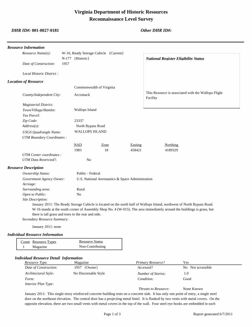
Virginia Department of Historic Resources
Reconnaissance Level Survey
DHR ID#: 001-0027-0181 Other DHR ID#:
Resource Information
National Register Eligibility Status
This Resource is associated with the Wallops Flight
Facility
Resource Name(s): W-16, Ready Storage Cubicle {Current}
N-177 {Historic}
Date of Construction: 1957
Local Historic District :
Location of Resource
County/Independent City:
Commonwealth of Virginia
Accomack
Magisterial District:
Town/Village/Hamlet: Wallops Island
Tax Parcel:
Zip Code: 23337
Address(s): North Bypass Road
USGS Quadrangle Name: WALLOPS ISLAND
UTM Boundary Coordinates :
Northing EastingZone NAD
1983 18 458421 4189329
UTM Center coordinates :
NoUTM Data Restricted?.
Resource Description
Ownership Status: Public - Federal
Government Agency Owner: U.S. National Aeronautics & Space Administration
Acreage:
Surrounding area: Rural
Open to Public: No
January 2011: The Ready Storage Cubicle is located on the north half of Wallops Island, northwest of North Bypass Road.
W-16 stands at the south corner of Assembly Shop No. 4 (W-015). The area immediately around the buildings is grass, but
there is tall grass and trees to the rear and side.
Site Description:
Secondary Resource Summary:
January 2011: none
Resource StatusResource TypesCount
Magazine Non-Contributing 1
Individual Resource Information
MagazineResource Type. Primary Resource? Yes
Individual Resource Detail Information
Date of Construction: Accessed? 1957 {Owner} No Not accessible
1.0 Number of Stories:Architectural Style: No Discernable Style
Good
Interior Plan Type:
Form: Condition:
Threats to Resource: None Known
January 2011: This single-story reinforced concrete building rests on a concrete slab. It has only one point of entry, a single steel
door on the northeast elevation. The central door has a projecting metal lintel. It is flanked by two vents with metal covers. On the
opposite elevation, there are two small vents with metal covers in the top of the wall. Four steel eye hooks are embedded in each
Report generated 6/7/2011Page 1 of 3

Virginia Department of Historic Resources
Reconnaissance Level Survey
DHR ID#: 001-0027-0181 Other DHR ID#:
corner of the roof. Cables run through the hooks, connecting it to W-15, Assembly Shop No. 4.
W-16 represents a Navy standardized building design for storage of small materials. At Wallops, it is typically utilized for storage of
hazardous materials. The Navy built numerous buildings of this type on the main base and Wallops Island between 1956 and 1965.
As of 2011, 14 buildings of this type are extant.
Primary Resource Exterior Component Description:
Material TreatmentMaterialComp Type/FormComponent
Foundation Foundation - Slab Concrete Foundation - Poured
Structural System Structural System - Masonry Concrete Structural System - Block
Roof Roof - Flat Concrete
Historic Time Period(s):S- The New Dominion (1946- Present)
Historic Context(s): Military/Defense
Technology/Engineering
Significance Statement
January 2011: W-16 and the other eight buildings on Wallops Island of this same type (V-42, V-52, W-51, W-67, Y-16, Y-20, Y-37, Y-38)
represent a secondary resource built near the beginning of the New Dominion period (1945–present) at a Military/Defense research
facility. The U.S. Navy expanded the mission of the CNAAS in 1946 to include the NAOTS, which was charged with research and testing
of naval aviation weapons and ordnance. The CNAAS/NAOTS retained this mission until the base was closed in 1959 and transferred to
NASA. During the period of 1946–1959, most of the development that occurred on the main base was related to housing and services.
However, several new buildings were constructed on main base within the three years leading up to the closure of the Navy station. The
Navy erected the same type of storage buildings as W-16 between 1956 and 1965. Each of these nine storage buildings has been
evaluated both as a contributing resource in a historic district and as an individual resource. No historic district on Wallops Island was
identified because of a lack of significance and integrity.
This resource type is not individually eligible for listing on the NRHP because it lacks significance, and also in some cases, integrity. Each
building is recommended not eligible under Criterion A because it is not associated with an event or pattern of events of local, state, or
national significance. It is not associated with the life of a person significant in our past; therefore, it is recommended not eligible under
Criterion B. Each of these storage buildings is a secondary resource of simple design and common construction and, therefore, is
recommended not eligible under Criterion C because it does not embody the distinctive characteristics of a type, period, or method of
construction; represent the work of a master; possess high artistic value; or represent a significant or distinguishable entity whose
components may lack individual distinction. It is recommended not eligible under Criterion D because it does not have the potential to
yield information important in history or prehistory.
W-16 was moved during the period of significance; therefore, it does not possess integrity of location. It also has no integrity of setting:
the setting of the current location is not comparable to the historical setting. The removal of the building from its original location and
setting has destroyed its integrity of feeling and association. Thes resource retains its integrity of design, materials, and workmanship.
National Register Eligibility Information (Intensive Level Survey):
NR Resource StatusNR Resource TypeNR Count
Building Non-contributing 1
1 Non-Contributing:
National Register Criteria:
Level of Significance:
Period of Significance:
Graphic Media Documentation
PhotographerPhoto DateNegative RepositoryDHR Negative # Photographic Media
Report generated 6/7/2011Page 2 of 3

Virginia Department of Historic Resources
Reconnaissance Level Survey
DHR ID#: 001-0027-0181 Other DHR ID#:
Digitial Images L ThursbyJanuary 2011
Bibliographic Documentation
Reference #: 1
Bibliographic RecordType: Local Records
Author:
DHR CRM Report Number:
Notes:
Wallops Flight Facility Real Property Records
Cultural Resource Management (CRM) Events
CRM Event # 1,
Cultural Resource Management Event: Survey:Phase I/Reconnaissance
Date of CRM Event: January 2011
CRM Person: TEC Inc
VDHR Project ID # Associated with Event: 2010-2274
CRM Event Notes or Comments:
Lori Thursby and Kimberly Martin
Bridge Information
Cemetery Information
Ownership Information
Unknown Unknown Name: .................................
NASA Wallops Flight FacilityCompany: ..........................
Wallops Flight FacilityAddress: .............................
Wallops IslandCity: ...................................
23337Zip: ....................................... VirginiaState: USACountry:
000-000-0000757-824-1000Phone/Extension: ..............
0000/ 0000
Relation to the Property: Owner of property
Report generated 6/7/2011Page 3 of 3
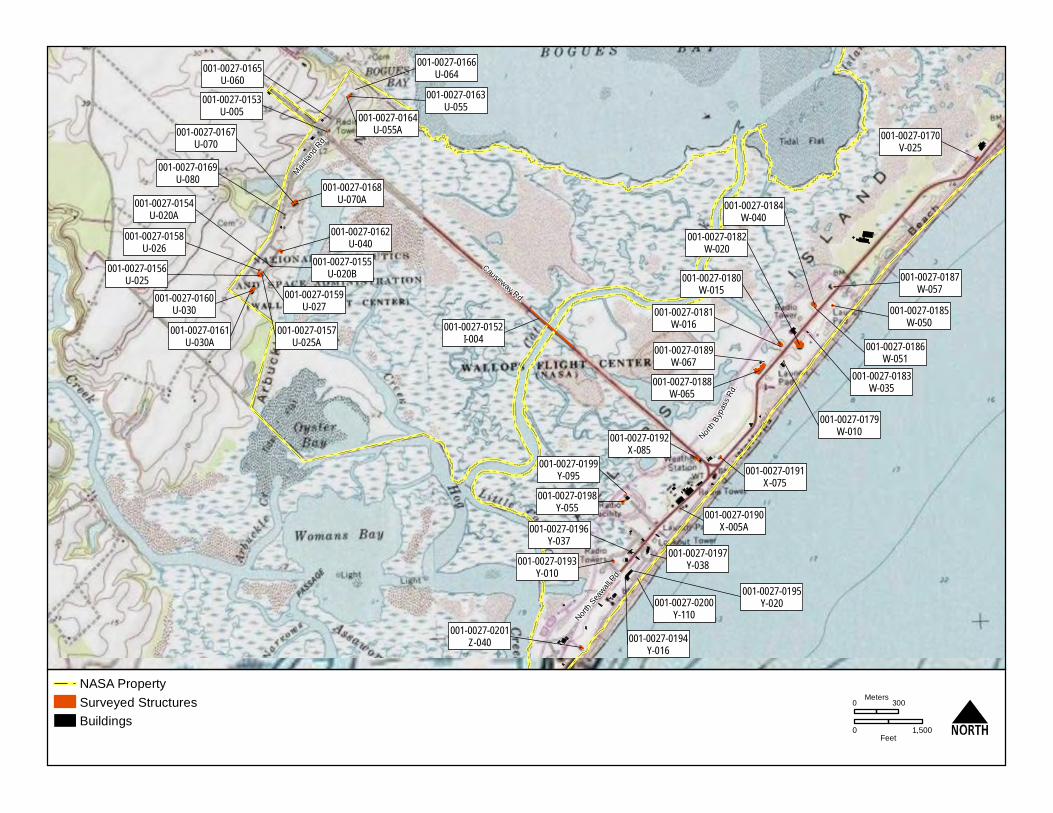
001-0027-0152I-004
Mai
nlan
d R
d.
Causeway Rd.
North
Sea
wall R
d.
North
Byp
ass
Rd.
001-0027-0182W-020
001-0027-0188W-065
001-0027-0160U-030
001-0027-0184W-040
001-0027-0167U-070
001-0027-0156U-025
001-0027-0192X-085
001-0027-0163U-055
001-0027-0201Z-040
001-0027-0198Y-055
001-0027-0193Y-010
001-0027-0170V-025
001-0027-0190X-005A
001-0027-0187W-057
001-0027-0153U-005
001-0027-0197Y-038
001-0027-0194Y-016
001-0027-0180W-015
001-0027-0162U-040
001-0027-0191X-075
001-0027-0159U-027
001-0027-0158U-026
001-0027-0168U-070A
001-0027-0185W-050
001-0027-0179W-010
001-0027-0155U-020B
001-0027-0161U-030A
001-0027-0183W-035
001-0027-0169U-080
001-0027-0165U-060
001-0027-0164U-055A
001-0027-0154U-020A
001-0027-0157U-025A
001-0027-0166U-064
001-0027-0189W-067
001-0027-0195Y-020
001-0027-0181W-016
001-0027-0186W-051
001-0027-0199Y-095
001-0027-0200Y-110
001-0027-0196Y-037
NASA Property
Surveyed Structures
Buildings
0 300Meters
0 1,500Feet


Virginia Department of Historic Resources
Reconnaissance Level Survey
DHR ID#: 001-0027-0182 Other DHR ID#:
Resource Information
National Register Eligibility Status
This Resource is associated with the Wallops Flight
Facility
Resource Name(s): W-20, Blockhouse No. 3 {Current}
Date of Construction: 1960
Local Historic District :
Location of Resource
County/Independent City:
Commonwealth of Virginia
Accomack
Magisterial District:
Town/Village/Hamlet: Wallops Island
Tax Parcel:
Zip Code: 23337
Address(s): North Bypass Road
USGS Quadrangle Name: WALLOPS ISLAND
UTM Boundary Coordinates :
Northing EastingZone NAD
1983 18 458421 4189348
UTM Center coordinates :
NoUTM Data Restricted?.
Resource Description
Ownership Status: Public - Federal
Government Agency Owner: U.S. National Aeronautics & Space Administration
Acreage:
Surrounding area: Rural
Open to Public: No
January 2011: Blockhouse No. 3 is located on the north half of Wallops Island, east of North Bypass Road. It is situated close
to Mainland Road, in a flat, open area. Tall grass and shrubs grow on the southwest side of the buildings. Elevated metal
tracks that carry cables run parallel to the road and then extend from the northeast and southwest, into the building. A fuel
tank, resting on a concrete base, is located at the front corner of the building.
Site Description:
Secondary Resource Summary:
January 2011: fuel tank on a concrete base
Resource StatusResource TypesCount
Research
Facility/Laboratory
Non-Contributing 1
Individual Resource Information
Research Facility/LaboratoryResource Type. Primary Resource? Yes
Individual Resource Detail Information
Date of Construction: Accessed? 1960 {Owner} No Not accessible
1.0 Number of Stories:Architectural Style: No Discernable Style
Good
Interior Plan Type:
Form: Condition:
Threats to Resource: None Known
January 2011: Blockhouse No. 3 is composed of two parts, a one-story, rectangular, concrete portion on the front and two-story,
hemispherical, reinforced concrete structure on the back. The dome was covered with protective sand and then sprayed with a layer
Report generated 6/7/2011Page 1 of 3

Virginia Department of Historic Resources
Reconnaissance Level Survey
DHR ID#: 001-0027-0182 Other DHR ID#:
of gunite concrete. The roofing membrane system of the dome has been replaced three different times, most recently in 2002 with
the installation of a new modified bitumen system with rigid insulation (WFF 2011). The rectangular part has a flat built-up roof and
metal fascia. The entire building rests on a reinforced concrete slab.
The northwest elevation features a concrete loading dock or platform in front of four bays of openings. The platform has a set of
metal stairs on one end with a metal tube railing surrounding it. There are two sets of double hollow steel doors interspersed with
two pairs of double aluminum fixed over awning windows. The south half of the northwest elevation originally contained two bays
of overhead doors. The original multi-light, steel-sash awning windows were replaced with the current ones in 1987 (WFF 2011).
A pair of windows appears to have been filled in on the southwest elevation. A louvered window is located directly beneath a metal
stair with metal tube railing, which leads to the roof. A second set of metal stairs leads to a round observation deck on the roof of
the dome.
The northeast elevation has a pair of replacement aluminum fixed over awning windows. Two wood frame decks, supporting
mechanical equipment, rest on a concrete pad. The dome has 4 ft-tall walls around its perimeter and rubble concrete stairs extending
to the northeast and southwest. A metal vent pierces the southeast side of the dome and a large crack, which has been covered
with asphalt roll, can be seen on the same elevation.
Primary Resource Exterior Component Description:
Material TreatmentMaterialComp Type/FormComponent
Foundation Foundation - Slab Concrete Foundation - Poured
Structural System Structural System - Masonry Concrete
Porch Porch - Loading dock Concrete
Windows Windows - Awning Metal Windows - 1-light
Windows Windows - Fixed Metal Windows - 1-light
Roof Roof - Flat Asphalt
Historic Time Period(s):S- The New Dominion (1946- Present)
Historic Context(s): Military/Defense
Technology/Engineering
Significance Statement
January 2011: This building is representative of a Research, Development and Testing resource type built near the beginning of the New
Dominion period (1945–present) at a Technology/Engineering research facility. This is one of approximately 50 buildings and structures
that were erected within six years of the establishment of NASA and the incorporation of Wallops Station as one of its operational
facilities in 1959. Initially, Wallops Station’s new mission under NASA was to develop and test various components related to manned
space flight. This mission was short-lived, however, as Wallops became a test range and launch site for suborbital and orbital rockets and
satellites beginning in the early 1960s. The planned expansion of Wallops Station after becoming a NASA facility included construction
of two launch pads (3b and 5), a blockhouse between them (W-20), and terminal buildings at each launch pad (W-10 and W-50).
Construction of this blockhouse was completed in 1960. It houses control equipment used during the launchings of large rockets from
Launch Areas 3b, 4, and 5. A closed-circuit television camera at the apex of the dome provides surveillance of each of the three launch
areas (WFF 2011).
Blockhouse No. 3 has been evaluated both as a contributing resource in a historic district and as an individual resource. No historic
district on Wallops Island was identified because of a lack of significance and integrity.
W-20 is not individually eligible for listing on the NRHP because it lacks significance and integrity. The building is recommended not
eligible under Criterion A because it is not associated with an event or pattern of events of local, state, or national significance. It is not
associated with the life of a person significant in our past; therefore, it is recommended not eligible under Criterion B. The building retains
integrity, but is of simple design and common construction and, therefore, is recommended not eligible under Criterion C because it does
not embody the distinctive characteristics of a type, period, or method of construction; represent the work of a master; possess high
artistic value; or represent a significant or distinguishable entity whose components may lack individual distinction. It is recommended
not eligible under Criterion D because it does not have the potential to yield information important in history or prehistory.
Blockhouse No. 3 has diminished integrity. The building is in its historical location. The setting of the site, however, has experienced
several recent changes that have altered the historical character of the surroundings. They include the addition of a few post-1965
buildings across the street, the addition of an extended launch slab northeast of the adjacent Launch Area 3b, the addition of a post-1965
launch area to the southwest of Launch Area 3b, and the removal of the historical timber pile seawall and groins. The building’s integrity
of design, materials, and workmanship have been compromised by the removal of two bays of overhead doors that faced the loading dock,
Report generated 6/7/2011Page 2 of 3

Virginia Department of Historic Resources
Reconnaissance Level Survey
DHR ID#: 001-0027-0182 Other DHR ID#:
the removal and replacement of all windows and personnel doors, and the replacement of the historical roofing system. The design and
material changes to the building and its setting have adversely affected the integrity of feeling. The integrity of association is largely
intact.
National Register Eligibility Information (Intensive Level Survey):
NR Resource StatusNR Resource TypeNR Count
Building Non-contributing 1
1 Non-Contributing:
National Register Criteria:
Level of Significance:
Period of Significance:
Graphic Media Documentation
PhotographerPhoto DateNegative RepositoryDHR Negative # Photographic Media
Digitial Images L ThursbyJanuary 2011
Bibliographic Documentation
Reference #: 1
Bibliographic RecordType: Local Records
Author:
DHR CRM Report Number:
Notes:
Wallops Flight Facility Real Property Records
Cultural Resource Management (CRM) Events
CRM Event # 1,
Cultural Resource Management Event: Survey:Phase I/Reconnaissance
Date of CRM Event: January 2011
CRM Person: TEC Inc
VDHR Project ID # Associated with Event: 2010-2274
CRM Event Notes or Comments:
Lori Thursby and Kimberly Martin
Bridge Information
Cemetery Information
Ownership Information
Unknown Unknown Name: .................................
NASA Wallops Flight FacilityCompany: ..........................
Wallops Flight FacilityAddress: .............................
Wallops IslandCity: ...................................
23337Zip: ....................................... VirginiaState: USACountry:
000-000-0000757-824-1000Phone/Extension: ..............
0000/ 0000
Relation to the Property: Owner of property
Report generated 6/7/2011Page 3 of 3

001-0027-0152I-004
Mai
nlan
d R
d.
Causeway Rd.
North
Sea
wall R
d.
North
Byp
ass
Rd.
001-0027-0182W-020
001-0027-0188W-065
001-0027-0160U-030
001-0027-0184W-040
001-0027-0167U-070
001-0027-0156U-025
001-0027-0192X-085
001-0027-0163U-055
001-0027-0201Z-040
001-0027-0198Y-055
001-0027-0193Y-010
001-0027-0170V-025
001-0027-0190X-005A
001-0027-0187W-057
001-0027-0153U-005
001-0027-0197Y-038
001-0027-0194Y-016
001-0027-0180W-015
001-0027-0162U-040
001-0027-0191X-075
001-0027-0159U-027
001-0027-0158U-026
001-0027-0168U-070A
001-0027-0185W-050
001-0027-0179W-010
001-0027-0155U-020B
001-0027-0161U-030A
001-0027-0183W-035
001-0027-0169U-080
001-0027-0165U-060
001-0027-0164U-055A
001-0027-0154U-020A
001-0027-0157U-025A
001-0027-0166U-064
001-0027-0189W-067
001-0027-0195Y-020
001-0027-0181W-016
001-0027-0186W-051
001-0027-0199Y-095
001-0027-0200Y-110
001-0027-0196Y-037
NASA Property
Surveyed Structures
Buildings
0 300Meters
0 1,500Feet


Virginia Department of Historic Resources
Reconnaissance Level Survey
DHR ID#: 001-0027-0183 Other DHR ID#:
Resource Information
National Register Eligibility Status
This Resource is associated with the Wallops Flight
Facility
Resource Name(s): W-35, Terminal Building Launch Area No. 4
{Current}
Date of Construction: 1960
Local Historic District :
Location of Resource
County/Independent City:
Commonwealth of Virginia
Accomack
Magisterial District:
Town/Village/Hamlet: Wallops Island
Tax Parcel:
Zip Code: 23337
Address(s): North Seawall Road
USGS Quadrangle Name: WALLOPS ISLAND
UTM Boundary Coordinates :
Northing EastingZone NAD
1983 18 458622 4189403
UTM Center coordinates :
NoUTM Data Restricted?.
Resource Description
Ownership Status: Public - Federal
Government Agency Owner: U.S. National Aeronautics & Space Administration
Acreage:
Surrounding area: Rural
Open to Public: No
January 2011: : This Terminal Building is located adjacent to Launch Area No. 4, which is on the north half of Wallops Island,
east of North Bypass Rd. It is in the middle of a row of three buildings. The area, next to the ocean, is open and flat. A
separate concrete access road leads to the building.
Site Description:
Secondary Resource Summary:
January 2011: none
Resource StatusResource TypesCount
Research
Facility/Laboratory
Non-Contributing 1
Individual Resource Information
Research Facility/LaboratoryResource Type. Primary Resource? Yes
Individual Resource Detail Information
Date of Construction: Accessed? 1960 {Owner} No Not accessible
1.0 Number of Stories:Architectural Style: No Discernable Style
Good
Interior Plan Type:
Form: Condition:
Threats to Resource: None Known
January 2011: The Terminal Building is a simple, one-story concrete building with a flat built-up roof and metal fascia. It rests on a
reinforced concrete slab and has only one opening, a set of hollow steel double doors with view windows on the northeast
Report generated 6/7/2011Page 1 of 3

Virginia Department of Historic Resources
Reconnaissance Level Survey
DHR ID#: 001-0027-0183 Other DHR ID#:
elevation. A cantilevered concrete hood provides cover to the doors and a concrete stoop. The southwest elevation has a set of
wooden stairs leading to the roof. A conduit box is located at the corner of the elevation, near the bottom of the stairs, and contains
cables extending from Blockhouse No. 3 (W-20).
Primary Resource Exterior Component Description:
Material TreatmentMaterialComp Type/FormComponent
Structural System Structural System - Masonry Concrete Structural System - Block
Foundation Foundation - Slab Concrete Foundation - Poured
Porch Porch - Stoop Concrete
Roof Roof - Flat Asphalt
Historic Time Period(s):S- The New Dominion (1946- Present)
Historic Context(s): Military/Defense
Technology/Engineering
Significance Statement
January 2011: This building represents an Infrastructure resource type built at a Technology/Engineering research facility near the
beginning of the New Dominion period (1945–present). This is one of approximately 50 buildings and structures that were erected within
six years of the establishment of NASA and the incorporation of Wallops Station as one of its operational facilities in 1959. Initially,
Wallops Station’s new mission under NASA was to develop and test various components related to manned space flight. This mission
was short-lived, however, as Wallops became a test range and launch site for suborbital and orbital rockets and satellites beginning in the
early 1960s. W-35 was constructed in 1960 as the terminal building for Launch Pad 4.
The Terminal Building Launch Area 4 has been evaluated both as a contributing resource in a historic district and as an individual
resource. No historic district on Wallops Island was identified because of a lack of significance and integrity.
W-10 is not individually eligible for listing on the NRHP because it lacks significance. The building is recommended not eligible under
Criterion A because it is not associated with an event or pattern of events of local, state, or national significance. It is not associated with
the life of a person significant in our past; therefore, it is recommended not eligible under Criterion B. The building retains integrity, but is
of simple design and common construction and, therefore, is recommended not eligible under Criterion C because it does not embody the
distinctive characteristics of a type, period, or method of construction; represent the work of a master; possess high artistic value; or
represent a significant or distinguishable entity whose components may lack individual distinction. It is recommended not eligible under
Criterion D because it does not have the potential to yield information important in history or prehistory.
National Register Eligibility Information (Intensive Level Survey):
NR Resource StatusNR Resource TypeNR Count
Building Non-contributing 1
1 Non-Contributing:
National Register Criteria:
Level of Significance:
Period of Significance:
Graphic Media Documentation
PhotographerPhoto DateNegative RepositoryDHR Negative # Photographic Media
Digitial Images L ThursbyJanuary 2011
Bibliographic Documentation
Reference #: 1
Bibliographic RecordType: Local Records
Report generated 6/7/2011Page 2 of 3

Virginia Department of Historic Resources
Reconnaissance Level Survey
DHR ID#: 001-0027-0183 Other DHR ID#:
Author:
DHR CRM Report Number:
Notes:
Wallops Flight Facility Real Property Records
Cultural Resource Management (CRM) Events
CRM Event # 1,
Cultural Resource Management Event: Survey:Phase I/Reconnaissance
Date of CRM Event: January 2011
CRM Person: TEC Inc
VDHR Project ID # Associated with Event: 2010-2274
CRM Event Notes or Comments:
Lori Thursby and Kimberly Martin
Bridge Information
Cemetery Information
Ownership Information
Unknown Unknown Name: .................................
NASA Wallops Flight FacilityCompany: ..........................
Wallops Flight FacilityAddress: .............................
Wallops IslandCity: ...................................
2337Zip: ....................................... VirginiaState: USACountry:
000-000-0000757-824-1000Phone/Extension: ..............
0000/ 0000
Relation to the Property: Owner of property
Report generated 6/7/2011Page 3 of 3

001-0027-0152I-004
Mai
nlan
d R
d.
Causeway Rd.
North
Sea
wall R
d.
North
Byp
ass
Rd.
001-0027-0182W-020
001-0027-0188W-065
001-0027-0160U-030
001-0027-0184W-040
001-0027-0167U-070
001-0027-0156U-025
001-0027-0192X-085
001-0027-0163U-055
001-0027-0201Z-040
001-0027-0198Y-055
001-0027-0193Y-010
001-0027-0170V-025
001-0027-0190X-005A
001-0027-0187W-057
001-0027-0153U-005
001-0027-0197Y-038
001-0027-0194Y-016
001-0027-0180W-015
001-0027-0162U-040
001-0027-0191X-075
001-0027-0159U-027
001-0027-0158U-026
001-0027-0168U-070A
001-0027-0185W-050
001-0027-0179W-010
001-0027-0155U-020B
001-0027-0161U-030A
001-0027-0183W-035
001-0027-0169U-080
001-0027-0165U-060
001-0027-0164U-055A
001-0027-0154U-020A
001-0027-0157U-025A
001-0027-0166U-064
001-0027-0189W-067
001-0027-0195Y-020
001-0027-0181W-016
001-0027-0186W-051
001-0027-0199Y-095
001-0027-0200Y-110
001-0027-0196Y-037
NASA Property
Surveyed Structures
Buildings
0 300Meters
0 1,500Feet


Virginia Department of Historic Resources
Reconnaissance Level Survey
DHR ID#: 001-0027-0184 Other DHR ID#:
Resource Information
National Register Eligibility Status
This Resource is associated with the Wallops Flight
Facility
Resource Name(s): W-40, Assembly Shop No. 5 {Current}
Date of Construction: 1964
Local Historic District :
Location of Resource
County/Independent City:
Commonwealth of Virginia
Accomack
Magisterial District:
Town/Village/Hamlet: Wallops Island
Tax Parcel:
Zip Code: 23337
Address(s): North Seawall Road
USGS Quadrangle Name: WALLOPS ISLAND
UTM Boundary Coordinates :
Northing EastingZone NAD
1983 18 458665 4189609
UTM Center coordinates :
NoUTM Data Restricted?.
Resource Description
Ownership Status: Public - Federal
Government Agency Owner: U.S. National Aeronautics & Space Administration
Acreage:
Surrounding area: Rural
Open to Public: No
January 2011: Assembly Shop No. 5 is located on the north half of Wallops Island, east of North Bypass Road. Across the
street by approximately 600 ft is the ocean shore, which is lined by large riprap. A new building was recently constructed to its
northeast. There is a concrete pad in front of the building used for equipment storage and vehicle parking and an asphalt
parking lot behind it for a new building. The immediate surrounding area is grass, but there is tall grass and trees beyond to the
rear and side of the building.
Site Description:
Secondary Resource Summary:
January 2011: none
Resource StatusResource TypesCount
Workshop Non-Contributing 1
Individual Resource Information
WorkshopResource Type. Primary Resource? Yes
Individual Resource Detail Information
Date of Construction: Accessed? 1964 {Owner} No Not accessible
1.0 Number of Stories:Architectural Style: No Discernable Style
Good
Interior Plan Type:
Form: Condition:
Threats to Resource: None Known
January 2011: Assembly Shop No. 5 is a composed of two parts, the original building and a 60 ft by 20 ft addition on the northeast
side, which was completed after the original building was moved to this site in 1964 (WFF 2011). There is a discrepancy in the real
Report generated 6/7/2011Page 1 of 3

Virginia Department of Historic Resources
Reconnaissance Level Survey
DHR ID#: 001-0027-0184 Other DHR ID#:
property records concerning the date of construction of Building W-40 as either 1957 or 1960 (WFF 2011). The original building is
constructed of concrete block and sheathed with insulated metal panels. The addition is prefabricated metal construction. Both
components stand on a reinforced concrete foundation and terminate in front gable roofs clad in metal. The metal roofing and
siding were installed in 1996 (WFF 2011). The southeast elevation has a central overhead steel door and a single hollow steel door
on the original building. The 1964 addition has a set of double hollow steel doors and a pair of one-over-one aluminum windows.
The northeast elevation has no openings on the original building. The addition has two sets of triple and one set of double
one-over-one aluminum windows. The southwest elevation consists of two sets of triple one-over-one aluminum windows. The
northwest elevations features two single hollow steel doors, with one situated in each part. All windows and doors are
replacements. The windows were originally either six-light fixed units or horizontal sliding units (WFF 2010). Two metal hoods are
affixed to the building; the hood on the original building provides cover to the door, but the hood on the addition is on the opposite
side from the door. Two wood decks on concrete pads are located on the northwest elevation; these provide storage to HVAC
units. A small lean-to with a shed roof is also on the northwest side of the building. The lean-to has a single hollow steel door and
a metal stack that pierces the corner of the roof.
Primary Resource Exterior Component Description:
Material TreatmentMaterialComp Type/FormComponent
Foundation Foundation - Slab Concrete Foundation - Poured
Structural System Structural System - Frame Metal Structural System - Siding
Structural System Structural System - Masonry Concrete Structural System - Block
Porch Porch - Stoop Concrete
Windows Windows - Sash, Double-Hung Aluminum Windows - 1/1
Roof Roof - Gable, Front Metal Roof - Corrugated
Historic Time Period(s):S- The New Dominion (1946- Present)
Historic Context(s): Military/Defense
Technology/Engineering
Significance Statement
January 2011: This building is representative of an Industrial resource type built near the beginning of the New Dominion period
(1945–present) at a Military/Defense research facility. Different real property records list the date of construction of this building as 1957
or 1960. The building is not identified on a 1957 map of Wallops Island; however, it is nearly identical in design to W-15, which was built
by the Navy in 1957 for the NAOTS. The Navy expanded the mission of the CNAAS in 1946 to include the NAOTS, which was charged
with research and testing of naval aviation weapons and ordnance. The CNAAS/NAOTS retained this mission until the base was closed
in 1959 and transferred to NASA. During the period of 1946–1959, development on the north part of Wallops Island primarily consisted of
target installations. In 1964, five years after the base was transferred to NASA, the building was moved to its present location, expanded
with a prefabricated metal addition, and used as an assembly shop (WFF 2011). Available sources did not indicate the original location of
the building.
W-40 has been evaluated both as a contributing resource in a historic district and as an individual resource. No historic district on
Wallops Island was identified because of a lack of significance and integrity.
Assembly Shop No. 5 is not individually eligible for listing on the NRHP because it lacks significance and integrity. Because it was moved
from its original site to its current location, W-40 was evaluated under Criteria Consideration B in addition to Criteria A–D. The building is
recommended not eligible under Criterion A because it is not associated with an event or pattern of events of local, state, or national
significance. It is not associated with the life of a person significant in our past; therefore, it is recommended not eligible under Criterion
B. The building is of simple design and common construction and, therefore, is recommended not eligible under Criterion C because it
does not embody the distinctive characteristics of a type, period, or method of construction; represent the work of a master; possess high
artistic value; or represent a significant or distinguishable entity whose components may lack individual distinction. It is recommended
not eligible under Criterion D because it does not have the potential to yield information important in history or prehistory.
The building was moved during the period of significance; therefore, it does not possess integrity of location. It also has no integrity of
setting because the surroundings of the current location are not comparable to those of the historical setting. The removal of the building
from its original location and setting has destroyed its integrity of feeling and association. The resource retains its integrity of design.
The materials and workmanship have been compromised by removal and replacement of the historical siding, roofing, doors, and windows.
Report generated 6/7/2011Page 2 of 3

Virginia Department of Historic Resources
Reconnaissance Level Survey
DHR ID#: 001-0027-0184 Other DHR ID#:
National Register Eligibility Information (Intensive Level Survey):
NR Resource StatusNR Resource TypeNR Count
Building Non-contributing 1
1 Non-Contributing:
National Register Criteria:
Level of Significance:
Period of Significance:
Graphic Media Documentation
PhotographerPhoto DateNegative RepositoryDHR Negative # Photographic Media
Digitial Images L ThursbyJanuary 2011
Bibliographic Documentation
Reference #: 1
Bibliographic RecordType: Local Records
Author:
DHR CRM Report Number:
Notes:
Wallops Flight Facility Real Property Records
Cultural Resource Management (CRM) Events
CRM Event # 1,
Cultural Resource Management Event: Survey:Phase I/Reconnaissance
Date of CRM Event: January 2011
CRM Person: TEC Inc
VDHR Project ID # Associated with Event: 2010-2274
CRM Event Notes or Comments:
Lori Thursby and Kimberly Martin
Bridge Information
Cemetery Information
Ownership Information
Unknown Unknown Name: .................................
NASA Wallops Flight FacilityCompany: ..........................
Wallops Flight FacilityAddress: .............................
Wallops IslandCity: ...................................
23337Zip: ....................................... VirginiaState: USACountry:
000-000-0000757-824-1000Phone/Extension: ..............
0000/ 0000
Relation to the Property: Owner of property
Report generated 6/7/2011Page 3 of 3

001-0027-0152I-004
Mai
nlan
d R
d.
Causeway Rd.
North
Sea
wall R
d.
North
Byp
ass
Rd.
001-0027-0182W-020
001-0027-0188W-065
001-0027-0160U-030
001-0027-0184W-040
001-0027-0167U-070
001-0027-0156U-025
001-0027-0192X-085
001-0027-0163U-055
001-0027-0201Z-040
001-0027-0198Y-055
001-0027-0193Y-010
001-0027-0170V-025
001-0027-0190X-005A
001-0027-0187W-057
001-0027-0153U-005
001-0027-0197Y-038
001-0027-0194Y-016
001-0027-0180W-015
001-0027-0162U-040
001-0027-0191X-075
001-0027-0159U-027
001-0027-0158U-026
001-0027-0168U-070A
001-0027-0185W-050
001-0027-0179W-010
001-0027-0155U-020B
001-0027-0161U-030A
001-0027-0183W-035
001-0027-0169U-080
001-0027-0165U-060
001-0027-0164U-055A
001-0027-0154U-020A
001-0027-0157U-025A
001-0027-0166U-064
001-0027-0189W-067
001-0027-0195Y-020
001-0027-0181W-016
001-0027-0186W-051
001-0027-0199Y-095
001-0027-0200Y-110
001-0027-0196Y-037
NASA Property
Surveyed Structures
Buildings
0 300Meters
0 1,500Feet


Virginia Department of Historic Resources
Reconnaissance Level Survey
DHR ID#: 001-0027-0185 Other DHR ID#:
Resource Information
National Register Eligibility Status
This Resource is associated with the Wallops Flight
Facility
Resource Name(s): W-50, Launch Area Cable Terminal Building
{Current}
Date of Construction: 1960
Local Historic District :
Location of Resource
County/Independent City:
Commonwealth of Virginia
Accomack
Magisterial District:
Town/Village/Hamlet: Wallops Island
Tax Parcel:
Zip Code: 23337
Address(s): North Seawall Road
USGS Quadrangle Name: WALLOPS ISLAND
UTM Boundary Coordinates :
Northing EastingZone NAD
1983 18 458784 4189596
UTM Center coordinates :
NoUTM Data Restricted?.
Resource Description
Ownership Status: Public - Federal
Government Agency Owner: U.S. National Aeronautics & Space Administration
Acreage:
Surrounding area: Rural
Open to Public: No
January 2011: The Launch Area Cable Terminal Building is located on the north half of Wallops Island, east of North Bypass
Road. It is set back from an access road in a grass field. A large new building was constructed across the street. riprap Behind
the building is the rip rap-lined seashore.
Site Description:
Secondary Resource Summary:
January 2011: none
Resource StatusResource TypesCount
Research
Facility/Laboratory
Non-Contributing 1
Individual Resource Information
Research Facility/LaboratoryResource Type. Primary Resource? Yes
Individual Resource Detail Information
Date of Construction: Accessed? 1960 {Owner} No Not accessible
1.0 Number of Stories:Architectural Style: No Discernable Style
Good
Interior Plan Type:
Form: Condition:
Threats to Resource: None Known
January 2011: The Terminal Building is a simple, one-story concrete and concrete block building with a flat built-up roof and metal
fascia. A thin metal membrane has been placed over the fascia and is in poor condition. The building rests on a reinforced concrete
Report generated 6/7/2011Page 1 of 3

Virginia Department of Historic Resources
Reconnaissance Level Survey
DHR ID#: 001-0027-0185 Other DHR ID#:
slab and has only one opening, located on the northwest elevation. The opening consists of a central set of double hollow steel
doors with a concrete stoop. There is window structure visible beside the door, but it has been filled in. Additional evidence of
openings, now filled in, can be seen on the southwest elevation. According to the real property records, the building had louvered
windows installed in 1976; none remain today (WFF 2011). There are two metal conduits on southwest elevation. The southeast
elevation has no opening and the northeast elevation was inaccessible.
Primary Resource Exterior Component Description:
Material TreatmentMaterialComp Type/FormComponent
Structural System Structural System - Masonry Concrete Structural System - Parged
Roof Roof - Flat Asphalt
Foundation Foundation - Slab Concrete Foundation - Poured
Historic Time Period(s):S- The New Dominion (1946- Present)
Historic Context(s): Military/Defense
Technology/Engineering
Significance Statement
January 2011: This building represents an Infrastructure resource type built at a Technology/Engineering research facility near the
beginning of the New Dominion period (1945–present). This is one of approximately 50 buildings and structures that were erected within
six years of the establishment of NASA and the incorporation of Wallops Station as one of its operational facilities in 1959. Initially,
Wallops Station’s new mission under NASA was to develop and test various components related to manned space flight. This mission
was short-lived, however, as Wallops became a test range and launch site for suborbital and orbital rockets and satellites beginning in the
early 1960s. The planned expansion of Wallops Station after becoming a NASA facility included construction of two launch pads (3b and
5), a blockhouse between them (W-20), and terminal buildings at each launch pad (W-10 and W-50). W-50 is the terminal building for
Launch Pad 5. Construction of the terminal building was completed in 1960.
The Launch Area Cable Terminal Building has been evaluated both as a contributing resource in a historic district and as an individual
resource. No historic district on Wallops Island was identified because of a lack of significance and integrity.
W-50 is not individually eligible for listing on the NRHP because it lacks significance. The building is recommended not eligible under
Criterion A because it is not associated with an event or pattern of events of local, state, or national significance. It is not associated with
the life of a person significant in our past; therefore, it is recommended not eligible under Criterion B. The building retains integrity, but is
of simple design and common construction and, therefore, is recommended not eligible under Criterion C because it does not embody the
distinctive characteristics of a type, period, or method of construction; represent the work of a master; possess high artistic value; or
represent a significant or distinguishable entity whose components may lack individual distinction. It is recommended not eligible under
Criterion D because it does not have the potential to yield information important in history or prehistory.
National Register Eligibility Information (Intensive Level Survey):
NR Resource StatusNR Resource TypeNR Count
Building Non-contributing 1
1 Non-Contributing:
National Register Criteria:
Level of Significance:
Period of Significance:
Graphic Media Documentation
PhotographerPhoto DateNegative RepositoryDHR Negative # Photographic Media
Digitial Images L ThursbyJanuary 2011
Report generated 6/7/2011Page 2 of 3

Virginia Department of Historic Resources
Reconnaissance Level Survey
DHR ID#: 001-0027-0185 Other DHR ID#:
Bibliographic Documentation
Reference #: 1
Bibliographic RecordType: Local Records
Author:
DHR CRM Report Number:
Notes:
Wallops Flight Facility Real Property Records
Cultural Resource Management (CRM) Events
CRM Event # 1,
Cultural Resource Management Event: Survey:Phase I/Reconnaissance
Date of CRM Event: January 2011
CRM Person: TEC Inc
VDHR Project ID # Associated with Event: 2010-2274
CRM Event Notes or Comments:
Lori Thursby and Kimberly Martin
Bridge Information
Cemetery Information
Ownership Information
Unknown Unknown Name: .................................
NASA Wallops Flight FacilityCompany: ..........................
Wallops Flight FacilityAddress: .............................
Wallops IslandCity: ...................................
23337Zip: ....................................... VirginiaState: USACountry:
000-000-0000757-824-1000Phone/Extension: ..............
0000/ 0000
Relation to the Property: Owner of property
Report generated 6/7/2011Page 3 of 3

001-0027-0152I-004
Mai
nlan
d R
d.
Causeway Rd.
North
Sea
wall R
d.
North
Byp
ass
Rd.
001-0027-0182W-020
001-0027-0188W-065
001-0027-0160U-030
001-0027-0184W-040
001-0027-0167U-070
001-0027-0156U-025
001-0027-0192X-085
001-0027-0163U-055
001-0027-0201Z-040
001-0027-0198Y-055
001-0027-0193Y-010
001-0027-0170V-025
001-0027-0190X-005A
001-0027-0187W-057
001-0027-0153U-005
001-0027-0197Y-038
001-0027-0194Y-016
001-0027-0180W-015
001-0027-0162U-040
001-0027-0191X-075
001-0027-0159U-027
001-0027-0158U-026
001-0027-0168U-070A
001-0027-0185W-050
001-0027-0179W-010
001-0027-0155U-020B
001-0027-0161U-030A
001-0027-0183W-035
001-0027-0169U-080
001-0027-0165U-060
001-0027-0164U-055A
001-0027-0154U-020A
001-0027-0157U-025A
001-0027-0166U-064
001-0027-0189W-067
001-0027-0195Y-020
001-0027-0181W-016
001-0027-0186W-051
001-0027-0199Y-095
001-0027-0200Y-110
001-0027-0196Y-037
NASA Property
Surveyed Structures
Buildings
0 300Meters
0 1,500Feet


Virginia Department of Historic Resources
Reconnaissance Level Survey
DHR ID#: 001-0027-0186 Other DHR ID#:
Resource Information
National Register Eligibility Status
This Resource is associated with the Wallops Flight
Facility
Resource Name(s): W-51, Launch Pad 5 Firing Cubical {Historic}
W-51, Flammables Storehouse Ready Magazine
{Current}
B-187 {Historic}
Date of Construction: 1956
Local Historic District :
Location of Resource
County/Independent City:
Commonwealth of Virginia
Accomack
Magisterial District:
Town/Village/Hamlet: Wallops Island
Tax Parcel:
Zip Code: 23337
Address(s):
USGS Quadrangle Name: WALLOPS ISLAND
UTM Boundary Coordinates :
Northing EastingZone NAD
1983 18 458462 4200310
UTM Center coordinates :
NoUTM Data Restricted?.
Resource Description
Ownership Status: Public - Federal
Government Agency Owner: U.S. National Aeronautics & Space Administration
Acreage:
Surrounding area: Rural
Open to Public: No
January 2011: The Flammables Storehouse is located on the north half of Wallops Island, east of North Bypass Road. Across
the street by approximately 600 ft is the ocean shore, which is lined by large riprap. A new building was recently constructed to
its northeast. The immediate surrounding area is grass, but there is tall grass and trees beyond to the rear and side of the
building.
Site Description:
Secondary Resource Summary:
January 2011: none
Resource StatusResource TypesCount
Magazine Non-Contributing 1
Individual Resource Information
MagazineResource Type. Primary Resource? Yes
Individual Resource Detail Information
Date of Construction: Accessed? 1956 {Owner} No Not accessible
1.0 Number of Stories:Architectural Style: No Discernable Style
Good
Interior Plan Type:
Form: Condition:
Threats to Resource: None Known
Report generated 6/7/2011Page 1 of 3

Virginia Department of Historic Resources
Reconnaissance Level Survey
DHR ID#: 001-0027-0186 Other DHR ID#:
January 2011: This single-story reinforced concrete building rests on a concrete slab. It has only one point of entry, a single steel
door on the northwest elevation. The central door does not have a projecting metal lintel, which is typical for this building type.
The entry is flanked by two vents with metal covers. On the opposite elevation there are two small vents in the top of the wall. A
metal plate has been added to the center of the wall. Unlike other buildings of this type, W-51 does not have steel eye hooks in
each corner of the roof.
W-51 represents a Navy standardized building design for storage of small materials. At Wallops, it is typically utilized for storage of
hazardous materials. The Navy built numerous buildings of this type on the main base and Wallops Island between 1956 and 1965.
As of 2011, 14 buildings of this type were extant.
Primary Resource Exterior Component Description:
Material TreatmentMaterialComp Type/FormComponent
Roof Roof - Flat Concrete
Foundation Foundation - Slab Concrete Foundation - Poured
Structural System Structural System - Masonry Concrete
Historic Time Period(s):S- The New Dominion (1946- Present)
Historic Context(s): Military/Defense
Technology/Engineering
Significance Statement
January 2011: W-51 and the other eight buildings on Wallops Island of this same type (V-42, V-52, W-16, W-67, Y-16, Y-20, Y-37, and Y-38)
represent a secondary resource built near the beginning of the New Dominion period (1945–present) at a Military/Defense research
facility. The U.S. Navy expanded the mission of the CNAAS in 1946 to include the NAOTS, which was charged with research and testing
of naval aviation weapons and ordnance. The CNAAS/NAOTS retained this mission until the base was closed in 1959 and transferred to
NASA. During the period of 1946–1959, most of the development that occurred on the main base was related to housing and services.
However, several new buildings were constructed on main base within the three years leading up to the closure of the Navy station. The
Navy erected the same type of storage buildings as W-51 between 1956 and 1965. Each of these nine storage buildings has been
evaluated both as a contributing resource in a historic district and as an individual resource. No historic district on Wallops Island was
identified because of a lack of significance and integrity.
This resource type is not individually eligible for listing on the NRHP because it lacks significance, and also in some cases, integrity. Each
building is recommended not eligible under Criterion A because it is not associated with an event or pattern of events of local, state, or
national significance. It is not associated with the life of a person significant in our past; therefore, it is recommended not eligible under
Criterion B. Each of these storage buildings is a secondary resource of simple design and common construction and, therefore, is
recommended not eligible under Criterion C because it does not embody the distinctive characteristics of a type, period, or method of
construction; represent the work of a master; possess high artistic value; or represent a significant or distinguishable entity whose
components may lack individual distinction. It is recommended not eligible under Criterion D because it does not have the potential to
yield information important in history or prehistory.
W-51 was moved during the period of significance; therefore, it does not possess integrity of location. It also has no integrity of setting:
the setting of the current location is not comparable to the historical setting. The removal of the building from its original location and
setting has destroyed its integrity of feeling and association. The resource retains its integrity of design, materials, and workmanship.
National Register Eligibility Information (Intensive Level Survey):
NR Resource StatusNR Resource TypeNR Count
Building Non-contributing 1
1 Non-Contributing:
National Register Criteria:
Level of Significance:
Period of Significance:
Report generated 6/7/2011Page 2 of 3

Virginia Department of Historic Resources
Reconnaissance Level Survey
DHR ID#: 001-0027-0186 Other DHR ID#:
Graphic Media Documentation
PhotographerPhoto DateNegative RepositoryDHR Negative # Photographic Media
Digital Images L. ThursbyJanuary 2011
Bibliographic Documentation
Reference #: 1
Bibliographic RecordType: Local Records
Author:
DHR CRM Report Number:
Notes:
Wallops Flight Facility Real Property Records
Cultural Resource Management (CRM) Events
CRM Event # 1,
Cultural Resource Management Event: Survey:Phase I/Reconnaissance
Date of CRM Event: January 2011
CRM Person: TEC Inc
VDHR Project ID # Associated with Event: 2010-2274
CRM Event Notes or Comments:
Lori Thursby and Kimberly Martin
Bridge Information
Cemetery Information
Ownership Information
Unknown Unknown Name: .................................
NASA Wallops Flight FacilityCompany: ..........................
Wallops Flight FacilityAddress: .............................
Wallops IslandCity: ...................................
23337Zip: ....................................... VirginiaState: USACountry:
000-000-0000757-824-1000Phone/Extension: ..............
0000/ 0000
Relation to the Property: Owner of property
Report generated 6/7/2011Page 3 of 3

001-0027-0152I-004
Mai
nlan
d R
d.
Causeway Rd.
North
Sea
wall R
d.
North
Byp
ass
Rd.
001-0027-0182W-020
001-0027-0188W-065
001-0027-0160U-030
001-0027-0184W-040
001-0027-0167U-070
001-0027-0156U-025
001-0027-0192X-085
001-0027-0163U-055
001-0027-0201Z-040
001-0027-0198Y-055
001-0027-0193Y-010
001-0027-0170V-025
001-0027-0190X-005A
001-0027-0187W-057
001-0027-0153U-005
001-0027-0197Y-038
001-0027-0194Y-016
001-0027-0180W-015
001-0027-0162U-040
001-0027-0191X-075
001-0027-0159U-027
001-0027-0158U-026
001-0027-0168U-070A
001-0027-0185W-050
001-0027-0179W-010
001-0027-0155U-020B
001-0027-0161U-030A
001-0027-0183W-035
001-0027-0169U-080
001-0027-0165U-060
001-0027-0164U-055A
001-0027-0154U-020A
001-0027-0157U-025A
001-0027-0166U-064
001-0027-0189W-067
001-0027-0195Y-020
001-0027-0181W-016
001-0027-0186W-051
001-0027-0199Y-095
001-0027-0200Y-110
001-0027-0196Y-037
NASA Property
Surveyed Structures
Buildings
0 300Meters
0 1,500Feet
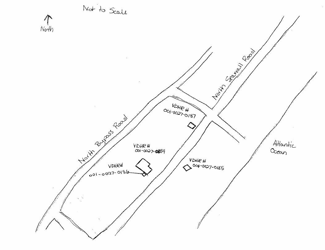
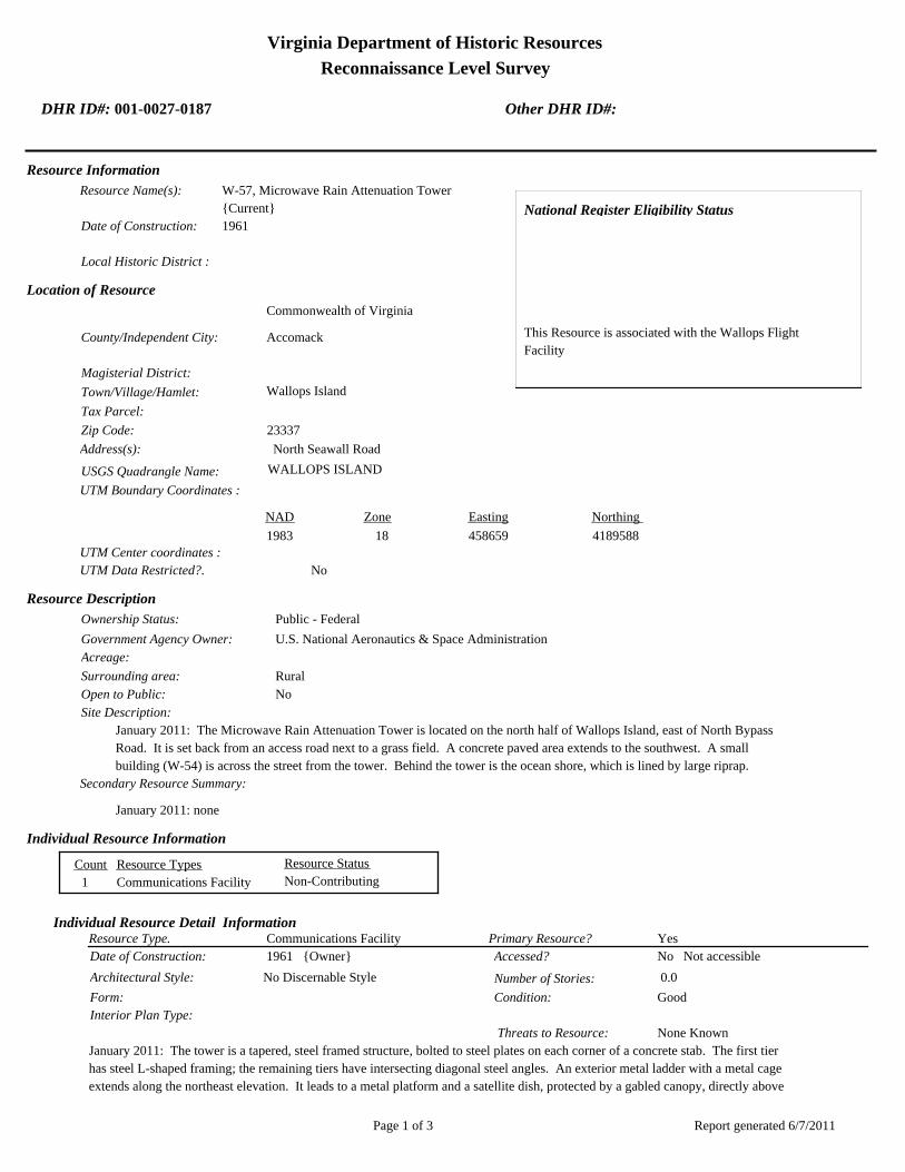
Virginia Department of Historic Resources
Reconnaissance Level Survey
DHR ID#: 001-0027-0187 Other DHR ID#:
Resource Information
National Register Eligibility Status
This Resource is associated with the Wallops Flight
Facility
Resource Name(s): W-57, Microwave Rain Attenuation Tower
{Current}
Date of Construction: 1961
Local Historic District :
Location of Resource
County/Independent City:
Commonwealth of Virginia
Accomack
Magisterial District:
Town/Village/Hamlet: Wallops Island
Tax Parcel:
Zip Code: 23337
Address(s): North Seawall Road
USGS Quadrangle Name: WALLOPS ISLAND
UTM Boundary Coordinates :
Northing EastingZone NAD
1983 18 458659 4189588
UTM Center coordinates :
NoUTM Data Restricted?.
Resource Description
Ownership Status: Public - Federal
Government Agency Owner: U.S. National Aeronautics & Space Administration
Acreage:
Surrounding area: Rural
Open to Public: No
January 2011: The Microwave Rain Attenuation Tower is located on the north half of Wallops Island, east of North Bypass
Road. It is set back from an access road next to a grass field. A concrete paved area extends to the southwest. A small
building (W-54) is across the street from the tower. Behind the tower is the ocean shore, which is lined by large riprap.
Site Description:
Secondary Resource Summary:
January 2011: none
Resource StatusResource TypesCount
Communications Facility Non-Contributing 1
Individual Resource Information
Communications FacilityResource Type. Primary Resource? Yes
Individual Resource Detail Information
Date of Construction: Accessed? 1961 {Owner} No Not accessible
0.0 Number of Stories:Architectural Style: No Discernable Style
Good
Interior Plan Type:
Form: Condition:
Threats to Resource: None Known
January 2011: The tower is a tapered, steel framed structure, bolted to steel plates on each corner of a concrete stab. The first tier
has steel L-shaped framing; the remaining tiers have intersecting diagonal steel angles. An exterior metal ladder with a metal cage
extends along the northeast elevation. It leads to a metal platform and a satellite dish, protected by a gabled canopy, directly above
Report generated 6/7/2011Page 1 of 3

Virginia Department of Historic Resources
Reconnaissance Level Survey
DHR ID#: 001-0027-0187 Other DHR ID#:
it. The canopy’s roof, as well as its northwest and southeast sides, is covered in corrugated metal. The tower originally was located
in another location and used for the Television Infra-Red Observation Satellite (TIROS) weather tracking program (Wallace, 1997).
Primary Resource Exterior Component Description:
Material TreatmentMaterialComp Type/FormComponent
Foundation Foundation - Slab Concrete Foundation - Poured
Structural System Structural System - Masonry Concrete Structural System - Block
Roof Roof - Gable, Front Steel Roof - Corrugated
Historic Time Period(s):S- The New Dominion (1946- Present)
Historic Context(s): Military/Defense
Technology/Engineering
Significance Statement
January 2011: This tower is representative of a Communications resource type built at a Technology/Engineering research facility towards
the beginning of the New Dominion period (1945–present). This is one of approximately 50 buildings and structures that were erected
within six years of the establishment of NASA and the incorporation of Wallops Station as one of its operational facilities in 1959.
Initially, Wallops Station’s new mission under NASA was to develop and test various components related to manned space flight. This
mission was short-lived, however, as Wallops became a test range and launch site for suborbital and orbital rockets and satellites
beginning in the early 1960s. NASA erected this structure in 1961.
This tower has been evaluated both as a contributing resource in a historic district and as an individual resource. No historic district on
Wallops Island was identified because of a lack of significance and integrity.
W-10 is not individually eligible for listing on the NRHP because it lacks significance. The structure is recommended not eligible under
Criterion A because it is not associated with an event or pattern of events of local, state, or national significance. It is not associated with
the life of a person significant in our past; therefore, it is recommended not eligible under Criterion B. W-57 retains integrity, but it is
recommended not eligible under Criterion C because it does not embody the distinctive characteristics of a type, period, or method of
construction; represent the work of a master; possess high artistic value; or represent a significant or distinguishable entity whose
components may lack individual distinction. It is recommended not eligible under Criterion D because it does not have the potential to
yield information important in history or prehistory.
National Register Eligibility Information (Intensive Level Survey):
NR Resource StatusNR Resource TypeNR Count
Building Non-contributing 1
1 Non-Contributing:
National Register Criteria:
Level of Significance:
Period of Significance:
Graphic Media Documentation
PhotographerPhoto DateNegative RepositoryDHR Negative # Photographic Media
Digitial Images L ThursbyJanuary 2011
Bibliographic Documentation
Reference #: 1
Bibliographic RecordType: Local Records
Author:
Report generated 6/7/2011Page 2 of 3

Virginia Department of Historic Resources
Reconnaissance Level Survey
DHR ID#: 001-0027-0187 Other DHR ID#:
DHR CRM Report Number:
Notes:
Wallops Flight Facility Real Property Records
Cultural Resource Management (CRM) Events
CRM Event # 1,
Cultural Resource Management Event: Survey:Phase I/Reconnaissance
Date of CRM Event: January 2011
CRM Person: TEC Inc
VDHR Project ID # Associated with Event: 2010-2274
CRM Event Notes or Comments:
Lori Thursby and Kimberly Martin
Bridge Information
Cemetery Information
Ownership Information
Unknown Unknown Name: .................................
NASA Wallops Flight FacilityCompany: ..........................
Wallops Flight FacilityAddress: .............................
Wallops IslandCity: ...................................
23337Zip: ....................................... VirginiaState: USACountry:
000-000-0000757-824-1000Phone/Extension: ..............
0000/ 0000
Relation to the Property: Owner of property
Report generated 6/7/2011Page 3 of 3

001-0027-0152I-004
Mai
nlan
d R
d.
Causeway Rd.
North
Sea
wall R
d.
North
Byp
ass
Rd.
001-0027-0182W-020
001-0027-0188W-065
001-0027-0160U-030
001-0027-0184W-040
001-0027-0167U-070
001-0027-0156U-025
001-0027-0192X-085
001-0027-0163U-055
001-0027-0201Z-040
001-0027-0198Y-055
001-0027-0193Y-010
001-0027-0170V-025
001-0027-0190X-005A
001-0027-0187W-057
001-0027-0153U-005
001-0027-0197Y-038
001-0027-0194Y-016
001-0027-0180W-015
001-0027-0162U-040
001-0027-0191X-075
001-0027-0159U-027
001-0027-0158U-026
001-0027-0168U-070A
001-0027-0185W-050
001-0027-0179W-010
001-0027-0155U-020B
001-0027-0161U-030A
001-0027-0183W-035
001-0027-0169U-080
001-0027-0165U-060
001-0027-0164U-055A
001-0027-0154U-020A
001-0027-0157U-025A
001-0027-0166U-064
001-0027-0189W-067
001-0027-0195Y-020
001-0027-0181W-016
001-0027-0186W-051
001-0027-0199Y-095
001-0027-0200Y-110
001-0027-0196Y-037
NASA Property
Surveyed Structures
Buildings
0 300Meters
0 1,500Feet


Virginia Department of Historic Resources
Reconnaissance Level Survey
DHR ID#: 001-0027-0188 Other DHR ID#:
Resource Information
National Register Eligibility Status
This Resource is associated with the Wallops Flight
Facility
Resource Name(s): W-65, Checkout and Assembly Shop No. 3
{Current}
Date of Construction: 1963
Local Historic District :
Location of Resource
County/Independent City:
Commonwealth of Virginia
Accomack
Magisterial District:
Town/Village/Hamlet: Wallops Island
Tax Parcel:
Zip Code: 23337
Address(s): North Bypass Road
USGS Quadrangle Name: WALLOPS ISLAND
UTM Boundary Coordinates :
Northing EastingZone NAD
1983 18 458289 4189188
UTM Center coordinates :
NoUTM Data Restricted?.
Resource Description
Ownership Status: Public - Federal
Government Agency Owner: U.S. National Aeronautics & Space Administration
Acreage:
Surrounding area: Rural
Open to Public: No
January 2011: Checkout and Assembly Shop No. 3 is located on the north half of Wallops Island, northwest of North Bypass
Road. A concrete pad surrounds the building. The immediate area around the building is grass, but there is tall grass beyond
to the rear. Across the street by approximately 600 ft is the shoreline, which is covered by large riprap.
Site Description:
Secondary Resource Summary:
January 2011: none
Resource StatusResource TypesCount
Workshop Non-Contributing 1
Individual Resource Information
WorkshopResource Type. Primary Resource? Yes
Individual Resource Detail Information
Date of Construction: Accessed? 1963 {Owner} No Not accessible
1.0 Number of Stories:Architectural Style: No Discernable Style
Good
Interior Plan Type:
Form: Condition:
Threats to Resource: None Known
January 2011: Checkout and Assembly Shop No. 3 is a reinforced concrete building with a flat built-up roof and aluminum fascia.
The building originally consisted of five bays of shops; a sixth bay was appended to the southeast end of the building in 1965
(WFF 2010, 2011). Dividing each of the five original bays are tapered, sand-filled blast walls. The walls are reinforced concrete
Report generated 6/7/2011Page 1 of 3

Virginia Department of Historic Resources
Reconnaissance Level Survey
DHR ID#: 001-0027-0188 Other DHR ID#:
(WFF 2010). Generally, sand is better blast absorber than concrete because sand is a better insulator than concrete and it will have a
little give to allow for impact absorption that concrete does not have. As such the impact of an explosion would cause less damage
in a building with sand-compressed walls versus solid concrete walls. The northwest (rear) elevation includes a central lean-to clad
in metal siding; the lean-to is original to the building. A concrete block lean-to was affixed to the southeast side of the 1965 addition
in 1976 (WFF 2011).
The southeast elevation has six bays of overhead doors. The four south bays have insulated coiling overhead doors the full height
of the building; the remaining two bays have shorter steel rolling doors. Translucent panels act as sidelights to the doors. Single
hollow steel doors with view windows are situated to the southwest of each overhead door, with the exception of the overhead
doors on the end, which each has a door to the northeast. All the personnel and overhead doors were removed and replaced in 1999
(WFF 2011). Translucent insulated blast panels sheath the entire northwest and southeast elevations; these replaced the original
translucent panel wall system in 1999 (WFF 2010, 2011).
The northwest elevation has two overhead doors: a steel rolling door in the southeast corner and a canvas door in the center of the
elevation. There is one single hollow steel door with a view window on the northwest corner and a set of double doors with view
windows. The 1965 addition has three sets of double windows that have been filled in with ribbed metal: one set is located next to
the door and the remaining two sets are above the door. There is a louvered aluminum window in the original lean-to.
The northeast elevation of the original lean-to contains a set of double half-glazed metal doors. There are three evenly spaced
single hollow steel doors in the concrete block portion and a large one-over-one window in the 1965 addition. The top pane has
been filled with ribbed metal
Primary Resource Exterior Component Description:
Material TreatmentMaterialComp Type/FormComponent
Structural System Structural System - Masonry Concrete Structural System - Block
Structural System Structural System - Frame Metal Structural System - Siding
Windows Windows - Industrial Plastic Windows - 1-light
Roof Roof - Flat Asphalt
Foundation Foundation - Slab Concrete Foundation - Poured
Historic Time Period(s):S- The New Dominion (1946- Present)
Historic Context(s): Military/Defense
Technology/Engineering
Significance Statement
January 2011: This building is an example of an Industrial resource type built at a Technology/Engineering research facility towards the
beginning of the New Dominion period (1945–present). This is one of approximately 50 buildings and structures that were erected within
six years of the establishment of NASA and the incorporation of Wallops Station as one of its operational facilities in 1959. Initially,
Wallops Station’s new mission under NASA was to develop and test various components related to manned space flight. This mission
was short-lived, however, as Wallops became a test range and launch site for suborbital and orbital rockets and satellites beginning in the
early 1960s. Construction of Assembly Shop No. 3 was completed in 1963.
W-65 has been evaluated both as a contributing resource in a historic district and as an individual resource. No historic district on
Wallops Island was identified because of a lack of significance and integrity.
Assembly Shop No. 3 is not individually eligible for listing on the NRHP because it lacks significance and integrity. The building is
presently less than 50 years old; therefore, it was evaluated under Criteria Consideration G in addition to Criteria A–D. The building is
recommended not eligible under Criterion A because it is not associated with an event or pattern of events of exceptional importance at
the local, state, or national level. It is not associated with the life of a person who made exceptionally important contributions in history;
therefore, it is recommended not eligible under Criterion B. The building has an interesting, and perhaps unique, structural system of
tapered sand-filled blast walls; however, it is recommended not eligible under Criterion C because it does not embody exceptional
architectural merit for distinctive characteristics of a type, period, or method of construction. Instead, the sand-filled walls appear to be a
sound resolution for lessening the impact of an accidental explosion during rocket assembly operations. However, a re-evaluation of this
method of construction, as employed in this Industrial type building, may be warranted when the building reaches 50 years of age. W-65
is recommended not eligible under Criterion D because it does not have the potential to yield information exceptionally important in
history or prehistory.
Report generated 6/7/2011Page 2 of 3

Virginia Department of Historic Resources
Reconnaissance Level Survey
DHR ID#: 001-0027-0188 Other DHR ID#:
National Register Eligibility Information (Intensive Level Survey):
NR Resource StatusNR Resource TypeNR Count
Building Non-contributing 1
1 Non-Contributing:
National Register Criteria:
Level of Significance:
Period of Significance:
Graphic Media Documentation
PhotographerPhoto DateNegative RepositoryDHR Negative # Photographic Media
Digitial Images L ThursbyJanuary 2011
Bibliographic Documentation
Reference #: 1
Bibliographic RecordType: Local Records
Author:
DHR CRM Report Number:
Notes:
Wallops Flight Facility Real Property Records
Cultural Resource Management (CRM) Events
CRM Event # 1,
Cultural Resource Management Event: Survey:Phase I/Reconnaissance
Date of CRM Event: January 2011
CRM Person: TEC Inc
VDHR Project ID # Associated with Event: 2010-2274
CRM Event Notes or Comments:
Lori Thursby and Kimberly Martin
Bridge Information
Cemetery Information
Ownership Information
Unknown Unknown Name: .................................
NASA Wallops Flight FacilityCompany: ..........................
Wallops Flight FacilityAddress: .............................
Wallops IslandCity: ...................................
23337Zip: ....................................... VirginiaState: USACountry:
000-000-0000757-824-1000Phone/Extension: ..............
0000/ 0000
Relation to the Property: Owner of property
Report generated 6/7/2011Page 3 of 3

001-0027-0152I-004
Mai
nlan
d R
d.
Causeway Rd.
North
Sea
wall R
d.
North
Byp
ass
Rd.
001-0027-0182W-020
001-0027-0188W-065
001-0027-0160U-030
001-0027-0184W-040
001-0027-0167U-070
001-0027-0156U-025
001-0027-0192X-085
001-0027-0163U-055
001-0027-0201Z-040
001-0027-0198Y-055
001-0027-0193Y-010
001-0027-0170V-025
001-0027-0190X-005A
001-0027-0187W-057
001-0027-0153U-005
001-0027-0197Y-038
001-0027-0194Y-016
001-0027-0180W-015
001-0027-0162U-040
001-0027-0191X-075
001-0027-0159U-027
001-0027-0158U-026
001-0027-0168U-070A
001-0027-0185W-050
001-0027-0179W-010
001-0027-0155U-020B
001-0027-0161U-030A
001-0027-0183W-035
001-0027-0169U-080
001-0027-0165U-060
001-0027-0164U-055A
001-0027-0154U-020A
001-0027-0157U-025A
001-0027-0166U-064
001-0027-0189W-067
001-0027-0195Y-020
001-0027-0181W-016
001-0027-0186W-051
001-0027-0199Y-095
001-0027-0200Y-110
001-0027-0196Y-037
NASA Property
Surveyed Structures
Buildings
0 300Meters
0 1,500Feet


Virginia Department of Historic Resources
Reconnaissance Level Survey
DHR ID#: 001-0027-0189 Other DHR ID#:
Resource Information
National Register Eligibility Status
This Resource is associated with the Wallops Flight
Facility
Resource Name(s): W-67, Ready Issue Explosive Storage Cubicle
{Current}
Date of Construction: 1963
Local Historic District :
Location of Resource
County/Independent City:
Commonwealth of Virginia
Accomack
Magisterial District:
Town/Village/Hamlet: Wallops Island
Tax Parcel:
Zip Code: 23337
Address(s): North Seawall Road
USGS Quadrangle Name: WALLOPS ISLAND
UTM Boundary Coordinates :
Northing EastingZone NAD
1983 18 458308 4189243
UTM Center coordinates :
NoUTM Data Restricted?.
Resource Description
Ownership Status: Public - Federal
Government Agency Owner: U.S. National Aeronautics & Space Administration
Acreage:
Surrounding area: Rural
Open to Public: No
January 2011: The Ready Issue Explosives Storage Cubical is located on the north half of Wallops Island, northwest of North
Bypass Road. It is adjacent to Checkout and Assembly Shop No. 3 (W-65). The area in front of the building is paved in
asphalt, and behind the building are tall grasses. Across the street by approximately 600 ft is the shoreline, which is covered by
large riprap.
Site Description:
Secondary Resource Summary:
January 2011: none
Resource StatusResource TypesCount
Magazine Non-Contributing 1
Individual Resource Information
MagazineResource Type. Primary Resource? Yes
Individual Resource Detail Information
Date of Construction: Accessed? 1963 {Owner} No Not accessible
1.0 Number of Stories:Architectural Style: No Discernable Style
Good
Interior Plan Type:
Form: Condition:
Threats to Resource: None Known
January 2011: This single-story reinforced concrete building rests on a concrete slab. It has only one point of entry, a single steel
door on the southwest elevation. The central door has a projecting metal lintel. It is flanked by two vents with metal covers. On the
Report generated 6/7/2011Page 1 of 3
Virginia Department of Historic Resources
Reconnaissance Level Survey
DHR ID#: 001-0027-0189 Other DHR ID#:
opposite elevation (northeast), there are two small vents with metal covers in the top of the wall. Four steel eye hooks are
embedded in each corner of the roof.
W-67 represents a Navy standardized building design for storage of small materials. At Wallops, it is typically utilized for storage of
hazardous materials. The Navy built numerous buildings of this type on the main base and Wallops Island between 1956 and 1965.
As of 2011, 14 buildings of this type are extant.
Primary Resource Exterior Component Description:
Material TreatmentMaterialComp Type/FormComponent
Foundation Foundation - Slab Concrete Foundation - Poured
Structural System Structural System - Masonry Concrete
Roof Roof - Flat Concrete
Historic Time Period(s):S- The New Dominion (1946- Present)
Historic Context(s): Military/Defense
Technology/Engineering
Significance Statement
January 2011: W-67 and the other eight buildings on Wallops Island of this same type (V-42, V-52, W-16, W-51, Y-16, Y-20, Y-37, and
Y-38) represent a secondary resource built near the beginning of the New Dominion period (1945–present) at a Military/Defense research
facility. The U.S. Navy expanded the mission of the CNAAS in 1946 to include the NAOTS, which was charged with research and testing
of naval aviation weapons and ordnance. The CNAAS/NAOTS retained this mission until the base was closed in 1959 and transferred to
NASA. During the period of 1946–1959, most of the development that occurred on the main base was related to housing and services.
However, several new buildings were constructed on main base within the three years leading up to the closure of the Navy station. The
Navy erected the same type of storage buildings as W-67 between 1956 and 1965.
Each of these nine storage buildings has been evaluated both as a contributing resource in a historic district and as an individual
resource. No historic district on Wallops Island was identified because of a lack of significance and integrity.
This resource type is not individually eligible for listing on the NRHP because it lacks significance, and also in some cases, integrity. The
building is recommended not eligible under Criterion A because it is not associated with an event or pattern of events of local, state, or
national significance. It is not associated with the life of a person significant in our past; therefore, it is recommended not eligible under
Criterion B. Each of these storage buildings is a secondary resource of simple design and common construction and, therefore, is
recommended not eligible under Criterion C because it does not embody the distinctive characteristics of a type, period, or method of
construction; represent the work of a master; possess high artistic value; or represent a significant or distinguishable entity whose
components may lack individual distinction. It is recommended not eligible under Criterion D because it does not have the potential to
yield information important in history or prehistory.
Building W-67 retains its integrity. It is in its historical location and its setting has not substantially changed. Exhibiting no alterations,
W-67 retains its integrity of design, materials, and workmanship. The building possesses its integrity of feeling and association.
National Register Eligibility Information (Intensive Level Survey):
NR Resource StatusNR Resource TypeNR Count
Building Non-contributing 1
1 Non-Contributing:
National Register Criteria:
Level of Significance:
Period of Significance:
Graphic Media Documentation
PhotographerPhoto DateNegative RepositoryDHR Negative # Photographic Media
Report generated 6/7/2011Page 2 of 3

Virginia Department of Historic Resources
Reconnaissance Level Survey
DHR ID#: 001-0027-0189 Other DHR ID#:
Digitial Images L ThursbyJanuary 2011
Bibliographic Documentation
Reference #: 1
Bibliographic RecordType: Local Records
Author:
DHR CRM Report Number:
Notes:
Wallops Flight Facility Real Property Records
Cultural Resource Management (CRM) Events
CRM Event # 1,
Cultural Resource Management Event: Survey:Phase I/Reconnaissance
Date of CRM Event: January 2011
CRM Person: TEC Inc
VDHR Project ID # Associated with Event: 2010-2274
CRM Event Notes or Comments:
Lori Thursby and Kimberly Martin
Bridge Information
Cemetery Information
Ownership Information
Unknown Unknown Name: .................................
NASA Wallops Flight FacilityCompany: ..........................
Wallops Flight FacilityAddress: .............................
Wallops IslandCity: ...................................
23337Zip: ....................................... VirginiaState: USACountry:
000-000-0000757-824-1000Phone/Extension: ..............
0000/ 0000
Relation to the Property: Owner of property
Report generated 6/7/2011Page 3 of 3

001-0027-0152I-004
Mai
nlan
d R
d.
Causeway Rd.
North
Sea
wall R
d.
North
Byp
ass
Rd.
001-0027-0182W-020
001-0027-0188W-065
001-0027-0160U-030
001-0027-0184W-040
001-0027-0167U-070
001-0027-0156U-025
001-0027-0192X-085
001-0027-0163U-055
001-0027-0201Z-040
001-0027-0198Y-055
001-0027-0193Y-010
001-0027-0170V-025
001-0027-0190X-005A
001-0027-0187W-057
001-0027-0153U-005
001-0027-0197Y-038
001-0027-0194Y-016
001-0027-0180W-015
001-0027-0162U-040
001-0027-0191X-075
001-0027-0159U-027
001-0027-0158U-026
001-0027-0168U-070A
001-0027-0185W-050
001-0027-0179W-010
001-0027-0155U-020B
001-0027-0161U-030A
001-0027-0183W-035
001-0027-0169U-080
001-0027-0165U-060
001-0027-0164U-055A
001-0027-0154U-020A
001-0027-0157U-025A
001-0027-0166U-064
001-0027-0189W-067
001-0027-0195Y-020
001-0027-0181W-016
001-0027-0186W-051
001-0027-0199Y-095
001-0027-0200Y-110
001-0027-0196Y-037
NASA Property
Surveyed Structures
Buildings
0 300Meters
0 1,500Feet
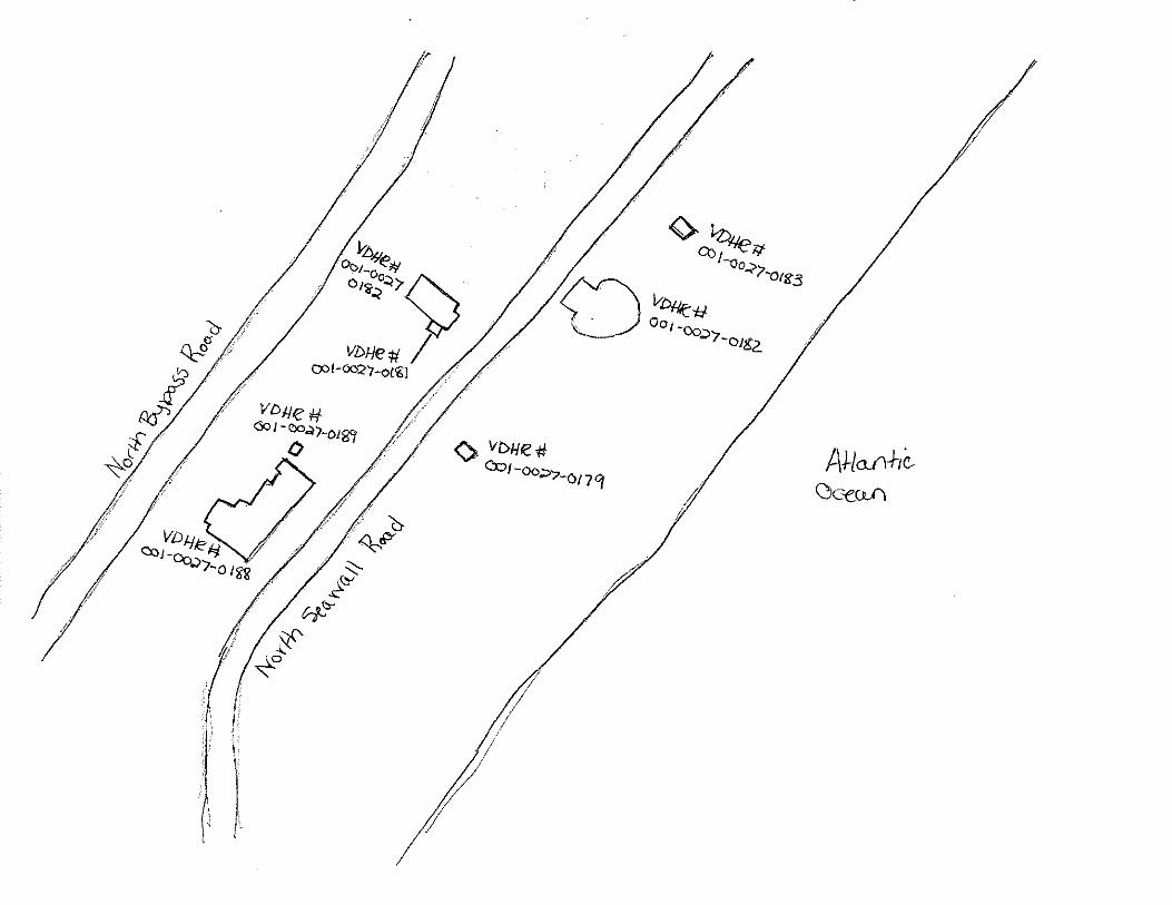
Virginia Department of Historic Resources
Reconnaissance Level Survey
DHR ID#: 001-0027-0190 Other DHR ID#:
Resource Information
National Register Eligibility Status
This Resource is associated with the Wallops Flight
Facility
Resource Name(s): X-05A, Path Finder Radar Antenna Tower
{Current}
Date of Construction: 1966
Local Historic District :
Location of Resource
County/Independent City:
Commonwealth of Virginia
Accomack
Magisterial District:
Town/Village/Hamlet: Wallops Island
Tax Parcel:
Zip Code: 23337
Address(s): North Seawall Road
USGS Quadrangle Name: WALLOPS ISLAND
UTM Boundary Coordinates :
Northing EastingZone NAD
1983 18 457709 4188261
UTM Center coordinates :
NoUTM Data Restricted?.
Resource Description
Ownership Status: Public - Federal
Government Agency Owner: U.S. National Aeronautics & Space Administration
Acreage:
Surrounding area: Rural
Open to Public: No
January 2011: The Path Finder Radar Antenna Tower is located on the southern half of Wallops Island on the east side of North
Seawall Road, south of Causeway Road. It is attached to the southwest corner of the roof of Building X-05, which is close to
the shore and an earthen berm. Large riprap extends along the shoreline. The area is open and flat. There is a prefabricated
metal building across the street.
Site Description:
Secondary Resource Summary:
January 2011: Buildng X-005
Resource StatusResource TypesCount
Communications Facility Non-Contributing 1
Individual Resource Information
Communications FacilityResource Type. Primary Resource? Yes
Individual Resource Detail Information
Date of Construction: Accessed? 1966 {Owner} No Not accessible
0.0 Number of Stories:Architectural Style: No Discernable Style
Good
Interior Plan Type:
Form: Condition:
Threats to Resource: None Known
January 2011: The Path Finder Radar Antenna Tower is a four-tiered, steel frame structure mounted to the roof of a concrete block
building (X-05). The tower is 18 ft in height and 12 ft in width at the base. It is constructed of four steel posts and diagonal
Report generated 6/7/2011Page 1 of 3

Virginia Department of Historic Resources
Reconnaissance Level Survey
DHR ID#: 001-0027-0190 Other DHR ID#:
intersecting steel angles. A small exterior metal ladder encircled by a metal cage is on the southwest elevation. A T-shaped,
counterclockwise rotating antenna is attached to the top of the tower. The antenna was relocated to this site in 1983 (WFF, 2011).
Primary Resource Exterior Component Description:
Material TreatmentMaterialComp Type/FormComponent
Foundation Foundation - Slab Concrete Foundation - Poured
Structural System Structural System - Frame Steel
Historic Time Period(s):S- The New Dominion (1946- Present)
Historic Context(s): Military/Defense
Technology/Engineering
Significance Statement
January 2011: This tower is representative of a Communications resource type built at a Technology/Engineering research facility towards
the beginning of the New Dominion period (1945–present). This is one of approximately 50 buildings and structures that were erected
within six years of the establishment of NASA and the incorporation of Wallops Station as one of its operational facilities in 1959.
Initially, Wallops Station’s new mission under NASA was to develop and test various components related to manned space flight. This
mission was short-lived, however, as Wallops became a test range and launch site for suborbital and orbital rockets and satellites
beginning in the early 1960s. NASA erected this antenna tower in 1966.
The Path Finder Radar Antenna Tower has been evaluated both as a contributing resource in a historic district and as an individual
resource. No historic district on Wallops Island was identified because of a lack of significance and integrity.
X-05A is not individually eligible for listing on the NRHP because it lacks significance and integrity. The tower moved to its current
location and is presently less than 50 years old; therefore, it was evaluated under Criteria Considerations B and G in addition to Criteria
A–D. The structure is recommended not eligible under Criterion A because it is not associated with an event or pattern of events of
exceptional importance at the local, state, or national level. It is not associated with the life of a person who made exceptionally important
contributions in history; therefore, it is recommended not eligible under Criterion B. The tower is recommended not eligible under
Criterion C because it does not embody exceptional engineering merit for distinctive characteristics of a type, period, or method of
construction; represent the work of a master; or possess high artistic value. Likewise, it does not represent an exceptionally significant or
distinguishable entity whose components may lack individual distinction. It is recommended not eligible under Criterion D because it
does not have the potential to yield information exceptionally important in history or prehistory.
The tower was moved after the period of significance; therefore, it does not possess integrity of location. It also has no integrity of
setting because the surroundings of the current location are not comparable to those of the historical setting. The removal of the
structure from its original location and setting has destroyed its integrity of feeling and association. The resource retains its integrity of
design, materials, and workmanship.
National Register Eligibility Information (Intensive Level Survey):
NR Resource StatusNR Resource TypeNR Count
Building Non-contributing 1
1 Non-Contributing:
National Register Criteria:
Level of Significance:
Period of Significance:
Graphic Media Documentation
PhotographerPhoto DateNegative RepositoryDHR Negative # Photographic Media
Digitial Images L ThursbyJanuary 2011
Report generated 6/7/2011Page 2 of 3

Virginia Department of Historic Resources
Reconnaissance Level Survey
DHR ID#: 001-0027-0190 Other DHR ID#:
Bibliographic Documentation
Reference #: 1
Bibliographic RecordType: Local Records
Author:
DHR CRM Report Number:
Notes:
Wallops Flight Facility Real Property Records
Cultural Resource Management (CRM) Events
CRM Event # 1,
Cultural Resource Management Event: Survey:Phase I/Reconnaissance
Date of CRM Event: January 2011
CRM Person: TEC Inc
VDHR Project ID # Associated with Event: 2010-2274
CRM Event Notes or Comments:
Lori Thursby and Kimberly Martin
Bridge Information
Cemetery Information
Ownership Information
Unknown Unknown Name: .................................
NASA Wallops Flight FacilityCompany: ..........................
Wallops Flight FacilityAddress: .............................
Wallops IslandCity: ...................................
23337Zip: ....................................... VirginiaState: USACountry:
000-000-0000757-824-1000Phone/Extension: ..............
0000/ 0000
Relation to the Property: Owner of property
Report generated 6/7/2011Page 3 of 3

001-0027-0152I-004
Mai
nlan
d R
d.
Causeway Rd.
North
Sea
wall R
d.
North
Byp
ass
Rd.
001-0027-0182W-020
001-0027-0188W-065
001-0027-0160U-030
001-0027-0184W-040
001-0027-0167U-070
001-0027-0156U-025
001-0027-0192X-085
001-0027-0163U-055
001-0027-0201Z-040
001-0027-0198Y-055
001-0027-0193Y-010
001-0027-0170V-025
001-0027-0190X-005A
001-0027-0187W-057
001-0027-0153U-005
001-0027-0197Y-038
001-0027-0194Y-016
001-0027-0180W-015
001-0027-0162U-040
001-0027-0191X-075
001-0027-0159U-027
001-0027-0158U-026
001-0027-0168U-070A
001-0027-0185W-050
001-0027-0179W-010
001-0027-0155U-020B
001-0027-0161U-030A
001-0027-0183W-035
001-0027-0169U-080
001-0027-0165U-060
001-0027-0164U-055A
001-0027-0154U-020A
001-0027-0157U-025A
001-0027-0166U-064
001-0027-0189W-067
001-0027-0195Y-020
001-0027-0181W-016
001-0027-0186W-051
001-0027-0199Y-095
001-0027-0200Y-110
001-0027-0196Y-037
NASA Property
Surveyed Structures
Buildings
0 300Meters
0 1,500Feet
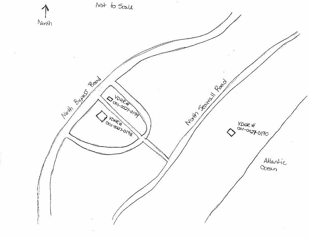

Virginia Department of Historic Resources
Reconnaissance Level Survey
DHR ID#: 001-0027-0191 Other DHR ID#:
Resource Information
National Register Eligibility Status
This Resource is associated with the Wallops Flight
Facility
Resource Name(s): X-75, Island Terminal Building {Current}
Date of Construction: 1960
Local Historic District :
Location of Resource
County/Independent City:
Commonwealth of Virginia
Accomack
Magisterial District:
Town/Village/Hamlet: Wallops Island
Tax Parcel:
Zip Code: 23337
Address(s): North Seawall Road
USGS Quadrangle Name: WALLOPS ISLAND
UTM Boundary Coordinates :
Northing EastingZone NAD
1983 18 457836 4188596
UTM Center coordinates :
NoUTM Data Restricted?.
Resource Description
Ownership Status: Public - Federal
Government Agency Owner: U.S. National Aeronautics & Space Administration
Acreage:
Surrounding area: Rural
Open to Public: No
January 2011: The Island Terminal Building is located on the south half of Wallops Island near the intersection of Causeway
and North Seawall Roads. Across the street by approximately 100 yards is the shoreline of the Atlantic Ocean. The area is
open and a tower with the NASA logo can be seen to the southwest. There are elevated metal tracks that carry cables behind
the building. Two concrete block buildings (X-140 and X-141) are to the west and Building X-76 is to the east.
Site Description:
Secondary Resource Summary:
January 2011: none
Resource StatusResource TypesCount
Communications Facility Non-Contributing 1
Individual Resource Information
Communications FacilityResource Type. Primary Resource? Yes
Individual Resource Detail Information
Date of Construction: Accessed? 1960 {Owner} No Not accessible
1.0 Number of Stories:Architectural Style: No Discernable Style
Good
Interior Plan Type:
Form: Condition:
Threats to Resource: None Known
January 2011: The Island Terminal Building is a simple, one-story concrete block building with a flat roof and metal fascia. The
footprint of the building was originally L-shaped, but an addition in 1986 enclosed the “L” into a rectangle. The addition has a
slightly shorter roofline. A wooden handrail surrounds the west corner of the roof.
Report generated 6/7/2011Page 1 of 3

Virginia Department of Historic Resources
Reconnaissance Level Survey
DHR ID#: 001-0027-0191 Other DHR ID#:
The southeast elevation had two double hollow steel door entries and a window, but one door and the window have been filled in
with concrete block. The extant doors have louvers in the lower half. A cantilevered concrete hood provides shelter across the
three former openings. The southwest elevation has a set of double hollow steel doors in the south end. All the building’s original
doors were removed and replaced in 1981 (WFF 2011). A set of switchback wooden stairs on the west end provides access to roof.
These replace the original single-flight metal staircase with a landing. A single hollow steel door with a two-step concrete stoop and
metal tube handrails provides access to the building on the northeast elevation. The northwest elevation has a single and a pair of
double steel sash awning windows with precast concrete slip sills. Cables connect to the corner of the building and a metal stack
pierces the roof.
Primary Resource Exterior Component Description:
Material TreatmentMaterialComp Type/FormComponent
Foundation Foundation - Slab Concrete Foundation - Poured
Structural System Structural System - Masonry Concrete Structural System - Block
Windows Windows - Sash, Double-Hung Steel Windows - 1/1
Roof Roof - Flat Asphalt
Historic Time Period(s):S- The New Dominion (1946- Present)
Historic Context(s): Military/Defense
Technology/Engineering
Significance Statement
January 2011: : This building represents an Infrastructure resource type built at a Technology/Engineering research facility near the
beginning of the New Dominion period (1945–present). This is one of approximately 50 buildings and structures that were erected within
six years of the establishment of NASA and the incorporation of Wallops Station as one of its operational facilities in 1959. Initially,
Wallops Station’s new mission under NASA was to develop and test various components related to manned space flight. This mission
was short-lived, however, as Wallops became a test range and launch site for suborbital and orbital rockets and satellites beginning in the
early 1960s. NASA erected this terminal building in 1960.
The Island Terminal Building has been evaluated both as a contributing resource in a historic district and as an individual resource. No
historic district on Wallops Island was identified because of a lack of significance and integrity.
X-75 is not individually eligible for listing on the NRHP because it lacks significance and integrity. The building is recommended not
eligible under Criterion A because it is not associated with an event or pattern of events of local, state, or national significance. It is not
associated with the life of a person significant in our past; therefore, it is recommended not eligible under Criterion B. The building retains
integrity, but is of simple design and common construction and, therefore, is recommended not eligible under Criterion C because it does
not embody the distinctive characteristics of a type, period, or method of construction; represent the work of a master; possess high
artistic value; or represent a significant or distinguishable entity whose components may lack individual distinction. It is recommended
not eligible under Criterion D because it does not have the potential to yield information important in history or prehistory.
The building is in its historical location. The setting of the building has been adversely affected by the addition of a few post-1965
buildings nearby and substantial material changes to a primary pre-1966 resource in the vicinity. The design of X-75 has been
compromised by the removal and enclosure of original openings on the façade (southeast elevation). The building has reduced integrity
of materials and workmanship due to the replacement of historical doors and windows and the metal staircase with a wood one. The
changes in setting, design, materials, and workmanship have negatively impacted the integrity of feeling and association.
National Register Eligibility Information (Intensive Level Survey):
NR Resource StatusNR Resource TypeNR Count
Building Non-contributing 1
1 Non-Contributing:
National Register Criteria:
Report generated 6/7/2011Page 2 of 3

Virginia Department of Historic Resources
Reconnaissance Level Survey
DHR ID#: 001-0027-0191 Other DHR ID#:
Level of Significance:
Period of Significance:
Graphic Media Documentation
PhotographerPhoto DateNegative RepositoryDHR Negative # Photographic Media
Digitial Images L ThursbyJanuary 2011
Bibliographic Documentation
Reference #: 1
Bibliographic RecordType: Local Records
Author:
DHR CRM Report Number:
Notes:
Wallops Flight Facility Real Property Records
Cultural Resource Management (CRM) Events
CRM Event # 1,
Cultural Resource Management Event: Survey:Phase I/Reconnaissance
Date of CRM Event: January 2011
CRM Person: TEC Inc
VDHR Project ID # Associated with Event: 2010-2274
CRM Event Notes or Comments:
Lori Thursby and Kimberly Martin
Bridge Information
Cemetery Information
Ownership Information
Unknown Unknown Name: .................................
NASA Wallops Flight FacilityCompany: ..........................
Wallops Flight FacilityAddress: .............................
Wallops IslandCity: ...................................
23337Zip: ....................................... VirginiaState: USACountry:
000-000-0000757-824-1000Phone/Extension: ..............
0000/ 0000
Relation to the Property: Owner of property
Report generated 6/7/2011Page 3 of 3

001-0027-0152I-004
Mai
nlan
d R
d.
Causeway Rd.
North
Sea
wall R
d.
North
Byp
ass
Rd.
001-0027-0182W-020
001-0027-0188W-065
001-0027-0160U-030
001-0027-0184W-040
001-0027-0167U-070
001-0027-0156U-025
001-0027-0192X-085
001-0027-0163U-055
001-0027-0201Z-040
001-0027-0198Y-055
001-0027-0193Y-010
001-0027-0170V-025
001-0027-0190X-005A
001-0027-0187W-057
001-0027-0153U-005
001-0027-0197Y-038
001-0027-0194Y-016
001-0027-0180W-015
001-0027-0162U-040
001-0027-0191X-075
001-0027-0159U-027
001-0027-0158U-026
001-0027-0168U-070A
001-0027-0185W-050
001-0027-0179W-010
001-0027-0155U-020B
001-0027-0161U-030A
001-0027-0183W-035
001-0027-0169U-080
001-0027-0165U-060
001-0027-0164U-055A
001-0027-0154U-020A
001-0027-0157U-025A
001-0027-0166U-064
001-0027-0189W-067
001-0027-0195Y-020
001-0027-0181W-016
001-0027-0186W-051
001-0027-0199Y-095
001-0027-0200Y-110
001-0027-0196Y-037
NASA Property
Surveyed Structures
Buildings
0 300Meters
0 1,500Feet


Virginia Department of Historic Resources
Reconnaissance Level Survey
DHR ID#: 001-0027-0192 Other DHR ID#:
Resource Information
National Register Eligibility Status
This Resource is associated with the Wallops Flight
Facility
Resource Name(s): X-85, Special Projects Building {Current}
X-85, Meteorological Observation Center
{Historic}
Date of Construction: 1963
Local Historic District :
Location of Resource
County/Independent City:
Commonwealth of Virginia
Accomack
Magisterial District:
Town/Village/Hamlet: Wallops Island
Tax Parcel:
Zip Code: 23337
Address(s): Causeway Road
USGS Quadrangle Name: WALLOPS ISLAND
UTM Boundary Coordinates :
Northing EastingZone NAD
1983 18 457836 4187931
UTM Center coordinates :
NoUTM Data Restricted?.
Resource Description
Ownership Status: Public - Federal
Government Agency Owner: U.S. National Aeronautics & Space Administration
Acreage:
Surrounding area: Rural
Open to Public: No
January 2011: The Special Projects Building is on the south half of Wallops Island, on the south side of Causeway Road,
northwest of its intersection with North Seawall Road. There is an asphalt paved parking lot in front of it and tall grass and
shrubs behind it. Building X-86 is next door. An oil tank surrounded by four concrete walls is located on the southwest
elevation. Wooded stairs provide access to the tank.
Site Description:
Secondary Resource Summary:
January 2011: none
Resource StatusResource TypesCount
Research
Facility/Laboratory
Non-Contributing 1
Individual Resource Information
Research Facility/LaboratoryResource Type. Primary Resource? Yes
Individual Resource Detail Information
Date of Construction: Accessed? 1963 {Owner} No Not accessible
1.0 Number of Stories:Architectural Style: No Discernable Style
Good
Interior Plan Type:
Form: Condition:
Threats to Resource: None Known
Report generated 6/7/2011Page 1 of 3
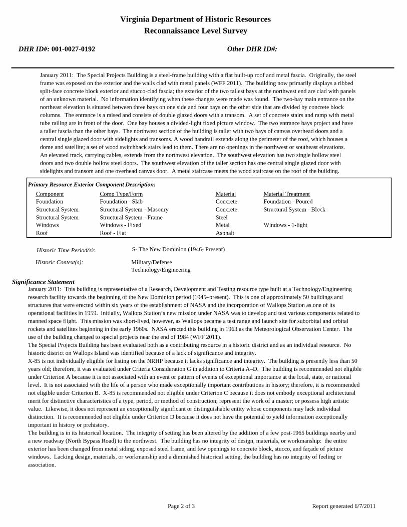
Virginia Department of Historic Resources
Reconnaissance Level Survey
DHR ID#: 001-0027-0192 Other DHR ID#:
January 2011: The Special Projects Building is a steel-frame building with a flat built-up roof and metal fascia. Originally, the steel
frame was exposed on the exterior and the walls clad with metal panels (WFF 2011). The building now primarily displays a ribbed
split-face concrete block exterior and stucco-clad fascia; the exterior of the two tallest bays at the northwest end are clad with panels
of an unknown material. No information identifying when these changes were made was found. The two-bay main entrance on the
northeast elevation is situated between three bays on one side and four bays on the other side that are divided by concrete block
columns. The entrance is a raised and consists of double glazed doors with a transom. A set of concrete stairs and ramp with metal
tube railing are in front of the door. One bay houses a divided-light fixed picture window. The two entrance bays project and have
a taller fascia than the other bays. The northwest section of the building is taller with two bays of canvas overhead doors and a
central single glazed door with sidelights and transoms. A wood handrail extends along the perimeter of the roof, which houses a
dome and satellite; a set of wood switchback stairs lead to them. There are no openings in the northwest or southeast elevations.
An elevated track, carrying cables, extends from the northwest elevation. The southwest elevation has two single hollow steel
doors and two double hollow steel doors. The southwest elevation of the taller section has one central single glazed door with
sidelights and transom and one overhead canvas door. A metal staircase meets the wood staircase on the roof of the building.
Primary Resource Exterior Component Description:
Material TreatmentMaterialComp Type/FormComponent
Foundation Foundation - Slab Concrete Foundation - Poured
Structural System Structural System - Masonry Concrete Structural System - Block
Structural System Structural System - Frame Steel
Windows Windows - Fixed Metal Windows - 1-light
Roof Roof - Flat Asphalt
Historic Time Period(s):S- The New Dominion (1946- Present)
Historic Context(s): Military/Defense
Technology/Engineering
Significance Statement
January 2011: This building is representative of a Research, Development and Testing resource type built at a Technology/Engineering
research facility towards the beginning of the New Dominion period (1945–present). This is one of approximately 50 buildings and
structures that were erected within six years of the establishment of NASA and the incorporation of Wallops Station as one of its
operational facilities in 1959. Initially, Wallops Station’s new mission under NASA was to develop and test various components related to
manned space flight. This mission was short-lived, however, as Wallops became a test range and launch site for suborbital and orbital
rockets and satellites beginning in the early 1960s. NASA erected this building in 1963 as the Meteorological Observation Center. The
use of the building changed to special projects near the end of 1984 (WFF 2011).
The Special Projects Building has been evaluated both as a contributing resource in a historic district and as an individual resource. No
historic district on Wallops Island was identified because of a lack of significance and integrity.
X-85 is not individually eligible for listing on the NRHP because it lacks significance and integrity. The building is presently less than 50
years old; therefore, it was evaluated under Criteria Consideration G in addition to Criteria A–D. The building is recommended not eligible
under Criterion A because it is not associated with an event or pattern of events of exceptional importance at the local, state, or national
level. It is not associated with the life of a person who made exceptionally important contributions in history; therefore, it is recommended
not eligible under Criterion B. X-85 is recommended not eligible under Criterion C because it does not embody exceptional architectural
merit for distinctive characteristics of a type, period, or method of construction; represent the work of a master; or possess high artistic
value. Likewise, it does not represent an exceptionally significant or distinguishable entity whose components may lack individual
distinction. It is recommended not eligible under Criterion D because it does not have the potential to yield information exceptionally
important in history or prehistory.
The building is in its historical location. The integrity of setting has been altered by the addition of a few post-1965 buildings nearby and
a new roadway (North Bypass Road) to the northwest. The building has no integrity of design, materials, or workmanship: the entire
exterior has been changed from metal siding, exposed steel frame, and few openings to concrete block, stucco, and façade of picture
windows. Lacking design, materials, or workmanship and a diminished historical setting, the building has no integrity of feeling or
association.
Report generated 6/7/2011Page 2 of 3

Virginia Department of Historic Resources
Reconnaissance Level Survey
DHR ID#: 001-0027-0192 Other DHR ID#:
National Register Eligibility Information (Intensive Level Survey):
NR Resource StatusNR Resource TypeNR Count
Building Non-contributing 1
1 Non-Contributing:
National Register Criteria:
Level of Significance:
Period of Significance:
Graphic Media Documentation
PhotographerPhoto DateNegative RepositoryDHR Negative # Photographic Media
Digitial Images L ThursbyJanuary 2011
Bibliographic Documentation
Reference #: 1
Bibliographic RecordType: Local Records
Author:
DHR CRM Report Number:
Notes:
Wallops Flight Facility Real Property Records
Reference #: 2
Bibliographic RecordType: Drawings
Author:
DHR CRM Report Number:
Notes:
Wallops Flight Facility As-Built Drawings
Cultural Resource Management (CRM) Events
CRM Event # 1,
Cultural Resource Management Event: Survey:Phase I/Reconnaissance
Date of CRM Event: January 2011
CRM Person: TEC Inc
VDHR Project ID # Associated with Event: 2010-2274
CRM Event Notes or Comments:
Lori Thursby and Kimberly Martin
Bridge Information
Cemetery Information
Ownership Information
Unknown Unknown Name: .................................
NASA Wallops Flight FacilityCompany: ..........................
Wallops Flight FacilityAddress: .............................
Wallops IslandCity: ...................................
23337Zip: ....................................... VirginiaState: USACountry:
000-000-0000757-824-1000Phone/Extension: ..............
0000/ 0000
Relation to the Property: Owner of property
Report generated 6/7/2011Page 3 of 3

001-0027-0152I-004
Mai
nlan
d R
d.
Causeway Rd.
North
Sea
wall R
d.
North
Byp
ass
Rd.
001-0027-0182W-020
001-0027-0188W-065
001-0027-0160U-030
001-0027-0184W-040
001-0027-0167U-070
001-0027-0156U-025
001-0027-0192X-085
001-0027-0163U-055
001-0027-0201Z-040
001-0027-0198Y-055
001-0027-0193Y-010
001-0027-0170V-025
001-0027-0190X-005A
001-0027-0187W-057
001-0027-0153U-005
001-0027-0197Y-038
001-0027-0194Y-016
001-0027-0180W-015
001-0027-0162U-040
001-0027-0191X-075
001-0027-0159U-027
001-0027-0158U-026
001-0027-0168U-070A
001-0027-0185W-050
001-0027-0179W-010
001-0027-0155U-020B
001-0027-0161U-030A
001-0027-0183W-035
001-0027-0169U-080
001-0027-0165U-060
001-0027-0164U-055A
001-0027-0154U-020A
001-0027-0157U-025A
001-0027-0166U-064
001-0027-0189W-067
001-0027-0195Y-020
001-0027-0181W-016
001-0027-0186W-051
001-0027-0199Y-095
001-0027-0200Y-110
001-0027-0196Y-037
NASA Property
Surveyed Structures
Buildings
0 300Meters
0 1,500Feet


Virginia Department of Historic Resources
Reconnaissance Level Survey
DHR ID#: 001-0027-0193 Other DHR ID#:
Resource Information
National Register Eligibility Status
This Resource is associated with the Wallops Flight
Facility
Resource Name(s): Y-10, Fuel Storage Magazine {Current}
Date of Construction: 1957
Local Historic District :
Location of Resource
County/Independent City:
Commonwealth of Virginia
Accomack
Magisterial District:
Town/Village/Hamlet: Wallops Island
Tax Parcel:
Zip Code: 23337
Address(s): Causeway Road
USGS Quadrangle Name: WALLOPS ISLAND
UTM Boundary Coordinates :
Northing EastingZone NAD
1983 18 457243 4187931
UTM Center coordinates :
NoUTM Data Restricted?.
Resource Description
Ownership Status: Public - Federal
Government Agency Owner: U.S. National Aeronautics & Space Administration
Acreage:
Surrounding area: Rural
Open to Public: No
January 2011: The Fuel Storage Magazine is located on the south half of Wallops Island, on North Seawall Road south of
Causeway Road. The magazine is set back approximately 275 ft from North Seawall Road. The area around it is open with taller
grass on the northwest and southwest sides. An antenna tower is behind the magazine. Two to three magazines, constructed
after Y-10, are located to the north and northeast.
Site Description:
Secondary Resource Summary:
January 2011: none
Resource StatusResource TypesCount
Magazine Non-Contributing 1
Individual Resource Information
MagazineResource Type. Primary Resource? Yes
Individual Resource Detail Information
Date of Construction: Accessed? 1957 {Owner} No Not accessible
1.0 Number of Stories:Architectural Style: No Discernable Style
Good
Interior Plan Type:
Form: Condition:
Threats to Resource: None Known
January 2011: The Fuel Storage Magazine is built into an earthen berm. The top halves of its reinforced concrete walls are exposed
on the northeast and southwest elevations. A metal capped vent pierces the roofline on the southwest. The building faces
northwest and consists of a reinforced concrete façade with rebar extending to the north and west, indicating that it was originally
Report generated 6/7/2011Page 1 of 3
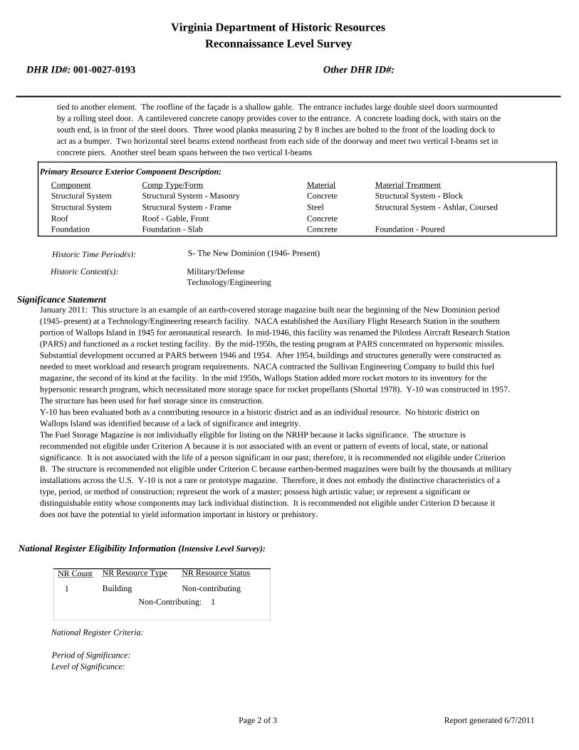
Virginia Department of Historic Resources
Reconnaissance Level Survey
DHR ID#: 001-0027-0193 Other DHR ID#:
tied to another element. The roofline of the façade is a shallow gable. The entrance includes large double steel doors surmounted
by a rolling steel door. A cantilevered concrete canopy provides cover to the entrance. A concrete loading dock, with stairs on the
south end, is in front of the steel doors. Three wood planks measuring 2 by 8 inches are bolted to the front of the loading dock to
act as a bumper. Two horizontal steel beams extend northeast from each side of the doorway and meet two vertical I-beams set in
concrete piers. Another steel beam spans between the two vertical I-beams
Primary Resource Exterior Component Description:
Material TreatmentMaterialComp Type/FormComponent
Structural System Structural System - Masonry Concrete Structural System - Block
Structural System Structural System - Frame Steel Structural System - Ashlar, Coursed
Roof Roof - Gable, Front Concrete
Foundation Foundation - Slab Concrete Foundation - Poured
Historic Time Period(s):S- The New Dominion (1946- Present)
Historic Context(s): Military/Defense
Technology/Engineering
Significance Statement
January 2011: This structure is an example of an earth-covered storage magazine built near the beginning of the New Dominion period
(1945–present) at a Technology/Engineering research facility. NACA established the Auxiliary Flight Research Station in the southern
portion of Wallops Island in 1945 for aeronautical research. In mid-1946, this facility was renamed the Pilotless Aircraft Research Station
(PARS) and functioned as a rocket testing facility. By the mid-1950s, the testing program at PARS concentrated on hypersonic missiles.
Substantial development occurred at PARS between 1946 and 1954. After 1954, buildings and structures generally were constructed as
needed to meet workload and research program requirements. NACA contracted the Sullivan Engineering Company to build this fuel
magazine, the second of its kind at the facility. In the mid 1950s, Wallops Station added more rocket motors to its inventory for the
hypersonic research program, which necessitated more storage space for rocket propellants (Shortal 1978). Y-10 was constructed in 1957.
The structure has been used for fuel storage since its construction.
Y-10 has been evaluated both as a contributing resource in a historic district and as an individual resource. No historic district on
Wallops Island was identified because of a lack of significance and integrity.
The Fuel Storage Magazine is not individually eligible for listing on the NRHP because it lacks significance. The structure is
recommended not eligible under Criterion A because it is not associated with an event or pattern of events of local, state, or national
significance. It is not associated with the life of a person significant in our past; therefore, it is recommended not eligible under Criterion
B. The structure is recommended not eligible under Criterion C because earthen-bermed magazines were built by the thousands at military
installations across the U.S. Y-10 is not a rare or prototype magazine. Therefore, it does not embody the distinctive characteristics of a
type, period, or method of construction; represent the work of a master; possess high artistic value; or represent a significant or
distinguishable entity whose components may lack individual distinction. It is recommended not eligible under Criterion D because it
does not have the potential to yield information important in history or prehistory.
National Register Eligibility Information (Intensive Level Survey):
NR Resource StatusNR Resource TypeNR Count
Building Non-contributing 1
1 Non-Contributing:
National Register Criteria:
Level of Significance:
Period of Significance:
Report generated 6/7/2011Page 2 of 3

Virginia Department of Historic Resources
Reconnaissance Level Survey
DHR ID#: 001-0027-0193 Other DHR ID#:
Graphic Media Documentation
PhotographerPhoto DateNegative RepositoryDHR Negative # Photographic Media
Digitial Images L ThursbyJanuary 2011
Bibliographic Documentation
Reference #: 1
Bibliographic RecordType: Local Records
Author:
DHR CRM Report Number:
Notes:
Wallops Flight Facility Real Property Records
Cultural Resource Management (CRM) Events
CRM Event # 1,
Cultural Resource Management Event: Survey:Phase I/Reconnaissance
Date of CRM Event: January 2011
CRM Person: TEC Inc
VDHR Project ID # Associated with Event: 2010-2274
CRM Event Notes or Comments:
Lori Thursby and Kimberly Martin
Bridge Information
Cemetery Information
Ownership Information
Unknown Unknown Name: .................................
NASA Wallops Flight FacilityCompany: ..........................
Wallops Flight FacilityAddress: .............................
Wallops IslandCity: ...................................
23337Zip: ....................................... VirginiaState: USACountry:
000-000-0000757-824-1000Phone/Extension: ..............
0000/ 0000
Relation to the Property: Owner of property
Report generated 6/7/2011Page 3 of 3

001-0027-0152I-004
Mai
nlan
d R
d.
Causeway Rd.
North
Sea
wall R
d.
North
Byp
ass
Rd.
001-0027-0182W-020
001-0027-0188W-065
001-0027-0160U-030
001-0027-0184W-040
001-0027-0167U-070
001-0027-0156U-025
001-0027-0192X-085
001-0027-0163U-055
001-0027-0201Z-040
001-0027-0198Y-055
001-0027-0193Y-010
001-0027-0170V-025
001-0027-0190X-005A
001-0027-0187W-057
001-0027-0153U-005
001-0027-0197Y-038
001-0027-0194Y-016
001-0027-0180W-015
001-0027-0162U-040
001-0027-0191X-075
001-0027-0159U-027
001-0027-0158U-026
001-0027-0168U-070A
001-0027-0185W-050
001-0027-0179W-010
001-0027-0155U-020B
001-0027-0161U-030A
001-0027-0183W-035
001-0027-0169U-080
001-0027-0165U-060
001-0027-0164U-055A
001-0027-0154U-020A
001-0027-0157U-025A
001-0027-0166U-064
001-0027-0189W-067
001-0027-0195Y-020
001-0027-0181W-016
001-0027-0186W-051
001-0027-0199Y-095
001-0027-0200Y-110
001-0027-0196Y-037
NASA Property
Surveyed Structures
Buildings
0 300Meters
0 1,500Feet


Virginia Department of Historic Resources
Reconnaissance Level Survey
DHR ID#: 001-0027-0194 Other DHR ID#:
Resource Information
National Register Eligibility Status
This Resource is associated with the Wallops Flight
Facility
Resource Name(s): Y-16, Ready Service Magazine {Current}
F-171 {Historic}
Date of Construction: 1957
Local Historic District :
Location of Resource
County/Independent City:
Commonwealth of Virginia
Accomack
Magisterial District:
Town/Village/Hamlet: Wallops Island
Tax Parcel:
Zip Code: 23337
Address(s): North Seawall Road
USGS Quadrangle Name: WALLOPS ISLAND
UTM Boundary Coordinates :
Northing EastingZone NAD
1983 18 457329 4187804
UTM Center coordinates :
NoUTM Data Restricted?.
Resource Description
Ownership Status: Public - Federal
Government Agency Owner: U.S. National Aeronautics & Space Administration
Acreage:
Surrounding area: Rural
Open to Public: No
January 2011: The Ready Service Magazine is located on the south half of Wallops Island, on North Seawall Road south of
Causeway Road. The area around it is open with taller grass on the northwest and southwest sides. An antenna tower is
behind the magazine.
Site Description:
Secondary Resource Summary:
January 2011: none
Resource StatusResource TypesCount
Magazine Non-Contributing 1
Individual Resource Information
MagazineResource Type. Primary Resource? Yes
Individual Resource Detail Information
Date of Construction: Accessed? 1957 {Owner} No Not accessible
1.0 Number of Stories:Architectural Style: No Discernable Style
Good
Interior Plan Type:
Form: Condition:
Threats to Resource: None Known
January 2011: This single-story reinforced concrete building rests on a concrete slab. It has only one point of entry, a single steel
door on the southwest elevation. The central door has a projecting metal lintel. It is flanked by two vents. On the opposite
elevation (northeast), there are two small vents in the top of the wall. Only one of four original steel eye hooks remains at the corner
Report generated 6/7/2011Page 1 of 3

Virginia Department of Historic Resources
Reconnaissance Level Survey
DHR ID#: 001-0027-0194 Other DHR ID#:
of the roof.
Y-16 represents a Navy standardized building design for storage of small materials. At Wallops, it is typically utilized for storage of
hazardous materials. The Navy built numerous buildings of this type on the main base and Wallops Island between 1956 and 1965.
As of 2011, 14 buildings of this type were extant.
Primary Resource Exterior Component Description:
Material TreatmentMaterialComp Type/FormComponent
Structural System Structural System - Masonry Concrete
Foundation Foundation - Slab Concrete Foundation - Poured
Roof Roof - Flat Concrete
Historic Time Period(s):S- The New Dominion (1946- Present)
Historic Context(s): Military/Defense
Technology/Engineering
Significance Statement
January 2011: Y-16 and the other eight buildings on Wallops Island of this same type (V-42, V-52, W-16, W-51, W-67, Y-20, Y-37, and
Y-38) represent a secondary resource built near the beginning of the New Dominion period (1945–present) at a Military/Defense research
facility. The U.S. Navy expanded the mission of the CNAAS in 1946 to include the NAOTS, which was charged with research and testing
of naval aviation weapons and ordnance. The CNAAS/NAOTS retained this mission until the base was closed in 1959 and transferred to
NASA. During the period of 1946–1959, most of the development that occurred on the main base was related to housing and services.
However, several new buildings were constructed on main base within the three years leading up to the closure of the Navy station. The
Navy erected the same type of storage buildings as Y-16 between 1956 and 1965.
Each of these nine storage buildings has been evaluated both as a contributing resource in a historic district and as an individual
resource. No historic district on Wallops Island was identified because of a lack of significance and integrity.
This resource type is not individually eligible for listing on the NRHP because it lacks significance, and also in some cases, integrity. Each
building is recommended not eligible under Criterion A because it is not associated with an event or pattern of events of local, state, or
national significance. It is not associated with the life of a person significant in our past; therefore, it is recommended not eligible under
Criterion B. Each of these storage buildings is a secondary resource of simple design and common construction and, therefore, is
recommended not eligible under Criterion C because it does not embody the distinctive characteristics of a type, period, or method of
construction; represent the work of a master; possess high artistic value; or represent a significant or distinguishable entity whose
components may lack individual distinction. It is recommended not eligible under Criterion D because it does not have the potential to
yield information important in history or prehistory.
Y-16 was moved during the period of significance; therefore, it does not possess integrity of location. It also has no integrity of setting:
the setting of the current location is not comparable to the historical setting, which was on the main base. The removal of the building
from its original location and setting has destroyed its integrity of feeling and association. The resource retains its integrity of design,
materials, and workmanship.
National Register Eligibility Information (Intensive Level Survey):
NR Resource StatusNR Resource TypeNR Count
Building Non-contributing 1
1 Non-Contributing:
National Register Criteria:
Level of Significance:
Period of Significance:
Report generated 6/7/2011Page 2 of 3

Virginia Department of Historic Resources
Reconnaissance Level Survey
DHR ID#: 001-0027-0194 Other DHR ID#:
Graphic Media Documentation
PhotographerPhoto DateNegative RepositoryDHR Negative # Photographic Media
Digitial Images L ThursbyJanuary 2011
Bibliographic Documentation
Reference #: 1
Bibliographic RecordType: Local Records
Author:
DHR CRM Report Number:
Notes:
Wallops Flight Facility Real Property Records
Cultural Resource Management (CRM) Events
CRM Event # 1,
Cultural Resource Management Event: Survey:Phase I/Reconnaissance
Date of CRM Event: January 2011
CRM Person: TEC Inc
VDHR Project ID # Associated with Event: 2010-2274
CRM Event Notes or Comments:
Lori Thursby and Kimberly Martin
Bridge Information
Cemetery Information
Ownership Information
Unknown Unknown Name: .................................
NASA Wallops Flight FacilityCompany: ..........................
Wallops Flight FacilityAddress: .............................
Wallops IslandCity: ...................................
23337Zip: ....................................... VirginiaState: USACountry:
000-000-0000757-824-1000Phone/Extension: ..............
0000/ 0000
Relation to the Property: Owner of property
Report generated 6/7/2011Page 3 of 3

001-0027-0152I-004
Mai
nlan
d R
d.
Causeway Rd.
North
Sea
wall R
d.
North
Byp
ass
Rd.
001-0027-0182W-020
001-0027-0188W-065
001-0027-0160U-030
001-0027-0184W-040
001-0027-0167U-070
001-0027-0156U-025
001-0027-0192X-085
001-0027-0163U-055
001-0027-0201Z-040
001-0027-0198Y-055
001-0027-0193Y-010
001-0027-0170V-025
001-0027-0190X-005A
001-0027-0187W-057
001-0027-0153U-005
001-0027-0197Y-038
001-0027-0194Y-016
001-0027-0180W-015
001-0027-0162U-040
001-0027-0191X-075
001-0027-0159U-027
001-0027-0158U-026
001-0027-0168U-070A
001-0027-0185W-050
001-0027-0179W-010
001-0027-0155U-020B
001-0027-0161U-030A
001-0027-0183W-035
001-0027-0169U-080
001-0027-0165U-060
001-0027-0164U-055A
001-0027-0154U-020A
001-0027-0157U-025A
001-0027-0166U-064
001-0027-0189W-067
001-0027-0195Y-020
001-0027-0181W-016
001-0027-0186W-051
001-0027-0199Y-095
001-0027-0200Y-110
001-0027-0196Y-037
NASA Property
Surveyed Structures
Buildings
0 300Meters
0 1,500Feet

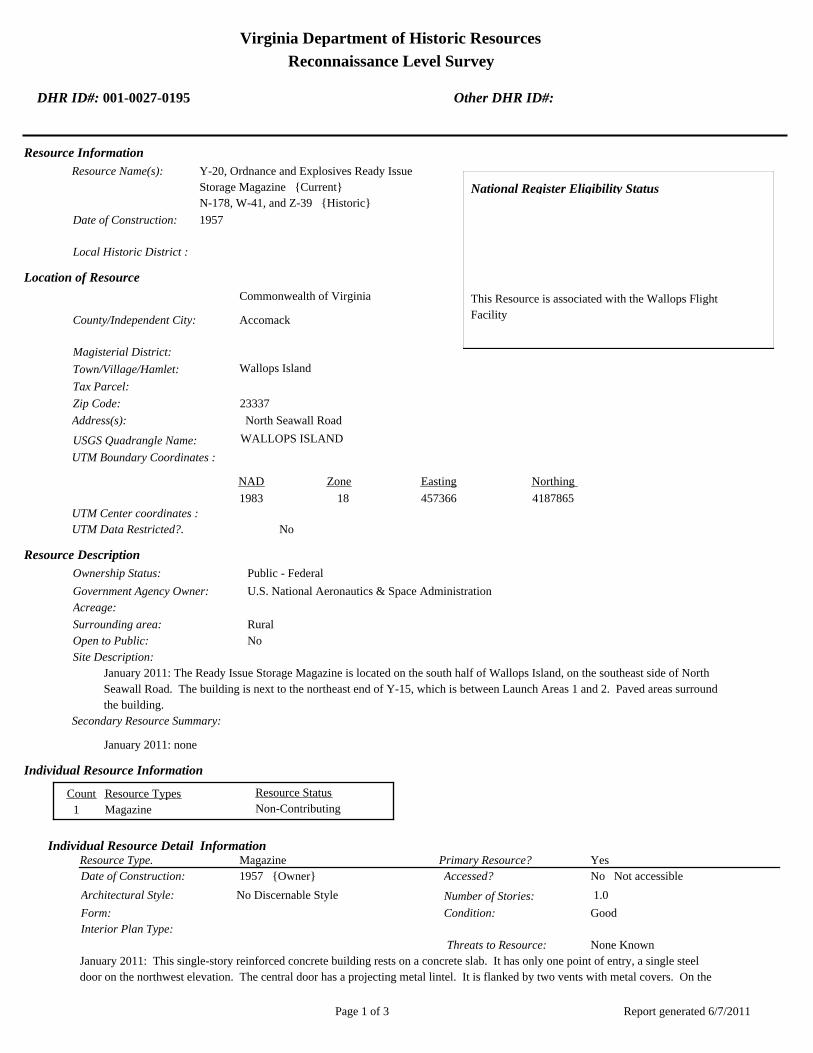
Virginia Department of Historic Resources
Reconnaissance Level Survey
DHR ID#: 001-0027-0195 Other DHR ID#:
Resource Information
National Register Eligibility Status
This Resource is associated with the Wallops Flight
Facility
Resource Name(s): Y-20, Ordnance and Explosives Ready Issue
Storage Magazine {Current}
N-178, W-41, and Z-39 {Historic}
Date of Construction: 1957
Local Historic District :
Location of Resource
County/Independent City:
Commonwealth of Virginia
Accomack
Magisterial District:
Town/Village/Hamlet: Wallops Island
Tax Parcel:
Zip Code: 23337
Address(s): North Seawall Road
USGS Quadrangle Name: WALLOPS ISLAND
UTM Boundary Coordinates :
Northing EastingZone NAD
1983 18 457366 4187865
UTM Center coordinates :
NoUTM Data Restricted?.
Resource Description
Ownership Status: Public - Federal
Government Agency Owner: U.S. National Aeronautics & Space Administration
Acreage:
Surrounding area: Rural
Open to Public: No
January 2011: The Ready Issue Storage Magazine is located on the south half of Wallops Island, on the southeast side of North
Seawall Road. The building is next to the northeast end of Y-15, which is between Launch Areas 1 and 2. Paved areas surround
the building.
Site Description:
Secondary Resource Summary:
January 2011: none
Resource StatusResource TypesCount
Magazine Non-Contributing 1
Individual Resource Information
MagazineResource Type. Primary Resource? Yes
Individual Resource Detail Information
Date of Construction: Accessed? 1957 {Owner} No Not accessible
1.0 Number of Stories:Architectural Style: No Discernable Style
Good
Interior Plan Type:
Form: Condition:
Threats to Resource: None Known
January 2011: This single-story reinforced concrete building rests on a concrete slab. It has only one point of entry, a single steel
door on the northwest elevation. The central door has a projecting metal lintel. It is flanked by two vents with metal covers. On the
Report generated 6/7/2011Page 1 of 3

Virginia Department of Historic Resources
Reconnaissance Level Survey
DHR ID#: 001-0027-0195 Other DHR ID#:
opposite elevation, there are two small vents with metal covers in the top of the wall. Four steel eye hooks are embedded in each
corner of the roof.
Y-20 represents a Navy standardized building design for storage of small materials. At Wallops, it is typically utilized for storage of
hazardous materials. The Navy built numerous buildings of this type on the main base and Wallops Island between 1956 and 1965.
As of 2011, 14 buildings of this type were extant.
Primary Resource Exterior Component Description:
Material TreatmentMaterialComp Type/FormComponent
Foundation Foundation - Slab Concrete Foundation - Poured
Structural System Structural System - Masonry Concrete Structural System - Block
Roof Roof - Flat Concrete
Historic Time Period(s):S- The New Dominion (1946- Present)
Historic Context(s): Military/Defense
Technology/Engineering
Significance Statement
January 2011: Y-20 and the other eight buildings on Wallops Island of this same type (V-42, V-52, W-16, W-51, W-67, Y-16, Y-37, and
Y-38) represent a secondary resource built near the beginning of the New Dominion period (1945–present) at a Military/Defense research
facility. The U.S. Navy expanded the mission of the CNAAS in 1946 to include the NAOTS, which was charged with research and testing
of naval aviation weapons and ordnance. The CNAAS/NAOTS retained this mission until the base was closed in 1959 and transferred to
NASA. During the period of 1946–1959, most of the development that occurred on the main base was related to housing and services.
However, several new buildings were constructed on main base within the three years leading up to the closure of the Navy station. The
Navy erected the same type of storage buildings as Y-20 between 1956 and 1965.
Each of these nine storage buildings has been evaluated both as a contributing resource in a historic district and as an individual
resource. No historic district on Wallops Island was identified because of a lack of significance and integrity.
This resource type is not individually eligible for listing on the NRHP because it lacks significance, and also in some cases, integrity. Each
building is recommended not eligible under Criterion A because it is not associated with an event or pattern of events of local, state, or
national significance. It is not associated with the life of a person significant in our past; therefore, it is recommended not eligible under
Criterion B. Each of these storage buildings is a secondary resource of simple design and common construction and, therefore, is
recommended not eligible under Criterion C because it does not embody the distinctive characteristics of a type, period, or method of
construction; represent the work of a master; possess high artistic value; or represent a significant or distinguishable entity whose
components may lack individual distinction. It is recommended not eligible under Criterion D because it does not have the potential to
yield information important in history or prehistory.
Y-20 was moved during the period of significance; therefore, it does not possess integrity of location. It also has no integrity of setting:
the setting of the current location is not comparable to the historical setting. The removal of the building from its original location and
setting has destroyed its integrity of feeling and association. The resource retains its integrity of design, materials, and workmanship.
National Register Eligibility Information (Intensive Level Survey):
NR Resource StatusNR Resource TypeNR Count
Building Non-contributing 1
1 Non-Contributing:
National Register Criteria:
Level of Significance:
Period of Significance:
Report generated 6/7/2011Page 2 of 3

Virginia Department of Historic Resources
Reconnaissance Level Survey
DHR ID#: 001-0027-0195 Other DHR ID#:
Graphic Media Documentation
PhotographerPhoto DateNegative RepositoryDHR Negative # Photographic Media
Digitial Images L ThursbyJanuary 2011
Bibliographic Documentation
Reference #: 1
Bibliographic RecordType: Local Records
Author:
DHR CRM Report Number:
Notes:
Wallops Flight Facility Real Property Records
Cultural Resource Management (CRM) Events
CRM Event # 1,
Cultural Resource Management Event: Survey:Phase I/Reconnaissance
Date of CRM Event: January 2011
CRM Person: TEC Inc
VDHR Project ID # Associated with Event: 2010-2274
CRM Event Notes or Comments:
Lori Thursby and Kimberly Martin
Bridge Information
Cemetery Information
Ownership Information
Unknown Unknown Name: .................................
NASA Wallops Flight FacilityCompany: ..........................
Wallops Flight FacilityAddress: .............................
Wallops IslandCity: ...................................
23337Zip: ....................................... VirginiaState: USACountry:
000-000-0000757-824-1000Phone/Extension: ..............
0000/ 0000
Relation to the Property: Owner of property
Report generated 6/7/2011Page 3 of 3

001-0027-0152I-004
Mai
nlan
d R
d.
Causeway Rd.
North
Sea
wall R
d.
North
Byp
ass
Rd.
001-0027-0182W-020
001-0027-0188W-065
001-0027-0160U-030
001-0027-0184W-040
001-0027-0167U-070
001-0027-0156U-025
001-0027-0192X-085
001-0027-0163U-055
001-0027-0201Z-040
001-0027-0198Y-055
001-0027-0193Y-010
001-0027-0170V-025
001-0027-0190X-005A
001-0027-0187W-057
001-0027-0153U-005
001-0027-0197Y-038
001-0027-0194Y-016
001-0027-0180W-015
001-0027-0162U-040
001-0027-0191X-075
001-0027-0159U-027
001-0027-0158U-026
001-0027-0168U-070A
001-0027-0185W-050
001-0027-0179W-010
001-0027-0155U-020B
001-0027-0161U-030A
001-0027-0183W-035
001-0027-0169U-080
001-0027-0165U-060
001-0027-0164U-055A
001-0027-0154U-020A
001-0027-0157U-025A
001-0027-0166U-064
001-0027-0189W-067
001-0027-0195Y-020
001-0027-0181W-016
001-0027-0186W-051
001-0027-0199Y-095
001-0027-0200Y-110
001-0027-0196Y-037
NASA Property
Surveyed Structures
Buildings
0 300Meters
0 1,500Feet
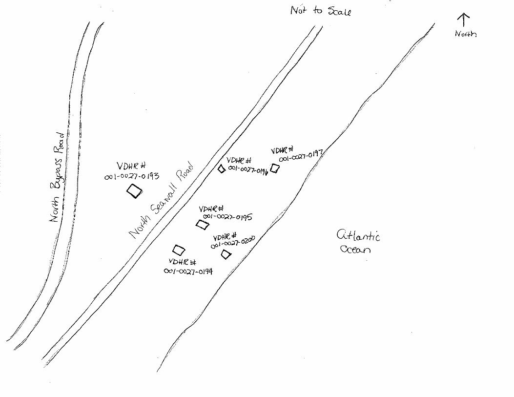

Virginia Department of Historic Resources
Reconnaissance Level Survey
DHR ID#: 001-0027-0196 Other DHR ID#:
Resource Information
National Register Eligibility Status
This Resource is associated with the Wallops Flight
Facility
Resource Name(s): Y-37, Firing Cubicle {Current}
Date of Construction: 1956
Local Historic District :
Location of Resource
County/Independent City:
Commonwealth of Virginia
Accomack
Magisterial District:
Town/Village/Hamlet: Wallops Island
Tax Parcel:
Zip Code: 23337
Address(s): North Seawall Road
USGS Quadrangle Name: WALLOPS ISLAND
UTM Boundary Coordinates :
Northing EastingZone NAD
1983 18 457498 4187963
UTM Center coordinates :
NoUTM Data Restricted?.
Resource Description
Ownership Status: Public - Federal
Government Agency Owner: U.S. National Aeronautics & Space Administration
Acreage:
Surrounding area: Rural
Open to Public: No
January 2011: The Firing Cubicle is located on the south half of the Wallops Island, on the southeast side of North Seawall
Road. It is located near Launch Area 1 and is next to Y-035B. Paved areas surround the buildings.
Site Description:
Secondary Resource Summary:
January 2011: none
Resource StatusResource TypesCount
Magazine Non-Contributing 1
Individual Resource Information
MagazineResource Type. Primary Resource? Yes
Individual Resource Detail Information
Date of Construction: Accessed? 1956 {Owner} No Not accessible
1.0 Number of Stories:Architectural Style: No Discernable Style
Good
Interior Plan Type:
Form: Condition:
Threats to Resource: None Known
January 2011: This single-story reinforced concrete building rests on a concrete slab. It has only one point of entry, a single steel
door on the northwest elevation. The central door has a projecting metal lintel. It is flanked by two vents with metal covers. A
wood-frame fixed window is on the northeast elevation. On the southeast elevation, another window of the same type replaces
metal-covered vents. Four steel eye hooks are embedded in each corner of the roof.
Y-37 represents a Navy standardized building design for storage of small materials. At Wallops, it is typically utilized for storage of
Report generated 6/7/2011Page 1 of 3

Virginia Department of Historic Resources
Reconnaissance Level Survey
DHR ID#: 001-0027-0196 Other DHR ID#:
hazardous materials. The Navy built numerous buildings of this type on the main base and Wallops Island between 1956 and 1965.
As of 2011, 14 buildings of this type were extant.
Primary Resource Exterior Component Description:
Material TreatmentMaterialComp Type/FormComponent
Foundation Foundation - Slab Concrete Foundation - Poured
Roof Roof - Flat Concrete
Structural System Structural System - Masonry Concrete Structural System - Block
Historic Time Period(s):S- The New Dominion (1946- Present)
Historic Context(s): Military/Defense
Technology/Engineering
Significance Statement
January 2011: Y-37 and the other eight buildings on Wallops Island of this same type (V-42, V-52, W-16, W-51, W-67, Y-16, Y-20, and Y-38)
represent a secondary resource built near the beginning of the New Dominion period (1945–present) at a Military/Defense research
facility. The U.S. Navy expanded the mission of the CNAAS in 1946 to include the NAOTS, which was charged with research and testing
of naval aviation weapons and ordnance. The CNAAS/NAOTS retained this mission until the base was closed in 1959 and transferred to
NASA. During the period of 1946–1959, most of the development that occurred on the main base was related to housing and services.
However, several new buildings were constructed on main base within the three years leading up to the closure of the Navy station. The
Navy erected the same type of storage buildings as Y-37 between 1956 and 1965.
Each of these nine storage buildings has been evaluated both as a contributing resource in a historic district and as an individual
resource. No historic district on Wallops Island was identified because of a lack of significance and integrity.
This resource type is not individually eligible for listing on the NRHP because it lacks significance, and also in some cases, integrity. Each
building is recommended not eligible under Criterion A because it is not associated with an event or pattern of events of local, state, or
national significance. It is not associated with the life of a person significant in our past; therefore, it is recommended not eligible under
Criterion B. Each of these storage buildings is a secondary resource of simple design and common construction and, therefore, is
recommended not eligible under Criterion C because it does not embody the distinctive characteristics of a type, period, or method of
construction; represent the work of a master; possess high artistic value; or represent a significant or distinguishable entity whose
components may lack individual distinction. It is recommended not eligible under Criterion D because it does not have the potential to
yield information important in history or prehistory.
Unlike some of the other buildings of this type on Wallops Island, available information indicates that Y-37 has not been moved;
therefore, it has integrity of location. The surroundings of the building has changed a bit, but the changes do not adversely affect its
setting. The building lacks integrity of design and materials. Both exhibit multiple alterations from the historical standardized design,
which in turn, diminish the integrity of feeling. The resource retains integrity of association.
National Register Eligibility Information (Intensive Level Survey):
NR Resource StatusNR Resource TypeNR Count
Building Non-contributing 1
1 Non-Contributing:
National Register Criteria:
Level of Significance:
Period of Significance:
Graphic Media Documentation
PhotographerPhoto DateNegative RepositoryDHR Negative # Photographic Media
Digitial Images L ThursbyJanuary 2011
Report generated 6/7/2011Page 2 of 3

Virginia Department of Historic Resources
Reconnaissance Level Survey
DHR ID#: 001-0027-0196 Other DHR ID#:
Bibliographic Documentation
Reference #: 1
Bibliographic RecordType: Local Records
Author:
DHR CRM Report Number:
Notes:
Wallops Flight Facility Real Property Records
Cultural Resource Management (CRM) Events
CRM Event # 1,
Cultural Resource Management Event: Survey:Phase I/Reconnaissance
Date of CRM Event: January 2011
CRM Person: TEC Inc
VDHR Project ID # Associated with Event: 2010-2274
CRM Event Notes or Comments:
Lori Thursby and Kimberly Martin
Bridge Information
Cemetery Information
Ownership Information
Unknown Unknown Name: .................................
NASA Wallops Flight FacilityCompany: ..........................
Wallops Flight FacilityAddress: .............................
Wallops IslandCity: ...................................
23337Zip: ....................................... VirginiaState: USACountry:
000-000-0000757-824-1000Phone/Extension: ..............
0000/ 0000
Relation to the Property: Owner of property
Report generated 6/7/2011Page 3 of 3

001-0027-0152I-004
Mai
nlan
d R
d.
Causeway Rd.
North
Sea
wall R
d.
North
Byp
ass
Rd.
001-0027-0182W-020
001-0027-0188W-065
001-0027-0160U-030
001-0027-0184W-040
001-0027-0167U-070
001-0027-0156U-025
001-0027-0192X-085
001-0027-0163U-055
001-0027-0201Z-040
001-0027-0198Y-055
001-0027-0193Y-010
001-0027-0170V-025
001-0027-0190X-005A
001-0027-0187W-057
001-0027-0153U-005
001-0027-0197Y-038
001-0027-0194Y-016
001-0027-0180W-015
001-0027-0162U-040
001-0027-0191X-075
001-0027-0159U-027
001-0027-0158U-026
001-0027-0168U-070A
001-0027-0185W-050
001-0027-0179W-010
001-0027-0155U-020B
001-0027-0161U-030A
001-0027-0183W-035
001-0027-0169U-080
001-0027-0165U-060
001-0027-0164U-055A
001-0027-0154U-020A
001-0027-0157U-025A
001-0027-0166U-064
001-0027-0189W-067
001-0027-0195Y-020
001-0027-0181W-016
001-0027-0186W-051
001-0027-0199Y-095
001-0027-0200Y-110
001-0027-0196Y-037
NASA Property
Surveyed Structures
Buildings
0 300Meters
0 1,500Feet


Virginia Department of Historic Resources
Reconnaissance Level Survey
DHR ID#: 001-0027-0197 Other DHR ID#:
Resource Information
National Register Eligibility Status
This Resource is associated with the Wallops Flight
Facility
Resource Name(s): Y-38, Launcher Equipment Shelter {Current}
Date of Construction: 1965
Local Historic District :
Location of Resource
County/Independent City:
Commonwealth of Virginia
Accomack
Magisterial District:
Town/Village/Hamlet: Wallops Island
Tax Parcel:
Zip Code: 23337
Address(s): North Seawall Road
USGS Quadrangle Name: WALLOPS ISLAND
UTM Boundary Coordinates :
Northing EastingZone NAD
1983 18 457498 4187963
UTM Center coordinates :
NoUTM Data Restricted?.
Resource Description
Ownership Status: Public - Federal
Government Agency Owner: U.S. National Aeronautics & Space Administration
Acreage:
Surrounding area: Rural
Open to Public: No
January 2011: The Launcher Equipment Shelter is located on the south half of Wallops Island, on the southeast side of North
Seawall Road. It is located near Y-030 in Launch Area 1. Paved areas surround the building.
Site Description:
Secondary Resource Summary:
January 2011: none
Resource StatusResource TypesCount
Magazine Non-Contributing 1
Individual Resource Information
MagazineResource Type. Primary Resource? Yes
Individual Resource Detail Information
Date of Construction: Accessed? 1965 {Owner} No Not accessible
1.0 Number of Stories:Architectural Style: No Discernable Style
Good
Interior Plan Type:
Form: Condition:
Threats to Resource: None Known
January 2011: This single-story reinforced concrete building rests on a concrete slab. It has only one point of entry, a set of double
steel doors on the northwest elevation. This differs from the standardized plan, which consists of a single steel door entrance
flanked by two vents with metal covers. On the opposite elevation, there is a small vent with a metal cover at the bottom of the wall.
Four steel eye hooks are embedded in each corner of the roof.
Y-38 represents a Navy standardized building design for storage of small materials. At Wallops, it is typically utilized for storage of
Report generated 6/7/2011Page 1 of 3

Virginia Department of Historic Resources
Reconnaissance Level Survey
DHR ID#: 001-0027-0197 Other DHR ID#:
hazardous materials. The Navy built numerous buildings of this type on the main base and Wallops Island between 1956 and 1965.
As of 2011, 14 buildings of this type were extant.
Primary Resource Exterior Component Description:
Material TreatmentMaterialComp Type/FormComponent
Structural System Structural System - Masonry Concrete Structural System - Block
Roof Roof - Flat Composite
Foundation Foundation - Slab Concrete Foundation - Poured
Historic Time Period(s):S- The New Dominion (1946- Present)
Historic Context(s): Military/Defense
Technology/Engineering
Significance Statement
January 2011: Y-38 and the other eight buildings on Wallops Island of this same type (V-42, V-52, W-16, W-51, W-67, Y-16, Y-20, and
Y-37) represent a secondary resource built near the beginning of the New Dominion period (1945–present) at a Military/Defense research
facility. The U.S. Navy expanded the mission of the CNAAS in 1946 to include the NAOTS, which was charged with research and testing
of naval aviation weapons and ordnance. The CNAAS/NAOTS retained this mission until the base was closed in 1959 and transferred to
NASA. During the period of 1946–1959, most of the development that occurred on the main base was related to housing and services.
However, several new buildings were constructed on main base within the three years leading up to the closure of the Navy station. The
Navy erected the same type of storage buildings as Y-38 between 1956 and 1965.
Each of these nine storage buildings has been evaluated both as a contributing resource in a historic district and as an individual
resource. No historic district on Wallops Island was identified because of a lack of significance and integrity.
This resource type is not individually eligible for listing on the NRHP because it lacks significance, and also in some cases, integrity. Each
building is recommended not eligible under Criterion A because it is not associated with an event or pattern of events of local, state, or
national significance. It is not associated with the life of a person significant in our past; therefore, it is recommended not eligible under
Criterion B. Each of these storage buildings is a secondary resource of simple design and common construction and, therefore, is
recommended not eligible under Criterion C because it does not embody the distinctive characteristics of a type, period, or method of
construction; represent the work of a master; possess high artistic value; or represent a significant or distinguishable entity whose
components may lack individual distinction. It is recommended not eligible under Criterion D because it does not have the potential to
yield information important in history or prehistory.
Unlike several of the other buildings of this same type, available information indicates that Y-38 has not been moved; therefore, it has
integrity of location. The surroundings of the building have changed a bit, but the changes do not adversely affect its setting. Y-38 lacks
integrity of design and materials. It exhibits multiple alterations from the historical standardized design, which in turn, diminish the
integrity of feeling. The resource retains integrity of association.
National Register Eligibility Information (Intensive Level Survey):
NR Resource StatusNR Resource TypeNR Count
Building Non-contributing 1
1 Non-Contributing:
National Register Criteria:
Level of Significance:
Period of Significance:
Graphic Media Documentation
PhotographerPhoto DateNegative RepositoryDHR Negative # Photographic Media
Digitial Images L ThursbyJanuary 2011
Report generated 6/7/2011Page 2 of 3
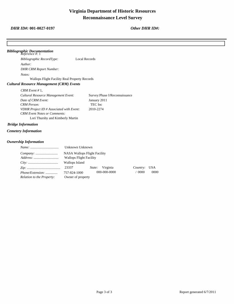
Virginia Department of Historic Resources
Reconnaissance Level Survey
DHR ID#: 001-0027-0197 Other DHR ID#:
Bibliographic Documentation
Reference #: 1
Bibliographic RecordType: Local Records
Author:
DHR CRM Report Number:
Notes:
Wallops Flight Facility Real Property Records
Cultural Resource Management (CRM) Events
CRM Event # 1,
Cultural Resource Management Event: Survey:Phase I/Reconnaissance
Date of CRM Event: January 2011
CRM Person: TEC Inc
VDHR Project ID # Associated with Event: 2010-2274
CRM Event Notes or Comments:
Lori Thursby and Kimberly Martin
Bridge Information
Cemetery Information
Ownership Information
Unknown Unknown Name: .................................
NASA Wallops Flight FacilityCompany: ..........................
Wallops Flight FacilityAddress: .............................
Wallops IslandCity: ...................................
23337Zip: ....................................... VirginiaState: USACountry:
000-000-0000757-824-1000Phone/Extension: ..............
0000/ 0000
Relation to the Property: Owner of property
Report generated 6/7/2011Page 3 of 3

001-0027-0152I-004
Mai
nlan
d R
d.
Causeway Rd.
North
Sea
wall R
d.
North
Byp
ass
Rd.
001-0027-0182W-020
001-0027-0188W-065
001-0027-0160U-030
001-0027-0184W-040
001-0027-0167U-070
001-0027-0156U-025
001-0027-0192X-085
001-0027-0163U-055
001-0027-0201Z-040
001-0027-0198Y-055
001-0027-0193Y-010
001-0027-0170V-025
001-0027-0190X-005A
001-0027-0187W-057
001-0027-0153U-005
001-0027-0197Y-038
001-0027-0194Y-016
001-0027-0180W-015
001-0027-0162U-040
001-0027-0191X-075
001-0027-0159U-027
001-0027-0158U-026
001-0027-0168U-070A
001-0027-0185W-050
001-0027-0179W-010
001-0027-0155U-020B
001-0027-0161U-030A
001-0027-0183W-035
001-0027-0169U-080
001-0027-0165U-060
001-0027-0164U-055A
001-0027-0154U-020A
001-0027-0157U-025A
001-0027-0166U-064
001-0027-0189W-067
001-0027-0195Y-020
001-0027-0181W-016
001-0027-0186W-051
001-0027-0199Y-095
001-0027-0200Y-110
001-0027-0196Y-037
NASA Property
Surveyed Structures
Buildings
0 300Meters
0 1,500Feet

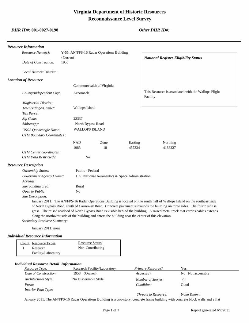
Virginia Department of Historic Resources
Reconnaissance Level Survey
DHR ID#: 001-0027-0198 Other DHR ID#:
Resource Information
National Register Eligibility Status
This Resource is associated with the Wallops Flight
Facility
Resource Name(s): Y-55, AN/FPS-16 Radar Operations Building
{Current}
Date of Construction: 1958
Local Historic District :
Location of Resource
County/Independent City:
Commonwealth of Virginia
Accomack
Magisterial District:
Town/Village/Hamlet: Wallops Island
Tax Parcel:
Zip Code: 23337
Address(s): North Bypass Road
USGS Quadrangle Name: WALLOPS ISLAND
UTM Boundary Coordinates :
Northing EastingZone NAD
1983 18 457324 4188327
UTM Center coordinates :
NoUTM Data Restricted?.
Resource Description
Ownership Status: Public - Federal
Government Agency Owner: U.S. National Aeronautics & Space Administration
Acreage:
Surrounding area: Rural
Open to Public: No
January 2011: The AN/FPS-16 Radar Operations Building is located on the south half of Wallops Island on the southeast side
of North Bypass Road, south of Causeway Road. Concrete pavement surrounds the building on three sides. The fourth side is
grass. The raised roadbed of North Bypass Road is visible behind the building. A raised metal track that carries cables extends
along the northwest side of the building and enters the building near the center of this elevation.
Site Description:
Secondary Resource Summary:
January 2011: none
Resource StatusResource TypesCount
Research
Facility/Laboratory
Non-Contributing 1
Individual Resource Information
Research Facility/LaboratoryResource Type. Primary Resource? Yes
Individual Resource Detail Information
Date of Construction: Accessed? 1958 {Owner} No Not accessible
2.0 Number of Stories:Architectural Style: No Discernable Style
Good
Interior Plan Type:
Form: Condition:
Threats to Resource: None Known
January 2011: The AN/FPS-16 Radar Operations Building is a two-story, concrete frame building with concrete block walls and a flat
Report generated 6/7/2011Page 1 of 3

Virginia Department of Historic Resources
Reconnaissance Level Survey
DHR ID#: 001-0027-0198 Other DHR ID#:
built-up roof and metal fascia. A wood handrail runs along the perimeter of the roof and a dish satellite rests on its west corner. The
building rests on a reinforced concrete slab foundation. The northeast elevation has two sets of double hollow steel doors with
view windows on each floor. A concrete balcony with a metal tube railing leads from the second floor doors to a set of metal stairs
on the northwest elevation. These metal stairs provide access to the roof and satellite. A small opening, covered by an aluminum
hood is the port for cables extending along a raised metal track. The southwest elevation has a single hollow steel door with a view
window. A three-step concrete stoop with metal tube handrails leads to the door. The southeast elevation has a metal staircase
with metal tube handrails leading to a wood-framed platform, also with metal tube handrails, and a single hollow steel door with view
windows. The steel stairway replaced the historical concrete platform (WFF 2011). Conduits attached to the middle of the wall,
extend to a raised, wood frame deck to the northwest. Power equipment and fans sit on the deck.
Primary Resource Exterior Component Description:
Material TreatmentMaterialComp Type/FormComponent
Foundation Foundation - Slab Concrete Foundation - Poured
Roof Roof - Flat other
Structural System Structural System - Masonry Concrete Structural System - Block
Structural System Structural System - Frame Concrete
Historic Time Period(s):S- The New Dominion (1946- Present)
Historic Context(s): Military/Defense
Technology/Engineering
Significance Statement
January 2011: This building is representative of a Research, Development and Testing resource type built near the beginning of the New
Dominion period (1945–present) at a Technology/Engineering research facility. NACA established the Auxiliary Flight Research Station
in the southern portion of Wallops Island in 1945 for aeronautical research. In mid-1946, this facility was renamed the Pilotless Aircraft
Research Station (PARS) and functioned as a rocket testing facility. By the mid-1950s, the testing program at PARS concentrated on
hypersonic missiles. Substantial development occurred at PARS between 1946 and 1954. After 1954, buildings and structures generally
were constructed as needed to meet workload and research program requirements. NACA constructed this building in 1958 for the FPS-16
radar, which is mounted to its roof. A long-range radar, the FPS-16 was loaned to Wallops Station by the U.S. Air Force to track
multistage rocket vehicles. The 12-foot dish of this C-band radar can track a target to approximately 190 miles (Shortal 1978).
Y-55 has been evaluated both as a contributing resource in a historic district and as an individual resource. No historic district on
Wallops Island was identified because of a lack of significance and integrity (refer to Section 4.3.1).
The AN/FPS-16 Radar Operations Building is not individually eligible for listing on the NRHP because it lacks significance and integrity.
The building is recommended not eligible under Criterion A because it is not associated with an event or pattern of events of local, state,
or national significance. It is not associated with the life of a person significant in our past; therefore, it is recommended not eligible under
Criterion B. The building is recommended not eligible under Criterion C because it does not embody the distinctive characteristics of a
type, period, or method of construction; represent the work of a master; possess high artistic value; or represent a significant or
distinguishable entity whose components may lack individual distinction. It is recommended not eligible under Criterion D because it
does not have the potential to yield information important in history or prehistory.
The building is in its historical location. The integrity of setting is diminished by the addition of the raised roadbed of North Bypass Road
behind the building. The building retains integrity of design and workmanship. The integrity of materials has been reduced by the
replacement of the concrete platform on the southeast elevation and the removal of some exterior equipment and/or openings from the
southeast and northeast elevations. The building retains integrity of feeling and association.
National Register Eligibility Information (Intensive Level Survey):
NR Resource StatusNR Resource TypeNR Count
Building Non-contributing 1
1 Non-Contributing:
National Register Criteria:
Report generated 6/7/2011Page 2 of 3

Virginia Department of Historic Resources
Reconnaissance Level Survey
DHR ID#: 001-0027-0198 Other DHR ID#:
Level of Significance:
Period of Significance:
Graphic Media Documentation
PhotographerPhoto DateNegative RepositoryDHR Negative # Photographic Media
Digitial Images L ThursbyJanuary 2011
Bibliographic Documentation
Reference #: 1
Bibliographic RecordType: Local Records
Author:
DHR CRM Report Number:
Notes:
Wallops Flight Facility Real Property Records
Reference #: 2
Bibliographic RecordType: Article
Author: Joseph Adams Shortal
DHR CRM Report Number:
Notes:
1978 A New Dimension Wallops Island Flight Test Range: The First Fifteen Years. Washington D.C.: NASA Scientific
and Technical Information Office.
Cultural Resource Management (CRM) Events
CRM Event # 1,
Cultural Resource Management Event: Survey:Phase I/Reconnaissance
Date of CRM Event: January 2011
CRM Person: TEC Inc
VDHR Project ID # Associated with Event: 2010-2274
CRM Event Notes or Comments:
Lori Thursby and Kimberly Martin
Bridge Information
Cemetery Information
Ownership Information
Unknown Unknown Name: .................................
NASA Wallops Flight FacilityCompany: ..........................
Wallops Flight FacilityAddress: .............................
Wallops IslandCity: ...................................
23337Zip: ....................................... VirginiaState: USACountry:
000-000-0000757-824-1000Phone/Extension: ..............
0000/ 0000
Relation to the Property: Owner of property
Report generated 6/7/2011Page 3 of 3

001-0027-0152I-004
Mai
nlan
d R
d.
Causeway Rd.
North
Sea
wall R
d.
North
Byp
ass
Rd.
001-0027-0182W-020
001-0027-0188W-065
001-0027-0160U-030
001-0027-0184W-040
001-0027-0167U-070
001-0027-0156U-025
001-0027-0192X-085
001-0027-0163U-055
001-0027-0201Z-040
001-0027-0198Y-055
001-0027-0193Y-010
001-0027-0170V-025
001-0027-0190X-005A
001-0027-0187W-057
001-0027-0153U-005
001-0027-0197Y-038
001-0027-0194Y-016
001-0027-0180W-015
001-0027-0162U-040
001-0027-0191X-075
001-0027-0159U-027
001-0027-0158U-026
001-0027-0168U-070A
001-0027-0185W-050
001-0027-0179W-010
001-0027-0155U-020B
001-0027-0161U-030A
001-0027-0183W-035
001-0027-0169U-080
001-0027-0165U-060
001-0027-0164U-055A
001-0027-0154U-020A
001-0027-0157U-025A
001-0027-0166U-064
001-0027-0189W-067
001-0027-0195Y-020
001-0027-0181W-016
001-0027-0186W-051
001-0027-0199Y-095
001-0027-0200Y-110
001-0027-0196Y-037
NASA Property
Surveyed Structures
Buildings
0 300Meters
0 1,500Feet


Virginia Department of Historic Resources
Reconnaissance Level Survey
DHR ID#: 001-0027-0199 Other DHR ID#:
Resource Information
National Register Eligibility Status
This Resource is associated with the Wallops Flight
Facility
Resource Name(s): Y-95, Camera Platform {Current}
Date of Construction: 1964
Local Historic District :
Location of Resource
County/Independent City:
Commonwealth of Virginia
Accomack
Magisterial District:
Town/Village/Hamlet: Wallops Island
Tax Parcel:
Zip Code: 23337
Address(s): North Bypass Road
USGS Quadrangle Name: WALLOPS ISLAND
UTM Boundary Coordinates :
Northing EastingZone NAD
1983 18 457324 4188327
UTM Center coordinates :
NoUTM Data Restricted?.
Resource Description
Ownership Status: Public - Federal
Government Agency Owner: U.S. National Aeronautics & Space Administration
Acreage:
Surrounding area: Rural
Open to Public: No
January 2011: This camera tower is located on the south half of Wallops Island, south of Causeway Road and southeast of
North Bypass Road. The area is flat and open with grass surrounding the structure. The AN/FPS 16-Radar Operations
Building (Y-55) is to the southwest.
Site Description:
Secondary Resource Summary:
January 2011: none
Resource StatusResource TypesCount
Research
Facility/Laboratory
Non-Contributing 1
Individual Resource Information
Research Facility/LaboratoryResource Type. Primary Resource? Yes
Individual Resource Detail Information
Date of Construction: Accessed? 1964 {Owner}
0.0 Number of Stories:Architectural Style: No Discernable Style
Good
Interior Plan Type:
Form: Condition:
Threats to Resource: None Known
January 2011: The Camera Tower is a four tiered steel structure. It is constructed of four steel corner posts, attached to 17-inch by
17-inch concrete footings and steel intersecting diagonal steel angles. A spiral steel stair case on the southeast corner extends to a
metal framed platform with metal tube handrails. Steel bars spring from the middle of the second tier to support the platform on all
Report generated 6/7/2011Page 1 of 3

Virginia Department of Historic Resources
Reconnaissance Level Survey
DHR ID#: 001-0027-0199 Other DHR ID#:
four corners of the tower. The camera tower once supported a 12-ft cylinder and dome, but these were removed in the 1990s (WFF
2011). Wood stairs lead to a concrete platform supporting mechanical equipment on the southwest corner.
Primary Resource Exterior Component Description:
Material TreatmentMaterialComp Type/FormComponent
Structural System Structural System - Frame Steel
Foundation Foundation - Piers Concrete Foundation - Poured
Historic Time Period(s):S- The New Dominion (1946- Present)
Historic Context(s): Military/Defense
Technology/Engineering
Significance Statement
This structure represents an Infrastructure resource type built at a Technology/Engineering research facility towards the beginning of the
New Dominion period (1945–present). This is one of approximately 50 buildings and structures that were erected within six years of the
establishment of NASA and the incorporation of Wallops Station as one of its operational facilities in 1959. Initially, Wallops Station’s
new mission under NASA was to develop and test various components related to manned space flight. This mission was short-lived,
however, as Wallops became a test range and launch site for suborbital and orbital rockets and satellites beginning in the early 1960s.
NASA erected this camera platform in 1964 (WFF 2011).
Y-95 has been evaluated both as a contributing resource in a historic district and as an individual resource. No historic district on
Wallops Island was identified because of a lack of significance and integrity (refer to Section 4.3.1).
This Camera Tower is not individually eligible for listing on the NRHP because it lacks significance. The structure is presently less than
50 years old; therefore, it was evaluated under Criteria Consideration G in addition to Criteria A–D. Y-95 is recommended not eligible
under Criterion A because it is not associated with an event or pattern of events of exceptional importance at the local, state, or national
level. It is not associated with the life of a person who made exceptionally important contributions in history; therefore, it is recommended
not eligible under Criterion B. The structure is recommended not eligible under Criterion C because it does not embody exceptional
engineering merit for distinctive characteristics of a type, period, or method of construction; represent the work of a master; or possess
high artistic value. Likewise, it does not represent an exceptionally significant or distinguishable entity whose components may lack
individual distinction. It is recommended not eligible under Criterion D because it does not have the potential to yield information
exceptionally important in history or prehistory.
National Register Eligibility Information (Intensive Level Survey):
NR Resource StatusNR Resource TypeNR Count
Building Non-contributing 1
1 Non-Contributing:
National Register Criteria:
Level of Significance:
Period of Significance:
Graphic Media Documentation
PhotographerPhoto DateNegative RepositoryDHR Negative # Photographic Media
Digitial Images L ThursbyJanuary 2011
Bibliographic Documentation
Reference #: 1
Bibliographic RecordType: Local Records
Report generated 6/7/2011Page 2 of 3

Virginia Department of Historic Resources
Reconnaissance Level Survey
DHR ID#: 001-0027-0199 Other DHR ID#:
Author:
DHR CRM Report Number:
Notes:
Wallops Flight Facility Real Property Records
Cultural Resource Management (CRM) Events
CRM Event # 1,
Cultural Resource Management Event: Survey:Phase I/Reconnaissance
Date of CRM Event: January 2011
CRM Person: TEC Inc
VDHR Project ID # Associated with Event: 2010-2274
CRM Event Notes or Comments:
Lori Thursby and Kimberly Martin
Bridge Information
Cemetery Information
Ownership Information
Unknown Unknown Name: .................................
NASA Wallops Flight FacilityCompany: ..........................
Wallops Flight FacilityAddress: .............................
Wallops IslandCity: ...................................
23337Zip: ....................................... VirginiaState: USACountry:
000-000-0000757-824-1000Phone/Extension: ..............
0000/ 0000
Relation to the Property: Owner of property
Report generated 6/7/2011Page 3 of 3

001-0027-0152I-004
Mai
nlan
d R
d.
Causeway Rd.
North
Sea
wall R
d.
North
Byp
ass
Rd.
001-0027-0182W-020
001-0027-0188W-065
001-0027-0160U-030
001-0027-0184W-040
001-0027-0167U-070
001-0027-0156U-025
001-0027-0192X-085
001-0027-0163U-055
001-0027-0201Z-040
001-0027-0198Y-055
001-0027-0193Y-010
001-0027-0170V-025
001-0027-0190X-005A
001-0027-0187W-057
001-0027-0153U-005
001-0027-0197Y-038
001-0027-0194Y-016
001-0027-0180W-015
001-0027-0162U-040
001-0027-0191X-075
001-0027-0159U-027
001-0027-0158U-026
001-0027-0168U-070A
001-0027-0185W-050
001-0027-0179W-010
001-0027-0155U-020B
001-0027-0161U-030A
001-0027-0183W-035
001-0027-0169U-080
001-0027-0165U-060
001-0027-0164U-055A
001-0027-0154U-020A
001-0027-0157U-025A
001-0027-0166U-064
001-0027-0189W-067
001-0027-0195Y-020
001-0027-0181W-016
001-0027-0186W-051
001-0027-0199Y-095
001-0027-0200Y-110
001-0027-0196Y-037
NASA Property
Surveyed Structures
Buildings
0 300Meters
0 1,500Feet


Virginia Department of Historic Resources
Reconnaissance Level Survey
DHR ID#: 001-0027-0200 Other DHR ID#:
Resource Information
National Register Eligibility Status
This Resource is associated with the Wallops Flight
Facility
Resource Name(s): Y-110, Camera Platform and 10-ft Astrodome
{Current}
Date of Construction: 1964
Local Historic District :
Location of Resource
County/Independent City:
Commonwealth of Virginia
Accomack
Magisterial District:
Town/Village/Hamlet: Wallops Island
Tax Parcel:
Zip Code: 23337
Address(s): North Bypass Road
USGS Quadrangle Name: WALLOPS ISLAND
UTM Boundary Coordinates :
Northing EastingZone NAD
1983 18 457498 4187963
UTM Center coordinates :
NoUTM Data Restricted?.
Resource Description
Ownership Status: Public - Federal
Government Agency Owner: U.S. National Aeronautics & Space Administration
Acreage:
Surrounding area: Rural
Open to Public: No
January 2011: This Camera Platform and 10-ft Dome is located on the south half of Wallops Island, southeast of North Seawall
Road, next to large riprap that lines the shore of the Atlantic Ocean. The riprap bounds the eastern side and grass surrounds
the platform on all the remaining sides.
Site Description:
Secondary Resource Summary:
January 2011: none
Resource StatusResource TypesCount
Research
Facility/Laboratory
Non-Contributing 1
Individual Resource Information
Research Facility/LaboratoryResource Type. Primary Resource? Yes
Individual Resource Detail Information
Date of Construction: Accessed? 1964 {Owner}
0.0 Number of Stories:Architectural Style: No Discernable Style
Good
Interior Plan Type:
Form: Condition:
Threats to Resource: None Known
January 2011: The Camera Platform is an L-shaped, one tiered wooden structure. Wood posts are set in concrete footings; wood
diagonal intersecting members provide additional structural support. Stairs extend to the platform and the dome on the south side.
Report generated 6/7/2011Page 1 of 3

Virginia Department of Historic Resources
Reconnaissance Level Survey
DHR ID#: 001-0027-0200 Other DHR ID#:
Handrails run along the perimeter of the platform. The camera equipment consists of a 10-ft-diameter cylinder with a 10-ft- diameter
dome atop it (WFF 2011). A track runs along the east-west axis of the dome.
Primary Resource Exterior Component Description:
Material TreatmentMaterialComp Type/FormComponent
Foundation Foundation - Piers Concrete
Structural System Structural System - Frame Wood
Historic Time Period(s):S- The New Dominion (1946- Present)
Historic Context(s): Military/Defense
Technology/Engineering
Significance Statement
January 2011: This structure represents an Infrastructure resource type built at a Technology/Engineering research facility towards the
beginning of the New Dominion period (1945–present). This is one of approximately 50 buildings and structures that were erected within
six years of the establishment of NASA and the incorporation of Wallops Station as one of its operational facilities in 1959. Initially,
Wallops Station’s new mission under NASA was to develop and test various components related to manned space flight. This mission
was short-lived, however, as Wallops became a test range and launch site for suborbital and orbital rockets and satellites beginning in the
early 1960s. NASA erected this camera platform in 1964 (WFF 2011).
Y-110 has been evaluated both as a contributing resource in a historic district and as an individual resource. No historic district on
Wallops Island was identified because of a lack of significance and integrity.
The camera platform is not individually eligible for listing on the NRHP because it lacks significance. The structure is presently less than
50 years old; therefore, it was evaluated under Criteria Consideration G in addition to Criteria A–D. Y-110 is recommended not eligible
under Criterion A because it is not associated with an event or pattern of events of exceptional importance at the local, state, or national
level. It is not associated with the life of a person who made exceptionally important contributions in history; therefore, it is recommended
not eligible under Criterion B. The structure is recommended not eligible under Criterion C because it does not embody exceptional
engineering merit for distinctive characteristics of a type, period, or method of construction; represent the work of a master; or possess
high artistic value. Likewise, it does not represent an exceptionally significant or distinguishable entity whose components may lack
individual distinction. It is recommended not eligible under Criterion D because it does not have the potential to yield information
exceptionally important in history or prehistory.
National Register Eligibility Information (Intensive Level Survey):
NR Resource StatusNR Resource TypeNR Count
Building Non-contributing 1
1 Non-Contributing:
National Register Criteria:
Level of Significance:
Period of Significance:
Graphic Media Documentation
PhotographerPhoto DateNegative RepositoryDHR Negative # Photographic Media
Digitial Images L ThursbyJanuary 2011
Bibliographic Documentation
Reference #: 1
Bibliographic RecordType: Local Records
Report generated 6/7/2011Page 2 of 3

Virginia Department of Historic Resources
Reconnaissance Level Survey
DHR ID#: 001-0027-0200 Other DHR ID#:
Author:
DHR CRM Report Number:
Notes:
Wallops Flight Facility Real Property Records
Cultural Resource Management (CRM) Events
CRM Event # 1,
Cultural Resource Management Event: Survey:Phase I/Reconnaissance
Date of CRM Event: January 2011
CRM Person: TEC Inc
VDHR Project ID # Associated with Event: 2010-2274
CRM Event Notes or Comments:
Lori Thursby and Kimberly Martin
Bridge Information
Cemetery Information
Ownership Information
Unknown Unknown Name: .................................
NASA Wallops Flight FacilityCompany: ..........................
Wallops Flight FacilityAddress: .............................
Wallops IslandCity: ...................................
23337Zip: ....................................... VirginiaState: USACountry:
000-000-0000757-824-1000Phone/Extension: ..............
0000/ 0000
Relation to the Property: Owner of property
Report generated 6/7/2011Page 3 of 3

001-0027-0152I-004
Mai
nlan
d R
d.
Causeway Rd.
North
Sea
wall R
d.
North
Byp
ass
Rd.
001-0027-0182W-020
001-0027-0188W-065
001-0027-0160U-030
001-0027-0184W-040
001-0027-0167U-070
001-0027-0156U-025
001-0027-0192X-085
001-0027-0163U-055
001-0027-0201Z-040
001-0027-0198Y-055
001-0027-0193Y-010
001-0027-0170V-025
001-0027-0190X-005A
001-0027-0187W-057
001-0027-0153U-005
001-0027-0197Y-038
001-0027-0194Y-016
001-0027-0180W-015
001-0027-0162U-040
001-0027-0191X-075
001-0027-0159U-027
001-0027-0158U-026
001-0027-0168U-070A
001-0027-0185W-050
001-0027-0179W-010
001-0027-0155U-020B
001-0027-0161U-030A
001-0027-0183W-035
001-0027-0169U-080
001-0027-0165U-060
001-0027-0164U-055A
001-0027-0154U-020A
001-0027-0157U-025A
001-0027-0166U-064
001-0027-0189W-067
001-0027-0195Y-020
001-0027-0181W-016
001-0027-0186W-051
001-0027-0199Y-095
001-0027-0200Y-110
001-0027-0196Y-037
NASA Property
Surveyed Structures
Buildings
0 300Meters
0 1,500Feet

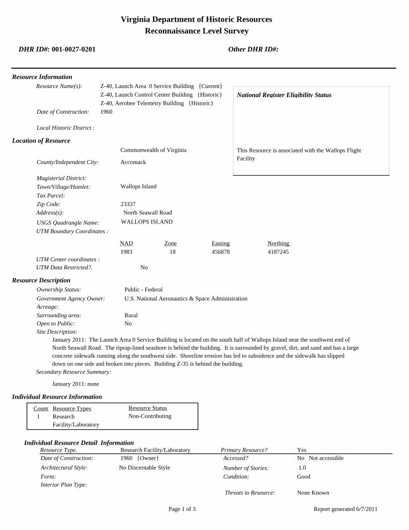
Virginia Department of Historic Resources
Reconnaissance Level Survey
DHR ID#: 001-0027-0201 Other DHR ID#:
Resource Information
National Register Eligibility Status
This Resource is associated with the Wallops Flight
Facility
Resource Name(s): Z-40, Launch Area 0 Service Building {Current}
Z-40, Launch Control Center Building {Historic}
Z-40, Aerobee Telemetry Building {Historic}
Date of Construction: 1960
Local Historic District :
Location of Resource
County/Independent City:
Commonwealth of Virginia
Accomack
Magisterial District:
Town/Village/Hamlet: Wallops Island
Tax Parcel:
Zip Code: 23337
Address(s): North Seawall Road
USGS Quadrangle Name: WALLOPS ISLAND
UTM Boundary Coordinates :
Northing EastingZone NAD
1983 18 456878 4187245
UTM Center coordinates :
NoUTM Data Restricted?.
Resource Description
Ownership Status: Public - Federal
Government Agency Owner: U.S. National Aeronautics & Space Administration
Acreage:
Surrounding area: Rural
Open to Public: No
January 2011: The Launch Area 0 Service Building is located on the south half of Wallops Island near the southwest end of
North Seawall Road. The riprap-lined seashore is behind the building. It is surrounded by gravel, dirt, and sand and has a large
concrete sidewalk running along the southwest side. Shoreline erosion has led to subsidence and the sidewalk has slipped
down on one side and broken into pieces. Building Z-35 is behind the building.
Site Description:
Secondary Resource Summary:
January 2011: none
Resource StatusResource TypesCount
Research
Facility/Laboratory
Non-Contributing 1
Individual Resource Information
Research Facility/LaboratoryResource Type. Primary Resource? Yes
Individual Resource Detail Information
Date of Construction: Accessed? 1960 {Owner} No Not accessible
1.0 Number of Stories:Architectural Style: No Discernable Style
Good
Interior Plan Type:
Form: Condition:
Threats to Resource: None Known
Report generated 6/7/2011Page 1 of 3
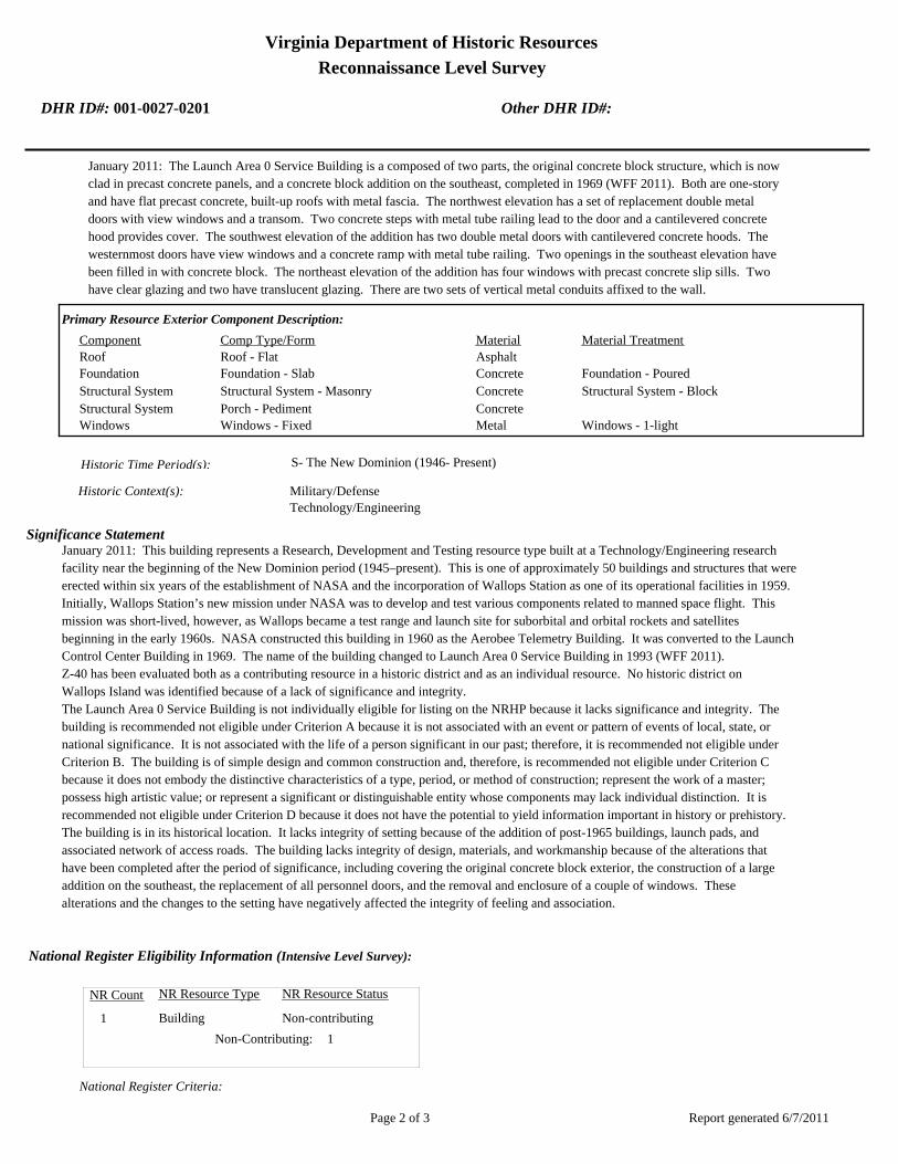
Virginia Department of Historic Resources
Reconnaissance Level Survey
DHR ID#: 001-0027-0201 Other DHR ID#:
January 2011: The Launch Area 0 Service Building is a composed of two parts, the original concrete block structure, which is now
clad in precast concrete panels, and a concrete block addition on the southeast, completed in 1969 (WFF 2011). Both are one-story
and have flat precast concrete, built-up roofs with metal fascia. The northwest elevation has a set of replacement double metal
doors with view windows and a transom. Two concrete steps with metal tube railing lead to the door and a cantilevered concrete
hood provides cover. The southwest elevation of the addition has two double metal doors with cantilevered concrete hoods. The
westernmost doors have view windows and a concrete ramp with metal tube railing. Two openings in the southeast elevation have
been filled in with concrete block. The northeast elevation of the addition has four windows with precast concrete slip sills. Two
have clear glazing and two have translucent glazing. There are two sets of vertical metal conduits affixed to the wall.
Primary Resource Exterior Component Description:
Material TreatmentMaterialComp Type/FormComponent
Roof Roof - Flat Asphalt
Foundation Foundation - Slab Concrete Foundation - Poured
Structural System Structural System - Masonry Concrete Structural System - Block
Structural System Porch - Pediment Concrete
Windows Windows - Fixed Metal Windows - 1-light
Historic Time Period(s):S- The New Dominion (1946- Present)
Historic Context(s): Military/Defense
Technology/Engineering
Significance Statement
January 2011: This building represents a Research, Development and Testing resource type built at a Technology/Engineering research
facility near the beginning of the New Dominion period (1945–present). This is one of approximately 50 buildings and structures that were
erected within six years of the establishment of NASA and the incorporation of Wallops Station as one of its operational facilities in 1959.
Initially, Wallops Station’s new mission under NASA was to develop and test various components related to manned space flight. This
mission was short-lived, however, as Wallops became a test range and launch site for suborbital and orbital rockets and satellites
beginning in the early 1960s. NASA constructed this building in 1960 as the Aerobee Telemetry Building. It was converted to the Launch
Control Center Building in 1969. The name of the building changed to Launch Area 0 Service Building in 1993 (WFF 2011).
Z-40 has been evaluated both as a contributing resource in a historic district and as an individual resource. No historic district on
Wallops Island was identified because of a lack of significance and integrity.
The Launch Area 0 Service Building is not individually eligible for listing on the NRHP because it lacks significance and integrity. The
building is recommended not eligible under Criterion A because it is not associated with an event or pattern of events of local, state, or
national significance. It is not associated with the life of a person significant in our past; therefore, it is recommended not eligible under
Criterion B. The building is of simple design and common construction and, therefore, is recommended not eligible under Criterion C
because it does not embody the distinctive characteristics of a type, period, or method of construction; represent the work of a master;
possess high artistic value; or represent a significant or distinguishable entity whose components may lack individual distinction. It is
recommended not eligible under Criterion D because it does not have the potential to yield information important in history or prehistory.
The building is in its historical location. It lacks integrity of setting because of the addition of post-1965 buildings, launch pads, and
associated network of access roads. The building lacks integrity of design, materials, and workmanship because of the alterations that
have been completed after the period of significance, including covering the original concrete block exterior, the construction of a large
addition on the southeast, the replacement of all personnel doors, and the removal and enclosure of a couple of windows. These
alterations and the changes to the setting have negatively affected the integrity of feeling and association.
National Register Eligibility Information (Intensive Level Survey):
NR Resource StatusNR Resource TypeNR Count
Building Non-contributing 1
1 Non-Contributing:
National Register Criteria:
Report generated 6/7/2011Page 2 of 3
Virginia Department of Historic Resources
Reconnaissance Level Survey
DHR ID#: 001-0027-0201 Other DHR ID#:
Level of Significance:
Period of Significance:
Graphic Media Documentation
PhotographerPhoto DateNegative RepositoryDHR Negative # Photographic Media
Digitial Images L ThursbyJanuary 2011
Bibliographic Documentation
Reference #: 1
Bibliographic RecordType: Local Records
Author:
DHR CRM Report Number:
Notes:
Wallops Flight Facility Real Property Records
Cultural Resource Management (CRM) Events
CRM Event # 1,
Cultural Resource Management Event: Survey:Phase I/Reconnaissance
Date of CRM Event: January 2011
CRM Person: TEC Inc
VDHR Project ID # Associated with Event: 2010-2274
CRM Event Notes or Comments:
Lori Thursby and Kimberly Martin
Bridge Information
Cemetery Information
Ownership Information
Unknown Unknown Name: .................................
NASA Wallops Flight FacilityCompany: ..........................
Wallops Flight FacilityAddress: .............................
Wallops IslandCity: ...................................
23337Zip: ....................................... VirginiaState: USACountry:
000-000-0000757-824-1000Phone/Extension: ..............
0000/ 0000
Relation to the Property: Owner of property
Report generated 6/7/2011Page 3 of 3

001-0027-0152I-004
Mai
nlan
d R
d.
Causeway Rd.
North
Sea
wall R
d.
North
Byp
ass
Rd.
001-0027-0182W-020
001-0027-0188W-065
001-0027-0160U-030
001-0027-0184W-040
001-0027-0167U-070
001-0027-0156U-025
001-0027-0192X-085
001-0027-0163U-055
001-0027-0201Z-040
001-0027-0198Y-055
001-0027-0193Y-010
001-0027-0170V-025
001-0027-0190X-005A
001-0027-0187W-057
001-0027-0153U-005
001-0027-0197Y-038
001-0027-0194Y-016
001-0027-0180W-015
001-0027-0162U-040
001-0027-0191X-075
001-0027-0159U-027
001-0027-0158U-026
001-0027-0168U-070A
001-0027-0185W-050
001-0027-0179W-010
001-0027-0155U-020B
001-0027-0161U-030A
001-0027-0183W-035
001-0027-0169U-080
001-0027-0165U-060
001-0027-0164U-055A
001-0027-0154U-020A
001-0027-0157U-025A
001-0027-0166U-064
001-0027-0189W-067
001-0027-0195Y-020
001-0027-0181W-016
001-0027-0186W-051
001-0027-0199Y-095
001-0027-0200Y-110
001-0027-0196Y-037
NASA Property
Surveyed Structures
Buildings
0 300Meters
0 1,500Feet