historic american engineering record lake champlain bridge...
TRANSCRIPT

HISTORIC AMERICAN ENGINEERING RECORD
LAKE CHAMPLAIN BRIDGE
HAER No. NY-541 Location: Spanning Lake Champlain at NY Route 185 and VT Route 17,
Town of Crown Point, Essex County, New York, and Town of Addison, Addison County, Vermont.
The Lake Champlain Bridge is located at latitude 44.0149,
longitude -73.2524. The coordinate represents the center of the bridge at the New York/Vermont boundary. The coordinate was obtained on 4 May 2010 by plotting its location on the 1:25,000 Port Henry, NY USGS Topographic Quadrangle Map. The accuracy of the coordinate is +/- 12 meters. The coordinate’s datum is North American Datum 1983. The Lake Champlain Bridge location has no restriction on its release to the public.
Structural Type: Steel continuous through and deck truss span Date of Construction: 1928-29 Designer: Fay, Spofford and Thorndike, Engineers Builders: Substructure - Merritt-Chapman and Scott Corporation, Boston
Superstructure - American Bridge Company, New York Deck and Approach Paving - Scott Brothers Construction Company, Rome, New York Electrical Equipment - Alvin E. Bennett, Crown Point, New York
Toll House – Charles Malone, Port Henry, New York Present Owner: New York State Department of Transportation and Vermont
Agency of Transportation Present Use: Vehicular bridge, closed October 16, 2009, removed December 28,
2009 Significance: The bridge was a nationally significant engineering landmark and
one of the country’s most technologically inventive and aesthetically sophisticated designs for highway bridges of its period. Opened to traffic in 1929, the bridge symbolized a convergence of four separate but related trends in transportation engineering, the origins of which can be traced to the closing decades of the nineteenth century: (1) continuous truss technology; (2) a debate within the engineering community regarding the
LAKE CHAMPLAIN BRIDGE HAER No. NY-541
(Page 2)
aesthetics of bridge design, and especially the aesthetics of truss bridges; (3) the use of cantilevers in truss design to extend span length, reduce construction costs, and address aesthetic concerns; and (4) evolving engineering responses to rapidly increasing travel by automobiles. Those trends intersected at Lake Champlain, and the inventive design that blossomed from that meeting is original in American engineering. Equally important, the crossing served as the country’s prototype for a succession of important bridges built or planned for major waterways during the remainder of the twentieth century.
Historians: Mark S. LoRusso, M.A., Cultural Resources Survey Program, New
York State Museum, Albany, New York
Robert McCullough, Ph.D., Associate Professor of Historic Preservation, University of Vermont, Burlington, Vermont
Project Information: Recording of the Lake Champlain Bridge was completed in
November and December 2009, under the direction of Mark S. LoRusso, Historian, Cultural Resources Survey Program (CRSP), and under the supervision of Dr. Christina Reith, Program Director, CRSP. The photography team consisted of New York State Museum Photographer Thaddeus Beblowski and Mark S. LoRusso. The New York State Department of Transportation provided additional photographs. Measured drawings were prepared from the original plans by CRSP Cartographer Jessie Pellerin. Comprehensive field measurements were not possible due to the emergency closure and removal of the bridge.
The historical report was prepared by Mark S. LoRusso, with assistance from Christopher Marston, HAER Architect, National Park Service. Mark S. LoRusso authored the introductory sections, the site description, the background history, and the descriptive information from 2009-2011. The bridge description, the biography of Fay, Spofford and Thorndike, and the statement of significance are from the draft National Historic Landmark (NHL) Nomination of the Lake Champlain Bridge by Robert McCullough, prepared in October 2009 and revised in 2010. A copy of the NHL Nomination is provided in the field records accompanying this documentation. The documentation was submitted to HAER in 2011.
LAKE CHAMPLAIN BRIDGE HAER No. NY-541
(Page 3)
HISTORIC AMERICAN ENGINEERING RECORD
INDEX TO PHOTOGRAPHS
Photographer: Thaddeus Beblowski November 2009
Photo 1. New York approach, view northeast. .............................................................................. 4 Photo 2. New York approach, view northeast. The former tollhouse is shown at right. .............. 5 Photo 3. Vermont approach, view southwest.. The Chimney Point Tavern is shown at left ........ 6 Photo 4. Vermont approach, view southwest. ................................................................................ 7 Photo 5. View from Fort St Frederic, Crown Point State Historic Site, looking northeast. .......... 8 Photo 6. View from Fort Crown Point, Crown Point State Historic Site, looking northeast. ....... 9 Photo 7. View from Crown Point Public Campground, looking north. ....................................... 10 Photo 8. View from Crown Point Public Campground, looking northwest. ............................... 11 Photo 9. View from the Champlain Memorial lighthouse, looking northwest. ........................... 12 Photo 10. View from Chimney Point State Park, looking southwest. The Chimney Point Tavern is shown at right ................................................................................................................ 13 Photo 11. View from Port Henry, New York, looking southeast across Lake Champlain. The bridge, two miles distant, is just visible above the horizon ................................................... 14 Photo 12. New York abutment and Span 1, west side, view south.. The spans are numbered, 1-14, beginning at the New York (south) end ............................................................. 15 Photo 13. Spans 1 and 2, west side, view east. ............................................................................ 16 Photo 14. Spans 2 and 3, west side, view northeast. .................................................................... 17 Photo 15. Spans 4 and 5, west side, view northeast. .................................................................... 18 Photo 16. Span 4, upper truss detail, west side, view northeast. ................................................. 19 Photo 17. Spans 4, 5, and 6, Pier 5, east side, view southwest toward New York. ..................... 20 Photo 18. Spans 6, 7 and 8 (continuous truss), east side, view from Crown Point Public Campground pier, looking northwest. .......................................................................................... 21 Photo 19. Spans 6, 7 and 8, east side, view from Crown Point Public Campground pier, looking northwest.......................................................................................................................... 22 Photo 20. Span 7, Pier 6, east side and underside, view north.................................................... 23 Photo 21. Spans 7 and 8, Pier 7, east side and underside, view southwest. ................................. 24 Photo 22. Spans 7 and 8, Pier 7, east side, view north. ................................................................ 25 Photo 23. Spans 8 and 9, Pier 8, east side and underside, ........................................................... 26 Photo 24. Spans 8 and 9, Pier 8, east side, view northwest. ........................................................ 27 Photo 25. Spans 9 and 10, Pier 9, east side and underside, view northwest ................................ 28 Photo 26. Span 9 and Spans 10-14, east side and underside, view north. ................................... 29 Photo 27. Original steel light standard with replacement lamp, Span 1, west side, view northeast ............................................................................................................................... 30 Photo 28. Original concrete light standard and steel support arm, with replacement lamp, New York approach, east side, view south ............................................................................................ 31
LAKE CHAMPLAIN BRIDGE HAER No. NY-541
(Page 4)
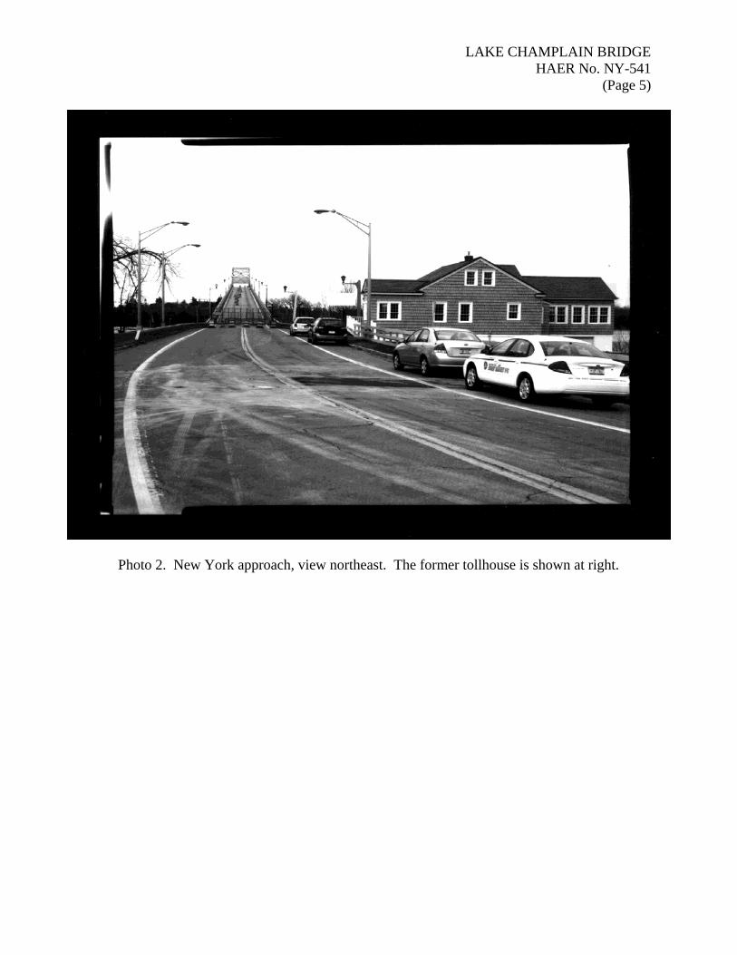
Photo 1. New York approach, view northeast.
LAKE CHAMPLAIN BRIDGE HAER No. NY-541
(Page 5)
Photo 2. New York approach, view northeast. The former tollhouse is shown at right.

LAKE CHAMPLAIN BRIDGE HAER No. NY-541
(Page 6)
Photo 3. Vermont approach, view southwest. The Chimney Point Tavern is shown at left.
LAKE CHAMPLAIN BRIDGE HAER No. NY-541
(Page 7)
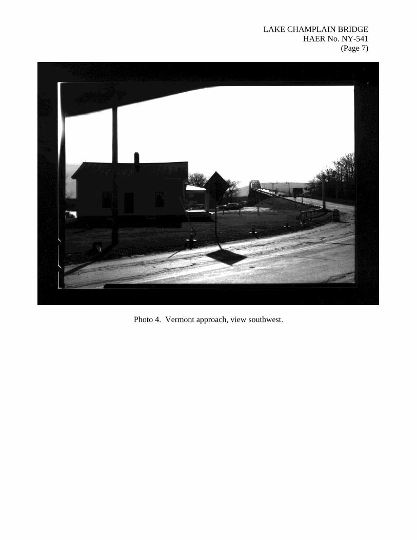
Photo 4. Vermont approach, view southwest.

LAKE CHAMPLAIN BRIDGE HAER No. NY-541
(Page 8)
Photo 5. View from Fort St Frederic, Crown Point State Historic Site, looking northeast.

LAKE CHAMPLAIN BRIDGE HAER No. NY-541
(Page 9)
Photo 6. View from Fort Crown Point, Crown Point State Historic Site, looking northeast.

LAKE CHAMPLAIN BRIDGE HAER No. NY-541
(Page 10)
Photo 7. View from Crown Point Public Campground looking north.
LAKE CHAMPLAIN BRIDGE HAER No. NY-541
(Page 11)
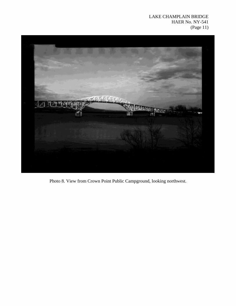
Photo 8. View from Crown Point Public Campground, looking northwest.

LAKE CHAMPLAIN BRIDGE HAER No. NY-541
(Page 12)
Photo 9. View from the Champlain Memorial lighthouse looking northwest.

LAKE CHAMPLAIN BRIDGE HAER No. NY-541
(Page 13)
Photo 10. View from Chimney Point State Park looking southwest. The Chimney Point Tavern is shown at right.

LAKE CHAMPLAIN BRIDGE HAER No. NY-541
(Page 14)
Photo 11. View from Port Henry, New York, looking southeast across Lake Champlain. The bridge, two miles distant, is just visible above the horizon.
LAKE CHAMPLAIN BRIDGE HAER No. NY-541
(Page 15)
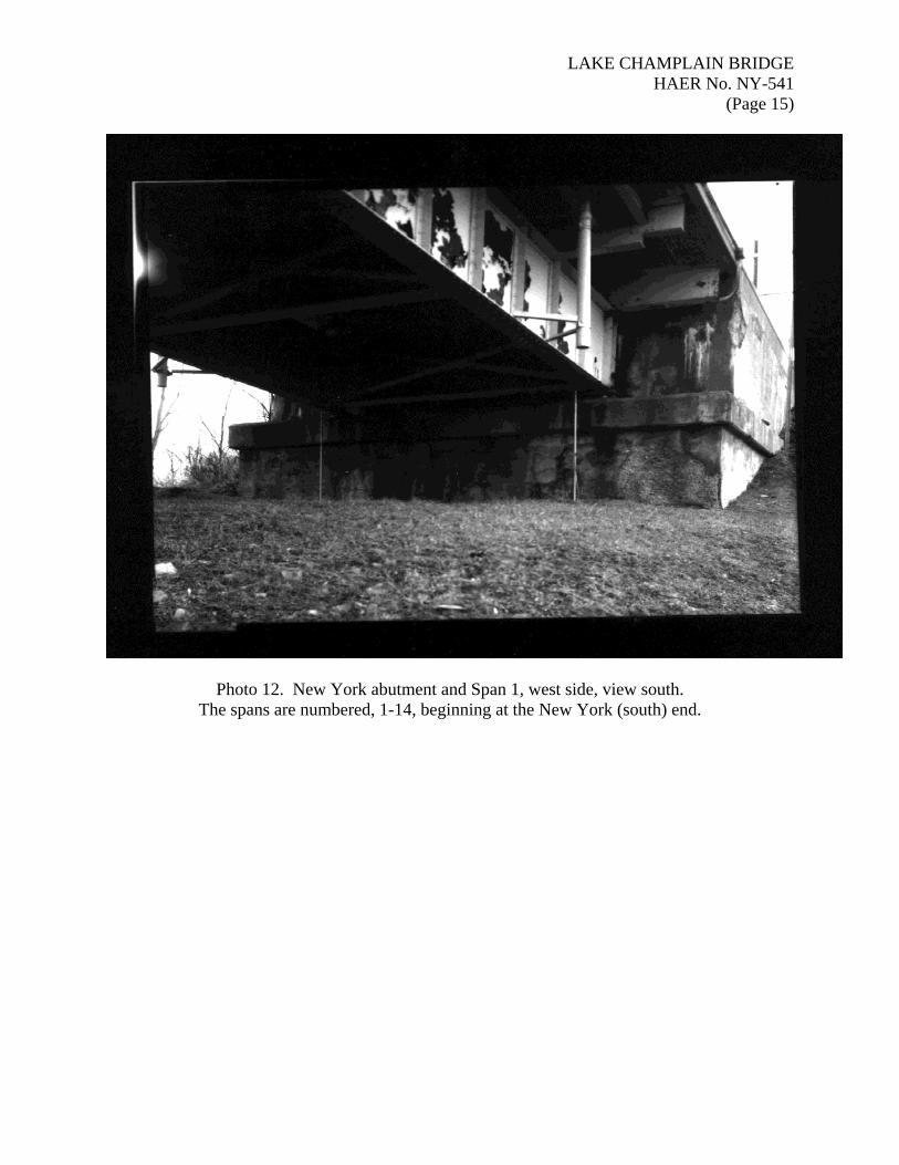
Photo 12. New York abutment and Span 1, west side, view south. The spans are numbered, 1-14, beginning at the New York (south) end.

LAKE CHAMPLAIN BRIDGE HAER No. NY-541
(Page 16)
Photo 13. Spans 1 and 2, west side, view east.
LAKE CHAMPLAIN BRIDGE HAER No. NY-541
(Page 17)
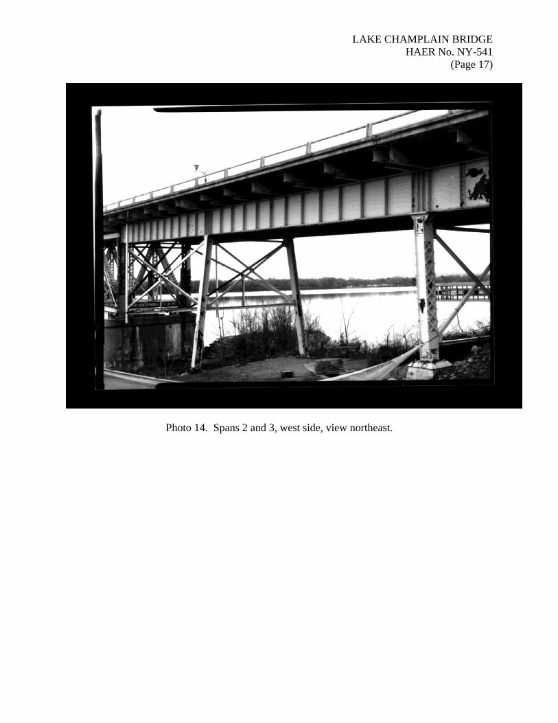
Photo 14. Spans 2 and 3, west side, view northeast.

LAKE CHAMPLAIN BRIDGE HAER No. NY-541
(Page 18)
Photo 15. Spans 4, and 5, Pier 3, west side, view northeast.

LAKE CHAMPLAIN BRIDGE HAER No. NY-541
(Page 19)
Photo 16. Span 4, upper truss detail, west side, view northeast.
LAKE CHAMPLAIN BRIDGE HAER No. NY-541
(Page 20)
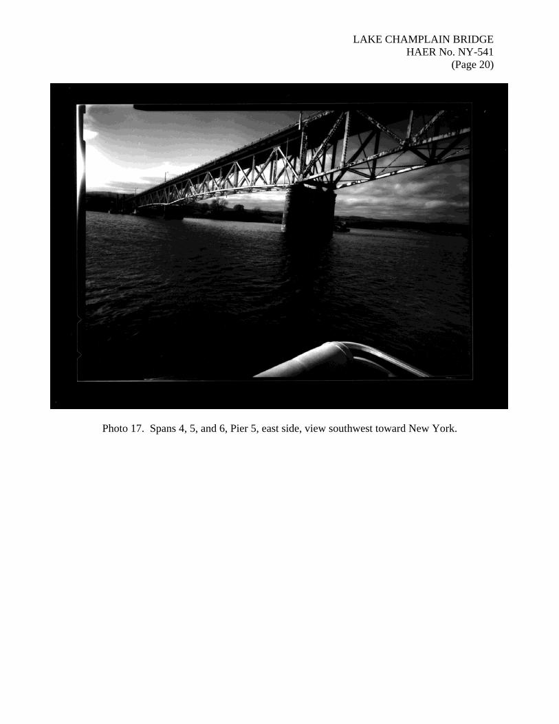
Photo 17. Spans 4, 5, and 6, Pier 5, east side, view southwest toward New York.
LAKE CHAMPLAIN BRIDGE HAER No. NY-541
(Page 21)
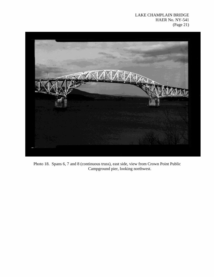
Photo 18. Spans 6, 7 and 8 (continuous truss), east side, view from Crown Point Public Campground pier, looking northwest.
LAKE CHAMPLAIN BRIDGE HAER No. NY-541
(Page 22)
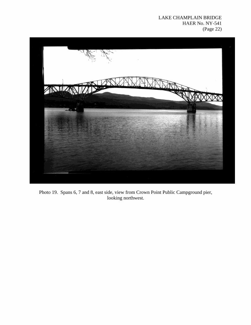
Photo 19. Spans 6, 7 and 8, east side, view from Crown Point Public Campground pier, looking northwest.
LAKE CHAMPLAIN BRIDGE HAER No. NY-541
(Page 23)
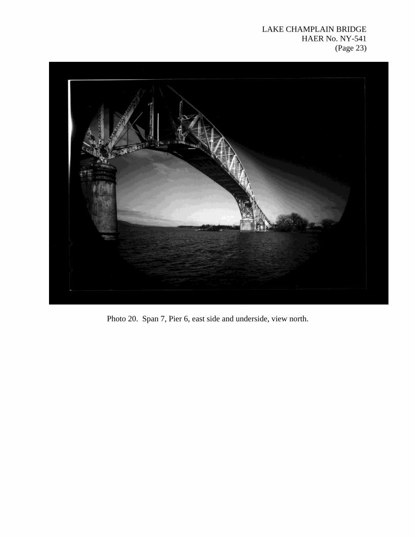
Photo 20. Span 7, Pier 6, east side and underside, view north.

LAKE CHAMPLAIN BRIDGE HAER No. NY-541
(Page 24)
Photo 21. Spans 7 and 8, Pier 7, east side and underside, view southwest.

LAKE CHAMPLAIN BRIDGE HAER No. NY-541
(Page 25)
Photo 22. Spans 7 and 8, Pier 7, east side, view north.
LAKE CHAMPLAIN BRIDGE HAER No. NY-541
(Page 26)
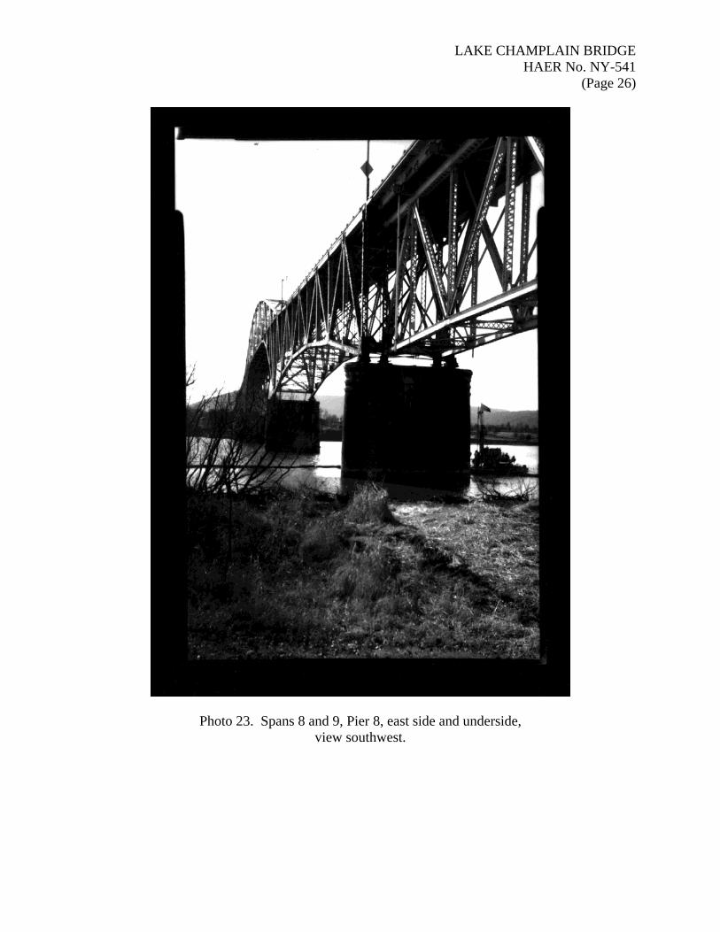
Photo 23. Spans 8 and 9, Pier 8, east side and underside, view southwest.
LAKE CHAMPLAIN BRIDGE HAER No. NY-541
(Page 27)
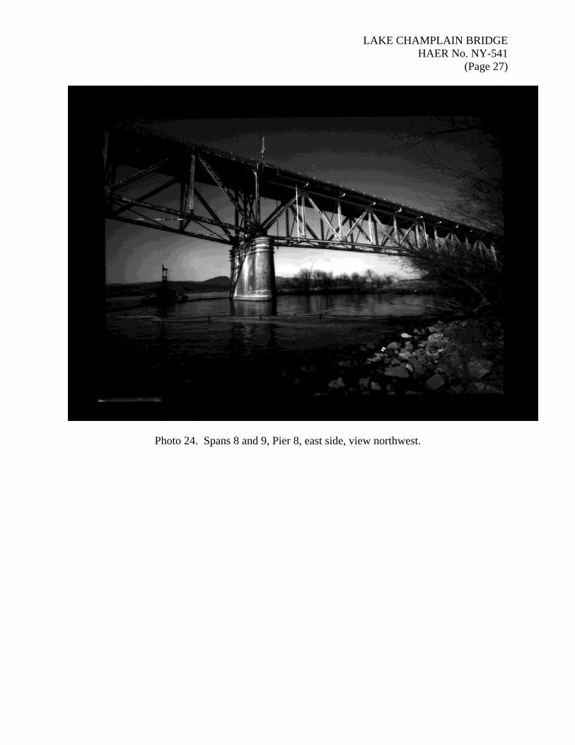
Photo 24. Spans 8 and 9, Pier 8, east side, view northwest.

LAKE CHAMPLAIN BRIDGE HAER No. NY-541
(Page 28)
Photo 25. Spans 9 and 10, Pier 9, east side and underside, view northwest

LAKE CHAMPLAIN BRIDGE HAER No. NY-541
(Page 29)
Photo 26. Span 9 and Spans 10-14, east side and underside, view north.

LAKE CHAMPLAIN BRIDGE HAER No. NY-541
(Page 30)
Photo 27. Original steel light standard with replacement lamp, Span 1, west side, view northeast.

LAKE CHAMPLAIN BRIDGE HAER No. NY-541
(Page 31)
Photo 28. Original concrete light standard and steel support arm, with replacement lamp, New York approach, east side, view south.