harvesting water from above the surface: a study of indigenous and modern drought coping strategies...
TRANSCRIPT

8/3/2019 Harvesting Water From Above the Surface: A Study of Indigenous and Modern Drought Coping Strategies in Cholist…
http://slidepdf.com/reader/full/harvesting-water-from-above-the-surface-a-study-of-indigenous-and-modern-drought 1/27
8. Project Area Ethnographic Profile: Punjab, Bahawalpur
Bahawalpur Division (defunct) is the largest Division of the Punjab Province of Pakistan. With a total
surface area of 45588 sq. km (11.3 million acres), it houses 7.64 million people. Over 78 percent of the
total population (7.636 million) of Bahawalpur Division (defunct) lives in the rural areas and dependsdirectly or indirectly on agriculture for livelihood. Despite their substantial contribution to both the
provincial and the national economy, the rural masses of this area have a relatively low per capita
income, suffer under employment and have highly inadequate access to basic infrastructure and social
services. This has, over the years, tended to create a weak human resource base. The eventual result is
poverty, the most pernicious of social evils. The rural poor largely comprise small farmers, tenants, and
the landless laborers.
The Bahawalpur city, is the divisional headquarter, lies in 29 22 North and 71' 41 East. In 1748, Nawab
Bahwal Khan I raised a wall around the village of Muhammad Panah Khan and within it built a town
which he called Bahawalpur after his own name. For its irrigation, he dug a canal which ran until early
twentieth century. The traditional walled city grew with time spreading over 3 miles with six gates,
with narrow streets lined with shops into a big bustling city thriving outside the city boundaries. When
the Nawab of Bahawalpur shifted the capital of the state from desert city of Drawar Fort to Bahawalpur
emerged as the nerve center of the Bahawalpur state: a status that it still enjoys as the divisional
headquarter of the Punjab province.
Police Stations/Posts, Mauzas, Urban/Rural Union Councils, and Cantonment Boards
By District, The Punjab: As on 31st December, 2007
District Police
Stations
Police
Posts
Mauzas Total Union
Council (UC)
Urban
(UC)
Rural
(UC)
Cantt
Boards
Bahawalpur 22 6 916 107 29 78 1
Source: Bahawalpur Commissioner Office Record.
8.1.1. District Profile, Bahawalpur, Cholistan.
A large part of Bahawalpur district comprise of parts of Baluchistan, which is spread over 6655360
acres in the districts of Rahim Yar Khan, Bahawal Nagar and Bahawalpur. Cholistan is an extension of
the Great Indian Desert, which includes the Thar Desert in Sindh province of Pakistan and the
8/3/2019 Harvesting Water From Above the Surface: A Study of Indigenous and Modern Drought Coping Strategies in Cholist…
http://slidepdf.com/reader/full/harvesting-water-from-above-the-surface-a-study-of-indigenous-and-modern-drought 2/27
Rajasthan Desert in India, covering an area of 26,330 km. It lies with in the southeast quadrant of
Punjab province between 27”42' and 29”45' north latitude and 69”52' and 73”05' east longitude
(FAO/ADB, 1993).In terms of general topography, the Cholistan desert consists of sand dune, sandy
soil, loamy soil, and saline-sodic clayey soil Cholistan desert has a length of about 480 km while the
width varies from 32 km to 192 km. (Khan, 1987). Based on the topography, soil and vegetation, thewhole of Cholistan comprises of two topographic regions. The northern region or Lesser Cholistan
borders the canal irrigated areas and covers about within area of 8081 Sq. km or southern region or
Greater Cholistan which comprise of an area of 18852 Sq.kms. The Lesser Cholistan consist of saline
alluvial flats (locally called Dahars) alternating with low sandy ridges. The clayey flats of Lesser
Cholistan are generally homogeneous to at depth ranging from 30 to 90 cm. These soils are saline with
pH ranging from 8.2 to 8.4, but serve as the main source of catchments area for rainwater. The Greater
Cholistan is a wind resorted sandy desert and comprised of river terraces, large sand dunes, ridges and
depressions. (Baig et al. 1980; Khan, 1987).
The word Cholistan has multiple derivation, all of which may equally be true. According to one source,
the word has come from Turkish word, Chol, which means a desert, while others consider it a Kurdish-
Iraqi word Cholistan, meaning waterless wasteland. The local word for Cholistan Desert is Rohi, which
has been derived from Pushtu word Roh, meaning a sandy desert. The people of Cholistan in turn are
called Rohiala. (Auj, 1987, 1991). According to the last census, the human population in the desert is
about 1.2 million and livestock population is nearly 2.0 million. The population is scattered at different
places on the availability of drinking water. Low and sporadic rainfall (166 mm average annual), high
temperatures (up to 550 C in summer), low humidity, high rate of evaporation and strong summer
winds are the main characteristics of the climate. The groundwater is mostly saline and unfit for human
and livestock drinking (PCRWR, 2004a). The irrigation facilities are available during flood season only
for 75 days i.e. from 1st to 15th September. For rest of the period, the irrigation is dependent on
agriculture. Total number of notified Chaks in Cholistan is 407 out of which 205 Nos. Chaks are under
irrigation boundary.
For parts of lesser Cholistan and whole of Greater Cholistan, rainfall is the primary source of water,
especially sweet drinking water. Rainwater is harvested by collecting in natural depression or man
made ponds locally called “tobas”. At present, there are 598 tobas in Cholistan where desert dwellers
collect and store rainwater from natural catchment. Dahars act as good catchment for rainwater
harvesting. Water loss through evaporation from such ponded water was estimated as the highest as

8/3/2019 Harvesting Water From Above the Surface: A Study of Indigenous and Modern Drought Coping Strategies in Cholist…
http://slidepdf.com/reader/full/harvesting-water-from-above-the-surface-a-study-of-indigenous-and-modern-drought 3/27
compared to seepage losses (Khan etal, 1990). The average rainfall in Cholistan is 199-200 mm. Most
of the rainfall is received during monsoon seas from July to September; however, some of it may fall
during winter as well. A large amount of water is harvested and if stored properly, can serve human and
livestock as well as can be used for raising nurseries and forage.
The secondary source of water is underground water, which is saline and partially fit for drinking and
agricultural purposes. It is tapped through ground water wells, which are sunk near settlements. At
times, however, the brackish water from wells is used for agricultural as well as domestic purposes.
The absence of active canal system has led to deep acquiafiers in Cholistan with neglible
corresponding recharge through rainwater. The changes in the water quality of wells depends on the
amount and type of salts present in the soil. The groundwater located at the depths from 30 to 90
meters is mostly saline, and two major qualifiers in Cholistan have sweet water, but they are
surrounded by saline water. (FAO/ADB, 1993). Besides, the sweet water is also present along the
abondoned Hakra River bed.
Low and spatially erratic rainfall, water scarcity is Cholistan is endemic in the region. Low rainfall and
high filtration in sandy soil and rapid evaporation preclude the establishment of permanent sources of
surface water in the desert. However, shallow ephemeral lakes are formed in dahars, which have highly
impervious loam or clay soils bottom, often of a saline or saline-sodic nature. The dahar is surrounded
by sand dunes so that drainage ends blindly with the dahars. Traditional methods of water storage and
delivery include soil erosion, prevention, rainwater harvesting, irrigation and drinking water-delivery
structures, some which have survived for many centuries. These structures being long lasting prove that
advance procedures had been followed in their design and construction. This indigenous knowledge
has neither been well documented nor scientifically analyzed in order to utilize it for supporting the
sustainable development of rain fed, runoff and spate-irrigated framing.
Around 4000 B.C. the Cholistan was a cradle of civilization commonly known as the Hakra valley
civilization. This was when the river Hakra flowed through the region. The river supplied permanent
water until 1200 B.C. About 600 B.C. it became irregular in flow and consequently vanished within
a century or so. The Hakra civilization that flourished here was one of the longest in the course of
world history. It was also the earliest civilization of the Indian subcontinent. In cultural advancement it
can be compared with the Mesopotamian, Anatolian, Egyptian, and Babylonian civilizations (FAO
1993). No one is sure how this great Aryan civilization ended. Probably a variety of problems such as

8/3/2019 Harvesting Water From Above the Surface: A Study of Indigenous and Modern Drought Coping Strategies in Cholist…
http://slidepdf.com/reader/full/harvesting-water-from-above-the-surface-a-study-of-indigenous-and-modern-drought 4/27
hostile invading tribes, changes in the course of the river and depletion of irrigation facilities
contributed to the ultimate disappearance of this great civilization (Khan 1987; FAO 1993).
It is significant to note that until the late nineteenth century under the princely state of Bahawalpur, the
system of water resource management was so effective that the State chronicles did not report anycases of famine at the times of drought within the state boundaries. In contrast, thousands of refugees
from the neighboring Rajputana states swarmed the Bahawalpur state. Food and grains were generously
supplied from the State granaries to the refugees and a large number of them were employed on public
works. The Gazetteer of Bahawalpur State reports a famine in 1896 in Rajputana and the State was
inundated by Bikaner, Jaisalmer and Marwar refugees, who found ample labor on the canals. Three
years later in 1899, again famine broke out due to continuous crop failure due to inadequate rainfall and
40,000 refugees flooded from the neighboring states. Nawab of Bahawalpur also set up poor houses
(lanagars) at Bahawalpur, Ahamadpur and Dera Nawab where hundreds of women and children were
fed by the State officials and no deaths by starvation were reported despite sever drought. Sadly,
hundred years later, the situation in present day Bahawalpur - Cholistan has reversed in favor of former
Rajputana States, where the customary methods of rain water harvesting, sometimes helped by canal
irrigation have regenerated the desertified regions.
8/3/2019 Harvesting Water From Above the Surface: A Study of Indigenous and Modern Drought Coping Strategies in Cholist…
http://slidepdf.com/reader/full/harvesting-water-from-above-the-surface-a-study-of-indigenous-and-modern-drought 5/27
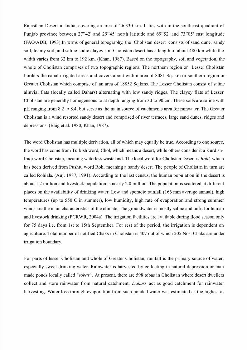
Illustration 2: Cholistan Desert Before the
Rain
Illustration 1: Cholistan Desert After the
Rain
Illustration 3: Camel Illustration 4: A Rohilla Family in the
Desert Settlement
Illustration 5: A Rohilla Boy Carrying
Drinkin Water rom Toba to Villa e Illustration 6: A Rohilla Boy Collecting
Water rom a Toba

8/3/2019 Harvesting Water From Above the Surface: A Study of Indigenous and Modern Drought Coping Strategies in Cholist…
http://slidepdf.com/reader/full/harvesting-water-from-above-the-surface-a-study-of-indigenous-and-modern-drought 6/27
Climate
Cholistan falls within the arid subtropical continental monsoonal zone. Its low rainfall is highly
variable both in time and space.The mean annual rainfall varies less than 12.5 mm in the west, and 200
mm in the east. Monsoonal rain in the form of heavy showers usually fall between July to September,turning the desert into lush green. During the monsoons, vegetation growth, plant composition, biomass
and plantability is better than rest of the years. A small amount of runoff is accumulated in temporary
water holes (tobas) while a large amount evaporates due to high temperature.
According to the table below, the estimated amount of 350 million cubic meter (Mm) runoff potential is
available for storage in the desert, if the rain water is harvested serving the desert population and
livestock in the times of drought.
Potential Runoff in the Cholistan Desert
Year Rainfall (mm) Potential Runoff
(mm)
Runoff for Storage in
Cholistan (Mm3)
1989 84.2 38 168
1990 144.1 42 187
1991 173.0 87 385
1992 231.0 115 506
1993 155.9 89 392
1994 299.2 152 672
1995 213.0 131 582
1996 152.0 81 359
1997 201.0 74 327
1998 172.1 65 287
1999 20.0 3 14
2000 126.4 62 273
2001 148.6 50 222
2002 2.0 - -
2003 240.0 106 467
2004 146.1 44 189
2005 177.1 70 292
2006 169.9 62 583
Average 160 79 284
Source: Pakistan Meteorological Department, Bahawalpur

8/3/2019 Harvesting Water From Above the Surface: A Study of Indigenous and Modern Drought Coping Strategies in Cholist…
http://slidepdf.com/reader/full/harvesting-water-from-above-the-surface-a-study-of-indigenous-and-modern-drought 7/27
Vegetation Cover:
At the conclusion of monsoon, the range remains green for a short period. Aridity intensifies with
gradual decrease in temperature, from 36” C to 14 “C and vegetation cover considerably decreases
grasses and some shrubs dry out partially while forbs dry out completely. During the winter, a period
between December and January, the temperature falls from 27 C to 3 C. In this season, some plans
remain partially green are Calligonm, Haloxylon, Crotalaria and Leptotene, providing forage for
camels and goats. The most common plants used as supplement of cereals are Cenchrus, Ciliaris,
Cenchrus, and Cenchras. These grasses are very widely distributed in Cholistan. During the famine and
drought years the seeds of these grasses ground in flour and used as supplement (Arshad, etal,
1999).The grains of Panieum antidote are also consumed as good during the famine years. Panicam are
very drought resistant and found on high sand dunes and perpeutate by their hardy rhizomes and seeds.
Thet also protect themselves from overgrazing because of their hard and unpalatable stubble. The seeds
of both species are ground and mixed with other cereals. Indigofera argentea is wild legume and mostly
found during the monsoon on the monsoon on the top of very high sand dunes of Greater Cholistan.
During the drought years, the seeds of this herbage are also ground and mixed with other cereals. In
addition, many indigenous species of plants contain high percentage of oils. Citrulus Coloocynthis is a
perennial trailing herb, with fruit of sandy tract,which is used in soap industry. It also have high
medical value for joint pains in human and stomach ailment in animals (Sen, 1982). An important
specie of plant used as wind breaker and shelter belt are Prosopis Juliflora, (Valyati Kiker) Tamarosx
Aphylla ( Frash), Prosopis Cineraria ( Jandi) and Asccia Nilotica ( Kiker ).
Cholistan is rich in vegetation resources that can be exploited on commercial basis. The areas was once
green and prosperous, where cultivation was practiced. The source of irrigation was Hakra River and
with the drying of river the area was deserted through desertification processes and only few grazing
lands were left.
Socioeconomic Organization of Cholistan
Cholistan desert is home to over 1.2 million pastoral herders who are part of a large Seraki speaking
ethno-linguistic group, practicing nomadic life style for centuries. The pastoral system is characterized
by mass migrations of animal and people throughout the year in search of water and forage. The cycle
of monsoon rainfall dictate the pattern of nomadic movement of men and livestock. A supporting
structures of temporary employment with the irrigated farming communities, opportunities for

8/3/2019 Harvesting Water From Above the Surface: A Study of Indigenous and Modern Drought Coping Strategies in Cholist…
http://slidepdf.com/reader/full/harvesting-water-from-above-the-surface-a-study-of-indigenous-and-modern-drought 8/27
livestock grazing on wheat stubbles, drinking water for human and livestock and steady markets for
selling selective livestock, and their dairy byproducts. To take maximum advantage of available
resources, the livestock is mixed in a way that milking cows (and buffaloes) are kept near the urban
centers where there is potential market for their milk, while camels, goats and sheep are sent out to
desert for grazing in the pastures. In nomadic culture, livestock is the primary source of wealth andwell being and a person's socioeconomic status is determined by the number of livestock that he may
own.
The population of Cholistan is largely Muslims, divided into exogamous social groups (quoms), which
is extended into matrlineal descent groups (biradaris). Each quoms has a customary leader, Wadda, who
mediates social conflicts over grazing and distribution of water, in addition to making critical decisions
about migrations. In case of negotiations with town farmers and government officials, Wadda, role is
significant in social cohesion of community and protecting its rights, although he is not invested with
judicial authority. Numberdar, is a leader of the quom/community, who used to be the official
representative of the Bahawalpur state under Mughal administration since 1869, now selected by the
Forest Development as a grade 7 officer, and approved by the CDA. He carries the judicial authority to
collect grazing tax (Tarni) for which he is compensated with 3 percent of the annual cattle head tax.
(Jowkar, 1996). Most critically, a Numberdar of a quom, oversees the water resource management of
tobas and authorizes its use, which comes critical in case of drought. In case of failure of conflict
resolution, the cases are taken to civil courts for decisions, with CDA and Forest Department pursuing
the case on behalf of the government. A copy of one such cases is attached as Annex X.
Livestock:
Nomads attach high values to their herds. Livestock are the main source of their survival and a number
of cultural norms are linked with the animals. Livestock are frequently used for meat, milk and, gifts.
Communal ceremonies like weddings, funerals, and tribal celebrations include slaughtering and
exchange of animals. A person's status in the desert nomadic life style is chiefly represented by the size
of the herd he owns. All livestock are indigenous breeds well suited to the environment. Herd
reproductive performance is naturally poor with low birth rates and high mortality.
The number of livestock are in many cases under reported and discrepancies exist between figures
provided by relevant departments. The Livestock Services Department in Bahawalpur, which is directly
concerned with the desert livestock provides figures which do not match with the ones collected by

8/3/2019 Harvesting Water From Above the Surface: A Study of Indigenous and Modern Drought Coping Strategies in Cholist…
http://slidepdf.com/reader/full/harvesting-water-from-above-the-surface-a-study-of-indigenous-and-modern-drought 9/27
Forestry Department, which indirectly deals with the livestock, however, the latter's census based on
returns of livestock from the Namdaras is considered most reliable. However to Forest Department
officials, they have no means to verify the statistics provided by the Nambardar, and they in complicity
with herders continue to under report the figures.
Livestock Population:
Specie Number
Camel 2,126
Cows 6,300
Sheep 69,177
Goat 39,395
Total 1,62,883
Source: Forestry Department Census, 2006.
The Forest Department imposes grazing tax on livestock head. It is Rs 18 for Camel, Rs 8 for a cow
and Rs 2 for a sheep or goat. Although the grazing tax receipt serves as the official domicile of
residence in Cholistan, which can draw agricultural land entitlements, a large number of herder chose
not to report their cattle to the Namdar to save even a small amount of grazing tax which has not been
revised in the decades.
Civic Infrastructure
Draft animals and carts are extensively used for transport in Cholistan, whole motorcycles and tractors
are being increasingly used as the means for human travel and transport of agricultural goods and
services. However, the sparse road infrastructure and the availability of expensive motor vehicle fuel
(@ Rs 100 per liter) in the desert make their use restricted and work related.
Greater Cholistan has no means of electrification at all. The villages on the fringes of lesser Cholistan
are electrified in the recent years by the CDA under WAPDA.
The department of Public Health Engineering (PHED) provides water and sewerage facilities in some
rural areas of Cholistan. As a matter of policy, the PHED supplies water to those villages where the
sweet ground water is either not available or can hand pumped from 15 meters depth. In areas of its
operations, the PHED hands over the water supply scheme to the community after two years of
running.

8/3/2019 Harvesting Water From Above the Surface: A Study of Indigenous and Modern Drought Coping Strategies in Cholist…
http://slidepdf.com/reader/full/harvesting-water-from-above-the-surface-a-study-of-indigenous-and-modern-drought 10/27
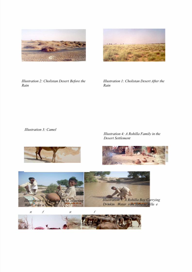
Fig. 3: Cows being herded back to village
Fig. 2: Calfs resting in cattle shed
Illustration 7: Cows being herded back to thevillage
Fig. 1: Cattle being herded back to Village
Fi . 5: Villa e Pro ile
Fi . 4: Lon Shot o a Villa e
8/3/2019 Harvesting Water From Above the Surface: A Study of Indigenous and Modern Drought Coping Strategies in Cholist…
http://slidepdf.com/reader/full/harvesting-water-from-above-the-surface-a-study-of-indigenous-and-modern-drought 11/27
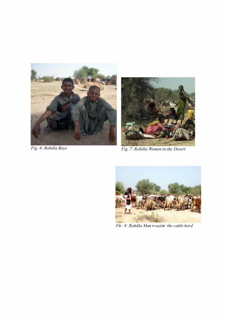
Fig. 7: Rohilla Women in the Desert Fig. 6: Rohilla Boys
Fi . 8: Rohilla Man razin the cattle herd

8/3/2019 Harvesting Water From Above the Surface: A Study of Indigenous and Modern Drought Coping Strategies in Cholist…
http://slidepdf.com/reader/full/harvesting-water-from-above-the-surface-a-study-of-indigenous-and-modern-drought 12/27
8.1.2. Intervention Mapping: Cholistan
The presence of NGOs in Cholistan is limited to ad hoc relief in case of sever drought. However there
are large number of registered NGOS, which are working for infrastructural development and
rangeland management of Cholistan for effective drought preparedness...
Cholistan Development Authority (CDA)
In the past few decades, the Government of Pakistan has made substantial inputs in drought mitigation
and preparedness in Cholistan, however, the success of some projects is rather limited. One of the
principal ways in which the Government has intervened in the development of the area is by setting up
Cholistan Development Authority in 1976 with the objectives to improve the socio-economic condition
of the people of Cholistan and to tap the development potential of the region. It has made substantial
impact in two areas: colonization of government land and development of physical infrastructure. Some
of its main functions include: forestation, plantation, cultivation and reclamation of land; colonization
and allotment of government land; to provide means of irrigation, and provision of drinking water in
the desert.
Over the years, it has extensively surveyed with international collaborations the sweet ground water
resources in the desert and sunk numerous tube wells for drinking and irrigation. It also undertakes to
layout or construct chaks, mandi (market) town and human settlements, in addition to provision of
communication and educational facilities to the community. The management and encouragement of
rural trades, crafts and industries, arrangements for marketing of produce and preservation and
multiplication of forests, vegetation and wildlife is also included in its diverse portfolios. As a result,
CDA works in conjunction with several other departments, which are involved in the irrigation and
rangeland management of Cholistan, such as Irrigation, Forestry and Wildlife.
CDA has also emerged as the focal point of development activities in the region. Drought Emergency
Relief Program, worked through CDA and since 2005 four pipelines have come up and the drinking
water has been made available round the year to some extent on the fringes of Cholistan desert area of
District Bahawalnagar and Bahawalpur.
A Physical Development wing, which was created in CDA in the year 1988-89 executes development
schemes concerning farm to market Roads, water supply schemes, BHUs, veterinary dispensaries and

8/3/2019 Harvesting Water From Above the Surface: A Study of Indigenous and Modern Drought Coping Strategies in Cholist…
http://slidepdf.com/reader/full/harvesting-water-from-above-the-surface-a-study-of-indigenous-and-modern-drought 13/27
schools buildings etc. under the supervisions of VC/MD through an XEN who is assisted by SDOs and
field staff. The CDA despite financial constraints has constructed about 61 rainwater-harvesting
reservoirs 108 Kunds, 131 Diggies, 32 Wells, 23 Turbines, 155.20 Kms Link Road, 19-Nos. Village
Road Bridges, 81 Primary School Buildings, 09 Middle School Buildings, 01 High School, 07
Veterinary Dispensaries, 03 Basic Health Unit, One Rest House, 03 Residences and Electrification of 34 Villages. Besides we have laid 4 water pipelines measuring 243 Kms in the desert in the year
2003-04 at a cost of Rs.404.71 millions under Drought Emergency Relief Assistance Programme to
mitigate drought on permanent footings. 03 water pipeline schemes in District Rahim Yar Khan,
Cholistan measuring 177 kms will be taken up for execution shortly under ADP.
The CDA has allocation of about Rs. 684.519 millions under ADP 2006-07. With the help of ADP loan,
300 kms. farm to market road are being executed. Besides water supply for 16 Chaks, electricity for 35
Chaks would be provided. In addition, 10 veterinary dispensaries would be constructed.
Pakistan Council of Research on Water Resources (PCRWR)
Water harvesting through traditional methods as a new paradigm in water resources development and
management has led to several successful examples of water harvesting for drought proofing can be
easily seen in operation in arid regions of South Asia and Central Asia. The water resources generated
locally help in meeting domestic and livestock needs, provide water for supplementary/deficit
irrigation, enhance groundwater recharge; reduce storm water discharges, urban flood and seawater
intrusion in coastal areas. Participatory management of water resources ensures effective utilization,
maintenance and sustainable operation of these systems.
Among the key advocates of this policy is the Pakistan Council of Research in Water Resources
(PCRWR) which was established in 1964 within the Ministry of Natural Resources. It was brought
under the control of Ministry of Science and Technology in 1970. The Council was renamed as
Pakistan Council of Research in Water Resources (PCRWR) in 1985. The PCRWR is an apex
autonomous body established with the objective to conduct, organize, coordinate and promote research
in all aspects of water resources. Since its inception, PCRWR has played its role as a national research
organization by undertaking and promoting applied as well as basic research in various disciplines of
water sector, more specifically, irrigation, drainage, surface and groundwater management,
groundwater recharge, watershed management, desertification control, rainwater harvesting, , water

8/3/2019 Harvesting Water From Above the Surface: A Study of Indigenous and Modern Drought Coping Strategies in Cholist…
http://slidepdf.com/reader/full/harvesting-water-from-above-the-surface-a-study-of-indigenous-and-modern-drought 14/27
quality assessment and monitoring, and development of innovative water resource management,
conservation and quality improvement technologies, etc.
As a result of field research on rainwater harvesting techniques, PCRWR initiated a 4-year Research
and Development (R&D) Programme in 2001 to make water available in the desert for drinking. Theactivities were undertaken including reconnaissance survey to identify the suitable catchments,
demographic survey to assess water demands, hydrological studies to assess the runoff potential of the
catchment, topographic survey to determine the slope for runoff; development of catchments to
establish a network of ditches, soil profile investigations to determine physical and chemical properties
of the catchment/pond, design analysis of rainwater harvesting system to estimate
the quantity of civil works.
One of mega R&D project sponsored by the government titled “Mitigation of Drought Disasters in
Cholistan Desert by Management of Water Resources” was initiated at a cost of $ 2.5 m Under the
project, to mitigate the drought in the area, 92 rainwater-harvesting systems and 20 deep tube- wells
were installed to extract sweet water for human and livestock use have been developed on pilot scale.
Each system contains the components like storage reservoir, energy dissipater (stair), boundary wall,
silting basin, lined channel, and ditches network in the catchment. The storage pond is designed to
collect about 15000 m3 (4.0 US million gallon) of water. The depth of the pond is 6 m. Polyethylene
sheet (0.127 mm) on bed and plastering of slag mortar (3.81 cm) mixture of clay, quick lime, wheat
straw and cement on sides of the pond have been provided to minimize seepage losses. The quantity of
the mortar for one pond includes 6 m3 clay, 100 kg lime, 970 kg wheat straw, and 0.06 m3 cement. The
energy dissipater having dimensions of 1 m wide and 23 cm each length and height along one side of
the pond protects the sides and the bed of the pond from severe erosion expected from gushy water.
Boundary wall does not only restrict the wild animals and livestock but also provides barrier against
movement of sand by strong summer winds. A small silting basin controls the entrance of heavy
sediments and debris in the pond. Each pond has been connected with the catchment through a lined
channel, which has a network of ditches. It has been observed that all the constructed ponds got fill up
to their full design capacity during the rainy seasons (winter or monsoon). Water quality analysis of the
selected ponds illustrated that the water quality was within the permissible limits excluding turbidity
level. In general practice, the livestock drink water from the pond directly. However, the dwellers keep
this water in mud pot for few hours by adding alum treatment before drinking.

8/3/2019 Harvesting Water From Above the Surface: A Study of Indigenous and Modern Drought Coping Strategies in Cholist…
http://slidepdf.com/reader/full/harvesting-water-from-above-the-surface-a-study-of-indigenous-and-modern-drought 15/27
Another project entitled “Mitigation of desertification for poverty alleviation (MDPA)” has been
completed for stabilizing moving sand dunes through forestry practices. The future plan of PCRWR
among other activities include establishment of “Desertification Control Research Institute”, primarily
to expand its desertification control programme in collaboration with international partners and funding
mechanisms.
All these pilot activities have initiated a process of social change by creating awareness among the
desert people and the concerned development agencies working in the area. This project has harvested
about 368 million gallons of freshwater annually to meet drinking water requirements of human and
livestock population. Moreover, this project has saved 6000 million rupees per drought in the form of
livestock production due to reduction in livestock migration, mortality, diseases and damage of crops.
Increase in production of livestock has also been observed in the form of meat, milk and other utilities
besides reduction of migration of human and livestock from desert towards irrigated area.
Successful models and practices in Cholistan are being replicated in Thar desert of Sindh and Kharan
desert of Baluchistan under two different projects named “Combating drought and desertification in
Thar desert by management of water resources” and “Rainwater harvesting and desertification control
in Kharan-Chagai desert of Baluchistan”.
However, given the substantial input of millions of dollars of international development aid and the
accompanying human and physical infrastructure has enabled the CDA to build a model agriculture
farm through rainwater harvesting, which may not be replicated by the target communities in the desert
for which it is intended to serve as a model given their socioeconomic capacities.

8/3/2019 Harvesting Water From Above the Surface: A Study of Indigenous and Modern Drought Coping Strategies in Cholist…
http://slidepdf.com/reader/full/harvesting-water-from-above-the-surface-a-study-of-indigenous-and-modern-drought 16/27
Illustration 8: Drinking Water Supply
Drewar b DERA-P
Illustration 12: PCRWR built Toba to raise
fish Illustration 13: PCRWR built Toba for
livestock drinking
Illustration 10: Information
Plate of PCRWR project at Dingarh
Illustration 11: Diesl Engine Turbine at Dingarh
Illustration 9: DERA funded CDA Drinking Water Supply at Drewar Fort

8/3/2019 Harvesting Water From Above the Surface: A Study of Indigenous and Modern Drought Coping Strategies in Cholist…
http://slidepdf.com/reader/full/harvesting-water-from-above-the-surface-a-study-of-indigenous-and-modern-drought 17/27
Illustration 14: Sign Post of PCRWRmodel farm and Wildlife Department Illustration 15: Treated Water Tank built
by PCRWR at Dingarh Model Farm
Illustration 16: Broken Water Taps in
the PCRWR Plant Farm Illustration 17: A Closed View of Water Gaughe

8/3/2019 Harvesting Water From Above the Surface: A Study of Indigenous and Modern Drought Coping Strategies in Cholist…
http://slidepdf.com/reader/full/harvesting-water-from-above-the-surface-a-study-of-indigenous-and-modern-drought 18/27
9. Drought Mitigation through Ground Water Resource Harvesting in Cholistan
Cholistan desert is described as one of the most inhospitable regions of the world, and yet it has been
one of the most populated deserts in the world. It has been continuously habited for over 1200 years,despite the fact that a large tract of Cholistan comprise of desertification areas which have never been
irrigated ever since the drying up of Hakra river that flowed through it hundreds of years ago.
Therefore, a number of urban centers developed, but always in locations that had easy access to water.
The people of Cholistan, made sagacious use of natural resources, particularly water to sustain human
and livestock population. As a result, ever since, it has emerged as the rangeland, which offers rich
potentials for livestock production. The normal rainfall pattern is 150 to 200 mm per year, which keeps
the desert wild plants and vegetations alive as well as water reservoirs. In the desert towns of Cholistan,
such as Drewar Fort, large catchments supplied water to tanks. The catchments and the canals were
regularly maintained and kept clean. Roof top harvesting was common in cities and towns of Cholistan
and Rajasthan. With scanty rainfall, the agriculture largely depends on the irrigation from wells,
inundation canals, river floods, Jhalars, on the banks of rivers and canals. Even well irrigation unless
supplemented by canals or river floods is a precarious means of cultivation, except in rare seasons of
good rainfall. There were hundreds of water structures of diverse technologies existed all over
Cholistan with diverse management systems to ensure equitable and sustainable water supply to all.
Structures built to trap and manage rainwater were specific to the terrain and meteorological
conditions. Technologies were usually simple and harnessed local material and labor. Over time, the
rainwater harvesting structures were woven into the region's cultural and religious milieu.
9.1. Indigenous Copying Strategies.
Many indigenous water harvesting strategies that we discuss in this report have a cross cultural
resonance and are practiced in neighboring Tharparker in Sind and Rajasthan desert in India as well as
in similar arid ecological zones in China. At the same time, they are also strengthened through technical
and financial input by the local and international development agencies for effective rainwater
harvesting.
1. Village ponds ( Tobas)
The rainwater which is collected in natural depressions or man made ponds called Tobas forms the
principal source of fresh water, to be used for drinking and agriculture purposes. Toba is one of central

8/3/2019 Harvesting Water From Above the Surface: A Study of Indigenous and Modern Drought Coping Strategies in Cholist…
http://slidepdf.com/reader/full/harvesting-water-from-above-the-surface-a-study-of-indigenous-and-modern-drought 19/27
features of the agro-pastoral economy. The estimated number of Tobas in Cholistan is around 1500.
Tobas comprise of are small to medium sized excavated or embanked village ponds, for harvesting
meager precipitation to mitigate the scarcity of drinking water and domestic needs in water scarcity
regions of Cholistan. A flat, highly impervious loam or clay soils bottom, locally called dahars
provides the micro catchment area for the rainwater, where shallow ephemeral lakes are formed have,often of a saline or saline-sodic nature.
Pond water is available for periods from two months to a year after rain, depending upon the catchment
characteristics and amount and intensity of rainfall. The nadis range from 1.5 to 12 m in depth, 400 to
700,000 m in capacity and have drainage basins of various shapes and sizes (8 to 2,000 ha). These
Tobas can also be used for recharging the groundwater through construction of infiltration wells and
recharge pits in the bed of the storage area.
These traditional structures are however not scientifically designed and constructed and suffer from
high seepage and evaporation losses. Pakistan government has constructed more than 1500 tobas in
Cholistan area for domestic and livestock water supplies. The optimized characteristics of the village
ponds for minimizing the storage losses are given by Sharma and Joshi (1983,Table x). They show that
water may still be available in such structures during drought lasting up to 1 year. Some of the findings
of the research in neighboring Rajasthan desert have been incorporated into the rain water harvesting
policies in Pakistan. PCRWR in Bahawalpur has utilized the research to improve the village pond
characteristics to maximize storage capacity and safeguard against rapid evaporation.
Table X. Optimized village pond characteristics to minimize the storage losses
Physiography Optimized
depth (m)
Optimized surface
area (m2 x 103)
Water availability
(months)
Dune complex 2.5 29.1 4.8
Sandy plain 2.0 27.1 8.3Younger alluvial plain 5.0 161.0 12.0
Older alluvial plain 3.0 96.0 12.0
Rocky/ gravel pediment 6.0 126.5 12.0
However, apart from improved structural changes, there is a pressing need to revive the customary
social organization for natural resource management.

8/3/2019 Harvesting Water From Above the Surface: A Study of Indigenous and Modern Drought Coping Strategies in Cholist…
http://slidepdf.com/reader/full/harvesting-water-from-above-the-surface-a-study-of-indigenous-and-modern-drought 20/27
Illustration 18: A Toba Constructed by
Forest Department Illustration 19: A Toba in the Desert
Illu stration21: A Dried U Toba Illustration 20: A CDA built Toba with
Cattle Drinkin Water
Illustration 23: A CDA built Toba Illustration 22: A PCRWR built Toba for Cattle Drinking Water

8/3/2019 Harvesting Water From Above the Surface: A Study of Indigenous and Modern Drought Coping Strategies in Cholist…
http://slidepdf.com/reader/full/harvesting-water-from-above-the-surface-a-study-of-indigenous-and-modern-drought 21/27
Wells (khuh)
In order to recharge ground water and also use it for irrigation and drinking purposes, the rain water is
harvested directly to the wells. This served several inter-related functions: First to improve the water quality when the ground water is saline and not drinkable. Secondly, to improve the water table that has
been reduced by the continuous discharge. The only form of well traditionally used in Cholistan was
the Persian wheel. The ordinary well is either lined with baked brick masonry and known as Pakka
Khuh or with logs in which case it was known as khachacha or Ghat da Kharaora. A well lined with
wattles is called Lei (or pilchhi) da Kharoram wattles made from the Lei bus. Without a linning
kachcha wells cannot be built except in Lesser Cholistan, where narrow wells, usually friom 2 to 3 feet
in circumference, are sunk for obtaining drinking water only. In the Greater Cholistan, this is not
possible due to fineness of the sand in the lower substrata of the soil.
The traditional methods of identify the sources of sweet ground water is the spot over which Suchcha
kana is grown as it us understood that under that plant sweet water is supposed to exist. In comparison,
in arid zones of Baluchstan, a water diviner is employed the source of ground water. The site having
been selected, a hole larger than the brick cycliner proposed is excavated down to the Sach or the
stratum of water giving sand. This hole is called par . The wooden base of the brick word called the
chak is then laid down in the par, and the cyclinder of brick work is built upon it till it reaches a few
feet above the surface of ground. The sand or han at the bottom of the past and the under chak is then
dug out. The removal of mud is called tobhi and is performed by tobhas, a class of professional well
sinkers, generally called out from neighbouring settled districts of Punjab. The wells generally dry in
the drought or offer limited hours of water. The wells that are situated near the rivers are subject to
much influx of sand and have therefore to be cleaned out by tobhas every third or fourth year.
Before the construction of perennial canals on the Punjab rivers, the river floods were more than
sufficient for the purposes of irrigation and the farmers constructed very few wells. When subsequently
rivers failed to supply the usual amount of water, inspite of the construction of new canals in the State,
irrigation was reduced to an unsatisfactory conduction, the State encouraged the farmers and pastorals
to sink wells and various encouragements were held out to them. Taqavi grants were freely made, and
under the rules repayment was to be made by installments within 12 years. Moreover, the wells so
constructed were exempted from parta or water rate for 12 years, and wood for the well gear and

8/3/2019 Harvesting Water From Above the Surface: A Study of Indigenous and Modern Drought Coping Strategies in Cholist…
http://slidepdf.com/reader/full/harvesting-water-from-above-the-surface-a-study-of-indigenous-and-modern-drought 22/27
apparatus was given at the half the usual price.
In seasons of drought some the wells ratain their water through at a lower level but most of them give
water only for 12 hours in the day while others got quite dry. Each clan enjoys the sole ownership of
wells and tobas and its use is authorized by customary and civil law. The leading members of clanmonitor its use and were responsible for its maintenance. The regular maintenance of tobas and wells
and their sustainable use is critical to the existence of tobas. With increasing reliance on alternate
means of getting water either through canals or water supply schemes, the community management of
Tobas and wells is falling apart.
Percolation tanks
Percolation Tanks ( Kach Khu) were traditionally used to improve ground recharge. In this method, the
rainwater is harvested into unlined dug wells through which the water seeps in the ground, improving
the water table. Percolation tanks are generally constructed on the small streams or rivulets with
adequate catchment for impounding surface runoff. These tanks are used entirely for recharging the
aquifer through percolation. In comparison to ponds, percolation tanks conserve water to a greater
extent because the filling and recharge occur mostly during the monsoon when the evaporation rate is
about the half of potential rate in summer through which ponds contain water. Selection of suitable site
for the construction of percolation tanks and subsequent maintenance is crucial for its effective
functioning.
Rooftop Harvesting through Kund
Underground storage cisterns or locally called kund is the most common rainwater harvesting system in
the Pakistani arid zone, which it shares with India, Sri Lanka, China and several other countries,
generally constructed for storage of surface runoff. Almost every household, school, religious center in
rural areas constructed kund for meeting drinking water needs. The tanks were sometimes as large as a
room.
Kund is constructed by digging a circular hole of 3.00 to 4.25 m diameters and plastering the base and
sides with 6-mm thick lime mortar or 3mm thick cement mortar. The catchment of Kunds are made in a
variety of ways using locally available sealing materials like pond silt, murram, wood, coal ash, gravel
etc. Improved designs of Kunds have been developed and adopted under Drinking Water Missions in
drought prone developing countries. It is estimated that more than 200 kunds in Cholistan desert of

8/3/2019 Harvesting Water From Above the Surface: A Study of Indigenous and Modern Drought Coping Strategies in Cholist…
http://slidepdf.com/reader/full/harvesting-water-from-above-the-surface-a-study-of-indigenous-and-modern-drought 23/27
Pakistan.
Nomadic Movement as a Indigenous Drought Copying Strategies
As part of transhumant system, the population of Cholistan moves from Lesser Cholistan to Greater
Cholistan throughout the year, according to the availability of water for drinking and fodder for livestock. However, the cultural patterns of movement of human and livestock are location specific and
determined by a customary system of land tenure.
The onset of monsoon in July and August starts off the movement of human and livestock, from
irrigated, semi urban and riverine areas at the fringes of Lesser Cholistan towards community/quom
owned tobas in Greater Cholistan. Spreading out from a area of 10 km radius, they continue to traverse
from Lesser to Greater Cholistan, in the following months, sometimes traveling within the range of 100
km. By October and November, the water at the tobas begins to deplete and a reverse movement
towards fringes begins, breaking frequent journeys at semi permanent settlements having wells and
kunds...By March and April, the movement of the nomads have come to a full circle, and the livestock
and people are back to the fringes of deserts in irrigated areas and after wheat harvesting is over, to the
Sutlej River for those with customary riverine rights. The canal water supplies drinking water to the
livestock and are fed on dried forage on vegetation along canal banks .....
The transhumant system of Cholistan depends critically on the timings and quantity of rainfall, which
in case of drought could be seriously disrupted..For examples during a prolong drought over the last 4
to 6 years most of the herders moved south and some staying only a few days or for few months before
being compeled to return. A rupture in the cycle of nomadic movement of people and livestock causes
infrastructural damage to Tobas in the desert, which become silted in the absence of herders, as the
constant repair and maintenance is necessary for their existence.. According to estimates by Forest
Department, which inspects Tobas in the course of rangeland surveying, out of 43 tobas in Greater
Cholistan, 25 has been reported to have filled with sediment .
The quality and quantity of water also varies dramatically in the region. In the eastern arid region of
Cholistan, Toba water is of good quality but limited in quantity. In semi permanent settlements well
water is adequate but of saline quality and wells being unlined needs constant repair. In the western
hyper arid region the quantaties of both water and feed is inadequate.

8/3/2019 Harvesting Water From Above the Surface: A Study of Indigenous and Modern Drought Coping Strategies in Cholist…
http://slidepdf.com/reader/full/harvesting-water-from-above-the-surface-a-study-of-indigenous-and-modern-drought 24/27
The patterns of cattle grazing in the desert are also potent indigenous strategies that help cope with the
scarcity of water and become critical to the very survival of animals in case of drought. In the events of
drought, since the feed depletes first, sheep whose walking range is 4 km mist be keep ahead of the rest
of the animals to other tobas. All herds are kept as long as possible in the semi permanent settlementsnear wells or on the Sutlej river plains. A major constraint on the pastoral system is the scarcity of free
grazing land during their sojourn on the irrigated fringe or the floodplain even through fresh water is
abundant. In the events of no rainfall, the herder desert the Greater Cholistan as the water stored in
Tobas is not recharged and tonks and other smaller water reservoirs are also dried up. They take refuge
on the fringes of the desert near canal irrigated areas and buy fodder for their livestock from the mandi
town markets.
With the consolidation of British rule in India, the traditional water harvesting systems began to
decline. Under the princely rule, there was no water bureaucracy to regulate the water use. The
communities were expected to build rain water harvesting structures for themselves. But the princely
state offered fiscal incentives to the communities who were encouraged to build water harvesting
structures such as wells and Tobas. The centralized bureaucracy under the British neither understood
the technological rationale of these systems nor could manage the diverse and decentralized systems.
Moreover, the British water bureaucracy and the independent Pakistan's officialdom favored structures
that were built entirely for surface water and did not sink well with India's monsoonal spells. The
communities on the fringes of Cholistan desert were provided irrigation water from Sutlej river and
drinking water supply through underground pipes.
One of the unintended consequences of the modern facilities is that communities who had lived within
the confines of the natural water sources for centuries, no longer wish to maintain the existing ones,
given the fact that water comes at the turn of a tap. In a similar manner, the people of Bahawalpur are
clamoring for an increased share of canal water, although the tanks and wells that harvested rainwater
had served them well for centuries. Over the decades, the rainwater harvesting systems that needed
communities to work together, disappeared and is increasingly being replaced by state (and now
increasingly privately) sourced water. The deep bore technology of the 1970s only exacerbated the
situation. Ground water is being ruthlessly mined, even as systems to recharge the same ground water
are destroyed. As we shall see, in case of Baluchistan, similar process of decline of traditional water
systems which were based on ecologically sustainable use of underground water resources is being
8/3/2019 Harvesting Water From Above the Surface: A Study of Indigenous and Modern Drought Coping Strategies in Cholist…
http://slidepdf.com/reader/full/harvesting-water-from-above-the-surface-a-study-of-indigenous-and-modern-drought 25/27
replaced by modern technologies which are depleting water at a much higher rate than then what could
be recharged.
9.2. Modern Macro Management.
Canal Irrigation.
The first colonization of Cholistan Desert for large scale irrigation dates to early 1949s when under the
Sutlej Valley Project, Cholistan was brought into the network of Sutlej river network for increasing
agricultural production. Soon after, first round of land allotments was made irrespective of ethnic
origin, which consequently brought peasants from Punjab on the 5,758 acres of land which was
allocated in 50 acres parcels. The next round allocated even bigger parcels of land ranging up to 31,041
acres. The pastoral community of Cholistan preferred livestock grazing over settling down for farming,
thereby settling the basis for their present subordinate status in region's ethnic hierarchy...After the
independence of Pakistan, another round of land colonization began, in 1970s, which allocated 25,475
acre however restricting the eligibility to the local Cholistan population total number of 6500 holders of
Cholistan ID card were for the first time successful in gaining land. As canal irrigated agriculture
expanded on the fringes of the desert, the settler population grew in great number, market towns
mushroomed in the area, providing services to the town residents and to the wider nomadic population.
Existing towns like Bahawalpur and Yazman became important centers for settler activity,,, (Bakhsh...
1993). Supported by strong systems of baradarii linking them with Punjabi dominated bureaucracy, the
settler began to occupy high status in the local power hierarchy. In the years of land reforms under Z A
B regime, and dissolution of princely state of Bahawalpur, an estimated 22,375 acres of land belong to
the deposed Nawab was distributed (CDA, 2006). In 1983, Cholistan Development Authority the
agency now responsible for land allocation made a round of land allocations, and henceforth has
concentrated its attention to shifted its development agenda to providing services
Series of check dams on natural streams
In this system the artificial recharge is made to restrict the surface run off through streams and by
making additional water available for percolation. The surface water is impounded during monsoon
behind the structure and spread over the entire stream bed and thereby increasing the whetted area. The
impounded water helps in replenishment of groundwater. A series of check dams can be constructed on
a stream to recharge the depleted groundwater aquifers.
8/3/2019 Harvesting Water From Above the Surface: A Study of Indigenous and Modern Drought Coping Strategies in Cholist…
http://slidepdf.com/reader/full/harvesting-water-from-above-the-surface-a-study-of-indigenous-and-modern-drought 26/27
Pitcher Irrigation
A small number of economically viable water harvesting techniques have been developed after a long
term research in arid zones agriculture. Among these, pitcher irrigation is the most successful in
Cholistan. In this technique, the plants and vegetable crops are planted along side earthen pitchers
which utilizes seepage of water through pitchers to get nourishment. Plants like Jojoba, the specie
which are used for reseeding, planting and sand dunes stabilization, and vegetable crops like Gourd and
Water Melon are preferred, of which latter provides maximum utilization of seepage water and its
harvest offers immediate cash returns. The vegetable crops not only provide immediate produce for a
household use but also serve as a mulch for the jojoba plant to save it from hot desiccating desert
winds.
Recharge tube wells
Excess rainwater collected behind check dams, surface ponds or percolation tanks can be efficiently
utilized for recharging groundwater through recharge tube wells. The floodwater, which has to be
mixed with groundwater occurring at a deeper depth, should be potable and free from suspended solids.
To achieve this, filter bed should be provided on top of the recharge tube well. Recharge tube well may
be drilled in the area of the dam or percolation tank down to the prevalent depth of exploitation.
Diameter of the bore hole may be around 50 cm and PVC pipe of 6-kg/m2 strength having a diameter of
20 cm be used. The annular space between the bore hole and the pipe is filled with gravel and
developed with compressor till it gives clear water. On top a 6m x 6m x 6m dimension pit should be
dug out keeping the tube well at the center and the section is filled with rounded boulders, chips and
sand. This recharge tube well can also be used for pumping ground water in case of emergency.
Hundreds of such recharge tube wells have been constructed in Kutchh and Saurashtra (Gujarat, India)
for harvesting groundwater.
9.3 Conclusions
Potential of water harvesting in arid zones of Cholistan is not yet fully understood, quantified and
implemented. Indigenous and modern technologies in the form of micro-catchments, storage cisterns,
run-off water harvesting based farming, embankment ponds, check dams on natural streams,
percolation tanks, recharge tube wells, sub-surface barriers, integrated watershed development and rain
water harvesting in urban areas offer a large potential even under water scarce regions. Several village
8/3/2019 Harvesting Water From Above the Surface: A Study of Indigenous and Modern Drought Coping Strategies in Cholist…
http://slidepdf.com/reader/full/harvesting-water-from-above-the-surface-a-study-of-indigenous-and-modern-drought 27/27
level success stories especially in neighboring Indian Rajasthan have demonstrated that water
harvesting based development paradigms were able to mitigate drought and positively impact
household economy. Indications are that rainwater-harvesting measures when adopted on a large scale
may minimize the risk of water scarcity even during severe drought years like PCRWR in Cholistan but
such case studies are few, scattered and under-studied. Further research is needed to ascertain to whatextent these interventions help to withstand droughts and to what extent shall cover the deficit.
Potential of water harvesting as a strategic tool for drought mitigation can be realized through a policy
framework to develop institutional mechanism to water harvesting at different levels such as user,
watershed, urban locality, district, state and federal level by having representatives from local level
people’s institutions, NGOs and concerned government departments. Small and micro-water harvesting
systems should be made integral part of basin-wise planning and water resource development at the
regional and national levels.