handbook on best management practices and mitigation strategies for coal bed methane in the
TRANSCRIPT

ii
TABLE OF CONTENTS
COVER PAGE .........................................................................................................................I
TABLE OF CONTENTS ...................................................................................................... II
INTRODUCTION................................................................................................................... 1
PURPOSE ................................................................................................................................ 1 OVERVIEW OF RESEARCH ...................................................................................................... 2
Study Area......................................................................................................................... 2 Data Collection and Field Reconnaissance...................................................................... 2 BMP Handbook Preparation ............................................................................................ 3 GIS Application................................................................................................................. 3 Technology Transfer ......................................................................................................... 4 Best Management Practices.............................................................................................. 4 Researchers....................................................................................................................... 4
DEPARTMENT OF ENERGY...................................................................................................... 5 SIGNIFICANCE OF CBM.......................................................................................................... 6
CBM BACKGROUND AND STUDY AREA DETAILS.................................................... 7
GEOLOGY............................................................................................................................... 8 The Tullock Member ......................................................................................................... 9 The Lebo Member ............................................................................................................. 9 The Tongue River Member................................................................................................ 9
HYDROLOGY ........................................................................................................................ 10 CLIMATE .............................................................................................................................. 11 AIR QUALITY ....................................................................................................................... 11 CULTURAL/PALEONTOLOGICAL RESOURCES ....................................................................... 12 INDIAN TRUST ASSETS/ NATIVE AMERICAN ISSUES ............................................................ 12 LIVESTOCK GRAZING........................................................................................................... 13 SOILS ................................................................................................................................... 13 SOLID AND HAZARDOUS WASTE ISSUES .............................................................................. 14 VEGETATION........................................................................................................................ 15 VISUAL RESOURCE MANAGEMENT ...................................................................................... 15 WILDLIFE ............................................................................................................................. 16
PROJECT PLANNING ELEMENTS ................................................................................ 17
FEDERAL LANDS .................................................................................................................. 17 LEASE STIPULATIONS........................................................................................................... 17 CONTROLLED GROUNDWATER AREA................................................................................... 18 MONITORING PLANS ............................................................................................................ 18 REGULATORY ENVIRONMENT .............................................................................................. 19
FEDERAL REGULATIONS............................................................................................ 19 STATE REGULATIONS.................................................................................................. 20 LOCAL REGULATIONS................................................................................................. 21
iii
BEST MANAGEMENT PRACTICES AND MITIGATION MEASURES ................... 22
EXPLORATION OF COAL BED METHANE................................................................................ 22 Site Location ................................................................................................................... 22 Baseline Studies .............................................................................................................. 23 Health and Safety............................................................................................................ 24
DEVELOPMENT AND OPERATIONS OF CBM ......................................................................... 25 Water Management......................................................................................................... 25
Beneficial Use............................................................................................................. 25 Dust Control............................................................................................................ 25 Irrigation ................................................................................................................. 26 Livestock Watering................................................................................................. 27 Industrial Use .......................................................................................................... 27 Impoundments......................................................................................................... 27 Landowner Use ....................................................................................................... 28 Potable Water Use................................................................................................... 29 Aquifer Storage and Recovery................................................................................ 29 Aquifer Recharge .................................................................................................... 30 Other Use ................................................................................................................ 30
Disposal....................................................................................................................... 30 Deep Injection......................................................................................................... 31 Direct Discharge to Land Surface........................................................................... 31 Direct Surface Water Discharge ............................................................................. 32 Impoundments......................................................................................................... 33
Treatment .................................................................................................................... 33 Freeze/Thaw/Evaporation....................................................................................... 34 Atomization............................................................................................................. 34 Reverse Osmosis..................................................................................................... 35 Ultra-Violet Sterilization ........................................................................................ 35 Wetlands Treatment ................................................................................................ 35 Chlorination ............................................................................................................ 36
Facilities ......................................................................................................................... 36 Surface Disturbances .................................................................................................. 36 Aesthetics.................................................................................................................... 37 Emissions .................................................................................................................... 39 Pumps.......................................................................................................................... 39
ABANDONMENT AND RESTORATION OF CBM FACILITIES .................................................... 39 Land Surface Reclamation.............................................................................................. 39 Well Plugging.................................................................................................................. 41
1
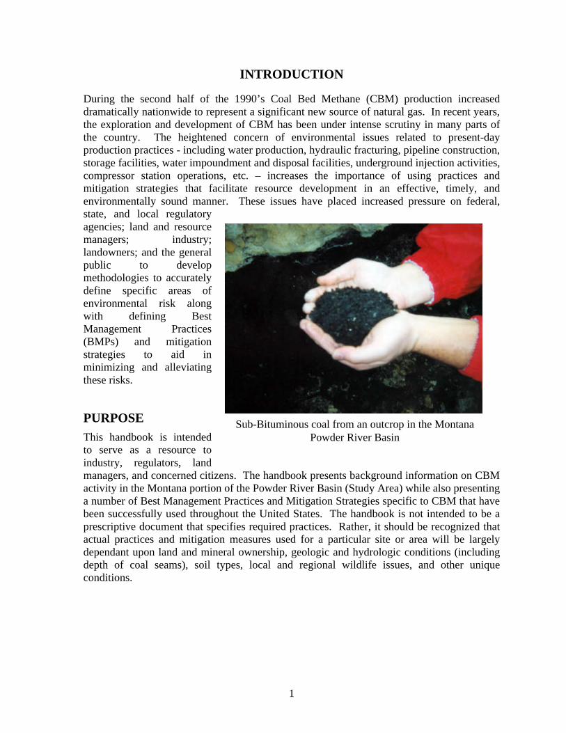
INTRODUCTION
During the second half of the 1990’s Coal Bed Methane (CBM) production increased dramatically nationwide to represent a significant new source of natural gas. In recent years, the exploration and development of CBM has been under intense scrutiny in many parts of the country. The heightened concern of environmental issues related to present-day production practices - including water production, hydraulic fracturing, pipeline construction, storage facilities, water impoundment and disposal facilities, underground injection activities, compressor station operations, etc. – increases the importance of using practices and mitigation strategies that facilitate resource development in an effective, timely, and environmentally sound manner. These issues have placed increased pressure on federal, state, and local regulatory agencies; land and resource managers; industry; landowners; and the general public to develop methodologies to accurately define specific areas of environmental risk along with defining Best Management Practices (BMPs) and mitigation strategies to aid in minimizing and alleviating these risks.
PURPOSE This handbook is intended to serve as a resource to industry, regulators, land managers, and concerned citizens. The handbook presents background information on CBM activity in the Montana portion of the Powder River Basin (Study Area) while also presenting a number of Best Management Practices and Mitigation Strategies specific to CBM that have been successfully used throughout the United States. The handbook is not intended to be a prescriptive document that specifies required practices. Rather, it should be recognized that actual practices and mitigation measures used for a particular site or area will be largely dependant upon land and mineral ownership, geologic and hydrologic conditions (including depth of coal seams), soil types, local and regional wildlife issues, and other unique conditions.
Sub-Bituminous coal from an outcrop in the Montana Powder River Basin

2
OVERVIEW OF RESEARCH This handbook aligns with research goals and objectives established by ALL Consulting and the Montana Board of Oil & Gas Conservation as approved by the U.S. Department of Energy for this project. Understanding the focus of the research will provide an increased level of understanding regarding findings and results presented in this handbook. Project research elements include this handbook and components that will serve as a supplement to this handbook as well as other data collection and research activities. An abbreviated summary of research activities associated with this project is presented below.
STUDY AREA The research Study Area and focus of this manual is the Montana portion of the Powder River Basin. Currently, the only commercial production of CBM in the Montana Powder River Basin is located near Decker, Montana. During the field reconnaissance effort, the research team made several visits to the Study Area while also performing extensive analysis of existing data for the area.
DATA COLLECTION AND FIELD RECONNAISSANCE Field reconnaissance and data collection activities performed as part of this project were broadly performed. Data collection included working with a variety of federal and state agencies and industry to obtain existing
data from spatial data sets on a variety of resources in the area. The following list specifies many of the organizations that supported this research effort through the data collection and field reconnaissance effort: ??Bureau of Land Management (Miles City Field Office, Montana State Office, Buffalo
Field Office, New Mexico State Office, Durango Field Office); ??Montana Board of Oil & Gas Conservation; ??Montana Department of Environmental Quality;
Montana/Wyoming Delegation CBM Field Trip
Montana Powder River Basin CBM Development Likelihood and Water Use
3
??Montana Department of Natural Resources and Conservation; ??Montana State Library’s Natural Resource Information System; ??Montana Bureau of Mines and Geology; ??United States Geological Survey; ??U.S. Department of Agriculture’s Natural Resources Conservation Service; ??Alabama Oil & Gas Board; ??Arkansas Oil & Gas Commission; ??Kansas Corporation Commission; ??Oklahoma Corporation Commission; ??Utah Division of Oil, Gas and Mining; ??Ground Water Protection Council; ??Burlington Resources, Inc. ??Red Willow Production (Southern Ute Indians); ??Fidelity Exploration; ??Williams/Barrett Resources; ??BP America; ??Marathon/Pennaco; and ??J.M. Huber Corporation.
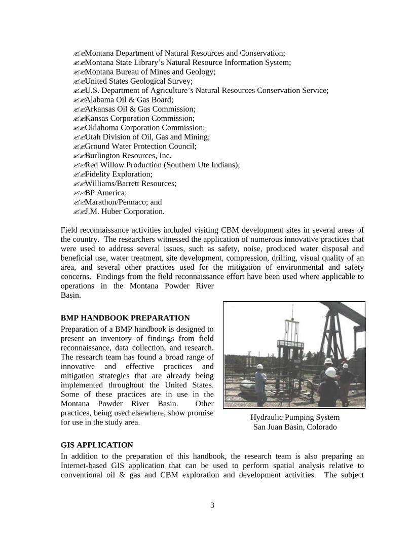
Field reconnaissance activities included visiting CBM development sites in several areas of the country. The researchers witnessed the application of numerous innovative practices that were used to address several issues, such as safety, noise, produced water disposal and beneficial use, water treatment, site development, compression, drilling, visual quality of an area, and several other practices used for the mitigation of environmental and safety concerns. Findings from the field reconnaissance effort have been used where applicable to operations in the Montana Powder River Basin.
BMP HANDBOOK PREPARATION Preparation of a BMP handbook is designed to present an inventory of findings from field reconnaissance, data collection, and research. The research team has found a broad range of innovative and effective practices and mitigation strategies that are already being implemented throughout the United States. Some of these practices are in use in the Montana Powder River Basin. Other practices, being used elsewhere, show promise for use in the study area.
GIS APPLICATION In addition to the preparation of this handbook, the research team is also preparing an Internet-based GIS application that can be used to perform spatial analysis relative to conventional oil & gas and CBM exploration and development activities. The subject
Hydraulic Pumping System San Juan Basin, Colorado

4
application will be interactive and include a variety of information in GIS and numeric formats. Visitors to the site will be able to perform spatial analysis for evaluation of environmental concerns, information relating to the types of mitigation strategies that could be considered, and statistical information for such things as preparing project and water management plans.
TECHNOLOGY TRANSFER As part of the ongoing research, an aggressive technology transfer plan is ongoing. Researchers are currently planning to hold 2-3 workshops in Montana relative to the project’s findings. One workshop has already been held in Houston, Texas (January 2002). In addition, researchers have already presented several technical papers concerning CBM development in the Powder River Basin, the ongoing Montana Environmental Impact Statement and Resource Management Plan Amendment, and the application of BMPs and mitigation strategies. Several more presentations are planned through the remainder of 2002.
BEST MANAGEMENT PRACTICES Best Management Practices (BMPs) can be defined as a suite of techniques, procedures, measures, or practices which are site specific, economically feasible, and are used to guide, or may be applied to, management actions to aid in achieving desired outcomes. Measures or procedures that can be utilized within a BMP may include, but are not limited to, structural and nonstructural controls, operational procedures, and maintenance procedures. In this document, BMPs are presented as a procedure that is initiated by the identification of a specific CBM activity that is to be conducted, followed by an evaluation of the potential impact to the environment resulting from that activity, and concludes with the development and implementation of measures or procedures to mitigate the impact from that activity. This document does not provide an exhaustive list of BMPs. Additional measures may also be identified during CBM development or the MEPA/NEPA process for a specific activity.
RESEARCHERS Researchers involved in this project are ALL Consulting and the Montana Board of Oil & Gas Conservation. Individual researchers involved in the project are listed in Table 1, below:
ALL/MBOGC Research Team Power River Basin - Montana
5
TABLE 1
PROJECT RESEARCH TEAM Dan Arthur, P.E. Petroleum/Environmental Engineer ALL Consulting 17 Years Experience
Bruce Langhus, Ph.D., CPG. Geologist/Hydrogeologist ALL Consulting 35 Years Experience
Tom Richmond Administrator/Petroleum Engineer Montana Board of Oil && Gas Conservation 25 Years Experience
Jim Halvorson State Petroleum Geologist Montana Board of Oil & &Gas Conservation 20 Years Experience
Dave Bockelmann, CPG Petroleum/Environmental Geologist ALL Consulting 20 Years Experience
David Epperly, Ph.D., P.E. Agriculture/Soils Engineer ALL Consulting 15 Years Experience
Brian Bohm Hydrologist/Sociologist ALL Consulting 5 Years Experience
Greg Casey, P.E. Drilling/Operations Engineer ALL Consulting 17 Years Experience
Parker Fleming Economist ALL Consulting 3 Years Experience
Jason Patton Geologist/Geography/GIS ALL Consulting 5 Years Experience
Jon Seekins Environmental Scientist ALL Consulting 15 Years Experience
David Winter Biologist/Wildlife ALL Consulting 5 Years Experience
DEPARTMENT OF ENERGY The U.S. Department of Energy’s (DOE’s) National Petroleum Technology Office (NPTO) is the funding agency for this research effort. The NPTO is responsible for carrying out the National Petroleum Technology Program (NPTP). The Mission of the NPTP is to move the Nation toward a reliable, economic oil supply, enhance U.S. technological leadership, and protect the environment. Working together with their customers, the NPTO promotes key activities and policies that move our nation closer to its goal: to improve efficiency and environmental quality of domestic oil operations. The Vision of the NPTP is to be a domestic oil resource at its fullest potential, contributing to the Nation’s energy security, economic growth, environmental quality, and science and technological leadership. The United States leads the world in the advancement of oil technologies. A key-contributing factor in the success of the NPTP is the customer-driven approach to public-private partnerships, which contribute to the development of technologies, regulatory streamlining, and policies that support increased oil supplies.

6
SIGNIFICANCE OF CBM Coal Bed Methane is a carbon-based gas that occurs naturally within the seams of un-mined coal beds. It is typically contained within the micro-pores of the coal and is retained in place due to the pressure created by the presence of water. During production, this water is pumped to the ground surface to lower the pressure in the coal bed reservoir and to stimulate the release of methane from the coal. Methane from un-mined coal beds has been produced on a minor scale since the early 1900s when a rancher in the Powder River Basin (Wyoming) drilled a water-well into a coal bed and started heating buildings with the produced gas. Until the 1980s, coal seams generally were not considered to be a reservoir target, even though producers often drilled through coal seams when going to deeper horizons. During the second half of the 1990s, Coal Bed Methane (CBM) production increased dramatically nationwide to represent a significant new source of natural gas to meet ever-growing energy demands. In Montana, oil and gas development began with the drilling of the first oil test wells in the late 19th century. Today, Montana’s oil and gas industry exceeds 300 million dollars per year and is a significant aspect of the state’s economic livelihood. Recent oil and gas exploration and development in the state has included a focus on CBM exploration and development. There are currently more than 200 commercially producing CBM wells in the state of Montana, all of which are located in the Powder River Basin near the town of Decker, Montana. CBM development in the Montana portion of the Powder River Basin (PRB) is, in part, the result of successful CBM development in the Wyoming portion of the basin where CBM activity started as early as 1993 (Flores et al, 2001).

7
CBM BACKGROUND AND STUDY AREA DETAILS
The Powder River Basin (PRB) of Montana comprises the Study Area and is where CBM exploration operations are currently being conducted in Montana. Future CBM development predictions for the state indicate that approximately 25,000 CBM wells could be drilled and completed during the next 10 to 20 years. The total Reasonable Foreseeable Development (RFD) scenario for CBM development in the State of Montana (including federal, Indian, state, and private mineral ownership) amounts to approximately 24,875 total CBM wells drilled. It is expected that about 10 percent of these wells will be dry holes. In considering the total RFD for the state, the majority of CBM development is expected to occur within the Montana PRB Study Area. CBM has been produced in the Powder River Basin of Montana since April 1999, slightly behind production in Wyoming that began in the mid 1990’s. The first Montana CBM exploration wells were drilled in both the Big Horn and Powder River Basins. The bulk of the producing data has, however, less history than that. In the CX Ranch Field located within the Montana Powder River Basin approximately 24 months of production data have been submitted to the Montana Board of Oil and Gas Conservation (MBOGC). The schematic to the right shows the construction of a typical CBM well from the CX Ranch Field. Although there are variations in the drilling and completion methodology, the construction method shown is the most common for current practices. However, future practices could vary from this method depending on the depth of targeted coal seams, advances in drilling technologies, or changes in drilling philosophies. Potential changes could include, but may not be limited to, completing wells in more than one coal seam or drilling directional or horizontal wells. The exploration, development, and production of Coal Bed Methane (CBM) involves activities that have the potential to impact a number of resources/issues in the Powder River Basin Study Area. In pursuing CBM production, an evaluation of the specific CBM activities to be conducted would identify any potential impacts to these resources that might occur. This evaluation should include the identification of potential impacts from individual activities as well as the potential cumulative impacts resulting from multiple activities being carried-out concurrently or over the life of the production.
Typical Coal Bed Methane Well Construction Diagram for Wells in the
Montana Powder River Basin

8
The development of a project plan is an integral aspect of CBM exploration, development, and production and is considered necessary for resource conservation. One aspect of the plan is to identity and describe potentially affected resources/issues that may be impacted by CBM efforts. Proper identification of each resource/issue can be useful in preventing accidental disruptions to local communities and in reducing the potential for future impacts that may significantly alter the surrounding environment.
GEOLOGY Montana is the site of the juxtaposition of the Great Plains with the Rocky Mountains. Montana’s basins have accumulated sediments that are up to several miles in thickness; these sands, shales, and limestones represent both the source rock and reservoirs of Montana’s fossil energy reserves – crude oil, natural gas, coal, and Coal Bed Methane (CBM). In these basins, the accumulated sediments were buried to great depths where heating and increased pressure from overburden formed the fossil energy fuels from the raw plant materials trapped within the sediments as they were being deposited. These sedimentary basins also contain a significant portion of the water resources of the state; in the deep parts of these basins the water is generally salty while in the shallower parts of these basins the water is generally fresh. With respect to CBM, it is important to recognize that this resource is directly associated with coal deposits. CBM gas is generated within the coal deposits under both thermogenic (heat-driven) and biogenic (microbe-driven) conditions. At the same time, the methane is trapped in the coal seams by the pressure of groundwater. Releasing the pressure of groundwater from the coal seams liberates the methane that is present, allowing it to be produced as an energy resource. The magnitude of the CBM resource is determined by coal type and volume; the location of CBM resources within the Montana PRB will coincide with the location of the coal seams.
Stratigraphic Column of Upper Cretaceous and Lower Tertiary Sediments in the Powder River Basin

9
The sedimentary strata at the surface within the Study Area consist of recent alluvium in stream valleys to surrounding outcrops that are largely Tertiary and Cretaceous in age. The stratigraphic column, on the previous page, depicts the sequence of Upper Cretaceous and Lower Tertiary sediments that are present within the Montana PRB. The stratigraphic column shows the continuous development of several thousand feet of sediments that include widespread sands, coals and fluvial, fine-grained sediments. Surface outcrops within the PRB consist largely of the several members of the Paleocene Fort Union Formation, as well as the overlying Wasatch Formation in a small corner of the basin (Rice et al. 2000). The Fort Union forms most of the sedimentary fill within the Montana PRB. It consists of approximately 3,500 feet of non-marine silty and shaley clastics and coal beds whose individual thicknesses can be as much as 37 feet near the Decker mine (Roberts et al, 1999a). The Fort Union is split into three stratigraphic members: the lowest being the Tullock Member, overlain by the Lebo Shale Member, overlain by the Tongue River Member (McLellan et al. 1990). In the Montana PRB, the bulk of the coals are confined to the Tongue River Member, while the Lebo and Tullock Members are predominantly shale and shaley sand (McLellan et al. 1990). The Members are discussed in detail below:
THE TULLOCK MEMBER This is the stratigraphically lowest part of the Fort Union, consisting of approximately 300 feet to more than 500 feet of interbedded sands and shales with minor coals near the base (Tudor 1975). The Tullock rests unconformably upon the Upper Cretaceous Hell Creek Formation and is overlain by the Lebo Member of the Fort Union Formation. While generally sandier, the Tullock is difficult to separate in outcrop and in the subsurface from the overlying Lebo Member.
THE LEBO MEMBER This middle member of the Fort Union Formation ranges from 75 feet to more than 200 feet in thickness and consists of claystones, limestones, and mudstones with the Big Dirty coal (3 to 13 feet of thickness) at the very base (Tudor 1975). The Lebo Member is, in part, stratigraphically equivalent with the overlying Tongue River Member (McLellan 1990).
THE TONGUE RIVER MEMBER The thickness of the Tongue River Member of the Fort Union Formation varies from 750 feet at the outcrop edge near the fringe of the basin to 3,000 feet near the axis of the basin (Williams 2001). Total coal thickness within the Tongue River Member ranges up to approximately 150 feet (Ellis et al. 1999). The Tongue River Member is divided into three units. The lower unit includes that portion below the Sawyer coal seam. The Middle unit includes the Sawyer through the Wall coal seam. The Upper unit consists of that portion above the Wall coal seam and includes the Wyodak-Anderson coal seam (Ellis et al. 1999).

10
HYDROLOGY The Montana PRB Study Area includes many aquifers that represent different hydrologic flow regimes. The basin includes unconfined aquifers as well as confined, bedrock aquifers. Aquifers range from the unconfined Quaternary alluvium in the streambeds of rivers and creeks to the Mississippian Age Madison Formation in excess of 10,000 feet below the surface. The water quality within these aquifers ranges from less than 300 mg/L Total Dissolved Solids (TDS) to more than 30,000 mg/L TDS (Bergantino 1980). The aquifers also vary in depth from the basin center to the margin. Coal aquifers are also present and supply large numbers of water wells. Table 2 below provides a list of the major aquifers within the Montana PRB. Groundwater wells within the Montana PRB are almost exclusively completed in the shallow aquifers (< 500 ft depth) with the Tongue River Coals aquifer having the greatest number of wells. Wells completed in these major aquifers are limited in geographic distribution – alluvium wells are distributed along principle rivers and streams, coal wells are arrayed in two principal bands corresponding to two stratigraphic units, and Cretaceous sand wells are generally limited to the rim of the PRB.
TABLE 2
AQUIFERS AND WELLS IN THE MONTANA PRB STUDY AREA
AGE AQUIFER APPROXIMATE DEPTH
NUMBER OF WELLS IN THE MBMG DATABASE
Quaternary and Recent Quaternary Alluvium Surface to 90 feet 198 Wasatch 100 feet 6
Tongue River Coals 50 to 400 feet 957 Tertiary Lebo/Tullock 100 to 400 feet 306
Hell Creek/Fox Hills 100 to 500 feet 199 Judith River 2500 feet 1
Eagle 2700 to 5700 feet 0 Cretaceous
Dakota/Lakota 5600 to 8600 feet 0
Note: MBMG = Montana Bureau of Mines and Geology
Watersheds are an important factor in considering the development of CBM within the Montana PRB. Each watershed is ultimately drained by a single stream or river and each is bounded by a no-flow topographic boundary. Streams and rivers are influenced by their watersheds; in particular, water volume and water quality vary from base flow conditions to high-flow conditions under the control of runoff from land surfaces and recharge to rivers by aquifers. Table 3 shows the surface area of each watershed within the PRB that overlies known coal occurrences and the predicted number of CBM wells that would be drilled within each watershed. The areas with the highest potential for CBM development are located within the northern portion of the Upper Tongue River Watershed, the southern section of the Lower Tongue River Watershed, the western section of the Middle Powder River Watershed, and the eastern section of the Rosebud Watershed. Current CBM exploration operations in the Montana PRB consist of the CX Ranch Field located within the Upper Tongue River Watershed.

11
TABLE 3
WATERSHED ACREAGE AND FUTURE POTENTIAL CBM WELLS IN THE PRB STUDY AREA
WATERSHED SURFACE ACREAGE OF WATERSHED
POTENTIAL NUMBER OF WELLS
Little Bighorn 87,000 1,050 Little Powder 29,500 278
Lower Bighorn 121,500 1,200 Lower Tongue 1,374,000 5,183
Lower Yellowstone-Sunday 687,500 2,568 Middle Powder 368,500 3,167
Mizpah 24,000 224 Rosebud 814,000 5,397
Upper Tongue 589,000 5,806 Total 4,095,000 24,875
CLIMATE Montana is dry; therefore, it is neither oppressively hot nor oppressively cold. Average annual rainfall is 15 inches, varying from 9.69 to more than 100 inches. Average daytime temperatures vary from 28 degrees in January to 84.5 degrees in July. Montana's cold spells are frequently interrupted by Chinook winds.
AIR QUALITY The air quality of any region is controlled primarily by the magnitude and distribution of pollutant emissions and the regional climate. The transport of pollutants from specific source areas is affected by local topography and meteorology. In the mountainous western United States, topography is particularly important in channeling pollutants along valleys, creating up slope and down slope circulations which may entrain airborne pollutants as well as blocking the flow of pollutants toward certain areas. In general, local effects are superimposed on the general weather regime, and are most important, when large-scale wind flow is weak. Site-specific air quality monitoring was not conducted throughout most of the PRB Study Area, but air quality conditions are likely to be very good, as characterized by limited air pollution emission sources (few industrial facilities and residential emissions in the relatively small communities and isolated ranches) and good atmospheric dispersion conditions, resulting in relatively low air pollutant concentrations. Air quality monitoring data collected throughout southeastern Montana and northeastern Wyoming was primarily conducted in urban or industrial areas and is considered to be the best available representation of background air pollutant concentrations through out the PRB Study Area.
12
Regulated air pollutants include: carbon monoxide (CO), nitrogen dioxide (NO2; a portion of oxides of nitrogen, or NOx), inhalable particulate matter less than 10 microns in effective diameter (PM-10), fine particulate matter less than 2.5 microns in effective diameter (PM-2.5), sulfur dioxide (SO2), and volatile organic compounds (VOC). The assumed background pollutant concentrations are below applicable National Ambient Air Quality Standards (NAAQS) and applicable Montana Ambient Air Quality Standards for most pollutants and averaging times, although hourly background concentrations of nitrogen dioxide, ozone, and sulfur dioxide are not available.
CULTURAL/PALEONTOLOGICAL RESOURCES Cultural resources consist of the material remains of, or the locations of, past human activities including sites of traditional cultural importance to both past and contemporary Native American communities. Cultural resources within the Study Area represent human occupation throughout two broad periods: the prehistoric and the historic. The prehistoric period is separated into the Paleo-Indian Period (circa 10,000 B.C. to 5,500 B.C.), the Archaic Period (circa 5,500 B.C. to A.D. 500), the Late Prehistoric Period (circa A.D. 500 to 1750), and the Proto-historic Period (circa 1750 to 1805+). The prehistoric period began with the arrival of humans to the area around 12,000 years ago, and is generally considered to have ended in 1805 when the Lewis and Clark Expedition passed through the area. Cultural resources relating to the prehistoric period may consist of scatters of flaked and ground stone tools and debris, stone quarry locations, hearths and other camp debris, stone circles, wooden lodges and other evidence of domestic structures, occupied or utilized rock shelters and caves, game traps and kill sites, petroglyphs, pictographs, stone cairns and alignments, and other features associated with past human activities. Some of these sites contain cultural resource features that are in buried deposits. Paleontological resources consist of fossil bearing rock formations containing information that can be interpreted to provide a further understanding about Montana’s past. Fossil-bearing rock units underlie the entire Study Area. While fossils are relatively rare in most rock layers, there are seven geologic rock units within the Study Area that do contain significant fossil material. Rock units that are known to contain fossils are the Tullock and Ludlow Members of the Fort Union Formation, the Judith River, Hell Creek, Morrison, Cloverly Formations, the Lakota Sandstone Formation, and the White River Group.
INDIAN TRUST ASSETS/ NATIVE AMERICAN ISSUES Indian Trust Assets (ITAs) are official interests in assets held in trust by the federal government for Indian tribes or individuals. The U.S. Department of the Interior (DOI) Departmental Manual 303 DM 2 defines ITAs lands, natural resources, money, or other assets held by the federal government in trust or that are restricted against alienation for Indian tribes and individual Indians. Furthermore, DOI Departmental Manual 512 DM 2 requires all of its bureaus and offices to explicitly address anticipated effects on ITAs in planning, decision, and operating documents.
13
Land associated with a reservation or public domain allotments are examples of ITAs. Natural resources that exist within Indian reservations such as standing timber, minerals, and oil and gas are ITAs. Treaty rights, water rights, and hunting and fishing rights may also be ITAs. Other ITAs may consist of financial assets held in trust accounts or intangible items such as Indian cultural values. ITAs are a product of the unique history and relationship of the U.S. government with various American Indian tribes and remain within the purview of federal process. There is no similar relationship between the Montana State government agencies and sovereign independent Indian tribal nations (like the Northern Cheyenne and Crow Tribes). Two Indian reservations are located within the PRB area: the Crow and Northern Cheyenne Tribes. The Crow Reservation is located in south-central Montana, and comprises nearly 2,296,000 acres. Access is via Interstate 90 or U.S. Highway 87. The reservation is bordered on the south by the State of Wyoming, on the east by the Northern Cheyenne Reservation, and on the northwest by the city of Billings, which is Montana's largest metropolitan area. The reservation encompasses the Little Big Horn Battlefield and approximately 3,600 square miles of rolling prairie and rugged foothills drained by the Bighorn River. The BIA Realty Office indicated that the tribe has some 455,719 surface acres and 405,888 acres of mineral rights. There are another 1,035,850 acres that have been individually allotted, and 824,427 acres of allotted mineral rights. The Northern Cheyenne Indian Reservation occupies about 445,000 acres in eastern Big Horn and southern Rosebud Counties, Montana. Access to the reservation is provided via U.S. Highway 212. The reservation covers nearly 695 square miles and is bordered on the east by the Tongue River and on the west by the Crow Reservation. According to the BIA Realty Office, the tribe has 442,193 trust acres and 444,000 of surface and mineral estate lands. There are 138,211 individual allotted acres on the reservation.
LIVESTOCK GRAZING Most livestock grazing allotments involve only one permittee; however, there are several multi-permittee allotments. There are no other rights or control of public lands granted by issuance of a livestock grazing permit. The length of grazing periods varies from seasonal to yearlong use. Most ranch operators using the allotments are cow-calf operations with sheep operations coming in second. Most allotments are predominantly private lands with scattered 40 to 80 acre tracts of federal lands. Occasionally a few larger blocks of 640 acres or more of federal lands are encountered. Most allotments have several range improvements such as fences, stock ponds, pipelines, springs, windmills, seedings, wells, and access roads for better control of livestock for management purposes (BLM 1992).
SOILS The U.S. Department of Agriculture’s (USDA) Natural Resources Conservation Services (NRCS) has published a general soil association map for Montana in digital format. The State Soil Geographic Database (USDA NRCS 1996) provides a general overview of soils distribution and occurrences in the Study Area but is not sufficiently detailed to be suitable

14
for site-specific evaluations. Soils in the PRB area are derived mainly from sedimentary bedrock and alluvium. The soils generally range from loams to clays, but are principally loams to silty clay loams. Detailed soil information in the PRB Study Area can be found in the Soils Technical Report (ALL 2001a). Slope and K-factor are values that are used in the estimation of soil erosion potential. Slope values range up to greater than 40 percent; however, there are many soils that have slopes of zero to about 10 percent. Almost all of the soils in the Study Area have low K-factors (below 0.37). Easily eroded soils have a K-factor between 0.37 and 0.69, and resistant soils have a K-factor less than 0.37 (Jarrett 1995). Soil salinity affects the suitability of a soil for crop production and the stability of the soil. Most of the soils within the Study Area have low salinity values. A factor of CBM produced water that can affect area soils is the Sodium Adsorption Ratio (SAR). SAR is a measure of the concentration of sodium in water relative to the concentration of calcium and magnesium. High SAR values adversely affect the soil structure by reducing its ability to allow water to infiltrate. Soil SAR values vary widely both statewide and within the Study Area. Based on the generally fine texture of the surface soils (clayey), much of the soil will likely be susceptible to increasing sodicity if irrigated with water having a high SAR value. The use of good water management practices, such as mixing high SAR water with better quality low SAR water, would allow for much of the soil within the study area to be irrigated. Permeability is the measure of vertical water movement within the soil (infiltration rate) when it is saturated. The soil structure, porosity, gradation, and texture all influence the permeability of the soil. Those soils with a coarser texture (sandy to loamy) and good internal drainage (higher permeability) will be the least susceptible to increasing sodicity and salinity.
SOLID AND HAZARDOUS WASTE ISSUES The hazardous materials program priorities are to protect the public health and safety; protect natural and environmental resources; comply with applicable federal and state laws and regulations; and minimize future hazardous substance risks, costs, and liabilities on public lands. BLM is responsible for all releases of hazardous materials on public lands and requires notification of all hazardous materials to be used or transported on public land. Solid and hazardous wastes can be generated during oil and gas and CBM activity. These wastes are under the jurisdiction of the MDEQ for Resource Conservation and Recovery Act (RCRA) wastes; the MBOGC for RCRA-exempt wastes such as drilling wastes; and the EPA on tribal lands. At the present time, wastes generated from the wellhead through the production stream to and through the gas plant are exempt from regulation as a hazardous waste under RCRA’s exploration and production exemption, but are covered by mineral leasing regulations on BLM lands. The exemption does not apply to natural gas as it leaves the gas plant for transportation to market. Releases must be reported in a timely manner to the National Response Center, the same as any release covered under the Comprehensive Environmental Response, Compensation, and Liability Act (CERCLA). The MDEQ’s Solid and Hazardous Waste Bureau is responsible for administering both the Montana Solid Waste

15
Management Act (75-10-201 et. seq., Montana Code Annotated [MCA] and the Montana Hazardous Waste Act (75-10-401 et seq. MCA). Montana’s Department of Transportation (MDT) under CFR Parts 171-180 regulates the transportation of hazardous materials. These regulations pertain to packing, container handling, labeling, vehicle placarding, and other safety aspects. The transportation of all hazardous waste materials in Montana must comply with the applicable Federal Motor Carrier Safety Regulations.
VEGETATION The Study Area includes six general land classes or vegetative communities: Agriculture/Urban Areas, Grassland, Shrub land, Forests, Riparian Areas, and Barren Lands. All of these habitats are important to a wide variety of wildlife species. Many federally listed threatened, endangered, or candidate species of special concern exist in the Study Area that are given special consideration under Section 7(c) of the Endangered Species Act of 1973 (ESA). Although the word “noxious” means harmful or deleterious, in this context it is a legal term for species of plants that have been designated “noxious” by law. Noxious weeds are non-native species with the potential to spread rapidly—usually through superior reproductive capacity, competitive advantage mechanisms, and lack of natural enemies. Fourteen species have been defined as Category 1 noxious weeds for Montana; these are weeds that are currently established within the state.
VISUAL RESOURCE MANAGEMENT Visual resources are visual features in the Montana landscape that include landforms, water, vegetation, color, adjacent scenery, unique or rare structures, and other man-made features. The Montana PRB contains a variety of landscapes and habitats, all with different visual qualities. There are four defined classes of visual resource management for federal lands; these are: ?? Class I—preserve the existing character of the landscape
?? Class II—retain the existing character of the landscape
?? Class III—partially retain the existing character of the landscape
?? Class IV—provide for management activities that require major modifications to the existing character of the landscape
Non-federal land is not under any visual resource management system although there are often visual quality concerns. Federally authorized projects, however, undergo a visual assessment to comply with aesthetic requirements. Typically, sensitive areas include residential areas, recreation sites, historical sites, significant landmarks or topographic features, or any areas where existing visual quality is valued.

16
WILDLIFE The PRB Study Area contains substantial geographic and topographic variation that supports a wide variety of plant communities and wildlife habitat types. This combination of factors results in very diverse wildlife communities with some species having widespread occurrence throughout the Study Area and others being restricted to one or a few specialized habitats and locations. Many federally listed threatened, endangered, or candidate species of special concern exist within the Study Area that are given special consideration under Section 7(c) of the Endangered Species Act (ESA) of 1973.
17
PROJECT PLANNING ELEMENTS
The exploration and development of CBM within the Powder River Basin has many elements that are common to corresponding conventional oil and gas activities. As such, there are a number of existing industry practices, standards, laws, and regulations that apply to all oil and gas exploration and development activities, including CBM. However, there are also many aspects of CBM exploration and development that are unique and different from conventional oil and gas activities. With the development of the Statewide Draft Oil and Gas Environmental Impact Statement and Amendment of the Powder River and Billings Resource Management Plans (EIS) for CBM in Montana, there will be additional requirements identified and developed that will apply specifically to CBM operations within the state. Among those included in the EIS is the requirement for a Project Plan. The Project Plan will serve as an overall means for the CBM operator to specify how a particular area or field CBM operation will be conducted. The Project Plan would include such items as a Water Management Plan, Groundwater Monitoring Plan, and Wildlife Monitoring and Protection Plan as well as outline any provisions that are specific to the leasing arrangements or the siting of CBM facilities. Also included would be specific provisions for CBM operations that are conducted on lands or minerals that are owned or managed by the federal or state government or a tribal government. The Project Plan would also include a section on Best Management Practices (BMPs) that would be implemented by the operator to address site-specific issues such as the mitigation of potential impacts to area resources.
FEDERAL LANDS Oil and gas activities, including CBM, conducted on federally owned or managed lands or minerals carry unique requirements. Federally owned oil, gas, and CBM resources are administered by the Bureau of Land Management (BLM) in cooperation with other Federal Surface Management Agencies (SMAs) or surface owners. The BLM has developed a guidance document entitled “Surface Operating Standards for Oil and Gas Exploration and Development” or, as it is more commonly referred to, the “Gold Book”. The “Gold Book” provides guidance for oil and gas operations on federal lands and minerals that ranges from initial exploration activities through abandonment as well as presenting standards on surface land use and drilling programs. The standards and guidance that are contained in the “Gold Book” would also apply to CBM operations that are conducted on federal lands or minerals. The “Gold Book” also pertains to operations conducted on Indian Lands but those operations should incorporate early consultation with the BLM, the appropriate Bureau of Indian Affairs agency office, and local tribal government.
LEASE STIPULATIONS Lease stipulations consist of specific measures that are incorporated into a mineral lease and are intended to avoid potential effects on resource values and land uses from oil and gas operations, including CBM. Lease stipulations can include provisions for, and constraints on, such things as site clearances, occupancy, and timing restrictions. Lease stipulations are applied before the lease is issued and, depending on the language of the stipulation, apply to all facets of exploration, production, and abandonment activities. The Federal government

18
uses lease stipulations and site-specific mitigation measures determined at the development stage to protect various resources. The Montana Board of Oil and Gas Conservation (MBOGC) implements restrictions that are analogous to lease stipulations through the issuance of field rules. Field rules are applied on a case-by-case basis to protect resources on state and privately owned land. The Montana Trust Land Management Division (TLMD) of the Montana Department of Natural Resources and Conservation (DNRC) also has lease stipulations for their minerals. The TLMD utilizes a set of standard stipulations on all oil and gas leases that is different from those used by BLM. In addition, the TLMD undertakes a site-specific review process for exploration and operating plan proposals. This review process generates site-specific stipulations for issues such as steep topography, wildlife, streams, wooded areas, and rivers or lakes. Additional stipulations can be placed on the use of MDNRC minerals on a case-by-case basis prior to their being leased. The success of these stipulations or field rules in avoiding a specified impact, in some instances, will require the collection of site-specific information regarding the resources to be protected relative to changes that occur from exploration, production, and abandonment activities.
CONTROLLED GROUNDWATER AREA
The technology involved in extracting Coal Bed Methane requires the withdrawal of groundwater from the coal seam aquifers to reduce water pressures allowing methane to be released. Because the Montana PRB will be a primary area of CBM development, it is anticipated that significant quantities of groundwater will be removed, resulting in an overall lowering of water levels within the Study Area. As such, the DNRC has adopted a Final Order creating a Controlled Groundwater Area within the Montana PRB. This Final Order designating the Montana PRB as a Controlled Groundwater Area contains specific provisions that include:
?? Applies only to CBM production and includes all formations above the Lebo member of the Fort Union Formation.
?? The setting of specific standards for permitting, drilling, and producing CBM wells. ?? Requirements for water source mitigation agreements. ?? The creation of a Technical Advisory Committee to review, oversee, and advise on
scientific and technical aspects of the PRB Controlled Groundwater Area. ?? Requirements for reporting specific information on groundwater characterization and
monitoring. ?? Requirements for the collection of specific data and sets procedures for notifications
that will need to be made to appropriate state agencies and the public.
MONITORING PLANS The EIS for CBM contains proposed provisions for the monitoring of changes that occur to groundwater and wildlife resources as a result of CBM exploration and development.
19
The Montana Department of Natural Resources and Conservation (DNRC) Technical Advisory Committee for the Powder River Basin Controlled Groundwater Area has proposed a groundwater monitoring plan for CBM development. The focus of this monitoring plan is to conduct an overall evaluation of the potential effects of CBM development and to track the changes that occur as CBM fields mature, and gas production declines and eventually ends. Monitoring performed by CBM operators, that is required by MBOGC or the U.S. EPA, will gradually be discontinued as portions, and eventually all, of the CBM fields are played out. Abandoned producing wells or monitoring wells within CBM fields could be incorporated into the regional monitoring program as fields mature in order to effectively monitor post-production groundwater recovery in affected areas. The need for detailed information and the cost of installing monitoring wells and monitoring ground water-levels and spring flows will need to be balanced to determine the ultimate spacing between monitoring sites. The Bureau of Land Management (BLM), Fish and Wildlife Service (FWS), and the state have developed a draft outline for a Wildlife Monitoring and Protection Plan (WMPP). The goal of the WMPP is to avoid or minimize impacts to wildlife and serve as a communications tool to foster cooperative relationships among the CBM industry, landowners, and the various local, state, and federal agencies that will be involved in the regulation of CBM operations.
REGULATORY ENVIRONMENT The identification of Federal, State, and Local regulations that are applicable to Coal Bed Methane (CBM) production will be a key element of the initial planning process. The provided information was obtained from the Montana Department of Environmental Quality (MDEQ) and is not considered all-inclusive since CBM related technologies and regulations are constantly being improved and/or revised. It is suggested that the Montana Department of Environmental Quality (MDEQ) as well as other relevant regulatory agencies be contacted prior to the performance for all CBM production activities. Additional guidance on the subject of regulations may be found at www.deq.state.us/coalbedmethane.
FEDERAL REGULATIONS The Clean Water Act, as it relates to CBM activities, primarily regulates the discharge of dredged or fill material into the waters of the United States under section 404. The U.S. Army Corps of Engineers regulates all Montana water bodies, including wetlands and riverine systems, under this section. The discharge of water during CBM development and production activities may require a section 404 permit (Clean water Act, Section 404 regulations, 33 parts 320-330 and 404(b)(1). Under the Federal Safe Drinking Water Act, the EPA Underground Injection Control (UIC) Program provides safeguards for endangerment of current and future drinking water sources. The EPA recognizes five classes of injection wells depending on the type of waste injected and where the waste is injected. The Montana Board of Oil and Gas Conservation (see below) regulates Type II wells, including injection of brines and other fluids associated with

20
CBM production. The EPA Region 8 office is responsible for the four well classes (42 U.S.C 300h et. seq.). The National Environmental Policy Act of 1969 provides guidelines that are used to determine and assess the potential for environmental impacts on major federal projects. Under this Act, Environmental Impact Statements (EIS) are developed to consider project specific environmental impacts that may result from CBM development practices. Information evaluated in the EIS, including impact alternatives, is made available to the public prior to commencement of CBM activities (42 U.S.C 4321 et seq.).
STATE REGULATIONS The Montana Board of Oil & Gas Conservation (MBOGC) is a quasi-judicial body that is attached to the Department of Natural Resources and Conservation (DNRC). The board's regulatory actions serve three primary purposes: (1) to prevent waste of oil and gas resources, (2) to conserve oil and gas by encouraging maximum efficient recovery of the resource, and (3) to protect the correlative rights of the mineral owners. The board also seeks to prevent oil and gas operations from harming nearby land or underground resources. It accomplishes these goals by establishing spacing units, issuing drilling permits, administering bonds, classifying wells, and adopting rules. The board has issued an order establishing the current CBM operating requirements. The MBOGC has assumed the primary regulatory jurisdiction over the Underground Injection Control (UIC) Program for Class II injection or disposal wells. The purpose of this program is to protect underground sources of drinking water (USDWs). An oil and gas operator must apply for a permit to inject, providing specific data about the company and other required information (Administrative Rules of Montana (ARM) 32-22-101 through 1706). Montana Water Quality Act & Rules classifies water quality standards and procedures for surface water and mixing zones. Under these standards Montana has implemented several permit requirements including water quality discharge, discharge elimination, and water quality pollution control. Discharged water resulting from CBM activities are regulated by these standards and are subject to permit approval prior to any discharge activity (ARM 17.30 and MCA 75-5). The Montana Water Quality Act also requires 401 certification for the discharges of any dredged or fill materials. The certification process is defined and regulated by the Army Corps of Engineer’s 404 permit (MCA 75-5). The Montana Water Use Act provides guidelines specific to controlled groundwater areas in the Powder River Basin and applies to wells designed and installed for the extraction of Coal Bed Methane. CBM development must follow the standards for drilling, completing, testing, and production of CBM wells as adopted by the MBOGC; CBM operators must offer water mitigation agreements to owners of water or natural springs within one-half mile of a CBM operation or within the area that the operator reasonably believes may be impacted by the CBM operation, whichever is greater. This area will automatically be extended one-half mile

21
beyond any well adversely affected; and DNRC will designate a Technical Advisory Committee to oversee groundwater characteristics and monitoring, and reporting requirements (MCA 85-2-101 et. seq. and ARM 36.12.101 through 1212). The Montana Clean Air Act governs activities with the potential to emit greater than 25 tons per year of any regulated pollutant. Such activities must obtain an air quality pre-construction permit prior to the construction or operation of the affected source. The process of coal bed methane extraction requires the construction and operation of wells to access the gas and compressor stations to extract and convey the gas. The compressor stations consist of various pieces of equipment with the potential to emit pollutants at varying levels depending on equipment capacities. In addition, the facility may incorporate a Coal Bed Methane powered generator (well-head generator) located on top of the well to generate electricity. In these cases, the generator could also be a source of pollutant emissions. A typical compressor station gathering CBM will incorporate from 1 to 3 compressor engines varying in power from 100 to 500 hp. Operation of these natural gas fired engines results in the emission of regulated air pollutants including CO, NOx, VOC, SOx, and PM10 (Montana Code Annotated (MCA) 75-2-204 and 211, ARM 17.8.705).
LOCAL REGULATIONS The local Conservation District is responsible for administering 310 Permits for proposed work in Montana that may disrupt streams, lakes, and wetlands. The Montana Natural Streambed and Land Preservation Act establishes guidelines and mitigation measures to prevent degradation of natural water systems that might result from construction activities.

22
BEST MANAGEMENT PRACTICES AND MITIGATION MEASURES
EXPLORATION OF COAL BED METHANE SITE LOCATION The surface location of CBM wells is often constrained by regulatory requirements, lease stipulations, optimization for successful geologic testing, and other operational needs. Of equal importance is the selection of surface locations to minimize and mitigate surface conflicts and avoid unnecessary surface uses that will require additional reclamation, special operating procedures, or other restrictions that could be avoided. Consideration should be given to the proximity to schools, residences and other public areas, visual impacts, erosion potential, wildlife habit, and the improvements and structures of the landowner/surface lessee. Of particuar importance in populated areas or where individual residents are close by is the selection of an exploration site that takes maximum advantage of natural features and topography to minimize both audible disturbance and visual impairment of the local view shed. The well drilling operation in the photo is located in a valley between hills that act as barriers to both visual and noise impacts. The use of natural barriers may also benefit the operator by reducing potential vandalism and mitigating safety concerns that may occur if the exploration site is visible and accessible to the public. Topography and natural features may also be used to buffer areas where wildlife concerns such as breeding grounds or special habitats exist. These factors may be of substantially less importance in areas where no sensitive population is present. However, it is important to avoid “sky lining” of facilities even in remote areas to avoid unnecessary disruption of the vistas that travelers and residents have become accustomed to. Operators should avoid steep slopes, unstable soils, and locations that block or restrict natural drainages. Care should be taken to disturb the minimum amount of native vegetation as possible, particularly in those areas where vegetation will be difficult to re-establish. Locations in areas with a potential for high surface run-off, with increased erosion potential or in the flood plain of surface drainages could dramatically increase maintenance costs and the ultimate restoration costs and create additional safety concerns. An exploration site that has a low slope, soils with low erosion potential, and that can be readily re-vegetated benefits the operator by reducing the costs of compliance with storm water discharge permits and associated well and road site remediation.
CBM Drilling Operations - Wyoming

23
BASELINE STUDIES Defining existing conditions prior to commencing exploration activities can be of considerable importance when the operator is faced with issues such as landowner mitigation agreements, future site reclamation/restoration activities, and public concern. Establishing existing conditions such as groundwater hydrologic characteristics and quality, surface water quality and flow, vegetation type and distribution, soil type, use and sensitivity, and the presence of local habitat will provide a basis for evaluating changes that may occur as a result of CBM exploration and development activities. Having background or existing conditions established will be a critical element in developing and choosing the types of practices to apply as well as the strategies for mitigation that will prove most effective. Since the production of CBM involves the inherent production of groundwater resources, the research team noted it to be relatively common for producers to proactively take steps to establish pre-development environmental conditions – especially with respect to groundwater. Establishing baseline environmental conditions may also be required for CBM development on federal or state lands. NEPA documents prepared in both Wyoming and Montana that pertain to CBM development include monitoring plans, including the collection of baseline data. However, the research team noted that in many areas of the country, baseline data is becoming more comprehensive.
One example pertaining to the emphasis that can be placed upon collection of baseline data was exhibited with respect to a proposed CBM exploration well near Bozeman, Montana. In this case, the proposed exploratory well was located in an area having residents opposed to CBM development. Local residents rallied against the proposed exploratory well and suggested extensive baseline studies be performed prior to proceeding with the drilling of the exploratory well. The local residents were concerned with a variety of issues, not limited to, but including potential degradation and/or contamination of area watersheds and
groundwater. Although baseline studies were conducted in this area, it is important to recognize that performing baseline studies do offer benefits in many cases, including establishing actual (i.e., not perceived) background characteristics.
Local Residents at a Public Meeting for CBM Exploration near Bozeman, Montana
Cattle Grazing near Bozeman Pass

24
Baseline data may involve characterization of produced water, groundwater, and surface water. The presence and number of cattle in a specific area may, for instance, drive the volume of water that may be used for stock watering. It may also include an evaluation of area soils, cultural and paleontological resources, wildlife, and other environmental concerns. Baseline data collection may also pertain to issues that are not environmentally related. If there are potential concerns relating to property values then the collection of this and other data and information may prove valuable as development proceeds. The actual extent of baseline studies will certainly be driven by local conditions and concerns that may be unique to a specific area. An evaluation of the type and extent of baseline conditions should likely be done early in the planning process.
HEALTH AND SAFETY Many of the health and safety risks associated with gas and oil production are not commonly present at CBM sites. Nevertheless, there are important health and safety considerations at CBM sites that need to be taken into consideration. Health and Standards established by OSHA’s Construction Standard (29 CFR 1926.1101), the State of Montana’s Accident Prevention Regulations (1967), and DOE’s Environmental Health and Safety Handbook, prepared for the Montana Oil and Gas Exploration and Production Industry (1998), are regulatory guidance not only circulated for worker and employee protection, but also for the local populace not directly involved in CBM activities. Often times, CBM project sites must be accessed by driving on small rural highway systems that are not designed to accommodate large volumes of traffic. The research team, during the field investigation, recognized the importance of car-pooling to help minimize construction traffic and reduce the potential for vehicular accidents. Training, including defensive driving courses, has also been shown to help reduce work related traffic accidents. The team also noted that in some cases construction traffic and school buses share the same roads. It became evident that careful planning by the project staff was necessary to create a safe environment for the children. Planning work hours around the schedule of school bus pick-ups and drop-offs is a practical solution to achieve a safe highway environment. Another safety issue common to CBM sites is fire control. The Powder River Basin is geographically located in an arid section of Montana and Wyoming and is therefore susceptible to outbreaks of uncontrolled fires. The conservation and protection of local habitat, including mature small grass prairies and endangered and threatened species habitat, often times could depend on a successful fire control plan. Fire safety is a concern not only for operators but local communities as well. The researchers noted in other regions where CBM development is occurring that notification of the local fire department and having on-site fire protection services often helps alleviate some of the concern. Implementing spark prevention programs, methods for properly disposing of cigarette butts, training in the proper use of fire extinguishers, and having emergency information accessible to employees are also important elements of fire control plans that were observed by the field team. Lastly, the field team found that the development and utilization of a functional Health and Safety Plan allows for a successful working environment for on-site personnel. A Health and

25
Safety Plan allows employees to determine site-specific training requirements, activity specific Personal Protection Equipment (PPE) requirements, and other issues pertinent to CBM activities. A Health and Safety plan is intended to provide critical information to the employee, as well as the employer, to create a safe and responsible work environment that does not inhibit work efficiency. The research crew found the most effective plans were always easily accessible to all on-site personnel and in some cases, reward programs were implemented to recognize employee conformance with the plan.
DEVELOPMENT AND OPERATIONS OF CBM WATER MANAGEMENT Beneficial Use The beneficial use of CBM produced water represents an opportunity for operators to provide themselves, the landowner, and nearby industry with water that does not result in the waste of this resource. The loss of groundwater resources that reside in the coal seam aquifers from which CBM is produced presents a significant concern to the regulatory community, and the residents of the Montana Powder River Basin. The ability of a CBM operator to provide produced water for beneficial uses by industry, landowners, or other parties, can provide unique and substantial benefits. Dust Control Dust is a noticeable nuisance, especially in arid regions of the country such as the Montana PRB Study Area. Dust from construction activities and standard travel of personnel and equipment over unpaved roads has the potential to impact air quality and create a nuisance to those traveling in these areas. The use of produced water for dust control offers multiple benefits from an environmental viewpoint, including the prevention of air quality concerns and the loss of surface soils. Based on available water quality data for water originating from underground coal seams in the Montana PRB, the application of produced water for dust control appears feasible. However, site-specific analysis may be necessary as well as gaining appropriate approvals from landowners and applicable governmental agencies. Possible applications of produced water for dust control include use on lease roads, other unpaved roads in the development area, and various construction sites where surface disturbances due to CBM development exist. Water produced from CBM operations at the CX Ranch Field near Decker, Montana has been provided to nearby coalmines for industrial uses that include dust control. The use of CBM produced water for dust suppression does present some concerns. Poor quality CBM water, generally associated with high sodium adsorption ratio (SAR) values, can create problems with native soils. Soils and crops have a particular sensitivity to sodium and its concentration relative to calcium and magnesium (referred to as the sodium adsorption ratio) in water. If operators continuously apply high SAR water to access routes and unpaved areas, future land reclamation and reseeding problems may arise. Further complications such as increased soil erosion could arise if the water is applied too frequently or at high rates. The fact that produced water has the potential of causing negative impacts to
26
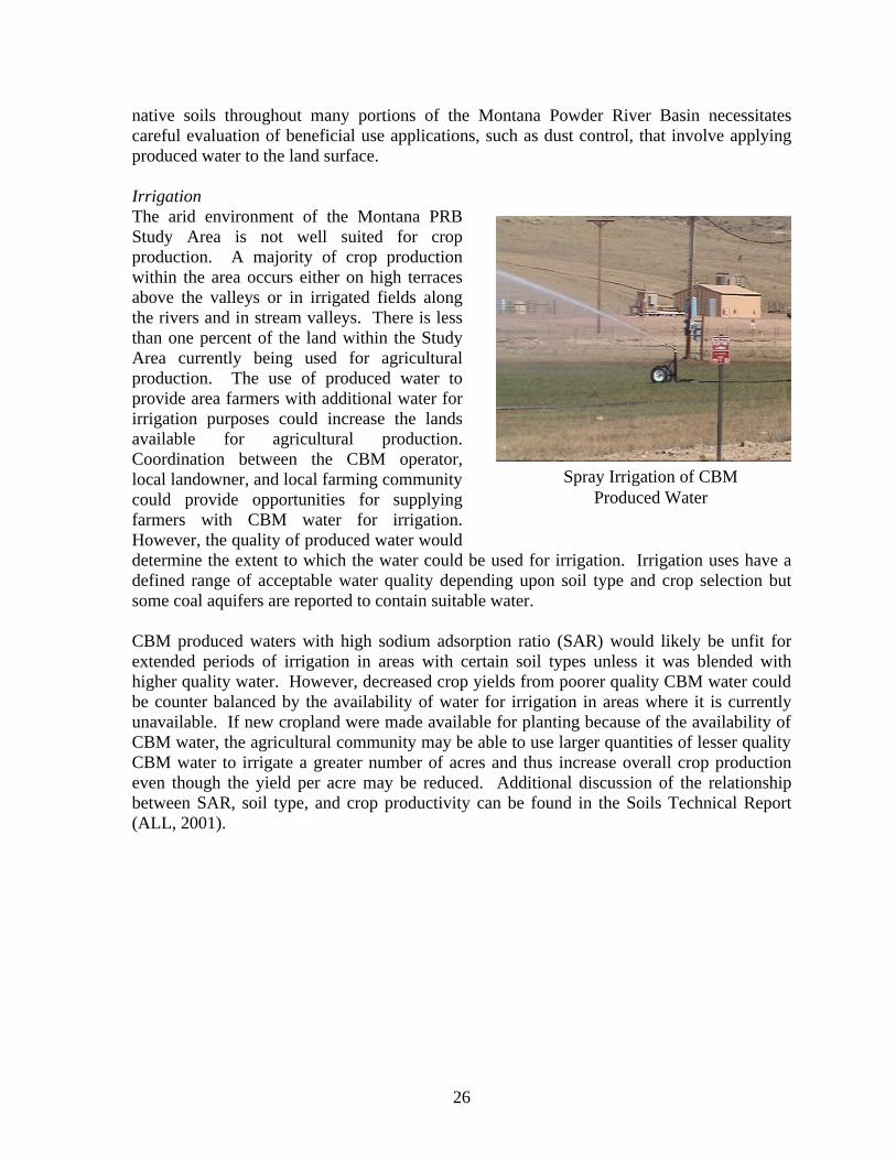
native soils throughout many portions of the Montana Powder River Basin necessitates careful evaluation of beneficial use applications, such as dust control, that involve applying produced water to the land surface. Irrigation The arid environment of the Montana PRB Study Area is not well suited for crop production. A majority of crop production within the area occurs either on high terraces above the valleys or in irrigated fields along the rivers and in stream valleys. There is less than one percent of the land within the Study Area currently being used for agricultural production. The use of produced water to provide area farmers with additional water for irrigation purposes could increase the lands available for agricultural production. Coordination between the CBM operator, local landowner, and local farming community could provide opportunities for supplying farmers with CBM water for irrigation. However, the quality of produced water would determine the extent to which the water could be used for irrigation. Irrigation uses have a defined range of acceptable water quality depending upon soil type and crop selection but some coal aquifers are reported to contain suitable water. CBM produced waters with high sodium adsorption ratio (SAR) would likely be unfit for extended periods of irrigation in areas with certain soil types unless it was blended with higher quality water. However, decreased crop yields from poorer quality CBM water could be counter balanced by the availability of water for irrigation in areas where it is currently unavailable. If new cropland were made available for planting because of the availability of CBM water, the agricultural community may be able to use larger quantities of lesser quality CBM water to irrigate a greater number of acres and thus increase overall crop production even though the yield per acre may be reduced. Additional discussion of the relationship between SAR, soil type, and crop productivity can be found in the Soils Technical Report (ALL, 2001).
Spray Irrigation of CBM Produced Water

27
Livestock Watering Throughout the PRB there is significant land that has no water that is easily accessible. The availability of produced water from CBM activities would allow some of this land to be used for grazing. The rancher would have to obtain the water rights for the use of the produced water for livestock watering through the Montana DNR. There are estimates that, on average, cattle can consume 11.5 gallons of water per day. The governmental standards for livestock water are less restrictive than potable water and would allow for the use of lesser quality CBM water for this purpose. Early coordination and cooperation between area CBM operators, landowners, and local
ranchers on the potential uses of produced water could again prove beneficial to all parties. The CBM produced water provided to ranchers for use as livestock water in areas currently lacking water would increase the land area that ranchers have available for grazing. This practice is currently being implemented in portions of the PRB through the use of stock tanks made from old heavy equipment tires such as the one depicted in the photo here. Industrial Use In the Montana PRB, the researchers identified that certain industries, specifically coalmines, are often lacking water for activities such as dust control and the restoration of aquifers. The availability of CBM produced water to industries such as coal mines may assist in the restoration of aquifers impacted by mining activities as well as provide useable water for dust control, slurry mining, and slurry piping. Oil and gas and CBM development can require large quantities of water during drilling, completion, and the testing of wells and also for certain formation treatments such as water flushes. These activities could be performed using produced water. Other industries such as manufacturing and meat processing may have uses that are compatible with CBM produced water of sufficient quality. Impoundments Impoundments can provide a variety of beneficial use options for both the lease operator and landowners. Site-specific conditions may dictate which impoundment options are best suited for the area because of topography, soil conditions, clinker deposits, and the intended purpose of the impoundment. The CBM operator can coordinate with the landowner on the location of impoundments, future uses the landowner may have, whether to construct in-channel ponds or out-channel ponds, and
Recycled Tire Stock Tank
Landowner Requested Out Channel Pond

28
what size impoundments to construct. The out-channel pond in the picture was requested by the landowner and is currently stocked as a fishing pond. Impoundments could have a variety of uses including storage ponds, coal or shallow aquifer recharge (infiltration into clinker zones), fisheries, livestock and wildlife watering ponds.
Surface ownership, purpose of the impoundment, and local topography may dictate the design of the impoundment. Surface ownership can determine what regulatory requirements govern impoundments as both the Bureau of Land Management (BLM) and Montana Department of Environmental Quality (MDEQ) have design and construction rules for impoundments. In some cases, such as the impoundment pictured here, impoundments are required to be lined with bentonite or synthetic liners to prevent infiltration through the bottom of the
impoundment into shallow aquifers. In Montana, impoundments require Montana Board of Oil and Gas Conservation (MBOGC) permits that require the impoundment to have an impermeable liner if the water is in excess of 15,000 mg/l TDS (ARM 36.22.1227). If the water in an impoundment should seep into the shallow groundwater and that groundwater would later discharge into a surface water body, then such discharges require a general produced water discharge MPDES permit from the MDEQ (ARM 17.30.1341). Landowner Use The lack of water supplies in many areas of the PRB can limit the options many surface owners have for land uses. Produced water supplied to landowners creates additional options for their land use. In some instances the landowner may have some future use for the land that may benefit from the addition of produced water. The researchers have seen where cooperation between landowners and CBM producers in Wyoming has provided additional beneficial uses for produced water. The picture here shows a fishing pond that was constructed and supplied with produced water at the landowner’s request. In one instance near Sheridan, Wyoming the researchers encountered a lease where the landowner requested that CBM operators create an out–channel pond around which the surface property would be subdivided and converted into a housing development. As CBM development continues, other options will likely be identified by landowners for the beneficial use of significant quantities of produced water that would otherwise require disposal.
Lined Pond
Fishing Pond filled with CBM produced water, PRB Wyoming

29
Potable Water Use Potable water is a valued resource in the arid regions of the Montana PRB Study Area. Drinking water is often supplied from shallow surficial aquifers and coal seam aquifers. The water co-produced with methane is also a valuable commodity particularly when it is of drinking water quality. Although there is currently no regulation that requires produced water of drinking quality to be conserved, this water could be used to settle mitigation agreements and excess water could represent a saleable commodity. In populated areas, the water could be used to supplement water supplies during the dry seasons or drought years when there is a water deficit.
Aquifer Storage and Recovery In areas where there are distinct wet and dry seasons, during the wet seasons water is abundant in both surface streams and groundwater supplies. However, water supplies are often depleted during the dry seasons leaving a demand upon water supplies at this time. In these areas, water is captured from surface streams and other sources then stored in permeable aquifers for use during the dry season to ensure this resource is not wasted. Aquifer Storage and Recovery (ASR) is a proven technology for storing large volumes of water. ASR is a process in which underground aquifers are used as reservoirs to store water, which is later withdrawn for use. In the Study Area much of the recharge to alluvial aquifers occurs during the winter and spring when snowmelt from the mountains fills the streams. The production of water from CBM will be a year round activity and may occur
for as long as 20 years in some production wells. Regulators and citizens are concerned that this valuable resource may be wasted. The storage of produced water for future use could be accomplished through the use of aquifer storage and recovery techniques. In the case of CBM, large quantities of produced water could be stored in depleted aquifers or coal seams where gas has been depleted. ASR provides water storage at lower costs than traditional surface storage methods while functioning in a similar manner as a traditional surface reservoir. Other benefits of ASR include eliminating evaporative losses and minimizing impacts to the environment, which can be of particular importance in instances where produced water is of drinking water quality.
Aquifer Storage and Recovery Well Schematic

30
Aquifer Recharge In arid climates such as that of the Study Area, during dry seasons and droughts, shallow surficial aquifers can experience significant water level declines. The production of CBM will also result in the lowering of water levels in coal seam aquifers. Produced water of sufficient quality could be used to recharge surficial aquifers during drought years and recharge depleted coal seam aquifers. Impoundments could be constructed and produced water allowed to infiltrate into shallow alluvial aquifers. During infiltration some filtering of the water would likely occur and water quality may be improved in some instances. In other portions of the PRB, coal clinker deposits are exposed at the surface; these zones are depleted of methane gas because of their exposure to the atmosphere. These clinker zones could be used to replenish coal
seams aquifers with produced water. CBM production activities are unlikely in areas near exposed coal and would not be impacted by pore pressure increases resulting from recharge efforts. The use of produced water to recharge shallow surficial aquifers and coal seam aquifers could also meet the requirements established in some mitigation agreements. Other Use The control of noxious and exotic plants in areas where surface disturbances have occurred is often a concern. These plants can be transported to other areas on vehicles and equipment that have come in contact with them. Exotics can have detrimental impacts to native plant populations by consuming nutrients that would otherwise be available for native plants and grasses. The construction of wash facilities which use produced water can minimize the spread of noxious and exotic plants within the Study Area. The facilities can be constructed so that both local landowners and producers can clean vehicles and equipment thus minimizing the spread of noxious plants. Disposal There are a number of options for the beneficial use of CBM produced water depending upon the quality of the water and the effectiveness of the various treatment options which could be applied to improve water quality. However, even with treatment, it is unlikely that all of the produced water can be beneficially used and some of the produced water will still require disposal. The disposal of produced water could be the only option available to some operators. Produced water quality may be so poor that beneficial use is not possible or treatment technologies cannot efficiently improve the water quality. If site specific conditions dictate that disposal is the preferred management option, there are a variety of disposal methods for CBM produced water including, deep well injection, direct discharge to
Aquifer Recharge Well Schematic

31
the land surface, direct discharge to surface water, and the use of impoundments for evaporation. Deep Injection The injection of water waste into deep reservoirs is a standard practice of disposal in the conventional oil and gas industry. Injection wells and injection technology is an established industry regulated by state agencies and the US Environmental Protection Agency. The MBOGC currently regulates the Class II UIC rules for the state of Montana as established under 36.22.1400 of the Administrative Rules of Montana. The rule establishes guidelines for the permitting requirements for Class II injection wells including their construction, installation, and monitoring and requirements for the receiving formation. These regulations have been adjusted to include the use of all Class II injection wells for the CBM industry. Deep injection could also require a permit from the US EPA if Indian Tribal Land is involved.
The injection of CBM produced water into deep subsurface formations provides an alternative for disposal that would not require the treatment of water, or result in the degradation of surface water, groundwater, or further erosion of the surface soils. Operators could inject produced water into deeper reservoirs that are not classified as Underground Sources of Drinking Water (USDWs). The PRB contains several reservoirs scattered across the Study Area that could be used for injection disposal. Injection facilities are currently operating in the Wyoming PRB for the disposal of CBM produced water.
Direct Discharge to Land Surface The direct discharge of water to the land surface can be a viable disposal practice. Factors such as the quality of produced water, the existing land use and landowners future plans for use, soil type, vegetative cover, and other site-specific conditions can affect surface disposal. The potential impacts and benefits from direct surface discharge can be discussed with the landowner to determine if direct land surface discharge is advantageous to the landowner and operator.
Deep Injection Facility for the Disposal CBM Produced Water, Wyoming
Direct Surface Discharge Location

32
The image above shows direct discharge to the land surface as it is currently being practiced in the PRB. The operator has placed rocks around the base of the discharge point to help prevent erosion of the soil. The use of rocks helps reduce the physical impacts that can cause erosion, however, other impacts to the soil can still occur depending on the quality of the water being discharged. The direct surface discharge of produced water with a high SAR on certain soil types could result in undesired impacts to the soil. Specifically, high SAR water can result in a reduction in the infiltration characteristics of certain types of soils. Further discussion of the relationship between SAR and soil type can be found in the Soils and Water Technical Reports (ALL, 2001a and 2001b). Direct Surface Water Discharge The discharge of CBM produced water to surface water can provide another disposal alternative for operators. Produced water can be discharged to waters of the state of Montana with an appropriate permit from the MDEQ. New discharges are subject to Montana’s Non-Degradation Rules (ARM 17.30.700). The MDEQ is currently working to adopt Total Maximum Daily Loads (TMDLs) relating to CBM produced water discharge, in particular, they are evaluating rules to regulate Electrical Conductivity (EC), SAR, and bicarbonate values for select waterways in Montana.
Lease operators could consider various discharge scenarios based on the quantity and quality of the produced water and the receiving water. The image to the left shows direct discharge to the surface waters of the Tongue River; note how the discharge point is over a rocky surface to minimize erosion of the stream bank. Discharge options such as flow based discharge, rate based discharge, or other discharge options may be appropriate depending on site-specific conditions. Flow based discharge can be used to control the quantity of poor quality CBM produced water discharged to receiving streams during times of low flow
in streams and rivers when the potential for degradation of surface water quality is greatest. Flow based discharge is designed to maximize the dilution potential of the receiving stream by controlling the volume of water discharged relative to the flow rate of the receiving stream. This is done by storing produced water during times of low flow in the receiving stream when the dilution potential is lowest; in the Study Area this would be during the dry summer months. Stored water is then discharged when flow in the receiving streams has been increased in the Study Area; this usually results from precipitation and/or snowmelt. Flow based discharge requires more management than rate based discharge including the continuous monitoring of produced water and the receiving stream.
Direct Discharge to the Surface Waters of the Tongue River

33
Rate based discharge typically establishes a single rate at which discharge is allowed year round and is often based on a worse case discharge scenario. Rate based discharge can be more restrictive of the total volume of produced water an operator can discharge. However, because rate based discharge permits typically have one rate of discharge they are easier to manage and require less monitoring. Impoundments Impoundments can provide a variety of disposal options and benefits to both the lease operator and landowners depending on site-specific conditions. The quality of produced water, soil type, current and future land use, and terrain are factors that should be considered when constructing an impoundment. The owner of the mineral lease could also affect the design of impoundments as BLM and the State of Montana have different requirements for the design and construction of impoundments on their mineral leases. Additionally, in Montana impoundments require MBOGC permits and, if the water is in excess of 15,000 mg/l TDS, the pond or impoundment must be lined with an impermeable liner (ARM 36.22.1227). In the case where produced water would be discharged to surface waters, a Montana Pollution Discharge Elimination System (MPDES) permit from the MDEQ (ARM 17.30.1341) is required. Impoundments built for the disposal of produced water could include evaporation ponds, storage ponds with discharge to surface waters, and constructed wetlands treatments. Evaporation/infiltration ponds can be constructed for the disposal of produced water. These ponds would utilize natural conditions to allow produced water to infiltrate back into the alluvium and eventually back into the water table while also allowing evaporation to occur at the surface. The construction and operation of an infiltration pond can be impacted by the local water table as high water tables prevent the natural filtration of water. A high water table could present regulatory concerns if the groundwater was in contact with a surface stream. Infiltration ponds constructed in areas where produced water infiltrates into the groundwater and is subsequently discharged to a stream or river would require a MPDES permit. Evaporation/infiltration ponds are currently being used in the PRB for disposal of produced water. Treatment During the production of Coal Bed Methane, groundwater is extracted from coal seam aquifers to facilitate the release of methane gas trapped under hydrostatic pressure. Development of new CBM fields will require the production of more water from areas where hydrostatic pressure within the coal seam aquifer has not already been reduced. Over the life of a CBM well the rate at which groundwater will need to be withdrawn is expected to decrease while methane gas continues to be produced. The quality of the water that is extracted during CBM development may determine how this water can be managed. In some instances, high quality CBM produced water can be used for a variety of beneficial uses or disposed in a variety of manners. Discussions regarding the types of beneficial uses and disposal options are included in other sections of this chapter. However, it is also expected that poor quality water will be produced during CBM operations, which may limit potential beneficial uses and limit disposal options. CBM water may be considered poor quality for a variety of reasons depending on the intended beneficial use or disposal practice being

34
considered. For instance, water that is below drinking water quality standards may be considered poor for mitigation requirements, but may be of sufficient quality for livestock watering. Another example would include water that has a high SAR value, which would be unsuitable for irrigation practices, but still meets drinking water standards. It is important to consider that some of the produced water may require treatment prior to its beneficial use or disposal. Presented below are a variety of treatment technologies that could be used to treat produced water. Treatment technologies including freeze/thaw/evaporation, atomization, reverse osmosis, UV, chlorination, wetlands treatment, and other technologies that could be used depending on the ultimate intended use of the produced water. Freeze/Thaw/Evaporation The Study Area experiences seasonal changes that may benefit operators in treating some of the produced water. During the summer, the region is warm and dry with high evaporation rates, in the winter, the area typically reaches freezing temperatures for several consecutive months. These seasonal changes can be applied to reasonably simple treatment technologies to reduce the amount of produced water that must be managed. Freeze/Thaw/Evaporation treatments are currently being practiced in Alaska, Colorado and Wyoming to reduce the concentration of Total Dissolved Solids (TDS) in CBM produced water. The produced water is allowed to freeze naturally and as the water freezes, the dissolved solids and other
constituents are concentrated in the unfrozen liquid. The ice that is formed is higher quality water than the produced water from which it was derived. The ice can be collected and thawed providing a source of high quality water with more management options or simply allowed to evaporate. This process can be repeated until the more concentrated effluent is of a manageable volume. The smaller volume of effluent, though more concentrated, can be more
easily disposed. Atomization The Study Area is an arid region with annual average evaporation rates between 38 and 40 inches. The high evaporation rates in the area create another natural condition that can be used for treatment of produced water. The evaporation of water results in a decrease in the volume of poor quality water that must be managed. Atomization is a process whereby water particles are separated into small droplets and dispersed; in warm dry climates these droplets are more easily evaporated than water stored in impoundments.
Frozen CBM Produced Water from a Freeze/Thaw/ Evaporation Treatment (picture from Ogbe, 2000)

35
Reverse Osmosis Reverse Osmosis (RO) is a proven technology for the treatment of water and the removal of TDS and other constituents. RO involves the removal of water from a solution containing dissolved solids by passing the water through a semi-permeable membrane. As pressure is applied, the semi-permeable membrane allows water to pass while the membrane retains the dissolved solids. The membranes are often cleaned by a cross flow which removes the molecules retained on the surface, these molecules are then collected and concentrated to be disposed. RO systems can be used to treat produced water and concentrate constituents into an effluent that is smaller in volume and more easily disposed. Ultra-Violet Sterilization Ultra-violet sterilization (UV) is a proven technology for the treatment of water and the removal of unwanted free-floating constituents. Although UV will not remove the dissolved constituents which present water quality problems for CBM produced water, it will remove microscopic organic contaminants that can prevent some uses of produced water. It is required that water that has been exposed at the surface be sterilized before it can be re-injected into an aquifer. The use of UV sterilization would achieve this requirement. Produced water which will be used for groundwater restoration, aquifer storage and recovery, or aquifer recharge should be sterilized prior to re-injection.
Wetlands Treatment The treatment of produced water can also be achieved by natural biologic reactions in a constructed wetland. Wetland plants can remove some dissolved constituents from water, reducing the concentration levels in the water and binding the constituents within the plant structure. Wetlands have been constructed in a variety of different environments and used to reduce the concentrations of constituents including dissolved sodium, and other metals. Currently in Wyoming, CBM operators are using constructed wetlands to reduce the level of some constituents before discharging the
produced water to surface streams. The photo above shows a wetland constructed as a flow
Ultra-Violet Sterilization Treatment Of CBM Produced Water
Constructed Wetland for the Treatment of Produced Water in Wyoming.

36
through treatment for produced water. The wetlands are able to reduce the concentrations of some constituents within the water prior to its being discharged. Chlorination Water that will be used for human consumption is often chlorinated before distribution. Chlorination effectively removes disease-causing bacteria, nuisance bacteria, parasites and other organisms, and can be used to oxidize iron, manganese, and hydrogen sulfide so these minerals can be filtered from the water. In instances where produced water could be used for beneficial human consumption, storage, or injection into aquifers, it may be necessary to chlorinate the water.
FACILITIES The planning of CBM operation facilities prior to construction can be beneficial in minimizing impacts to resources. Throughout the course of this project, researchers have been informed of concerns regarding the impacts CBM will have by landowners, citizens groups, and the regulatory community. Well-developed Project Plans will aid operators in reducing concerns from the regulatory community, landowners, and citizens groups. Planning principals that are designed to minimize surface disturbances, view shed impacts, noise levels, emissions, and erosion can be implemented to address these concerns and reduce impacts. Surface Disturbances The impacts to both the present and future land uses of areas that will be developed for CBM operations represents concerns for surface landowners. The disruption of the land for the construction of roads, utility corridors, CBM operation facilities, and wells can result in significant impacts to soils, land use, wildlife, and surface drainages. The planning of operation facilities can benefit both the operator and surface landowner and reduce these impacts. Surface disturbances can be minimized by a variety of planning activities including, using existing roads and utilities, constructing wells in pods, centrally locating compressor stations, and the use of utility corridors. Operators must also consider minimizing the
footprint of operation facilities as well as the number of operational disturbances. The state of Montana requires a storm water discharge permit for construction activity which results in the disturbance of more than 5 acres or more than one acre if located within 100 ft of a lake, stream or river (ARM 16.20.1314). In portions of the Study Area there are multiple coal seams that are expected to have CBM production potential. Operators who have leases with multiple gas producing coal seams can reduce surface disturbances by completing multiple wells in the different coal seams, called well pods. Well pods can
CBM Wells Constructed as Part of a Well Pod in Montana
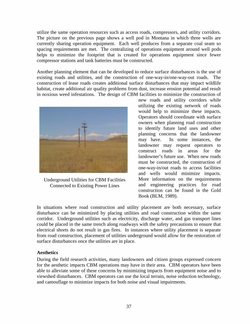
37
utilize the same operation resources such as access roads, compressors, and utility corridors. The picture on the previous page shows a well pod in Montana in which three wells are currently sharing operation equipment. Each well produces from a separate coal seam so spacing requirements are met. The centralizing of operations equipment around well pods helps to minimize the footprint that is created for operations equipment since fewer compressor stations and tank batteries must be constructed. Another planning element that can be developed to reduce surface disturbances is the use of existing roads and utilities, and the construction of one-way-in/one-way-out roads. The construction of lease roads creates additional surface disturbances that may impact wildlife habitat, create additional air quality problems from dust, increase erosion potential and result in noxious weed infestations. The design of CBM facilities to minimize the construction of
new roads and utility corridors while utilizing the existing network of roads would help to minimize these impacts. Operators should coordinate with surface owners when planning road construction to identify future land uses and other planning concerns that the landowner may have. In some instances, the landowner may request operators to construct roads in areas for the landowner’s future use. When new roads must be constructed, the construction of one-way-in/out roads to access facilities and wells would minimize impacts. More information on the requirements and engineering practices for road construction can be found in the Gold Book (BLM, 1989).
In situations where road construction and utility placement are both necessary, surface disturbance can be minimized by placing utilities and road construction within the same corridor. Underground utilities such as electricity, discharge water, and gas transport lines could be placed in the same trench along roadways with the safety precautions to ensure that electrical shorts do not result in gas fires. In instances where utility placement is separate from road construction, placement of utilities underground would allow for the restoration of surface disturbances once the utilities are in place. Aesthetics During the field research activities, many landowners and citizen groups expressed concern for the aesthetic impacts CBM operations may have in their area. CBM operators have been able to alleviate some of these concerns by minimizing impacts from equipment noise and to viewshed disturbances. CBM operators can use the local terrain, noise reduction technology, and camouflage to minimize impacts for both noise and visual impairments.
Underground Utilities for CBM Facilities Connected to Existing Power Lines

38
As was discussed in the exploration section, the landscape of a lease surface can act to buffer neighboring communities from view- shed and noise impacts during drilling activities. In the same manner, local terrain can be used to buffer local communities from operation facilities. Low lying areas and hills can be used to camouflage roadways, CBM facilities, and wells minimizing view- shed disturbances and creating natural sound barriers. In the image to the right, a production well is located behind a rock outcrop protecting the viewshed and acting as a natural barrier to noise generated by well pumps. The image also illustrates how paint can be used to camouflage the facilities as the light brown color blends with the color of the grasses and rocks. For much of the year within the Study Area the grasses have a brown color; using neutral paint tones for buildings allows them to be blended into the viewshed. Other line of site conditions can be used to minimize visual impacts. Using low profile equipment and building structures can also minimize viewshed impacts. In some cases, traditional pump jacks may be used for CBM production; rotating the pump jack to a position where the line of site is not a profile view of the pump jack can minimize visual impacts. In areas where natural barriers do not exist, noise from pumps and compressor stations can be reduced through the use of sound barrier technology. There are several sound reduction technologies, which can be applied to reduce noise impacts to local communities including, mufflers, barrier walls, and insulation. Barrier walls are frequently constructed in urban regions to reduce highway noise; similar technology could be applied to reduce noise from CBM facilities. The walls are designed to disrupt sound waves reducing the level of noise that communities on the other side experience.
Another option for operators is to use noise-reducing insulation in the construction of buildings that house compressors, gas transmission equipment, and pumps. This insulation is designed to allow sound to resonate within the walls of the facility until a desired level is reached. The result is a reduced sound level outside the facility walls that dissipates before reaching neighboring communities. The use of insulation to reduce noise levels from compressors and pumps is currently being used in other CBM producing regions including the San Juan Basin. The image to the left shows a cut away of the noise reducing insulation used in
CBM Production Well Hidden Behind a Rock Outcrop
Member of the Project Team Posing with Noise Reducing Insulation

39
constructing the walls around a CBM compressor. Mufflers can also be utilized to reduce the noise from compressor engines and pump motors. The maintenance of these motors would make certain that mufflers are operational and efforts are made to ensure that, when the mufflers do wear out, they are replaced in a timely manner. Noise generated from CBM facilities can also be reduced through the identification of alternative methods that can be used to power compressors and pumps. Diesel and gas powered engines produce more noise than electric or hydraulic motors. Operators in other producing areas have identified alternatives to diesel and gasoline powered engines including using electric and hydraulic pumps to extract groundwater in CBM wells. These pumps operate at a much lower noise level than the pumps powered by diesel or gasoline engines. Emissions Landowners and citizen groups have expressed concern regarding the impacts that CBM development will have on the air quality in the Study Area. Operators who find methods to reduce air emissions from compressors and pump motors can alleviate this concern. Besides providing noise reduction, mufflers on diesel and gas engines reduce emissions to the atmosphere. The use of electric and hydraulic motors to operate pumps and compressors could also be used to reduce emissions. Another option is to use produced methane to power pumps since its combustion results in fewer emissions than diesel or gasoline. Pumps In addition to the reduction of noise and emissions there are several other considerations when selecting pumps including, depth of the reservoir, extraction rate and volume, view- shed, noise generation, and power supply. The discussion of impacts for viewshed, noise and power supply/emissions, and how these affect pump selection was discussed earlier in this section. The other two main considerations for pumps are the depth of the reservoir and the extraction rate and volume. There are numerous options for pumps to extract water from CBM wells including diesel and gasoline powered pumps, electrical pumps, progressive cavity pumps, hydraulic pumps, and traditional pump jacks. Site-specific conditions are going to determine which pump is best for CBM production.
ABANDONMENT AND RESTORATION OF CBM FACILITIES LAND SURFACE RECLAMATION CBM development and operation practices will result in a disturbance of existing vegetation and plant communities that could eventually lead to the loss of overall grazing/wildlife forage productivity, erosion, and introduction of noxious weeds as well as adverse impacts to native plant and animal populations. For this reason, proper re-vegetation of the disturbed area is an important component of the reclamation process. A successful restoration program is designed to identify and re-introduce impacted native species where necessary, to re-establish a local distribution, and to plant selected species that are determined to be valuable and successful in the area being restored. In general, the success of a re-introduction
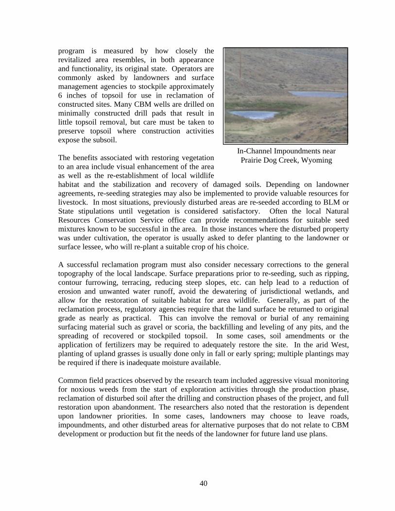
40
program is measured by how closely the revitalized area resembles, in both appearance and functionality, its original state. Operators are commonly asked by landowners and surface management agencies to stockpile approximately 6 inches of topsoil for use in reclamation of constructed sites. Many CBM wells are drilled on minimally constructed drill pads that result in little topsoil removal, but care must be taken to preserve topsoil where construction activities expose the subsoil. The benefits associated with restoring vegetation to an area include visual enhancement of the area as well as the re-establishment of local wildlife habitat and the stabilization and recovery of damaged soils. Depending on landowner agreements, re-seeding strategies may also be implemented to provide valuable resources for livestock. In most situations, previously disturbed areas are re-seeded according to BLM or State stipulations until vegetation is considered satisfactory. Often the local Natural Resources Conservation Service office can provide recommendations for suitable seed mixtures known to be successful in the area. In those instances where the disturbed property was under cultivation, the operator is usually asked to defer planting to the landowner or surface lessee, who will re-plant a suitable crop of his choice. A successful reclamation program must also consider necessary corrections to the general topography of the local landscape. Surface preparations prior to re-seeding, such as ripping, contour furrowing, terracing, reducing steep slopes, etc. can help lead to a reduction of erosion and unwanted water runoff, avoid the dewatering of jurisdictional wetlands, and allow for the restoration of suitable habitat for area wildlife. Generally, as part of the reclamation process, regulatory agencies require that the land surface be returned to original grade as nearly as practical. This can involve the removal or burial of any remaining surfacing material such as gravel or scoria, the backfilling and leveling of any pits, and the spreading of recovered or stockpiled topsoil. In some cases, soil amendments or the application of fertilizers may be required to adequately restore the site. In the arid West, planting of upland grasses is usually done only in fall or early spring; multiple plantings may be required if there is inadequate moisture available. Common field practices observed by the research team included aggressive visual monitoring for noxious weeds from the start of exploration activities through the production phase, reclamation of disturbed soil after the drilling and construction phases of the project, and full restoration upon abandonment. The researchers also noted that the restoration is dependent upon landowner priorities. In some cases, landowners may choose to leave roads, impoundments, and other disturbed areas for alternative purposes that do not relate to CBM development or production but fit the needs of the landowner for future land use plans.
In-Channel Impoundments near Prairie Dog Creek, Wyoming

41
WELL PLUGGING The plugging of dry holes and wells that are taken out of productive service is regulated by the Montana Board of Oil and Gas Conservation (MBOGC) and by lease stipulations established by the mineral lease owners, especially for state and federally owned mineral rights. The primary purpose for abandonment and plugging of a well is to return the disturbed area to a safe and stable condition while preventing the migration of fluids from one subsurface formation to another. This migration of fluids is of particular concern when shallow groundwater resources are at risk. Typically, wells that are determined to be dry holes are plugged on location by placing cement through the open-ended drill pipe. Successful plugging is usually accomplished by placement of cement plugs below the base of the surface casing and above the surface casing. Depending on lease stipulations, the casing can remain in place and is cutoff below ground level and marked with a dry hole marker. Depending on mineral rights ownership of wells to be abandoned, additional plugging stipulations may be required prior to abandonment. Stipulations such as BLM’s requirement for approval prior to well reclamation activities as described in the “Sundry Notices and Reports on Wells” is one example of additional requirements from lease stipulations. The sundry notice serves as an operator’s Notice of Intention of Abandonment (NIA). In some cases, especially in older wells that have been produced for some time before being plugged and abandoned, BLM may require a reclamation plan to accompany the NIA. A representative of BLM may also be present on-site during the reclamation process to assure that bureau stipulations are satisfied and to act as a professional witness. Wells on State owned minerals rights and fee lands are required to be plugged and abandoned in accordance with regulations as set by the MBOGC or MDNR.

42
Bibliography ALL. 2001a. Soils Technical Report, Montana statewide Oil and Gas Environmental Impact
Statement and Amendment of the Powder River and Billings Resource Management Plans. Prepared for the U.S. Department of the Interior, Bureau of Land Management.
ALL. 2001b. Water Technical Report, Montana statewide Oil and Gas Environmental Impact Statement and Amendment of the Powder River and Billings Resource Management Plans. Prepared for the U.S. Department of the Interior, Bureau of Land Management.
ALL. 2002. Statewide Oil and Gas Environmental Impact Statement and Amendments of the Powder River and Billings Resource Management Plans (in print).
American Petroleum Institute.1989. Onshore Solid Waste Management in Exploration and Production Operations. First Ed.
Bergantino, R.N. 1980. Hardin Groundwater Sheet MA-2B, Montana Bureau of Mines and Geology.
Ellis, M.S., G.L. Gunther, R.M. Flores, A.M. Ochs, G.D. Stricker, S.B. Roberts, T.T. Taber, L.R. Bader, and J.H. Schuenemeyer. 1999. Preliminary report on coal resources of the Wyodak-Anderson coal zone, Powder River Basin, Wyoming and Montana, U.S. Geological Survey Open-File Report 98-789A.
Flores, R., Stricker, G., Meyer, J., Doll, T., Norton, P., Livingston, R., Jennings, M. 2001. A Field Conference on Impacts of Coal Bed Methane Development in the Powder River Basin, Wyoming, USGS Open-File Report 01-126.
Jarrett, A. R. 1995. Water management. Kendall, Iowa. Hunt Publishing Company.
McLellan, M.W., Biewick, L.R.H., Molnia, and Pierce, F.W. 1990. Cross sections showing the reconstructed stratigraphic framework of Paleocene rocks and coalbeds in the northern and central Powder River Basin, Montana and Wyoming. USGS Misc. Invest. Map I-1959-A.
Montana Board of Oil and Gas Conservation. 1989. Oil and gas drilling and production in Montana: Final Programmatic Environmental Impact Statement. Prepared for the Board of Oil and Gas Conservation. Pursuant to Senate Bill 184, with assistance from the Office of the Governor, the Department of Health and Environmental Sciences, the Department of Fish, Wildlife and Parks, the Department of State Lands, and the Department of Natural Resources and Conservation.
Montana Bureau of Mines & Geology. 1982. Occurrence and Characteristics of Groundwater in Montana, 1982. Montana Bureau of Mines and Geology. 99(1).
Montana Department of Environmental Quality. 1967. Montana Clean Air Act, MCA 75-2-204 and 211, ARM 17.8.705.
Montana Department of Environmental Quality. 1967. Montana Water Quality Act, MCA 75-5 and ARM 17.30.
43
Montana Department of Environmental Quality. 1996. Montana Sediment and Erosion Control Manual.
Montana Department of Environmental Quality. 1997. Montana Water Use Act, MCA 85-2-101 et seq and ARM 36.12.101 through 1212.
Montana Department of Environmental Quality. 1999. Air Quality Monitoring Data. http://www.deq.state.mt.us/ppa/mdm/air/nwrev/nw_intro.asp. <July 9, 2001>.
Montana Department of Safety Industrial Accident Board. 1967. Oil and Gas Well Drilling and Servicing Industry-Accident Prevent Regulations.
Ogbe, David O. 2000. Guidelines for Designing Water Disposal Systems for Coalbed Methane Production in Alaska. Prepared for Opportunities in Alaskan Coalbed Methane: Alaska Coalbed Methane Workshop. Anchorage, Alaska.
Rice, C.A., M.S. Ellis, and J.H. Bullock. 2000. Water co-produced with coalbed methane. USGS OF Report 00-372.
Roberts, S.B., G.L. Gunther, T.T. Taber, A.M. Ochs, D. Blake, M.S. Ellis, G.D. Stricker, E.M. Wilde, J.H. Schuenemeyer, and H.C. Power. 1999a. Decker Coalfield, Powder River Basin, Montana: geology, coal quality, and coal resources, in USGS Prof. Paper 1625-A.
Tudor, M.S. 1975. Geologic exploration and development of coal in the Sarpy Creek area, Big Horn County, Montana, in J. Doroshenko, W.R. Miller, E.E. Thompson, Jr., J.H. and Rawlins, eds. Energy Resources of Montana: Montana Geological Society 22nd Annual Publication, pp. 159-164.
United States Army Corps of Engineers and United States Environmental Protection Agency. 1977. Clean Water Act, Section 404 Regulations, 33 parts 320-330 and 404(b)(1).
U.S. Department of Agriculture Natural Resources Conservation Service 1996 (1998 update). The state soils geographic database (STATSGO) (for Montana). U.S. Department of Agriculture, Natural Resource Conservation Service. http://www.ftw.nrcs.usda.gov/stat_data.html <March 2001>.
U.S. Department of Energy National Petroleum Technology Office Independent Petroleum Association of Mountain States. 1998. Environmental Health and Safety handbook for the Montana Oil and Gas Exploration & Production Industry.
U.S. Department of the Interior Bureau of Land Management and the United States Department of Agriculture Forest Service. 1989. Surface Operating Standards for Oil and Gas Exploration and Development. (AKA The Gold Book) 3rd Ed.
U.S. Department of Interior Bureau of Land Management 1992. Final Oil and Gas RMP/EIS Amendment for the Billings, Powder River and South Dakota Resource Areas. U.S. Department of the Interior, Bureau of Land Management, Miles City District.
U.S. Department of the Interior Bureau of Land Management. 1999. Seeding Policy, Instruction Memorandum No. MT-020-2000-001.
U.S. Department of Labor Occupational Safety and Health Administration. 1997. Standards for the Construction Industry (29 CFR Part 1926).

44
U.S. Environmental Protection Agency. 1979. Clean Air Act, Federal Safe Drinking Act, EPA Underground Injection Control (UIC) Program.
Williams, B. 2001. Personal communication between Dr. Bruce Langhus and Mr. Williams, Vice President of Redstone Gas Partners LLC, March 23, 2001.