guide to visiting california's grasslands - wild apricot a grassland... · guide to visiting...
TRANSCRIPT

Guide to Visiting California's Grasslands

Guide to Visiting California's Grasslands
California's native grasslands are incredibly diverse and biologically important ecosystems. Yet
grasslands remain one of the most under-protected of California's vegetation types, and native
grasslands have undergone the greatest percentage loss of any habitat type in the state--including
much-publicized losses in wetland and riparian systems.
The individual profiles in this Guide to Visiting California's Grasslands are written to open the readers'
eyes to the diversity and natural beauty of native grasslands, to provide specific information
about each site's ecology and management, and to make it possible for you to visit native grasses in
the ground.
All of the locations included are publicly accessible grasslands. The profiles will tell you how to reach
the site, best times to visit, what to look for, and where you may find similar sites. You are
encouraged to print the profile and take it with you when you visit.
Elements of this guide were developed with the assistance of a LEGACI Grant from the Great Valley
Center.

Table of Contents
Page
1… Alkali Sacaton Grassland--San Luis National Wildlife Refuge Complex, Kesterson
Unit
4… Coastal Grassland--Tilden and Wildcat Canyon Regional Parks
7… Inner Coast Range Prairie--Bear Creek Botanical Management Area
10… Native Dune Grasslands--Asilomar State Beach
14… Purple Needlegrass Grassland--Lake Chabot Regional Park, Fairmont Ridge
17… Purple Needlegrass Grassland--Pacheco State Park, Pig Pond
20… Santa Rosa Plateau Ecological Reserve--Southwestern Riverside County
23… Serpentine Grassland--Redwood Regional Park, Skyline Serpentine Prairie
26… Tufted Hairgrass Grassland--Point Reyes National Seashore, "F" Ranch
28… Vernal Pool Grassland--Pixley Vernal Pools Preserve
31… Wagon Creek Research Natural Area--Los Padres National Forest

1
Visiting Alkali Sacaton Grassland
San Luis National Wildlife Refuge Complex, Kesterson Unit
Location
Overview The Refuge has five main units: the Kesterson Unit, the Freitas Unit, the West Bear Creek Unit, the
East Bear Creek Unit, and the Main Refuge Unit. The Kesterson Unit has some of the best stands of
Alkali sacaton grassland in the Central Valley as well as on-going grassland restoration projects.
Similarly, the West Bear Creek and the Main Refuge Units also have on-going grassland restoration
projects, and the Main Refuge Unit has a herd of tule elk in a 760-acre fenced enclosure.
Best Time To Visit
The Kesterson Unit can be explored on foot and by bicycling the main road to the Mud Slough bridge
(four miles away) from February through September.
March-May: peak bloom of vernal pool-associated wildflowers; songbirds, shorebirds and nesting
raptors; grassland restoration
August-October: native perennial grasses flower in August; long-billed curlews feeding in
grasslands; white-faced ibis feeding in wetlands when they begin to flood, autumn arrival of
waterfowl; tule elk bugling in the Main Refuge Unit.
Site Description
Geography and Climate
The 10,605-acre Kesterson Unit is bisected by Mud Slough, a tributary of the San Joaquin River. The
Unit's elevation is 60-70 feet above sea level. The soil is deep and level, but drains poorly. Winters are
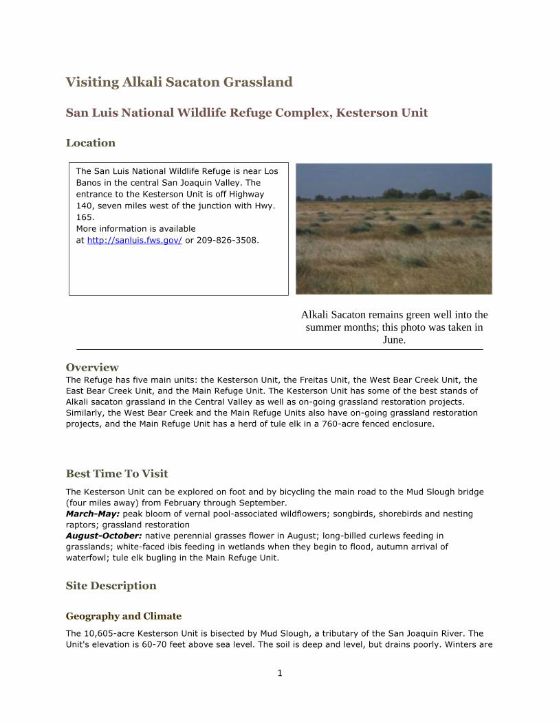
Alkali Sacaton remains green well into the
summer months; this photo was taken in
June.
The San Luis National Wildlife Refuge is near Los
Banos in the central San Joaquin Valley. The
entrance to the Kesterson Unit is off Highway
140, seven miles west of the junction with Hwy.
165.
More information is available
at http://sanluis.fws.gov/ or 209-826-3508.

2
cool and wet; summers are hot and dry; the average precipitation is 9.5 inches per year; and
temperatures range from 14 to 114 °F.
Plant Communities
Grasslands, including Alkali sacaton grasslands,
cover two-thirds of the Kesterson Unit and the
remaining area comprises wetlands, riparian
habitat and vernal pools. The Alkali sacaton
grasslands are in 30-400 acre patches which are
interspersed with the wetlands and vernal pools.
Besides Alkali sacaton, the other major native
grasses are Alkali barley, Dwarf barley, Annual hair
grass, Saltgrass and Creeping wildrye.
Characteristic forbs and shrubs include Iodine bush,
Alkali heath, Alkali mallow, Gum plant, Saltbush and Bush seepweed. Non-native grasses are also
prevalent, particularly Foxtail barley, Mediterranean barley, Red brome, Soft chess and Foxtail fescue.
The showy display of spring wildflowers includes Yellow carpet, Bluedicks, Downingia, Goldfields,
Meadowfoam, Miniature lupine, Navarretia, Popcorn flower and Tidy tips.
In addition, the Mud Slough floodplain contains
extensive Iodine bush communities.
Birds The Kesterson Alkali sacaton grasslands
support a tremendous diversity of birds
representative of the Central Valley. Resident birds
include blue grosbeak, western kingbird, western
meadowlark, horned lark, and loggerhead shrike;
wintering songbirds include dark-eyed junco, ruby-
crowned kinglet, lesser goldfinches and golden-
crowned sparrow. Raptors include northern
harriers, white-tailed kites, prairie falcons, merlins,
burrowing owls, barn owls, Swainson's hawks, and
great horned owls.
Numerous migratory birds use the Kesterson Unit.
The Central Valley is a main wintering ground for
waterfowl migrating along the Pacific Flyway and
the Kesterson grasslands provide important winter foraging areas for sandhill cranes as well as geese
that nest in the arctic, such as snow geese. These grasslands are also critical to shorebirds (such as
American avocets, killdeer, greater yellowlegs,and black-necked stilts) and the riparian habitat
supports neotropical songbirds (such as black-chinned hummingbirds, western tanagers, yellow
warblers, Wilson's warblers, olive-sided flycatchers, and orange-crowned warblers).
History and Current Management
Historically, the area was part of a cattle ranch. The Kesterson Unit has been a National Wildlife
Refuge since acquisition in 1970. Grazing was eliminated from 1981 to 2000. Heavy infestations of
invasive weeds and dense carpets of introduced annual grasses occurred after grazing ceased and no
active management or control was implemented during that time. Since 2000, there has been active
control of both exotic weeds and annual grasses employing sheep and cattle grazing in the winter and
spring, as well as using prescribed burning and herbicides.
Despite its name, the Kesterson Unit does not include the nearby Kesterson Reservoir, a holding pond
for agricultural drain water that was closed in the mid-1980s due to concerns over selenium
contamination and potential adverse effects to wildlife.

3
Nearby Alkali Sacaton Grassland Sites:
Main Refuge - Once severely infested with yellow starthistle, the grasslands, including stands of
alkali sacaton, in the 760-acre tule elk enclosure have been enhanced with prescribed burning,
herbicides, and biocontrol.
West Bear Creek Unit - About 100 acres of Alkali sacaton grasslands have been restored.
Great Valley Grasslands State Park - This 2,800-acre state park, which is adjacent to the Refuge,
has Alkali sacaton grasslands intermingled with other plant communities such as Saltgrass grasslands,
Valley grasslands (which are now predominantly introduced annuals), Iodine bush shrublands, and
Valley oak woodlands.
More information is available at http://www.parks.ca.gov/
Alkali Sacton Grassland researched and written by Karen Harvey, May 2003.

4
Visiting Coastal Grassland
Tilden and Wildcat Canyon Regional Parks
Location
Overview
Tilden Park (2,077 acres) adjoins Wildcat Canyon Park (2,428 acres) and both are part of the East Bay
Regional Park District. This coastal grassland is noted for its wide variety native grasses. In addition,
Nimitz Way has another coastal grassland site between the Havey Canyon Trail and the Mezue Trail;
the area near the cattle loading corral has one of the most superb, densely packed native bunchgrass
stands in the state. This site has abundant Purple needlegrass and the only sizable stand of the native
wildflower Iris longipetela known in the East Bay.
Best Time To Visit
March-May: The best time to see this coastal
grassland site is during the spring, when the
perennial grasses are green and flowering and the
wildflowers are blooming.
Site Description
Geography and Climate
The elevation is about 1,000 feet and the soil is clay
with bands of gravel and rock. The area is semi-arid,
with cool winters (40-60 F) and mild summers (50-75 F).
Tilden and Wildcat Canyon Regional Parks are in
Wildcat Canyon, which is near Berkeley. The
coastal grassland site is on Nimitz Way, a paved
trail on the east side of the parks that is
accessible to wheelchairs and bikes. Follow
Highway 24 east of the Caldecott Tunnel and take
the Orinda exit to Camino Pablo Road. Then take
Wildcat Canyon Road to Inspiration Point, which is
just before the park. From Inspiration Point, follow
Nimitz Way for nearly a mile (across from the
second park bench) to the grassland site. More
information is available at
http://www.ebparks.org/parks/tilden.htm or 510-
562-7275.

5
Plant Communities
This coastal grassland has a wide variety native grasses including Big squirreltail, Idaho fescue and
Purple needlegrass. Bentgrass and Blue wild rye grow near the Nimitz trail, while California brome
dominates further up the hill from the trail.
The east-facing slopes of the Wildcat Canyon have large coast live oaks, bay laurels and a scattering
of bigleaf maples and madrones. North-facing slopes have some nearly pure stands of bay laurel with
coast live oak on the edges. High up, the north-facing slopes have moist chaparral with coyote brush,
elderberry, poison oak, snowberry, blackberry and bracken fern.
Animals
Wildcat Canyon has abundant wildlife, including the deer, ground squirrels and voles that forage
during the day, and the foxes, opossums, raccoons, skunks and great horned owls that forage at
night. In addition, gopher snakes, king snakes and western racers live in the fields and meadows;
garter snakes hunt in the ponds and stream verges; and rubber boas and ringneck snakes live in the
forest. The canyon is also home to a variety of songbirds and raptors, including American kestrels,
hawks (Cooper's, redtail and sharp-shinned) and
turkey vultures.
History and Current Management
In 1935, the East Bay Regional Park District acquired
the southern part of Wildcat Canyon to create Tilden
Regional Park. Named for Charles Lee Tilden, the
first president of the Park District Board of Directors,
Tilden Park is one of the District's three oldest parks
and has been called the jewel of the system. Tilden
Park's recreational activities include a pony ride,
carousel, golf course and Lake Anza. The park also
has a spectacular 10-acre Botanic Garden where you
can explore the state's diverse native flora by
walking through areas that represent defined floral regions of the state, including seacoast bluffs,
coastal mountains, interior valleys, arid foothills, alpine zones, and two kinds of desert.
In 1952, EBMUD sold the northern part of Wildcat Canyon to private interests and in 1966 Standard
Oil drilled exploratory wells but these did not justify further drilling. The Park District began buying
land in the northern part of the canyon in 1967 and created Wildcat Canyon Regional Park in 1976.
Since then, Wildcat Canyon Regional Park has grown from 2,197 to 2,428 acres.
Wildcat Canyon Regional Park's grasslands are grazed by cattle, which control brush by trampling it.
In the early 1990s, a two-year demonstration grazing project in the park showed that managed
grazing can be compatible with both promoting recreational values and conserving resource values,
such as maintaining native perennial cover. Conducted by the Contra Costa Resource Conservation
District and funded by the U.S. Environmental Protection Agency, the 400-acre demonstration project
consisted of installing a well and trough to provide water for the cattle, fencing to exclude the cattle
from wetland areas, and using a rotational grazing system.
In contrast, there have been no livestock in Tilden Park since the 1930s. This has led to the
encroachment of coyote brush in many natural areas of the park. Jim Roof, former director of the
Botanic Garden in Tilden Park, was fond of describing the diverse wildflowers that used to cover
Tilden's slopes before the coyote brush moved in. However, without vegetation management, the
coastal grassland site along Nimitz Way and many other grasslands in Tilden Regional Park are likely
to change to coastal scrub.

6
Conservation Status
Encroachment by woody species is among the greatest threats to California's coastal grasslands.
Historically, large hooved animals likely controlled brush encroachment on grassland in California.
Today, cattle can effectively control this encroachment.
Coastal Grassland researched and written by Sheila Barry, May 2003.
7
Visiting Inner Coast Range Prairie
Bear Creek Botanical Management Area
Location
Driving directions:
1) From I-80 from the San Francisco Bay Area, take Highway 505 to Highway 16 and go north through
Capay Valley. Turn left on Highway 20 and go about 0.2 miles. Then go over Bear Creek bridge and
park in the large turnout on the right. The Bear Creek Botanical Management Area is directly across
from the turnout on the south side of Highway 20.
2) From Sacramento, take I-5 to Williams and go west on Highway 20. Go about twenty miles to just
past the Highway 16 intersection, go over Bear Creek bridge and park in the large turnout on the
right. The Bear Creek Botanical Management Area is directly across from the turnout on the south side
of Highway 20.
Overview
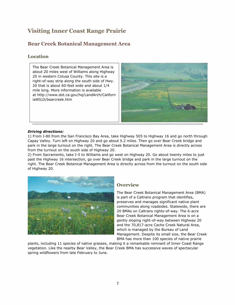
The Bear Creek Botanical Management Area (BMA)
is part of a Caltrans program that identifies,
preserves and manages significant native plant
communities along roadsides. Statewide, there are
20 BMAs on Caltrans rights-of-way. The 6-acre
Bear Creek Botanical Management Area is on a
gently sloping right-of-way between Highway 20
and the 70,817-acre Cache Creek Natural Area,
which is managed by the Bureau of Land
Management. Despite its small size, the Bear Creek
BMA has more than 100 species of native prairie
plants, including 11 species of native grasses, making it a remarkable remnant of Inner Coast Range
vegetation. Like the nearby Bear Valley, the Bear Creek BMA has successive waves of spectacular
spring wildflowers from late February to June.
The Bear Creek Botanical Management Area is
about 20 miles west of Williams along Highway
20 in western Colusa County. This site is a
right-of-way strip along the south side of Hwy.
20 that is about 60-feet wide and about 1/4
mile long. More information is available
at http://www.dot.ca.gov/hq/LandArch/Californ
iaWILD/bearcreek.htm

8
Best Time To Visit
March-May: The dramatic wildflower blooms begin in mid-March and the native grasses begin to
flower in April and May.
August-October: The saltgrass and late season forbs are still green, and riparian plants are blooming
along an intermittent drainage that cuts midway
through the site.
Site Description
Geography and Climate
The elevation is 1200 feet and the soil is derived
from serpentine rock. The intermittent drainage
that cuts midway through the BMA drains into Bear
Creek.
The average high temperatures are about 55 F
from late fall to early spring (November- April) and
85 F from late spring to early fall (May-October).
Plant Communities
The site's 11 native grasses are pine bluegrass, squirrel tail, meadow barley, blue wildrye, purple
needlegrass, California melic, creeping wildrye, saltgrass, and three native annuals, low barley small
fescue, and annual hairgrass. These native grasses are interspersed among the wildflowers, forbs and
European annual grasses. Native grasses account for about 2% of the cover, non-native grasses
account for about 20%, and the rest is wildflowers and native forbs. The best bunchgrass stands are
in the eastern part of the BMA and are dominated by squirrel tail, pine bluegrass, and meadow barley.
In addition, saltgrass grows in an upland rocky area and near the intermittent drainage that cuts
midway through the site.
The dramatic wildflower blooms begin in mid-March with the deep pink collinsia. By mid-April the
prairie is an explosion of color with brodiaeas, owl's clover, wild dandelion, bird's eye gilia, goldfields,
lomatium, poppies, tidy tips and much more. Mid-May brings spectacular displays of checker bloom,
pale delphinium, mariposa lily and still more poppies.
In August-October, the saltgrass and late season forbs such as Spanish clover, narrow-leaf milkweed,
turkey mullein and tarplants are still green. In addition, several riparian plants are blooming along the
intermittent drainage that cuts midway through the site, including centaury, monkey flower, annual
paintbrush and vinegar plant.
Animals
The Bear Creek BMA prairie has many pollinators, including the bumblebees that are abundant when
the pale delphinium bloom in May. Other pollinators include solitary bees, beetles, butterflies and
wasps. In addition, Bear Creek is one of California's seven "hot spots" of dragonfly and damselfly
diversity, with 41 of the state's 108 species.
Bear Creek also has many birds, including red-wing blackbirds, green herons, kingfishers, black
phoebes, song sparrows, swallows and bald eagles.
The adjacent Cache Creek Natural Area has herds of tule elk and the best viewing site is "Cowboy
Camp", which is on an unpaved entry road off Highway 16 about a mile south of Hwy. 20. From the
Bear Creek BMA, go east on Hwy. 20, go south on Hwy. 16 for about a mile and then turn west on the
entry road. Cowboy Camp is between Hwy. 16 and Bear Creek. Look across Bear Creek for good view
of the meadows. The elk tend to come down from the hills to feed in these meadows when they are
green, which is typically from the first rain of the year until late March.

9
History and Current Management
The primary management focus on the Bear Creek BMA is to restore native vegetation by controlling
invasive plants. For example, the site has had four consecutive years of prescribed burns to control
yellow starthistle and barb goatgrass. The site's excellent native seed bank has responded well to
management. While invasive species covered about three-quarters of the site five years ago, today
they cover only about a fifth of the site.
Nearby Similar Sites There are also two other sites in the area that are being actively managed to
restore native plants and wildlife habitat. One is the adjacent Cache Creek Natural Area (CCNA), which
extends from Highway 20 south to the confluence of Bear and Cache creeks. The CCNA has dense
stands of meadow barley that are just beyond the Bear Creek corrals and are visible from the Bear
Creek BMA. In addition, Bear Creek has an alkaline riparian plant community with dense stands of
saltgrass, scratchgrass, and creeping wildrye. The area also has numerous sedges, rushes and other
rhizomatous graminoids.
The second site that is being restored is private property just north of the Highway 20 turnout. Five
years ago, the latter site had dense stands of yellow starthistle and perennial pepperweed. Now,
thanks to burning, herbicide applications, mowing and hand-pulling, this site has some very dense
stands of creeping wildrye and saltgrass; excellent spring wildflower displays in the spring; and
riparian-associated plants including mugwort, ambrosia, narrow-leaf goldenrod, and narrow-leaf
milkweed.
Of particular note, this private property has three acres of nearly solid creeping wildrye that can be
seen from Bear Valley Road. From Highway 20, turn north on Bear Valley Road just east of Bear Creek
Bridge and go about 1/4 mile. The creeping wildrye stand is towards the west between Bear Valley
Road and Bear Creek.
Conservation Status
Non-native invasive species are an ongoing threat.
Inner Coast Range Prairie researched and written by Craig Thomsen, February 2004.

10
Visiting Native Dune Grasslands
Asilomar State Beach
Location
Overview
Asilomar State Beach & Conference Grounds have among the best examples of dune grasslands on the
central coast of California, and is also an excellent example of a restored ecosystem. The site has a
boardwalk that is accessible to wheelchairs. Ranger-led walking tours of Asilomar's natural and
cultural history are available by contacting the California State Park office at (831) 372-4076.
There are three main types of grass communities:
o dune bluegrass (Poa douglassii) grows throughout the main dunes along Asilomar's boardwalks,
o rush/sedge communities, which are the most common, grow in swales between the tall dunes
and near the high intertidal zone, and
o American dunegrass (Leymus mollis) stands grow in a few places along the shore, just south of
the first beach access.
Asilomar State Beach & Conference Grounds is
along Sunset drive just off the westernmost
portion of Hwy. 68 in Pacific Grove, California.
More information is available at
http://www.parks.ca.gov/default.asp?page_id
=566 or (831) 372-4076.

11
Best Time To Visit
March-June: Spring is the best time to see the dune bluegrass community. The perennial grasses
have intact seed heads and many of the other dune plants have beautiful flowers.
April-July: Spring and summer are the best time to see the rush/sedge community. During this
period these plants are flowering or seeding.
June-August: Summer is the best time to see the American dunegrass stands. At this time the
grasses have reached their fullest density; having recovered from winter storms that temporarily
cover them in some areas low on the beach. They are in full bloom during this season.
Site Description
Geography and Climate
The area has a Mediterranean climate, with an average rainfall of about 19 inches per year. Due to the
proximity to the ocean, the humidity is relatively high and the area can be quite foggy, especially
during the summer. Daytime temperatures average in the high 50s in the winter and in the high 60s
in the summer, and extreme temperatures are rare.
While most dune systems are created by fine sediment deposits from river systems, the sand at
Asilomar is derived solely from the underlying granitic bedrock. This gives the dunes their pure white
color and makes them relatively nutrient-poor and inhospitable to most plants. In contrast, swales
(the areas between dunes) have more developed soils. This is due to the swales being more sheltered
from wind. This shelter provides conditions for a larger variety of plants than the more exposed dunes.
As plants grow and die in the swales, over time the organic material that they produce is incorporated
into the soil. This makes the soil more nutrient rich and makes the swale community more hospitable
to a larger variety of plants.
Plant Communities
One of the best places to see dune bluegrass is the upper main boardwalk. Start the trail system near
the green house and go right (north) at the first 3-way juncture. The dune bluegrass stand is to the
right (east) of the boardwalk, just before a sitting area with an excellent view of the dunes.
The dune bluegrass community also has many blooming plants, including the endangered Menzies'
wallflower (Erysimum menziesii ssp. menziesii) and Tidestrom's lupine (Lupinus tidestromii), as well as
more common dune plants such as yellow sand verbena (Abronia latifolia) seaside painted cup
(Castilleja latifolia) beach poppy (Eschscholzia californica var. maritima) California thrift (Armeria
maritma) bishop's lotus (Lotus strigosus) and dune aster (Lessingia filaginafolia var. californica).

12
The rush/sedge community is dominated by dune
sedge (Carex pansa) and, in many low-lying areas,
rushes (Juncus sp.) These low-lying, sometimes
wet areas are throughout the lower coast trail,
particularly around trail entrance #15. Wet areas,
where rain water is trapped or gently flowing at the
surface or just below, support blue-eyed
(Sisyrinchium bellum) and yellow-eyed grasses
(Sisyrinchium californica) that bloom in the spring.
Near the beach at trail entrance #4, there are
steep slopes with seeps that have Pacific silver-
weed (Potentilla anserine ssp. pacifica) and
common monkey flowers (Mimulus gutatta) that
bloom from May to August. Salt grass (Distichlis
spicata) flourishes in areas with frequent salt spray,
and California brome (Bromus carinatus) and
Pacific reed-grass (Calamagrostis nutkaensis) grow
in some of the swales, including those that can be
seen by taking the boardwalk from the green house
and heading toward the beach.
Another major plant community is Monterey pine
(Pinus radiata) forest, which has giant ryegrass
(Leymus condensatus) and Pacific reed grass
(Calamagrostis nutkaensis). In addition, non-native
annual grasses and ice plant are ubiquitous
throughout the park, both in the dunes and forest.
Animals
The Park is home to many animals, including black-
tailed deer (Odocoileus hemionus), Cooper's hawks (Accipiter cooperii), white-tailed kites (Elanus
caeruleus) Lucia slender salamanders (Batrachoseps luciae) and black legless lizards (Anniella
pulchra). In forested areas, acorn woodpeckers (Melanerpes formicivorus) cache their food in old,
dead trees. Sea Otters (Enhydra lutris) are frequently observed from shore, feeding or just relaxing in
kelp.
History and Current Management
Asilomar, which means "refuge by the sea", was purchased from the Pacific Improvement Company in
1913 for a YWCA camp. By 1928 Julia Morgan, the architect who designed Hearst Castle, had created
11 YWCA camp buildings, all of which are currently listed in the Registry of National Landmarks. In the
1950s, the California State Parks system acquired the property and converted it into a conference
grounds. Currently, the conference grounds are operated by an independent concessionaire under
contract with and the guidance of California State Parks.
The California Department of Parks and Recreation provides natural resource management,
interpretive services and law enforcement on the site. The natural resource staff propagates native
plants in an on-site greenhouse for ongoing restoration efforts, and is responsible for controlling
invasive plant species and maintaining a wheelchair-accessible trail system along the coast and
throughout the dunes.

13
In the past, Asilomar's dunes were covered by ice-
plant and European beachgrass, two non-native
plants that were introduced to stabilize the sand
dunes. The combination of these invasive plants
and heavy foot traffic made native plants the
exception rather than the norm.
In the early 1980s, the California Department of
Parks and Recreation began a long-term effort to
restore the plant communities. While there has
been great progress, the process is not yet
complete. The park staff wages an ongoing battle
to control exotic plant species that invade the
dunes and forest communities from adjacent
properties. These include poison hemlock (Conium
maculatum), mustards (Brassicaceae), ice-plant (Mesobryanthem cristallinum), cut-leaved fire weed
(Erechtites glomerata), thistles (Cardueae), and a variety of non-native annual grasses.
The natural resources staff is also working to restore the Monterey pine forest, which has been greatly
damaged since 1992 by a fungal disease called pine pitch canker. The fungus attacks the Monterey
pines (Pinus radiata), often through injuries or with the assistance of vectors, such as bark beetles
(Scolytidae). Beginning in 2002, thousands of Monterey pine trees have been grown from seed. When
the trees are approximately one year in age they are inoculated with a strain of pine pitch canker.
After several months, those trees which have a natural resistance to the fungus are able to survive,
while those that do not, die. Because natural resistance occurs in only about 4% of the seedlings, the
process is slow going. Once the resistant trees are well started, they are planted in the forest and
monitored carefully.
Nearby Similar Grassland Sites
Marina State Beach also has dune grass communities, with larger stands of dune bluegrass but less
developed sedge/rush communities. Marina State Beach is in Marina, which is 10 miles north of
Monterey. More information is available at http://www.parks.ca.gov/default.asp?page_id=581.
Conservation Status
Asilomar's dune, beach and swale grasslands are threatened by development and the invasion of non-
native noxious plants.
Native Dune Grasslands, Asilomar State Beach researched and written by Brian D. Freiermuth and
Lorrie Madison of California State Parks, date unknown.
Photographs: Brian D. Freiermuth

14
Visiting Purple Needlegrass Grassland
Lake Chabot Regional Park, Fairmont Ridge
Location
Overview
Lake Chabot Regional Park is part of the East Bay Regional Park District and the 282-acre Fairmont
Ridge was added to the park in the early 1990s. Fairmont Ridge is noted for exceptionally dense
stands of Purple needlegrass. The site is is surrounded by extensive development including the cities
of San Leandro, San Lorenzo, Castro Valley and Hayward. The end of the Fairmont Ridge trail
overlooks the East Bay and the cities of San Leandro and San Lorenzo. The Fairmont Ridge trail also
leads to a Children’s Memorial Grove, a stone circle surrounded by a grove of young oak trees that
were planted to commemorate Alameda County children who died by violence. Dedicated in 1996, the
Memorial Grove has an annual public service in remembrance of children who were killed during the
previous year.
View from the ridge toward the urban areas.
View of the grasslands looking toward Lake
Chabot.
Lake Chabot Regional Park is near Oakland. The
grassland site is on Fairmont Ridge, which is west
of Lake Chabot. From I-880 in San Leandro, take
the Hesperian Blvd exit east. Turn right onto
Fairmont Drive. The parking area and trail head
are north of the road, just before Fairmont Dr.
turns into Lake Chabot Rd. The trail is a paved
access road that leads to radio communication
towers, and is mildly steep and about a mile long.
Purple needlegrass grows all along the Fairmont
Ridge trail, particularly on the east side.
More information is available
athttp://www.ebparks.org/parks/lakechab.htm or
call 510-526-7275.

15
Best Time To Visit
March-May: The best time to see the Purple needlegrass grassland is during the spring, when bunch
grasses are green and wildflowers are blooming.
Site Description
Geography and Climate
The elevation is about 700 feet, and the soil is clay and clay loam with some serpentine areas.
Serpentine soils are derived from serpentine rock, which is smooth, shiny and blue-green, and is the
state rock of California. Serpentine clay soils tend to dry out quickly; be low in nutrients such as
calcium, nitrogen and phosphorus; and be high in heavy metals such as chromium, molybdenum and
nickel. While these high concentrations of heavy metals make serpentine soil toxic to most plants
(such as blue and live oaks), many species have
adapted to thrive there.
Some plants can grow both on and off serpentine
(such as California bay, gray pine and toyon) and
about a tenth of California's 2,300 endemic plant
species live only in serpentine areas.
The area is semi-arid, with cool winters (45-60 F)
and mild summers (55-75 F).
Plant Communities
Besides dense stands of Purple needlegrass, this site
also has several rare plants including California
balsamroot, California black walnut and White
fritillary.
Animals
This site has Alameda striped racers, Peregrine falcons, Red-tailed hawks, Western meadowlarks and
California phoebes. Fairmont Ridge is also home to a spider unique to the area, the Fairmont
microblind harvestman. Primarily nocturnal, these spiders are popularly known as "daddy longlegs"
because their legs are unusually long and thin compared to their small oval bodies.
History and Current Management
Before being added to Lake Chabot Regional Park in
the early 1990s, Fairmont Ridge was heavily grazed
by horses year-round. The park district currently
manages the site as a resource conservation area,
which means that conserving native species is the
primary focus. To control exotic annual grasses, cows
with fall-born calves graze the site during the
December-June growing season. The number of
cattle and the timing of the grazing season are
adjusted each year according to the plant growth.
The rest of the park has been in public ownership for
much longer. The 315-acre Lake Chabot Reservoir
Purple Needlegrass in early spring.

16
was originally built in 1875 to be the primary source of water for the East Bay. In the 1950s, a 5,000
acre regional park was established north of the lake, and in 1966 the lake was leased to the regional
park district and opened to the public.
Conservation Status
Once widespread, California's Purple needlegrass grasslands are now scattered and surrounded by
vast seas of exotic annuals grasses. These grasslands are threatened by factors from severe
fragmentation to invasive species.
Purple Needlegrass Grassland researched and written by Sheila Barry, July 2003.

17
Visiting Purple Needlegrass Grassland
Pacheco State Park, Pig Pond
Location
Overview
Currently, only the western 2,600 acres of Pacheco State Park are open for public use. There is an
exceptional stand of Purple needlegrass just southwest of "Pig Pond", and individual bunches of this
grass are scattered throughout the park. The park also has beautiful displays of spring wildflowers and
scenic vistas, with views of the San Luis Reservoir and the San Joaquin Valley to the east and of the
Santa Clara Valley to the west.
Best Time To Visit
March-May: The best time to see the Purple
needlegrass grassland is during the spring, when
perennial grass seed heads are waving in the wind
and the slopes abound with wildflowers.
Site Description
Geography and Climate
The elevation is about 1,300 feet, and the soil is
shallow loam that drains well. The area is semi-arid,
with cool winters (45-65 F during the day) and hot
summers (80-100 F during the day). Evenings are
quite cool all year due to the coastal marine air that moves east through Pacheco Pass. The high
ridges are very windy, especially during the spring and summer.
Purple Needlegrass stand in the spring.
Purple Needlegrass southwest of Pig Pond.
Pacheco State Park is just south of Pacheco Pass
between Los Banos and Gilroy. The entrance to
the park is on Dinosaur Point Road just off
Highway 152. From the entrance, follow the trail
signs to Pig Pond. The grassland site is uphill
from Pig Pond and is an easy one-mile hike from
the entrance.
More information is available at http://cal-
parks.ca.gov/ or 209-826-6283.

18
Plant Communities
Besides dense Purple needlegrasses, the native perennial grasses in this stand include Pine bluegrass,
California brome and California oniongrass. The ground around these perennial grasses is carpeted
with wild flowers including bluedicks, butter-n-eggs, cowbag clover, goldfields, navarretia and popcorn
flower. In addition, the riparian area below Pig Pond
has Creeping wildrye.
Animals
The park is home to tule elk, deer, bobcat, coyote,
fox, hawks, eagles and a variety of smaller animals.
History and Current Management
This park is a former ranch that was donated to the
state by Paula Fatjo, a direct descendant of Francisco
Pacheco, for whom the Pacheco Pass is named. Paula
Fatjo wanted her ranch, El Rancho San Luis Gonzaga,
to be kept intact for people who share her love of
horses and the beauty of the land.
This grassland site is seasonally grazed from
November to June with yearling cattle. The cattle and
land are holistically managed by a local rancher whose goal is to have rich biological diversity as well
as an economically- and socially-sound ranching business. The cattle are managed to simulate the
effects that native grazers once had on the land. They are moved through 10 fenced pastures at a rate
determined by the recovery needs of the perennial grasses, the nutritional needs of the animals, and
the management needs of the park and the rancher.
Each spring, the rancher holds a field day that is open to the public to illustrate the management
techniques and discuss their effects on the land. For more information, contact Pacheco State Park
(209-826-6283).
Conservation Status
Once widespread in the Central Valley, Purple needlegrass grasslands are now scattered and
surrounded by vast seas of non-native annual grasses.
A view from very near the top of the trail in the
park.

19
The easy one-mile hike from the entrance
makes this a 'family friendly' excursion.
Purple Needlegrass Grassland researched and written by Sheila Barry, May 2003.

20
Visiting Santa Rosa Plateau Ecological Reserve
Southwestern Riverside County
Location
Overview
About half of the reserve's 8,200 acres are closed to the public for research and to limit human
influence. The rest of the reserve is open to the public and has an extensive system of trails, which
range from being short and easily accessible to more remote with light traffic. The reserve has among
the best Foothill needlegrass grasslands remaining in the state, and has exceptional spring wildflower
displays. In addition, the largest vernal pool has a boardwalk across it, and the trails through the
1,000-acre Sylvan Meadows are accessible to bicycles and horses.
The Santa Rosa Plateau Ecological Reserve is at
the southern end of the Santa Ana Mountains
near Murrieta. From I-15, take the Clinton Keith
Road exit and go west (left from I-15 North;
right from I-15 South) about 4 miles. The Visitor
Center is on the left about 0.1 miles past La
Cresta road and is open on weekends 9:00 am -
5:00 pm. Grassland and oak savanna occur
along all the trails:
o The Sylvan Meadows trailhead is on the
right about 1.5 miles past the Visitor
Center.
o The Hidden Valley trailhead is on the left
across from the Sylvan Meadows trailhead.
o The Vernal Pool trailhead is on the left
about 4 miles past the Visitor Center.
There is a $2 fee for adults and a $1 fee for
children ages 12 and under, and dogs are not
allowed. The reserve is open from sunrise to
sunset every day of the year except during
prescribed burns, which usually scheduled on a
few days between late May and mid-June. More
information is available
at:http://www.santarosaplateau.org/,
or http://www.tnccalifornia.org/our_proj/santa_
rosa/index.asp,http://tchester.org/srp or 909-
677-6951.

21
Best Time To Visit
Early February to early June: Spring is the best
time to visit the reserve. The wildflowers in the
grasslands are at their peak and chocolate lilies
bloom in March and April in several locations,
including along the Vernal Pool Trail. During years
when the reserve gets at least 9 inches of rain, the
vernal pools typically fill up between January and
February. The vernal pool flowers typically start
blooming as the pools dry, which is usually from mid-
May to early June. During the blooming season,
weekly updates on the status of the vernal pools and
which plants are flowering are available at http://tchester.org/srp
Site Description
Geography and Climate
The elevation ranges from about 1,500 to 2,100 feet. The soil is clay and clay loam in most of the
grasslands, oak savannas and mesa tops; the soil is loam to sandy loam in Sylvan Meadows and the
chaparral. Mid-day temperatures are usually in the high 60s to low 70s during the winter and spring,
in the 80-90s in June, and in the 90-100s from mid-July to early November.
Plant Communities
About half of the reserve is grassland and oak savanna, and about half is chaparral and riparian
woodland. The grasslands are dominated by Purple needlegrass, which is native, and a number of
non-native grasses such as Ripgut brome, Soft brome, Filaree, Slender oat and Wild oats.
The savanna has an Engelmann oak overstory with an understory dominated by non-native annual
grasses such as Foxtail barley, Ripgut brome and Wild oats. The riparian woodland has coast live oaks
and sycamores with an understory of shrubs and native grasses that include California brome,
Deergrass, Junegrass, Blue wildrye, Creeping wildrye and Giant wild rye. The riparian understory also
has the non-native grasses found in the savanna, but to a lesser extent.
The southern basalt vernal pools have five state or federally listed plants (Orcutt's brodiaea, Thread-
leafed brodiaea, San Diego button celery, Parish's meadow foam, and California orcutt grass) as well
as fairy shrimp and many other aquatic invertebrates, tree frogs, toads, wading birds and water fowl.
Animals
The reserve's abundant wildlife includes:
o mule deer, bobcats, coyotes and mountain lions,
o tarantulas, and many lizards (granite spiny, side-blotch and western fence) and snakes
(California king, gopher, red diamond rattle, and southern pacific rattle),
o many birds such as acorn woodpeckers, grasshopper sparrows, scrub jays, towhees (California
and spotted) and western meadow larks, and
o raptors such as hawks (red-tail and red-shoulder), northern harriers and white-tailed kites.

22
History and Current Management
In 1984, The Nature Conservancy purchased about 3,400 acres of
the reserve to protect southern basalt vernal pools, Engelmann oak
woodland, riparian woodland and native grasslands. Unfortunately,
this acreage was in two unconnected parcels and the land in
between (another 3,400 acres) was slated for development. In
1991, the Metropolitan Water District of Southern California bought
the land between the two original parcels to mitigate a reservoir
project. In addition, two smaller parcels were purchased
cooperatively by TNC, the California Department of Fish and Game,
and Riverside County: about 400 acres in 1995 and the 1,000-acre
Sylvan Meadows in 1996, bringing the reserve to its current 8,200
acres.
Riverside County Parks takes the lead on public access, maintaining
the reserve and staffing the Visitor Center, while TNC takes the lead
on managing the natural resources. The greatest threat to the
reserve is non-native invasive species. High-priority non-native
invasive species (such as artichoke thistle, fennel, goat grass and
yellow star thistle) are treated with mowing, hand-pulling and
herbicides. Non-native grasses in the grasslands and oak savannas are treated with prescribed
burning, which decreases the non-native grass seed and the litter that favors its germination. Roughly
400 acres are burned every other year in the late spring.
Santa Rosa Plateau Ecological Reserve researched and written by Zachary Principe, August 2003.

23
Visiting Serpentine Grassland
Redwood Regional Park, Skyline Serpentine Prairie
Location
Overview
The 1,836-acre Redwood Regional Park is part of the East Bay Regional Park District. The park has
redwoods, other evergreens, chaparral, and an area of serpentine soil that supports an exceptionally
diverse stand of native grasses.
Best Time To Visit
March-May: During the spring, the serpentine
grassland's perennial grasses are green and
flowering, and native flowers are blooming.
Site Description
Geography and Climate
The elevation is about 1,000 feet and the grassland
site has clay and serpentine soils. The clay-and-
serpentine soil is saturated in the winter and dries
out in the spring. Redwoods don't grow in this area of the part because the clay soils dry out too fast
for the roots of their seedlings to grow, and because they can't tolerate extended periods of soil
saturation. In addition, forests are extremely uncommon on serpentine soil because they have low
nutrient levels.
Serpentine soils are derived from serpentine rock, which is smooth, shiny and blue-green, and is the
state rock of California. Serpentine soils tend to dry out quickly; be low in nutrients such as calcium,
nitrogen and phosphorus; and be high in heavy metals such as chromium, molybdenum and nickel.
While these high concentrations of heavy metals make serpentine soil toxic to most plants (such as
blue and live oaks), many species have adapted to thrive there. Some plants can grow both on and off
Redwood Regional Park is near Oakland and the
Skyline serpentine prairie is on the ridge of the
park’s southwest boundary. From Highway 13,
take the Redwood Road exit and go east on
Redwood Road. Turn left on Skyline Blvd., go half
a mile and then turn right into the entrance and
parking area, which is next to the Richard Trudeau
Training Center, 11500 Skyline Blvd.. The
serpentine grassland site is just behind the
training center; follow the Dunn trail down the hill
behind the building. More information is available
athttp://www.ebparks.org/parks/redwood.htm or
510-562-7275.
24
serpentine (such as California bay, gray pine and toyon) and about a tenth of California's 2,300
endemic plant species live only in serpentine areas.
The area is semi-arid, with cool winters (40-60 F)
and mild summers (50-75 F).
Plant Communities
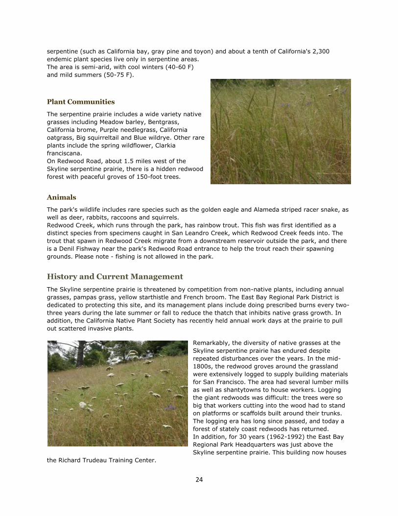
The serpentine prairie includes a wide variety native
grasses including Meadow barley, Bentgrass,
California brome, Purple needlegrass, California
oatgrass, Big squirreltail and Blue wildrye. Other rare
plants include the spring wildflower, Clarkia
franciscana.
On Redwood Road, about 1.5 miles west of the
Skyline serpentine prairie, there is a hidden redwood
forest with peaceful groves of 150-foot trees.
Animals
The park's wildlife includes rare species such as the golden eagle and Alameda striped racer snake, as
well as deer, rabbits, raccoons and squirrels.
Redwood Creek, which runs through the park, has rainbow trout. This fish was first identified as a
distinct species from specimens caught in San Leandro Creek, which Redwood Creek feeds into. The
trout that spawn in Redwood Creek migrate from a downstream reservoir outside the park, and there
is a Denil Fishway near the park's Redwood Road entrance to help the trout reach their spawning
grounds. Please note - fishing is not allowed in the park.
History and Current Management
The Skyline serpentine prairie is threatened by competition from non-native plants, including annual
grasses, pampas grass, yellow starthistle and French broom. The East Bay Regional Park District is
dedicated to protecting this site, and its management plans include doing prescribed burns every two-
three years during the late summer or fall to reduce the thatch that inhibits native grass growth. In
addition, the California Native Plant Society has recently held annual work days at the prairie to pull
out scattered invasive plants.
Remarkably, the diversity of native grasses at the
Skyline serpentine prairie has endured despite
repeated disturbances over the years. In the mid-
1800s, the redwood groves around the grassland
were extensively logged to supply building materials
for San Francisco. The area had several lumber mills
as well as shantytowns to house workers. Logging
the giant redwoods was difficult: the trees were so
big that workers cutting into the wood had to stand
on platforms or scaffolds built around their trunks.
The logging era has long since passed, and today a
forest of stately coast redwoods has returned.
In addition, for 30 years (1962-1992) the East Bay
Regional Park Headquarters was just above the
Skyline serpentine prairie. This building now houses
the Richard Trudeau Training Center.

25
Conservation Status
While serpentine is found in several parts of the world, it covers some 2,200 square miles of
California, and the North Coast Ranges have among the richest diversity of serpentine plants. While
non-native plants dominate most of the grasslands in California, most non-native weeds and grasses
do not grow or compete well in serpentine soils so they often have fine examples of near-original
bunchgrass grasslands. However, like many of California's natural habitats, serpentine grasslands are
threatened by development and competition from non-native plants.
Serpentine Grassland researched and written by Sheila Barry, July 2003.

26
Visiting Tufted Hairgrass Grassland
Point Reyes National Seashore, "F" Ranch
Location
Overview
Established in 1962, Point Reyes National Seashore is noted for its spectacular panorama of
thunderous ocean breakers, open grasslands, bushy hillsides and forested ridges. Thanks in part to
this variety of habitats, Point Reyes has tremendous biological diversity: the peninsula has nearly a
fifth of California's flowering plant species, and 37 land mammal and 12 marine mammal species. In
addition, more than 45% of the bird species in North America have been sighted on Point Reyes. While
other stands of tufted hairgrass are scattered around the coastal portions of the Seashore, the stand
along Bull Point Trail is among the largest and most accessible.
Best Time To Visit
April-May: The tufted hairgrass and wildflowers are
usually flowering during these months, although the
blooming season may start and end later during
years with late rains. Spring also tends to be quite
windy at Point Reyes, so be prepared.
Site Description
Geography and Climate
The elevation in this part of Point Reyes rises about
80 feet from the ocean to Drake's Estero. Most of the soil is sandy and drains well, but there are also
Point Reyes National Seashore is in western Marin
County and is most easily reached via Sir Francis
Drake Blvd. The largest tufted hairgrass
grassland is on the Bull Point Trail, in a low rolling
area in the middle of the park between the ocean
and an estuary called Drake's Estero. From the
town of Inverness, go west on Sir Francis Drake
Blvd. for 7 1/4 miles and turn left into the
parking area for the trailhead. The parking area
has a sign and is surrounded by a split-rail fence.
While the beginning of Bull Point Trail is mixed
native and non-native grassland, after 300 feet
there are small areas of tufted hairgrass along
the trail. More may be found by exploring the
area further along the trail toward Drake's Estero.
More information on the park is available
athttp://www.nps.gov/pore or 415-464-5100.

27
scattered wetlands with soil that is more than half peat. The foggy summers provide moisture that
keeps the perennial grasses green longer than in hot,
dry inland sites.
Plant Communities
The top layer of soil is so dry during the summer that
this area has mostly annual plants (such as native
wildflowers and non-native grasses) and deep-rooted
shrubs (such as Bush lupine and Coyote brush).
However, there are also stands of native perennial
grasses such as tufted hairgrass and California
oatgrass, which have relatively deep roots.
The sand dunes along the ocean and in several
inland areas are dominated by European beachgrass
but also have pockets of native dune plant species
such as beach layia and spineflower.
Animals
The sandy soil is favored by pocket gophers and other rodents, and the rolling landscape and nearby
dunes provide habitat for coyotes, fox and deer. The area is also frequented by hawks, white-crowned
sparrows, and, occasionally, burrowing owls.
History and Current Management
This grassland site is part of the historic "F" Ranch, which was one of the many tenant ranches leased
out by the Shafter/Howard partnership that once owned most of the peninsula. Established in the
1860s, "F" Ranch was originally a dairy and also included vegetable farming fields. In the late 1940s,
the dairy was closed and the land was stocked with beef cattle. In the 1970s, the land was purchased
for inclusion in the National Seashore. Since then, the land's previous owner has had a permit to
rotate grazing beef cattle through four pastures. Other agricultural activies are no longer allowed,
including seeding with non-native forage plants, using herbicides or disturbing the soil.
Conservation Status
Once widespread on the California coast, Tufted
hairgrass grasslands and other coastal grasslands
are estimated to have declined by up to 95% due to
factors such as residential and agricultural
development, and invasion by non-native species.
While the Tufted hairgrass grassland along Bull Point
Trail is protected from development, the constant
influx of new invasive non-native species to
California may pose a threat in the future.
Tufted Hairgrass Grassland researched and written
by Mark Homrighausen, August 2003.

28
Visiting Vernal Pool Grassland
Pixley Vernal Pools Preserve
Location
Overview
Managed by the Center for Natural Lands Management, Pixley Vernal Pools Preserve protects among
the last remaining vernal pools in the southern San Joaquin Valley and provides habitat for sensitive
plant and animal species.
Best Time To Visit
March-May: This is the peak of the wildflower blooming season, although vernal pool plants can be
seen as late as June. Please be careful not to walk too close to the pools because some of the plants
are sensitive to trampling.
Site Description
Geography and Climate
Pixley Vernal Pools Preserve is in the southeastern San Joaquin Valley, nearly 20 miles from the
foothills of the Sierra Nevada. The elevation is about 320 feet, with gently sloping mounds and
depressions. Because hardpan clay soil underlies the area, these depressions fill with rainwater during
the winter and form 25-75 vernal pools, depending on the amount of rainfall.
The 40-acre Pixley Vernal Pools Preserve is
about four miles east of Pixley, which is on
Highway 99 between Bakersfield and Visalia.
The site is open to the public all year with
permission from the Preserve Manager, Greg
Warrick (661-387-9453, [email protected]).
More information is available at CNLM's site.
From Highway 99 south, take Road 120 and go
east for 5 miles. Then turn right on Road 160
and go south for 18 miles. The Preserve is on
the left and is easy to recognize because it
stands out from the surrounding cultivated
fields. The best place is along the dirt road on
the north side of the Preserve.
From Highway 99 north, take the Terra Bella
exit to County Highway J24 and go east for 3
miles. Then turn left on Road 152, go 1 mile
north, turn right on Road 104, go 1 mile east
and turn left on Road 160. The Preserve is
about a quarter of a mile on the right.

29
The climate is Mediterranean, with hot, dry
summers and cool, moist winters. Rainfall is usually
scant, averaging only 8 inches per year. The
average high temperatures range from about 60 F
in January to nearly 100 F in July, while the
average lows range from the 30s in December to
the 60s in July.
Plant Communities
While dominated by non-native annual grasses, the
Preserve also has scattered Saltgrass bunches
throughout as well as Alkali sacaton bunches in the
western half.
During the spring, the vernal pools are surrounded
by hairgrass, a native annual grass, and many
beautiful wildflowers such as Downingia, Goldfields,
Flowering quiltwork and Popcorn flower. In
addition, the tops of the mounds have wildflowers
such as Blue dicks, Lupines and Parry's mallow.
As the water in the vernal pools begins to
evaporate, they develop concentric rings of colorful
wildflowers. These flower rings are mostly yellow
and white from Goldfields and Popcorn flowers,
with occasional splashes of blue and reddish purple
from Downingias and Owl's clover. By early
summer, the pools are dry and most of the plants
have died back, leaving seeds that await the next
year's rain.
The Preserve has several plant species that are
classified as rare by the California Native Plant Society, including Heartscale, Recurved larkspur,
Subtle orache and Vernal pools smallscale.
Animals
Amphibians take advantage of the temporary
vernal pools to breed, and many of them escape
the summer's heat by burying themselves in the
moist soil. Western spadefoot toads burrow as deep
as three feet. During wet years, ducks and
shorebirds feed and rest in the vernal pools. The
Preserve's birds also include black-shouldered
kites, burrowing owls and hawks, and the
mammals include ground squirrels, jack-rabbits
and rabbits
The Preserve's rare animal species include the
vernal pool fairy shrimp, which is federally listed as
threatened, and the western spadefoot toad, which
is state listed as a species of concern.
A view from very near the top of the trail in the
park.
The easy one-mile hike from the entrance makes
this a 'family friendly' excursion.

30
History and Current Management
For centuries the San Joaquin Valley was inhabited by the Yokut Indians, who moved seasonally
among villages scattered though the valley and foothills. Early European settlers grazed cattle and
sheep in the Valley, and soon afterwards farming dominated. Then in the early 1960s, local grape
grower and botanist Jack Zinanovich noticed the beauty of the vernal pools and plants in what is now
the Preserve. In 1964 he protected the pools permanently by buying the land and transferring it to
The Nature Conservancy. In 1986 the U. S. Department of Interior designated the Preserve as a
National Natural Landmark, and in 1997 the Preserve was transferred to the Center for Natural Lands
Management.
To keep the non-native annual grasses from becoming too dense, the Preserve is managed with
prescribed burning about every 4-5 years.
Conservation Status
The Preserve is threatened by competition from non-native annual grasses, especially Red brome and
Ripgut brome.
Vernal Pool Grassland researched and written by Greg Warrick, July 2003.

31
Visiting Deergrass
Wagon Creek Research Natural Area, Los Padres National Forest
Location
Overview
The Wagon Caves Research Natural Area (RNA)
was established to preserve the valley oak
savanna's diverse range of native grasses and
forbs. This site has an incredible diversity of both
annual and perennial grasses and has spectacular
displays of wild owers every spring. In addition,
visitors can sh and swim in the San Antonio River,
which passes through Wagon Caves RNA. Another
popular attraction is Mission San Antonio, which is
10 miles before entering the Los Padres National
Forest.
Wagon Caves Research Natural Area is in the
Los Padres National Forest near King City in
southern Monterey County. From Highway 101
at King City, take the Jolon Road exit and go
south 18 miles to the entrance of Fort Hunter
Liggett. Turn right on Mission Road, which will
take you into the Fort (you can con rm your
location at the guard station). Then go about 5
miles north, turn left on Del Venturi Road and
go another 10 miles through the Fort, which will
take you into the National Forest (the boundary
line has a cattle guard across the road and is
posted Welcome to the Los Padres National
Forest ). You are now in the Wagon Caves
Research Natural Area. The most prominent and
vigorous stands of deergrass are another half
mile on Del Venturi Road. Park in the small dirt
parking area on the left side of the road near
the large sandstone rock outcrop. Then go
through the pedestrian gate, enter the Wagon
Caves Pasture and follow the trail. The most
abundant deergrass in the area is within the rst
1/8 mile. More information is available
at www.r5.fs.fed.us/lospadres or from the
Monterey Ranger District office in King City at
831-385-5434.

32
Best Time To Visit
October-December: The best time to see the deergrass is in late summer to fall, when the seed
stalks are 2-4 feet tall.
March-May: After the seasonal grazing ends on April 1, the grasslands have one of California'best
remaining massive displays of eld wild owers. Here, livestock grazing and great wild ower displays are
obviously compatible.
Site Description
Geography and Climate
The elevation is about 1,200 feet. The area is semi-
arid, with cool winters (45-65 F during the day) and
hot dry summers (80-100 F during the day). This
site has about 18 inches of rain per year, mostly
between December and April. The Wagon Caves are
in the San Antonio valley, which is about 12 miles
inland from the Pacifc Ocean and lies between the
interior and coastal ranges of the Santa Lucia
Mountains. The San Antonio river flows southeast
into the Salinas river, which in turn flows northwest
until emptying into the Pacifc ocean at Monterey Bay.
Plant Communities
The Wagon Caves grasslands have many annual and perennial grasses and forbs. The most abundant
native perennial grasses are deergrass (Muhlenbergia rigens) and three types of needlegrass (Nassella
spp.), which were once abundant and widespread bunchgrasses in California. The native Americans
used deergrass extensively, making many types of coiled baskets out of the long (up to 4 feet) thin
ower stalks.
The extensive displays of spring wild owers include abundant clarkias, clovers, goldfields, lupines and
popcorn flowers.
The Wagon Caves area is also renowned for its huge valley oaks, which are up to 100 feet tall with
massive trunks that are 6-to-7 feet across.
Animals
This most common wildlife in the part of Los Padres National Forest are quail, deer, golden eagles,
bobcats, and foxes.
History and Current Management
This most common wildlife in the part of Los Padres National Forest are quail, deer, golden eagles,
bobcats, and foxes.
Historically, the native Americans burned Wagon Caves grasslands to enhance the deergrass
populations. These Indianset res increased the yields of the ower stalks used for making baskets and
also recycled nutrients, cleared away detritus, and promoted deergrass seedling production by
reducing competition from other plants. According to native elders, these res maintained a greater
density and abundance of deergrass than would have occurred under natural conditions. Basket

33
making required productive, healthy stands of deergrass since producing just one medium-sized
cooking basket would require 3750 deergrass stalks harvest from at least 75 healthy plants.
In 1771, Junipero Serra, the founder and president of the California Missions, chose the San Antonia
Valley for the third in what would eventually be a string of twenty-one missions. By the early 1820s,
several ranchos had been established in the San Antonio Valley and the neighboring Nacimiento
Valley.
In 1905, the United States Land Of ce withdrew from settlement most of what is now the Monterey
Ranger District of the Los Padres National Forest. In 1906, President Theodore Roosevelt proclaimed
the Monterey Forest Reserve , which was later called the Monterey National Forest.
In 2000, the 300-acre Wagon Caves Pasture was partitioned off from a 2,200-acre livestock grazing
unit. Deergrass throughout the grazing unit was grazed seasonally from February 1 through May 31st.
Although the deergrass was still alive and well, this grazing limited production of the ower stalks that
the native Americans use to make baskets.
Today, deergrass in the Wagon Caves Pasture produces abundant ower stalks (see photos). In
collaboration with Salinan tribal members, the U. S. Forest Service is using controlled grazing to mimic
the effects of re. The tribal members have requested that the Forest Service maintain the health and
vigor of the existing deergrass and leave the ower stalks available for gathering.
To meet this desired condition, the area is grazed by cattle using a two-pasture deferred rotation
system: the Wagon Caves Pasture is grazed only during December and January, leaving the remaining
10 months for regrowth, owering and setting seed; the larger adjoining second pasture is grazed from
February 1 to May 31. No cattle are allowed on either of these grazing units from June 1 through
November 30.
To verify that our objectives are being met, we use photo monitoring to record the abundance and
vigor of the deergrass populations each fall between October and November.
Conservation Status
Yellow starthistle is well established in the San Antonio Valley. Fortunately, this thistle has only
appeared in spot infestations in the National Forest. To keep the thistle from becoming established
there, we are currently depending on early detection and manual eradication of new spot infestations.
Deergrass, Wagon Creek Research Natural Area researched and written by Jeff Kwasny, October 2003.