greenville county, sc zoning code & land …
TRANSCRIPT

GREENVILLE COUNTY, SCZONING CODE & LAND DEVELOPMENT REGULATIONS ASSESSMENT
FINAL | DECEMBER 4, 2020

TABLE OF CONTENTS
INTRODUCTION ............................................................................................................... 1
BACKGROUND ................................................................................................................. 4A. Project Kick-Off ................................................................................................................................................................ 4B. Comprehensive Plan ........................................................................................................................................................ 5C. Community & Area Plans .................................................................................................................................................. 6D. Existing Development-Related Ordinances ........................................................................................................................ 7
AREAS OF RECOMMENDED CHANGES ............................................................................ 9A. Increase Compatibility & Consistency with Municipalities ................................................................................................... 9B. Improve Code Organization, Formatting, & Usability .......................................................................................................... 9C. Revise the Zoning Districts .............................................................................................................................................. 11D. Modernize the Land Uses & Use Regulations ................................................................................................................... 17E. Align Development & Design Standards with Plan Greenville County ................................................................................. 26F. Update the Land Development Regulations ..................................................................................................................... 36G. Improve Procedures & Administration ............................................................................................................................ 46H. Promote Historic Preservation ........................................................................................................................................ 51
CONCLUSION & NEXT STEPS ......................................................................................... 54
ii
ZONING CODE & LAND DEVELOPMENT REGULATIONS ASSESSMENT | GREENVILLE COUNTY, SC FINAL | DECEMBER 4, 2020
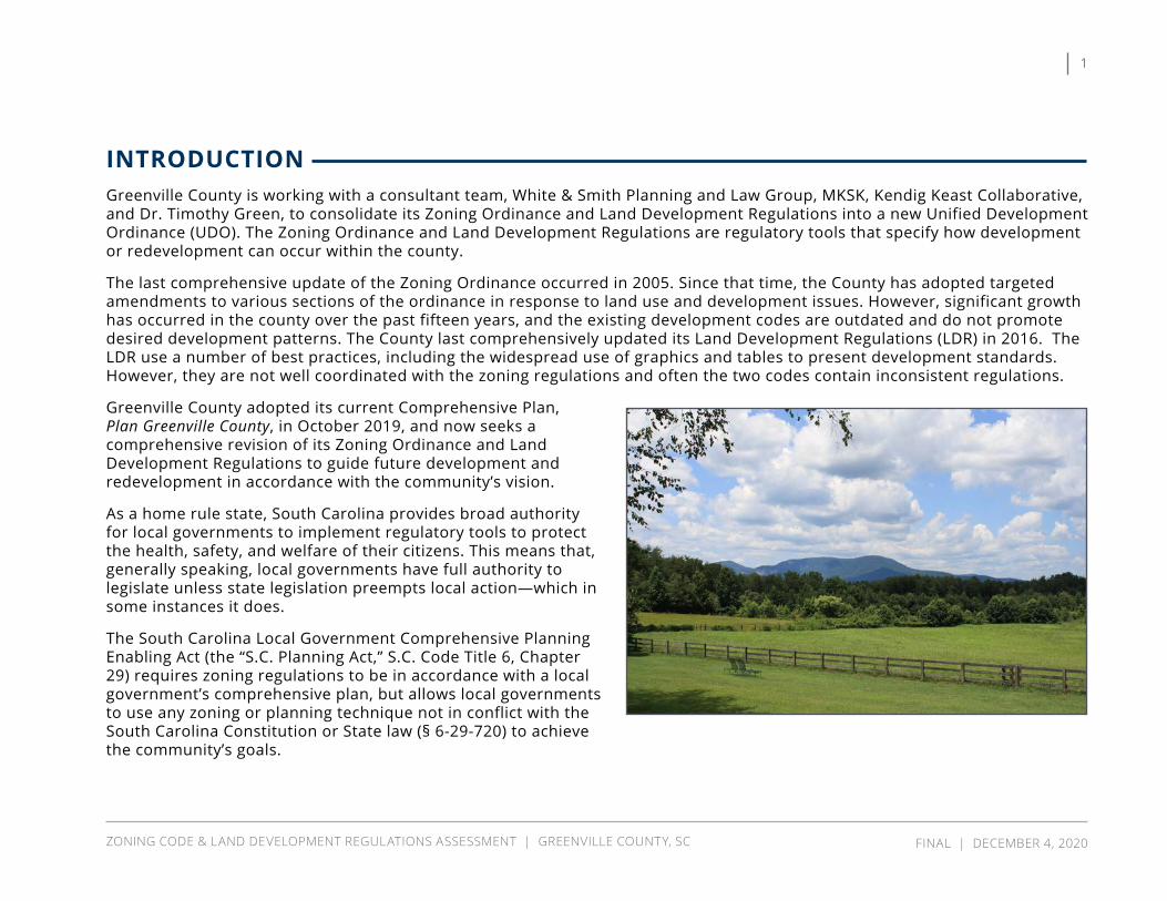
INTRODUCTION Greenville County is working with a consultant team, White & Smith Planning and Law Group, MKSK, Kendig Keast Collaborative, and Dr. Timothy Green, to consolidate its Zoning Ordinance and Land Development Regulations into a new Unified Development Ordinance (UDO). The Zoning Ordinance and Land Development Regulations are regulatory tools that specify how development or redevelopment can occur within the county.
The last comprehensive update of the Zoning Ordinance occurred in 2005. Since that time, the County has adopted targeted amendments to various sections of the ordinance in response to land use and development issues. However, significant growth has occurred in the county over the past fifteen years, and the existing development codes are outdated and do not promote desired development patterns. The County last comprehensively updated its Land Development Regulations (LDR) in 2016. The LDR use a number of best practices, including the widespread use of graphics and tables to present development standards. However, they are not well coordinated with the zoning regulations and often the two codes contain inconsistent regulations.
Greenville County adopted its current Comprehensive Plan, Plan Greenville County, in October 2019, and now seeks a comprehensive revision of its Zoning Ordinance and Land Development Regulations to guide future development and redevelopment in accordance with the community’s vision.
As a home rule state, South Carolina provides broad authority for local governments to implement regulatory tools to protect the health, safety, and welfare of their citizens. This means that, generally speaking, local governments have full authority to legislate unless state legislation preempts local action—which in some instances it does.
The South Carolina Local Government Comprehensive Planning Enabling Act (the “S.C. Planning Act,” S.C. Code Title 6, Chapter 29) requires zoning regulations to be in accordance with a local government’s comprehensive plan, but allows local governments to use any zoning or planning technique not in conflict with the South Carolina Constitution or State law (§ 6-29-720) to achieve the community’s goals.
1
ZONING CODE & LAND DEVELOPMENT REGULATIONS ASSESSMENT | GREENVILLE COUNTY, SC FINAL | DECEMBER 4, 2020
This project’s overarching purposes are to implement Plan Greenville County planning policies and bring Greenville County’s zoning and development regulations into the 21st century, with the following specific project goals:
» Provide a Comprehensive Framework for Development. Greenville County covers a range of urban, traditional, suburban, and rural settings. It is a diverse community with quickly urbanizing areas near municipal population centers, suburban residential neighborhoods and retail centers, historic mill villages, industrial developments, rural homesteads, agricultural lands, open spaces, and undeveloped lands. The codes must cover all development contexts in a way that is appropriate for their neighborhood, market, and environmental settings. A one-size-fits all approach will not work.
» Ensure the UDO Is User-Friendly. The UDO should be easy to use for the general public, applicants, and administrators. Information should be logically arranged, easy to find, and with language and graphics that are attractive and clear.
» The UDO Should Have Community Support. A development code is not just a document – it is a process. It should reflect the input of a broad range of stakeholders – from neighborhoods to the development and business community. This will ensure its processes and metrics are understood and will give it sustainable, long-term support.
» The UDO Should Make the Right Things Easy. Development that reflects the long-term planning policies of Plan Greenville County, community and area plans, and other adopted plans should have a streamlined approval process. Standards that pose a barrier to redevelopment and adaptive reuse should be revised or eliminated.
» The Codes Should be Up to Date. The current Zoning Ordinance and Land Development Regulations blend conventional zoning requirements with more modern, character-focused site design standards (such as planned neighborhood commercial districts and traditional neighborhood developments). There also are a number of development-related ordinances that are not part of the Zoning Ordinance, such as the Sign Ordinance and ordinances for specific land uses, including motor sports, junkyards, and adult-oriented businesses. The new UDO will deliver a comprehensive, vertically integrated approach to Greenville County’s zoning, design, and development objectives. The UDO will provide the tools for redevelopment and adaptive reuse, mixed use centers, and sustainability available in modern form-based codes – but with a language, metrics, and processes that are easy to use. In addition, there are elements of conventional zoning that remain viable – such as sensible use regulations that protect neighborhoods and landscaping in suburban contexts. The codes should reflect best practices, but avoid making unnecessary changes simply to be trendy.
2
ZONING CODE & LAND DEVELOPMENT REGULATIONS ASSESSMENT | GREENVILLE COUNTY, SC FINAL | DECEMBER 4, 2020
INTRODUCTION

» Right-Size the Standards and Procedures. The codes should not over- or under-deliver. Greenville County expects a given level of design, and the zoning and land development standards should ensure development reflects those expectations. However, the standards should reflect the needs and context of Greenville County rather than national trends or fads.
» The Codes Should Promote Community Cohesion. While parts of the community have experienced significant growth, other areas, particularly in the northern and southern portions of Greenville County, are rural in character and are anticipated to remain so for the foreseeable future. The current Zoning Ordinance and Land Development Regulations do not reflect the differences in desired development patterns and standards in different areas of the county. While the neighborhoods and corridors are different, they should all receive equal and equitable attention in the UDO’s use, dimensional, and design metrics.
» Provide a Clear, Fluid Administrative Process. Entitlement processes should be efficient, expand opportunities for administrative review, and coordinate with substantive changes to the codes.
» Avoid Nonconformities. Any substantive change to the zoning districts or development standards will likely create nonconformities. Our approach will consider regulations that minimize nonconformities by exploring standards that reflect the best aspects of current development patterns and eliminating unnecessary and outdated standards. We will also include standards to process existing nonconformities or recognize the legality of minor or beneficial deviations from the new UDO. This will minimize variance requests, potentially avoid litigation, and improve public support for the UDO.
» Provide Enforcement Tools. At its core, zoning and land development regulations are legal documents. They provide Greenville County the authority to regulate and condition development. However, the UDO must be enforceable to serve its intended purpose. We will explore tools to improve enforceability. These include reporting requirements, compliance plans, and improved notification procedures. These processes will align with South Carolina land use law.
3
ZONING CODE & LAND DEVELOPMENT REGULATIONS ASSESSMENT | GREENVILLE COUNTY, SC FINAL | DECEMBER 4, 2020
INTRODUCTION

BACKGROUND
A. PROJECT KICK-OFF On June 24 and 25, 2020, the Consultant Team met with Greenville County staff and stakeholders in a series of virtual Focus Group Sessions to discuss the current codes. These meetings resulted in a list of issues relating to the existing zoning and land development regulations, ranging from big-picture items (such as how to reorganize the codes) to specific regulatory issues (such as review districts, open space requirements, and riparian buffers). In addition, Plan Greenville County includes implementation recommendations that detail specific areas of the codes where amendments are desired.
A consistent theme that emerged during the Focus Group Sessions is the need to align the development codes with Plan Greenville County. The comprehensive planning process generated significant community interest in and support for updating the codes to implement the recommendations expressed in the plan. As described in the Plan, a one-size-fits-all approach to zoning and land development is not appropriate for Greenville County. The zoning and land development regulations should recognize the differences in development patterns and growth potential in the rural, suburban, and more urban areas of the county.
Plan Greenville County identifies “Character Areas” and sub-areas (or “Place Types”). There was general support among stakeholders for implementing these Character Areas through the UDO, particularly if it will provide opportunities for more predictable, by-right development. Residents want to see consistent development quality throughout Greenville County and better transitions where the unincorporated county borders municipalities.
Another consistent theme that emerged is the need to simplify and increase predictability in the development process, particularly for subdivisions in the un-zoned areas. There is widespread concern with Land Development Regulations Section 3.1 and the degree of discretion it introduces into the subdivision process. We understand that, due to the complexity of the issue and the need to act expeditiously, Greenville County is working now to address this particular concern separately from the development of the Unified Development Ordinance. This assessment includes comments from stakeholders related to the un-zoned areas since it was a consistent concern amongst most Focus Groups.
4
ZONING CODE & LAND DEVELOPMENT REGULATIONS ASSESSMENT | GREENVILLE COUNTY, SC FINAL | DECEMBER 4, 2020

This assessment addresses specific revisions to the codes suggested by stakeholders, as well as revisions identified in Plan Greenville County and by the consultant team in its review of the current codes. This assessment is designed to allow Greenville County and the consultant team to focus their efforts on the specific issues identified during the project kick-off meetings, based on feedback from the County and stakeholders. It is not the final word on the new Unified Development Ordinance, nor does it cover all anticipated revisions; rather, the report provides an opportunity for the County to verify the primary areas of focus during development of the new UDO.
B. COMPREHENSIVE PLAN Greenville County completed its Comprehensive Plan, Plan Greenville County, in January 2020. The plan is divided into ten elements, each focused on a particular aspect of the community, such as land use, agriculture and food security, transportation, and economic development. Each element includes a series of goals, objectives, and implementation strategies designed to address community issues, needs, and opportunities identified during the comprehensive planning process. A number of recommended strategies include specific actions related to the development code, such as requiring stream buffers (Objective D-2, Strategy 2.) and sidewalks (Objective F-3, Strategy 1.).
Plan Greenville County recognizes that the current development regulations do not align with the goals of the Plan and calls for the adoption of a new Unified Development Ordinance (UDO) to implement the Plan
5
ZONING CODE & LAND DEVELOPMENT REGULATIONS ASSESSMENT | GREENVILLE COUNTY, SC FINAL | DECEMBER 4, 2020
BACKGROUND: COMPREHENSIvE PLAN

(one of four recommended “Next Steps”). The citizens of Greenville County want to align the zoning and land development regulations to implement the Future Land Use Map (FLUM) in zoned and un-zoned areas of the County. The current codes are outdated, and citizens expressed frustration that the current codes do not support the Comprehensive Plan.
The Plan calls for a new UDO that will create separate character areas with distinct development styles. These character areas require a way to addresses the appearance and physical form of buildings in ways that the current regulations do not. In addition, the Comprehensive Plan recognizes that Greenville County is no longer just suburban, but many unincorporated areas of the County are urbanizing also. The UDO can help shape this growth to fit the vision stated in the Comprehensive Plan.
C. COMMUNITY & AREA PLANS For more than 25 years, Greenville County has worked with its citizens to create community- and area-specific plans for different parts of the unincorporated county, including many historic mill villages. These plans address a variety of community issues and opportunities including land use—although land use generally is not the major focus of the plans. The plans are intended to help guide decision-making but, like the Comprehensive Plan, are not regulatory. Plans for the Scuffletown and Taylors areas did result in the adoption of zoning districts for these areas to implement some of the plan recommendations.
Plan Greenville County builds on these (and other) prior planning efforts to create a shared vision for the future
of Greenville County and its distinct neighborhoods and communities. Development of the new UDO will consider ways in which the new and revised standards can support community goals expressed in the county-wide plan, as well as in the community and area plans.
This graphic from Plan Greenville County illustrates the variety of community, area, and other plans that help guide decision-making.
6
ZONING CODE & LAND DEVELOPMENT REGULATIONS ASSESSMENT | GREENVILLE COUNTY, SC FINAL | DECEMBER 4, 2020
BACKGROUND: COMMUNITy & AREA PLANS

D. EXISTING DEVELOPMENT-RELATED ORDINANCES Greenville County’s current Zoning Ordinance applies in only approximately one-third of the unincorporated county. The remaining two-thirds of the county is un-zoned and subject only to the Land Development Regulations and other county-wide regulations such as the motor sports and junkyard ordinances. These areas of the county are anticipated to remain un-zoned. However, according to Plan Greenville County, the community desires a certain degree of regulation in the un-zoned areas to ensure new development and redevelopment is compatible with the character of existing development. The new UDO must consider the most appropriate ways to regulate development character in un-zoned areas and to clearly distinguish between zoning regulations and land development regulations in accordance with the SC Planning Act.
1. Zoning Ordinance The current Zoning Ordinance is codified as Appendix A to the Greenville County Code of Ordinances. It does not appear online with the rest of the County Code on the American Legal website, and instead is maintained as a PDF document available on the Planning Department’s website.
The Zoning Ordinance is divided into numbered articles, sections, and subsections, each of which contain the numbers of the higher level order for ease of navigation. The ordinance begins with sections on the purpose and applicability of the regulations, followed by a variety of legal provisions. Article 2 establishes the Review and Decision-
Making Bodies responsible for zoning-related land use decisions. Article 3 sets forth the review procedures for zoning applications. Article 4 defines terms used in the Zoning Ordinance.
Articles 5 and 8 establish the County’s zoning districts, and Articles 6 and 11 establish regulations for specific land uses. Articles 7 and 12 establish density and development standards, including parking, height, and screening requirements. Article 10 establishes standards for group developments, which are cohesive multi-building developments with shared parking areas.
Article 9 contains a variety of unrelated provisions, such as nonconformities, adequate water/sewer facilities, and parking and storage of travel trailers and commercial vehicles in residential districts. The Zoning Ordinance ends with Article 13, which includes violation and enforcement provisions.
The Table of Contents indicates the Zoning Ordinance has several appendices:
» Sign Ordinance » Transportation Corridor Preservation Ordinance (#4326) » Junk yard Ordinance (#1777) » Adult-Oriented Business Ordinance (#2673) » Transfer of Development Rights for ESD-PM District » Motor Sports Ordinance » Obsolete Districts
7
ZONING CODE & LAND DEVELOPMENT REGULATIONS ASSESSMENT | GREENVILLE COUNTY, SC FINAL | DECEMBER 4, 2020
BACKGROUND: EXISTING DEvELOPMENT-RELATED ORDINANCES
Although the provisions of the Zoning Ordinance do not apply in un-zoned areas of Greenville County, it appears most of these appendices apply in both zoned and un-zoned areas. In addition, the adult-oriented business regulations are codified in Chapter 2.5, Article III, of the County Code.
2. Land Development RegulationsThe current Land Development Regulations (LDR) are codified as Appendix C to the Greenville County Code of Ordinances. Like the Zoning Ordinance, the LDR do not appear online with the rest of the County Code on the American Legal website, and instead are maintained in a PDF document available on the Planning Department’s website.
The LDR uses formatting consistent with the Zoning Ordinance. The LDR are divided into numbered articles, sections, and subsections, each of which contain the numbers of the higher level order for ease of navigation.
The LDR begin with legal and administrative provisions, followed by definitions. Article 3 establishes procedural requirements for each type of subdivision. Article 4 establishes general survey requirements in accordance with State law. Article 9 contains requirements for another procedural requirement for traffic impact studies for large developments.
Articles 5 and 6 classify streets and establish street design and construction standards. Article 7 addresses water and sewer infrastructure. Stormwater management infrastructure requirements are established in Article 11.
Article 8 contains some basic subdivision design standards, mainly related to lot layout. Articles 10 through 16 set forth site design standards for different development types, such as industrial, commercial, multi-family, cluster, traditional neighborhoods, and Rv parks. Articles 18 through 21 establish procedural requirements for site plan review in planned and review zoning districts, including the Planned Office, Neighborhood Commercial, Planned Development, and Flexible Review Districts.
The LDR include seven appendices: » Subdivision Jurisdiction Map » Acceptable Plant Material List » Specifications for Alternative Traffic Calming Measures » Water Quality Guidelines for Commercial & Community Facility Parking Lots
» Low Impact Development Features within the Centers and Corridors
» Miscellaneous Design Details » Density Bonus for Low Impact Development Program (Stormwater Banking Program)
The Stormwater Banking Program also is codified as Appendix E to the County Code of Ordinances.
8
ZONING CODE & LAND DEVELOPMENT REGULATIONS ASSESSMENT | GREENVILLE COUNTY, SC FINAL | DECEMBER 4, 2020
BACKGROUND: EXISTING DEvELOPMENT-RELATED ORDINANCES

AREAS OF RECOMMENDED CHANGES
A. INCREASE COMPATIBILITY & CONSISTENCY WITH MUNICIPALITIES The stakeholder groups revealed that numerous municipalities struggle with compatibility of development in the transition areas from municipal to County jurisdiction because there are major differences between what can be built in the county and the cities. This disconnect can be alleviated by revision of the regulations to provide more consistent treatment of zoning and land development along these municipal boundaries. The regulations should provide consistency at the boundaries of municipalities and better transitions in intensity between unincorporated and incorporated areas.
In particular, the cities’ development regulations emphasize connectivity, sidewalks, and landscaping, but the County’s regulations do not include similar requirements. Similarly, mass grading is allowed in the county but typically is not allowed in cities. The different regulations can result in “jurisdiction shopping” by developers and create difficulties in the annexation process for cities. Some examples raised by the stakeholders included Fountain Inn’s northern boundary with the Scuffletown Rural Conservation overlay district and high growth areas, such as the unincorporated areas outside Fountain Inn and Mauldin. Fountain Inn has the opposite of the usual growth pattern, where the City wants to keep its historic downtown low density with higher density on the edges, but county regulations do not provide for the type of density needed to accommodate the growth. Mauldin also has a need for higher density development on its edges to accommodate growth.
B. IMPROVE CODE ORGANIZATION, FORMATTING, & USABILITY The Zoning Ordinance is divided into numbered articles, sections, and subsections, each of which contain the numbers of the higher level order for ease of navigation. While many sections and subsections are divided into lettered and numbered paragraphs, others include long or multiple paragraphs. This makes the ordinance difficult to read and information difficult to find.
The ordinance begins with sections on the purpose and applicability of the regulations, followed by a variety of legal provisions. While Articles 1, 2, and 3 are important components of the ordinance, they are not used as often as specific zoning and use regulations, and generally should be located towards the middle to end of the ordinance. The zoning district and use regulations are the most often used portions of a development code and should be placed near the front. In the current code, these regulations are spread out into four non-consecutive articles (Articles 5, 6, 7, 8, and 11).
9
ZONING CODE & LAND DEVELOPMENT REGULATIONS ASSESSMENT | GREENVILLE COUNTY, SC FINAL | DECEMBER 4, 2020
Article 4 defines terms used in the Zoning Ordinance. Most readers expect to find a glossary at the end of a document. Stakeholders generally support consolidation of all zoning-related definitions into one article at the end of the UDO.
Article 9 contains a variety of unrelated provisions, which should be consolidated with related provisions in other sections of the UDO. For example, Section 9:5 regulates parking of travel trailer and commercial vehicle parking in residential districts. These provisions should be located with other parking standards or potentially in the use regulations.
The Zoning Ordinance and LDR present a variety of quantitative standards in a table format and includes illustrations, which are best practices to improve clarity and usability. The UDO will carry these forward and will include additional tables and illustrations where they would assist the reader.
The primary goal of the Unified Development Ordinance is to combine land development regulations and zoning into one seamless regulatory framework. The new UDO will be easier to understand and administer because it will include use tables and illustrations that clarify the concepts in a user-friendly way. The new UDO will also define dimensional standards for each applicable zoning district category that will coordinate the density and intensity of development. In order to accomplish this task, it will be necessary to determine which portions of the Zoning Code and Land Development Regulations Appendices and other ordinances, such as those regulating Motor Sports Facilities, are to be included in the new UDO. For example, stakeholders and staff indicated it might not be appropriate to include the
Greenville-Pickens Area Transportation Study (GPATS) right-of-way preservation regulations in the new UDO. However, it will be necessary to identify an appropriate location for the regulations to ensure that the area for future rights-of-way are maintained for future transportation infrastructure.
The technical and functional goals for the UDO will be to provide more consistency and clarity. The stakeholders reported that there are many gray areas in the current code that create difficulties in application. While the new UDO will seek to maintain flexibility, the UDO will be more intentional about what is subject to flexibility and what is not. In addition, the Zoning Ordinance and LDR are not well coordinated, so the UDO will provide a coordinated regulatory process. It will combine and consolidate standards for ease of review and administration. In addition, the UDO will improve consistency and clarity by allowing developers and staff to look in one location to determine applicable standards.
The stakeholders and the consulting team’s analysis of the current ordinances revealed many technical issues with the definitions, internal consistency, and technical components of the current ordinances. The stakeholders noted situations where the code provisions are inconsistent with the actual intent of the regulations. In order to improve on the process, the UDO will use clear language and revise vague language that results in differing interpretations. Language providing consistent interpretation is essential for reducing delays in development approvals and will limit the need to amend the code to clarify ambiguities. The intent of the Comprehensive Plan and the desired end state are key to directing these revisions.
10
ZONING CODE & LAND DEVELOPMENT REGULATIONS ASSESSMENT | GREENVILLE COUNTY, SC FINAL | DECEMBER 4, 2020
AREAS OF RECOMMENDED CHANGES: IMPROvE CODE ORGANIZATION, FORMATTING, & USABILITy

Finally, the UDO will modernize the Zoning Code for improved performance. While there is nothing inherently wrong with the current regulations, the framework was developed in the early 2000s, and a lot has changed in the real estate development industry since then. This modernization should provide improved performance for the foreseeable future. Examples of modernization include a revision of the use table to accommodate new and emerging trends in real estate development. In addition, the stakeholders reported that flowcharts, white papers, short handouts, or development guidebooks would aid in understanding the UDO.
C. REVISE THE ZONING DISTRICTS
1. Generally The new Unified Development Ordinance will ensure that each zoning district has a clear purpose and desired end-state. In order to accomplish this goal, the UDO will consolidate district-specific requirements into one section. This revision will clarify and simplify the regulation of density, lot dimensions, and setbacks. Such a revision would allow the creation of a short handout with the characteristics of each district that would be understandable to developers, applicants, and Greenville County’s citizens.
2. Density With Greenville County’s success in attracting new industry and new residents, it is understandable that many of the focus groups expressed concerns about the effects of growth. In particular, the density of new development is a concern for most community members, regardless of how they feel about zoning. There is an ongoing community conversation regarding the degree to which the County should use density as a metric. One of the important ideas that emerged was that the County should move more towards density-based zoning rather than lot size to manage growth. This type of proposal would accommodate higher density by eliminating minimum lot sizes in high-growth areas where sewer service and adequate transportation infrastructure is available.
11
ZONING CODE & LAND DEVELOPMENT REGULATIONS ASSESSMENT | GREENVILLE COUNTY, SC FINAL | DECEMBER 4, 2020
AREAS OF RECOMMENDED CHANGES: REvISE THE ZONING DISTRICTS

The focus groups and staff identified an increasing need for affordable housing, and the County has recently received a report on the need for “missing middle” housing. Missing Middle Housing are housing types that fall between single-family detached and large apartment buildings. These housing types are not provided in sufficient numbers and include duplexes, triplexes, fourplexes, cottage courts, and townhouses. Including these residential building types would increase the density of residential development to improve affordability issues created by high growth and would better meet the market demands driven by changing resident lifestyles. The smaller footprints of these housing types generally make them more affordable, and they would also accommodate more growth in focused areas instead of allowing a sprawling development pattern that would continue to deplete the County’s farmland and open spaces.
The un-zoned areas of the County present a particularly difficult example of regulating density and preserving farmland and open space. The focus groups and staff identified difficulty in regulating density in the un-zoned areas of the County. Currently, the LDR do not regulate density in the un-zoned areas of the County. However, minimum lot sizes of ½-acre apply to most lots in these areas due to DHEC’s septic system regulations, unless DHEC requires larger lots due to poor soil conditions. The DHEC regulations practically define lot sizes based on whether the lot has well water and septic, water service and septic, or water service and sewer.
The revision of the subdivision regulations would bring the current development pattern in line with the density goals of the comprehensive plan instead of the current reality
driven by DHEC’s regulatory requirements. For example, the comprehensive plan’s goal for density in the un-zoned areas is 1 dwelling unit per 2 acres, which is inconsistent with the ½ acre minimum lot sizes implied by DHEC’s regulations. The current LDR seek to address this deficiency by requiring new subdivisions to be “compatible” with the surrounding area. If, under the S.C. Planning Act and other applicable statutes, density cannot be used to regulate development in the un-zoned areas, a minimum lot size could accomplish similar objectives.
In developing the new UDO, Greenville County could consider the use of dynamic zoning in appropriate areas, such as urban/core areas and mixed-use corridors, to gradually increase allowable density and development intensity. This could help reduce development pressure in the un-zoned areas. These types of regulatory options are particularly important because there is little desire to apply zoning to the currently un-zoned areas of the County.
3. Agricultural Districts With its rapid growth, Greenville County risks losing the farmland and open space that contribute to the quality of life of many of the County’s residents. The Comprehensive Plan identified the goal to “Protect Prime Farmland” as one of the primary land use goals, with several specific land use strategies included (p. 132-133). Stakeholders also support farmland and open space preservation as an essential item for consideration in the UDO. A large portion of prime farmland in the County is located in un-zoned areas in southern Greenville County. In addition to the issue of farmland preservation, many other communities
12
ZONING CODE & LAND DEVELOPMENT REGULATIONS ASSESSMENT | GREENVILLE COUNTY, SC FINAL | DECEMBER 4, 2020
AREAS OF RECOMMENDED CHANGES: REvISE THE ZONING DISTRICTS

have experienced conflicts between expanding residential use and agricultural production, which has led to the widespread adoption of state “right to farm” legislation.
First, in order to align the regulations with the locations of prime farmland, it is important to ensure the most recent and accurate data is used. The County planning staff has obtained Geographic Information Systems (GIS) datasets to map locations of prime farmland. In addition, the American Farmland Trust recently completed a study of prime soils in each state. While farmland and open space preservation is a valid goal for preserving a community’s heritage and quality of life, preservation of prime soils is a very important issue because these soils are the most productive and suitable for agricultural use, and they produce the highest yields per acre. Importantly, once agricultural land is converted to residential use, it is permanently taken out of agricultural production.
In order to preserve prime agricultural land for current use and future generations, the County could consider several options. One option the stakeholders raised is the creation of a true agricultural zoning district. This type of district provides for agricultural production and limited residential use that is accessory to the farm uses. The County could also consider adding incentives to preserve certain areas, which could be based on factors such as location, soil types, or prime farmland. This strategy could be especially effective in un-zoned areas. The County could also implement site analysis that incorporates soil quality considerations, such as the USDA’s Land Evaluation and Site Assessment system (the LESA system) during rezoning requests.
Plan Greenville County recommends over two dozen strategies in support of Goal C, which is to “protect
farmland for local food production and ensure access to healthy foods for all citizens.” Strategy 4, a short-term
implementation strategy, is to “ensure the ability of a farm to have a farm-related business on-site.”
During development of the UDO, we will analyze barriers to agritourism uses and revise standards to allow and
encourage on-site farm businesses.
13
ZONING CODE & LAND DEVELOPMENT REGULATIONS ASSESSMENT | GREENVILLE COUNTY, SC FINAL | DECEMBER 4, 2020
AREAS OF RECOMMENDED CHANGES: REvISE THE ZONING DISTRICTS

Finally, there are other strategies the County could implement to improve yields and adapt to changes in agricultural production, such as allowing farm businesses (e.g., farm stands and sales of farm products) on farm sites. In fact, Plan Greenville County Objective B-1, Strategy 6 is to encourage agritourism as a method of supporting continued farming. The Comprehensive Plan establishes additional strategies in the section on Agriculture and Food Security that can be directly implemented through land use regulations. These strategies will be evaluated for implementation through the UDO.
4. Residential Districts Reducing the number of zoning districts can simplify zoning codes in general, and Greenville County’s numerous zoning districts present an opportunity for simplification. For example, there are ten residential single-family districts outlined in the code. Some of these districts vary only slightly from each other. Stakeholders indicate the slight variations in zoning districts over-emphasize the importance of many rezoning requests. The rezoning notice implies a major change, but the proposed changes typically results in no change in the land use and little change in density. Therefore, the rezoning request creates significant public outcry and expends administrative time for little actual change. Stakeholders pointed out that the City of Simpsonville recently reduced the number of its residential districts, and this change has worked well. The consulting team will review lot sizes for residential districts to recommend specific changes to the residential zoning framework.
5. Commercial & Industrial Districts While Greenville County has experienced significant commercial and industrial growth over the past thirty years, stakeholders pointed to a need to have more available, appropriately zoned land for commercial and industrial uses. The real estate community reported they are seeing increasing conversion (through rezoning) of industrial to residential use. They informed the consulting team that the profitability of residential development exceeds that for industrial use. If the County desires to maintain future growth in industrial development and employment, the County will need to maintain viable industrial-zoned properties on appropriate sites with utilities and transportation access.
6. Special Purpose & Review Districts Special purpose and review districts are an important issue discussed by many of the stakeholder groups. While Greenville County has several special purpose districts, such as the Historic Preservation District, that can help to preserve the character of Greenville County, many of the stakeholders reported widespread use of the Planned Development District (PD) and Flexible Review District (FRD) in current practice. These districts allow deviations from otherwise applicable zoning and development standards. The widespread use of these districts indicates the base zoning districts could be improved to better accommodate the type of development desired by the community and the real estate market. The PD and FRD should be reserved for truly unique development that is not accommodated by the base districts. Stakeholders feel the rezoning and
14
ZONING CODE & LAND DEVELOPMENT REGULATIONS ASSESSMENT | GREENVILLE COUNTY, SC FINAL | DECEMBER 4, 2020
AREAS OF RECOMMENDED CHANGES: REvISE THE ZONING DISTRICTS
development approval process for review districts is too long, and that major changes should be made to the regulations to simplify and expedite the process.
Some stakeholders recommended changing the process for special purpose and review districts so that there are more administrative approvals and less review by the Planning Commission and County Council. The stakeholders made similar recommendations for Character Areas in zoned and un-zoned areas. This type of change would allow more uses by-right and provide more authority for staff to approve minor changes in PDs and review districts. The UDO would specifically identify items that constitute minor changes and those that constitute major changes requiring approval by County Council. This type of change also would require less time from the Planning Commission and County Council and would result in fewer contentious rezoning requests.
Stakeholders also suggested that the consulting team evaluate ways to streamline the different Review Districts to make them more cohesive. This could be accomplished by applying the same process for major or minor changes in all Review Districts. The stakeholders reported that PD and FRD approvals take too long--six months, including Final Development Plan--and require significant staff time to process. They reported that the review process includes too many steps and redundant reviews. Planning staff already is working to streamline internal review processes, particularly those related to the Review Districts.
In addition, stakeholders reported inconsistent interpretations of the Land Development Regulations from project to project. The stakeholders also noted the LDR include standards for some Review Districts (which are established in the Zoning Code), and these should be evaluated for consistency and clarity.
REVIEW DISTRICT PROCESS
Step 1: Review District Rezoning
Step 2: Land Disturbance Permit Approval
Step 3: Final Development Plan Application
• Applicant undergoes typical rezoning process to rezone aproperty to a review district and meet any conditions placedon the rezoning approval by County Council.
• Applicant submits a Land Disturbance Permit for site work.
• Submitted civil plans include a site plan for Zoning staff to review to ensure compliance with Section 3:9 of the Zoning Ordinance and approved review district documentation(Step 1). Additionally, the site plan for single-family residential review districts will match the approved Preliminary Plat.
• Zoning staff provides any necessary comments and reviews the revised plans.
• When plans meet all applicable requirements, Zoning staff approves its portion of the Land Disturbance Permit.
• Applicant submits a building plan set. A Final DevelopmentPlan application is included in the building plan applicationpackage.
• Applicant delivers a completed Final Development Planapplication to the Zoning counter. Zoning staff acceptsthe application and a payment of $75, and provides theapplicant with a set of red “Plan Review” signs for posting fora period of 15 days.
• Zoning staff reviews the site plan included in the buildingplan set and compares it to the site plan approved duringthe LDP process (Step 2) and Section 3:9 of the ZoningOrdinance. If comments are needed, Zoning staff includesthem here.
• When Zoning staff has a site plan that meets all applicablerequirements, Zoning staff approves its portion of thebuilding plan set.
For single-family residential:
• The above process is the same, except the applicant includes the Final Development Plan application withthe Final Plat submittal. The applicant brings the application and payment to the Zoning counter and thenreceives red “Plan Review” signs for posting for a period of 15 days.
• Zoning staff reviews the Final Plat in accordance with the regulations for submittals under the LandDevelopment Regulations and to ensure compliance with the approved Preliminary Plat.
$
Step 4: Final Development Plan Approval
• Applicant calls in for inspections and a Building Inspector goes into the field to verify the site is developed per the approved plans. If not, the Building Inspector denies and requires changes. If so, the Building Inspector approves the site inspection. Approval generates a Certificate of Occupancy for the site.
• Upon approval, Zoning Staff issues a “Letter of Completion” for the review district accepting the site plan as the approved Final Development Plan.
For single-family residential:
• When the Final Plat is completed and recorded, Zoning staff generates a “Letter of Completion” for the review district accepting the Final Plat as the approved Final Development Plan.
Greenville County Planning staff is working to streamline internal review processes, particularly those related to
Review Districts. This also includes development of tools, such as this handout, to help clarify the process for
applicants and citizens.
15
ZONING CODE & LAND DEVELOPMENT REGULATIONS ASSESSMENT | GREENVILLE COUNTY, SC FINAL | DECEMBER 4, 2020
AREAS OF RECOMMENDED CHANGES: REvISE THE ZONING DISTRICTS
The stakeholders addressed several of the special purpose districts, including the Environmentally Sensitive District-Paris Mountain (ESD-PM), Historic Preservation Districts, and the Business and Technology Park District. The stakeholders recommended that the consulting team review and revise the ESD-PM district to simplify it and to make it easier to track and monitor program objectives. The consulting team will also evaluate other strategies for regulation that would make environmental preservation requirements easier to implement and administer.
The stakeholders suggest the UDO should clarify applicability and standards for the Historic Preservation District to encourage its more frequent use. They cited the Scuffletown Rural Conservation District and the Taylor’s Main Street Development District as good examples of districts designed to preserve the character of an area while providing a framework for growth..
The stakeholders also requested that the consulting team explore ways to expand the concepts of the Business & Technology Park District. A broader application of the standards from this district could create more opportunities for the flexibility needed to attract businesses to Greenville County.
In general, projects developed as PDs and FRDs are a “good benchmark” of market segment demand and also to indicate gaps in the conventional zoning districts. Stakeholders reported that review districts are used for many reasons, but are primarily used to satisfy neighboring landowners that sufficient buffers and other mitigation will be implemented as part of the project. In addition, PDs and FRDs allow County Council to condition development
approvals on matters that are important to their constituents, like mitigation of potential negative impacts of new development.
Many developers choose the Flexible Review District option because it is “easier” to zone this way. However, projects developed using this option are not necessarily better or more unique than projects developed under a standard base zoning district. The FRD is the developers’ solution for residential product types and lot sizes that don’t fit in other districts, including the combination of single-family detached and attached (townhouse) in one development. Stakeholders believe it is better to reserve PDs and FRD for truly unique cases and to develop other techniques for more standard development projects. The consulting team will evaluate and recommend strategies to include some of the positive aspects of these review districts into standard zoning that will provide the flexibility to respond to market demand for different housing types.
Stakeholders reported that the UDO should reduce the need to apply conditions to rezonings. Overall, the stakeholders and consulting team discussed the need for well-defined triggers in PDs and FRDs for transportation improvements, such as a threshold for traffic impact studies and mitigation. A Countywide Mobility Plan, as recommended by Plan Greenville County as a key “next step” in implementation of the Plan, could help to define the triggers for impact studies and mitigation. Stakeholders also reported that project phasing causes a problem because developers want to wait until the end to complete infrastructure that will mitigate conflicts. Therefore, the consulting team will evaluate when and how the County should require developers to install or contribute to mitigation.
16
ZONING CODE & LAND DEVELOPMENT REGULATIONS ASSESSMENT | GREENVILLE COUNTY, SC FINAL | DECEMBER 4, 2020
AREAS OF RECOMMENDED CHANGES: REvISE THE ZONING DISTRICTS

Finally, stakeholders reported issues with “legacy PDs,” or PDs that are not fully developed. This situation is common where developers cease to operate or where economic conditions or housing preferences change. However,
it can create conflicts because existing residents have expectations that a new developer may not be able to meet. The consulting team will review examples of some legacy PDs and consider alternatives to better regulate them.
D. MODERNIZE THE LAND USES & USE REGULATIONS
1. Generally The stakeholder feedback developed around several general concepts to pursue in the development of the UDO. The stakeholders thought that the current code produces “compartmentalized” land use, where there is too much segregation of uses. They believe there should be a way to more easily develop mixed use projects. They generally support “cumulative” zoning but recognized that this can push developers towards PDs and FRDs to limit uses to address the concerns of neighbors. In addition, stakeholders think the UDO should focus more on the scale and impact of development than specific uses. They believe land use balance should be the overarching goal, citing the trend of industrial zoning “losing out” to residential due to market forces.
The current use table lists approximately 150 land uses, with several additional uses (not listed in the table) allowed in the BTD District. While 150 uses appears to be a long list, the use regulations do not reflect the broad range of contemporary uses that are likely to occur in the community. For example, the 2017 North American Industrial Classification System (NAICS) includes 1,059 separately listed 6-digital codes. While the use table will need to classify most of these in broader use categories,
the uses should be audited to ensure there is a place for all businesses, service agencies, and residential categories that the community needs.
Figure 1 illustrates the number of allowed land uses in the base zoning districts, based on the type of use (permitted, conditional, or special exception). This includes the additional five BTD District uses. There are an average of 6 permitted, 14 conditional, and 13 special exception uses in the residential districts; and an average of 40 permitted, 9 conditional, and 6 special exception uses in the non-residential districts.
The allowed uses in the non-residential districts generally reflect the cumulative zoning technique mentioned by stakeholders, where the more intensive districts allow, in addition to other uses, the same uses allowed in lower intensity districts.
However, this approach generally is not reflected in the I-1, I-2, and BTD Districts. I-2 and BTD have fewer allowed uses than nearly all the other districts, including residential. Limiting land uses in these specialized business and industrial districts is appropriate, as it helps to limit encroachment of incompatible land uses.
17
ZONING CODE & LAND DEVELOPMENT REGULATIONS ASSESSMENT | GREENVILLE COUNTY, SC FINAL | DECEMBER 4, 2020
AREAS OF RECOMMENDED CHANGES: MODERNIZE THE LAND USES & USE REGULATIONS

Figure 1. Number of Allowed Land Uses per District
18
ZONING CODE & LAND DEVELOPMENT REGULATIONS ASSESSMENT | GREENVILLE COUNTY, SC FINAL | DECEMBER 4, 2020
AREAS OF RECOMMENDED CHANGES: MODERNIZE THE LAND USES & USE REGULATIONS

The focus groups also discussed housing issues, and this topic is addressed in several sections below. Generally, stakeholders recognize that there are low density dwellings and high density dwellings, but little moderate density or “Missing Middle” housing. In order to address some of the housing issues, they suggested the consulting team consider zero lot line developments, urban lot sizes, and pocket neighborhoods. They commented that zoning is often exclusionary, where only estate homes are built in a neighborhood. This uniformity is part of a market trend where residential developers typically build a single product type in a development. Stakeholders suggested that Greenville County should review the demographics of proposed projects and products because the typical mix of products doesn’t accommodate the variety of housing types needed to meet the community’s needs.
Stakeholders suggest the UDO should define all uses and use categories in the use table. In addition, the stakeholders were interested in expanding County Council’s ability to allow a use not otherwise allowed in a district on a particular parcel, so that if the use terminates, it cannot be reinstated. The consulting team will explore areas of additional flexibility related to land uses, though there are legal limitations based on recent court cases and ambiguities in the SC Planning Act.
2. Specific Uses to Address The stakeholder groups discussed a number of specific uses that should be addressed in the development of the new UDO. In particular, they want the consulting team to evaluate and address emerging uses and trends and to provide clarification of current regulations.
Several of the emerging uses the stakeholders discussed include short-term rentals, data centers, mixed use developments, telecommunications (5G, small cell, etc.), and solar panels and arrays. In addition, they believe allowing and encouraging redevelopment and adaptive reuse is important for Greenville County. In particular, they want the consulting team to address the reuse of “big box” stores and development/redevelopment in Opportunity Zones. They also support allowing “Missing Middle” housing in appropriate districts and promoting mixed-use neighborhoods by allowing “corner stores” in urban and traditional neighborhoods. Stakeholders identified agritourism as an emerging trend that should be supported in Southern Greenville County, with several establishments, such as Happy Cow Creamery and wineries such as City Scape, Wellborn, and Crescent Mountain vineyards, leading the way.
The stakeholders identified several land uses that can create compatibility issues and should be addressed through clarification of existing regulations or implementation of new regulations. These land uses include manufactured and mobile homes, outdoor storage, convenience stores, liquor sales, home occupations, commercial auto sales vs. personal vehicle sales, outdoor
19
ZONING CODE & LAND DEVELOPMENT REGULATIONS ASSESSMENT | GREENVILLE COUNTY, SC FINAL | DECEMBER 4, 2020
AREAS OF RECOMMENDED CHANGES: MODERNIZE THE LAND USES & USE REGULATIONS
storage, motor sports facilities, and non-depository financial service uses. Stakeholders also identified a need to clarify screening and fencing requirements for junkyards, as well as standards for special exception uses such as communication towers and temporary accessory buildings. Finally, they identified a lack of diversity in the type of manufacturing allowed in the various commercial and industrial zoning districts, and want to see the Business & Technology District revised in ways that will tailor manufacturing and other commercial uses to specific areas of the county.
3. Real Estate Market Understanding the local real estate market, specifically the type of uses most frequently developed, can assist in the review and update of the use table and zoning districts.
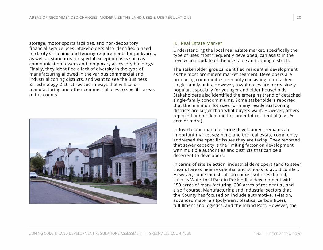
The stakeholder groups identified residential development as the most prominent market segment. Developers are producing communities primarily consisting of detached single-family units. However, townhouses are increasingly popular, especially for younger and older households. Stakeholders also identified the emerging trend of detached single-family condominiums. Some stakeholders reported that the minimum lot sizes for many residential zoning districts are larger than what buyers want. However, others reported unmet demand for larger lot residential (e.g., ½ acre or more).
Industrial and manufacturing development remains an important market segment, and the real estate community addressed the specific issues they are facing. They reported that sewer capacity is the limiting factor on development, with multiple authorities and districts that can be a deterrent to developers.
In terms of site selection, industrial developers tend to steer clear of areas near residential and schools to avoid conflict. However, some industrial can coexist with residential, such as Waterford Park in Rock Hill, a development with 150 acres of manufacturing, 200 acres of residential, and a golf course. Manufacturing and industrial sectors that the County has focused on include automotive, aviation, advanced materials (polymers, plastics, carbon fiber), fulfillment and logistics, and the Inland Port. However, the
20
ZONING CODE & LAND DEVELOPMENT REGULATIONS ASSESSMENT | GREENVILLE COUNTY, SC FINAL | DECEMBER 4, 2020
AREAS OF RECOMMENDED CHANGES: MODERNIZE THE LAND USES & USE REGULATIONS

stakeholders reported that food companies are considering increasing regional food production and distribution in the wake of COvID-19. The primary concern of manufacturers is the cost of operations, so they look for an environment that will protect their investment through covenants and restrictions and other strategies. In addition, companies want to be close to transit and major transportation corridors.
Under the current conditions, good areas for industrial development include the areas near Huff Creek to Grove Creek, between I-185 and I-385. In addition, there are future opportunities with 14 miles of undeveloped I-85 frontage in Greenville County. There is some market demand for manufacturing and warehouse uses in Southern Greenville County, and there is significant demand for industrial near the Spartanburg County line. However, there is no availability in the eastern part of the County, near Greer.
Commercial development continues to occur in Greenville County, and most of this development is highway commercial. There is not much neighborhood commercial development; that occurs more in the municipalities.
Office development is an increasingly important market segment. The real estate community reported more office projects than manufacturing in 2018. This transition requires new thinking about commercial locations, because office users want to be in areas with amenities and other, complementary uses.
4. Affordable & Workforce HousingThe stakeholders reported a significant and growing need for affordable housing. This concern occurred in discussions with many of the focus groups, and they reported that employers and prospective businesses are concerned about housing affordability and availability for their employees. Companies want to know how far their employees will have to commute. In order to afford housing, a resident needs household income of around $30,000. The affordable housing shortage is part of a shortage of housing in general that impacts most market segments. While there is some “naturally occurring” affordable housing, the supply is dwindling as areas that were once affordable, such as the area around Hampton Station, have seen significant redevelopment.
In order to alleviate the shortage of affordable housing, many of the stakeholders believe new policies are needed. They suggest the County consider adding incentives for affordable housing, such as density bonuses—particularly along transit corridors. The consulting team will evaluate this and other strategies to promote housing affordability, including a new state credit for senior workforce housing (Workforce & Senior Affordable Housing Act).
Other options mentioned by the stakeholders include: » Decreasing the cost to develop housing by streamlining regulatory approvals;
» Increasing density for lower-priced market segments; » Reducing required parking; » Allowing modular houses, tiny houses, and accessory dwelling units; and
» Promoting infill, mixed-income neighborhoods, and new multi-family rental developments.
21
ZONING CODE & LAND DEVELOPMENT REGULATIONS ASSESSMENT | GREENVILLE COUNTY, SC FINAL | DECEMBER 4, 2020
AREAS OF RECOMMENDED CHANGES: MODERNIZE THE LAND USES & USE REGULATIONS

In Greenville County, a large number of developers, non-profit organizations, and government agencies work together on this issue. The County can incentivize affordable housing through zoning where builders partner with an agency that helps with economic mobility. Under current conditions, jobs, affordable housing, and transit are not connected, so people cannot live near job opportunities or lack the transportation needed to access employment. In addition, people exiting homelessness have difficulties obtaining necessary social services because they don’t have access to transportation.
At the lower end of the economic spectrum, the County has seen a six-year trend of an increasing number of families experiencing homelessness, and almost 100% of schools have children whose families are experiencing homelessness. This indicates the problem is geographically dispersed throughout the County. Stakeholders reported that only 10% of residents have access to resources to end homelessness. In order to meet the housing needs of these residents, stakeholders reported that 850 units are needed, including 350 units for families with children and 100 units for the “chronically” homeless. While a family might be able to afford up to $650 per month in rent, single individuals who need one-bedroom options may only be able to afford $200 per month in rent. Stakeholders pointed out that communities often focus more on larger multi-family projects for affordable housing, but low-income families frequently want yards and not necessarily large apartment buildings.
Several non-profits, such as Habitat for Humanity and Homes of Hope, are actively developing affordable housing. Habitat for Humanity focuses on the demographic that
could marginally afford home ownership, from 30%-80% of area median income (AMI). They find it is especially difficult to build for the 30%-50% of AMI demographic. Homes of Hope focuses on people in the range of 60%-120% AMI. They build approximately four houses per year for 30% AMI and also reported that it is harder to develop lower AMI units. Their funding often goes to residents making 80%-120% of AMI. The fact that County residents earning around the median income need subsidies or non-profit developers to assist with the development of housing shows how this issue affects many people.
The development community provided some suggestions on ways that the County could improve the development process to facilitate the production of affordable housing. First, they commented that the zoning/rezoning process is lengthy. They think the County should reduce need to “come back” for minor changes and have more “by-right” zoning. The timing of approvals makes it difficult to coordinate with grant funding cycles that the non-profits rely on. In addition, zoning and site approvals often require revisions by their engineers and other professionals, which adds to development costs. The stakeholders suggested that better application forms would help ensure that all issues are addressed in the first application.
The stakeholders addressed the economics of producing affordable housing and reported that it is most difficult to build for the lower range of AMI (30%-50%). However, they reported there are economic barriers for residents earning 120% of AMI. Therefore, they believe that even market-driven affordable housing still needs subsidies and incentives to be viable in Greenville County.
22
ZONING CODE & LAND DEVELOPMENT REGULATIONS ASSESSMENT | GREENVILLE COUNTY, SC FINAL | DECEMBER 4, 2020
AREAS OF RECOMMENDED CHANGES: MODERNIZE THE LAND USES & USE REGULATIONS

5. Manufactured & Mobile HomesThe stakeholders identified a need to continue to allow manufactured and mobile homes, since they provide an affordable housing option. Stakeholders reported that special regulations in mill villages result in an unofficial “moratorium” on manufactured homes. Stakeholders questioned how to set design standards for manufactured homes without barring this as an affordable option. In terms of design, the orientation of the house is an important issue in urban/traditional neighborhoods, and the County could consider requiring front porches. Manufactured and mobile home parks may be similar in many respects to single-family “cottage courts,” but subdivision regulations generally do not apply because the spaces are frequently rented by the residents.
6. Missing Middle Housing The County recently commissioned a Missing Middle Housing Deep Dive study, which was completed in December 2019. Missing Middle Housing is a term to describe housing types that fall between single-family detached and large apartment buildings, such as duplexes, triplexes, fourplexes, cottage courts, and townhouses. Conventional zoning does not generally allow these housing types in sufficient numbers, but the use and physical form of the housing is similar to that of single-family detached housing. The report concludes that expanding these residential building types would increase the density of residential development to improve affordability issues created by high growth and would better meet the
Prepared for: Impact Greenville December 3, 2019
Greenville, South Carolina
MMH Deep Dive™ Testing + Solutions for
Missing Middle Housing
Greenville County and the City of Greenville recently commissioned a local Missing Middle Housing study. This study recommends
specific improvements to the development codes to remove barriers to the construction of Missing Middle Housing (MMH).
MMH includes a variety of one-, two-, and multi-family housing types that are compatible in scale and character with detached single-family homes and increase affordable housing options.
23
ZONING CODE & LAND DEVELOPMENT REGULATIONS ASSESSMENT | GREENVILLE COUNTY, SC FINAL | DECEMBER 4, 2020
AREAS OF RECOMMENDED CHANGES: MODERNIZE THE LAND USES & USE REGULATIONS
market demands driven by changing resident lifestyles, such as aging in place for older residents. In fact, some communities and states are eliminating zoning regulations that allow only detached single-family residential uses to ensure that Missing Middle Housing can be built by-right in all areas. Stakeholders also suggested that duplexes, triplexes, and fourplexes could be added as a conditional use in most districts. In order to accomplish this, it will be necessary to address setbacks and possibly reduce lot size requirements.
Cottage developments, single-family detached structures in a horizontal property regime, meet a market demand but typically are not developed because they require rezoning to the Flexible Review District. Stakeholders think this type of development should be allowed by-right. This housing type is increasingly popular with Baby Boomers and empty-nesters who want a single-family house but not the associated maintenance responsibility. The stakeholders find that cottage court development looks like a single-family neighborhood, so the ownership structure should not matter. However, it will be important for the consulting team to consider the implications of any changes on manufactured housing and mobile home parks.
7. Accessory Dwelling Units Stakeholders report demand for accessory dwelling units (ADUs), which is a second, smaller dwelling unit on a lot. Currently, Greenville County does not allow ADUs as a separate (accessory) structure. While accessory structures are allowed, a detached accessory structure with a kitchen is not. However, current regulations allow an ADU when
it is attached to the principal structure, including those connected by a breezeway. The consulting team will evaluate strategies to expand options for ADUs in the new UDO.
8. Tiny Homes & Recreational vehiclesTiny homes are an emerging trend for a market segment of typically younger people. Stakeholders reported that tiny homes present mainly building code issues. Greenville County currently uses the 2015 edition of the International Residential Code (IRC), which does not include provisions for tiny houses. The 2018 IRC, however, includes an appendix (Appendix Q) that addresses tiny houses.
Neither the Zoning Code nor the LDR address tiny homes, though County staff currently is developing regulations for tiny home subdivisions. These regulations may be adopted outside of the UDO development process, but will be incorporated into the UDO during Module 2.
Under the current regulations, a Tiny Home on Wheels (THOW) is considered an Rv, and the LDR include standards for Rv Parks. Stakeholders suggest distinguishing between Tiny Homes on foundations and THOW, and providing standards for development of each. The consulting team will review these issues and evaluate how they might also interact with ADUs.
24
ZONING CODE & LAND DEVELOPMENT REGULATIONS ASSESSMENT | GREENVILLE COUNTY, SC FINAL | DECEMBER 4, 2020
AREAS OF RECOMMENDED CHANGES: MODERNIZE THE LAND USES & USE REGULATIONS

9. Townhouses Townhouses are extremely popular in Greenville County, especially with millennials and aging baby-boomers. Stakeholders noted the current code doesn’t address townhouses very well. The regulations are confusing and generally designed for detached single-family dwellings. Townhouses often require rezoning (frequently to a Flexible Review District), which creates political discord. The stakeholders generally believe townhouses are a popular market segment and a lifestyle choice that should not require the use of FRDs to develop.
The development community informed us that the current code does not sufficiently address the demand for the most popular townhouse products. The residential-multifamily (R-MA and R-M2-R-M20) districts allow townhouses. The most typical products are 20-26 feet wide, but the code requires a minimum lot width of 30 feet. Therefore, most townhouse developments require rezoning as an FRD or require development as an open space development, which requires more open space reservations. In an open space development, only four townhouse units per building are allowed. Stakeholders think this should be increased to at least 6 units. Stakeholders also think the requirement that only 15% of units can be attached in open space developments is a significant barrier to townhouse development.
Staff reported that text amendments currently under evaluation would revise these requirements to better conform with market conditions. The consulting team will
review the definitions of single-family, attached single-family, multi-family, etc., and will recommend a framework that provides a complete treatment of housing types.
The stakeholders requested clarity in the design/subdivision standards. They also sought a review of the bonding of private roads in these communities, which require the same bonding as roads that will be dedicated to the public.
10. Mixed Use Developments Mixed use developments are an extremely popular trend in planning in which residential uses are located in close proximity with office, restaurant, retail, and entertainment uses to create a walkable district in which most daily needs can be met. However, the stakeholders informed us that there are some practical problems with the economics and regulation of these types of projects.
Generally, the vertical integration of uses (with uses mixed by floor) is not popular for developers or lenders because each segment is so specialized, where, for example, multi-family owners don’t want to own ground-floor restaurants or retail. The horizontal integration of uses (with different uses on adjacent lots) allows developers to sell off “components” of the project to other developers or owners who specialize in a particular market niche, such as multi-family, office, or retail. Therefore, they believe the market better supports having retail and restaurant outparcels than vertical mixed use. Stakeholders suggested that smaller (2-3 story) mixed use commercial buildings near residential neighborhoods could create a similar end result.
25
ZONING CODE & LAND DEVELOPMENT REGULATIONS ASSESSMENT | GREENVILLE COUNTY, SC FINAL | DECEMBER 4, 2020
AREAS OF RECOMMENDED CHANGES: MODERNIZE THE LAND USES & USE REGULATIONS
Overall, the stakeholders could not point to any vertical mixed use developments in the County and could only point to a few examples of horizontal mixed use, including Cliffs
Mountain Park. Such a development requires rezoning to PD to accommodate different uses because the current zoning framework focuses on the separation of land uses.
E. ALIGN DEVELOPMENT & DESIGN STANDARDS WITH PLAN GREENVILLE COUNTY
1. Setbacks The stakeholders identified several issues relating to setbacks. First, they requested that the UDO clarify setback requirements or consider removing the mandate for setbacks based on road classification. Instead, they propose establishing setbacks by district and/or use. They believe it is reasonable to minimize setbacks in urban and traditional neighborhoods, such as mill villages. Current setback requirements can present an obstacle to redevelopment of existing structures. However, stakeholders want to see the County maintain current suburban setbacks, as well as setback requirements for right-of-way preservation.
The stakeholders would like to see review and revision of the commercial district use and setback requirements. They also would like to see the setback requirements for corner lots clarified and simplified.
2. Commercial & Multi-Family Site & Building Design Standards
The stakeholder groups discussed whether and how character matters to the general public and to participants in the development process. In order to facilitate development, some stakeholders are interested in by-right development in Character Areas. Others think Greenville
County should consider applying Review District design standards in more areas and districts to preserve the unique character of the region. The development community believes there is an increase in quality of most development now that is driven by the owner, not the government, because many are interested in better design.
Some of the stakeholders want the County to review big box design requirements for site plans and buildings. This is an important type of commercial development, so the consulting team will evaluate the current conditions and consider some options for revision of the standards. In addition, the stakeholders asked that the County consider expanding outdoor lighting requirements, such as shielding, to more uses.
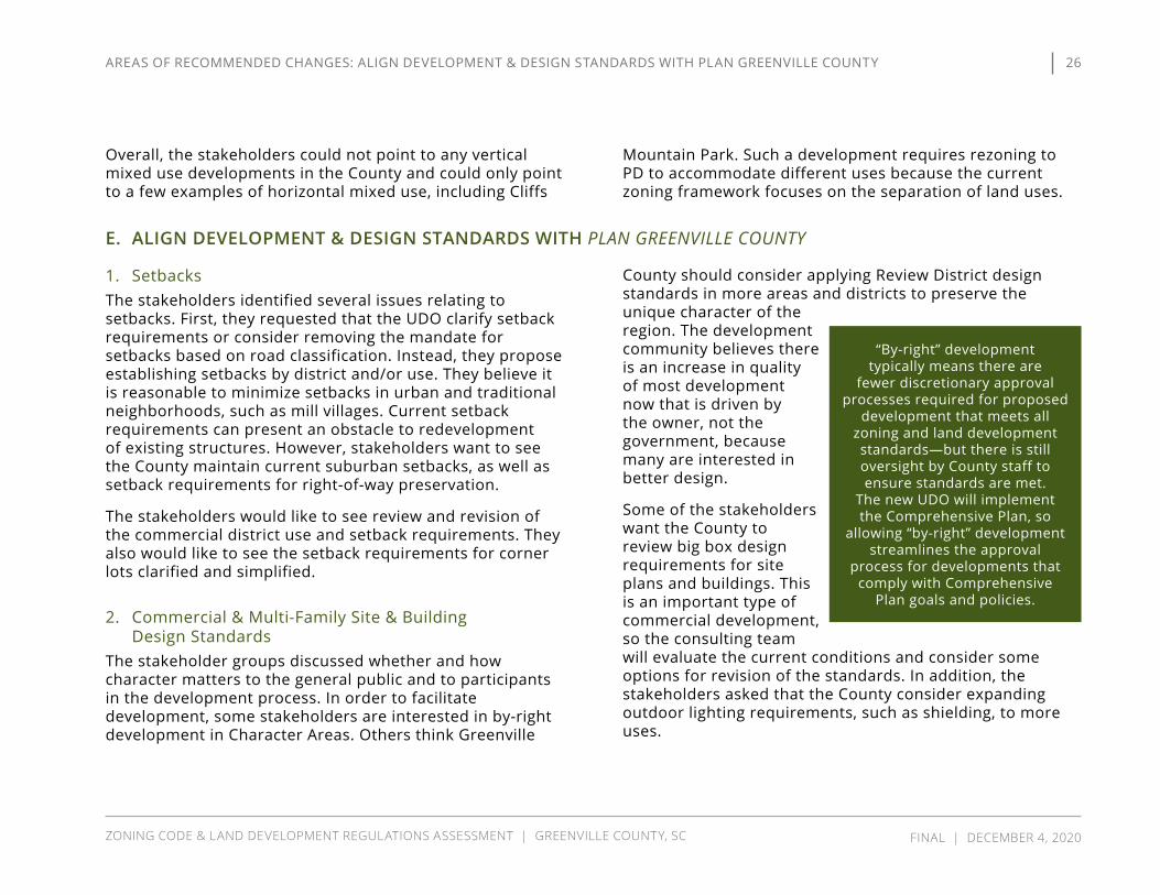
“By-right” development typically means there are
fewer discretionary approval processes required for proposed
development that meets all zoning and land development standards—but there is still oversight by County staff to ensure standards are met.
The new UDO will implement the Comprehensive Plan, so
allowing “by-right” development streamlines the approval
process for developments that comply with Comprehensive
Plan goals and policies.
26
ZONING CODE & LAND DEVELOPMENT REGULATIONS ASSESSMENT | GREENVILLE COUNTY, SC FINAL | DECEMBER 4, 2020
AREAS OF RECOMMENDED CHANGES: ALIGN DEvELOPMENT & DESIGN STANDARDS WITH PLAN GREENvILLE COUNTy
In terms of process, the stakeholders think commercial developers would have a concern with additional design regulations but believe they will work within the standards if the standards provide predictability and specificity. However, developers do not want to add more discretion in the development process. The stakeholders asked that the County consider the impact of increased design regulations on small businesses and “mom & pop” stores. The current LDR include development and design standards for industrial, commercial, multi-family, and mixed-use developments, so the consulting team will review these standards and recommend revisions where appropriate.
3. Parking Parking is always an important issue in commercial development. The stakeholders asked the consulting team to comprehensively review and revise parking regulations, including ratios, parking lot design requirements, shared parking, and development character. They identified specific issues with the current regulations, such as parking lot connectivity, curb cuts, stub-outs in urban settings, and providing for evolution of parking lots into development sites. Staff does not typically see variance requests for parking, except under the LDR’s connectivity requirement.
The stakeholders provided significant feedback on parking ratios. Currently, the zoning ordinance mandates minimum parking ratios for conventional zoning districts. For planned development, the parking ratio can be reduced by 25%. This is a major negotiating point for review districts, and there is no one-size-fits-all formula. Parking reductions for transit access are not available in standard zoning, but could be
considered in the new UDO. For example, the new UDO could allow reduced parking along transit corridors when a proposed development provides a new transit stop. In addition, the stakeholders want to consider the effect of minimum parking ratios on the affordability of housing.
In terms of the current market, developers want less parking than what the code requires when the development is more urban in nature. The stakeholders expressed interest in ways to decrease the parking ratios, including expanding the allowance for shared parking, and allowing reductions for uses with different peak parking demands or operating hours. One difficult issue has been the large
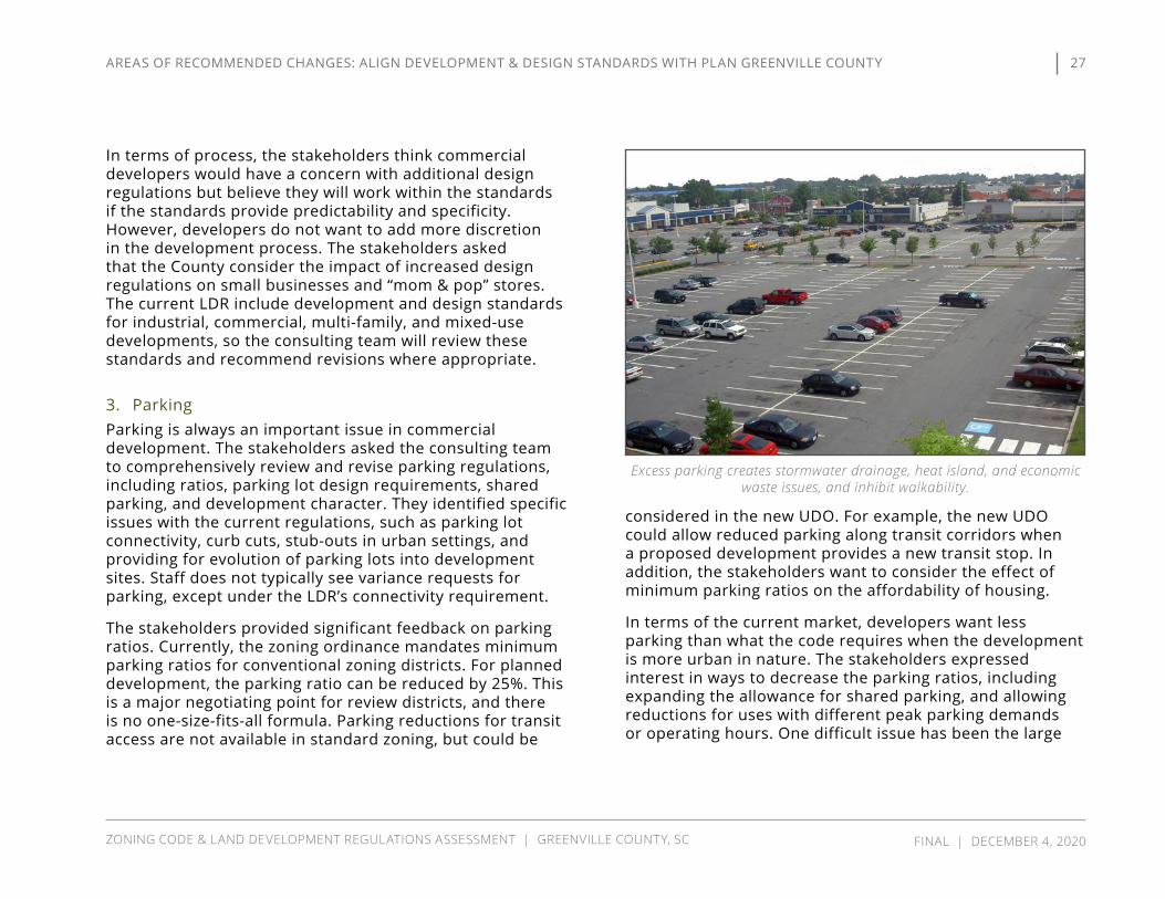
Excess parking creates stormwater drainage, heat island, and economic waste issues, and inhibit walkability.
27
ZONING CODE & LAND DEVELOPMENT REGULATIONS ASSESSMENT | GREENVILLE COUNTY, SC FINAL | DECEMBER 4, 2020
AREAS OF RECOMMENDED CHANGES: ALIGN DEvELOPMENT & DESIGN STANDARDS WITH PLAN GREENvILLE COUNTy

parking lots for suburban big box stores that plan for “Black Friday” parking volumes. However, this is not a typical scenario, so the stakeholders questioned whether a maximum parking ratio might be more appropriate. The stakeholders also think parking maximums could be appropriate within certain character areas or zoning districts, especially those with transit and bike/pedestrian accessibility. In terms of the process, the stakeholders suggested consideration of allowing limited administrative adjustments for parking requirements.
On-street parking was also an important topic. It is not allowed under the current code, except in traditional neighborhood design (TND) areas. The TND regulations are located in LDR, not the zoning code. The stakeholders find on-street parking appropriate in certain districts. However, on-street parking can be problematic for fire trucks in subdivisions that are more compact and high density because it can limit the trucks’ ability to maneuver.
4. Transit The stakeholders believe that Greenville County has not grown in a way to have viable transit in many locations. Transit requires a certain minimum population density to be viable. Currently, Greenlink is implementing its 2018 Transit Plan. Transit stops are generally ½-mile apart, but in more dense areas, they are ¼-mile apart. The stakeholders asked how the character areas, which have higher density, can be better connected.
Greenlink’s infrastructure and integration with the County’s infrastructure was an important issue the stakeholders raised. For example, adequate lighting is a safety issue near bus stops. One of the biggest challenges for Greenlink is providing ADA-compliant bus stops. Wider sidewalks could help address this challenge.
Greenlink has started to work with developers more, and the developers are approaching staff regarding new developments. The stakeholders believed it was important to continue improving coordination between Greenlink and County staff. In particular, the County should incorporate transit concerns early in the process within Transit Corridors, and a formal coordination agreement might be necessary to accomplish this objective. The UDO could
28
ZONING CODE & LAND DEVELOPMENT REGULATIONS ASSESSMENT | GREENVILLE COUNTY, SC FINAL | DECEMBER 4, 2020
AREAS OF RECOMMENDED CHANGES: ALIGN DEvELOPMENT & DESIGN STANDARDS WITH PLAN GREENvILLE COUNTy

incentivize or require, in certain locations, the incorporation of transit stops into new development. Stakeholders also suggest the County establish transit infrastructure standards, which will help establish clear expectations for developers and provide consistency in infrastructure design and quality.
5. TreesThe tree ordinance will be updated and included in the new UDO. The current ordinance prioritizes replacement of removed trees with new trees over preservation of existing trees, but many of the stakeholders believe it should be the other way around. Therefore, they suggest a comprehensive review, revision, and simplification of the current approach. In addition, stakeholders identified specific issues for consideration, including:
» The use of different standards based on district or Character Area;
» The issue of clearcutting/mass grading, especially in rural areas;
» Consideration of techniques to better protect heritage trees;
» Ensuring consistency with related regulations, such as buffers and landscaping; and
» Implementation of a “tree bank” or fee-in-lieu that could be used to replant trees in the county and to fund a staff arborist position. Stakeholders cited examples from the Conway, Charlotte, and Atlanta ordinances as a guide.
Stakeholders also suggested that the County consider creating a Green Infrastructure Plan. Currently, the City of Greenville is working on such a plan, and Charleston
and Summerville provide good examples. In addition, the stakeholders suggest the County consider establishing a tree advisory group.
The stakeholders discussed concerns with the placement of street trees under the current LDR. The County generally wants to avoid trees in the road right-of-way, other than in TND areas where they are required, due to maintenance and liability concerns. However, stakeholders support the use of street trees. If trees are located in the ROW, the UDO should ensure adequate road width and clear sight distance at driveways and intersections are maintained. Stakeholders also noted that trees need six to eight feet of room to develop healthy root systems, but they are frequently planted in locations where the footprint is closer to four feet. There is also a safety issue because motorists who leave the roadway could hit the trees, mainly along rural highways. Therefore, where the speed limit is 55 mph and over, the trees should be away from road, but in urban environments the trees slow down traffic. Also, larger trees can interfere with infrastructure, so the UDO should ensure that they have proper separation from storm drains, catch basins, and other infrastructure.
Overall, the stakeholders support street trees if they are the right trees in the right place with the right design. The stakeholders also support optional provisions for street trees in more districts if the developers want to install them for character. For example, in suburban commercial areas, there is demand for patio and sidewalk seating with shading. The stakeholders also recognized practical issues with allowing more widespread street trees, such as who maintains the trees and picks up leaves in the street.
29
ZONING CODE & LAND DEVELOPMENT REGULATIONS ASSESSMENT | GREENVILLE COUNTY, SC FINAL | DECEMBER 4, 2020
AREAS OF RECOMMENDED CHANGES: ALIGN DEvELOPMENT & DESIGN STANDARDS WITH PLAN GREENvILLE COUNTy

6. Buffers & Screening The stakeholders provided informative feedback on residential buffers. The most recent LDR revision implemented 20-foot buffers around residential developments, regardless of context or adjacent land use. This one-size-fits-all approach is ineffective on sloped properties, where lots simply overlook the buffer. The UDO should provide options for residential buffers based on character area, adjacent uses, or other factors. The County should evaluate whether buffers should generally be undisturbed or planted, which could vary based on the same factors (character area, adjacent uses, etc.). Stakeholders mentioned the need to maintain buffers on all parcels, not just when a site is developed. Stakeholders also suggest consideration of larger or wider buffers to create wildlife migration corridors.
Several stakeholders discussed the importance of riparian buffers, but opinion was divided between those who want enlarged buffers to improve water quality and developers who do not want the added expense for the acquisition of unusable land. For example, the Reedy River Water Quality Group (RRWQG) has been developing an ordinance to expand the riparian buffer from the current 35 feet to 100 feet in Reedy River Watershed. Developers have pushed back against the proposed increased buffer requirement, and homebuilders are concerned about a potential reduction in lot yield.
County staff currently is working with the RRWQG Economic Impact Committee on this proposal. An economic impact analysis commissioned by the RRWQG found the benefits of
the increased buffers outweigh the potential reduction in lot yield. As such, it is anticipated the new UDO will include provisions for increased buffer width.
Stakeholders also requested the consulting team address and clarify riparian buffers, particularly by specifying what kind of development and activities can occur in riparian buffers.
7. Stormwater Greenville County has a medium MS4 general stormwater permit and issued its first stormwater permit in 2001. The County operates the program for all cities except Greenville and Greer, and the cities are co-permittees. Some cities have expressed interest to DHEC about obtaining their own MS4 permits, but program management would be more onerous for cities. The stakeholders believe there is a need to be clear about the participant roles, the review process, and applicable standards. Currently, the County operates under a memorandum of understanding for stormwater management and a more detailed co-permittee manual that clarifies the allocation of responsibility. The lack of clarity in the process may simply be a result of city staff turnover, where new staff is unaware of these existing documents. This may reflect a need to consider periodic meetings between County staff and the city co-permittees.
The stakeholders believe there could be a better way to coordinate the regulations for all the jurisdictions. For example, Mauldin builds to a different year storm/flood rating than Greenville County and has different regulations for riparian buffers. Generally, if all of the
30
ZONING CODE & LAND DEVELOPMENT REGULATIONS ASSESSMENT | GREENVILLE COUNTY, SC FINAL | DECEMBER 4, 2020
AREAS OF RECOMMENDED CHANGES: ALIGN DEvELOPMENT & DESIGN STANDARDS WITH PLAN GREENvILLE COUNTy

various governments’ regulations and specifications are the same or similar, the permitting process is easier and more consistent. However, this may not be practical in a large county with such diverse communities. Some of the more dense incorporated areas, for example, may not have the land area needed to expand riparian buffers for consistency with the County’s regulations (see discussion in E.6, Buffers & Screening).
The stakeholders mentioned the increasing importance of downstream analysis in stormwater permitting. The County recognizes this, as the LDR currently require a downstream
analysis for all sites, with a higher level of analysis required in flood-prone areas.
Stakeholders asked the consulting team to consider whether and where pervious paving materials should be encouraged, or possibly required, to decrease cumulative stormwater runoff. Pervious paving is a Low Impact Development technique (see E.8, Low Impact Development) available in the County’s Stormwater Management Design Manual as an option to meet stormwater management requirements. It will likely continue as an optional requirement, as the cost-effectiveness varies based on site-specific factors. In addition, on-site stormwater management often involves multiple techniques to meet water quality and quantity standards. The most appropriate combination of techniques also varies based on site-specific factors.
Stakeholders discussed a Stormwater Banking Program that has been in place for the past five to six years. Unfortunately, developers have not used this program. In order to comply with the procedure, Council has to approve the development, and this additional approval process and the time and uncertainty associated with it may contribute to developers’ unwillingness to use the program.
8. Low Impact Development The stakeholders explained that Greenville County has not had much success with Low Impact Development (LID) because most engineers are apprehensive about doing “something different,” and noted that unique design time adds cost to a project. However, the County provides a
Houses in this new Greenville County neighborhood front “green streets,” a low impact development technique to help manage stormwater and
provide community green space.
31
ZONING CODE & LAND DEVELOPMENT REGULATIONS ASSESSMENT | GREENVILLE COUNTY, SC FINAL | DECEMBER 4, 2020
AREAS OF RECOMMENDED CHANGES: ALIGN DEvELOPMENT & DESIGN STANDARDS WITH PLAN GREENvILLE COUNTy

variety of technical information and specifications for LID techniques, including design manuals, construction specifications, and software models. These materials provide guidance to help simplify and reduce costs in the design process. The new UDO will cross-reference these materials to help increase public awareness.
There is some interest in using LID design for small (minor) subdivisions because it can replace the need for detention ponds. In major subdivisions, however, LID features on their own cannot meet the state and local regulatory requirements for stormwater management. In these instances, the County encourages a combination of detention/retention ponds and LID features. LID features, like the “green streets” in the photo at the right, can provide community benefits like open space, as well as reduce the size of other stormwater facilities like ponds. During development of the UDO, the consulting team will consider ways to further encourage or incentivize the use of LID techniques.
9. Floodplains The stakeholders want to ensure that the floodplain ordinance “talks to” the UDO and is coordinated with the County’s other ordinances. The current cluster development provisions have been effective in preserving floodplains, however there is a general lack of support for cluster development due to the perception that smaller lot sizes results in higher density. There are also some issues with design of open space elements. Developers often try to put detention ponds in the floodplain. Currently, detention is allowed in 500-year floodplains but not in 100-year
floodplains. The stakeholders believe the UDO needs to specify what development and activities are allowed in floodplains. Most of these areas have limited public access, and the open space is usually owned and maintained by the homeowners’ association.
Stakeholders also mentioned a special need to coordinate regulatory requirements on the Saluda River with Anderson County because it is the boundary between the counties that share its watershed.
32
ZONING CODE & LAND DEVELOPMENT REGULATIONS ASSESSMENT | GREENVILLE COUNTY, SC FINAL | DECEMBER 4, 2020
AREAS OF RECOMMENDED CHANGES: ALIGN DEvELOPMENT & DESIGN STANDARDS WITH PLAN GREENvILLE COUNTy

10. Open Space, Parks, & Trails Greenville County’s open space requirements have broad support among stakeholders. Open space provides a variety of community benefits, such as improved passive and active recreation opportunities, environmental protection, and increased property values.
Plan Greenville County identifies a need for an Parks, Recreation, and Trails Master Plan. While this would occur outside the process of developing the new UDO, the new UDO should establish design standards for and uses and activities that can occur in open space preserved in new developments. Stakeholders noted the UDO needs to clarify the definition of developable and undevelopable land and the amount of open space a developer must preserve. They requested the County consider minimum areas and dimensions, and also ensure that open space in different subdivisions is contiguous. The illustration at the end of this section depicts contiguous neighborhood open space connected by a trail system.
The stakeholders recommend clarification and simplification of the current requirements for Open Space Residential Developments. Currently, developers may simply reserve floodplains as open space—which is good if it ultimately protects floodplain and flood capacity storage. However, the stakeholders also are interested in allowing uses such as trails, passive recreation, and non-permanent structures that would keep disturbance to a minimum. Some stakeholders think new subdivisions should be required to preserve any floodplain as open space or owned by the property owners’ association and protected via covenants.
33
ZONING CODE & LAND DEVELOPMENT REGULATIONS ASSESSMENT | GREENVILLE COUNTY, SC FINAL | DECEMBER 4, 2020
AREAS OF RECOMMENDED CHANGES: ALIGN DEvELOPMENT & DESIGN STANDARDS WITH PLAN GREENvILLE COUNTy

The stakeholders reported that subdivisions are being developed near new parks, and the County should ensure that sidewalks and multi-use paths/ greenways connect new developments with the parks. The stakeholders find that trails are one of the County’s greatest assets, and believe the County should extend trail connections. In order to coordinate parks and new subdivisions, they believe that it is important for the UDO and the County’s long-term Capital Improvements Plan (CIP) to work together. For example, if the CIP includes a network of sidewalks and paths, the UDO could include a requirement for individual developments to fit into that network.
This illustration from a Pennsylvania community depicts contiguous common open space in adjacent subdivisions, connected by a trail
system. Illustration from Growing Greener: Conservation by Design by Randall Arendt.
34
ZONING CODE & LAND DEVELOPMENT REGULATIONS ASSESSMENT | GREENVILLE COUNTY, SC FINAL | DECEMBER 4, 2020
AREAS OF RECOMMENDED CHANGES: ALIGN DEvELOPMENT & DESIGN STANDARDS WITH PLAN GREENvILLE COUNTy
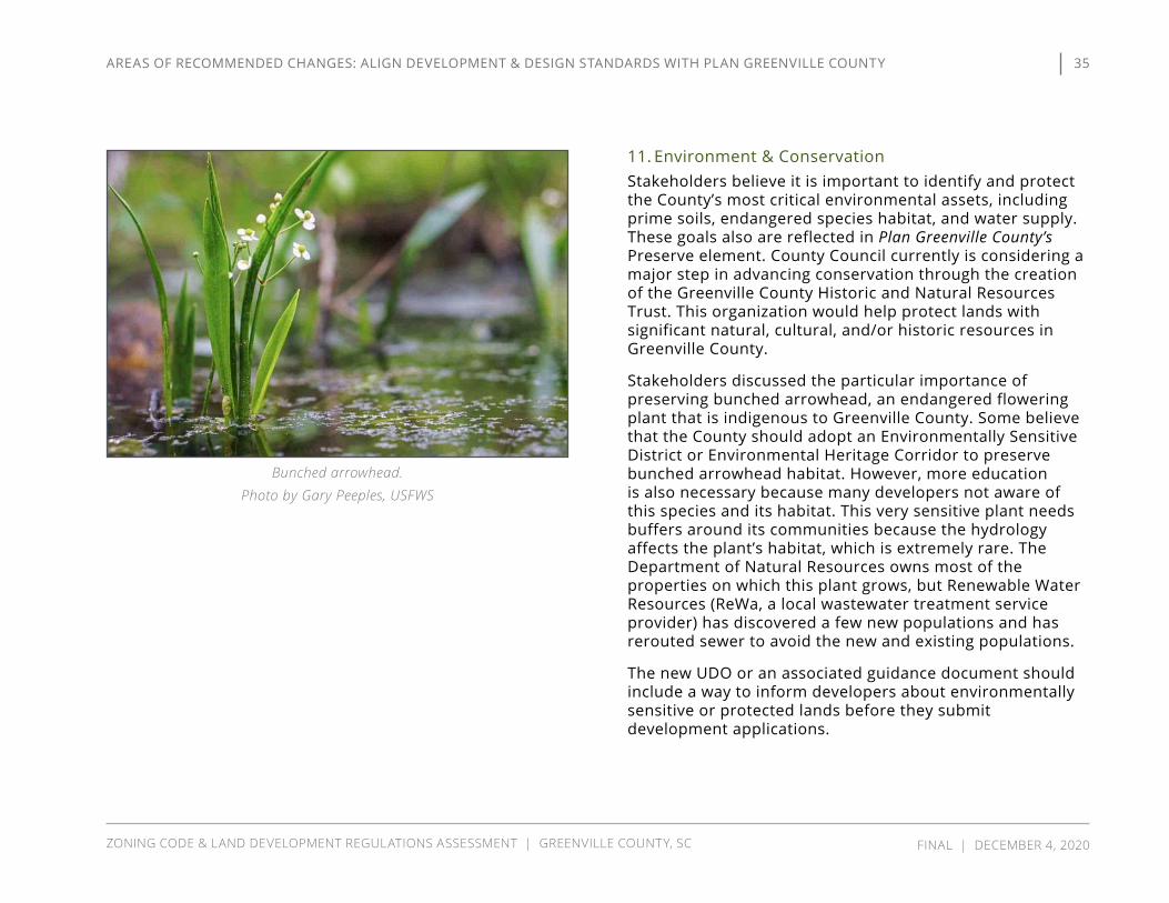
11. Environment & Conservation Stakeholders believe it is important to identify and protect the County’s most critical environmental assets, including prime soils, endangered species habitat, and water supply. These goals also are reflected in Plan Greenville County’s Preserve element. County Council currently is considering a major step in advancing conservation through the creation of the Greenville County Historic and Natural Resources Trust. This organization would help protect lands with significant natural, cultural, and/or historic resources in Greenville County.
Stakeholders discussed the particular importance of preserving bunched arrowhead, an endangered flowering plant that is indigenous to Greenville County. Some believe that the County should adopt an Environmentally Sensitive District or Environmental Heritage Corridor to preserve bunched arrowhead habitat. However, more education is also necessary because many developers not aware of this species and its habitat. This very sensitive plant needs buffers around its communities because the hydrology affects the plant’s habitat, which is extremely rare. The Department of Natural Resources owns most of the properties on which this plant grows, but Renewable Water Resources (ReWa, a local wastewater treatment service provider) has discovered a few new populations and has rerouted sewer to avoid the new and existing populations.
The new UDO or an associated guidance document should include a way to inform developers about environmentally sensitive or protected lands before they submit development applications.
Bunched arrowhead. Photo by Gary Peeples, USFWS
35
ZONING CODE & LAND DEVELOPMENT REGULATIONS ASSESSMENT | GREENVILLE COUNTY, SC FINAL | DECEMBER 4, 2020
AREAS OF RECOMMENDED CHANGES: ALIGN DEvELOPMENT & DESIGN STANDARDS WITH PLAN GREENvILLE COUNTy
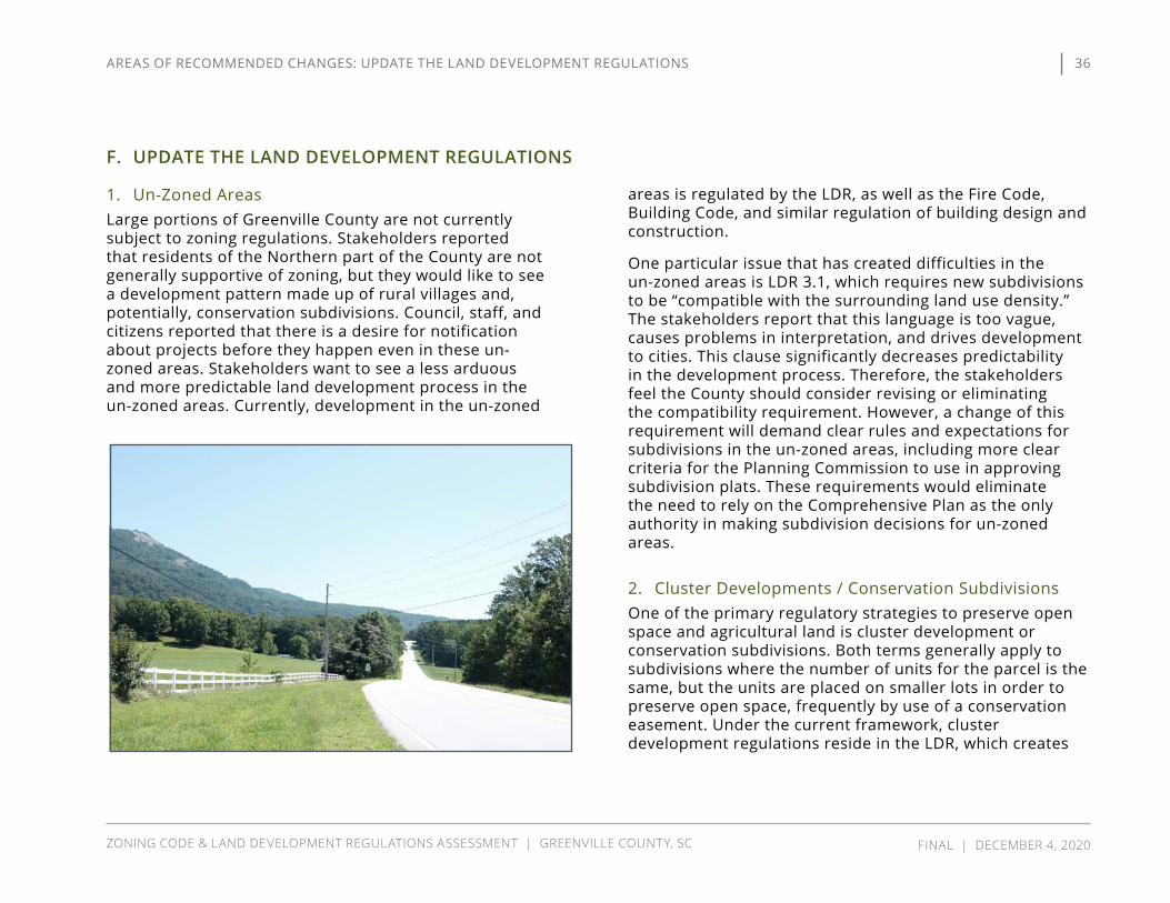
F. UPDATE THE LAND DEVELOPMENT REGULATIONS
1. Un-Zoned Areas Large portions of Greenville County are not currently subject to zoning regulations. Stakeholders reported that residents of the Northern part of the County are not generally supportive of zoning, but they would like to see a development pattern made up of rural villages and, potentially, conservation subdivisions. Council, staff, and citizens reported that there is a desire for notification about projects before they happen even in these un-zoned areas. Stakeholders want to see a less arduous and more predictable land development process in the un-zoned areas. Currently, development in the un-zoned
areas is regulated by the LDR, as well as the Fire Code, Building Code, and similar regulation of building design and construction.
One particular issue that has created difficulties in the un-zoned areas is LDR 3.1, which requires new subdivisions to be “compatible with the surrounding land use density.” The stakeholders report that this language is too vague, causes problems in interpretation, and drives development to cities. This clause significantly decreases predictability in the development process. Therefore, the stakeholders feel the County should consider revising or eliminating the compatibility requirement. However, a change of this requirement will demand clear rules and expectations for subdivisions in the un-zoned areas, including more clear criteria for the Planning Commission to use in approving subdivision plats. These requirements would eliminate the need to rely on the Comprehensive Plan as the only authority in making subdivision decisions for un-zoned areas.
2. Cluster Developments / Conservation Subdivisions One of the primary regulatory strategies to preserve open space and agricultural land is cluster development or conservation subdivisions. Both terms generally apply to subdivisions where the number of units for the parcel is the same, but the units are placed on smaller lots in order to preserve open space, frequently by use of a conservation easement. Under the current framework, cluster development regulations reside in the LDR, which creates
36
ZONING CODE & LAND DEVELOPMENT REGULATIONS ASSESSMENT | GREENVILLE COUNTY, SC FINAL | DECEMBER 4, 2020
AREAS OF RECOMMENDED CHANGES: UPDATE THE LAND DEvELOPMENT REGULATIONS

a disconnect between the Zoning Ordinance and LDR on open space preservation. The stakeholders suggested that regulatory treatment of conservation subdivisions needs a comprehensive review and revision.
The stakeholders reported a general perception that the cluster development ordinance is not doing what it should and has been misused by developers. The stakeholders believed that the goal of the regulations should be more contiguous, usable open space. They think the current regulation’s requirement of contiguous placement “to the maximum extent possible” is too vague. While the regulatory intent of cluster development is to preserve open space, developers use this type of design to reduce lot size and lower road construction costs by reducing the amount of road frontage per unit. In addition, many developers choose this option because undevelopable land can count towards open space, so the land that is preserved could not have been used anyway. The stakeholders find the selection of areas to be preserved as open space seems to be an afterthought.
The stakeholders requested that the consulting team evaluate this issue and clarify the open space requirements and also mandate good design. They suggested that the County could identify criteria of preferred areas to preserve as open space, including prime soils and established forest. Stakeholders identified Horry County as an example, which has adopted a framework of rural/agricultural zoning that includes 12 combinations of rural and agricultural zoning. These illustrations show layouts for a conventional
subdivision (top) and a cluster/conservation subdivision (bottom). The cluster subdivision includes the same number of lots as the conventional subdivision, but
conserves significantly more open space. Illustration from the NC State University Conservation
Subdivision Handbook.
37
ZONING CODE & LAND DEVELOPMENT REGULATIONS ASSESSMENT | GREENVILLE COUNTY, SC FINAL | DECEMBER 4, 2020
AREAS OF RECOMMENDED CHANGES: UPDATE THE LAND DEvELOPMENT REGULATIONS

3. SubdivisionsSubdivision regulation is an essential component needed to shape Greenville County’s future. The stakeholders discussed subdivision market trends and how they interact with the current regulations. The typical subdivision is between 50 and 89 lots, and developers select this smaller size strategically to fit under the Traffic Impact Study requirement, which is required for subdivisions of 90 or more lots. However, sometimes there are smaller subdivisions in the range of 25 lots.
The stakeholders reported that typical, conventional subdivisions—with lots of cul-de-sacs and limited usable open space—generally are not what is desired by the community. While appropriate lot sizes and densities vary depending on the location in the county, the community wants to see neighborhoods with more meaningful open space and better pedestrian and vehicular connectivity. New subdivisions should contribute to, rather than detract from, the character of the community.
The subdivision regulations attempt to promote connectivity through road and sidewalk requirements. The stakeholders think the new UDO should strengthen current street connectivity requirements. In particular, they suggest the County require a street grid design to restrict dead-end streets and cul-de-sacs. Where natural terrain or other site features preclude street connectivity, alternatives to cul-de-sacs that offer more community space, such as “loop lanes,” could be implemented.
In addition, they believe the County needs to better enforce the street connectivity requirements. The current “three
ways out” access requirement is not strictly enforced because variances are frequently granted. However, there also is some concern with requiring “stub-outs” to adjacent properties which, due to the manner in which the adjacent property develops or other factors, may never provide the intended connection.
Illustration of a loop lane from Growing Greener: Conservation by Design Model Ordinance Version 2.0 by Randall Arendt.
38
ZONING CODE & LAND DEVELOPMENT REGULATIONS ASSESSMENT | GREENVILLE COUNTY, SC FINAL | DECEMBER 4, 2020
AREAS OF RECOMMENDED CHANGES: UPDATE THE LAND DEvELOPMENT REGULATIONS

The current street connection requirements in the LDR are based on the number of lots, and the LDR are very conservative on when a connection required. Generally, 60-300 or more lots require connectivity, and the stakeholders think these requirements should be increased at smaller scales. The stakeholders also think trail connection opportunities should be added to subdivision and other development reviews.
The stakeholders reported that the most common subdivision variances are for sidewalks and the number of entrances. These variances also impact the nature of character areas. There are challenges dealing with mill villages, which are urban, while other areas are more rural. There was consensus that a mill village should have sidewalks on both sides of street, but others in more rural areas do not necessarily need sidewalks.
The stakeholders also discussed several specific aspects of the subdivision regulations, including family and farm subdivisions. Staff reported that they receive approximately four family subdivision application per month and mainly see it in the Scuffletown area. The stakeholders did not identify any particular problems with the family subdivision regulations. However, the stakeholders suggest the County consider adding standards for farm subdivisions, which are residential neighborhoods with a working farm, and equestrian subdivisions.
The stakeholders identified several problems with the current LDR. In particular, they think the new UDO should address the relationship of separate subdivisions that are created from a single parent parcel, including requirements
and connections for access roads, setbacks, buffers, stormwater management, and open space. They also noted that the new UDO should better address flag lots, simple plats, and the subdivision of lots with shared driveways. The stakeholders suggest the County consider whether to maintain and revise standards for TND or eliminate them altogether.
The stakeholders identified some ways to improve the subdivision approval process. The current process begins with a preliminary plat reviewed by the Subdivision Advisory Committee, which issues a report for the Planning Commission. The Planning Commission has final approval authority on the subdivision application. The stakeholders suggested that the County develop a white paper for applicants explaining the subdivision process, including steps, contact requirements, and other procedural requirements. In addition, the stakeholders ask that the new UDO clarify the close-out process for completed developments.
4. Infrastructure
Generally Plan Greenville County sets a goal to focus growth in existing mill villages and urban areas, which will cause a greater impact on infrastructure in those areas. The stakeholders suggest that the County consider cost sharing with the municipalities for upgrading infrastructure when a County subdivision impacts infrastructure in a nearby municipality. However, the stakeholders believe that the pace of development exceeds Greenville County’s ability to fund
39
ZONING CODE & LAND DEVELOPMENT REGULATIONS ASSESSMENT | GREENVILLE COUNTY, SC FINAL | DECEMBER 4, 2020
AREAS OF RECOMMENDED CHANGES: UPDATE THE LAND DEvELOPMENT REGULATIONS

improved infrastructure and may even outpace the new infrastructure for funded projects.
In addition, the stakeholders believe that road and sidewalk standards should be coordinated between the County and the cities to provide consistency between jurisdictions. This type of coordination will help with future annexations because a city can take ownership of roads and other infrastructure and know they meet the city’s requirements.
Streets Greenville County participates in the Greenville Pickens Area Transportation Study (GPATS), the Metropolitan Planning Organization for the Greenville Urbanized Area. GPATS has adopted a Long-Range Transportation Plan (LRTP), as well as a shorter term (1-6 years) Transportation Improvement Plan (TIP).
The County adopted a GPATS right-of-way (ROW) preservation ordinance that requires additional setbacks along roads scheduled for improvements in the TIP. Stakeholders suggested the ordinance should also apply to local multi-use path projects, as well as SCDOT roads scheduled for improvements in the Statewide Transportation Improvement Program. While SCDOT policy is to acquire ROW only when it is needed for a funded project, subjecting properties along SCDOT roads to additional setbacks would help preserve land needed for future ROW expansion.
Expanding the ROW protection ordinance would establish which corridors in the County need protection, based on the LRTP, TIP, or future Mobility Plan, regardless of ROW
ownership. For new development projects located along a protected corridor, stakeholders suggested that the County consider requiring dedication of ROW at the time of development, rather than when road improvements are scheduled or funded. As noted above, this likely is not feasible for SCDOT roads but could be a requirement for County roads.
The stakeholders suggested that it may be more appropriate to maintain the ROW preservation ordinance as a standalone ordinance, rather than incorporating it into the UDO.
Stakeholders noted inconsistencies between the street framework of the LDR and Zoning Code. They suggest the County develop additional street types & and cross-sections, particularly for residential street types, including design specifications for alternative modes of transportation such as bicycle and multi-use paths. Regulations for TND developments include street cross-sections not allowed elsewhere. These street types may be appropriate in other medium to high density residential areas. Stakeholders also want the County to consider ways to “dis-incentivize” cul-de-sacs, perhaps through connectivity standards or requirements for them to be privately owned and maintained.
New street cross-sections should consider the needs of the Fire Department and utility providers. The Fire Department prefers designs that accommodate fire trucks through street connectivity or sufficient turn-around space (e.g., cul-de-sacs). The size of fire trucks can dictate street widths, and emergency access is an important aspect of street and
40
ZONING CODE & LAND DEVELOPMENT REGULATIONS ASSESSMENT | GREENVILLE COUNTY, SC FINAL | DECEMBER 4, 2020
AREAS OF RECOMMENDED CHANGES: UPDATE THE LAND DEvELOPMENT REGULATIONS

development design. Utility providers prefer to locate their infrastructure in the ROW, rather than on the back of lots. This requires sufficient ROW width to accommodate.
New street cross-sections also should include transit stops and/or bus lanes as potential street elements for street types that are anticipated to accommodate transit. These elements could be developed in conjunction with the transit infrastructure standards suggested in E.4 Transit to provide consistency in infrastructure design and quality throughout transit corridors.
The stakeholders also reported that the street design specifications do not align with how people use streets for multi-modal uses, such as walking and biking. As an example, the redesign or upgrade of Augusta Street would require reconfiguration from four to three lanes to increase the lane width from 10 feet to 12 feet to accommodate fire trucks and provide sidewalks for pedestrians.
The stakeholders suggested the new UDO include design specifications for the transitions from SCDOT to County ROW and for sidewalks that would safely allow walking and running along major highways. In order to improve transit, the stakeholders recommended shorter neighborhood blocks since long blocks discourage walking and biking to transit stops. Greenlink places its stops ½-mile apart for most routes but sometimes locates them ¼-mile apart in more urban areas.
Finally, the stakeholders recommend more consistent street design and construction standards between the County and municipalities because inconsistencies affect
road acceptance by municipalities. For example, some municipalities do not accept County roads unless they meet city standards, and some cities don’t accept roads even if they meet standards, due to cost-sharing issues.
Sidewalks, Multi-Use Paths, & Greenways The stakeholders raised sidewalks as one of the major areas of inconsistent regulations between cities and Greenville County. They believed that the County should require sidewalks in more situations. The stakeholders reported that all municipalities require sidewalks, and Greer and Travelers Rest require internal and external connections. Greer is currently considering fee-in-lieu for sidewalks to retrofit old sidewalks and install new sidewalks where they were never installed.
The stakeholders presented different perspectives on sidewalk construction as a part of residential development. In general, stakeholders believe that sidewalks are especially important to provide connections from neighborhoods to schools (both within subdivisions and along the front of subdivisions) because students need a safe place to walk to the bus stop. The County requires a sidewalk connection to the main road, but the sidewalks are not required to connect outside the neighborhood or be installed fronting the main road. Some of the stakeholders think sidewalks along the main road should be installed whether or not they connect to existing sidewalks so that they would eventually be part of a unified network of sidewalks. This position often gets pushback from developers, who don’t want to install sidewalks when they don’t connect to anything. In addition, the SCDOT prefers
41
ZONING CODE & LAND DEVELOPMENT REGULATIONS ASSESSMENT | GREENVILLE COUNTY, SC FINAL | DECEMBER 4, 2020
AREAS OF RECOMMENDED CHANGES: UPDATE THE LAND DEvELOPMENT REGULATIONS

not to take ownership of short, non-connecting stretches of sidewalk because it creates a liability issue for them. However, the DOT is willing to accept sidewalks if they will connect to a network within a reasonable period of time, such as when there is a master plan. This issue is important because the DOT will maintain sidewalks if it takes ownership, but the County must maintain the sidewalks otherwise.
Many of the stakeholders expressed support for multi-use paths and greenways. They believe on-street bike lanes are feasible in certain areas, but they do not ensure safe travel in rural or suburban areas. The County and SCDOT prefer multi-use paths over sidewalks because they accommodate more modes of transportation and present less risk of injury by cars. In addition, multi-use paths are easier to maintain and don’t get as much debris from the roadway as they typically are set back further from the travel lanes than a sidewalk. The consulting team will evaluate how ROW requirements should be adjusted to accommodate multi-use paths. In addition, the stakeholders reported that the Trails and Greenways Master Plan could provide a policy basis to allow or require greenways in lieu of sidewalks. Adoption of a county-wide plan or map for future trails and greenways could help direct development to desirable locations.
Stakeholders identified some recurring issues associated with sidewalks and greenways. First, fences sometimes end up in the ROW because the County does not regulate residential fences, which can interfere with sidewalk installation. Second, the mill villages are challenging locations to install new or upgraded sidewalks. The roads
in these communities are mostly SCDOT roads, and the ROW is a wide array of widths, from 20 to 40 feet. This lack of consistency and narrow ROW make uniform sidewalk planning difficult. In order to address these challenging locations, the UDO should address sidewalks and greenways differently in redevelopment and infill areas than in greenfield locations.
42
ZONING CODE & LAND DEVELOPMENT REGULATIONS ASSESSMENT | GREENVILLE COUNTY, SC FINAL | DECEMBER 4, 2020
AREAS OF RECOMMENDED CHANGES: UPDATE THE LAND DEvELOPMENT REGULATIONS

5. Utilities & Services
Individual & Community Septic Systems The stakeholders identified public sewer access and capacity as the primary limiting factors for residential and industrial development. One alternative is a community septic system, which consists of individual or common
septic tanks that disperse effluent through a shared drainfield. Community
septic systems can be professionally maintained to minimize unintended
discharges, and the physical design of these systems are
readily integrated into the open space of conservation subdivisions. Based on the high demand for
residential property and lack of sewer service, some developers have considered the use
of community septic systems. However, these
developers experienced practical difficulties such as
unsuitable soils and proximity of wetlands. These systems
are rarely implemented in Greenville County, partially because DHEC is less willing to permit community septic over individual septic. In addition, the
developer is required to provide financial assurances for future maintenance.
The stakeholders expressed a goal to minimize individual septic facilities because malfunctioning and poorly maintained septic systems are a primary non-point source of water pollution. Greenville County is working with ReWa to identify failing septic tanks and has secured some Section 319 grants to repair and replace failing systems.
ReWa is currently seeking alternative treatment options for developments where sewer is not feasible, including the use of package plants, community septic, and low-pressure systems to serve isolated areas. A package plant is a small-scale water treatment system, and DHEC has approved one of these systems near Paris Mountain. ReWa is also exploring installing new pump stations. The stakeholders suggested that some of these treatment systems could be temporary until sewer is available. They have been trying to find a developer to work with on a pilot project and have not developed standards for alternative systems yet. In terms of future development, the stakeholders are focused on reserving corridors for future sewer construction.
Sewer & Fire Districts The Appalachian Council of Governments is the 2A water quality management (wastewater) coordinator for region. Greenville County has a decentralized system of water treatment, with ReWa serving as the treatment provider and 16 different subdistricts that connect to the user. Each of
HOA open space used as shared drainfields for individual septic systems. Illustration from Growing Greener: Conservation by Design by Randall Arendt.
43
ZONING CODE & LAND DEVELOPMENT REGULATIONS ASSESSMENT | GREENVILLE COUNTY, SC FINAL | DECEMBER 4, 2020
AREAS OF RECOMMENDED CHANGES: UPDATE THE LAND DEvELOPMENT REGULATIONS

these districts is a special purpose tax district with quasi-governmental powers. The stakeholders recommended revisions to LDR provisions related to sewer that the consulting team will incorporate into the new UDO.
The subdistricts vary in size and demand. Some are small and serve built-out areas without significant demand. The stakeholders identified some issues with the different subdistricts. Some basins are constrained to treat additional wastewater. ReWa has asked some systems to remove some infiltration and inflow prior to approving more development. However, development decisions are not directly affectedly by which subdistrict the project is in, although procedures vary by subdistrict. In order to approve a new development with planned sewer service, the County requires “intent to serve” letters from the subdistrict.
The stakeholders believe Greenville County needs a single unified sewer authority, which also is a key recommendation of Plan Greenville County. County Council is beginning the process to potentially implement this recommendation, and will hold a public hearing on November 23, 2020 on the consolidation.
Sewer service is the primary limiting factor for development, and multiple authorities and districts can be a deterrent to developers due to differing rules and the length of time for regulatory approval. Stakeholders reported that it can take a significant amount of time for subdistricts to determine whether sewer is available and the amount of available capacity. Such delays can be detrimental to a potential development project. The stakeholders suggested that a
“reservation” process, where a developer can reserve a certain capacity for 90 days, could help to facilitate the development process.
Currently, Greenville County’s regulations do not require sewer service for new subdivisions. Many jurisdictions have a mandatory sewer connection ordinance to control the location and density of development. ReWa’s policies strongly favor sewer connections if the subdivision is within 300 feet of an existing line, and some subdistricts use this standard as well. However, this is a rule of thumb and is not mandatory. Some stakeholders would prefer to require sewer connections at the sale of property. The consulting team will evaluate potential changes to sewer connection requirements, particularly in more urban areas.
The stakeholders also suggested improved coordination and communication earlier in the process by engaging ReWa and the subdistricts well in advance of the Subdivision Advisory Committee meeting. For water treatment systems, knowing about upcoming demand ahead of time allows ReWa to plan for infrastructure that meets the users’ needs. In particular, the stakeholders reported that the un-zoned areas are problematic for sewer provision. A subdistrict can tell a developer to use a certain size trunk line, but the developer and the subdistrict do not know if the Planning Commission will approve the density needed for it. The comprehensive plan cannot be used to regulate sewer sizing and mandate expansion of service in the un-zoned areas because it is not a regulatory document.
In terms of sewer expansion, ReWa is master planning in the northern part of the County, but septic subdivisions are
44
ZONING CODE & LAND DEVELOPMENT REGULATIONS ASSESSMENT | GREENVILLE COUNTY, SC FINAL | DECEMBER 4, 2020
AREAS OF RECOMMENDED CHANGES: UPDATE THE LAND DEvELOPMENT REGULATIONS
happening so fast that they may not be able to realize fees to cover the expansion. For example, ReWa is working on a lift station in the northern part of county, but development using septic systems is occurring faster than they can handle. They foresee that sewer will expand along the Highway 25 corridor from Greenville to Travelers Rest, but there are not adequate standards to address what that growth looks like.
The Taylor Fire and Sewer District provided some helpful feedback about the details for the fire protection process and sewer coordination. They do not have a fixed service area but will serve contiguous development if there is excess capacity. They participate in the subdivision advisory process, and their sewer administration issues “intent to serve” letters to comply with the County’s requirements. They reported that three different water agencies provide service in the district, which highlights the decentralization and difficult coordination issues developers face. Currently, they require that developers to construct and install sewer lines, but they have to deed it to the district upon completion.
Taylors also reported that they participate in the Collections Systems Alliance, which is a group of all the collection systems in Greenville County. This group develops and compiles shared technical details and specifications for the subdistricts to share. It will “unify” the subdistricts and streamline development process, which currently varies drastically from subdistrict to subdistrict.
Trash Collection The stakeholders reported that developers and designers typically do not want to use land for garbage receptacles due to the cost of real estate. One alternative they identified is Sutera’s in-ground dumpsters. In the design process, dumpsters and garbage collection often is an afterthought and is not always evaluated during site plan review.
Trash collection from alley-loaded lots is a common challenge faced by local governments, including Greenville County. Collection vehicles often are too large to navigate narrow alleys. In some cases, alleys are privately owned and maintained, creating the potential for conflicts over wear and tear on the infrastructure. However, alleys Rear alleys are allowed in TND areas and, though not prohibited in other areas, are infrequently used in new development. Some of the mill villages have rear alleys, but the roads are so narrow that the collection vehicles cannot access them.
New street sections (see F.4. Infrastructure) should consider access needs for collection vehicles. In addition, the Sanitation Department should be involved in the review of developments it will serve.
45
ZONING CODE & LAND DEVELOPMENT REGULATIONS ASSESSMENT | GREENVILLE COUNTY, SC FINAL | DECEMBER 4, 2020
AREAS OF RECOMMENDED CHANGES: UPDATE THE LAND DEvELOPMENT REGULATIONS

G. IMPROVE PROCEDURES & ADMINISTRATION
1. Development & Approval ProcessesThe stakeholders provided diverse opinions and points of view on the development and approval process, but several overarching themes emerged: make the rules clear, make the process as efficient as it can be, and arrive at a UDO that is durable. The nature of planning for the future means that some things will by definition remain unpredictable, including innovative, large, or distinguishable developments and coordination of sewer capacity, with 16 different districts.
The modern best practice is to assign as many processes as possible to administrative staff when public hearings are not necessary. For example, public hearings are not necessary when a particular use is subject to very clear regulations defined in the ordinance (leaving no room for interpretation or discretion), or where the application is the final step in a multi-step approval process (such as the process to establish an FRD) where discretionary decisions have already been made.
In addition to an overall simplification of the zoning and land development process, the stakeholders suggested several specific concepts for improvement, including streamlining and expediting the process to apply zoning in currently un-zoned areas, clarification of the process for variances (by delineating BZA vs. Planning Commission authority) and for appeals of Zoning and LDR decisions, and reconsideration of application denials. Procedural flowcharts, like the one shown at the right, can help clarify a process and offer readers an “at-a-glance” understanding of the various steps necessary for approval.
Rezoning Procedure Flowchart from the Olathe, KS Unified Development Ordinance.
46
ZONING CODE & LAND DEVELOPMENT REGULATIONS ASSESSMENT | GREENVILLE COUNTY, SC FINAL | DECEMBER 4, 2020
AREAS OF RECOMMENDED CHANGES: IMPROvE PROCEDURES & ADMINISTRATION

The stakeholders also suggested that the County consider a process to allow administrative adjustments and variances. The stakeholders suggested the new UDO should include fixed timelines for action, which contributes to predictability in the development process.
Stakeholders expressed a concern with the length of time related to certain approval processes. For example, approval of a Review District can take up to six months, and even minor changes to Final Development Plans require another three month approval process. The stakeholders expressed a preference for administrative approvals but recognized that some boards and commissions need to be involved because they have the statutory and legal authority to make decisions.
The development community seeks predictability, consistency, and flexibility. Predictability is the most important aspect of the process because it is difficult to develop a business plan that accounts for unpredictable moving parts. Therefore, they would benefit from a UDO that is clear, understandable, consistent, and reliable. The County should consider building automatic and by-right development processes into the UDO for development that is consistent with the Comprehensive Plan. These by-right approvals would avoid unnecessary political disputes and costly project delays.
In addition, the developers suggested the new UDO consider the size of the project in the necessary approvals. If the approval process costs the same for both small and large projects, then it disproportionately burdens the small projects and makes them less viable. These approval costs
can be a barrier to entry for smaller commercial projects, affordable housing, and infill development.
Stakeholders suggested improvements to the subdivision process are needed. They reported that final platting process typically takes longer in Greenville County than in other jurisdictions in the region. There is a perception that the current process varies from project-to-project. The UDO should increase predictability and clarify where there is room for discretion and where there is not.
Some stakeholders expressed a concern that administrative policies and manuals seem to exceed the intent of the ordinance they implement. They suggested adoption of an Administrative Procedures policy or ordinance that requires Council review of changes to administrative manuals or policies that are cross-referenced in the UDO, so that Council has to affirmatively accept any changes to these administrative documents. However, one of the benefits of maintaining administrative manuals is that they can be updated as needed for consistency with current industry standards.
2. Submittal Requirements & FeesStakeholders recommend simplifying application submittal requirements. A table format is an effective way to consolidate and simplify these requirements, as well as reduce redundancy in the code.
Stakeholders suggested the new UDO should not include application fees so that they can be adjusted without code amendments. The consulting team will evaluate the most appropriate method to establish fees.
47
ZONING CODE & LAND DEVELOPMENT REGULATIONS ASSESSMENT | GREENVILLE COUNTY, SC FINAL | DECEMBER 4, 2020
AREAS OF RECOMMENDED CHANGES: IMPROvE PROCEDURES & ADMINISTRATION

3. Traffic Impact Studies
GenerallyAs in most growing communities, traffic is a major concern in Greenville County. Stakeholders feel that adequate transportation infrastructure should be in place in advance of development. The Traffic Impact Study process is a planning technique that can be used to help mitigate the effects of new development on the transportation network by requiring developers to make or contribute to improvements.
The stakeholders discussed how Traffic Impact Studies (TIS) are used and avoided in the development process. Currently, Greenville County does not exact impact fees from developers. Instead, the TIS process is more of a negotiation focused on “what can we get a developer to build.” Some stakeholders feel the current TIS process does not change development outcomes because the County does not have the authority to say “no” or “not now.”
The stakeholders suggested that the requirement for TIS should be expanded to smaller projects. Developers limit the size of developments so that the project does not trigger a TIS, but the aggregate effect of these developments often is the same as one large development. The stakeholders believe the County should have the ability to require infrastructure improvements for smaller developments. In addition, they think the TIS study area should be expanded to more than one or two intersections nearest a project. Some stakeholders suggested the UDO could authorize the Planning Commission or County Council the discretion to require a TIS for certain projects where it otherwise would not be required.
The stakeholders recommend the TIS process consider requirements for “planning-level” studies as well as “engineering-level” studies. Some rural roads not built as farm-to-market roads were not designed to accommodate commercial uses. These roads, such as Garlington Road and Woodruff Road, present difficulties in transitioning to more intensive land uses.
Level of Service (LOS)The stakeholders reported on some of the ways that Level of Service (LOS) is considered in the approval process. While LOS is established in the LDR, the TIS process should incorporate specific LOS goals for mitigation. In addition, a pure LOS analysis for subdivisions does not always capture multi-modal transportation needs because the Planning Commission mainly reviews volume to capacity (v/c) ratios. This measure is reasonable for highway uses, but it does not fully consider residential settings where residents are more likely to walk or bike.
Required Improvements/MitigationThe stakeholders discussed ways that the County has required developers to make infrastructure improvements to mitigate the effects of growth. The County does not require the developer to improve roads outside the project boundary. This can present a problem in areas like Harrison Bridge Road, where development is occurring faster than improvements can be made.
The UDO should better define the improvements that a project requires. In addition, there should be a way to plan for several projects over multiple years in high-traffic areas that would appropriately phase the improvements
48
ZONING CODE & LAND DEVELOPMENT REGULATIONS ASSESSMENT | GREENVILLE COUNTY, SC FINAL | DECEMBER 4, 2020
AREAS OF RECOMMENDED CHANGES: IMPROvE PROCEDURES & ADMINISTRATION

to the development process. The current system creates transportation system impacts before the necessary improvements are built, so the stakeholders suggest consideration of the most appropriate time to require certain improvements, including roads, major utilities, parks, schools, and incorporation of pedestrian connections to existing parks and infrastructure.
The County has begun working collaboratively with developers to complete transportation improvement projects. However, this general approach creates debate over what should be the developer’s responsibility and what should be the County’s responsibility. The stakeholders suggest that the UDO should more clearly distinguish the responsibility for public and private improvements.
The stakeholders believe the TIS ordinance needs stronger requirements for private improvements. If a new development is smaller than the TIS threshold, the County can require improvements to substandard roads within a development. However, developers can also request a variance from subdivision requirements. Inconsistent decisions on variance requests for issues such as road widening, the number of entrances, emergency entrances, sidewalks, interconnectivity, and turn lanes contributes to unpredictability in the development process and points to areas of the ordinance in need of clarification and revision.
The stakeholders report that the SCDOT has more leeway than the County to ask for and receive contributions. They suggest aligning the UDO with SCDOT guidelines. In particular, SCDOT requirements should be considered in
determining situations that warrant new stop signs, signals, and mid-block crossings.
The stakeholders also want to see consideration of transit in traffic mitigation. In particular, they sought stronger requirements for transit-oriented development in transit corridors. They would like to see the UDO provide locations for bus stops and mandate sidewalk connections to stops.
4. Coordination
Coordination with SCDOT Planning staff coordinates with the SCDOT on rezoning, and the SCDOT is represented on the Subdivision Advisory Committee. This participation is important because the entrances for new subdivisions are often off state roads. The coordination includes communication on the requirements and at what stage the recommended improvements are to be made.
Coordination with Municipalities & Regional Organizations The stakeholders believe regional coordination is important because the general public does not care about boundaries or funding sources; they just expect all local governments to work together. Therefore, it is important to think regionally with regulations. In addition, there is value in having consistency in goals and standards among jurisdictions.
The stakeholders recognize there are ways to improve coordination and allocation of responsibilities among jurisdictions, including in zoning, regulation, and annexation. As one example of proposed improvements
49
ZONING CODE & LAND DEVELOPMENT REGULATIONS ASSESSMENT | GREENVILLE COUNTY, SC FINAL | DECEMBER 4, 2020
AREAS OF RECOMMENDED CHANGES: IMPROvE PROCEDURES & ADMINISTRATION

to coordination, ReWa has drafted recommended changes to the LDR to improve pre-development coordination between the applicants, the County, and the sewer districts. Currently, there is no formal coordination among staffs of the agencies in the region. However, the local government planners expressed an interest in meeting together periodically to discuss local development-related issues, zoning, best practices, and other issues.
In addition, School District representatives attend subdivision meetings to advocate for sidewalk connections to ensure access for walking to bus stops and to school sites. The stakeholders identified a need for better communication with County Planning Staff on the plans for new facilities and site development to coordinate this type of pedestrian infrastructure.
5. Nonconformities In general, the stakeholders reported that nonconforming uses (NCUs) have not presented many difficulties under the current regulations. In developing the new UDO, the County should consider how new and revised regulations will affect property owners and property values. In addition, the UDO should clarify the process for the BZA to allow expansion of NCUs, and the requirements for temporary NCUs should be reviewed and revised.
6. Definitions In both the Zoning Code and LDR, definitions are consolidated into a single article towards the beginning of the codes (in Article 4 and Article 2, respectively). However, readers typically expect to find a glossary at the end of a document. Stakeholders support consolidation of all definitions into one article of the new UDO. In addition, current definitions should be updated, new definitions should be added where needed, land uses in the use table should be clearly defined, and redundant or unused terms should be removed.
7. Enforcement The stakeholders suggest review of enforcement provisions for both zoning and land development regulations, including provisions to enforce lack of compliance with plat approval conditions. The successful completion of these conditions should be integrated with the financial security requirements.
50
ZONING CODE & LAND DEVELOPMENT REGULATIONS ASSESSMENT | GREENVILLE COUNTY, SC FINAL | DECEMBER 4, 2020
AREAS OF RECOMMENDED CHANGES: IMPROvE PROCEDURES & ADMINISTRATION

H. PROMOTE HISTORIC PRESERVATION Historic preservation should be considered in developing the new UDO because many in the development community are interested in redeveloping historic properties, especially in West Greenville where development and infill are increasing. However, some developers see historic preservation as an obstacle. The stakeholders suggest the County consider requiring a pre-application meeting with the Historic Preservation Commission (HPC), and also consider requiring a historic resource survey as part of the development process.
The stakeholders reported that consideration of historic buildings in the development process is of increasing importance because of a state authorization for local tax incentive programs for rehabilitated historic properties (the “Bailey Bill,” S.C. Code of Laws §§4-9-195 and 5-21-140). Currently, the Commission is trying to simplify the tax credit application process.
One particular historic preservation issue stakeholders raised is how to handle abandoned family cemeteries. First, stakeholders believe that developers need education on this issue. Second, the staff is considering creating a map of known cemeteries. Currently, the County does not have any formal protections outside of State law. Therefore, a County ordinance is needed to protect abandoned cemeteries. This could include a requirement to identify the location of cemeteries on site plans. The identification and delineation of cemeteries can be difficult because cemeteries often are bigger than they appear based on obvious headstones, and a survey by ground penetrating radar can increase the
51
ZONING CODE & LAND DEVELOPMENT REGULATIONS ASSESSMENT | GREENVILLE COUNTY, SC FINAL | DECEMBER 4, 2020
AREAS OF RECOMMENDED CHANGES: PROMOTE HISTORIC PRESERvATION

cemetery’s size by 50%. Staff cited at least one example where a cemetery was recently destroyed because a clearing and grading permit was not required.
The stakeholders also discussed the general value of conducting a Cultural Resources Survey. A survey requirement could be added to submittal requirements for particular applications so that staff will know whether a property has historic value when a development is proposed. A survey could also be used to ensure developers know they own an historic property, and the HPC could be notified if a property is being redeveloped. In particular, the six mill villages should be considered as possible National Register Historic Districts. Historic designations can also be complicated because the Federal Emergency Management Agency has its own definition of historic, as it pertains to buildings located in floodplains.
The stakeholders suggest review and revision of the Zoning Code’s Historic Preservation District; evaluation of techniques to protect historic road corridors, such as Augusta Road, from incompatible development; and consideration of additional incentives to designate historic properties.
The stakeholders identified some regulatory obstacles to the reuse of historic properties. Current code provisions are too suburban to appropriately treat historic development patterns. For example, large setback requirements often create barriers to the redevelopment of existing structures. Therefore, there should be some built-in flexibility for historic restorations that comply with federal guidelines. In addition, the stakeholders recommend the new UDO
52
ZONING CODE & LAND DEVELOPMENT REGULATIONS ASSESSMENT | GREENVILLE COUNTY, SC FINAL | DECEMBER 4, 2020
AREAS OF RECOMMENDED CHANGES: PROMOTE HISTORIC PRESERvATION

include adaptive reuse provisions. In particular, there is a trend in the change of use from abandoned industrial properties that requires special consideration, especially for the mill districts, and the new UDO should evaluate ways to treat building setbacks, parking, density, change of use, and opportunity zones for these projects. For residential subdivisions, the stakeholders suggest consideration of techniques to encourage the reuse of historic homes as common areas and cited the example of the Plantation on Pelham.
The stakeholders believed that Neighborhood Conservation Districts would be a useful tool in preserving the historic character of a particular area. For example, in the Taylors Community, the Main Street Development District provides an effective way to preserve the character of the area. The stakeholders think Taylors is a good example of applying some limited standards to preserve community character, even though the area is not a true “historic district.”
County Council currently is considering a major step in advancing historic preservation in the county through the creation of the Greenville County Historic and Natural Resources Trust. This organization would help protect lands with significant natural, cultural, and/or historic resources in Greenville County.
53
ZONING CODE & LAND DEVELOPMENT REGULATIONS ASSESSMENT | GREENVILLE COUNTY, SC FINAL | DECEMBER 4, 2020
AREAS OF RECOMMENDED CHANGES: PROMOTE HISTORIC PRESERvATION

CONCLUSION & NEXT STEPS The new UDO is a key tool for implementing Plan Greenville County. While the existing Zoning Code and Land Development Regulations contain some excellent and effective provisions, they both require significant updates in order to fully realize the County’s planning goals and objectives. In addition, further reorganizing, rewriting, and illustrating existing and revised zoning and land development requirements will make the document easier to read, and potentially create a higher quality of public discourse and design quality.
Because the amendments to the Zoning Code and Land Development Regulations will be comprehensive, it will be difficult for staff, elected and appointed officials, and the public to digest them in a single draft. Therefore, we will draft the new UDO in a series of three modules:
» Module 1: Zoning Districts & Use Regulations » Module 2: Development Standards & Land Development Regulations » Module 3: Nonconformities, Procedures, Administration, & Definitions
Greenville County will hold public workshops and input sessions throughout the project to receive public comments on proposed code revisions, the County’s existing and potential strategies for regulating development, and key neighborhood compatibility and economic development goals. Due to impacts from COvID-19, these workshops and input sessions may be virtual or a combination of virtual and in-person events. We anticipate holding public events for each module, separate from the final public hearings and adoption process. Draft documents will be posted on the project website in advance of the public events. The final “public hearing draft” document will incorporate revisions that result from the input received during each module.
We look forward to working with Greenville County on this important process.
54
ZONING CODE & LAND DEVELOPMENT REGULATIONS ASSESSMENT | GREENVILLE COUNTY, SC FINAL | DECEMBER 4, 2020
