gps and wireless - mit
TRANSCRIPT


AgendaOverviewHow It WorksGPS UsesTeletype GPSSTEFS GPS

OverviewU.S. DoD - $12 billion24 Satellites and Ground StationsSelective Availability 100 MetersRegular MetersDGPS CentimetersReceivers are a few I-Circuits

How it WorksTriangulationTravel Time of Radio SignalsAccurate TimingExact Satellite LocationDelays through Atmosphere
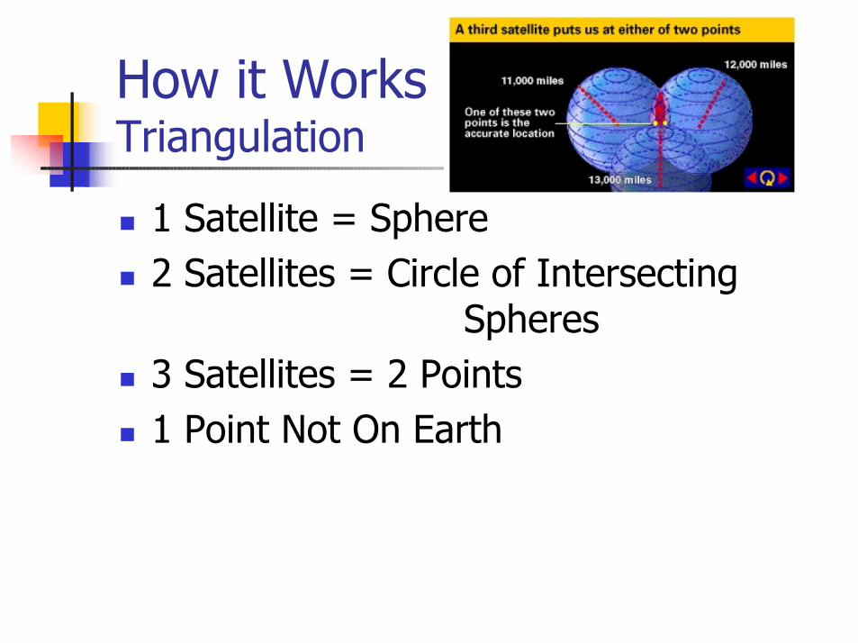
How it Works Triangulation
1 Satellite = Sphere2 Satellites = Circle of Intersecting
Spheres3 Satellites = 2 Points1 Point Not On Earth
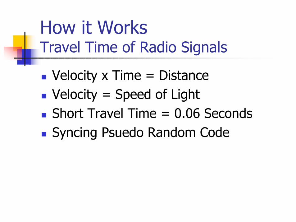
How it Works Travel Time of Radio Signals
Velocity x Time = DistanceVelocity = Speed of LightShort Travel Time = 0.06 SecondsSyncing Psuedo Random Code

How it Works PsuedoRandom Code
ComplexAvoid Syncing With Other SignalsUnique to Each SatelliteHard to JamDoD Control
Different from Selective Availability
Amplification = Cheap Receivers

How it Works Accurate Timing
.001 second = 200 milesSatellites have Atomic Clocks Cost $50k-$100k4th Satellite UsedWhen they Don’t Match
UMT is Adjusted

How it WorksExact Satellite Location
11,000 Mile Altitude – Predictable OrbitReceiver Location AlmanacEphemeris Errors – Sun and MoonDoD Monitors PositionBroadcasts in Psuedo Random Code
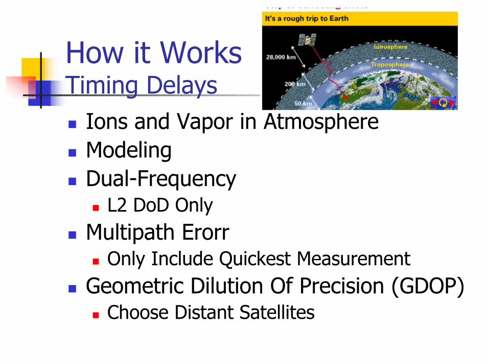
How it WorksTiming Delays
Ions and Vapor in AtmosphereModelingDual-Frequency
L2 DoD OnlyMultipath Erorr
Only Include Quickest MeasurementGeometric Dilution Of Precision (GDOP)
Choose Distant Satellites

How it Works Errors Summary
0.60.6Multipath
0.30.3Receiver Noise
0.20.5Troposphere
0.45.0Ionosphere
02.5Orbit Errors
01.5Satellite Clocks
Differential GPSStandard GPSTypical Error in Meters(per satellite)

How it WorksAdvanced GPS
DGPS2 ReceiversOne Stationary
Dead ReckoningAccelerometers
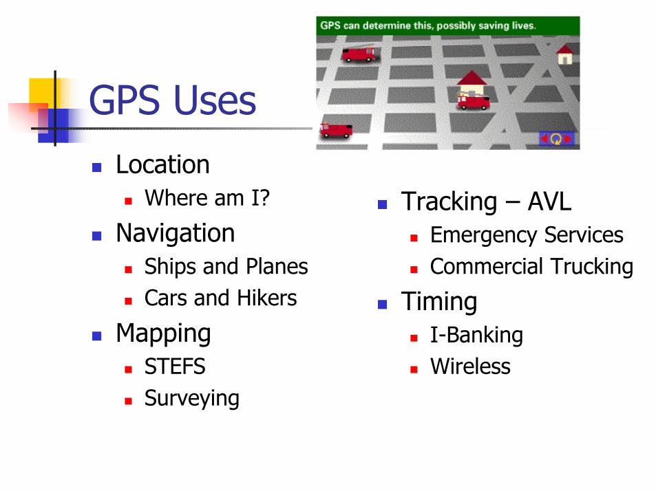
GPS UsesLocation
Where am I?
NavigationShips and PlanesCars and Hikers
MappingSTEFSSurveying
Tracking – AVLEmergency ServicesCommercial Trucking
TimingI-BankingWireless

Using Teletype GPSConnecting to iPaq
PCMCIA CardExpansion PackAntenna
ArcPAD GISComm 4

Telewtype GPS Specsb Teletype GPS 12911 PCMCIA Card3m to 30m AccuracyReport Every 0.1 SecondsRegardless of Weather ConditionsOperational Temperature 0oC - 70oCOperational Humidity 5%-95%Variance in Reported Location on a GPS
Module that is Not Moving.
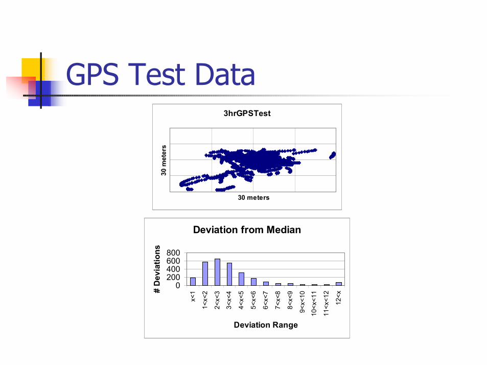
GPS Test Data3hrGPSTest
30 meters
30 m
eter
s
Deviation from Median
0200400600800
x<1
1<x<
2
2<x<
3
3<x<
4
4<x<
5
5<x<
6
6<x<
7
7<x<
8
8<x<
9
9<x<
10
10<x
<11
11<x
<12
12<x
Deviation Range
# D
evia
tions
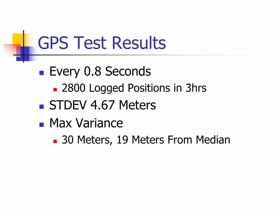
GPS Test ResultsEvery 0.8 Seconds
2800 Logged Positions in 3hrs
STDEV 4.67 MetersMax Variance
30 Meters, 19 Meters From Median
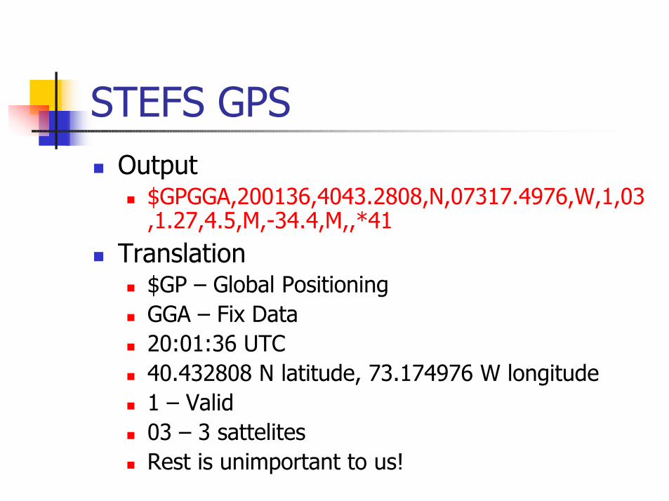
STEFS GPSOutput
$GPGGA,200136,4043.2808,N,07317.4976,W,1,03,1.27,4.5,M,-34.4,M,,*41
Translation$GP – Global PositioningGGA – Fix Data20:01:36 UTC40.432808 N latitude, 73.174976 W longitude1 – Valid03 – 3 sattelitesRest is unimportant to us!
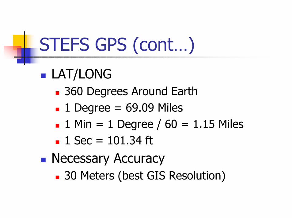
STEFS GPS (cont…)LAT/LONG
360 Degrees Around Earth1 Degree = 69.09 Miles1 Min = 1 Degree / 60 = 1.15 Miles1 Sec = 101.34 ft
Necessary Accuracy30 Meters (best GIS Resolution)

STEFS GPS in AustraliaAssociating By Project
Not all iPaqs will have GPSLink by Data by
SessionTimeFlow LocGPS Averaging
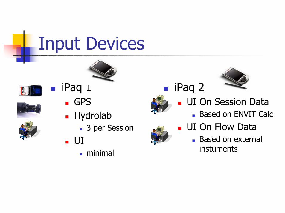
Input Devices
iPaq 1GPSHydrolab
3 per Session
UIminimal
iPaq 2UI On Session Data
Based on ENVIT Calc
UI On Flow DataBased on external instuments

Infra Red (IrDa)
802.11b (COR-1100)
GPRS (GSM Phone)
MIT Static IP
CommunicationsiPaq 1 to iPaq 2
iPaq 2 to Laptop
Laptop to WebServer
WebServer to Web

IrDa
Through the protective CaseOnly GPS and Hydrolab DBs sentNothing is linked on the iPaq

802.11bSilver Orinoco Card in iPaq 2Gets fixed IP on EnvitNetworkCommunicates up to 26 miles to AntennaOmniDirectional Antenna is 2.4GhzAttaches to Orinoco Card in COR-1100COR-1100 connects to Laptop using Ethernet Cross-overInformation is transferred via MS ActiveSync on user command.

GPRSLaptop connects via USB to phonePhone obtains IP from TelstraTransfers Data directly to ENVITWEB

STEFS WirelessSTEFS Meng Wireless ArchitectureHunter Integrated Telemetry System
PocketPC ToolsPocket ControllerActiveSync Over Wireless 802.11b IPOrinoco ClientStandard SyncsPebbles
Remote CommanderScribble
Pocket Controller

Where Do We Go From Here?TO DO LIST
Envitweb.mit.edu/ToDo.xlsUI
Prototype on iPaq connected to laptop with DB by MONDAY!!!
HydroLabWe need what your data will look like??????!!?!
GPSCollection of Shore DataShape files on iPaqs vs Laptop???

DEADLINESEarly December Field TripPut stuff on Laptop and iPaqs 11/29/01!Get Everything Ready for integration 11/22/01!!!

Referenceshttp://envitweb.mit.eduhttp://HITS.nsw.gov.au/http://www.Trimble.com/GPS/http://www.gpsscales.com/http://www.Teletype.com/http://www.OrinocoWireless.com/http://www.VoiceStream.com/http://www.Telstra.com.au/http://commerce.Motorola.com/http://www.Compaq.com/