gnss in africa: applications, infrastructures, research ... · african leadership conf alc space s...
TRANSCRIPT

African Leadership Conf ALC Space S & T, Session 7: GNSS, 4 Dec 2013, Accra, GhanaAfrican Leadership Conf ALC Space S & T, Session 7: GNSS, 4 Dec 2013, Accra, Ghana
GNSS in Africa:
Applications, Infrastructures,
Research Implications & Prospects
Babatunde Rabiu,
Centre for Atmospheric Research,
National Space Research & Development Agency,
NASRDA, Anyigba, NigeriaEmail: [email protected]
1

African Leadership Conf ALC Space S & T, Session 7: GNSS, 4 Dec 2013, Accra, Ghana
Outline�About Africa
�Applications of GNSS in Africa
�Status quo
�AFREF and National Reference Frames
�AfricaArray
�IHY/ISWI
�ICTP-BC Joint Program on GNSS
�Prospects
�Conclusion.
GN
SS
Ch
all
en
ge
s in
Afr
ica
2

African Leadership Conf ALC Space S & T, Session 7: GNSS, 4 Dec 2013, Accra, Ghana
• A continent
• 54 individual nations
• Multi-lingual structure• English, French, Portuguese, Arabic,
Spanish
• ~ 30 billion km2
• ~ 850 million people
• ~14% World population
Africa !
3
African Leadership Conf ALC Space S & T, Session 7: GNSS, 4 Dec 2013, Accra, Ghana
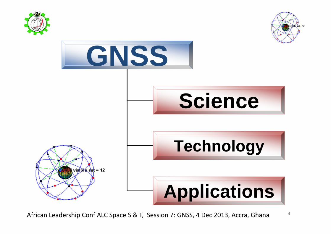
GNSSScience
Technology
Applications4

African Leadership Conf ALC Space S & T, Session 7: GNSS, 4 Dec 2013, Accra, Ghana
Science with GNSS
• Characterization of ionosphere using TEC
• Space weather studies
• Scintillation studies
• Atmospheric delay
• TIDs
• Validation/improvement of existing atmospheric models
• Water vapour estimation
• Climate change studies
• Seismic studies
5
�Atmospheric & Geophysical research
� PhDs
� M.Sc
� Research publicationsOutput

African Leadership Conf ALC Space S & T, Session 7: GNSS, 4 Dec 2013, Accra, Ghana
Social-Economic Applications
positioning services,
surveying & mapping,
Boundary mapping
food security,
disaster management,
air, land & sea navigation,
Land administration
emergency response
Wild life management
on increasing level
6

African Leadership Conf ALC Space S & T, Session 7: GNSS, 4 Dec 2013, Accra, Ghana
Impact of GNSS
�Military
�Aviation
�Education
�Economy
�Agriculture
�Minerals & oil exploration
�Disaster monitoring systems
�Land & maritime transportation
�Land surveying
�Health
�Revenue
7

African Leadership Conf ALC Space S & T, Session 7: GNSS, 4 Dec 2013, Accra, Ghana
GIS & Land Administration in Nigeria
• A viable tool for promotion of Good Governance
• a system for land & property management, registration & taxation
• being used to increase revenue generation, planning & collection.
• Additional System features include data storage, information management, quick and easy data access, as well as retrieval of Statistical data and updated reports from the office & field.
• proved to be highly efficient and has greatly changed the landscape of town-planning services and land administration
• Uncovered some past corrupt practices
• removal of existing bottlenecks in the current land titling and registration procedures
• Abuja & Lagos (AGIS); being planned for entire nation
http://www.abujagis.com/index.html
http://www.punchng.com/news/land-reform-fg-picks-ondo-kano-for-pilot-scheme/March 12,
2012 Punch Newspaper
8

African Leadership Conf ALC Space S & T, Session 7: GNSS, 4 Dec 2013, Accra, Ghana
Defense/Military
• Signal transmission
• Robotics
• Space commands
• Navigation
• Drones
9

African Leadership Conf ALC Space S & T, Session 7: GNSS, 4 Dec 2013, Accra, Ghana
Applications of GNSS Technology in
Africa
Wild life
conservation
10

African Leadership Conf ALC Space S & T, Session 7: GNSS, 4 Dec 2013, Accra, Ghana
Latest Application: News Gathering
11

African Leadership Conf ALC Space S & T, Session 7: GNSS, 4 Dec 2013, Accra, Ghana
Latest Application: News Gathering
12
International New York Times
Tuesday Nov 26 2013

African Leadership Conf ALC Space S & T, Session 7: GNSS, 4 Dec 2013, Accra, Ghana
Other Applications in Nigeria
Fadama rice plantation (Agriculture)
control of meningitis disease
desertification control and
monitoring of encroachment of ocean along the coast
Mapping of Bitumen deposit in SW Nigeria
Climate change related studies
13

African Leadership Conf ALC Space S & T, Session 7: GNSS, 4 Dec 2013, Accra, Ghana
GSM & GPS
• GSM telecommunication systems are
synchronized with GPS systems
• GSM users are now track-able – position and time
• Location identification
• Crime control and public safety
14
African Leadership Conf ALC Space S & T, Session 7: GNSS, 4 Dec 2013, Accra, Ghana
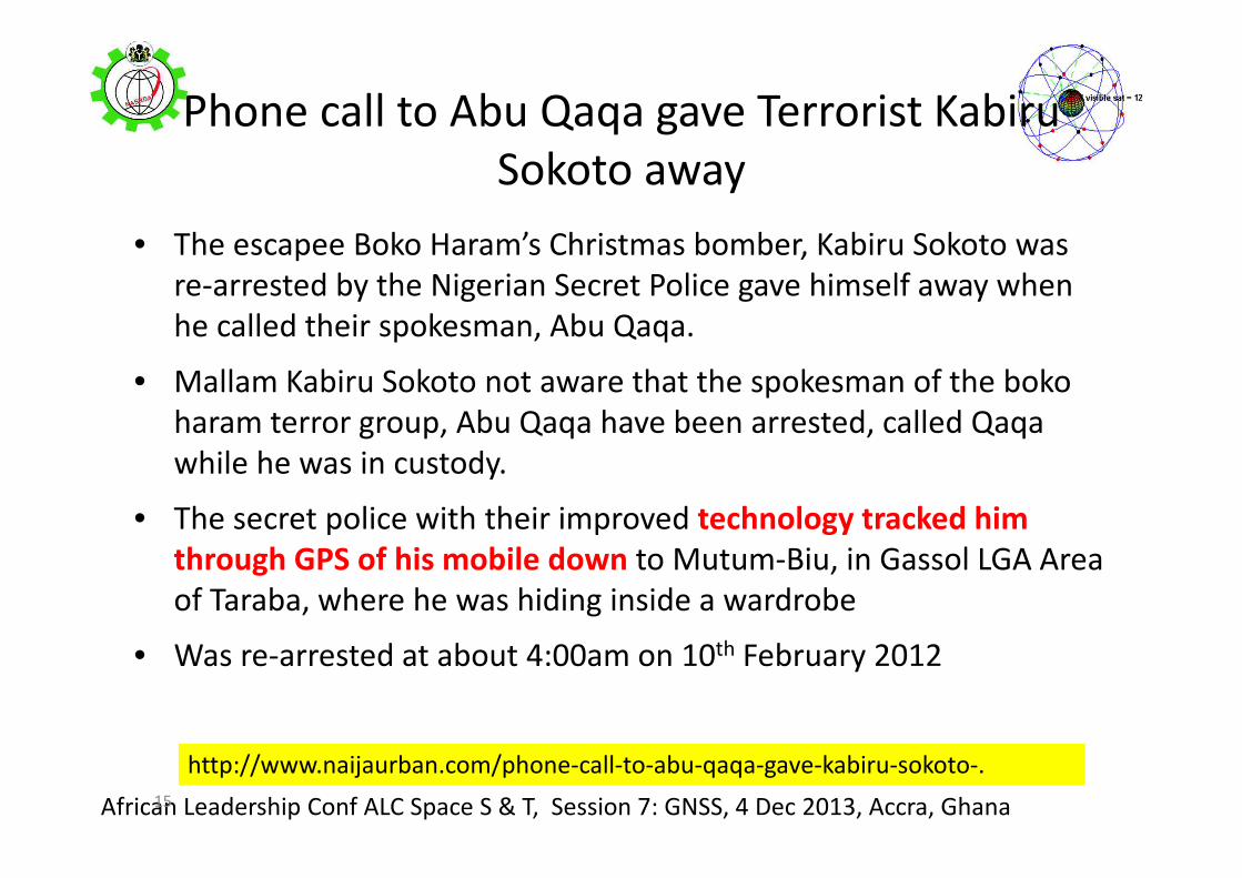
Phone call to Abu Qaqa gave Terrorist Kabiru
Sokoto away
• The escapee Boko Haram’s Christmas bomber, Kabiru Sokoto was
re-arrested by the Nigerian Secret Police gave himself away when
he called their spokesman, Abu Qaqa.
• Mallam Kabiru Sokoto not aware that the spokesman of the boko
haram terror group, Abu Qaqa have been arrested, called Qaqa
while he was in custody.
• The secret police with their improved technology tracked him
through GPS of his mobile down to Mutum-Biu, in Gassol LGA Area
of Taraba, where he was hiding inside a wardrobe
• Was re-arrested at about 4:00am on 10th February 2012
15
http://www.naijaurban.com/phone-call-to-abu-qaqa-gave-kabiru-sokoto-.
African Leadership Conf ALC Space S & T, Session 7: GNSS, 4 Dec 2013, Accra, Ghana
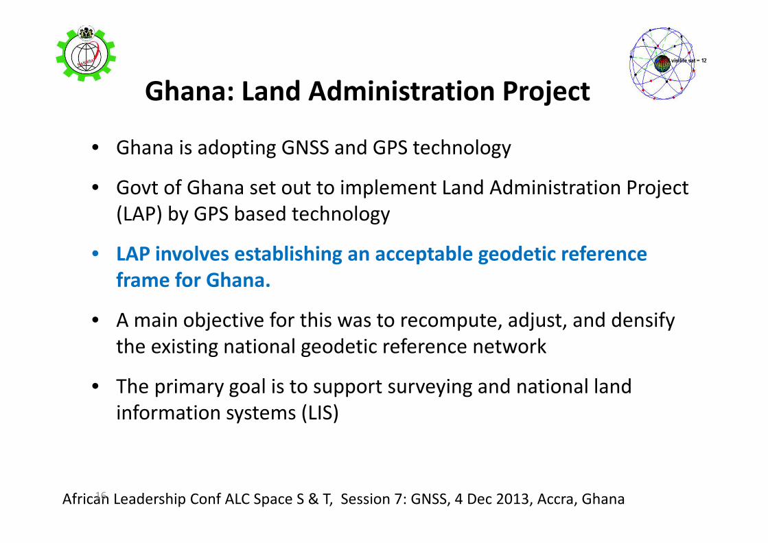
Ghana: Land Administration Project
• Ghana is adopting GNSS and GPS technology
• Govt of Ghana set out to implement Land Administration Project
(LAP) by GPS based technology
• LAP involves establishing an acceptable geodetic reference
frame for Ghana.
• A main objective for this was to recompute, adjust, and densify
the existing national geodetic reference network
• The primary goal is to support surveying and national land
information systems (LIS)
16
African Leadership Conf ALC Space S & T, Session 7: GNSS, 4 Dec 2013, Accra, Ghana
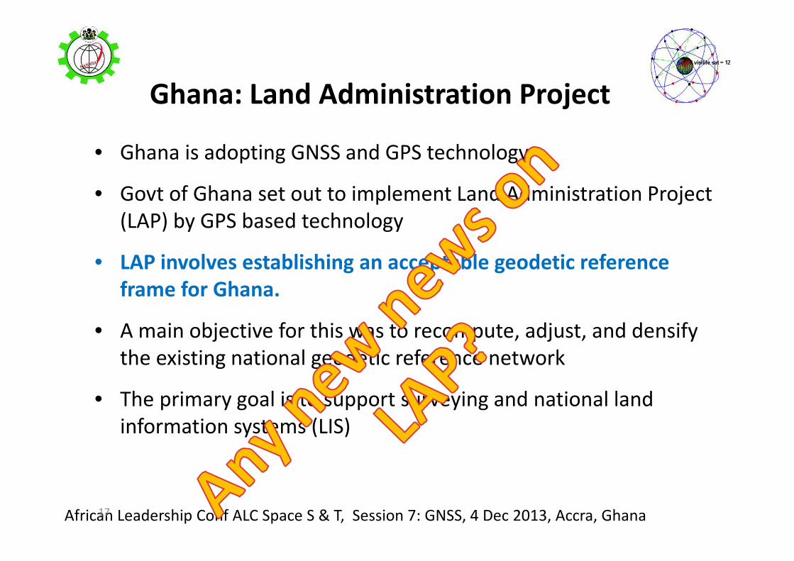
Ghana: Land Administration Project
• Ghana is adopting GNSS and GPS technology
• Govt of Ghana set out to implement Land Administration Project
(LAP) by GPS based technology
• LAP involves establishing an acceptable geodetic reference
frame for Ghana.
• A main objective for this was to recompute, adjust, and densify
the existing national geodetic reference network
• The primary goal is to support surveying and national land
information systems (LIS)
17

African Leadership Conf ALC Space S & T, Session 7: GNSS, 4 Dec 2013, Accra, Ghana
GNSS Receivers Densification
Programmes in Africa
18
AFREF
National Reference Frames
IGS
IHY/ISWI
AfricaArray
ICTP-BC joint GNSS program

African Leadership Conf ALC Space S & T, Session 7: GNSS, 4 Dec 2013, Accra, Ghana
The African Geodetic Reference Frame AFREF
�a unified geodetic reference frame
�fundamental basis for the national & regional
three-dimensional reference networks
�fully consistent and homogeneous with the
International Terrestrial Reference Frame ITRF
�Densification of GNSS networks with its
products in Africa
�Full implementation will include a unified
vertical datum and support for efforts to
establish a precise African geoid
http://geoinfo.uneca.org/afref/
19

African Leadership Conf ALC Space S & T, Session 7: GNSS, 4 Dec 2013, Accra, Ghana
AFREF: African solution� each African country has its national geodetic reference system for producing
maps and other geoinformation products - some countries even have more
than one
� representation of cross-border features on maps cannot be done accurately
� For example, roads, watershed & ecosystem boundaries and wildlife reserves
appear disconnected when national maps are joined together for regional
planning and decision analysis
�Work on large infrastructure projects is normally undertaken in sections
� a uniform mapping surface is required to ensure that the sections join up
� To unify the reference systems, parameters of the best fitting surface for map
projections need to be determined and used by all countries
20

African Leadership Conf ALC Space S & T, Session 7: GNSS, 4 Dec 2013, Accra, Ghana21

African Leadership Conf ALC Space S & T, Session 7: GNSS, 4 Dec 2013, Accra, Ghana22
ECA 2009, E/ECA/CODIST/1/6;
Products of incoherent maps - confusion

African Leadership Conf ALC Space S & T, Session 7: GNSS, 4 Dec 2013, Accra, Ghana
Reducing 54
Reference
frames to
1
Combrinck (AFREF Presentation Berlin GNSS 2008)
23

African Leadership Conf ALC Space S & T, Session 7: GNSS, 4 Dec 2013, Accra, Ghana
Strategy
• Densification of GNSS CORS
• Central processing of data
24

African Leadership Conf ALC Space S & T, Session 7: GNSS, 4 Dec 2013, Accra, Ghana
National Participation
25
• More than 5 countries have established a network of CORS
�Ghana
�Tanzania
�South Africa
�Nigeria
�Egypt
� (???)
• About 20 countries now have at least one CORS

African Leadership Conf ALC Space S & T, Session 7: GNSS, 4 Dec 2013, Accra, GhanaAfrican Leadership Conf ALC Space S & T, Session 7: GNSS, 4 Dec 2013, Accra, Ghana
Typical AFREF CORS
26
Recently installed
GPS antenna at
Sokoto, Northern
Nigeria, 6th Nov 2013

African Leadership Conf ALC Space S & T, Session 7: GNSS, 4 Dec 2013, Accra, Ghana
Benefits of Good national geodetic network
� Provides foundation for all geo-referencing activities.
� It is the base for coherent multipurpose Land Information System (cadastre)
and its subsequent maintenance.
� positioning services,
� surveying & mapping,
� Community-Boundary mapping
� food security, disaster management,
� air, land & sea navigation,
� Effective land administration, registration & taxation
� emergency response, management of resources
� promotion of Good Governance
� revenue planning and collection.
� Checkmating corrupt practices
27

African Leadership Conf ALC Space S & T, Session 7: GNSS, 4 Dec 2013, Accra, Ghana
Capabilities of AFREF (Combrinck, 2008)
28
Combrinck, 2008, Berlin
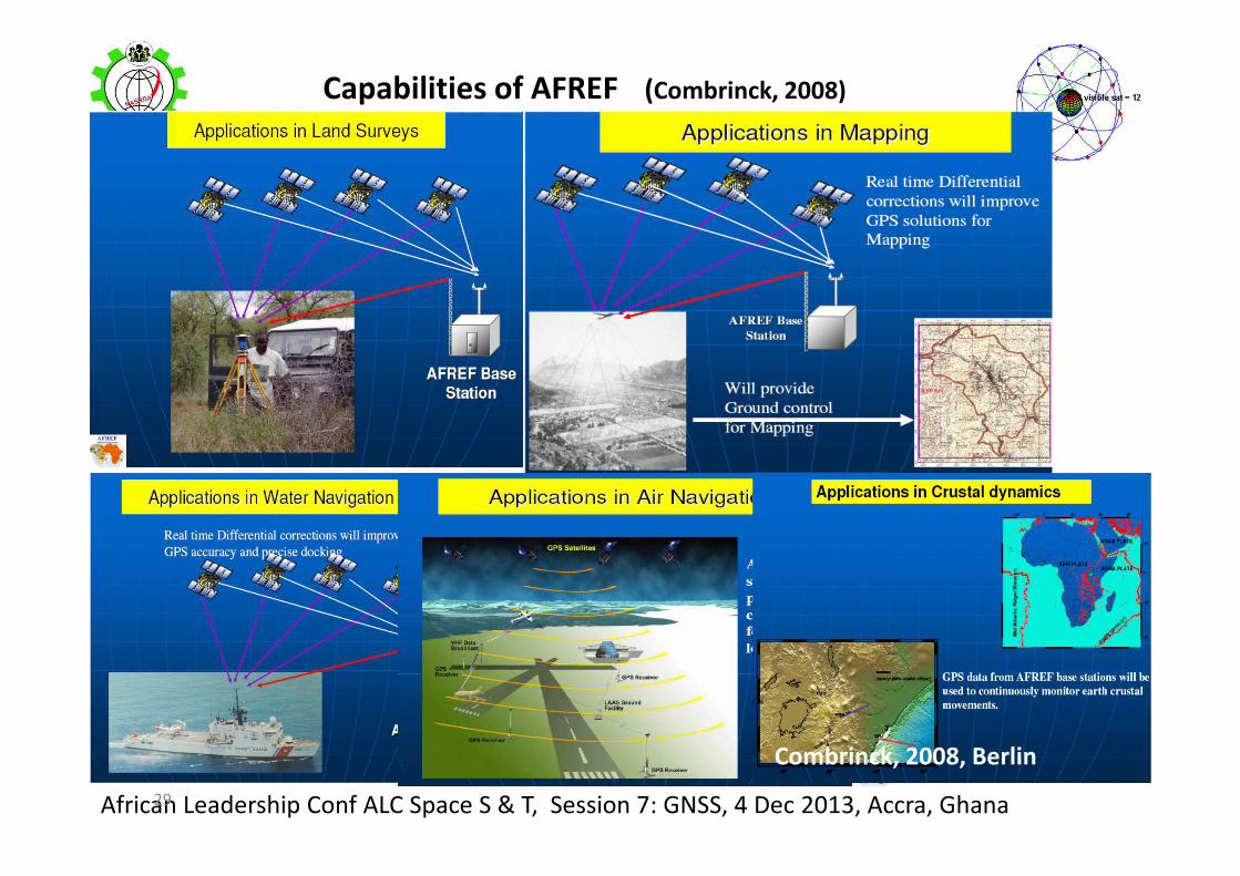
African Leadership Conf ALC Space S & T, Session 7: GNSS, 4 Dec 2013, Accra, Ghana
Capabilities of AFREF (Combrinck, 2008)
29
Combrinck, 2008, Berlin

African Leadership Conf ALC Space S & T, Session 7: GNSS, 4 Dec 2013, Accra, Ghana
NATIONAL REFERENCE FRAMES
30

African Leadership Conf ALC Space S & T, Session 7: GNSS, 4 Dec 2013, Accra, Ghana
Densification of National networks
31
South African TRIGNET (60 GPS CORS) Nigerian NIGNET 11 GPS CORS

African Leadership Conf ALC Space S & T, Session 7: GNSS, 4 Dec 2013, Accra, Ghana
NIGNET
32
• Top – OSGF station installed
at OSGoF headquarters,
Abuja
• Middle – UNILAG station
installed at the campus of
University of Lagos.
• Bottom Left –FUTY station
installed at Federal
University of Technology of
Yola
• Bottom Right - location at
Toro.
(Jatau et al, 2010, Sydney, Australia)

African Leadership Conf ALC Space S & T, Session 7: GNSS, 4 Dec 2013, Accra, Ghana
AfricaArray
• Launched in July 2004
• AfricaArray mission: To create new geoscientific research and
training programmes and rebuild existing ones in Africa with
Africans and for Africans
• While the long-term vision is to support training in many
geoscience fields
• development of new geophysical training programmes and
expanded support of existing ones
• promotion of geophysical research; and design and establishment
of a network of geophysical observatories
33http://www.africaarray.psu.edu
African Leadership Conf ALC Space S & T, Session 7: GNSS, 4 Dec 2013, Accra, Ghana34
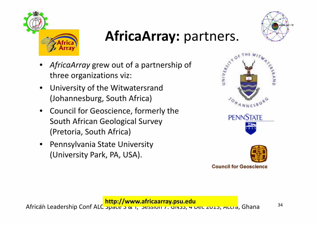
AfricaArray: partners.
• AfricaArray grew out of a partnership of
three organizations viz:
• University of the Witwatersrand
(Johannesburg, South Africa)
• Council for Geoscience, formerly the
South African Geological Survey
(Pretoria, South Africa)
• Pennsylvania State University
(University Park, PA, USA).
34http://www.africaarray.psu.edu

African Leadership Conf ALC Space S & T, Session 7: GNSS, 4 Dec 2013, Accra, Ghana
AfricaArray: Operations
• A network of shared scientific observatories across Africa linked through
common instrumentation, data access, and operation
• Data from the observatories provide the underpinning for much of the
science supported by AfricaArray. Some of the observatories are permanent,
while others are installed and operated on a temporary basis
• The first phase of AfricaArray (2005-2007) established a network of 20 to 30
permanent observatories spanning much of southern and eastern Africa
• the second phase of AfricaArray (2008-2010), the network of permanent
observatories was expanded into other parts of Africa,
35

African Leadership Conf ALC Space S & T, Session 7: GNSS, 4 Dec 2013, Accra, Ghana
• starting in August, 2010,
many of the observatories
are being equipped with GPS
receivers and automated
weather stations.
• data are archived at the
UNAVCO Data Management
Facility
36
AfricaArray stations

African Leadership Conf ALC Space S & T, Session 7: GNSS, 4 Dec 2013, Accra, Ghana
• Partnership between Boston College, USA and Abdus
Salam ICTP, Trieste, Italy.
• Series of annual Workshops since 2009
• Deployment of GPS stations in Africa
• Over 300 African scientists have been trained at ICTP
• Leading experts in GNSS teach at the annual workshops
• A training model
ICTP-BC GNSS in Africa
37

African Leadership Conf ALC Space S & T, Session 7: GNSS, 4 Dec 2013, Accra, Ghana38
International Heliophysical Year 2007 (IHY,
2005-2009)
&
International Space Weather Initiative
(ISWI, 2010 -).
www.ihy2007.org
38
http://www.spaceweather-eg.org/iswi/

African Leadership Conf ALC Space S & T, Session 7: GNSS, 4 Dec 2013, Accra, Ghana
IHY/ISWI• Initiated in 1990, the United Nations Basic Space Science Initiative
(UNBSSI) has led to the establishment of planetariums,
astronomical telescope facilities, and IHY/ISWI instrument arrays
worldwide, particularly in developing countries
• ISWI is envisioned to continue the tradition of IHY in the
worldwide deployment of space weather monitoring instrument
arrays
• To date, ISWI contributes to the observation of space weather
through 14 instrument arrays with close to 1000 operating
instruments in 97 countries
39
www.ihy2007.org http://www.spaceweather-eg.org/iswi/

African Leadership Conf ALC Space S & T, Session 7: GNSS, 4 Dec 2013, Accra, Ghana
IHY/ISWI ANCHORS
�United Nations office for Outer Space
Affairs UNOOSA, Vienna, Austria
�International Committee on Global
Navigation Satellite Systems (ICG)
�NASA
40

African Leadership Conf ALC Space S & T, Session 7: GNSS, 4 Dec 2013, Accra, Ghana
IHY/ISWI
• increase of stations
that can serve as
CORS in Africa in
recent time
• IHY/ISWI activity
has increased the
potential CORS in
Africa by more
than 20
41

African Leadership Conf ALC Space S & T, Session 7: GNSS, 4 Dec 2013, Accra, Ghana
SCINTILLATION NETWORK DECISION AID
(SCINDA)
• Ground-based sensor network
– Passive UHF / L-band /GPS
scintillation receivers
– Measures scintillation intensity,
eastward drift velocity, and TEC
– Automated real-time data retrieval
via internet
• Data supports research and space weather
users
– Understand on-set, evolution and
dynamics of large-scale ionospheric
disturbances
– Empirical model provides simplified
visualizations of scintillation regions
in real-time
A regional nowcasting system to support research and users of space-based
communication and navigation systems
Real-time to 2-Hr Forecasts
42
African Leadership Conf ALC Space S & T, Session 7: GNSS, 4 Dec 2013, Accra, Ghana
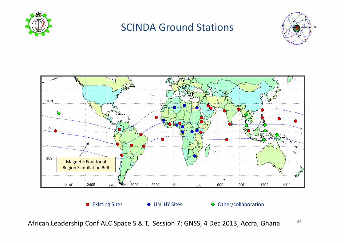
SCINDA Ground Stations
30N
0
30S
210E 240E 270E 300E 330E 0 30E 60E 90E 120E 150E
Existing Sites UN IHY Sites Other/collaboration
Magnetic Equatorial
Region Scintillation Belt
43

African Leadership Conf ALC Space S & T, Session 7: GNSS, 4 Dec 2013, Accra, Ghana
SCINDA facility
at Akure, Nigeria
44

African Leadership Conf ALC Space S & T, Session 7: GNSS, 4 Dec 2013, Accra, Ghana 4545
VTEC, S4, ROT &
ROTI,
3rd March 2010
Ap = 8
ROTI gave a
more
pronounced
representation
of TEC
fluctuation than
S4
Rabiu et al (2012)

African Leadership Conf ALC Space S & T, Session 7: GNSS, 4 Dec 2013, Accra, Ghana
Capabilities of GNSS products
• producing good governance
• inhibits corruption
• create job opportunities
• advance wealth creation
• promote quality of living
• Secured society/public safety
• Control emigration, engaging active minds
• provide platform for sustainable manpower and economic
development
Me
ga
-so
luti
on
to
Re
gio
na
l m
eg
a-p
rob
lem
s
46

African Leadership Conf ALC Space S & T, Session 7: GNSS, 4 Dec 2013, Accra, Ghana
Recommendations
• Intensify complimentary efforts at densifying the GNSS
ground infrastructures
• Development of Pre-requisite physical infrastructures
for GNSS facilities
• Internet connectivity
• Power
47

African Leadership Conf ALC Space S & T, Session 7: GNSS, 4 Dec 2013, Accra, Ghana
Summary� GNSS is being used for ionospheric and space weather research in Africa
� Socio-economic application of GNSS is increasing in Africa
�International GNSS programs with impact in Africa include those of:
� AFREF
�National Reference Frames
�IGS
�IHY/ISWI
�AfricaArray
�ICTP-BC joint GNSS program
�GNSS has enormous capability to provide platform for sustainable
manpower and socio-economic development
�GNSS is still being under-explored in developing Africa!
48
African Leadership Conf ALC Space S & T, Session 7: GNSS, 4 Dec 2013, Accra, Ghana
Thank You
49

African Leadership Conf ALC Space S & T, Session 7: GNSS, 4 Dec 2013, Accra, Ghana
Acknowledgements
�UNOOSA
�NASRDA
�LOC, ALC 2013
50