glaciation and glacial erosion. - k elliott geography c glaciation 2016(i) - copy.pdf · glaciers...
TRANSCRIPT

GLACIATION
and Glacial
Erosion.


Ice Caps – cover land less than
50,000sq kms

Ice Sheets – cover land more than
50,000 sq kms.


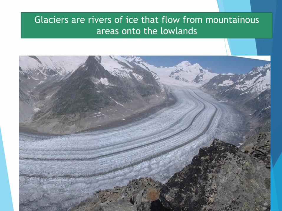
Glaciers are rivers of ice that flow from mountainous
areas onto the lowlands

Ice can be
hundreds of
metres thick

The ice carries soil
and boulders with it.

Crevasses exist in
the ice – this is
evidence that
the ice is moving

Large boulders can
be carried by the
ice and deposited
hundreds of kms
from where they
originated
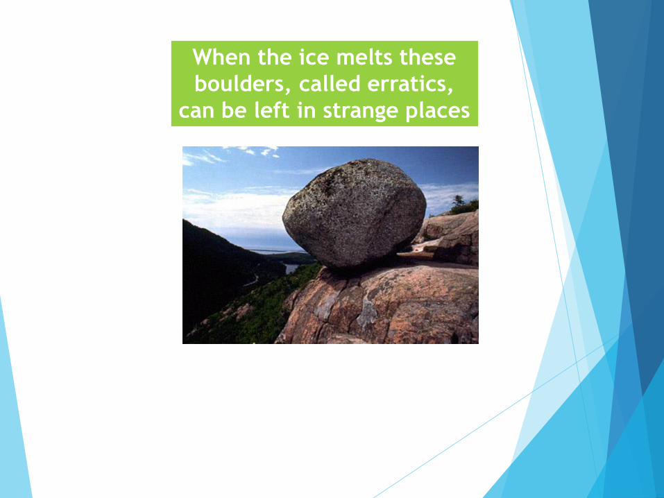
When the ice melts these
boulders, called erratics,
can be left in strange places

CORRIES,
CIRQUES

Ice and snow
can collect in a
hollow in the
side of a
mountain

Eventually the hollow becomes too small for all
the snow and so it spills out and makes its way
down the mountainside

When the ice melts, a deep hollow is left in
the side of the mountain. This is a corrie or
a cirque. Sometimes it may contain water

ARETES

An ARETE is
a thin, knife
edged ridge
between
two corries.
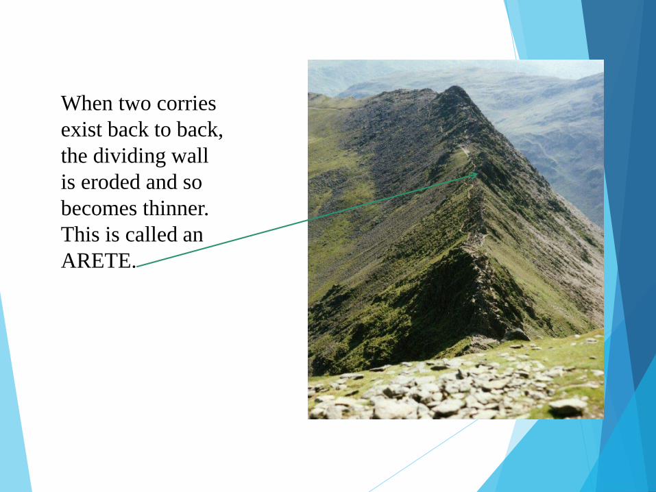
When two corries
exist back to back,
the dividing wall
is eroded and so
becomes thinner.
This is called an
ARETE.

PYRAMIDAL
PEAK

When a mountain peak contains TWO or
more aretes, it takes on the shape of a
triangle and is called a PYRAMIDAL peak

The Matterhorn in the Alps is the best example


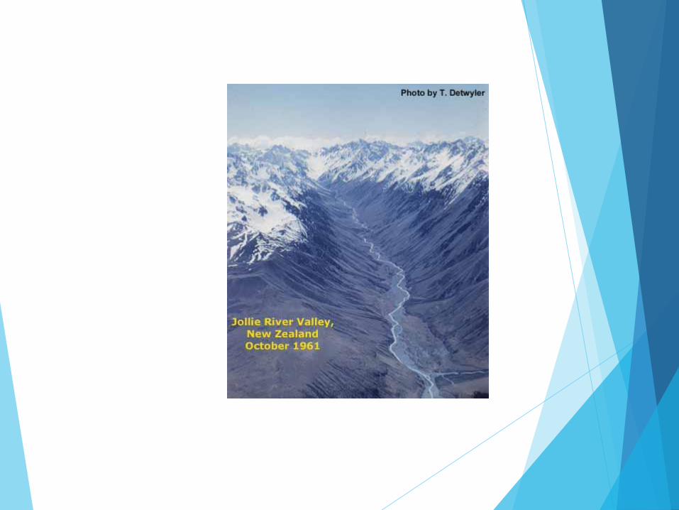
U SHAPED
VALLEYS

When the
ice flows
out of the
corrie it
makes its
way down
onto the
lowlands in
a glacier.

Glaciers usually make their way down old
river valleys. Due to the strength of the
glacier it is eroding the bed and the sides of
the river valley as it moves.
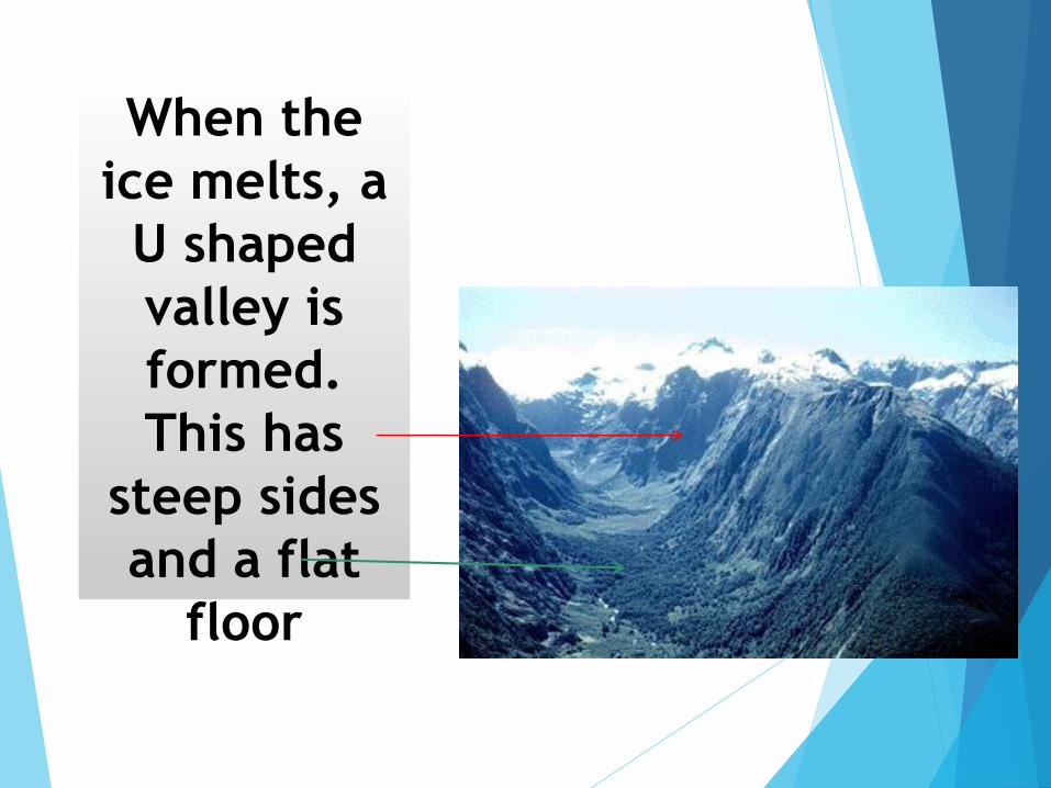
When the
ice melts, a
U shaped
valley is
formed.
This has
steep sides
and a flat
floor


Ribbon
lakes
Steep
sides
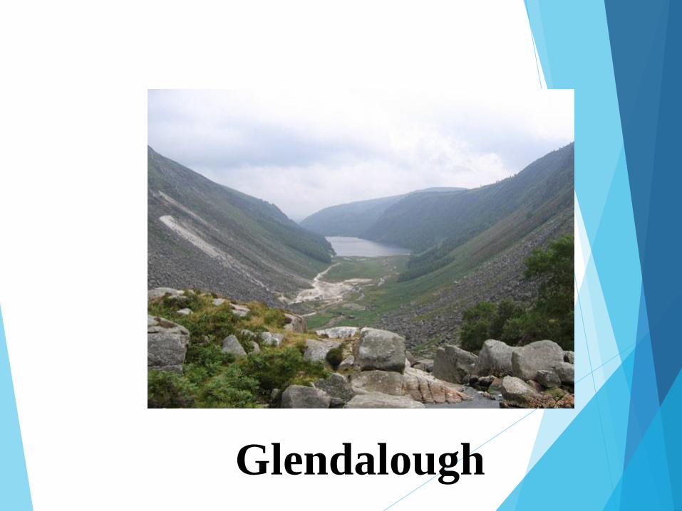
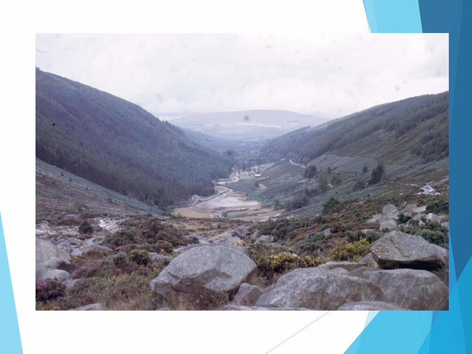
Glendalough
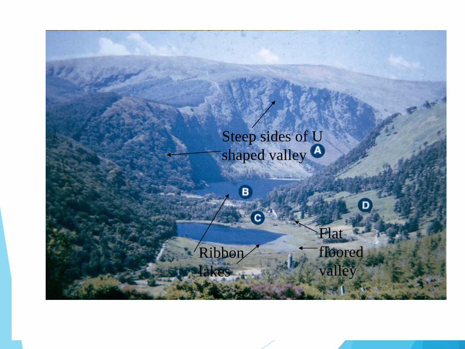
Ribbon
lakes
Flat
floored
valley
Steep sides of U
shaped valley


Hanging
Valley

Sometimes
smaller
glaciers
can form
high up in
the
mountains
at right
angles to
the main
glacier

Because
they are
not as
powerful,
they do not
erode as
much

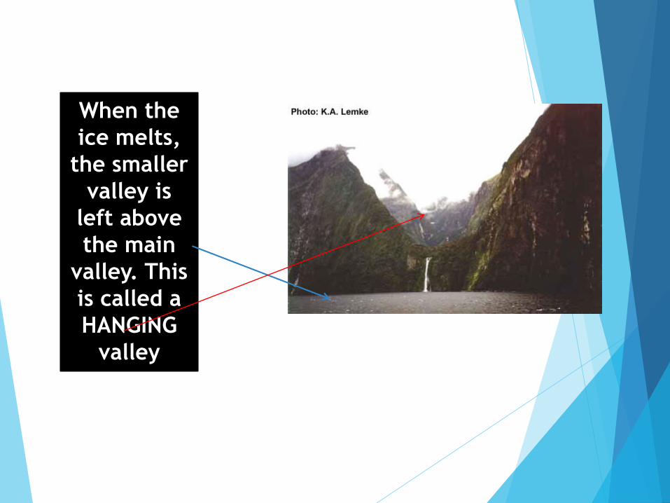
When the
ice melts,
the smaller
valley is
left above
the main
valley. This
is called a
HANGING
valley

Very often a
waterfall
flows from
the hanging
valley down
into the main
U shaped
valley.

TRUNCATED
SPURS
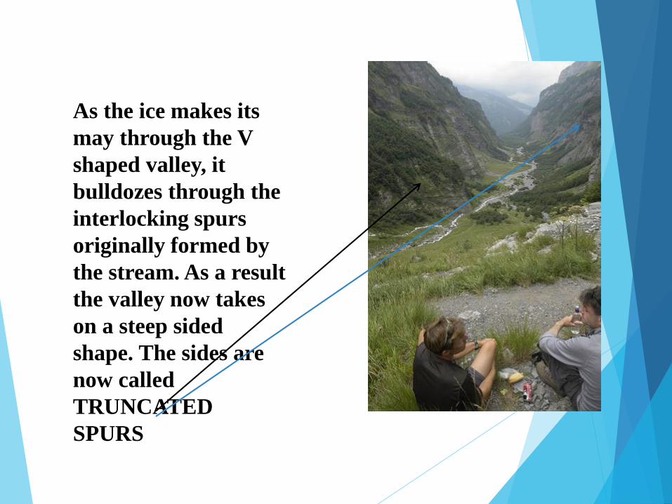
As the ice makes its
may through the V
shaped valley, it
bulldozes through the
interlocking spurs
originally formed by
the stream. As a result
the valley now takes
on a steep sided
shape. The sides are
now called
TRUNCATED
SPURS

Greenland
Truncated spurs
create steep valley
sides

RIBBON
LAKES

As the glacier
makes its way
down through the
u shaped valley, it
meets sections of
rock on the valley
floor. It freezes
around them and
so when it moves
plucks out the rock
and carries it with
it. The hollow left
on the valley floor
can fill with water
to be called a
RIBBON LAKE

These ribbon
lakes can also
be called
PATER
NOSTER
lakes as they
are thought to
resemble the
beads on a
Rosary beads

There is
no limit to
the
amount of
lakes that
can be
found in
the U
shaped
valley.

Ribbon
lakes can
be any
size or
shape
FIORD,
FJORD

Sometimes the glacier can move out to sea and cut
a U shaped valley that ends at the coastline. When
the ice melts, the section of the u shaped valley
closest to the coast can flood and so it is called a
FIORD


Killary Harbour, Ireland’s only FIORD

FIORD Norway

FIORD NORWAY

Landscape
features in
West of
Ireland
formed by
glaciers.