gis cmm dot - transportation.org · slimgim-t cmm 1. organizational structure and leadership y d...
TRANSCRIPT

DOT GIS CMMGIS CMM and State DOTs
GOTUG Webinar
January 9, 2019

Today’s Outline
What is a GIS CMM?
What are State DOTs doing with GIS CMMs?

What is a GIS CMM?
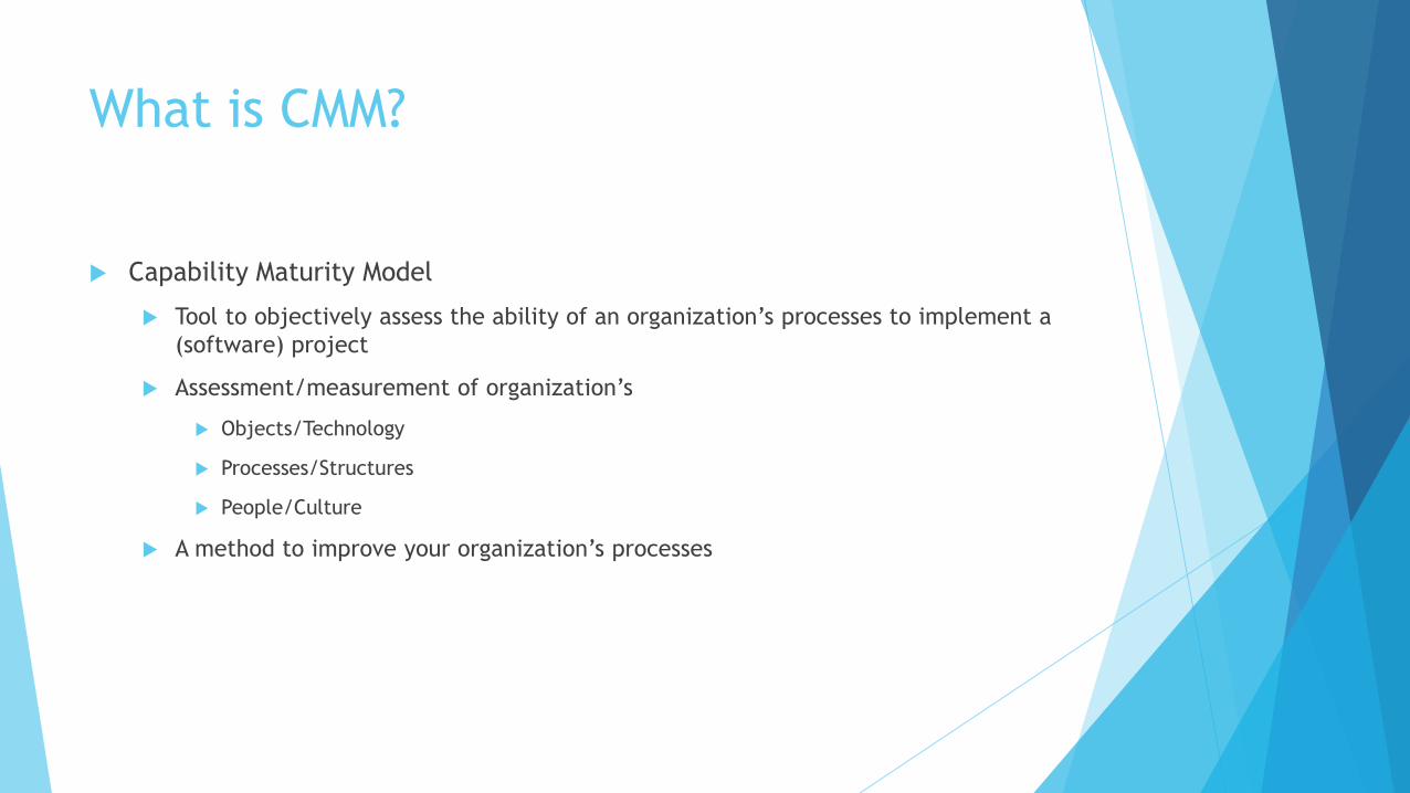
What is CMM?
Capability Maturity Model
Tool to objectively assess the ability of an organization’s processes to implement a
(software) project
Assessment/measurement of organization’s
Objects/Technology
Processes/Structures
People/Culture
A method to improve your organization’s processes

Maturity Levels
InitialRepeatable
DefinedManaged
Optimized
• Processes are
disorganized
• Individual efforts
• Not repeatable
• Not defined and
documented
• Reactive, ad-hoc
• Basic management
techniques
• Successes can be
replicated
• Established
process
• Documented
processes
• Generally
consistent
application
• Documented
processes
• Performance
measured
• Documented
processes
• Performance
measured
• Continuous
process
improvement
Maturity
What are the measures?

What is a GIS CMM?
Helps an answer the question, “Got Enterprise GIS?”
Ultimately defines an Enterprise GIS
Helps you measure yourself to see if you are there
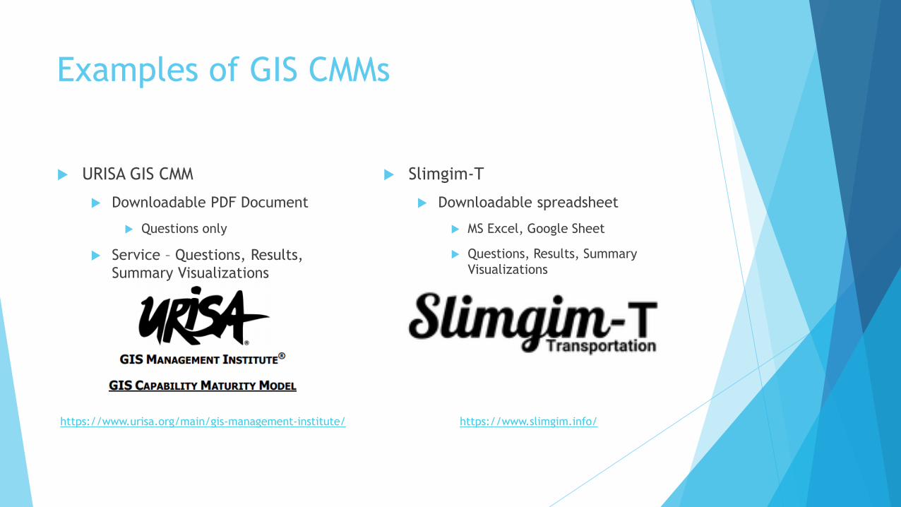
Examples of GIS CMMs
URISA GIS CMM
Downloadable PDF Document
Questions only
Service – Questions, Results,
Summary Visualizations
Slimgim-T
Downloadable spreadsheet
MS Excel, Google Sheet
Questions, Results, Summary
Visualizations
https://www.urisa.org/main/gis-management-institute/ https://www.slimgim.info/

URISA GIS CMM
Enabling Capability Component
23 Questions
Do you have the resources,
organizational structure, and
infrastructure to do what you need
to do?
Execution Ability Component
22 Questions
Are you able to maximize the use
of your available capability?

URISA GIS CMM – Enabling Capability

URISA GIS CMM – Execution Ability

URISA GIS Capability Maturity
Assessment Service
A comprehensive assessment of GIS management capability maturity. The
assessment tool indicates your organization’s GIS management maturity on a
wide range of geospatial capabilities.
Annual self-administered assessment of key metrics associated with organizational
GIS management maturity levels
Results report and graphic charting
Visualize your organization’s GIS management strengths and weaknesses
Comparison across other organizations
For URISA members
https://www.urisa.org/main/gis-management-institute/
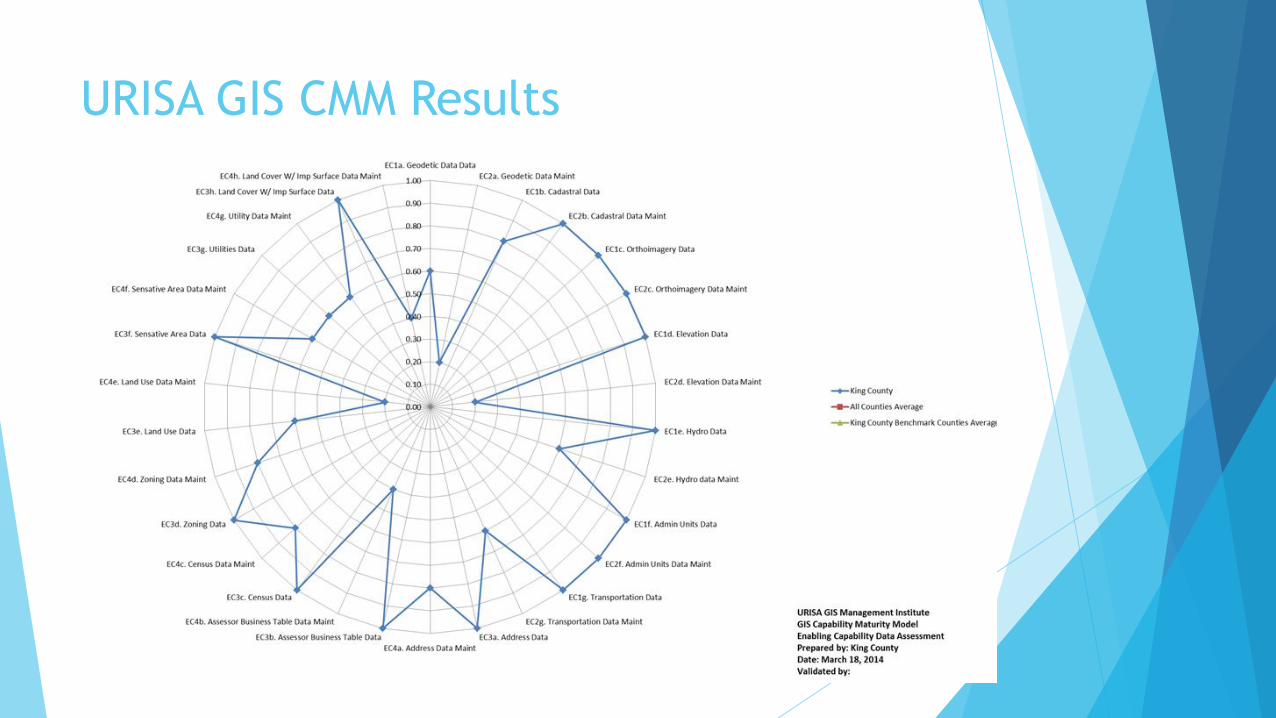
URISA GIS CMM Results

URISA GIS CMM Results Comparison

Slimgim-T CMM
Based on Slimgim CMM by Paul Giroux
Creative Commons License
Components
Organizational Structure & Leadership (8)
Corporate Culture (11)
Organizational Capability (4)
Enterprise GIS Sustainability (8)
Foundational Data & Technologies (11)

Slimgim-T CMM
1. Organizational Structure and Leadership
Mat
uri
ty
Like
liho
od
GIO 1.1 GIS manager or coordinator
The organization has a permanent Enterprise GIS management function and position. 2 5
GIA 1.2 GIS is authoritative
Spatial data has been recognized as a critical component of business systems and should work seamlessly
between the business systems and the software. 2 3
FGG 1.3 Formal GIS governance
Formal GIS governance is established which may include committee structures, user groups and working
groups. Some structure is in place to coordinate long range planning, stakeholder satisfaction and ability
to leverage EGIS are in place in some organized manner.
5 4
GRA 1.4 GIS resource allocation
Management has in place policies, procedures, and sufficient resource allocation to maintain GIS related
services2 5
VCU 1.5 GIS v ision & comprehensive use
Formal GIS governance is established which may include committee structures, user groups, and working
groups. Some structure is in place to coordinate long range planning, stakeholder satisfaction, and ability
to leverage EGIS are in place in some organized manner. 5 2
IDC 1.6 Inter-department cooperation
An emphasis is placed on integration and coordination of inter-departmental activities. There are
processes and procedures in place for inter-departmetal conflict management and to prevent duplicative
efforts.
4 2
GPA 1.7 GIS projects align with enterprise vision
GIS projects undertaken work seamlessly within the enterprise framework and aim to help the
agency work smarter and more efficiently. 3 4
SUS 1.8 Strategic use of GIS by senior management
Senior management recognizes EGIS as a strategic technology. 2 3
1. Average maturity of organizational structure and leadership 3.1 3.5
Enter value of 1 - 5
Auto update totals
Maturity
1 = Ad-hoc
2 = Repeatable
3 = Define
4 = Managed
5 = Optimized
Improvement Likelihood
1 = Extremely Unlikely
2 = Likely
3 = Neutral
4 = Unlikely
5 = Extremely Likely
1. Organizational Structure and Leadership
Mat
uri
ty
Like
liho
od
GIO 1.1 GIS manager or coordinator
The organization has a permanent Enterprise GIS management function and position. 2 5
GIA 1.2 GIS is authoritative
Spatial data has been recognized as a critical component of business systems and should work seamlessly
between the business systems and the software. 2 3
FGG 1.3 Formal GIS governance
Formal GIS governance is established which may include committee structures, user groups and working
groups. Some structure is in place to coordinate long range planning, stakeholder satisfaction and ability
to leverage EGIS are in place in some organized manner.
5 4
GRA 1.4 GIS resource allocation
Management has in place policies, procedures, and sufficient resource allocation to maintain GIS related
services2 5
VCU 1.5 GIS v ision & comprehensive use
Formal GIS governance is established which may include committee structures, user groups, and working
groups. Some structure is in place to coordinate long range planning, stakeholder satisfaction, and ability
to leverage EGIS are in place in some organized manner. 5 2
IDC 1.6 Inter-department cooperation
An emphasis is placed on integration and coordination of inter-departmental activities. There are
processes and procedures in place for inter-departmetal conflict management and to prevent duplicative
efforts.
4 2
GPA 1.7 GIS projects align with enterprise vision
GIS projects undertaken work seamlessly within the enterprise framework and aim to help the
agency work smarter and more efficiently. 3 4
SUS 1.8 Strategic use of GIS by senior management
Senior management recognizes EGIS as a strategic technology. 2 3
1. Average maturity of organizational structure and leadership 3.1 3.5

Slimgim-T Results
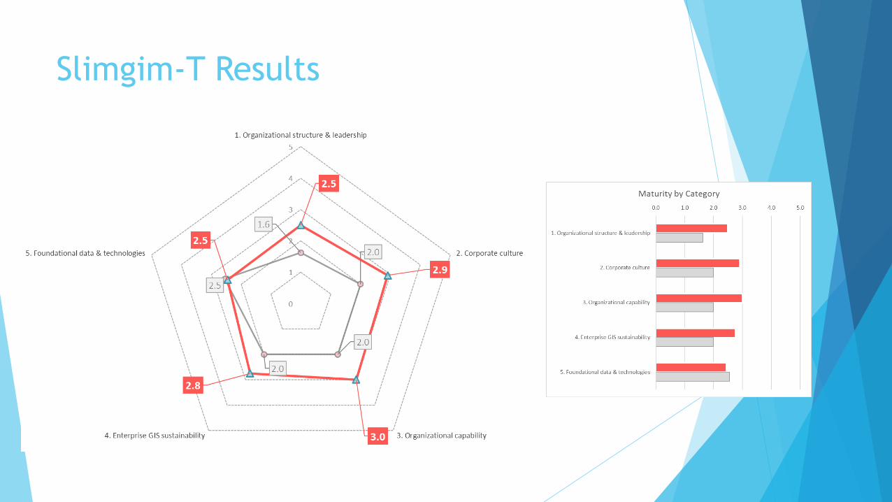
Slimgim-T Results

What are states doing with GIS
CMMs?
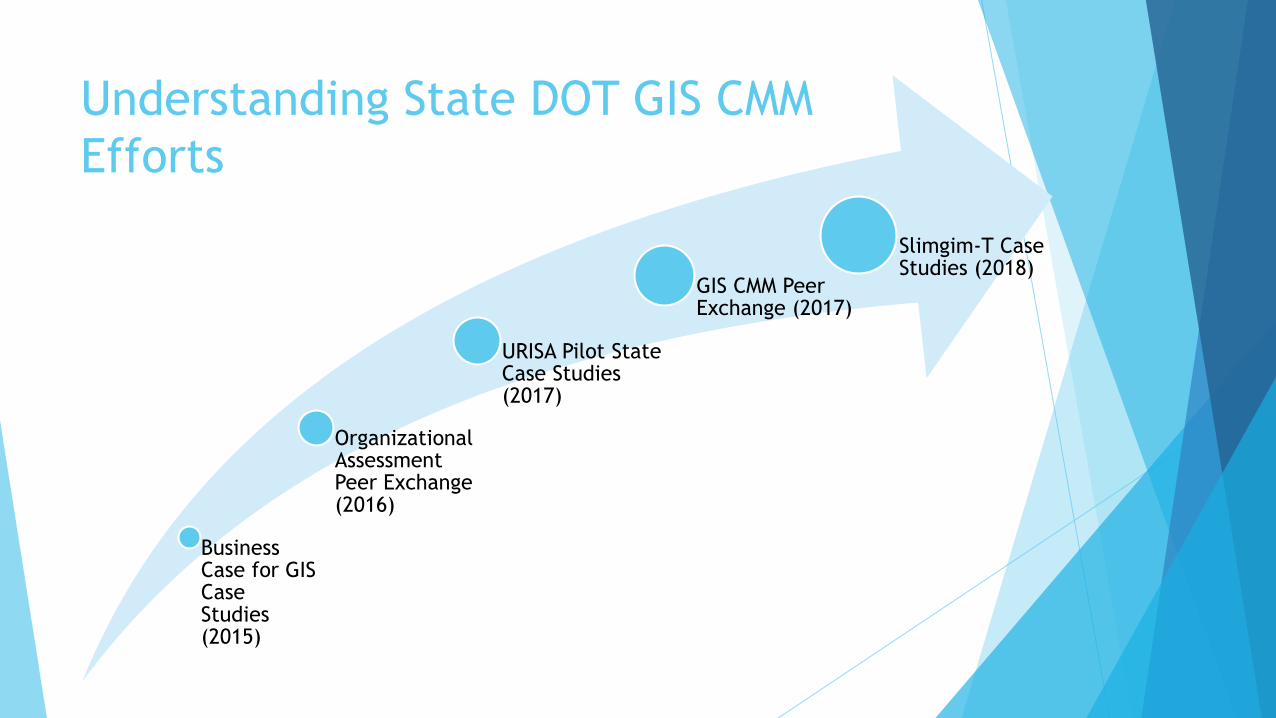
Understanding State DOT GIS CMM
Efforts
Business Case for GIS Case Studies (2015)
Organizational Assessment Peer Exchange (2016)
URISA Pilot State Case Studies (2017)
GIS CMM Peer Exchange (2017)
Slimgim-T Case Studies (2018)

GIS CMM Pilot States (and a Province)
States volunteered
to try out GIS CMMs
Captured their
experiences in
interviews
Results of
interviews
produced case
study reports
Motivations
Benefits
Challenges
Lessons Learned
Why do DOTs want to use a GIS CMM?
Formally identify current business process limitations
Leverage model results to prioritize and promote needed GIS projects
Demonstrate the success of other GIS initiatives
Compare evaluation results with other similar agencies

Benefits to Using a GIS CMM
Allows GIS professionals to demonstrate changes in maturity that result from
clearly defined and executed tasks
Helps identify strengths, weaknesses in GIS applications and services at an
agency
Facilitate discussions that can lead to actionable short-term and long-term
items
Challenges to Using a GIS CMM
Completing a new CMM assessment can be time-intensive
Limited staffing to do the CMM
Lessons Learned
CMMs and scaled assessments are critical to developing GIS departments
Strong understanding and “buy-in” is needed in order to start and complete
the analysis effectively
A test run can be helpful to get context before taking an in-depth approach to
the CMM
Identifying an efficient organizational structure of GIS, IT, and Planning
departments within an agency is critical
Establish efficient data management policies and processes in order to
maintain continuity.

My Observations
Working on the CMM is as valuable as the results itself
Conversation starter
Approaches for completing a CMM will impact results
Individual effort
Group effort
Several individuals coming together to compare results
Share and compare results can have big benefits
Individual State GIS CMM efforts can give national perspective
Help peers learn from each other
Need exists for successful strategies for doing GIS CMM
Mature Organization can lead to Successful GIS applications

Summary
What is GIS CMM?
What is CMM?
URISA GIS CMM
Slimgim-T CMM
What are State DOTs doing with GIS CMM?
Who
Motivations for doing a GIS CMM
GIS CMM Benefits and challenges
Pilot states lesson learned
Observations

More Detailed Information Available
FHWA Reports at https://gis.fhwa.dot.gov
Organizational Assessments and GIS Peer Exchange Summary Report -https://www.gis.fhwa.dot.gov/documents/Capability_Maturity_Model_Peer_Exchange.htm
URISA GIS CMM Case Study Report -https://www.gis.fhwa.dot.gov/documents/GIS_Capability_Maturity_Models_Case_Studies.htm
CMM Peer Exchange Summary Report -https://www.gis.fhwa.dot.gov/documents/Capability_Maturity_Model_Peer_Exchange_Ohio_Sept2017.htm
Slimgim-T Case Study Report - https://www.gis.fhwa.dot.gov/documents/Slimgim-T_GIS_Capability_Maturity_Model.htm
Contact – Mark Sarmiento, [email protected]
One more thing…Special Interest Group (SIG) Meeting at 2019 AASHTO GIS-T Symposium,
April 23 – 26, 2019, Kissimmee, Florida.