gila county grading and drainage … gila county grading & drainage ordinance article i...
TRANSCRIPT
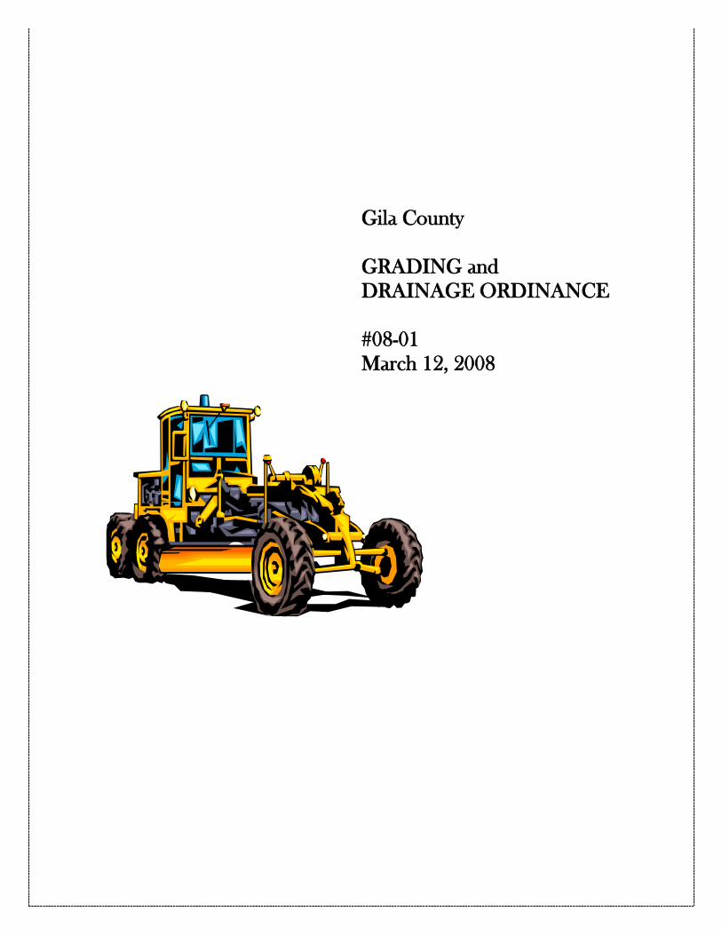
Gila County
GRADING and DRAINAGE ORDINANCE
#08-01 March 12, 2008

2
GILA COUNTY
GRADING & DRAINAGE ORDINANCE
ARTICLE I
STATUTORY AUTHORIZATION, FINDINGS OF FACT, PURPOSE, AND OBJECTIVES
100.0 STATUTORY AUTHORIZATION The Legislature of the State of Arizona has in A.R.S. 11-251(30), (31), and (36) and A.R.S. 11-251.05 authorized the Board of Supervisors to “Do and perform all other acts and things necessary to the full discharge of its duties as the legislative authority of the county government.” And to “adopt and enforce standards for excavation, landfill and grading to prevent unnecessary loss from erosion, flooding and landslides.” And to “adopt, amend and repeal all ordinances necessary or proper to carry out the duties, responsibilities and functions of the County.” 101.0 FINDINGS OF FACT Grading and development can increase runoff from undisturbed lands. As more land is developed more runoff can occur. An increase in runoff affects surrounding property as well as downstream properties. As property develops, the capacity of natural channels may be exceeded. 102.0 STATEMENT OF PURPOSE It is the purpose of this ordinance to promote the public health, safety, and general welfare, and to minimize public and private losses by regulating grading and drainage of all land within the unincorporated area of Gila County, Arizona. 103.0 TITLE The ordinance may be cited as the “Gila County Grading and Drainage Ordinance” and shall be referred to herein as the “Ordinance”.
3
ARTICLE II
DEFINITIONS 200.0 DEFINITIONS “Acre, net” means 43,560 square feet not including Rights-of-Way, roadway easement or ingress and egress easements. “Acre, commercial” means thirty six thousand (36,000) square feet of land area, exclusive of streets and alleys and other non-developable square footage. “Appeal” means a request for review of the Public Works Director or his designee’s interpretation or application of the provisions of this Regulation. "Approval" shall mean that the proposed work or completed work conforms to this ordinance in the opinion of the Public Works Director or his designee as evidenced by the issuance of a “Grading and Drainage Compliance Form” “A.R.S.” means Arizona Revised Statutes. "As-Graded" is the extent of surface conditions on completion of grading. "Bedrock" is in-place solid rock. "Bench" is a relatively level step excavated into earth material on which fill is to be placed. "Borrow" is earth material acquired from an off-site location for use in grading on a site. “Building Official” means the functional title of the Director of the Community Development Division, or the Director’s duly authorized representative, charged with the administration and enforcement of the Gila County Building Code. “Building Site” means the area extending laterally a minimum distance of 5 feet beyond the foundation or support of a structure, which is constructed or placed on the site. "Civil Engineer" is a professional engineer registered by the State of Arizona to practice in the field of civil works, in accordance with A.R.S. Title 32, Chapter 1. "Compaction" is the densification of a fill by mechanical means. “Design Flow” means the peak flow and peak volume of rainfall resulting from the design storm generated within a defined area.

4
“Design Storm” means a rainfall event having a one-percent probability of occurrence in any given year, also referred to as the “100-year storm”. “Design Storm Duration” means the length of time over which the design storm occurs. “Design Standards” means criteria for design of grading and drainage facilities, and criteria for preparation of Drainage and Grading Report/plan, as determined and published by the Public Works Director or his designee. “Detention System” means a system, which detains runoff in controlled manner through the use of storage facilities. Stored runoff is metered out at specified rate to accomplish the detention design objectives. “Development” means any man-made change to property, including but not limited to, buildings or other structures, mining, dredging, filling, grading, landscaping, paving, excavation or drilling operations. “Drainage” means runoff, which flows overland as a result of precipitation. This shall include sheet flow and flows which may concentrate in local drainage systems with or without defined channels. “Public Works Director or his designee” means the individual or position as appointed by the Board of Supervisors of Gila County, who is responsible for the administration of this Ordinance. “Drainage Easement” means a legal right or privilege to use an area defined and established to receive or convey runoff. “Drainage and Grading Report/Plan” means the report and drawings detailing a proposed development and supporting calculations. The Drainage and Grading Report/Plan must be prepared under the direct responsible charge of a Professional Engineer registered in the State of Arizona per ARS 32-101 (et. seq.), who shall seal the work per ARS 32-125. “Drainage System” means a system of lakes, rivers, creeks, streams, washes, arroyos, channels, closed conduits, or other topographic features on, through, or over which storm water flow at least periodically. “Dry well” means a hole, usually rock-filled, covered and designed to allow drainage water to seep into the ground. "Earth Material" is any rock, natural soil or fill or any combination thereof. "Engineering Geologist" is a geologist experienced and knowledgeable in engineering geology.
5
"Engineering Geology" is the application of geologic knowledge and principles in the investigation and evaluation of naturally occurring rock and soil for use in the design of civil works. “Engineered Grading” means grading as defined by Appendix Chapter 33 of the 1997 Uniform Building Code or latest revision. “Erosion” means the transportation of sediment and changing the ground surface as a result of the movement of wind, water, ice and other geologic agents. "Excavation" is the mechanical removal of earth material. "Fill" is a deposit of earth material placed by artificial means. “Floodplain Administrator” is the individual or position appointed to administer the Gila County Floodplain Management Ordinance, in accordance with the provisions of that ordinance. "Geotechnical Engineer." See "Soils Engineer." "Grade" is the vertical location of the ground surface. "Existing Grade" is the grade prior to grading. "Finish Grade" is the final grade of the site that conforms to the approved plan. "Rough Grade" is the stage at which the grade approximately conforms to the approved plan. "Grading" is any excavating or filling or combination thereof. “Grading and Drainage Compliance Form” means a document issued by the Public Works Director or his designee when the Public Works Director or his designee has determined the site was developed in accordance with the approved plan. “Grading and Drainage Permit” means a document indicating the approval by the Public Works Director or his designee of a grading and drainage report/plan to develop a site. "Key" is a designed compacted fill placed in a trench excavated in earth material beneath the toe of a proposed fill slope. “Off-site Runoff” means runoff produced from precipitation which falls outside the limits of the parcel(s) on which development is proposed, and which drains through that(those) parcel(s). “On-site Runoff” means runoff produced from precipitation which falls within the limits of a development or the parcel on which development is proposed, including easements and dedicated rights-or-way.

6
“Person” means an individual, developer or the developer’s agent, firm, partnership, association, corporation, municipality or agent of the aforementioned groups/individual or its agencies or political subdivisions. “Parcel” means a plot of real estate described by a duly recorded legal description. "Professional Inspection" is the inspection required by this ordinance to be performed by the civil engineer, soils engineer or engineering geologist. Such inspections include that performed by persons supervised by such engineers or geologists and shall be sufficient to form an opinion relating to the conduct of the work. “Rainfall Event” means precipitation falling in a specified temporal distribution. “Reach” means a specific section of a stream or watercourse. “Retention System” means a system, which retains runoff in a controlled manner through the use of storage facilities. Stored runoff is evacuated by percolation and evaporation. “Road or Roadway” means that area, whether public or private, between right-of-way or easements lines, dedicated, reserved or provided for purposes of vehicular and pedestrian traffic and other uses not inconsistent therewith. "Site" is any lot or parcel of land or contiguous combination thereof, under the same ownership, where grading is performed or permitted. "Slope" is an inclined ground surface the inclination of which is expressed as a ratio of horizontal to vertical distance. "Soil" is naturally occurring superficial deposits overlying bedrock. "Soils Engineer (Geotechnical Engineer)" is a professional engineer experienced and knowledgeable in the practice of soils engineering (geotechnical engineering). "Soils Engineering (Geotechnical Engineering) is the application of the principles of soil mechanics in the investigation, evaluation and design of civil works involving the use of earth materials and the inspection or testing of the construction thereof. “State Standard” means publications of the Arizona Department of Water Resources developed to set minimum standards for drainage. “Substantial Improvement” means any repair, reconstruction, rehabilitation, addition or improvement of structure, the cost of which equals or exceeds 50 percent (50%) of the market value of the structure either (1) before the improvement or repair is started, or (2) if the structure has been damaged and is being restored, before the damage occurred. For the purposes of this definition, “substantial improvement” is considered to occur when the first alteration of a wall, ceiling, floor, or other structural part of the building
7
commences, whether or not that alteration affects the external dimensions of the structure. The term does not, however, include either (1) any project for improvement of a structure to comply with existing state or local health, sanitary, or safety code specifications which are solely necessary to assure safe living conditions or (2) any alteration of a structure listed on the National Register of Historic Places or a State Inventory of Historic Places. “Temporal Distribution” means a specified distribution of rainfall over time. "Terrace" is a relatively level step constructed in the face of a graded slope surface for drainage or maintenance purposes. “Variance” means a grant of relief from the requirements of this ordinance which permits construction or other uses of property in a manner that would otherwise be prohibited or restricted by this ordinance.

8
ARTICLE III
GENERAL PROVISIONS 300.0 LANDS TO WHICH THIS ORDINANCE APPLIES This ordinance shall apply to all land within the unincorporated area of Gila County, Arizona, excluding lands under federal and tribal jurisdiction unless requested by tribal state or federal official or mandated by state or federal regulation. 301.0 COMPLIANCE No structure or land shall hereafter be constructed, located, extended, converted, or altered without full compliance with the terms of this ordinance and other applicable regulations. 302.0 ABROGATION AND GREATER RESTRICTIONS This ordinance is not intended to repeal, abrogate, or impair any existing easements, covenants, or deed restrictions. However, where this ordinance and another ordinance, easement, covenant, or deed restriction conflict or overlap, whichever imposes the more stringent restrictions shall prevail. Nothing contained in this Ordinance shall be construed to limit or repeal other ordinances adopted and/or powers granted to Gila County, the Flood Control District of Gila County, or statutes adopted by the State of Arizona or the United States of America. That portion of a development that is within a designated special flood hazard area shall comply with Gila County Floodplain Management Ordinance. Development within a delineated floodplain is not exempt from the requirements of this ordinance. Further, this Ordinance shall not be construed to legalize existing conditions or uses, which are in violation of other statutes, ordinances or regulations. 303.0 INTERPRETATION Unless specifically defined below, words or phrases used in this ordinance shall be interpreted so as to give them the meaning they have in common usage and to give this ordinance its most reasonable application. When not inconsistent with the context, words used in the present tense include the future; words in the singular include the plural; words in the plural include the singular. The word “shall” is mandatory and the word “may” is permissive. In the interpretation and application of this ordinance, all provisions shall be: (1) considered as minimum requirements, (2) liberally construed in favor of the governing

9
body, and (3) deemed neither to limit nor repeal any other powers granted under State Statutes. Specific projects may warrant additional requirements. The Public Works Director or his designee has the authority to establish standards and/or policies as necessary to carry out the provisions of this title. 304.0 WARNING AND DISCLAIMER OF LIABILITY. The degree of protection from flooding due to storm water runoff required by this ordinance is considered reasonable for regulatory purposes and is based on engineering and scientific methods of study. Compliance with this Ordinance does not insure complete protection from flooding and is not to be taken as a warranty. Greater storms may occur or man-made obstructions or diversions may increase the water damage hazard. Better scientific methodology or improved data available at some future time may also result in modified flood hazard estimates. Compliance with this Ordinance does not imply that land will be free from flooding or flood damage. This Ordinance shall not create liability on the part of Gila County, the Flood Control District of Gila County, or any officer or employee thereof for any flood damages that may result from reliance on this ordinance or any administrative decision based upon this ordinance. 305.0 RESTRICTION ON ORDINANCE Nothing in this ordinance shall:
305.1 Affect Existing uses of property or the right to its continued use or the reasonable repair or alteration thereof for the purposes existing at the time this ordinance takes effect, provided that the effect of such repair or alteration upon drainage would not be considered a “substantial improvement” or constitute an increased hazard to that or other properties. 305.2 Prevent, restrict or otherwise regulate the use or occupation of land or improvements for railroad, mining, metallurgical, grazing or general agricultural purposes, if the tract concerned is five or more contiguous commercial acres. This restriction on regulation shall be construed to conform with the requirements of A.R.S. 11-830 as written or as subsequently amended. 305.3 Require a property owner to submit plans for or install or change a drainage system on property already developed at the time this ordinance becomes effective. 305.4 Require submission of a drainage report and plan in connection with the repair or alteration of property as it was developed at the time this ordinance became effective so long as the effect of such repair or alteration upon drainage would not be considered a “substantial improvement” or constitute an increased hazard to that or other properties.

10
305.5 Diminish or otherwise alter the enforcement of the Gila County Floodplain Management Ordinance. 305.6 Apply to property specifically exempted by other ordinance, statute or law. 305.7 Preclude any person in compliance with this ordinance from liability if that person’s actions increase flood hazards or result in property damage or injury to any other person or property.
306.0 SEVERABILITY This ordinance and the various parts thereof are hereby declared to be severable. Should any section of this ordinance be declared by the courts to be unconstitutional or invalid, such decision shall not affect the validity of the ordinance as a whole or any portion thereof other than the section so declared to be unconstitutional or invalid.

11
ARTICLE IV
ADMINISTRATION
400.0 DESIGNATION OF THE PUBLIC WORKS DIRECTOR OR HIS DESIGNEE The Public Works Director or his designee shall be the individual or position as defined in section 200.0 “DEFINITIONS” in this ordinance. This article sets forth the duties and powers of the Public Works Director or his designee. The Public Works Director or his designee may delegate to others the duties and authority necessary to carry out these duties as outlined in Section 401.00 and 402.00. 401.0 MANDATORY DUTIES AND RESPONSIBILITIES OF THE PUBLIC WORKS DIRECTOR OR HIS DESIGNEE
401.1 Review drainage reports and plans for all developments of land covered by this ordinance and issue a Grading and Drainage Permit approving such plans when the requirements of this Ordinance are met.
401.2 Investigate complaints of non-compliance with this ordinance.
401.3 Keep copies of all documents or other submissions made pursuant to the requirements of this ordinance.
402.0 DISCRETIONARY POWERS OF THE PUBLIC WORKS DIRECTOR OR HIS DESIGNEE
402.1 Inspect properties for which approval of drainage and grading reports and plans have been requested.
402.2 Inspect properties in response to complaints; and if violations are found, require compliance with the provision of this ordinance.
402.3 Upon determination that development of land subject to this ordinance has proceeded without a Grading and Drainage Permit or was developed not in accordance with the approved Grading and Drainage Permit, take action necessary to attempt compliance with this ordinance.
402.4 Upon determination that all reasonable means to gain voluntary compliance have been exhausted, a notice of non-compliance or disclaimer may be recorded with the Gila County Recorder in a manner so that it appears in the chain of Title of the affected parcel of land.
402.5 Issue notices of violation.

12
402.6 Require additional information necessary to make a determination concerning violations and compliance with the provisions of this ordinance.
402.7 Establish and adopt drainage design standards, guidelines, administrative rules, procedures and policies to implement and effectuate the purposes of this ordinance.
402.8 Require appropriate financial assurances for any drainage and or grading infrastructure projects.
402.9 Maintain or require maintenance of all public and private drainage, retention and detention easements and Rights-of-Way.

13
ARTICLE V
FEES 500.0 AUTHORITY FOR FEE SCHEDULE The Board of Supervisors may adopt a fee schedule to cover expenses for grading and drainage matters. 500.1 NAME OF FEE SCHEDULE Such fee schedule will be identified as the Grading and Drainage Fee Schedule, and shall be updated from time to time to cover costs of administering this ordinance. 500.2 WAIVER OF FEE Fees may be waived on property owned by Federal, State, County, Municipal or School Districts governments when said property is used by them in carrying out their governmental operations. 500.3 REVISION OF FEES The Board may revise the fee schedule as needed to cover expenses for review, inspection services and administration of this ordinance. The adoption or revision of a fee schedule shall not effect any change in the ordinance itself. 500.4 CIVIL PENALTIES Civil Penalties: Any person, firm or corporation, whether as principal, owner, agent, tenant, employee or otherwise, who violates any provisions of this Ordinance shall be subject to a civil penalty. Each day of a continuing violation is a separate violation for the purpose of imposing a separate penalty. Remedies: All remedies provided for herein shall be cumulative and not exclusive. The conviction and punishment of any person hereunder shall not relieve such person from the responsibility to correct prohibited conditions or improvements nor prevent the enforcement, correction or removal thereof. In addition to the other remedies provided in this article, the Board of Supervisors, the County Attorney, the Inspector, or any adjacent or neighboring property owner who is damaged by the violation of any provision of this Ordinance, may institute, in addition to the other remedies provided by law, injunction, mandamus, abatement or any other appropriate action, proceeding or proceedings to prevent or abate or remove such unlawful erection, construction, reconstruction, alteration, maintenance or use. Schedule of Civil Penalties for violation of the Gila County Grading and Drainage Ordinance:

14
The Board establishes the amounts of civil penalties for violations and authorizes the hearing officer to impose civil penalties for grading violations in the following amounts: First Violation For an individual person: Not more than $700 per day of continuing violation. For an enterprise: Not more than $10,000 per day of continuing violation. Subsequent Violations of the Same Provision: For an individual person: Not less than $100.00 nor more than $700.00 per day of continuing violation. For an enterprise: Not less than $200.00 nor more than $10,000.00 per day of continuing violation.
15
ARTICLE VI
GENERAL REQUIREMENTS
This article sets forth the general requirements for Drainage and Grading Permit, Drainage and Grading Clearance, and Drainage and Grading Report/Plan. 600.0 GRADING AND DRAINAGE PERMIT
600.1 A Grading and Drainage Permit shall be required for any development or substantial improvement, if such development or substantial improvement will divert, retard, obstruct, or otherwise affect existing drainage. The Public Works Director or his designee may extend the Grading and Drainage Permit in one-year increments. The extensions may be repeated as approved by the Public Works Director or his designee. During construction, the owner must take all means necessary to avoid detrimental effects from interior grading.
600.2 No person shall perform any grading not exempted by this ordinance without first having obtained a grading permit from the Public Works Director or his designee.
600.3 Written application for a Grading and Drainage Permit shall be submitted to the Public Works Director or his designee on forms provided by Gila County.
600.3.1 If an application is submitted to extend a permit for additional
grading, an engineered grading plan and drainage report/plan (per section 601.0) shall be required then the cumulative grading would exceed 5,000 yards. Multiple applications for grading small quantities at a time shall not be used to avoid the engineered grading plan and drainage report/plan requirements.
600.4 An exemption from requirements for zoning clearance, building permit,
Health Department clearance, floodplain use permit or other permits does not constitute an exemption from this ordinance, except as set forth A.R.S. 11-830.
600.5 Before issuance of the Drainage and Grading Permit, financial assurances
may be required by the Public Works Director or his designee to ensure construction, completion and/or maintenance of approved drainage facilities. Assurances shall be released upon verification of compliance with approved plans and all provisions of this ordinance.
16
600.6 The Public Works Director or his designee may require completion of a master drainage plan and or a Drainage and Grading plan/report for a development(s) to determine the need for area drainage facilities resulting from a proposed development. The plan shall set forth the amounts of land required for construction of area drainage facilities. The total required amount of land for detention/retention is to be determined by approximate engineering methods in the State Standards or by a detailed engineering analysis. The Public Works Director or his designee shall evaluate each request for a Grading and Drainage Permit or variance and determine if the applicant has proposed sufficient facilities and reserved sufficient land area to be able to mitigate any increased runoff resulting from the proposed development.
600.7 A copy of the Drainage and Grading Permit shall be kept on the site for which the permit was issued, and available for public inspection for the duration of the construction work.
600.8 Exempted Work. A Grading and Drainage Permit is not required for the following:
600.8.1 An excavation below finished grade for basements and footings of
a building, retaining wall or other structure authorized by a valid building permit. This shall not exempt any fill made with the material from such excavation or exempt any excavation having an unsupported height greater than 5 feet (1524 mm) after the completion of the structure.
600.8.2 Cemetery Graves. 600.8.3 Refuse disposal sites controlled by other regulations. 600.8.4 Excavations for wells or tunnels or utilities. 600.8.5 Mining, quarrying, processing or stockpiling of rock, sand, gravel,
aggregate or clay where established and provided for by law, provided such operations do not affect the lateral support or increase the stresses in or pressure upon any adjacent or contiguous property, or modify drainage patterns.
600.8.6 Exploratory excavations under the direction of soil engineers or
engineering geologists. 600.9 Exemption from the permit requirements of this ordinance shall not be deemed to grant authorization for any work to be done in any manner of the provisions of this ordinance or any other laws or ordinances.

17
601.0 DRAINAGE REPORT/PLAN A Drainage Report/Plan shall be required for all (1) manufactured home parks, (2) recreational vehicle parks, (3) industrial parks, (3) commercial development, (4) single or multi-family residential subdivisions, (5) apartment sites, and (6) other development that in the opinion of Public Works Director or his designee. All Drainage and Grading Reports/Plans shall be prepared and sealed by a Registered Professional Civil Engineer (and or Geotechnical Engineer for Soil/Grading), registered in the State of Arizona per A.R.S. 32-101(et. seq.). The Drainage and Grading Report/Plan shall be based on minimum criteria established by the State Standard, unless Gila County adopts more restrictive Drainage and Grading Design Standards. Biennial report updates shall be submitted for any undeveloped or partially developed portions of an approved plan if in the opinion of the Public Works Director or his designee the unfinished work creates drainage problems for downstream or surrounding properties. The report shall address interim existing drainage conditions as compared to drainage conditions at the time of plan approval. Based upon the conclusions of the report and or field inspection, reasonable modifications to the approved plan and/or construction of facilities to mitigate interim hazards may be required by the Public Works Director or his designee. The provisions of Section 602.00 shall govern submittals for a single family residential development. All Drainage and Grading Reports/Plans shall be prepared and sealed by a Registered Professional Civil Engineer (and or Geotechnical Engineer for Soil/Grading), registered in the State of Arizona per A.R.S. 32-101(et. seq.). The Drainage and Grading Report/Plan shall be based on minimum criteria established by the State Standard, unless Gila County adopts more restrictive Drainage and Grading Design Standards. Storm water detention may be required where necessary to mitigate downstream impacts resulting from the proposed development. Storm water retention is allowed only with special permission. The Drainage and Grading Report/Plan and any revised or updated Drainage and Grading Report/Plan include but are not limited to the following information:
601.1 Grading
601.2 The entrance and exit points and continuity of all natural drainage ways on a development hillside site, and their preservation shall be provided for in the plan.
601.3 All engineered Drainage and Grading plans with any cutting or filling of slopes shall meet the provisions of section 603.00 of this Ordinance.
601.4 Subsurface drainage for cuts and fill slopes must maintain the stability integrity of the cut or slope.

18
601.5 Drainage facilities designed to convey runoff to the nearest approved drainage way or detention facility. Erosion of the ground in the area of discharge shall be prevented by installation of non-erosive cutoff walls, aprons or other approved devices.
601.6 Cut and fill slopes must be protected against erosion by suitable plantings, check dams, riprap or other approved methods. If steeper than 2 horizontal to 1 vertical, slope stability shall be certified by a Registered Professional Engineer.
601.7 Finished Floor Elevation(s) for all buildings.
601.8 Any additional requirements per Drainage and Grading Design Standards which may be adopted by Gila County.
602.0 SITE PLAN (SITE) For all permitted structures within areas affected by drainage not deemed to pose a risk to life or property, or adequately protected by up-slope drainage control structures, a Drainage and Grading Report/Plan is not required, unless the Public Works Director or his designee deems it necessary for other reasons. However, a site plan will be required with the following minimum information unless waived by the Public Works Director or his designee.
602.1 A site plan of the property indicating:
602.1.1 North arrow and a bar scale for the drawing;
602.1.2 Property lines with dimensions, including easements;
602.1.3 Legal description, property address (if assigned), assessor number, and distance and direction to the nearest street intersection;
602.1.4 Location and description of types of existing and proposed structures including fences;
602.1.5 Location and size of any existing or proposed drainage easements;
602.1.6 An on-site temporary elevation bench mark for verification purposes;
602..1.7 Drainage arrows and topography with maximum five foot contour interval or sufficient spot elevations to determine building pad elevation in relation to the parcel and adjacent land;

19
602.1.8 Appropriate floor elevation criterion;
602.1.9 Retention/detention system location and size required.
601.1.10 Location and dimensions of any existing or proposed and drainage structures;
602.1.11 Location(s) where offsite drainage enters and exits the
parcel for existing and proposed conditions.
602.2 Any supporting information which the Public Works Director or his designee deems necessary to evaluate the Drainage Clearance.
602.3 For those sites located in or partially in all flood hazard areas as defined by
Gila County Floodplain Management Ordinance the information as required by State Standard 6-05 or the latest revision shall also be included.
602.4 For areas where the slope is steeper 2 horizontal to 1 vertical, the
requirements of Section 601.00 shall also apply. 602.0 DESIGN PARAMETERS The latest revision of all of the State Standards or other more stringent standards specified in a civil engineer’s sealed document shall be the governing requirements for drainage design. If any conflict exists within this Ordinance, the stricter of the two requirements shall prevail. All drainage design shall be based on the “design flow” as defined in this ordinance. Grading shall be designed to drain storm water away from all buildings and into (public or private) drainage easements, Rights-of-Way, on-site detention, or streets. Drainage into streets is only allowed if it is shown by Engineering analysis that the street has adequate capacity within the Right-of-Way. No modification on existing drainage patterns to adjacent lots is permitted unless written approval, easement or Right-of-Way is given by all affected property owners and noted in writing on the Drainage and Grading Permit. All approvals by affected property owners shall be notarized, signed by all who hold title to the land (or by one authorized to act for the title owner(s) along with proof of such agency) and shall apply to their successors and be recorded prior to issuance of the Drainage and Grading Permit. Sites shall be graded to slope away from all structures at a minimum slope of 2%. This 2% slope shall be maintained for at least 10 feet on all sides, where lot size permits. Lowest floor elevations shall be in accordance with Section 610.0.
20
603.1 Testing Standards. The standards listed below are recognized testing standards.
603.1.1 ASTM D 1557, Moisture-Density Relations of Soils and Soil Aggregate Mixtures.
603.1.2 ASTM D 1556, In-Place Density of Soils by the Sand-Cone Method. 603.1.3 ASTM D 2167, In-Place Density of Soils by the Rubber-Balloon
Method. 603.1.4 ASTM D 2937, In-Place Density of Soils by the Drive-Cylinder Method. 603.1.5 ASTM D 2922 and D 3017, In-Place Moisture Contact and Density of
Soils by Nuclear Methods.
603.2 Hazards. Whenever the Public Works Director or his designee determines that any existing excavation or embankment fill on private property has become a hazard to life and limb, or endangers property, or adversely affects the safety, use or stability of a public way or drainage channel, the owner of the property upon which the excavation or fill is located, or other person or agent in control of said property, upon receipt of notice in writing from the Public Works Director or his designee, shall within the period specified therein repair or eliminate such excavation or embankment to eliminate the hazard and to be in conformance with the requirements of this ordinance.
603.3.1 Regular Grading Requirements. Each application for a grading permit shall be
accompanied by a plan in sufficient clarity to indicate the nature and extent of the work. The plans shall give the location of the work, the name of the owner and the name of the person who prepared the plan. The plan shall include the following information:
1. General vicinity of the proposed site.
2. Limiting dimensions and depth of cut and fill.
3. Location of any buildings of structures where work is to be performed, and the location of any buildings or structures within 15 feet (4572 mm) of the proposed grading.
603.3.2 Issuance. The Public Works Director or his designee may require that grading operations and Project designs be modified if delays occur which incur weather-generated problems not considered at the time the permit was issued.

21
The Public Works Director or his designee may require professional inspection and testing by a soils engineer. When the Public Works Director or his designee has cause to believe that geologic factors may be involved, the grading will be required to conform to engineered grading.
603.4.1 Permits Required. Except as exempted in Section 600.8 of this ordinance, no person shall do any grading without first obtaining a grading and drainage permit from the Public Works Director or his designee. A separate permit shall be obtained for each site, and may cover both excavations and fills. 603.4.2 Application.The application shall state the estimated quantities of work involved. 603.4.3 Grading Designation. Grading in excess of 5,000 cubic yards (3825m³) shall be performed in accordance with the approved drainage and grading plan prepared by a civil engineer, and shall be designated as “engineered grading.” Grading involving less than 5,000 cubic yards (3825m³) shall be designated “regular grading” unless the permitee chooses to have the grading performed as engineered grading, or the Public Works Director or his designee determines that special conditions or unusual hazards exist, in which case grading shall conform to the requirements for engineered grading. 603.4.4 Engineered Grading Requirements. Application for a Grading and Drainage Permit shall be accompanied by two sets of plans and specifications, and supporting data consisting of a soils engineering report and engineering geology report. The plans and specifications shall be prepared and signed by an individual licensed by the state to prepare such plans of specifications when required by the Public Works Director or his designee.
Specifications shall contain information covering construction and material requirements. Plans shall be drawn to scale upon substantial paper and shall be of sufficient clarity to indicate the nature and extent of the work proposed and show in detail that they will conform to the provisions of this ordinance and all other relevant laws, ordinances, rules and regulations. The first sheet of each set of plans shall give location of the work, the name and address of the owner, and the person by whom they were prepared. The plans shall include the following information:
1. General vicinity of the proposed site.
2. Property limits and accurate contours of existing ground and details of terrain and area drainage.
22
3. Limiting dimensions, elevations or finish contours to be achieved by the grading, and proposed drainage channels and related construction. 4. Detailed plans of all surface and subsurface drainage devices, walls, cribbing, dams and other protective devices to be constructed with, or as a part of, the proposed work, together with a map showing the drainage area and the estimated runoff of the area served by any drains.
5. Location of any buildings or structures on the property where the work is to be performed and the location of any buildings or structures on land of adjacent owners that are within 15 feet (4572 mm) of the property or that may be affected by the proposed grading operations.
6. Recommendations included in the soils engineering report and the engineering geology report shall be incorporated in the grading and drainage plans or specifications. When approved by the Public Works Administrator or his designee specific recommendations contained in the soils engineering report and the engineering geology report, which are applicable to grading, may be included by reference.
7. The dates of the soils engineering and engineering geology reports together with the names, addresses and phone numbers of the firms or individuals who prepared the reports.
603.4.5 Soils Engineering Report. The soils engineering report (for Engineered grading) required by Section 603.4.4 shall include data regarding the nature, distribution and strength of existing soils, conclusions and recommendations for grading procedures and design criteria for corrective measures, including buttress fills, when necessary, and opinion on adequacy for the intended use of sites to be developed by the proposed grading as affected by soils engineering factors, including the stability of slopes. If soils indicate potential problems, an Engineering Geology Report (if required) and/or Liquefaction Study may be necessary.
603.4.6 Engineering Geology Report. The engineering geology report required by Section 634.4 shall include an adequate description of the geology of the
site, conclusions and recommendations regarding the effect of geologic conditions on the proposed development, and opinion on the adequacy for the intended use of sites to be developed by the proposed grading, as affected by geologic factors.
603.4.7 Liquefaction Study. The Public Works Director or his designee may require a geotechnical investigation when, during the course of an investigation, all of the following conditions are discovered, and the report shall address the potential for liquefaction:

23
1. Shallow ground water, 50 feet (15 240 mm) or less. 2. Unconsolidated sandy alluvium. 3. Seismic zones 3 and 4.

24
603.5 Bonds. The Public Works Director or his designee may require bonds in such
forms and amounts as may be deemed necessary to ensure that the work, if not completed in accordance with the approved plans and specifications, will be corrected to eliminate hazardous conditions.
In lieu of a surety bond the applicant may file a cash bond or instrument of credit
with the building official in an amount equal to that which would be required in the surety bond.
SECTION 603.6 – CUTS 603.6.1 General. Unless otherwise recommended in the approved soils engineering or
engineering geology report, cuts shall conform to the provisions of this section. In the absence of an approved soils engineering report, these provisions may be waived for minor cuts not intended to support structures, the failure of which will not also affect other properties.
603.6.2 Slope. The slope of cut surfaces shall be not steeper than is safe for the
intended use and shall be not steeper than 1 unit vertical in 2 units horizontal (50% slope) unless the permitee furnishes a soils engineering or an engineering geology report, or both, stating that the site has been investigated and giving an opinion that a cut at a steeper slope will be stable and not create a hazard to public or private property.
SECTION 603.7 – FILLS 603.7.1 General. Unless otherwise recommended in the approved soils engineering
report, fills shall conform to the provisions of this section. In the absence of an approved soils engineering report, these provisions may be
waived for minor fills (less than 3’ depth and less than 3 cubic yards) not intended to support structures.
603.7.2 Preparation of Ground. Fill slopes shall not be constructed on natural slopes
steeper than 1 unit vertical in 2 units horizontal (50% slope). The ground surface shall be prepared to receive fill by removing vegetation, non-complying fill, topsoil and other unsuitable materials scarifying to provide a bond with the new fill and, where slopes are steeper than 1 unit vertical in 5 units horizontal (20% slope) and the height is greater than 5 feet (1524 mm), by benching into sound bedrock or other competent material as determined by the soils engineer. The bench under the toe of a fill on a slope steeper than 1 unit vertical in 5 units horizontal (20% slope) shall be at least 10 feet (3048 mm) wide. The area beyond the toe of fill shall be sloped for sheet overflow or a paved drain shall be provided. When fill is to be placed over a cut, the bench under the toe of fill shall be at least 10 feet (3048 mm) wide but the cut shall be made before placing the

25
fill and acceptance by the soils engineer or engineering geologist or both as a suitable foundation for fill.
603.7.3 Fill Material. Detrimental amounts of organic material shall not be permitted in
fills. Except as permitted by the Public Works Director or his designee, no rock or similar irreducible material with a maximum dimension greater than 12 inches (305 mm) shall be buried or placed in fills.
EXCEPTION: The Public Works Director or his designee may permit placement of larger rock when the soils engineer properly devises a method of placement, and continuously inspects its placement and approves the fill stability. The following conditions shall also apply: 1. Prior to issuance of the grading permit, potential rock disposal areas shall be
delineated on the grading plan. 2. Rock sizes greater than 12 inches (305 mm) in maximum dimension shall be
10 feet (3048 mm) or more below grade, measured vertically. 3. Rocks shall be placed so as to assure filling of all voids with well-graded soil.
603.7.4 Compaction. All fills shall be compacted to a minimum of 95 percent of
maximum density. 603.7.5 Slope. The slope of fill surfaces shall be not steeper than is safe for the intended
use. Fill slopes shall be no steeper than 1 unit vertical in 2 units horizontal (50% slope).
SECTION 603.8 – SETBACKS 603.8.1 General. Cut and fill slopes shall be set back from site boundaries in
accordance with this section. Setback dimensions shall be horizontal distances measured perpendicular to the site boundary. Setback dimensions shall be shown in Figure 70-1.
603.8.2 Top of Cut Slope. The top of cut slopes shall not be made nearer to the site
boundary line than one fifth of the vertical height of cut with minimum of 2 feet (610 mm) and a maximum of 10 feet (6096 mm). The setback may need to be increased for any required interceptor drains.
603.8.3 Toe of Fill Slope. The toe of fill slope shall be made not nearer to the site
boundary line than one half of the height of the slope with a minimum of 2 feet and a maximum of 20 feet. Where a fill slope is to be located near the site boundary and the adjacent off-site property is developed, special precautions shall be incorporated in the work as the building official deems necessary to protect the

26
adjoining property from damage as a result of such grading. These precautions may include but are not limited to:
1. Additional setbacks. 2. Provision for retaining or slough walls. 3. Mechanical or chemical treatment of the fill slope surface to minimize erosion. 4. Provisions for the control of surface waters.
603.8.3 Modification of Slope Location. The Public Works Director or his designee
may approve alternate setbacks. The Public Works Director or his designee may require an investigation and recommendation by a qualified engineer or engineering geologist to demonstrate that the intent of this section has been satisfied.
SECTION 603.9 – DRAINAGE AND TERRACING 603.9.1 General. Unless otherwise indicated on the approved grading plan, drainage
facilities and terracing shall conform to the provisions of this section for cut or fill slopes steeper than 1 unit vertical in 3 units horizontal (33.3% slope).
603.9.2 Terrace. Terraces at least 6 feet (1829 mm) in width shall be established at not
more than 30-foot (9144 mm) vertical intervals on all cut or fill slopes to control surface drainage and debris except that where only one terrace is required, it shall be at mid-height. For cut or fill slopes greater than 60 feet (18,288 mm) and up to 120 feet (36,576 mm) in vertical height, one terrace at approximately mid-height shall be 12 feet (3658 mm) in width. Terrace widths and spacing for cut and fill slopes greater than 120 feet (36,576 mm) in height shall be designed by the civil engineer and approved by the building official. Suitable access shall be provided to permit proper cleaning and maintenance.
Swales or ditches on terraces shall have a minimum gradient of 5 percent and must be paved with reinforced concrete not less than 3 inches (76 mm) in thickness or an approved equal paving. They shall have a minimum depth at the deepest point of 1 foot (305 mm) and a minimum paved width of 5 feet (1524 mm).
A single run of swale or ditch shall not collect runoff from a tributary area exceeding 13,500 square feet (1254.m²) (projected) without discharging into a down drain.
603.9.3 Subsurface Drainage. Cut and fill slopes shall be provided with subsurface
drainage as necessary for stability.

27
603.9.4 Disposal. All drainage facilities shall be designed to carry waters to the nearest
practicable drainage way approved by the Public Works Director or his designee or other appropriate jurisdiction as a safe place to deposit such waters. Erosion of ground in the area of discharge shall be prevented by installation of non-erosive down-drains or other devices.
Building pads shall have a drainage gradient of 2 percent toward approved
drainage facilities, unless waived by the Public Works Director or his designee.
EXCEPTION: The gradient from the building pad may be 1 percent if all of the following conditions exist throughout the permit area: 1. No proposed fills are greater than 10 feet (3048 mm) in maximum depth. 2. No proposed finish cut or fill slope faces have a vertical height in excess of 10
feet (3048 mm). 3. No existing slope faces steeper than 1 unit vertical in 10 units horizontal (10%
slope) have a vertical height in excess of 10 feet (3048 mm). 603.9.5 Interceptor Drains. Paved interceptor drains shall be installed along the top of
all cut slopes where the tributary drainage area above slopes toward the cut and has a drainage path greater than 40 feet (12 192 mm) measured horizontally. Interceptor drains shall be paved with a minimum of 3 inches (76 mm) of concrete or gunite and reinforced. They shall have a minimum depth of 12 inches (305 mm) and a minimum paved width of 30 inches (762 mm) measured horizontally across the drain. The slope of drain shall be approved by the Public Works Director or his designee.
SECTION 603.10 – EROSION CONTROL 603.10.1 Slopes. The faces of cut and fill slopes may be prepared and maintained to
control against erosion. This control may consist of effective planting, and irrigation facilities as needed to ensure continued growth, or other suitable erosion control approved by the Public Works Director or his designee. The protection for the slopes shall be installed as soon as practicable and prior to calling for the final approval. Where cut slopes are not subject to erosion due to the erosion-resistant character of the materials, such protection may be omitted.
603.10.2 Other Devices. Where necessary, check dams, cribbing, riprap or other devices
or methods shall be employed to control erosion and provide safety. 603.10.3 In areas where there is a flood-related erosion potential from watercourses
having an upstream drainage area greater than or equal to 160 acres, an erosion setback will apply, as determined by the Public Works Director or his designee. A

28
minimum erosion setback of twenty (20) feet from the nearest top of bank shall apply, unless adequately engineered, constructed and maintained erosion protection measures are in place or are to be installed as part of the development, or unless a lesser setback is justified by appropriate engineering analysis.
SECTION 603.11 – GRADING INSPECTION 603.11.1 General. Grading operations for which a permit is required shall be subject to
inspection by the Public Works Director or his designee. Professional inspection of grading operations shall be provided by the civil engineer, soils engineer and the engineering geologist retained to provide such services in accordance with Section 603.11.2 for engineered grading. The professional inspections and reports shall be at the expense of the permitee. The Public Works Director or his designee may require that the permitee retain professional inspection for regular grading, if unusual circumstances justify the need. Copies of all inspection reports shall be given to the Public Works Director or his designee in a timely manner.
603.11.2 Inspection. The Public Works Director or his designee shall provide
professional inspection within such engineer’s area of technical specialty, which shall consist of observation and review as to the establishment of line, grade and surface drainage of the development area.
603.11.3 Soils Engineer. The soils engineer shall provide professional inspection within
such engineer’s area of technical specialty, which shall include observation during grading and testing for required compaction. The soils engineer shall provide sufficient observation during the preparation of the natural ground and placement and compaction of the fill to verify that such work is being performed in accordance with the conditions of the approved plan and the appropriate requirements of this chapter. Revised recommendations relating to conditions differing from the approved soils engineering and engineering geology reports shall be submitted to the permitee, the Public Works Director or his designee.
603.11.4 Permitee. The permitee shall be responsible for the work to be performed in
accordance with the approved plans and specifications and in conformance with the provisions of this code, and the permitee shall engage consultants, if required, to provide professional inspections on a timely basis. The permitee shall act as a coordinator between the consultants, the contractor and the Public Works Director or his designee. In the event of changed conditions, the permitee shall be responsible for informing the Public Works Director or his designee of such change and shall provide revised plans for approval.
603.11.5 The Public Works Director or his designee or his designee shall inspect the
project at the various stages of work requiring approval to determine that adequate control is being exercised by the professional consultants.

29
603.11.6 Notification of Noncompliance. If, in the course of fulfilling their respective
duties under this chapter, the Public Works Director or his designee finds that the work is not being done in conformance with this chapter or the approved grading plans, the discrepancies shall be reported immediately in writing to the Hearing Officer.
603.11.7 Transfer of Responsibility. It shall be the duty of the permitee to notify the
Public Works Director or his designee in writing of such change prior to the recommencement of such grading.
SECTION 603.12 – COMPLETION OF WORK 603.12.1 Final Reports. Upon completion of the rough grading work and at the final
completion of the work, the following reports and drawings and supplements thereto are required for engineered grading or when professional inspection is performed for regular grading, as applicable.
1. An as-built grading plan prepared by the civil engineer retained to provide
such services in accordance with Section 603.11.5 showing original ground surface elevations, as-graded ground surface elevations, lot drainage patterns, and the locations and elevations of surface drainage facilities and of the outlets of subsurface drains. As-constructed locations, elevations and details of subsurface drains shall be shown as reported by the soils engineer. When work is completed in accordance with the approved plan, civil engineers shall state that to the best of their knowledge the work within their area of responsibility was done in accordance with the final approved grading plan.
2. A report prepared by the soils engineer retained to provide such services in
accordance with Section 603.11.3, including locations and elevations of field density tests, summaries of field and laboratory tests, other substantiating data, and comments on any changes made during grading and their effect on the recommendations made in the approved soils engineering investigation report. Soils engineers shall submit a statement that, to the best of their knowledge, the work within their area of responsibilities is in accordance with the approved soils engineering report and applicable provisions of this chapter.
3. A report prepared by the engineering geologist retained to provide such
services in accordance with Section 603.11.5, including a final description of the geology of the site and any new information disclosed during the grading and the effect of same on recommendations incorporated in the approved grading plan. When work is completed in accordance with the approved plan, engineering geologists shall submit a statement that, to the best of their knowledge, the work within their area of responsibility is in accordance with
30
the approved engineering geologist report and applicable provisions of this chapter.
4. The grading contractor shall submit in a form prescribed by the Public Works
Director or his designee a statement of conformance to said as-built plan and the specifications.
603.12.2 Notification of Completion. The permitee shall notify the Public Works
Director or his designee when the grading operation is ready for final inspection. Final approval shall not be given until all work, including installation of all drainage facilities and their protective devices, and all erosion-control measures have been completed in accordance with the final approved grading plan, and the required reports have been submitted.

31
604.0 STORMWATER DETENTION / RETENTION
Detention or retention of storm water is to be used only to solve site-specific problems which cannot be feasibly solved by other onsite or offsite improvements. Detention may be used to mitigate increased storm water peak flow rate and volume impacts to neighboring and/or downstream properties where it is not feasible to convey the increased runoff to a major drainage facility with adequate capacity. It may also be used where downstream flooding problems exist on a major watercourse where increased peak flows could worsen the situation, and detention can be shown to make a significant difference. Retention may be used ONLY with special permission within the Salt and Verde River watersheds because of potential detrimental effects to the volume of water in reservoirs located lower in the watersheds (See ARS 48-3625). Detention or retention designed to criteria in ADWR State Standard 8-99 etseq.
604.1 GENERAL WAIVERS OF STORMWATER DETENTION/RETENTION
604.2 The following do not need a Drainage and Grading report/plan nor is storm water detention required. However, the design parameters in Section 603 still apply, and the provisions of the Gila County Floodplain Management Ordinance may still apply.
604.2.1 Improvements, which do not increase the impervious cover of the parcel, impede the natural flow onto the parcel, change the location of flow from the parcel or concentrate flow leaving the parcel. 604.2.2 Development for which the Public Works Director or his designee deems it unnecessary. 604.2.3 An individual lot within a developed residential subdivision with a lot area greater than or equal to one acre net. 604.2.4 An individual lot within a recorded subdivision, which was recorded before the effective date of this ordinance. 604.2.5 A new single-family residence not in a recorded subdivision, on a parcel of land greater than two acres. 604.2.6 Walls, fences, decorative borders, berms and other similar structures or features less than 1 foot in height above grade, provided they do not have an adverse effect on adjacent land or obstruct, retard or divert any drainage way or other drainage feature.

32
604.3 The following need a Drainage and Grading Permit and a drainage report/plan but storm water detention/retention is not required.
604.3.1 Projects smaller than 160 acres, which drain directly into a watercourse intercepting a drainage area greater than or equal to one hundred square miles. 604.3.2 Residential subdivisions with average lot areas greater than or equal one net acre. 604.3.3 New Single family residential homes on parcels created before the effective date of this ordinance. 604.3.4 The above waivers do not authorize the development to adversely affect surrounding properties or downstream properties.
605.0 DISPOSAL OF DETAINED / RETAINED STORM WATER On-site runoff that has been detained or retained shall be disposed of within 36 hours either by percolation, dry wells or draining into an approved drainage way. Flows from basins shall comply with article 603.0 above. 606.0 RETENTION/DETENTION OF STORM DRAINAGE In addition to the requirements of the above referenced State Standard 8-99 (et. seq.) the following requirements apply to Retention/Detention basins.
606.1 On-site retention/detention facilities may include natural depressions or man-made basins. 606.2 Individual lot retention/detention is permitted on parcel(s) not in residential subdivisions.
606.3 Individual lot retention/detention shall not be permitted in single family residential development with a lot size less than one net acre.
606.4 Lot retention/detention allowed per articles 607.02 and 607.03 above shall be allowed in the zoning front and rear building setback areas.
606.5 Retention/detention basins shall not be located within twenty-five feet of septic system facilities, including leach fields.
606.7 Retention/detention basins shall not be located within ten feet of buildings (i.e. the building site) or five feet of block fences or property lines.
33
606.8 Utility lines and structures shall not be located within drainage facilities unless approved by the utility company and the Public Works Director or his designee.
606.9 A public right-of-way or public utility easement shall not be designated for drainage or retention without prior written approval of the appropriate agency and
affected utilities.
34
607.0 DRYWELL DESIGN
607.1 If drywells are to be utilized for storm water disposal, certifications shall be required indicating that the drywells meet the provisions of the Arizona Department of Environmental Quality and of this Ordinance. 607.2 Drywells shall be used only for storm water disposal and not for disposal or deposit of wastes or other contaminants. 607.3 Proof of drywell registration with the Arizona State Department of Environmental Quality shall be required prior to issuance on certificate of occupancy, release of financial assurances or any final approvals.
608.0 ROAD DESIGN
608.1 To facilitate drainage, the design of roadways, which may be in or are proposed for future inclusion into the Gila County Highway Maintenance System, shall conform to Gila County Standards for Roadways and the following: 608.2 Adequate drainage ways shall be constructed to convey the street design flow if that flow is designed to leave the public right-of-way. Such drainage ways shall be platted as drainage easements or as separate tracts with maintenance provisions designated. 608.3 The Public Works Director or his designee may require construction of a culvert or bridge where a road crosses a natural drainage way. The size of the culvert or bridge shall conform to Gila County Standards for roadways. 608.4 If roads are designed to convey runoff, the amount conveyed shall not exceed design standards. Additional flow shall be conveyed in drainage ways or storm sewer systems if the design standards are exceeded or the flow depth along roadways is greater than 8 inches for the 100-year runoff event. 608.5 To prevent back and head cutting, dip sections and culvert crossings of rights-of-way shall have adequate cutoff walls or aprons constructed of non-erodible material extending below the scour depth. The minimum depth of the cutoff wall shall not be less than four feet. 608.6 Each site shall have at least one all-weather road access with a maximum flow of 12 inches in depth and a maximum velocity of 5 feet per second over the roadway or overflow section for brief intervals during the 100-year peak flow event. The 25-year event shall be conveyed under the crossing.
608.7 Culverts installed in private driveways adjoining or located within public Right-of-Way shall not increase the 100-year flow depth on the roadway, or on
35
adjacent properties. The culvert shall also not adversely impact any habitable structures.
609.0 LOWEST FLOOR ELEVATION Finished floors of a building shall be elevated a minimum of one foot above the highest grade within ten feet of the foundation of the building. In no case shall the lowest floor elevation be less than the regulatory flood elevation defined per the Gila County Floodplain Management Ordinance for sites under the jurisdiction of the Gila County Floodplain Management Ordinance. For such cases, lowest floor elevations and elevations of all machinery and/or equipment servicing the building may be required to be elevated above and referenced to a known benchmark, and certified on the FEMA Elevation Certificate form. In cases where there is a known flood hazard potential, the Public Works Director or his designee shall advise the applicant, in writing, of the flood hazard potential. For buildings adjacent to watercourses having a contributing drainage area equal to or exceeding 160 acres (1/4 square mile), and less than 640 acres (l square mile), the Public Works Director or his designee MAY Require that the lowest floor elevation of the building, or the bottom of the lowest structural member in the case of a manufactured home, be elevated up to one foot above the 100-year flood elevation, if deemed necessary to protect life and property. For buildings adjacent to watercourses having a contributing drainage area equal to or exceeding 640 acres (1 square mile), the Public Works Director or his designee SHALL require that the lowest floor elevation of the building, or the bottom of the lowest structural member in the case of a manufactured home, be elevated up to one foot above the 100-year flood elevation, if deemed necessary to protect life and property. The Public Works Director or his designee may require that the applicant provide the 100-year flood elevation and certify that the constructed building meets the elevation criteria. The 100-year flood elevation may be estimated using procedures in State Standard 2-96, “Requirement for Floodplain and Floodway Delineation in Riverine Environments,” et. seq., State Standard 9-05, “State Standard for Floodplain Hydraulic Modeling,” et. seq., any FEMA-accepted floodplain delineation methodologies, or other applicable federal, state, or county criteria for determining 100-year flood elevations. 610.0 DRAINAGE AND GRADING COMPLIANCE FORM A drainage inspection may be required prior to the issuance of a Grading and Drainage Compliance Form. The Public Works Director or his designee shall make written notice to the applicant of any deficiency noted if a drainage inspection(s) is performed. The deficiencies shall be

36
corrected within 90 days unless the Public Works Director or his designee approves another schedule. A Certificate of Occupancy for permits issued to construct commercial, industrial, educational, and residential units regulated by this ordinance shall not be issued prior to the issuance of the Grading and Drainage Compliance Form.

37
ARTICLE VII
VARIANCE AND APPEALS PROCEDURE
700.0 VARIANCES AND APPEALS
700.1 The Board of Supervisors shall hear all written requests for variances to this ordinance and appeals from interpretations made by the Public Works Director or his designee in accordance with the rules of this section.
700.2 Any person aggrieved by a decision of the Public Works Director or his
designee may, within 30 days of such decision, appeal to the Board of Supervisors by filing a written notice of appeal with the Clerk of the board of Supervisors on a form provided by the Public Works Director or his designee. Said notice of appeal shall specify the grounds of appeal. The Board of Supervisors shall conduct the appeal under such rules of procedure, as they shall adopt. The decision of the Board of Supervisors shall be a final decision.
700.3 During the pendency of an appeal all matters regarding the proceeding
shall be stayed unless the Public Works Director or his designee certifies to the Board of Supervisors that by reason of facts surrounding the appeal the stay would, in the Public Works Director or his designee opinion, cause imminent peril to life or property. In such cases the other matters shall not be stayed.
701.0 ADMINISTRATIVE DRAINAGE VARIANCE Conditions for the issuance of a variance:
701.1 The Board of Supervisors, or the Public Works Director, or his designee as the case may be, shall hear and decide requests for variance from the requirements of the Regulation.
701.2 Before granting a variance the Board of Supervisors shall find that each of
the following criteria are met:
701.2.1 The grant will not result in an increase in the 100-year peak
discharge or velocity; and
38
701.2.2 By reason of special physical circumstances, location or surroundings of the property, strict application of the Regulation would deprive the property of privileges enjoyed by similar property; and
701.2.3 The variance would not constitute a grant of special privilege
inconsistent with the limitations on similar property; and 701.2.4 The variance request is the minimum necessary, considering the
flood hazard, to afford relief; and 701.2.5 There is a showing of good and sufficient cause; and 701.2.6 Failure to grant the variance would result in exceptional hardship
to the applicant; and 701.2.7 Granting the variance will not result in additional threats to
public safety, health, welfare, or extraordinary public expense, create a nuisance, the victimization of or fraud on the public and that the variance does not conflict with existing local laws or ordinances.
701.2.8 The Board of Supervisors or the Public Works Director or his
designee may attach such conditions or restrictions to the granting of a variance as it determines necessary to reduce or eliminate potential threats to public safety, health, welfare or to public or private property resulting from the granting of the variance. The applicant among other things may be required to post bonds, assurances or other security to guarantee compliance with the conditions and restrictions imposed.
701.2.9 The administrative drainage variance shall be in writing, signed
and dated by the Public Works Director, and a copy shall be kept in perpetuity and referenced by Assessor’s parcel number in the office of the Public Works Division. The variance approval shall be recorded in the Gila County Recorder’s Office so that it appears in the chain of title.

39
ARTICLE VIII
COMPLIANCE, ENFORCEMENT AND PENALTIES.
800.0 DEED RESTRICTIONS Recording of deed restrictions, which include drainage easements, tracts, channels or common areas used for drainage, purposes to be maintained by the property owner may be required. Recordation of such deed restrictions shall be noted on the final plat. 800.1 PERFORMANCE ASSURANCES Financial assurances may be required by the Public Works Director or his designee to ensure construction, completion or maintenance of approved drainage facilities. Assurances shall be released upon verification of compliance with approved plans and all provisions of this ordinance.
800.2 REGULATION VIOLATION
It is a violation of this Ordinance:
800.2.1 To develop, construct, alter, use, repair, improve, fill, divert, retard, remove or commence the creation construction, alteration, repair, improvement, filling, diversion, obstruction or removal of any wash, culvert, easement, channel, ditch, berm, retention basin, wall fence, other structure or use which will divert, retard, obstruct, or otherwise affect any natural drainage or improved drainage design or drainage system without obtaining a Grading and Drainage Permit from the Public Works Director or his designee, except as provided in ARS 48-3613 and ARS 48-3625; 800.2.2 For any person to place or knowingly allow to be placed any fill material, rubbish, trash, weeds, filth, or debris which obstructs, retards or diverts any natural or improved drainage system upon any private or public property located in the unincorporated areas of Gila County; 800.2.3 To fail to maintain any natural drainage system or any drainage easement, tract, channel or common area created pursuant to this Regulation; 800.2.4 To fail to obtain the required Grading and Drainage Permit and Grading and Drainage Clearance Form prior to obtaining a final Certificate of Occupancy for permits issued to construct commercial, industrial, educational, institutional, residential and such dwelling units as condominiums and apartments, or prior to physical occupancy of such structures;

40
800.2.5 For any owner (builder/developer) to fail to correct any deficiencies noted by the Public Works Director or his designee within ninety (90) days of the date of notice of such deficiencies or upon a date stated by the Public Works Director or his designee, whichever is the longer period; 800.2.6 For any person to modify drainage to have an adverse impact on the ability of other users to enjoy existing water rights.
800.3 CIVIL REMEDIES
800.3.1 The County Attorney or any person who may be or has been damaged by the violation of any provision of this ordinance may institute legal action to enforce the provisions of this ordinance or seek damages and attorney fees for violations of this ordinance. 800.3.2 Remedies for Unauthorized Diversion, Retardation, or Obstruction of a Watercourse.
800.3.2.1 A person who may be damaged or has been damaged as a result of
the unauthorized diversion, retardation or obstruction of a watercourse has the right to commence, maintain and prosecute any appropriate action or pursue any remedy to enjoin, abate or otherwise prevent any person from violating or continuing to violate this section.
800.3.2.2 For watercourses with contributing drainage areas less than one
square mile, which are outside the jurisdiction of the Gila County Floodplain Management Ordinance, drainage issues shall be resolved between affected private parties, rather than through the enforcement provisions of Article VIII of this ordinance. The provisions in Article VIII of this ordinance are applicable only when 1) the Gila County Board of Supervisors determines that a specific drainage modification action constitutes a threat to life or public safety, and 2) when the Board directs the Public Works Director and/or the County Attorney to take action.
800.3.2.3 Drainage issues involving watercourses with contributing drainage
areas of one square mile and greater, the enforcement provisions in Article VIII of this ordinance are applicable. The enforcement of the provisions of Article VIII of this ordinance do not preclude enforcement actions under the Gila County Floodplain Management Ordinance, if also applicable.
800.3.2.4 Nothing in this ordinance shall limit the applicability of ARS 48-
3614 through 48-3615.

41
800.4 DECLARATION OF PUBLIC NUISANCE Violation of the requirements of this ordinance is a public nuisance, per se, and subject to all remedies as provided by law. 800.5 VIOLATION REMOVAL
800.5.1 If the property owner fails to remove fill material, rubbish, trash, filth, debris or any obstruction that is classified as a violation under Article 800.2 of this ordinance or that which the Public Works Director or his designee determines obstructs, retards or diverts a natural or improved drainage system, after 30 days written notice from the Public Works Director or his designee to remove or abate the condition, the Public Works Director or his designee may, remove or cause the removal of the fill material, rubbish, trash, filth or debris upon the Public Works Director or his designee determination that failure to remove or abate the condition constitutes a threat to the public health, safety or welfare. 800.5.2 The charge for the removal shall be billed to the property owner and collected by the County Attorney by use of all appropriate legal remedies, including but not limited to a lien against the property for the costs of removal plus attorney fees and costs of collection. 800.5.3 The determination that a condition constitutes a hazard to the public health, safety or welfare may be appealed in the same manner as appeals from decisions of the Public Works Director or his designee as set forth in Article VII above and such appeal shall be filed within 30 days of receipt of the written notice from the Public Works Director or his designee. 800.5.4 The Public Works Director or his designee shall be under no affirmative duty pursuant to this section to either identify violations or undertake their removal. Removal pursuant to this section is discretionary with the Public Works Director or his designee. 800.5.5 The property owner shall be liable for any damages caused by failure to remove or abate the condition.
800.6 CRIMINAL PENALTIES Any person, firm or corporation found guilty violating this ordinance, or any part thereof, is guilty of a class 1 misdemeanor, which is punishable by fine, imprisonment, or both.
42
Each and every day during which the violation continues to exist is a separate offense. The County Attorney shall be responsible for prosecuting all violator if requested by the Public Works Director or his designee or the Gila County Board of Supervisors.

43
ARTICLE IX
AMENDMENTS 900.0 ORDINANCE MAY BE AMENDED, ETC. The provisions of this ordinance may, from time to time, be amended, supplemented, changed, modified, or repealed at the initiation of the Gila County Board of Supervisors by said Board following a public hearing at which parties in interest and other citizens have an opportunity to be heard. 901.0 HEARING BEFORE THE GILA COUNTY BOARD OF SUPERVISORS
PROVISIONS THEREFORE.
901.1 Upon initiation of a hearing to adopt, the Board of Supervisors shall set a date, time and place and cause notice of same to be published in a newspaper of general circulation in the County at least thirty (30) days prior to the date of said hearing.
901.2 Full test of any proposed amendments to the Ordinance shall be
available for inspection by the public at the office of the Clerk of the Board of Supervisors at least thirty (30) days prior to the amendment hearing.
901.3 Full text of any proposed amendments to the Ordinance shall be
available for inspection by the public at the office of the Clerk of the Board of Supervisors at least thirty (30) days prior to the amendment hearing.

44
r----------------------------------------------------------------------------------------------------------------------------------------------------------------------------------------------------------------------1, ,
! 45 Ii
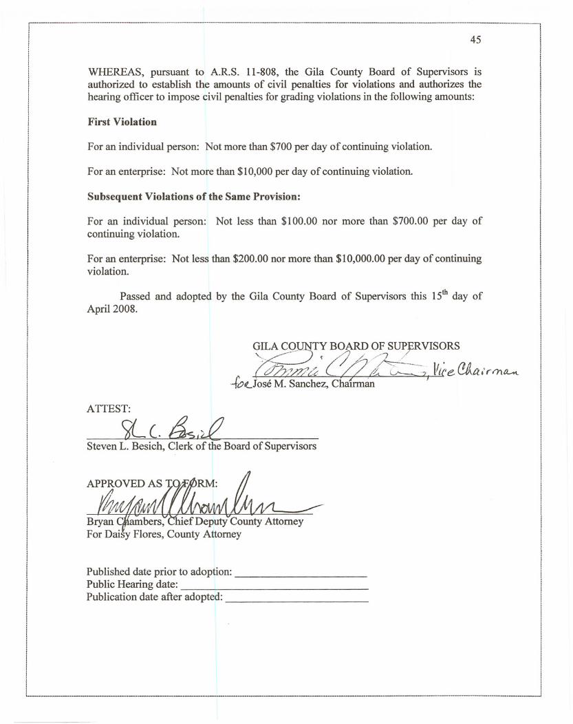
WHEREAS, pursuant to A.R.S. 11-808, the Gila County Board of Supervisors is !
authorized to establish the amounts of civil penalties for violations and authorizes the !
hearing officer to impose civil penalties for grading violations in the following amounts: ii
First Violation
For an individual person: Not more than $700 per day of continuing violation.
For an enterprise: Not more than $10,000 per day of continuing violation.
Subsequent Violations of the Same Provision:
For an individual person: Not less than $100.00 nor more than $700.00 per day ofcontinuing violation.
For an enterprise: Not less than $200.00 nor more than $10,000.00 per day of continuingviolation.
Passed and adopted by the Gila County Board of Supervisors this 15th day ofApril 2008.
~~~~!9~T;B,1~~!V~~VIS~RS~ (" ~J;;~u (>?/i.. 0----.--7, {lice (!jtr.I'rm~
-.ft?tLJoseM. Sanchez, ChaIrman .
ATTEST:
9l C. ~I~
Steven L. Besich, Clerk of the Board of Supervisors
Published date prior to adoption: _Public Hearing date: _Publication date after adopted: _