ghulam rasool mughal. all rights reserved profile of wwf – pakistan and climate change dr. ejaz...
TRANSCRIPT

Ghulam Rasool Mughal. All Rights Reserved
Profile of WWF – Pakistan and Climate Change
Dr. Ejaz AhmadOctober 16, 2012
Dhaka, Bangladesh

WWF’s mission is to stop the degradation of the planet’s natural environment and to build a future in which humans live in harmony with nature, by:
• conserving the world’s biological diversity. • ensuring that the use of renewable natural resources is sustainable. • promoting the reduction of pollution and wasteful consumption.

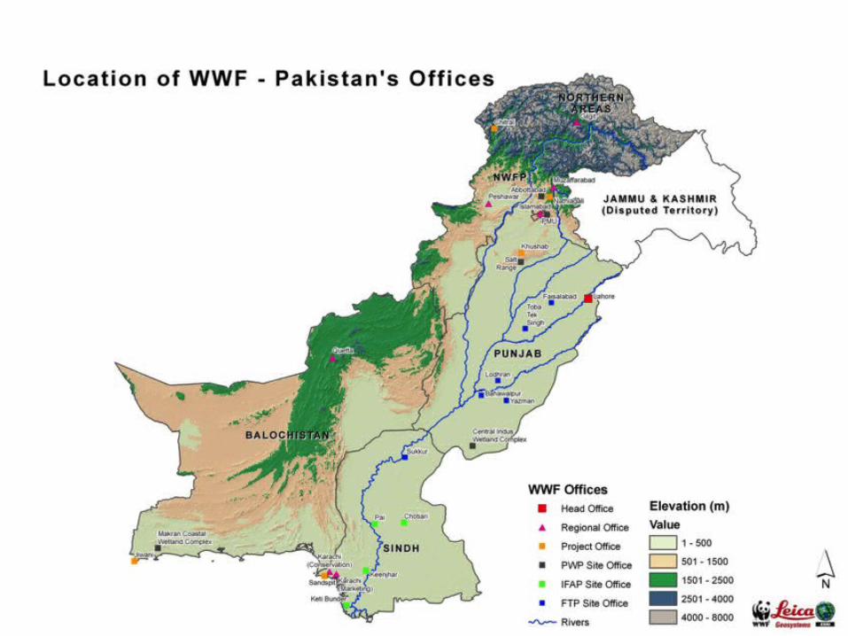
WWF - Pakistan
32WWF is working on 21 projects with 32 offices scattered all over Pakistan.
1970WWF was founded in 1970
+ 350WWF has over 350 staff in Pakistan
US$ 8 millionWWF -Pak has an annual budget of US$ 8 million.

WWF Network Meta-Goals
Reduce Footprint
ProtectBiodiversity
We’re here to stop the degradation of our
planet’s natural environment, and
build a future where people live in harmony
with nature.
We do this by
Reducing our footprint on the natural world by
challenging wasteful consumption and
pollution and promoting
sustainability.Protecting
biodiversity the magnificent array of
living things that inhabit our planet, and
the places they live.
How we do it?

The Global 200 The Global 200 is a
ranking of the World’s most
biologically outstanding terrestrial,
freshwater and marine ecosystems.
Five of these Eco-regions are found in
Pakistan:
• Rann of Kutch Flooded Grasslands• Tibetan Plateau• Western Himalaya Forest• Indus Delta Ecosystem• Arabian Sea

Marine
SpeciesClimate Change
ToxicsFreshwater
Forests
Global Priority Issues of WWF

Ghulam Rasool Mughal. All Rights Reserved
Approaches of WWF
• Work in partnership and build capacity of partners• Integrating conservation & development • Involve local communities• Research based solutions
• 350 staff• 30+ offices• Annual Budget 5
Million

Building Capacity on Climate Change Adaptation in Coastal Areas of Pakistan
www.wwfpak.org/ccap
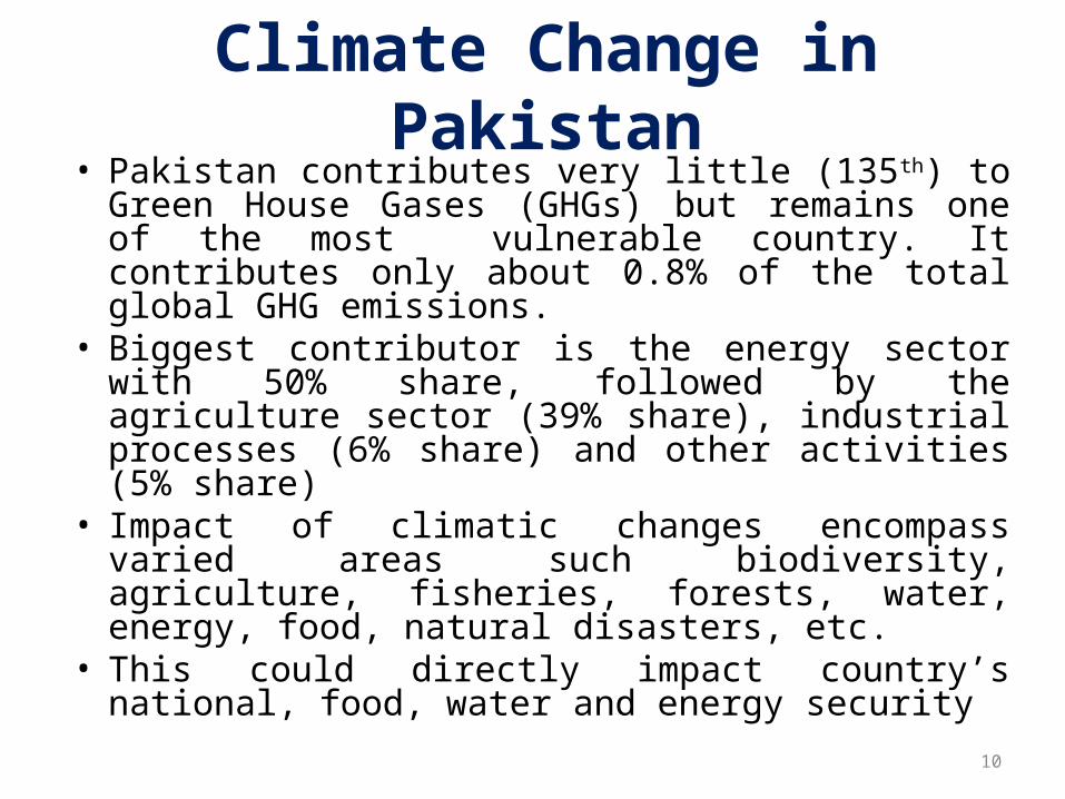
• Pakistan contributes very little (135th) to Green House Gases (GHGs) but remains one of the most vulnerable country. It contributes only about 0.8% of the total global GHG emissions.
• Biggest contributor is the energy sector with 50% share, followed by the agriculture sector (39% share), industrial processes (6% share) and other activities (5% share)
• Impact of climatic changes encompass varied areas such biodiversity, agriculture, fisheries, forests, water, energy, food, natural disasters, etc.
• This could directly impact country’s national, food, water and energy security
10
Climate Change in Pakistan

Climate Change in Pakistan• Pakistan is particularly vulnerable to Climate
Change, • Visible changes in hydrological cycle have
been observed in the form of – Changing precipitation pattern– Droughts– Water availability periods– Frequency and intensity of heat waves– Precipitation events– Weather-induced natural disasters.
Building Capacity on Climate Change Adaptation in Coastal Areas of Pakistan

The Long-Term Climate Risk Index (CRI): Results (annual averages) in specific indicators in the 10 countries most affected in 1991 to 2010
Source:Germanwatch 12

The Climate Risk Index for 2010: the 10 Most Affected Countries
Source:Germanwatch 13

Present Climatic Indicators: Temperature
• Average annual temperature over Pakistan increased by 0.6 °C during the last century, with the temperature increase over northern Pakistan being higher than over southern Pakistan (0.8 °C versus 0.5 °C)
• Global Circulation Models (GCMs) outputs:
Source: Report of Task Force on Climate Change, February 2010
Year Expected temperature increase
2020s 1.3 – 1.5 °C
2050s 2.5 – 2.8 °C
2080s 3.9 – 4.4 °C
14

Annual Temperature Variation
Building Capacity on Climate Change Adaptation in Coastal Areas of Pakistan
Past 50 years’ daily temp (weighted annual averages) – rise after ‘00, excepting ’05.Trend due partly to severest El-Nino yet (>4⁰C above normal heating of East-Equatorial Pacific water

ImplicationsIncrease in maximum and minimum temperatures in the winter
season results in shorter winters as well longer summers
Reduce the length of the growing season for crops
Hastens the biological life cycle of crops Plants undergo accelerated maturity without reaching the appropriate size or heightReduced economic yields This trend is observable in the case of wheat.
Building Capacity on Climate Change Adaptation in Coastal Areas of Pakistan

Present Climatic Indicators: Precipitation
• Precipitation over Pakistan increased on the average by 25%. However, there is expected no significant change in annual precipitation in near future
• It is projected that climate change will increase the variability of monsoon rains resulting into increased frequency and severity of floods and droughts
Source: Report of Task Force on Climate Change, February 201017

Existing policy, institutional and legislative structure
• Pakistan’s environmental policy framework is based on the Pakistan Environment Protection Act 1997 (PEPA)
• Ministry of Climate Change has been established
• “Inter-ministerial Committee on Climate Change” was established in 2008
• In 2008, Planning Commission established a Task Force on Climate Change
18

• National Climate Change Policy 2012 provides framework for addressing climatic issues
• Drinking and National Water Policy, National Sustainable Development Strategy, National Rangeland Policy, Pakistan Water Sector Strategy, Punjab Urban Water and Sanitation Policy are few in the list of many policy documents
Existing policy, institutional and legislative structure….contd.
19

• Pakistan is divided into three hydrological units: – the Indus basin, covering an area of over
566,000 km2 (70% of the surveyed area in the country),
– the Kharan desert in west Balochistan with its inland drainage, and
– the arid Makran coast along the Arabian Sea in the South
National Scenario: Hydrological Units
Source: Pakistan Initial Communication on Climate Change20

21
Indus Irrigation System

National Scenario: Forests• Forest in Pakistan is diverse because of varied
ecological zones and environment variations• Total estimated area under forest cover is
around 4.22 million hectares, which comprises of 4.8% total landmass
• It is envisaged to increase forest cover from 4.9% of the total land area in 2005 to 5.2% in 2010 and 6.0% by 2015
• Pakistan is gifted with diverse habitats that are home to varied animal and plant life
Source: State of Forests and Forestry in Pakistan; Shahid Rashid Awan and Asghar Khan July 2009
22

Disaster Management Systems• National Disaster Management (NDM) Act 2010
provides a complete institutional mechanism of pre, during and post disaster management at federal, provincial and district levels
• National Disaster Management Council (NDMC) is an apex body in the field of disaster management under the chairmanship of Prime Minister
• National Disaster Management Authority (NDMA) is the leading implementing agency headed by Chairman/Director General
23

Water Security Socioeconomic• Water Sector: Current Status and Vulnerability
– Pakistan is extremely short of fresh water resources.– Water-stressed country water availability heading towards
less than 1000 cubic meter/y by 2035 (WB 2006). – Pakistan’s primary sources of water are rainfall (50 maf )
by monsoon and westerly winds and river inflows (141 maf) in the Indus River System fed by glaciers and snowmelt from the Hindukush-Karakoram-Himalayas.
– The shares of main contributing rivers to the IRS in Pakistan are:
• Indus: 44%, Chenab: 19%, Jhelum: 16%, Kabul: 16% and Others: 5% (see Figure 5.1).
• The per capita availability of river water, which was 5,650 cubic meter/y in 1951 and 1000 cubic meter/y in 2010, is expected to decline further to 800 cubic meter/y in 2026.
24
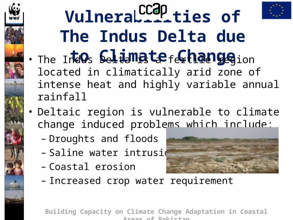
Vulnerabilities of The Indus Delta due to Climate
Change• The Indus Delta is a fertile region located in climatically arid zone of intense heat and highly variable annual rainfall
• Deltaic region is vulnerable to climate change induced problems which include:– Droughts and floods– Saline water intrusion– Coastal erosion– Increased crop water requirement
Building Capacity on Climate Change Adaptation in Coastal Areas of Pakistan

Precipitation
Inter-annual variability of precipitation over Pakistan during the last century and first decade of 21st century. Climate Research Unit (CRU) data used to downscale Pakistan’s regional precipitation
Building Capacity on Climate Change Adaptation in Coastal Areas of Pakistan
Past 50 years Indus Ecoregion trends (droughts eg, 68-69 and 71-74), has damaged crops, ecosystem services, etc.
In this case, the real time precipitation records of 56 meteorological stations have been incorporated

Sea Surface Temperature
• Pakistan receives rainfall in summer mainly from weather systems formed over the North Arabian Sea and the Bay of Bengal
• Frequency and intensity of Tropical Cyclones has increased
• Analysis revealed that the Bay of Bengal was warmer than the North Arabian Sea till mid 1990s.
• The trend started inverting and now the latter is slightly warmer than the former.
Building Capacity on Climate Change Adaptation in Coastal Areas of Pakistan

Sea Surface Temperature
Inter-annual variation of sea surface temperature over the North Arabian Sea and the Bay of Bengal in June from 1982 to 2011
Building Capacity on Climate Change Adaptation in Coastal Areas of Pakistan
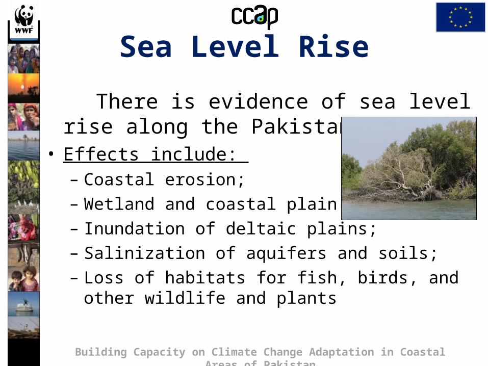
Sea Level Rise
There is evidence of sea level rise along the Pakistan coast
• Effects include: – Coastal erosion; – Wetland and coastal plain flooding;– Inundation of deltaic plains;– Salinization of aquifers and soils;– Loss of habitats for fish, birds, and other wildlife and
plants
Building Capacity on Climate Change Adaptation in Coastal Areas of Pakistan

Coastal Erosion

1.2 million acre land in Indus Delta is under water intrusion
App. 4,544 ha agriculture land has been destroyed along Humbas Wali creek since 1952
This area was irrigated through Ochito River by regular flow of Indus River up to 1960s
Change/Shift in agricultural activities
Agriculture land in 1952 Agriculture land in 2006
Humbas Wali creek

Sea Intrusion and Coastal Erosion• 0.5 million hectares of
fertile land in Thatta district alone (or 12% of the entire cultivated area of the province) is affected by sea intrusion.
• Lives of about 400,000 fishermen families are threatened
• Rangeland depletion, shortage of fodder and food crops, reduction in potable water, losses to livestock production are translating into out migration of local population.

Rapid Glaciers Retreat
• Pakistan’s rivers are predominantly fed by Hindu Kush, Karakoram and Himalyan glaciers. These are receding due to rising temperatures
Building Capacity on Climate Change Adaptation in Coastal Areas of Pakistan
Siachen Glacier (largest glacier of HKH) retreated by 5.9 km during 21 years and lost 17% ice mass

Extreme Weather EventsRecent extreme weather events which inflicted great loss to the socio-economic sectorCloudburst Events 2001, 2003, 2007, 2008,2009, 2010, 2011 Prolonged Drought 1999-2002Historic River Flooding 2010Tropical Cyclones 1999,2007,2009,2010, 2011 Severe Urban Flooding 2001, 2003, 2007, 2008, 2009, 2010, 2011 Heat Waves in Spring 2006, 2007, 2010, 2011 (Reduced the wheat yield)Snowmelt flooding 2005, 2007 and 2010Drought at sowing stage 2004, 2006, 2007, 2009, 2010 and 2011
Building Capacity on Climate Change Adaptation in Coastal Areas of Pakistan

35
Thank you
www.wwfpak.org/ccap