geothermal strategy for the global renewable energy atlas · renewable energy atlas spatial data...
TRANSCRIPT

Geothermal strategy for the Global Renewable Energy Atlas
2 GLOBAL ATLAS FOR RENEWABLE ENERGY
DISCLAIMER
The designations employed and the presentation of materials herein do not imply the expression of any opinion whatsoever on the part of the International Renewable Energy Agency or German Biomass Research Centre (DBFZ) concerning the legal status of any country, territory, city or area, or concerning their authorities or the delimitation of their frontiers or boundaries.
About IRENA
The International Renewable Energy Agency (IRENA) is an intergovernmental organisation that supports countries in their transition to a sustainable energy future, and serves as the principal platform for international cooperation, a centre of excellence, and a repository of policy, technology, resource and financial knowledge on renewable energy. IRENA promotes the widespread adoption and sustainable use of all forms of renewable energy, including bioenergy, geothermal, hydropower, ocean, solar and wind energy, in the pursuit of sustainable development, energy access, energy security and low-carbon economic growth and prosperity.
Acknowledgements
IRENA would like to express its sincere gratitude to the following experts for their immense contribution to this document. They include all the researchers, industry practitioners, and government officials that attended and provided feedback from the meetings in Pisa and Nevada, and those who participated in the survey:
Lee Allison and Stephen Richard (ASGS)a, Arlene Anderson and Dough Hollet (US Department of Energy), Tom Anderson (University of Utah), Ben Barker (Barker Engineering), Graeme Beardsmore (HotDryRocks), Ruggero Bertani (Enel)b, David Blackwell and Maria Richards (Southern Methodist University), Anthony Budd (Geoscience Australia), Jim Combs (Geo Hills Associates), Ashley Derry and Alison Thompson (CANGEA)c, Britta Ganz and Thorsten Agemar (LIAG)d, Mario Gonzalez (Nicaragua), Will Gosnold (UND)e, Ahmed Guimale (Ministry of Energy, Somalia), Hector Guttierez, Eduardo Iglesias (IIE)f, Hjallti Pall Ingolfsson and Thorvaldur Bragson (Orkustofnun), Joana Jasnos and Anna Sowizdzal (AGHUST)g, Guðni Jóhannesson (EU Geothermal ERA-NET)h, Beata Kepinska (PASMEERI)i, Andrej Lapanje (GS Slovenia)j, Ben Laenen (VITO)k, Adele Manzella and Eugenio Trumpy (CNR)l, Sofia Martinez (I.D.A.E)m, Gosaye Mengistie (Ministry of Water and Energy, Ethiopia), Thecla Munanie Mutia (UNU GTP)n, Annamaria Nador (MFGI)o, Christian Oeser (MEDDE)p, Will Osborn (Geothermal Resources Group), Sophie Pearson and Anya Seward (GNS Science)q, Arni Ragnasson (Iceland GeoSurvey), Hezy Ram (Ram Energy), Alexander Richter (ThingGeoEnergy), David Ryan (Natural Resource Canada), Ladislaus Rybach (ETH Zurich)r, Burkhard Sanner and Miklos Antics (EGEC)s, Estella Smith and Steve Ponder (GRC)t, Mohammed Al Tamimi (K.A.CARE)u, Charles Visser (NREL)v, Romain Vernier (BRGM)y, Jan-Diederik Van Wees and Thijs Boxem (TNO)x, Collin Williams (US Geological Survey), Meseret Zemedkun (UNEP)y, Keyan Zheng (GCES)z.
aArizona State Geological Survey, bEnel Green Power, cCanadian Geothermal Energy Association, dLeibniz Institute for Applied Geophysics, eUniversity of North Dakota, fInstituto de Investigaciones Eléctricas, gAGH University of Science and Technology, hEuropean Research Area Network, iPolish Academy of Sciences and Minerals, jGeological Survey of Slovenia, kVision on Technology, lConsiglio Nazionale delle Ricerche, mInstituto para la Diversificacion y Ahorro de la Energía, nUnited Nations University Geothermal Training Programme, oGeological and Geophysical Institute of Hungary, pMinistère du Développement Durable, qInstitute for Geological & Nuclear Sciences, rSwiss Federal Institute of Technology, sEuropean Geothermal Energy Council, tGeothermal Resources Council, uKing Abdullah City for Atomic and Renewable Energy, vNational Renewable Energy Laboratory, wBureau de Recherches Géologiques et Minières, xNetherlands Organization for Applied Scientific Research, zGeothermal Council of China Energy Society.
DisclaimerThe designations employed and the presentation of materials herein do not imply the expression of any opinion whatsoever on the part of the International Renewable Energy Agency (IRENA) concerning the legal status of any country, territory, city or area or of its authorities, or concerning the delimitation of its frontiers or boundaries. While this publication promotes the adoption and use of renewable energy, IRENA does not endorse any particular project, product or service provider.

GEOTHERMAL STRATEGY FOR THE GLOBAL RENEWABLE ENERGY ATLAS 3
Contents
» Background 5
» Global Renewable Energy Atlas 6
» Strategy for expansion to geothermal energy 8
» Work streams 10
» Integrating existing general datasets to inform policy makers 10
» Building synergies with compatible Spatial Data Infrastructures 11
» Sharing knowledge by referencing more detailed datasets 11
» Promoting education by creating a section on the Global Renewable Energy Atlas website 11
» References 13
» Annex 1: Datasets to be referenced in the Global Renewable Energy Atlas 14
» General Datasets 14
» Complex analysis datasets 14
» Country information and other national atlases 15
» Annex 2: Questionnaires circulated to the geothermal community and summary of the answers 17

4 GLOBAL ATLAS FOR RENEWABLE ENERGY
Hverir in Iceland©Denis Kichatof/Shutterstock

GEOTHERMAL STRATEGY FOR THE GLOBAL RENEWABLE ENERGY ATLAS 5
BaCkgroundCurrently, there is no single information source for existing geothermal energy data. Several initiatives1 exist within the community that collect geothermal data, but these often use widely different methodologies.
Equally for resource mapping, a number of different protocols have been used for such assessments, even across the various geothermal systems that exist2. In this, there is also not a single reporting code common to all countries for relating the resource estimates that result from these mapping processes. The consequence being that there is an overrated perception of risk and a lack of proper recognition of the possible contribution of geothermal energy in its many forms (electricity, direct use, heating and cooling) to the energy mix of countries.
In a detailed consultation conducted by the International Renewable Energy Agency (IRENA), the geothermal community identified as a first step the need to create a large global repository for all the information, in all the different aspects, that exists pertinent to geothermal energy. These include resource maps, policies, capacity building opportunities, conferences, proceedings and active geothermal environments.
IRENA’s answer is to work with the geothermal community (network of institutes, experts and the private sector) to extend the Global Renewable Energy Atlas (Global Atlas) services to geothermal energy. It is envisaged that the geothermal component of the Global Atlas could act as: a tool to aid political discussions on the subject; an entry point for investors’ preliminary search for prospective areas of the world; and also a tool to support further massive efforts that could be undertaken by the geothermal community in the future to compare and harmonise assessment protocols and reporting codes.
Starting with Solar and Wind, the first component of the Global Atlas initiative was launched by IRENA in January 2013. The Global Atlas (Solar and Wind components) was developed through a large partnership that includes 39 countries and over 50 research institutes around the world. It is a spatial data infrastructure (SDI) that references high quality datasets on solar and wind resources through a catalog
and enables user interaction through an internet based geographic information system (GIS) platform. On this platform, it is possible to visualise areas that could be interesting for further investigation, and in this case, the development of solar and wind resources. The agency is mandated to expand this platform to stimulate global interest in other renewable sources.
Differing from solar and wind, the process to identify and quantify geothermal resources in detail requires large upfront exploration drilling, which can be costly (depending on depth) and involve a high level of uncertainty.
Estimating geothermal resources requires several distinct datasets and very complex analyses. Most developers will drill their first production well only after a routine exploration process has provided enough information to ensure some degree of confidence of reaching a specific reservoir temperature, at a specific depth, with adequate flow rates. The process currently consists of a combination of preliminary reconnaissance studies (to find information on regional heat-flow/temperature at depth, etc.), geological, geochemical, and geophysical surveys, all of which provide datasets that can increase the rates of success in drilling the initial production well (Jennejohn, 2009).
However, for political discussions and preliminary assessments, it may be sufficient to display basic datasets that provide some measure of the presence and significance of the resource wherever it is found. This would answer questions such as: ‘is it worth it to establish a national programme on geothermal energy?’; ‘What kind of resources (high, medium or low enthalpy and temperature?) are likely to be present in this region?’; ‘What is the gross expenditure estimated to drill exploration wells in this region based on information from existing wells?’; ‘Is it meaningful to structure a risk mitigation fund to incentivise exploration?’; etc.
IRENA is working to help provide as much information as possible to answer these questions, through a coordinated effort with the geothermal community to define which datasets exist in this regard and to plan their integration into the Global Renewable Energy Atlas. Subsequently, IRENA would work with the institutes to identify other aspects for future
1 For example, the thinkgeoenergy website, International geothermal association (Iga) geothermal plants and conference database, International energy agency (Iea) geo-thermal implementing agreement (annex 10), etc.2 Conventional, unconventional and supercritical systems.

6 GLOBAL ATLAS FOR RENEWABLE ENERGY
cooperation that can add value to already existing information within the sector.
The following chapters explain the current Global Renewable Energy Atlas spatial data infrastructure, the strategy for its expansion to geothermal energy, the possible partnership structures and the work plan foreseen for achieving the goal of a Global Renewable Energy Atlas with a focus on geothermal energy.
2. gloBal renewaBle energy atlasThis initiative provides a GIS that can exploit a large library of data sources hosted on remote servers, and operated by the data providers. The geographic interface is flexible, and IRENA is working with a consortium of international institutes to continuously improve the framework.
For solar and wind, the multiple end-user consultations concluded that there was a need to develop a flexible
platform able to provide information on technical potentials (United National Environment Programme (UNEP) and IRENA, 2013). For solar and wind, the interface is therefore designed to provide to non-experts a direct access to map-based information, and to superpose different layers in order to identify particular areas of interest. The interface also gives access to basic analysis tools to estimate interactively the technical solar and wind potentials.
The data library is a geo-catalog currently listing more than 400 maps on solar and wind resources in a GIS format. The maps are hosted by remote data providers. Each of the 400 catalog entries provides a detailed description of the source of information, intellectual property restrictions and links to the originating website (called metadata).
» GIS interface: http://irena.masdar.ac.ae/
» Geocatalog: http://geocatalog.webservice-energy.org/geonetwork/srv/eng/main.home
Figure 1. Global Renewable Energy Atlas architecture
Global Atlas Catalog
Global Atlas GIS Interface
Existing Catalogs
Existing Applications

GEOTHERMAL STRATEGY FOR THE GLOBAL RENEWABLE ENERGY ATLAS 7
The Geocatalog is compatible with Open Geospatial Consortium (OGC) standards, which enables linkage to existing similar platforms (FAO3, UNEP/GRID4, GeoSUR), and allows third party applications to search and access the information (See Figure 1).
By linking to existing relevant data collections, and referencing additional sources previously not available in a GIS format, the Global Renewable Energy Atlas initiative is creating a central information node for sharing and accessing GIS information on all renewable energy technologies, while avoiding duplication or moving the information.
In other words, contributors to the initiative are able to share information through the system without necessarily transferring any data from their current servers. The catalog is able to connect to several geoservers5 that are resident in institutes all over the world, and register the data hosted by these geoservers, thereby enabling direct access to these datasets and their metadata.
The Global Renewable Energy Atlas GIS interface is designed to search the data library and to visualise the GIS information. By overlaying one or more GIS layers, a map can be created, saved by the system and disseminated over the internet.
A map need not necessarily be global, and the system is able to store maps centred on limited areas. There is no limit to the number of maps that can be stored by the system. Each map has its own URL and can be accessed directly through the website’s map gallery. Every user of the Global Renewable Energy Atlas can create a private account and create a map. IRENA can make these maps visible from the online map gallery if requested6.
In the next release of the GIS interface, each map will have a tag (solar, wind, bioenergy, hydropower, geothermal, marine), allowing to search the gallery of maps by resource, and adjusting the tools and functionalities of the GIS depending on the selected resource.
3 united nations Food and agriculture organization4 uneP global resource Information database5 a geoserver is an open source server application written in Java which allows users to publish, share, process and edit geospatial data. It is downloadable for free through – www.geoserver.org/display/geos/welcome. also a tutorial that explains how a geoserver is set up can be assessed on – www.youtube.com/watch?v=wHser5hqQlc 6 the concept of a map gallery and interface with the website is currently under development.
Figure 2: Definition of the main terms used.
The data Catalog (left) provides the title and description of each individual layer, which indicates i.e. the data source, copyrights, and originating
website. The data catalog is open access and interoperable using OGC standards, and similar efforts to share information.
The GIS interface (right) enables an overlay of information registered by the data catalog. The full description of each individual layer is preserved
fully from the data catalog to the interface. A map is made of a superposition of such layers. A map is limited to a geographic extend defined
by its author (world, continent, region, country). A map is referenced by a title and description. The description can point at a specific method,
provide restrictions of use, and other relevant information.
Metadata
User InterfaceLayer tree
Map = sum of activated layers
Legend
Layer

8 GLOBAL ATLAS FOR RENEWABLE ENERGY
3.strategy For exPansIon to geotHermal energyIn 2012, IRENA undertook a study to identify the relevant experts, institutes, networks and private sector players in the geothermal sector with the requisite expertise, datasets and tools to help in the development of the geothermal component of the Atlas.
The result of this effort was an extensive consultation with the geothermal community in early 2013 to conceptualise the Global Renewable Energy Atlas in a geothermal context and to identify targeted data and services relevant for promoting geothermal energy.
The first meeting of the Global Renewable Energy Atlas on geothermal energy was held successfully in Pisa. The meeting featured 32 participants from 17 countries, including representatives of the International Geothermal Association (IGA), UNEP Africa Rift Geothermal Development Facility (ArGeo) initiative, the International Energy Agency (IEA) Geothermal implementing agreement, the Geothermal ERA-NET, and European Geothermal Energy Council (EGEC).
The purpose of the meeting was to articulate the value of the Atlas and to scope for the prospective target
audience, datasets and tools that are most relevant. Also the meeting aimed to identify any limitations or possible misuse of information that should be considered in the development of the system.
At the meeting there was a common agreement that creating a dedicated section on geothermal energy in the Global Renewable Energy Atlas presented an ideal opportunity to promote all end use applications of the resource in all regions of the world where there is an indication of this potential. Also, given the datasets recommended, the Atlas may provide a preliminary understanding of the possible exploration costs in a region based on information from existing wells in that region. This can help to inform preparatory assessments of the incentive level that would be required to stimulate exploration activities.
The majority of the experts proposed that the ideal approach to the Global Renewable Energy Atlas for Geothermal Energy, would be to target primarily policy and key decision makers. This approach does not aim at providing bankable information for investment decisions.
According to the scientific community, this could be achieved by displaying in the Atlas mappable information and general datasets that can easily be assimilated by
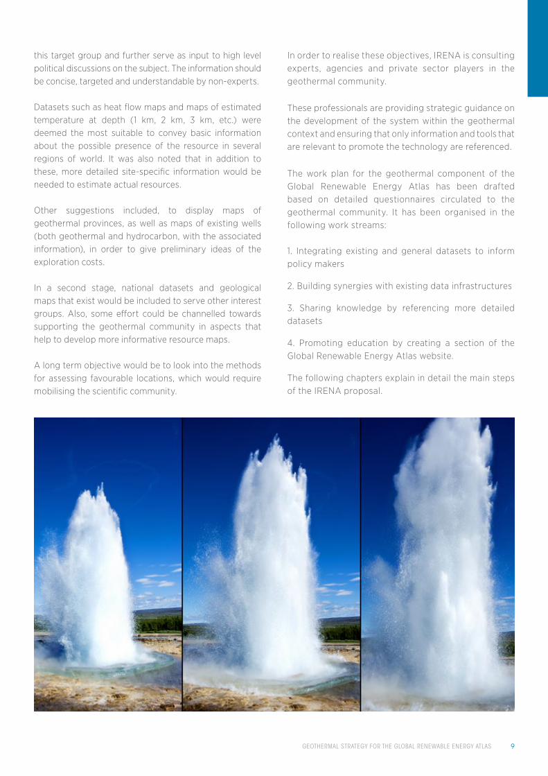
Strokkur Geyser eruption in sequence. Geothermal power, Iceland©Ivan Marc/Shutterstock
GEOTHERMAL STRATEGY FOR THE GLOBAL RENEWABLE ENERGY ATLAS 9
this target group and further serve as input to high level political discussions on the subject. The information should be concise, targeted and understandable by non-experts.
Datasets such as heat flow maps and maps of estimated temperature at depth (1 km, 2 km, 3 km, etc.) were deemed the most suitable to convey basic information about the possible presence of the resource in several regions of world. It was also noted that in addition to these, more detailed site-specific information would be needed to estimate actual resources.
Other suggestions included, to display maps of geothermal provinces, as well as maps of existing wells (both geothermal and hydrocarbon, with the associated information), in order to give preliminary ideas of the exploration costs.
In a second stage, national datasets and geological maps that exist would be included to serve other interest groups. Also, some effort could be channelled towards supporting the geothermal community in aspects that help to develop more informative resource maps.
A long term objective would be to look into the methods for assessing favourable locations, which would require mobilising the scientific community.
In order to realise these objectives, IRENA is consulting experts, agencies and private sector players in the geothermal community.
These professionals are providing strategic guidance on the development of the system within the geothermal context and ensuring that only information and tools that are relevant to promote the technology are referenced.
The work plan for the geothermal component of the Global Renewable Energy Atlas has been drafted based on detailed questionnaires circulated to the geothermal community. It has been organised in the following work streams:
1. Integrating existing and general datasets to inform policy makers
2. Building synergies with existing data infrastructures
3. Sharing knowledge by referencing more detailed datasets
4. Promoting education by creating a section of the Global Renewable Energy Atlas website.
The following chapters explain in detail the main steps of the IRENA proposal.

10 GLOBAL ATLAS FOR RENEWABLE ENERGY
4. work streams4.1.Integrating existing general datasets to inform policy makers
The principal message from the consultation with the geothermal experts was that there exists a massive amount of information collected within the geothermal community.
However, the information are on very diverse aspects, not homogenously coded (collection and reporting method varies from country to country) and exist in very different formats, which in most cases can be overwhelming and not easily communicable.
The consequence of this is a general perception that geothermal resources are often restricted to high grade hydrothermal systems, which occur only in a few locations around the world. Other forms of the resource are often neglected in national and state long-term energy projections. These include, e.g., unconventional geothermal systems (geo-pressurised systems, supercritical systems, hot dry rocks) and medium to low temperature resources used in industrial and agricultural heating, and other therapeutic applications (Massachusetts Institute of Technology, 2006).
According to the scientific community, there could be a tremendous value in making available through the Global Renewable Energy Atlas, mappable geothermal information and general datasets that can easily be assimilated by policy makers and energy agencies, thereby serving as an input to high level political discussions on the subject.
The information should be concise, targeted, and easily understandable by non-experts. These would include maps of surface heat flow, maps of temperature at depth (1 km, 2 km, 3 km, etc.), maps of existing geothermal plants, maps of existing wells (depth and cost information if possible for both test and exploration wells) and possibly maps of several end-use locations.
In this work-stream, IRENA would aim to collaborate with the expert community to establish the right general datasets best suited to this context, which exist in the community. Other activities along the same stream would include planning for the necessary technical developments to the Global Renewable Energy Atlas data infrastructure to accommodate the various formats of geothermal information anticipated (including point data). Subsequently, data identified and agreed upon by the group would be integrated into the system.
4.2. Building synergies with compatible Spatial Data Infrastructures
In the course of the consultation with the geothermal community, Spatial Data Infrastructures were highlighted by the community that are compatible with the Global Renewable Energy Atlas. These include; the US National Geothermal Data System (“NGDS”), which hosts a rich and complex variety of geothermal related data, including information on over one million wells across the United States; and the OneGeology initiative which hosts geological maps contributed by the geological surveys of over 117 countries.
Compared to the Global Renewable Energy Atlas, these spatial data infrastructures are more detailed and include several levels of complexity, addressing a broad range of audiences.
Since the audience is narrower, and the application more specific, the Global Renewable Energy Atlas does not intend to reach the level of detail achieved by these other initiatives. Instead, IRENA would be looking to work with the respective consortiums to identify the sub-set of information that is best adapted to inform the users of the Atlas, and to promote the direct use of these platforms for more detailed information.
4.3. Sharing knowledge by referencing more detailed datasets
Policy makers constitute only a subset of a broad spectrum of audience that can be reached through the geothermal component of the Atlas. For this group, maps of temperature at depth, EGS7 potential, potential end-use applications, average drilling costs, etc., may be sufficient.
However, for other end-user groups such as researchers and project developers, more detailed datasets may be required. These could include (but not limited to) information on the regional physical attributes (geology, geophysical data, infrastructure and demand) and policy settings (security of title, support mechanisms, taxation, etc.). In some cases, detailed information on technical potential may also be necessary.
In order to appreciate the value of the Global Renewable Energy Atlas to these unique user groups, IRENA is also proposing to work with the geothermal community to integrate more detailed national datasets from countries that have conducted assessments, as well as other high quality geological and geophysical datasets that may be needed for complex analysis and prospecting.
7 enhanced geothermal systems

GEOTHERMAL STRATEGY FOR THE GLOBAL RENEWABLE ENERGY ATLAS 11
Over time, the Global Renewable Energy Atlas could become a repository for state-of-the-art work on geothermal resource mapping from each participating country, institute, private company or agency.
4.4. Promoting education by creating a section on the Global Renewable Energy Atlas website
The Global Renewable Energy Atlas website will consist of dedicated sections for each renewable energy resource.The website will act as a reference for information on policies, educational materials, such as tutorials, webinars, and conference proceedings, publications related to resource assessment, etc.
For geothermal energy, several initiatives already exist that provide these information (e.g. IGA website, thinkgeoenergy, etc.). IRENA will work with the geothermal community to identify relevant aspects of the existing initiatives that can be integrated into the Global Renewable Energy Atlas.
reFerenCes » MIT (Massachusetts Institute of Technology)
(2006), “The Future of Geothermal Energy: Impact of Enhanced Geothermal Systems (EGS) on the United States in the 21st Century”, Idaho National Laboratory, www1.eere.energy.gov/geothermal/
pdfs/future_geo_energy.pdf.
» Jennejohn, D. (2009), “Research and Development i n G e o t h e r m a l E x p l o rat i o n a n d D r i l l i n g ” , Geothermal Energy Association, Washington D.C.,
pp. 25.
» UNEP (United Nations Environment Programme) and IRENA (International Renwable Energy Agency) (2013), “Insights from Interviews, a Survey and a Workshop with potential end users of the Global Atlas for Solar and Wind”, UNEP and IRENA, www.irena.org/DocumentDownloads/Publications/IRENA_UNEP_Insights_Global_Atlas.pdf.
Long exposure, Tungurahua volcano with blue skyes©Pablo Hidalgo/Shutterstock

12 GLOBAL ATLAS FOR RENEWABLE ENERGY
Geothermal power station pipeline perspective©N.Minton/Shutterstock

GEOTHERMAL STRATEGY FOR THE GLOBAL RENEWABLE ENERGY ATLAS 13
Datesets
1. Global heat-flow database (University of North Dakota: 35,523 Continental data points and 23,013 Oceanic data points)
2. IRENA/IEA Global Renewable Energy Policy and Measures database
3. Known geothermal fields (IGA)
4. Geothermal plants database (Thinkgeoenergy)
5. East Africa Geothermal Database (ARGeo: known fields, high potential areas, skill, etc.)
6. Maps of temperature at depth – Australia, U.S.A., Canada (British Colombia and Alberta), Poland, Republic of Korea, and Europe.
7. Thermo GIS World Edition
annex 1: datasets IdentIFIed as relevant For tHe gloBal renewaBle energy atlasGeneral Datasets
Datesets
1. Global Gravity dataset ( From the European Space Agency’s Gravity Field and Steady-State Ocean Circulation Explorer -GOCE)
2. Gravity, magnetic, geochemistry and radiometric datasets (GETECH)
3. Globe Landcover 2009 by European Space Agency (already part of the Global Renewable Energy Atlas)
4. UNEP World Database for Protected Areas (already part of the Global Renewable Energy Atlas)
5. Global database of Volcanoes (US National Geophysical Data Center: 1,500 data points)
Complex analysis datasets
Please report missing datasets at: [email protected]

14 GLOBAL ATLAS FOR RENEWABLE ENERGY
Dataset CoverageDepth Range
Fields/ Reservoirs
Thermal springs
Year
1 Geothermal Atlas of India India 3 km 350 1991
2Maps of identified Hydrothermal Sites in the USA
U.S.A 2008
3 Geothermal Resources of Spain Spain 2011
4Geothermal Information System of Germany
Germany 1–5 km 2010
5SEAI8 Geothermal Mapping System
IrelandAbout 5
km 2004
6Geothermal and Groundwater database of New Zealand
New Zealand 2011
7Geothermal maps of Australia (EGS)
Australia 3.5-10 km
8Database of Mexican Medium to Low Temperature Resources
Mexico 2,023 2005
9 Icelandic Geothermal Database Iceland
10Geothermal Database for East-South East Asia
Cambodia, China, Indonesia, Japan, Korea, Malaysia,
Papua New Guinea, the Philippines,
Thailand and Vietnam
7,319
11Database for Geothermal Resources of Eastern Europe
Bulgaria, Czech Republic, Romania,
Slovakia and Ukraine
366 2001
12Database for the Geothermal Resources of Turkey
Turkey 63 1999
Country information and other national atlases
8 sustainable energy authority of Ireland
Please report missing datasets at: [email protected]

GEOTHERMAL STRATEGY FOR THE GLOBAL RENEWABLE ENERGY ATLAS 15
Dataset CoverageDepth Range
Fields/ Reservoirs
Thermal springs
Year
13 Geothermal Resources in China China 12 2,509 1996
14
Database for Geothermal Resources in the Russian Federation and Ukraine
Russia, Ukraine 1996
15 Geothermal Atlases for Poland Poland 351990 - 2013
16Database for the Geothermal Resources of the Balkans
Herzegovina, Croatia, Macedonia,
Slovenia, Serbia, Montenegro
237 2001
17
Database of the Geothermal Resources of Latin America and the Caribbean (LAC).
LAC countries 152 1999
18Italian National Geothermal Database
Italy 1–3 km 3193 586 2010
19 GEODH9 project Europe 1-3 Km 2013
20Atlas of Geothermal Resources in Europe
European Union 2002
21 TransenergyAustria, Slovakia, Hungary, Slovenia
22 ENGINE10 project 2008
23ThermoGIS (Map of aquifers in the Netherlands)
Netherlands 2013
24 Swiss Geothermal Resource Atlas~30% of
Switzerland0.2-4 km 4 aquifers 2006/
9 geothermal district Heating10 enhanced geothermal Information network for europe
Please report missing datasets at: [email protected]

16 GLOBAL ATLAS FOR RENEWABLE ENERGY
annex 2: QuestIonnaIres CIrCulated to tHe geotHermal CommunIty and summary oF tHe answers
Questionnaire
1. What should be a realistic and useful objective for the Global Renewable Energy Atlas in the context of geothermal energy?
Summary of Answers: To gather together and present existing state-of-the-art maps of geothermal potential at all scales and following
all current methodologies. This will serve to promote geothermal exploitation, to debunk any widespread notion of complexity
understanding the resource and provide a single platform for comparing and contrasting current approaches to mapping geothermal
potential. Practically, the most ‘mappable’ parameter related to geothermal energy potential is rock temperature at different depths.
It is also possible to show possibilities for direct use, e.g in greenhouses, heating, cooling and other industrial applications.
2. Are there particular boundaries to the exercise that should be particularly considered? Risks of misuse of information, or risks to
display misleading information?
Summary of Answers: An area strongly highlighted was that the Atlas could lead to communicating a single definition of geothermal
potential, which is never the case since the idea of potential and degree to which it can be calculated, depends on the type of geothermal
system (EGS, Hydrothermal systems, etc.). Also, displaying oversimplified datasets might sometimes be risky in that geothermal
resource estimates are very site specific and values calculated over large scales can be misleading. Additionally, there is a risk that
overlapping maps of the same location might display vastly different estimates of potential because they have been derived following
different assumptions. To mitigate this risk, maps would need to be displayed alongside the methodologies and the assumptions that
have been made in developing the maps
3. Which elements would help to provide sufficient confidence in the Atlas to support the development of policies that promote
geothermal energy? What specific parameters should the Atlas focus on to reach this goal?
Summary of Answers: To stimulate effort on policy development, It is important to show in the Atlas currently exploited geothermal
areas and their level of development (both for power production and direct uses): (a) Geothermal power plants (b) Direct use of the
heat. Also, it is important to show a preliminary overview of the favourable areas through, Temperature maps (e.g. 1 km depth) (b)
Well location and cost if possible. Finally it is important to highlight areas where there are policies in favour of geothermal exploration
and list these policies in the system.
4. Under which conditions would the Global Renewable Energy Atlas help in initiating/raising interest for countries to deploy
measurement campaigns at national scale? What specific parameters should the Atlas focus on to reach this goal?
Summary of Answers: The Global Renewable Energy Atlas should give an outlook of the geothermal potential, i.e., show maps of the
available thermal energy and what part of it may be used for power production. The Atlas should also show current well locations.
These information are available only in few places. By posting potential maps and well location, it will be clear how much we still need
to explore. It is important to show load centres, urban/industrial areas, and transmission grid, information on infrastructure policies
and procedures, etc.

GEOTHERMAL STRATEGY FOR THE GLOBAL RENEWABLE ENERGY ATLAS 17
5. How best can the Atlas attract the interest of renewable energy developers and investors in new markets? Can it help broadly
prospecting areas of potential interest for future investigation? What specific parameters should the Atlas focus on to reach this goal?
Summary of Answers: It may not be a primarily feasible objective for the Atlas to address the investment community, especially
because the level of detail required to fulfil this is difficult to provide at the required scale. However, GIS layers showing power
infrastructure, geology, demand and favourable policies might help to focus attention on such regions.
6. Which additional interest groups/stakeholders in the geothermal sector should be targeted by the Global Renewable Energy Atlas,
and what would be their broad requirements?
Summary of Answers: The general public for awareness raising.
7. From the parameters identified above, are there data gaps – information that would be important, but that is not available as yet?
Summary of Answers: Large parts of the globe lack the basic geological datasets for a reliable assessment of geothermal potential.
There is need to work towards a consistent methodology to estimate the potential in these areas with clear understanding of the
confidence of these estimates.
8.Are there particular requirements regarding the spatial or temporal resolution of the data, or a limit below which the data would
be wrong or misleading?
Summary of Answers: The Atlas should focus on large scale mapping resolution for regional assessment of geothermal potential.
Resolution at the individual prospect or development scale could be misleading for potential developers.
9.Are there benchmarks or indicators of data quality that can be used to guide the users of a particular dataset?
Summary of Answers: There are currently no reliable universal benchmarks methodologies to estimate geothermal potential. The
International Geothermal Association is working towards such global protocols, but this will not be available for some time. A first
approach for the Atlas in this regard could be to showcase the methodology and models used to build each map, alongside each
map. A future consideration could be to have INSPIRE11 Europe lead the way in helping to standardise reporting codes to facilitate
interoperable and comparable information.
10. The Atlas is able to host programs/tools performing local or global calculations on the information that is being displayed. Are
there particular calculation tools or toolboxes used in the geothermal sector? If so, should the Atlas consider including such tools, and
what could be the limits of use for those tools?
Summary of Answers: Volumetric calculations of heat stored in the rock might be useful on a regional scale. However, tools to calculate
geothermal potential at finer scales (reservoir) require too many site specific details and are currently not existent.
11 Infrastructure for spatial Information in the european Community

18 GLOBAL ATLAS FOR RENEWABLE ENERGY
Steaming geothermal hot water, Iceland© PavelSvoboda/Shutterstock

GEOTHERMAL STRATEGY FOR THE GLOBAL RENEWABLE ENERGY ATLAS 19
11. A number of national geothermal atlases and datasets (See Annex 1) have been identified and proposed for addition to the system
under a default category ‘National geothermal datasets’. Kindly advise if you are aware of any updates to the ones identified or
additional datasets that may be included in this section
Summary of Answers: Showing in the Global Renewable Energy Atlas, National geothermal atlases, where they exist would be of great
value. Countries such as Italy, Netherlands, Switzerland, Australia, and Slovenia have updated or are currently updating their national
atlases.
12. A number of major initiatives and databases were also identified (Please See Annex 2). In your opinion, which one of these should/
should not be considered to include in the Atlas? In addition to these initiatives and datasets identified, are there any other datasets
you would suggest to be included in the system?
Summary of Answers: All the datasets listed in Annex 1 should all be included. Specifically, the Global Heatflow database, OneGeology
dataset, gravity and magnetics. This Atlas work provides a good opportunity to update some of these datasets, in particular the Global
heat Flow Database.
13. In your opinion, which one (or group) of the classification systems used in the geothermal community would be best suitable to
categorise and display data in the Global Atlas? In addition to the examples of classification systems highlighted, are there any forms
of classifying geothermal information, you may want to include in the Atlas?
Summary of Answers: There is no global system for classifying the reliability of geothermal potential estimates. The International
Geothermal Association is working towards such global protocols, but is some way off yet. The Global Renewable Energy Atlas should
be flexible enough to incorporate the several classification systems that exist. Where possible, resources should be classified according
to commercially-oriented schemes such as the Australian Code for Reporting of Exploration Results, Geothermal Resources and
Reserves and subsequent derivative codes. However, it is also necessary to include a classification system for geothermal potential at
a larger scale, including simple heat flow, predicted temperature at depth, and those based on geological classification (e.g. potential
for EGS, shallow high temperature, conventional and unconventional, etc.).
14. Please provide any other information that may be of interest
Summary of Answers: There is need within the community for research and development aimed at estimating recovery factors for
several geothermal environments. There is also a need to work towards a common reporting code for geothermal exploration results
and estimates in order to facilitate interoperable information.

www.irena.org/GlobalAtlas
ae.linkedin.com/pub/irena-global-atlas/74/b/307
https://twitter.com/GlobalREAtlas
https://www.facebook.com/GlobalAtlas

IRENA Headquarters
CI Tower, Khalidiyah
P.O. Box 236, Abu Dhabi
United Arab Emirates
www.irena.org
Copyright © IRENA 2014
http://globalatlas.irena.org