geospatial web services for disaster management
TRANSCRIPT

Geospatial web services for Disaster Management
for presentation in the Joint International Workshop of ISPRS WG IV/1, VIII/1 and IV/3 on
‘Geospatial Data Cyber Infrastructure and Real-time Services with special emphasis on Disaster Management’
November 25-27, 2009K . Anitha Kumari, P.S.B Kumar, Dr. P.V.S.P.Raju ,Dr.J.SaiBaba,
Mrs.Geeta Varadan
ADRIN, Department of Space

Objective
• The main objective of the project NationalDatabase for Emergency Management (NDEM) isto develop a Spatial Database and SpatialDecision Support System (SDSS) for variousdisasters.
• This particular application is SDSS for landslidedisaster, is designed as web application includingrisk based queries and analysis tools developed asweb services, to share resources across manylocations.

Scope of the project
The scope of the this project covers
• Managing and processing spatial & non-spatial data,
• Developing analysis tools and
• Integrating them in a GIS environment using information technologies, and
• Transmitting them to decision makers via the Internet to effectively share data, application and processing resources across many locations.

Web services
• Web services are self-contained, self-describing, modular software components that can be published, discovered, and invoked across Web
• They can be plugged together to build larger, more comprehensive services and/or applications
• They make functional building blocks accessible over standard protocols independent of platforms and languages
• Web services implements service oriented architecture (SOA)

Geospatial services• GIS web service: GIS resource running on a server
• Standards based GIS with a high level ofinteroperability
•Any GIS operation thatcan be done locally maybe run using a service.•Each service isindependent in functionand design, and each isa fully functioning unitof logic without anydependencies onanother
Figure courtesy: ESRI

Web services architecture
consumer
catalog
provider
publishFind
Bind

Standards for Geospatial services
• OGC and ISO for distributed GIServices
• Some of the standards are WMS, WFS, WCS
Figure courtesy: ESRI

Communication between browser and server

Goals of the application
Centralized data storage
Centralized processingUpgrade Data and
process as and when needed
Interoperability at data & process level
Easily scalable, expandable
Flexibility to develop the application as Thin
or thick client
Easy integration of new data and new
process analysis as the requirement arises
Accessible to user at any location
Solution is to develop Geo-spatial services for data
and Geoprocessing and distributing over Internet

Development Phases of the project
Phase I
• Spatial database creation
• Queries and analysis as web services
Phase II
• Online Hazard map generation
Phase III
• Simulation or Scenario generation
Integrationall the phases into the SDSS web application

Architecture of SDSS application for landslide disaster
• It followed anenterprisearchitecture withmiddlewarebased on SOA.
Database
GIS server
Web server
Internet
Client ClientClient

Work done
• List of queries are developed as web services for pilgrim routes of Uttaranchal and Himachal Pradesh organized in GeoDatabase
• Layers organized are Lithology, Geomorphology, Drainage, Slope angle, Slope aspect, Slope morphology, Land use /Land cover, Rock Weathering, Soil Texture, Soil Depth, Rainfall, Lineaments, Earthquake and Anthropogenic layer, LHZ layer for each route
• For phase II: Linear model is implemented as per BIS guides, it has to be evaluated.

Spatial Data Management
• The spatial database stores various layers
corresponding to pilgrim routes in the Himalayas of
Uttaranchal and Himachal Pradesh states.
• Consisting of 86 map sheets at 1:25000 scale
• Total number of routes is eight. Each route comprises
of sub routes or study areas along the path.
• All the data is organised in Geodatabase format as
feature classes and is made seamless
• Spatial data is launched as map services using to
distribute over the different locations over the
Internet.

Pilgrim Routes in HP and Uttaranchal

Queries for landslide SDSS as web services
• What are the settlements in high hazard zone (HHZ)?• Which road/rail passes through HHZ?• Which road/rail is nearly (20m, 50m) HHZ?• How many LandSlide incidents are falling in HHZ?• Landuse classes in high hazard • Soil classes in High hazard zone• Relation between Hazard VS Land use • Relation between Slope VS LS incidents • Relation between Slope VS High Hazard• Hazard vs area • ROI Area vs high Hazard• ROI vs parameter values

Example: Settlements falling in high hazard zone
Select polygons of high hazard
zoneIntersect
Settlements in high
hazard zone
Settlements lyr
Landslide hazard
zonation lyr

listener
Business logic
Presentation Tier
Application Tier
Database TierData access
Database
User interaction and presentation
Spatial decision support system
• Spatial data and the GISanalysis that are launchedas web services, areintegrated into SDSS webapplication
• As these are based onstandard protocols, Userfrom any location can accessthese services, can integrateinto their applications andtake advantage of spatialdata and geo-processingoffered online

Settlements in High Hazard Zone

Landslide incidents in High Hazard Zone

High Hazard Zones in selected ROI

High Hazard Zones in selected ROI
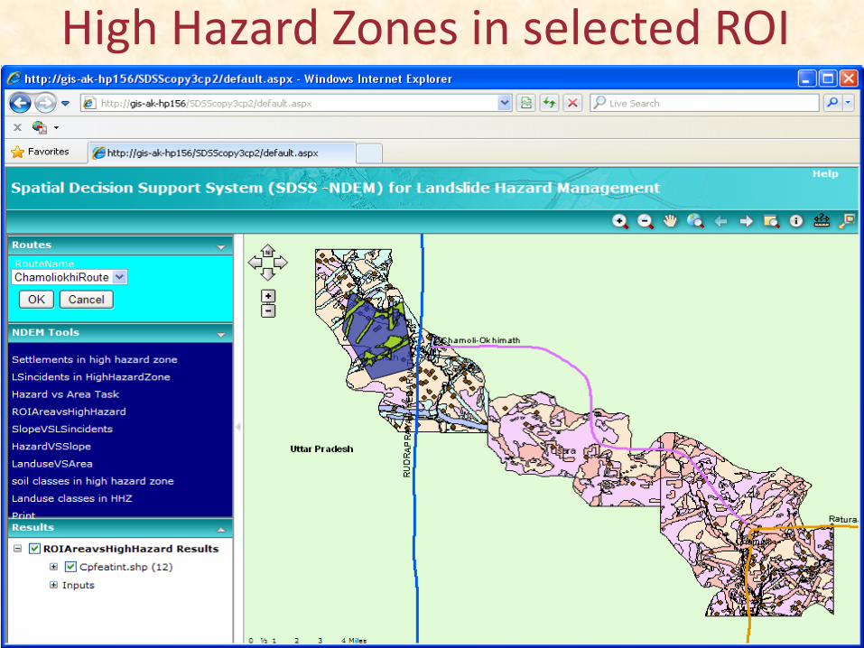
High Hazard Zones in selected ROI
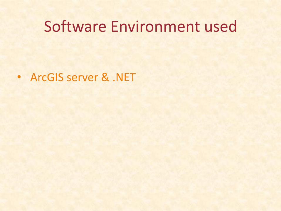
Software Environment used
• ArcGIS server & .NET

Uses of Geospatial services approach• Geospatial services allows data and processing
resources to be combined across a network
• Utilizing the computing resources more effectively
• Open , interoperable, resuable, standards based.
• Scalable, extensible, secure
• Improved application integration
• Capable of effectively integrated into other applications
• Eventual cost savings
• Information sharing across departments
• SOA benefits
conclusions• Developed risk based queries are reusable and
distributive, works on SOA and open standards.
• They facilitate modular approach, scalable to accommodate future growth
• Multiple applications can be built over these geospatial web services.
• These can not only be utilized in landslide disaster, some of the services can be used in other disaster.
• Web browser is used as client & does not require any license
