geospatial products i (selectseries 1) - bentleyuser.dk · geospatial products v8i ... •wms...
TRANSCRIPT

© 2
009 B
entley
Sys
tem
s,
Incorp
ora
ted Geospatial Products
V8i (SELECTseries 1)
Keith Raymond
Product Manager Geospatial Desktop Products
© 2
009 B
entley
Sys
tem
s,
Incorp
ora
ted
2 | WWW.BENTLEY.COM
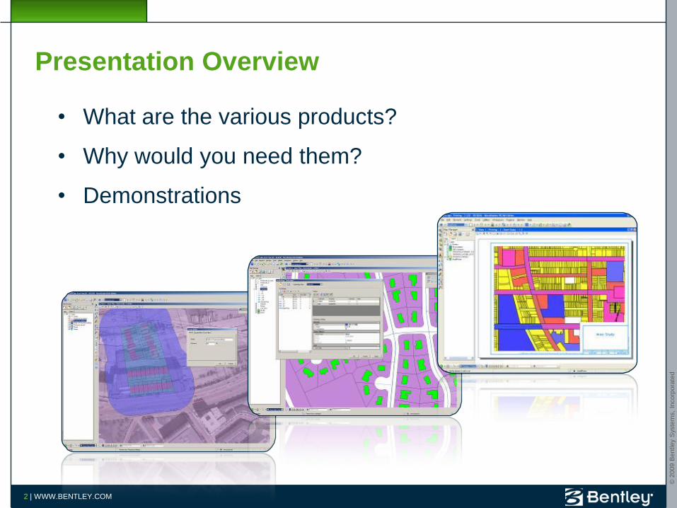
Presentation Overview
• What are the various products?
• Why would you need them?
• Demonstrations

© 2
009 B
entley
Sys
tem
s,
Incorp
ora
ted
3 | WWW.BENTLEY.COM
Bentley Geospatial Server
Data FilesData Files
w/ Database LinkagesSpatial
DocumentsSpatial
DatabasesBusiness
DocumentsAncillary Filesw/ RDBWS
WebServices
ProprietaryGIS Databases
EnterpriseData Stores
MicroStation/Bentley MapStand-Alone
Mapping
Geo Web
Publisher
Civil Engineering
Architecture Imaging Mapping Cadastre Utilities
Interoperability Connectors
EnterpriseConnectors
Web
Clients
Architecture
Bentley Geospatial Servers
Bentley Geospatial Desktop

© 2
009 B
entley
Sys
tem
s,
Incorp
ora
ted
4 | WWW.BENTLEY.COM
Geospatial Desktop Product LineF
un
cti
on
ality
Expertise Level
Bentley Map
High-end Desktop GIS for 3D Editing, 3D Mapping
and Analysis
Bentley PowerMap
Field and Desktop GIS for Editing, Mapping and
Analysis
Bentley PowerMap Field
Field and Desktop GIS for Viewing and Redlining
All products
include API
and developer
toolkit ready to
be used
Bentley Descartes
Advanced Raster
Viewing/Editing
Extension
Bentley
CadastreCreate, Maintain, and
Analyze Land and
Property Information
Bentley CADscript
Advanced Map
Production and
Plotting

© 2
009 B
entley
Sys
tem
s,
Incorp
ora
ted
Bentley Map
© 2
009 B
entley
Sys
tem
s,
Incorp
ora
ted
6 | WWW.BENTLEY.COM
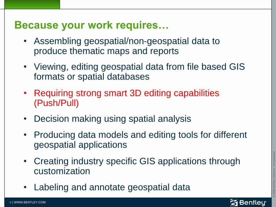
Because your work requires…
• Assembling geospatial/non-geospatial data to produce thematic maps and reports
• Viewing, editing geospatial data from file based GIS formats or spatial databases
• Requiring strong smart 3D editing capabilities (Push/Pull)
• Decision making using spatial analysis
• Producing data models and editing tools for different geospatial applications
• Creating industry specific GIS applications through customization
• Labeling and annotate geospatial data

© 2
009 B
entley
Sys
tem
s,
Incorp
ora
ted
7 | WWW.BENTLEY.COM
Top Features
• GeoReferenced PDF- Powered by MicroStation
• WMS Client- Powered by MicroStation
• Google Earth (Import/Export)- Powered by MicroStation
• AEC GeoReferencing- Powered by MicroStation
• GPS Tracking- Powered by MicroStation

© 2
009 B
entley
Sys
tem
s,
Incorp
ora
ted
8 | WWW.BENTLEY.COM
Top Features
• 3D Smart Editing
• XML Feature Modeling with Geospatial Administrator
• Oracle Spatial editing– 3D objects support
– ProjectWise Links and Design Links support with Oracle Spatial persistence
– Simpler Register Feature Process
• Dynamic Labeling of Features

© 2
009 B
entley
Sys
tem
s,
Incorp
ora
ted
9 | WWW.BENTLEY.COM
Top Features
• Joins between features
• Promote to XFM tool
• Search, browse and report– Multi-features attributes editing
• Map Manager
• Map generation and print preparation
© 2
009 B
entley
Sys
tem
s,
Incorp
ora
ted
10 | WWW.BENTLEY.COM
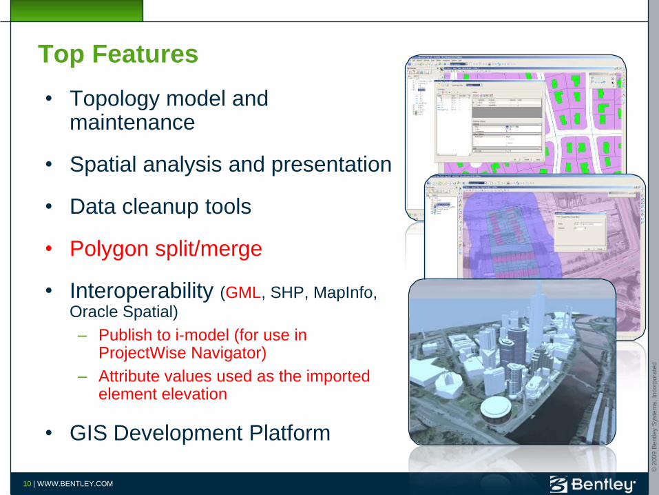
Top Features
• Topology model and maintenance
• Spatial analysis and presentation
• Data cleanup tools
• Polygon split/merge
• Interoperability (GML, SHP, MapInfo, Oracle Spatial)
– Publish to i-model (for use in ProjectWise Navigator)
– Attribute values used as the imported element elevation
• GIS Development Platform

© 2
009 B
entley
Sys
tem
s,
Incorp
ora
ted
11 | WWW.BENTLEY.COM
Bentley Map Value Proposition
11
Assemble/
Integrate
Create
Maps/Reports
Feature ModelingCreate Custom
Applications
Analyze/ Make
Decisions
View/Edit
All your Geospatial
Information
3D Modeling

© 2
009 B
entley
Sys
tem
s,
Incorp
ora
ted
12 | WWW.BENTLEY.COM
Demo: Bentley Map Basic Mapping
• Import of Shapefile
• Thematic Mapping
• Labeling
• Attributes Editing using Grid Control
• Joins
• Raster DEM (powered by Bentley Descartes)
Demonstration

© 2
009 B
entley
Sys
tem
s,
Incorp
ora
ted
13 | WWW.BENTLEY.COM
Demo: Bentley Map Spatial Analysis
• Easy to use buffering tools
• Easy to use spatial overlays tools (Intersect, Difference, etc)
• Browsing the result of the spatial analysis
• Export the analysis result to CSV
Demonstration

© 2
009 B
entley
Sys
tem
s,
Incorp
ora
ted
14 | WWW.BENTLEY.COM
XML Feature Modeling (XFM)
• XML Metadata Driven GIS
– Features
– Properties
– Domain lists, default values
– Property based symbology
– Property based annotation
– Relationships
– Placement and editing rules
– Operations and methods
– Other behaviors
– Message propagation rules
– User interface
• Extensible
• Enforces user standards
• Easy to implement without programming
GeoSpatialAdministrator
XFM Schema
Bentley Map
geographic objects

© 2
009 B
entley
Sys
tem
s,
Incorp
ora
ted
15 | WWW.BENTLEY.COM
Interoperability with Oracle Spatial
Bentley Geospatial Server
Any PL/SQL Client
Bentley IndustryApplications via Two-Tier Direct Connection
Bentley Map viaTwo-Tier Direct Connection
Other GIS SystemsCompliant withOracle Spatial
Bentley Map Enterprise Connection
Bentley Industry Applications Enterprise Connection

© 2
009 B
entley
Sys
tem
s,
Incorp
ora
ted
16 | WWW.BENTLEY.COM
Demo: Bentley Map – XFM
• Oracle Spatial Editing
• Feature Modeling
Demonstration

© 2
009 B
entley
Sys
tem
s,
Incorp
ora
ted
17 | WWW.BENTLEY.COM
Demo: Bentley Map- Polygon split and merge
• Splits and merges polygon features
• Handles attributes based on user defined rules
• Copies all properties in absence of any defined rules
Demonstration
© 2
009 B
entley
Sys
tem
s,
Incorp
ora
ted
18 | WWW.BENTLEY.COM
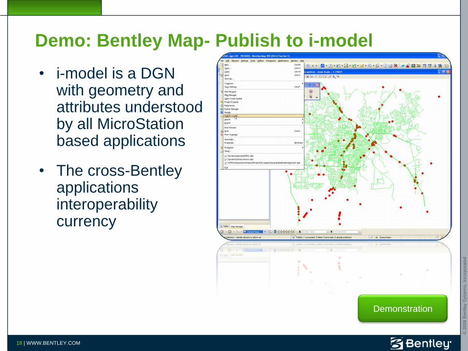
Demo: Bentley Map- Publish to i-model
• i-model is a DGN with geometry and attributes understood by all MicroStation based applications
• The cross-Bentley applications interoperability currency
Demonstration

© 2
009 B
entley
Sys
tem
s,
Incorp
ora
ted
Bentley Descartes

© 2
009 B
entley
Sys
tem
s,
Incorp
ora
ted
20 | WWW.BENTLEY.COM
Why Descartes? Because your work requires…
• Editing raster based maps (Full Color) or plans (Black/White)
• Geo-referencing scanned plans/older maps
• Viewing Oracle Spatial GeoRaster
• Viewing Raster DEM with visualization
• Editing 3D oriented images (e.g.: building textures)
• Converting raster into vector or converting vector into raster
• Creating raster scene(s) using any data (vector, raster)
• Creating image mosaics

© 2
009 B
entley
Sys
tem
s,
Incorp
ora
ted
21 | WWW.BENTLEY.COM
Top Features
• Viewing of Oracle Spatial Georaster
• Viewing of Raster DEM
• Binary Raster Editing
– (ala I/RAS B)
• Color Raster Editing
• Snap on raster content
• 3D Texture Editing (e.g.: 3D building texture)
© 2
009 B
entley
Sys
tem
s,
Incorp
ora
ted
22 | WWW.BENTLEY.COM
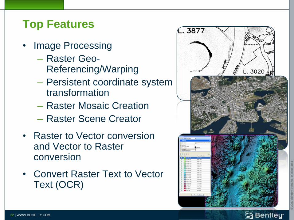
Top Features
• Image Processing
– Raster Geo-Referencing/Warping
– Persistent coordinate system transformation
– Raster Mosaic Creation
– Raster Scene Creator
• Raster to Vector conversion and Vector to Raster conversion
• Convert Raster Text to Vector Text (OCR)
© 2
009 B
entley
Sys
tem
s,
Incorp
ora
ted
23 | WWW.BENTLEY.COM
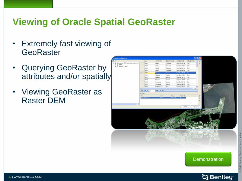
Viewing of Oracle Spatial GeoRaster
• Extremely fast viewing of GeoRaster
• Querying GeoRaster by attributes and/or spatially
• Viewing GeoRaster as Raster DEM
Demonstration

© 2
009 B
entley
Sys
tem
s,
Incorp
ora
ted
24 | WWW.BENTLEY.COM
Viewing of Raster DEM
• Allows viewing Raster DEM
• Allows applying multiple filtering
• Elevation, Slope, Aspect
• Supports multiple formats• Erdas image (*.img)
• Oracle Spatial GeoRaster
• GeoTiff (*.tif)
• Tag Image File (*.tif)
• Internet Tiff (*.itiff)
• Internet Tiff 64 bit (*.iTiff64)
• USGS DEM (*.dem)
• USGS SDTS (*.catd.DDF)
Demonstration
© 2
009 B
entley
Sys
tem
s,
Incorp
ora
ted
25 | WWW.BENTLEY.COM
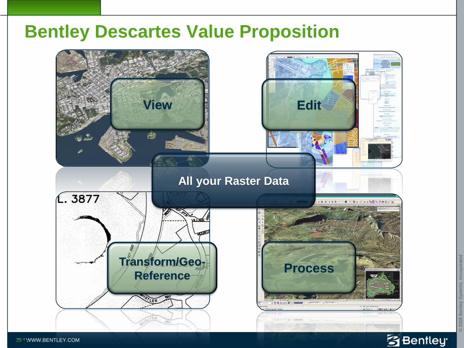
Bentley Descartes Value Proposition
25
Edit
ProcessTransform/Geo-
Reference
View
All your Raster Data

© 2
009 B
entley
Sys
tem
s,
Incorp
ora
ted
Geo Web Publisher

© 2
009 B
entley
Sys
tem
s,
Incorp
ora
ted
27 | WWW.BENTLEY.COM
Why Geo Web Publisher ? Because you need to…
• Make data available to a wide audience
• Because you need to share 3D city data with citizens, mayor, city council, managers
• Integrate with many data types in a single portal
• “Deliver” GIS tools to casual users
• Allow Web GIS users to create reports, prints, etc. from Web GIS applications
• Create and maintain Web GIS applications, be able to rapidly meet Web users needs
• Integrate GIS and mapping data with other enterprise wide systems

© 2
009 B
entley
Sys
tem
s,
Incorp
ora
ted
28 | WWW.BENTLEY.COM
What is Geo Web Publisher?
• It is a Web GIS
– Easy to implement, high performance
– Brings together multiple data sources, and databases
– Supports collaboration workflows
– OGC compliant, WMS/WFS server
• Advanced tools for GIS Web applications creation and administration
• End user tools for map navigation, querying, analysis, reporting, redlining, editing
28
© 2
009 B
entley
Sys
tem
s,
Incorp
ora
ted
29 | WWW.BENTLEY.COM
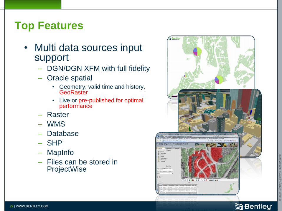
Top Features
• Multi data sources input support– DGN/DGN XFM with full fidelity
– Oracle spatial• Geometry, valid time and history,
GeoRaster
• Live or pre-published for optimal performance
– Raster
– WMS
– Database
– SHP
– MapInfo
– Files can be stored in ProjectWise
© 2
009 B
entley
Sys
tem
s,
Incorp
ora
ted
30 | WWW.BENTLEY.COM
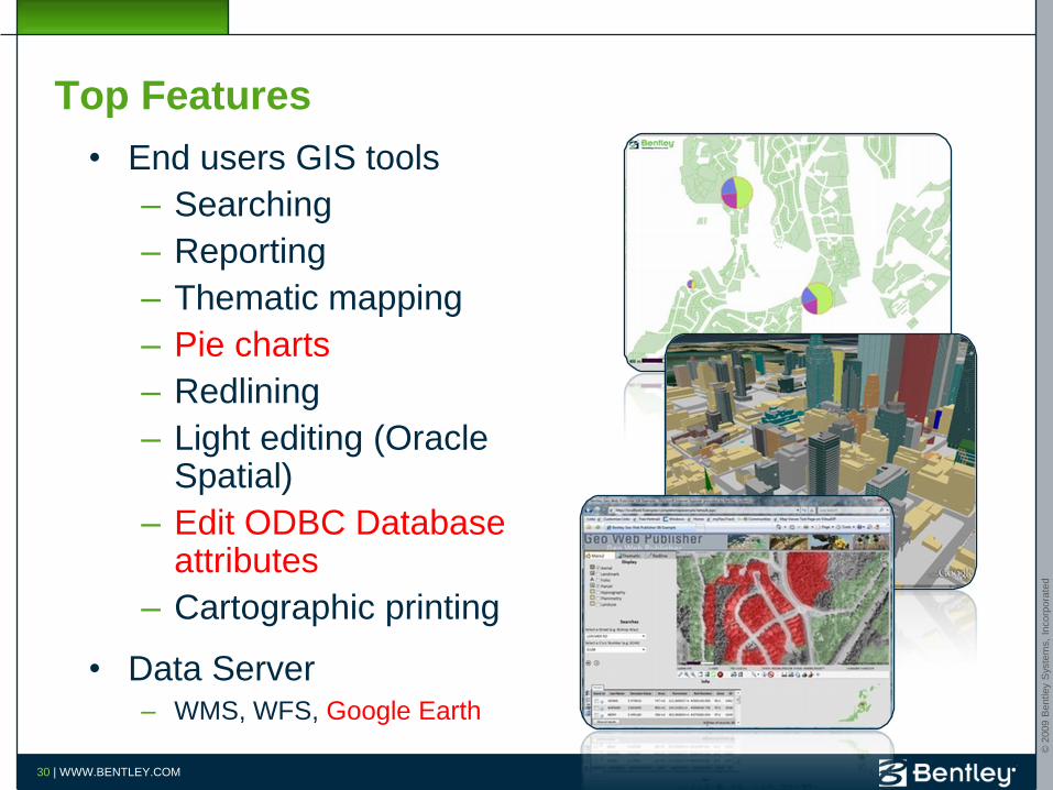
Top Features
• End users GIS tools
– Searching
– Reporting
– Thematic mapping
– Pie charts
– Redlining
– Light editing (Oracle Spatial)
– Edit ODBC Database attributes
– Cartographic printing
• Data Server– WMS, WFS, Google Earth
© 2
009 B
entley
Sys
tem
s,
Incorp
ora
ted
31 | WWW.BENTLEY.COM
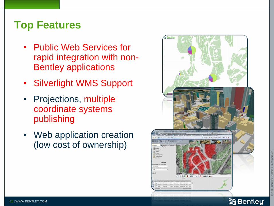
Top Features
• Public Web Services for rapid integration with non-Bentley applications
• Silverlight WMS Support
• Projections, multiple coordinate systems publishing
• Web application creation (low cost of ownership)

© 2
009 B
entley
Sys
tem
s,
Incorp
ora
ted
32 | WWW.BENTLEY.COM
Value proposition
Data
Integration
Databases
OGC WFS
Earth
Rapid
Deployment
Map Server
Web GIS
Geospatial Web tools
OGC WMS

© 2
009 B
entley
Sys
tem
s,
Incorp
ora
ted
33 | WWW.BENTLEY.COM
Demo: Bentley Geo Web Publisher – Reporting
• Redline map
• Query area
• Query properties
• Print report
Demonstration

© 2
009 B
entley
Sys
tem
s,
Incorp
ora
ted
3D City GIS

© 2
009 B
entley
Sys
tem
s,
Incorp
ora
ted
35 | WWW.BENTLEY.COM
3D City GIS
Shadow Analysis
3D Analysis and
Design
Natural Disaster
Mitigation
Noise Simulation
Urban Planning
Public
Relationship
Management
Bentley 3D City
GIS

© 2
009 B
entley
Sys
tem
s,
Incorp
ora
ted
36 | WWW.BENTLEY.COM
Components of a 3D City GIS

© 2
009 B
entley
Sys
tem
s,
Incorp
ora
ted
37 | WWW.BENTLEY.COM
Bentley Map in 3D City
• The central piece of any Bentley 3D City GIS
• 3D Data Creation tool
• Model and edit smart 3D Objects
• Work with Oracle Spatial 3D
• 3D Data Analysis tool
• Produce 3D thematic maps
• Review attributes, produce reports
• 3D Development platform
• For cities
• For data producers

© 2
009 B
entley
Sys
tem
s,
Incorp
ora
ted
38 | WWW.BENTLEY.COM
Demo: Bentley Map 3D Oracle Spatial
• View Oracle Spatial 3D data
• Query streets and terrain
• Thematic mapping
• Overlay with zoning areas and defined height limits
Data provided by Quebec City, CanadaDemonstration

© 2
009 B
entley
Sys
tem
s,
Incorp
ora
ted
39 | WWW.BENTLEY.COM
Demo: Bentley Map 3D Oracle Spatial
• Sketch a new building
• Post to Oracle
• Modify the building
• Post to Oracle
DemonstrationData provided by Quebec City, Canada

© 2
009 B
entley
Sys
tem
s,
Incorp
ora
ted
40 | WWW.BENTLEY.COM
Demo: Bentley Geo Web Publisher Google Earth
• View 3D City model in Google Earth
• Model is tiled and served by Bentley Geo Web Publisher
Demonstration
© 2
009 B
entley
Sys
tem
s,
Incorp
ora
ted
Geospatial Server
© 2
009 B
entley
Sys
tem
s,
Incorp
ora
ted
42 | WWW.BENTLEY.COM
Why Geospatial Server? Because you need to…
• Manage huge volumes of heterogeneous data (GIS data, document, images, projections, …)
• Easily find the data you own about a given location on earth
• Know if the data you are about to work with is the latest and greatest or not
• Make sure that colleagues have access to the data they need to perform their tasks, no less, no more
• Edit information in spatial databases using a disconnected/long transaction workflow

© 2
009 B
entley
Sys
tem
s,
Incorp
ora
ted
43 | WWW.BENTLEY.COM
What is the Bentley Geospatial Server?
• A portfolio of the following products:
– ProjectWise Integration Server
– ProjectWise Geospatial Management Module
– ProjectWise Connector for Oracle
– ProjectWise InterPlot Server
• Integrated for geospatial needs
• Five Services:
– Document Service
– Spatial Indexing/Searching Service
– Workflow Management Service
– Spatial Database Service
– Plotting Service
• Can add ProjectWise Connector for ArcGIS as an option
43

© 2
009 B
entley
Sys
tem
s,
Incorp
ora
ted
44 | WWW.BENTLEY.COM
The Bentley Geospatial Server Way
Time Line
Data
Spatial
RDBMS

© 2
009 B
entley
Sys
tem
s,
Incorp
ora
ted
45 | WWW.BENTLEY.COM
Top Features
• Oracle Spatial
• Live transactional editing
• Disconnected transactional editing
• History and valid time
• Oracle GeoRaster
• Oracle Spatial 3D Editing
• Design Link support

© 2
009 B
entley
Sys
tem
s,
Incorp
ora
ted
46 | WWW.BENTLEY.COM
Top Features
• Advanced Background Maps (streamed CAD/raster maps, GIS layers, spatial database layers, WMS)
• Spatial Locations/Spatial Search
• GIS Types Support:
• ESRI Personal Geodatabase Support
• ESRI Shapefile
• MapInfo TAB
• MapInfo MIF/MID
• MapInfo WOR
© 2
009 B
entley
Sys
tem
s,
Incorp
ora
ted
47 | WWW.BENTLEY.COM
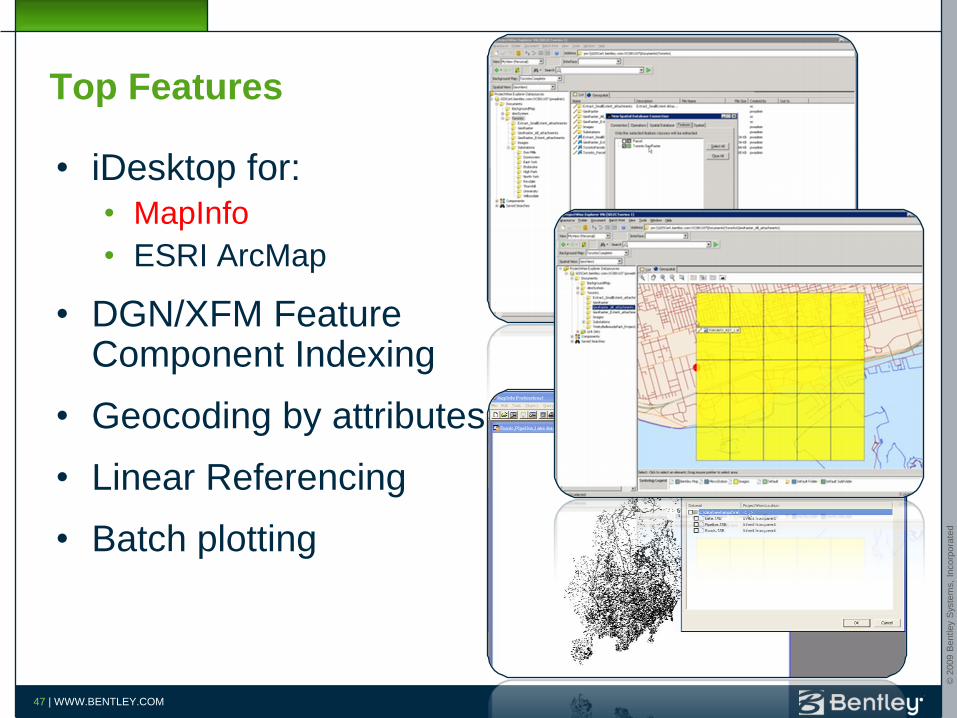
Top Features
• iDesktop for:
• MapInfo
• ESRI ArcMap
• DGN/XFM Feature Component Indexing
• Geocoding by attributes
• Linear Referencing
• Batch plotting

© 2
009 B
entley
Sys
tem
s,
Incorp
ora
ted
48 | WWW.BENTLEY.COM
Demo: Bentley Geospatial Server-Oracle Spatial Georaster
• Extract Oracle Spatial Geometry and GeoRaster
• Edit in Bentley Map
• Add Design Links (ProjectWise and URL)
• Post to Oracle Spatial
Demonstration

© 2
009 B
entley
Sys
tem
s,
Incorp
ora
ted
49 | WWW.BENTLEY.COM
Demo: Bentley Geospatial Server-iDesktop for MapInfo
• Load MapInfo TAB file in Geospatial Server
• Open MapInfo Tab from Geospatial Server
Demonstration

© 2
009 B
entley
Sys
tem
s,
Incorp
ora
ted
50 | WWW.BENTLEY.COM
Value proposition
50
Manage
Index
Find
OrganizeArchive
Plot
Edit
Geospatial information

© 2
009 B
entley
Sys
tem
s,
Incorp
ora
ted
51 | WWW.BENTLEY.COM
Questions?