geological society of america special papers -...
TRANSCRIPT

Geological Society of America Special Papers
doi: 10.1130/0-8137-2326-4.125 1998;326;125-169Geological Society of America Special Papers
E. Calais, J. Perrot and B. Mercier de Lépinay from Cuba to HispaniolaStrike-slip tectonics and seismicity along the northern Caribbean plate boundary
Email alerting servicescite this article
to receive free e-mail alerts when new articleswww.gsapubs.org/cgi/alertsclick
SubscribeAmerica Special Papers
to subscribe to Geological Society ofwww.gsapubs.org/subscriptions/click
Permission request to contact GSAhttp://www.geosociety.org/pubs/copyrt.htm#gsaclick
viewpoint. Opinions presented in this publication do not reflect official positions of the Society.positions by scientists worldwide, regardless of their race, citizenship, gender, religion, or politicalarticle's full citation. GSA provides this and other forums for the presentation of diverse opinions and articles on their own or their organization's Web site providing the posting includes a reference to thescience. This file may not be posted to any Web site, but authors may post the abstracts only of their unlimited copies of items in GSA's journals for noncommercial use in classrooms to further education andto use a single figure, a single table, and/or a brief paragraph of text in subsequent works and to make
GSA,employment. Individual scientists are hereby granted permission, without fees or further requests to Copyright not claimed on content prepared wholly by U.S. government employees within scope of their
Notes
Geological Society of America
on January 14, 2010specialpapers.gsapubs.orgDownloaded from

INTRODUCTION
The Caribbean domain and Central America form a smalllithospheric plate between North and South America (Fig. 1),which was first identified by Molnar and Sykes (1969) on thebasis of seismicity. Although the North and South America platesshow little relative motion, the Caribbean plate is moving east-ward relative to them at a rate of 12 ± 3 mm/yr (DeMets et al.,1990). This displacement occurs along two major strike-slip faultzones: the Bocono and El Pilar faults along its southern bound-ary, and the Polochic-Motagua, Swan, and Oriente faults alongits northern boundary. The Caribbean plate is bounded to the east
by the Lesser Antilles subduction zone, and to the west by theCentral America subduction zone. Despite this apparently well-constrained kinematic framework, the current motion of theCaribbean plate is one of the more poorly known among allmajor plates. The Caribbean plate does not have any activespreading centers, except a short segment of spreading ridge inthe Cayman trough. Moreover, most of its northern transformboundary is located at sea, and detailed mapping of its trace hasbeen undertaken only recently.
We present in this chapter a synthesis of the active tectonicstructures along the northern Caribbean plate boundary fromCuba to Hispaniola, identified from marine geophysical data
Geological Society of AmericaSpecial Paper 326
1998
Strike-slip tectonics and seismicity along the northern Caribbean plate boundary from Cuba to Hispaniola
E. Calais, J. Perrot, and B. Mercier de LépinayCNRS, UMR Géosciences Azur, 250 rue Albert Einstein, Valbonne 06560, France
ABSTRACT
We present a compilation of marine geophysical data (Seabeam bathymetry, side-scan sonar, seismic-reflection profiles) collected along the northern Caribbean plateboundary from the southern margin of Cuba to the northern margin of Hispaniola. Wecompare the structural observations with the seismicity to quantify the kinematicregime along the plate boundary. The marine data show a narrow zone of active defor-mation extending along a major left-lateral strike-slip fault, the Oriente fault. The mostprominent structural feature is the Santiago deformed belt, a transpressive deforma-tion area that extends along the southern Cuban margin and displays active folding andreverse faulting. Dextral offsets in the Oriente fault trace create tensional strain andlocal pull-apart basins. The earthquake distribution and source parameters are wellcorrelated with the active tectonic structures. They show a combination of north-southcompression and left-lateral shear starting at about 78°W long. and continuing all theway to the east along the southern Cuban margin. Our results indicate the existence ofa small convergence component added to the mostly strike-slip displacement betweenthe Caribbean and North America plates. This convergence component is responsiblefor large-scale transpressive structures such as the Santiago deformed belt and is com-patible with local tensional structures due to the geometry of the main fault trace. Onthe basis of instrumental and historical seismicity records, we compute a seismic sliprate of 13–15 mm/yr along the northern Caribbean plate boundary. This result agreeswell with the 12 ± 3 mm/yr NUVEL-1 estimate and could indicate that most of the stressalong the plate boundary is released seismically.
Calais, E., Perrot, J., and Mercier de Lépinay, B., 1998, Strike-slip tectonics and seismicity along the northern Caribbean plate boundary from Cuba toHispaniola, in Dolan, J. F., and Mann, P., eds., Active Strike-Slip and Collisional Tectonics of the Northern Caribbean Plate Boundary Zone: Boulder, Colorado,Geological Society of America Special Paper 326.
125
on January 14, 2010specialpapers.gsapubs.orgDownloaded from

(seabeam bathymetry, seismic reflection, side-scan sonar) andteleseismic data. This comprehensive data set allows us toimage in great detail the present-day trace of the plate boundaryand its associated structures and to characterize the deformationregime along it.
THE NORTHERN CARIBBEAN PLATE BOUNDARY,GEOLOGICAL SETTING
The northern boundary of the Caribbean plate consists oftwo major strike-slip systems, the Swan and the Oriente faultzones (Fig. 1). The Swan fault is the marine extension of thePolochic-Motagua fault zone of Central America. It is connectedto the Oriente fault by the mid-Cayman spreading center, a shortoceanic spreading ridge that has been generating the oceaniccrust of the Cayman trough since late Eocene (Rosencrantzet al., 1988). The Oriente fault follows the southern Cuban mar-gin and the northern coast of Hispaniola. It continues onland intonorthern Dominican Republic (Mann et al., this volume) andmerges farther east with the Puerto Rico subduction trench(Dolan et al., this volume).
From the mid-Cayman spreading center to the western endof the Cuban margin, the geometry of the Oriente fault is poorlyknown. It has been thought to follow the foot of the southernescarpment of the Cayman ridge, as shown by some seismicreflection profiles (Goreau, 1983) and by recent seismicity(Fig. 2). Further east, the plate boundary trace continues alongthe southern margin of Cuba where it corresponds to a promi-nent topographic scarp, the Oriente Wall. This scarp extendsfrom the summits of the Sierra Maestra of Cuba (2,000 m) intoa deep (6,500 m) and narrow east-west–trending marine basin,the Oriente Deep (Case and Holcombe, 1980; Mercier deLépinay et al., 1989). The Oriente Deep was first interpreted asan active pull-apart basin (Mann and Burke, 1984) on the basisof its topography and its close spatial association with the Ori-ente transform zone. However, seismic reflection, magnetism,and gravity profiles led Goreau (1983) to the conclusion that thesouthern Cuban margin is structurally complex and showsmainly compressive tectonics. He described folds and north-dipping reverse faults affecting the sediments of the OrienteDeep, and he noticed a high negative gravimetric anomaly par-allel to the Deep, slightly shifted to the north. On the basis of
126 E. Calais and others
Figure 1. (A) Kinematic framework of the Caribbean plate. (B) Major active faults along the northernCaribbean plate boundary.
on January 14, 2010specialpapers.gsapubs.orgDownloaded from

these observations, he compared this area to a subduction zoneand proposed the existence of a major south-verging thrust par-allel to the southern Cuban margin.
East of the Cuban margin, the plate boundary tracecrosses the Windward Passage, a 90-km-wide strait betweenthe southeastern Cuban coast and the northwestern peninsulaof Haiti. Prior to our investigations, few data were available inthe Windward Passage. On the basis of two single channelseismic lines, Goreau (1983) defined the main morphostruc-tural units of the Windward Passage, namely, the WindwardPassage Sill and the Windward Passage Deep. Two additionalmultichannel seismic lines (written communication, R/V F. H.Moore, University of Texas at Austin, cruise CT2, 1989) ledMann and Burke (1984) to interpret the Windward PassageDeep as an active pull-apart basin. They also postulated theTortue channel (Fig. 1) to be the eastward prolongation of theOriente fault, although other authors claimed that it was con-nected with the western end of the North America plate sub-duction under Puerto Rico and Hispaniola (Mascle andLetouzey, 1990).
THE PLATE BOUNDARY TRACE AND ITSASSOCIATED STRUCTURES
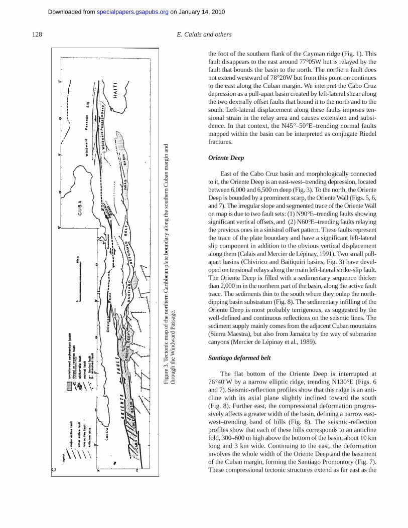
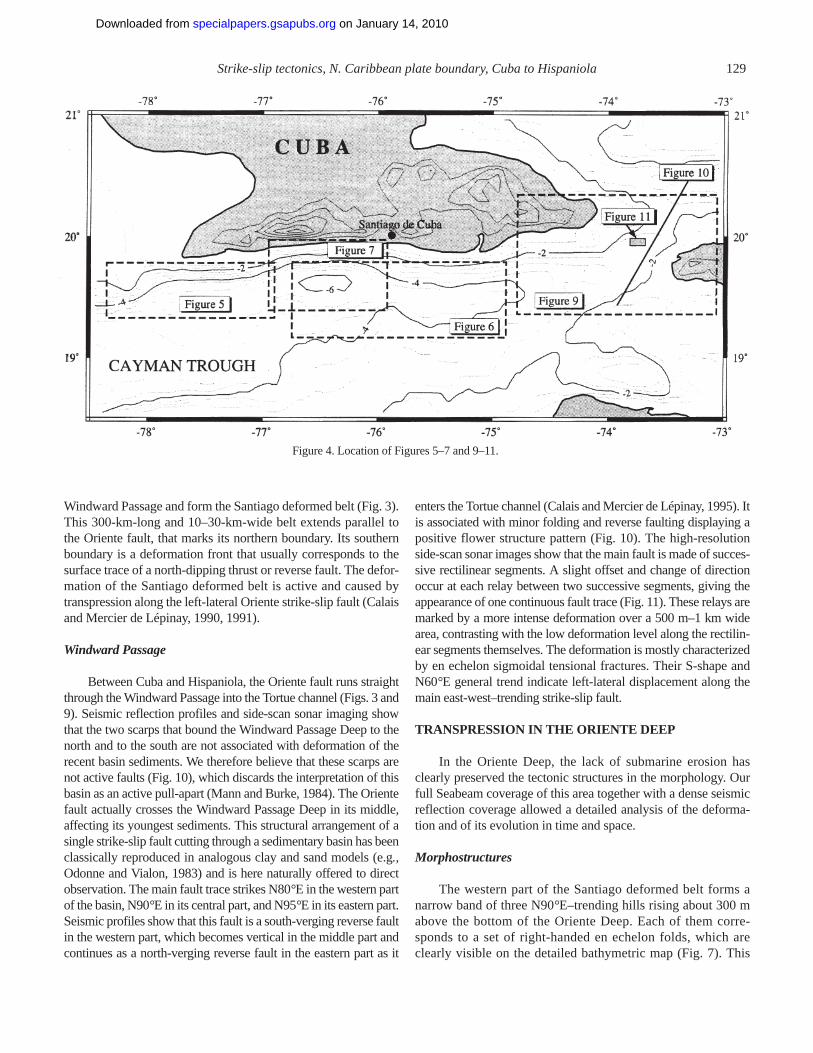
Figure 3 displays a tectonic map of the active structures inthe study area, established from a morphostructural analysis ofSeabeam bathymetry, 50 single channel seismic lines, and a fullhigh-resolution side-scan sonar coverage in the Windward Pas-sage area. Figure 4 shows the location of some of the figures ref-erenced in this chapter. We identify four major structural domainsand describe them from west to east in the following sections.
The Cabo Cruz basin
In the western part of the study area, the plate boundary traceis divided into two parallel faults that trend N80°E. These faultsbound the northern and southern margin of a rectilinear depres-sion, the Cabo Cruz basin (Fig. 5). This basin is internallydivided into a series of oblique horsts and grabens delimited bynormal faults trending N45° to 50°E. The southern border of thebasin is the eastward extension of the Oriente fault that follows
Strike-slip tectonics, N. Caribbean plate boundary, Cuba to Hispaniola 127
Figure 2. Seismicity (black dots, ISC catalog, 1960–1993, Ms > 3.5) and earthquake focal mechanisms(CMT catalog, 1977–1993) in the Cayman trough and along the southern Cuban margin. Bathymetrylabeled in thousand meters.
on January 14, 2010specialpapers.gsapubs.orgDownloaded from
128 E. Calais and others
Fig
ure
3. T
ecto
nic
map
of t
he n
orth
ern
Car
ibbe
an p
late
bou
ndar
y al
ong
the
sout
hern
Cub
an m
argi
n an
dth
roug
h th
e W
indw
ard
Pas
sage
.
the foot of the southern flank of the Cayman ridge (Fig. 1). Thisfault disappears to the east around 77°05W but is relayed by thefault that bounds the basin to the north. The northern fault doesnot extend westward of 78°20W but from this point on continuesto the east along the Cuban margin. We interpret the Cabo Cruzdepression as a pull-apart basin created by left-lateral shear alongthe two dextrally offset faults that bound it to the north and to thesouth. Left-lateral displacement along these faults imposes ten-sional strain in the relay area and causes extension and subsi-dence. In that context, the N45°–50°E–trending normal faultsmapped within the basin can be interpreted as conjugate Riedelfractures.
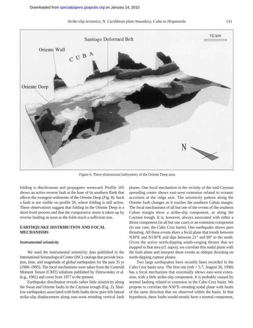
Oriente Deep
East of the Cabo Cruz basin and morphologically connectedto it, the Oriente Deep is an east-west–trending depression, locatedbetween 6,000 and 6,500 m deep (Fig. 3). To the north, the OrienteDeep is bounded by a prominent scarp, the Oriente Wall (Figs. 5, 6,and 7). The irregular slope and segmented trace of the Oriente Wallon map is due to two fault sets: (1) N90°E–trending faults showingsignificant vertical offsets, and (2) N60°E–trending faults relayingthe previous ones in a sinistral offset pattern. These faults representthe trace of the plate boundary and have a significant left-lateralslip component in addition to the obvious vertical displacementalong them (Calais and Mercier de Lépinay, 1991). Two small pull-apart basins (Chivirico and Baitiquiri basins, Fig. 3) have devel-oped on tensional relays along the main left-lateral strike-slip fault.The Oriente Deep is filled with a sedimentary sequence thickerthan 2,000 m in the northern part of the basin, along the active faulttrace. The sediments thin to the south where they onlap the north-dipping basin substratum (Fig. 8). The sedimentary infilling of theOriente Deep is most probably terrigenous, as suggested by thewell-defined and continuous reflections on the seismic lines. Thesediment supply mainly comes from the adjacent Cuban mountains(Sierra Maestra), but also from Jamaica by the way of submarinecanyons (Mercier de Lépinay et al., 1989).
Santiago deformed belt
The flat bottom of the Oriente Deep is interrupted at76°40′W by a narrow elliptic ridge, trending N130°E (Figs. 6and 7). Seismic-reflection profiles show that this ridge is an anti-cline with its axial plane slightly inclined toward the south(Fig. 8). Further east, the compressional deformation progres-sively affects a greater width of the basin, defining a narrow east-west–trending band of hills (Fig. 8). The seismic-reflectionprofiles show that each of these hills corresponds to an anticlinefold, 300–600 m high above the bottom of the basin, about 10 kmlong and 3 km wide. Continuing to the east, the deformationinvolves the whole width of the Oriente Deep and the basementof the Cuban margin, forming the Santiago Promontory (Fig. 7).These compressional tectonic structures extend as far east as the
on January 14, 2010specialpapers.gsapubs.orgDownloaded from
Windward Passage and form the Santiago deformed belt (Fig. 3).This 300-km-long and 10–30-km-wide belt extends parallel tothe Oriente fault, that marks its northern boundary. Its southernboundary is a deformation front that usually corresponds to thesurface trace of a north-dipping thrust or reverse fault. The defor-mation of the Santiago deformed belt is active and caused bytranspression along the left-lateral Oriente strike-slip fault (Calaisand Mercier de Lépinay, 1990, 1991).
Windward Passage
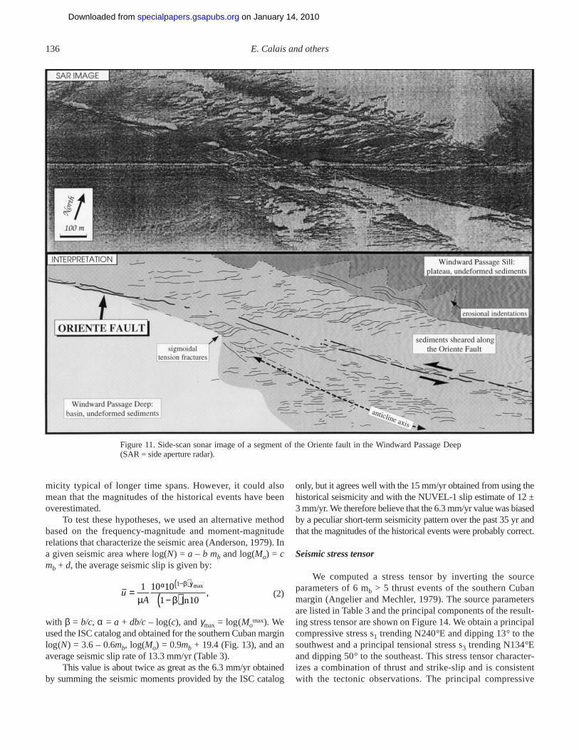
Between Cuba and Hispaniola, the Oriente fault runs straightthrough the Windward Passage into the Tortue channel (Figs. 3 and9). Seismic reflection profiles and side-scan sonar imaging showthat the two scarps that bound the Windward Passage Deep to thenorth and to the south are not associated with deformation of therecent basin sediments. We therefore believe that these scarps arenot active faults (Fig. 10), which discards the interpretation of thisbasin as an active pull-apart (Mann and Burke, 1984). The Orientefault actually crosses the Windward Passage Deep in its middle,affecting its youngest sediments. This structural arrangement of asingle strike-slip fault cutting through a sedimentary basin has beenclassically reproduced in analogous clay and sand models (e.g.,Odonne and Vialon, 1983) and is here naturally offered to directobservation. The main fault trace strikes N80°E in the western partof the basin, N90°E in its central part, and N95°E in its eastern part.Seismic profiles show that this fault is a south-verging reverse faultin the western part, which becomes vertical in the middle part andcontinues as a north-verging reverse fault in the eastern part as it
enters the Tortue channel (Calais and Mercier de Lépinay, 1995). Itis associated with minor folding and reverse faulting displaying apositive flower structure pattern (Fig. 10). The high-resolutionside-scan sonar images show that the main fault is made of succes-sive rectilinear segments. A slight offset and change of directionoccur at each relay between two successive segments, giving theappearance of one continuous fault trace (Fig. 11). These relays aremarked by a more intense deformation over a 500 m–1 km widearea, contrasting with the low deformation level along the rectilin-ear segments themselves. The deformation is mostly characterizedby en echelon sigmoidal tensional fractures. Their S-shape andN60°E general trend indicate left-lateral displacement along themain east-west–trending strike-slip fault.
TRANSPRESSION IN THE ORIENTE DEEP
In the Oriente Deep, the lack of submarine erosion hasclearly preserved the tectonic structures in the morphology. Ourfull Seabeam coverage of this area together with a dense seismicreflection coverage allowed a detailed analysis of the deforma-tion and of its evolution in time and space.
Morphostructures
The western part of the Santiago deformed belt forms anarrow band of three N90°E–trending hills rising about 300 mabove the bottom of the Oriente Deep. Each of them corre-sponds to a set of right-handed en echelon folds, which areclearly visible on the detailed bathymetric map (Fig. 7). This
Strike-slip tectonics, N. Caribbean plate boundary, Cuba to Hispaniola 129
Figure 4. Location of Figures 5–7 and 9–11.
on January 14, 2010specialpapers.gsapubs.orgDownloaded from

arrangement is typical for folding in a left-lateral strike-slip tec-tonic regime. The axial trend of the folds, however, signifi-cantly varies within each set. On both the central and southernfold sets, the westernmost anticline trends N125°E–N130°E,making an angle of 35°–40° with the main strike-slip faultdirection. Both are of small size and have a rectilinear axis. Theother anticlines are bigger and have a curved axis striking5°–20° from the main strike-slip fault direction. The stretchedsigmoidal shape of these curved fold axes indicates left-lateralshear. The anticlines’ wavelength is 9 km in the northern foldset, 7 km in the central fold set, and 5 km in the southern foldset, but remains constant within each fold set. The size of theanticlines shows that same gradient: they are 12 km long ×3 km wide in the northern fold set but only 5 km long × 2 kmwide in the southern one. We interpret this geometry as theresult of progressive northward deepening of the sedimentaryinfilling of the Oriente Deep, as suggested by analog models(Wilcox et al., 1973; Cobbold, 1975; Odonne and Vialon, 1983;Richard and Cobbold, 1989). The trend of the central set offolds occurs on an extension of the fault bounding the CaboCruz basin to the south. This suggests that this fault may extend
farther east in the subsurface and act as a preexisting disconti-nuity that would passively initiate the folding.
SPACE AND TIME EVOLUTION OF FOLDING ANDREVERSE FAULTING
An upper sequence of diverging reflections onlaps southwardonto the northern flank of the anticlines (B´ on profile 59 shown inFig. 8), with a thickness that progressively increases from thefolds’ crest down along their flank. This geometry characterizes asyntectonic sequence, deposited and progressively tilted duringthe folding of the underlying sequence. A sequence showing thesame seismic characteristics is visible on profile 105 (A shown inFig. 8), but is covered on that profile by a sequence of parallelreflections that uncomformably overlies the fold. A third sequencecan be identified on profiles 59 and 105 (C or C´ shown in Fig. 8),with continuous and parallel reflections clearly affected by foldingon both profiles. The most recent sediments on profile 59 aretherefore syntectonic, whereas they are post-tectonic on profile105. This result indicates that the fold on profile 59 is currentlygrowing, whereas the fold on profile 105 is not. It suggests that
130 E. Calais and others
Figure 5. Three-dimensional bathymetry of the Cabo Cruz basin area.
on January 14, 2010specialpapers.gsapubs.orgDownloaded from
folding is diachronous and propagates westward. Profile 105shows an active reverse fault at the base of its southern flank thataffects the youngest sediments of the Oriente Deep (Fig. 8). Sucha fault is not visible on profile 59, where folding is still active.These observations suggest that folding in the Oriente Deep is ashort-lived process and that the compressive strain is taken up byreverse faulting as soon as the folds reach a sufficient size.
EARTHQUAKE DISTRIBUTION AND FOCALMECHANISMS
Instrumental seismicity
We used the instrumental seismicity data published in theInternational Seismological Center (ISC) catalogs that provide loca-tion, time, and magnitude of global earthquakes for the past 35 yr(1960–1995). The focal mechanisms were taken from the CentroidMoment Tensor (CMT) solutions published by Dziewonsky et al.(e.g., 1981) and cover from 1977 to the present.
Earthquake distribution reveals rather little seismicity alongthe Swan and Oriente faults in the Cayman trough (Fig. 2). Shal-low earthquakes associated with both faults show pure left-lateralstrike-slip displacement along east-west–trending vertical fault
planes. One focal mechanism in the vicinity of the mid-Caymanspreading center shows east-west extension related to oceanicaccretion at the ridge axis. The seismicity pattern along theOriente fault changes as it reaches the southern Cuban margin.The focal mechanisms of all but one of the events of the southernCuban margin show a strike-slip component, as along theCayman trough. It is, however, always associated with either athrust component (in all but one case) or an extension component(in one case, the Cabo Cruz basin). One earthquake shows purethrusting. All these events share a focal plane that trends betweenN30ºE and N130°E and dips between 21° and 69° to the north.Given the active north-dipping south-verging thrusts that wemapped in that area (cf. supra), we correlate this nodal plane withthe fault plane and interpret these events as oblique thrusting onnorth-dipping rupture planes.
Two large earthquakes have recently been recorded in theCabo Cruz basin area. The first one (mb = 5.7, August 26, 1990)has a focal mechanism that essentially shows east-west exten-sion, with a little strike-slip component. It is probably caused bynormal faulting related to extension in the Cabo Cruz basin. Wepropose to correlate the N30°E–trending nodal plane with faultsof the same direction that we observed within the basin. In thathypothesis, these faults would mostly have a normal component,
Strike-slip tectonics, N. Caribbean plate boundary, Cuba to Hispaniola 131
Figure 6. Three-dimensional bathymetry of the Oriente Deep area.
on January 14, 2010specialpapers.gsapubs.orgDownloaded from

combined with little left-lateral strike-slip. This result is in accor-dance with an interpretation of these faults as Riedel fracturesassociated with left-lateral shear along major east-west–trendingfaults. The most recent and biggest earthquake along the southernCuban margin is a mb = 6.3 that struck the Cabo Cruz basin areaon May 25, 1992 (Perrot et al., 1997). The main shock probablyoccurred along the northern edge of the basin, although the accu-
racy of teleseismic determinations does not give a precise enoughlocation to undoubtedly point out the associated rupture. Wemodeled that earthquake using a hybrid ray-tracing method(Perrot et al., 1994) that enables us to use a two-dimensionalcrustal model around the seismic source. We used the crustalmodel obtained by Edgar et al. (1971) from seismic-refractiondata. The best fit between the observed and synthetic seismo-
132 E. Calais and others
Figure 7. Detailed bathymetric map of the Oriente Deep and morphostructural interpretation. Thedashed lines give the location of the seismic profiles of Figure 8.
on January 14, 2010specialpapers.gsapubs.orgDownloaded from

Strike-slip tectonics, N. Caribbean plate boundary, Cuba to Hispaniola 133
Figure 8. Single-channel seismic-reflection profiles 59, 103, and 105 across the Oriente Deep and corresponding interpretation.
on January 14, 2010specialpapers.gsapubs.orgDownloaded from

134 E. Calais and others
Figure 9. Three-dimensional bathymetry of the Windward Passage area.
grams is obtained for a 19-km-deep hypocenter with a focal planetrending N80°E and dipping 55° to the north (Fig. 12). Becauseof its coincidence with the Oriente fault direction and the consis-tency of this focal mechanism with others farther east, we inter-pret this focal plane as the rupture plane.
Historical seismicity
Reports of earthquakes in the Greater Antilles date as farback as the 16th century when the region was being colonizedby the Spanish. On the basis of these reports, Salterain (1883)already noticed the significant seismic activity in southernCuba. Before the 20th century, the only populated area in thatregion was the city of Santiago de Cuba (Fig. 4), which wasfounded in 1514. The history of Santiago therefore provides aprecise calendar for major earthquakes in that region. Taber(1922, p. 211) noted that while strong shocks were usually feltover a large region, small events have been reported only fromSantiago. The location of these old events is not accurate, but
because the Oriente fault is the only major active fault in thearea, it seems reasonable to assume that they occurred along it,as Taber already proposed in 1922: “Most of the earthquakesthat have damaged property in eastern Cuba have probably theirorigins along the precipitous scarp that forms the north side ofthe Bartlett [Cayman] Trough.” The first earthquake reported inSalterain’s listing that caused serious damage to Santiagooccurred in 1578. Two other strong and damaging shocks fol-lowed in 1675 and 1677, two years apart. One year later, onFebruary 11, 1678, a strong shock caused extensive destructionin the city. In 1755, a severe earthquake was followed by atsunami that flooded Santiago. The strongest earthquake everfelt in this region occurred on June 11, 1766, and almost com-pletely destroyed the city of Santiago. Salterain lists 18 strongearthquakes between 1777 and 1852 and quotes a witness of theAugust 20, 1852, earthquake who reported that “the first shockconsisted of a strong up and down motion, causing many of theinhabitants to flee from the city.” This last information, andespecially the 1755 tsunami, suggests that some of the historical
on January 14, 2010specialpapers.gsapubs.orgDownloaded from

earthquakes of southern Cuba may have had a thrust compo-nent, as the instrumental seismicity has shown for most of therecent earthquakes in that region.
The earliest earthquake in the southern Cuban region forwhich an estimate of source parameters is available is dated1887 (Mocquet, 1984). In about a century, five earthquakeswith a magnitude Ms greater than 6.5 occurred along the south-ern Cuban margin (Table 1, from Mocquet, 1984). This pro-vides us with a century of quantitative information on majorearthquakes in this region.
SEISMIC SLIP, STRESS AND STRAIN
Seismic slip rates
The seismic energy released during earthquakes provides anestimate of the displacement due to earthquakes on a strike-slipfault (e.g., Brune, 1968; Thatcher et al., 1975; Anderson, 1979).
In the following paragraphs, we estimate the slip rate along thesouthern Cuban margin from 78°W to 74°W (Fig. 2).
The average seismic slip is given by
(1)
where A is the total fault area, µ the shear modulus, ∆T the datatime span, and Mo the seismic moment (Brune, 1968). We usedµ = rVs
2 = 3.3 × 10¹¹ dyn/cm2, a 440-km-long × 15-km-deepfault plane (from 78°E to 74°E). We applied the above equationto the data listed in Table 1 and in the ISC catalog (1960–pres-ent). From 1887 to the present, we obtain an average seismicslip rate of 15 mm/yr, fairly close to the 12 ± 3 mm/yr NUVEL-1 slip estimate along the Oriente fault (Table 2, p. 211). How-ever, using only the ISC data we obtain an average seismic sliprate of only 6.3 mm/yr. This probably indicates that the 35 yrspan of the ISC catalog does not provide a record of the seis-
uA T
MO
T
= ∑1
µ ∆ ∆
Strike-slip tectonics, N. Caribbean plate boundary, Cuba to Hispaniola 135
Figure 10. Multichannel seismic-reflection profile crossing the Windward Passage Deep and corre-sponding interpretation.
on January 14, 2010specialpapers.gsapubs.orgDownloaded from
micity typical of longer time spans. However, it could alsomean that the magnitudes of the historical events have beenoverestimated.
To test these hypotheses, we used an alternative methodbased on the frequency-magnitude and moment-magnituderelations that characterize the seismic area (Anderson, 1979). Ina given seismic area where log(N) = a – b mb and log(Mo) = cmb + d, the average seismic slip is given by:
(2)
with β = b/c, α = a + db/c– log(c), and γmax = log(Momax). We
used the ISC catalog and obtained for the southern Cuban marginlog(N) = 3.6 – 0.6mb, log(Mo) = 0.9mb + 19.4 (Fig. 13), and anaverage seismic slip rate of 13.3 mm/yr (Table 3).
This value is about twice as great as the 6.3 mm/yr obtainedby summing the seismic moments provided by the ISC catalog
only, but it agrees well with the 15 mm/yr obtained from using thehistorical seismicity and with the NUVEL-1 slip estimate of 12 ±3 mm/yr. We therefore believe that the 6.3 mm/yr value was biasedby a peculiar short-term seismicity pattern over the past 35 yr andthat the magnitudes of the historical events were probably correct.
Seismic stress tensor
We computed a stress tensor by inverting the sourceparameters of 6 mb > 5 thrust events of the southern Cubanmargin (Angelier and Mechler, 1979). The source parametersare listed in Table 3 and the principal components of the result-ing stress tensor are shown on Figure 14. We obtain a principalcompressive stress s1 trending N240°E and dipping 13° to thesouthwest and a principal tensional stress s3 trending N134°Eand dipping 50° to the southeast. This stress tensor character-izes a combination of thrust and strike-slip and is consistentwith the tectonic observations. The principal compressive
uA
=−( )
−( )1 10 10
1 10
1
µ β
α β γ max
ln,
136 E. Calais and others
Figure 11. Side-scan sonar image of a segment of the Oriente fault in the Windward Passage Deep(SAR = side aperture radar).
on January 14, 2010specialpapers.gsapubs.orgDownloaded from

stress is subperpendicular to the main strike-slip fault and per-pendicular to the axis of the folds that we imaged in the Ori-ente Deep (Fig. 7).
This same stress pattern has been described along theSan Andreas fault system in California (Mount and Suppe,1987), where a small component of convergence is added tothe general strike-slip displacement between the Pacific andNorth America plates. We tentatively apply the same inter-
pretation to the northern Caribbean plate boundary along thesouthern Cuban margin and thus infer a small convergencecomponent to be added to the general strike-slip displace-ment between the Caribbean and North America plates in thatregion. This convergence component could explain the trans-pressive tectonic regime revealed by the morphostructuralanalysis as well as the teleseismic data along the southernCuban margin.
Strike-slip tectonics, N. Caribbean plate boundary, Cuba to Hispaniola 137
Figure 12. Focal mechanism of the Ms = 7.0 “Cabo Cruz” earthquake (May 25, 1992) from P-wavesmodeling. The observed (top) and synthetic (bottom) seismograms are displayed for each station withthe station name on the left. Seismic moments are in 10–18N.m. The source time function is at the bot-tom right of the figure.
on January 14, 2010specialpapers.gsapubs.orgDownloaded from

Seismic strain rates
Kostrov (1974) showed that the average irrotational strain ina volume caused by slips on different rupture planes is given by
(3)
where Mij is the seismic moment components summed over nrupture planes and ∆V is the deformed volume. As before, weassumed a shear modulus µ of 3.3 × 10¹¹ dyn/cm2 and a440-km-long × 40-km-wide × 15-km-deep deformed volumeextending along the Oriente fault from 78°E to 74°E. Using theCMT source parameters (Table 3), we obtain the followingstrain tensor:
(4)
with the rows and columns corresponding to the east, south, andvertical components, respectively. The average slip correspond-ing to this strain tensor is 13.9 mm/yr in a N84.5°E direction.Given the uncertainties associated with the determination ofearthquake source parameters, this direction is in fair agreementwith the NUVEL-1 prediction of N78°E. The slip rate agreeswell with the value of 13.3 mm/yr obtained using Anderson’s
method (Table 2) and with the NUVEL-1 prediction of 12 ±3 mm/yr.
This strain tensor represents the strain released duringearthquakes in the deformed area averaged over 18 yr (datatime span). It shows east-west extension and north-south con-traction of about the same amount and with little vertical exten-sion. Figure 15 shows that the strain tensor is almost isotropicin a vertical east-west–trending plane, as one should expectwithin a shear plane. This agrees with the Oriente fault beingthe main shear zone. In the horizontal plane, the strain tensorshows left-lateral shear (Fig. 15) consistent with strike-slip dis-placement along the plate boundary. In a vertical north-south–trending plane, the strain tensor shows right-lateral shearand strong contraction along an axis dipping 45° to the north,both consistent with southward thrusting and north-south short-ening in the Santiago deformed belt.
DISCUSSION: SEISMICITY, ACTIVE STRUCTURES,AND PLATE MOTION
Marine geophysical data and the seismicity characteristicsshow that the tectonic regime along the southern Cuban margin isa combination of left-lateral shear and north-south compressionalong the whole margin. This transpressive regime is notrestricted to the Santiago deformed belt, where surficial evidenceof transpression is pronounced, but also extends into the CaboCruz basin, where the major tectonic structures indicate transten-sion. However, transtension in the Cabo Cruz pull-apart area isrelated to the local geometry of the main fault zone, and does notpreclude the existence of a regional compressional componentalong the fault zone.
The seismic slip rate along the Oriente fault deduced fromdifferent methods and from data spanning up to 108 yr agreeswell with the 12 ± 3 mm/yr NUVEL-1 prediction (Table 2).This result suggests that all the stress accumulated by theCaribbean–North America plate motion is released seismicallyalong the southern Cuban margin. On the other hand, 97% ofthe total seismic energy released along the southern Cuban mar-
εij =
×31 27 42
42 06 30
30 1 79
10
. .46 –49.49
.46 –33. .40
–49.49 .40 .
,–9 yr
εµ∆ij ij
x
x
n
VM= ( )
=∑1
2 1
138 E. Calais and others
TABLE 1. HISTORICAL EARTHQUAKESREPORTED ALONG THE SOUTHERN CUBAN MARGIN*
Date Location Moment Magnitude Ms(1026 dyn.cm)
Sept. 23, 1887 South of Cuba 25 7.5Feb. 20, 1917 19.5°N/78.5°W 14 7.4Feb. 3, 1932 19.8°N/75.8°W 1.5 6.7July 7, 1947 19.9°N/75.3°W 1.5 6.7
*Source parameters have been estimated (from Mocquet, 1984).Numerical values are approximate.
TABLE 2. SLIP AND MOMENT RATES ALONG THE SOUTHERN CUBAN MARGIN*
Geology Cumulative Cumulative Anderson Kostrov(NUVEL-1) Seismic Moment, Seismic Moment, (1979) (1974)
1887 to Present 1960 to Present
Moment rate 26 34 14 29 30(1024 dyn.cm/yr)
Slip rate 12.0 ± 3 15 6.3 13.3 13.8(mm/yr)
Time span 3 × 10⁶ 108 35 35 18(years)
*Rates estimated from five different methods (explanations in text).
on January 14, 2010specialpapers.gsapubs.orgDownloaded from

gin over the past 35 yr is due to the May 25, 1992, earthquake(Table 3). Also noticeable is the lack of moderate-size earth-quakes (5.0 < Ms < 6.0) in this region, as shown by Figure 13.This tends to show that most of the seismic stress is releasedduring a few strong earthquakes, such as the 1992 Cabo Cruzevent, and is consistent with the historical seismicity that showsthe occurrence of only one or two earthquakes with a magni-tude greater than 7.0 per century.
These results single out this segment of the northernCaribbean strike-slip plate boundary from oceanic transformfaults, where up to 95% of the total slip can occur aseismically(Trehu and Solomon, 1983; Steward and Okal, 1983; Dziak etal., 1991). In the case of oceanic transform faults, this processis usually related to an anomalously high heat flow that pre-
vents seismic failure (Burr and Solomon, 1978; Kawasaki etal., 1985). Heat-flow measurements in the eastern part of theCayman trough do not show any significant anomaly (Rosen-crantz et al., 1988). Moreover, the Oriente fault along thesouthern Cuban margin crosses island-arc rocks, not oceanicmaterial (Edgar et al., 1971; Mercier de Lépinay et al., 1989).We also show that the relative displacement of the Caribbeanand North America plates is slightly oblique to the Orientefault trend along the southern Cuban margin. This could par-ticipate in “locking” the fault zone by increasing the couplingbetween the Caribbean and North America lithospheres. Thesecharacteristics may explain the highly seismic nature of thenorthern Caribbean plate boundary along the southern Cubanmargin.
Strike-slip tectonics, N. Caribbean plate boundary, Cuba to Hispaniola 139
Figure 13. Cumulative frequency (N) versus magnitude (mb) plot for the southern Cuban margin seismicitybetween 78°W and 74°W. The plotted regression line corresponds to the relation indicated in the figure.
TABLE 3. SOURCE PARAMETERS OF M b >5 EARTHQUAKES ALONG SOUTHERN CUBAN MARGIN FROM 1970 TO PRESENT
Date Time Strike Dip Rake mb Ms Mo Mrr* Mss* Mee* Mrs* Mre* Mse*11/13/78 07:43 330° 69° 73° 5.1 4.7 0.63 0.41 0.02 -0.43 -0.3 0.35 0.6909/01/85 01:00 228° 53° 82° 5.1 4.5 0.44 0.44 -0.28 -0.17 -0.06 -0.11 -0.1802/12/89 14:27 286° 29° 43° 5.2 4.6 0.75 0.44 -0.28 -0.16 0.11 -0.55 0.3105/22/90 20:36 290° 43° 27° 5.0 4.9 0.13 0.57 -0.07 -0.50 -0.35 -0.82 0.7408/26/90 07:53 039° 62° 57° 5.7 5.1 2.2 -1.4 -0.72 2.2 -0.69 -0.59 0.8209/04/90 08:03 302° 21° 21° 5.2 4.5 0.73 0.24 -0.07 -0.17 -0.26 -0.63 0.2305/25/92 16:55 248° 43° 01° 6.3 7.0 201 4 -85 81 81 -127 109
*Mrr, Mss, Mee, Mrs, Mre, and Mse are the moment tensor elements in 1024 dyn.cm expressed in an r-up, s-South, e-East coordinate system.
on January 14, 2010specialpapers.gsapubs.orgDownloaded from

CONCLUSION
The analysis of the active tectonic structures along thenorthern Caribbean plate boundary from Cuba to Hispaniolareveals a narrow deformation zone dominated by left-lateralstrike-slip faulting. The shear displacement is probably con-centrated along the most prominent structural feature, the Ori-ente fault. This fault has a discontinuous trace withleft-stepping offsets that generate tensional strain and cause thesubsidence of pull-apart basins like the Cabo Cruz basin. How-ever, the most striking tectonic structures display transpression(Santiago deformed belt) with active folding and reverse fault-ing. The earthquakes’ distribution and their source parametersare well correlated with the active tectonic structures. Bothtypes of data reveal the combination of north-south compres-sion and left-lateral shear starting at about 78°W long. in theCabo Cruz basin area and continuing all the way along thesouthern Cuban margin. We infer the existence of a componentof convergence added to the shear displacement between theCaribbean and North America plates that would induce thetranspressive strain regime and cause folding and reverse fault-ing along structures parallel to the main fault. We compute aseismic slip rate of 13–15mm/yr that agrees well with the 12 ±3 mm/yr NUVEL-1 estimate along the northern Caribbean
plate boundary. This result implies that all the slip along thesouthern Cuban margin occurs seismically and could suggeststrong lithospheric coupling between the Caribbean and NorthAmerica plates in that region.
ACKNOWLEDGMENTS
We are grateful to the ship crew and scientific members ofthe Seacarib II (R/V Jean Charcot) and Oriente (R/V Le Suroit)oceanographic campaigns during which most of the marine geo-physical data presented here were collected. We thank Jim Dolan,William Dillon, and James Dewey for their helpful reviews. Géo-science Azur publication 167.
REFERENCES CITED
Anderson, J. G., 1979, Estimating the seismicity from geological structure forseismic-risk studies: Bulletin of the Seismological Society of America,v. 69, p. 135–158.
Angelier, J., and Mechler, P., 1979, A graphic method applied to the localizationof principal stresses for fault tectonics and seismology; the right dihe-dral method: Bulletin de la Societé Géologique de France, v. 19, p.1309–1318.
Brune J. N., 1968, Seismic moment, seismicity, and rate of slip along majorfault zones: Journal of Geophysical Research, v. 73, p. 777–784.
Burr N. C., and Solomon, S. C., 1978, The relationship of source parameters ofoceanic transform earthquakes to plate velocity and transform length:Journal of Geophysical Research, v. 83, p. 1193–1205.
Calais, E., and Mercier de Lépinay, B., 1990, A natural model of active trans-pressional tectonics: The en échelon structures of the Oriente Deep,along the northern Caribbean transcurrent plate boundary: Revue del’Institute Francais du Pétrole et Annales des Combustible Liquides, v.45, p. 147–160.
Calais, E., and Mercier de Lépinay, B., 1991, From transtension to transpressionalong the northern Caribbean plate boundary off Cuba: Implications forthe recent motion of the Caribbean plate: Tectonophysics, v. 186,p. 329–350.
Calais, E., and Mercier de Lépinay, B., 1995, Strike-slip tectonic processes inthe northern Caribbean between Cuba and Hispaniola (Windward Pas-sage): Marine Geophysical Research, v. 17, p. 63–95.
Case, J. E., and Holcombe, T. L., 1980, Geologic-tectonic map of the Caribbeanregion: U.S. Geological Survey, Miscellaneous Investigations, MapI-1100, Scale 1:2,500,000.
Cobbold P. R., 1975, Fold propagation in single embedded layers: Tectono-physics, v. 27, p. 333–351.
DeMets, C., Gordon, R. G., Argus, D. F., and Stein, S., 1990, Current platemotions: Geophysical Journal of the Royal Astronomical Society, v.101, p. 425–478.
Dziak R. P., Fox, C. G., and Embley, R. W., 1991, Relationship between theseismicity and geologic structure of the Blanco transform zone: MarineGeophysical Researches, v. 13, p. 203–208.
Dziewonski, A. M., Chou, T. A., and Woodhouse, J. H., 1981, Determination ofearthquake source parameters from waveform data for studies of globaland regional seismicity: Journal of Geophysical Research, v. 86,p. 2825–2852.
Edgar, N. T., Ewing, J. I., and Hennion, J., 1971, Seismic refraction and reflec-tion in the Caribbean Sea: American Association of Petroleum GeologyBulletin, v. 55, p. 833–870.
Goreau, P. D. E., 1983, The tectonic evolution of the north-central Caribbeanplate margin [Ph.D. thesis]: Cambridge, Massachusetts, MassachusettsInstitute of Technology, 245 p.
Kawasaki, I., Yasutosi, K., Ikuko, T., and Kosugi, N., 1985, Mode of seismic
140 E. Calais and others
Figure 14. Principal axis of the stress tensor along the southern Cubanmargin (Schmidt projection, lower hemisphere). Inset: theoretical stresstensor axis in the case of pure strike-slip, pure compression, and pureextension.
on January 14, 2010specialpapers.gsapubs.orgDownloaded from

moment release at transform faults: Tectonophysics, v. 118, p. 313–327.Kostrov, V. V., 1974, Seismic moment and energy of earthquakes, and seismic
flow of rocks: Physics Solid Earth, v. 1, p. 13–21.Mann, P., and Burke, K., 1984, Neotectonics of the Caribbean: Review of Geo-
physics and Space Physics, v. 22, p. 309–362.Mascle, A., and Letouzey, A., 1990, Geological map of the Caribbean: Rueil-
Malmaison, France, L’institute Français du Pétrole, Z sheets.Mercier de Lépinay, B., Renard, V., Calais, E., Calmus T., Capet, X., Delteil, J.,
Gardner, O., Hernandez, G., Mauffret, A., Momplaisir, R., Quentric, I.,Rodriguez, R., Ross, M., Tardy, M., and Vila, J. M., 1989, Morphologyand structure along a major marine strike-slip fault zone: The northernCaribbean plate boundary between Cuba, Hispaniola and Jamaica, inProceedings of the 28th International Geological Congress, July 9–19,1989: Washington D.C.
Mocquet, A., 1984, Vitesses de déplacement discontinu le long d’une zone lim-ite de plaques: Caraibes-Amérique du Nord (Discontinuous slip ratesalong the Caribbean–North America plate boundary) [unpublished M.A.thesis]: France, University of Rennes, 53 p.
Molnar, P., and Sykes, L. R., 1969, Tectonics of the Caribbean and MiddleAmerica regions from focal mechanisms and seismicity: GeologicalSociety of America Bulletin, v. 80, p. 1639–1684.
Mount, V. S., and Suppe, J., 1987, State of stress near the San Andreas Fault;implications for wrench tectonics: Geology, v. 15, p. 1143–1146.
Odonne, F., and Vialon, P., 1983, Analogue models of folds above a wrenchfault: Tectonophysics, v. 99, p. 31–46.
Perrot, J., Deschamps, A., Farra, V., and Virieux, J., 1994, Azimuthal distorsionof the seismic focal sphere: Application to earthquakes in subductionzone: Physics of the Earth and Planetary Interiors, v. 84, p. 240–270.
Perrot, J., Calais, E., and Mercier de Lépinay, B., 1997, Waveform simulation ofthe May 25th, 1992, Ms = 6.7 Cabo Cruz earthquake (Cuba): New con-
straints on the tectonic regime along the northern Caribbean plateboundary: PAGEOPH, v. 149, p. 475–487.
Richard, P., and Cobbold, P., 1989, Structures en fleur positives et décroche-ments crustaux: Modélisation analogique et interprétation dynamique(Positive flower structures and crustal strike-slip faults: analog modelsand dynamic interpretation): Comptes Rendus de l’Académie des Sci-ences des Paris, p. 553–560.
Rosencrantz, E., Ross, M. I., and Sclater, J. G., 1988, The age and spreadinghistory of the Cayman Trough as determined from depth, heat flow andmagnetic anomalies: Journal of Geophysical Research, v. 93, p.2141–2157.
Salterain, P., 1883, Ligera resena de los tremblores de tierra ocurridos en la islade Cuba (The earthquakes of the island of Cuba): Boletin de la Comi-sion del Mapa Geologico de Espana, v. 10, p. 371–385.
Steward, L. M., and Okal, E. A., 1983, Seismicity and aseismic slip along theEltanin fracture zone: Journal of Geophysical Research, v. 88,p. 10495–10507.
Taber, S., 1922, The seismic belt in the greater Antilles: Bulletin of the Seis-mological Society of America, v. 4, p. 199–219.
Thatcher W., Hileman, J. A., and Hanks, T. C., 1975, Seismic slip distributionalong the San Jacinto fault zone, southern California, and its implica-tions: Geological Society of America Bulletin, v. 86, p. 1140–1146.
Tréhu, A. M., and Solomon, S. C., 1983, Earthquakes in the Orozco transformzone: Seismicity, source mechanisms, and tectonics: Journal of Geo-physical Research, v. 88, p. 8203–8225.
Wilcox, R. E., Harding, T. P., and Seely, D. R., 1973, Basic Wrench Tectonics:American Association of Petroleum Geologists Bulletin, v. 57, p.74–96.
MANUSCRIPTACCEPTED BY THESOCIETY JANUARY 9, 1998
Strike-slip tectonics, N. Caribbean plate boundary, Cuba to Hispaniola 141
Figure 15. Ellipsoid representation of the strain tensor along the southern Cuban margin.
Printed in U.S.A.
on January 14, 2010specialpapers.gsapubs.orgDownloaded from


Geological Society of AmericaSpecial Paper 326
1998
The 1943–1953 north-central Caribbean earthquakes: Active tectonic setting, seismic hazards, and implications
for Caribbean–North America plate motions
James F. DolanDepartment of Earth Sciences, University of Southern California, Los Angeles, California 90089
David J. WaldU.S. Geological Survey, Pasadena, California 91125
ABSTRACT
The 1943 northern Mona Passage earthquake and the 1946 northeastern Hispan-iola earthquake were two of the largest events to strike the north-central Caribbeanregion in more than 400 yr. Both were oblique, left-lateral thrust events generated bythe rupture of large parts of the gently south-dipping, plate-interface fault that sepa-rated the obliquely subducting North America (Atlantic) slab from the overriding His-paniola and Puerto Rico blocks of the northern Caribbean plate boundary zone(NCPBZ). These ruptures occurred at strongly coupled collisional asperities associatedwith active, collisional underthrusting of high-standing carbonate banks of the south-eastern Bahamas. This is particularly well illustrated by the 1946 mainshock, wherethe 200-km-long aftershock zone exactly matches the limits of the active collision zonebetween northern Hispaniola and Silver and Navidad carbonate banks. A large after-shock of the 1946 earthquake in 1948 deepened the mainshock rupture plane, andanother major aftershock in 1953 extended the rupture 15 km westward to the leadingedge of the oblique, westward-propagating Bahamas collision.
Bathymetric data reveal a 7-km-deep pull-apart basin along a major left-lateralstrike-slip fault in the Hispaniola slope between the 1943 and 1946 rupture planes,suggesting that this section of the plate-interface oblique thrust fault may not beundergoing active collision. We speculate that such noncollisional parts of the plate-interface fault may not be as strongly coupled as the collisional asperities. Theoccurrence of both the 1943 and 1946 events—the two largest thrust events knownto have occurred on the plate-interface fault since at least 1787—suggests that inthe northern Caribbean such large thrust earthquakes may typically nucleate onlyat strongly coupled collisional asperities.
Rakes derived from focal mechanisms that we calculated for the 1943 and 1946mainshocks (030° and 034°, in map view, respectively) indicate that slip along theplate-interface fault is oblique to the 080–110° trend plate margin in the northeasternHispaniola–northwestern Puerto Rico area. Much of the plate-boundary slip in thisregion, however, is partitioned onto the left-lateral, Septentrional fault onshore His-paniola. This fault probably merges into the south-dipping plate interface along thetop of the underthrust Atlantic slab at ~15 km depth beneath northern Hispaniola.The exact location of the downward termination of the Septentrional fault is
Dolan, J. F., and Wald, D. J, 1998, The 1943–1953 north-central Caribbean earthquakes: Active tectonic setting, seismic hazards, and implications forCaribbean–North America plate motions, in Dolan, J. F., and Mann, P., eds., Active Strike-Slip and Collisional Tectonics of the Northern Caribbean PlateBoundary Zone: Boulder, Colorado, Geological Society of America Special Paper 326.
143
on January 14, 2010specialpapers.gsapubs.orgDownloaded from

INTRODUCTION
Although the densely populated northern Caribbean islandsof Hispaniola and Puerto Rico (Fig. 1) have the longest historicalearthquake record in the Americas, dating back to the mid-16thcentury (Scherer, 1912; Kelleher et al., 1973; Chalas-Jimenez,1989; W. R. McCann and L. Feldman, written communication,1995), seismic hazards in the north-central Caribbean regionremain relatively poorly understood. One of the main reasons forthis is that, although the general tectonic setting of the northernCaribbean plate margin has been known for some time(e.g., Molnar and Sykes, 1969; Bracey and Vogt, 1970; Schelland Tarr, 1978), the major active faults in the plate boundary havenot been studied in detail until recently. In many cases, basicfaulting parameters, such as location, extent, geometry, kinemat-ics, and earthquake history have not been known. For example,although the Septentrional fault is a major left-lateral strike-slipfault that stretches for several hundred kilometers across the
length of northern Hispaniola, it was not fully identified as suchuntil the early 1980s (Mann et al., 1984; Mann and Burke, 1984).The study of Mann et al. (this volume) is the first detailed studyto be published on this major fault. The offshore part of the plateboundary in the Hispaniola region was, until recently, even lesswell studied than the onshore faults. Austin (1983) and Dillonet al. (1992) recognized active thrust faulting off northwesternHispaniola, but a companion chapter by Dolan et al. (this vol-ume) is the first detailed description of the active structures andtectonics of a 400-km length of the offshore plate boundarybetween north-central Hispaniola and northwestern Puerto Rico.
Major earthquakes in the region have also received rela-tively little study until recently. Prior to the 1943–1953 sequencediscussed in this chapter, which was studied by Kelleher et al.(1973), only a few historic events have been documented in anydetail (e.g., the 1842 northwest Hispaniola earthquake inScherer, 1912; and the 1918 Mona Passage earthquake in Reidand Taber, 1919) despite the long historic record in the region.
144 J. F. Dolan and D. J. Wald
unknown, but it probably occurs downdip from the 1943 and 1946 rupture planes.Thus, the rakes derived from the 1943 and 1946 mainshocks show that relative platemotion in the region must be oriented more easterly than ~030°. Furthermore, theoblique-thrust mechanism of the 1943 mainshock indicates that plate motion alongthe 080°-trending plate boundary off northwestern Puerto Rico must be orientedmore northerly than 080°. This is supported by geological data that reveal evidencefor a slight component of convergence across this part of the plate margin. Thus, thedirection of relative motion between the obliquely subducting North America(Atlantic) plate and the Hispaniola and Puerto Rico blocks of the NCPBZ is between030° and 080°. These data support several published models that predict east-north-east relative plate motion in the region. Conversely, the earthquake data rule out sev-eral models that predict that relative motion between the North America plate andthe Puerto Rico block of the NCPBZ plate motion is oriented east-west. The trans-pressional regime revealed by the earthquake data also preclude models in whichPuerto Rico has been proposed to be (1) actively rotating counterclockwise or (2)underlain by an active, south-dipping extensional decollement.
Evidence for a component of oblique left-lateral slip on the plate-interface thrust,coupled with published, preliminary Global Positioning System geodetic data, sug-gests that a significant portion of the relative motion between the North America plateand the Hispaniola and Puerto Rico blocks of the NCPBZ may be accommodatedalong the south-dipping plate-interface thrust fault. This fault thus represents amajor seismic hazard to the densely populated northern parts of Hispaniola andPuerto Rico. Other major seismic sources in the region include the Septentrionalfault, large normal faults in the Mona Passage between Hispaniola and Puerto Rico,and the left-lateral Enriquillo-Plantain Garden strike-slip fault and north-dippingLos Muertos plate-interface thrust fault along the southern edge of the NCPBZ.
The 1943–1953 earthquakes were the most recent major events in a cluster oflarge events that have occurred on faults along the northern margin of the NCPBZsince 1842. Available historical data suggest that this cluster of activity in the northerndeformation belt is anti-correlated—both temporally and geographically—with a sim-ilar cluster of earthquakes that occurred between the early 1600s and 1860 on a paral-lel system of left-lateral strike-slip and thrust faults that stretches along the southernboundary of the NCPBZ. The cause of the intriguing pattern of “deformation switch-ing” remains unknown but represents an important target of future research.
on January 14, 2010specialpapers.gsapubs.orgDownloaded from

Furthermore, paleoseismological studies have only just begun inthe region. Prentice et al. (1993) published the first paleoseis-mologic data from the northern Caribbean based on their trenchstudies of the Septentrional fault in north-central Hispaniola (seealso Mann et al., this volume).
Another major factor in our lack of knowledge about theseismotectonics and seismic hazards of the northern Caribbean isthe fact that relatively few large earthquakes have occurred alongthe plate boundary during the instrumental era. This chapterfocuses on the two largest instrumentally recorded earthquakes—the 1943 northern Mona Passage earthquake and the 1946 north-eastern Hispaniola earthquake—that have occurred in thenorthern Caribbean region. In this study we (1) examine the rela-tionship between these earthquakes and zones of active, colli-sional underthrusting along the northern Caribbean plateboundary zone (NCPBZ); (2) discuss the significance of thesecollisions for seismic hazard assessment in the region; (3) use theearthquake focal mechanisms that we have determined to addressthe long-standing disagreement about relative plate motions in
the north-central Caribbean region; and (4) discuss the 1943 and1946 earthquakes in the context of the temporal and spatial pat-terns of strain release along the NCPBZ.
GEOLOGIC SETTING
As a result of long-lived and ongoing interactions with thesurrounding North America and South America plates, the mar-gins of the Caribbean plate are extremely complex, both struc-turally and kinematically (Fig. 1). The north-central Caribbeanislands of Hispaniola, Puerto Rico, and Cuba represent the dis-membered remnants of one or more Cretaceous to Eocene islandarcs that developed above a southwest-dipping subduction zone(Pindell and Barrett, 1991). Since middle Eocene time both theNorth and South America plates have moved westward relative tothe Caribbean plate (in a hot-spot reference frame), with active arcvolcanism occurring in the Lesser Antilles in response to west-dipping subduction of Atlantic oceanic lithosphere beneath theCaribbean plate (Pindell and Barrett, 1990). This relative motion
1943–1953 north-central Caribbean earthquakes 145
Figure 1. Location map of the Caribbean region (after Mann et al., 1984). Arrow in northeast denotesbest estimate of northern Caribbean plate boundary zone (NCPBZ)–North America (Atlantic) platerelative motion vector determined in this study. Other arrows show plate motion directions fromMann et al. (1984). Westward motion of both the North America and South America plates relativeto the Caribbean plate south of the NCPBZ results in predominantly left-lateral strike-slip motionalong the northern boundary, and right-lateral strike-slip motion along the southern margins of theCaribbean plate, respectively; the Caribbean plate is stationary relative to a hot-spot reference frame.Dark shading denotes Bahamas carbonate province. PR is Puerto Rico; Hisp is Hispaniola.
on January 14, 2010specialpapers.gsapubs.orgDownloaded from

results in predominantly left-lateral motion along the northernboundary of the Caribbean plate (Molnar and Sykes, 1969; Braceyand Vogt, 1970; Schell and Tarr, 1978; Mann et al., 1984, 1990;Pindell and Barrett, 1990). Despite a general consensus on thispoint, both the direction and velocity of Caribbean–North Amer-ica relative plate motion have been the subject of long-standingdebate, with a range of proposed directions from 090° to 065°, anda range of proposed rates from 11 to 37 mm/yr (Molnar andSykes, 1969; Jordan, 1975; Minster and Jordan, 1978; Sykes etal., 1982; Stein et al., 1988; DeMets et al., 1990; DeMets, 1993;Deng and Sykes, 1995; Farina et al., 1995).
Global plate motion model NUVEL-1, which is relativelypoorly constrained for the northern Caribbean region, yieldednear east-west relative plate motion at an overall rate of~11 ± 3 mm/yr in the Hispaniola region (De Mets et al., 1990;DeMets, 1993). Analysis of magnetic lineations in the Caymantrough suggests that the long-term average plate motion rate is~15 mm/yr along the Caribbean–North America plate boundary(Rosencrantz et al., 1988). However, more recent analysis ofonly post-early Miocene to Holocene magnetic lineationsyielded a slightly faster estimate of ~19–22 mm/yr (Rosen-crantz, 1995). MacDonald and Holcombe (1978) obtained a sim-ilar estimate (20 ± 4 mm/yr) using magnetic anomaly data forthe past 2.3 Ma. Sykes et al. (1982) and Rosencrantz and Mann(1991), however, argued that these values underestimate totalCaribbean–North America motion because some plate-boundaryslip bypasses the northern part of the Cayman trough and isaccommodated along the left-lateral Enriquillo-Plantain Gardenfault zone in Jamaica and southern Hispaniola (Fig. 1) (Mannet al., 1984). Sykes et al. (1982), using the configuration andthermal character of the subducted Atlantic slab and slip vectorsfrom plate-boundary earthquakes in the eastern and northeasternCaribbean, estimated a rate of 37 ± 5 mm/year along an azimuthof 065°. Deng and Sykes (1995) argued that this rate is probablyan overestimate, and they use their calculated Euler poletogether with GPS geodetic data from Dixon (1993) to estimatea rate of 20–30 mm/yr, with a best estimate of 23 mm/yr, alongan azimuth of 070° in the north-central Caribbean. Dewey andSuarez (1991) obtained a rate of 27 mm/yr by assuming that theCaribbean is fixed with respect to a hotspot reference frame.Preliminary GPS geodetic data from a network of northernCaribbean stations yielded an overall Caribbean–North Americaplate relative plate motion rate of ~24 mm/yr in the Hispaniolaregion (Farina et al., 1995; Dixon et al., 1998). Collectively,these estimates indicate that the relative motion rate between theCaribbean and North America plates is ~20–25 mm/yr.
In the north-central Caribbean the plate boundary forms acomplex, 250-km-wide zone of deformation known as the north-ern Caribbean plate boundary zone (NCPBZ) (Fig. 2; Mannet al., 1984). The NCPBZ in this region is highlighted by twomajor zones of deformation that occur along the northern andsouthern boundaries of the islands of Puerto Rico and Hispaniola(Mann et al., 1984, 1990; Burke, 1988). The northern zone,which is the focus of this study, is associated with south-dipping
underthrusting of Atlantic oceanic lithosphere of the NorthAmerica plate (McCann and Sykes, 1984; McCann and Penning-ton, 1990; Deng and Sykes, 1995; Dolan et al., this volume),whereas the southern deformation zone involves north-dippingunderthrusting of Caribbean lithosphere at the Los Muertostrench (Ladd and Watkins, 1978; Byrne et al., 1985; Ladd et al.,1990; Dillon et al., 1994; Dolan et al., this volume). The northerndeformation zone exhibits well-developed strain partitioning inHispaniola (Dolan et al., this volume), with much of the plate-boundary, left-lateral strike-slip motion accommodated on theSeptentrional fault system (Mann et al., 1984, 1990, this volume;Calais et al., 1992; Prentice et al., 1993). The Septentrional faultsystem extends westward into the Oriente fault zone, whichforms the northern boundary of the Cayman trough pull-apartbasin (Fig. 1) (Calais et al., 1989, 1992, this volume; Edgar,1991; Rosencrantz and Mann, 1991). East of Hispaniola, left-lat-eral strike-slip motion occurs on the eastern Septentrional andnorthern Puerto Rico slope fault zones north of Puerto Rico(Masson and Scanlon, 1991; Dolan et al., this volume). Develop-ment of a small accretionary prism offshore northern Hispaniolaattests to an active component of convergence across the plateboundary in the Hispaniola region (Austin, 1983; Dillon et al.,1992; Dolan et al., this volume).
Hispaniola–Bahamas collision zone
One of the most notable features of the plate boundary in theHispaniola area is a zone of active collision between Hispaniolaand high-standing carbonate banks of the southeastern Bahamas.SeaMARC II side-scan sonar data collected offshore northernHispaniola reveal that two Bahamas carbonate banks are activelycolliding with Hispaniola over a front more than 200 km long(Dolan et al., this volume). The collision, which extends alongthe plate boundary between ~70° 00′W and 68° 30′W, involvesthe southern margins of Silver and Navidad banks, which rise5.5 km above the surrounding Atlantic abyssal plain (Fig. 2). Thecollision is best illustrated offshore of north-central Hispaniola,between 70° 05′W and 69° 42′W, where Silver Spur, a bathymet-rically high-standing ridge of Silver bank carbonate, impinges onthe Hispaniola slope and projects beneath the Rio San JuanPeninsula of the Dominican Republic (Dolan et al., this volume).Throughout the rest of the collision zone, high-reflectivity car-bonate bank material directly abuts lower reflectivity material ofthe Hispaniola slope.
To the west of the collision zone, the high-standing Mouchoirbank is separated from the deformation front at the base of thenorthern Hispaniola slope by the 20–30-km-wide Hispaniolabasin (Fig. 3). Thus, this part of the Hispaniola margin is notexperiencing active collision with the buoyant Bahamas block. Incontrast, to the east of the Silver-Navidad bank collision zone, theBahamas ridge has already been obliquely subducted beneath thePuerto Rico block of the NCPBZ (Dolan et al., this volume).These major differences in the structural style of the plate marginare due to the diachronous nature of the Bahamas collision—the
146 J. F. Dolan and D. J. Wald
on January 14, 2010specialpapers.gsapubs.orgDownloaded from

generally westward motion and more northwesterly strike of theBahamas ridge relative to the NCPBZ results in a westward-younging zone of active collision. Based on this reasoning, Dolanet al. (this volume) proposed that the Bahamas ridge collision hasprogressed much farther beneath northern Mona Passage than ithas within the Silver-Navidad collision zone. They suggest that azone of relatively shallow bathymetry in the northern part ofMona Passage (their Mona block) is the sea-floor manifestationof ongoing collisional underthrusting of an already subductedsoutheastern Bahamas bank, which they named Mona bank.
Dolan et al. (this volume) also used recent seismicity data toconstruct a structure-contour map on the top of the south- tosouth-southwest–dipping, underthrust Atlantic (North America)slab (Figs. 3 and 4). The strike and dip of the slab changesmarkedly at the proposed Mona bank collision. North of the Vir-gin Islands, at ~65° W, local network data reveal that the slab dips45° south (Frankel, 1982; McCann and Sykes, 1984; Fischer andMcCann, 1984). The dip of the slab shallows markedly westwardtoward the postulated Mona bank collision zone. At the locus ofthe collision at 67° 30′ the slab dips ~25° south (Fig. 3; Dolan
et al., this volume). West of the collision the strike of the shallowpart of the slab changes to west-northwest. Along the Silver-Navidad collision zone in northeastern Hispaniola the shallowpart of the underthrust slab dips ~30° south-southwest.
THE 1943–1953 NORTH-CENTRAL CARIBBEANEARTHQUAKE SEQUENCE
On July 29, 1943, a major earthquake occurred offshore ofnorthwestern Puerto Rico (Fig. 5) (Kelleher et al., 1973). Thisevent, which we refer to as the northern Mona Passage earth-quake, was the first in a sequence of large earthquakes that struckthe north-central Caribbean region during the decade 1943–1953.Three years after the northern Mona Passage earthquake, theregion experienced an even larger event when, on August 4,1946, a great earthquake occurred beneath the coast of northeast-ern Hispaniola, ~200 km west of the 1943 epicenter (Fig. 5)(Lynch and Bodle, 1948; Small, 1948; Kelleher et al., 1973).
In the following discussion of these earthquakes and theiraftershocks we use the surface-wave magnitude (Ms) estimates of
1943–1953 north-central Caribbean earthquakes 147
Figure 2. Neotectonic map of north-central Caribbean showing great width (250 km) and com-plexity of the northern Caribbean plate boundary zone (NCPBZ) as well as the location of majorhistorical earthquakes (year of occurrence shown for each event; 1751a event occurred in Octoberand 1751b earthquake occurred in November). Geologic data compiled from Dolan et al. (this vol-ume), Mann et al. (1984, this volume), Masson and Scanlon (1991), Edgar (1991), Dillon et al.(1992), and Case and Holcombe (1980). Earthquake data compiled from Kelleher et al. (1973),Chalas-Jimenez (1989), McCann and Pennington (1990), and Mann et al. (this volume). CB isCaicos bank; EPGFZ is Enriquillo-Plantain Garden fault zone; J is Jamaica; LMDB is Los Muer-tos deformed belt; Mo is Mouchoir bank; MP is Mona Passage; N is Navidad bank; NHDB isnorthern Hispaniola deformed belt; NPRSFZ is northern Puerto Rico slope fault zone; PR is PuertoRico; S is Silver bank; SDB is Santiago deformed belt; SFZ is Septentrional fault zone; VI is Vir-gin Islands; WP is Windward Passage.
on January 14, 2010specialpapers.gsapubs.orgDownloaded from

Kelleher et al. (1973), despite the fact that subsequent studies sug-gest that these estimates are systematically too large. For exam-ple, Kelleher et al. (1973) estimated an Ms of 8.1 for the 1946mainshock, whereas Abe (1981) estimated Ms 8.0, and bothPacheco and Sykes (1992) and Russo and Villaseñor (1995) esti-mated Ms 7.8. Nevertheless, for the sake of consistency we usethe Kelleher et al. (1973) estimates because only their study esti-mated magnitudes for all of the events we discuss below. Where
available, we include more recent magnitude estimates in paren-theses after the Kelleher et al. (1973) estimate. For example, the1946 northeast Hispaniola earthquake is referred to as Ms 8.1(Kelleher et al., 1973; Ms 8.0 in Abe, 1981; Ms 7.8 in bothPacheco and Sykes, 1992, and Russo and Villaseñor, 1995); the1943 northern Mona Passage earthquake is referred to as Ms 7.8(Kelleher et al., 1973; Ms7.7 in Abe, 1981; Ms7.5 in Pacheco andSykes, 1992).
148 J. F. Dolan and D. J. Wald
Figure 3. Structure contour map of underthrust Atlantic and Caribbean slabs in north-centralCaribbean region. Depth contour interval is 25 km. Contours are from Dolan et al. (this volume) andare based on cross sections of recent seismicity that occurred between 1962 and 1994 and that weretaken from the International Seismological Centre (ISC) Catalog of Earthquakes (1994). Slab con-tours shown as solid gray lines are constructed along the top of a south-dipping zone of seismicityinterpreted to represent the top of the underthrust slab of Atlantic oceanic lithosphere of the NorthAmerica plate. Slab contour shown by black dashed line is constructed along top of north-dippingupper limit of a north-dipping zone of seismicity thought to represent the top of underthrustCaribbean lithosphere. Note the epicenters and approximate focal depths of the 1943 northern MonaPassage and 1946 northeastern Hispaniola earthquakes, which are discussed in this chapter. The min-imum focal depth shown for the 1943 event was determined in this study. The approximate focaldepth for the 1946 event is from Russo and Villaseñor (1995). Dark shading denotes limits ofBahamas carbonate province (from Dolan et al., this volume). Black circles show locations of majorcities. CH is Cap Haitien, Haiti; EPGFZ is Enriquillo-Plantain Garden fault zone from Mann et al.(1984); Hsp Bas is Hispaniola basin; Ma is Mayaguez, Puerto Rico; MoB is Mouchoir bank; N isNavidad bank; Na is Nagua, Dominican Republic; NEHSFZ is northeast Hispaniola slope fault zone;NHDB is northern Hispaniola deformed belt, which includes the northern Hispaniola accretionaryprism; NPRFZ is northern Puerto Rico fault zone compiled from Masson and Scanlon (1991) andDolan et al. (this volume); PP is Port-au-Prince, Haiti; Sa is Santiago, Dominican Republic; SB is Sil-ver bank; SD is Santo Domingo, Dominican Republic; SJ is San Juan, Puerto Rico. Irregular blackareas northeast of Hispaniola denote pull-apart basins at left-steps along the Septentrional fault sys-tem (from Dolan et al., this volume).
on January 14, 2010specialpapers.gsapubs.orgDownloaded from

The north-central Caribbean region was first settled perma-nently during Columbus’s second voyage in 1494, and conse-quently the area has the longest historical earthquake record inthe New World, dating back to the mid-16th century (Scherer,1912; Kelleher et al., 1973; Chalas-Jimenez, 1989; W. R.McCann and L. Feldman, written communication, 1995). Basedon this historical record, the 1943 and 1946 mainshocks appear tobe the largest earthquakes that have struck the northeastern His-paniola–Mona Passage–northwestern Puerto Rico area since atleast November 2, 1564, when a large earthquake destroyed thenorthern Hispaniola cities of Santiago and La Vega (Scherer,1912; McCann and Pennington, 1990; W. R. McCann and L.Feldman, written communication, 1995).
Despite the large magnitudes of the 1943 and 1946 earth-quakes, they have been studied little; prior to this study and therecent study by Russo and Villaseñor (1995), neither their focalmechanisms or focal depths had been determined. To betterunderstand the seismotectonics and seismic hazards of the area,
we have determined focal mechanisms for the six largest earth-quakes from the 1943–1953 sequence, including both the 1943and 1946 mainshocks, and the four largest aftershocks of the1946 event (August 8, 1946; October 4, 1946; April 21, 1948;and May 31, 1953) (Figs. 6 and 7). We initially determined therange of possible first motion mechanisms for each event(Fig. 6). For all but one of the six events (the Ms 7.6 event onAugust 8, 1946, discussed in a following section), one nodalplane is well constrained to strike west-northwest and dip ~70–75° north-northeast. The best-fitting conjugate planes are consis-tent with shallowly dipping thrust faulting with fault dips rangingfrom south-southeast to due west. To resolve the strike of theshallowly dipping planes, we used the well-constrained, steeplydipping nodal planes as a constraint in body-waveform inver-sions to determine the conjugate plane most consistent withavailable P and S bodywaves for each earthquake. The detailedresults of our waveform inversions will be reported in detail in alater paper by Wald and Dolan. Because the number of high-qual-
1943–1953 north-central Caribbean earthquakes 149
Figure 4. Map of recent seismicity (1962–1992) from ISC catalog (slightly modified from Dolan et al., thisvolume). Gray shading denotes limits of southeastern Bahamas carbonate province. Box denotes limits ofseismicity used to construct cross section shown in Figure 8. CB is Caicos bank; M is Mouchoir bank; MPis Mona Passage seismicity cluster; MRC is Main Ridge seismicity cluster; N is Navidad bank; NHAP isnorthern Hispaniola accretionary prism; S is Samana seismicity cluster; SB is Silver bank; SC is Sosuaseismicity cluster. See Dolan et al. (this volume) for detailed discussion of seismicity distribution.
on January 14, 2010specialpapers.gsapubs.orgDownloaded from

150 J. F. Dolan and D. J. Wald
Figure 5. Relocated mainshocks and aftershocks of the 1943 northern Mona Passage earthquake andthe 1946 northeastern Hispaniola earthquake from Kelleher et al. (1973). Mainshocks and large after-shocks, including the four largest aftershocks of the 1946 event (August 8, 1946; October 4, 1946;April 21, 1948; and May 31, 1953), are denoted by black stars. Smaller aftershocks denoted by vari-ous open symbols. Open stars show relocations of the 1946 mainshock and October 4, 1946, after-shock by Russo and Villaseñor (1995). Russo and Villaseñor’s (1995) relocation of the 1946mainshock epicenter does not change significantly from that of Kelleher et al. (1973). Russo andVillaseñor’s (1995) relocation of the October 4, 1946, aftershock does change significantly, however,shifting 20 km to the north-northeast of the Kelleher et al. (1973) location. Note coincidence of 1946aftershock zone with the 200-km-long Silver-Navidad bank collision zone. Solid lines with teeth aredeformation fronts of the Puerto Rico trench–northern Hispaniola accretionary prism system (north ofHispaniola and Puerto Rico) and the Los Muertos trench accretionary prism (south of the islands).Dark shading denotes limits of southeast Bahamas carbonate banks (Dolan et al., this volume). Thetwo irregular zones of diagonal hatching north-northwest of Puerto Rico represent areas of anom-alously shallow bathymetry (“anomalous block” of McCann and Sykes, 1984). Dolan et al. (this vol-ume) interpret these shallow regions as the surficial manifestation of collisional underthrusting of asoutheastern Bahama bank, which they named Mona bank. The triangular zone of horizontal hatchingnorth of Puerto Rico denotes the rupture plane of the 1943 northern Mona Passage earthquake, asdetermined in this study. Note the proximity of the 1943 rupture zone to the proposed Mona bankcollision. Solid lines without teeth are major, left-lateral strike-slip faults of the Septentrional faultsystem (SFS). Note the bifurcation of the SFS in the northern Mona Passage and the divergence of twoeastern strands around the Mona bank zone of anomalously shallow bathymetry. Dark shading repre-sents basinal sediments in the Puerto Rico trench. Geologic data compiled from Dolan et al. (this vol-ume), Mann et al. (1984), Dillon et al. (1991), Edgar (1991), Masson and Scanlon (1990), and Caseand Holcombe (1980). MB is Mouchoir bank; N is Navidad bank; SB is Silver bank.
on January 14, 2010specialpapers.gsapubs.orgDownloaded from

ity waveforms is limited for this time period, constraining onenodal plane based on the more numerous polarity observations(for the steeply dipping plane) is beneficial in adding stability tothe waveform inversion. We used the methodology of Kikuchiand Kanamori (1991), which we modified to accommodate boththe nodal plane constraint and the varied mechanical and electro-magnetic instrument types available during this time period.
Our body-waveform inversions were most successful forthree events—the 1943 and 1946 mainshocks and the 1953 Silver
Spur aftershock (discussed in following sections)—and these areshown in Figures 6 and 7. The focal mechanisms shown for theother three events—the two large 1946 aftershocks and the April21, 1948, Samana earthquake—are first-motion mechanisms only.In general it proved difficult to accurately constrain the exactstrike of the shallowly dipping thrust plane for these events; rotat-ing the strike of this plane by as much as 60°, from near east-westto north-northwest, does not result in significantly different wave-form results. For these events we assumed that the strike of theshallowly dipping plane, which we interpret as the faulting plane,was parallel to the west-northwest–trending long axis of the 1946aftershock zone (Fig. 5). Given the parallelism of the aftershockzone with the ~275–290° orientation of all major active faults inthis part of the plate boundary, including the Septentrional strike-slip fault and the offshore deformation front, we feel that this isan appropriate assumption. In the following section we discusseach of the six earthquakes we studied in detail.
1946 northeastern Hispaniola earthquake
The tectonic setting of the 1946–1953 northeastern Hispan-iola earthquake sequence is somewhat better defined than that forthe 1943 northern Mona Passage earthquake, and we thereforediscuss the northeastern Hispaniola earthquake and its after-shocks first. The Ms 8.1 mainshock (Kelleher et al., 1973; Ms 8.0in Abe, 1981; Ms 7.8 in both Pacheco and Sykes, 1992, andRusso and Villaseñor, 1995) occurred on August 4, 1946, andwas followed by numerous small to moderate aftershocks.Kelleher et al. (1973) relocated 53 of the largest aftershocks.Their relocated aftershocks define a 195-km × 95-km zone thatextends west-northwest along the northern slope of Hispaniola,basically between the offshore deformation front and the coast ofHispaniola; several early aftershocks (i.e., before the first largeaftershock on August 8, 1946) extend northward almost to thedeformation front (Fig. 5). Russo and Villaseñor (1995) also relo-cated 61 aftershocks of the 1946 mainshock. Their distribution isgenerally similar to that shown by Kelleher et al. (1973),although the spatial clustering of their relocated events is some-what tighter than that shown by Kelleher et al. (1973). The after-shock zone (as defined both by Kelleher et al., 1973, and Russoand Villaseñor, 1995) exactly matches the limits of the Hispan-iola–Bahamas collision zone as defined by SeaMARC II side-scan sonar and seismic reflection data, from the southeast edge ofNavidad bank to the western margin of Silver Spur (Fig. 5; Dolanet al., this volume). Our body-waveform inversions yielded afocal mechanism for the 1946 mainshock that shows that it was athrust fault event that occurred on either a shallowly south-dip-ping plane that strikes 085°, or a steeply northeast-dipping planethat strikes 110° (Fig. 6).
As noted above, the strike of the shallowly dipping plane israther poorly constrained. Several lines of evidence, however,show that the event occurred on the shallowly south-dippingplane. The great width of the 1946 aftershock zone relative to itslength is incompatible with a steeply dipping fault plane and
1943–1953 north-central Caribbean earthquakes 151
Figure 6. Focal mechanisms determined in this study for the six largestearthquakes in the 1943–1953 north-central Caribbean sequence (lowerhemisphere projections). Mechanisms for July 29, 1943, northern MonaPassage mainshock; the August 4, 1946, northeastern Hispaniola main-shock; and the May 31, 1953, Sosua earthquake (an aftershock of the1946 mainshock) show the results of our body-waveform inversions.The mechanisms for the other three events are P-wave first-motion focalmechanisms. Circles, triangles, and plus symbols denote dilational,nodal, and compressional arrivals, respectively.
on January 14, 2010specialpapers.gsapubs.orgDownloaded from

shows that the earthquake occurred along the shallowly dippingnodal plane (Fig. 5). Furthermore, the coincidence of the northernedge of the aftershock zone with the collisional deformation frontindicates that the rupture plane dipped south beneath Hispaniola.Finally, Russo and Villaseñor’s (1995) relocated aftershocksdefine a gently south- to southwest-dipping plane that extendsfrom the deformation front toward the mainshock focus (Fig. 8).In our body-waveform inversion, the depth of the mainshockfocus is relatively poorly constrained but was between 15 and 40km. Russo and Villaseñor (1995) estimate a depth of ~20 km. Thedip of the shallowly south-dipping nodal plane on our focal mech-anism is 23° (Fig. 6). If we fit a plane extending from the defor-mation front at the sea floor, through the south-dipping cluster ofaftershocks, to the mainshock focus at 20-km depth, we calculatea dip of the fault plane of ~20°, nearly identical to that derivedfrom our focal mechanism (Fig. 8). The mainshock focusoccurred near the downdip (southern) edge of the rupture plane,
near the southeastern edge of the aftershock zone. These data sug-gest that the 1946 mainshock rupture propagated updip and to thewest-northwest.
In addition to the shallow, gently south-dipping cluster ofaftershocks extending downdip to the mainshock focus, Russoand Villaseñor (1995) also relocated 22 deeper 1946 events thatthey interpret as aftershocks (all events relocated by Russo andVillaseñor, 1995, shown by triangles in Fig. 8). These deep 1946events occurred in a diffuse zone that encompassed most of thethickness of the underthrust Atlantic slab. As can be seen fromFigure 8, the deep 1946 events are part of a long-lived sequenceof intraplate seismicity associated with the underthrust Atlanticslab, probably related to bending stresses within the slab (andpossibly also deep extension as the slab sinks, as suggested byMcCann and Sykes, 1984). In contrast, the shallow, south-dip-ping zone of aftershocks was temporally anomalous, and rela-tively few events have occurred in this region during the past
152 J. F. Dolan and D. J. Wald
Figure 7. Map of the six focal mechanisms determined in this study (large mechanisms) as well asseven other instrumentally recorded events (small mechanisms) compiled from Molnar and Sykes(1969); Kafka and Weidner (1979); and Harvard Centroid Moment Tensor Catalog (1994). Focalmechanisms are lower hemisphere projections; black areas denote compression, white areas showdilation. MB is Mouchoir bank; N is Navidad bank; SB is Silver bank.
on January 14, 2010specialpapers.gsapubs.orgDownloaded from

1943–1953 north-central Caribbean earthquakes 153
Figure 8. Cross section oriented 017° showing recent seismicity in the region of the 1946 northern His-paniola earthquake (modified from Dolan et al., this volume). Heavy line at top of figure representsbathymetry-topography along center line of cross section. No vertical exaggeration. Note that althoughprofile is oriented approximately perpendicular to regional strike, the profile is oblique to some tectonicand topographic features. Shading denotes approximate thickness of different lithospheric plates, basedon assumptions that the Atlantic plate consists of normal oceanic lithosphere ~90–100 km thick andthat the thicker crust of the Caribbean plate (Edgar et al., 1971; Case et al., 1990) results in a thickerlithosphere. All seismicity data from National Earthquake Information Center Catalog of Earthquakes(1994) 1962–1992 except as noted. Only earthquakes with well-defined depths have been used; earth-quakes assigned default depths of 10 km and 33 km were not used in constructing these sections. Tri-angles denote 1946 aftershocks relocated by Russo and Villaseñor (1995). Note the well-defined,shallowly southwest-dipping zone of 1946 aftershocks. Also note the diffuse, southward-dipping zoneof aftershocks associated with underthrusting of Atlantic oceanic crust and Bahamas platform carbon-ates. These shallow aftershocks extend almost to the deformation front defined by the SeaMARC IIdata, suggesting that the 1946 mainshock may have locally ruptured all the way to the sea floor in thiscollisional region of enhanced mechanical coupling. Note the near-total absence in the recent ISC dataof well-located earthquakes associated with the south-dipping plate interface between underthrustAtlantic oceanic crust and Hispaniola that ruptured during the 1946 northeastern Hispaniola earthquake.In contrast, the relocated 1946 aftershocks define a shallowly southwest-dipping plane approximatelyalong our proposed 1946 mainshock rupture surface. Note that the deeper relocated 1946 aftershocksoccur within a long-lived zone of deep background seismicity defined by the past 30 yr of ISC catalogdata. The gentle southwestward dip of the shallow 1946 aftershock zone, coupled with its location northof the Septentrional fault, confirms that the 1946 mainshock occurred along the shallowly southwest-dipping plate interface, rather than along a strand of the Septentrional fault system as has been sug-gested by Russo and Villaseñor (1995). Focal mechanisms are shown for the 1946 northeast Hispaniolamainshock (from this study) and for the Ms 6.7 earthquake of June 24, 1984, which occurred along thenorth-dipping Los Muertos trench zone of underthrusting (from Byrne et al., 1985).
on January 14, 2010specialpapers.gsapubs.orgDownloaded from
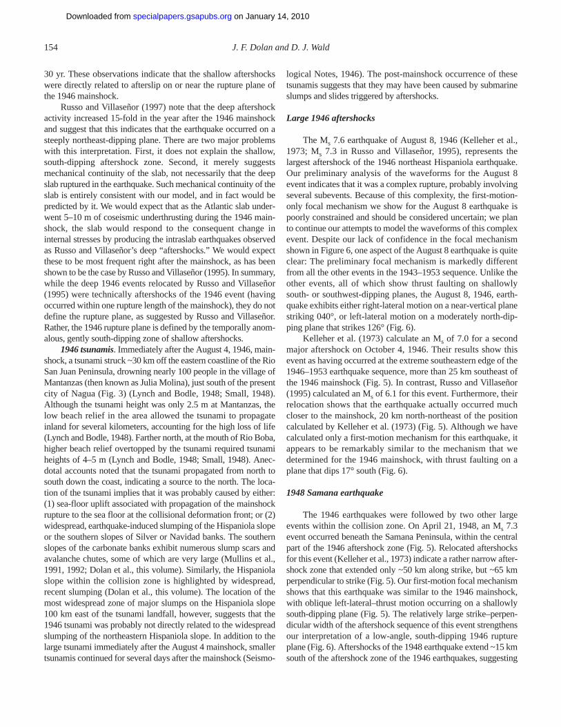
30 yr. These observations indicate that the shallow aftershockswere directly related to afterslip on or near the rupture plane ofthe 1946 mainshock.
Russo and Villaseñor (1997) note that the deep aftershockactivity increased 15-fold in the year after the 1946 mainshockand suggest that this indicates that the earthquake occurred on asteeply northeast-dipping plane. There are two major problemswith this interpretation. First, it does not explain the shallow,south-dipping aftershock zone. Second, it merely suggestsmechanical continuity of the slab, not necessarily that the deepslab ruptured in the earthquake. Such mechanical continuity of theslab is entirely consistent with our model, and in fact would bepredicted by it. We would expect that as the Atlantic slab under-went 5–10 m of coseismic underthrusting during the 1946 main-shock, the slab would respond to the consequent change ininternal stresses by producing the intraslab earthquakes observedas Russo and Villaseñor’s deep “aftershocks.” We would expectthese to be most frequent right after the mainshock, as has beenshown to be the case by Russo and Villaseñor (1995). In summary,while the deep 1946 events relocated by Russo and Villaseñor(1995) were technically aftershocks of the 1946 event (havingoccurred within one rupture length of the mainshock), they do notdefine the rupture plane, as suggested by Russo and Villaseñor.Rather, the 1946 rupture plane is defined by the temporally anom-alous, gently south-dipping zone of shallow aftershocks.
1946 tsunamis. Immediately after the August 4, 1946, main-shock, a tsunami struck ~30 km off the eastern coastline of the RioSan Juan Peninsula, drowning nearly 100 people in the village ofMantanzas (then known as Julia Molina), just south of the presentcity of Nagua (Fig. 3) (Lynch and Bodle, 1948; Small, 1948).Although the tsunami height was only 2.5 m at Mantanzas, thelow beach relief in the area allowed the tsunami to propagateinland for several kilometers, accounting for the high loss of life(Lynch and Bodle, 1948). Farther north, at the mouth of Rio Boba,higher beach relief overtopped by the tsunami required tsunamiheights of 4–5 m (Lynch and Bodle, 1948; Small, 1948). Anec-dotal accounts noted that the tsunami propagated from north tosouth down the coast, indicating a source to the north. The loca-tion of the tsunami implies that it was probably caused by either:(1) sea-floor uplift associated with propagation of the mainshockrupture to the sea floor at the collisional deformation front; or (2)widespread, earthquake-induced slumping of the Hispaniola slopeor the southern slopes of Silver or Navidad banks. The southernslopes of the carbonate banks exhibit numerous slump scars andavalanche chutes, some of which are very large (Mullins et al.,1991, 1992; Dolan et al., this volume). Similarly, the Hispaniolaslope within the collision zone is highlighted by widespread,recent slumping (Dolan et al., this volume). The location of themost widespread zone of major slumps on the Hispaniola slope100 km east of the tsunami landfall, however, suggests that the1946 tsunami was probably not directly related to the widespreadslumping of the northeastern Hispaniola slope. In addition to thelarge tsunami immediately after the August 4 mainshock, smallertsunamis continued for several days after the mainshock (Seismo-
logical Notes, 1946). The post-mainshock occurrence of thesetsunamis suggests that they may have been caused by submarineslumps and slides triggered by aftershocks.
Large 1946 aftershocks
The Ms 7.6 earthquake of August 8, 1946 (Kelleher et al.,1973; Ms 7.3 in Russo and Villaseñor, 1995), represents thelargest aftershock of the 1946 northeast Hispaniola earthquake.Our preliminary analysis of the waveforms for the August 8event indicates that it was a complex rupture, probably involvingseveral subevents. Because of this complexity, the first-motion-only focal mechanism we show for the August 8 earthquake ispoorly constrained and should be considered uncertain; we planto continue our attempts to model the waveforms of this complexevent. Despite our lack of confidence in the focal mechanismshown in Figure 6, one aspect of the August 8 earthquake is quiteclear: The preliminary focal mechanism is markedly differentfrom all the other events in the 1943–1953 sequence. Unlike theother events, all of which show thrust faulting on shallowlysouth- or southwest-dipping planes, the August 8, 1946, earth-quake exhibits either right-lateral motion on a near-vertical planestriking 040°, or left-lateral motion on a moderately north-dip-ping plane that strikes 126° (Fig. 6).
Kelleher et al. (1973) calculate an Ms of 7.0 for a secondmajor aftershock on October 4, 1946. Their results show thisevent as having occurred at the extreme southeastern edge of the1946–1953 earthquake sequence, more than 25 km southeast ofthe 1946 mainshock (Fig. 5). In contrast, Russo and Villaseñor(1995) calculated an Ms of 6.1 for this event. Furthermore, theirrelocation shows that the earthquake actually occurred muchcloser to the mainshock, 20 km north-northeast of the positioncalculated by Kelleher et al. (1973) (Fig. 5). Although we havecalculated only a first-motion mechanism for this earthquake, itappears to be remarkably similar to the mechanism that wedetermined for the 1946 mainshock, with thrust faulting on aplane that dips 17° south (Fig. 6).
1948 Samana earthquake
The 1946 earthquakes were followed by two other largeevents within the collision zone. On April 21, 1948, an Ms 7.3event occurred beneath the Samana Peninsula, within the centralpart of the 1946 aftershock zone (Fig. 5). Relocated aftershocksfor this event (Kelleher et al., 1973) indicate a rather narrow after-shock zone that extended only ~50 km along strike, but ~65 kmperpendicular to strike (Fig. 5). Our first-motion focal mechanismshows that this earthquake was similar to the 1946 mainshock,with oblique left-lateral–thrust motion occurring on a shallowlysouth-dipping plane (Fig. 5). The relatively large strike–perpen-dicular width of the aftershock sequence of this event strengthensour interpretation of a low-angle, south-dipping 1946 ruptureplane (Fig. 6). Aftershocks of the 1948 earthquake extend ~15 kmsouth of the aftershock zone of the 1946 earthquakes, suggesting
154 J. F. Dolan and D. J. Wald
on January 14, 2010specialpapers.gsapubs.orgDownloaded from

that the 1948 event may have extended the 1946 rupture planedowndip in the central part of the collision zone.
1953 Silver Spur earthquake
On May 31, 1953, an Ms 7.0 earthquake occurred beneathnorthern Hispaniola, just south of the coast, along the southwest-ern projection of the western edge of the Silver Spur collision(Fig. 2) (International Seismological Summary of 1953, 1961);Sykes and Ewing, 1965). Our body-waveform inversion yieldeda focal mechanism for this earthquake that is similar to the 1946and 1948 ruptures, revealing thrust faulting on a shallowly south-southwest–dipping plane (Figs. 6 and 7). Aftershocks for thisearthquake define an elongated triangle that extends northeast-ward from the mainshock along the western edge of the SilverSpur collision (Fig. 5). Although the 1953 mainshock occurred~15 km west of the western edge of the 1946 aftershock zone, theeastern half of the 1953 aftershock zone overlaps with the west-ernmost part of the 1946 aftershock zone (Fig. 5). The focaldepth of the Silver Spur earthquake was ~15–25 km.
1943 northern Mona Passage earthquake
The July 29, 1943, Ms 7.8 northern Mona Passage earth-quake (Kelleher et al., 1973; Ms 7.7 in Abe, 1981; Ms 7.5 inPacheco and Sykes, 1992) ruptured a large segment of the plateboundary north of the Mona Passage between Hispaniola andPuerto Rico (Fig. 5). Our body-waveform inversion yielded afocal mechanism that is generally similar to the 1946, 1948, and1953 northeastern Hispaniola earthquakes in that it shows thrustfaulting on either a shallowly south-dipping plane, or a steeplywest-northwest–dipping plane (Fig. 6). However, the focal mech-anism indicates that the 1943 event exhibited slightly moreoblique, left-lateral motion than the 1946 mainshock (Fig. 6).
We have used the waveform inversion to constrain thedimensions of the main rupture area for the 1943 mainshock.These data reveal a roughly triangular asperity that extends west-ward from the mainshock focus for ~50 km; almost no strainrelease occurred east of the mainshock (Fig. 5). The rupture planeis ~40 km wide (viewed perpendicular to the shallowly dippingfaulting plane) along its eastern edge and narrows to a point at itswestern end. Seven aftershocks of the 1943 earthquake (relocatedby Kelleher et al., 1973) define a 90-km × 65-km “halo” thatextends well beyond the rupture plane (Fig. 5). The aftershockzone closely corresponds to the zone of anomalously shallowbathymetry at the north end of Mona Passage, which Dolan et al.(this volume) interpret as the sea-floor manifestation of the Monabank collision. The rupture zone of the earthquake is parallel to,and just south of the zone of shallow bathymetry (Fig. 5). Unlikethe 1946 mainshock, the 1943 northern Mona Passage event doesnot appear to have ruptured to the sea floor at the deformationfront. Rather, the waveform analysis indicates that slip occurredno shallower than ~25 km depth. The absence of shallow ruptureprobably explains the lack of any reported tsunamis for this earth-
quake. A 25–30-km-deep focus for the 1943 mainshock placesthe event near the top of a long-lived, south-dipping cloud ofsmall to moderate earthquakes identified by Dolan et al. (this vol-ume) as the top of the underthrust Atlantic (North America) slab(Fig. 3; see also Dolan et al., this volume).
Furthermore, although the 1943 mainshock epicenter waslocated close to the sea-floor trace of the southeastern strand ofthe left-lateral Septentrional strike-slip fault defined bySeaMARC II side-scan sonar data (Dolan et al., this volume), thelarge strike–perpendicular width of the 1943 aftershock zone rel-ative to its along-strike length, with the occurrence of aftershocksalmost 40 km north of the surface trace of the fault as well as25 km to the south, suggests that the earthquake occurred on ashallowly south-dipping plane. This observation, coupled withthe occurrence of the earthquake along the inferred top of theunderthrust slab and the similarity of the 1943 focal mechanismto the shallowly south- to southwest-dipping thrust earthquakesof the 1946–1953 sequence to the west, indicates that the 1943earthquake did not occur on the Septentrional fault. Rather, aswith the 1946–1953 earthquakes beneath Hispaniola, the focalmechanism and aftershock data indicate that the 1943 earthquakeruptured the shallowly south-dipping, interplate thrust interfacealong the top of the underthrust Atlantic slab (Fig. 6).
Focal mechanisms for recent (1962–1994) moderateearthquakes
In addition to our focal mechanisms for the 1943–1953earthquakes, focal mechanisms of seven moderate earthquakesthat have occurred in the region since 1962 have been published(Molnar and Sykes, 1969; Kafka and Weidner, 1979; HarvardCentroid Moment Tensor Catalog, 1994). Six of the seven pub-lished focal mechanisms are similar to the 1943–1953 earth-quakes, showing predominantly thrust motion along shallowlysouth- and southwest-dipping planes (Fig. 7). As with the larger1943–1953 events, rake angles of the six recent moderatethrust-fault events indicate that motion was oblique to the strikeof the plate margin. Obliquity of slip during these earthquakesto the plate margin ranges from ~30° to near 90°, indicating arange of motion from mixed thrust–left-lateral displacement toleft-lateral strike-slip offset nearly parallel to the strike of theunderthrust Atlantic slab (Fig. 7). In general, the focal mecha-nisms for the smaller events show more highly oblique motionthan the larger 1943–1953 earthquakes. The seventh moderateearthquake, which occurred just north of the deformation frontnear 69° 45′W, exhibited near-pure strike-slip motion on verti-cal planes, either left-lateral slip on a 100°-striking plane, orright-lateral slip on a 015°-striking plane.
DISCUSSION
The most striking characteristic of the 1943 and 1946 earth-quakes is their spatial coincidence with active collision zonesinvolving buoyant, high-standing carbonate banks of the south-
1943–1953 north-central Caribbean earthquakes 155
on January 14, 2010specialpapers.gsapubs.orgDownloaded from

eastern Bahamas. This relationship is particularly clear in thecase of the 1946–1953 north Hispaniola sequence. When com-pared with the structure contour map of the underthrust Atlanticslab beneath Hispaniola, the focal depth, the shallow southwarddip, and the west- to west-northwest strike of the 1946–1953faulting planes are all consistent with the earthquakes havingoccurred on the plate interface along the top of the underthrustNorth America (Atlantic) slab (Fig. 7). This observation, coupledwith the spatial coincidence of the aftershock zones of the1946–1953 earthquakes with the Silver-Navidad bank collisionzone defined by Dolan et al. (this volume), suggests that theearthquake ruptured the strongly coupled interface betweenHispaniola and the underthrust portions of the colliding Bahamabanks. The fact that the shallow, gently south-dipping zone of1946 aftershocks extends to the deformation front further impliesthat the earthquake may have ruptured updip from the focus at~20 km all the way to the sea-floor deformation front.
The tectonic significance of the August 8, 1946, Ms 7.6(Kelleher et al., 1973; Ms 7.3 in Russo and Villaseñor, 1995)aftershock that struck offshore Hispaniola just south of the colli-sional deformation front is still somewhat unclear because of theuncertain nature of the focal mechanism and the absence of awell-constrained focal depth. One possibility is that the earth-quake represents right-lateral tear faulting within the underthrustBahama bank as part of collisional readjustment of the collidingblock to slip during the northeastern Hispaniola earthquake.
The focal mechanism and location of the October 4, 1946,Ms 7.0 (Kelleher et al., 1973; Ms 6.1 in Russo and Villaseñor,1995) aftershock suggest that this earthquake may have re-rup-tured the extreme downdip (southern) limit of the 1946 main-shock rupture plane. We speculate that the October 4 earthquakemay have ruptured down to the extreme downdip edge of under-thrust, buoyant Bahamas material.
The location of the 1948 Samana earthquake suggests thatthis event re-ruptured, and deepened, the central part of the shal-lowly south-dipping 1946 mainshock rupture plane (Fig. 5).Aftershocks of the 1946 mainshock and recent moderate earth-quakes are both anomalously sparse in the eastern part of the1946 rupture zone to the east of the 1948 rupture (Figs. 4 and 5).These data suggest that the 1948 earthquake may have ruptured azone of incomplete strain release during the 1946 mainshock.The Samana earthquake also occurred directly downdip (south-ward) of the projection of Navidad Channel—the deep, linear,north-northeast–trending channel that separates Silver and Navi-dad banks (Dolan et al., this volume)—suggesting the possibilitythat the 1948 rupture occurred along a zone of weakness associ-ated with the underthrust portion of Navidad Channel. The 1948earthquake occurred beneath the Samana Peninsula, whichexhibits much more rugged topography than areas to the east orwest (de Zoeten et al., 1991; Dolan et al., this volume; theirfig. 11A). This observation suggests a third possibility, that theSamana earthquake may have been localized at a collisionalasperity beneath the Samana Peninsula. We speculate that theanomalously high topography of the peninsula may be related to
underthrusting of a particularly shallow portion of the underthrustBahama banks, in much the same way that we propose that thezone of anomalously shallow bathymetry in the northern part ofMona Passage is caused by underthrusting of Mona bank.
The coincidence of the western limit of 1953 aftershockzone with the leading (western) edge of the Silver Spur collisionsuggests that this earthquake ruptured the area of strong couplingbetween Hispaniola and the underthrust portion of Silver Spur.The 1953 aftershock zone extended ~10–15 km west of the west-ern limit of the 1946 aftershocks (Fig. 5), indicating that the 1953earthquake may have extended the 1946 rupture to the extremewestern edge of colliding carbonate basement. Molnar and Sykes(1969) have determined a focal mechanism for a 1967 M 5.3event that occurred at a depth of 39 km, ~15 km southeast of the1953 event (Fig. 7). Their mechanism is consistent with west-southwestward underthrusting along a shallowly west-south-west–dipping fault plane. Comparison of the depths of the 1953and 1967 earthquakes with the structure contour map of theunderthrust Atlantic slab shows that both earthquakes were gen-erated by rupture of the plate-boundary thrust interface along thetop of the underthrust slab (Fig. 7).
On the basis of recent seismicity, the 25- and 50-km depthcontours of the top of the underthrust Atlantic slab can only beconfidently traced northwestward to ~69° 45′W (Fig. 3; Dolanet al., this volume). However, based on the similarity of the 1953and 1967 focal mechanisms with those of the 1943, 1946a, 1946c,and 1948 earthquakes, we suggest that the shallowly south-dip-ping North America (Atlantic) slab extends at least as far west as70° 15′W, the western edge of the 1953 rupture. Furthermore, theconsistent southerly dip of structures in the accretionary prism ofthe northern Hispaniola deformed belt west of the Silver Spur col-lision, and the shallow southward dip of underthrust carbonatebasement beneath the deformation front along the southern edgeof the Hispaniola basin (Dolan et al., this volume), imply that theunderthrust Atlantic slab may exist west of the collision. The slabis not seismically resolvable in north-central and northwesternHispaniola, however, and the deep crustal–upper mantle structurewest of 70° 15′W remains poorly understood.
As with the 1946 northeastern Hispaniola earthquake, the1943 northern Mona Passage earthquake appears to have beenlocalized along an active collision. As discussed above, Dolanet al. (this volume) have proposed that the anomalously shallowbathymetry of the northern Mona Passage area has developed inresponse to underthrusting of a buoyant Bahama bank, which theynamed Mona bank. Since the Bahamas ridge strikes more north-westerly than the plate boundary deformation front, collisionalunderthrusting is diachronous, younging from east to west (Dolanet al., this volume). Thus, the collision has progressed farther inthe Mona Passage area than to the west in the region of the 1946earthquake. Based on this reasoning, Dolan et al. (this volume)suggest that the Mona bank has already been thrust beneath theinsular slope, which has been uplifted in response to the collision.
Comparison of the 1943 mainshock focal mechanism datawith the structure contour map of the underthrust Atlantic slab
156 J. F. Dolan and D. J. Wald
on January 14, 2010specialpapers.gsapubs.orgDownloaded from
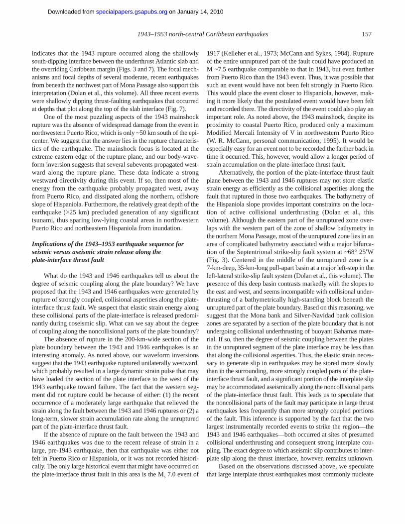
indicates that the 1943 rupture occurred along the shallowlysouth-dipping interface between the underthrust Atlantic slab andthe overriding Caribbean margin (Figs. 3 and 7). The focal mech-anisms and focal depths of several moderate, recent earthquakesfrom beneath the northwest part of Mona Passage also support thisinterpretation (Dolan et al., this volume). All three recent eventswere shallowly dipping thrust-faulting earthquakes that occurredat depths that plot along the top of the slab interface (Fig. 7).
One of the most puzzling aspects of the 1943 mainshockrupture was the absence of widespread damage from the event innorthwestern Puerto Rico, which is only ~50 km south of the epi-center. We suggest that the answer lies in the rupture characteris-tics of the earthquake. The mainshock focus is located at theextreme eastern edge of the rupture plane, and our body-wave-form inversion suggests that several subevents propagated west-ward along the rupture plane. These data indicate a strongwestward directivity during this event. If so, then most of theenergy from the earthquake probably propagated west, awayfrom Puerto Rico, and dissipated along the northern, offshoreslope of Hispaniola. Furthermore, the relatively great depth of theearthquake (>25 km) precluded generation of any significanttsunami, thus sparing low-lying coastal areas in northwesternPuerto Rico and northeastern Hispaniola from inundation.
Implications of the 1943–1953 earthquake sequence forseismic versus aseismic strain release along theplate-interface thrust fault
What do the 1943 and 1946 earthquakes tell us about thedegree of seismic coupling along the plate boundary? We haveproposed that the 1943 and 1946 earthquakes were generated byrupture of strongly coupled, collisional asperities along the plate-interface thrust fault. We suspect that elastic strain energy alongthese collisional parts of the plate-interface is released predomi-nantly during coseismic slip. What can we say about the degreeof coupling along the noncollisional parts of the plate boundary?
The absence of rupture in the 200-km-wide section of theplate boundary between the 1943 and 1946 earthquakes is aninteresting anomaly. As noted above, our waveform inversionssuggest that the 1943 earthquake ruptured unilaterally westward,which probably resulted in a large dynamic strain pulse that mayhave loaded the section of the plate interface to the west of the1943 earthquake toward failure. The fact that the western seg-ment did not rupture could be because of either: (1) the recentoccurrence of a moderately large earthquake that relieved thestrain along the fault between the 1943 and 1946 ruptures or (2) along-term, slower strain accumulation rate along the unrupturedpart of the plate-interface thrust fault.
If the absence of rupture on the fault between the 1943 and1946 earthquakes was due to the recent release of strain in alarge, pre-1943 earthquake, then that earthquake was either notfelt in Puerto Rico or Hispaniola, or it was not recorded histori-cally. The only large historical event that might have occurred onthe plate-interface thrust fault in this area is the Ms 7.0 event of
1917 (Kelleher et al., 1973; McCann and Sykes, 1984). Ruptureof the entire unruptured part of the fault could have produced anM ~7.5 earthquake comparable to that in 1943, but even fartherfrom Puerto Rico than the 1943 event. Thus, it was possible thatsuch an event would have not been felt strongly in Puerto Rico.This would place the event closer to Hispaniola, however, mak-ing it more likely that the postulated event would have been feltand recorded there. The directivity of the event could also play animportant role. As noted above, the 1943 mainshock, despite itsproximity to coastal Puerto Rico, produced only a maximumModified Mercali Intensity of V in northwestern Puerto Rico(W. R. McCann, personal communication, 1995). It would beespecially easy for an event not to be recorded the farther back intime it occurred. This, however, would allow a longer period ofstrain accumulation on the plate-interface thrust fault.
Alternatively, the portion of the plate-interface thrust faultplane between the 1943 and 1946 ruptures may not store elasticstrain energy as efficiently as the collisional asperities along thefault that ruptured in those two earthquakes. The bathymetry ofthe Hispaniola slope provides important constraints on the loca-tion of active collisional underthrusting (Dolan et al., thisvolume). Although the eastern part of the unruptured zone over-laps with the western part of the zone of shallow bathymetry inthe northern Mona Passage, most of the unruptured zone lies in anarea of complicated bathymetry associated with a major bifurca-tion of the Septentrional strike-slip fault system at ~68° 25′W(Fig. 3). Centered in the middle of the unruptured zone is a7-km-deep, 35-km-long pull-apart basin at a major left-step in theleft-lateral strike-slip fault system (Dolan et al., this volume). Thepresence of this deep basin contrasts markedly with the slopes tothe east and west, and seems incompatible with collisional under-thrusting of a bathymetrically high-standing block beneath theunruptured part of the plate boundary. Based on this reasoning, wesuggest that the Mona bank and Silver-Navidad bank collisionzones are separated by a section of the plate boundary that is notundergoing collisional underthrusting of buoyant Bahamas mate-rial. If so, then the degree of seismic coupling between the platesin the unruptured segment of the plate interface may be less thanthat along the collisional asperities. Thus, the elastic strain neces-sary to generate slip in earthquakes may be stored more slowlythan in the surrounding, more strongly coupled parts of the plate-interface thrust fault, and a significant portion of the interplate slipmay be accommodated aseismically along the noncollisional partsof the plate-interface thrust fault. This leads us to speculate thatthe noncollisional parts of the fault may participate in large thrustearthquakes less frequently than more strongly coupled portionsof the fault. This inference is supported by the fact that the twolargest instrumentally recorded events to strike the region—the1943 and 1946 earthquakes—both occurred at sites of presumedcollisional underthrusting and consequent strong interplate cou-pling. The exact degree to which aseismic slip contributes to inter-plate slip along the thrust interface, however, remains unknown.
Based on the observations discussed above, we speculatethat large interplate thrust earthquakes most commonly nucleate
1943–1953 north-central Caribbean earthquakes 157
on January 14, 2010specialpapers.gsapubs.orgDownloaded from

at collisional asperities. This does not mean that large thrust rup-tures cannot nucleate outside the zones of active collisionalunderthrusting, only that the inferred higher degree of interplatecoupling in the collision zones results in faster, more effectivestrain accumulation necessary to generate large earthquakes. Fur-thermore, although large earthquakes may commonly nucleate atcollisional asperities, the earthquake ruptures may propagatebeyond those asperities into less strongly coupled, noncollisionalparts of the plate-interface thrust fault.
Extent of underthrust, buoyant Bahamas province in thenorth-central Caribbean
If large thrust earthquakes along the northern margin of theNCPBZ nucleate more effectively at collisional asperities, then itis of obvious importance to understand the three-dimensional dis-tribution of underthrust, buoyant Bahamas material. Furthermore,the extent of buoyant Bahamas material along the plate boundaryrepresents one of the key elements that must be understoodbefore attempting any reconstruction of the tectonic and mechan-ical evolution of the NCPBZ. The southern margin of theBahamas province, however, has already been subducted beneaththe NCPBZ. We must therefore use indirect means to infer thesubducted extent of the Bahamas province.
First, and most basically, the Bahamas province is thoughtto have developed above a northwest-striking oceanic fracturezone associated with opening of the Atlantic Ocean (Mullins andLynts, 1977). The linear, fracture-zone–parallel nature of theBahamas is reflected most prominently in the Bahamas escarp-ment, the steep, northeastern wall of the Bahamas (Fig. 1). Asdiscussed above, the northwest strike of the Bahamas, coupledwith the overall near–east-west relative North America (Atlantic)plate–NCPBZ motion, indicates that the Bahamas collision isdiachronous, younging from the west. Thus, the collision has pro-gressed farther in the east than in the west. Dolan et al. (thisvolume) propose that Mona bank, which they hypothesize hasbeen subducted beneath the northern Mona Passage, representsthe easternmost extent of underthrust, buoyant Bahamas.
As noted above, the bathymetry of the Hispaniola slope alsoplaces important constraints on the distribution of underthrustBahamas material. Specifically, the presence of the 7-km-deeppull-apart basin above the middle of the unruptured section ofthe thrust fault suggests that this part of the plate boundary is notundergoing active collisional underthrusting. We suggest thatthis zone of noncollision probably extends from the eastern edgeof the 1946 rupture plane at ~68° 30′W to the western edge ofthe northern Mona Passage zone of anomalously shallowbathymetry at ~68° 00′W (Fig. 5).
If, as we propose, 1943 and 1946 mainshocks nucleated atcollisional asperities, then we can use the rupture planes of the1946 and (with slightly less confidence) the 1943 earthquakes asproxies for the presence of underthrust buoyant Bahamas mater-ial. The clear spatial correlation between the rupture plane of the1946 northeastern Hispaniola earthquake and the active Silver-
Navidad bank zone of collisional underthrusting provides strongsupport for this inference.
Finally, side-scan sonar data show that collisional under-thrusting terminates at the western edge of the Silver Bank colli-sion zone (Dolan et al., this volume). West of the collision, thesouthern edges of high-standing Mouchoir and Caicos banks lieto the north of the deformation front (Fig. 2). For example, seis-mic-reflection data from the Hispaniola basin west of Silver Spurshow a sharply defined southern limit to high-standing Mouchoirbank 8–25 km north of the deformation front; carbonate materialunderthrust beneath the Hispaniola slope consists of gently south-dipping slope deposits that lie more than 4.5 km below the crestof Mouchoir bank (Dolan et al., this volume). In other words,because of the highly irregular shape of the southern margin ofthe Bahamas province, and the diachronous, westward-youngingnature of the oblique collision, collisional underthrusting of high-standing carbonate bank material has not yet occurred west of theSilver Spur collision, with a few minor exceptions (e.g.,Mouchoir Spur; Dolan et al., this volume).
Based on these observations, we have constructed a map ofthe probable approximate downdip, southern limit of underthrustBahama carbonates (Fig. 9). Note that although we have drawnthe southern edge of postulated Mona bank along the southernedge of the 1943 rupture plane, the actual downdip limit ofunderthrust Mona bank basement in this area is unknown.
Relative plate motions in the north-central Caribbean basedon earthquake focal mechanisms
To understand the mechanics and evolution of the NCPBZ,we must know the direction of relative plate motion between theNorth America plate (Bahamas province) and the Hispaniola andPuerto Rico blocks, which lie within the NCPBZ; the trueCaribbean plate lies to the south of the NCPBZ. The direction ofmotion along the NCPBZ has been the subject of much debateduring recent years. Regional plate models, based primarily onanalysis of magnetic lineations formed during opening of the Cay-man trough, the presence of left-lateral strike-slip faults along thenorthern plate boundary and right-lateral faults along the southernboundary, and active volcanism in the Lesser Antilles island arcindicate that both the North and South America plates have movedgenerally westward with respect to the Caribbean (relative to thehot-spot reference frame) since Eocene time (Pindell and Barrett,1990; Mann et al., 1990). However, current absolute and relativeplate motions in the north-central Caribbean region remain rela-tively poorly constrained. One of the major reasons for this is that,in marked contrast to most other plate boundaries worldwide,attempts to model Caribbean–North America plate motion vectorshave largely proved unsuccessful (e.g., DeMets et al., 1990;DeMets, 1993). These results indicate that the Caribbean platecannot be modeled as a rigid plane with discrete boundaries(DeMets, 1993). Rather, the Caribbean plate must be undergoingsignificant internal deformation. The validity of this concept isdemonstrated by numerous geological and geophysical studies
158 J. F. Dolan and D. J. Wald
on January 14, 2010specialpapers.gsapubs.orgDownloaded from

that show that the margins of the Caribbean plate are character-ized by wide, extremely complex zones of deformation (seeoverview in Mann et al., 1990). In the north-central Caribbean, forexample, the 250-km-wide plate boundary zone is characterizedby relative motions between several microplates and numeroussmaller structural blocks (Mann et al., 1984, 1995; Byrne et al.,1985; Masson and Scanlon, 1991; Dolan et al., this volume).
As noted above, global plate motion models do not ade-quately constrain Caribbean–North America plate motions, andconsequently there is disagreement about the exact relative platemotion along the NCPBZ (e.g., Sykes et al., 1982; McCann andSykes, 1984; Stein et al., 1988; DeMets et al., 1990; DeMets,1993). There is general agreement that both the North and SouthAmerica plates are moving predominantly westward with respectto the Caribbean plate, resulting in a significant component of left-lateral strike-slip motion across the NCPBZ. Differences arise,however, in terms of the amount of oblique motion occurringalong the margin, and even in the direction of any oblique motion.
Most models indicate either east-west relative motion
(e.g., DeMets, 1993; Farina et al., 1995) or east-northeast motion(Bracey and Vogt, 1970; Schell and Tarr, 1978; Sykes et al.,1982; Deng and Sykes, 1995). All of these models predict pre-dominantly left-lateral motion along the NCPBZ, with varyingdegrees of convergence. Masson and Scanlon (1991), on thebasis of their analysis of the neotectonics of the Puerto Ricoarea, proposed an alternative scenario in which Puerto Ricobehaves as a distinct platelet that is actively rotating counter-clockwise between the Puerto Rico trench and Los Muertostrench within the overall left-lateral NCPBZ. Still other modelssuggest active transtensional and extensional deformation of theHispaniola–Puerto Rico region (Larue and Ryan, 1990; Larueet al., 1990; Speed and Larue, 1991).
In the absence of high-resolution geodetic data for the north-ern Caribbean region, which are just becoming available (Farinaet al., 1995; Dixon et al., 1998), the focal mechanisms that wehave calculated, when coupled with geologic data, provide one ofthe most accurate means for placing constraints on the directionsof relative plate motions in the region. The 1943 and 1946 earth-
1943–1953 north-central Caribbean earthquakes 159
Figure 9. Map of proposed extent of underthrust Bahama bank material based on earthquake locations,limits of Silver-Navidad bank collision zone, and extent of Mona bank zone of anomalously shallowbathymetry. MB is Mouchoir bank; N is Navidad bank; SB is Silver bank.
on January 14, 2010specialpapers.gsapubs.orgDownloaded from

quakes are among the largest (and the 1946 mainshock may, infact, be the largest) events to have struck the northeast Hispan-iola–northwest Puerto Rico area in at least 430 yr, and they recordmost of the strain released seismically along the plate interfaceduring that time. It is therefore likely that they represent a signifi-cant portion of the long-term pattern of strain release along themargin. This inference is supported by the internal similarity ofthe focal mechanisms calculated for the individual earthquakes inthe 1943–1953 sequence, as well as by the overall similarity ofthose focal mechanisms to mechanisms calculated for recent,moderate earthquakes that have occurred along the plate interface.
The rake that we calculated for the 1943 earthquake (030°in map view) indicates that during the earthquake motion alongthe east-northeast–trending plate interface (080° trend at the seafloor; ~065° trend at 25 km depth; Fig. 3) was highly oblique,with approximately equal amounts of convergence perpendicularto the margin and left-lateral motion parallel to it. The rake forthe 1946 event (034° in map view) shows that motion along theplate interface during that earthquake was also oblique, but withonly about one-half as much left-lateral motion parallel to the100°-trending margin as thrust motion perpendicular to the mar-gin (margin-parallel:margin-perpendicular ratio ~1:2). The rakescalculated for the other earthquakes from the 1946–1953sequence give similar results (Fig. 6).
The earthquake data are supported by Dolan et al.’s (this vol-ume) analysis of the active tectonics of the north-centralCaribbean, which shows evidence of a convergent component ofdeformation along the entire northern boundary of the NCPBZ,from north of the Virgin Islands to north-central Hispaniola. Simi-larly, marine geophysical data from northwestern Hispaniola(Dillon et al., 1992) and southeastern Cuba (Calais et al., 1989,1992, this volume) indicate that the contractional component ofdeformation continues as far west as the eastern end of the Cay-man trough (Fig. 2). Even in a regime in which pure left-lateralmotion would occur on east-west planes (e.g., NUVEL-1; DeMetset al., 1990), such contractional structures would be expected alongthe west-northwest–trending plate margin in the Hispaniolarestraining bend (Mann et al., 1984). The occurrence of active con-tractional structures along the 080–085°-trending plate margin offnorthern Puerto Rico, however, requires that the relative motionvector between the North America plate and the Hispaniola andPuerto Rico blocks of the NCPBZ must be oriented more northerlythan 080° to the north of Puerto Rico, given that the eastern strandof the Septentrional fault and the northern Puerto Rico slope faultzone—the only major strike-slip faults in the region—strikeapproximately east-west and northeast, respectively.
The relative motion data discussed above are based on themechanisms of earthquakes that occurred at depths of 19–49 kmalong the south-dipping plate interface. Dolan et al. (this volume)have shown that the Hispaniola–Puerto Rico margin exhibitswell-developed strain partitioning, with contractional deforma-tion largely decoupled from left-lateral strike-slip motion. Innorthern Hispaniola, most transcurrent motion is accommodatedalong the Septentrional fault system (Mann et al., 1984, this vol-
ume; Prentice et al., 1993). East of 68° 15′W strike-slip motionappears to be accommodated along both the Septentrional systemand the northeastern Hispaniola slope–northern Puerto Ricoslope fault systems (Fig. 2) (Masson and Scanlon, 1991; Dolanet al., this volume). In such a strain-partitioned regime, motionsalong the decoupled contractional and transcurrent structures sumto the overall relative plate motion. These partitioned structuresmust merge at depth, with the deep portions of the transpressionalplate boundary moving in the overall (oblique) relative platemotion direction (i.e., east-northeast). In the north-centralCaribbean region, the partitioned strike-slip and contractionalfaults probably merge along a shallowly south-dipping decolle-ment at the top of the underthrust North America (Atlantic) slab(Dolan et al., this volume).
For the rake of an earthquake to represent the true relativeplate motion, partitioning of the overall oblique slip onto parallelstrike-slip and contractional faults must occur updipof the ruptureplane of the plate-interface earthquake. In other words, if a strike-slip fault merges with the decollement deeper than the rupture zoneof a plate-interface earthquake, then the earthquake will exhibit afocal mechanism that is more contractional than the overall rela-tive plate motion. Overall relative plate motion in such cases willdepend on the relative slip directions and slip rates along the plate-interface thrust fault and the parallel strike-slip fault. Thus, theexact nature and location of the mechanical interaction between thestrike-slip faults and the plate-interface decollement are critical forcorrectly interpreting the earthquake rake data.
Although we do not have definitive data on the location atwhich the partitioned strike-slip faults of the north-centralCaribbean merge with the decollement, the marine geophysicaldata discussed in Dolan et al. (this volume) provide a general ideaof where such interactions must take place. The mainshock focusof the 1943 northern Mona Passage earthquake was locatedalmost directly beneath the eastern strand of the left-lateralSeptentrional fault system, well to the south of the northernPuerto Rico slope fault zone (NPRSFZ) (Fig. 3). Thus, strike-slipon the NPRSFZ is partitioned off the south-dipping plate-inter-face oblique-thrust fault updipfrom the 1943 rupture plane. Therake from the 1943 earthquake can therefore be used to define therelative motion direction between the Puerto Rico block and theNorth America (Atlantic) slab for the area to the north(i.e., updip) of the 1943 rupture plane. In contrast, the ruptureplane lies beneath, and locally slightly to the south of, the sea-floor trace of the Septentrional fault (Fig. 5). Although we do notknown the exact nature and location of the interaction of the east-ern strand of the Septentrional fault with the decollement, itwould appear from the location of the surface trace of the faultthat at least some left-lateral strike-slip motion may be parti-tioned off the decollement downdipfrom the 1943 earthquakeplane. If so, then the rake derived from the 1943 earthquake focalmechanism would indicate more of a compressional componentof deformation than the overall relative plate motion that isoccurring downdip of the zone of strain partitioning. In otherwords, overall relative plate motion between the North America
160 J. F. Dolan and D. J. Wald
on January 14, 2010specialpapers.gsapubs.orgDownloaded from

plate and the Puerto Rico block is probably more easterly thanthe 030° direction implied by the 1943 focal mechanism.
The data from the 1946 northeastern Hispaniola earthquakeare similar. The sea-floor trace of the northeastern Hispaniolaslope fault zone (NEHSFZ), a left-lateral strike-slip splay of theSeptentrional fault system, is located only ~10–20 south of thedeformation front, more than 40 km north of the epicenter of the1946 mainshock (Fig. 3). Thus, assuming that the NEHSFZ dipssteeply or vertically, most strike-slip motion on this fault is parti-tioned off the south-dipping plate interface updip from the majorpart of the 1946 rupture plane. In contrast, the 1946 epicenter waslocated just south of the surface trace of the Septentrional fault.Most of the aftershocks of the 1946 earthquake that were associ-ated with the rupture plane, as well as the 1953 earthquake,occurred to the north of the Septentrional fault, indicating that therupture plane extends well to the north of the Septentrional fault.The location of the Septentrional fault therefore suggests that alarge percentage of the left-lateral motion is partitioned off theplate-interface fault to the south (i.e., downdip) of the 1946 rup-ture plane. As with the 1943 event, the rake determined for the1946 earthquake therefore exhibits motion that is more contrac-tional than the overall relative plate motion.
The data for the 1943 and 1946 earthquakes show that over-all relative motion between the underthrust North America(Atlantic) plate and the Hispaniola and Puerto Rico blocks of theNCPBZ cannot be oriented more northerly than ~030°. Further-more, the oblique-thrust focal mechanism for the 1943 event,together with geologic evidence showing some convergencealong the margin north of Puerto Rico, requires that overall rela-tive motion cannot be oriented more easterly than ~080° north ofPuerto Rico. Thus, the relative plate motion direction along thenorthern deformation belt of the NCPBZ in the Puerto Rico–Hispaniola region lies between ~030° and 080°. These data castdoubt on models in which the direction of relative plate motionalong the northern edge of the NCPBZ is oriented east-west (e.g.,DeMets, 1993; Farina et al., 1995).
The exact relative plate motion vector depends on the ratioof slip rates on the left-lateral Septentrional fault system and theplate-interface oblique-thrust fault. The higher the slip rate on theSeptentrional fault system, the closer the overall relative platemotion vector will be to 080°. Conversely, the higher the slip ratealong the plate-interface thrust fault, the closer the overall rela-tive motion vector will be to 030°. No well-constrained slip-ratedata are currently available for motion along either the plateinterface or the left-lateral strike-slip faults of the Septentrionalfault system, although Mann et al. (this volume) show two inde-pendent estimates of the maximum possible slip rate for theSeptentrional fault of 17 ± 6 and 19 ± 5 mm/yr.
Recent GPS geodetic data suggest that the Septentrional faultmay accommodate only about 40% to 50% of the total motionalong the NCPBZ (Dixon et al., 1998). Furthermore, these dataimply that significant left-lateral motion occurs to the north of theSeptentrional fault, offshore of Hispaniola. Because the oblique-left-lateral–thrust fault along the south-dipping plate interface is
the dominant structure offshore northern Hispaniola, we suggestthat it is likely that much of this off-Septentrional fault motionprobably occurs during oblique slip on the south-dipping plate-interface fault. If so, then the offshore oblique thrust fault mayhave a relatively fast slip rate. Alternatively, some of the offshoreleft-lateral motion suggested by the GPS data may be accommo-dated on the northeastern Hispaniola slope fault and/or the Camufault. Determination of the true slip rates of the major faults withinthe northern deformation belt of the NCPBZ will require moreoccupations of the recently established northern Caribbean geo-detic network (Dixon et al., 1998), as well as the use of moresophisticated models that incorporate realistic fault geometriesand the rakes derived from our focal mechanisms derived fromevents on the offshore plate-interface thrust fault.
The lack of detailed slip-rate data, coupled with our inabil-ity to determine exactly where strike-slip motion is partitionedoff the plate interface, precludes an exact assessment of relativeplate motion in north-central Caribbean, beyond placing maxi-mum limits on the orientation of the relative motion vectorbetween 030° and 080°. Even with detailed GPS geodetic data,care must be taken to model the effects of interseismic strainaccumulation on the offshore oblique-thrust fault, as well as theSeptentrional strike-slip fault. Other possible complicationsinclude the strain fields generated by the northeastern Hispan-iola slope and Camu left-lateral strike-slip faults.
The similarity of the focal mechanisms of the 1943 and1946–1953 earthquakes argues against active rotation of PuertoRico as a separate microplate, as proposed by Masson andScanlon (1991). The Masson and Scanlon (1991) model predictstranstensional deformation northwest of Puerto Rico, in theregion of the 1943 earthquake. Our focal mechanism for thatevent, however, reveals oblique convergence along this part ofthe plate boundary. As noted above, marine geophysical data off-shore northern Puerto Rico also show transpressional deforma-tion across the entire margin (Larue and Ryan, 1998; Dolan et al.,this volume). We believe that the post–10.9 Ma clockwise rota-tion of Puerto Rico observed in paleomagnetic data (Reid et al.,1991) record an earlier, since-terminated tectonic event.
The data discussed above also rule out models in which theNCPBZ is currently undergoing transtensional deformation(e.g., Larue and Ryan, 1990; Larue et al., 1990; Speed andLarue, 1991). We do not mean to imply by this that normal faultsdo not exist along the plate margin. Masson and Scanlon (1991)and Dolan et al. (this volume) describe large, oblique-normalfaults along the northern margin of the Puerto Rico trench.Minor normal faults also occur along the southern edges ofNavidad and Silver banks. Furthermore, it is possible that somepredominantly strike-slip faults that Dolan et al. (this volume)describe from the northeastern Hispaniola slope also exhibitlocal transtensional motion (e.g., bounding faults of the twolarge pull-apart basins northeast of Hispaniola). However, theearthquake data discussed above indicate that motion along theNCPBZ is fundamentally transpressional, not transtensional, inthe Hispaniola–Puerto Rico region.
1943–1953 north-central Caribbean earthquakes 161
on January 14, 2010specialpapers.gsapubs.orgDownloaded from

In summary, the earthquake data presented in this chapter,coupled with geological evidence for a minor component of con-tractional deformation along the 080–085°-trending plate bound-ary north of Puerto Rico (Dolan et al., this volume), indicate thatoverall relative plate motion between the North America(Atlantic) plate and the Hispaniola and Puerto Rico blocks of theNCPBZ is oriented between ~030° and 080°. These data supportearlier models in which relative plate motion is east-northeast inthe region (e.g., Bracey and Vogt, 1970; Schell and Tarr, 1978;Sykes et al., 1982; Deng and Sykes, 1995).
Dolan et al. (this volume) point out that some north-southshortening also occurs along north-dipping thrust faults withinthe Los Muertos deformed belt (Fig. 2). This observation indi-cates that the relative motion vector between the true Caribbeanplate, which lies south of the NCPBZ, and the North Americaplate, which lies north of the NCPBZ, must be oriented morenortheasterly than the relative motion vector between the NorthAmerica plate and the Hispaniola and Puerto Rico blocks. Thetrue orientation of the plate motion vector between theCaribbean and North America plates depends on the slip ratesof the plate-boundary–parallel, left-lateral Septentrional–north-ern Puerto Rico slope and Enriquillo-Plantain Garden fault sys-tems, relative to the slip rates of the oblique-contractional andcontractional fault systems of the northern Hispaniola and LosMuertos deformed belts—the higher the contractional slip ratesrelative to the strike-slip rates, the more northerly the true platemotion vector will be oriented; the higher the left-lateral strike-slip rates, the more easterly the relative motion vector will beoriented. Recent GPS geodetic data, however, suggest that ratesof north-south shortening across the northern Caribbean plateboundary are probably only a few mm/yr (Dixon and Mao,1997). Their data show that north-south convergence betweenthe North America and South America plates is ~3.5 mm/yr at65° W, increasing steadily to ~6 mm/yr at 75° W. Because someof this north-south motion must be accommodated along con-tractional structures along the southern Caribbean plate bound-ary zone (see Mann et al., 1990, for an overview of southernCaribbean tectonics), north-south shortening across the LosMuertos deformed belt is probably slow.
SEISMIC HAZARDS OF THE NORTHERNCARIBBEAN REGION
In this section we discuss the seismic hazards associatedwith major faults within the northern Caribbean plate boundaryzone in the Hispaniola–Puerto Rico region. Historic earthquakesdefine two major belts of active faulting along the northern andsouthern boundaries of the NCPBZ (Fig. 2). The northern defor-mation belt comprises the offshore, plate-interface, oblique-thrustfault as well as the Septentrional, northern Puerto Rico slope, andnortheastern Hispaniola slope left-lateral strike-slip faults. Thesouthern deformation belt comprises the north-dipping LosMuertos plate-interface thrust fault and the Enriquillo-PlantainGarden left-lateral strike-slip fault.
Northern deformation zone of the NCPBZ
Earthquakes generated by slip on the plate-interfaceoblique thrust fault. In this chapter, we have documented thefaulting parameters and tectonic setting of the 1943 and 1946earthquakes, which we interpret to have occurred on the south-dipping, oblique-thrust fault separating the downgoing NorthAmerica (Atlantic) slab from the overriding Hispaniola andPuerto Rico–Virgin Island blocks of the NCPBZ. The interplatethrust fault can certainly generate M ~8 earthquakes, such as the1946 event, that are capable of producing extensive damage(Lynch and Bodle, 1948; Small, 1948). The gentle southwarddip of this fault results in much greater potential fault-plane arearelative to fault length than for the more steeply dipping strike-slip faults of the Septentrional system. Balancing this, however,is the fact that the subduction thrust fault lies well offshore ofboth Hispaniola and Puerto Rico. Even with the gentle dip ofthis fault, it lies ~25–30 km deep beneath the population centersof northern Hispaniola, and 75–100 km deep beneath the northcoastal region of Puerto Rico (Fig. 3). Furthermore, as with mostsubduction-zone thrust-fault earthquakes worldwide, rupture inboth the 1943 and 1946 mainshocks initiated near the base of thefault plane and propagated updip toward the deformationfront—away from populated areas. In the case of the 1943 main-shock, rupture also appears to have propagated unilaterally tothe west, directly away from the population centers of coastalPuerto Rico. Source directivity is not always so beneficial, how-ever, as in the case of the 1946 mainshock, where probable uni-directional westward propagation—inferred from the location ofthe earthquake focus at the far eastern end of the rupture plane—probably directed much of the energy toward the major cities ofthe Cibao Valley and northern coast of Hispaniola.
In addition to the 1943 and 1946 thrust earthquakes, a poorlyreported earthquake in 1787 caused strong ground shaking (Mod-ified Mercalli Intensity [MMI] VIII) over a 150-km length of thenorthern coastal region of Puerto Rico (McCann and Sykes,1984). This is the only potential great earthquake to have affectednorthern Puerto Rico during the >400-yr-long historic period(McCann and Sykes, 1984). The widespread nature of thesereports of strong ground shaking led McCann and Sykes (1984) topropose that the 1787 earthquake was generated by rupture of alarge part of plate-interface thrust fault (Fig. 2). The poorlydefined location of the 1787 event suggests that it, like the 1943and 1946 events, may have nucleated at a collisional asperity. Wespeculate that the 1787 earthquake may have nucleated at a colli-sion involving Main Ridge, a west-northwest–trending ridgelocated 125 km north-northeast of Puerto Rico (Fig. 1). McCannand Sykes (1984) suggest that the Main Ridge is an aseismic ridgethat, like the Bahamas, developed along a fracture zone associatedwith Mesozoic opening of the Atlantic Ocean. The proposed MainRidge collision is the site of a persistent cluster of seismicity(McCann and Sykes, 1984; Dolan et al., this volume). Historicalaccounts of the 1787 event must be better documented to deter-mine whether this event was, or was not, a great thrust earthquake.
162 J. F. Dolan and D. J. Wald
on January 14, 2010specialpapers.gsapubs.orgDownloaded from

The damage patterns reported for the 1787 event could also havebeen generated by a large, offshore strike-slip earthquake on theeastern continuation of the Septentrional fault system.
Accurate estimates of the seismic hazard posed by the south-dipping plate-interface thrust to the population centers of northernHispaniola and Puerto Rico are complicated by the absence of awell-constrained slip rate for the fault (see discussion above), aswell as by our lack of knowledge about the ratio of seismic toaseismic slip that occurs along the plate-interface thrust outsidethe collisional asperities. Determination of this parameter is ofobvious importance for seismic hazard assessments for the region.If the plate-interface thrust fault is strongly coupled, even in non-collisional areas, then the seismic hazard to the Virgin Islands,Puerto Rico, and Hispaniola is much higher than if the noncolli-sional parts of the plate boundary are slipping largely aseismically.
Septentrional fault system.Slip on the Septentrional faultprobably generated the large northwestern Hispaniola earth-quakes of 1842 and 1887 (Fig. 2) (McCann and Pennington,1990; Mann et al., this volume). The great length of the zone ofhigh shaking intensities during the 1842 event suggests that itmay have been a great earthquake (Scherer, 1912; Mann et al.,1984, this volume). Other evidence for the potential of theSeptentrional fault system to produce large earthquakes comesfrom paleoseismological trenching along the central reach of thefault in Hispaniola. There, Prentice et al. (1993) and Mann et al.(this volume) have shown that the most recent surface rupture onthe fault produced several meters of slip. These data indicate thatthis earthquake was almost certainly in excess of M 7. The recur-rence of such a large event today in the rapidly developing north-ern part of Hispaniola would have devastating consequencesgiven the high population density and frequently poor quality ofconstruction in the region. The city of Santiago, DominicanRepublic, in particular, with a population of ~750,000, lies withina few kilometers of the fault (Fig. 3) (Prentice et al., 1993; Mannet al., this volume). Old Santiago was destroyed in the earthquakeof November 2, 1564, although it remains unclear what fault gen-erated that event (Prentice et al., 1993; Mann et al., this volume).
Strike-slip faults offshore northern Puerto Rico Dolan etal. (this volume) show that the Septentrional fault system (SFS)extends eastward offshore Hispaniola. The fault bifurcates at~68° 30′W, with one strand extending eastward toward the north-ern slope of Puerto Rico, and another strand extending northeast-ward to connect with the northern Puerto Rico slope fault zone(NPRSFZ) (Fig. 3) (Masson and Scanlon, 1991; Dolan et al., thisvolume). The presence of at least one active strike-slip fault ofthe eastern SFS beneath the northern Puerto Rico slope, within~60 km of the northwestern tip of the island, represents a majorpotential hazard to the densely populated northern coastal regionof Puerto Rico. In contrast, the NPRSFZ probably does not rep-resent a major, independent seismic hazard of concern for north-ern Puerto Rico. The fault is located more than 110 km north ofthe Puerto Rico coast (Fig. 2). Furthermore, the location of thefault within a few kilometers of the deformation front of thesouth-dipping subduction thrust indicates that the NPRSFZ must
merge downward into the subduction thrust at a depth of only afew kilometers (Dolan et al., this volume). Thus, the NPRSFZ isprobably not capable of generating damaging earthquakes byitself, independently of major earthquakes generated by slip onthe plate-interface, oblique-subduction thrust fault.
Normal fault earthquakes in Mona Passage. Mona Canyon,offshore of northwestern Puerto Rico, is controlled by large nor-mal faults (Dolan et al., this volume). The steep eastern wall ofthe canyon, in particular, appears to be controlled by a single nor-mal fault. These faults must be considered a potential seismicsource, particularly in light of the fact that they lie within ~25 kmof the northwestern tip of Puerto Rico. The location of the 1918Ms ~7.5 Mona Passage earthquake suggests that it may have beengenerated by slip on a normal fault within Mona Passage(McCann and Sykes, 1984). The 1918 event resulted in extensivedamage and loss of life in cities along the western coast of PuertoRico (Reid and Taber, 1919, 1920).
Normal fault earthquakes in the underthrust Atlantic slab.Dolan et al. (this volume) ascribe the normal faults observedalong the northern edge of the Puerto Rico trench to bending ofthe Atlantic slab during highly oblique underthrusting. OnDecember 25, 1969, an Ms 7.5 normal fault earthquake occurredin the Atlantic oceanic slab being subducted beneath the LesserAntilles island arc (Stein et al., 1982, 1983). Similar normal faultearthquakes along the northern margin of the Caribbean platemay pose a significant seismic hazard to the region. The directionof underthrusting in the northern Caribbean is highly oblique,however, and consequently the rate of slab bending is muchslower than along the Lesser Antilles subduction zone. Thus, nor-mal fault earthquakes associated with slab bending along thenorthern plate boundary will be less frequent and/or smaller thanthose along the Lesser Antilles margin where subduction isnearly perpendicular to the plate boundary. Nevertheless, theincrease in deep, intraslab seismicity following the 1946 north-east Hispaniola mainshock shows that the oblique thrust compo-nent of motion associated with oblique underthrusting does causereadjustment of the underthrust slab after major slab-interfacethrust earthquakes.
Tsunami hazards. Earthquakes on the offshore subductionthrust fault can cause destructive tsunamis (e.g., numerous small- tomoderate-sized tsunamis generated by the 1946 northeastern His-paniola earthquake) that are a cause for concern for the many low-lying coastal communities in Hispaniola and Puerto Rico. Suchtsunamis can be generated either by displacement of the sea floorassociated with updip rupture of the thrust fault to the sea floor, aswell as by underwater landsliding. Because strong ground motionscan trigger these underwater landslides, earthquakes on offshorestrike-slip faults (e.g., eastern Septentrional fault system; northeast-ern Hispaniola slope fault; northern Puerto Rico slope fault),although they may not directly cause major elevation changes in thesea floor through fault slip, must also be considered potential trig-gers for destructive tsunamis. The numerous tsunamis that occurredfor several days after the 1946 northeastern Hispaniola mainshockwere probably generated by landsliding triggered by aftershocks.
1943–1953 north-central Caribbean earthquakes 163
on January 14, 2010specialpapers.gsapubs.orgDownloaded from

Southern deformation zone of the NCPBZ
Los Muertos deformed belt.The Los Muertos deformed belt(LMDB) forms the southern edge of the NCPBZ for more than 650km, from the Anegada Passage in the east to the San Pedro basinsouth of central Hispaniola in the west (Fig. 3). Active accretionaryprism development within the LMDB is characterized by offscrap-ing of Caribbean sediments and the development of north-dippingthrust faults and folds above a gently north-dipping thrust fault.This thrust fault defines the boundary between the overridingPuerto Rico–Virgin Islands and Hispaniola blocks of the NCPBZand the true Caribbean plate, which lies to the south of the NCPBZ(Ladd and Watkins, 1978; Masson and Scanlon, 1991). The 1984Ms 6.7 San Pedro basin thrust earthquake, the largest instrumen-tally recorded event to occur within the LMDB, demonstrates thatthe subduction thrust along the top of the underthrust Caribbeanslab is seismogenic (Byrne et al., 1985). Little is known about thismajor seismic source, save its basic geometry as defined by side-scan sonar and seismic-reflection surveys and the dip of theWadati-Benioff zone (Ladd and Watkins, 1978; Byrne et al., 1985;Ladd et al., 1990; Masson and Scanlon, 1991; Dolan et al., this vol-ume). No known large historical earthquakes can be reliably asso-ciated with the Los Muertos subduction thrust, despite the>400-yr-long historic record in Puerto Rico.
Anegada Passage.The Anegada Passage, which extends north-eastward across the Virgin Islands, connects the Los Muertosdeformed belt with the Puerto Rico trench at ~63° W (Fig. 3). TheAnegada Passage appears to encompass a zone of northeast-trendingstrike-slip faults and several pull-apart basins (Murphy and McCann,1979; Jany et al., 1990). Isoseismals and maps of seismic seawavesgenerated by the large earthquake of 1867 indicate that the eventoccurred within the Anegada Passage (Reid and Taber, 1920).McCann and Sykes estimated a magnitude of ~7.75 for this event.
Enriquillo-Plantain Garden fault. First identified by Mannet al. (1984), the Enriquillo-Plantain Garden fault zone is a majorleft-lateral strike-slip fault that extends from near the western ter-mination of the Los Muertos deformed belt in south-central His-paniola westward for >800 km through the southern peninsula ofHaiti and offshore through Jamaica to the southern edge of theCayman trough (Fig. 2). No paleoseismological information isavailable for this fault, but it may have generated many of themajor earthquakes that have struck southern Hispaniola (Fig. 2)(Mann et al., 1984, this volume; Chalas-Jimenez, 1989; McCannand Pennington, 1990). By analogy to the strain-partitioned sys-tem of faults beneath the northern zone of deformation of theNCPBZ, earthquakes generated by slip on thrust faults orientedparallel to the Enriquillo-Plantain Garden fault zone must also beconsidered a potential hazard to the southern Hispaniola andJamaica regions (Mann et al., this volume).
Temporal occurrence of major earthquakes in the NCPBZ
Earthquakes in the NCPBZ in the Hispaniola area haveclustered in two major temporal and geographic sequences—a
period of numerous large events along the southern deforma-tion belt during the 17th and 18th centuries, and a period of ele-vated activity along the northern belt of the NCPBZ during the19th and 20th centuries (Figs. 2 and 10) (Scherer, 1912; Reidand Taber, 1919, 1920; Lynch and Bodle, 1948; Kelleher et al.,1973; Chalas-Jimenez, 1989). We refer to this alternation ofmajor earthquake activity between the two deformation belts as“deformation switching.”
Since 1842, the northern deformation zone of the NCPBZ hasbeen in an active period of relatively frequent earthquakes(Fig. 10). These earthquakes include large events in 1842 and 1884that probably occurred on the Septentrional fault system in north-western Hispaniola (Mann et al., 1984, this volume), the 1917 and1918 Mona Passage earthquakes (which may have occurred oneither normal faults within Mona Passage [McCann and Sykes,1984], the eastern Septentrional fault system, or the plate-interfacethrust), and the 1943 northern Mona Passage and 1946 northeast-ern Hispaniola earthquakes, which occurred on the plate-interfaceoblique-thrust fault (this study) (Fig. 2). The 1953 Silver Spurearthquake was the most recent major event in this active period.
The active period along the southern deformation belt of theNCPBZ began in the early 1600s and included large earthquakesin October and November 1751, 1770, and 1860 (Fig. 2)(Scherer, 1912). These four events define a westward-propagat-ing sequence that may have occurred along the Enriquillo-Plan-tain Garden fault system in southern Hispaniola (Fig. 2) (Mannet al., this volume). The occurrence of a tsunami during the Octo-ber 1751 event, however, led McCann and Sykes (1984) to sug-gest the alternative possibility that this event may have occurredalong the westernmost part of the north-dipping, plate-interfacethrust fault beneath the Los Muertos deformed belt. The occur-rence of a tsunami during an earthquake, however, does not pro-vide definitive proof of an offshore source, as strong groundshaking generated by an earthquake on a nearby onshore faultcould also trigger submarine landslides. The most likely possibil-ity is that the 1751–1860 southern Hispaniola earthquakesequence was a domino-like, east-to-west “cascade” of eventssimilar to the 1939–1967 sequence of earthquakes along theNorth Anatolian fault in Turkey, in which ~1,000 km of that largestrike-slip fault broke in a westward-propagating series of largeto great earthquakes (Ambraseys, 1970; Barka, 1992).
Although the first major event in the northern active sequence(1842) occurred before the final major event in the southern activeperiod (1860), during most of the 250-yr-long southern activeperiod, no large earthquakes appear to have occurred within thenorthern zone of deformation. Conversely, no large events—asidefrom the moderate-sized (Ms 6.7) 1984 San Pedro basin earth-quake beneath the Los Muertos deformed belt—have occurredalong the southern deformation belt since 1860 (Fig. 10). Thesouthern active period was preceded by the 1564 earthquake,which devastated the city of Santiago in the Cibao Valley of north-ern Hispaniola (Scherer, 1912; Prentice et al., 1993; Mann et al.,this volume; L. Feldman and W. R. McCann, written communica-tion, 1995). This is apparently the earliest well-recorded event in
164 J. F. Dolan and D. J. Wald
on January 14, 2010specialpapers.gsapubs.orgDownloaded from

1943–1953 north-central Caribbean earthquakes 165
Figure 10. Plots of temporal and geographic distribution of major historical earthquakes in the His-paniola–Puerto Rico region of the northern Caribbean plate boundary zone (NCPBZ) (modified fromChalas-Jimenez, 1989). Catalog is probably complete for large to great earthquakes since ca. 1800.Although some large offshore events may be missing during this period, it is unlikely that any greatearthquakes were not recorded during the past 200 yr (Kelleher et al., 1973). Catalog prior to 1800 isof variable quality and may be incomplete, especially for offshore earthquakes. Events listed herehad maximum Modified Mercali Intensities of >VIII, and many exhibited MM Intensities of X andXI. (A) Occurrence of large recorded earthquakes in the northern belt of deformation of the NCPBZin the Hispaniola region (includes offshore, south-dipping interplate thrust fault and the Septentrionalfault system). Note cluster of events beginning in 1842 and apparent absence of great earthquakesbetween 1564 and 1842. (B) Occurrence of large earthquakes in the southern deformation belt of theNCPBZ in the Hispaniola region (includes the left-lateral Enriquillo-Plantain Garden strike-slip faultsystem [Mann et al., 1984, this volume] and offshore thrust faults of the western Los Muertosdeformed belt). Note cluster of large to great earthquakes during 17th and 18th centuries, as well asabsence of large earthquakes since 1860. This cluster appears to be anticorrelated with the 19th and20th century cluster of events in the northern deformation belt. (C) Occurrence of large recordedearthquakes along the northern deformation belt of the NCPBZ in the Puerto Rico–Virgin Islandsregion (includes offshore, south-dipping interplate thrust fault and left-lateral strike-slip faults of theeastern Septentrional and northern Puerto Rico slope fault systems). In general, Puerto Rico appearsto have experienced far fewer large to great earthquakes than Hispaniola (Kelleher et al., 1973). Thisdoes not appear to be a result of better record keeping in Hispaniola than Puerto Rico, as the histori-cal record of earthquakes in Puerto is actually better preserved than that for Hispaniola (L. Feldman,personal communication, 1995). Rather, it may be a function of the fact that all of the major activeplate-boundary faults are offshore in the Puerto Rico region, in contrast to Hispaniola, where themajor strike-slip faults are onshore for most of their lengths. In addition to a great earthquake in 1787,the northern deformation zone off Puerto Rico produced a cluster of earthquakes in the first half ofthe 20th century. The largest of these shocks was the 1943 Mona Passage earthquake. This cluster isbroadly contemporaneous with the recent cluster in northern Hispaniola. (D) Occurrence of largeearthquakes in the southern deformation belt of the NCPBZ in the Puerto Rico–Virgin Islands area.The only well-recorded, large event to strike this region during the historic period was the great 1867Anegada Passage earthquake.
on January 14, 2010specialpapers.gsapubs.orgDownloaded from

the Western Hemisphere (L. Feldman and W. R. McCann, writtencommunication, 1995). Thus, it remains unknown whether itrecords the final large event in an earlier northern active period.
Far fewer large earthquakes have been recorded in thePuerto Rico–Virgin Islands areas than in the Hispaniola region,despite comparable historical records in both areas (Kelleher etal., 1973; McCann and Pennington, 1990). In the 450-yr-longhistoric record from the Puerto Rico area, only the poorlyrecorded 1787 event (McCann and Sykes, 1984), the Mona Pas-sage earthquakes of 1917, 1918, and 1943, and the Anegada Pas-sage earthquake of 1867 have ruptured large parts of theplate-boundary faults (Figs. 2 and 10). Unlike Hispaniola, how-ever, all of the major plate-boundary faults in the Puerto Ricoregion (northern Puerto Rico slope fault zone, eastern Septentri-onal fault zone, Mona Passage normal faults, south- and north-dipping plate-interface thrusts north and south of the island) arelocated offshore. Offshore earthquakes are less likely to berecorded than onshore events, and the catalog for Puerto Ricomay be missing large events. Nevertheless, with the possibleexception of the 1787 event north of Puerto Rico, no large earth-quakes appear to have occurred near San Juan, Puerto Rico, sincethe mid-16th century (Kelleher et al., 1973).
Because of the rarity of recorded events and the possibilityof a significantly incomplete catalog, we cannot determinewhether the Puerto Rico–Virgin Islands region has experiencedalternating periods of activity on the northern and southern defor-mation belts of the NCPBZ. We can say, however, that the1917–1943 sequence of earthquakes in the northern MonaPassage occurred within the active period along the northerndeformation zone in Hispaniola (Fig. 10). As the Mona Passageis located adjacent to Hispaniola, this is perhaps not a surprise. Itdoes, however, suggest that whatever mechanism is controllingthe temporal and geographic clusters of major earthquakes oper-ates over an area encompassing most of the northern belt ofdeformation, from northwestern Hispaniola to the Mona Passage,a distance of 750 km (Fig. 2).
Although it is difficult to generalize from only one cycle of“deformation switching,” the striking temporal and geographicseparation of the “active” and “quiet” earthquake periods suggeststhat active deformation alternates between fault systems along thenorthern and southern edges of the NCPBZ for time periods onthe order of hundreds of years. We suggest that it is likely thatwithin each of the deformation zones, an active sequence merelyrecords a stress perturbation that propagates throughout large partsof the fault network. In other words, all but the first earthquake ineach active sequence may be triggered by static stress changes (anincrease in Coulomb failure stress) within the fault networkcaused by an earlier earthquake in that deformation belt. Althoughthe mechanics of this stress triggering are not yet fully understood,this idea has recently been successfully used to explain much ofthe earthquake distribution in California during the past 185 yr(Harris and Simpson, 1992, 1996; Stein et al., 1992, 1994; Harriset al., 1995; Deng and Sykes, 1997) and along the North Anato-lian fault during the 1939–1967 rupture sequence (Stein et al.,
1997). Alternatively, time-dependent loading caused by viscousrelaxation of the lower crust after a large earthquake may provideanother mechanism for generating clusters of earthquakes (Ben-Zion et al., 1993).
Although the idea of static stress triggering provides a rea-sonable, and intuitively understandable, explanation for the clus-tered earthquake behavior within each of the deformation belts, itdoes not readily explain the apparent limitation of active defor-mation to one belt of deformation at a time. This pattern of earth-quake occurrence raises a number of interesting questions: Whydoes deformation in one belt shut off when deformation begins inthe other belt? Or does the locus of active deformation trulyswitch from one edge of the plate boundary zone to the other? Isthe “quiet” edge of the plate boundary zone only quiet withrespect to earthquakes? In other words, do aseismic processesdominate during the quiet intervals? More detailed geodeticmeasurements should be able to resolve the question of whetheraseismic deformation is an important contributor to strain accom-modation, especially on onshore faults in Hispaniola. The otherquestions, however, particularly the question of what triggeredthe 19th and 20th century active period in the northern belt ofdeformation, can probably best be addressed through numericalmodeling, both of static stress changes related to earlier earth-quakes and of the effects of viscous relaxation of the lower crust.
It is possible, of course, that the apparent switching of activedeformation from the southern to the northern edge of theNCPBZ is merely a temporal and geographic coincidence—anartifact of a historical catalog that is not long enough. It is alsopossible that the “deformation switching” is an artifact of anincomplete historical record. However, although the possibilityof an incomplete catalog cannot be ruled out, particularly for theearlier events, it seems unlikely that any large earthquakes aremissing from the catalog since the mid-18th century, at least foronshore events. The possibility of an incomplete catalog needs tobe investigated further, with a more complete review of originalhistorical documents.
CONCLUSIONS
Our focal mechanisms show that the 1943 northern MonaPassage earthquake and the 1946 northeastern Hispaniola earth-quake were both oblique-thrust events that occurred on the gentlysouth-dipping plate-interface between the underthrust North Amer-ica (Atlantic) plate and the Hispaniola and Puerto Rico blocks ofthe northern Caribbean plate boundary zone (NCPBZ). Further-more, a comparison of the aftershock zones of these two eventswith marine geophysical data reveals that the earthquakes rupturedstrongly coupled asperities on the plate-interface thrust associatedwith zones of active collisional underthrusting of high-standingcarbonate banks of the southeastern Bahamas. These two earth-quakes represent two of the largest events to strike the northeasternHispaniola–northwestern Puerto Rico region during the past400 yr, leading us to suggest that such large thrust events may typ-ically nucleate only at strongly coupled collisional asperities on the
166 J. F. Dolan and D. J. Wald
on January 14, 2010specialpapers.gsapubs.orgDownloaded from

plate interface. The rakes derived from our focal mechanisms forthese events reveal a relatively constant, 030–035° direction of slip(in map view) along the plate interface. The northern deformationbelt of the NCPBZ, however, exhibits well-developed strain parti-tioning, with much of the left-lateral slip along the plate boundarypartitioned off the south-dipping plate interface and onto thesteeply dipping Septentrional (and related) strike-slip faults. Thedepth at which the strike-slip fault merges with the south-dippingplate interface is poorly constrained, but it probably lies downdipof the 1943 and 1946 rupture planes. This indicates that the rakesderived from those events will show a plate motion direction that ismore contractional than the true vector. Thus, the 030–035° orien-tation of slip along the south-dipping oblique-thrust plate-interfacefault represents the most northerly possible orientation of the rela-tive motion vector. Furthermore, the fact that the oblique-thrust1943 event occurred along an 080°-trending margin requires thatrelative motion along the northern edge of the NCPBZ be orientedmore northerly than 080°, given that the only major strike-slipfaults in the region strike approximately east-west to east-northeast.
This estimate is in sharp contrast to published, preliminaryGPS data (Farina et al., 1995), which show the overall motionvector oriented ~090°, as well as earlier studies of global platemodels (e.g., NUVEL-1; DeMets et al., 1990; DeMets, 1993),which show predominantly east-west relative plate motion. Morerecent GPS data suggest that significant left-lateral motion mayoccur offshore northern Hispaniola (Dixon et al., 1998). Themarine geophysical and seismicity data discussed by Dolan et al.(this volume) show that the south-dipping, plate-interface thrustfault is the dominant structure north of the Septentrional fault. Ourfocal mechanisms show that oblique-slip along this interfaceaccommodates significant left-lateral motion. Thus, we suggestthat it is likely that the slip rate on the offshore oblique thrust faultmay be higher than previously assumed in models suggestingnear-pure, east-west relative plate motion. The only other possiblefault that could accommodate left-lateral slip north of the Septen-trional fault in Hispaniola is the Camu fault. This fault, however,does not appear to be a continuous feature across the Silver-Navi-dad bank collision zone, and it may no longer be a major activefault. Any future modeling of GPS data must incorporate realisticslip vectors and geometries for the offshore plate-interface fault.
The south-dipping, plate-interface oblique-thrust fault and theSeptentrional strike-slip fault—the two major faults within thenorthern deformation belt of the NCPBZ—represent only two ofthe seismic hazards affecting the north-central Caribbean region.Other major seismic sources that must be considered in any com-prehensive seismic hazard assessment of the region include thetwo major faults of the southern deformation belt—the left-lateralEnriquillo-Plantain Garden strike-slip fault and the north-dippingLos Muertos plate-interface thrust fault—as well as normal faultsin the Mona Passage and large, offshore normal-fault earthquakeswithin the underthrust Atlantic slab. Direct displacement of thesea floor during offshore thrust and normal-fault events representsa major hazard to the densely populated coastal regions of His-paniola and Puerto Rico, as many cities are built close to sea level.
Tsunamis may also be generated by underwater landslides trig-gered by strong shaking from nearby ruptures. Because suchtsunamis do not require direct tectonic displacement of the seafloor, they can be generated by ruptures on onshore faults. Theseismic risk is tremendously increased by the relatively poor con-struction techniques common to many parts of the region.
The 1943 and 1946 mainshocks were the most recent largeearthquakes in a series of major events that occurred on faults inthe northern part of the NCPBZ between 1842 and 1953. The his-torical record suggests that this earthquake cluster was precededby more than 250 yr of relative quiescence on faults along thenorthern edge of the NCPBZ. Ruptures on faults along the south-ern edge of the NCPBZ (Enriquillo-Plantain Garden fault, LosMuertos thrust fault) exhibit exactly the opposite temporalsequence. An ongoing period of quiescence since 1860 was pre-ceded by a 250-yr-long period of intense activity beginning in theearly 1600s. Within each of the two belts of deformation, suchon-off clustering of events may be triggered by either static stresschanges (e.g., Harris and Simpson, 1992, 1996; Stein et al., 1992,1994, 1997; Harris et al., 1995; Deng and Sykes, 1997) or bytime-dependent loading related to viscous relaxation of the duc-tile lower crust (Ben-Zion et al., 1993). These mechanisms, how-ever, fail to explain in any obvious way why earthquakes shouldoccur in only one of the belts of deformation at a time. This pat-tern could, of course, be merely coincidental—the function of anincomplete or too-short historical record. Nevertheless, it repre-sents a potentially fruitful subject for both static stress modelingand models of long-distance, long-term, visco-elastic interactionsbetween widely separated fault networks.
ACKNOWLEDGMENTS
Dolan was supported by a grant from the National ScienceFoundation (OCE 8812082) and Wald was supported as a post-doctoral research fellow by the U.S. Geological Survey and theNational Research Council. We would like to thank Paul Mann,Bill McCann, Eric Calais, and Carol Prentice for helpful discus-sions and thoughtful reviews. Larry Feldman and Bill McCannkindly shared information from their unpublished compilation ofhistorical earthquakes in the northern Caribbean region.
REFERENCES CITED
Abe, K., 1981, Magnitudes of large shallow earthquakes from 1904–1980:Physics of the Earth and Planetary Interiors, v. 27, p. 72–92.
Ambraseys, N. N., 1970, Some characteristic features of the North Anatolian faultzone: Tectonophysics, v. 9, p. 143–165.
Austin, J. A., 1983, Overthrusting in a deep-water carbonate terrane, in Balley,A. W., ed., Seismic expression of structural styles: American Associationof Petroleum Geologists Studies in Geology 15, p. 3.4.2-167–3.4.2-172.
Barka, A., 1992, The North Anatolian fault zone: Annales Tectonicae, SpecialIssue—Supplement to v. VI, p. 164–195.
Ben-Zion, Y., Rice, J. R., and Dmowska, R., 1993, Interaction of the San Andreasfault creeping segment with adjacent great rupture zones and earthquakerecurrence at Parkfield: Journal of Geophysical Research, v. 98,p. 2135–2144.
1943–1953 north-central Caribbean earthquakes 167
on January 14, 2010specialpapers.gsapubs.orgDownloaded from

Bracey, D. W., and Vogt, P. R., 1970, Plate tectonics in the Hispaniola area:Geological Society of America Bulletin, v. 81, p. 2855–2860.
Burke, K., 1988, Tectonic evolution of the Caribbean: Annual Review of Earthand Planetary Sciences, v. 16, p. 201–230.
Byrne, D. B., Suarez, G., and McCann, W. R., 1985, Muertos Trough subduc-tion—Microplate tectonics in the northern Caribbean: Nature, v. 317,p. 420–421.
Calais, E., Mercier de Lépinay, B., Renard, V., and Tardy, M., 1989, Geometrie etregime tectonique le long d’une limite de plaques en coulissage: La fron-tiere nord-Caraibe de Cuba a Hispaniola, Grandes Antilles, (Geometryand tectonic regime along a strike-slip plate boundary: The northernCaribbean plate boundary from Cuba to Hispaniola, Greater Antilles):Comptes Rendus de l’Académie des Sciences Paris, v. 308, p. 131–135.
Calais, E., Bethoux, N., and Mercier de Lépinay, B., 1992, From transcurrentfaulting to frontal subduction: A seismotectonic study of the northernCaribbean plate boundary from Cuba to Puerto Rico: Tectonics, v. 11,p. 114–123.
Case, J., and Holcombe, T., 1980, Geologic-tectonic map of the Caribbean region:U.S. Geological Survey Miscellaneous Investigations Map I-1100, scale1:2,500,000.
Case, J. E., MacDonald, W. D., and Fox, P. J., 1990, Caribbean crustal provinces;seismic and gravity evidence, in Dengo, G., and Case, J. E., eds., TheCaribbean region: Boulder, Colorado, Geological Society of America,The Geology of North America, v. H, p. 15–36.
Chalas-Jimenez, J. A., 1989, Probabilidad de un sismo catastrofico en la Repub-lica Dominicana: Historia sismica, prediccion, y magnitudes esperadas:Revista Geofisica (Instituto de Geografia e Historia), v. 31, p. 185–193.
DeMets, C., 1993, Earthquake slip vectors and present-day plate motions: Journalof Geophysical Research, v. 98, p. 6703–6714.
DeMets, C., Gordon, R. G., Argus, D. F., and Stein, S., 1990, Current PlateMotions: Geophysical Journal International, v. 101, p. 425–478.
Deng, J., and Sykes, L. R., 1995, Determination of Euler pole for contemporaryrelative motion of Caribbean and North American plates using slip vec-tors of interplate earthquakes: Tectonics, v. 14, p. 39–53.
Deng, J., and Sykes, L. R., 1997, Evolution of the stress field in southern Califor-nia and triggering of moderate-sized earthquakes: A 200-year perspective:Journal of Geophysical Research, v. 102, p. 9859–9886.
Dewey, J. W., and Suarez, G., 1991, Seismotectonics of Middle America, inSlemmons, D. B., Engdahl, E. R., Zoback, M. D., and Blackwell, D., eds.,Neotectonics of North America: Boulder, Colorado, Geological Societyof America Decade Map Volume 1, p. 309–321.
de Zoeten, R., Draper, G., and Mann, P., 1991, Geologic map of the northernDominican Republic, scale 1:100,000, in Geologic and Tectonic develop-ment of the North America–Caribbean plate boundary in Hispaniola,Mann, P., Draper, G., and Lewis, J., eds., Geological Society of AmericaSpecial Paper 262, Plate 1.
Dillon, W. P., Austin, J. A., Scanlon, K. M., Edgar, N. T., and Parson, L. M., 1992,Structure and development of the insular margin north of western His-paniola: A tectonic accretionary wedge on the Caribbean plate boundary:Marine and Petroleum Geology, v. 9, p. 70–88.
Dillon, W. P., Edgar, N. T., Scanlon, K. M., and Coleman, D. F., 1994, A reviewof the tectonic problems of the strike-slip northern boundary of theCaribbean Plate and examination by GLORIA, in Gardner, J. V., Field,M. E., and Twichell, D. C., eds., Geology of the United States’ Seafloor:The View from Gloria: United Kingdom, Cambridge University Press,p. 135–164.
Dixon, T. H., 1993, GPS measurement of relative motion of the Cocos andCaribbean plates and strain accumulation across the Middle AmericanTrench: Geophysical Research Letters, v. 20, p. 2167–2170.
Dixon, T. H., and Mao, A., 1997, A GPS estimate of relative motion between Northand South America: Geophysical Research Letters, v. 24, p. 535–538.
Dixon, T., Farina, F., DeMets, C., Jansma, P., Mann, P., and Calais, E., 1998, Rel-ative motion between the Caribbean and North American plates and asso-ciated boundary zone deformation based on a decade of GPS observations:
Journal of Geophysical Research (in press).Edgar, N. T., 1991, Structure and geologic development of the Cibao Valley, in
Mann, P., Draper, G., and Lewis, J. F., eds., Geologic and tectonic devel-opment of the North America–Caribbean plate boundary in Hispaniola:Geological Society of America Special Paper 262, p. 281–299.
Edgar, N. T., Ewing, J. I., and Hennion, J., 1971, Seismic refraction and reflectionin the Caribbean Sea: American Association of Petroleum GeologistsBulletin, v. 55, p. 833–870.
Farina, F., Calais, E., DeMets, C., Dixon, T., Jansma, P., and Mann, P., 1995, GPSmeasurements across the northern Caribbean plate boundary zone:Preliminary results: Eos (Transactions of the American GeophysicalUnion), v. 76, p. S94.
Fischer, K. M., and McCann, W. R., 1984, Velocity modeling and earthquakerelocation in the North East Caribbean: Seismological Society of AmericaBulletin, v. 74, p. 1249–1262.
Frankel, A., 1982, A composite focal mechanism for microearthquakes along thenortheastern border of the Caribbean plate: Geophysical Research Letters,v. 9, p. 511–514.
Harris, R., A., and Simpson, R. W., 1992, Changes in static stress on southernCalifornia faults after the 1992 Landers earthquake: Nature, v. 360,p. 251–254.
Harris, R. A., and Simpson, R. W., 1996, In the shadow of 1857—Effect of thegreat Ft. Tejon earthquake on subsequent earthquakes in southern Cali-fornia: Geophysical Research Letters, v. 23, p. 229–232.
Harris, R. A., Simpson, R. W., and Reasonberg, P. A., 1995, Influence of staticstress changes on earthquake locations in southern California: Nature,v. 375, p. 221–224.
Harvard Centroid Moment Tensor Catalog, 1993 (http://www.seismology.harvard.edu): Harvard University, Department of Earth and Planetary Sciences,Cambridge, Massachusetts.
International Seismological Centre Catalog of Earthquakes, 1994 (http://www.isc.ac.uk): Cambridge, U.K., International Seismological Centre.
International Seismological Summary of 1953, 1961, prepared and edited by theInternational Union of Geodesy and Geophysics, The British AssociationSeismological Committee: Richmond, Surrey, U.K., Kew Observatory,823 p.
Jany, I., Scanlon, K. M., and Mauffret, A., 1990, Geological interpretation ofcombined SEABEAM, GLORIA, and seismic data from Anegada Pas-sage (Virgin Islands, North Caribbean): Marine Geophysical Research,v. 12, p. 173–196.
Jordan, T. H., 1975, The present-day motions of the Caribbean plate: Journal ofGeophysical Research, v. 80, p. 4433–4449.
Kafka, A. L., and Weidner, T. J., 1979, The focal mechanisms and depths of smallearthquakes as determined from Rayleigh wave radiation patterns: Bul-letin of the Seismological Society of America, v. 69, p. 1379–1390.
Kelleher, J., Sykes, L., and Oliver, J., 1973, Possible criteria for predicting earth-quake locations and their application for major plate boundaries of thePacific and the Caribbean: Journal of Geophysical Research, v. 78,p. 2547–2585.
Kikuchi, M., and Kanamori, H., 1991, Inversion of complex Body Waves-III:Bulletin of the Seismological Society of America, v. 81, p. 2335–2350.
Ladd, J. W., and Watkins, J. S., 1978, Tectonic development of trench-arc com-plexes on the northern and southern margins of the Venezuela Basin, inWatkins, J. S., Montadert, L., and Dickerson, P., eds., Geophysical andgeological invetigations of continental margins: American Association ofPetroleum Geologists Memoir 29, p. 363–372.
Ladd, J. W., Holcombe, T. L., Westbrook, G. K., and Edgar, N. T., 1990,Caribbean marine geology; Active margins of the plate boundary, inDengo, G., and Case, J. E., eds., The Caribbean region: Boulder, Col-orado, Geological Society of America, The Geology of North America,v. H., p. 261–290.
Larue, D., and Ryan, H., 1990, Extensional tectonism in the Mona Passage,Puerto Rico and Hispaniola: A preliminary study: Transactions of the12th Caribbean Geological Conference, St. Croix, Virgin Islands: Miami,
168 J. F. Dolan and D. J. Wald
on January 14, 2010specialpapers.gsapubs.orgDownloaded from

Florida, Miami Geological Society, p. 223–230.Larue, D. K., and Ryan, H. F., 1998, Seismic reflection profiles of the Puerto Rico
Trench: Shortening between the North American and Caribbean plates, inLidiak, E. G., and Larue, D. K., eds.: Boulder, Colorado, GeologicalSociety of America Special Paper 322, p. 193–210.
Larue, D. K., Joyce, J., and Ryan, H. F., 1990, Neotectonics of the Puerto RicoTrench: Extensional tectonism and forearc subsidence: Transactions ofthe 12th Caribbean Geological Conference, St. Croix, Virgin Islands:Miami, Florida, Miami Geological Society, p. 231–247.
Lynch, J. J., and Bodle, R. R., 1948, The Dominican earthquakes of August,1946: Bulletin of the Seismological Society of America, v. 38, p. 1–17.
MacDonald, K. C., and Holcombe, T. L., 1978, Inversion of magnetic anomaliesand sea-floor spreading in the Cayman Trough: Earth and PlanetaryScience Letters, v. 40, p. 407–414.
Mann, P., and Burke, K., 1984, Neotectonics of the Caribbean: Reviews ofGeophysics and Space Physics, v. 22, p. 309–362.
Mann, P., Burke, K., and Matumoto, T., 1984, Neotectonics of Hispaniola: Platemotion, sedimentation, and seismicity at a restraining bend: Earth andPlanetary Science Letters, v. 70, p. 311–324.
Mann, P., Schubert, C., and Burke, K., 1990, Review of Caribbean neotectonics,in Dengo, G., and Case, J. E., eds., The Caribbean region: Boulder,Colorado, Geological Society of America, The Geology of North Amer-ica, v. H., p. 405–432.
Mann, P., Taylor, F., Edwards, R. L., and Ku, T., 1995, Actively evolvingmicroplate formation by oblique collision and sideways motion alongstrike-slip faults: An example from the northeastern margin of theCaribbean plate: Tectonophysics, v. 246, p. 1–69.
Masson, D. G., and Scanlon, K. M., 1991, The neotectonic setting of Puerto Rico:Geological Society of America Bulletin, v. 103, p. 144–154.
McCann, W. R., and Pennington, W. D., 1990, Seismicity, large earthquakes, andthe margin of the Caribbean Plate, in Dengo, G., and Case, J. E., eds., TheCaribbean Region: Boulder, Colorado, Geological Society of America,The Geology of North America, v. H, p. 291–306.
McCann, W. R., and Sykes, L. R., 1984, Subduction of aseismic ridges beneaththe Caribbean Plate: Implications for the tectonics and seismic potentialof the northeastern Caribbean: Journal of Geophysical Research, v. 89,p. 4493–4519.
Minster, J. B., and Jordan, T. H., 1978, Present-day plate motions: Journal ofGeophysical Research, v. 83, p. 5331–5354.
Molnar, P., and Sykes, L. R., 1969, Tectonics of the Caribbean and Middle Amer-ica regions from focal mechanisms and seismicity: Geological Society ofAmerica Bulletin, v. 80, p. 1639–1684.
Mullins, H. T., and Lynts, G. W., 1977, Origin of northwestern Bahama Platform:Review and reinterpretation: Geological Society of America Bulletin,v. 88, p. 1447–1461.
Mullins, H. T., Dolan, J., Breen, N., Andersen, B., Gaylord, M., Petruccione, J. L.,Wellner, R. W., Melillo, A. J., and Jurgens, A. D., 1991, Retreat of carbonateplatforms: Response to tectonic processes: Geology, v. 19, p. 1089–1092.
Mullins, H. T., Breen, N., Dolan, J., Wellner, R. W., Petruccione, J. L., Gaylord,M., Anderses, B., Melillo, A. J., Jurgens, A. D., and Orange, D., 1992,Carbonate platforms along the southeast Bahamas-Hispaniola collisionzone: Marine Geology, v. 105, p. 169–209.
Murphy, A. J., and McCann, W. R., 1979, Preliminary results from a new seismicnetwork in the northeastern Caribbean: Bulletin of the SeismologicalSociety of America, v. 69, p. 1497–1513.
National Earthquake Center Catalog of Earthquakes, 1994 (http://wwwneic.cr.usgs.gov): Golden, Colorado, U.S. Geological Survey.
Pacheco, J. F., and Sykes, L. R., 1992, Seismic moment catalog of large, shallowearthquakes, 1900–1989: Bulletin of the Seismological Society ofAmerica, v. 82, p. 1306–1349.
Pindell, J. L., and Barrett, S. F., 1990, Geologic evolution of the Caribbeanregion; a plate-tectonic perspective, in Dengo, G., and Case, J. E., eds.,The Caribbean region: Boulder, Colorado, Geological Society of Amer-ica, The Geology of North America, v. H., p. 405–432.
Prentice, C. S., Mann, P., Taylor, F. W., Burr, G., and Valastro, S., 1993, Paleo-seismicity of the North American–Caribbean plate boundary (Septentri-onal fault), Dominican Republic: Geology, v. 21, p. 49–52.
Reid, H., and Taber, S., 1919, The Puerto Rico earthquakes of October–November1918: Bulletin of the Seismological Society of America, v. 9, p. 95–127.
Reid, H., and Taber, S., 1920, The Virgin Islands earthquakes of 1867–1868: Bul-letin of the Seismological Society of America, v. 10, p. 9–30.
Reid, J. A., Plumley, P. W., and Schellekens, J. H., 1991, Paleomagnetic evidencefor late Miocene counterclockwise rotation of north coast carbonatesequence, Puerto Rico: Geophysical Research Letters, v. 18, p. 565–568.
Rosencrantz, E., 1995, Opening of the Cayman Trough and evolution of thenorthern Caribbean plate boundary: Geological Society of AmericaAbstracts with Programs, v. 27, no. 6, p. A–153.
Rosencrantz, E., and Mann, P., 1991, SeaMARC II mapping of transform faults inthe Cayman Trough, Caribbean Sea: Geology, v. 19, p. 690–693.
Rosencrantz, E., Ross, M., and Sclater, J. G., 1988, Age and spreading history ofthe Cayman Trough as determined from depth, heat flow, and magneticanomalies: Journal of Geophysical Research, v. 93, p. 2141–2157.
Russo, R. M., and Villaseñor, A., 1995, The 1946 Hispaniola earthquake and thetectonics of the North America–Caribbean plate boundary zone, northeast-ern Hispaniola: Journal of Geophysical Research, v. 100, p. 6265–6280.
Russo, R. M., and Villaseñor, A., 1997, The 1946 Hispaniola earthquake and thetectonics of the North America–Caribbean plate boundary zone, north-eastern Hispaniola: Reply: Journal of Geophysical Research, v. 102,p. 793–802.
Schell, B. A., and Tarr, A. C., 1978, Plate tectonics of the northeastern CaribbeanSea region: Geologie En Mijnbouw, v. 57, p. 319–324.
Scherer, J., 1912, Great earthquakes in the island of Haiti: Bulletin of the Seis-mological Society of America, v. 2, p. 161–180.
Seismological Notes, 1946, Bulletin of the Seismological Society of America,v. 36, p. 373–383.
Small, W. M., 1948, A short description of the general geology of the DominicanRepublic, with notes on the earthquake of August 4, 1946: Bulletin of theSeismological Society of America, v. 38, p. 19–32.
Speed, R. C., and Larue, D. K., 1991, Extension and transtension in the plateboundary zone of the northeastern Caribbean: Geophysical Research Let-ters, v. 18, p. 573–576.
Stein, R. S., King, G. C. P., and Lin, J., 1992, Change in failure stress on thesouthern San Andreas fault system caused by the 1992 Magnitude M=7.4Landers earthquake: Science, v. 258, p. 1328–1332.
Stein, R. S., King, G. C. P., and Lin, J., 1994, Stress triggering of the 1994 M=6.7Northridge, California, earthquake by its predecessors: Science, v. 265,p. 1432–1435.
Stein, R. S., Barka, A., and Dieterich, J. H., 1997, Progressive failure on the NorthAnatolian fault since 1939 by earthquake stress triggering: GeophysicalJournal International, v. 128, p. 594–604.
Stein, S., Englen, J., Wiens, D., Speed, R., and Fujita, K., 1982, Subduction seis-micity and tectonics in the Lesser Antilles arc: Journal of GeophysicalResearch, v. 87, p. 8642–8664.
Stein, S., Engeln, J. F., Wiens, D. A., Speed, R. C., and Fujita, K., 1983, Slowsubduction of old lithosphere in the Lesser Antilles: Tectonophysics,v. 99, p. 139–148.
Stein, S., DeMets, C., Gordon, R. G., Brodholt, J., Argus, D., Engeln, J. F., Lund-gren, P., Stein, C., Wiens, D. A., and Woods, D. F., 1988, A test of alter-native Caribbean Plate relative motion models: Journal of GeophysicalResearch, v. 93, p. 3041–3050.
Sykes, L. R., and Ewing, M., 1965, The seismicity of the Caribbean region:Journal of Geophysical Research, v. 70, p. 5065–5074.
Sykes, L. R., and McCann, W. R., and Kafka, A. L., 1982, Motion of theCaribbean plate during the last 7 million years and implications for ear-lier Cenozoic movements: Journal of Geophysical Research, v. 87,p. 10656–10676.
MANUSCRIPTACCEPTED BY THESOCIETY JANUARY 9, 1998
1943–1953 north-central Caribbean earthquakes 169
Printed in the U.S.A.
on January 14, 2010specialpapers.gsapubs.orgDownloaded from