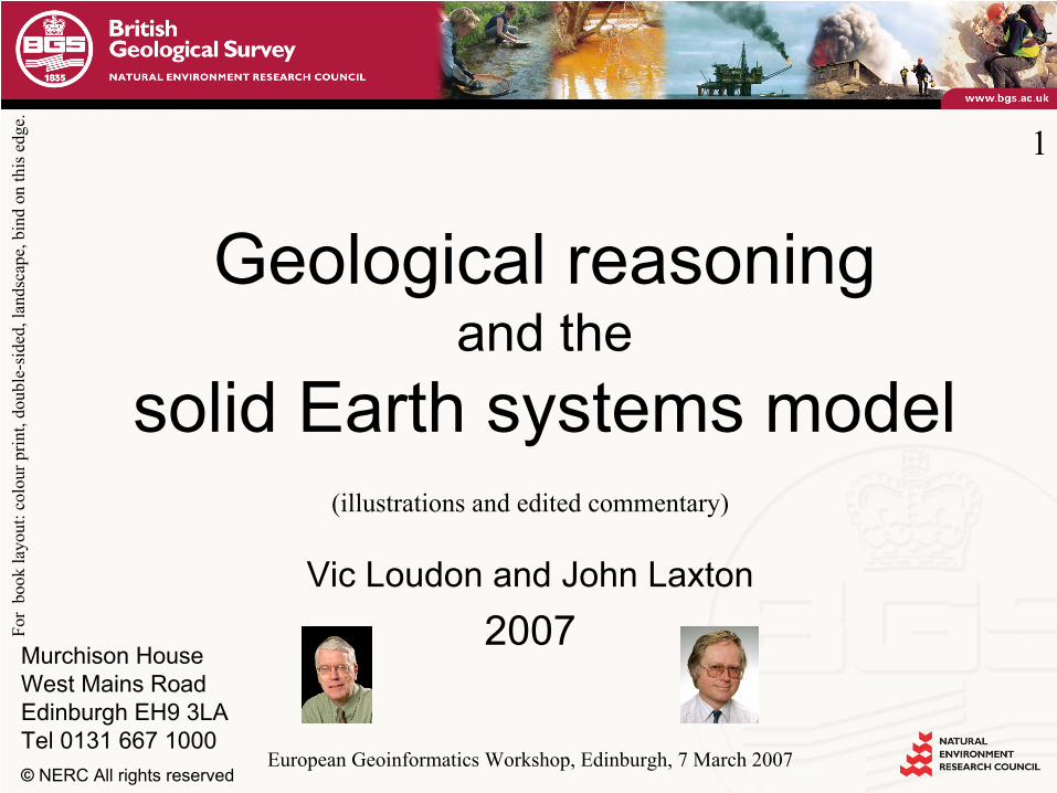
geological reasoning and the solid earth systems model · pdf file(illustrations and edited...
TRANSCRIPT
Murchison HouseWest Mains RoadEdinburgh EH9 3LATel 0131 667 1000© NERC All rights reserved
Geological reasoning and the solid Earth systems model
Vic Loudon and John Laxton 2007
1
European Geoinformatics
Workshop, Edinburgh, 7 March 2007
(illustrations and edited commentary)
For
book
layo
ut: c
olou
r prin
t, do
uble
-sid
ed, l
ands
cape
, bin
d on
this
edg
e.

© NERC All rights reserved
To what end?
‘Do nothing in haste; look well to each step;and from the beginning,
think what may be the end.’
Edward Whymper, Scrambles in the Alps, 1865
2

© NERC All rights reserved
2 (commentary).
Whymper’s
advice to mountaineers seems equally appropriate for systems developers. We might consider ontologies, databases and a general framework of information structures, as steps marking out a path to a specific objective –
perhaps leading to digital availability of
the core product of Geological Surveys, namely, the lithostratigraphic map.
But: Is that really the end we should have in view? Can it meet the potential of the semantic grid? Or do these steps come to a prickly and painful end?
It might be useful first to consider where the path is coming from.

© NERC All rights reserved
William Smith (1769 –
1839)
Geological map of England and Wales
by William Smith1815 (updated 1820)
3
http://www.bgs.ac.uk/education/williamsmith/page2/page6.html

© NERC All rights reserved
3 (commentary). In 1815, William Smith published a geological map of England and
Wales –
one result of his 30 years of surveying for canal construction. It is remarkably similar to today’s lithostratigraphic map at the same scale. He classified the rocks into types that he could trace laterally, based on their properties and fossil content, familiar to him from his observations in excavations, coalmines and natural outcrops. He recognised that the strata regularly occurred in the same sequence, disrupted in places by folding and faulting. This simple model enabled him to predict the nature of the underlying rocks from the few observable exposures. His map had immediate practical value in planning and surveying routes for new canals; deciding where excavation might be most straightforward; and where suitable rock could be found to construct bridges and embankments. Many analogous uses were subsequently found. His huge achievement influenced the establishment in 1835 of the British Geological Survey. Over 150 similar organisations now exist worldwide, and lithostratigraphic maps cover the globe.

© NERC All rights reserved
The Scottish Enlightenment (1730 –
1790)
4
Detail from painting of the High Street, Edinburgh by David Allan (1744-96)

© NERC All rights reserved
4 (commentary). As we are in Edinburgh, and many of you are not primarily geologists, it seems appropriate to point out that while Smith was preparing his earlier geological maps, the so-called Scottish Enlightenment was in full flow.In 1775, an English visitor remarked: ‘Here I stand at what is called the Cross of Edinburgh, and can, in a few minutes, take fifty men of genius and learning by the hand.’
[The European Geoinformatics
Workshop took place in the e-Science Institute, a few hundred yards from the painting’s still-recognisable buildings. The Workshop included geologists, computer scientists, geographers, space scientists and philosophers from around the globe –
representatives of the Enlightenment of our time.]

© NERC All rights reserved
David Hume (1711 –
1776)
Like causes + like circumstances
= > like effects
Uniform course of nature
Experience establishes fact
5
Detail from a portrait of Hume by Carmontelle
(ca.1765)

© NERC All rights reserved
5 (commentary). Meet David Hume, a philosopher of the Scottish Enlightenment. ‘Like causes, in like circumstances’, he held, ‘will always produce like effects.’And …‘the course of nature will [through time] continue uniformly the same.’He claimed to base his arguments on experience, as only experience establishes matters of fact.One might deduce that geological processes operate, regardless of time or place, in the same invariant manner.

© NERC All rights reserved
James Hutton (1726 –
1797) 6
Detail from a painting by Hardie
of a meeting at Sciences House, Edinburgh
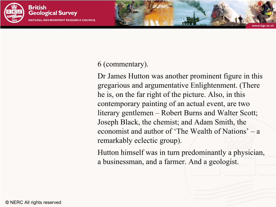
© NERC All rights reserved
6 (commentary). Dr James Hutton was another prominent figure in this gregarious and argumentative Enlightenment. (There he is, on the far right of the picture. Also, in this contemporary painting of an actual event, are two literary gentlemen –
Robert Burns and Walter Scott;
Joseph Black, the chemist; and Adam Smith, the economist and author of ‘The Wealth of Nations’
–
a
remarkably eclectic group). Hutton himself was in turn predominantly a physician, a businessman, and a farmer. And a geologist.
© NERC All rights reserved
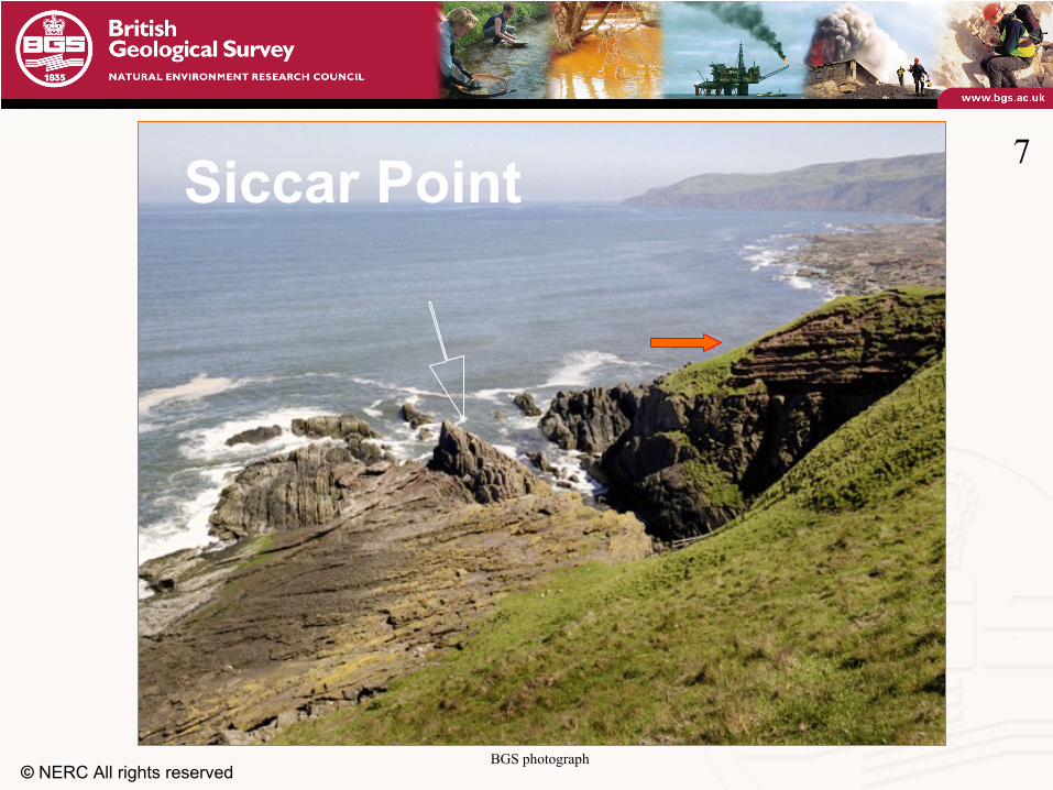
Siccar
Point 7
BGS photograph

© NERC All rights reserved
7 (commentary). In 1787, Hutton predicted that an interesting relationship between two bodies of rock that he had studied at obscured inland exposures, would be seen more clearly at the coast, some 30 miles away. With his friends Playfair
and Hall, he searched the coast by
boat, and found his predicted relationship at Siccar
Point, three miles southeast of Cockburnspath
(some 40 miles east
of Edinburgh on the A1). If you approach today from the car park, note the vertical ridges of hard, grey siltstone and sandstone (the white arrow), slowly eroding as waves sweep sand and boulders across them. Note the unconformity, where the great thickness of the Old Red Sandstone (the red arrow) rests horizontally on these vertical beds.

© NERC All rights reserved
‘Hutton’s unconformity’ Siccar
Point, near Cockburnspath
8
BGS photo. Detail from caricature of Hutton by John Kay, 1787

© NERC All rights reserved
8 (commentary). Where the sand is moving now, it had also moved, and settled as the Old Red Sandstone, three or four hundred million years ago. Playfair’s
famous account of their visit reveals something
of Hutton’s mode of thought:‘We felt ourselves necessarily carried back to the time when the schistus
on which we stood lay in horizontal
planes at the bottom of the sea, and where the sandstone before us was only beginning to be deposited, in the shape of sand and mud, from the waters of a superincumbent
ocean. An epoch still more remote presented itself, when even the most ancient of these rocks, instead of standing upright in vertical beds, …
© NERC All rights reserved
Lord Playfair’s
comment‘…lay in horizontal planes
at the bottom of the sea … revolutions still more remote appeared in the distance of this extraordinary perspective.
The mind seemed to grow giddy by looking so far into the abyss of time.’
9
© NERC All rights reserved
9 (commentary). Or perhaps it was the effect of the boat trip

© NERC All rights reserved
The legacy of Smith and HuttonHutton 1785 –
The system of the Earth (copy in Albritton, 1975, pp, 24-52)
Hutton 1795 –
The Theory of the Earth (book)Smith 1815 –
Geological map of England and Wales
Geological maps can model existing geological objects A theory of Earth systems involves geological processesKnowledge of geological processes relates observations to
the background theory Spatial relationships can define time relationshipsGeological events can be correlated in a stratigraphic time
sequence
10

© NERC All rights reserved
10 (commentary). William Smith’s predictive model of the layered strata of the solid Earth –
objects defined by their properties and sequence –
was
simple, informative, and readily depicted on a map. James Hutton
imagined the circumstances in which the rocks
formed, introducing the complexity of geological processes as a basis for reasoning –
for informing observations by relating them to
a background theory. Presumably influenced by David Hume, he seems to have viewed time as a parameter of processes, not (like
many of his contemporaries) as a scale prescribed by Holy Writ. He saw the cycle of geological processes as proceeding now in the same manner, and at the same relative rates, as they had in the geological past. Thus the interaction of processes (shown by spatial relationships in their products) could establish time relationships of past geological events, potentially correlating them to processes that provide an appropriate standard surrogate for time (radioactive decay now being the popular choice).
© NERC All rights reserved
Historical geology
The solid Earth systems model includes a postulated history of the configurations of objects, processes and events that created and transformed the solid Earth
By Hume’s logic, that history requires reasoning based on imagining, studying and experimenting
with analogous processes at the present day
11

© NERC All rights reserved
11 (commentary). Hutton’s resulting model comprised a postulated and rudimentary history of the systems of configurations of objects, processes and events that created and transformed the solid Earth: a history that could be explained (according to Hume’s logic) by reasoning based on imagining, studying and experimenting with analogous systems at the present day. The reasoning could inform the surveyor’s choice and form of objects shown on the geological map –
essential as mapping
extended to areas of more complex geology.

© NERC All rights reserved
The map as an interpretation
The geological map does not represent the reasoning –
it does represent its
consequences The choice and form of objects shown on
the map is based on reasoning and interpretation –
bringing wider scientific
knowledge to bear
12

© NERC All rights reserved
12 (commentary). But the geological map cannot and does not represent the reasoning –
it merely represents
its consequences. The choice and form of objects shown on the map is based on reasoning and interpretation –
bringing wider scientific knowledge to bear. For example, a siliceous grit
directly overlying
the granite from which it had been eroded would not be mapped as part of the granite, for despite their contiguity and similar properties, they result from quite different processes, far removed in time and environment

© NERC All rights reserved
Same rocks, different interpretations From Harrison, J.M., 1963 in
Albritton, C.C., The fabric of geology p.225-232
� Geological Society of America
1928 1958
13

© NERC All rights reserved
13 (commentary). When the underlying theory changes, the rocks remain the same, but the map can change dramatically. This example shows two maps of a small part of the Canadian Shield, both of the same area at the same scale. The one on the left was surveyed in 1928 when granites were seen as solidifying from liquid magma. The other in 1958, when theories of granitization
postulated a process of
ultrametamorphism, involving extreme conditions of long duration with movement of chemical components through an essentially solid matrix.

© NERC All rights reserved
Active
geological processes on the North Norfolk Coast (2 miles east of Cromer)
Many interacting processes
Each has a wide range of scales
Processes involve geosphere, hydrosphere, atmosphere, biosphere
14

© NERC All rights reserved
14 (commentary). Processes, then, underpin geological interpretation –
the basis of the map.
In Britain, geological processes are particularly active on the south and east coasts. In this example, many processes are at work. Waves, tides and winds are moving the beach deposits eastwards, undercutting the cliff. Material is slumping from the cliff; mud flows and small rivulets help to move the material to
lower levels; the
vegetation slows its disintegration. There is no single process,
but many interacting processes, each operating in its own way. Note also, that the large slumps have smaller and smaller slumps
on their flanks.
Each process is operating over a range of scales, determined in part by its mode of operation, in part by the configuration of the material. The interactions of processes over a range of scales have important effects on rock properties, which cannot be depicted on the conventional fixed-scale map. The processes do not just involve rocks, but also their interactions with the hydrosphere, atmosphere, and biosphere. They are not just geological processes, they are processes of Earth-systems science.

© NERC All rights reserved
An impact on the biosphere15

© NERC All rights reserved
15 (commentary). Present-day geological processes affect many elements of the biosphere, not least the ones living in this house. Understanding their operation in the geological past throws light on current concerns (such as the effects of climate change) relating them to historical interpretations of present-day geological objects.With all these issues in mind, it is desirable to extend the framework of digital mapping to a framework based on a more complete model of Earth systems.

© NERC All rights reserved
Extending the map modelGIS procedures relate to the existing map product.Their extension to modelling solid-Earth systems could•
Match the surveyors’
reinforcement learning procedure:
predict from existing knowledge, investigate, observe, reason, interpret, predict…
•
Provide more complete and accessible records of evidence, reasoning and conclusions
•
Throw a clearer light on geological processes at all scales, and their consequences, now and in the past
•
Help us to view geological surveying as a component of the whole-Earth system
16

© NERC All rights reserved
The solid Earth systems modelIs concerned with geological objects (things of interest)•
Their classification (instances and classes)
•
Where they are and how they are arranged•
Their observed and interpreted properties, composition and relationships
•
Their geological history: the processes and events that acted on past (conceptual) configurations of objects within a structure of spatial relationships, nested in stratigraphical time and scale-space
17
© NERC All rights reserved
Geoscience knowledge management system
Priorities of Geological Surveys are changing -away from publication of maps and related documents
towards maintaining a geoscience knowledge management system of reusable elements (enabling us to record the reasoning process and its consequences at all levels of detail)
from which users can obtain specific responses to meet their specific needs –
with maps seen as illustrative
visualizations, not as end products
18

© NERC All rights reserved
The metamodelGeological Surveys can study only selected facets and
fragments of the solid Earth systems modelA metamodel, or description of the model, can serve as a
framework to bind the incomplete fragments together within the geoscience knowledge system
Shared ontologies in the framework can help to achieve interoperability among Earth models (geosphere, atmosphere, hydrosphere, biosphere) –
a step to aid
Earth-systems science in its task of understanding the past, present and future of the whole-Earth system
19

© NERC All rights reserved
Generic ontologies
Ontology space
General processes
Property or state-space
Space and time relationships
Geographic space or relative locations
Stratigraphic time-scale (absolute or relative)
Scale-space and classification level
Scientific workflows
Threads of reasoning
Specific ontologies
Process-models
Classification spaceObject classes
Object instances Relationships
Configurations
Historical change (event)
Evidence, reasoning
finer or coarser granularity
Hypermedia sequences
Indexes linking ontologies and metamodel
to information in stores
Solid Earth systems metamodel
Explicit framework 20
From Loudon and Laxton (2007) Fig. 4. An explicit framework for the information system. The metamodel
describes the contents of the solid Earth systems model, providing a means of referencing them, and bringing the components into a shared framework, which relates them to appropriate ontologies, indexes and hypermedia sequences.
©
Geological Society of America

© NERC All rights reserved
20 (commentary).
Here is one tentative suggestion for the solid Earth systems metamodel. It shows the object classes, instances, properties and classification; process-models; relationships and configurations, nested within historical changes, then nested within scale-space.
Where possible, the concepts are related to generic ontologies.
The framework is traversed by hypermedia sequences: workflows setting out the surveying process, the methods of generating user-
products, and recording threads of reasoning.
Indexes are a link to information held in distributed stores

© NERC All rights reserved
The next steps
Carry forward the legacy of geological maps
Open geology to a wider interoperable framework
21

© NERC All rights reserved
21 (commentary). Of course, the methodologies and framework for digitised geological maps remain essential, to carry forward the huge legacy of existing records. But surely that is not the end that we have in mind. It must be timely to consider how the existing framework can be extended to open geology to a wider framework as part of the whole Earth system, to support new approaches to recording our knowledge of the Earth, to new business models to guide our endeavours. These could be the next steps, …

© NERC All rights reserved
“No vestige of a beginning, - no prospect of an end”
(Hutton, 1795)
22

© NERC All rights reserved
22 (commentary). … but, as Hutton concluded, in his Theory of the Earth: ‘The result, therefore, of our present enquiry is, that we find no vestige of a beginning, -
no prospect of an
end.’

Murchison HouseWest Mains RoadEdinburgh EH9 3LATel 0131 667 1000© NERC All rights reserved
The End
23

© NERC All rights reserved
Suggested sources for further information
The Enlightenment:
Daiches, D., Jones, P., Jones, J. (editors), 1996. The Scottish Enlightenment, 1730-1790: A hotbed of genius. The Saltire
Society, Edinburgh.
William Smith:
Winchester, S., 2001. The Map that changed the World. Penguin Books, London.
British Geological Survey, 2006. William Smith –
life and work. http://www.bgs.ac.uk/education/williamsmith/page2/page6.html
The nature of geological investigation:
Albritton, C.C., (editor), 1963. The fabric of geology. Freeman, Cooper & Co., Stanford.
Albritton, C.C., (editor), 1975. Philosophy of Geohistory: 1785-1970. (Benchmark Papers in Geology, volume 13.) Dowden, Hutchinson & Ross, Stroudsburg, PA.
Loudon, T.V., Laxton, J.L., 2007. Steps toward Grid-based geological survey. Geosphere, 3(5) 319-336. doi:10.1130/GES00095.1
24
© NERC All rights reserved
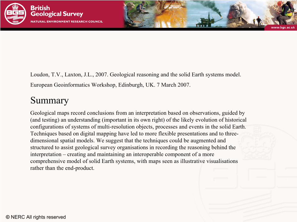
Loudon, T.V., Laxton, J.L., 2007. Geological reasoning and the solid Earth systems model.
European Geoinformatics
Workshop, Edinburgh, UK. 7 March 2007.
SummaryGeological maps record conclusions from an interpretation based on observations, guided by (and testing) an understanding (important in its own right) of the likely evolution of historical configurations of systems of multi-resolution objects, processes and events in the solid Earth. Techniques based on digital mapping have led to more flexible presentations and to three-
dimensional spatial models. We suggest that the techniques could
be augmented and structured to assist geological survey organisations in recording the reasoning behind the interpretation –
creating and maintaining an interoperable component of a more comprehensive model of solid Earth systems, with maps seen as illustrative visualisations rather than the end-product.