geography matters. geography and technology geography affects us in many waysgeography affects us in...
TRANSCRIPT
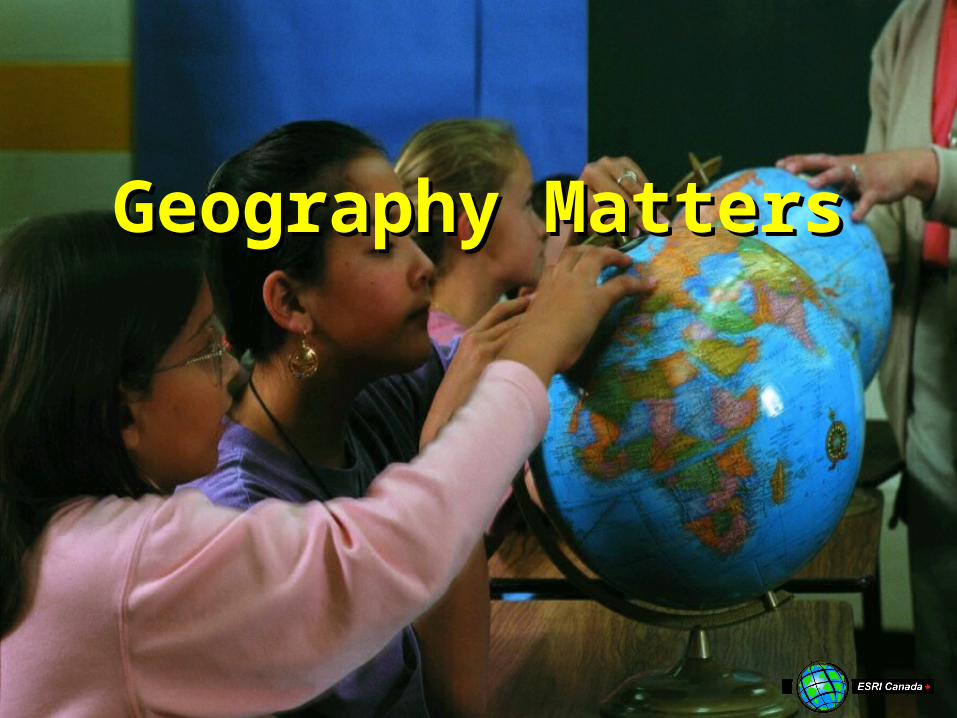
Geography MattersGeography Matters
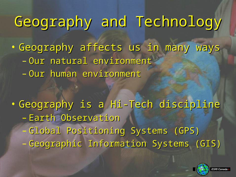
Geography and TechnologyGeography and Technology
• Geography affects us in many waysGeography affects us in many ways– Our natural environmentOur natural environment– Our human environmentOur human environment
• Geography is a Hi-Tech disciplineGeography is a Hi-Tech discipline– Earth ObservationEarth Observation– Global Positioning Systems (GPS)Global Positioning Systems (GPS)– Geographic Information Systems (GIS)Geographic Information Systems (GIS)
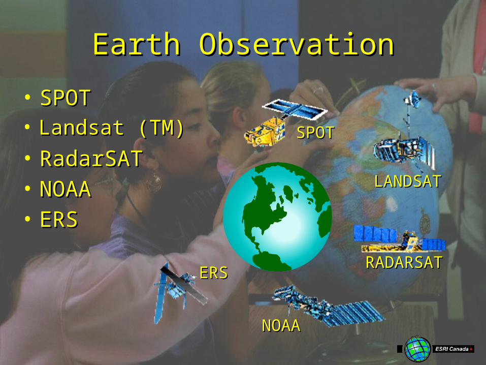
Earth ObservationEarth Observation
LANDSATLANDSAT
• Landsat (TM)Landsat (TM)
RADARSATRADARSAT
• RadarSATRadarSAT
NOAANOAA
• NOAANOAA
ERSERS
• ERSERS
SPOTSPOT
• SPOTSPOT
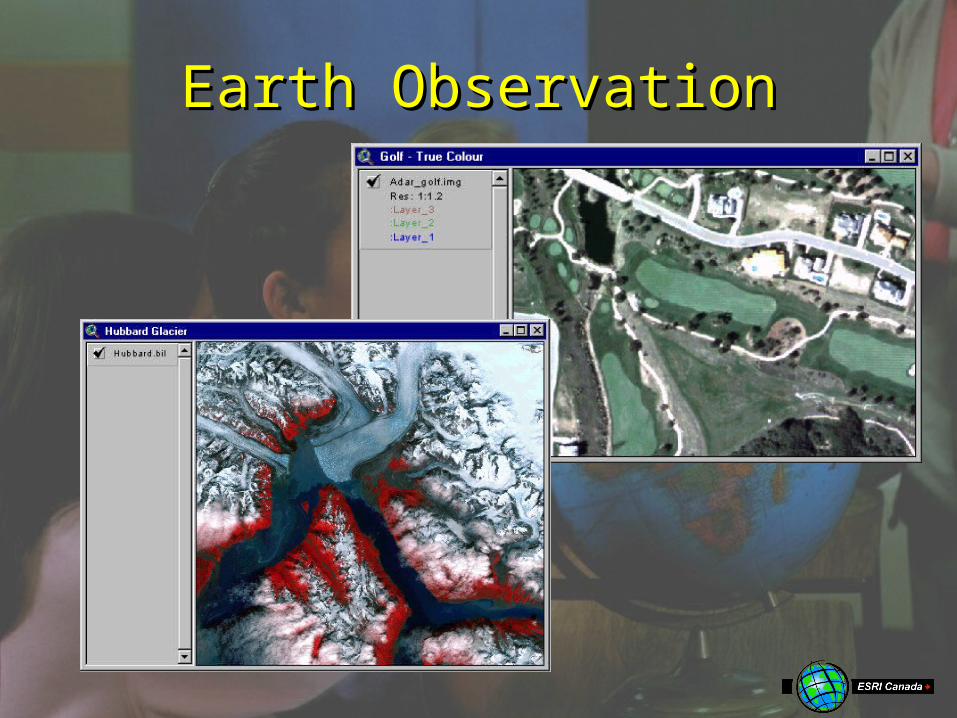
Earth ObservationEarth Observation
Global Positioning SystemsGlobal Positioning Systems
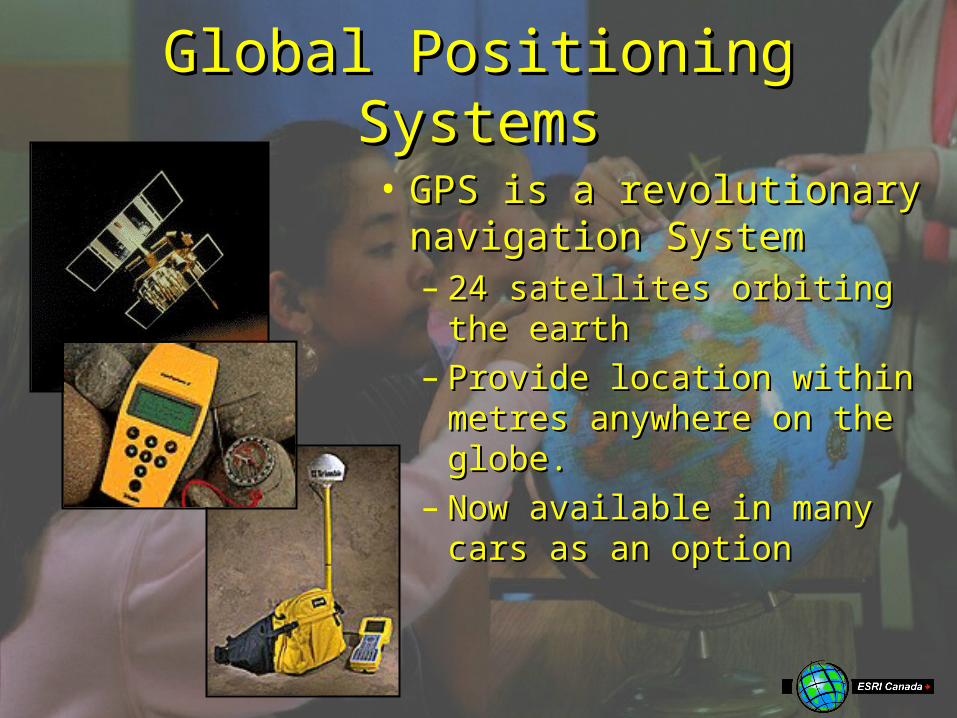
• GPS is a revolutionary GPS is a revolutionary navigation Systemnavigation System– 24 satellites orbiting the 24 satellites orbiting the
earthearth– Provide location within Provide location within
metres anywhere on the metres anywhere on the globe.globe.
– Now available in many Now available in many cars as an optioncars as an option

Geographic Information Geographic Information SystemsSystems
Describing Our WorldDescribing Our World• We can describe We can describe
any element of our any element of our world in two ways:world in two ways:
Attribute Information:What is it?
Species: OakHeight: 15mAge: 75 Yrs
Location Information: Where is it?
51°N, 112°W
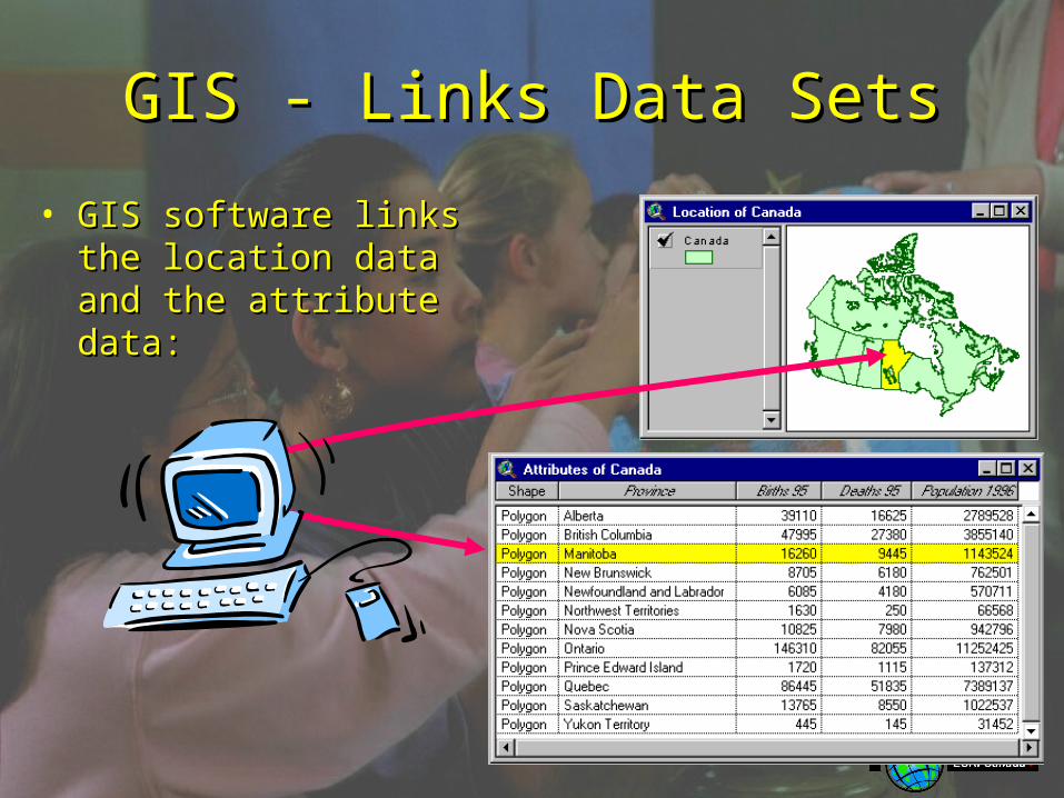
GIS - Links Data SetsGIS - Links Data Sets
• GIS software links the GIS software links the location data and the location data and the attribute data:attribute data:
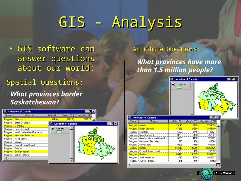
GIS - AnalysisGIS - Analysis
• GIS software can answer GIS software can answer questions about our questions about our world:world:
What provinces border Saskatchewan?
Spatial Questions:Spatial Questions:
What provinces have more than 1.5 million people?
Attribute Questions:Attribute Questions:
GIS - AnalysisGIS - Analysis
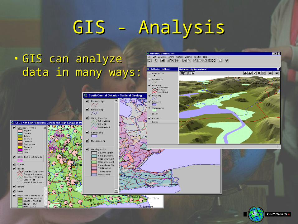
• GIS can analyze GIS can analyze data in many ways:data in many ways:
• Base Map DataBase Map Data
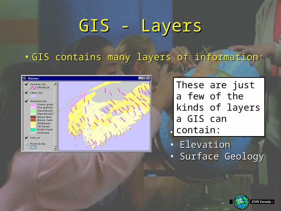
GIS - LayersGIS - Layers
• GIS contains many layers of information:GIS contains many layers of information:
• ElevationElevation• Surface GeologySurface Geology
These are just a few of the kinds of layers a GIS can contain:
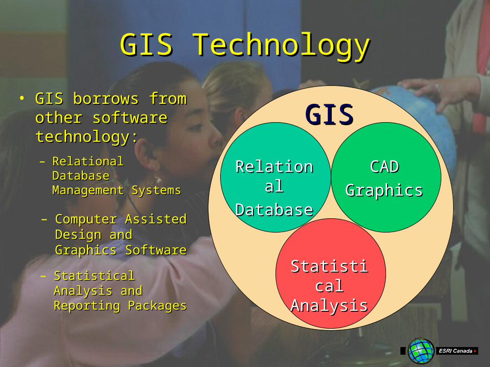
GIS TechnologyGIS Technology
GISGIS• GIS borrows from GIS borrows from
other software other software technology:technology:
RelationalRelational
DatabaseDatabase
– Relational Database Relational Database Management Management SystemsSystems
CADCAD
GraphicsGraphics
– Computer Assisted Computer Assisted Design and Design and Graphics SoftwareGraphics Software
Statistical Statistical AnalysisAnalysis
– Statistical Analysis Statistical Analysis and Reporting and Reporting PackagesPackages
Summary - What is GIS?Summary - What is GIS?
• GIS is about using data to describe our GIS is about using data to describe our world in two ways:world in two ways:– Location Data - Where is it?Location Data - Where is it?– Attribute Data - What is it?Attribute Data - What is it?
• GIS software maintains a link between GIS software maintains a link between layers of location and attribute datalayers of location and attribute data– With the Link, we can ask questions about With the Link, we can ask questions about
our world…our world…
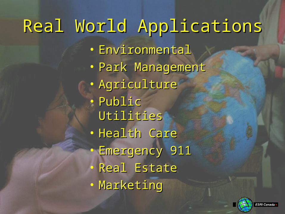
Real World ApplicationsReal World Applications• EnvironmentalEnvironmental• Park Park
ManagementManagement• AgricultureAgriculture• Public UtilitiesPublic Utilities• Health CareHealth Care• Emergency 911Emergency 911• Real EstateReal Estate• MarketingMarketing
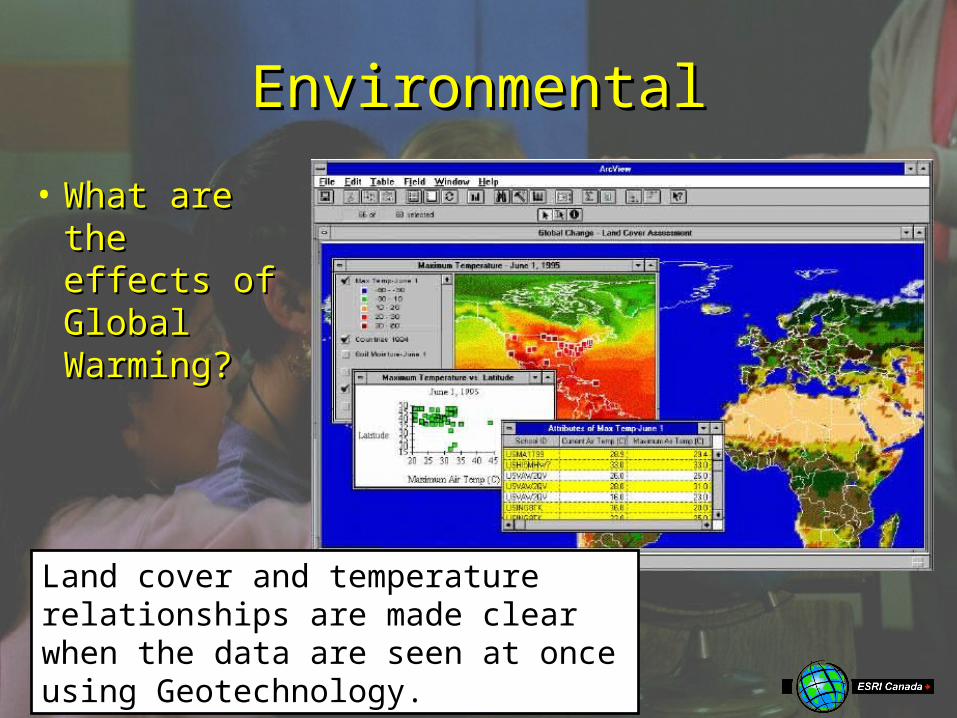
EnvironmentalEnvironmental
• What are What are the effects the effects of Global of Global Warming?Warming?
Land cover and temperature relationships are made clear when the data are seen at once using Geotechnology.
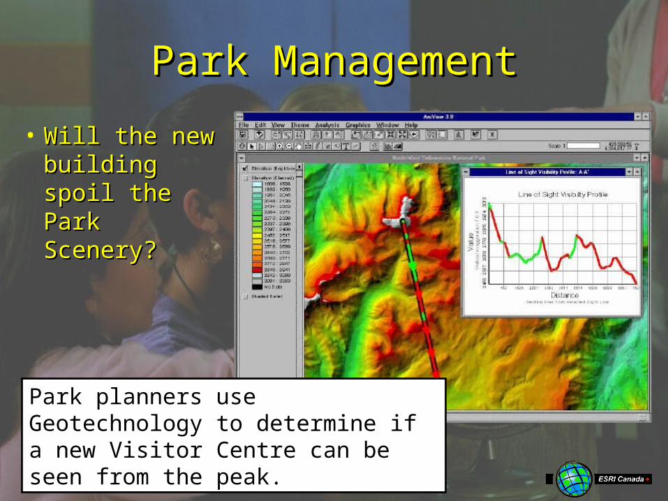
Park ManagementPark Management
• Will the new Will the new building spoil building spoil the Park the Park Scenery?Scenery?
Park planners use Geotechnology to determine if a new Visitor Centre can be seen from the peak.
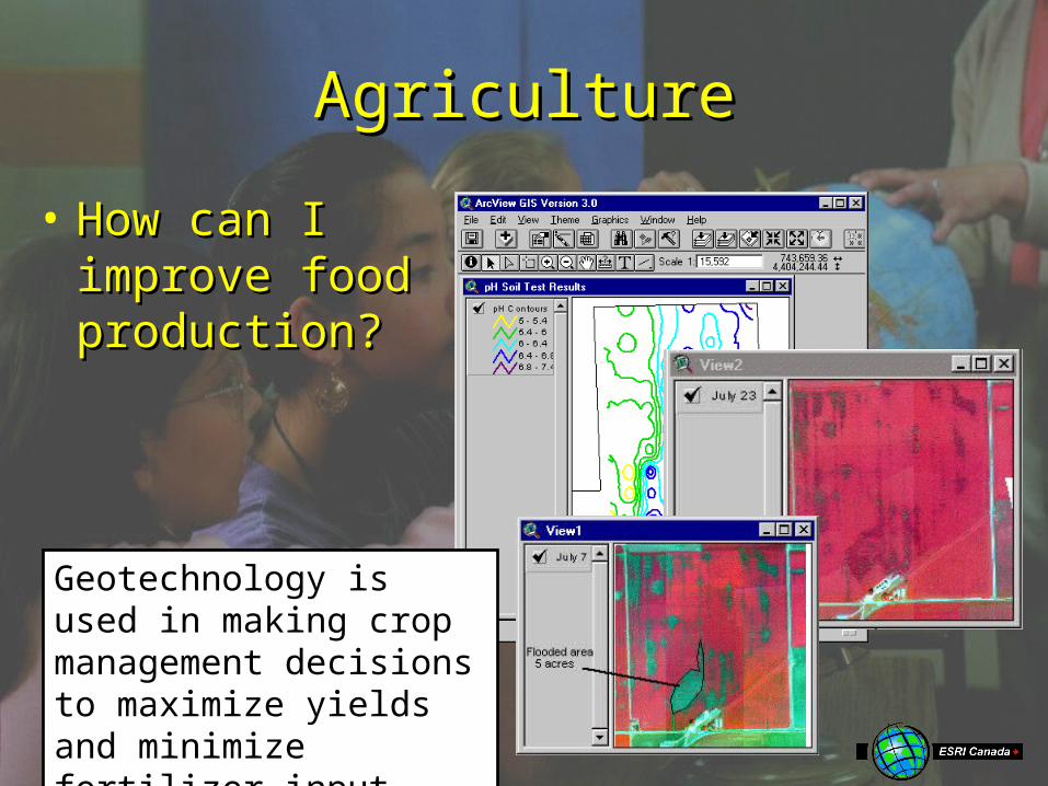
AgricultureAgriculture
• How can I How can I improve food improve food production?production?
Geotechnology is used in making crop management decisions to maximize yields and minimize fertilizer input.
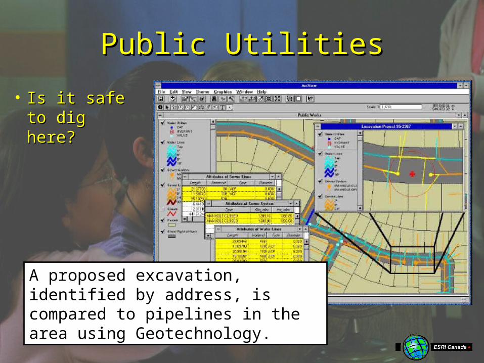
Public UtilitiesPublic Utilities
• Is it safe to Is it safe to dig here?dig here?
A proposed excavation, identified by address, is compared to pipelines in the area using Geotechnology.

Health CareHealth Care
• What What CommunitiCommunities are at es are at risk from risk from Disease?Disease?
Geotechnology identifies communities at risk of River Blindness and helps determine the impact of treatment.
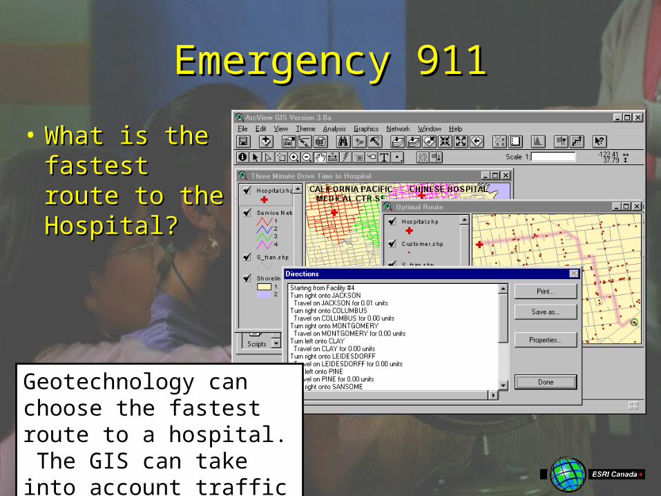
Emergency 911Emergency 911
• What is the What is the fastest fastest route to the route to the Hospital?Hospital?
Geotechnology can choose the fastest route to a hospital. The GIS can take into account traffic and other impediments.

Real EstateReal Estate
• Where is Where is my Dream my Dream Home?Home?
With Geotechnology, an agent can show a map of a neighborhood and a picture or video of the actual properties.
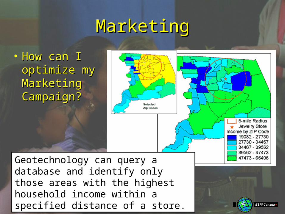
MarketingMarketing
• How can I How can I optimize my optimize my Marketing Marketing Campaign?Campaign?
Geotechnology can query a database and identify only those areas with the highest household income within a specified distance of a store.
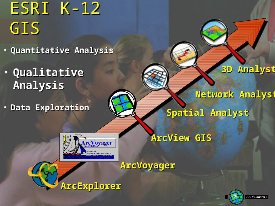
ESRI K-12 ESRI K-12 GISGIS
Spatial AnalystSpatial Analyst
3D Analyst3D Analyst
Network AnalystNetwork Analyst
ArcView GISArcView GIS
ArcVoyagerArcVoyager
ArcExplorerArcExplorer
• Data ExplorationData Exploration
• Quantitative AnalysisQuantitative Analysis
• Qualitative Qualitative AnalysisAnalysis
