geography and geographic information systems (gis): new
TRANSCRIPT

B. Wellar 2006
Geography and Geographic Information Systems (GIS): New Realities of Canada as An Emerging Information Society
Dr. Barry Wellar, Professor (ret.),University of Ottawa, and Media Program Director
Geography Awareness WeekCanadian Association of Geographers
Materials for a presentation at GIS Day 2006
University of Ottawa
Department of Geography and Environmental Studies University of Ottawa
November 15, 2006University Centre

B. Wellar 2006
Images from the Doomsday Map Project:Ecological Disaster and Local Response
•• Overexploitation risks survival of planet?Overexploitation risks survival of planet?
•• Rainforests: Their destruction a worldwide problemRainforests: Their destruction a worldwide problem
•• OilOil’’s black death takes terrible tolls black death takes terrible toll
•• Coastal waters being used as toxic dumpCoastal waters being used as toxic dump
Makings of ‘The Doomsday Map’?
Geography and Geographic Information Systems (GIS): New Realities of Canada as An Emerging Information Society

B. Wellar 2006
Makings of ‘The Doomsday Map’?
•• 100,000 eastern lakes hurt by acid rain100,000 eastern lakes hurt by acid rain
•• Cocktail of toxins threatens lakeCocktail of toxins threatens lake
•• More PCBMore PCB--laced oil spills in river fearedlaced oil spills in river feared
•• ItIt’’s not cool to kill the ozones not cool to kill the ozone
•• A warning on warmingA warning on warming
Images from the Doomsday Map Project:Ecological Disaster and Local Response
Geography and Geographic Information Systems (GIS): New Realities of Canada as An Emerging Information Society
B. Wellar 2006
Images from the Doomsday Map Project:Ecological Disaster and Local Response
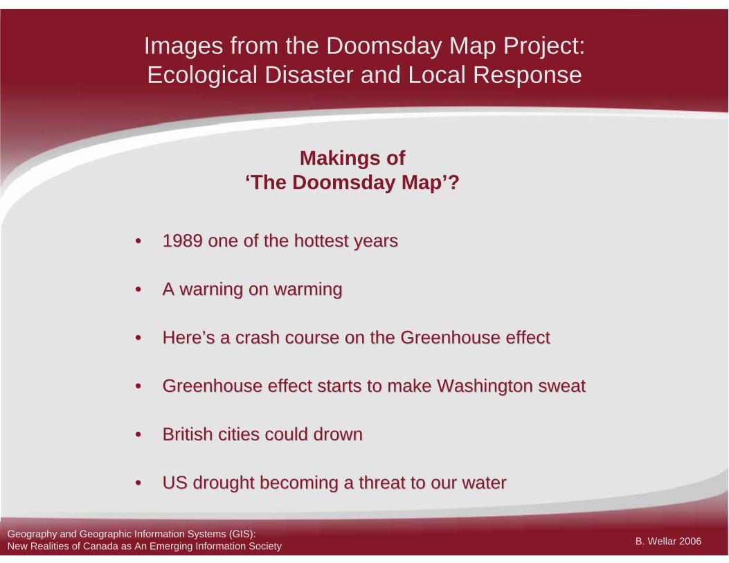
•• 1989 one of the hottest years1989 one of the hottest years
•• A warning on warmingA warning on warming
•• HereHere’’s a crash course on the Greenhouse effects a crash course on the Greenhouse effect
•• Greenhouse effect starts to make Washington sweatGreenhouse effect starts to make Washington sweat
•• British cities could drownBritish cities could drown
•• US drought becoming a threat to our waterUS drought becoming a threat to our water
Makings of ‘The Doomsday Map’?
Geography and Geographic Information Systems (GIS): New Realities of Canada as An Emerging Information Society

B. Wellar 2006
Images from the Doomsday Map Project:Ecological Disaster and Local Response
Makings of ‘The Doomsday Map’?
•• Dirty air threatens one billionDirty air threatens one billion
•• Metro choking on auto fumes hearings warnedMetro choking on auto fumes hearings warned
•• Mexico City population now Mexico City population now ‘‘irreversibleirreversible’’
•• Air pollution killing Europeans secret report saysAir pollution killing Europeans secret report says
Geography and Geographic Information Systems (GIS): New Realities of Canada as An Emerging Information Society

B. Wellar 2006
Images from the Doomsday Map Project:Ecological Disaster and Local Response
Makings of ‘The Doomsday Map’?
•• Third world becomes toxic dumping groundThird world becomes toxic dumping ground
•• State looking for State looking for ‘‘candidatescandidates’’ to store toxicsto store toxics
•• Garbage: Viable disposal plan an elusive Garbage: Viable disposal plan an elusive goal after 20 yearsgoal after 20 years
Geography and Geographic Information Systems (GIS): New Realities of Canada as An Emerging Information Society

B. Wellar 2006
Images from the Doomsday Map Project:Ecological Disaster and Local Response
Makings of ‘The Doomsday Map’?
•• Destroying a habitat: a threat to HawaiiDestroying a habitat: a threat to Hawaii
•• Saving the wetlandsSaving the wetlands
•• A shrinking nesting groundA shrinking nesting ground
•• The death of open spacesThe death of open spaces
•• A shrinking parkwayA shrinking parkway
•• Open space plan called skimpyOpen space plan called skimpy
Geography and Geographic Information Systems (GIS): New Realities of Canada as An Emerging Information Society

B. Wellar 2006
Images from the Doomsday Map Project:Ecological Disaster and Local Response
Makings of ‘The Doomsday Map’?
•• Urban sprawl: Many cities fight backUrban sprawl: Many cities fight back
•• Plaza site permits let dozers rollPlaza site permits let dozers roll
•• Fighting the concrete jungle Fighting the concrete jungle
•• Choking on successChoking on success
•• AutoAuto--maker: donmaker: don’’t let cars destroy our citiest let cars destroy our cities
•• NeighboursNeighbours fight towering developmentfight towering development
Geography and Geographic Information Systems (GIS): New Realities of Canada as An Emerging Information Society
B. Wellar 2006
Images from the Doomsday Map Project:Ecological Disaster and Local Response
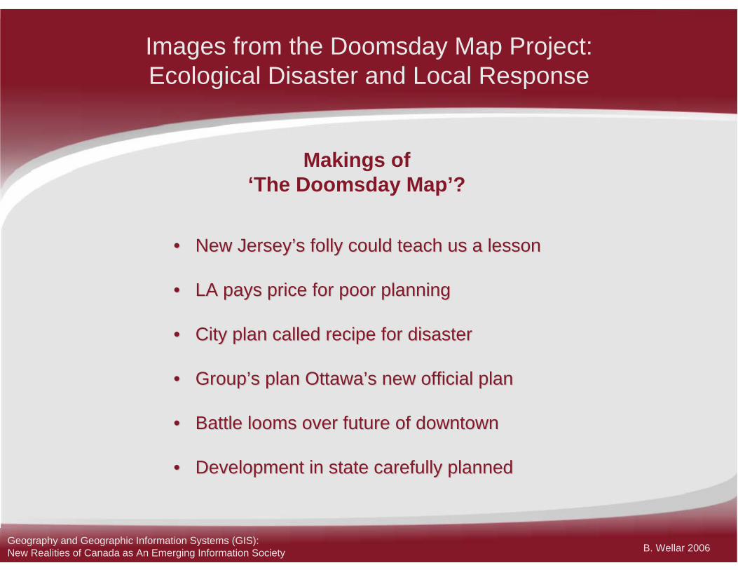
Makings of ‘The Doomsday Map’?
•• New JerseyNew Jersey’’s folly could teach us a lessons folly could teach us a lesson
•• LA pays price for poor planningLA pays price for poor planning
•• City plan called recipe for disasterCity plan called recipe for disaster
•• GroupGroup’’s plan Ottawas plan Ottawa’’s new official plans new official plan
•• Battle looms over future of downtownBattle looms over future of downtown
•• Development in state carefully plannedDevelopment in state carefully planned
Geography and Geographic Information Systems (GIS): New Realities of Canada as An Emerging Information Society

B. Wellar 2006
Images from the Doomsday Map Project:Ecological Disaster and Local Response
Geography and Geographic Information Systems (GIS): New Realities of Canada as An Emerging Information Society

B. Wellar 2006
Images from the Doomsday Map Project:Ecological Disaster and Local Response
Geography and Geographic Information Systems (GIS): New Realities of Canada as An Emerging Information Society

B. Wellar 2006
Images from the Doomsday Map Project:Ecological Disaster and Local Response
Geography and Geographic Information Systems (GIS): New Realities of Canada as An Emerging Information Society

B. Wellar 2006
Images from the Doomsday Map Project:Ecological Disaster and Local Response
Geography and Geographic Information Systems (GIS): New Realities of Canada as An Emerging Information Society

B. Wellar 2006
Images from the Doomsday Map Project:Ecological Disaster and Local Response
Geography and Geographic Information Systems (GIS): New Realities of Canada as An Emerging Information Society

B. Wellar 2006
Images from the Doomsday Map Project:Ecological Disaster and Local Response
Geography and Geographic Information Systems (GIS): New Realities of Canada as An Emerging Information Society
B. Wellar 2006
Images from the Doomsday Map Project:Ecological Disaster and Local Response
Geography and Geographic Information Systems (GIS): New Realities of Canada as An Emerging Information Society

B. Wellar 2006
Images from the Doomsday Map Project:Ecological Disaster and Local Response
Geography and Geographic Information Systems (GIS): New Realities of Canada as An Emerging Information Society

B. Wellar 2006
Images from the Doomsday Map Project:Ecological Disaster and Local Response
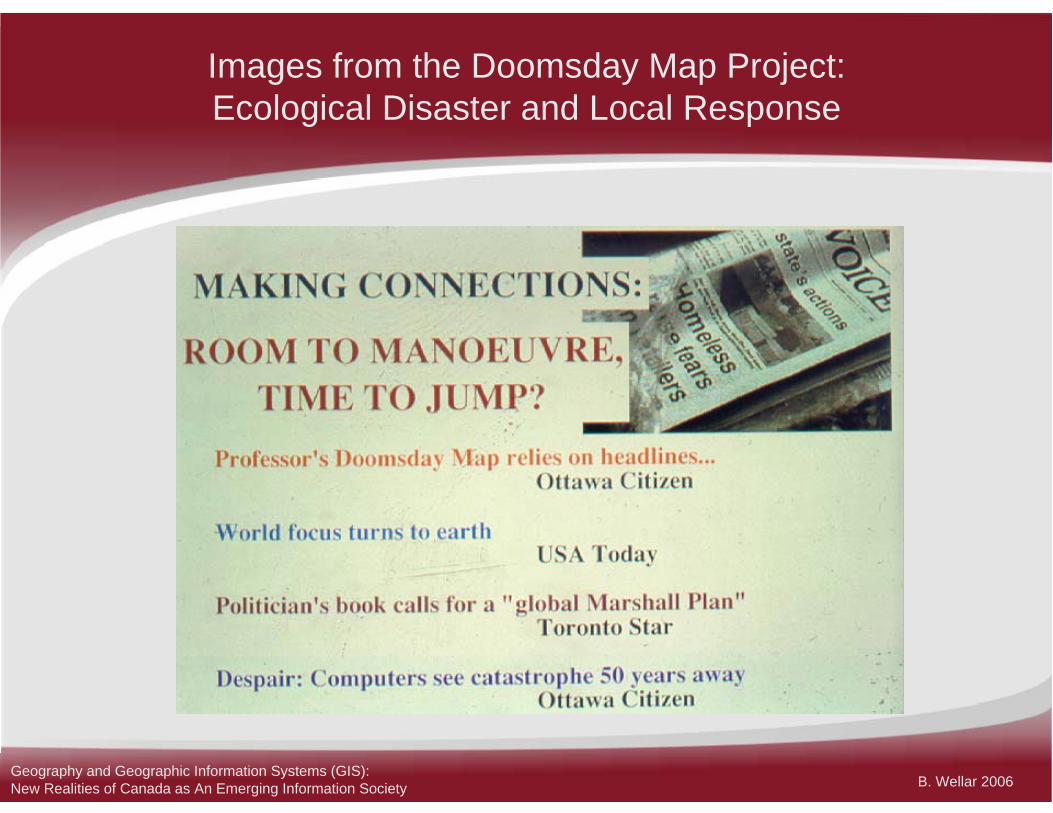
The Geographer’s Lament
With too many wrong things In too many wrong places, We have just about ________All our life support spaces
Geography and Geographic Information Systems (GIS): New Realities of Canada as An Emerging Information Society
B. Wellar 2006
Geography and
Geographic Information Systems:
Combining to Create a
Spatially-Aware Information Society
Geography and Geographic Information Systems (GIS): New Realities of Canada as An Emerging Information Society

B. Wellar 2006
CURIOSITY-DRIVENDATA, INFORMATION,
KNOWLEDGE ACTIVITIES
DescriptionExplanationPrediction
CLIENT-DRIVENDATA, INFORMATION,
KNOWLEDGE ACTIVITIES
Impact AssessmentPrescriptionForecasting
EvaluationDesign
MEDIA
PrintRadio
TelevisionInternet
GEOGRAPHY
HumanPhysical
MethodologyTechnology
Figure 1. Geography, the Media, and the Pursuit and Application of
Data, Information and Knowledge to Create a Spatially-Aware Information Society (1): Components
Geography and Geographic Information Systems (GIS): New Realities of Canada as An Emerging Information Society
B. Wellar 2006
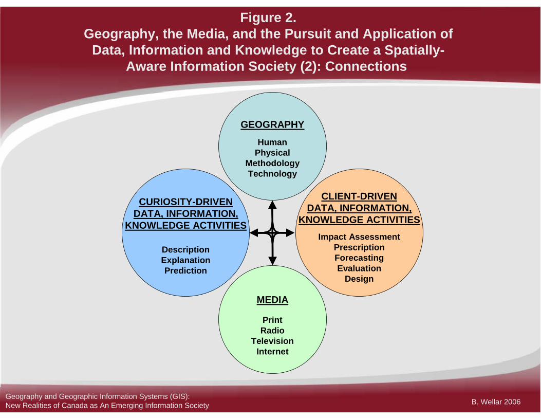
Figure 2. Geography, the Media, and the Pursuit and Application of
Data, Information and Knowledge to Create a Spatially-Aware Information Society (2): Connections
CURIOSITY-DRIVENDATA, INFORMATION,
KNOWLEDGE ACTIVITIES
DescriptionExplanationPrediction
CLIENT-DRIVENDATA, INFORMATION,
KNOWLEDGE ACTIVITIESImpact Assessment
PrescriptionForecastingEvaluation
Design
MEDIA
PrintRadio
TelevisionInternet
GEOGRAPHY
HumanPhysical
MethodologyTechnology
Geography and Geographic Information Systems (GIS): New Realities of Canada as An Emerging Information Society

B. Wellar 2006
Figure 3.Geography, the Media, and the Pursuit and Application of Data,
Information and Knowledge to Create a Spatially-Aware Information Society (3): The Typology of Stories
Geography and Geographic Information Systems (GIS): New Realities of Canada as An Emerging Information Society

B. Wellar 2006
Table 1. Terms and Concepts Which Underlie the Work of the Geographic
Community, and Indicate the Potential for Creating A Spatially-Aware Information Society
ConcentricConnect (ion/ivity)ContiguousContinent(al)ConurbationCoordinates CoreCorrelationCountrysideDensityDiffusionDimensionDisperse(ion)DistanceDistributionEdgeEffectElevationEncroach(ment)EnvironmentEverywhereExtrusionFarFieldFjord
Flow(s)FormFringeFunction(al/ity)GeocodeGeodeticGeofactorGeographicGeomaticGeometricGeopoliticalGeoreferenceGeospatialGIS/GISScGlobal(ization)GridGridlockHabitatHinterlandInteractionIntersectionIntrusionIslandIsolate(ion)Land
LandscapeLatitudeLineLinkLocalityLocationLocal(ization) LongitudeMapMargin(al)MeridianMigrationMorphologyMovementNation(al/ization)Near(ness)NeighborNetworkNIMBYNodeNowhereObjectOrientationOriginOverlay
ParcelPartitionPathPatternPedshedPerimeterPeripheryPlacePlainPlanePointPole(ar/ity)Polygon(al)ProximityQuadrangleQuadrantRegionRelation(ship)Right-of-wayRouteRuralScaleSegregate(ion)ShapeShed
SiteSituationSlopeSomewhereSpaceSpatialSphereSprawlSpreadStripStructureSurfaceSystemTerritoryTopographicTopology(ic)Urban(ex/sub)VectorWalkshedWardWarrenWatershedWhereYIMBYZone
Accessible (ity)Adjacent(cy)Agglomerate (ion)Aggregate(ion)Along(side)Amalgamate(ion)AnywhereArcArea(polygon)AroundAssociationBlockBorderBoundaryBufferCause(al/ity)CenterCentralityCircleClose(ness)ClumpClusterCoastalCommutershedConcentrate(ion)
Geography and Geographic Information Systems (GIS): New Realities of Canada as An Emerging Information Society

B. Wellar 2006
Table 2. Ten of the Most Critical Geographic Terms and Concepts
Underlying GIS Applications that Advance Canada as a Spatially-Aware Information Society
InteractionLinkagePatternRelationshipSystem
AccessibilityCausalityConnectionDensityFunctionality
Geography and Geographic Information Systems (GIS): New Realities of Canada as An Emerging Information Society
B. Wellar 2006
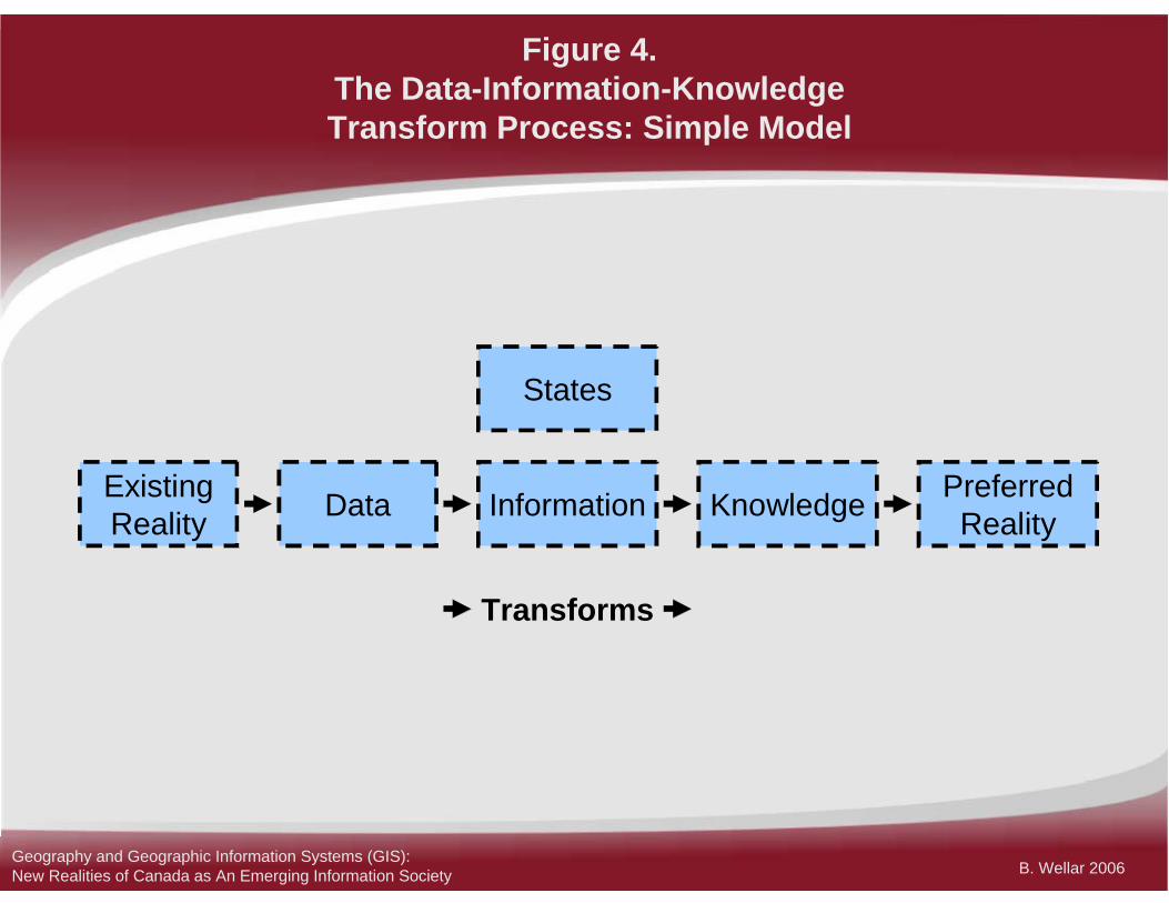
Figure 4.The Data-Information-KnowledgeTransform Process: Simple Model
ExistingReality Data Information Knowledge Preferred
Reality
Transforms
States
Geography and Geographic Information Systems (GIS): New Realities of Canada as An Emerging Information Society

B. Wellar 2006
How Are Geographers and
the GIS Community Helping
Canada to Advance as a
Spatially-Aware
Information Society?
Geography and Geographic Information Systems (GIS): New Realities of Canada as An Emerging Information Society

B. Wellar 2006
http://www.cag-acg.ca/en/
www.gisday.com
www.geomatics.uottawa.ca/gisday
http://www.ccge.org/ccge/english/Newsletter/symposium_june 2005.asp
Check Out theFollowing Sources
References
For information about the sources used for this presentation contact B. Wellar at [email protected]
Geography and Geographic Information Systems (GIS): New Realities of Canada as An Emerging Information Society