geographical locations british isles. q1 which of the following is not part of the united kingdom?...
TRANSCRIPT
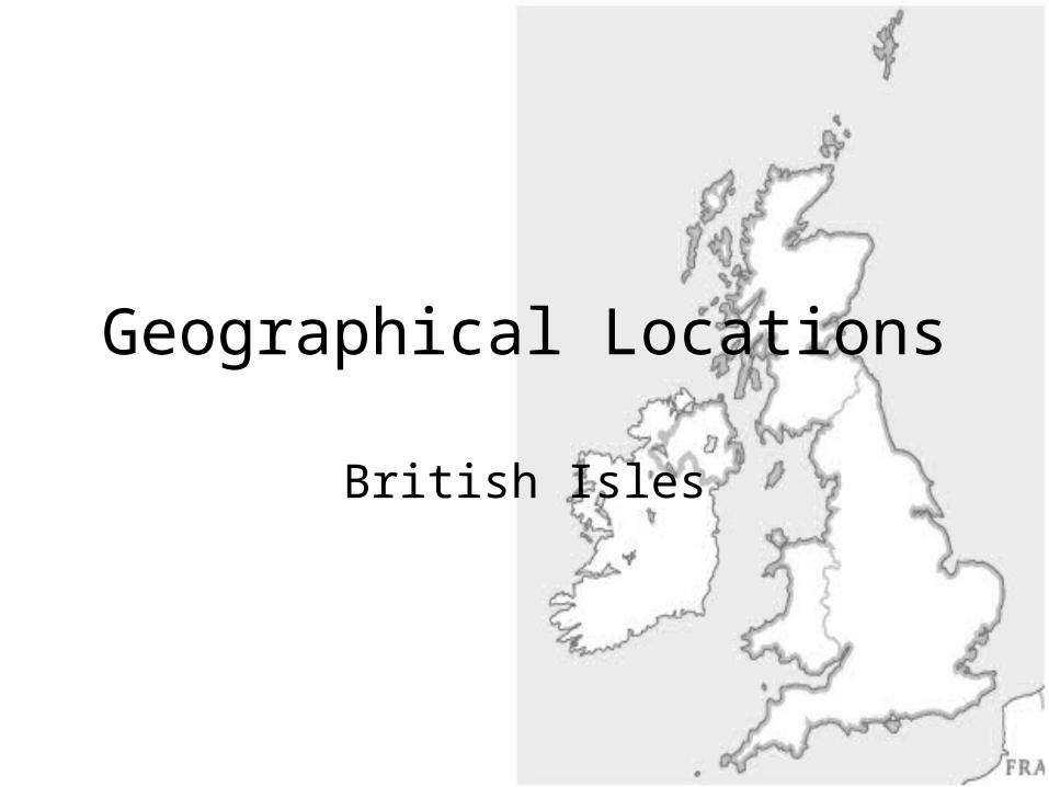
Geographical Locations
British Isles

Q1 Which of the following is not part of the United Kingdom?
• England• Northern Ireland• Republic of Ireland• Scotland• Wales

Q2. Which of the following is not part of Great Britain?
• England• Northern Ireland• Scotland• Wales
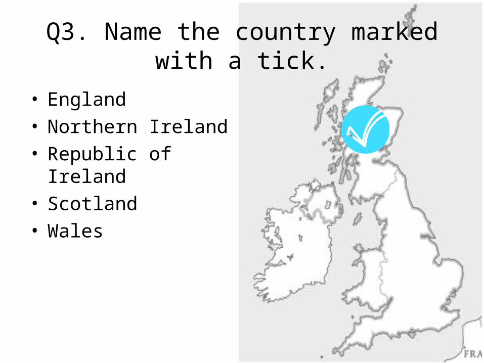
Q3. Name the country marked with a tick.
• England• Northern Ireland• Republic of Ireland• Scotland• Wales
• England• Northern Ireland• Republic of Ireland• Scotland• Wales
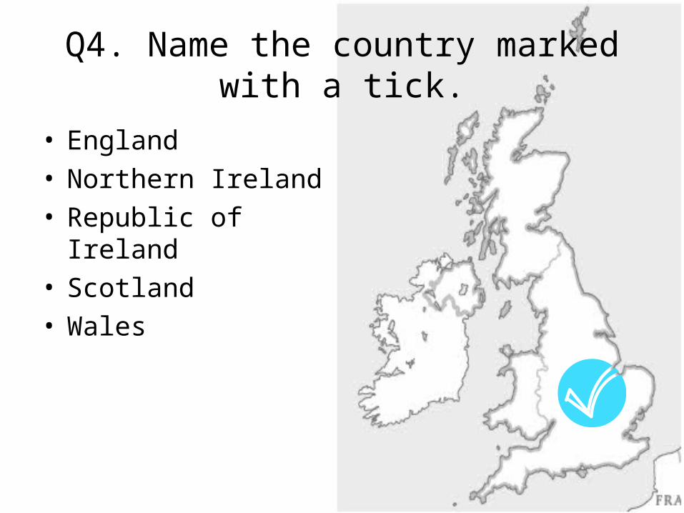
Q4. Name the country marked with a tick.

• England• Northern Ireland• Republic of Ireland• Scotland• Wales
Q5. Name the country marked with a tick.

• England• Northern Ireland• Republic of Ireland• Scotland• Wales
Q6. Name the country marked with a tick.
• England• Northern Ireland• Republic of Ireland• Scotland• Wales
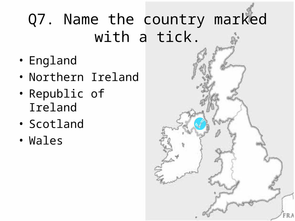
Q7. Name the country marked with a tick.
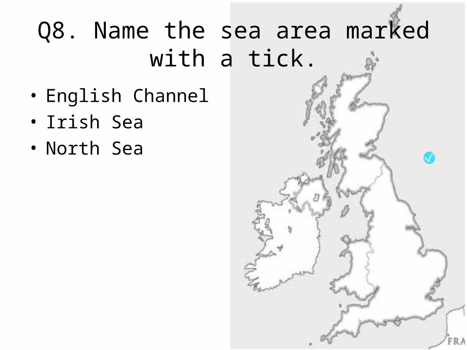
• English Channel• Irish Sea• North Sea
Q8. Name the sea area marked with a tick.
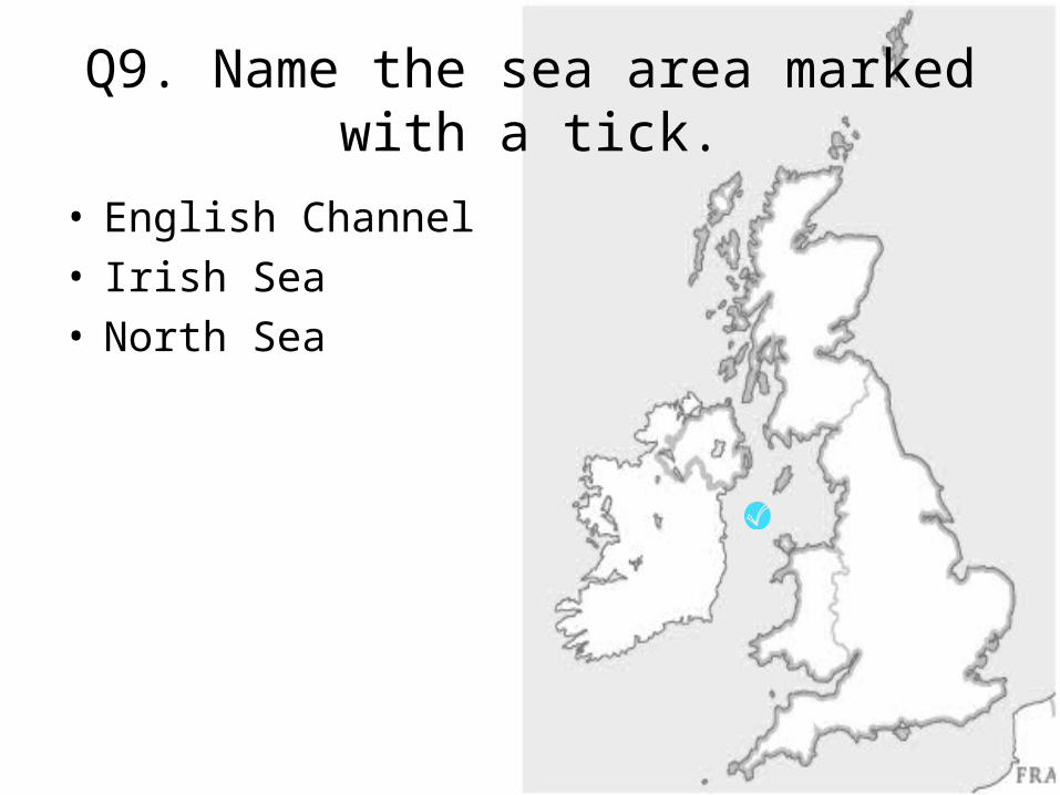
Q9. Name the sea area marked with a tick.
• English Channel• Irish Sea• North Sea
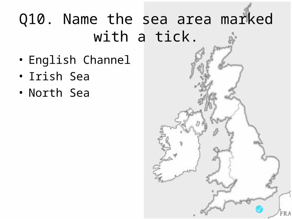
Q10. Name the sea area marked with a tick.
• English Channel• Irish Sea• North Sea

Q11. Name the river whose approximate course is given on the map.
• Clyde• Severn• Shannon• Thames• Trent
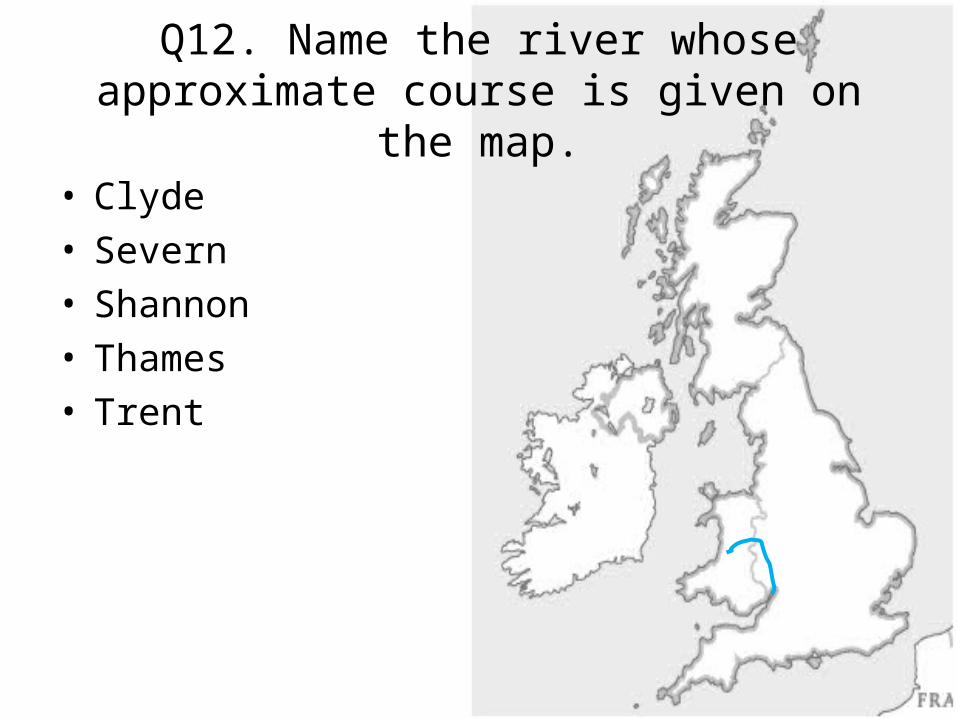
Q12. Name the river whose approximate course is given on the map.
• Clyde• Severn• Shannon• Thames• Trent
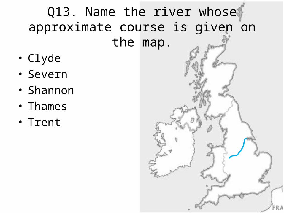
Q13. Name the river whose approximate course is given on the map.
• Clyde• Severn• Shannon• Thames• Trent

Q14. Name the river whose approximate course is given on the map.
• Clyde• Severn• Shannon• Thames• Trent

Q15. Name the river whose approximate course is given on the map.
• Clyde• Severn• Shannon• Thames• Trent

Q16. Name the upland area shaded onto the map.
• Grampians• Lake District• Pennines• Snowdonia
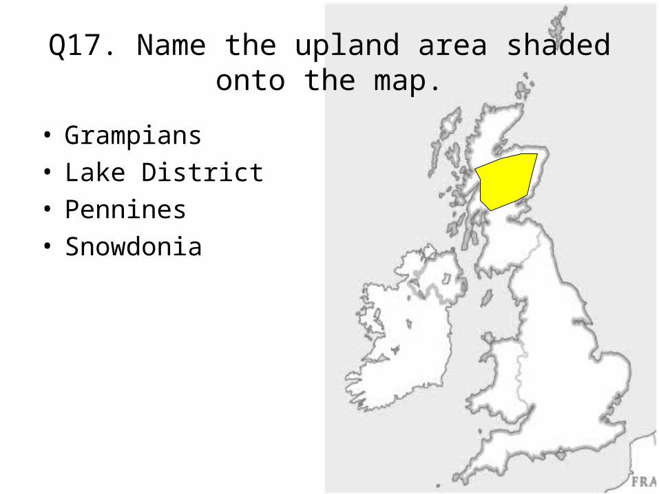
Q17. Name the upland area shaded onto the map.
• Grampians• Lake District• Pennines• Snowdonia
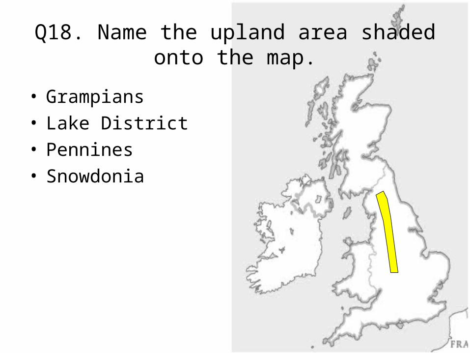
Q18. Name the upland area shaded onto the map.
• Grampians• Lake District• Pennines• Snowdonia

Q19. Name the upland area shaded onto the map.
• Grampians• Lake District• Pennines• Snowdonia

Q20. Name the major town identified by a cross.
• Belfast• Birmingham• Cardiff• Dublin• Edinburgh• Glasgow• Liverpool• London• Manchester• Newcastle
x
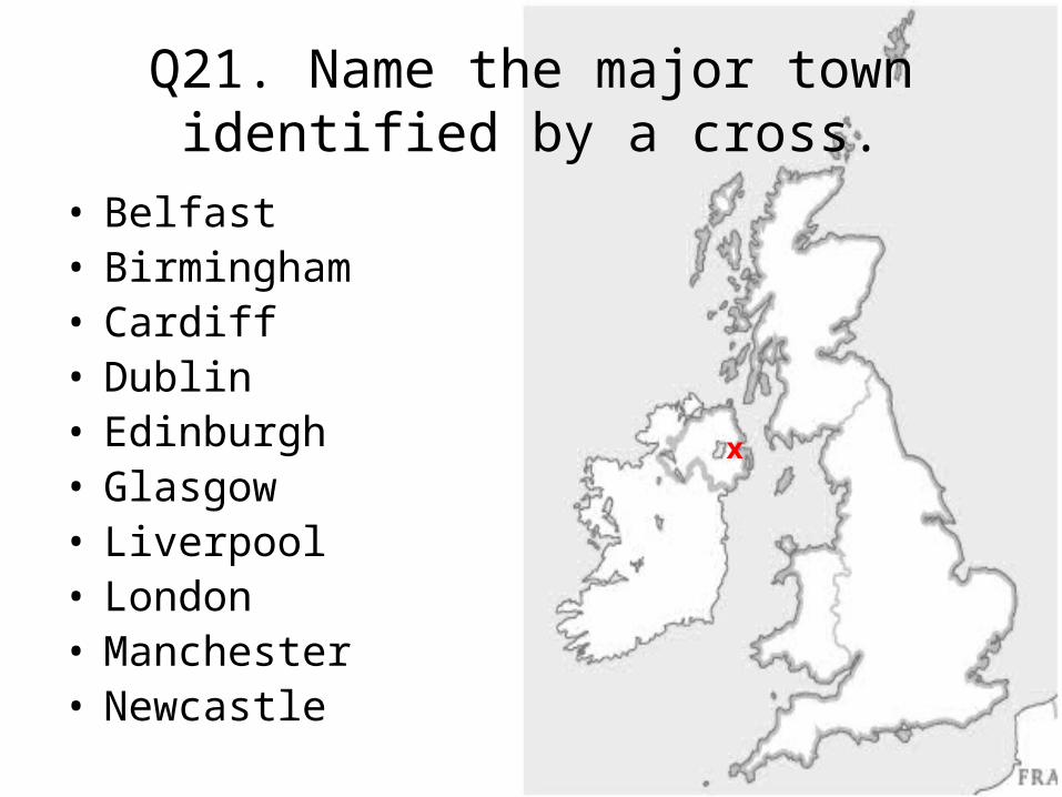
Q21. Name the major town identified by a cross.
x
• Belfast• Birmingham• Cardiff• Dublin• Edinburgh• Glasgow• Liverpool• London• Manchester• Newcastle

Q22. Name the major town identified by a cross.
x
• Belfast• Birmingham• Cardiff• Dublin• Edinburgh• Glasgow• Liverpool• London• Manchester• Newcastle
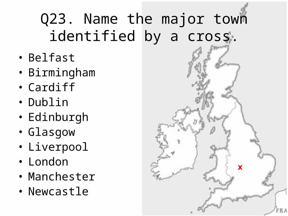
Q23. Name the major town identified by a cross.
x
• Belfast• Birmingham• Cardiff• Dublin• Edinburgh• Glasgow• Liverpool• London• Manchester• Newcastle
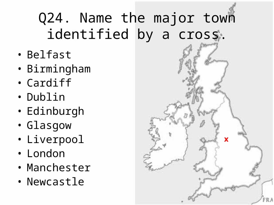
Q24. Name the major town identified by a cross.
x
• Belfast• Birmingham• Cardiff• Dublin• Edinburgh• Glasgow• Liverpool• London• Manchester• Newcastle

Q25. Name the major town identified by a cross.
x
• Belfast• Birmingham• Cardiff• Dublin• Edinburgh• Glasgow• Liverpool• London• Manchester• Newcastle

Q26. Name the major town identified by a cross.
x
• Belfast• Birmingham• Cardiff• Dublin• Edinburgh• Glasgow• Liverpool• London• Manchester• Newcastle
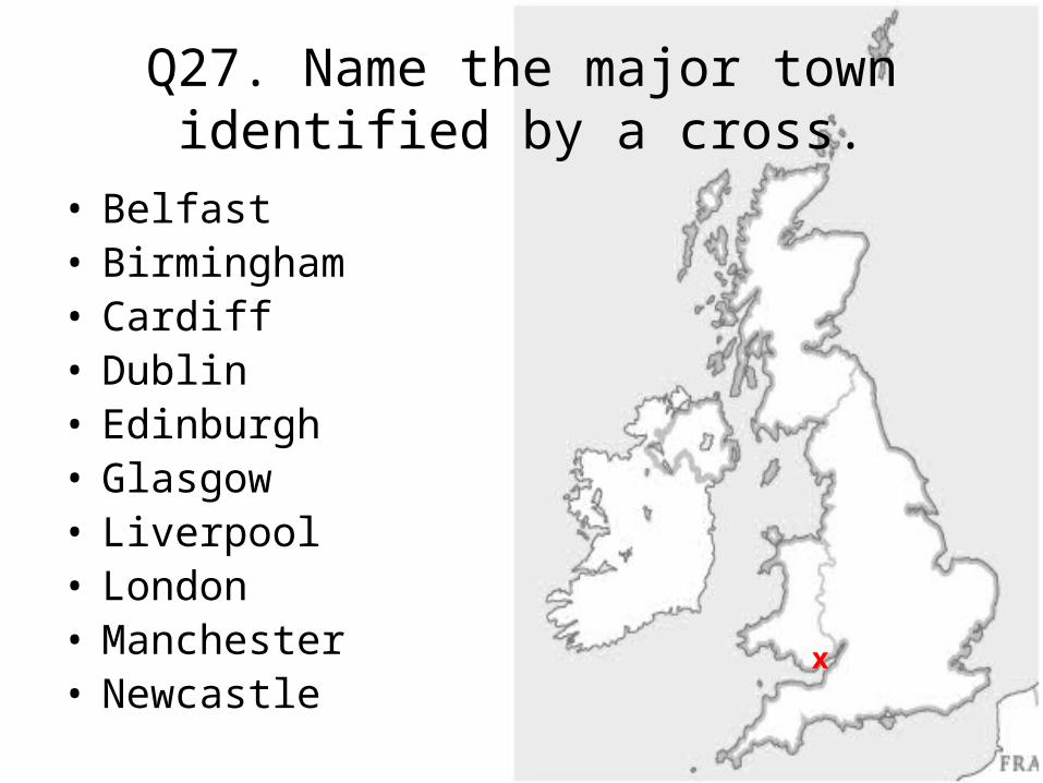
Q27. Name the major town identified by a cross.
x
• Belfast• Birmingham• Cardiff• Dublin• Edinburgh• Glasgow• Liverpool• London• Manchester• Newcastle
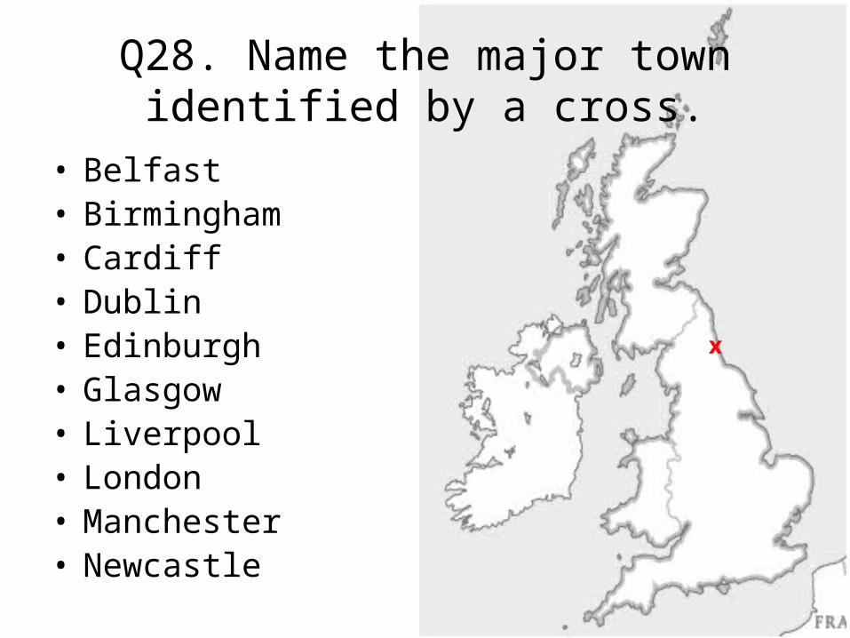
Q28. Name the major town identified by a cross.
x
• Belfast• Birmingham• Cardiff• Dublin• Edinburgh• Glasgow• Liverpool• London• Manchester• Newcastle

Q29. Name the major town identified by a cross.
x
• Belfast• Birmingham• Cardiff• Dublin• Edinburgh• Glasgow• Liverpool• London• Manchester• Newcastle