genesee county planning board zoning · pdf fileboard name planning board applicant's...
TRANSCRIPT

GCDP Referral ID T-01-DAR-1-15
Review Date 1/8/2015
Municipality DARIEN, T.
Board Name PLANNING BOARD
Applicant's Name Darien Lake Amusement Park
Location 9993 Alleghany Rd. (NYS Rt. 77), Darien
Referral Type Site Plan Review
Variance(s)
Zoning District Recreational (REC) District
PLANNING BOARD DECISIONAPPROVAL
EXPLANATION:The proposed ride is a permitted use in the Recreation (REC) Zoning District and should pose no significant county-wide or inter-community impact.
GENESEE COUNTY PLANNING BOARD ZONING REFERRALS NOTICE OF FINAL
ACTION
Description: Site Plan Review to remove an existing ride (UFO) and replace it with a new ride (Larson Giant Loop) at an existing amusement park (Darien Lake).
Director Date
If the County Planning Board disapproved the proposal, or recommends modifications, the referring agency shall NOT act contrary to the recommendations except by a vote of a majority plus one of all the members and after the adoption of a resolution setting forth the reasons for such contrary action. Within 30 days after the final action the referring agency shall file a report of final action with the County Planning Board. An action taken form is provided for this purpose and may be obtained from the Genesee County Planning Department at 344-2580 x 5466, or online at http://www.co.genesee.ny.us/ under Forms and Permits for Towns and Villages.
January 8, 2015

* G E N E S E E C O U N T Y * P L A N N I N G B O A R D R E F E R R A L
Required According to: G E N E R A L M U N I C I P A L L A W A R T I C L E 1 2 B , S E C T I O N S 2 3 9 L , M , N
(Please answer ALL questions as fully as possible)
1. REFERRING BOARD AND ADDRESS 2. APPLICANT’S NAME, ADDRESS & PHONE #
___________________________________ __________________________________________
___________________________________ __________________________________________
___________________________________ __________________________________________ MUNICIPALITY : CITY TOWN VILLAGE : of ___________________________________
3. TYPE OF REFERRAL: (Check all applicable items)
Area Variance Map Change Subdivision Proposal Use Variance Text Amendments Preliminary Special Use Permit New Zoning Ordinance Final Site Plan Review Other: ____________________
4. LOCATION OF THE REAL PROPERTY PERTAINING TO THIS REFERRAL:
A. Road name _________________________________________________________________________________
B. Nearest intersection___________________________________________________________________________
C. Tax Map Parcel # (T.M.P.) _____________________________________________________________________
D. Dimensions of the property________________________ Area of the property____________________________
E. Present zoning district_________________________________________________________________________
5. REFERRAL CASE INFORMATION: A. Has this referral been previously reviewed by the Genesee County Planning Board?
NO YES If Yes, give date and action taken_________________________________________________
_____________________________________________________________________________________________
B. Special Use Permit and/or Variances refer to the following section(s) of the present zoning ordinance and/or law
_____________________________________________________________________________________________
C. Please describe the nature of this request___________________________________________________________
_____________________________________________________________________________________________
_____________________________________________________________________________________________
_____________________________________________________________________________________________ 6. ENCLOSURES – Please enclose copy(s) of all appropriate items in regard to this referral
Copy of local application Copy of text amendments Other: Sketch of proposal Copy of new Ordinance/Law __________________ Subdivision plot plans Site Plan Maps Agricultural Data Statement __________________
Name, Address and Phone # of the person representing the community in filling out this form (required information)
_______________________________________________________________________________________________________
SEND OR DELIVER TO: GENESEE COUNTY DEPARTMENT OF PLANNING 3837 West Main Street Road Batavia, N.Y. 14020-9404 Phone: (585) 344-2580 Ext. 5467
D E P A R T M E N T U S E O N L Y :
G.C.D.P. Referral # __________________________
Date Received __________________________

TOWN OF DARIEN APPLICATION FOR ZONING PERMIT
Today's Date: 1?--) l ;t/~Y Application ~u~nber: Applicant's Name~n. r\e.n k 't..e & ,, )£e ry--e n±- Pe&r:l Address: qce :?-> Al\ \lf~"''t {2J. t~vi e.n
1 t.J"{ t'lcL/o
PhoneNumber: :JllQ-53lP-3913/p j-- Tax Map#: (. -\- 5. '~ Address of Project: ---':sr_._.,_ro~e..._..,~----------------------
INSTRUCTIONS: e rY\<:_et."LAh.'f@ ~(lif) \o.X£. CJ;)IT)
Please read the instructions carefully before completing the application form. Fill out the application form completely, using ball point pen or a typewriter. Submit your application fonn & required attachments (list of such on this form) to the Zoning Enforcement Officer (ZEO) prior to commencing this project or use. *THIS APPLICATION IS NONTRANSFERABLE AND IS VALID FOR ONE YEAR PERIOD ONLY
I. Zoning District property located in: RESIDENTIAL L Low or_ Medium Density) Industrial Commercial A. Recreational
2. Permit Application for: _New Construction _Addition _Alteration _Relocation JlAccessory Structure _Home Occupation _SPECIAL USE PERMIT
VARIANCE bl.SITE PLAN REVIEW TEMPORARY USE 3. Is this parcel: _Comer Lot _Water District Sewer District 4. Dimensions of this lot: _____ length X width and/or area nvev lCDCLC4(.~ 5. What is the front set back (in feet) from the project to the street right-of-way (Check ~urvey for ROW);
tv ~,bOO 1 tt and what is the set back (in feet) from project property line Side XV /~O Side B __ Back __ (Also depict on plot diagram).
6. Total percentage(%) of coverage of all buildings on lot (including proposed): % 7. Total Dwelling Units: _.._) __ ./A.
8. p E_ roject Cost: . I fh. : I /i nl:) Actual Estimated 9. PROPOSED
PROJECT House
Garage/Pole Barn Accessory Structure Commercial Industrial Signs
HEIGHT LENGTH WIDTH SQUARE FEET # Bathrooms:
#Bedrooms: Rec Room: Family Room: __ Fireplace: __
CERTIFICATION: I hereby certify that I have read the instructions, examined this application and supporting attachments and know them to be true: & corret-'1.. All provisions of Laws and Ordinances covering this type of work or use will be complied with, whether specified herein or not. The granting of a permit does not give authority to violate or cancel the provisions of any other State or Local Law/Ordinance regulating constntetion, performance or use.
PROPERTY OWNER SIGNA TIJRE (If otner than applicant)

Attachments required & veri.fied by ZEO: ---------------------------
Action taken by ZEO: APPROVED: 0 DENIED: D Reason: __________________________ ___
Referral To: 0 Town Planning D Town Appeals D County Planning D Building Inspector
Date of Signature Signature ofZEO
Date of Signature #of Inspects Signature of Building Inspector
Date Fee Received Fee Indicate Fees Paid/Town Clerk Use Only
Date of Signature Renewal Approval I ZEO Signature
This application will not be considered complete uutil all appropriate attachments have been supplied and accepted; photo-copies are acceptable. The applicant is responsible to present all applicable attachments to the ZEO. The project in question can not be started until an approved Zoning Permit has been issued, the Building Inspector contacted and if required, the Town Clerk has issued the Building Permit. The applicont is responsible to make all calls to the Building Inspector for review of plans und inspection assignments and to pay any necessnry fees as set forth in the appropriate schedule of fees to the Town Clerk. lf a Site Plan is necessary, a total of nine (9) copies are needed.
Please be advised that you may contac:t tht: following if you have aoy questions or concerns with regard to procedures: *ZEO- foi lling out or filing Zoning Permits. Zoning, Regulations, appointments for Zoning Permit approval. Variance & Spcci!il Use Procedures. *Building Inspector- Construction. Plan review. C'.odc requirements and inspections *Town Clerk - Forms. Feet. (payable 10 Town C lerk). Building Pennil General lnformation & who to contact.
ATTACHMENTS: The following attachments are mandated for all projects or uses in question. *Layout sketch (Plot Diagram) shall consist of an accurate map (survey or plot diagram on graph paper) showing all structures and/or buildings on the parcel. All dimensions of project, property lines and right-of-ways shall also be indicated. Identify adjoining parcels and indicate the owners of such.
Please contact the ZBO regarding which of the following attachments will be required for the project or use in question:
1. Graphic material showing traffic circulation, parking spaces, pedestrian walks, topography and landscape plans, open space & buffer zone. 2. Preliminory engineering plans showing street improvements, storm drainage, water supply and sanitary sewer facilities. 3. Copy of current Genesee County Health Department approval for nn individual sewer disposal system and plans for such. 4. A drawing of any signs which the applicnnt wishes to post. This drawing shall include dimensions, characters, shape, and illumination (if any, show source of power & location of illumination). 5. Elevation drawings with applicable height dimensions. 6. Description of the nature of existing use. 7. Freshwater wetland de-termination and/or permit, from 'NYS Dept of Environmental Conservation. 8. Certification indicating specific elevations in relation to the Federal Flood Hazard Area. 9. Letter of review from the Depanment of Soil and Water Conservation when applying for a pond.
Other:

TOWN OF DARIEN GENESEE COUNTY, NEW YORK 14040
PLANNING BOARD SITE PLAN REVIEW
SPECIAL USE PERMIT APPLICATION
Application #: ------(For office use only) Today's Date: 11./11./Jy
Provision of Zoning Law Involved: Article: ..li=" , Section: <-!or , Subsection: _ _(,______, Paragraph: ~3..
Purpose of Request: *This request would be in harmony with the orderly development of the district in whic
located because: ' ns-+o·c t
*This request would not be detrimental to the property or persons in the neighborhood because: .:Gt • -~ 9..n o.. \\olJ:) o.b \e_ r-e 13ues"t
*This request would not increase the traffic flow in the area to the extent that traffic safety would be endangered be~ause: ~ 0 _,.,~·<:.->· fo:::h~ c.}.o. iW~L ~d\ Qjj.Q~ ,V\.CQ lD :b<o. 't):j &
The applicant should submit one (I) copy of the application, nine (9) copies of the site plan and one (I) copy of the zoning application
CERTIFICA TlON: I hereby certify that I have read the instructions and examined this application and supporting
attachments and know the same to be true and correct. All provisions of laws and ordinances covering this type of work or use will be complied with whether specified herein or not. The granting of a permit does not presume to give authority to violate or cancel the provisions of any other state or local ordinance regulating construction or performance of construction.
/S;g;iawre of Ap('ll icanl
Date of Signature Signature of Owner (If different from Appltcan1)
Office Use Only: Zoning Permit Application #: ______ Date Received: ______ Fee Paid: ___ _
Date of First Hearing:---- ------
Date of Second Hearing: ---------
Date of Subsequent Hearings:----- ---
Action: (_)APPROVED (_)_REJECTED
Location: ______________ __
Location: ---------------
Location:-----------------
Date: _________________ ___
Planning Board Chairman Signature:--------------------------
Zoning Officer Signature: ---------------Date Permit Issued: ____ _
Additional Conditions Imposed: --------------------- ----

+ TOWN Agricultural
DARIEN + OF Data Statement
Appllcotloft I -----
Dote _____ _
INSTRUCT I 0 N 5: Thia form Muat b• eompl•t•d for any application for a apecioJ us• permit, tit• pion approval, us• variane• or a aubdivisioft approval, r•quiring municipal r•vr•w, thot would occur on prop•rty within 500 f•et of o form op•ratlon locat•cf in a NY$ D•pt. of Ag. & Markell c.rtlfi•cf Agricultural Diatriet.
Applicant Owner If dift&r&nt than Applicant
Name ~(\en 4_\u_ Name
Addrest qqq.3 All~~cu~~~ {2J_ Addres t
':Do._vt~Jt.) , A.. 'Ji lYo~·D
3. location of proiect: Adcfreu Cf'tx 3 A-l l~fu;l'-Ln..,y._ .... {2-~.,cl......_ __________ _ Tax Map Number (TMPJ - f'- l- 5, \2. ~ Check with your
4. Is this property within an Agricultural District ' N.Or"\71 YES!! local Assessor tf LA.J l-...J you do not know S. IF yes, Agricultural District Number ------6. I$ this property actively farmed ' NO OCJ YES D 7. list aU form operations within 500 feet oF your property, (Attach additional sheets if necessary).
UJ tVO()f <
~ Nome Nome
Address Addres s
h thh properly ocu.,.ly for111eci f NoD vuD Ia thia prop•rtr oct&vely lo,ucl f NoDvesD
~ _!J Nome Nome
Address Address
I• tlli• proputy octiulr farmocl t NcC]vuO h this proporty octiu1y lat~ud t NoOvesO
IIVIIWID IY
NOTI YO llfEIIAL AOINCY
Signature of Owl\., (II olhat lhen Applic:anl}
Signa h.lf• ol Murucrpal OHrc:ual
County r•vi•w is r•quir•d. A copy of th• Agricultural Data ttat ... •nt mud b• submitted along with th• r•f•rral to the Cournty Plonnini D•partment.
--------------------------------------------------------------------------~~~-Co~ty Olttrrbuhort WHITE- Z E 0 CANARY- Pla.,n'"O Board

Instructions for Completine
617.20 AppendixB
Short Environmental As.~essment Form
Part l - Pt·oject Information. The ap licant or project sponsor Is responsible for the com..Pletton of Part 1. Responses become part of the application for approval or funding, are subject to public review, and may be subject to further verification. Complete Part I based on information currently available. If additional research or investigation would be needed to fully respond to any item, please answer as thoroughly as possible based on current information.
Complete all items in Part 1. You may also provide any additional information which you believe will be needed by or useful to the lead agency; attach additional pages as necessary to supplement any item.
Part l ~t and Sponsor Information
<\. Ul lcLte__ ~\JSe.XY\.W Po..~<'~ Name of Action or Project:
Lo..~O(\ c;~Gr\'\- loop etJ£-Project Location (describe, and attach a location map): . d.~ of ~
ct qq:s A/l~~n-~ ea.. l bo.(fe.n Or (0"/ t4olo l.!) 1.' tl ~\..) •".. - l.l\. ))At\U\ ~ .J.Q;
Brief Description of Proposed Acticm: '
~~1:>~\)~~ ~.~ a_ ~~ ~ ~p Cl;l'n• ~ l'o~· J'vd.o)
~;;:ant~ Ed. mc.Co..Y"'\hv) fl\ aif\m-e ~vse.M~'\- Pu.f ~ ~r-
Telephone: t ~ \\ f \\4 - 5?,tn- 3q &,
E-Mai 1: e rY\<"-Cr.. ..-~\'\\ (<i> An. -rl ~ 1'\ \ri ~ Address: I
qq__<j 2> A\ \~hn.n\.J f<no.d City !PO: v I State: IZi~~~~ ~(\. <11?..n ('!v- IJ'I l. Does the proposed action only involve the legislative adoption of a plan, local law, ordinance, NO YES
administrative rule, or regulation?
~ D If Yes, attach a narrative description of the intent ofthe proposed action and the environmental resources that may be affected in the municipality and proceed to Part 2. If no, continue to question 2.
2. Does the proposed action require a permit, approval or funding from any other governmental Agency? NO YES If Yes, list agency(s) name and permit oriproval:
lcV'"- u~ bo._(,·w , IJ -·Si+e_ .Pb.l'\. ~~ - -~0\~\nc. f'etl"'\l+
D ~ 3.a. Total acreage of the site of the proposed action? J( 01e:r@ _acres
b. Total acreage to be physically disturbed? t Qi: \f~ acres c. Total acreage (project site and any contiguous properties) owned
or controlled by the applicant or project sponsor? nJ&-100 acres
4. Check all land uses that occur on, adjoining and near the proposed action. DUrban ORural (non-agriculture) 0 Industrial 0 Commercial 0Residential (suburban)
DForest DAgriculture 0Aquatic ~ther (specify): ~ec (f n ....:hoo.'d-= OParkland
Page 1 of4

5. Is the proposed action, NO YES N/A a. A permitted use under the zoning regulations? D [g] D b. Consistent with the adopted comprehensive plan? D [g) D
6. Is the proposed action consistent with the predominant character of the existing built or natural NO YES landscape? D 0
7. Is the site of the proposed action located in, or does it adjoin, a state listed Critical Environmental Area? NO YES If Yes, identi fY:
~ D 8. a. Will the proposed action result in a substantial increase in traffic above present levels'? NO YES
~ D b. Are public transportation service{s) available at or near the site of the proposed action? 10 D c. Are any pedestrian accommodations or bicycle routes available on or near site of the proposed action? B -,.
_J 9. Does the proposed action meet or exceed the state energy code requirements? NO YES If the proposed action will exceed requirements, describe design features and technologies:
D D 10. Will the proposed action connect to an existing public/private water supply? NO YES
If No, describe method for providing potable water: D ~ 11. Will the proposed action connect to existing wastewater utilities? NO YES
If No, describe method for providing wastewater treatment: D ~ 12. a. Does the site contain a structure that is listed on either the State or National Register of Historic NO YES
Places?
! 0 b. Is the proposed action located in an archeological sensitive area? u 13. a. Does any portion of lhe site of the proposed action, or lands adjoining the proposed action, contain NO YES
wetlands or other waterbodies regulated by a federal, state or local agency? [0 D b. Would the proposed action physically alter, or encroach into, any existing wetland or waterbody? ® D If Yes, identifY the wetland or waterbody and extent of alterations in square feet or acres:
14. IdentifY the typical habitat types that occur on, or are likely to be found on the project site. Check all that apply: 0 Shoreline 0 Forest 0 AgriculturaVgrasslands DEarly mid-successional
reu~o·~~ 0 Wetland D Urban 0 Suburban ~;\-e._ ~~'t
15. Does the site of the proposed action contain any species of animal, or associated habitats, listed NO YES by the State or Federal government as threatened or endangered? @._ D
16. Is the project site located ln the I 00 year flood plain? NO YE§
~e. C\..fb.c.h~d ~C\.n I I lXl 17. Will the proposed action create storm water discharge.' either from point or non-point sources? NO YES If Yes, 0. D a. Will storm water discharges flow to adjacent properties? 0NO DYES
b. Will storm water discharges be directed to established conveyance systems (runoff and storm drains)? IfYes, briefly describe: 0NO D YES
Page2 of4

18. Does the proposed action include construction or other activities that result in the impoundment of NO YES water or other liquids (e.g. retention pond. waste lagoon, dam)?
If Yes, explain purpose and size:
~ D 19. Has the site of the proposed action or an adjoining property been the location of an active or closed NO YES
solid waste management facility?
E1 If Yes, describe: D 20. Has the site of the proposed action or an adjoining property been the subject of remediation (ongoing or NO YES
completed) for hazardous waste? If Yes, describe: I8J D I AFFIRM THAT THE INFORMATION PROVIDED ABOVE IS TRUE AND ACCURATE TO THE BEST OF MY KNOWLEDGE
Applicant/sponsor name: J::()id ~ ~ 1h j Date: L1jL_1/ ~o t'L. Signature: ~.....?C:. _..:) ·
APPLICANT STOP HERE . ,.
PLEASE PRINT ENTIRE FORM.
Part 2 - lmpoct Assessment. The Lead Agency is responsible for the completion of Part 2. Answer all of the following questions in Part 2 using the information contained in Part I and other materials submitted by the project sponsor or otherwise available to the reviewer. When answering the questions the reviewer should be guided by the concept "Have my responses been reasonable considering the scale and context of the proposed action?"
No, or Moderate small to large impact impact may may occur occur
I. Will the proposed action create a material conflict with an adopted land use plan or zoning D D regulations?
2. Will the proposed action result in a change in the use or intensity of use of land? D D 3. Will the proposed action impair the character or quality of the existing community? D D 4. Will the proposed action have an impact on the environmental characteristics that caused the D D establishment of a Critical Environmental Area (CEA)?
5. Will the proposed action result in an adverse change in the existing level of traffic or D D affect existing infrastructure for mass transit, biking or walkway?
6. Will the proposed action cause an increase in the use of energy and it fails to incorporate D D reasonably available energy conservation or renewable energy opportunities?
7. Will the proposed action impact existing: D D a. public I private water supplies?
b. public I private wastewater treatment utilities? D D 8. Will the proposed action impair the character or quality of important historic, archaeological, D D architectural or aesthetic resources?
9. Will the proposed action result in an adverse change to natural resources (e.g., wetlands, D D waterbodies, groundwater, air quality, flora and fauna)?
Page 3 of4

Gooole earth feetl~===============2o~o-~ ~ters~ 70

I 15.13 ft
I
72.11 ft
150"---1 I ADA RAMP SIDE
j_ 36"
ll~mc==±rr~~m==r~T=~~~~==~r~
ELECTRICAL BOX LOCATION 480 VOLT- 3 PHASE
150 AMP (5 WIRE) 02 1/2" RECOMMENDED CONDUIT SIZE-
R33.02 ft
-r=------R36.00 II
---------------67.45 f\-----------------1
52t"
16" TOP OF WALKWAY TO TOP OF I-BEAM
TOP OF WALKWAY TO BOTTOM OF BASE PLATE (ACTUAL WAS 52 3/4" GL#4)
REV E C.O.
SECTION A-A S(";AI F 1 ·50
TRAIN HIDDEN
SIZE 'M'JGHl
C 1
BY
REV

d.v'<.>) ooa I SO-I>'f' le.... o..re... C.J:J~
SECTION B-B SCALE 1:45
-rJ:J=~------_-_ -!T --=-- ....... --- --0 [2]--- ~ '! - ___ _____ _l_if~ -,.·--r, I --- ·-- ___ __ _ "-..._ rrajt• . ,
1
. ~~-.. --- -- --~- -- ---- I / . I _ '"'~- - , ,______________ ~· --· --- -- -~- 231~~· · ---k' ssi· __c:~---~ do- ---- ~~ I /-~------ I I ~ -- ---· ----- ·/ . '"''~·· -- ~'-....._--_ . / -- ~ -+ mi· 216t" -- - - - - - - ---- - - - ·-::__,_, --.,~~~2271.·~-~r-.1---\ .. ~.
....... - - -- 3£ I I 3s4i· ' "' I - - - - - -- ----es-__ ,
b
DETAILC SCALE 1 : a
ll>1~" 4 TYP.
,.i· I
I j !T!ICX
1' I}JtO&
It 1 Lorl&
. _ I I
DARI
EN L
AKE T
HEME PARK DRIVEWAY
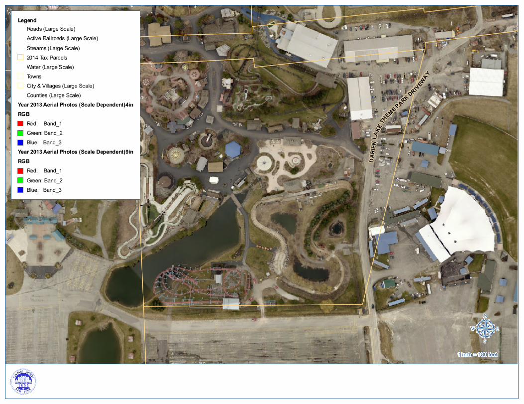
LegendRoads (Large Scale)Active Railroads (Large Scale)Streams (Large Scale)2014 Tax ParcelsWater (Large Scale)TownsCity & Villages (Large Scale)Counties (Large Scale)
Year 2013 Aerial Photos (Scale Dependent)4inRGB
Red: Band_1Green: Band_2Blue: Band_3
Year 2013 Aerial Photos (Scale Dependent)9inRGB
Red: Band_1Green: Band_2Blue: Band_3
µ1 inch = 180 feet

A
SUMNER RD
DARIEN LAKE THEME PAR K DRIVEWAY
DARIEN LAKE THEME PARK DRIVEWAY Ellicott C reek
LegendRoads (Large Scale)Active Railroads (Large Scale)Streams (Large Scale)2014 Tax ParcelsWetland BoundaryProtected 100 ft BufferFederal
FEMA Flood Hazard AreasZone
100 Yr Flood Plain500 Yr Flood PlainWater (Large Scale)TownsCity & Villages (Large Scale)Counties (Large Scale)
Year 2013 Aerial Photos (Scale Dependent)4inRGB
Red: Band_1Green: Band_2Blue: Band_3
Year 2013 Aerial Photos (Scale Dependent)9inRGB
Red: Band_1Green: Band_2Blue: Band_3
µ1 inch = 360 feet

3.-1.a3.12
3.-1-34.2
111
3.-1.a5.2
7.-1-7.2
7.-1-18.21
- .,... ~ -.., .... ....
eft I "'i' .,... .,... I .,...
I :r.-1-5.11 ....: I .,... ....: I
....:
7.+41

T-01-DAR-1-15
N
E
S
W
Creation Date: Apr 09, 2013 15:40Modification Date: Apr 12, 2013 15:00
Copyright ©2013 Pictometry International Corp.