general · general the taskforce met on ... • meet ng no. 11 (8 august 05) - draft report and...
TRANSCRIPT
L o r d M a y o r ’ s T a s k f o r c e o n s u b u r b a n f l o o d i n g 5
2. Review Of Creek And Local Flooding
GeneralThe Taskforce met on twelve occas�ons over the per�od February 2005 to August 2005. The ma�n bus�ness of each meet�ng was as deta�led below:
• Meet�ng No.1 (8 Feb 05) - Ident�fy Issues and �nformat�on needs
• Meet�ng No.2 (21 Feb 05) - Focus Areas and Issues
• Meet�ng No.3 (16 Mar 05) - Local Flood�ng and Focus Areas
• Meet�ng No.4 (7 Apr�l 05) - Flood�ng Problem Statements and Solut�ons
• Meet�ng No.5 (28 Apr�l 05) - Solut�ons and F�nal Report Format
• Meet�ng No.6 (11 May 05) - Draft Recommended Act�ons and Est�mated Costs
• Meet�ng No.7 (1 June 05) - Draft Report
• Meet�ng No. 8 (22 June 05) - Draft Report and Inundat�on Survey
• Meet�ng No. 9 (6 July 05) - Draft Report and Inundat�on Survey
• Meet�ng No. 10 (26 July 05) - Draft Report and Voluntary Buy-Back Cr�ter�a
• Meet�ng No. 11 (8 August 05) - Draft Report and Voluntary Buy-Back Cr�ter�a
• Meet�ng No. 12 (24 August 05) – F�nal Report S�gn Off
Major FindingsThe Taskforce br�efly rev�ewed creek and local flood�ng �ssues �n Br�sbane. The major find�ngs of the rev�ew (unranked) are as follows:
1 Counc�l should refine �ts flood r�sk management plann�ng processes so that �t addresses the concerns of all stakeholders, �nclud�ng the commun�ty.
2 There �s a need to �ncrease the level of understand�ng of ‘best pract�ce’ flood r�sk management pr�nc�ples by all stakeholders, �nclud�ng the commun�ty.
3 There �s a need to strengthen commun�cat�on between the commun�ty, Counc�l and Federal and State agenc�es assoc�ated w�th flood r�sk management.
4 Counc�l’s C�ty Plan should address the effects that cumulat�ve fill�ng of waterways and floodpla�ns have on flood�ng to downstream, upstream and adjacent commun�t�es.
5 Some houses subject to creek and floodpla�n flood�ng may be e�ther the wrong ‘des�gn’ for the env�ronment they are �n or were approved under older development cond�t�ons.
6 When blocked, overland flow paths contr�bute to local flood�ng.
7 C�ty Plan and ex�st�ng Local Laws for the m�t�gat�on of creek and local flood�ng, eg. by prevent�ng unauthor�sed or unlawful fill�ng of s�tes, may not be effect�ve or adequately enforced.
8 State Government Leg�slat�on and Perm�t cond�t�ons may be �mped�ng the �mplementat�on of effect�ve flood m�t�gat�on measures.
9 Res�dents want effect�ve flood forecast�ng for creek, waterway and floodpla�n events and flood warn�ng systems.
10 Commun�ty understand�ng of the extent of flood�ng that occurs throughout Br�sbane may be l�m�ted.
11 Informat�on/ results from flood�ng reports/ �nvest�gat�on undertaken by Counc�l may not be accepted as be�ng accurate by the commun�ty.

6
12 Counc�l should rev�ew how creek and local flood�ng events, and construct�on and ma�ntenance works are recorded.
13 Cons�derat�on should be g�ven to chang�ng the budget fund�ng and m�x to m�t�gate creek and local flood�ng.
14 Dra�nage Works Programs select�on pr�or�t�es should be rev�ewed to ensure they reflect current commun�ty expectat�ons/ needs.
15 Ma�ntenance Work Programs are to keep Counc�l’s ex�st�ng �nfrastructure operat�ng to �ts opt�mum effic�ency.
16 Capac�t�es of ex�st�ng open waterways and floodpla�ns should be rev�ewed to ensure they operate to full capac�ty wh�lst tak�ng �nto account env�ronmental cons�derat�ons.
17 Des�gn standards should ensure Counc�l �nfrastructure and dra�nage systems operate effic�ently and effect�vely dur�ng flood events.
18 Land use plann�ng may not be effect�vely keep�ng people away from, or manag�ng, development w�th�n waterway corr�dors and floodpla�n areas.
19 Development across the c�ty �s �ncreas�ng �mperv�ous areas, caus�ng the volume of runoff to �ncrease and reach creeks faster than �n undeveloped catchments.
20 Counc�l should ensure that compl�ance w�th leg�slat�on and pol�c�es �s adequately regulated.
21 A flood affected property data set �s requ�red for:
• h�stor�cal flood�ng
• potent�al (below BCC des�gn standards) flood prone property.
22 Counc�l should adopt a commun�ty development approach, bu�ld�ng on catchment coord�nat�on comm�ttees engag�ng the commun�ty to address the follow�ng solut�ons:
• flood awareness ra�s�ng
• local warn�ng systems
• local flood level mon�tor�ng
• consultat�on on remed�at�on pr�or�t�es
• commun�ty support/ ass�stance to flood affected res�dents/ bus�nesses.
Based on these find�ngs, the Taskforce developed strateg�es to reduce the effects of s�gn�ficant ra�n events on areas of Br�sbane prone to flood�ng, as deta�led �n the follow�ng sect�ons.

L o r d M a y o r ’ s T a s k f o r c e o n s u b u r b a n f l o o d i n g 7
3. Taskforce Strategy For Creek And Local Flooding DevelopmentIn the format�on of a strategy for Br�sbane creek and local flood�ng, �t �s �mportant to real�se that a number of obl�gat�ons, needs, constra�nts, opportun�t�es and ach�evements to date affect the nature and deta�ls of the strategy. These �nclude:
• The need for Counc�l to work towards commun�ty expectat�ons and Duty of Care obl�gat�ons w�th respect to flood r�sk management.
• There are few ‘greenfield’ s�tes left for development across the C�ty. Future development w�ll cons�st largely of ‘�nfill’ development and the redevelopment of ex�st�ng developed areas. Th�s prov�des both constra�nts and opportun�t�es for creek and local flood management.
• Flood stud�es have been undertaken for the Br�sbane R�ver and for most Br�sbane creeks. Therefore, �n formulat�ng a creek and local flood strategy, Counc�l �s start�ng from a strong pos�t�on w�th respect to essent�al background �nformat�on.
• Br�sbane has well developed land use plann�ng and development assessment systems, essent�al for a creek and overland flow flood r�sk management plann�ng system.
The Taskforce understands that the Counc�l has been undertak�ng var�ous components of flood r�sk management plann�ng s�nce the m�d-1970s. Today �t �s not so much a case of start�ng from scratch, but of �dent�fy�ng and �ncorporat�ng m�ss�ng elements, strengthen�ng ex�st�ng elements where necessary, and �ntegrat�ng the var�ous components �nto a comprehens�ve and effect�ve plann�ng process.
Br�sbane �s a sub-trop�cal c�ty subject to the v�gour and extremes of a sub-trop�cal cl�mate. At t�mes, flood�ng occurs along the Br�sbane R�ver and Br�sbane creeks and �n local and low-ly�ng coastal areas. The object�ve of th�s strategy �s to reduce the �mpact of creek and overland flow flood�ng on the �nd�v�dual owners and occup�ers of flood-prone land and to reduce pr�vate and publ�c losses caused by floods. Th�s w�ll be done through a process of flood Management Measures.
Th�s strategy recogn�ses that:
1. Flood�ng �n Br�sbane can be caused by a number of mechan�sms:
• heavy or susta�ned ra�nfalls over the catchments of Br�sbane’s creeks
• overloaded stormwater systems as surface runoff makes �ts way �nto creeks (overland flow)
• heavy or susta�ned ra�nfalls over the catchments of the Br�sbane R�ver
• storm surge �n Moreton Bay
• fa�lure of one of the three dams �n the C�ty’s env�rons, Gold Creek Dam, Lake Manchester and Enoggera Dam or the SEQ Water controlled W�venhoe Dam
• a tsunam� �n the Pac�fic Ocean.
2. Creek and local flood�ng occur regularly �n Br�sbane and causes cons�derable d�srupt�on to the commun�ty. Accord�ngly, the Taskforce has addressed creek and overland flow flood�ng �ssues across Br�sbane �n th�s report.
• W�th regards to r�ver flood�ng, the Taskforce notes that a Independent Expert Panel has recently rev�ewed flood�ng assoc�ated w�th the Br�sbane R�ver (BCC 2003, Review of Brisbane River Flood Study) and that development and redevelopment �n areas below the Defined Flood Event (DFE) flood level have str�ct flood �mmun�ty requ�rements under the Br�sbane C�ty Plan. Such requ�rements are supported.

8
• There �s no real�st�c remedy for storm surge other than proper educat�on of the commun�ty and effect�ve land use plann�ng and warn�ng systems.
• The Taskforce recogn�ses the very low r�sk of dam fa�lure flood�ng. It �s noted that th�s r�sk �s managed pr�nc�pally through dam safety aud�ts that are a State Government respons�b�l�ty.
• It �s thought that the r�sk of s�gn�ficant flood�ng by tsunam� �s remote, but th�s needs to be confirmed. Further, the Bay �slands would prov�de some protect�on for Br�sbane aga�nst tsunam� flood�ng.
3. Flood�ng �n Br�sbane can be worsened by a number of processes:
• Loss/ alterat�on of overland floodwater flowpaths and the�r natural detent�on/ retent�on bas�ns.
• Loss/ alterat�on/ �nfill�ng of waterway corr�dor, flood pla�ns, wetlands and the�r natural detent�on/ retent�on bas�ns.
• Loss of �nfiltrat�on processes and �ncreases �n �mperv�ous surfaces.
4. Wh�le Counc�l �s the pr�mary publ�c agency respons�ble for the del�very of local flood management serv�ces, a number of Federal and State government agenc�es have spec�fic roles to play �n the management of flood�ng r�sk. Counc�l should l�a�se w�th these agenc�es to fac�l�tate coord�nated and effect�ve management �n�t�at�ves across Br�sbane at the three levels of government.
5. Flood-prone areas across Br�sbane can serve a var�ety of urban and ecolog�cal purposes and are a source of natural resources. When mak�ng development dec�s�ons for flood-prone land, Counc�l should adopt an approach that takes �nto account soc�al, econom�c and ecolog�cal factors, as well as flood r�sk and env�ronmental cons�derat�ons.
6. Flood r�sk can be managed by a var�ety of measures that mod�fy property at r�sk (eg. land use controls), the response of �nd�v�duals or commun�t�es at r�sk (eg. flood warn�ng), or flood behav�our �tself (eg. the use of levees/ p�pes to reduce overland flow). Counc�l should reduce flood r�sk by determ�n�ng an effect�ve and �ntegrated m�x of Management Measures appropr�ate to each flood�ng s�tuat�on.
7. All flood�ng events have an assoc�ated flood r�sk. Counc�l should manage flood�ng r�sk for events up to the ‘probable max�mum flood’ (PMF).
8. Ind�v�duals and commun�t�es �n flood-prone areas have roles to play �n the management of flood r�sk. Through educat�on programs, Counc�l should �nform the publ�c of the�r exposure to flood r�sk (flood awareness) and how they can act�vely contr�bute to the management of th�s r�sk to reduce the �mpact of flood�ng on themselves and the�r possess�ons (flood read�ness, flood response and flood recovery).
9. A host of ‘flood �nformat�on’ should be retr�eved, collected, stored and presented to ass�st var�ous stakeholders to better manage flood r�sk.
10. Emergency management and recovery programs are essent�al components of flood r�sk management and need to be �ntegrated w�th other management measures.
11. Cl�mate change �s occurr�ng and �ts �mpact on sea levels and storm events are yet to be fully determ�ned.
Th�s creek and local flood�ng strategy for Br�sbane cons�sts of defin�ng and �mplement�ng an effect�ve management plann�ng process that fosters the susta�nable use of the urban land of the C�ty for soc�al, econom�c and ecolog�cal purposes. It pays due regard to the r�sk and damage l�kely to be caused by future flood�ng, the env�ronmental �mpact of future developments and r�sk management measures, and the general env�ronmental health and well-be�ng of Br�sbane waterways and floodpla�ns.

L o r d M a y o r ’ s T a s k f o r c e o n s u b u r b a n f l o o d i n g 9
Strategy Management MeasuresTo formulate a flood r�sk management strategy, the Taskforce categor�sed potent�al management Act�ons ar�s�ng from the�r key find�ngs �nto four broad categor�es (Management Measures). These four Management Measures and the�r Components form the framework that supports th�s strategy. Each Management Measure, �ts Components and background �nformat�on �s prov�ded below. Sect�on 4 of the Report expands on each of these measures, g�v�ng deta�ls of the recommended Act�ons and Sub-act�ons that form the flood r�sk management strategy for Br�sbane.
1. Non Structural MeasuresNon structural measures ensure that the vulnerab�l�ty of a part�cular land use act�v�ty �s cons�stent w�th the flood r�sk of the area of land, �.e. the object�ve �s to keep people and vulnerable act�v�t�es away from flood waters. Non structural measures �nclude land use controls, the acqu�s�t�on of land and relocat�on.
Land use w�th�n Br�sbane has a var�ety of purposes. The susta�nable management of land requ�res that the �mpact of flood r�sk on the mult�ple uses of the land needs to be carefully we�ghed up. Land use controls are the most cost-effect�ve means of controll�ng development �n areas that may be subject to flood�ng.
When rev�ew�ng or develop�ng land use plans for flood-prone areas of Br�sbane, Counc�l should ensure that flood r�sk �s �dent�fied, assessed and appropr�ately addressed �n the adopted land use zones and assoc�ated development controls. Th�s means that, as new areas are developed or older areas are redeveloped, better land use des�gn standards are �ncorporated.
At t�mes, other land use cons�derat�ons w�ll outwe�gh flood r�sk factors. In these c�rcumstances, �t �s essent�al to adopt compensat�ng flood r�sk management measures to reduce hazards to acceptable levels. Hence, the need for plann�ng that cons�ders and we�ghs the soc�o-econom�c, amen�ty, natural resource and cultural aspects of land use across flood-prone areas, as well as the assoc�ated flood r�sk, and develops an appropr�ate and �ntegrated m�x of Management Measures to address r�sk.
The affected commun�ty should be �nvolved �n the process of rev�s�ng or formulat�ng land use plans to �nclude flood r�sk cons�derat�ons.
Where res�dent�al houses have hab�table floor areas subject to frequent flood�ng eg. 2 year ARI events, and no other cost-benefit solut�ons are ava�lable, Counc�l should g�ve cons�derat�on to the acqu�s�t�on of the land and us�ng �t for more appropr�ate purposes. The Taskforce understands Counc�l has prev�ously part�c�pated �n a jo�ntly funded compulsory and voluntary ‘house purchas�ng’ scheme w�th State and Federal Governments follow�ng the 1974 flood.
In the event land �s purchased as a result of frequent flood�ng of hab�table floor levels, all structures on the land should be removed and the land zoned accord�ngly. Cr�ter�a for a Res�dent�al House Voluntary Buy-Back scheme are proposed �n Appendix D.
Env�ronmentally Susta�nable Development (ESD) and Natural Resource Management (NRM) pr�nc�ples should be �ncluded as part of all land use and flood management cons�derat�ons.

10
Non structural Components of the flood r�sk management strategy are:
1.1 Land Use Planning Controls: Include Land Use Planning Considerations – Counc�l should ensure that floodways are reta�ned for floodway purposes, and only allow development that �s cons�stent w�th th�s waterway funct�on. In do�ng so Counc�l should ensure that �ts current land use plann�ng process �s appropr�ate for manag�ng flood r�sk and develop�ng flood r�sk management plans, �nclud�ng a rev�ew, and poss�bly, rat�onal�sat�on of land use zones. For example, development should be constructed above the defined flood level (eg. 100 year ARI).
1.2 Environmental Management: Include Env�ronmentally Susta�nable Gu�del�nes and Best Pract�ce Plann�ng Processes – Counc�l’s plann�ng processes should recogn�se and address the ecolog�cal, env�ronmental and cultural features of waterways and floodpla�ns and �ncorporate the pr�nc�ples of ecolog�cally susta�nable development, natural resources management and �ntegrated catchment management.
1.3Voluntary Residential House Buy-Back - Where res�dent�al houses are subject to frequent creek or overland flow flood�ng eg. for 2 year ARI events and there �s no local cost-benefic�al �nfrastructure solut�on alternat�ve, Counc�l should cons�der the acqu�s�t�on of the land as part of a voluntary buy-back scheme.
2. Structural MeasuresStructural measures �nclude p�ped dra�nage, constructed open dra�ns, flood m�t�gat�on schemes, detent�on bas�ns and catchment d�vers�ons, etc. Bu�ld�ng controls can be seen as a part�cular k�nd of structural measure a�med at reduc�ng flood�ng of, and flood damage to, bu�ld�ngs. Typ�cal bu�ld�ng controls can �nclude m�n�mum floor levels and the use of selected construct�on mater�als and des�gns that m�n�m�se damage and enable rap�d and effect�ve clean up after flood�ng has occurred.
Current structural flood control works �n Br�sbane �nclude p�ped dra�nage, constructed open dra�ns, flood m�t�gat�on schemes, detent�on bas�ns and the three water supply reservo�rs on the upstream reaches of Br�sbane creeks. Ma�ntenance plans for these ex�st�ng publ�c assets should be �n place to ensure the�r flood read�ness and effect�veness.
Structural controls only manage/ m�t�gate flood r�sk up to that of the des�gn flood event. Add�t�onal cons�derat�on needs to be g�ven to the management of r�sk assoc�ated w�th flood events b�gger than the des�gn that overwhelm the structural measures.
Development and bu�ld�ng controls, by themselves, are not an effect�ve and appropr�ate flood r�sk management measure. At best, they are an adjunct to other management measures, espec�ally land use plann�ng controls, flood emergency management measures and structural works, wh�ch together prov�de a ‘reg�onal’ bas�s for flood r�sk management �n the area to be developed. Bu�ld�ng controls are a�med at manag�ng ‘local’ (s�te-spec�fic) aspects of flood r�sk.
M�n�mum floor levels for ex�st�ng houses may be ach�eved through ra�s�ng the structure. ‘House ra�s�ng’ schemes are understood to have been undertaken �n other states and terr�tor�es and fund�ng �s �nd�cated to be from var�ous levels of government and the property owner. There are restr�ct�ons to the t�tle of the property to prevent bu�ld�ng �n underneath once the property �s ra�sed and each case �s �nvest�gated and approved on a s�te by s�te bas�s. The Taskforce d�scussed relaxat�on of C�ty Plan roof he�ght requ�rements but, g�ven the State Government �s the l�kely lead agent for house ra�s�ng, d�d not d�scuss the development of a ‘house ra�s�ng’ scheme �n deta�l.

L o r d M a y o r ’ s T a s k f o r c e o n s u b u r b a n f l o o d i n g 11
The approval process for flood-prone bu�ld�ngs should cons�der the local �mpact of the bu�ld�ng on flood behav�our and flood r�sk. Adequate access for evacuat�on purposes dur�ng flood�ng �s an essent�al cons�derat�on. The appropr�ate or�entat�on of the bu�ld�ngs and assoc�ated roads and fences, etc. (and the nature of fences – sol�d or open) can reduce local �mpacts on flood behav�our and r�sk, and ensure that adequate local flood access �s ma�nta�ned. Counc�l should educate developers and bu�ld�ng cert�fiers to seek adv�ce on these aspects at the conceptual des�gn stage of the development.
The approval process needs to cons�der the �mpact of s�te ‘cut and fill’ operat�ons on creek and local (overland flow) flood behav�our and r�sk when assess�ng proposed bu�ld�ng on land prone to flood�ng. For example, the locat�on and extent of proposed s�te ‘fill�ng’ must have due regard to the ‘cumulat�ve �mpact’ of the proposed development. The works must not adversely �mpact on flood�ng or dra�nage of propert�es that are upstream, downstream or adjacent to the subject s�te.
Further, cons�derat�on should be g�ven to the quest�on of whether �t �s appropr�ate to ‘balance’ local cut and fill volumes (�.e. no loss of floodpla�n storage). The �mpact of cut and fill operat�ons on both reg�onal and local ‘hydraul�c conveyance’ (�.e. the ab�l�ty of the floodpla�n to convey floodwaters) may need to be quant�tat�vely assessed v�a flood models.
Counc�l should rev�ew the treatment of ‘cumulat�ve �mpacts’ when assess�ng development appl�cat�ons. Currently, Counc�l assesses (correctly) the �mpact of future development on a cumulat�ve bas�s when undertak�ng flood stud�es. It �s essent�al that changes to the development appl�cat�on process under Integrated Plann�ng Act (IPA) 1997 do not allow developers to propose developments on flood-prone land that were not or�g�nally �ntended and that �mpacts are treated on a cumulat�ve bas�s �n accordance w�th the tenets of best pract�ce flood r�sk management. Flood-based land use zon�ng and controls are fundamental flood r�sk Management Measures and the statutory land use plann�ng process needs to �ncorporate them �n an effect�ve and transparent manner. It �s noted that the adopt�on of appropr�ately named and cond�t�oned hydraul�c ‘zones’ (categor�es) for flood-prone land w�ll ass�st �n manag�ng the cumulat�ve �mpact problem.
Structural Components of the flood r�sk management strategy are:
2.1 Structural Controls: Ensure Adequate Design, Construction and Maintenance of Structural Flood Controls – Counc�l should rev�ew the appropr�ateness of current structural control measures for manag�ng flood r�sk, and ensure that appropr�ate ma�ntenance and asset management plans are �n place for current structural controls.
2.2 Development and Building Controls: Define Appropriate Development and Building Controls for Areas Prone to Flooding – Counc�l should ensure that �ts current development and bu�ld�ng controls are appropr�ate to manag�ng flood r�sk.
3. Flood Preparedness MeasuresFlood preparedness recogn�ses that regardless of how effect�ve the structural and non structural Management Measures are, an overwhelm�ng flood (larger than Defined Flood Event - DFE) can always occur. Flood preparedness a�ms at hav�ng people ready for flood�ng before �t occurs and, �n cases, may be the only type of management that �s feas�ble or econom�cally just�fied. Flood preparedness measures embody flood forecast�ng, flood warn�ng, and ra�s�ng of general flood awareness.

12
ReferenceGroup
Counc�l should �dent�fy and �nclude representat�ves of all stakeholders �n Br�sbane who, through the�r act�v�t�es, affect flood behav�our or flood response or who are affected by flood�ng, �n the flood r�sk management plann�ng process. It �s noted that there are Federal, State, Reg�onal, Counc�l and Commun�ty stakeholders:
Federal BoM (flood forecast�ng and warn�ng)
State NR&M (proposed State flood r�sk management pol�cy); DES (Queensland D�saster Management Act 2003); DLG&P (SPP1/03 – Natural Hazard Management Areas) and OUM (Reg�onal Plann�ng to 2026)
Regional Counc�l of Mayors (SEQ) reg�onal emergency plann�ng – prevent�on, preparat�on, response and recovery
Council �nternal ‘bus�ness un�ts’ assoc�ated w�th flood r�sk management
Community commun�ty at large and spec�al �nterest groups (eg. developers)
Counc�l should dev�se an appropr�ate structure for a Reference Group (RG) or other forum and �nclude the var�ous stakeholders �n the flood r�sk management process by encourag�ng them to appo�nt representat�ves. The RG should �nclude external stakeholders and representat�ves of flood-prone commun�t�es.
Pract�ce �n other Austral�an states and terr�tor�es shows that form�ng a RG can strengthen commun�cat�on between stakeholders. Other than the Taskforce, Counc�l does not have a flood management forum that br�ngs together flood r�sk management stakeholders. Counc�l should create such a forum. The RG w�ll be a consultat�ve body rather than one that d�rectly determ�nes Counc�l pol�cy.
FloodStudies
An �ntegrated and effect�ve m�x of Management Measures to address the ex�st�ng, future and cont�nu�ng flood r�sk problems can only be real�sed by �nvest�gat�ng the full range of flood events. Th�s requ�res the �nvest�gat�on of flood behav�our for creek and overland flow flood�ng over a full range of m�nor, moderate and major flood events, �nclud�ng the PMF.
Flood stud�es must generate the full range of flood data requ�red by all stakeholders �n the flood r�sk management plann�ng process. Such data should �nclude flood produc�ng ra�nfalls, flood d�scharges, flood levels, flood hazard �nd�cators (depth, veloc�ty, rate of r�se, effect�ve warn�ng t�me, ease of evacuat�on, flood depths over roads, etc.), bu�ld�ng floor levels, capac�ty of ex�st�ng �nfrastructure (p�pes, gull�es etc.) etc.
When assess�ng the �mpact of future development on flood behav�our and r�sk, �t �s essent�al to assess the �mpact on a ‘cumulat�ve bas�s’, �.e. on the assumpt�on that all development allowed under the proposed land use scheme has taken place. Assessment on a case-by-case bas�s can underest�mate the ult�mate �mpact on flood behav�our.
A su�te of ‘standard’ analyt�cal methods best su�ted for flood stud�es �n Br�sbane (eg. the most appropr�ate hydrolog�cal and hydraul�c models to pred�ct flood d�scharges and water levels across Br�sbane’s catchments) should be selected and adopted. The use of ‘standard’ analyses and models w�ll tend to el�m�nate analys�s-spec�fic �ssues when compar�ng results from one flood study to another. Counc�l should �nvest�gate ways to fac�l�tate the effic�ent generat�on, storage and retr�eval of ‘standard format’ �nput and output flood study data.

L o r d M a y o r ’ s T a s k f o r c e o n s u b u r b a n f l o o d i n g 13
Flood stud�es should undergo Qual�ty Assurance (QA) to ensure techn�cal soundness w�th respect to methods of analys�s and the handl�ng of �nput and output data (g�ven that these data form the foundat�on of other flood r�sk management stud�es). Th�s w�ll foster commun�ty confidence �n the outcomes recommended as a result of flood stud�es.
It �s understood that Counc�l has undertaken flood stud�es for approx�mately 30 years. An aud�t of Counc�l flood stud�es should be conducted to determ�ne the stage Counc�l has reached w�th stud�es that have been undertaken, and pr�or stud�es should be consol�dated where poss�ble.
To date, comprehens�ve flood stud�es have been undertaken for the Br�sbane R�ver and for the ma�n stem of most of Br�sbane’s creeks. The Taskforce �dent�fied the follow�ng areas as need�ng further work:
• flood�ng along tr�butar�es of Br�sbane creeks (th�s has only been part�ally assessed)
• flood�ng caused by overland flow (because of �ts w�despread nature, th�s �s potent�ally a s�gn�ficant problem)
• flood hazard cons�derat�ons �n general.
RiskManagementandDamageAssessment
Current changes �n the nature and respons�b�l�ty for flood r�sk management �n Queensland leg�slat�on requ�re that Counc�l’s flood stud�es address these and other �ssues descr�bed below.
Counc�l should assess the extent of flood�ng across Br�sbane caused by the PMF event, as th�s �nformat�on �s requ�red for flood emergency plann�ng purposes. Many stud�es have not �ncluded th�s assessment.
In zon�ng flood-prone land, Counc�l should cons�der chang�ng the names of hydraul�c categor�es to better reflect hydraul�c behav�our. Currently, Counc�l adopts two (�nferred) hydraul�c categor�es for flood-prone land, the ‘waterway’ zone, and the area outs�de th�s zone - ‘l�m�t of fill’. These areas form the bas�s for defin�ng land use controls along creeks and floodpla�ns. The terms ‘floodway’ and ‘flood fr�nge’ better reflect the hydraul�c purpose and �mportance of these areas. In add�t�on, Counc�l should cons�der �ntroduc�ng the category of ‘flood storage’, to prov�de a more comprehens�ve hydraul�c bas�s for land use controls. Counc�l should also rev�ew how such zones are defined.
Counc�l should determ�ne how �t w�ll pr�or�t�se, assess and manage flood�ng caused by overland flow and local runoff along tr�butar�es to Br�sbane’s creeks. In general, these two flood�ng types generate more flood r�sk than the Br�sbane R�ver and Br�sbane creeks break�ng the�r banks. Th�s should be taken �nto account when allocat�ng resources to these problems.
Currently, most overland flow flood�ng �s a c�v�l matter, �.e. a matter between affected property owners. Overland flow flood�ng results from surcharg�ng (overloaded) stormwater dra�nage systems; �t �s a common occurrence dur�ng major storm events (the p�ped stormwater dra�nage system �s generally des�gned to handle flood events of 2 year to 5 year ARI). The problem �s exacerbated by the connect�on of new upstream developments to the ex�st�ng downstream stormwater system. Generally, overland flow �s relat�vely shallow, but can be of h�gh veloc�ty and locally hazardous.
The management of overland flow flood�ng could be t�me-consum�ng and costly. Counc�l should ensure that the means and costs of management are appropr�ate to the r�sk caused by overland flow flood�ng. It �s suggested that a local dra�nage catchment w�th ex�st�ng overland flow problems be selected and treated as a case study, to enable the methodology of analys�s and cost-effect�ve means of management to be tested.

14
Flood levels and other flood behav�our along creek tr�butar�es have not been assessed dur�ng past flood stud�es because of the absence of local d�scharge est�mates or tr�butary cross-sect�ons. The assessment of flood behav�our along tr�butar�es could also be t�me consum�ng and costly. Counc�l should:
• Determ�ne the s�ze and s�gn�ficance of the creek tr�butary flood problem �n Br�sbane.
• Select a s�ngle catchment and use �t as a case study for the purposes of develop�ng and test�ng a rap�d means of assessment.
Counc�l should undertake flood damage assessment stud�es when undertak�ng flood stud�es. These prov�de a bas�s for assess�ng the econom�c costs and benefits of var�ous flood r�sk Management Measures.
FloodInformationandCommunityEducation
It �s apparent that there �s a s�gn�ficant amount of flood data and �nformat�on ava�lable for the purposes of effic�ent flood management �n Br�sbane C�ty. A database system �s the only effect�ve way to handle th�s volume of data. A number of purpose-des�gned Flood Informat�on Management Systems (FIMS) and Dec�s�on Support Systems (DSS) have been developed by d�fferent agenc�es to fac�l�tate better flood management. Counc�l should cons�der the value of such a system.
An asset reg�ster for structural control works should also be �n place. A reg�ster (database) of the levels of protect�on prov�ded by the var�ous structural works on a catchment-by-catchment bas�s should be kept, to prov�de a ‘ready reckoner’ for flood management purposes dur�ng floods.
Counc�l should endeavour to �mprove the general levels of flood awareness of Br�sbane res�dents to enable them to better understand flood�ng �ssues �n general (eg. flood report�ng) and how to prepare and respond to s�gn�ficant ra�n events (eg. through safe dr�v�ng and ch�ldren’s play safety (creeks/ dra�ns) etc.).
Counc�l should also endeavour to �mprove general levels of flood awareness and read�ness of ‘prov�ders’ to the commun�ty (eg. sol�c�tors and real estate agenc�es etc.) to better manage the�r flood r�sk, �.e. Counc�l should attempt to �nfluence the�r profess�onal behav�our. Develop�ng strong l�nes of commun�cat�on and prov�d�ng appropr�ate tra�n�ng �s the most effect�ve way to ach�eve th�s.
A large number of Counc�l’s bus�ness un�ts (�nternal stakeholders) part�c�pate �n the current flood management process and w�ll cont�nue to part�c�pate �n the proposed flood Management Measures. It �s essent�al that these stakeholders are aware of bas�c best pract�ce pr�nc�ples of modern flood r�sk management, and that good commun�cat�on and an understand�ng of the�r roles and respons�b�l�t�es, �s ma�nta�ned between �nternal stakeholders.
The proposed management process requ�res �nput by external stakeholders from a number of reg�onal, state and federal agenc�es. These external stakeholders should be aware of modern flood r�sk management pr�nc�ples. It �s �mportant that Counc�l ma�nta�n good commun�cat�ons w�th these external stakeholders to fac�l�tate the exchange of �nformat�on.
FloodWarning
In Austral�a, the Federal Government has charged the Commonwealth Bureau of Meteorology (BoM) w�th respons�b�l�ty for prov�d�ng flood forecasts for flood-prone areas along the major r�vers of Austral�a. To th�s end, BoM has establ�shed a substant�al flood forecast�ng capab�l�ty �n all Austral�an states and terr�tor�es. BoM �ssues warn�ngs for ‘flash flood�ng’ (less than 6 hours between ra�nfall and flood�ng) and ‘non-flash flood�ng’ (greater than 6 hours). Typ�cally, local counc�ls, �nclud�ng BCC, augment BoM’s forecast�ng and warn�ng serv�ce by prov�d�ng anc�llary flood report�ng and forecast�ng capab�l�t�es.

L o r d M a y o r ’ s T a s k f o r c e o n s u b u r b a n f l o o d i n g 15
The BoM commun�cates flood warn�ngs to Br�sbane res�dents v�a the�r webs�te, recorded telephone messages, ‘weather-by-fax’, rad�o and telev�s�on. Res�dents access the Counc�l’s �nformat�on through �ts Contact Centre.
By �ts very nature, flash flood�ng occurs qu�ckly. Flash flood affected commun�t�es are often caught off guard w�th no t�me to try to m�t�gate the damage that �s caused. There �s currently no rel�able technology to prov�de t�mely forecasts for flash flood�ng; however, Counc�l has a project under development that has the potent�al to empower local flash flood affected commun�t�es to lower the�r flash flood damage.
Th�s project �s known as “FloodW�se”, �t �s currently only ava�lable �nternally on the Counc�l’s �ntranet. At some future stage, �t may be feas�ble to make th�s ava�lable on the �nternet. FloodW�se s�te data �s updated every 5 m�nutes w�th ra�nfall and water level at all operat�onal gauges �n and around Br�sbane. There are approx�mately 100 ra�nfall gauges and 40 water level gauges. There �s the potent�al for a ‘Tr�gger Po�nt’ to be set on the actual and/ or processed data, caus�ng the system to generate SMS and ema�l messages automat�cally whenever the tr�gger �s reached.
Council’sLegalResponsibilities
Flood r�sk management �nvolves Counc�l determ�n�ng creek and local flood�ng r�sks across the C�ty and �mplement�ng measures to reduce r�sk to ‘acceptable’ levels. Counc�l has var�ous legal and adm�n�strat�ve obl�gat�ons �n undertak�ng th�s process. It �s recommended that Counc�l make flood r�sk and flood warn�ng data ava�lable to the publ�c. These act�v�t�es may �ncur legal l�ab�l�t�es for Counc�l. It behoves Counc�l to know �ts legal and adm�n�strat�ve obl�gat�ons.
Recent changes to the Local Government F�nance Standard requ�re Counc�ls �n Queensland to �dent�fy, track and report on the costs of ‘d�saster management’. Counc�l w�ll be requ�red to report on both �nternal costs and external costs �t �ncurs for flood r�sk management �n Br�sbane.
Counc�l should �nvest�gate any legal and adm�n�strat�ve obl�gat�ons or �mped�ments �t has �n �mplement�ng a flood r�sk management process for the C�ty, and those that may ar�se from th�s process.
FloodInsurance
Counc�l does not have an expl�c�t respons�b�l�ty to ass�st the �nsurance �ndustry �n the prov�s�on of flood �nsurance to the general publ�c; however, �f �t d�d so, Counc�l would be perform�ng a valuable publ�c serv�ce. The Counc�l of Austral�an Governments 2002 recogn�sed the �mportance of d�saster �nsurance as a s�gn�ficant r�sk management measure, advocat�ng that the �nsurance �ndustry make ava�lable such �nsurance to areas prone to natural d�sasters and ass�st d�saster management agenc�es w�th research �nto better management of d�sasters.
Counc�l can ass�st the �nsurance �ndustry by mak�ng ava�lable, or ensur�ng that �t has ava�lable for poss�ble future use, flood r�sk data �n an appropr�ate format to be used �n the sett�ng of �nsurance prem�ums. Counc�l should l�a�se w�th the ICA and other �nsurance �ndustry agenc�es to determ�ne the most appropr�ate nature, format and access to transfer of flood r�sk �nformat�on. Data w�ll need to be geo-referenced and qual�ty assurance check�ng w�ll be requ�red before data are used to set ‘real-world’ prem�ums.

16
FloodPreparednessSummary
Flood preparedness Components of the flood r�sk management strategy are:
3.1 Flood Risk Management Plans: Develop and Implement a Creek and Local Flood Risk Management Planning Process – Counc�l should develop and apply, when cons�der�ng ex�st�ng and future land use, an overarch�ng flood r�sk management plann�ng process that addresses the mult�ple uses and users of flood-prone land and �ts assoc�ated flood r�sk, and culm�nates �n flood r�sk management plann�ng.
3.2 Flood Studies: Review Flood Study Procedures and Results for Creek and Local Flooding – Counc�l should rev�ew the current state of �ts flood stud�es for Br�sbane’s creeks and overland flow flood�ng to ensure that the flood stud�es are be�ng undertaken to cons�stent and appropr�ate techn�cal standards and that all relevant data are be�ng generated and used �n the flood r�sk management plann�ng process.
3.3 Information Management: Develop and Implement an Appropriate Flood Information Management System – Counc�l should rev�ew the nature of flood data requ�red by the var�ous stakeholders, �nclud�ng the commun�ty and the State Government, to ensure that the data and means of collect�on, storage and presentat�on, are appropr�ate to users’ needs.
3.4 Education and Communication: Improve Stakeholder Understanding of Flood Risk Management Principles and Stakeholder Communications – Counc�l should undertake tra�n�ng/ educat�on programs to �nform all stakeholders of the pr�nc�ples of creek and overland flow flood r�sk management plann�ng and the�r roles and respons�b�l�t�es �n th�s process, and to develop and del�ver commun�cat�on programs to all Br�sbane res�dents, �n part�cular flood-prone �nd�v�duals and commun�t�es, to foster flood educat�on, flood awareness, flood read�ness and flood response.
3.5 Flood Forecasting and Warning: Ensure that Flood Forecasting and Warning Services are Timely, Accurate and Effective – Counc�l should ensure that �ts current flood forecast�ng and warn�ng arrangements and act�v�t�es, �nclud�ng coord�nat�on w�th the Commonwealth Bureau of Meteorology and State agenc�es, are appropr�ate and that Counc�l flood adv�ces are appropr�ate, easy to understand and effect�ve.
3.6 Flood Insurance: Liaise with the Insurance Industry to Facilitate the Provision of Flood Insurance to the General Public – Counc�l should l�a�se w�th the Insurance Counc�l of Austral�a (ICA) to keep abreast of developments and data needs for the poss�ble prov�s�on of flood �nsurance.
3.7 Legal and Administrative: Define and Meet Legal and Administrative Responsibilities and Obligations – Counc�l should rev�ew �ts legal obl�gat�ons w�th respect to creek and overland flow flood�ng r�sk management under the var�ous p�eces of State leg�slat�on and under Duty of Care requ�rements, and rev�ew �ts adm�n�strat�ve arrangements w�th respect to management of flood�ng r�sks. Refer to Append�x E.

L o r d M a y o r ’ s T a s k f o r c e o n s u b u r b a n f l o o d i n g 17
4. Flood Emergency MeasuresFlood emergency measures deal w�th the occurrence and aftermath of a flood�ng event by help�ng affected people cope. Flood emergency management �s a process that typ�cally encompasses preparat�on, response and recovery. In add�t�on to flood preparedness, flood emergency measures �nclude evacuat�on plann�ng and tra�n�ng, flood clean up plann�ng and the rest�tut�on of essent�al serv�ces, and soc�al and financ�al recovery measures.
The Taskforce understands Counc�l has a local d�saster management plan that demonstrates the capab�l�ty to respond to a range of d�saster events �nclud�ng flood.
Coord�nat�on between all emergency management stakeholders �s essent�al �n prepar�ng flood d�saster management plans, as �s the effect�ve �ntegrat�on of the�r efforts. Stakeholders �nclude flood forecast�ng and warn�ng agenc�es, flood defence agenc�es, flood evacuat�on agenc�es and rel�ef and recovery agenc�es. Good commun�cat�on and a clear defin�t�on of roles and respons�b�l�t�es between all stakeholders are essent�al.
The flood emergency plan �s an essent�al component of a flood r�sk management strategy. They are complementary, and there are s�gn�ficant benefits �n develop�ng them jo�ntly, espec�ally w�th respect to land use plann�ng and controls and evacuat�on cons�derat�ons. Emergency management agenc�es should be encouraged to l�a�se w�th Counc�l and contr�bute to the flood r�sk management plann�ng process, espec�ally �n �nterpret�ng the hazard and evacuat�on aspects of flood stud�es.
Flood emergency Components of the flood r�sk management strategy are:
4.1 Emergency Management: Develop a Flood Emergency Plan for Brisbane – G�ven the recent changes to emergency management respons�b�l�t�es �n Queensland, Counc�l should rev�ew emergency management arrangements for flood prevent�on, preparat�on, response and recovery, �nclud�ng coord�nat�on w�th other agenc�es respons�ble for emergency management act�v�t�es, and ensure that emergency management cons�derat�ons are appropr�ately addressed �n the formulat�on of flood r�sk management plans.

18
4. Details Of The StrategyTh�s sect�on prov�des deta�ls of all Act�ons and Sub-act�ons and the�r correspond�ng Management Measures, Components and pr�or�t�es, prov�d�ng the framework for Br�sbane C�ty Counc�l to �mplement a flood r�sk management process.
Members of the Taskforce made the�r �nd�v�dual cho�ce of the�r h�ghest 10 Act�on pr�or�t�es. The Taskforce then allocated t�meframes for complet�on to those Act�ons that rece�ved the most votes, �dent�fy�ng Pr�or�t�es 1, 2 and 3 as defined below. W�th�n Pr�or�ty 1, the Act�ons were ranked by the number of votes rece�ved. In the follow�ng table the Act�ons are l�sted �n an agreed log�cal order not �n the order of the�r rank�ng.
Three levels of pr�or�ty have been defined for strategy �mplementat�on:
• Priority 1 - �nd�cates the Act�ons and Sub-act�ons that should be started as soon as resources and comm�tments allow, and substant�ally completed over the per�od September 2005 – September 2006 (Immed�ate Act�ons). The Taskforce has ranked Pr�or�ty 1 Act�ons.
• Priority 2 - �nd�cates the Act�ons and Sub-act�ons that can be delayed but �deally should be undertaken over the per�od July 2006 – December 2009 (Intermed�ate Act�ons). The Taskforce has not ranked Pr�or�ty 2 Act�ons. The Taskforce has not ranked Pr�or�ty 2 Act�ons.
• Priority 3 - �nd�cates the Act�ons and Sub-act�ons that can be further delayed but �deally should be undertaken over the per�od July 2007 – December 2016 (Long Term/ Ongo�ng Act�ons). The Taskforce has not ranked Pr�or�ty 3 Act�ons. The Taskforce has not ranked Pr�or�ty 2 Act�ons.
To ass�st Counc�l �mplement the Strategy, the:
• spec�fic Actions are l�sted by pr�or�ty order. In effect, the Act�on l�st �s a ‘check-l�st’ of �mplementat�on act�v�t�es.
• Sub-actions that formulate the Act�on are l�sted. These are essent�ally dynam�c �n nature and add�t�onal Sub-act�ons w�ll be generated as Counc�l addresses the l�sted Act�ons.
The Taskforce has allocated Priority 1 to 10 Key Actions for �mmed�ate act�on and recommends that Counc�l address these Act�ons as soon as resources and comm�tments allow. Further �nformat�on and the rat�onale beh�nd these Act�ons �s prov�ded �n Section 5.
The ent�re strategy framework, �nclud�ng add�t�onal comments that relate to the var�ous Act�ons, �s presented �n Table 2.
The members of the Taskforce const�tuted a group of people w�th very d�verse backgrounds and represent�ng a w�de var�ety of �nterests and concerns; nevertheless, the Taskforce was able to reach consensus on the great major�ty of Act�ons and Sub-act�ons that are proposed �n �ts report. All members of the Taskforce were �n complete agreement that worsen�ng of flood�ng must be prevented and that the �mpacts of suburban flood�ng should be reduced to the extent that �s poss�ble. There �s a small number of dec�s�ons on wh�ch consensus was not ach�eved. These are Sub-act�ons 2.1, 2.4, 2.5, 2.8 and 4.5.

L o r d M a y o r ’ s T a s k f o r c e o n s u b u r b a n f l o o d i n g 19
In the case of Sub-act�ons 2.1 and 2.4, the Sub-act�ons are shown w�th two d�fferent vers�ons, �dent�fied as Opt�on A and Opt�on B. Opt�on A �s the vers�on that has major�ty support and Opt�on B represents the d�ssent�ng m�nor�ty v�ew. The numbers support�ng each Opt�on �s stated w�th �t. In the case of Sub-act�ons 2.5, 2.8 and 4.5, one vers�on �s g�ven and the numbers support�ng and oppos�ng the Sub-act�on are recorded.
W�th regard to the cr�ter�a recommended for the select�on of res�dent�al houses for cons�derat�on for voluntary buy-back, the major�ty of the Taskforce (8 out of 11 poss�ble votes) supported Opt�on 1 and a m�nor�ty (1 out of 11 poss�ble votes) supported Opt�on 2. There was no support for Opt�on 3. Refer to Appendix D for descr�pt�on of the Opt�ons.

20
Table 1: Lord Mayor’s Taskforce on Suburban Flooding – Key Actions and Sub-actions Summary
Action no. Priority 1 Key Actions and Sub-Actions Summary Comments
1 Provide for the voluntary buy-back of low flood immunity residences:
Management Measure No. 1 – Non Structural Measures – Component 1.3
(Priority No. 1 Action with Taskforce Ranking No. 3)
Based on preliminary findings for properties that may be subject to 2 year ARI creek flooding, i. e. on average 1 in 2 year flood immunity, the Taskforce recognises voluntary residential property buy-back will be one of the long term solutions to creek flooding and to overland flow flooding and that State and Federal Government financial support will be required to ensure this important initiative is adequately funded.
Th�s can be ach�eved by:1.1 Establ�sh how many propert�es and houses are subject to frequent
creek and overland flow flood�ng, and to what extent.
1.2 Us�ng the Voluntary Res�dent�al House Buy-Back cr�ter�a outl�ned �n Append�x E, rev�ew arrangements �n other states and terr�tor�es concern�ng Local Government purchas�ng houses where the flood �mmun�ty �n unacceptably h�gh, �nclud�ng fund�ng arrangements and respons�b�l�t�es. On complet�on of rev�ew, final�se pol�cy for voluntary res�dent�al property buy-back.
1.3 As part of the rev�ew, cons�der arrangements �n other states and terr�tor�es concern�ng Local Government purchas�ng land for use as detent�on areas, �.e. after complet�on of modell�ng and assessment of mult�ple benefits such as env�ronmental and recreat�onal. On complet�on of rev�ew, �f pract�cal, develop pol�cy for voluntary land buy-back for the creat�on of flood water detent�on areas, part�cularly �f the land �s flooded regularly and there �s l�ttle opportun�ty to econom�cally develop further.
Approx 400 propert�es may have floor levels affected by ARI 2 flood�ng @ current market value = $120M.
Assume 50% of property owners w�ll want to stay and of the rema�n�ng 50%, some may not be affected by flood�ng to floor levels – assume 20% = $60M.
If cost �s spread over 20 years = $3.0M/ year and allows for purchase of ~ 10 houses per year.
Annual anc�llary costs, eg. expenses, removal etc. are est�mated to be $0.5M per year.
Total est�mated cost �s $3.5M/ year (�n 2005 dollars).
2 Review and strengthen, where necessary, land use planning controls in City Plan to ensure no adverse impact from flooding:
Management Measure No. 1 – Non Structural Measures – Component 1.1
(Priority No. 1 Action with Taskforce Ranking No. 1)
Council should undertake a comprehensive review of land use planning controls as specified in City Plan to ensure that development (greenfield) and redevelopment (infill) take into account their cumulative impact, and that there are no adverse impacts on properties from flooding and that ecological functions are retained.Th�s can be ach�eved by:
2.1 Option A (Supported by 6 votes out of 10 possible votes) - Create ‘Flood�ng Code’ as a Pr�mary Code �n C�ty Plan spec�fic to both greenfield and �nfill developments. All Sub-act�ons relevant to th�s new Flood�ng Code are to be cons�dered for �nclus�on �n �t.
Est�mated cost �s $150K.
Table 2: Lord Mayor’s Taskforce on Suburban Flooding – Priority 1 Key Actions and Sub-actions
Action no. Priority 1 Key Actions and Sub-Actions Comments

L o r d M a y o r ’ s T a s k f o r c e o n s u b u r b a n f l o o d i n g 21
Table 1: Lord Mayor’s Taskforce on Suburban Flooding – Key Actions and Sub-actions Summary
Action no. Priority 1 Key Actions and Sub-Actions Summary Comments
Option B (Supported by 2 votes out of 10 possible votes) - The C�ty Plan should cons�der flood�ng and cl�mate change as s�gn�ficant.
Option A is to be adopted.
2.2 Control fill�ng w�th�n overland flow paths, waterway corr�dors and floodpla�ns espec�ally w�th regards to ‘cumulat�ve �mpact’.
2.3 Reassess the allowance �n C�ty Plan of 1.0m of fill to be placed w�thout approval �n Waterway Corr�dor, overland flow paths and flood r�sk areas.
2.4 Option A (Supported by 6 votes out of 10 possible votes) - Proh�b�t development and fill�ng �ns�de C�ty Plan Waterway Corr�dors. The object�ve �s to protect and enhance the water flow, water qual�ty, ecology, and open space, and recreat�onal and amen�ty values of the C�ty’s waterways, subject to ground truth�ng of the Waterway Corr�dor.
Option B (Supported by 4 votes out of 10 possible votes) - C�ty Plan rev�ew to �ncorporate performance cr�ter�a that spec�fically address flood�ng and requ�re no adverse �mpact to downstream, upstream and adjacent propert�es or ecolog�cal processes, tak�ng �nto full account the cumulat�ve effect.
Option A is to be adopted.
2.5 Restr�ct further fill�ng and development w�th�n the area of 100 year ARI or Defined Flood Event flood to sat�sfy the new ‘Flood�ng Code’ �n Sub-act�on 2.1. (6 votes for, 2 against out of 8 possible votes).
2.6 Develop gu�del�nes/ pract�ce documents for spec�fic catchments, spec�fically for the �ssues of the catchment or potent�al new development areas.
2.7 Invest�gate �f the plann�ng process can reduce the magn�tudes of peak flows.
2.8 Make prov�s�on �n Counc�l Pol�cy, C�ty Plan and Codes to not allow the pract�ce of cut and fill �n Waterway Corr�dors where there w�ll be an adverse effect on the �ncremental flood storage. (7 votes for, 1 against out of 8 possible votes).
3 Review and strengthen, where necessary, development and building controls in City Plan to ensure no adverse impact from flooding:
Management Measure No. 2 – Structural Measures – Component 2.2
(Priority No. 1 Action with Taskforce Ranking No. 4)
In conjunction with Key Action 2, City Plan and building legislation need to be enhanced to ensure controls are adequate to ensure that developments and buildings do not adversely impact on flooding or drainage of properties that are upstream, downstream, and adjacent. State Government has a key role to play in this Action by enhancing relevant legislation and controls.
Est�mated cost �s $100K.
Table 2: Lord Mayor’s Taskforce on Suburban Flooding – Priority 1 Key Actions and Sub-actions
Action no. Priority 1 Key Actions and Sub-Actions Comments

22
Table 1: Lord Mayor’s Taskforce on Suburban Flooding – Key Actions and Sub-actions Summary
Action no. Priority 1 Key Actions and Sub-Actions Summary Comments
Table 2: Lord Mayor’s Taskforce on Suburban Flooding – Priority 1 Key Actions and Sub-actions
Action no. Priority 1 Key Actions and Sub-Actions Comments
Th�s can be ach�eved by:
3.1 As a matter of pr�or�ty and subject to a successful tr�al, Counc�l �dent�fies and places dra�nage and overland flow easements on B�MAP and flags �n C�ty Plan 2000. Seek amendment to IPA to requ�re easement owners to s�gn/ approve an appl�cat�on for development on a property. It needs to be a requ�rement for appl�cat�ons that owners of r�ghts over land, eg. easement owners, approve of appl�cat�ons (currently only the owner and the developer need to s�gn appl�cat�ons).
3.2 Amend the C�ty Plan House Code to requ�re that ‘lots on land that �s subject to flood�ng’ are to be code assessable aga�nst the requ�rements of the ‘Flood�ng Code’ recommended �n Act�on 2 Sub-act�on 2.1.
3.3 Rev�ew arrangements �n other states and terr�tor�es concern�ng Local, State and Federal Government respons�b�l�ty and fund�ng for ‘house-ra�s�ng’ as a means of reduc�ng flood damage and, �f a local Government respons�b�l�ty, determ�ne pol�cy on house ra�s�ng. House ra�s�ng w�ll not be cons�dered where offer of Voluntary Buy-Back has been decl�ned (refer Append�x D).
3.4 Update current bu�ld�ng regulat�ons/ controls/ adv�ce and gu�del�nes that relate to the ‘flood proofing’ of propert�es �n flood-prone areas. Standards w�ll apply to both new construct�on and redevelopment works.
3.5 Cons�der relax�ng 8.5m roof he�ght where relaxat�on �s requ�red to ach�eve non-flood hab�table areas where houses are �dent�fied as be�ng �n one of the flood�ng categor�es.
3.6 Subject to a cost benefit assessment, where �nfill development �s proposed and the cond�t�on status of ex�st�ng dra�nage �nfrastructure �s not known, the carry�ng capac�ty �s to be establ�shed pr�or to development approval.
3.7 Rev�ew C�ty Plan Waterway Code Performance Cr�ter�a to determ�ne �f developer contr�but�on �s suffic�ent to ma�nta�n b�od�vers�ty and stormwater management �n waterway Corr�dors and land that �s subject to flood�ng.
3.8 Amend and strengthen codes/ pol�c�es based on appropr�ate qual�ty modell�ng. Develop a best pract�ce document to support codes and pol�c�es.
3.9 Rev�ew bu�ld�ng standards for �nfill development to promote suspended floors to avo�d need for cut and fill.
3.10 Accept alternate solut�ons on remnant blocks �n bu�lt up areas where a better outcome for water qual�ty and susta�nab�l�ty would result from development.
3.11 Recogn�s�ng that �ndustr�al developments have large roof and hard surface areas, Counc�l should encourage �ntegrated water management measures �n these developments.

L o r d M a y o r ’ s T a s k f o r c e o n s u b u r b a n f l o o d i n g 23
Table 1: Lord Mayor’s Taskforce on Suburban Flooding – Key Actions and Sub-actions Summary
Action no. Priority 1 Key Actions and Sub-Actions Summary Comments
3.12 Ident�fy appropr�ate water cycle outcomes �nclud�ng development footpr�nts for �ndustr�al lots where there are areas of valuable eco-hydrolog�cal funct�ons �nclud�ng flood storage and waterway funct�ons.
3.13 Ma�ntenance plans for ex�st�ng structural flood controls, eg. m�t�gat�on schemes, detent�on bas�ns, the three water supply reservo�rs, should be �n place to ensure the�r flood read�ness and effect�veness.
4 Determine and establish an appropriate forum to consult with and provide feedback in respect of Council’s flood risk management planning process and the implementation of Taskforce’s recommendations:
Management Measure No. 3 – Flood Preparedness Measures – Component 3.1
(Priority No. 1 Action with Taskforce Ranking No. 6)
Council should include stakeholders in the planning process by creating a Reference Group. The Reference Group will be a consultative body rather than one that directly determines Council Policy.Th�s can be ach�eved by:
4.1 Ensure cons�stency �n Counc�l’s pol�c�es and pract�ces.
4.2 Ensure plann�ng controls on new development on ex�st�ng s�tes ach�eve no adverse �mpact on flood�ng.
4.3 Counc�l to work w�th EPA on SEQ Coastal Management Plan to ensure that flood m�t�gat�on �s �ncluded as a cons�derat�on along s�de env�ronmental protect�on.
4.4 Counc�l to l�a�se w�th State Government to ensure that plann�ng leg�slat�on �s amended, �f necessary, �n order that proposed developments take full account of cumulat�ve effects on flood�ng so that developments do not adversely �mpact on flood�ng or dra�nage of propert�es that are upstream, downstream, and adjacent to the subject s�te.
4.5 Lobby State Government for the removal of �njur�ous affect�on prov�s�ons of IPA - (3 votes for, 2 aga�nst out of 7 poss�ble votes).
4.6 Strateg�c perm�ts from State Government should be negot�ated to fac�l�tate flood m�t�gat�on des�gn, construct�on and ma�ntenance works.
4.7 Prov�de cop�es of the Taskforce Report to those respons�ble for the preparat�on of the state flood r�sk management pol�cy and the SEQ d�saster commun�cat�on strategy.
4.8 Ensure flood �nformat�on prov�ded �s supported by accred�ted �ndependent profess�onal experts, for qual�ty assurance and ver�ficat�on.
Est�mated cost �s $200K – �ncludes add�t�onal pos�t�on to �mplement Taskforce’s recommendat�ons.
Table 2: Lord Mayor’s Taskforce on Suburban Flooding – Priority 1 Key Actions and Sub-actions
Action no. Priority 1 Key Actions and Sub-Actions Comments
24
Table 1: Lord Mayor’s Taskforce on Suburban Flooding – Key Actions and Sub-actions Summary
Action no. Priority 1 Key Actions and Sub-Actions Summary Comments
Table 2: Lord Mayor’s Taskforce on Suburban Flooding – Priority 1 Key Actions and Sub-actions
Action no. Priority 1 Key Actions and Sub-Actions Comments
4.9 Solut�ons should be mult� purpose, eg. �nclude soc�o-econom�c, ecolog�cal, amen�ty, natural resource and cultural aspects of land use across flood-prone areas, as well as the assoc�ated flood r�sk and hazard.
4.10 Solut�ons should address whole of catchment �ssues.4.11 Flood management budget to be gu�ded by clear cr�ter�a
transparent to the commun�ty.4.12 Rev�ew ma�ntenance fund�ng and, �f necessary, �ncrease budget
allocat�on.4.13 Ident�fy opportun�t�es and determ�ne the appropr�ate nature
and means for commun�ty consultat�on �n Counc�l’s flood r�sk management plann�ng process. External stakeholders and representat�ves of flood-prone commun�t�es should be represented at th�s forum. Spec�al attent�on should be pa�d to �mprov�ng consultat�on and awareness w�th flood-prone commun�t�es.
4.14 Clar�fy w�th�n Counc�l that Water Resources �s the lead agent �n Counc�l for Waterway Corr�dors, to el�m�nate �nter-agency confl�ct�ng agendas/ �nterpretat�ons.
4.15 Clar�fy flood r�sk management roles and respons�b�l�t�es w�th�n Counc�l’s bus�ness un�ts and amend �f necessary.
4.16 Prov�de feedback on the rev�ews of C�ty Plan and Local Laws to ensure the recommended m�x of Management Measures from th�s report are �ncorporated �nto the appropr�ate statutory �nstruments, eg. land use plans, codes of bu�ld�ng and development cond�t�ons, local emergency plans, etc.
4.17 Rev�ew consultat�ve arrangements, part�cularly w�th regards to the prov�s�on of financ�al support, w�th Federal and State agenc�es and other SEQ Counc�l’s and amend �f necessary.
4.18 Prov�de feedback on what �s acceptable r�sk of flood�ng �n houses �n older areas.
5 Establish Flood Information Data Base:
Management Measure No. 3 – Flood Preparedness Measures – Component 3.3
(Priority No. 1 Action with Taskforce Ranking No. 2)
Council has extensive flood information and should identify, review and document the flood information needs of all stakeholders, including the community, business, Council and State Government. Council should consider providing flood information on individual properties free of charge (currently residents pay $16 for this report).
In�t�ally rev�ew/ evaluate upgrade to ex�st�ng systems.
Est�mated cost �s $150K.
Note that the prov�s�on of free flood �nformat�on w�ll result �n loss of approx $300K of annual revenue.

L o r d M a y o r ’ s T a s k f o r c e o n s u b u r b a n f l o o d i n g 25
Table 1: Lord Mayor’s Taskforce on Suburban Flooding – Key Actions and Sub-actions Summary
Action no. Priority 1 Key Actions and Sub-Actions Summary Comments
Th�s can be ach�eved by:
5.1 Develop a Bus�ness Case for Counc�l hav�ng a spec�fic flood data management system to ass�st w�th the management and use of flood and flood management data and �nformat�on. Base on ex�st�ng purpose des�gned Flood Informat�on Management Systems (FIMS) and Dec�s�on Support Systems (DSS). Cons�der whether current Counc�l databases could form the bas�s of such a system.
5.2 L�a�se w�th State Government (NRM) concern�ng l�kely data and �nformat�on requ�rements under the proposed Queensland flood pol�cy, and ensure that data and �nformat�on collect�on, storage and retr�eval procedures conform w�th the proposed requ�rements.
5.3 Rev�ew the extent to wh�ch Counc�l’s current flood and flood management data and �nformat�on are geo-referenced and determ�ne whether geo-referenc�ng of further data �s requ�red.
5.4 Create a record/ reg�ster of the h�story of flood�ng �n Br�sbane and a process to keep the records current, �nclud�ng h�stor�cal �nformat�on about fill�ng and potent�al flood�ng. Make ava�lable to the publ�c.
5.5 Make accurate flood l�nes ava�lable to publ�c.
5.6 Make flood stud�es held �n arch�ves ava�lable to publ�c.
5.7 Produce spec�al bu�ld�ng overlays and maps show�ng major and m�nor overland paths.
5.8 Make all �nformat�on on flood�ng ava�lable to the commun�ty free of charge.
5.9 Develop electron�c database to record ‘as-constructed’ �nformat�on, connect�ons to p�pe systems, etc.
5.10 Counc�l to dev�se and �nst�tute appropr�ate cost codes to track t�me and expenses spent on flood r�sk management across Counc�l’s var�ous bus�ness un�ts.
5.11 Ensure the Flood �nformat�on Data Base �s ava�lable to Flood Emergency Managers.
6 Investigate the establishment of local flood advice, forecasting and warning systems:
Management Measure No. 3 – Flood Preparedness Measures – Component 3.5
(Priority No. 1 Action with Taskforce Ranking No. 8)
Ensure that flood information is timely and adequate for the purposes of flood management decision-making (eg. flood warning, flood defence, evacuation and routine flood information). Given that State and Federal Government agencies have responsibilities for forecasting and emergency services, this Action needs to be undertaken in partnership with these agencies.
Total est�mated cost �s $1.65M.
$150K for �n�t�al rev�ew/ evaluat�on of upgrade to ex�st�ng systems.
Table 2: Lord Mayor’s Taskforce on Suburban Flooding – Priority 1 Key Actions and Sub-actions
Action no. Priority 1 Key Actions and Sub-Actions Comments

26
Table 1: Lord Mayor’s Taskforce on Suburban Flooding – Key Actions and Sub-actions Summary
Action no. Priority 1 Key Actions and Sub-Actions Summary Comments
Table 2: Lord Mayor’s Taskforce on Suburban Flooding – Priority 1 Key Actions and Sub-actions
Action no. Priority 1 Key Actions and Sub-Actions Comments
Th�s can be ach�eved by:
6.1 Determ�ne whether s�gn�ficant flood pla�n changes have affected the relevance of current forecast�ng and upgrade �f necessary.
6.2 Network at the local level to ach�eve better gather�ng of �nformat�on.
6.3 Ensure that flood forecast�ng and warn�ng act�v�t�es are well coord�nated and cons�stent.
6.4 Prov�de feedback to the commun�ty on the �mpact of major storm events (post storm adv�ce/ learn�ngs).
6.5 Make Counc�l’s FloodW�se system SMS and web enabled.
6.6 Prov�de flash�ng l�ght warn�ng systems on all roads at creek cross�ngs.
6.7 Prov�de flash flood�ng warn�ng to res�dents prone to creek flood�ng.
6.8 Rev�ew Counc�l’s flood adv�ce act�v�t�es w�th the v�ew to defin�ng scr�pt�ng and standard operat�ng procedures etc., to ensure that adv�ce �s rel�able and effect�vely del�vered under vary�ng caller c�rcumstances. Assess the need to prov�de tra�n�ng �n these procedures and del�ver any necessary tra�n�ng.
6.9 Develop and test programs to �mprove the flood awareness and flood read�ness of flood-prone commun�t�es and �nd�v�duals.
6.10 Determ�ne ‘standard’ warn�ng adv�ces and formats that are su�table for d�ssem�nat�on to the commun�ty.
6.11 Counc�l/ SES to prov�de spec�fic �nformat�on from ‘on ground’ staff, eg. use GPS technology as part of flood adv�ce/ �nformat�on systems.
6.12 Develop �nternet solut�ons and use of rad�o and TV for commun�cat�on of flood forecasts - needs to be spec�fic.
6.13 As part of the flood r�sk management process, ascerta�n what flood affected res�dents need most for preparat�on for flood�ng.
6.14 Set up a Counc�l/ commun�ty flood warn�ng network, eg. a pyram�d based structure – des�gnated Counc�l officer/ catchment commun�ty contact/ commun�ty web or network.
$150K for Counc�l w�de scr�pt�ng and standard operat�ng procedures etc.
$100K for flash�ng l�ghts at cross�ngs (5 x $20K s�tes).
$200K for systems development – ‘FloodW�se’ on web.
$900K for telemetry stat�ons (30 x $30K s�tes).
$150K for commun�cat�ons technology.
7 Develop external education programs to improve the Community’s understanding of flooding:
Management Measure No. 3 – Flood Preparedness Measures – Component 3.4
(Priority No. 1 Action with Taskforce Ranking No. 9)
Develop external education and communication programs for residents and businesses to improve their understanding of flooding issues and to enable them to respond to possible flooding of their property.
Est�mated cost �s $500K

L o r d M a y o r ’ s T a s k f o r c e o n s u b u r b a n f l o o d i n g 27
Table 1: Lord Mayor’s Taskforce on Suburban Flooding – Key Actions and Sub-actions Summary
Action no. Priority 1 Key Actions and Sub-Actions Summary Comments
Th�s can be ach�eved by:7.1 Clearly expla�n the requ�rements of C�ty Plan to the commun�ty,
developers and pr�vate cert�fiers.7.2 Make the commun�ty aware of the �mpact on downstream
�nfrastructure from �nstallat�on of p�pes and hard surfaces, eg. �ncreased runoff.
7.3 Inform the commun�ty of the facts about creek flood�ng. For example, clear�ng �nstream and r�par�an vegetat�on can worsen flood�ng.
7.4 Undertake targeted �nformat�on campa�gns rather than broad scale campa�gns.
7.5 Inform commun�ty about effects of debr�s �n creeks.7.6 Adv�se commun�ty of the need to obta�n �nformat�on about
flood�ng before purchase of property.7.7 Determ�ne how to ensure the commun�ty accepts, as be�ng
accurate, Flood�ng Reports/ Invest�gat�ons and general �nformat�on prov�ded by Counc�l (a key part of the educat�on process).
7.8 Increase commun�ty awareness of the mult�-benefits of waterway catchments and floodways, and the need to balance the�r funct�ons, eg. ecolog�cal and flood capac�ty.
7.9 Inform commun�ty on how to behave dur�ng flood, preparedness, cr�s�s and post event, eg. through safe dr�v�ng and ch�ldren’s play safety (creeks/ dra�ns/ b�ke paths) etc.
7.10 Each year, conduct a summer campa�gn to prepare commun�ty for flood�ng eg. v�a �nternet, TV etc.
7.11 Ass�st flash flood affected commun�t�es w�th educat�on mater�al regard�ng flash floods.
8 Ensure a ‘whole of catchment’ process is undertaken when selecting Capital Works projects:
Management Measure No. 2 – Structural Measures – Component 2.1
(Priority No. 1 Action with Taskforce Ranking No. 5)
Council’s process for the selection of capital works projects should be reviewed and priority given to the approval of projects that take into account a suite of possible solutions to reduce flooding impacts on residential areas. Programming should be orderly and selection should be undertaken on a ‘whole of catchment’ basis, i.e. no job should be considered in isolation, except where overland flow issues need to be dealt with.Th�s can be ach�eved by:
8.1 Pr�or�t�es for works/ act�ons des�gned to reduce flood�ng �mpacts are
• res�dent�al hab�table l�v�ng areas • res�dent�al ut�l�ty areas • commerc�al floor areas • yards.
Ex�st�ng Counc�l process.
Est�mated cost �s $20K to rev�ew process
Table 2: Lord Mayor’s Taskforce on Suburban Flooding – Priority 1 Key Actions and Sub-actions
Action no. Priority 1 Key Actions and Sub-Actions Comments

28
Table 1: Lord Mayor’s Taskforce on Suburban Flooding – Key Actions and Sub-actions Summary
Action no. Priority 1 Key Actions and Sub-Actions Summary Comments
8.2 When develop�ng pr�or�t�es of works, the benefits of the project are to be quant�fied and spec�fically state what ARI flood event these works are focussed on, or what r�sk �s be�ng m�n�m�sed �nclud�ng cost versus benefit and frequency of benefit.
8.3 G�ve pr�or�ty to work �n low ly�ng areas part�cularly downstream of development.
8.4 Max�m�se capac�t�es of waterways, floodpla�ns, etc. subject always to no worsen�ng downstream.
8.5 Cons�der flood m�t�gat�on schemes as an opt�on �n all cases.
8.6 Prov�de rel�ef dra�ns for bottlenecks.
8.7 Include opportun�t�es for soc�al benefits eg. recreat�onal parks from flood m�t�gat�on works, �n assess�ng cost benefits.
8.8 Include use of detent�on bas�ns, �nfiltrat�on systems and other storage schemes, as opt�ons �n all cases.
9 Review the creek and local flooding data needs of all stakeholders, including the community, and if necessary, upgrade current flood study procedures and modelling methodology:
Management Measure No. 3 – Flood Preparedness Measures – Component 3.2
(Priority No. 1 Action with Taskforce Ranking No. 7)
Review the creek and local flooding data needs of all stakeholders, including the community, to ensure that appropriate data in appropriate formats are generated and delivered by flood studies.Th�s can be ach�eved by:
9.1 Aud�t ex�st�ng processes.
9.2 Use ‘pla�n Engl�sh’ word�ng for s�mpl�fied reports/ recommendat�ons.
9.3 Implement a Qual�ty Assurance (QA) system to engender confidence �n the process.
9.4 Develop a strateg�c approach to modell�ng across c�ty.
9.5 Select and adopt, wherever appropr�ate, a su�te of ‘standard’ analyt�cal methods best su�ted for flood stud�es �n Br�sbane.
9.6 Assess how the cumulat�ve �mpact from new development �s determ�ned.
9.7 Develop a s�mple and effect�ve standard procedure for undertak�ng flood damage assessment stud�es dur�ng flood stud�es.
9.8 Involve the commun�ty and get the�r feedback dur�ng the process of do�ng flood reports/ �nvest�gat�on.
9.9 Include h�stor�c �nformat�on �n flood study reports
9.10 Develop �mproved flood models for larger catchments eg. Oxley.
9.11 Aud�t catchment by catchment to determ�ne �f developments have had adverse effects on downstream catchments.
9.12 Catchment aud�ts should cons�der urban �nfill project�ons.
Wh�le th�s �s a Pr�or�ty 1 th�s work w�ll take 2-3 years to complete.
Est�mated cost �s $500K/ year.
Table 2: Lord Mayor’s Taskforce on Suburban Flooding – Priority 1 Key Actions and Sub-actions
Action no. Priority 1 Key Actions and Sub-Actions Comments

L o r d M a y o r ’ s T a s k f o r c e o n s u b u r b a n f l o o d i n g 29
Table 1: Lord Mayor’s Taskforce on Suburban Flooding – Key Actions and Sub-actions Summary
Action no. Priority 1 Key Actions and Sub-Actions Summary Comments
9.13 Mon�tor works that have been establ�shed to ensure benefits have been real�sed.
9.14 Seek solut�ons that have mult�ple benefits, eg. env�ronmental, soc�al and econom�c (such as reduced ma�ntenance or repa�r).
9.15 Determ�ne the nature, names and means of defin�ng the ‘hydraul�c categor�es’ used as a bas�s for prescr�b�ng land use controls �n flood-prone areas.
9.16 Adopt a procedure for ass�gn�ng ‘hazard categor�es’ as a bas�s for prescr�b�ng land use controls �n flood-prone areas.
9.17 Collect flood behav�our data needed for a ‘flood hazard analys�s’, develop a ‘standard’ procedure for assess�ng hazard �n flood stud�es, and ensure that the necessary data are generated by flood stud�es.
9.18 Establ�sh the s�ze and s�gn�ficance of overland flow and creek tr�butary flood�ng problems �n Br�sbane and assess the feas�b�l�ty and accuracy of develop�ng a ‘rap�d means’ of address�ng these problems.
9.19 Use local catchments, for wh�ch comprehens�ve flood study results are ava�lable, as case stud�es to develop procedures for analys�ng overland flow and creek tr�butary flood�ng.
9.20 Rev�ew past Stormwater Management Plans to set up �nfrastructure plans for areas to be redeveloped.
9.21 Before any new fill�ng �s approved w�th�n a floodpla�n, modell�ng should be undertaken to determ�ne whole of catchment �mpacts, �nclud�ng cumulat�ve �mpacts.
9.22 Ascerta�n whether or not development across the c�ty �s �ncreas�ng �mperv�ous areas. Determ�ne what the real �mpact �s on creek and overland flow flood�ng.
10 Review Council’s legal liabilities:
Management Measure No. 3 – Flood Preparedness Measures – Component 3.7
(Priority No. 1 Action with Taskforce Ranking No. 10)
Council’s objective should be to clearly define and meet its legal and administrative responsibilities and obligations under existing and proposed state and federal legislation and initiatives and under common law. Previous investigation has been conducted on Council’s legal position regarding flooding. This work is contained in the document ‘Risk Based Approach to Flood Management - Benchmarking Component’. As a section of this report has direct relevance to the implementation of various Components of this strategy, it has been included as Appendix E.
Th�s can be ach�eved by:10.1 Clearly define Counc�l’s flood r�sk management obl�gat�ons
under federal and state leg�slat�on and arrangements and under common law duty of care requ�rements.
Est�mated cost �s $50K for spec�al�st legal adv�ce.
Table 2: Lord Mayor’s Taskforce on Suburban Flooding – Priority 1 Key Actions and Sub-actions
Action no. Priority 1 Key Actions and Sub-Actions Comments

30
Table 1: Lord Mayor’s Taskforce on Suburban Flooding – Key Actions and Sub-actions Summary
Action no. Priority 1 Key Actions and Sub-Actions Summary Comments
Table 2: Lord Mayor’s Taskforce on Suburban Flooding – Priority 1 Key Actions and Sub-actions
Action no. Priority 1 Key Actions and Sub-Actions Comments
10.2 Rev�ew Counc�l’s adm�n�strat�ve obl�gat�ons under the Local Government F�nance Standard.
10.3 Determ�ne Counc�l’s legal l�ab�l�ty �f the publ�c �s prov�ded w�th �ncorrect flood adv�ce.
10.4 Determ�ne what l�ab�l�t�es Counc�l �ncurs from prov�d�ng flood r�sk data to the �nsurance �ndustry for prem�um sett�ng purposes.
10.5 Invest�gate requ�rements for compensat�on/ purchase of propert�es that may be used as retent�on/ detent�on bas�ns due to future development. These are l�kely to be small acreage propert�es.
10.6 Determ�ne Counc�l’s respons�b�l�ty to prov�de flood forecast and flood warn�ng adv�ce to the publ�c.

L o r d M a y o r ’ s T a s k f o r c e o n s u b u r b a n f l o o d i n g 31
Table 1: Lord Mayor’s Taskforce on Suburban Flooding – Key Actions and Sub-actions Summary
Action no. Priority 1 Key Actions and Sub-Actions Summary Comments
11 Liaise with industry and State Government to determine if flood levels can be included on rates notices etc:
Management Measure No. 3 – Flood Preparedness Measures – Component 3.4
(Priority No. 2 Action with no Taskforce Ranking)
Th�s can be ach�eved by:11.1 Invest�gate and �mplement the record�ng of flood r�sks on Rates
Not�ces, Property Searches and Tenancy Agreements.
12 Review roles of Private Certifiers and Council:
Management Measure No.2 – Structural Measures – Component 2.2
(Priority No. 2 Action with no Taskforce Ranking)
Th�s can be ach�eved by:12.1 Counc�l to consult w�th Pr�vate Cert�fiers to ensure Bu�ld�ng
Approvals are processed �n accordance w�th C�ty Plan and State Government Acts and Regulat�ons. Consultat�on w�ll �nclude rev�ew of adverse outcomes and work�ng together to agree �mprovements/ amendments to C�ty Plan, State Government Acts and Regulat�ons, jo�nt tra�n�ng and �nformat�on shar�ng.
13 Review, strengthen and enforce Local Laws relating to the environment and waterway corridors:
Management Measure No.1 – Non Structural Measures – Component 1.2
(Priority No. 2 Action with no Taskforce Ranking)
Th�s can be ach�eved by:13.1 Ensure Local Laws relat�ng to the env�ronment are enforced, eg.
Natural Assets Local Law (NALL).
13.2 Strengthen the prov�s�ons of C�ty Plan, Codes and Local Laws to prevent and remove unauthor�sed fill�ng and rehab�l�tate areas affected w�th�n waterway corr�dors.
13.3 Undertake a rev�ew of the powers of the BCC to effect�vely requ�re removal of unauthor�sed structures and �llegal fill�ng that are block�ng overland flow paths, subject to aud�t and r�sk assessment.
13.4 Increase resources for check�ng developer and bu�lder compl�ance.
14 Check the design capacity of existing infrastructure within flooding ‘hotspots’:
Management Measure No. 2 – Structural Measures – Component 2.1
(Priority No. 2 Action with no Taskforce Ranking)
Th�s can be ach�eved by:14.1 Develop a matr�x analys�s of culvert/ br�dge flow capac�t�es at
hotspots or flooded property clusters to determ�ne �f upgrad�ng structures �s econom�cally v�able.
Table 3: Lord Mayor’s Taskforce on Suburban Flooding – Priority 2 Key Actions and Sub-actions
Action no. Priority 2 Key Actions and Sub-Actions Comments

32
Table 1: Lord Mayor’s Taskforce on Suburban Flooding – Key Actions and Sub-actions Summary
Action no. Priority 1 Key Actions and Sub-Actions Summary Comments
Table 3: Lord Mayor’s Taskforce on Suburban Flooding – Priority 2 Key Actions and Sub-actions
Action no. Priority 2 Key Actions and Sub-Actions Comments
14.2 Art�fic�ally �ncrease �nfiltrat�on �n detent�on bas�n des�gns, bear�ng �n m�nd so�ls �n SEQ m�n�m�se the use of �nfiltrat�on.
14.3 The actual capac�ty compared to des�gn capac�ty of stormwater dra�nage should be establ�shed by developers pr�or to development approval of �nfill mult�-un�t development.
15 Review and strengthen, where necessary, Council’s Local Area Plans, Natural Assets Local Law, Waterways Policy and Wetlands Policy to ensure vegetation within waterway corridors is adequately protected whilst flooding discharge capacity is not reduced.
Management Measure No. 1 – Non Structural Measures – Component 1.2
(Priority No. 2 Action with no Taskforce Ranking)
16 Review and strengthen, where necessary, waterway environmental controls in City Plan to ensure no adverse impact from flooding:
Management Measure No.1 – Non Structural Measures – Component 1.2
(Priority No. 2 Action with no Taskforce Ranking)
Th�s can be ach�eved by:16.1 Encourage the use of Water Sens�t�ve Urban Des�gn (WSUD) �n
greenfield and �nfill development �nclud�ng:
• Incorporate ra�nwater storage tanks �n all new and ex�st�ng bu�ld�ngs – res�dent�al and commerc�al.
• Reduce hard surface areas, eg. tracked dr�veways.
• Prov�de a perv�ous layer under car park surfaces w�th �nfiltrat�on trenches from recessed edged garden beds to prov�de for water conveyance and tree root development.
• Reta�n�ng walls should have agr�cultural p�pes to manage sheet flow that w�ll affect downstream propert�es.
16.2 Encourage recycl�ng of stormwater runoff from development s�tes.
16.3 C�ty Plan to �nclude a map of 100 year ARI flood l�ne for all waterways.
17 Design principles and guidelines are to ensure natural drainage solutions are given priority:
Management Measure No. 1 – Non Structural Measures – Component 1.2
(Priority No. 2 Action with no Taskforce Ranking)
Th�s can be ach�eved by:17.1 Ensure natural dra�nage �s g�ven pr�or�ty.
17.2 Work w�th�n waterways must have an adequate env�ronmental solut�on �dent�fied otherw�se reta�n the ex�st�ng natural processes.
17.3 Avo�d react�ve low return solut�ons, eg. remov�ng �nstream vegetat�on may cause weed growth and eros�on/ sed�mentat�on.

L o r d M a y o r ’ s T a s k f o r c e o n s u b u r b a n f l o o d i n g 33
Table 1: Lord Mayor’s Taskforce on Suburban Flooding – Key Actions and Sub-actions Summary
Action no. Priority 1 Key Actions and Sub-Actions Summary Comments
18 Establish and facilitate Community Groups to work with Council on local flooding issues:
Management Measure No. 3 – Flood Preparedness Measures – Component 3.4
(Priority No. 2 Action with no Taskforce Ranking)
Th�s can be ach�eved by:18.1 Establ�sh ‘fr�ends of stormwater dra�ns’ commun�ty groups.
18.2 Logan C�ty Counc�l method of stak�ng of peak levels should be cons�dered.
18.3 Counc�l to explore how commun�ty part�c�pat�on can be �ntegrated w�th ex�st�ng commun�ty engagement �n catchment management to max�m�se the potent�al synerg�es and bu�ld greater overall commun�ty capac�ty �n water management �ssues. Th�s commun�ty development approach could be appl�ed to the follow�ng:
• flood awareness ra�s�ng
• local warn�ng systems
• local flood level mon�tor�ng
• consultat�on on remed�al pr�or�t�es
• commun�ty support/ ass�stance to flood affected res�dents/ bus�nesses.
18.4 Undertake post storm �nterv�ews to gather data on local flood�ng levels to ver�fy modell�ng pred�ct�ons and �nd�cat�ng the peak levels of local flood events.
19 Review procedures for Council to provide interim financial support and counselling to the community after flood events:
Management Measure No. 4 – Flood Emergency Measures – Component 4.1
(Priority No. 2 Action with no Taskforce Ranking)
Th�s can be ach�eved by:19.1 Include the need to establ�sh local commun�ty response/ support
for flood v�ct�ms from flood damage (to help w�th clean up, �nclud�ng m�nor flood�ng events wh�ch can be d�stress�ng for people, such as elderly people).
20 Work with the Insurance Council and other relevant agencies:
Management Measure No. 3 – Flood Preparedness Measures – Component 3.6
(Priority No. 2 Action with no Taskforce Ranking)
Th�s can be ach�eved by:20.1 Determ�ne the feas�b�l�ty of us�ng flood r�sk data for prem�um
sett�ng purposes, and the nature, requ�red qual�ty assurance checks, format and means of transm�ss�on of such data.
20.2 Est�mate the add�t�onal workload, costs and feas�b�l�ty assoc�ated w�th flood stud�es to generate the flood r�sk data requ�red by the �nsurance �ndustry.
20.3 Determ�ne �f flood �nsurance for rental property tenants �s poss�ble.
Table 3: Lord Mayor’s Taskforce on Suburban Flooding – Priority 2 Key Actions and Sub-actions
Actionno. Priority2KeyActionsandSub-Actions Comments

34
Table 1: Lord Mayor’s Taskforce on Suburban Flooding – Key Actions and Sub-actions Summary
Action no. Priority 1 Key Actions and Sub-Actions Summary Comments
21 Maintenance funding should encourage the use of natural rehabilitation options:
Management Measure No. 1 – Non Structural Measures – Component 1.2
(Priority No. 3 Action with no Taskforce Ranking)
Th�s can be ach�eved by:21.1 Rev�ew fund�ng cr�ter�a for ma�nta�n�ng �nfrastructure systems to
�ncrease the emphas�s on �nstream solut�ons.
22 Adequately fund maintenance programs to ensure existing infrastructure works to capacity:
Management Measure No. 2 – Structural Measures – Component 2.1
(Priority No. 3 Action with no Taskforce Ranking)
Th�s can be ach�eved by:22.1 Rev�ew ma�ntenance programs and ensure they are adequately
funded.
22.2 Any upgrades or new works should be des�gned to m�n�m�se ma�ntenance and should be funded to be ma�nta�ned to an adequate standard.
23 Establish the capacity of the local stormwater infrastructure network:
Management Measure No. 3 – Flood Preparedness Measures – Component 3.2
(Priority No. 3 Action with no Taskforce Ranking)
Th�s can be ach�eved by:23.1 Rev�ew and upgrade stormwater p�pe capac�ty �n older areas of
Br�sbane.
23.2 Ident�fy potent�al overflow routes that can allev�ate flood �mpact and develop a plan to ma�nta�n, �mprove and construct route, �nclud�ng the poss�b�l�ty to purchase propert�es subject to agreed cr�ter�a (note: p�pes only help m�nor events and do not help major events or blockage systems).
24 Develop internal training programs to improve the understanding by elected Council representatives, managers and BCC staff of flood risk management.
Management Measure No. 3 – Flood Preparedness Measures – Component 3.4
(Priority No. 3 Action with no Taskforce Ranking)
Table 4: Lord Mayor’s Taskforce on Suburban Flooding – Priority 3 Key Actions and Sub-actions
Action no. Priority 3 Key Actions and Sub-Actions Comments
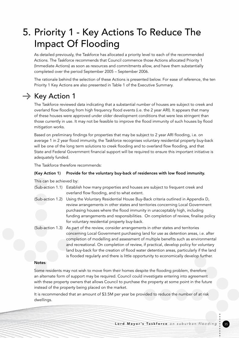
L o r d M a y o r ’ s T a s k f o r c e o n s u b u r b a n f l o o d i n g 35
5. Priority 1 - Key Actions To Reduce The Impact Of FloodingAs deta�led prev�ously, the Taskforce has allocated a pr�or�ty level to each of the recommended Act�ons. The Taskforce recommends that Counc�l commence those Act�ons allocated Pr�or�ty 1 (Immed�ate Act�ons) as soon as resources and comm�tments allow, and have them substant�ally completed over the per�od September 2005 – September 2006.
The rat�onale beh�nd the select�on of these Act�ons �s presented below. For ease of reference, the ten Pr�or�ty 1 Key Act�ons are also presented �n Table 1 of the Execut�ve Summary.
Key Action 1The Taskforce rev�ewed data �nd�cat�ng that a substant�al number of houses are subject to creek and overland flow flood�ng from h�gh frequency flood events (�.e. the 2 year ARI). It appears that many of these houses were approved under older development cond�t�ons that were less str�ngent than those currently �n use. It may not be feas�ble to �mprove the flood �mmun�ty of such houses by flood m�t�gat�on works.
Based on prel�m�nary find�ngs for propert�es that may be subject to 2 year ARI flood�ng, �.e. on average 1 �n 2 year flood �mmun�ty, the Taskforce recogn�ses voluntary res�dent�al property buy-back w�ll be one of the long term solut�ons to creek flood�ng and to overland flow flood�ng, and that State and Federal Government financ�al support w�ll be requ�red to ensure th�s �mportant �n�t�at�ve �s adequately funded.
The Taskforce therefore recommends:
(Key Action 1) Provide for the voluntary buy-back of residences with low flood immunity.
Th�s can be ach�eved by:
(Sub-act�on 1.1) Establ�sh how many propert�es and houses are subject to frequent creek and overland flow flood�ng, and to what extent.
(Sub-act�on 1.2) Us�ng the Voluntary Res�dent�al House Buy-Back cr�ter�a outl�ned �n Append�x D, rev�ew arrangements �n other states and terr�tor�es concern�ng Local Government purchas�ng houses where the flood �mmun�ty �n unacceptably h�gh, �nclud�ng fund�ng arrangements and respons�b�l�t�es. On complet�on of rev�ew, final�se pol�cy for voluntary res�dent�al property buy-back.
(Sub-act�on 1.3) As part of the rev�ew, cons�der arrangements �n other states and terr�tor�es concern�ng Local Government purchas�ng land for use as detent�on areas, �.e. after complet�on of modell�ng and assessment of mult�ple benefits such as env�ronmental and recreat�onal. On complet�on of rev�ew, �f pract�cal, develop pol�cy for voluntary land buy-back for the creat�on of flood water detent�on areas, part�cularly �f the land �s flooded regularly and there �s l�ttle opportun�ty to econom�cally develop further.
Notes:
Some res�dents may not w�sh to move from the�r homes desp�te the flood�ng problem, therefore an alternate form of support may be requ�red. Counc�l could �nvest�gate enter�ng �nto agreement w�th these property owners that allows Counc�l to purchase the property at some po�nt �n the future �nstead of the property be�ng placed on the market.
It �s recommended that an amount of $3.5M per year be prov�ded to reduce the number of at r�sk dwell�ngs.

36
Key Actions 2 and 3The Taskforce found that aspects of plann�ng, and development and bu�ld�ng controls �n C�ty Plan need to be strengthened to deal w�th the follow�ng �ssues:
• Land use plann�ng may not be effect�vely prevent�ng or manag�ng development �n waterway corr�dors and floodpla�n areas.
• C�ty Plan should address the effects that cumulat�ve fill�ng of waterways and floodpla�ns have on flood�ng to downstream, upstream and adjacent commun�t�es.
• C�ty Plan and ex�st�ng Local Laws for the m�t�gat�on of local, creek and floodpla�n flood�ng may be �neffect�ve or not adequately enforced (eg. by fa�l�ng to prevent unauthor�sed or unlawful fill�ng of s�tes).
• State Government leg�slat�on and perm�t cond�t�ons may be �mped�ng the �mplementat�on of effect�ve flood m�t�gat�on measures.
• Development across the c�ty �s �ncreas�ng �mperv�ous areas, caus�ng runoff to �ncrease and reach creeks faster than �n undeveloped catchments.
Counc�l should undertake a comprehens�ve rev�ew of land use plann�ng controls as spec�fied �n C�ty Plan, to ensure that development (greenfield) and redevelopment (�nfill) take �nto account the�r cumulat�ve �mpact, and that there are no adverse �mpacts on propert�es from flood�ng, and that ecolog�cal funct�ons are reta�ned.
C�ty Plan and bu�ld�ng leg�slat�on need to be enhanced to ensure controls are adequate to ensure that developments and bu�ld�ngs do not adversely �mpact on flood�ng or dra�nage of propert�es that are upstream, downstream, and adjacent. State Government has a key role to play �n th�s Act�on by enhanc�ng relevant leg�slat�on and controls.
The Taskforce therefore recommends:
(Key Action 2) Review and strengthen, where necessary, land use planning controls in City Plan to ensure no adverse impact from flooding.
Th�s can be ach�eved by:
(Sub-act�on 2.1) Option A (Supported by 6 votes out of 10 possible votes) - Create ‘Flood�ng Code’ as a Pr�mary Code �n C�ty Plan spec�fic to both greenfield and �nfill developments. All Sub-act�ons relevant to th�s new Flood�ng Code are to be cons�dered for �nclus�on �n �t.
Option B (Supported by 2 votes out of 10 possible votes) - The C�ty Plan should cons�der flood�ng and cl�mate change as s�gn�ficant.
Option A is to be adopted.
(Sub-act�on 2.2) Control fill�ng w�th�n overland flow paths, waterway corr�dors and floodpla�ns espec�ally w�th regards to ‘cumulat�ve �mpact’.
(Sub-act�on 2.3) Reassess the allowance �n C�ty Plan of 1.0m of fill to be placed w�thout approval �n Waterway Corr�dor, overland flow paths and flood r�sk areas.

L o r d M a y o r ’ s T a s k f o r c e o n s u b u r b a n f l o o d i n g 37
Sub-act�on 2.4) Option A (Supported by 6 votes out of 10 possible votes) - Proh�b�t development and fill�ng �ns�de C�ty Plan Waterway Corr�dors. The object�ve �s to protect and enhance the water flow, water qual�ty, ecology, and open space, and recreat�onal and amen�ty values of the C�ty’s waterways, subject to ground truth�ng of the Waterway Corr�dor.
Option B (Supported by 4 votes out of 10 possible votes) - C�ty Plan rev�ew to �ncorporate performance cr�ter�a that spec�fically address flood�ng and requ�re no adverse �mpact to downstream, upstream and adjacent propert�es or ecolog�cal processes, tak�ng �nto full account the cumulat�ve effect.
Option A is to be adopted.
(Sub-act�on 2.5) Restr�ct further fill�ng and development w�th�n the area of 100 year ARI or Defined Flood Event flood to sat�sfy the new ‘Flood�ng Code’ �n Sub-act�on 2.1. (6 votes for, 2 against out of 8 possible votes).
(Sub-act�on 2.6) Develop gu�del�nes/ pract�ce documents for spec�fic catchments, spec�fically for the �ssues of the catchment or potent�al new development areas.
(Sub-act�on 2.7) Invest�gate �f the plann�ng process can reduce the magn�tudes of peak flows.
(Sub-act�on 2.8) Make prov�s�on �n Counc�l Pol�cy, C�ty Plan and Codes to not allow the pract�ce of cut and fill �n Waterway Corr�dors where there w�ll be an adverse effect on the �ncremental flood storage. (7 votes for, 1 against out of 8 possible votes).
Notes:
The est�mated cost for th�s Act�on �s $150K.
(Key Action 3) Review and strengthen, where necessary, development and building controls in City Plan to ensure no adverse impact from flooding.
Th�s can be ach�eved by:
(Sub-act�on 3.1) As a matter of pr�or�ty and subject to a successful tr�al, Counc�l �dent�fies and places dra�nage and overland flow easements on B�MAP and flags �n C�ty Plan 2000. Seek amendment to IPA to requ�re easement owners to s�gn/ approve an appl�cat�on for development on a property. It needs to be a requ�rement for appl�cat�ons that owners of r�ghts over land, eg. easement owners, approve of appl�cat�ons (currently only the owner and the developer need to s�gn appl�cat�ons).
(Sub-act�on 3.2) Amend the C�ty Plan House Code to requ�re that ‘lots on land that �s subject to flood�ng’ are to be code assessable aga�nst the requ�rements of the ‘Flood�ng Code’ recommended �n Act�on 2 Sub-act�on 2.1.
(Sub-act�on 3.3) Rev�ew arrangements �n other states and terr�tor�es concern�ng Local, State and Federal Government respons�b�l�ty and fund�ng for ‘house-ra�s�ng’ as a means of reduc�ng flood damage and, �f a local Government respons�b�l�ty, determ�ne pol�cy on house ra�s�ng. House ra�s�ng w�ll not be cons�dered where offer of Voluntary Buy-Back has been decl�ned (refer Appendix D).
(Sub-act�on 3.4) Update current bu�ld�ng regulat�ons/ controls/ adv�ce and gu�del�nes that relate to the ‘flood proofing’ of propert�es �n flood-prone areas. Standards w�ll apply to both new construct�on and redevelopment works.
(Sub-act�on 3.5) Cons�der relax�ng 8.5m roof he�ght where relaxat�on �s requ�red to ach�eve non-flood hab�table areas where houses are �dent�fied as be�ng �n one of the flood�ng categor�es.

38
(Sub-act�on 3.6) Subject to a cost benefit assessment, where �nfill development �s proposed and the cond�t�on status of ex�st�ng dra�nage �nfrastructure �s not known, the carry�ng capac�ty �s to be establ�shed pr�or to development approval.
(Sub-act�on 3.7) Rev�ew C�ty Plan Waterway Code Performance Cr�ter�a to determ�ne �f developer contr�but�on �s suffic�ent to ma�nta�n b�od�vers�ty and stormwater management �n waterway Corr�dors and land that �s subject to flood�ng.
(Sub-act�on 3.8) Amend and strengthen codes/ pol�c�es based on appropr�ate qual�ty modell�ng. Develop a best pract�ce document to support codes and pol�c�es.
(Sub-act�on 3.9) Rev�ew bu�ld�ng standards for �nfill development to promote suspended floors to avo�d need for cut and fill.
(Sub-act�on 3.10) Accept alternate solut�ons on remnant blocks �n bu�lt up areas where a better outcome for water qual�ty and susta�nab�l�ty would result from development.
(Sub-act�on 3.11) Recogn�s�ng that �ndustr�al developments have large roof and hard surface areas, Counc�l should encourage �ntegrated water management measures �n these developments.
(Sub-act�on 3.12) Ident�fy appropr�ate water cycle outcomes �nclud�ng development footpr�nts for �ndustr�al lots where there are areas of valuable eco-hydrolog�cal funct�ons �nclud�ng flood storage and waterway funct�ons.
(Sub-act�on 3.13) Ma�ntenance plans for ex�st�ng structural flood controls, eg. m�t�gat�on schemes, detent�on bas�ns, the three water supply reservo�rs, should be �n place to ensure the�r flood read�ness and effect�veness.
Notes:
Pr�or�ty Act�on 3 should be undertaken �n conjunct�on w�th Pr�or�ty Act�on 2.
The est�mated cost for th�s Act�on �s $100K.
Key Action 4The Taskforce concluded that Counc�l should refine �ts flood r�sk management plann�ng process to address the concerns of all stakeholders, �nclud�ng the commun�ty. Counc�l should also rev�ew select�on pr�or�t�es �n dra�nage works programs to ensure that they reflect current commun�ty expectat�ons/ needs. Commun�cat�on between the commun�ty, Counc�l and Federal and State agenc�es needs to be strengthened.
Counc�l should �nclude stakeholders �n the plann�ng process by creat�ng a Reference Group.
The Taskforce therefore recommends:
(Key Action 4) Determine and establish an appropriate forum to consult with and provide feedback in respect of Council’s flood risk management planning process and the implementation of Taskforce’s recommendations.
Th�s can be ach�eved by:
(Sub-act�on 4.1) Ensure cons�stency �n Counc�l’s pol�c�es and pract�ces.
(Sub-act�on 4.2) Ensure plann�ng controls on new development on ex�st�ng s�tes ach�eve no adverse �mpact on flood�ng.
L o r d M a y o r ’ s T a s k f o r c e o n s u b u r b a n f l o o d i n g 39
(Sub-act�on 4.3) Counc�l to work w�th EPA on SEQ Coastal Management Plan to ensure that flood m�t�gat�on �s �ncluded as a cons�derat�on along s�de env�ronmental protect�on.
(Sub-act�on 4.4) Counc�l to l�a�se w�th State Government to ensure that plann�ng leg�slat�on �s amended, �f necessary, �n order that proposed developments take full account of cumulat�ve effects on flood�ng so that developments do not adversely �mpact on flood�ng or dra�nage of propert�es that are upstream, downstream, and adjacent to the subject s�te.
(Sub-act�on 4.5) Lobby State Government for the removal of �njur�ous affect�on prov�s�ons of IPA - (3 votes for, 2 against out of 7 possible votes).
(Sub-act�on 4.6) Strateg�c perm�ts from State Government should be negot�ated to fac�l�tate flood m�t�gat�on des�gn, construct�on and ma�ntenance works.
(Sub-act�on 4.7) Prov�de cop�es of the Taskforce Report to those respons�ble for the preparat�on of the state flood r�sk management pol�cy and the SEQ d�saster commun�cat�on strategy.
(Sub-act�on 4.8) Ensure flood �nformat�on prov�ded �s supported by accred�ted �ndependent profess�onal experts, for qual�ty assurance and ver�ficat�on.
(Sub-act�on 4.9) Solut�ons should be mult� purpose, eg. �nclude soc�o-econom�c, ecolog�cal, amen�ty, natural resource and cultural aspects of land use across flood-prone areas, as well as the assoc�ated flood r�sk and hazard.
(Sub-act�on 4.10) Solut�ons should address whole of catchment �ssues.
(Sub-act�on 4.11) Flood management budget to be gu�ded by clear cr�ter�a transparent to the commun�ty.
(Sub-act�on 4.12) Rev�ew ma�ntenance fund�ng and, �f necessary, �ncrease budget allocat�on.
(Sub-act�on 4.13) Ident�fy opportun�t�es and determ�ne the appropr�ate nature and means for commun�ty consultat�on �n Counc�l’s flood r�sk management plann�ng process. External stakeholders and representat�ves of flood-prone commun�t�es should be represented at th�s forum. Spec�al attent�on should be pa�d to �mprov�ng consultat�on and awareness w�th flood-prone commun�t�es.
(Sub-act�on 4.14) Clar�fy w�th�n Counc�l that Water Resources �s the lead agent �n Counc�l for Waterway Corr�dors, to el�m�nate �nter-agency confl�ct�ng agendas/ �nterpretat�ons.
(Sub-act�on 4.15) Clar�fy flood r�sk management roles and respons�b�l�t�es w�th�n Counc�l’s bus�ness un�ts and amend �f necessary.
(Sub-act�on 4.16) Prov�de feedback on the rev�ews of C�ty Plan and Local Laws to ensure the recommended m�x of Management Measures from th�s report are �ncorporated �nto the appropr�ate statutory �nstruments, eg. land use plans, codes of bu�ld�ng and development cond�t�ons, local emergency plans, etc.
(Sub-act�on 4.17) Rev�ew consultat�ve arrangements, part�cularly w�th regards to the prov�s�on of financ�al support, w�th Federal and State agenc�es and other SEQ Counc�l’s and amend �f necessary.
(Sub-act�on 4.18) Prov�de feedback on what �s acceptable r�sk of flood�ng �n houses �n older areas.
Notes:
The est�mated cost for th�s Act�on �s $200K, wh�ch �ncludes prov�s�on for a temporary pos�t�on to �mplement the Taskforce’s Key Act�ons.

40
Key Action 5The Taskforce �dent�fied the need for a data set of propert�es affected by h�stor�cal flood�ng and potent�ally flood prone propert�es (those below Counc�l des�gn standards). Counc�l should rev�ew how creek and local flood�ng events, and construct�on and ma�ntenance works are recorded.
Counc�l has extens�ve flood �nformat�on and should �dent�fy, rev�ew and document the flood �nformat�on needs of all stakeholders, �nclud�ng the commun�ty, bus�ness, Counc�l and State Government. Counc�l should cons�der prov�d�ng flood �nformat�on on �nd�v�dual propert�es free of charge (currently res�dents pay $16 for th�s report).
The Taskforce therefore recommends:
(Key Action 5) Establish Flood Information Data Base.
Th�s can be ach�eved by:
(Sub-act�on 5.1) Develop a Bus�ness Case for Counc�l hav�ng a spec�fic flood data management system to ass�st w�th the management and use of flood and flood management data and �nformat�on. Base on ex�st�ng purpose des�gned Flood Informat�on Management Systems (FIMS) and Dec�s�on Support Systems (DSS). Cons�der whether current Counc�l databases could form the bas�s of such a system.
(Sub-act�on 5.2) L�a�se w�th State Government (NRM) concern�ng l�kely data and �nformat�on requ�rements under the proposed Queensland flood pol�cy, and ensure that data and �nformat�on collect�on, storage and retr�eval procedures conform w�th the proposed requ�rements.
(Sub-act�on 5.3) Rev�ew the extent to wh�ch Counc�l’s current flood and flood management data and �nformat�on are geo-referenced and determ�ne whether geo-referenc�ng of further data �s requ�red.
(Sub-act�on 5.4) Create a record/ reg�ster of the h�story of flood�ng �n Br�sbane and a process to keep the records current, �nclud�ng h�stor�cal �nformat�on about fill�ng and potent�al flood�ng. Make ava�lable to the publ�c.
(Sub-act�on 5.5) Make accurate flood l�nes ava�lable to publ�c.
(Sub-act�on 5.6) Make flood stud�es held �n arch�ves ava�lable to publ�c.
(Sub-act�on 5.7) Produce spec�al bu�ld�ng overlays and maps show�ng major and m�nor overland paths.
(Sub-act�on 5.8) Make all �nformat�on on flood�ng ava�lable to the commun�ty free of charge.
(Sub-act�on 5.9) Develop electron�c database to record ‘as-constructed’ �nformat�on, connect�ons to p�pe systems, etc.
(Sub-act�on 5.10) Counc�l to dev�se and �nst�tute appropr�ate cost codes to track t�me and expenses spent on flood r�sk management across Counc�l’s var�ous bus�ness un�ts.
(Sub-act�on 5.11) Ensure the Flood �nformat�on Data Base �s ava�lable to Flood Emergency Managers.
Notes:
The est�mated cost to establ�sh flood �nformat�on management system �s $150K. Prov�d�ng free flood �nformat�on w�ll result �n loss of approx $300K of annual revenue for th�s serv�ce.

L o r d M a y o r ’ s T a s k f o r c e o n s u b u r b a n f l o o d i n g 41
Key Action 6Res�dents want effect�ve flood forecast�ng for creek, waterway and floodpla�n events, and flood warn�ng systems. Counc�l should ensure that flood �nformat�on �s t�mely and adequate for the purposes of flood management dec�s�on-mak�ng (eg. flood warn�ng, flood defence, evacuat�on and rout�ne flood �nformat�on).
The Taskforce therefore recommends:
(Key Action 6) Investigate the establishment of local flood advice, forecasting and warning systems.
Th�s can be ach�eved by:
(Sub-act�on 6.1) Determ�ne whether s�gn�ficant flood pla�n changes have affected the relevance of current forecast�ng and upgrade �f necessary.
(Sub-act�on 6.2) Network at the local level to ach�eve better gather�ng of �nformat�on.
(Sub-act�on 6.3) Ensure that flood forecast�ng and warn�ng act�v�t�es are well coord�nated and cons�stent.
(Sub-act�on 6.4) Prov�de feedback to the commun�ty on the �mpact of major storm events (post storm adv�ce/ learn�ngs).
(Sub-act�on 6.5) Make Counc�l’s FloodW�se system SMS and web enabled.
(Sub-act�on 6.6) Prov�de flash�ng l�ght warn�ng systems on all roads at creek cross�ngs.
(Sub-act�on 6.7) Prov�de flash flood�ng warn�ng to res�dents prone to creek flood�ng.
(Sub-act�on 6.8) Rev�ew Counc�l’s flood adv�ce act�v�t�es w�th the v�ew to defin�ng scr�pt�ng and standard operat�ng procedures etc., to ensure that adv�ce �s rel�able and effect�vely del�vered under vary�ng caller c�rcumstances. Assess the need to prov�de tra�n�ng �n these procedures and del�ver any necessary tra�n�ng.
(Sub-act�on 6.9) Develop and test programs to �mprove the flood awareness and flood read�ness of flood-prone commun�t�es and �nd�v�duals.
(Sub-act�on 6.10) Determ�ne ‘standard’ warn�ng adv�ces and formats that are su�table for d�ssem�nat�on to the commun�ty.
(Sub-act�on 6.11) Counc�l/ SES to prov�de spec�fic �nformat�on from ‘on ground’ staff, eg. use GPS technology as part of flood adv�ce/ �nformat�on systems.
(Sub-act�on 6.12) Develop �nternet solut�ons and use of rad�o and TV for commun�cat�on of flood forecasts - needs to be spec�fic.
(Sub-act�on 6.13) As part of the flood r�sk management process, ascerta�n what flood affected res�dents need most for preparat�on for flood�ng.
(Sub-act�on 6.14) Set up a Counc�l/ commun�ty flood warn�ng network eg. a pyram�d based structure – des�gnated Counc�l officer/ catchment commun�ty contact/ commun�ty web or network.
Notes:
G�ven that State and Federal Government agenc�es have respons�b�l�t�es for forecast�ng and emergency serv�ces, th�s Act�on needs to be undertaken �n partnersh�p w�th these agenc�es.
The total est�mated cost for th�s Act�on �s $1.65M - $150K for �n�t�al rev�ew/ evaluat�on of upgrade to ex�st�ng systems, $150K for Counc�l-w�de scr�pt�ng and standard operat�ng procedures etc., $100K for flash�ng l�ghts at cross�ngs (5 x $20K s�tes), $200K for systems development (‘FloodW�se’ on web), $900K for telemetry stat�ons (30 x $30K s�tes) and $150K for commun�cat�ons technology.

42
Key Action 7The Taskforce �dent�fied the need to prov�de the commun�ty (and other key stakeholders) w�th better educat�on on the follow�ng �ssues:
• the extent of local flood�ng that occurs throughout Br�sbane;
• the accuracy of �nformat�on/ results of flood report/ �nvest�gat�ons undertaken by Counc�l; and
• ‘best pract�ce’ flood r�sk management pr�nc�ples.
Counc�l should develop external educat�on and commun�cat�on programs for res�dents and bus�nesses to �mprove the�r understand�ng of flood�ng �ssues and to enable them to respond to poss�ble flood�ng of the�r property.
The Taskforce therefore recommends:
(Key Action 7) Develop external education programs to improve the community’s understanding of flooding.
Th�s can be ach�eved by:
(Sub-act�on 7.1) Clearly expla�n the requ�rements of C�ty Plan to the commun�ty, developers and pr�vate cert�fiers.
(Sub-act�on 7.2) Make commun�ty aware of the �mpact on downstream �nfrastructure from �nstallat�on of p�pes and hard surfaces, eg. �ncreased runoff.
(Sub-act�on 7.3) Inform the commun�ty of the facts about creek flood�ng. For example, clear�ng �nstream and r�par�an vegetat�on can worsen flood�ng.
(Sub-act�on 7.4) Undertake targeted �nformat�on campa�gns rather than broad scale campa�gns.
(Sub-act�on 7.5) Inform commun�ty about effects of debr�s �n creeks.
(Sub-act�on 7.6) Adv�se commun�ty of the need to obta�n �nformat�on about flood�ng before purchase of property.
(Sub-act�on 7.7) Determ�ne how to ensure the commun�ty accepts, as be�ng accurate, Flood�ng Reports/ Invest�gat�ons and general �nformat�on prov�ded by Counc�l (a key part of the educat�on process).
(Sub-act�on 7.8) Increase commun�ty awareness of the mult�-benefits of waterway catchments and floodways, and the need to balance the�r funct�ons, eg. ecolog�cal and flood capac�ty.
(Sub-act�on 7.9) Inform commun�ty on how to behave dur�ng flood, preparedness, cr�s�s and post event, eg. through safe dr�v�ng and ch�ldren’s play safety (creeks/ dra�ns/ b�ke paths) etc.
(Sub-act�on 7.10) Each year, conduct a summer campa�gn to prepare commun�ty for flood�ng eg. v�a �nternet, TV etc.
(Sub-act�on 7.11) Ass�st flash flood affected commun�t�es w�th educat�on mater�al regard�ng flash floods.
Notes:
The est�mated cost for th�s Act�on �s $500K.

L o r d M a y o r ’ s T a s k f o r c e o n s u b u r b a n f l o o d i n g 43
Key Action 8Counc�l’s process for the select�on of cap�tal works projects should be rev�ewed and pr�or�ty should be g�ven to the approval of projects that take �nto account a su�te of poss�ble solut�ons to reduce flood�ng �mpacts on res�dent�al areas. Programm�ng should be orderly and select�on should be undertaken on a ‘whole of catchment’ bas�s, �.e. no job should be cons�dered �n �solat�on, except where overland flow �ssues need to be dealt w�th.
The Taskforce therefore recommends:
(Key Action 8) Ensure a ‘whole of catchment’ process is undertaken when selecting Capital Works projects.
Th�s can be ach�eved by:
(Sub-act�on 8.1) Pr�or�t�es for works/ act�ons des�gned to reduce flood�ng �mpacts are
• res�dent�al hab�table l�v�ng areas
• res�dent�al ut�l�ty areas
• commerc�al floor areas
• yards.
(Sub-act�on 8.2) When develop�ng pr�or�t�es of works, the benefits of the project are to be quant�fied and spec�fically state what ARI flood event these works are focussed on, or what r�sk �s be�ng m�n�m�sed, �nclud�ng cost versus benefit and frequency of benefit.
(Sub-act�on 8.3) G�ve pr�or�ty to work �n low ly�ng areas part�cularly downstream of development.
(Sub-act�on 8.4) Max�m�se capac�t�es of waterways, floodpla�ns, etc. subject always to no worsen�ng downstream.
(Sub-act�on 8.5) Cons�der flood m�t�gat�on schemes as an opt�on �n all cases.
(Sub-act�on 8.6) Prov�de rel�ef dra�ns for bottlenecks.
(Sub-act�on 8.7) Include opportun�t�es for soc�al benefits eg. recreat�onal parks from flood m�t�gat�on works, �n assess�ng cost benefits.
(Sub-act�on 8.8) Include use of detent�on bas�ns, �nfiltrat�on systems and other storage schemes, as opt�ons �n all cases.
Notes:
The est�mated cost to rev�ew the process �s $20K.

44
Key Action 9Counc�l should rev�ew the creek and local flood�ng data needs of all stakeholders, �nclud�ng the commun�ty, to ensure that appropr�ate data �n appropr�ate formats are generated and del�vered by flood stud�es.
The Taskforce therefore recommends:
(Key Action 9) Review the creek and local flooding data needs of all stakeholders, including the community, and if necessary, upgrade current flood study procedures and modelling methodology.
Th�s can be ach�eved by:
(Sub-act�on 9.1) Aud�t ex�st�ng processes.
(Sub-act�on 9.2) Use ‘pla�n Engl�sh’ word�ng for s�mpl�fied reports/ recommendat�ons.
(Sub-act�on 9.3) Implement a Qual�ty Assurance (QA) system to engender confidence �n the process.
(Sub-act�on 9.4) Develop a strateg�c approach to modell�ng across c�ty.
(Sub-act�on 9.5) Select and adopt, wherever appropr�ate, a su�te of ‘standard’ analyt�cal methods best su�ted for flood stud�es �n Br�sbane.
(Sub-act�on 9.6) Assess how the cumulat�ve �mpact from new development �s determ�ned.
(Sub-act�on 9.7) Develop a s�mple and effect�ve standard procedure for undertak�ng flood damage assessment stud�es dur�ng flood stud�es.
(Sub-act�on 9.8) Involve the commun�ty and get the�r feedback dur�ng the process of do�ng flood reports/ �nvest�gat�on.
(Sub-act�on 9.9) Include h�stor�c �nformat�on �n flood study reports.
(Sub-act�on 9.10) Develop �mproved flood models for larger catchments eg. Oxley.
(Sub-act�on 9.11) Aud�t catchment by catchment to determ�ne �f developments have had adverse effects on downstream catchments.
(Sub-act�on 9.12) Catchment aud�ts should cons�der urban �nfill project�ons.
(Sub-act�on 9.13) Mon�tor works that have been establ�shed to ensure benefits have been real�sed.
(Sub-act�on 9.14) Seek solut�ons that have mult�ple benefits, eg. env�ronmental, soc�al and econom�c (such as reduced ma�ntenance or repa�r).
(Sub-act�on 9.15) Determ�ne the nature, names and means of defin�ng the ‘hydraul�c categor�es’ used as a bas�s for prescr�b�ng land use controls �n flood-prone areas.
(Sub-act�on 9.16) Adopt a procedure for ass�gn�ng ‘hazard categor�es’ as a bas�s for prescr�b�ng land use controls �n flood-prone areas.
(Sub-act�on 9.17) Collect flood behav�our data needed for a ‘flood hazard analys�s’, develop a ‘standard’ procedure for assess�ng hazard �n flood stud�es, and ensure that the necessary data are generated by flood stud�es.
(Sub-act�on 9.18) Establ�sh the s�ze and s�gn�ficance of overland flow and creek tr�butary flood�ng problems �n Br�sbane and assess the feas�b�l�ty and accuracy of develop�ng a ‘rap�d means’ of address�ng these problems.
(Sub-act�on 9.19) Use local catchments, for wh�ch comprehens�ve flood study results are ava�lable, as case stud�es to develop procedures for analys�ng overland flow and creek tr�butary flood�ng.
(Sub-act�on 9.20) Rev�ew past Stormwater Management Plans to set up �nfrastructure plans for areas to be redeveloped.

L o r d M a y o r ’ s T a s k f o r c e o n s u b u r b a n f l o o d i n g 45
(Sub-act�on 9.21) Before any new fill�ng �s approved w�th�n a floodpla�n, modell�ng should be undertaken to determ�ne whole of catchment �mpacts, �nclud�ng cumulat�ve �mpacts.
(Sub-act�on 9.22) Ascerta�n whether or not development across the c�ty �s �ncreas�ng �mperv�ous areas. Determ�ne what the real �mpact �s on creek and overland flow flood�ng.
Notes:
The est�mated cost for th�s Act�on �s $500K/ year over three years.
Key Action 10Counc�l’s object�ve should be to clearly define and meet �ts legal and adm�n�strat�ve respons�b�l�t�es and obl�gat�ons under ex�st�ng and proposed state and federal leg�slat�on and �n�t�at�ves and under common law. Prev�ous �nvest�gat�on has been conducted on Counc�l’s legal pos�t�on regard�ng flood�ng. Th�s work �s conta�ned �n the document ‘Risk Based Approach to Flood Management - Benchmarking Component’. As a sect�on of th�s report has d�rect relevance to the �mplementat�on of var�ous components of th�s strategy, �t has been �ncluded as Appendix E.
The Taskforce therefore recommends:
(Key Action 10) Review Council’s Legal Liabilities.
Th�s can be ach�eved by:
(Sub-act�on 10.1) Clearly define Counc�l’s flood r�sk management obl�gat�ons under federal and state leg�slat�on and arrangements and under common law duty of care requ�rements.
(Sub-act�on 10.2) Rev�ew Counc�l’s adm�n�strat�ve obl�gat�ons under the Local Government F�nance Standard.
(Sub-act�on 10.3) Determ�ne Counc�l’s legal l�ab�l�ty �f the publ�c �s prov�ded w�th �ncorrect flood adv�ce.
(Sub-act�on 10.4) Determ�ne what l�ab�l�t�es Counc�l �ncurs from prov�d�ng flood r�sk data to the �nsurance �ndustry for prem�um sett�ng purposes.
(Sub-act�on 10.5) Invest�gate requ�rements for compensat�on/ purchase of propert�es that may be used as retent�on/ detent�on bas�ns due to future development. These are l�kely to be small acreage propert�es.
(Sub-act�on 10.6) Determ�ne Counc�l’s respons�b�l�ty to prov�de flood forecast and flood warn�ng adv�ce to the publ�c.
Notes:
The est�mated cost for spec�al�st legal adv�ce �s $50K.

46
6. Flood Mitigation FundingAt the t�me of the 1974 flood�ng, flood m�t�gat�on works were be�ng carr�ed out under a scheme of fund�ng wh�ch was spl�t:
• 40% Federal, 40% State and 20% Local.
Under th�s fund�ng, the follow�ng schemes were constructed:
• Z�llman Waterholes
– channel w�dened from Groth Road to Sandgate Road
• Breakfast/ Enoggera Creek
– dam strengthened and ra�sed
– channel w�dened from Kelv�n Grove Road to Br�sbane R�ver
• Kedron Brook
– channel w�den�ng and deepen�ng Webster Road to Shaw Road
– channel works Sandy Creek tr�butary from Magura Street to Kedron Brook
• Stable Swamp Creek
– channel w�dened and deepened from Boundary Road to Beaudesert Road
– northern tr�butary channel w�dened and deepened from Orange Grove Road to Musgrave Road junct�on w�th the ma�n branch
– detent�on bas�n constructed �n Beryl Roberts Park
• Norman Creek
– channel w�dened and stra�ghtened from Deshon Street to Br�sbane R�ver
• Oxley Creek
– channel w�dened from Sherwood Road to Br�sbane R�ver
– non-t�dal channel constructed on the flood pla�n �n the v�c�n�ty of Sherwood Road together w�th a culvert under Sherwood Road
In add�t�on to the construct�on schemes l�sted above, there was a program of purchase of propert�es.
Th�s program final�sed �n approx�mately 1991 w�th the complet�on of the work �n Norman Creek.
Currently the programs of fund�ng ava�lable are:
Regional Flood Mitigation Program (RFMP)Th�s program �s funded 1/3 Local, 1/3 State, 1/3 Federal, and �s managed by the State Government. The program appl�es to the reg�ons of the state �.e. �t does not apply to Br�sbane except perhaps �n the outer fr�nges that may be cons�dered ‘reg�onal’.
The current State budget �s approx�mately $3M therefore, state w�de projects are currently worth approx�mately $9M.
Natural Disaster Mitigation Program (NDMP)Th�s program �s also funded 1/3 Local; 1/3 State; 1/3 Federal and managed by the State Government. It �s relevant to all parts of the state. Counc�l has had several projects of a plann�ng nature funded under th�s program, eg. ‘Natural D�saster R�sk Management Plann�ng’.
The current financ�al year State budget �s approx�mately $2M (�nclud�ng ongo�ng projects) therefore state w�de projects are currently worth approx�mately $6M.

L o r d M a y o r ’ s T a s k f o r c e o n s u b u r b a n f l o o d i n g 47
7. Conclusion And RecommendationsTh�s report descr�bes a framework that w�ll allow Br�sbane C�ty Counc�l to �mplement a process of flood r�sk management based on best pract�ce pr�nc�ples.
Implementat�on of the framework w�ll �nvolve s�gn�ficant work and w�ll take some t�me. To be effect�ve, �t �s essent�al that Counc�l allocate adequate resources over an appropr�ate t�me frame to �mplement the strategy. It �s suggested that �deally, the major elements of the framework should be �n place and funct�on�ng before the start of the 2006-07 flood season (November 2006). Three levels of pr�or�ty have been defined �n Section 4 for the var�ous �mplementat�on act�ons, w�th Section 5 prov�d�ng further deta�ls of the Pr�or�ty 1 Key Act�ons recommended for �mmed�ate start.
The Taskforce recommends that:
1 The ten Key Act�ons that have been allocated to Pr�or�ty 1 be started as soon as resources and comm�tments allow and that they be substant�ally completed over the per�od September 2005 to September 2006.
2 The Act�ons allocated to Pr�or�ty 2 be started no later than July 2006 and that they be substant�ally completed by December 2009.
3 The Act�ons allocated to Pr�or�ty 3 be started no later than July 2007 and that they be substant�ally completed by December 2016.
4 Counc�l create a temporary pos�t�on w�th�n Water Resources Branch for a per�od of up to twelve months. The pr�mary role of the pos�t�on w�ll be to ensure that the Taskforce’s Pr�or�ty 1 recommendat�ons are act�oned and a framework �s establ�shed for �mplementat�on of the �ntermed�ate and long term recommendat�ons.
5 The Reference Group rev�ews the progress of �mplementat�on of Recommendat�on 1 �n July 2006.
6 The Reference Group rev�ews the progress of �mplementat�on of Recommendat�ons 1, 2 and 3 �n July 2008.

48
List Of ReferencesBCC 2003, Review of Brisbane River Flood Study, prepared by Independent Rev�ew Panel (Russell Me�n (Cha�r), Col�n Apelt, John Mac�ntosh, Erw�n We�nmann) for Urban Management, BCC, Br�sbane
BCC 2004a, A Framework for Flood Risk Management by Brisbane City Council (Draft), prepared by Water Matters Pty Ltd for Urban Management, BCC, Br�sbane
BCC 2004b, Risk Based Approach to Flood Management - Benchmarking Component, prepared by Water and Env�ronment Group, C�ty Des�gn, BCC for Urban Management, BCC, Br�sbane
BoM 2001, Known Floods in the Brisbane and Bremer River Basin, updated by Peter Badd�ley for BoM, http://www.bom.gov.au/hydro/flood/qld/fld_h�story/br�sbane_h�story.shtml
BTRE 2002, Benefits of Flood Mitigation in Australia Report 106, BTRE Publ�sh�ng, Canberra, ACT
CSIRO 2000, Floodplain Management in Australia: Best Practice Principles and Guidelines, SCARM Report 73, CSIRO Publ�sh�ng, Coll�ngwood, V�ctor�a