gandy corridor project - plan hillsborough powerpoint - gandy corridor project author silval created...
TRANSCRIPT

GANDY CORRIDOR PROJECTHillsborough County MPOPolicy CommitteeApril 2013
Coordination with Community Groups• Met with representatives of:
• Gandy/ Sun Bay South• Bayside West• Port Tampa Civic• South Tampa Chamber of Commerce• Offered to meet with Bayshore Beautiful
• Neighborhood concerns:• Elevated road is a visual barrier and creates blight underneath.• What is the real demand? Traffic’s a problem only at peak hour.• The real problems are at intersections. Focus on those.
• Chamber concerns:• No official position, because project was never finalized.• Taking traffic off Gandy would kill businesses.• Maintenance Of Traffic during construction also a concern.

Project History
Project Development & Environmental Study (early 1990s)• Conducted by FDOT• From 4th St. (Pinellas) to Dale Mabry Hwy.• Recommended:
• In Pinellas County: 6-lane controlled access road• In Hillsborough: 4-lane controlled access road along
CSX corridor south of Gandy Blvd.• Not completed due to new Major Investment Study requirement

Improved Gandy Bridge (1994)• New southbound span• Re-configured northbound span• Resulted in 6-lane bridge
• Increase of 2 lanes

Major Investment Study (1996 – 2000)
• Conducted by FDOT• Many Alternatives considered• Narrowed down to 3 options:
1. Elevated 4-lane controlled access road over Gandy Blvd. & re-construction of existing Blvd. as 4-lane divided road
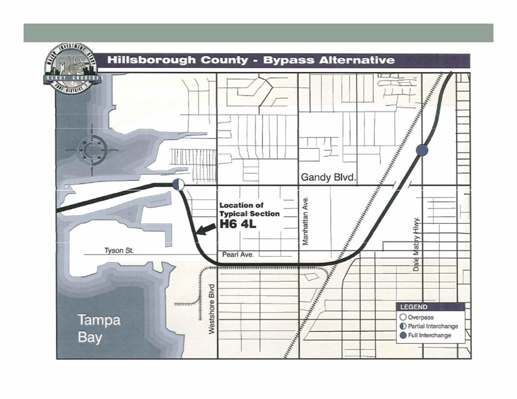
2. At-grade 4-lane By-pass south of CSX rail line, plus enhancements to existing Gandy Blvd.
3. Widening Gandy to 6 lanes (insufficient capacity per FDOT traffic forecast)
• MPO endorsed moving ahead with options 1 & 2

PD&E Study Resumed (2001 – 2002)• Conducted by FDOT• Alternatives Considered:
• Elevated 4-lane controlled access road over Gandy Blvd.
• 4-lane controlled access road along CSX right-of-way• Tunnel (determined not viable due to cost)
• Dec. 2002: MPO motion to suspend study & enhance Gandy Blvd. instead

Safety & Operational Enhancements (2006)
• Re-construction by FDOT• Raised median• Intersection improvements at Westshore Blvd. &
Manhattan Ave.• Dual Left Turn Lanes• 30 ft. medians
• Streetscape & aesthetic improvements• Lighting• Landscaping• “Main Street” look & feel
• No significant traffic capacity added

Gandy Area Transportation Study (2007)• Conducted by City of Tampa• Study area mostly south of Gandy Blvd.• Assessed needs of pending new developments • Recommended:
• Connecting Tyson Ave. from Westshore Blvd. to Manhattan Ave.
• Four-laning Westshore Blvd. from Tyson Ave. to Fair Oaks Ave.
• Adding a southbound lane on Manhattan Ave. from Gandy Blvd. to Tyson Ave.
• Other low-cost intersection and bicycle and pedestrian safety improvements.

Expressway Authority PD&E Study (2010)
• Conducted at request of City & FDOT• Recommended 2-lane elevated toll way
• Elevated structure in median of Gandy Blvd.• 30 foot height to allow visibility of businesses &
landscaping• State Environmental Impact Report prepared but not finalized by THEA

Gandy Project in the Long Range Transportation PlanLong Range
PlanAdopted Project Description
2010 Sept. 1991 Crosstown Xway 6 Lane Bypass
2015 Dec. 1995 Crosstown Xway Ext 4 Lane Bypass
2020 Nov. 1998 Gandy Corridor 4 Lane Bypass
2025 Nov. 2001 Gandy Boulevard 4 Lane Freeway
2025 Nov. 2004 Gandy Blvd. 2 Lane PartialControlled Access
2035 Dec. 2009 Gandy Blvd. 2 Lane Elevated Toll Way

Travel Demand

Travel Demand• How much traffic?
• 42,000 to 47,000 in past 10 years• 75,000 + in 2035 LRTP
• Where is the traffic going?
Travel Demand• What are the major regional projects underway and
planned?• Selmon Connector• Gandy Blvd in Pinellas County• I-275 through Westshore
• How does demand shift with construction projects?• Bay Bridges• Dale Mabry• Westshore

Emergency Evacuation
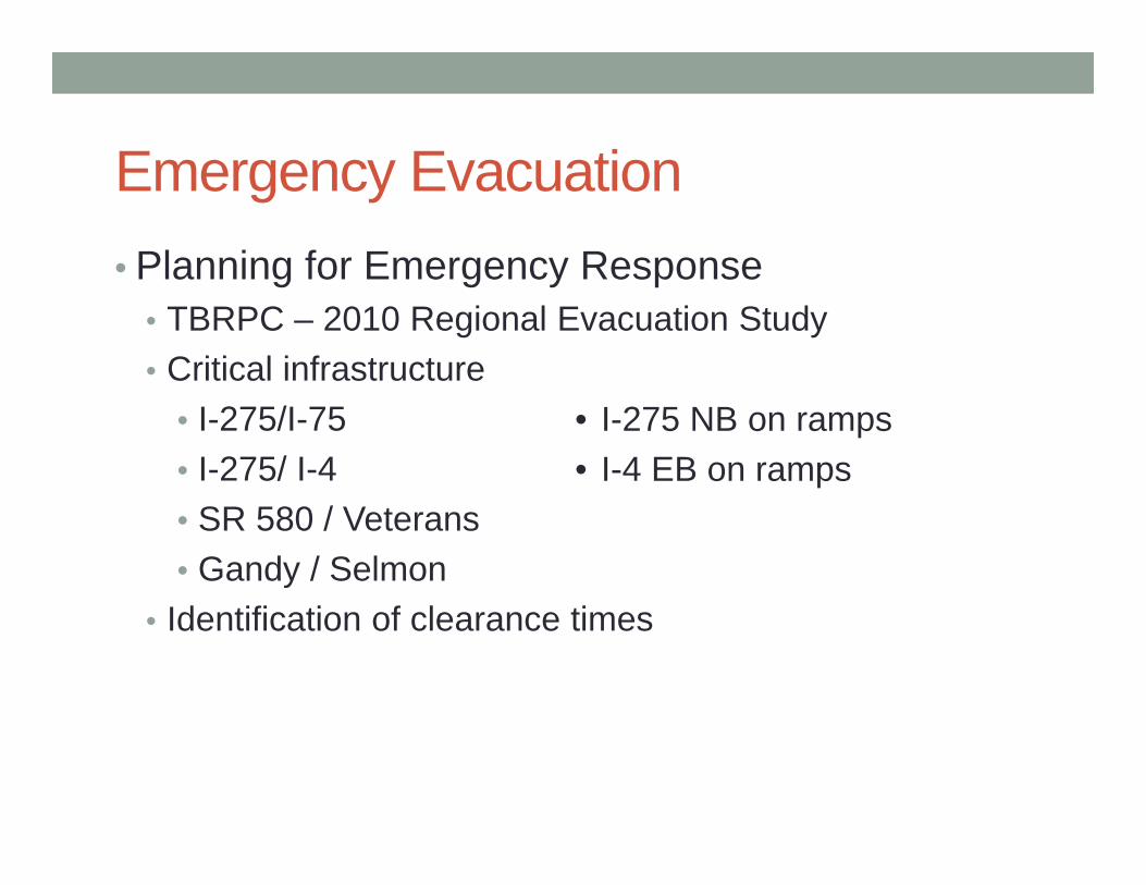
Emergency Evacuation• Planning for Emergency Response
• TBRPC – 2010 Regional Evacuation Study• Critical infrastructure
• I-275/I-75• I-275/ I-4• SR 580 / Veterans• Gandy / Selmon
• Identification of clearance times
• I-275 NB on ramps• I-4 EB on ramps

Emergency Evacuation

Emergency Evacuation• Emergency Response
• Inter-county Coordination• What is the process for timing of evacuations?• What are thresholds for closing bay bridges?

Next Steps: Public Opinion• Many community meetings & public workshops already
held• We suggest a cell phone survey of residents & business
in the zip code• Survey response is by text message, i.e. “Text your reply to…”• Can reach a much larger audience than typically attends a
community meeting, at lower cost.

Next Steps / ScheduleTopic Policy Committee Meeting
Emergency Management May 28Travel Demand Results June 25 or July 30Public Opinion Results August 27