from 2d drawings to 3d navigation networks built with fme
TRANSCRIPT

From 2D Drawings to 3D Navigation Networks with FME
Steve GriseSolution Architect, Vertex3 Inc.
Start
End

UW Seattle Routing
Room-room routing at one of the
largest campuses in the world
Over 1700 floors and 25M sq ft
2D CAD drawings for routes
FME used to transform to 3D
Synchronized updates with Floorplan changes
Hourly/daily updates with change detection
GISi Indoors routing application
2


Toronto Area Comparison
4

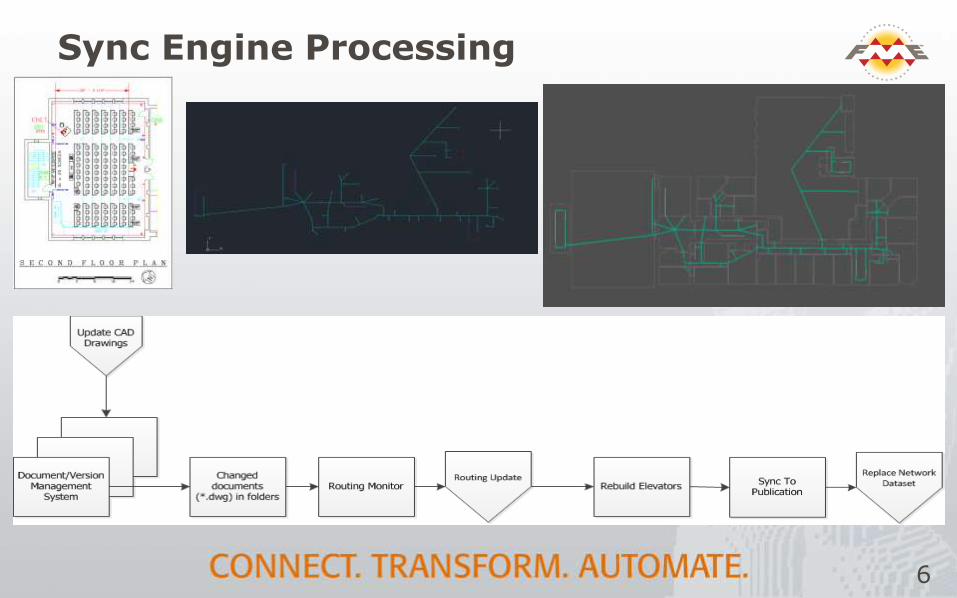
Sync Engine Processing
6
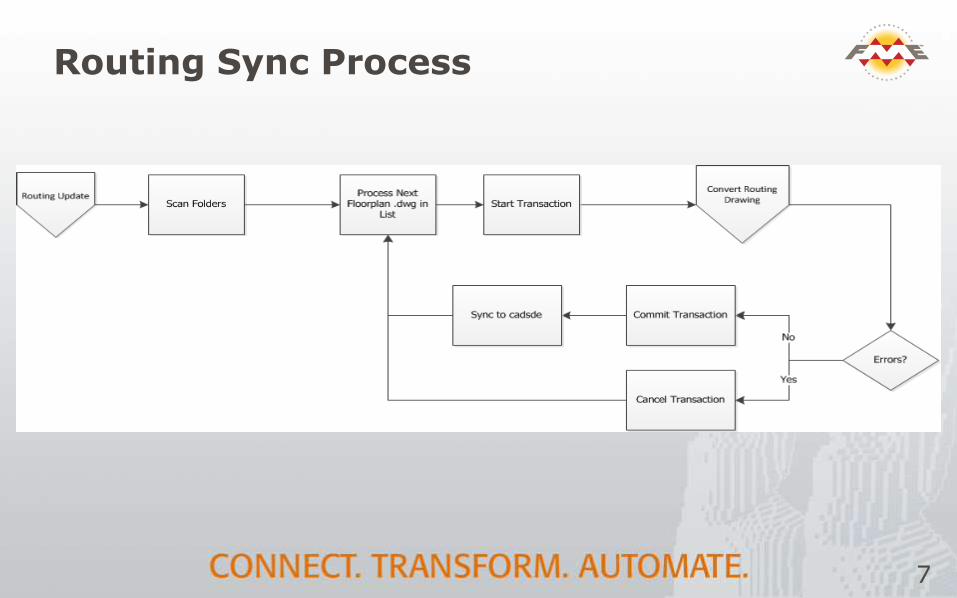
Routing Sync Process
7

Key Drawing Functions
Project data to Web Mercator
Add Z values based on layer & floor info
Add routing attributes
Create Room points
Connect Doors to Room Points
and Rooms within Rooms
Add waypoints
Sync
8

Workbench View
9

Key Building/Campus Functions
Construct Elevators
Connect floors with elevator rooms
Snap between floors
Sync
Connect exterior lines to buildings
Add points of interest
Create new file geodatabase
Sync
Build Network
Swap File Geodatabase
10
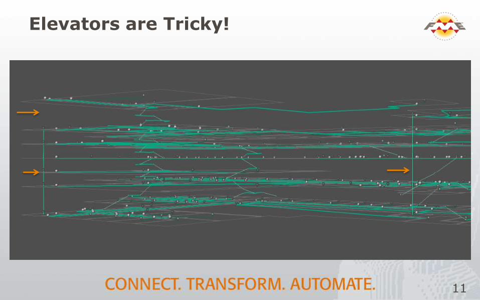
Elevators are Tricky!
11

Elevator Constructor
12

Attribute Handling
13
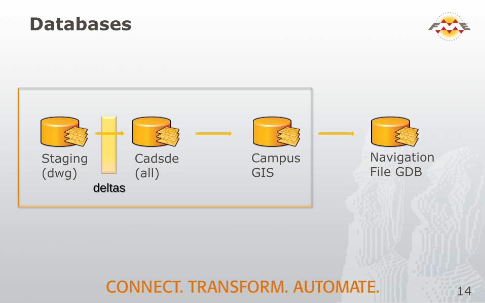
Databases
Staging(dwg)
Cadsde(all)
deltas
Campus GIS
Navigation File GDB
14

Summary
2D CAD drawings by floor
FME transformation
Floors
Buildings
Campus
3D network dataset in file Geodatabase
Navigation app
15

Thank You!
Questions?
For more information:
http://vertex3.com
http://gizinta.com
16
