form-1 with suggested terms of reference...
TRANSCRIPT

1
FORM-1 WITH SUGGESTED TERMS OF REFERENCE (ToR) FOR MINOR FISHING HARBOUR AT NAVEGAON –THAL, DIST. RAIGAD, MAHARASHTRA
FORM 1
(I) Basic Information:
S.No. Item Details
1 Name of the project/s: Construction of Minor Fishing Harbour
2 S. No. in the schedule 7(e)
3. Proposed capacity/area/length/tonnage to be
handled/command area/lease area/number of
Wells to be drilled.
Proposed total fish landing capacity is 8000 MT per annum. The fishing harbor facilities have been designed to accommodate 254 MFVs at present with addition of 75 vessels over the next 5 years.
4. New/Expansion/Modernization New
5. Existing Capacity Area etc. Fish Landing of 5000 MT/Year
6. Category of Project i.e.' A' or 'B' 'B'
7. Does it attract the general condition? If yes, Please specify.
No
8. Does it attract the specific condition? If 'yes, Please specify.
No
9. Location Lat 18° 42’(N) and Long. 72°51’(E).
Plot/Survey/Khasra No. Survey Nos. Adjacent to project Site are as follows,
Survey No. 304-( A)- Maharashtra Govt. Land.
Survey No. 304–(B) – Common Land ( Maya Soma) Survey No. 304-(C) – Gavthan Common Land
Survey No. 304-(D)- Thal Koli Community land
Survey 304-(E&F) – Muslim community Kabrasthan
Survey No. 302 ( Underi Island),
Survey No. 303- ( 1 & 2 ) ( Khanderi Island )
Village Thal and Navedar-Navgaon (on the opposite side of Thal creek)
Tehsil Alibag
District Raigad
State Maharashtra
10. Nearest railway station/airport along with
Distance in kms.
-Pen Railway Station (30 km)
- Mandawa Jetty : About 21 km
11. Nearest Town, city, District Headquarters
Along with distance in kms.
Alibag, district headquarters is about 12 km from Thal – Navgaon project area.
12. Village Panchayats, Zilla Parishad, Municipal Corporation, Local body (complete postal Address with telephone nos. to be given)
Thal and Navedar-Navgaon Gram Panchayats.

2
13. Name of the applicant Rashtriya Chemicals and Fertilizers Limited (A Govt. of India undertaking)
Thal Unit, Taluka - Alibag, District-Raigad Maharashtra, PIN -402208
14. Registered Address Rashtriya Chemicals and Fertilizers Limited (A Govt. of India undertaking)
Priyadarshini, Eastern Express Highway, Sion, Mumbai-400 022, Maharashtra
15. Address for correspondence: Rashtriya Chemicals and Fertilizers Limited (A Govt. of India undertaking)
Thal Unit, Taluka - Alibag, District-Raigad Maharashtra, PIN -402208
Name U. V. Dhatrak
Designation (Owner/Partner/CEO) ED ( Thal )
Address Rashtriya Chemicals and Fertilizers Limited (A Govt. of India undertaking)
Thal Unit, Taluka - Alibag, District-Raigad Maharashtra,
Pin Code PIN -402208
E-mail [email protected]
Telephone No. 02141-238069
Fax No. 20141-238206
16. Details of Alternative Sites examined, if any. Location of these sites should be shown on a topo sheet.
The project area comprises existing fish landing centers for which expansion of activities has been planned.
17. Interlinked Projects No
18. Whether separate application of interlinkedProject has been submitted?
Not Applicable
19. If yes, date of submission Not Applicable
20. If no, reason Not Applicable
21. Whether the proposal involves approval / clearance under: if yes, Details of the same and their status to be given.
(a) The Forest (Conservation) Act, 1980?
(b) The Wildlife (Protection) Act, 1972
(c) The C.R.Z. Notification, 1991?
1. MoEF CRZ Notification, 2011
2. MoEF EIA Notification, 2006
22. Whether there is any Government Order/ Policy relevant/ relating to the site?
CRZ Regulation / MCZMA, Maharashtra Maritime Board.
23. Forest land involved (hectares) No

3
24. Whether there is any litigation pending against the project and /or land in which the project is propose to be set up?
(a) Name of the Court
(b) Case No.
(c) Orders/directions of the Court, if any and its relevance with the proposed project.
No
Capacity corresponding to sectoral activity (such as production capacity for manufacturing, mining lease area and production capacity for mineral production, area for mineral exploration, length for linear transport infrastructure, generation capacity for power generation etc.,)
(II) Activity : Construction, operation or decommissioning of the Project involving actions,which will cause physical changes in the locality (topography, land use, changes in water bodies, etc.)
S.No. Information/Checklist confirmation Yes/No Details thereof (with approximate quantities /rates, wherever possible) with source of information data
1.1 Permanent or temporary change in land use, land cover or topography including increase in intensity of land use (with respect to local land use plan)
Yes Yes. Permanent. Low intensity change in land use/ land cover due to the construction works required for the project. The project will have negligible impact on the local land use plan. The land is ‘Government land’.
1.2 Clearance of existing land, vegetation and buildings?
Yes Clearance of existing land / vegetation required.
1.3 Creation of new land uses?
Yes Construction of Training Walls in the inter-tidal area and harbour facilities will be made in the inter-tidal area and on shore.
1.4 Pre-construction investigations e.g. bore houses, soil testing?
Yes
Bathymetry, topography and sub-soil investigations have been conducted for planning, foundation and designing of the Landing facilities.
1.5 Construction works?
Yes Activities / Infrastructure facilities to be created are :
I. Components / Activities in the Inter-tidal area and Thal creek
1) Construction of training walls in rubble mound structure
2) Dredging of entrance channel 3) Navigational aids viz. lighted
buoys/beacons 4) RC bridge across Thal creek
connecting Navagoan-Thal fishing centres

4
II. Components / Activities at Navgaon side of the creek
1) Land reclamation and revetment
2) Multi-purpose RC bored pile jetty for fish landing
3) Renovation of existing wharf with concrete surfacing, tyre-fenders, steel bollards and mooring rings
4) Fish handling and auction hall and covered fish loading area
5) Main asphalt road from Navgoan fishing village with culvert
6) Internal asphalt roads and hard surfaces
7) Vehicle parking area 8) Freshwater and seawater
supply and distribution including overhead water tank
9) Provision of fresh water outlets on the concrete wharf side
10) Area for fuel supply and storage
11) Provision for bilge water separator, spent engine oil and toxic waste collection sheds
12) Drainage and sewerage 13) Renovation of existing net
mending sheds 14) Concrete fish drying platforms
and dry fish storages 15) Fishermen gear shed 16) Fishermen rest shed 17) RC sloping hard 18) Boat repair/parking yard
behind RC sloping hard 19) Fishery administration office 20) Public toilet 21) Drainage and sewerage 22) Effluent treatment plant 23) Electrical substation 24) General electricity and high
mast lights including solar lamps
III. Components / Activities at Thal side of the creek
1) Land reclamation and revetment
2) Multi-purpose RC bored pile jetty for fish landing

5
3) Renovation of existing wharf with concrete surfacing, tyre-fenders, steel bollards and mooring rings
4) Main asphalt road from Thal fishing village
5) Internal asphalt roads and hard surfaces
6) Fish handling and auction hall and covered fish loading area
7) Vehicle parking area 8) Freshwater and seawater
supply and distribution including overhead water tank
9) Provision of fresh water outlets on the concrete wharf side
10) Area for fuel supply and storage
11) Provision for bilge water separator, spent engine oil and toxic waste collection sheds
12) Drainage and sewerage 13) Renovation of existing net
mending shed 14) Net drying yard 15) Concrete fish drying platforms 16) Fishermen gear sheds 17) Fishermen rest shed 18) RC sloping ramp for fish
landing of traditional non-mechanized boats
19) Boat repair/parking yard behind RC sloping ramp
20) Public toilet 21) Drainage and sewerage 22) Effluent treatment plant 23) General electricity and high
mast lights 24) Radio-communication tower
1.6 Demolition works? No New construction will be made on open space.
1.7 Temporary sites used for construction works or housing of construction workers?
Yes Temporary sites to be provided within the designated area of the proposed harbor areas.
1.8 Above ground buildings, structures or earthworks including linear structures, cut and fill or excavations
Yes Same as in Item No. 1.5
1.9 Underground works including mining or tunneling?
No
1.10 Reclamation works? No

6
1.11 Dredging?
No
1.12 Offshore structures? No Only shore based and foreshore facilities to be created
1.13 Production and manufacturing processes? No
1.14 Facilities for storage of goods or materials? Yes Temporary storage of construction materials during the construction phase. Existing diesel bunk with storage facilities for supply of diesel to the fishing vessels at Thal fish landing centre.
1.15 Facilities for treatment or disposal of solid waste or liquid effluents?
Yes Wash water from auction hall, packing areas and sewage from toilets will be treated in the Effluent Treatment Plants at Navgaon and Thal prior to disposal at Navgaon. Solid waste will be disposed in designated areas.
1.16 Facilities for long term housing of operational workers?
No Most of the operational workers reside in the adjoining villages of the project areas.
1.17 New road, rail or sea traffic during construction or operation?
No
1.18 New road, rail, air waterborne or other transport infrastructure including new or altered routes and stations, ports, airports etc?
No Only internal roads within the harbour complex will be constructed.
1.19 Closure or diversion of existing transport routes or infrastructure leading to changes in traffic movements?
No
1.20 New or diverted transmission lines or pipelines?
No
1.21 Impoundment, damming, culverting, realignment or other changes to the hydrology of watercourses or aquifers?
Yes Creation of approach channel / Training Wall will lead to parallel shifting the existing channel.
1.22 Stream crossings? No
1.23 Abstraction or transfers of water form ground or surface waters?
No Piped water will be made available from existing MIDC supply source.
1.24 Changes in water bodies or the land surface affecting drainage or run-off?
No

7
1.25 Transport of personnel or materials for construction, operation or decommissioning?
Yes Transport of personnel and materials will be there during construction. Transportation of fresh / dry fish from the harbours will be there during operation.
1.26 Long-term dismantling or decommissioning or restoration works?
No
1.27 Ongoing activity during decommissioning which could have an impact on the environment?
No
1.28 Influx of people to an area in either temporarily or permanently?
Yes There will be influx of temporary workers during construction period.
1.29 Introduction of alien species? No
1.30 Loss of native species or genetic diversity? No
1.31 Any other actions? No
1. Use of Natural resources for construction or operation of the Project (such asland, water, materials or energy, especially any resources which are non-renewable or in short supply):
S.No. Information/checklist confirmation Yes/No Details thereof (with approximate quantities /rates, wherever possible) with source of information data
2.1 Land especially undeveloped or agricultural land (ha)
Yes Non-agriculture land of the existing fish landing centres in the project areas will be utilized.
2.2 Water (expected source & competing users) unit: KLD
Yes Piped water supply from MIDC and RCF through Panchayat pipelines will be utilized.(Approx. 80 KLD)
2.3 Minerals (MT) No
2.4 Construction material–stone, aggregates, sand/ soil (expected source – MT)
Yes Sand : 11,000 MT approx; Material Stone : 2.5 lakh MT approx; Coarse Aggregate : 16,000 MT. Expected Source : Sand and Coarse Aggregates – from suppliers in the open market; Material Stone – To be available from mechanized cutting of the proposed alternate navigation channel.
2.5 Forests and timber (source – MT) No No forest resource or timber will be required.
2.6 Energy including electricity and fuels (source, competing users) Unit: fuel (MT), energy (MW)
Yes Electric Power will be sourced from the Maharashtra State Electricity Board (MSEB). (38 KW including 2 KW Solar Energy) Fuel Source: Diesel will be sourced from nationalized distribution agencies.(200 Ltr Per Day during Construction period after 10 Ltr Per Day)
8
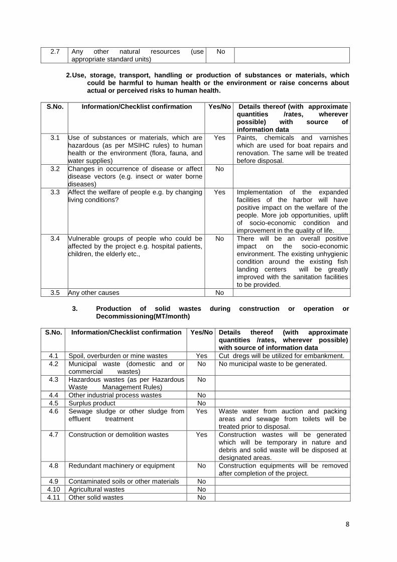
2.7 Any other natural resources (use appropriate standard units)
No
2. Use, storage, transport, handling or production of substances or materials, which could be harmful to human health or the environment or raise concerns about actual or perceived risks to human health.
S.No. Information/Checklist confirmation Yes/No Details thereof (with approximate quantities /rates, wherever possible) with source of information data
3.1 Use of substances or materials, which are hazardous (as per MSIHC rules) to human health or the environment (flora, fauna, and water supplies)
Yes Paints, chemicals and varnishes which are used for boat repairs and renovation. The same will be treated before disposal.
3.2 Changes in occurrence of disease or affect disease vectors (e.g. insect or water borne diseases)
No
3.3 Affect the welfare of people e.g. by changing living conditions?
Yes Implementation of the expanded facilities of the harbor will have positive impact on the welfare of the people. More job opportunities, uplift of socio-economic condition and improvement in the quality of life.
3.4 Vulnerable groups of people who could be affected by the project e.g. hospital patients, children, the elderly etc.,
No There will be an overall positive impact on the socio-economic environment. The existing unhygienic condition around the existing fish landing centers will be greatly improved with the sanitation facilities to be provided.
3.5 Any other causes No
3. Production of solid wastes during construction or operation or Decommissioning(MT/month)
S.No. Information/Checklist confirmation Yes/No Details thereof (with approximate quantities /rates, wherever possible) with source of information data
4.1 Spoil, overburden or mine wastes Yes Cut dregs will be utilized for embankment.
4.2 Municipal waste (domestic and or commercial wastes)
No No municipal waste to be generated.
4.3 Hazardous wastes (as per Hazardous Waste Management Rules)
No
4.4 Other industrial process wastes No
4.5 Surplus product No
4.6 Sewage sludge or other sludge from effluent treatment
Yes Waste water from auction and packing areas and sewage from toilets will be treated prior to disposal.
4.7 Construction or demolition wastes Yes Construction wastes will be generated which will be temporary in nature and debris and solid waste will be disposed at designated areas.
4.8 Redundant machinery or equipment No Construction equipments will be removed after completion of the project.
4.9 Contaminated soils or other materials No
4.10 Agricultural wastes No
4.11 Other solid wastes No

9
4. Release of pollutants or any hazardous, toxic or noxious substances to air (Kg/hr)
S.No. Information/Checklist confirmation Yes/No Details thereof (with approximate quantities /rates, wherever possible) with source of information data
5.1 Emissions from combustion of fossil fuels from stationary or mobile sources
Yes Stationary source: From the mechanized drilling machines to be used for creation of navigation channel / Training Wall. Mobile source: Vehicles for loading / unloading /other purpose; MFVs - during operation
5.2 Emissions from production processes No
5.3 Emissions from materials handling including storage or transport
Yes Fugitive dust and emissions during drilling operation on rocky substrate, earth moving devices, transport vehicles mainly during construction. Emissions from MFVs during operation. No emission during storage of construction materials.
5.4 Emissions from construction activities including plant and equipment
Yes Same as in item no. 5.3
5.5 Dust or odours from handling of materials including construction materials, sewage and waste
Yes Fugitive dust will be generated during construction period. No obnoxious odour during construction period. Odour from fish wastes and offal / fish drying will be generated. The same will be controlled through appropriate management plan. .
5.6 Emissions from incineration of waste No
5.7 Emissions from burning of waste in open air (e.g. slash materials, construction debris)
No
5.8 Emissions from any other sources No
5. Generation of Noise and Vibration, and Emissions of Light and Heat:
S.No. Information/Checklist confirmation Yes/No Details thereof (with approximate quantities /rates, wherever possible) with source of information data with source of information data
6.1 From operation of equipment e.g engines, ventilation plant, crushers
Yes Noise emission will be there during construction activities from drilling equipments and machinery, vehicles, etc. During operation noise will be generated from the engines of the MFVs.
6.2 From industrial or similar processes
No
6.3 From construction or demolition
Yes Same as in item no. 6.1
6.4 From blasting or piling
Yes Noise, vibration and dust emission will occur during mechanized drilling of the navigation channel / training wall. These will be temporary in nature and mitigated after completion of the works.
6.5 From construction or operational traffic
Yes Noise will be generated from vehicular traffic carrying construction materials. This will be confined during the daytime. During operation, noise will be mostly from the MFVs which will be during berthing and departure for fishing voyages. Transport vehicles linked with fish trade will also generate noise during their

10
entry and exit from the harbor areas.
6.6 From lighting or cooling systems
No
6.7 From any other sources
No
6. Risks of contamination of land or water from releases of pollutants into the ground or into sewers, surface waters, groundwater, coastal waters or the sea:
S.No. Information/Checklist confirmation Yes/No Details thereof (with approximate quantities /rates, wherever possible) with source of information data
7.1 From handling, storage, use or spillage of hazardous materials
Yes From handling of fuel and spillage of fuel from the MFVs. Leaching of anti-foulants from boat repairing activity. Appropriate management plan will be implemented for mitigation of the same.
7.2 From discharge of sewage or othereffluents to water or the land (expected mode and place of discharge)
No Sewage and other effluents will be discharged into the aquatic phase after treatment.2 nos. of ETPs will be set up at Navgaon and Thal respectively.
7.3 By deposition of pollutants emitted to air into the land or into water
No Control of fugitive dust will be made by creating a green belt in the reclaimed area and by regular sprinkling of saline water in the affected areas..
7.4 From any other sources
No
7.5 Is there a risk of long term buildup of pollutants in the environment from these sources?
No
7. Risk of accidents during construction or operation of the Project, which could affect human health or the environment
S.No. Information/Checklist confirmation Yes/No Details thereof (with approximate quantities /rates, wherever possible) with source of information data
8.1 From explosions, spillages, fires etc from storage, handling, use or production of hazardous substances
Yes Only in case of accidents due to outbreak of fire, oil spills, leakage of stored fuel, storage of fishing nets, etc.
8.2 From any other causes Yes Accidental grounding of vessels
8.3 Could the project be affected by natural disasters causing environmental damage (e.g. floods, earthquakes, landslides, Cloudburst etc)?
Yes By flood and cyclone. The region falls in low intensity earthquake zone (Seismic Zone-IV) as per Seismic Zone Map of India. There is no record of earthquake, landslide or cloud bursts.

11
8. Factors which should be considered (such as consequential development) which could lead to environmental effects or the potential for cumulative impacts with other existing or planned activities in the locality
S.No. Information/Checklist confirmation Yes/No Details thereof (with approximate quantities /rates, wherever possible) with source of information data
9.1 Lead to development of supporting utilities, ancillary development or development stimulated by the project which could have impact on the environment e.g.: Supporting infrastructure (roads,
power supply, waste or waste water treatment, etc.)
housing development extractive industries supply industries
other
No
No No No No
9.2 Lead to after-use of the site, which could have an impact on the environment
No
9.3 Set a precedent for later developments Yes Improvement in the socio-economic conditions of the local population through spin-off effect.
9.4 Have cumulative effects due to proximity to other existing or planned projects with similar effects
No
(III) Environmental Sensitivity
S.No Areas Name/ Identity
Aerial distance (within 15 km.) Proposed project location boundary
1 Areas protected under international conventions, national or local legislation for their ecological, landscape, cultural or other related value
Yes Kolaba island fort near Alibag is maintained by Archaeological Survey of India. The island forts of Undheri and Khandheri are within 5 kms of the project area.
2 Areas which are important or sensitive for ecological reasons - Wetlands, watercourses or other water bodies, coastal zone, biospheres, mountains, forests
Yes The Project areas lie under CRZ-III
3 Areas used by protected, important or sensitive species of flora or fauna for breeding, nesting, foraging, resting, over wintering, migration
No
4 Inland, coastal, marine or underground waters
No
5 State, National boundaries No
6 Routes or facilities used by the public for Access to recreation or other tourist, pilgrim areas
No

12
7 Defence installations No
8 Densely populated or built-up area No Predominantly rural area with sparse population.
9 Areas occupied by sensitive man-made land uses (hospitals, schools, places of worship, community facilities)
Yes Notable educational institutions include J.S.M. College, R.C.F School and junior College, St. Mary's Convent School, Chandrakant Hari Keluskar Homeopathic Medical College. The two hospitals viz. RCF and Civil hospitals are within the 15 km zone. This apart, there are primary health centres / primary health sub-centres, family welfare centres and doctors’ clinics/dispensaries.
10 Areas containing important, high quality or scarce resources (ground water resources, surface resources, forestry, agriculture, fisheries, tourism, minerals)
No
11 Areas already subjected to pollution or environmental damage. (those where existing legal environmental standardsare exceeded)
No
12 Areas susceptible to natural hazard which could cause the project to present environmental problems (earthquakes, subsidence, landslides, erosion, floodingor extreme or adverse climatic conditions)
No
(IV) Proposed Terms of Reference for EIA studies
Terms of Reference
All environmental attributes like air, noise, water (ground water and surface water), geology, sediment, soil, ecology (terrestrial and marine / aquatic), socio-economic, etc. will be covered in detail.
The study period for the Rapid Environmental Impact Assessment (REIA) will be a single season (pre-monsoon) broadly covering the following reference of work.
1. Review of relevant secondary data / documents, Notifications, Government circulars and documents (MoEF and State level) / reports, analysis of drawings, topo sheets, maps, plans, etc.
2. Identification of the Project Impact Area (PIA) of 10 km radial zone around the project site.
3. Formulation of the survey approach, designing of check-lists.
4. Stakeholder consultation
5. Reconnaissance Survey
6. Establishment of the baseline environmental scenario of the PIA with the help of the following attributes and parameters :

13
Sl. No.
Attribute Parameters Particulars
1. Ambient Air Quality RPM, SO2,NOx,CO, Amonia 2 Locations in the PIA
2. Ambient Noise Level Noise Levels in dB(A) 4 Locations in the PIA
3. Water Quality Physical, Chemical, Biological parameters
Surface (Marine) Water (5 locations):
Once during the study period at five locations for : Temperature, pH, Salinity, DO, BOD, COD, Transparency, TSS, TDS, Ammonia, Nitrite, Nitrate, Phosphate, Silicate, Cadmium, Iron, Lead, Zinc, Mercury, Chlorophyll, Total Coliform, Faecal Coliform, Phytoplankton, Zooplankton, Benthos
4. Meteorology Temperature, Relative Humidity, Rainfall, Wind
Secondary data
5. Sediment Characteristics
Physical and Chemical parameters
Once during the study period at three locations for all the standard parameters.
6. Ecology Existing status terrestrial and marine / aquatic flora fauna. Rare and endangered species.
Field Survey and Secondary data / information from (i) Office of the Chief Conservator of Forests (Thane) and Dy, Conservator of Forests (Alibag), Govt. of Maharashtra, Bombay Natural History Society (BNHS), Veer Wajekar Arts, Science and Commerce College, Uran and stakeholder consultation.
7. Geology Geological characteristics Secondary data / information / maps from the Geological Survey of India
8. Socio-economic Issues
Socio-economic characteristics of the PIA
Secondary data / information, Census data 2011, Stakeholder consultation.
9. Risk Assessment Identification of the major water / climate related, geology related natural hazards, accidents and secondary hazards
Identification of possible risks / vulnerability through stakeholder consultation and secondary sources viz. Office of the Collector and District Magistrate / District Disaster Management Authority, (Alibag) Raigad district, Maharashtra.
7. Identification and assessment of potential impacts.
8. Suggested mitigation measures during construction and operational phases.
9. Post project monitoring programme
I hereby given undertaking that the data and information given in the application and
enclosure are true to the best of my knowledge and belief and I am aware that if any part of the data
and information submitted is found to be false or misleading at any stage, the project will be rejected
and clearance give, if any to the project will be revoked at our risk and cost.
Date: 22nd September 2015
Place: Thal, Alibag.
Signature of the applicant
U. V. Dhatrak,
Executive Director ( Thal )
Rashtriya Chemicals & Fertilizers Ltd.
Thal, Taluka – Alibag, Dist- Raigad,
Maharashtra-402 208
(Project proponent / Authorized Signatory)
14
NOTE:
1. The projects involving clearance under coastal Regulation zone Notification, 1991 shall submit with the application a C.R.Z. map duly demarcated by one of the authorized agencies, showing the project activities, w.r.t. C.R.Z (at the stage of TOR) and the recommendations of the State Coastal zone Management Authority (at the stage of EC). Simultaneous action shall also be taken to obtain the requisite clearance under the provisions of the C.R.Z. Notification, 1991 for the activities to be located in the CRZ.
2. The projects to be located within 10 km of the National parks, sanctuaries, Biosphere Reserves, Migratory corridors of wild Animals, the project proponent shall submit the map duly authenticated showing by chief wildlife warden showing these features vis-a-vis the project location and the Recommendation or comments of the Chief Wildlife Warden 'thereon (at the stage of EC)."
3. All correspondence with the Ministry of Environment & Forests including submission of application for TOR/Environment Clearances, subsequent Clarifications, as may be required from time to time, participation in the EAC Meeting on behalf of the project proponent shall be made by the authorized signatory only. The authorized signatory should also submit a document in support of his claim of being an authorized signatory for the specific project.