for a final pdf of the published paper you can mail …
TRANSCRIPT

This is post-print version, not the final published version. This paper is
published as:
Notebaert, B., Berger, J.-F., Brochier, J. L., 2014. Characterization and quantification of Holocene
colluvial and alluvial sediments in the Valdaine Region (southern France). The Holocene, vol. 24,
no. 10, pp. 1320-1335.
Doi: 10.1177/0959683614540946
http://hol.sagepub.com/content/24/10/1320.abstract
FOR A FINAL PDF OF THE PUBLISHED PAPER YOU CAN MAIL THE MAIN
AUTHOR AT [email protected].

Characterization and Quantification of Holocene colluvial and alluvial sediments in the Valdaine
Region (South-France)
Bastiaan Notebaert1; Jean-François Berger2, Jacques Léopold Brochier3
Affiliations:
1: Bastiaan Notebaert, Department Earth & Environmental Sciences, KU Leuven (Leuven University),
Celestijnenlaan 200E, 3001 Leuven, Belgium
Research Foundation Flanders – FWO
Department of Geography, Ghent University, Belgium
2: Jean-François Berger, University of Lyon, UMR 5600 EVS/IRG-Lyon 2, France
3 : Jacques Léopold Brochier

Abstract
This study presents a Holocene sediment budget for the Valdaine Region, located at the edge of the
southern French Pre-Alps. Holocene colluvial and alluvial deposition are quantified based on existing
and new field data. Average sediment thickness values were calculated for different landscape units
and available chronological data were used to make a time-differentiated sediment budget. Total
Holocene colluvial deposition in the Valdaine (334 km²) amounts 167 106 m³, while alluvial deposition
in the Roubion and Jabron catchments (in total 610 km², including their catchment upstream the
Valdaine) amounts 177 106 m³. Especially colluvial deposition is high (0.75 106 g m-2) compared to
other catchments. Three major deposition periods (8500 – 2000 BC; 700 BC-800 AD; 1200 AD-2000
AD) and two periods of relative hillslope stability with local fluvial incision (2000 BC-700 BC; 800-1200
AD) set the framework for a time-differentiated sediment budget. Results show that depositional
phases relate to intense land use and hillslope stability and fluvial incision to land abandonment.
Catchment averaged colluvial deposition increases from 13 10-6 m3 m-2 a-1 for 8500-2000 BC to 355
10-6 m3 m-2 a-1 for 1200-2000 AD, while alluvial deposition increases from 16 10-6 m3 m-2 a-1 to 147 10-
6 m3 m-2 a-1 between the same time periods. A relationship with climatic fluctuations was not found
due to the limited temporal resolution of the sediment budget. The derived sediment cascade model
shows how alluvial sediments change from fine (silt and clay) to coarse (sand and gravel) after 1200
AD. This went along with the establishment of a braided river pattern indicating that the main source
of sediment shifted to the mountainous headwaters. Further research including fingerprinting and
modeling would be necessary to further understand the sediment budget and to more accurately
quantify the different source areas and the export from the catchment.

Introduction
Over a Holocene timeframe, soil erosion and sediment deposition is an important process in many
European catchments (Notebaert and Verstraeten, 2010; Dotterweich, 2008). The processes are
important for shaping the Earth surface and transport sediments and related biochemical
constituents from the upland towards the oceans, with intermediate sinks which act as buffers. An
increasing number of studies have shown the importance of quantifying the different processes
involved over different spatial and temporal scales, in order to understand the sediment cascade
(e.g., Trimble, 1999; Hoffmann et al., 2007; Trimble, 2009; Verstraeten et al., 2009b; Notebaert et al.,
2011a). Under ‘sediment cascade’ we understand the transport of sediment through a catchment’s
landscape, including sources, redistribution pathways and sinks. Quantification of such processes is
also important to assess the role of soil erosion and sediment burial in the global carbon cycle (e.g.,
Hoffmann et al., 2009; Van Oost et al., 2012; Hoffmann et al., 2013).
Often sediment budgets are used to quantify the sediment cascade. To quantify, the sediment
budget methodology can be used to give an accounting of the sources and sinks of sediment flows
for a spatial unit over a given time period (Slaymaker, 2003; Reid and Dunne, 2005). Over recent
years an increasing number of sediment budgets spanning time scales of decades to millennia have
become available (e.g., Hinderer, 2012). Such long-term sediment budgets allow to understand how
sediment cascades changes in response to environmental changes. In Europe, the majority of
sediment budgets refers to timescales of a years to decades, while sediment budgets referring to
timescales of millennia deal with catchment in Germany, Belgium and the Netherlands (e.g.,
Hoffmann et al., 2007; Seidel and Mackel, 2007; de Moor and Verstraeten, 2008; Verstraeten et al.,
2009b; Förster and Wunderlich, 2009; Notebaert et al., 2009; Fuchs et al., 2011; Stolz, 2011). Among
these studies chosen budget elements vary and may range from sole quantifications of total
floodplain storage (e.g., Stolz, 2011), to more detailed studies including different sink types (e.g.,
Macaire et al., 2002; Houben, 2008) and complex time-differentiated sediment budgets(e.g., Trimble,
2009; Verstraeten et al., 2009b; Notebaert et al., 2011a; Notebaert et al., 2013). For most
catchments, sediment budgets show the large influence of anthropogenic land use changes on the
sediment cascade (e.g., Trimble, 1999; Verstraeten et al., 2009a).
The results of these studies illustrate the non-linear nature of sediment flows between different
components of the sediment cascade and how this leads to variable sedimentation rates over space
and time (e.g., Fuchs et al., 2011; Notebaert et al., 2011a).
In contrast, only very few sediment budget studies are available for the landscapes of southern Europe (e.g., Dusar et al., 2011) although these provide classical examples of past to present human impacts on used landscapes. The French Valdaine region is an example of a south European landscape and consequently a wealth of archaeological and geo-archaeological data are available. This includes coring and profile data on Holocene colluvia, alluvia, and soil profile change, often with age information derived from archaeological artifacts or radiocarbon dating. So far, research has focused on until now site-specific reconstructions (e.g., Berger, 1996; Vital et al., 1999; Berger et al., 2002), particular cultural period synthesis (Berger and Brochier, 2006; Berger et al., 2007a) and relationships between geomorphology and archaeological site preservation (Verhagen and Berger, 2001; Berger, 2011). Quantification of sediment sinks and flows and a sediment cascade model is still missing.

The main objective of this paper is to quantify the Holocene sediment cascade for the Valdaine
region by the construction of a time-differentiated sediment budget. By doing so, we aim at closing
the gap between traditional sediment budget studies and site specific geo-archaeological studies.
This will be done by using geo-archaeological data to construct a sediment budget, and linking the
sediment budget results to palaeo-environmental data in order to understand the temporal and
quantitative variations in sediment redistribution.

Study Area
[FIGURE 1 can be inserted somewhere in this paragraph]
This study focuses on the Valdaine region (334 km²), which forms the lower part of the Jabron and
Roubion catchments (total 610 km²), situated west of the city of Montélimar, France (fig. 1). The
Jabron river enters into the Roubion river near Montélimar, shortly upstream of its confluence with
the Rhone river. The headwaters of both rivers are located in the mountainous calcareous Pre-Alps,
while the Valdaine landscape lies in a lower situated structural depression with gently rolling hills.
Altitudes in the Valdaine region range between 70 m and ca 850 m a.s.l.. The central part of the
catchment has a less expressed relief, with altitudes between 70m and ca 200 m a.s.l., and slopes
angles are generally less than 2%. Catchment margins rise up to altitudes of 500-600 m, and even 850
m in the east. The slopes angles are often higher than 10%. Some limestone hills also stick out in the
central Valdaine plain as ridges, with slopes >10% and height differences of more than 50 m.
The region has a transitional climate between the Mediterranean, continental and Atlantic climates
(Blanchet, 1990). Mean annual precipitation amounts to 900 mm-1000 mm (varying annually from
300 to 1700 mm; Hirsch and Vincent (1966); Blanchet (1990)). There is a high inter-annual variability
in precipitation pattern, with some years having large amount of precipitation in spring and fall
(September to November), typically for a Mediterranean climate, and other years with precipitation
more evenly spread over the year.
An extended dataset on archaeological sites exists in the Valdaine region, mainly originating from
field walking surveys and rescue archeology projects (such as Archaeomedes, ATP CNRS, TGV-
Méditerranée). Settlement density was reconstructed, taking into account the erosion and reworking
of archaeological deposits. Results show an intensive occupation history since the Neolithic Period
(Berger, 1996; Berger, 2011). Settlement density peaks first during the middle Neolithic Period (ca
4500 – 3500 BC) (Berger, 1996). Malacological data indicate a forested landscape during the Early-
Mid Bronze Age (ca 2300 BC – 1300 BC) following by a progressive opening of the environment
during the Late Bronze age (ca 1300 BC – 750 BC), while there was a general open landscape during
the Iron Age and Roman Period (750 BC- 500 AD) (Berger et al. (2007b). Settlement density data
published in Berger (1996) and Berger et al. (2007b) show an alternation of less and more dense
settlement patterns during the Bronze Age and Iron Age, while a peak in settlement density occurs
during the High Roman Empire (1-150 AD). This is followed by a decrease in settlement density
during the Low Roman Empire (ca 200-500 AD), and especially during the early and high Middle Ages
(ca 500 – 1000 AD), again followed by peaking settlement densities from 1000 AD on (Berger, 1996).
Sedimentary history
[insert fig. 2 around this paragraph]
A simplified overview of the sedimentary history of the Valdaine (fig. 2) is based on published
(Berger, 1996; Berger, 2003; Berger et al., 2007a) and unpublished data. This overview represented
widespread trends, and the local sedimentation and incision history of specific sites may differ from
this regional pattern. There are several larger periods of landscape instability with deforested
landscapes and/or periods of erosive rainfall, which results in soil erosion and subsequent colluvial
and alluvial deposition (Berger, 1996). Landscape stabilization, for instance related to reforestation

or periods with less erosive rainfall events, results in decreased erosion. As a consequence sediment
deposition decreases or even ceases, and in turn some rivers incise. This is often combined during
the Holocene with the formation of soils in alluvial and colluvial deposits (Berger, 2003; Berger et al.,
2007a). Also 20th century land abandonment resulted in forest increase, soil development and fluvial
incision. Early Holocene floodplain deposits (and records of incision phases) only occur at a few sites,
and a detailed history is still partly missing except for the Citelle floodplain (Berger et al., 2002). A
regional channel incision period is observed at different sites around 5500 BC. This period is followed
by several deposition and stability periods during the Neolithic until the transition with the Bronze
Age (ca 5000 BC – 2000 BC). An interplay of natural or anthropogenic deforestation and rainfall
events determine the severity of local soil erosion and sediment deposition.
During the Bronze Age and the transition phase between Bronze and Iron Age (ca 2000- 700 BC), a
stability period occurs on the hillslopes and the piedmonts, with local incision of the floodplains. This
is followed by a rapid infilling phase during the first centuries of the Iron Age (700-500 BC). The High
Roman Empire (1 – 200/300 AD) is a major soil erosion period, resulting in major colluvial and alluvial
sedimentation. Locally the fluvial system becomes temporarily torrential with the aggradation of
bedload deposition by braided rivers. Later on (300 – 450/500 AD) there is a gradual hillslope
stabilization (with local paleosol development), although this is combined with continuing irregular
fluvial deposition. A further regional stabilization of the soils occurs between 800 and 1200/1300 AD,
causing a clear water effect and renewed fluvial incision(Berger, 2003). An important sedimentation
period started in the 13-14th century AD, lasting until the beginning of the 20th century, with
widespread colluvial deposition and deposition of large amounts of coarse braided river and
torrential fluvial deposits. During the 20th century, the upper slopes were reforested and stabilized
(Liébault and Piégay, 2001), resulting in clear water effect and fluvial incision of the floodplains. It is
however unclear how colluvial deposition reacts, due to the absence of dates for this recent period.
Colluvial sediments vary in nature, depending on the moment of deposition and the source material.
They are in general fine grained (silty clay loam to loam), with locally some admixture of gravel. A
small fraction is locally more coarse grained (sandy, sometimes with some gravel), especially for
deposits from the Roman Period or more recent. Many colluvial deposits from the Bronze Age on
contain ceramic fragments or other archaeological remains. Overbank alluvial deposits from before
1200 AD are mainly fine grained (silty clay loam), while bed load deposits and deposits from
torrential phases during the Roman Time Period are coarse grained (coarse gravel). Alluvial deposits
from after 1200 AD exist mainly out of coarse gravels.
Methods
Landscape units
The topography of the Valdaine region is determined by its underlying geological structures. The
outer fringes of the Valdaine are pre-mountain limestone ridges, while the lower and less steep parts
have a marl underground. Also the upper parts of the Jabron and Roubion catchments, upstream the
Valdaine region, exist of a pre-mountain region with limestone ridges and marl depressions. In the
Valdaine, the lower slopes of the pre- mountain ridges are covered by Pleistocene footslope
deposits. On the northern slopes of the catchment, a system of Holocene colluvial (dry or perennial)
valleys has developed in these Pleistocene deposits. In the southern part of the Valdaine, two
limestone ridges occur, with undulating marl colluvial basins (“cuvettes”) in between.
The central part of the Valdaine is a structural depression with mostly less resistant marl deposits.
The topography is less expressed than for the edges, and is generally undulating (alternation of small
hills and valleys with often a brown to calcareous Pleistocene colluvial soil cover). Some large
Pleistocene river terraces occur, which are generally flat or slightly undulating when they are incised
after deposition. These terraces are dominated by gravel and are locally covered by loess. Holocene
floodplains widen downstream with two major floodplains (Roubion and Jabron rivers). A large
alluvial fan is formed at the catchment outlet, just downstream the Jabron-Roubion confluence and
the city of Montélimar is located on this fan.
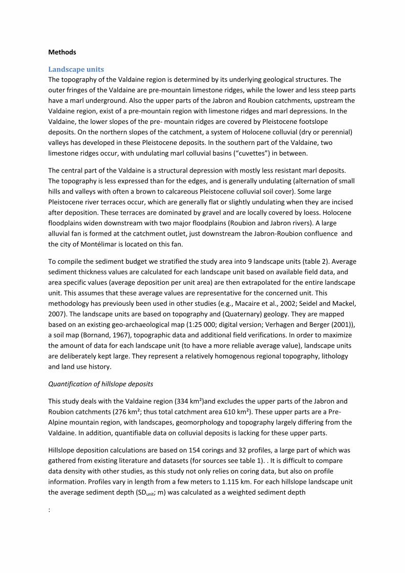
To compile the sediment budget we stratified the study area into 9 landscape units (table 2). Average
sediment thickness values are calculated for each landscape unit based on available field data, and
area specific values (average deposition per unit area) are then extrapolated for the entire landscape
unit. This assumes that these average values are representative for the concerned unit. This
methodology has previously been used in other studies (e.g., Macaire et al., 2002; Seidel and Mackel,
2007). The landscape units are based on topography and (Quaternary) geology. They are mapped
based on an existing geo-archaeological map (1:25 000; digital version; Verhagen and Berger (2001)),
a soil map (Bornand, 1967), topographic data and additional field verifications. In order to maximize
the amount of data for each landscape unit (to have a more reliable average value), landscape units
are deliberately kept large. They represent a relatively homogenous regional topography, lithology
and land use history.
Quantification of hillslope deposits
This study deals with the Valdaine region (334 km²)and excludes the upper parts of the Jabron and
Roubion catchments (276 km²; thus total catchment area 610 km²). These upper parts are a Pre-
Alpine mountain region, with landscapes, geomorphology and topography largely differing from the
Valdaine. In addition, quantifiable data on colluvial deposits is lacking for these upper parts.
Hillslope deposition calculations are based on 154 corings and 32 profiles, a large part of which was
gathered from existing literature and datasets (for sources see table 1). . It is difficult to compare
data density with other studies, as this study not only relies on coring data, but also on profile
information. Profiles vary in length from a few meters to 1.115 km. For each hillslope landscape unit
the average sediment depth (SDunit; m) was calculated as a weighted sediment depth
:

(equation 1)
Where nd is the number of datapoints for that landscape unit; SDi is the sediment depth for
datapoint i (m); Wi is the weighting factor for datapoint i (m). Datapoints are profiles, profile pits or
individual corings. The weighting factor Wi is calculated as the length of profile i, with a minimum of
25 m used for the smaller profiles and corings. A value of 25 m is used to take into account spatial
autocorrelation, although exact values are unknown for this autocorrelation and might differ
between sites. If only a weighting is used for the profiles, and not (a value of 1) for the corings,
calculated values would almost completely depend on these profiles. Houben (2008) has
demonstrated how erosion and deposition patterns are correlated for inter-coring distances of up to
20 m in the studied loess catchment. Error quantification was performed using Gaussian error
propagation (Notebaert et al., 2009). In order to compare the volumes quantified in this study with
masses yielded by other studies, we applied a bulk density value of 1.5 g cm-3, comparable with other
studies (e.g., Hoffmann et al., 2007).
Floodplains and alluvial fan
The quantification of floodplain deposition is based on detailed mapping of floodplain extent and
extrapolation of floodplain sediment thickness data. Similar to other studies (e.g., Seidel and Mackel,
2007; Notebaert et al., 2011a; Stolz, 2011), floodplains were divided in geomorphic units and for
each unit an average sediment thickness was calculated (equation 1). This is done in order because of
the different geomorphology, and related sediment values, between smaller tributaries and for
instance the main valleys. The fluvial deposits in the Valdaine region contain a significant but
variable amount of recent (post Medieval) gravel layers, which limit coring and digging possibilities.
As a consequence, there are only a few data. For the different tributaries a total of 12 floodplain
transects or profiles are available, while 4 transects are available for the main floodplains of the
Roubion and Jabron. The floodplain transects exist typically of a combination of smaller profiles and
some individual corings to connect these profiles. In addition, for the Roubion, also thickness data
from a ca 200 m long cutbank in the most upstream stretch in the Valdaine region was available and
combined with the transect data.
For the parts of the Roubion and Jabron floodplains upstream the Valdaine, floodplain thickness data
were lacking. Floodplain deposition was nevertheless calculated for these upper catchments by
measuring the height of the Holocene deposits in cutbanks at sites where the base of the Holocene
deposits could be observed. Due to 20th century river incision (Liébault and Piégay, 2001), cutbanks
have incised at several locations down to the underlying bedrock. We assume that the thickness of
the fluvial deposits is constant for the entire width of the floodplain.
At the outlet of the catchment near the city of Montélimar, the Roubion and Jabron form a large
alluvial fan (6.2 km²). Only a limited number of corings are available for this fan, mainly in the city
center of Montélimar, which is built on the apex of the fan. In addition, coring data is available for
the Rhône floodplain next to the edge of the fan. Based on the available point data, the volume of
fan sediment is calculated in two different ways: (1) first based on topography, and secondly (2)
based on a hypothetic cone shape. For the calculation based on topography, a uniform level of the
basal fan surface is assumed. Two different assumptions are used to estimate for this level: 68 and 71
m a.s.l. This basal fan level is substracted from a contemporary digital elevation model (DTM ; 25 m
resolution. Volume calculation using a theoretical cone shape assumes an uniformly decreasing

sediment thickness from the apex towards the edge of the fan. This uses again using two
assumptions: one with no deposition at the edge and one with 2 m deposition. This value of 2 m
equals the thickness of the Holocene Rhône floodplain deposits. These four scenarios are evaluated
to get at a best estimate.
Time-differentiated sediment budget
For various sites depositional ages are available. Here we use the published sedimentary history
(Berger, 1996), their results together with data from other sources (Brochier and Berger, in prep.),
radiocarbon dating, buried ceramics and archeological remains, and stratigraphic correlations (e.g.,
Berger, 1996). Radiocarbon dating provides maximal ages with an analytical precision associated with
the dead of the dated organic remains. Archaeological remains, by contrast, place sediments within a
cultural period provided that there was no reworking. Ceramics, e.g., from the Roman Period, can
often be dated with a better precision than calibrated radiocarbon dates. Age interpretation based
on archaeological remains has to be treated with caution (except when buried in situ) and is best
used in combination with physical dating methods.
The construction of a temporary differentiated sediment budget requires that sedimentation
patterns are quantified for well delineated time periods. Here, time periods are defined based on
important catchment wide geomorphologic changes that are present in the sedimentary record (e.g.,
Trimble, 1999; Verstraeten et al., 2009b). We determined three depositional periods separated by
two periods of hillslope stability and local fluvial incision, which represent the major time periods for
the sediment budget. The definition of these periods is based on their widespread impact on the
sedimentary history for the region, their identification at as many sites as possible, and the involved
uncertainties in the identification. At a smaller timescale deposition periods for one site can
correspond with a stability or even incision period for another site (Berger, 2003; Berger and
Brochier, 2006; Berger et al., 2007a), while the general pattern of the five used periods is valid for
each studied site.
For each site (profile, coring, coring transect) the volumes of the present day sediment is quantified
for the three depositional periods, as well as the eroded volumes for the intermediate incision
periods (when possible). Eroded volumes for these incision periods are calculated by applying a
logical interpolation of the upper surface level of that unit between the points for which this level is
still present. This assumes that (1) such a logical, often horizontal, continuation was present, and (2)
that for each period we can define the upper surface level of the original deposits. We take only into
account sites where the different depositional units are recognized and the reconstruction of eroded
volumes is possible. For each site and each depositional time period (dp) we calculated the relative
amount of sediment deposited (SRdp) as a function of the contemporary total amount of Holocene
sediment present (SHol) as:
equation 2
With Sdp the sediment deposition during time period p (m3/m²); and SHol the contemporary total
Holocene sediment deposition (m3/m²). Likewise the relative erosion amount (ERep) for each
incision/stability period (ep), was calculated:
equation 3

With Eep the erosion amount (m3/m2) during incision period ep.
Values for SR and ER are calculated for colluvial and ravine deposits; alluvia in tributaries and alluvial
deposits in the main valley. We did not make a differentiation between the different landscape units,
because of the too limited number of data this would yield for some units. They are combined with
the total quantities for these different sinks to result in a time-differentiated sediment budget. In
order to compare SR and ER values for the time periods with a different length, values are calculated
as rates per 1000 years (%/ 1000 a). By taking the total sediment deposition into account (see
results), these values can be converted to masses per unit surface area (such as 10-6 m3 m-2 a-1).
Budget closure
The available data only provide information on sedimentary sinks, and fail to explain the entire
sediment pathways and how they change over time. Constructing these pathways is challenging for
sediment budgets over time frames of centuries to millenia, as data is often lacking and results
depend on some fundamental assumptions (e.g., Notebaert et al., 2011a). Quantification that are
based on such fundamental assumptions are in the sediment budget displayed in a different way
than quantifications that are based on a more solid dataset. Sediment export out of the catchment
for periods D2, S2 and D3 (for definition of the periods D1-D3 and S1-S2: see results section) is
roughly estimated at 25 103 m3 a-1, based on a monitored regional sediment yield of 50-150 t km2 a-1
(Delmas et al., 2012), a specific weight of 1.5 t m-3, and a catchment area of 610 km2. For the early
Holocene (D1-S1) this value is corrected in order to have the same ratio for the export as for the
main floodplain deposition between periods D1 and D2. This results in an export of 9.4 103 m3 a-1.
We estimated the relative contribution of the mountainous headwater catchments (mainly
producing coarse sediment) and hilly central parts of the catchment (producing finer sediment) to
the fluvial system based on the abundance of gravel layers (described in the profile descriptions). We
tentatively used values of 15, 25 and 75% for the upstream contribution to sediments in the main
floodplains for D1, D2 and D3 respectively, and values of 10, 15 and 50% for the tributaries. These
values are based on an estimate of gravel amounts in tributary and main valley floodplain deposits
based on coring descriptions. Measured amounts of gravel are missing in the original field reports,
which results in a large uncertainty on these estimates.

Results
Quantification of Holocene deposition
[insert fig. 3 somewhere in this paragraph]
[insert fig. 4 somewhere in this paragraph]
Based on the different landscape units (fig. 1A, table 2) and the distribution of sediment thickness in
these units (fig. 3), the sediment budget (fig. 4) was created. Total (colluvial) hillslope deposition
equals 167.4 +- 13.5 106 m³, and 5.2 +-1.8 106 m³ is deposited in (dry) mountain ravines (table 3).
Colluvial deposits cover large areas of the lower parts of the study area. They vary in texture from
fine (silty-clayey) to coarse sediment (sand and gravel), and often contain anthropogenic fragments
(e.g., bricks, tegulae, ceramics, …) and (micro) charcoals. Thickness distributions of the colluvial
deposits vary significantly between landscape units (fig. 2), using a Kruskal-Wallis Rank Sum Test and
a p value of 0.01.
Floodplain deposition was estimated to be 176.8 ± 37.3 106 m³, of which 95.7 ± 36.7 106 m³ is
deposited in the main floodplains (Jabron and Roubion), 35 ± 5 106 m³in the alluvial fan at the outlet,
and 26.6 ± 3.0 106 m³ in the tributaries, while 19.5 ± 10.5 106 m³ is deposited in the upper
floodplains. Uncertainty is large on the calculated values of the main valleys due to the limited
number of data, even though this uncertainty corresponds only to calculation errors and does not
include uncertainty related to representativeness of the available data. Fluvial deposits have a large
textural range, from clay to coarse gravels. Coarse deposits (gravel and sand) are typically deposited
during active periods, coinciding with torrential waterflow and a braided river system. Sandy to
clayey deposits are related to less active fluvial periods, or less active parts of the floodplains. The
floodplain deposits show different cut and fill periods. Fluvial deposits typically contain
anthropogenic markers (eg., ceramics, tegulae and brick fragments), especially from the Roman
Period on.
The sediment thickness at the apex of the fan, in the city center of Montélimar, varies between 7.2
and 15.2 m, with an average of 11.8 ± 3.0 m (n=9). The calculated volume varies between 29 and 50
106 m³ sediment (table 4). Taking into account the most appropriate assumptions, the volume can be
estimated to fall within 30 to 40 106 m³. A best estimate of 35 ± 5 106 m3 is used in further
calculations. The fan deposits overlay coarse Pleistocene deposits, and consists of silt and clay with
some gravel layers.

Holocene and time-differentiated sediment budgets
[insert fig. 5 somewhere in this paragraph]
[insert fig. 6 somewhere in this paragraph]
Based on the sedimentary history, three major depositional periods (D1-D3) separated by two
stability and/or fluvial incision periods (S1-S2) are used for the sediment budget (fig. 5, 6): (D1) early
Holocene to Bronze Age (ca 8500 – 2000 BC); (S1) Bronze Age (ca 2000-700 BC); (D2) Iron Age to
early Medieval Period (700 BC-800 AD); (S2) the Middle Ages (800-1200 AD) and (D3) the last 800
years (ca 1200 -2000 AD).
In order to connect the different sediment sinks, fundamental assumptions had to be made (see
methods section), and results obtained based on these major assumptions are depicted in a separate
color in the sediment budget (fig. 4, 5). The fractions of deposited (and eroded) sediment for each
time period is calculated based on 26 colluvial sites, 3 mountain ravine sites, and 4 floodplain sites.
Results show that for both colluvial and alluvial sites sediment deposition is most important during
period D3, followed by period D2, while for the mountain ravines period D2 was the most important
period. Erosion by incision was very high for these ravines during period S2, but this calculated value
entirely depends on one site (n=3). Also for alluvial and colluvial sites S2 was more important than
S1.
Discussion
Methods and errors involved
The used methodology is based on the assumption that the sedimentary data is representative for
the defined landscape units. Only for the floodplains of the two major rivers, Roubion and Jabron,
data density is very low. Consequently standard errors appear rather high, even if they do not take
into account uncertainty resulting from a possible non-representativeness of the data.
The main shortcoming of the presented sediment budget is the unknown sediment export out of the
catchment. Sediment export was estimated based on rough regional estimates (which even do not
include bedload transport), but catchment-specific data to confirm these values are missing. Fan
sediments contain a limited amount of gravel, however, data are lacking to estimate the gravel or
bed load fraction for the export. The relative importance of the different sediment sources remains
also unknown. Detailed coring which includes a quantification of the gravel fraction are missing, and
the quantification of deposited gravel includes a very large uncertainty. In addition, not all gravel
originates from the mountainous zones, while not all fine material originates from the central zone.
We propose that future research can concentrate on determining the relative importance of both
sources by applying a finger print technique and a mixing model (e.g., D'Haen et al., 2012) to the
different deposits. In order to deal with these two major uncertainties in the sediment budget, and
to avoid that they are unjustified interpreted as accurate calculations, we have indicated depending
values in a separate color in the budget.
Spatial variation in sediment deposition
Because the main floodplains of the Roubion and Jabron have their source area upstream the
Valdaine, it is difficult to compare the alluvial and colluvial deposits based on the values from table 3,
as the catchment area differs for both types of deposits. In order to get better insight in the
quantities of sediment deposited in a typical Valdaine subcatchment, separate calculations were

made for some selected subcatchments (fig. 1A). These were selected based on the density of field
data and to represent the heterogeneity in the Valdaine landscape units. Results (table 5) show a
large variation in area specific deposition depending on the landscape structure of the
subcatchments. Results further show that for subcatchments of the central Valdaine, colluvial
deposition is most important. It is also clear that the major fluvial sedimentary sink are the lower
Roubion and Jabron floodplains.
Comparison with other regions
[insert fig. 7a&B somewhere in this paragraph]
Compared to other Holocene sediment budgets, area specific colluvial deposition (0.75 106 g m-2) is
rather high (fig. 7A). Values reported in the European loess region range typically between 0.1 and
0.4 106 g m-2. For the Valdaine subcatchments, values vary between 0.3 and 1.4 106 g m-2. Area
specific alluvial deposition for the R/J catchment (0.43 106 g m-2) and subcatchments (0.08 – 0.43 106
g m-2) fall within the variation in reported values (fig. 7B). Higher amounts of total sediment
deposition points towards higher total Holocene erosion, although sediment export out of the
catchment, and thus total erosion, remains unknown.
Time-differentiated budget and sediment cascade model
This simplification of the sedimentary history into three deposition and two erosion periods ignores
some stabilization and incision periods for different reasons. A fluvial incision period around 5500 BC
is not included as it can only be recognized for a few sites. Another fluvial incision period (ca 200 BC –
1 AD) separates the Iron Age deposits from the Roman Period deposits. This period can be separately
recognized for 14 sites (out of 32 with a good chronology), ten of which are stable during this period
and four with fluvial incision. Because of the lower amount of usable data it was decided to not make
a separation for these periods in the sediment budget. Based on the available data, colluvial
deposition is calculated to be 5.2% of total contemporary present sediments (=10.4%/1000 a or 52
10-6 m3 m-2 a-1; n=9) for the Iron Age (700 -200 BC) and 19.8% (=24.8%/1000 a or 124 10-6 m3 m-2 a-1;
n=7) for the Roman Period and early Middle Ages (1 AD – 700/800 AD). These numbers indicate that
Roman Period deposition was almost 2.5 times more intense than Iron Age deposition, and 10 times
higher than Early- and Mid-Holocene deposition (fig. 6).
An important fluvial incision period which is not separately calculated in the sediment budget is the
20th century fluvial incision, coinciding with reforestation of the upper catchment (Liébault and
Piégay, 2001) and a warming period. This fluvial incision period coincides with ongoing erosion and
colluvial deposition in the agricultural areas (Berger, 1996). This period was not separately included
in the budget because of the absence of quantitative information in the available dataset.
Quantification of incised/eroded amounts in the floodplains would require reconstruction of the pre-
incision surface and thus different techniques. For one site on the Roubion, Liébault et al. (2012)
have measured a vertical mean incision of 0.5 m for this period. Qualitative field observations for
different sites show comparable or even higher height differences between the current lower
floodplain and the 19th century floodplain level. Based on the soil map and topographic data, we
calculated the incised area (= current lower floodplain) for the main floodplains to be 1.7 km². A
tentative calculation based on these numbers yields an erosion of 0.9 106 m3. This is 13%/1000 a if
incision is supposed to have occurred over 100 year, although we have no data for the start of the

incision. This incision equals 1.3% of the present-day amount of sediment in the Roubion main
floodplain.
The major breaks in the sediment budget coincide also with major cultural breaks. Where these
cultural breaks are not necessary sudden events, this is also true for sedimentary changes at a
catchment scale, which introduces an error in the sediment budget. Many sedimentary units that can
be identified in the field (e.g., Berger, 1996; Berger, 2011) can indeed be directly attributed to a
specific cultural period. The relation between breaks in the budget and in cultural periods is not only
the result from coinciding processes, but also from the dating method (using archaeological remains,
whose precision is variable in time) and dating resolution. Many sites are dated by a combination of
radiocarbon dates and the presence of abundant archaeological material from a particular time
period. As a result sedimentary units are often linked to cultural periods with distinct archaeological
traces. The temporal resolution depends on the length of distinguishable cultural periods to which
separate sedimentary units can be coupled. Based on the length of the cultural periods and the
combined use with radiocarbon dating, the uncertainty on the boundaries of the sediment budget is
100-200 year. Periods of up to 200 year that lack events (no soil erosion or river incision) may not be
detected. As a result of these dating constraints, is was for instance not possible to distinguish a
separate phase of braided river formation during the Roman Period, nor was it possible to determine
whether this braided phase occurred synchronously at a regional scale.
[insert fig. 8 somewhere in this paragraph]
Based on the sediment budget, sedimentary history and sediment properties, a sediment cascade
model can be constructed (fig. 8). For this sediment cascade, we hypothesize that the mountainous
area produces mainly course sediment which is routed through mountain ravines towards tributaries
or directly towards the main Roubion and Jabron floodplains. Sediment eroded in the central part of
the catchment is partially deposited on the hillslopes. Another fraction of this sediment is routed
through dry valleys to the tributaries and/or directly towards the main Roubion and Jabron
floodplains. The field data indicate that reworking of previously deposited sediment is important (see
fig. 6), and different colluvial and alluvial sinks have acted for at least part of the Holocene as
sediment sources.
The sediment cascade model indicates how the mountainous region and the central region
underwent a change as regards their relative role as sediment sources within the sediment cascade.
During depositional phases D1 and D2 mainly fine material is deposited on floodplains (fig. 8),
originating mostly from the central part of the Valdaine. Single channel rivers are established,
probably with a meandering pattern. During torrential river flow phases, which occur during period
D3 (1200– 1900 AD) and some parts of period D2 (700 BC – 800 AD), large amounts of gravels are
deposited by braided rivers in the floodplains (fig. 8), probably mainly originating from the
mountainous region. Meanwhile erosion of fine sediments in the central parts remains high, as is
testified by the importance of (fine) colluvial deposition in this zone. During the stability and fluvial
incision phases, soil erosion on the hillslopes and in the mountainous area are limited and a clear
water effect is responsible for river incision, locally propagating upstream towards the dry valleys
(e.g., Berger, 2003). Most probably a major part of the sediment produced during these incision
phases is exported towards the Rhône.

Relation to climate and land use
[insert fig. 9 somewhere in this paragraph]
When comparing the sediment budget with the settlement history of the Valdaine (Berger, 1996) it is
apparent major depositional phases occur during the major land occupation phases (fig. 9). By
contrast, stability and fluvial incision occur after a decrease in settlement density. The increase in
deposition rates over the Holocene (D1-D2-D3) can only be explained by an important influence of
the increasing land use in the catchment and an increase of connectivity between slopes and fluvial
systems (e.g., Houben et al., 2013). Not only the temporal evolution gives an indication of the
importance of land use as a driving factor, also the spatial pattern. Colluvial sediment deposition is
especially important in the central Valdaine, which is the part of the Valdaine with highest historical
settlement density (Berger, 1996). Only for phase D3 also the mountainous area is a major sediment
source, but historical settlement data do not yet allow to quantify deforestation in this region on a
detailed (temporal and spatial) scale. It is difficult to establish links between the sediment budget
and the climatic variability during the Holocene. This is because of the lack of local climatic data on
the one hand, and a major difference in temporal resolution of the sediment budget and the regional
climatic data on the other hand.
At a more detailed temporal scale, the relationship between depositional phases and land use is less
obvious, and short phases of intense land use (e.g. in the late Bronze Age) are reported to come
without considerable deposition (Berger, 1996; Berger, 2003). A direct link between environmental
variables such as natural deforestation, anthropogenic land use and climate variability is reported to
be absent at a temporal resolution of decades to centuries. The temporal resolution of a sediment
budget and catchment wide processes is not fine enough to confirm this. The sediment budget does
indicate, however, the importance of anthropogenic forcings on soils from the Iron Age
onwardsculminating during the High Roman Empire. This , confirms recent results obtained from lake
archives in the Upper Rhone catchment (Simmonneau et al. 2013, Doyen et al. 2013) and
quantitative estimations of soil erosion in small catchment of the Rhine area (Houben et al. 2013).
When considering the temporal resolution of the sediment budget, the peak in sediment deposition
during period D3 coincides both with a peak in land use and with a marked climatic period (the Little
Ice Age (LIA)). In southern France, the LIA resulted in an increase in peak floods and droughts (Grove,
2001), in erosion in the high headwaters in the crystalline massifs (Arnaud et al., 2012) and in human
pressure on the landscape which resulted in the establishment of braided rivers in the Rhone
catchment (e.g., Bravard, 2010; Astrade et al., 2011). Likewise, previous research has shown how
braided rivers developed in the French (Pre-)Alps due to deforestation, increased sediment
production because of climatic change, or a combination of both (e.g., Liébault and Piégay, 2001;
Bravard, 2010). The 20th century river incision following this braided phase is a result of less (intense)
rainfall, of warming conditions at higher altitude, and of land abandonment and reforestation (e.g.,
Liébault and Piégay, 2001). Our sediment budget confirms the importance of the mountainous areas
as a sediment source and the establishment of a braided river during the LIA (period D3). The data
however do not indicate whether this unprecedented erosion period in the mountains is the result of
passing a precipitation threshold (as hypothesized by Arnaud et al. (2012)), lasting deforestation of
the mountainous region, or both. A refinement of historical land use data, especially for the

mountain region, combined with more detailed sedimentation rates and climatic data, could help to
decipher the relative importance of the environmental drivers.

Conclusions
In this paper we have presented a sediment budget for the Valdaine Region, located at the edge of
the French Pre-Alps. The budget quantifies volumes of Holocene colluvial and alluvial deposition and
is differentiated in time with three deposition periods, separated by two stability/incision periods.
Overall the amount of Holocene colluvial deposits is rather high compared to other catchments,
while the alluvial deposition falls within the variation found in literature for other catchments.
High rates of sediment deposition (and related soil erosion) correlate well with intense occupation
phases from the Late Holocene period (especially the Roman Period and Modern Times); phases of
hillslope stability and river incision correlate with periods of decreased human occupation. Human
occupation of the region was rather intense since (late) Neolithic times, which may at least partially
explain the high amounts of Holocene colluvial deposits found in the Valdaine. It is difficult to
demonstrate a climatic influence on the temporal variation in sediment deposition, but the major
deposition period (D3, 1200-2000 AD) coincides both with a more erosive climate (LIA) as with a
major occupation period.
The strengths of the sediment budget is the combination of quantification techniques with a spatial
and temporal variation in sediment sinks, which allows to go beyond single site sedimentary
deposition rate studies towards a catchment integrated approach. Although our sediment budget
has a smaller temporal resolution than for instance lake studies, results are quantified, spatially
integrated and take into account the different sediment pathways. Major future challenges to
improve this budget are related to the spatial and temporal resolution. The temporal resolution
depends on the possibility to recognize well constraint sedimentation (or incision) phases for a large
number of sites in order to calculate catchment wide trends. The combination of radiocarbon dating
with dating based on archaeological remains in this study has allow already to recognize 5 to 7
different stages in the sediment budget.
In this study, a major challenge has been the quantification of sediment export out of the catchment
for defined time periods. These values have an important influence on the reconstructed
catchment’s sediment flows. In addition, future work should try to integrate fingerprinting in order to
get less uncertainty in the quantification of sources.
The sediment budget shows the possibilities and constraints of field based studies to understand
variations in soil erosion and sediment flows over a Holocene time scale within a catchment.
Modeling of soil erosion and sediment transport might provide a solution for the most important
constraints of the approach presented in this study (e.g., Notebaert et al., 2011b). For this study area
it would however depend on models which are able to both incorporate mass processes, hillslope
process and fluvial processes, taking into consideration erosion, deposition and incision, and this for
mountainous and undulating landscapes. This also requires detailed and quantitative information on
the Holocene of all driving factors, which is not available for the Valdaine.
Acknowledgements
The authors wish to thank H. Piégay (ENS de Lyon, France) for his valuable advice and suggestions,
which were the onset of our research. We are also grateful to everybody who helped us finding

unpublished and published data, especially the CAPRA-Valence, Frédérique Thiercelin-Ferber (INRAP)
and all the archaeologists of the TGV-Méditerranée fast railway fieldwork operation, supervised by
INRAP.
The authors like to thank P. Houben and one anonymous reviewer for their valuable comments.
Funding Acknowledgements
This work was supported by the Research Foundation Flanders - FWO (personal grant and travel
grant for Bastiaan Notebaert) and the “APR 2012 du Réseau des Observatoires Hommes-Milieux
vallée du Rhône” project, Institut Ecologie et Environnement – INEE (CNRS, France).

Figures – full quality figures can be found in the final paper and the web version
Figure 1: Study area. A) overview of the study area, with indication of the extend of the Valdaine
region, the upper Roubion and Jabron catchments and the selected tributary catchments (see text).
The background colors represent the altitude. B) landscape units of the Valdaine region and
indication of coring and profile data used in this study. A color version is available online.
Jabron
Rhô
ne
Roubion
Ancelle
Citelles
VermenonManson
Lanson
Bourdeaux
Dieulefit
Montélimar
Cléon d'Andran
La Bégude de Mazenc
5°10'0"E
5°10'0"E
5°0'0"E
5°0'0"E
4°50'0"E
4°50'0"E
44°40'0"N
44°40'0"N
44°30'0"N
44°30'0"N
!!!
!!
!
!!!
!!
!!!
!!!
!
!!
!!!!
!
!!!!!!!!!!!!!!!!!!!!!!!!!!!!!!!!!!!!!!!!!!!!!!!!!!!!!
!!!!!!!!!!!!!!!!!!!!!!!!!!!!!!!!!!!!!!!!!!!!!!!!!!!!!!
!!
!
!
!
!!
!
!!!!!
!!!!!!
B
Legend B
profiles
! coring data
landscape units
bedrock
floodplain
stable terraces
northern large dry valleys
Pleistocene slope deposits
central zone
cuvettes en colluvial area
outlet fan
Legend A
subcatchments
Valdaine
Upper Roubion and Jabron
altitude
m a.s.l.High : 1599
Low : 55
0 6 123km
A
±

Figure 2: Sedimentary history of the Valdaine region as summarized in available studies. Red lines
indicate the different periods of the time-differentiated sediment budget (fig. 5). Symbol size
represents rather the duration of a process than the intensity of the process. The temporal resolution
used in the original papers amounts 100 to 200 years. A) floodplain history based on Berger (1996),
Thiercelin-Ferber (2012) and unpublished data. B) colluvial history based on Berger (1996), including
mainly colluvial sites from the central and southern Valdaine. C) colluvial history for large dry valleys
on the northern hillslopes, based on unpublished data from Brochier (Brochier and Berger, in prep.)
and Vital et al. (1999).

Figure 3: Distribution (weighted histograms, expressed as density) of the thickness of Holocene
colluvial deposits (sediment depth in m) of the different landscape units.
Figure 4: Holocene sediment budget for the Valdaine. Sediment volumes (106 m³) deposited in or
eroded from the different sediment sinks are based on available field data (red and orange arrows,
where orange arrows indicate sinks/sources with limited data availability). Sediment volumes
connecting these sinks and sediment export are based on a number of assumptions and do not
correspond with measured quantities (blue errors; see text).

Figure 5: Time-differentiated sediment budget of the Valdaine Region. Values based on measured
field data are given in red, values based on a number of assumptions (see text) are given in blue.
Sediment fluxes, sinks and sources are given as rates (103 m3 a-1) in order to correct for the different
lengths of the time periods. The sediment budget demonstrated how the different sediment sinks
increase in importance over time.

Figure 6: Average deposition and incision amounts for colluvial (A, E), alluvial (B, F) and ravine (C, G)
sites of the time-differentiated sediment budget. For colluvial deposition also a budget was created
with a finer temporal resolution (D, H; see discussion). Values are expressed in % per 1000 a (A-D),
with percentages being the fraction compared to total contemporary storage (see methods). These
values are converted to catchment area specific rates (10-6 m3 m-2 a-1; E-H). See text for discussion.
A) colluvial deposition (n=32)
%/1
000 a
-50
050
100
-8500 -4000 0 2000
date BC/AD
3
-1
23
-6
71
E) colluvial deposition (n=32)
10e-6
m³/
m²/
a
-100
0100
200
300
400
-8500 -4000 0 2000
date BC/AD
13
-6
114
-29
355
B) alluvial deposition (n=4)
%/1
000 a
-50
050
100
-8500 -4000 0 2000
date BC/AD
6
-7
27
-29
51
F) alluvial deposition (n=4)
10e-6
m³/
m²/
a
-100
-50
050
100
150
200
-8500 -4000 0 2000
date BC/AD
16
-19
79
-85
147
C) mountain ravines (n=3)
%/1
000 a
-250
-150
-50
050
100
-8500 -4000 0 2000
date BC/AD
11
-6
86
-209
12
G) mountain ravines (n=3)
10e-6
m³/
m²/
a
-40
-30
-20
-10
010
20
-8500 -4000 0 2000
date BC/AD
2
-1
13
-33
2
D) detailled colluvial deposition (n=14)
%/1
000 a
-50
050
100
-8500 -4000 0 2000
date BC/AD
3
-1
10
-12
25
-6
71
H) detailled colluvial deposition (n=14)
10e-6
m³/
m²/
a
-100
0100
200
300
400
-8500 -4000 0 2000
date BC/AD
13
-6
52
-58
124
-29
355

Figure 7: Area specific Holocene colluvial (A) and alluvial (B) sediment deposition during the
Holocene for the Valdaine region and some selected subcatchments (fig. 1D), compared to values
from other sediment budget studies in Europe. These studies are grouped per country with data
from Belgium and a Belgian-Dutch catchment (de Moor and Verstraeten, 2008; Verstraeten et al.,
2009b; Notebaert et al., 2011a; Notebaert et al., 2013), France (Macaire et al., 2002), Germany
(Seidel and Mackel, 2007; Förster and Wunderlich, 2009; Fuchs et al., 2011; Houben, 2012; Hoffmann
et al., 2007) Italy (Borrelli et al., 2012) and Turkey (Dusar et al., 2011). Masses of sediment (106 g) are
divided by the total catchment area to arrive at the area specific mass (y axis, 106 g m-2).
Figure 8: Simplified sediment cascade model for the Valdaine. Sediment pathways are schematically
represented, with the width of the arrows indicating the importance of the process (they are not
quantitatively scaled). The blue/red line represent a topographical cross section from the mountain
ridges (blue) towards the central parts of the Valdaine with rolling hills (red). Changes in sediment
pathways, sources and sinks occur between the different depositional periods and the
stability/incision periods. During periods D1 and (large parts of) D2, mainly fine sediment is deposited
in the floodplains. During period D3 (and some periods of D2) a large amount of coarse sediment is
being deposited, originating from the mountainous area and the river type changes to a braided river
system. Sediment production in the mountain ridges and the central hills decreases during the
stability/incision periods (S1-S2), resulting in incision of the floodplain.

Figure 9: Relation of colluvial and alluvial deposition (this study) with climate (based on lake levels
from middle France, Magny (2004)), and settlement density (taken from Berger (1996)). The gray-
colored background represents the different deposition (light gray) and stability/incision (dark gray)
periods. Note the apparent relationship between intense land use and sediment deposition,
especially for 700 BC-2000 AD. A relationship with climate is less clear. For interpretation, take into
account the less detailed resolution of the sediment budget data.

Tables
No Reference Type Details Data
1 Berger (1996) PhD Profiles through different landscape units; often very long profiles
Ca 65 profiles, 4 corings, 24 deep corings
2 Berger (2011) Paper -- 10 profiles
3 Berger and Guilaine (2009)
Paper -- 9 profiles
4 Berger and Jung (1999)
Archaeological report
Rescue excavation for TGV rail line
3 profiles (including several corings)
5 Berger et al. (2000)
Paper Profile; historical and geomorphological information
1 profile
6 Berger, pers. comm.
Unpublished data Original site reports of archaeological and geomorphologic transects, corings and profiles. Personal archive at Université Lyon II Lumière.
(originals of sources 1, 4)
7 Brochier, pers. comm..
Unpublished data Original reports of archaeological rescue excavations and detailed coring descriptions. Personal archive at CAP Valence.
67 corings, 18 profiles (including source 10)
8 Brochier and Berger (in prep.)
Personal archive/publication in preparation
Overview of geomorphologic history of catchment.
(based on sources 1, 4, 6, 7)
9 Ronco et al. (2008)
Archaeological report
Coring data along a long transect
110 corings
10 Thiercelin-Ferber (2012)
Archaeological report
Rescue excavation; profile through floodplain
1 profile
11 Verhagen and Berger (2007)
Paper Geo-archaeological map of the Valdaine
12 Vital et al. (1999)
Paper Archaeological excavation; profiles and coring transects through small (colluviated) valleys
1 transect
13 This study Paper Additional corings on hillslopes (11) and in floodplains (9). Field mapping.
20 corings
Table 1: Used sources. Each source is shortly described, and the amount of data is mentioned.
Different sources provide the same transects.

Landscape unit Average slope gradient
Area km² Geomorphology
1. Bedrock outcrops 23.9 ± 15.2 119 ± 11.9 Bedrock outcrops on limestone ridges and nearby marl terrain
2. Pleistocene fans 13.8 ± 14.7 22.4 ± 2.4 Pleistocene fans and slope deposits on the northern ridge
3. Northern dry valleys 5.0 ± 4.6 11.0 ± 1.1 Holocene dry and perennial valleys on the Pleistocene fans
4. Central zone 3.5 ± 4.2 72.5 ± 7.3 Rather flat central part of the Valdaine; eroded Quaternary river terraces, sometimes covered by loess; low marl hills.
5. Colluvial basins 10.3 ± 10.5 43.0 ± 4.3 Basins formed at the edge of the southern ridges, filled with Pleistocene en Holocene colluvial material.
6. table terraces 1.9 ± 2.2 23.0 ± 2.3 Quaternary terraces in the central Valdaine zone, non-eroded.
7. Ravines -- 1.9 ± 0.6 Ravines formed in the limestone and marly ridges.
8.a. Tributary floodplains 11.3 ± 2.3 Tributary floodplains in the Valdaine region.
8.b. Jabron and Roubion floodplains
22.1 ± 1.7 Main floodplains in the Valdaine region
9. Fan 0.9 ± 1.0 6.2 ± 0.6 Alluvial fan of the Roubion and Jabron rivers.
Upstream floodplains 7.2 ± 1.4 Floodplains upstream the Valdaine
Table 2: main properties of the different landscape units. Average slope gradients and standard deviation are calculated based on a digital elevation model
with a 50 m pixel resolution using ARCGIS.
Landscape unit Area km² Thickness m Volume 106 m³
n
Pleistocene fans 22.4 ± 2.4 0.51 ± 0.05 11.4 ± 1.7 51
Northern dry valleys 11.0 ± 1.1 1.66 ± 0.15 18.2 ± 2.5 31
Central zone 72.5 ± 7.3 1.22 ± 0.11 88.3 ± 11.7 49
Colluvial basins 43.0 ± 4.3 1.15 ± 0.08 49.4 ± 6.0 55

Stable terraces 23.0 ± 2.3 0 0 --
TOTAL COLLUVIAL -- -- 167.4 ± 13.5 187
Ravines 1.9 ± 0.6 2.79 ± 0.45 5.2 ± 1.8 3
Tributary floodplains 11.3 ± 2.3 2.4 ± 0.3 26.6 ± 3.0 10
Jabron and Roubion floodplains
22.1 ± 1.7 (4.2 ± 1.5) 95.7 ± 36.7 4
Fan 6.2 ± 0.6 - 35 ± 5 8
TOTAL FLOODPLAINS 39.6 ± 2.9 - 157.3 ± 37.2 22
TOTAL sediment deposition Valdaine
334 - 329.9 ± 39.6
Upstream floodplains 7.2 ± 1.4 2.7 ± 0.5 19.5 ± 3.5
Floodplain deposits entire Roubion and Jabron catchment
610 - 176.8 ± 37.3
Table 3: Quantification of Holocene sediment deposits in the Valdaine region and in the upper catchments of the Roubion and Jabron Rivers. For the
different landscape units, average sediment thickness values are combined with areas to calculate the volumes of sediment present. Colluvial deposition is
only calculated for the Valdaine. Alluvial deposition is calculated for the upstream parts of the Roubion and Jabron catchment as well as for the Valdaine.
The last column (n) gives the total number of transects and individual corings available for each sediment sink.

Method Sediment deposition (106 m³)
Topographic - Pre-Holocene height 68 m 50
Topographic - Pre-Holocene height 71 m 30
Distance from apex: no deposition at edge 29
Distance from apex: 2 m deposition at edge 41
Table 4: Holocene sediment volume present in the Roubion and Jabron fan near Montélimar, for the
different methods and assumptions used (see text).
Subcatchment Area (km²)
Colluvial deposits
Mountain ravines
Alluvial deposits
Total deposition
(106 m³)
(m3 m-2)
(106 m³)
(m3 m-2)
(106 m³)
(m3 m-2)
(106 m³)
(m3 m-2)
Vermenon 32.1 19.2 0.60 0.1 0.00 9.1 0.28 28.5 0.89
Manson 14.6 14.0 0.96 0.0 0.00 2.7 0.18 16.6 1.14
Ancelle 77.8 45.1 0.58 1.0 0.01 3.2 0.04 49.2 0.63
Citelles 26.4 4.9 0.19 0.9 0.03 4.3 0.16 10.2 0.39
Lanson 6.3 1.3 0.20 0.3 0.05 1.3 0.20 2.9 0.45
Entire Roubion/Jabron 610 ?? ?? ?? ?? 176.8 0.29 ?? ??
Valdaine without Roubion/Jabron floodplains 334 167.4 0.50 5.2 0.02 26.6 0.08 199.2 0.60
Upper Roubion/Jabron 276 ?? ?? ?? ?? 19.5 0.07 ?? ??
Table 5: Holocene sediment budgets for some selected subcatchments. Total amounts of deposited
sediment are given (left column, 106 m3), as well as catchment area specific values (m3 m-2).

References
Arnaud F, Révillon S, Debret M, et al. (2012) Lake Bourget regional erosion patterns reconstruction reveals Holocene NW European Alps soil evolution and paleohydrology. Quaternary Science Reviews 51: 81-92.
Astrade L, Jacob-Rousseau N, Bravard J-P, et al. (2011) Detailed chronology of mid-altitude fluvial system response to changing climate and societies at the end of the Little Ice Age (Southwestern Alps and Cévennes, France). Geomorphology 133: 100-116.
Berger J-F (1996) Le cadre paléogéographique des occupations du bassin valdainais (Drôme) à l'Holocène. . Paris, France: Université Paris I, 325.
Berger J-F (2003) Les étapes de la morphogenèse holocène dans le sud de la France. In: CNRS (ed) Archéologie et systèmes socio-environnementaux. Études multiscalaires sur la vallée du Rhône dans le programme Archaeomedes. Paris: CNRS, 87-167.
Berger J-F (2011) Hydrological and post-depositional impacts on the distribution of Holocene archaeological sites: The case of the Holocene middle Rhône River basin, France. Geomorphology 129: 167-182.
Berger J-F and Brochier J-L (2006) Les apports de la géoarchéologie à la connaissance des paysages et des climats de l’époque médiévale en moyenne vallée du Rhône. In: Maufras O (ed) Habitats, nécropoles et paysages dans la moyenne et basse vallée du Rhône (VIIe–XVe s.): conributions des travaux archéologiques sur le tracé du TGV Méditerranée à l’étude des sociétés rurales médiévales, Documents d’Archéologie française. Paris: Éditions de la maison des Sciences de l’Homme, 163-208.
Berger J-F, Brochier J-L, Vital J, et al. (2007a) Nouveau regard sur la dynamique des paysages et l'occupation humaine à l'âge du Bronze en moyenne vallée du Rhône. In: Richard H and Mordant C (eds) Le Temps, Actes du 109e congrès des CTHS. Emprises, déprises et rythmes agricoles à l’Âge du Bronze. Besançon: Éditions du CTHS, 260-283.
Berger J-F, Delhon C, Bonté S, et al. (2002) Paléodynamique fluviale, climat, action humaine et évolution des paysages du bassin versant de la Citelle (moyenne vallée du Rhône, Drôme) au cours de l'Atlantique ancien (8000-6000 BP) à partir de l'étude de la séquence alluviale d'Espeluche-lalo. In: Bravard JP and Magny M (eds) Les fleuves ont une histoire. Paléoenvironnement des rivières et lacs français depuis 15000 ans. Paris: Ed. Errance, 223-238.
Berger J-F and Guilaine J (2009) The 8200calBP abrupt environmental change and the Neolithic transition: A Mediterranean perspective. Quaternary International 200: 31-49.
Berger J-F and Jung C (1999) Rapport fossés: fossés et voirie. Operation transversalle. AFAN-TGV Ligne 5 Secteur II: Valance-Avignon. Archéologie et TGV: rapport de fouille. Bron, France: AFAN TGV.
Berger J-F, Magnin F, Thiébault S, et al. (2000) Emprise et déprise culturelle à l'Age du Bronze: l'exemple du Bassin Valdainais (Drôme) et de la moyenne vallée du Rhône. Bulletin de la Société préhistorique française: 95-119.
Berger J-F, Nuninger L and Van der Leeuw SE (2007b) Modeling the Role of Resilience in Socio-Environmental Co-Evolution: the Middle Rhone Valley between 1000 BC and ad 1000. In: Kolher T and Van der Leeuw SE (eds) Modeling Socioecological Systems. Santa-Fé: Sarre editions, 41-59.
Blanchet G (1990) Régimes météorologiques et diversité climatique dans l'espace rhonalpin / Meteorological regimes and climatic diversity in the Rhône-Alpes area. Revue de géographie de Lyon: 106-117.
Bornand M (1967) Etude pédologique du Bassin Valdainais, 1: 25,000. Institut National de Recherche Agronomique, Service d’Etude des Sols, Centre de Recherche Agronomique du Midi, Montpellier.

Borrelli P, Hoelzmann P, Knitter D, et al. (2012) Late Quaternary soil erosion and landscape development in the Apennine region (Central Italy). Quaternary International.
Bravard J-P (2010) Discontinuities in braided patterns: The River Rhone from Geneva to the Camargue delta before river training. Geomorphology 117: 219-233.
Brochier JL and Berger JF (in prep.) Des paysages et du climat de la fin des temps glaciaires à nos jours en moyenne vallée du Rhône d'après les données des travaux archéologiques du TGV Méditerranée.
D'Haen K, Verstraeten G and Degryse P (2012) Fingerprinting historical fluvial sediment fluxes. Progress in Physical Geography.
de Moor JJW and Verstraeten G (2008) Alluvial and colluvial sediment storage in the Geul River catchment (The Netherlands) — Combining field and modelling data to construct a Late Holocene sediment budget. Geomorphology 95: 487-503.
Delmas M, Cerdan O, Cheviron B, et al. (2012) Sediment export from French rivers to the sea. Earth Surface Processes and Landforms 37: 754-762.
Dotterweich M (2008) The history of soil erosion and fluvial deposits in small catchments of central Europe: Deciphering the long-term interaction between humans and the environment — A review. Geomorphology 101: 192-208.
Dusar B, Verstraeten G, Notebaert B, et al. (2011) Holocene environmental change and its impact on sediment dynamics in the Eastern Mediterranean. Earth-Science Reviews 108: 137-157.
Förster H and Wunderlich J (2009) Holocene sediment budgets for upland catchments: The problem of soilscape model and data availability. Catena 77: 143-149.
Fuchs M, Will M, Kunert E, et al. (2011) The temporal and spatial quantification of Holocene sediment dynamics in a meso-scale catchment in northern Bavaria, Germany. Holocene 21: 1093-1104.
Grove A (2001) The “Little Ice Age” and its geomorphological consequences in Mediterranean Europe. The Iceberg in the Mist: Northern Research in pursuit of a “Little Ice Age”. Springer, 121-136.
Hinderer M (2012) From gullies to mountain belts: A review of sediment budgets at various scales. Sedimentary Geology 280: 21-59.
Hirsch F and Vincent M (1966) Aspects climatiques du bassin du Jabron (Drôme). Revue de géographie alpine: 457-467.
Hoffmann T, Erkens G, Cohen KM, et al. (2007) Holocene floodplain sediment storage and hillslope erosion within the Rhine catchment. Holocene 17: 105-118.
Hoffmann T, Glatzel S and Dikau R (2009) A carbon storage perspective on alluvial sediment storage in the Rhine catchment. Geomorphology 108: 127-137.
Hoffmann T, Schlummer M, Notebaert B, et al. (2013) Carbon burial in soil sediments from holocene agricultural erosion, central europe. Global Biogeochemical Cycles.
Houben P (2008) Scale linkage and contingency effects of field-scale and hillslope-scale controls of long-term soil erosion: Anthropogeomorphic sediment flux in agricultural loess watersheds of Southern Germany. Geomorphology 101: 172-191.
Houben P (2012) Sediment budget for five millennia of tillage in the Rockenberg catchment (Wetterau loess basin, Germany). Quaternary Science Reviews 52: 12-23.
Houben P, Schmidt M, Mauz B, et al. (2013) Asynchronous Holocene colluvial and alluvial aggradation: A matter of hydrosedimentary connectivity. The Holocene 23: 544-555.
Liébault F, Lallias‐Tacon S, Cassel M, et al. (2012) LONG PROFILE RESPONSES OF ALPINE BRAIDED RIVERS IN SE FRANCE. River Research and Applications.
Liébault F and Piégay H (2001) Assessment of channel changes due to long-term bedload supply decrease, Roubion River, France. Geomorphology 36: 167-186.
Macaire J-J, Bellemlih S, Di-Giovanni C, et al. (2002) Sediment yield and storage variations in the Négron River catchment (south western Parisian Basin, France) during the Holocene period. Earth Surface Processes and Landforms 27: 991-1009.

Magny M (2004) Holocene climate variability as reflected by mid-European lake-level fluctuations and its probable impact on prehistoric human settlements. Quaternary International 113: 65-79.
Notebaert B and Verstraeten G (2010) Sensitivity of West and Central European river systems to environmental changes during the Holocene A review. Earth-Science Reviews 103: 163-182.
Notebaert B, Verstraeten G, Houbrechts G, et al. (2013) Holocene floodplain deposition and scale effects in a typical European upland catchment: A case study from the Amblève catchment, Ardennes (Belgium). The Holocene.
Notebaert B, Verstraeten G, Rommens T, et al. (2009) Establishing a Holocene sediment budget for the river Dijle. Catena 77: 150-163.
Notebaert B, Verstraeten G, Vandenberghe D, et al. (2011a) Changing hillslope and fluvial Holocene sediment dynamics in a Belgian loess catchment. Journal of Quaternary Science 26: 44-58.
Notebaert B, Verstraeten G, Ward P, et al. (2011b) Modeling the sensitivity of sediment and water runoff dynamics to Holocene climate and land use changes at the catchment scale. Geomorphology 126: 18-31.
Reid LM and Dunne T (2005) Sediment budgets as an organizing framework in fluvial geomorphology. Tools in Fluvial Geomorphology: 463.
Ronco C, Brochier J-L, Ferber F, et al. (2008) Rapport de diagnostic avril 2008. Canalisation de transport de gaz. . Bron, France: INRAP.
Seidel J and Mackel R (2007) Holocene sediment budgets in two river catchments in the Southern Upper Rhine Valley, Germany. Geomorphology 92: 198-207.
Slaymaker O (2003) The sediment budget as conceptual framework and management tool. Hydrobiologia 494: 71-82.
Stolz C (2011) Budgeting soil erosion from floodplain sediments of the central Rhenish Slate Mountains (Westerwald), Germany. Holocene 21: 499-510.
Thiercelin-Ferber F (2012) Route d’Espeluche Aménagement et extension du stade Beaulieu.: Inrap Rhône-Alpes / Auvergne.
Trimble SW (1999) Decreased rates of alluvial sediment storage in the coon creek basin, wisconsin, 1975-93. Science 285: 1244-1246.
Trimble SW (2009) Fluvial processes, morphology and sediment budgets in the Coon Creek Basin, WI, USA, 1975–1993. Geomorphology 108: 8-23.
Van Oost K, Verstraeten G, Doetterl S, et al. (2012) Legacy of human-induced C erosion and burial on soil-atmosphere C exchange. Proc Natl Acad Sci U S A 109: 19492-19497.
Verhagen P and Berger J-F (2001) Predictive modelling of buried archaeological sites in the Tricastin-Valdaine Region (Middle Rhone Valley, France). In: Stancic Z and Veljanovic T (eds) CAA 2000: Computing archaeology for understanding the past”, Joint CAA/UISPP Commission IV conference. Ljubjana, Slovenia: BAR International Series 219-231
Verhagen P and Berger J-F (2007) The hidden reserve. Predictive modelling of buried archaeological sites in the Tricastin-Valdaine region (Middle Rhône Valley, France). Case Studies in Archaeological Predictive Modeling 14: 41.
Verstraeten G, Lang A and Houben P (2009a) Human impact on sediment dynamics - quantification and timing Introduction. Catena 77: 77-80.
Verstraeten G, Rommens T, Peeters I, et al. (2009b) A temporarily changing Holocene sediment budget for a loess-covered catchment (central Belgium). Geomorphology 108: 24-34.
Vital J, Brochier J-L, Durand J, et al. (1999) Roynac le Serre 1 (Drôme): une nouvelle séquence holocène en Valdaine et ses occupations des Âges des métaux. Bulletin de la Société préhistorique française: 225-240.