floral assessment in lake mainit watershed, caraga region
TRANSCRIPT
Annals of Studies in Science and HumanitiesVolume 1 Number 2 (2015) : 12–28
http://journal.carsu.edu.ph/
Online ISSN 02408-3631
Floral Assessment in Lake Mainit Watershed, CaragaRegion, Mindanao Philippines
Meljan T. Demetillo1,∗, Richie P. Lador2 and Romell A. Seronay1
1Department of Biology, Caraga State University, Butuan City, Philippines2Environmental Science Division, Caraga State University, Butuan City, Philippines
Received: January 4, 2016 Accepted: June 15, 2016
ABSTRACT
Lake Mainit is one of the Key Biodiversity Areas (KBA) in the Philippines with uniquebiodiversity resources that are at risk due to forest degradation and conversion of forestedland to agriculture, shifting cultivation, and small scale mining activities. Thus, it is the mainconcern of this research to identify and assess the endemic and endangered flora of Lake Mainitand its watershed. The survey revealed a total of 202 species of which 14threatened species,52 endemic species and 57 economically important species. The floral diversity in Mainit wa-tershed area is currently facing variety of threats which need to be countered if conservationof biodiversity can be seriously considered. Among the threatened species were Toona calan-tas, Dracontemelon dao, Dipterocarpus validus, Shorea negrosensis, Shorea contorta, Shoreapolysperma, and the Agathis philippinensis. Noteworthy is the discovery of Raflessia mixta,a new species of plant found in a secondary growth forest of Mainit Surigao del Norte. Thisspecies is also considered site endemic, rare, and threatened. Thus, the result of this studywould serve as basis for the formulation of policies for the protection and conservation of thesespecies before these plants become extinct and the formulation of the Lake Mainit WatershedManagement Plan.
Keywords: Assessment, Endangered, Endemic flora, Lake Mainit, Rafflesia mixta
∗ Corresponding AuthorEmail:[email protected]
Annals of Studies in Science and Humanities Vol. 1 No. 2 2015
1 IntroductionLake Mainit is blessed with bountiful resources in both upland and lake ecosystems
as shown in researches and studies conducted by various institutions (Gracia, 1981).Thesedata are generated several years ago which currently needs assessment and validation todetermine whether previously identified species can still be found thriving in their respec-tive habitats. The watersheds of Lake Mainit are located adjacent to Mt. Hilong-hilongwhich situated within the political boundaries of Agusan del Norte, Agusan Del Sur andSurigao Del Sur provinces. It contains one of the few remaining primary forests in thePhilippines, making it a priority conservation area and a Key Biodiversity Area (KBA)within the Eastern Mindanao Biodiversity Corridor (EMBC). Housing the largest blockof the country’s remaining dipterocarp forests, Mt. Hilong-hilong is also an ImportantBird Area (IBA). Lake Mainit is reported to be the habitat of rare fish species; the puyoor perch and gabot. These species have become rare due to the introduction of new fishspecies. Habitats of other rare and threatened wildlife put the lake and its surroundingarea of high ecological value. The lake is undeniably very scenic. Its water has remainedgenerally clear and clean. There are various points around it that could be potential touristattractions. Thus, in the Caraga Tourism Master Plan, the lake area is defined as tourismsubzone, mainly for adventure tourism and ecotourism. The conduct of habitat assessmentin the vicinity of Lake Mainit can provide Lake Mainit Development Alliance (LMDA) theappropriate information in terms of floral status as basis in future planning and possiblemeasures to undertake for conservation. This study aims to determine species distribution,abundance and conservation status of flora within the sampling sites and to identify keystone species for conservation criteria within the lake Mainit watershed area.
2 MethodologyFloral Assessment (Field Survey / Data Collection)
Maps were used to initially asses and characterize the area for sampling site selection.Field reconnaissance and transect walk was conducted to identify and describe vegetationtypes by considering the species richness and dominance, canopy cover, altitude, locationand other ecological parameters. A Rapid Resource Assessment was employed to estimatethe present condition of floral species within the study sites. Transect Walk is a rapidbiodiversity assessment technique that employs a hike, recording of species, and physicalattributes. This method seeks all major ecosystems, determines stratified zones, and mapsthe areas across a landscape. Alpha taxonomy was done in order to list the entire floraencountered, with the help of local guide and field taxonomic keys, species were identified.Photos were taken for the species that was not identified and for proper documentation.Three sampling sites were considered for every sampling locations/municipality. One kilo-meter transect was considered per sampling site. Within the sampling site, a total of three20 × 20 m plots were established. The established plots served as monitoring stations to
13
M.T. Demetillo, R.P. Lador & R.A. Seronay Vol. 1 No. 2 2015
assess the temporal condition of the terrestrial flora of the watershed. Global PositioningSystem (GPS) was used to determine the location of each plot. All species of flora (trees,shrubs, ferns) along and up to 5 meters away from the transect and within the plot wererecorded.
Data Analysis
Species richness was measured per sampling site. The diversity indices of the differentsampling areas, which include the Shannon index was also computed. The diversity indiceswere computed using the following formula:
Shannon-Wiener Index (H ′). It is a measure of the average degree of “uncertainty” inpredicting to what species an individual chosen at random from a collection of S speciesand N individuals will belong (Magurran, 1988).
H ′ = −∑ [(
n
N
)ln
(n
N
)]
Floral Identification and Assessment of Status
Collected plants were identified using taxonomic keys from floras and monographs ofMerrill, E.D. (1926); Brummitt, R.K. (1992); Madulid, D.A. (2000); Barcelona et al.(1996); Rojo (1999); Amoroso et al. (1990). Assessment of status of each species collectedin the field was determined whether threatened, endemic, rare or economically important.The floral species was assessed based on the nationally listed of threatened PhilippinePlants.
Sampling sites identification
Prior to the actual field data collection, a community entry protocol meeting has beenconducted per municipality to inform the stakeholders about the biological assessmentproject in Lake Mainit. The participation of the community was sought during the meetingparticularly the identification of the site for the biological survey. Moreover, the accessi-bility, representativeness and peace and order situation of the potential site for the surveywere the criteria in selecting the sampling sites. The barangay sites identified during thecommunity entry meetings were visited by the biological team to identify further the sam-pling stations. Reconnaissance survey was done together with the representative of thebarangay. The sampling sites for flora assessment in Lake Mainit watershed presented inFigure 1.
14

Annals of Studies in Science and Humanities Vol. 1 No. 2 2015
3 Results and Discussion1. Santiago
Barangay Pangaylan is one of the rural barangays of Municipality of Santiago locatedat 09◦15.8.65N and 125◦ 35.013E. This Barangay is a river valley surrounded with steepslopes of mountain ranges (Fig. 2). Coconut farming is the primary source of income of thecommunity, but some of the inhabitants indulge in small scale mining at the hilly areas ofthe barangay. Result of the biological assessment revealed that the area still having a highspecies richness harbouring 92 floral species (Table 1). It has the highest Shannon-Weinerdiversity index among the eight sampling sites. Moreover, there are species identified whichare an indicator to a good and healthy condition of the environment. Some of the importantfloral species found were Ipil (Intsia bijuga), Kamagong (Diospyros philippinensis), Molave(Vitex parviflora), Narra (Pterocarpus indicus) and Lamio (Dracontomelon edule).
2. Tubay
The research site is located in barangay La Fraternidad and part of Santa Ana. Thegeneral topography of the area is a loosely ultramafic soil that drains to Tubay River.Mt. Minaasog is the highest peak measuring 475 m.asl characterized as a secondary forestand hilly agricultural followed areas. Results of the floral survey revealed a total of 68species, of which 15 were classified as endemic and 6 as threatened. Some of the importantfloral species found were “Tagibukbuk” (Helicia robusta), “Kamagong” (Diospyros philip-pinensis), Molave (Vitex parviflora), Narra (Pterocarpus indicus), and “Tindalo” (Afzeliarhomboidea).
3. Kitcharao
Municipality of Kitcharao is located in the northernmost part of the province of Agusandel Norte. It has only few plain areas of which settlements are concentrated and agricultureare dominant. Lake Mainit and lakeshore are utilized as fishing grounds and tourism sitesin some areas. The eastern portions are mountainous and rocky having a low incomefarming production and other plants are lifted denuded. There are 19 creeks and riversin the municipality of which all will go to the Lake Mainit. Some of these creeks are nowdried due to the denuded mountain areas. The development of tourism industry of themunicipality is on its infant stage which needs coordinated efforts to make it operational.Results of the biological survey in Barangay Sangay revealed the lowest number of floralspecies (56 species) among the four sampling sites in Lake Mainit watershed. Inspiteof its lower species richness, it has the highest number of endemic species and 2nd to thehighest threatened species (Table 1). Barangay Sangay is potential for habitat conservationbecause it is the home of some endemic and threatened species. Some of the important floralspecies found were “Puso-puso” (Neolitsea vidalii), “Tagibukbuk” (Helicia robusta), “Ipil”
15
M.T. Demetillo, R.P. Lador & R.A. Seronay Vol. 1 No. 2 2015
(Intsia bijuga), “Kamagong” (Diospyros philippinensis), Molave (Vitex parviflora), Narra(Pterocarpus indicus), “Law-at” (Sterculia luzonica) and “Batino” (Alstonia macrophylla).
4. Jabonga
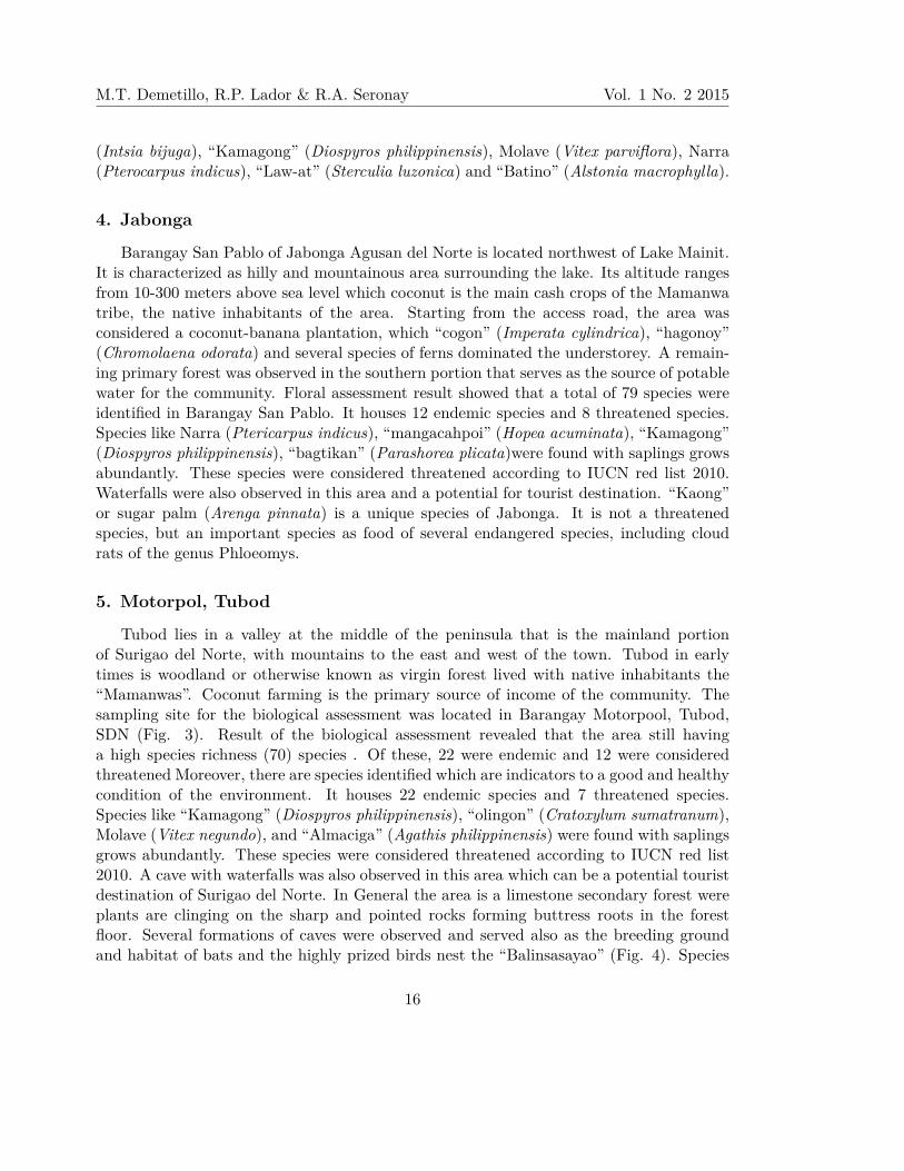
Barangay San Pablo of Jabonga Agusan del Norte is located northwest of Lake Mainit.It is characterized as hilly and mountainous area surrounding the lake. Its altitude rangesfrom 10-300 meters above sea level which coconut is the main cash crops of the Mamanwatribe, the native inhabitants of the area. Starting from the access road, the area wasconsidered a coconut-banana plantation, which “cogon” (Imperata cylindrica), “hagonoy”(Chromolaena odorata) and several species of ferns dominated the understorey. A remain-ing primary forest was observed in the southern portion that serves as the source of potablewater for the community. Floral assessment result showed that a total of 79 species wereidentified in Barangay San Pablo. It houses 12 endemic species and 8 threatened species.Species like Narra (Ptericarpus indicus), “mangacahpoi” (Hopea acuminata), “Kamagong”(Diospyros philippinensis), “bagtikan” (Parashorea plicata)were found with saplings growsabundantly. These species were considered threatened according to IUCN red list 2010.Waterfalls were also observed in this area and a potential for tourist destination. “Kaong”or sugar palm (Arenga pinnata) is a unique species of Jabonga. It is not a threatenedspecies, but an important species as food of several endangered species, including cloudrats of the genus Phloeomys.
5. Motorpol, Tubod
Tubod lies in a valley at the middle of the peninsula that is the mainland portionof Surigao del Norte, with mountains to the east and west of the town. Tubod in earlytimes is woodland or otherwise known as virgin forest lived with native inhabitants the“Mamanwas”. Coconut farming is the primary source of income of the community. Thesampling site for the biological assessment was located in Barangay Motorpool, Tubod,SDN (Fig. 3). Result of the biological assessment revealed that the area still havinga high species richness (70) species . Of these, 22 were endemic and 12 were consideredthreatened Moreover, there are species identified which are indicators to a good and healthycondition of the environment. It houses 22 endemic species and 7 threatened species.Species like “Kamagong” (Diospyros philippinensis), “olingon” (Cratoxylum sumatranum),Molave (Vitex negundo), and “Almaciga” (Agathis philippinensis) were found with saplingsgrows abundantly. These species were considered threatened according to IUCN red list2010. A cave with waterfalls was also observed in this area which can be a potential touristdestination of Surigao del Norte. In General the area is a limestone secondary forest wereplants are clinging on the sharp and pointed rocks forming buttress roots in the forestfloor. Several formations of caves were observed and served also as the breeding groundand habitat of bats and the highly prized birds nest the “Balinsasayao” (Fig. 4). Species
16

Annals of Studies in Science and Humanities Vol. 1 No. 2 2015
richness in the area is relatively high compared to the other sampling area.
6. Cantugas, Mainit
The research site was located in Barangay Cantugas, Mainit SDN. The general topogra-phy of the site is classified as secondary forest and hilly agricultural followed areas. Patchesof forest were seen in a sloppy area with an altitude ranges from 250-380 meters above sealevel. Some of the important floral species found were Narra (Pterocarpus indicus), red“lauan” (Shorea negrosensis) and Rafflesia mixta the largest flowering plant and a newrecord for Philippine plants in Caraga Region (Barcelona et al, 2014). It is noteworthythat this is a new species in the Philippines. Moreover, during the sampling period, therewere about 14 individuals of Rafflesia in the area, unlike the other areas of the Philippinesthat there are only a maximum of 3 individuals. A total of 68 species of plants recordedin the area. Of this number, 17 species were endemic in the Philippines and 6 species werethreatened based on IUCN (2010).
7. Budlingin, Alegria
The Municipality of Alegria is situated 9◦53′8′′ North, 125◦31′50′′. It is bounded in theNorth by the Municipality of Mainit and in the South by the Municipality of Kitcharao.Barangay Budlingin as a sampling sites is a hinterlands located northeast about two kilo-metres from the Poblacion. The area is graced with the presence of Lumundo falls whichserves as source of water for households and rice fields. Patches of secondary forest weredominated by Families Anacardiaceae and Rubiaceae species. Remains of Dipterocarp sppwere also observed. The area had a total of 76 species of flora and 17 of these were endemicand 6 species were considered threatened.
8.Mayag, Sison
The sampling site was located in Barangay Mayag, Sison SDN. Mayag is a valleysurrounded with Mt. Cangyagtiw in the Northern portion and mountains of BarangayImma in the western portion. The sampling sites were located in the rolling hills andplains abundant with crystal clear mountain springs, streams and brooks. A secondaryforest was dominated by small to medium size of ulayan, lawuan and ilang-ilang trees.Along the creek are stands of fruiting Ficus species which attracts fruit bats and otherbirds. Floral inventory revealed a total of 63 species with 18 species were endemic in thePhilippines and 6 were considered threatened.
Species Richness
The survey documented a total of 202 species, comprising 158 genera in 107 Familiesin all sampling sites. Among the group of plants, 165 (81.68%) species were angiosperms,
17
M.T. Demetillo, R.P. Lador & R.A. Seronay Vol. 1 No. 2 2015
4(1.98%) species were classified as Gymnosperms and 33 species (16.33%) were Pterido-phytes (Fig. 5). Angiosperms had 78 genera and 58 families. Moraceae, Rubiaceae,Fabaceae, and Myrrtaceae were amongst the most dominated families in flowering plants.On the other hand, Gymnosperms and Ferns have a total of 2 and 16 families respectively.Nephrolepis bisserata constantly dominated among all sites for the ferns while species ofGymnosperms were observed only in Tubod and Sison areas only. List of flora species ofthe four municipalities is presented in Appendix 1.
Species Diversity and Distribution
Concerning species diversity level, the highest species diversity index was obtainedfrom Santiago with H ′ = 2.94, followed by Tubod and Jabonga with H ′ = 2.36 and 2.17,which according to Fernando Biodiversity Scale (1998), these values where categorizedas moderate to low diverse areas. The lowest species diversity index was obtained inKitcharao with diversity value of 1.04. As observed, the area of Santiago and Tubod wereconsidered as secondary old growth forest to a pristine forest with higher altitudes rangingfrom 200-600 m asl. According to Barthlott et al. (1996), that biodiversity is high inmountain area because of the varied ecological conditions which give rise to wide rangeof habitats. Altitudinal and ecological zones provide plants with different exposures overshort distances. Moreover mountains have been less altered by various human activitiesbecause of the logistical difficulties inherent in the mountain areas (Gotame, 2008).
Species Similarity
Among all sampling sites, Kitcharao and Tubod have more similar species comparedto the rest of the sites. Ninety-five percent of the species in Kitcharao are also found inTubod area (Figure 6). This similarity maybe attributed to soil of these two areas whichis a limestonic type. On the other hand, Mainit and Santiago had 90% species similarityeven they are not of the same province but these two areas have the least similar speciesto the rest of the sampling sites with only 84%. This means that these two sampling siteshave more species which are unique and rare to the rest of the area.
There are several species that were found only on a specific area or these species canbe an indicator of a particular habitat and were considered rare and must be a priorityfor protection and conservation because they have also a fewer in number of individuals.In Tubod area, most of the species are indicators of higher altitude area which have morethan 500 meters above sea level. The species of trees was observed to have stunted growthdue to the rocky with a limestone substrate. The species in Alegria, Mainit and Sison areaswere indicators of an old growth forest and hilly Dipterocarp forest that extends from 300mto 450m asl. It includes numerous epiphytes, climbers and stranglers. This forest is alsorich in a variety of fruit trees such as durian, rambutan and coconut, as well as figs. Figshave been proven to be one of the most important sources of food, especially for monkeys
18

Annals of Studies in Science and Humanities Vol. 1 No. 2 2015
and civets and for larger birds such as hornbills and barbets.
Conservation status and Endemic Species
Of the total 202 plant species encountered, 52 species or (25.74%) were endemic in thePhilippines. Among the endemic species were Shorea negrosensis, Xantostemon verdugo-nianus Vitex parviflora, Dellinia philippinensis, Stenochlaena palustris and Dipterocarpusgrandiflorus (Table 2). Some of these Philippine endemic species were also threatened andendangered and it must be given sufficient protection measures in order to ensure theircontinued existence in the wild. Endangered species are defined as species that are threat-ened by disturbance such that the population of the species may become extinct in theimmediate future if the disturbance remains unchecked. To protect these species, they areincluded in the endangered species list of the International Union for the Conservationof Nature (IUCN) and the Convention on the International Trade of Endangered Species(CITES).
Figure 7 presents the plant species which are threatened and endemic to each samplingsites. As observed, Tubod and Kitcharao had the highest number of endemic and threat-ened with 22 and 21 species respectively. Most of these threatened species were distributedin all sampling sites of Lake Mainit watershed.
Threatened Species-Habitat Relationship
Canonical correspondence analysis revealed that threatened species has negative re-sponse to environmental factor like altitude, slope and canopy cover. They are not affectedwith short changes of altitude except for Agathis philippinensis which is an outlier and anindicator of higher altitude area (Fig. 8a & b). Moreover, all tree species were distributedto right axis which is an indicator of a true forest species but are threatened due to an-thropogenic activities such as timber poaching, shifting of forestland into agricultural areaand mining, while herbaceous species were distributed in the lower left axis which meansthey are the ground layer vegetation and are dependent to tree species. Some of thesespecies can still be found in the area growing naturally but should be given high priorityfor protection and conservation measures.
4 ConclusionLake Mainit watershed is the habitat of 202 species of flora, of which 14 threatened
species and 47 endemic species. The area is considered a moderately high in terms ofbiodiversity status with high endemicity status which is noteworthy for conservation andprotection. Most of these threatened species were distributed in all sampling sites but di-minishing in numbers due to natural and several anthropogenic activities thus these areasworth conserving and preserving for future use. The result of this study is very useful to de-veloped the template for the local ordinance to support local endemics. Revived the LMDA
19

M.T. Demetillo, R.P. Lador & R.A. Seronay Vol. 1 No. 2 2015
Sustainable Fishery Management Team that plays vital roles in initiating conservation oflake resources.
AcknowledgementOur sincere gratitude to LMDA for funding the research project and to the LGU of the
8 Municipalities that covers the Lake Mainit Watershed. To our research Assistants, AlvinGoloran and Glenn Betco for the untiring support during the field activities were greatlyappreciated and acknowledged.
Conflict of InterestsThe authors declare that there is no conflict of interests regarding the publication of
this paper.
ReferencesAmoroso, V. B. (1990). Ten edible economic ferns of Mindanao. Philippine Journal of
Science, 119. 295-313.
Barcelona, J. F., Cajano, M. A. O., and Hadsall, A. S. (2006). Rafflesia baletei, anothernew Rafflesia (Rafflesiaceae) from the Philippines. Kew Bulletin, 231-237.
Barthlott, W., Lauer, W. and Placke, A. (1996). Global distribution of species diversityin vascular plants: Towards A World Map of Phytodiversity. Erdkunde 50. 317-327
Brummitt, R. K. (1992). Vascular plant families and genera. Royal Botanic Gardens,Kew.
Gracia, D. M. (1981). Report on the hydrobiological survey and inventory of aquaticresources of Lake Mainit, Mindanao Island. Terminal report. Manila, BFAR FishPropagation Division.
Gotame, B. (2008). Economics of Biodiversity Conservation in Nepal. The Initiation,2 (1), 55–61.
Gruezo, W. S. (2010). Vegetation and flora of Naujan Lake National Park watershedzone, Mindoro Oriental Province, Philippines, II. Lower Watershed Zone. Asia LifeSciences-The Asian International Journal of Life Sciences, 19 (1). 71-114.
Fernando, E. S., Co, L. L., Lagunzad, D. A., Gruezo, W. S., Barcelona, J. F., Madulid,D. A., and Zamora, P. M. (2008). Threatened plants of the Philippines: a prelimi-nary assessment. Asia Life Sciences Supplement, 3. 1-52.
20

Annals of Studies in Science and Humanities Vol. 1 No. 2 2015
IUCN. (2010). IUCN Red List of Threatened Species. Version 2010.1. ElectronicDatabase accessible at www.iucnredlist.org.
Madulid D. A. (2000). A pictorial cyclopedia of Philippine ornamental plants. Book-mark Inc., Manila, 2nd edition
Magurran, A. E. (1988). Ecological diversity and its measurement. Princeton Univer-sity Press, Princeton, N.J.
Merrill, E. D. (1926). An enumeration of Philippine flowering plants. Bureau of Print-ing, I–IV. Manila, PH.
Rojo, J. P. (1999). Revised lexicon of Philippine trees. Forest Products Research andDevelopment Institute. Department of Science and Technology. Laguna.
Villegas, K. L. and Pollisco, F. A. (2008). Floral Survey of Laiban Watershed inthe Sierra Madre Mountain Range, Philippines. Journal of Tropical Biology andConservation 4 (1).
Copyright ©2015 M. T. Demetillo, R. P. Lador and R. A. Seronay. This is an open access articledistributed under the Creative Commons Attribution License, which permits unrestricted use,distribution, and reproduction in any medium, provided the original work is properly cited.
21

M.T. Demetillo, R.P. Lador & R.A. Seronay Vol. 1 No. 2 2015
Fig. 1: Map of Lake Mainit showing eight sampling locations for biological assessment.
22
Annals of Studies in Science and Humanities Vol. 1 No. 2 2015
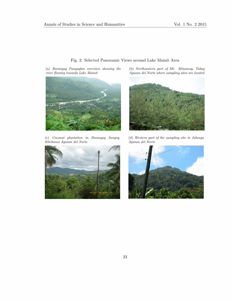
Fig. 2: Selected Panoramic Views around Lake Mainit Area
(a) Barangay Pangaylan overview showing theriver flowing towards Lake Mainit
(b) Northeastern part of Mt. Minaasog, TubayAgusan del Norte where sampling sites are located
(c) Coconut plantation in Barangay Sangay,Kitcharao Agusan del Norte
(d) Western part of the sampling site in JabongaAgusan del Norte
23

M.T. Demetillo, R.P. Lador & R.A. Seronay Vol. 1 No. 2 2015
Fig. 3: Select Panoramic View of Sampling Sites around Lake Mainit Watershed
(a) Part of sampling site in Barangay Motorpool,Tubod categorized as secondary limestone forest.
(b) Panoramic view of the sampling stations inMainit, Surigao del Norte
(c) Panoramic view of the sampling sites inBarangay Mayag, Sison, Surigao del Norte
(d) A secondary forest in Alegria, Surigao delNorte
24

Annals of Studies in Science and Humanities Vol. 1 No. 2 2015
Fig. 4: Possible tourist destinations in Surigao del Norte part of the Lake Mainit Watershed
(a) Nest of Balinsasayao inside the cave inMotorpool, Tubod Surigao del Norte
(b) Habit of Rafflesia mixta in BarangayCantugas, Mainit, Surigao Del Norte
(c) Lumundo falls in Barangay Budlingin,Alegria, Surigao del Norte
25

M.T. Demetillo, R.P. Lador & R.A. Seronay Vol. 1 No. 2 2015
Fig. 5: Pie chart showing the percentage of the major group of plants in Lake Mainitwatershed sampling sites.
Fig. 6: Dendrogram showing the Bray-Curtis cluster analysis in all sampling sites
26

Annals of Studies in Science and Humanities Vol. 1 No. 2 2015
Fig. 7: Graph showing the number of threatened and endemic species per sampling sites
Fig. 8: Canonical correspondence analysis(CCA) results
(a) CCA on altitude and species richness(b) CCA on threatened species inresponse to richness and altitude
27

M.T. Demetillo, R.P. Lador & R.A. Seronay Vol. 1 No. 2 2015
Table 1: Species richness and number of endemic and threatened species in Lake Mainitwatershed sampling sites
Sites No. ofSpecies
No. ofendemic species
ThreatenedSpecies
H ′
Pangaylan, Santiago 92 17 11 2.94La Fraternidad, Tubay 68 15 6 1.28Sangay, Kitcharao 56 21 10 1.04San Pablo, Jabonga 79 12 8 2.17Motorpool, Tubod 22 22 8 2.36Cantugas, Mainit 68 17 7 1.18Budlingin, Allegria 76 16 7 2.04Mayag, Sison 63 18 6 1.03
Table 2: List of threatened species found in eight sampling areas in Lake Mainit Watershed
Local Name Scientific Name Conservation Status (2010)
Kamagong Diospyros philippinensis EndangeredMolave Vitex parviflora VulnerableIlang-ilang Cananga odorata VulnerableApitong Dipterocarpus grandiflorus VulnerableBagtikan Parashorea plicata VulnerableMangachapui Hopea acuminate EndangeredPalosapis Anisoptera thurifera VulnerableWhite lawaan Shorea contorta VulnerableYakal Shorea astylosa VulnerableAlmaciga Agathis philippinensis EndangeredBegonia Begonia bolsterii VulnerableKalingag Cinamomum mercadoi VulnerableRafflesia Rafflesia mixta EndangeredKalantas Toona calantas Endangered
28