flickr/photos/sacherfire/217113480
DESCRIPTION
Pop-up headland. http://www.flickr.com/photos/sacherfire/217113480/. 1. You need your template. This will represent a chalk headland. 2. Using a blue crayon- shade the outside horizontal strips- these represent the sea. 3. - PowerPoint PPT PresentationTRANSCRIPT

http://www.flickr.com/photos/sacherfire/217113480/

1
You need your template. This will represent a chalk
headland.
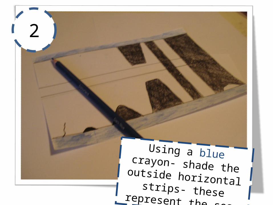
2
Using a blue crayon- shade the outside horizontal strips- these represent the sea.

3
Using a green crayon- shade the middle horizontal strip-
this represents the top of the headland- exposed to
weathering.

4 Just above the horizontal
blue lines- shade a grey line-
make sure it reaches the top
of the wave-cut notch. This
represents wave action
between high and low tide.
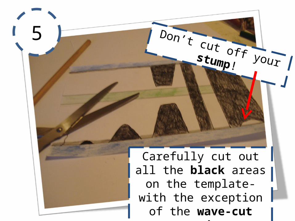
5
Carefully cut out all the black areas on the template- with the exception of the wave-
cut notch.
Don’t cut off your stump!
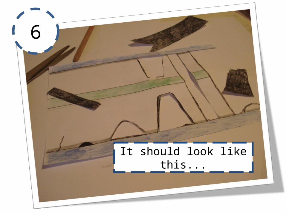
6
It should look like this...
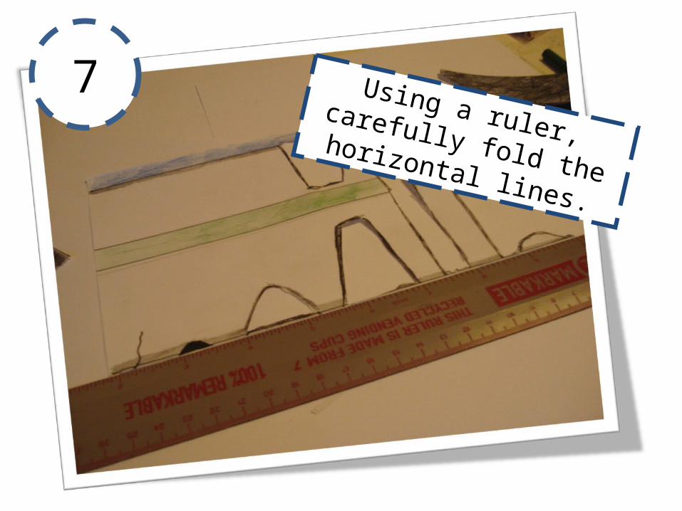
7 Using a ruler, carefully fold the horizontal lines.
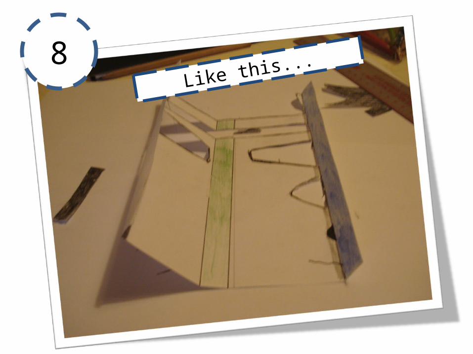
8Like this...

9 Glue along the two blue horizontal strips- on the reverse!
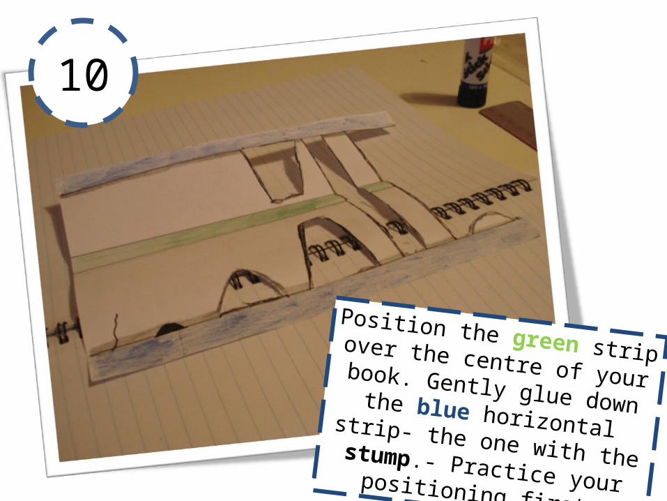
10
Position the green strip over the centre of your book. Gently glue down the blue horizontal strip- the one with the stump.- Practice your positioning first.

11
Carefully practice folding the
model... are the folds the
right way?

12Finally, glue the final blue strip down. Practice the
positioning first...

13 Gently close your book...
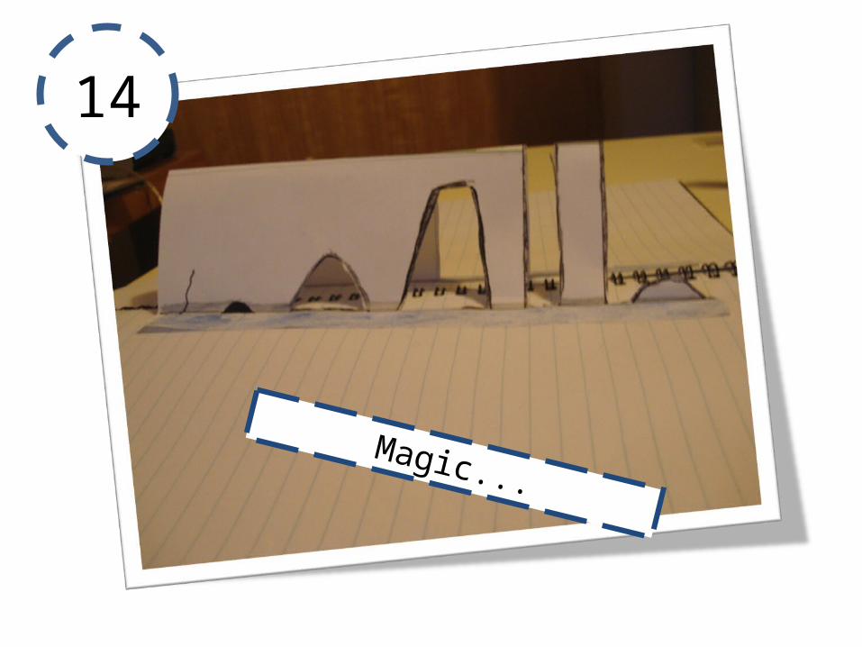
14
Magic...
1
2
3
4 5
6
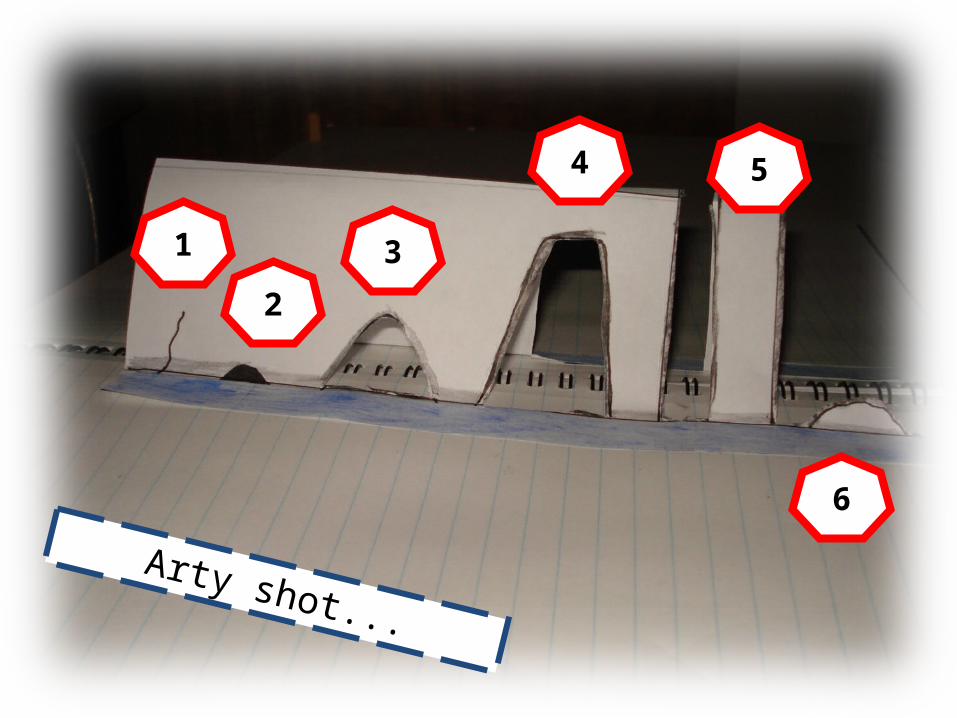
Arty shot...

About the template...You could draw your own template or print this slide and use for the model.
The template should be A5 to fit into across a A4 exercise book- of course you could supersize the model.
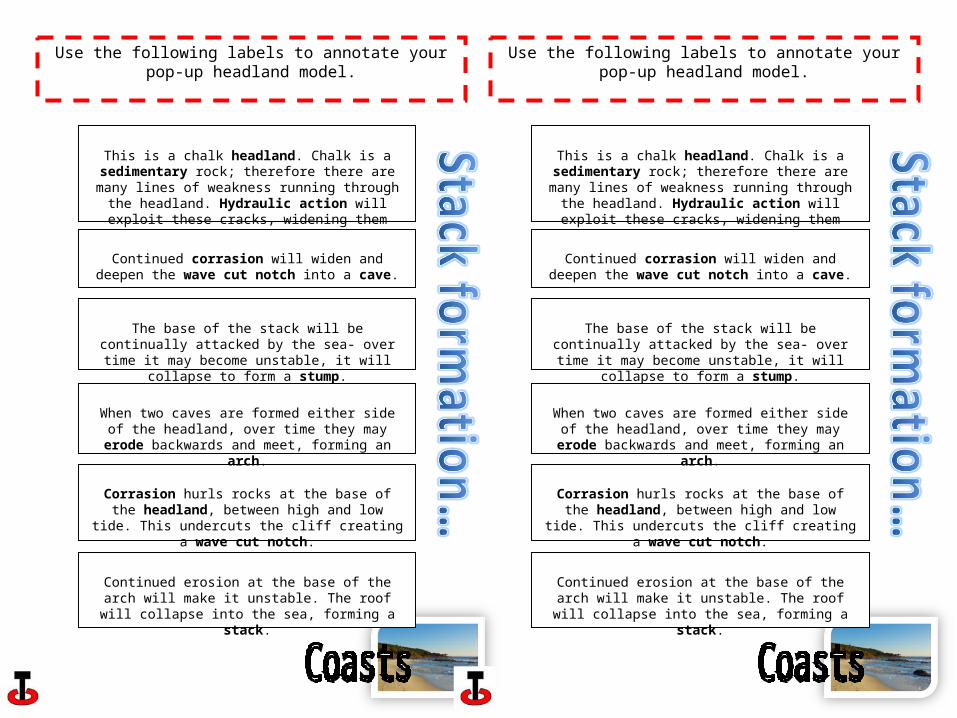
Use the following labels to annotate your pop-up headland model.
This is a chalk headland. Chalk is a sedimentary rock; therefore there are many lines of weakness running
through the headland. Hydraulic action will exploit these cracks, widening them over time.
Corrasion hurls rocks at the base of the headland, between high and low tide. This undercuts the cliff
creating a wave cut notch.
Continued corrasion will widen and deepen the wave cut notch into a cave.
When two caves are formed either side of the headland, over time they may erode backwards and meet, forming
an arch.
Continued erosion at the base of the arch will make it unstable. The roof will collapse into the sea, forming a
stack.
The base of the stack will be continually attacked by the sea- over time it may become unstable, it will collapse to
form a stump.