fishery management, current uses, data needs
TRANSCRIPT
GIS and EAFGIS and EAF
Chad DemarestChad DemarestNEFMC/NERO/NEFSCNEFMC/NERO/NEFSC
EAF Project LeaderEAF Project Leader
Fishery management, Fishery management, current uses, current uses,
considerations and considerations and data needsdata needs

GIS and EAFGIS and EAF
New England Fishery Management PlansNew England Fishery Management PlansSpatial/temporal managementSpatial/temporal managementCurrent GIS applicationsCurrent GIS applicationsEcosystem Approaches to Fisheries (EAF) Ecosystem Approaches to Fisheries (EAF) ConsiderationsConsiderationsEAF data needsEAF data needs
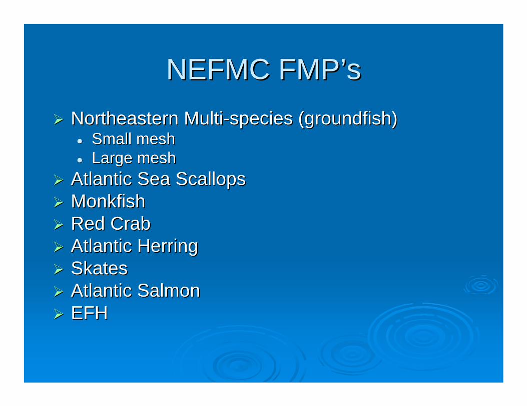
NEFMC NEFMC FMPFMP’’ssNortheastern MultiNortheastern Multi--species (groundfish)species (groundfish)
Small meshSmall meshLarge meshLarge mesh
Atlantic Sea ScallopsAtlantic Sea ScallopsMonkfishMonkfishRed CrabRed CrabAtlantic HerringAtlantic HerringSkatesSkatesAtlantic SalmonAtlantic SalmonEFHEFH

Other Pertinent Other Pertinent FMPFMP’’ss
MAFMCMAFMCBluefish (Bluefish (recrec))Surf Clam/Ocean Surf Clam/Ocean QuahogQuahogSquid/Mackerel/ButterfSquid/Mackerel/ButterfishishBlack Sea Bass/Scup/ Black Sea Bass/Scup/ Summer FlounderSummer FlounderDogfish*Dogfish*
ASMFCASMFCNorthern ShrimpNorthern ShrimpLobsterLobsterStriped Bass (Striped Bass (recrec))
OtherOtherHagfishHagfishPelagicsPelagics

Spatial/Temporal Management Spatial/Temporal Management
Most NE fisheries employ tacit MPA approach w/ Most NE fisheries employ tacit MPA approach w/ both spatial and temporal applicationsboth spatial and temporal applications
Define MPA: no different from Marine ZoningDefine MPA: no different from Marine ZoningNEMS NEMS –– Closed areas, seasonal closures, Closed areas, seasonal closures, RGAsRGAs, , RMAsRMAs, habitat closures, SAPs and on and on..., habitat closures, SAPs and on and on...Scallops Scallops –– Rotational management (13), including Rotational management (13), including NEMS closed areasNEMS closed areasHerring Herring –– Management areas (1A, 1B, 2, 3)Management areas (1A, 1B, 2, 3)Monkfish Monkfish –– Management areas (Northern, Southern)Management areas (Northern, Southern)Red crab and skates are exceptionsRed crab and skates are exceptions

NEMS rebuilding and habitat closuresNEMS rebuilding and habitat closures

NEMS NEMS US/Canada US/Canada Resource Resource Sharing Sharing
Understanding Understanding areaarea

Habitat Habitat ClosuresClosures
(all mobile, (all mobile, bottombottom--tending tending gears)gears)

Scallop rotational management areasScallop rotational management areas

Current GIS ApplicationsCurrent GIS Applications
Mapping in management documentsMapping in management documentsSpatial managementSpatial managementImpactImpact’’s analysiss analysis
EFH designation mappingEFH designation mappingSurvey data/abundance at life stageSurvey data/abundance at life stage
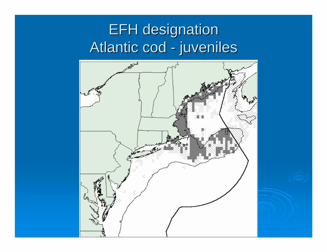
EFH designationEFH designationAtlantic cod Atlantic cod -- juvenilesjuveniles

EFH adverse impacts minimizationEFH adverse impacts minimizationFishing impactsFishing impacts
•• Spatial fishing effort data mappingSpatial fishing effort data mappingVTRVTRVMSVMSCG sightingCG sighting
•• Hangs/snags mappingHangs/snags mapping•• Assemblage/guild/canary species mappingAssemblage/guild/canary species mapping•• Surface sediment mapping (Poppe Surface sediment mapping (Poppe et al.et al.))•• MultiMulti--beam mapping (beam mapping (StellwagonStellwagon Bank, Jeffries Ledge, Bank, Jeffries Ledge,
GOM)GOM)•• SMAST visual mappingSMAST visual mapping
NonNon--fishing impacts fishing impacts •• VeryVery limited mappinglimited mapping
Current GIS Applications (Current GIS Applications (concon’’tt))

Fishing effort data (VTR)Fishing effort data (VTR)

Surficial sedimentation Surficial sedimentation w/ Atlantic cod abundancew/ Atlantic cod abundance

Current GIS Applications (Current GIS Applications (concon’’tt))
Social Science initiativesSocial Science initiativesCoastal communities interactive mappingCoastal communities interactive mapping•• Fisheries and census data synthesisFisheries and census data synthesis
County business patternsCounty business patternsInput/Output modelingInput/Output modeling
Network analysis Network analysis –– Atlantic herringAtlantic herringFrom fishFrom fish--inin--thethe--net to market to endnet to market to end--useruserEmployment, regional impact, multiEmployment, regional impact, multi--fishery fishery impactsimpacts

Current GIS Applications (Current GIS Applications (concon’’tt))Personal use GISPersonal use GIS
JPEG production/displayJPEG production/display•• Raw data (VTR, survey, observer)Raw data (VTR, survey, observer)•• Aggregation (TMS, QDS, Management areas)Aggregation (TMS, QDS, Management areas)
Geographic dataset manipulationGeographic dataset manipulation•• From and back into SASFrom and back into SAS
CouncilCouncil--level userslevel usersFour of eight analysts relatively highFour of eight analysts relatively high--end usersend usersPrimarily mapping for JPEGs and database Primarily mapping for JPEGs and database manipulationmanipulationVery little analysis/modelingVery little analysis/modeling

EAF ConsiderationsEAF Considerations
1.1. EAF is not a goal, itEAF is not a goal, it’’s a means to s a means to achieving a goalachieving a goal
2.2. We manage fisherman We manage fisherman –– extraction is the extraction is the only variable we directly influenceonly variable we directly influence
3.3. EAF may enhance SS management, not EAF may enhance SS management, not supplant itsupplant it

EAF data needsEAF data needsSpecies & stock distribution data from scientific surveysSpecies & stock distribution data from scientific surveysLarval, juvenile & adult life stagesLarval, juvenile & adult life stagesSpatial presence within water columnSpatial presence within water columnBenthic habit informationBenthic habit information
Sediment type Sediment type Depth contoursDepth contours
Oceanographic informationOceanographic informationCurrent dynamicsCurrent dynamicsSalinitySalinityTemperatureTemperatureLarval transportLarval transport

EAF data needs (EAF data needs (concon’’tt))Food webFood web
Geographic / seasonal information on predatorGeographic / seasonal information on predator--prey interactionsprey interactionsLocation of Location of phytophyto-- and zooplankton blooms (primary production) and zooplankton blooms (primary production) Fisheries catch informationFisheries catch informationFisheries effort information Fisheries effort information
Designated areasDesignated areasFishery management areasFishery management areasMarine Sanctuaries Marine Sanctuaries Jurisdictional / political boundariesJurisdictional / political boundariesDisposal sitesDisposal sitesShipping lanesShipping lanesValuable cultural sitesValuable cultural sites

EAF data needs (EAF data needs (concon’’tt))NonNon--fishing activitiesfishing activities
All fluid discharge sitesAll fluid discharge sitesAll watershedsAll watershedsNonNon--fluid disposal sitesfluid disposal sitesWater transportation facilities and patternsWater transportation facilities and patternsConcentrations of nonConcentrations of non--point source dischargepoint source dischargeLocations of other activities that affect the marine environmentLocations of other activities that affect the marine environment
Economic /socialEconomic /socialLocation of fishing communitiesLocation of fishing communitiesGeographic characterization of economic dependence on fishing Geographic characterization of economic dependence on fishing activities (including nonactivities (including non--consumptive uses) consumptive uses) Location of major support infrastructure Location of major support infrastructure Market distribution systemMarket distribution systemAreas where stakeholders resideAreas where stakeholders residePopulation areasPopulation areas