final project2
TRANSCRIPT
UNCC Emergency Phones
Chris SpryKareem Ali
Charles DraytonMitchell Stewart
5.4.10

Objective: Inventory the Emergency Blue Light Phones on the UNCC Campus and analyze the accessibility and visibility of the phones.

Data Used:
• Charlotte Streets (Lines)• UNCC campus sidewalks/paths (Lines)• Phone locations located with GPS (Points)• Building footprints and heights (Polygon)• Elevation contour lines (converted to DEM)• Orthophoto of campus (reference)
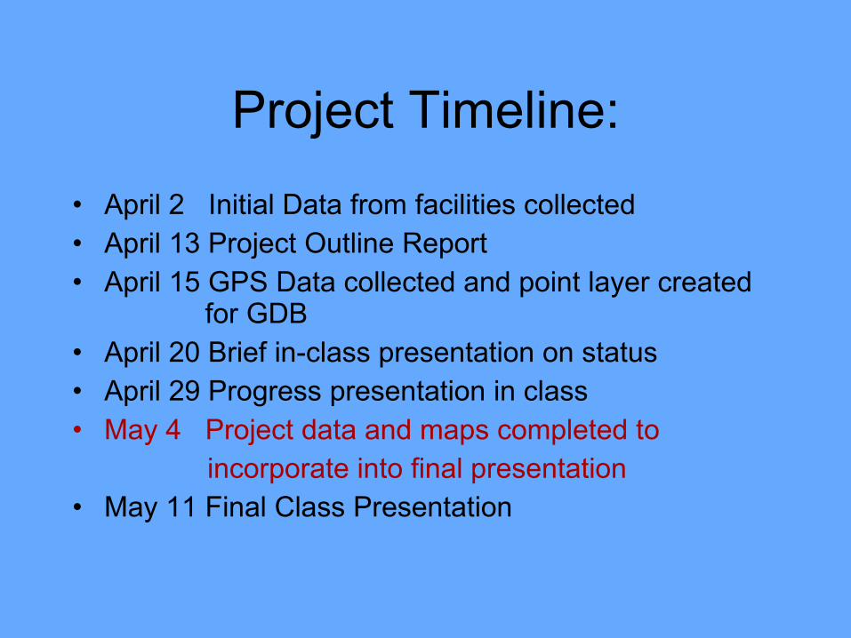
Project Timeline:
• April 2 Initial Data from facilities collected• April 13 Project Outline Report• April 15 GPS Data collected and point layer created
for GDB• April 20 Brief in-class presentation on status• April 29 Progress presentation in class• May 4 Project data and maps completed to incorporate into final presentation• May 11 Final Class Presentation
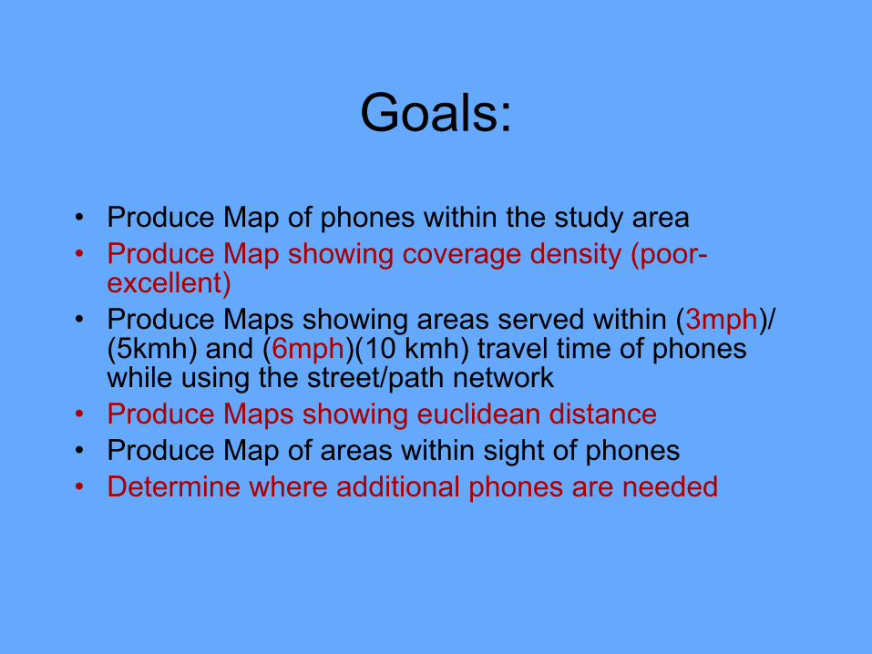
Goals:
• Produce Map of phones within the study area• Produce Map showing coverage density (poor-
excellent)• Produce Maps showing areas served within (3mph)/
(5kmh) and (6mph)(10 kmh) travel time of phones while using the street/path network
• Produce Maps showing euclidean distance• Produce Map of areas within sight of phones• Determine where additional phones are needed

Analysis Methods
• Global Positioning Systems (GPS)• Kernel Density• Euclidean Distance Analysis• Network Analysis• Visibility Analysis
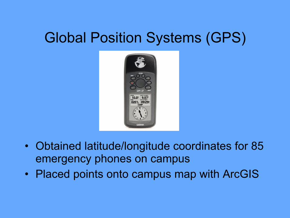
Global Position Systems (GPS)
• Obtained latitude/longitude coordinates for 85 emergency phones on campus
• Placed points onto campus map with ArcGIS


Density Analysis


Network Analysis


Visibility Analysis


Google Earth!
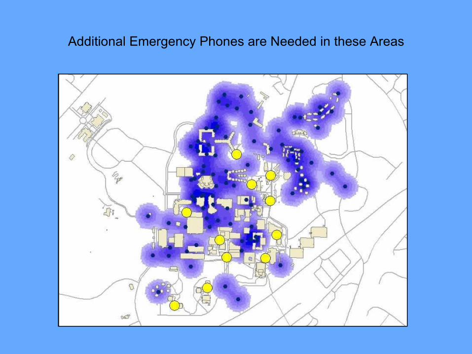
Additional Emergency Phones are Needed in these Areas

Questions?