final-pismo preserve presentation preserve - safe... · our nonprofit protecting what we all love...
TRANSCRIPT

PISMO PRESERVESafe, Sustainable…Sensational.

INTRODUCTIONS
Kaila Dettman, Executive Director
The Land Conservancy of San Luis Obispo County
Brandon Medeiros, Director of Landscape Architecture
Wallace Group

OUR NONPROFIT
Protecting what we all love best about
where we live: the land, the water, the open space, the lifestyle
• Local people, local land
• Nonprofit land trust
• Established in 1984
• 15,000+ acres
permanently protected
• CONSERVE
• CARE
• CONNECT

CONSERVE. CARE. CONNECT.Land protection
and planning
(purchasing land
and conservation
easements)
Restoration and
stewardship of
lands we own
and hold
easements
Outreach,
education, and
community
involvement

PISMOPRESERVE
Source from www.californiaclassic.com
PISMO BEACH

WHY WE
CONSERVED
THIS LAND
By acquiring the Pismo Preserve,
we permanently protected the
scenic beauty and limited natural
resources that provide healthy
air and clean water…

…preserved valuable habitat for wildlife and plants…

…will provide the natural and scenic beauty of a one-of-a-kind landscape for relaxation and rejuvenation…

…created critical opportunities for kids to get out and play…

…and will attract visitors from all around the world whichincreases tourism and brings money into our communities.

But that’s not all.

Video – Adventure is Waiting
• Add Picture

How we did it – A leap of faith…


Simple tools, Big impact

Public meetings & Support
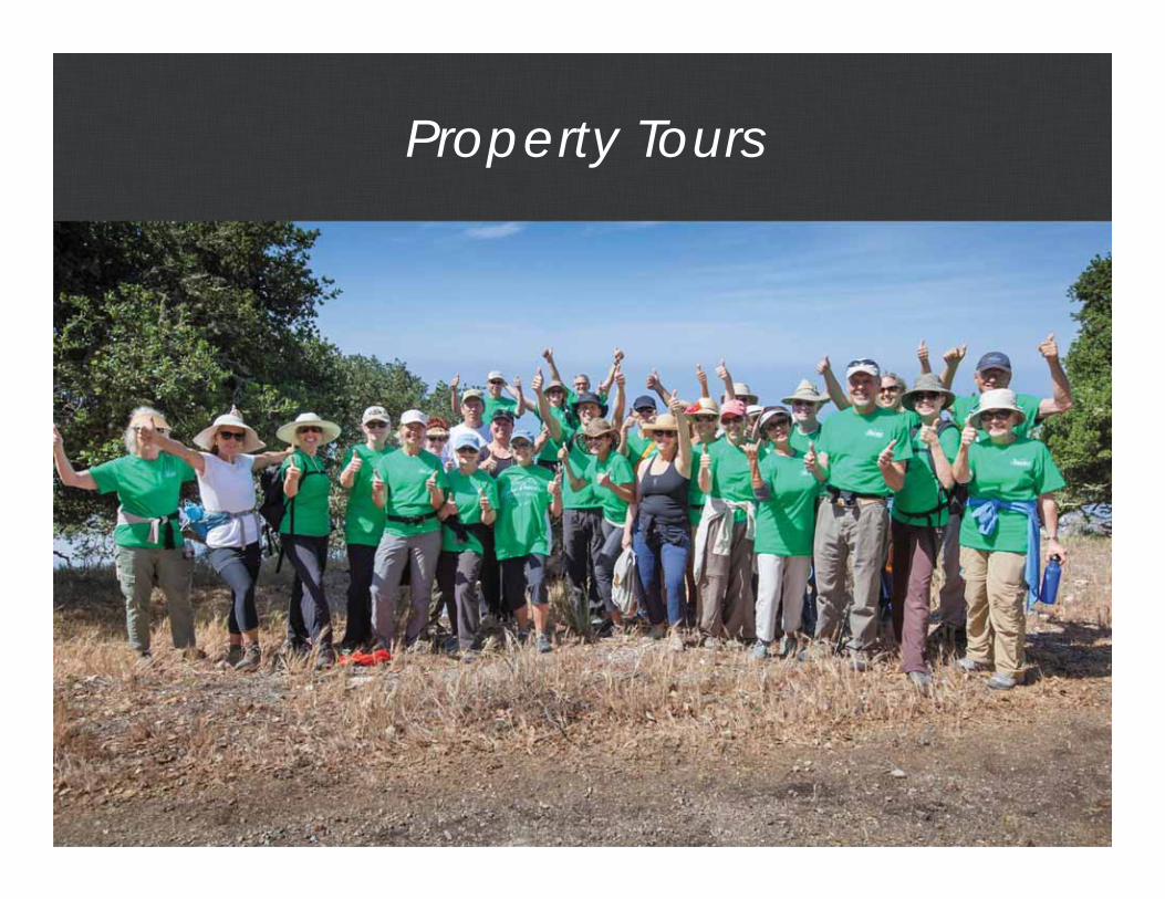
Property Tours
• Community Support• Engagement• Imagery of Preserve

Local Hotels & Restaurants

Art Shows & Club Auctions

Outreach
• Community Support• Engagement• Imagery of Preserve

Ambassador Trainings

Concerts and Events

Media Coverage

Escrow Closed September 17th, 2014

Pismo Preserve Funding Breakdown
$8 million State Agencies$4 million –California State Coastal Conservancy$4 million – Wildlife Conservation Board
$4 million Regional Government & Community Donations$1,500,000 – SLO County$900,000 City of Pismo Beach ($700K PB Grant, $200K TBID Sponsorship)
$350,000 Regional Water Quality Control Board$75,000 City of SLO$40,000 City of Arroyo Grande$5,000 City of Grover Beach$1,355,860.92– Community and business donations
Total Raised (in round numbers) - $12,227,000.00

Preparing for “After the Success”• Thanking our donors
and supporters• Media coverage• Land Stewardship

Our Team

Our Team

Preparing for “after the success”
• “Over-Fundraising” to cover all project costs, not just the purchase.
• Setting expectations for what happens after the deal closes.
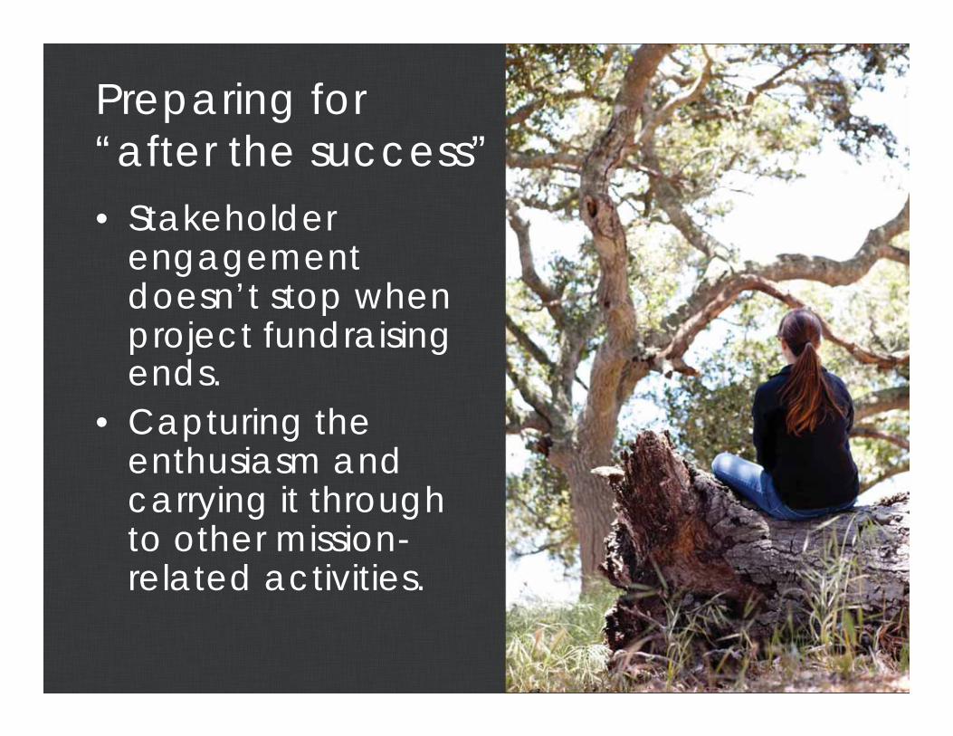
Preparing for “after the success”• Stakeholder
engagementdoesn’t stop when project fundraising ends.
• Capturing the enthusiasm and carrying it through to other mission-related activities.

Project Goals
• Public park: dawn to dusk passive recreation.
• Open to hikers, horseback riders, and mountain bikers.
• Preserve Manager and Ranger• Mattie Road parking and
infrastructure.– Parking areas.– Restrooms.– Interpretive signage and
wayfinding.– Donor recognition.– 10 to 15 miles of trail.
• Wildfire risk management and emergency evacuation routes.
• Environmental study and planning.
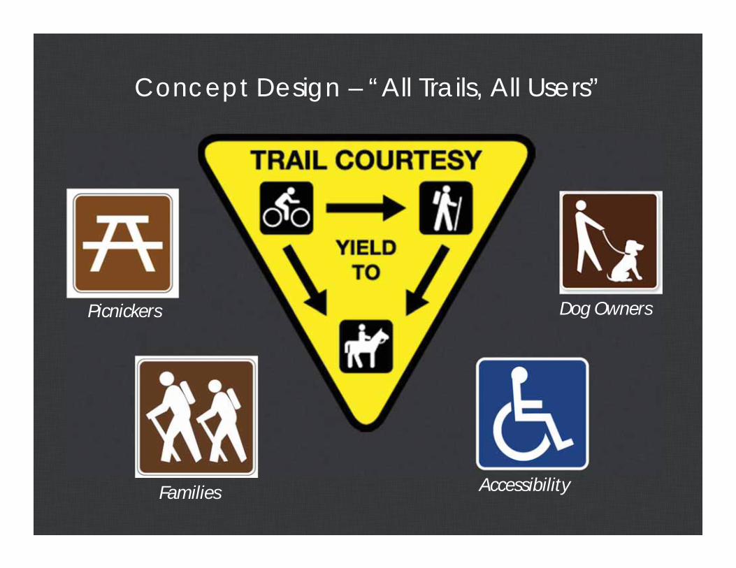
Concept Design – “All Trails, All Users”
Picnickers
Families
Dog Owners
Accessibility

– Opportunities & Constraints Mapping– Field Studies & Data Inventory– Design Development– Trail Building Progress Update
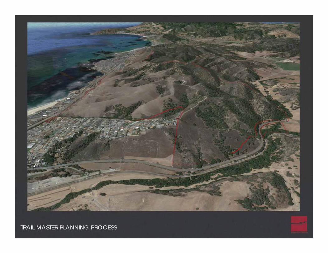
TRAIL MASTER PLANNING PROCESS

Regional Connections
PISMOPRESERVE
TRAIL MASTER PLANNING PROCESS

Community Connections
PISMOPRESERVE
TRAIL MASTER PLANNING PROCESS

Adjacent Land Use
PISMOPRESERVE
TRAIL MASTER PLANNING PROCESS

TRAIL MASTER PLANNING PROCESS
SLO County Planning GIS Database Overlays

Aerial & Topographic Base Information
TRAIL MASTER PLANNING PROCESS
TRAIL MASTER PLANNING PROCESS

FIRST ITERATION OF THE TRAIL PLAN

PRELIMINARY TRAIL GRADING STUDIES

PRELIMINARY TRAIL GRADING STUDIES
Study Findings:– Approx. 900 feet of elevation– Existing roads are steep– Difficult to have relatively
moderate sloped trails for allareas
– Will require a designatedaccessible trail.
– Vista Points are abundant– Loop trail system for a variety
of trail experiences and skilllevels
– Access points are limited– Preferred Parking Area will be a
tight fit

PRELIMINARY STUDIES
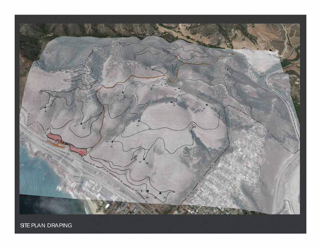
SITE PLAN DRAPING

SITE PLAN DRAPING

TRAIL HEIRARCHY AND LOOPS

FIELD STUDIES & INVENTORY
Truth is in the Field
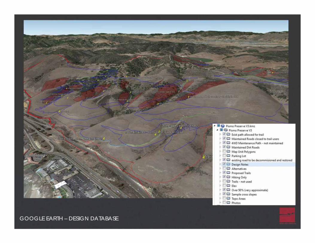
GOOGLE EARTH – DESIGN DATABASE

FIELD STUDIES & INVENTORY
GPS Tracking & Notes

UNDERSTANDING THE SENSE OF PLACE

UNDERSTANDING THE SENSE OF PLACE


CONCEPT MASTER PLAN – ENTRY AREA & ACCESSIBLE TRAIL

CONCEPT MASTER PLAN – ACCESSIBLE TRAIL
Accessible Trail:Parking: 50 passenger vehiclesspaces (Includes 3)Paved Accessible Trail8’ Asphalt (3” over 8” base)2’ Aggregate Base Shoulders (bothsidesBenchesTrail Head KiosksTrash & Recycling ReceptaclesBouldersPet Waste Stations

CONCEPT MASTER PLAN

CONCEPT MASTER PLAN
PRIC
ECA
NYO
NRD

TRAIL HEAD / PARKING LOT CONCEPT PLAN

ENTRY CONCEPT PLAN
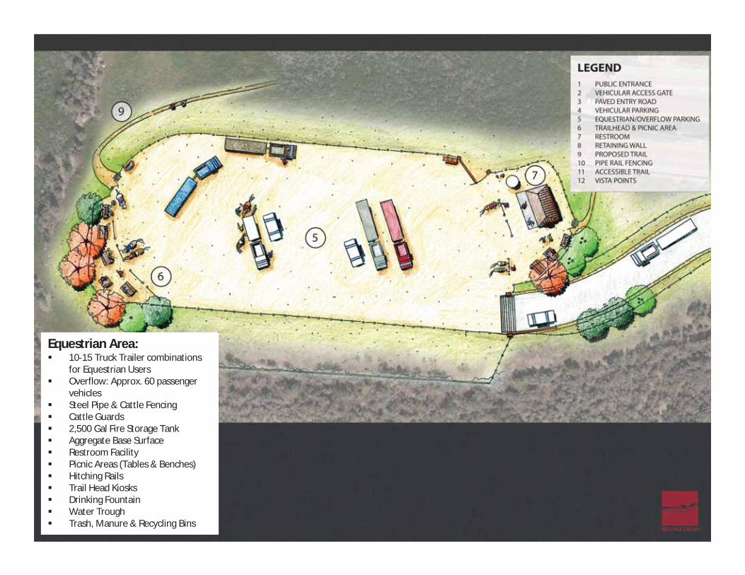
Equestrian Area:10 15 Truck Trailer combinationsfor Equestrian UsersOverflow: Approx. 60 passengervehiclesSteel Pipe & Cattle FencingCattle Guards2,500 Gal Fire Storage TankAggregate Base SurfaceRestroom FacilityPicnic Areas (Tables & Benches)Hitching RailsTrail Head KiosksDrinking FountainWater TroughTrash, Manure & Recycling Bins

PARKING LOT CONCEPT PLAN
General Area:Parking: 50 passenger vehiclesspaces (Includes 3)Donor WallCattle Fencing & Wood RailAsphalt PavingAggregate Base SurfaceRestroom FacilityTrail Head KiosksPicnic Areas (Tables & Benches)BouldersPet Waste StationsDrinking FountainTrash & Recycling ReceptaclesLow Security LightingBike Rack

TRAIL HEAD / PARKING LOT CONCEPT PLAN

TRAIL HEAD CONCEPT PLAN
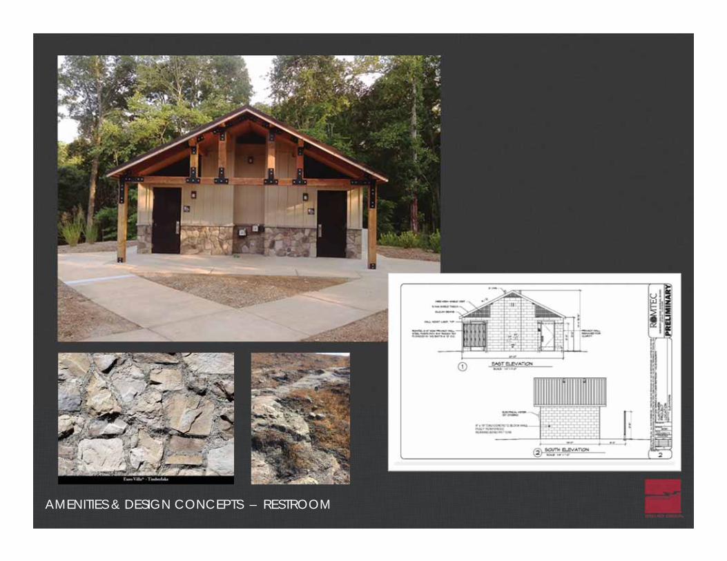
AMENITIES & DESIGN CONCEPTS – RESTROOM

AMENITIES & DESIGN CONCEPTS – KIOSK FACILITIES
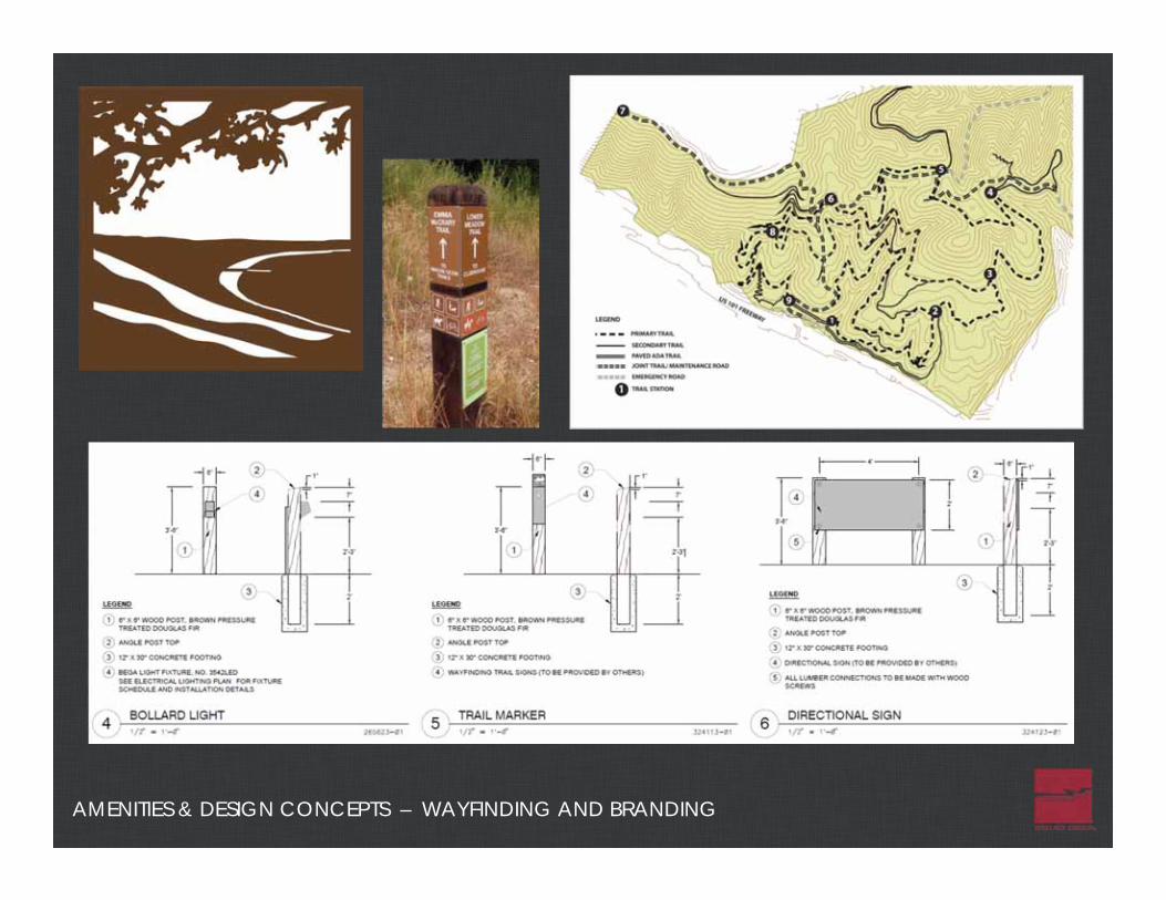
AMENITIES & DESIGN CONCEPTS – WAYFINDING AND BRANDING

AMENITIES & DESIGN CONCEPTS – PED BRIDGE / FENCING / FURNISHINGS

Conditions of Approval
– CalFire: Fire suppression, emergency ingress/egress, all weather road improvements, fire management plan, mapping.
– City of Pismo Beach: Parking, restrooms, signage and wayfinding, cooperative agreement to address public safety.
– County of SLO: CEQA Negative Declaration, onsite mitigation for sensitive biological and cultural resources.
– State of California: Open to public dawn to dusk for passive recreation, wildlife management.
DESIGN & PERMITTING
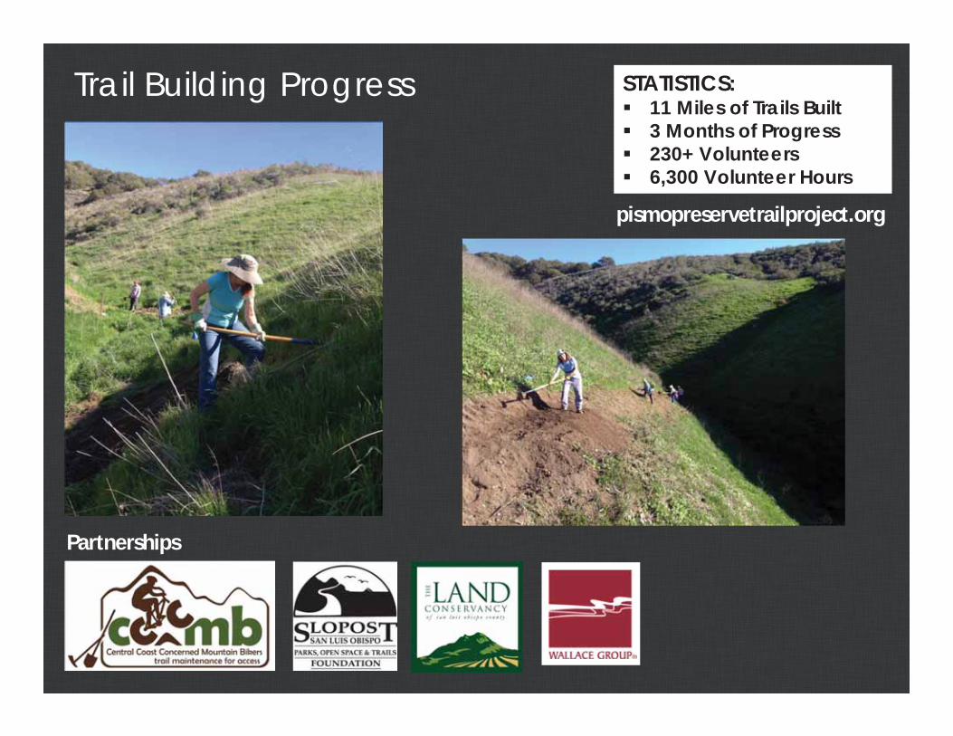
Trail Building Progress STATISTICS:11 Miles of Trails Built3 Months of Progress230+ Volunteers6,300 Volunteer Hours
pismopreservetrailproject.org
Partnerships


Our Team

Our Team

Our Team

Our Team

Our Team

Our Team

Our Team

Our Team

Our Team

Our Team

Our Team

Our Team

Video – Trail build drone footage

PISMO PRESERVESafe, Sustainable…Sensational.