field survey 20110426 - jica · field survey in the disaster affected area of the great east japan...
TRANSCRIPT
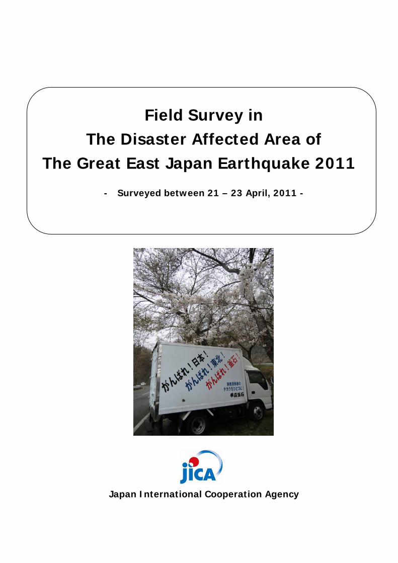
Field Survey in The Disaster Affected Area of
The Great East Japan Earthquake 2011
- Surveyed between 21 – 23 April, 2011 -
Japan International Cooperation Agency

Field Survey in the Disaster Affected Area of The Great East Japan Earthquake 2011
1
Route Map of Field Survey
Map Source: Google Map
Field Survey Schedule
Day Prefecture Field Survey Area
1st Day 21 April Miyagi ① Natori (Sendai Airport) ⇒ ② Sendai
(Wakabayashi-Ward)⇒③Shichigahama
2nd Day 22 April Miyagi, Iwate Kesennuma ⇒ ④ Rikuzentakata ⇒ Ofunato ⇒ ⑤
Kamaishi ⇒ ⑥ Otsuchi ⇒ ⑦ Yamada ⇒ ⑧ Miyako
(Taro)
3rd Day 23 April Iwate, Aomori ⑨Nodamura⇒Kuji⇒Taneichi⇒⑩Hachinohe⇒
Misawa
○Taro
Shichigahama
○
○Rikuzentakata
Hachinohe Port
○Yamada
○Nodamura
①
②③
④
⑤
⑦
⑧
⑩
Legend
1st Day
2nd Day
3rd Day
⑨
○Otsuchi ⑥
○
○
○
○
○

Field Survey in the Disaster Affected Area of The Great East Japan Earthquake 2011
2
1. Miyagi Prefecture
①Natori
Population 73,140
Death 887
Missing 230
Death+Missing 1,117Inun
dati
on a
rea
Cas
ualt
y
Casualty Ratio (%) 1.5
Sendai Airport and surrounding area, the Airport started their operation in 13 April, 2011, with minimum facilities.
Residential area along the Airport. Located near to coastal line and residential buildings were totally washed away.
Collapsed Sea Wall. Tsunami Control Forest was mostly destroyed.
Debris of Sea Wall, located behind the original position.
Source: Inundation Area, Geospatial Information Agency of Japan, 2011 Population, Population Census 2010, pre-released on 25 Feb. 2011 Death and Missing, Miyagi Prefecture, as of 23 April, 2011

Field Survey in the Disaster Affected Area of The Great East Japan Earthquake 2011
3
②Sendai (Wakabayashi-ward, Miyagino-ward)
Population 322,676
Death 662
Missing -
Death+Missing 662Inun
dati
on a
rea
Cas
ualt
y
Casualty Ratio (%) 0.2
Residential area and surrounding agricultural field
Tsunami Control Forest did not work well with this massive force of Tsunami.
Pumping Vehicle located near the coastal line owned by Ministry of Land, Infrastructure, Transport and Tourism(MLIT)
Sea water remained in the agricultural field by Tsunami inundation
Source: Inundation Area, Geospatial Information Agency of Japan, 2011 Population, Population Census 2010, pre-released on 25 Feb. 2011 Death and Missing, Miyagi Prefecture, as of 23 April, 2011 Note: Population of Sendai is 1,045,903, however, only Wakabayashi-ward, and Miyagino-ward where Tsunami damages observed were taken into account, therefore, 322,676 is the sum of population of Wakabayashi-ward and Miyagino-ward

Field Survey in the Disaster Affected Area of The Great East Japan Earthquake 2011
4
③Shichigahama
Population 20,419
Death 62
Missing 10
Death+Missing 72Inun
dati
on a
rea
Cas
ualt
y
Casualty Ratio (%) 0.4
Interview to Disaster Management Officials of Shichigahama-town for their preparedness and response
Retrofitted Municipal Building and no damages were observed, and the building is located at the highest point of the town
Residental buildings were washed away in the flat residential area
Temporary shelters under construction (to be completed in a few days), however still lack of number compared with needs
Source: Inundation Area, Geospatial Information Agency of Japan, 2011 Population, Population Census 2010, pre-released on 25 Feb. 2011 Death and Missing, Miyagi Prefecture, as of 23 April, 2011

Field Survey in the Disaster Affected Area of The Great East Japan Earthquake 2011
5
2. Iwate Prefecture
④Rikuzentakata
Population 23,302
Death 1,356
Missing 817
Death+Missing 2,173Inun
dati
on a
rea
Cas
ualt
y
Casualty Ratio (%) 9.3
One of the settlements in Rikuzentakata, residential buildings are totally washed away. There are shrine along the hilly area and people evacuated to this shrine
Municipal building was also inundated totally and can not be utilized for emergency response activities
Designated evacuation facility was also inundated totally, and many people killed
Source: Inundation Area, Geospatial Information Agency of Japan, 2011 Population, Population Census 2010, pre-released on 25 Feb. 2011 Death and Missing, Iwate Prefecture, as of 23 April, 2011

Field Survey in the Disaster Affected Area of The Great East Japan Earthquake 2011
6
⑤Kamaishi
Population 39,578
Death 761
Missing 570
Death+Missing 1,331Inun
dati
on a
rea
Cas
ualt
y
Casualty Ratio (%) 3.4
Sea wall was collapsed and residential area was washed away before entering city center of Kamaishi
Pushed away large ship along the Port of Kamaishi
Damaged buildings along the port of Kamaishi
Sign Board of Tsunami and High Tide evacuation route by Iwate Prefecture
Source: Inundation Area, Geospatial Information Agency of Japan, 2011 Population, Population Census 2010, pre-released on 25 Feb. 2011 Death and Missing, Iwate Prefecture, as of 23 April, 2011

Field Survey in the Disaster Affected Area of The Great East Japan Earthquake 2011
7
⑥Otsuchi
Population 15,277
Death 694
Missing 980
Death+Missing 1,674Inun
dati
on a
rea
Cas
ualt
y
Casualty Ratio (%) 11.0
Sign Board of “Estimation of Tsunami Inundation Area”, however, it is over estimated
Railway and railway bridge was collapsed
City center of Otsuchi. Most of buildings except RC buildings were washed away
Tsunami inundated along rivers far from coastal line
Source: Inundation Area, Geospatial Information Agency of Japan, 2011 Population, Population Census 2010, pre-released on 25 Feb. 2011 Death and Missing, Iwate Prefecture, as of 23 April, 2011

Field Survey in the Disaster Affected Area of The Great East Japan Earthquake 2011
8
⑦Yamada
Population 18,625
Death 547
Missing 380
Death+Missing 927Inun
dati
on a
rea
Cas
ualt
y
Casualty Ratio (%) 5.0
Residential Buildings were washed away in the flat area
Gymnasium are utilized as “Evacuation Center”
Movable Mobile Phone Station and new antenna installation
“Public Bath” operated by Self Defense Force
Source: Inundation Area, Geospatial Information Agency of Japan, 2011 Population, Population Census 2010, pre-released on 25 Feb. 2011 Death and Missing, Iwate Prefecture, as of 23 April, 2011
Field Survey in the Disaster Affected Area of The Great East Japan Earthquake 2011
9
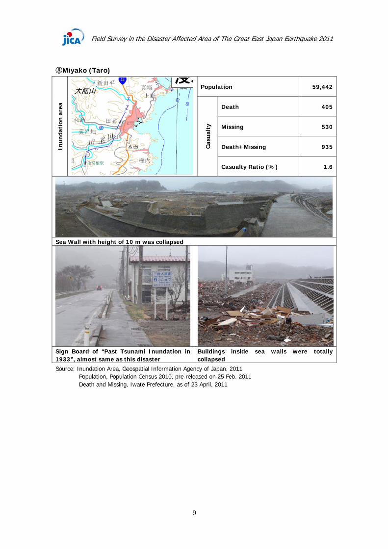
⑧Miyako (Taro)
Population 59,442
Death 405
Missing 530
Death+Missing 935Inun
dati
on a
rea
Cas
ualt
y
Casualty Ratio (%) 1.6
Sea Wall with height of 10 m was collapsed
Sign Board of “Past Tsunami Inundation in 1933”, almost same as this disaster
Buildings inside sea walls were totally collapsed
Source: Inundation Area, Geospatial Information Agency of Japan, 2011 Population, Population Census 2010, pre-released on 25 Feb. 2011 Death and Missing, Iwate Prefecture, as of 23 April, 2011

Field Survey in the Disaster Affected Area of The Great East Japan Earthquake 2011
10
⑨Nodamura
Population 4,632
Death 38
Missing -
Death+Missing 38Inun
dati
on a
rea
Cas
ualt
y
Casualty Ratio (%) 0.8
Collapsed Sea Wall Fallen down Tsunami Control Forest
Flat residential area and agricultural field were totally washed away
Left side road with higher elevation was the line to be collapsed or not
Source: Inundation Area, Geospatial Information Agency of Japan, 2011 Population, Population Census 2010, pre-released on 25 Feb. 2011 Death and Missing, Iwate Prefecture, as of 23 April, 2011
3. Aomori Prefecture

Field Survey in the Disaster Affected Area of The Great East Japan Earthquake 2011
11
⑩Hachinohe
Population 237,473
Death 1
Missing -
Death+Missing 1Inun
dati
on a
rea
Cas
ualt
y
Casualty Ratio (%) 0.0004
Many large ships were pushed away inland by Tsunami, structural damages are limited compared to other location, however, fishery activities can not be operated in this area
Source: Inundation Area, Geospatial Information Agency of Japan, 2011 Population, Population Census 2010, pre-released on 25 Feb. 2011 Death and Missing, Aomori Prefecture, as of 23 April, 2011