fema guidance for modeling and mapping the impact of …
TRANSCRIPT
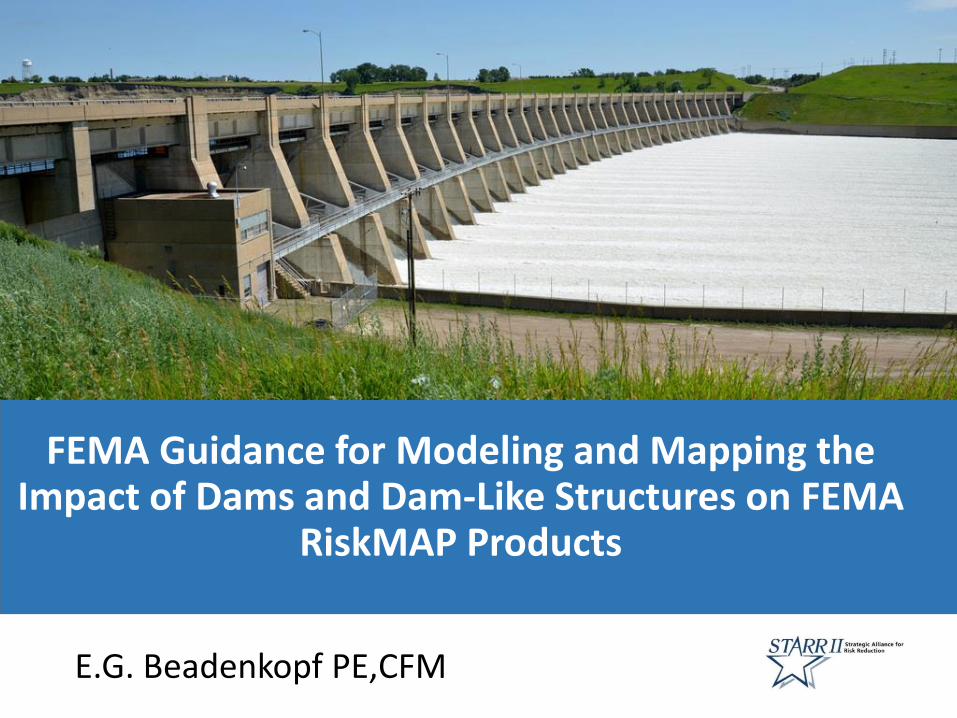
FEMA Guidance for Modeling and Mapping the Impact of Dams and Dam-Like Structures on FEMA
RiskMAP Products
E.G. Beadenkopf PE,CFM

Presentation Agenda
• Project Objectives
• Challenges Developing this Nationwide Guidance
• Addressing the Challenges
• Overview of the Guidance
• Input and Questions
Presentation Agenda

Purpose of the Assignment
• Develop guidance to assist FEMA and Mapping Partners consistently address the influence of dams and structures that function like dams in the preparation flood hazard products
• Lay the groundwork for further alignment of the National Dam Safety Program and RiskMAP
Project Objectives
• Wet and dry flood control
• Water supply
• Recreation
• Irrigation
• Flood fighting
• Power generation
• Multi-purpose
Dam- Like• High level
embankments
• Incidental flood storage
Dam

Purpose of the Assignment
• The existence of limited and unclear flood hazard program guidance
• The desire for new guidance but not new nationwide requirements
• The need for the new guidance to be RiskMAP specific
• The desire for the guidance to also align with the National Dam Safety Program
Project Challenges
Our goal is to head in the same direction

Purpose of the Assignment
• Recent H&H guidance does not address flood structure storage in detail
• 1992 G&S Appendix C sections covering structure storage is not considered by many Mapping Partners to be current policy
Project Challenges
Purpose of the Assignment
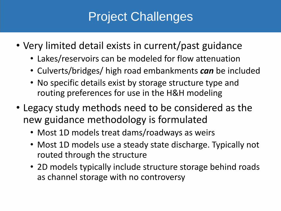
• Very limited detail exists in current/past guidance• Lakes/reservoirs can be modeled for flow attenuation
• Culverts/bridges/ high road embankments can be included
• No specific details exist by storage structure type and routing preferences for use in the H&H modeling
• Legacy study methods need to be considered as the new guidance methodology is formulated• Most 1D models treat dams/roadways as weirs
• Most 1D models use a steady state discharge. Typically not routed through the structure
• 2D models typically include structure storage behind roads as channel storage with no controversy
Project Challenges

Purpose of the Assignment
• FEMA Regions want maximum flexibility• They support guidance but not mandated requirements and
want to to make decisions what is hydrologically modeled to account for flood storage on a case-by case basis
• Hydrologically including structure flood storage in the floodplain mapping of downstream areas understates potential flood hazard• FPM decisions will be made assuming the structures stay do
not fail, are not modified, and flood storage remains
• New guidance must be compatible with the guidance for RiskMAP non-regulatory products for dams and any TMAC guidance developed per BW12 requirements
Project Challenges
Purpose of the Assignment
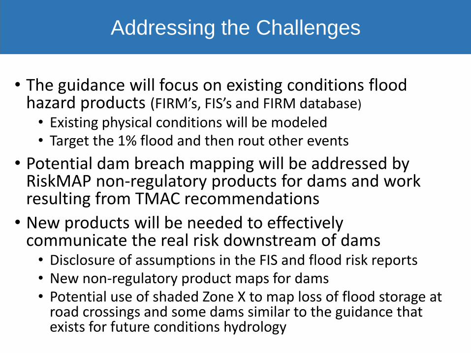
• The guidance will focus on existing conditions flood hazard products (FIRM’s, FIS’s and FIRM database)
• Existing physical conditions will be modeled• Target the 1% flood and then rout other events
• Potential dam breach mapping will be addressed by RiskMAP non-regulatory products for dams and work resulting from TMAC recommendations
• New products will be needed to effectively communicate the real risk downstream of dams• Disclosure of assumptions in the FIS and flood risk reports• New non-regulatory product maps for dams• Potential use of shaded Zone X to map loss of flood storage at
road crossings and some dams similar to the guidance that exists for future conditions hydrology
Addressing the Challenges
Purpose of the Assignment
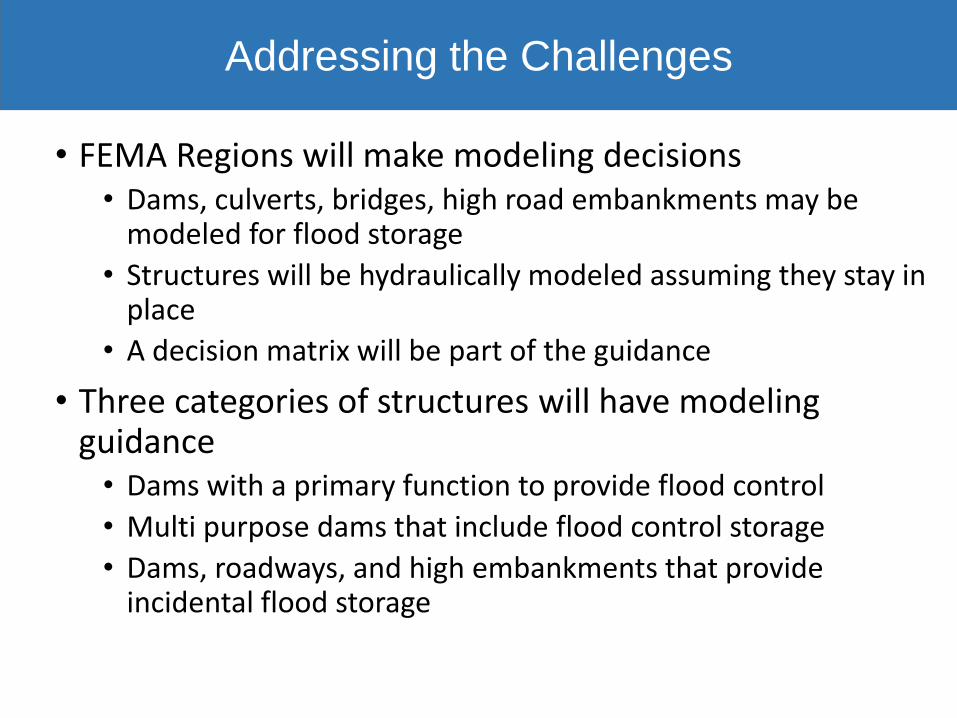
• FEMA Regions will make modeling decisions • Dams, culverts, bridges, high road embankments may be
modeled for flood storage
• Structures will be hydraulically modeled assuming they stay in place
• A decision matrix will be part of the guidance
• Three categories of structures will have modeling guidance• Dams with a primary function to provide flood control
• Multi purpose dams that include flood control storage
• Dams, roadways, and high embankments that provide incidental flood storage
Addressing the Challenges
Purpose of the Assignment
• Dams with a primary function to provide flood control• Typically designed by federal and state agencies and local
governments• Examples include some dams designed by the NRCS, USACE,
USBR and many by local governments• Identified as such in the National Inventory of Dams
• Guidance for hydrological routing• FEMA will create a rainfall-runoff hydrologic model or leverage
an existing model• If the 1% flood overtops the dam (without overtopping erosion
protection) assume that the dam hydraulically remains in place and do not model downstream flood reduction
• Include flood reduction that produces a downstream BFE change of 1’ or more
• Map the upstream 1% flood storage pool as floodway
General Guidance Flood Control Dams

Purpose of the AssignmentGeneral Guidance Flood Control Dams
South River #25- Tom’s Branch Augusta County VA

Purpose of the Assignment
• Multi purpose dams with flood control storage• Typically designed by governments and utilities• Examples include some dams designed by the NRCS, USACE, USBR,
TVA, and water/ power generation utility companies • Flood control could be a designed component or incidental
• Guidance for hydrological routing• FEMA will create a rainfall-runoff hydrologic model or leverage an
existing model• If the 1% flood overtops the dam (without overtopping erosion
protection) assume that the dam hydraulically remains in place and do not model downstream flood reduction
• Include flood reduction that produces a downstream BFE change of 1’ or more
• Map the upstream 1% flood storage pool as floodway• For gated or human controlled outlet works, the operational plan
rules will be used or worst case assumptions if no plan exists
General Guidance Multi-purpose Dams

Purpose of the AssignmentGeneral Guidance Multi-purpose Dams
T. Nelson Elliot Dam- Lake Manassas Prince William VA
Water supply reservoir providing incidental flood storage includes manual controls in the principal spillway to increase lake level for water supply

Purpose of the Assignment
• Dams, roadways, and high embankments that provide incidental flood storage• Typically operated by states and private owners and generically
include state/local roadways and privately owned and operated recreational dams
• Most significant flood reduction occurs in small watersheds where available flood storage volume is a large percentage of runoff volume
• Guidance for hydrological routing• FEMA will create a rainfall-runoff hydrologic model or leverage
an existing model• If the 1% flood overtops the dam (without overtopping erosion
protection) assume that the dam hydraulically remains in place and do not model downstream flood reduction
• Include flood reduction that produces a downstream BFE change of 1’ or more
• Map the upstream 1% flood storage pool as floodway• Guidance will be provided on the size of the contribution
watershed and storage volume whether to model flood storage
General Guidance Dam-like Structures

Purpose of the Assignment
• Dams, roadways, and high embankments guidance for hydrological routing (continued)• The embankment stability must be reasonably assured
• Massive embankments e.g. Interstate Highways
• Documented historical performance
• Stable outlet pipes e.g. concrete pipes with headwall and outlet protection and seepage control
• Storage depth and duration not high or long enough to produce seepage
• The 1% flood storage pool is contained in the floodway
• Agreement by community to not increase capacity of the outlet works
General Guidance Dam-like Structures

Purpose of the AssignmentGeneral Guidance Aides Dam-like Structures

General Guidance Aides

Purpose of the Assignment
• NDSP considerations for the guidance• Dams are not hazards but instead are infrastructure
subject to internal and external stress or loads
• Understanding the dam function and performance to the loads is critical to the decision whether and how to model and map flood reduction
• Does the dam have a unconditional state NDSP operations & maintenance permit?
• Do dam safety inspection reports identify maintenance issues or structural deficiencies?
• Is it appropriate to assume the dam will not fail and will provide flood reduction?
Aligning RiskMAP and the NDSP
Purpose of the Assignment
• Flood hazard mapping is a fundamental component of the NDSP• Preparedness planning
• Risk assessments
• Mitigation actions
• Residual risk management
• Emergency response during events
• Post flood resiliency planning and recovery
• The guidance document will include additional sections to align RiskMAP with the NDSP
Aligning RiskMAP and the NDSP

Purpose of the AssignmentAligning RiskMAP and the NDSP
• Regulatory flood hazard product guidance
• Recommendations for additional non-regulatory products for dams
• Pre-disaster preparedness modeling guidance for EM
• Disaster support dam breach modeling, mapping and risk prioritization
• Guidance for post disaster advisory dam breach recovery maps
Your Input
The guidance is in progress and an initial draft for review by FEMA HQ staff is planned in 2018. A more through review by FEMA Regions and Mapping Partners will then take place leading to release of the guidance in 2019.
We want your input!
• Send me an e-mail and I will provide a questionnaire
• Or send us any thoughts including your preferences for policy and technical methodology to:
and
Providing Input
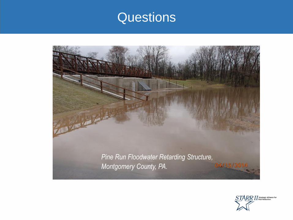
Questions
Pine Run Floodwater Retarding Structure,
Montgomery County, PA.
Questions