fd newsletter twelve print
TRANSCRIPT
1
12 Feb 2021
What would you do in the dark days of January? Well, you might decide to start planning something. The something a few members decided on was to improve the existing presentation of our Laid to Rest walks at Hatfield Road Cemetery and to work on a new walk.
Research isn’t easy when we cannot visit archives but we can at least talk to people. We can also prepare new leaflets and get to know what records we can discover between us on our book shelves.
From the selection of names in front of us the next stage will be to reveal those who have ‘made the cut’ and become subjects of the new 2021 walk.
PHOTO OF THE MONTH RECREATING ‘LAID TO REST’
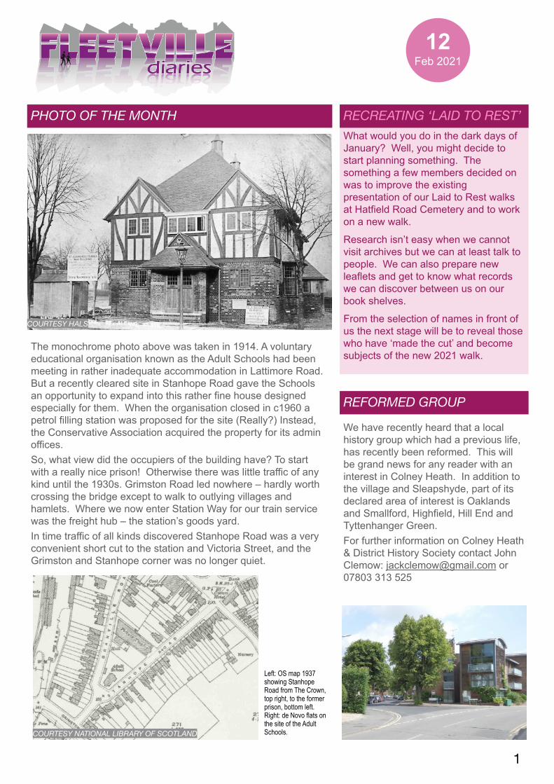
The monochrome photo above was taken in 1914. A voluntary educational organisation known as the Adult Schools had been meeting in rather inadequate accommodation in Lattimore Road. But a recently cleared site in Stanhope Road gave the Schools an opportunity to expand into this rather fine house designed especially for them. When the organisation closed in c1960 a petrol filling station was proposed for the site (Really?) Instead, the Conservative Association acquired the property for its admin offices. So, what view did the occupiers of the building have? To start with a really nice prison! Otherwise there was little traffic of any kind until the 1930s. Grimston Road led nowhere – hardly worth crossing the bridge except to walk to outlying villages and hamlets. Where we now enter Station Way for our train service was the freight hub – the station’s goods yard. In time traffic of all kinds discovered Stanhope Road was a very convenient short cut to the station and Victoria Street, and the Grimston and Stanhope corner was no longer quiet.
COURTESY HALS
REFORMED GROUP
We have recently heard that a local history group which had a previous life, has recently been reformed. This will be grand news for any reader with an interest in Colney Heath. In addition to the village and Sleapshyde, part of its declared area of interest is Oaklands and Smallford, Highfield, Hill End and Tyttenhanger Green. For further information on Colney Heath & District History Society contact John Clemow: [email protected] or 07803 313 525
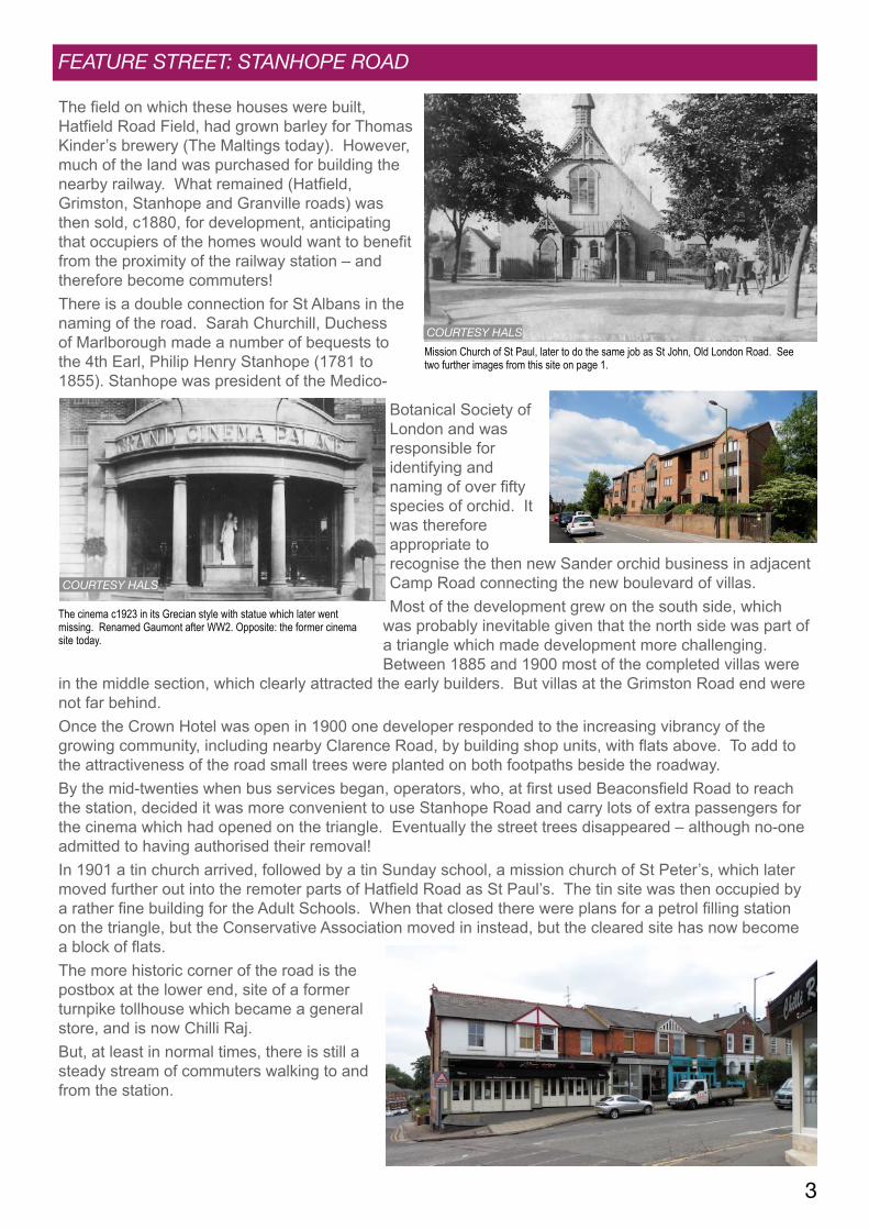
COURTESY NATIONAL LIBRARY OF SCOTLAND
Left: OS map 1937 showing Stanhope Road from The Crown, top right, to the former prison, bottom left. Right: de Novo flats on the site of the Adult Schools.
2
A POKEMON WELL
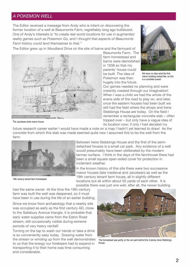
The Editor received a message from Andy who is intent on discovering the former location of a well at Beaumonts Farm, regrettably long ago bulldozed. One of Andy’s interests is “to create real world locations for use in augmented reality games such as Pokemon Go, and I thought that aspects of Beaumonts Farm history could lend themselves to that.” The Editor grew up in Woodland Drive on the site of barns and the farmyard of
Beaumonts Farm. The farm homestead and barns were demolished in 1938 so that my parents’ house could be built. The idea of Pokemon was then hugely into the future. Our games needed no planning and were instantly created through our imagination! When I was a child we had the whole of the evens side of the road to play on, and later, once the eastern houses had been built we still had the field where the shops and Irene Stebbings House are today. On the field I remember a rectangular concrete slab – often tripped over – but only have a vague idea of its location now; if only I had decided my
future research career earlier I would have made a note on a map I hadn’t yet learned to draw! As the concrete from which this slab was made seemed quite new I assumed this to be the well from the farm.
Between Irene Stebbings House and the first of the semi-detached houses is a small car park. Any evidence of a well would presumably have been obliterated by the modern tarmac surface. I think in the days of the farmhouse there had been a small square open-sided cover for protection in inclement weather.In the known history of this site there were two successive manor houses (late medieval and Jacobean) as well as the 19th century tenant farm house, all in slightly different locations but all within about 50 yards of each other. It is possible there was just one well, after all, the newer building
had the same owner At the time the 19th century farm was built the well was deepened, so it must have been in use during the life of an earlier building.Since we know from archaeology that a nearby site was occupied as early as the first century AD, close to the Salisbury Avenue triangle, it is probable that early water supplies came from the Eaton Road stream, still occasionally visible during extreme periods of very heavy rainfall! Turning on the tap to wash our hands or take a drink is so conveniently easy today. Drawing water from the stream or winding up from the well demonstrates to us that the energy our forebears had to expend in transporting it to their home was time consuming and considerable.
We have no idea what the first manor building looked like, so this is a complete guess!
The Jacobean-style manor house
COURTESY HISTORIC ENGLAND
19th century tenant farm homestead.
The homestead was partly on the car park behind the 3-storey Irene Stebbings House.
3
FEATURE STREET: STANHOPE ROAD
The field on which these houses were built, Hatfield Road Field, had grown barley for Thomas Kinder’s brewery (The Maltings today). However, much of the land was purchased for building the nearby railway. What remained (Hatfield, Grimston, Stanhope and Granville roads) was then sold, c1880, for development, anticipating that occupiers of the homes would want to benefit from the proximity of the railway station – and therefore become commuters! There is a double connection for St Albans in the naming of the road. Sarah Churchill, Duchess of Marlborough made a number of bequests to the 4th Earl, Philip Henry Stanhope (1781 to 1855). Stanhope was president of the Medico-
Botanical Society of London and was responsible for identifying and naming of over fifty species of orchid. It was therefore appropriate to recognise the then new Sander orchid business in adjacent Camp Road connecting the new boulevard of villas. Most of the development grew on the south side, which
was probably inevitable given that the north side was part of a triangle which made development more challenging. Between 1885 and 1900 most of the completed villas were
in the middle section, which clearly attracted the early builders. But villas at the Grimston Road end were not far behind. Once the Crown Hotel was open in 1900 one developer responded to the increasing vibrancy of the growing community, including nearby Clarence Road, by building shop units, with flats above. To add to the attractiveness of the road small trees were planted on both footpaths beside the roadway. By the mid-twenties when bus services began, operators, who, at first used Beaconsfield Road to reach the station, decided it was more convenient to use Stanhope Road and carry lots of extra passengers for the cinema which had opened on the triangle. Eventually the street trees disappeared – although no-one admitted to having authorised their removal! In 1901 a tin church arrived, followed by a tin Sunday school, a mission church of St Peter’s, which later moved further out into the remoter parts of Hatfield Road as St Paul’s. The tin site was then occupied by a rather fine building for the Adult Schools. When that closed there were plans for a petrol filling station on the triangle, but the Conservative Association moved in instead, but the cleared site has now become a block of flats. The more historic corner of the road is the postbox at the lower end, site of a former turnpike tollhouse which became a general store, and is now Chilli Raj. But, at least in normal times, there is still a steady stream of commuters walking to and from the station.
Mission Church of St Paul, later to do the same job as St John, Old London Road. See two further images from this site on page 1.
COURTESY HALS
COURTESY HALS
The cinema c1923 in its Grecian style with statue which later went missing. Renamed Gaumont after WW2. Opposite: the former cinema site today.
4
ANOTHER RAT IN ANOTHER CASTLE
Ideas, comments, pictures – anything – contact Mike on [email protected] The FD website is www.fleetvillediaries.org
RIGHT ROAD WRONG NAME
There have been a number of artistic hanging signs on the corner of the Rats’ Castle pub, including the one (below left) thought to have lasted the shortest period of time, when locals ensured it was promptly removed. Pub sign artists have clearly put their imaginations to good use down the years. David spotted a further example: “The sign is not the obvious one of a rat and a castle, but from the recesses of my memory I seem to recall an open window with a bed, the rat sitting on top of it, whilst a cat peers beneath it. I could, of course, have had one too many, but does anyone else recall it?” The photo from which this rather indistinct portion was cropped, below right, was taken c1967; the main body of the image is a rather fine Ballito frontage but is not shown here. If a reader is able to recall the story of the picture David describes above, or can make an attempt at describing the scene as shown, please have a go and let us know by email.
CO
URTE
SY R
OSE
MAR
Y W
ENZE
RUL
In Newsletter 11 your editor made an error – and then repeated it. Unforgivable, I know, but these things can happen. I mixed up the names of two roads. The name of the side road off Holywell Hill is, of course, Belmont Hill, not Hillside Road. And as that road featured in two sections the error was repeated. It was Roger who pointed out the error and gave me a ticking off.
LANE END, AVENUE HOUSE …
There is a sudden interest in the Laing estate of homes at the north end of Beaumont Avenue. It was given the name St John’s Court when built in the 1960s. The interest comes from three detached homes built previously: Avenue House (subsequently named St John’s Lodge) in c1905 for Mr H Adey, and Lane End and Bramhall built a few years later. Collectively their grounds covered some five acres. There is a rather nice recollection of visits to one of the houses, but so far it has proved impossible to locate any photographs of these homes. So the Editor is photo hunting! If anyone has a photo, or knows who might have one or more pictures do please get in touch – email address below. We will try to make a feature of them in a future Newsletter.