esriuk_track7_king edward vi _garry simmons
TRANSCRIPT
Adventures with Story Maps&
Using the ‘Collector for ArcGIS’ App
Garry SimmonsHead of Geography, Wilmington Grammar
School for Girls, Dartford, Kent@garrysimmons @GeoWilmington
• Three ways of thinking about story maps
• Progression with story maps
• Reflections on using story maps
Story Maps as resource
• For discovering about new places.
• For exploring places.
• For contrasting different places
• For developing aerial photography interpretation skills.
• For helping students to remember fieldwork.

American SW Water Crisis: Map Tour
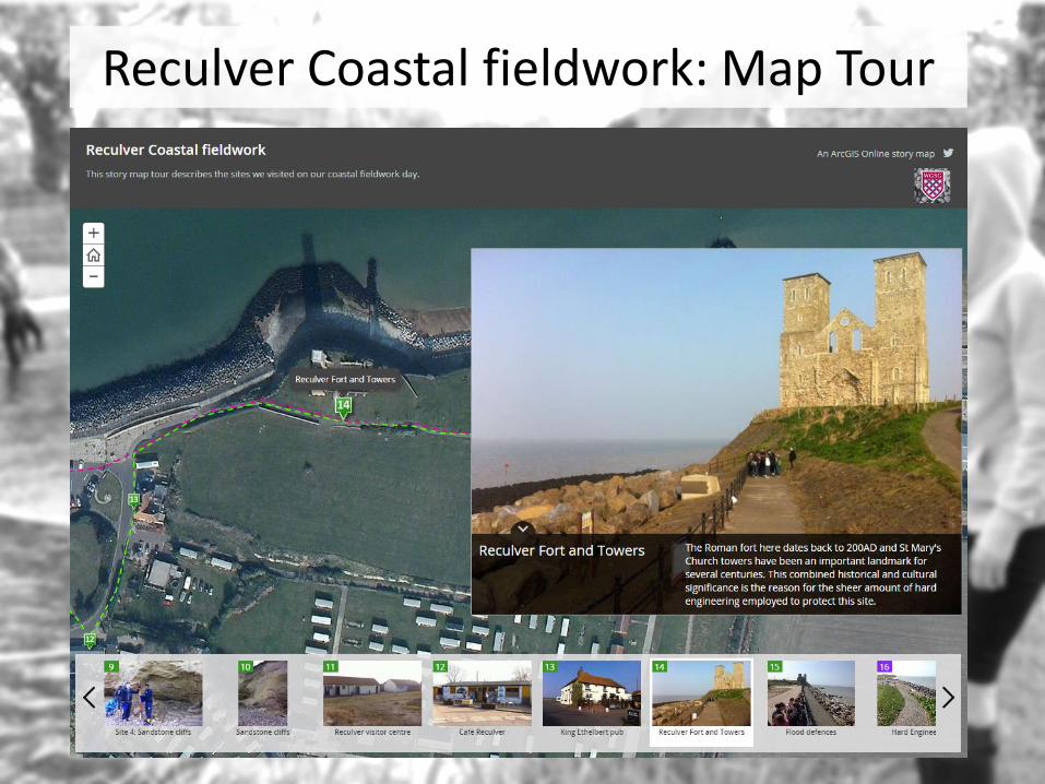
Reculver Coastal fieldwork: Map Tour

Disappearing Glaciers: Map Journal
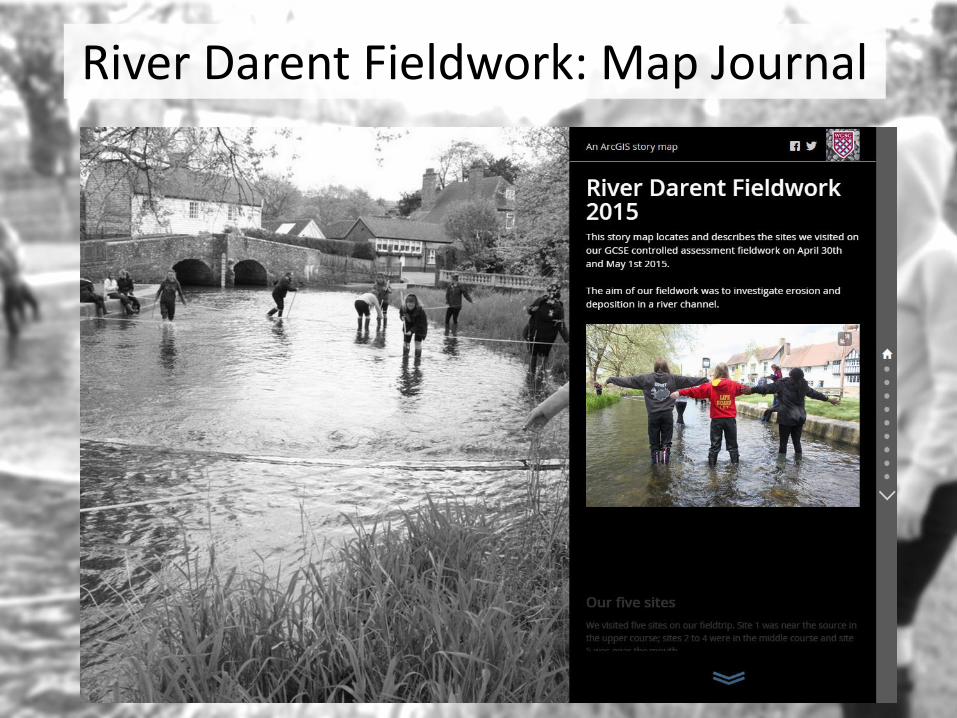
River Darent Fieldwork: Map Journal
Story Maps as student activity
• Year 9 Built Environment
• Which template to use? Map Tour vs Map Journal?
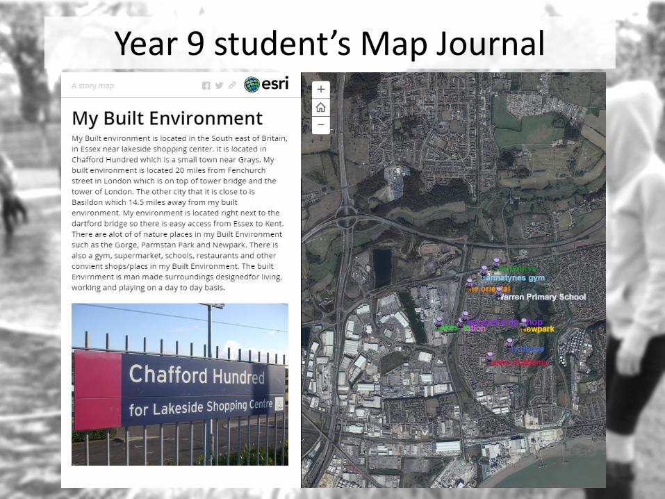
Year 9 student’s Map Journal
Story Maps as adventure
• What’s next?
• Local area story map.
– Use the Snap2map app?
– Use a map tour
– “How diverse is my local area?” Create a walking, cycle or road route to visit at least 5 sites in your local area to show how diverse your place is.
– Diversity could be seen in land use, housing type, wealth of local people, environmental quality.
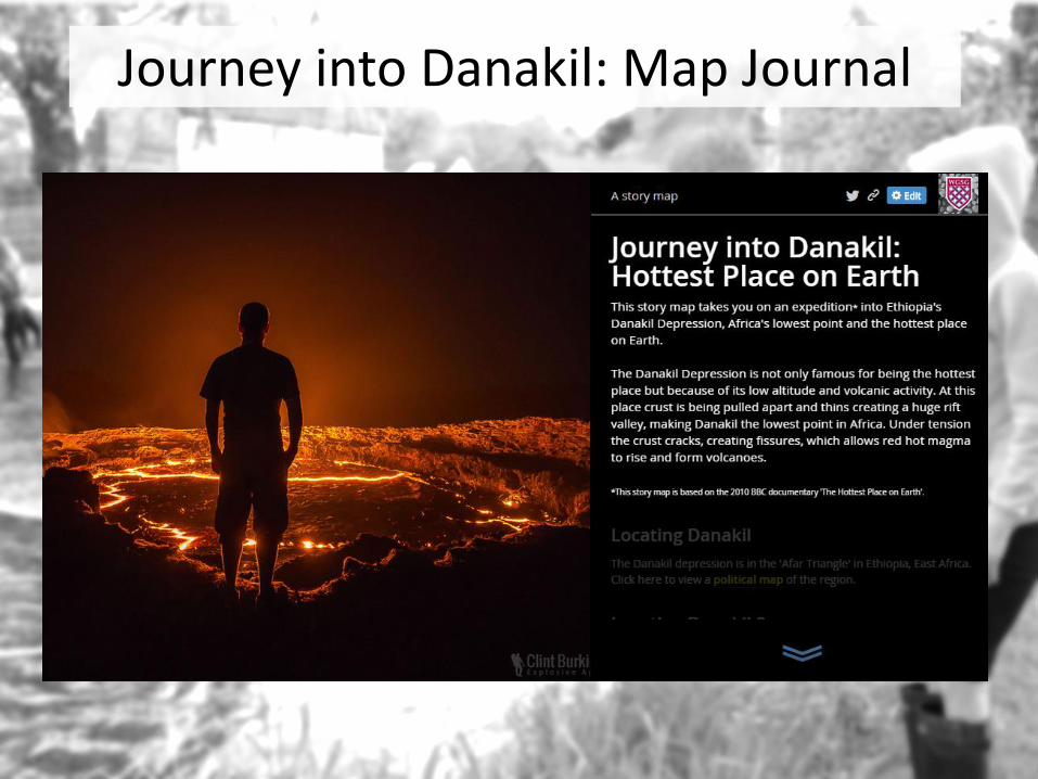
Journey into Danakil: Map Journal

Progression with Story Maps
• Web maps– Basic aerial photography
– Using ‘map notes ‘symbols in web maps
– Using CSV layers to managing symbols and labels more easily.
• Story Maps– Map Tour
– Map Journal
– Map Journal with embedded multimedia, multiple web maps and pop-ups
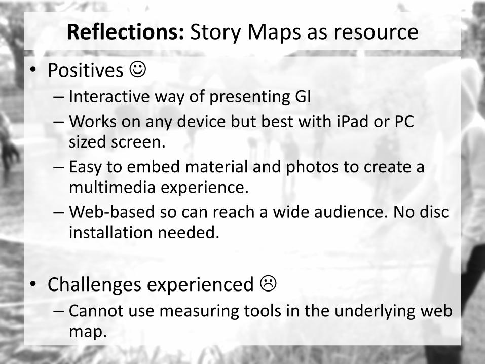
Reflections: Story Maps as resource
• Positives – Interactive way of presenting GI
– Works on any device but best with iPad or PC sized screen.
– Easy to embed material and photos to create a multimedia experience.
– Web-based so can reach a wide audience. No disc installation needed.
• Challenges experienced – Cannot use measuring tools in the underlying web
map.
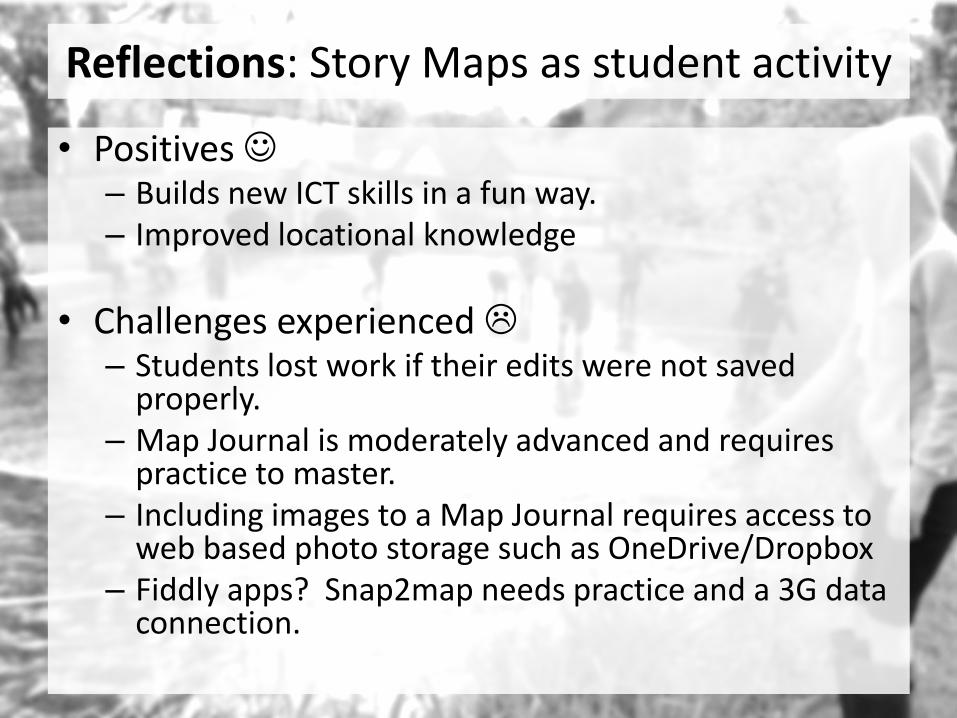
Reflections: Story Maps as student activity
• Positives – Builds new ICT skills in a fun way.– Improved locational knowledge
• Challenges experienced – Students lost work if their edits were not saved
properly. – Map Journal is moderately advanced and requires
practice to master.– Including images to a Map Journal requires access to
web based photo storage such as OneDrive/Dropbox– Fiddly apps? Snap2map needs practice and a 3G data
connection.
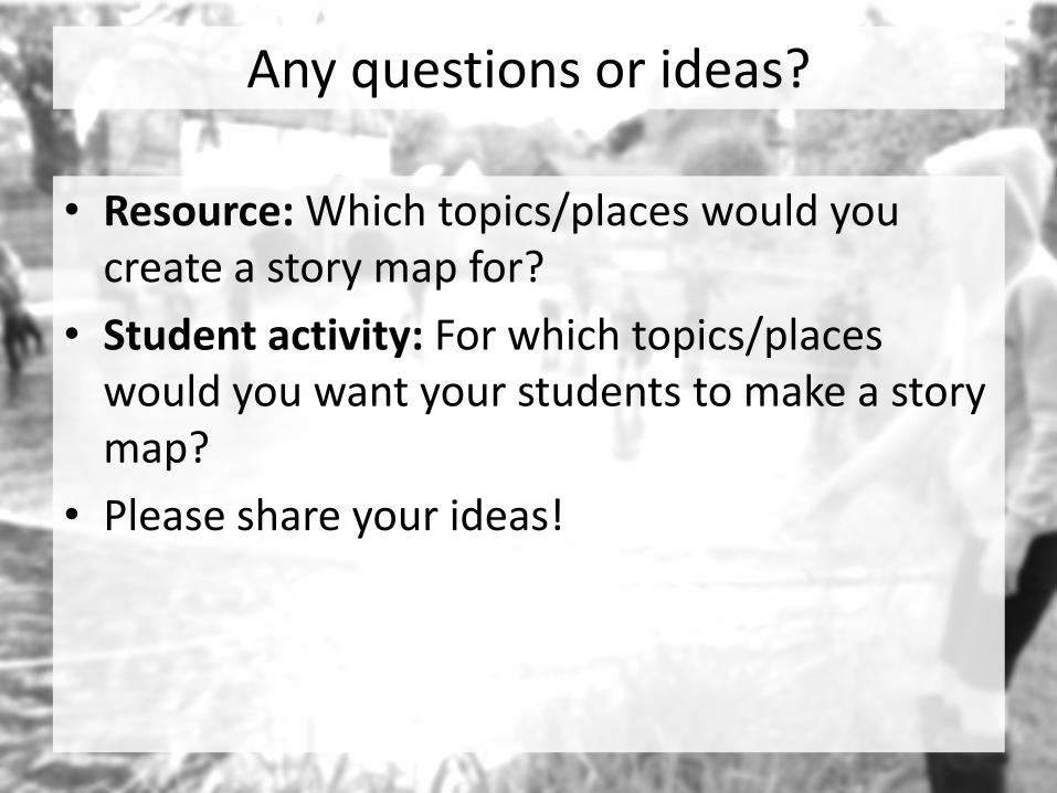
Any questions or ideas?
• Resource: Which topics/places would you create a story map for?
• Student activity: For which topics/places would you want your students to make a story map?
• Please share your ideas!
Using the ‘Collector for ArcGIS’ App
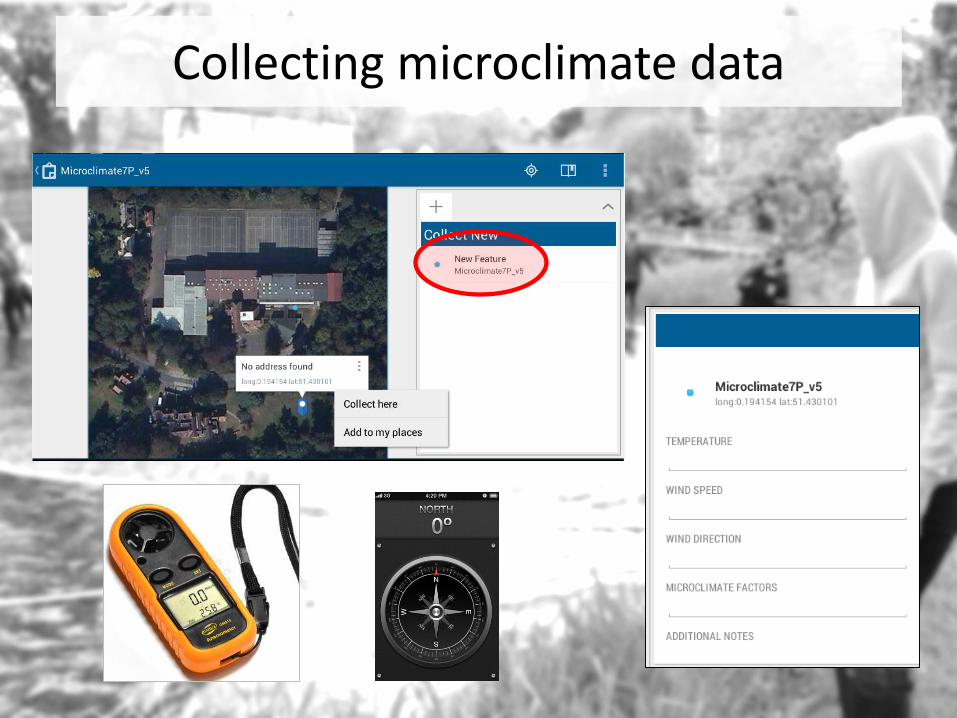
Collecting microclimate data
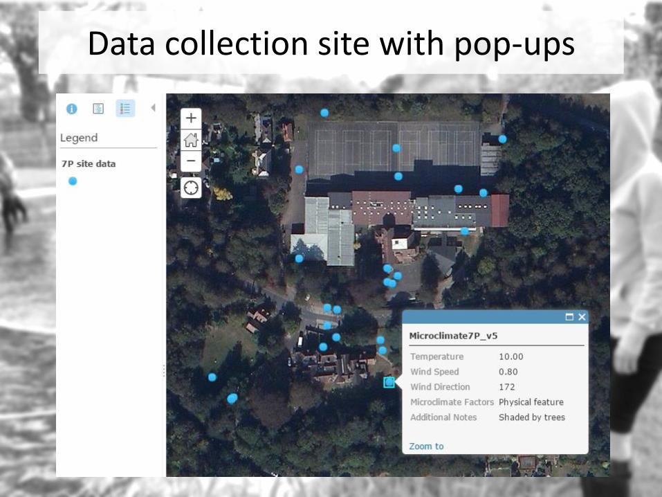
Data collection site with pop-ups
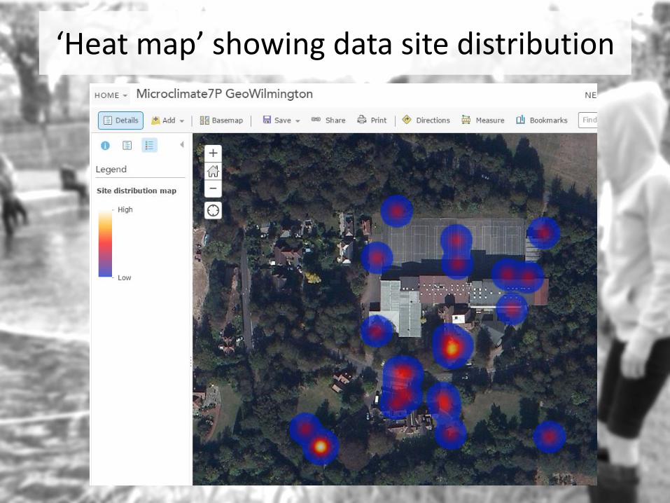
‘Heat map’ showing data site distribution
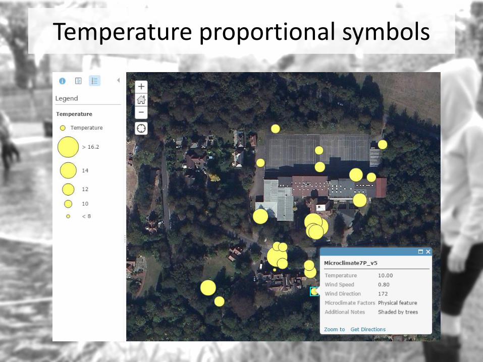
Temperature proportional symbols
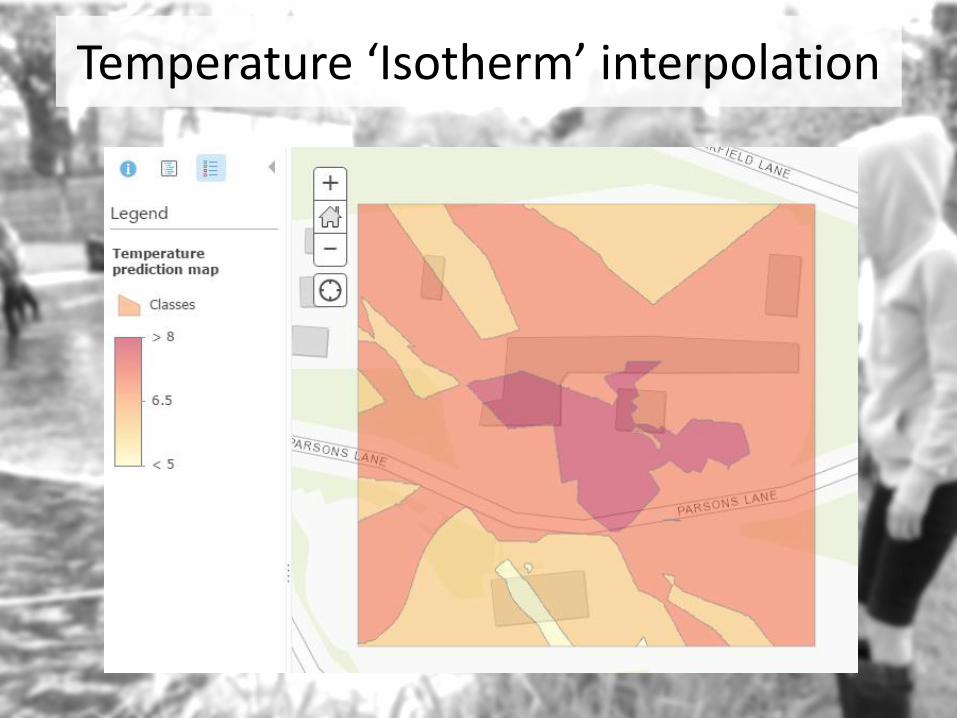
Temperature ‘Isotherm’ interpolation

Gust speed (ms-1) and direction

Gust speed ‘isotach’ interpolation
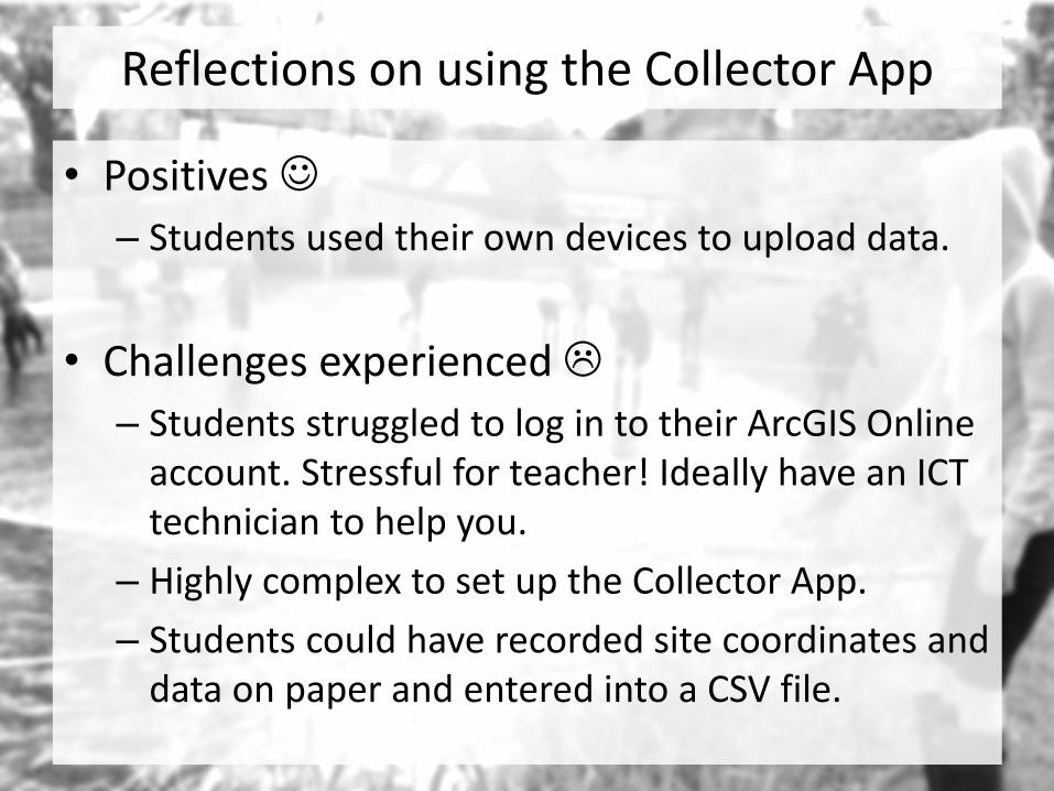
Reflections on using the Collector App
• Positives
– Students used their own devices to upload data.
• Challenges experienced
– Students struggled to log in to their ArcGIS Online account. Stressful for teacher! Ideally have an ICT technician to help you.
– Highly complex to set up the Collector App.
– Students could have recorded site coordinates and data on paper and entered into a CSV file.