escort notes - amazon web services state ranks high in the production of beef cattle, hogs, buffalo...
TRANSCRIPT
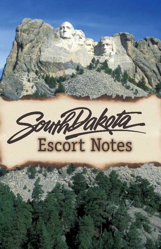
Escort Notes

IntroductionSouth Dakota is the land of Great Faces and Great Places. From our rolling prairies to the breathtaking beauty of the Black Hills, the Mount Rushmore State is a place you have to see to believe. South Dakota’s rich culture, heritage and history are showcased at the many attractions found within our borders. From awe-inspiring Mount Rushmore National Memorial and Crazy Horse Memorial, to the Mighty Missouri River, Fort Sisseton Historic State Park and the World’s Only Corn Palace, South Dakota won’t be a place you soon forget.
Native Americans such as the Arikara, Mandan, and tribes of the Great Sioux Nation were among the first inhabitants of these lands. According to many accounts, white men first entered South Dakota in 1743 when the Verendrye brothers claimed the region for France. Fur traders soon followed. And in 1804, explorers Meriwether Lewis and William Clark made their famous trek up the Missouri River, which bisects the state.
Today, South Dakota’s economy relies heavily on agriculture. The rich soil of eastern South Dakota supports a variety of crops, while cattle and sheep graze on the sprawling ranches of the western plains. The state ranks high in the production of beef cattle, hogs, buffalo and sheep. South Dakota is also a leading producer of honey, oats, rye, sunflowers, spring wheat, soybeans and corn.
But the resource South Dakota is most proud of is its people. The friendliness and hospitality of South Dakotans keep visitors returning year after year.
1
Please note: South Dakota Tourism makes every effort to ensure the accuracy of these listings, but changes sometimes occur without prior knowledge. South Dakota Tourism cannot be held liable in the event of errors or omissions in listings. The use of the names of private companies in this guide is for information purposes only and does not imply endorsement by any state or federal agency.
Introduction
South Dakota History
Tourism Regions
Major Attractions
The Great Sioux Nation
Looking Out the Window
Lewis and Clark
Did You Know?
Legends and Lore
Trivia
Tunnels, Trails, Byways
More Information
TableContents
of
1
2
5
8
12
16
2434
3844
4648
South Dakota Office of Tourism711 E. Wells Ave.Pierre, SD, USA57501-3369Phone: (605) 773-3301Fax: (605) 773-5657www.TravelSD.com
For detailed information about South Dakota, along with assistance for planning your group tour, check out: www.TourSDakota.com or email
32
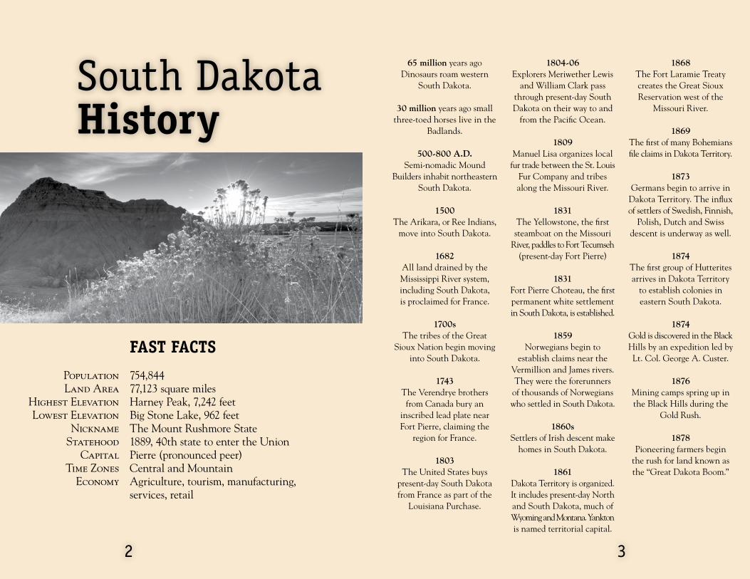
PopulationLand Area
Highest Elevation Lowest Elevation
Nickname Statehood
Capital Time Zones
Economy
Fast Facts
754,84477,123 square milesHarney Peak, 7,242 feetBig Stone Lake, 962 feetThe Mount Rushmore State1889, 40th state to enter the UnionPierre (pronounced peer)Central and MountainAgriculture, tourism, manufacturing, services, retail
65 million years ago Dinosaurs roam western
South Dakota.
30 million years ago small three-toed horses live in the
Badlands.
500-800 A.D. Semi-nomadic Mound
Builders inhabit northeastern South Dakota.
1500 The Arikara, or Ree Indians,
move into South Dakota.
1682All land drained by the Mississippi River system, including South Dakota, is proclaimed for France.
1700sThe tribes of the Great
Sioux Nation begin moving into South Dakota.
1743The Verendrye brothers
from Canada bury an inscribed lead plate near Fort Pierre, claiming the
region for France.
1803 The United States buys
present-day South Dakota from France as part of the
Louisiana Purchase.
1804-06Explorers Meriwether Lewis
and William Clark pass through present-day South Dakota on their way to and
from the Pacific Ocean.
1809 Manuel Lisa organizes local
fur trade between the St. Louis Fur Company and tribes along the Missouri River.
1831 The Yellowstone, the first steamboat on the Missouri
River, paddles to Fort Tecumseh (present-day Fort Pierre)
1831 Fort Pierre Choteau, the first permanent white settlement in South Dakota, is established.
1859 Norwegians begin to
establish claims near the Vermillion and James rivers. They were the forerunners
of thousands of Norwegians who settled in South Dakota.
1860s Settlers of Irish descent make
homes in South Dakota.
1861 Dakota Territory is organized. It includes present-day North and South Dakota, much of Wyoming and Montana. Yankton is named territorial capital.
1868 The Fort Laramie Treaty creates the Great Sioux Reservation west of the
Missouri River.
1869 The first of many Bohemians file claims in Dakota Territory.
1873 Germans begin to arrive in
Dakota Territory. The influx of settlers of Swedish, Finnish,
Polish, Dutch and Swiss descent is underway as well.
1874 The first group of Hutterites arrives in Dakota Territory
to establish colonies in eastern South Dakota.
1874 Gold is discovered in the Black Hills by an expedition led by Lt. Col. George A. Custer.
1876Mining camps spring up in the Black Hills during the
Gold Rush.
1878 Pioneering farmers begin
the rush for land known as the “Great Dakota Boom.”
South Dakota History

1889 The Land Act of March 1889
establishes the six current reservations in South Dakota. Later that year, South Dakota
becomes a state.
1890 More than 250 Lakota people
are killed by government troops in what came to be known as the Wounded
Knee Massacre.
1900 Jewel Cave is discovered;
eight years later it becomes a national monument.
1903Wind Cave becomes a
national park, the first cave designated as part of the
national park system.
1927Work begins on Mount
Rushmore National Memorial.
1930 The drought, grasshopper
plague and depression mark hard times.
1939 President Franklin D.
Roosevelt creates Badlands National Park.
1941 Work on Mount Rushmore National Memorial ends.
1944 The Flood Control Act
provides for dams along the Missouri River.
1948 Work begins on Crazy Horse
Memorial.
1966 The Pathfinder Atomic
Power Plant near Sioux Falls begins producing electricity.
54
Tourism Regions
1973 About 200 armed members
of the American Indian Movement (AIM) occupy Wounded Knee to protest
policies towards Native Americans.
1989 South Dakota celebrates its
centennial.
1991 Mount Rushmore National
Memorial celebrates its golden anniversary.
1998 The face of Crazy Horse
on the world-famous Crazy Horse mountain carving is dedicated. Work continues on the rest of the colossal
sculpture.
2004-2006 South Dakota commemorated the 200th anniversary of the Lewis and Clark Expedition.
Black Hills,Badlands & Lakes
Glacial Lakes & Prairies
Southeast
Great Lakes

76
Great Lakes of South Dakota
Association
PO Box 786Pierre, SD 57501
(605) 224-4617 or 1-888-386-4617
Fax: (605) 224-4617 [email protected]
In the center of South Dakota, the Missouri River and its high, rugged and grassy bluffs form a bridge between the gently rolling ranch country of the west and the tabletop flatness of the east. The Missouri River and its reservoirs offer vast expanses of open water and 3,000 miles (4,830 km) of shoreline. The reservoirs, formed by four huge, rolled-earth dams, afford recreation, world-class fishing and nearby top-notch hunting opportunities.
Lewis and Clark followed the Missouri River through present-day South Dakota in 1804. Numerous sites along South Dakota’s Lewis and Clark Trail recall their exploits, while first-rate museums like the Akta Lakota in Chamberlain and the Cultural Heritage Center in Pierre showcase the region’s history. Pierre also hosts the majestic architecture of the State Capitol, fully restored to its original 1910 splendor.
Great Lakes
Southeast South Dakota
Tourism Association
1101 Broadway, Suite 113Yankton, SD 57078(605) 665-2435 or
1-888-353-7382Fax: (605) 665-8776
The sophisticated atmosphere of the state’s largest city mingles with the charm of rural Americana in an alluring combination in the southeast region of South Dakota. Sioux Falls, named for the Falls of the Big Sioux River, features upscale restaurants, quirky shops, ethnic boutiques and historical districts. Area museums, like the Dakota Discovery Museum in Mitchell, celebrate the region’s pioneering history and heritage.
Many smaller scenic rivers accent the mighty Missouri River, which also flows through this region. Located within southeast South Dakota is Spirit Mound, one of the few historical sites along the entire Lewis and Clark Trail where you can stand where the explorers actually stood more than 200 years ago. The region is dotted with state parks and recreation areas featuring modern campgrounds, peaceful hiking trails and rolling scenery.
Southeast
Glacial Lakes & Prairies Tourism
Association
PO Box 244, 1200 33rd St. S.E.
Watertown, SD 57201-0244(605) 886-7305 or
1-800-244-8860Fax: (605) 886-7935
Glaciers once covered the northeastern region of South Dakota. As they moved, they scoured and scraped the earth - leveling it in some places, building it up in others and scooping out potholes in yet more places. The melting glaciers filled the chain of potholes forming lakes. French explorers dubbed this undulating terrain the coteau des prairies or hills of the prairie.
The rolling landscape is home to 15 state parks and recreation areas, two national wildlife refuges, De Smet, the “Little Town on the Prairie” made famous by author Laura Ingalls Wilder, and boundless water recreation at the area’s 120 lakes. This region also hosts a festival at one of the best preserved frontier forts in the country, gaming action at casinos near Watertown and Flandreau, and 150 original artworks at the Redlin Art Center.
Glacial Lakes& Prairies
Black Hills, Badlands & Lakes
Association
1851 Discovery CircleRapid City, SD 57701
(605) 355-3600Fax: (605) 355-3601
The Black Hills, an island of forested mountains rising from a sea of prairie, and nearby Badlands are home to majestic landscapes, free-roaming buffalo herds and diverse wildlife. Mount Rushmore National Memorial, Crazy Horse Memorial, two national parks, two national monuments, a national forest, a national historic site and one of the country’s largest state parks are located here.
Old West legend and lore is alive and well in Deadwood where gaming is once again legal. This region is rich with Native American artistry and history. The Lakota named the area Paha Sapa or Black Hills. A thick forest of pine and spruce trees cover the slopes making them appear black from a distance. You’ll find grassy mountain meadows, towering granite peaks, deep canyons, cascading trout streams and clear, clean lakes.
Black Hills,Badlands & Lakes

Mount Rushmore National Memorial
near Keystone
This mountain carving features the 60-foot (18 m) faces of four great American presidents: George Washington, Thomas Jefferson, Theodore Roosevelt and Abraham Lincoln. Work on the sculpture began in 1927 when sculptor Gutzon Borglum was 60. Work ended 14 years later at his death. The Lincoln Borglum Visitor Center and Museum has several interactive displays, along with more than 400 artifacts and 300 photographs. The Presidential Trail, which is about a half-mile (.8 km) walk and loops along the base of the mountain, offers a spectacular close-up view of the faces.
www.nps.gov/moru
Crazy Horse Memorialnear Custer
A fifth granite face has emerged in the Black Hills. The colossal Crazy Horse mountain carving, now in progress, can be seen just 17 miles (27 km) from Mount Rushmore National Memorial. Sculptor Korczak Ziolkowski started work on the mountain in 1948 as a tribute to Native Americans. His family continues to carve Crazy Horse, using three books of detailed plans he left after his death in 1982. When complete, Crazy Horse will be the world’s largest mountain carving, standing 563 feet high (172 m) and 641 feet long (195 m).
www.crazyhorse.org
Custer State ParkBlack Hills
There are few truly wild places left in this country. Custer State Park is one of them. Nearly 1,500 magnificent bison wander the park’s 71,000 acres (28,400 ha), which they share with swift pronghorn, shy elk, sure-footed mountain goats and a band of curious burros. Slender granite formations called Needles dominate the skyline and grassy meadows fill the valleys. Amidst pure nature, you’re free to explore via trail rides, scenic drives, mountain bikes, paddle-boats, hay rides and safari tours. Four lodges in the park provide beautiful accommodations for a great night’s sleep.
www.custerstatepark.info
Black Hills National Forest
Western South Dakota
“Paha Sapa” the Lakota call them, “hills that are black,” because their pine-covered slopes look as dark as shadows from afar. The forest is made up of 1.2 million acres (480,000 ha) of meadows and tree-covered mountains. At 7,242 feet (2,207 m) above sea level, Harney Peak is the highest peak in the United States east of the Rocky Mountains. The forest has more than 40 trails with 920 miles for hiking, biking, horseback riding, cross-country skiing and snowmobiling. Deer, elk, pronghorn, bighorn sheep and mountain goats roam freely through the forest.
www.fs.fed.us/r2/blackhills
Badlands National Park
Southwestern South Dakota
This striking landscape features a maze of buttes, canyons, pinnacles, and spires. The Lakota gave this land its name, “mako sica,” meaning “land bad.” Erosion of the Badlands reveals sedimentary layers of different colors: purple and yellow (shale), tan and gray (sand and gravel), red and orange (iron or rust) and white (volcanic ash). The skeletons of ancient camels, three-toed horses, saber-toothed cats and giant rhinoceros-like creatures are among the many fossilized species found here. Living creatures abound as well in the park’s 244,000 acres (97,600 ha). Bison, pronghorn, mule and whitetail deer, prairie dogs, coyotes, eagles and hawks can often be seen by visitors.
www.nps.gov/badl
State CapitolPierre
South Dakota’s majestic State Capitol building in Pierre was completed in 1910 using a variety of materials including native field stone, Indiana limestone, and Vermont and Italian marble. It features hundreds of handcrafted materials including carved woodwork and marble, special cast brass and hand-laid stone. Costing approximately $1 million to build, the current estimated value of the South Dakota Capitol is nearly $58 million. Restoration of the Capitol building to its original 1910 appearance began in 1977 and was basically completed by 1989, in time for South Dakota’s Centennial Celebration. The ceilings, wall designs, color schemes, window treatments and carpeted areas throughout the building were part of the restoration project. Features such as marble staircases, Victorian leaded glass, terrazzo floor and scagliola columns give the building its stately character.
www.state.sd.us/boa/tours.htm
98
Major Attractions

World’s Only Corn Palace
Mitchell
The first Corn Palace was built in 1892 to celebrate the harvest and stimulate economic growth in Mitchell. More than 3,000 bushels of corn are used to create the murals that decorate the exterior of the Corn Palace. Redecoration of the Moorish-looking landmark begins each year in June with replacement of native grasses. In August, the old corn and grain sorghum or milo are replaced. The Corn Palace hosts a celebration each September as a grand finale to the harvest with big-name entertainment, carnival rides, agriculture, exhibits, food booths, antique auto displays, flea markets and more.
www.cornpalace.com
Redlin Art CenterWatertown
The Redlin Art Center is home to more than 150 original oil paintings by Terry Redlin, one of America’s most popular artists. The surrounding Conservation Park is carefully contoured to complement the graceful Egyptian-revival architecture designed by the artist’s son. Wetlands and waterways provide an alluring habitat for wildlife. Visitors have plenty of room to stretch their legs on more than a mile of walking trails, or relax with a picnic at six small gazebos, one large gazebo and the Redlin Pavilion.
www.redlinart.com
The Little Town on the Prairie
De Smet
Author Laura Ingalls Wilder homesteaded in De Smet, with her pioneering family at the tender age of 12. The farming community and surrounding prairie served as a setting for six of her much beloved “Little House” books. Laura wrote about her family and pioneer life experiences late in her life, while recalling her childhood memories. Today, De Smet celebrates Laura’s life by preserving historic Ingalls sites. Every summer, actors portray pioneer life as experienced by Laura and her family during the Laura Ingalls Wilder Pageant.
www.discoverlaura.org
Fort Sisseton State Historical Park
near Lake City
Fort Sisseton serves as a colorful reminder of South Dakota’s frontier history. Situated in the rolling prairie hills of northeastern South Dakota, the military outpost, originally known as Fort Wadsworth, was established in 1864 after the nearby Dakota Conflict in western Minnesota. The outpost became known as Fort Sisseton, named for a nearby tribe of Native Americans. Today, it is recognized as one of the nation’s best preserved frontier forts. The fort, including all 14 intact buildings, is listed on the National Register of Historical Places and now serves as a scenic State Park.
www.sdgfp.info/parks/regions/glaciallakes/fortsisseton.htm
1110
Major Attractions
EventsHeld annually in early June (605) 448-5474www.sdgfp.info/Parks/Regions/GlacialLakes/FortSisseton.htm Held annually over three weekends in July.www.desmetpageant.org (605) 854-3383
Held annually in late July. (605) 335-6101www.jazzfestsiouxfalls.com [email protected]
Held annually in late July. (605) 578-1876www.deadwood.org [email protected]
Held annually in late July. (605) 996-3662www.cornpalacestampede.com [email protected]
Held annually in early August. (605) 720-0800www.sturgismotorcyclerally.com [email protected]
Held annually in early October. (605) 255-4515www.custerstatepark.info [email protected]
Held annually in early October. (605) 341-0925www.blackhillspowwow.com
Fort Sisseton Historical Festival
Laura Ingalls Wilder Pageant
Jazz Fest
Days of ‘76
Corn Palace Stampede Rodeo
Sturgis Motorcycle Rally
Buffalo Roundup
Black Hills Powwow
For a complete listing of events, go to www.TravelSD.com.
Falls ParkSioux Falls
Named after the falls of the Big Sioux River, Sioux Falls is South Dakota’s largest city. Falls Park showcases the city’s namesake with a visitor information center, five-story observation tower and hydroelectric plant-turned-café, as well as several walking trails and an art gallery. The park, which displays its beautiful pink granite outcroppings throughout, is the former site of the Queen Bee Flour Mill, which was originally a seven-story building constructed in 1881 by R.F. Pettigrew. The mill was never successful and the building was used for a wide variety of things over the years. In 1956 a fire destroyed the building.

South Dakota is home to the Great Sioux Nation, whose people call themselves “friends” in three dialects: Dakota, Lakota, and Nakota.
By the end of the 18th century, the Sioux Nation was at the height of its power, dominating the northern Plains. Their influence was wide-spread, covering the Dakotas and stretching into Nebraska, Wyoming, and Montana. The influx of settlers and depletion of the buffalo, however, led to dramatic changes in their lives.
The Sioux Nation has produced many wise and courageous leaders who are commemorated at sites throughout the state. Sitting Bull, a Hunkpapa leader, helped defeat Custer at the Battle of Little Big Horn. He’s buried on a Missouri River bluff near Mobridge. Red Cloud, an Oglala chief, was a respected warrior and statesman. The Red Cloud Indian School in Pine Ridge bears his name. A mountain carving of Crazy Horse, the great Lakota leader, is in progress in the Black Hills as a tribute to all Native Americans.
Artist Oscar Howe pioneered a new era in Native American art with his abstract paintings portraying Dakota life and spirituality. Many of his paintings are on display at the Dakota Discovery Museum in Mitchell.
More than 62,000 Native Americans still call South Dakota home. Nine tribes of the Sioux Nation offer visitors opportunities to experience their heritage and cultures. Contact the Alliance of Tribal Tourism Advocates at (605) 870-5144 to make arrangements to visit one of the tribes.
Akta Lakota MuseumChamberlain
Bear Butte State ParkSturgis
Buechel Memorial Lakota Museum
St. Francis
Buffalo Interpretive Center
Fort Pierre
Center for Western Studies
Sioux Falls
Cultural Heritage Center
Pierre
Dakota Discovery Museum
Mitchell
Dakotah Prairie Museum
Aberdeen
The Heritage CenterPine Ridge
HVJ Lakota Cultural Center
Eagle Butte
1312
The Great Sioux Nation
Native American Museums, Art Centers & Sites
Indian Museum of North AmericaCrazy Horse Memorial
The Journey MuseumRapid City
Sitting Bull Monument
Mobridge
Tatanka: Story of the Bison
Deadwood
Visual Arts Center at the Washington
Pavilion of Arts & ScienceSioux Falls

Cheyenne River Sioux Tribe PO Box 590Eagle Butte, SD 57625-0590(605) 964-7812Fax: (605) [email protected]
Crow Creek Sioux Tribe PO Box 50Fort Thompson, SD 57339-0050(605) 245-2221Fax: (605) 245-5470
Flandreau Santee Sioux Tribe PO Box 283Flandreau, SD 57028-0283(605) 997-3844Fax: (605) [email protected]
Lower Brule Sioux Tribe 187 Oyate CircleLower Brule, SD 57548(605) 473-5561Fax: (605) [email protected]
Oglala Sioux Tribe PO Box HPine Ridge, SD 57770-2070(605) 867-5821Fax: (605) 867-5659www.lakotamall.com/oglalasiouxtribe
Rosebud Tourism Sioux TribePO Box 1192Rosebud, SD 57555(605) 856-2538Fax: (605) 856-4886www.rosebudsiouxtribe-nsn.gov/[email protected]
Sisseton-Wahpeton Sioux Tribe PO Box 509Agency Village, SD 57262(605) 698-3911Fax: (605) 698-3708www.scw.tc
Standing Rock Sioux Tribe PO Box DFort Yates, ND 58538(701) 854-8500 ext. 186Fax: (701) 854-7299www.standingrock.org
Yankton Sioux Tribe PO Box 248Marty, SD 57361(605) 384-3804 or 384-3641Fax: (605) 384-5687www.yanktonsiouxtourism.com
In order to make your visit as enjoyable and respectful as possible, the following briefly outlines some general rules of thumb to follow when visiting Indian Country.
Native American communities contain a diversity of tribal members who practice varying degrees of tradition. Traditionalists expect tribal members and visitors alike to conduct themselves in a manner that is respectful of tribal religion and ceremonies. With this in mind, it must be recognized that a code of conduct practiced at one community or event may not be appropriate at another.
Moral precepts in appropriate dress, speech and behavior, and adherence to them, are highly regarded at ceremonial events.
Behaviors that are frowned upon include excessive questioning regarding ceremonial events, excessive talking or laughing, demanding or sneaking photographs or sketches, demanding preferential seating or viewing of a ceremonial event.
An unkempt appearance is very offensive at a ceremonial event, where many people wear their finest. Ragged jeans and especially high (short) shorts are also offensive at ceremonial events, though they may be acceptable at other gatherings such as craft fairs and some powwows.
The ancestors of today’s tribes left many artifacts and ruins behind. So should you by resisting the impulse to pick up souvenirs. Native American remains and artifacts are protected federally by the Native American Graves Protection and Repatriation Act, which carries stiff penalties.
Courtesy Scott Jones, Lower Brule Sioux Tribe
1514
History The Great Sioux Nation
The Fort Laramie Treaty of 1868 created the Great Sioux Reservation, which reached from the Missouri River west into the Big Horn Mountains in Wyoming and south to the Platte River in Nebraska.
In 1874, an expedition led by Lt. Col. George A. Custer discovered gold in the Black Hills, touching off a rush of prospectors to the region.
The federal government tried to convince the Indians to sell the Black Hills in 1875. When that failed, it ordered all Indians living outside the reservations to return to them by January 1876 or be sent by force. Among those who refused to follow the government order were two groups led by Crazy Horse and Sitting Bull. When Custer marched against them on June 25, 1876, they killed him and his entire
On Dec. 29, 1890, as troops searched the Wounded Knee camp for weapons, a shot rang out, triggering the army massacre of roughly 250 Lakota people.
The Indian Reorganization Act of 1934 recognized tribal governments as sovereign nations.
In 1973, 200 armed members of the American Indian Movement (AIM) seized the village of Wounded Knee and occupied it for 71 days.
Wounded Knee is now a National Historic Landmark.
In 1990, Gov. George S. Mickelson and representatives on the state’s nine tribal governments declared a year of reconciliation.
command of more than 200 men at the Battle of Little Big Horn in Montana.
The Land Act of March 1889 established the six current reservations in South Dakota. Later that year, South Dakota became a state.
In 1890, the Ghost Dance religion brought renewed hope to a portion of the Sioux Nation. Dancers believed the buffalo would return, white people would go away and ancestors who had died would come back to life.
After Sitting Bull’s death on Dec. 15, 1890, Big Foot and his band headed for Pine Ridge to seek protection under Red Cloud. When they tried to pass through the Badlands, the army stopped them at Wounded Knee Creek.
Visitor Etiquette
tRibal coNtacts
Western Wheatgrass
Has a blue, waxy appearance and is common throughout the state. It has stiff spiked flower clusters at the top of
a leafy stem.
As your motorcoach rolls down South Dakota’s highways, members of your tour will be curious about some of the plants and animals they see. The following sections will help you identify the natural scenery covering South Dakota’s countryside.
Coyote
Chinese ring-necked pheasant
Kuchen
Pasque
Walleye
Triceratops
Fairburn agate
Honey bee
Black Hills gold
Rose quartz
Rodeo
Black Hills Spruce
Animal
Bird
Dessert
Flower
Fish
Fossil
Gemstone
Insect
Jewelry
Mineral
Sport
Tree
1716
Looking out the Window...
Grasses
State Symbols
Big BluestemHas a blue or bronze cast in the summer and commonly grows 6 feet (1.8 m) tall. Its
three-pronged seed head resembles a turkey’s foot.
Buffalo GrassHas short curly leaves that
look like buffalo hair. It grows in mats that rarely
reach higher than 5 inches (12.7 cm) tall.
Green Needlegrass
Has seeds that look like small needles with thread-like awns protruding from
the plant heads.
SwitchgrassHas a loose, many seeded head called a panicle. Its
blue color changes to a rusty tan in the fall. It grows 2 to 5 feet (.6 to 1.5 m) tall.

1918
Wildflowers
Small Soapweed
Has a rigid stalk rising from a cluster of sharp leaves at its base. It is commonly called yucca and its root was used by Plains Indians as soap.
PasqueIs a small, lavender member of the buttercup family and is South Dakota’s state flower.
It grows wild throughout the state, and its blooming is one of the first signs of spring in South Dakota.
Plains Pricklypear
Cactus has flat, bristly stems. Its blossoms are large and waxy, usually yellow with
red in the center.
Sego LilyHas flowers that are a creamy white with a touch of magenta in the center. It’s found on
hillsides and dry, open areas.
Tufted Evening Primrose
Is a hardy perennial favoring dry buttes and clay banks, earning it the nickname
gumbo-lily. Its large white flowers turn pink and wilt
in less than a day.

2120
Crops
AlfalfaIs a member of the pea family.
Its leaves are compound, each consisting of three
leaflets and clusters of small purple flowers. South Dakota
farmers harvest it as hay.
CornOften reaches 7 feet (2 m)
tall and bears kernels on its large ears. It is generally grown east of the Missouri River.
FlaxseedContains linseed oil, an
extract used in paints and varnishes. The remaining is used to make livestock meal. Flax plants have small blue
or white flowers.
OatsAre characterized by slender stalks topped by thin branches (spikelets) that spread from all sides. The oat grain grows at the end of these spikelets.
RyeIs a cereal crop with long slender seed clusters with sweeping bristles. It’s used primarily as livestock feed. South Dakota is one of the nation’s top rye producers.
SoybeansAre processed mostly for
their oil. The leftover beans are made into food for
livestock. Much of the plant is covered with fine brown or gray hair, its flowers are
white or purple.
SunflowersGrow on a rough stem and
are easily recognized by their bright yellow petals and brown centers. They produce edible
seeds that are rich in oil.
WheatIs a major cash crop for
South Dakota farmers who grow spring, winter and durum varieties. When young, wheat looks like grass. As it matures, its
clusters of bearded kernels turn golden brown.

Are commonly referred to as buffalo and can weigh up to 2,000 pounds (900 kg) and run 30 mph (48 km). These gregarious animals have humped backs, shaggy manes and short, curved horns. Buffalo can be seenin the Sage Creek Wilderness Area in Badlands National Park, Custer State Park, Wind Cave National Park, Native American reservations and private ranches throughout the state.
Are sure-footed animals that live in the high granite outcroppings of the Black Hills. They have shaggy white coats with black hooves and horns. Watch for mountain goats on Highway 244 on the way to Mount Rushmore National Memorial.
Often called antelope, are graceful animals, run in herds and prefer open areas. They have tan coats, white rumps and bellies, black facial markings and prong-like horns. They routinely reach speeds of 60 mph (96 km). Pronghorn can be seen all across western South Dakota.
Are very shy and tend to spend their days in the dense forest. Males grow large antlers, which they shed each winter. A mature elk weighs 500 to 1,000 pounds (255 to 450 kg). Look for elk in Custer State Park and Wind Cave National Park.
Bison
Mountain Goats
Pronghorn
Elk
2322
WildlifePopulate virtually the entire state. They feed on leaves, twigs, tree branches and grass throughout South Dakota.
Can be found in small numbers in the Black Hills. They have gray or brownish coats, and the males have spiral-shaped horns. They prefer mountainous terrain, such as that found in Custer State Park.
Are South Dakota’s state bird, and outnumber the residents nearly 50 to 1. The male Chinese ring-necked pheasant, called a rooster, can be identified by its variety of colors. The tail is long and brown with black streaks, while the body plumage is barred bright gold and brown with green, purple and white markings. The female, or hen, by contrast, is much less colorful, with an all brown plumage. The Chinese ring-necked pheasant is also one of South Dakota’s most popular game birds.
Look like fat, furry squirrels. They live in central and western South Dakota in “towns” they create by borrowing deep into the ground.
White-tail & Mule Deer
Bighorn Sheep
Pheasants
Prairie Dogs

Adams Homestead and Nature Preserve near McCook LakeI-29 Information Center near Junction CityLewis and Clark Recreation Area Welcome Center near YanktonRunning Water, Neb. near Springfield, SDFort Randall Dam Visitor Center in PickstownSnake Creek Recreational Area Welcome AreaLewis & Clark Information Center at ChamberlainWest Bend Recreation Area southeast of Pierre
1
2
3
45
6
7
8
America commemorated the 200th anniversary of one of its greatest historical events, 2004-2006. In 1804, Meriwether Lewis and William Clark began their famous journey to explore the Louisiana Territory.
During their trek through present-day South Dakota, Lewis and Clark and the Corps of Discovery had many adventures. The highlights included their meetings with Yankton, Teton and Arikara tribes.
While traveling up the Missouri River, the expedition discovered many animals entirely new to science. The most amazing animals encountered were herds and herds of buffalo. They also discovered prairie dogs, or as Lewis called them, “barking squirrels.” The Corps was fascinated by the thousands of coyotes, mule deer, elk and pronghorn roaming the prairie.
Travelers can still experience the rugged prairie, just as the Corps of Discovery did so long ago. Visitors can see Spirit Mound, which the curious explorers climbed to investigate the fantastic stories that surrounded it. Area tribes believed that 18-inch (45 cm) tall spirits inhabited the hill. When the explorers reached the top of the hill, however, the spirits were nowhere to be found.
South Dakota’s Lewis and Clark Trail is a driving route following the Missouri River, roughly the same path the Corps of Discovery took more than 200 years ago. Historical and cultural stops along the trail bring the expedition’s story to life.
2524
Lewis & Clark trail
Farm Island Recreation Area near PierreLa Framboise Island in PierreWest Whitlock Recreation Area near GettysburgIndian Memorial Recreation Area near Mobridge
91011
12

The Lewis and Clark expedition was charged with exploring the newly acquired Louisiana Purchase, seeking a route to the Pacific Ocean and making peaceful contact with Native Americans they met.
Thomas Jefferson had the idea for a scientific expedition such as the Corps of Discovery long before he became president.
The expedition left Wood River, IL., (north of St. Louis, mo.) May 14, 1804.
Transportation for the first leg of the journey included a 55 foot (16 m) keelboat and two pirogues (similar to canoes).
The party consisted of about 40 men who journeyed from Wood River to its winter camp at Fort Mandan, ND.
By journey’s end, Sept. 23, 1806 the expedition had covered more than 8,000 miles (12,880 km). It took them two years, four months and nine days.
The expedition carried thousands of pounds of equipment and supplies including waterproof lead canisters for gun powder, cooking utensils, ink powder, mosquito netting and gifts for the Native Americans.
Lewis served as the expedition’s medical expert. His qualifications were the training he had received from his mother, an amateur physician, and hasty instruction from Dr. Benjamin Rush, the nation’s most celebrated physician at the time.
The expedition leaders were referred to as captains in the U.S. Army. However, Clark was not an official captain, a fact concealed from the members of the expedition.
At age 19, Pvt. George Shannon was the youngest member of the party.
Clark’s servant, York, was the first black man many of the Native American tribes had ever seen.
The party included Lewis’ dog, Seaman, a Newfoundland.
During their many councils with Native Americans, Lewis and Clark often shot the air gun as a way to impress the tribes.
Pvt. John Newman was expelled from the party while in present-day South Dakota.
Sgt. Charles Floyd was the only member of the expedition who died during the journey. The likely cause of his death was appendicitis.
2726
Lewis & Clark background
Lewis & Clark Fun Facts
Sacagawea, a Shoshone, and her husband, Toussaint Charbonneau, were added to the expedition’s roster during the winter of 1804-05 at Fort Mandan. Their infant son, Jean Baptiste (born Feb. 11, 1805), made the trip to the Pacific Ocean.
After the expedition, Clark spent many years in charge of relations with the Native American tribes west of the Mississippi River. The Indians called St. Louis, his headquarters, “Red Head’s Town.”
At age 6, Sacagawea’s son, Jean Baptiste, went to live with Clark in St. Louis.
After the expedition, Lewis served as governor of Louisiana Territory. He died by his own hand in 1809.

Lewis & Clarktimeline
Aug. 22, 1804
Approximate location: Southeast tip of South Dakota
Lewis almost poisonedClark’s journal entry noted that Lewis “was near being poisoned” from working with minerals on shore. Clark thought one of the minerals might have been arsenic. That night, Lewis took a dose of salts as a remedy.
The captains ordered a vote to select a man to take over Sgt. Floyd’s duties. Patrick Gass won the election with 19 votes.
Clark’s journal entry recorded much “elk sign” this day. That’s how the South Dakota town of Elk Point got its name.
Aug. 23, 1804
Approximate location: Clay County
First buffalo killedJoseph Fields shot a buffalo, the first killed by a member of the expedition.
Aug. 27 1804
Approximate location: Near Gavins Point Dam
Council with Yankton Sioux at Calumet BluffThe party held its first meeting with the Yankton Sioux at Calumet Bluff, near present-day Yankton. As the expedition approached, the captains ordered the prairie set on fire to signal their arrival.
Clark described the Yankton camp in his Aug. 29 entry: “the Sceouex Camps are handson of a Conic form Covered with Buffalow Roabs Painted different Colours and all Compact & hand Somly arranged, covered all around an orpen part in the Center for the fire, with Buffalow roabs each Lodg has a place for Cooking detached, the lodges contain 10 to 15 persons”
The two groups counciled Aug. 30 under an oak tree. That evening, they built three fires and celebrated into the night. The council included several days of speech-making (on both sides), exchange of gifts and smoking the peace pipe.
Lewis and Clark decided to leave Mr. Dorion behind to work on negotiating a peace between the Yankton Sioux and other tribes.
Sept. 3, 1804
Approximate location:Bon Homme County
Plums and pronghornThe expedition passed the mouth of Plum Creek (probably present-day Emmanuel Creek). Clark reported seeing great quantities of “plumbs of a most delisious flavour.” He collected the seeds of three kinds of plums to send to his brother. Clark also noted they saw several wild “goats.” Today, we know these animals as pronghorn (often mistakenly called antelope).
Sept. 7, 1804
Approximate location: Boyd County, Nebraska, just across the river from Charles Mix County, S.D.
Capturing a prairie dogThe explorers discovered a four-acre town of prairie dogs, which they called “barking squirrels” since they’d never seen such an animal. They poured five barrels of water into one of the many prairie dog holes without filling it up. However, they were able to force one prairie dog out with their water trick.
Clark’s description of the prairie dog: “Those Animals are about the Size of a Small Squrel & thicker, the head much resembling a Squirel in every respect, except the ears which is Shorter...they have fine fur & the longer hair is gray.” Later in the expedition, Clark sent a live prairie dog to President Jefferson.
2928
Aug. 25, 1804
Location: Spirit Mound, north of Vermillion
Hike to Spirit MoundOn a very hot day, several members of the expedition, including the two captains, set out on foot for Spirit Mound. Local tribes believed the mound was inhabited by 18-inch-tall spirits, armed with arrows. Clark wrote in his journal that York, his servant, was “nearly exosted with heat thurst and fatigue, he being fat and unaccustomed to walk as fast as I went was the Cause.”
The mound’s only remarkable characteristic, according to Clark: “it is insulated or Seperated a considerable distance from any other, which is very unusial in the natural order or disposition of the hills.”
One proof the Indians gave for the hill being inhabited by spirits was the large number of birds there. Clark’s explanation: Strong prairie winds blew insects up against the hill, and the birds gathered to feed on the insects.
From the top of Spirit Mound, the party saw a beautiful landscape: Plains extending without interruption as far as the eye could see, and buffalo feeding in every direction.

Sept. 11, 1804
(Approximate location: Gregory County)
The lost Shannon returnsPvt. George Shannon rejoined the expedition after more than two weeks of being lost on the prairie. Shannon had gone out to locate two stray horses; and believing that he was behind the keelboat, he hurried to catch up. As it turned out, he was actually ahead of the party. Shannon had run out of bullets for his gun and was subsisting on grapes. Weak and tired, he waited by the shore for a trading boat to pick him up. That’s where the expedition found him.
Clark wrote in his journal: “he (Shannon) had been 12 days with out any thing to eate but Grapes & one Rabit, which he killed by shooting a piece of hard Stick in place of a ball thus a man had like to have Starved to death in a land of Plenty for the want of Bulletes or Something to kill his meat.”
Sept. 10, 1804
Approximate location: Gregory County
Uncovering a dinosaurThe expedition found the fossilized remains of an ancient plesiosaur, an aquatic dinosaur of the Mesozoic era. The fossil measured about 45 feet (13 m) long.
Sept. 14, 1804
Approximate location: Brule County
Description of a pronghornClark killed a “goat.” The animal was actually a pronghorn, an animal native to this area.
Lewis wrote a description of this animal the group had never seen before: “it’s food is grass or herbs - it resorts the open plains, is extremely fleet and never burrows or takes shelter in the ground when pursued, I measured the leaps of one which I surprised in the plains on the 17th Inst. and found them 21 feet the ground was a little decending they appear to run with more ease and to bound with greater agility than any anamall I ever saw. (they are extremely fleet-) this anamal is usually single seldom associating in any considerable numbers.”
Sept. 16, 1804
Approximate location: Near Chamberlain
Time for a breakAfter several days of rain, the captains decided to stop for a few days and dry out the baggage. They set up camp in a beautiful plain surrounded with timber. They reported seeing great quantities of fine plums, so they called it Plum Camp. On their return trip, they referred to it as Camp Pleasant.
Clark noted that he “gave out a flannel Shirt to each man, & powder to those who had expended theirs.”
Sept. 17, 1804
Approximate location: Near Chamberlain
Wildlife watchingCaptain Lewis reported seeing immense herds of buffalo; he estimated there were about 3,000. Lewis tried to sneak up on a herd of pronghorn, but they took off before he could get to them.
He wrote: “I think I can safely venture the asscertion that the speed of this animal is equal if not superior to that of the finest blooded courser.”
Sept. 20, 2804
Location: Big Bend of the Missouri River
Big Bend presents big detourThe expedition reached the Big Bend of the Missouri River, where the river makes a huge loop. The captains sent a man to measure the distance on foot between the two ends of the loop; it was only 2,000 yards (1,820 m) across. By water, that same trip was 30 miles (48 km).
Sept. 21, 1804
Approximate location: Hughes County
Sinking SandbarThe sandbar on which the expedition had set up camp started giving way during the early morning hours. The sergeant on guard woke everyone in alarm. The party quickly packed; and as soon as they shoved off, the river swallowed the campsite.
In Lewis and Clark’s day, the Missouri River was wide, shallow and full of sandbars. Today, a series of dams has changed its original character in many places.
3130
Lewis & Clarktimeline
Sept. 22, 1804
Approximate location: Hughes County
Louiselle’s trading postThe expedition passed a post built by a Mr. Louiselle of St. Louis for the purpose of trading with the Teton Sioux.
Around the fort, Clark saw Indian lodges and fallen cottonwoods, a sign that horses had been feeding on the bark. The next day, three Teton boys swam up the campsite and told the captains about a large Teton band of about 80 lodges, who were camped near the mouth of the next river.

Lewis & Clarktimeline
the next several days among the Teton, moving upstream, bit-by-bit. On the evening of Sept. 26, the Teton prepared a feast. They carried the captains on buffalo robes (a sign of respect) to a large tent, where they smoked a peace pipe and watched the Teton dance by firelight.
Clark wrote this description: “a large fire made in the center, about 10 misitions playing on tamberins. Long sticks with deer and goat Hoofs tied so as to make a gingling noise and many others of a similer kind, those men began to Sing, and Beet on the tamboren, the women came forward highly Deckerated in theire way, with the Scalps and Trofies of war of ther father Husbands Brothers or near Connection and proceeded to Dance the war Dance which they done with great Chearfullness until 12 o clock when we informed the Cheifs that they must be fatigued.”
Sept. 25, 1804
Location: Mouth of the Bad River, Fort Pierre
Encounter with Teton SiouxLewis and Clark met with three chiefs, Black Buffalo, the Partisan and Buffalo Medicine, at the mouth of the Teton River (now known as the Bad River).
This was the expedition’s first council with the Teton Sioux. After giving the customary speeches and gifts, the captains invited the chiefs aboard the keelboat. But when Clark took the chiefs back to shore, three young Teton grabbed hold of the boat and wouldn’t let go. It was a pivotal moment as both sides drew arm. Chief Black Buffalo moved to diffuse the situation by ordering his men to back off. Eventually, they allowed Clark to return to the keelboat and two of the chiefs went with him.
Clark’s journal entry includes this interesting statement: “we discovered our interpreter do not Speak the language well.” The expedition spent
Oct. 6, 1804
Approximate location: Near Swan Creek in Walworth County
An abandoned villageThe expedition passed an abandoned village of about 80 Arikara lodges. Clark described it: “80 neet Lodges covered with earth and picketed around, those loges are Spicious of an Octagon form as close together as they can possibly be placed and appear to have been inhabited last Spring, from the Canoes of Skins Mats buckets & found in the lodges.”
Oct. 8, 1804
Approximate location: Corson County
Sojourn at an Arikara villageThe expedition stops at an Arikara village; this one is inhabited. Clark reported that “Great numbers of Spectators” lined the shores to see them. The villagers grew corn, tobacco and beans. Lewis went ashore on a pirogue and returned with a French trader who lived with the tribe and who proved useful as an interpreter.
The next day, many of the Arikara visited the expedition’s campsite. Clark wrote: “many Came to view us all day, much astonished at my black Servent, who did not lose the opportunity of his powers Strength &c&. This nation never Saw a black man before.” Clark also described the vessels the Arikara used to navigate the river: “Many Canoes of a Single Buffalow Skin made in the form of a Bowl Carrying generally 3 and sometimes 5 & 6 men, those Canoes, ride the highest Waves.”
Oct. 13, 1804
Approximate location: Campbell County
Newman makes troublePvt. Newman is confined for “mutinous expressions.” The charge, according to Lewis: “having uttered repeated expressions of highly criminal and mutinous nature; the same having tendency not only to destroy every principle of military discipline, but also to alienate the affections of the individuals composing this Detachment to their officers, and disaffect them to the service for which they have been so sacredly and solemnly engaged.”
Newman pleaded not guiltyA jury of his peers tried him and sentenced him to 75 lashes and banishment from the party, which meant he had to ride with the engages in the pirogues. This was the last night the party camped in present-day South Dakota on their trip to the coast.
SourceS:“The Journals of the Lewis and Clark Expedition,” John Bakeless, Editor“The Journals of the Lewis and Clark Expedition,” Gary E. Moulton, Editor“Undaunted Courage,” Stephen E. Ambrose
Contact the South Dakota Office of Tourism for Lewis and Clark step-on guide information.
3332

Fort Pierre is home to the oldest, continuously held Fourth of July rodeo.
Sculptor Gutzon Borglum originally planned to include a Hall of Records behind his carving of the four faces on Mount Rushmore, but he never completed the project. The Hall of Records was finished in 1998, as part of a 10-year redevelopment project at the mountain.
EROS, the Earth Resources Observation System Data Center near Sioux Falls, is the world’s largest photo lab devoted to processing photos taken from space.
Custer State Park in the Black Hills is home to a herd of 1,500 free roaming bison.
The Black Hills of South Dakota hold two national caves - Wind Cave National Park and Jewel Cave National Monument - and six privately-owned caves.
De Smet is the setting for six of Laura Ingalls Wilder’s pioneer adventure books.
The last great frontier gold rush occurred in South Dakota’s Black Hills after Lt. Col. George A. Custer’s 1874 expedition discovered gold along French Creek.
The most dramatic rise in temperature took place in Spearfish on Jan 22, 1943. The temperature rose 49 degrees in two minutes, rising from 4 degrees below zero F at 7:30 a.m. to 45 degrees above zero F at 7:32 a.m.
Kevin Costner’s Academy Award-wining movie “Dances With Wolves” was filmed entirely in South Dakota.
A point 23 miles (37 km) north of Belle Fourche is the geographic center of the United States. A granite monument sits in the city of Belle Fourche.
Bear Butte, which some call the birthplace of the Sioux and Cheyenne religions is an ancient volcanic laccolith, the hardened core of a volcano that never erupted.
“The Star Spangled Banner” was first used in an official capacity as part of the evening retreat ceremony at Fort Meade near Sturgis.
The floor of the State Capitol in Pierre is said to contain 66 blue tiles - one for each of the 66 Italian artisans who installed the floor in 1910. Only 55 of the blue tiles have ever been found.
French-Canadian trappers labeled the harsh terrain of the Badlands “les mauvaises terres a raverser,” or “bad land to travel across.”
3534
Did you know...
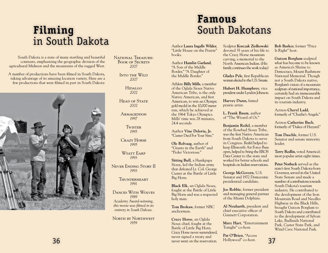
Filmingin South Dakota
South Dakota is a state of many startling and beautiful contrasts, emphasizing the geographic division of the
agricultural Midwest and the mountains of the rugged West.
A number of productions have been filmed in South Dakota, taking advantage of its amazing location variety. Here are a
few productions that were filmed in part in South Dakota:
National Treasure: Book of Secrets
2007
Into the Wild 2007
Hidalgo2002
Head of State2002
Armageddon1997
Twister 1995
Crazy Horse1995
Wyatt Earp1993
Never Ending Story II1993
Thunderheart1991
Dances With Wolves 1989
Academy Award-winning, this movie was filmed in its entirety in South Dakota.
North by Northwest1959
Author Laura Ingalls Wilder, “Little House on the Prairie” books.
Author Hamlin Garland, “A Son of the Middle Border,” “A Daughter of the Middle Border.”
Athlete Billy Mills, a member of the Oglala Sioux Native American Tribe, is the only Native American, and first American, to win an Olympic gold medal in the 10,000 meter run, which he achieved at the 1964 Tokyo Olympics. Mills’ time was 28 minutes, 24.4 seconds.
Author Vine Deloria, Jr. “Custer Died For Your Sins.”
Ole Rolvaag, author of “Giants in the Earth” and “Peder Victorious.”
Sitting Bull, a Hunkpapa Sioux, led the Indian army that defeated Lt. Col. George Custer at the Battle of Little Big Horn.
Black Elk, an Oglala Sioux, fought at the Battle of Little Big Horn and was a respected holy man.
Tom Brokaw, former NBC anchorman.
Crazy Horse, an Oglala Sioux chief, fought at the Battle of Little Big Horn. Crazy Horse never surrendered, never signed a treaty and never went on the reservation.
Sculptor Korczak Ziolkowski devoted 35 years of his life to the Crazy Horse mountain carving, a memorial to the North American Indian. (His family continues the work today.)
Gladys Pyle, first Republican woman elected to the U.S. Senate.
Hubert H. Humphrey, vice president under Lyndon Johnson.
Harvey Dunn, famed prairie artist.
L. Frank Baum, author of “The Wizard of Oz.”
Benjamin Reifel, a member of the Rosebud Sioux Tribe, was the first Native American from South Dakota to serve in Congress. Reifel helped to keep Ellsworth Air Force Base open, helped to bring the EROS Data Center to the state and worked for better schools and hospitals on Indian reservations.
George McGovern, U.S. Senator and 1972 Democratic presidential candidate.
Joe Robbie, former president and managing general partner of the Miami Dolphins.
Al Neuharth, president and chief executive officer of Gannett Corporation.
Mary Hart, “Entertainment Tonight” co-host.
Pat O’Brien, “Access Hollywood” co-host.
Bob Barker, former “Price Is Right” host.
Gutzon Borglum sculpted what has become to be known as America’s Shrine to Democracy, Mount Rushmore National Memorial. Though not a South Dakota native, Borglum’s vision of a mountain sculpture of national importance, certainly had an immeasurable impact on South Dakota and its tourism industry.
Actress Cheryl Ladd, formerly of “Charlie’s Angels.”
Actress Catherine Bach, formerly of “Dukes of Hazzard.”
Tom Daschle, former U.S. Senator and senate minority leader.
Terry Redlin, voted America’s most popular artist eight times.
Peter Norbeck served as the state’s first South Dakota-born Governor, served in the United State Senate and made a number of contributions towards South Dakota’s tourism industry. He contributed to the development of the Iron Mountain Road and Needles Highway in the Black Hills, brought Gutzon Borglum to South Dakota and contributed to the development of Sylvan Lake, Badlands National Park, Custer State Park, and Wind Cave National Park.
3736
FamousSouth Dakotans

Legends & Lore...
As a rule, legendary gunman Wild Bill Hickok never sat with his back to the door. But that’s what he was doing on Aug. 2, 1876, when he was gunned down in a Deadwood saloon. Wild Bill never saw his killer, Jack McCall, because he was too absorbed in a poker game. But legend has it that he had both pistols out and cocked before his head hit the table. Wild Bill’s last hand - black aces and eights and the Jack of Diamonds - is now known as the “Deadman’s Hand.”
After being convicted of the murder of Wild Bill Hickok, “Crooked Nose” Jack McCall was sentenced to death. On the morning of his execution in Yankton, Jack McCall casually looked out over a throng of onlookers. As the Marshal drew the noose over his neck, Jack McCall’s last words were only, “Draw it tighter, Marshal.” Seconds later, Jack McCall died.
Jesse James was one of the most notorious outlaws in history and tales of his prowess still live on in South Dakota’s historic Palisades State Park. On Sept. 7, 1876, Jesse and Frank James, along with seven other bandits, attempted to rob a Northfield, Minn., bank. That robbery proved to be one of the most daring and least rewarding of Jesse James’ career. Two gang members were killed and all but Jesse and his brother, Frank, were captured by lawmen. With an avenging posse of nearly 500 men hot on their trail, Jesse and Frank headed southwest to Dakota Territory. The two separated, each following one side of Split Rock Creek. Suddenly, Jesse found himself facing a 15-foot-wide (4.5 m) gorge. Spurring his mount, he reportedly jumped the chasm and sped away. Folks still marvel at Jesse’s daring feat at what is known as Devil’s Gulch near Garretson. Visitors may walk across a foot bridge that now spans the gap.
Even though Hunkpapa leader Sitting Bull was born and died in South Dakota, he was buried at Fort Yates, N.D. In 1953, under the cover of night, a group of South Dakotans took Sitting Bull’s remains from a North Dakota cemetery and returned him to his rightful home. (They did so with the permission of Sitting Bull’s relatives.) To ensure the body wouldn’t be stolen back, the new grave was covered with a concrete block weighing 20 tons (1,820 metric tons.) A granite bust of Sitting Bull marks the grave site near Mobridge.
Deadman’s Hand
Jack McCall
Jesse James’ Famous Leap
Sitting Bull’s Grave
Tipperary was the bucking bronc infamous on the rodeo circuit for being un-rideable. For 10 years, the renegade horse took on the best of the rodeo world with his list of victims reading like a “Who’s Who” of rodeo riders. Tales of Tipperary’s vicious bucking and lightning speed spread throughout the West like wildfire. The legend grew so large that many cowboys refused to ride him. A handsome purse awaited the brave soul who could master the wild beast. Few did. Passing his prime, Tipperary was retired to pasture near Buffalo. Today, the town hosts what could be the only monument erected in honor of a bucking bronc. It reads: “Tipperary - World’s Greatest Bucking Horse - 1910-1932.”
Years ago, the beautiful maiden Minnecotah lived on the shores of Lake Kampeska. Many young men from her tribe wanted her as a wife. But Minnecotah loved a hunter from another tribe. One day, she was told to choose a husband from among her tribe. Minnecotah craftily said she’d marry whoever could throw a stone furthest into the lake. The young men threw rocks for days until an island formed. But because of the waves, they could never gauge which stone went the furthest. The young men grew angry, put Minnecotah on the island and left her there. One night, her beloved hunter returned, paddled to the island and stole her away forever. The rock pile, Maiden’s Isle, still stands in Lake Kampeska near Watertown.
South of Scenic stands haunting Coffin Butte, all but inaccessible from the surrounding landscape. Its crumbling 90-degree walls have seldom been scaled. Legend has it that 10 Indian boys, on the run from army soldiers, formed a human bridge and crossed the butte’s summit. The angry soldiers surrounded the area, but the Indian boys starved to death rather than surrender. In 1936, a troop of Boy Scouts set out to prove, or disprove, the legend. After reaching the summit with ladders, the scouts discovered a human skeleton. To this day, although no one knows if the tale is true, the butte still bears the name of Coffin Butte.
A Bronc’s Legacy
Maiden’s Isle
Coffin Butte
3938

Legends & Lore...In the spring of 1876 two brothers, Moses and Fred Manuel discovered the Homestake Lead (pronounced “Leed”). This rich vein was eventually purchased by the Hearst family, and by 1900, had become the largest and most famous of all the Black Hills mining operations. The mine, the deepest in the world, has more than 500 miles (805 km) of tunnels from 150 feet (45.7 m) below the surface to more than 8,000 feet (2,438 m) deep. The mine, near Lead, closed in 2001. In 2006 the State of South Dakota purchased the mine. In 2007, the National Science Foundation designated the mine as the official site for development of a Deep Underground Science and Engineering Laboratory. The lab will be used to study sub-atomic particles.
In 1928, a new radio station called WNAX played host to a young musician who later would become one of the nation’s most popular TV personalities. That year, the young accordionist from Strasburg, N.D., arrived in Yankton with his novelty band. Hoping to restock their dwindling cash reserves, the band sought out the local radio station and asked if they might perform. After feeding the hungry group, the station’s manager arranged to put them on the air. Listener reaction was so great the manager offered to add the band to the station’s roster of regular entertainers. The leader of the band realized, though the pay was sparse, the gig could help the band attract better-paying bookings. That “brief stop” in Yankton lasted almost nine years. Thus began the illustrious career of the great Lawrence Welk.
Every morning, as the train passed near Clark, a little boy would stand alongside the tracks, waving to the crew on board. The crew always waved back. A time came when, for three days, the little boy failed to greet the train. Learning of the little fellow’s sudden death, the railroad crew took time out each trip to stop and lay flowers on the boy’s grave, as conductor “Big Bill” Chambers bowed his head in prayer. Today, the friendship of the “Little Fellow” and the rail crew is still honored at an annual Memorial Day Celebration in Clark.
The Homestake Mine
The Lawrence Welk Legend
Little Fellow
“March King” John Philip Sousa was engaged to play for Mitchell’s 13th Annual Corn Palace Festival in 1904. Festival organizers sent a telegram to New York asking what the bandmaster’s fee would be for 12 performances. When Sousa’s manager replied the fee would be $7,000, Mitchell jumped at the deal. But Sousa himself was not so easily swayed. When he arrived in the city, he insisted on being paid in cash before he would let his band members off the train. Sousa was paid, and his 12 concerts are now part of the great history of the World’s Only Corn Palace in Mitchell.
South Dakota historian Doane Robinson first conceived the notion of historic rock carvings in the Black Hills in 1923. But Robinson’s original proposal to sculptor Gutzon Borglum suggested the statues of Western heroes such as Kit Carson, Buffalo Bill Cody and Jed Smith be carved on the Needles. Borglum liked the idea of the carvings but had even bigger plans. He wanted to carve something with more significance. After much thought, the Western heroes became the four faces we know so well: George Washington, Thomas Jefferson, Theodore Roosevelt and Abraham Lincoln.
Colorado Charlie Utter is best known as the wagoneer who brought the most famous wagon train to Deadwood. Loaded down with supplies, Colorado Charlie picked up passengers in Denver, then traveled to Cheyenne, Wyo., where he stopped long enough to pick up more than 37,000 pounds of flour and several piano players, fiddlers, banjo pickers, gamblers, con-artists, brothel owners, dance hall girls and other “soiled doves.” By the time that wagon reached Deadwood, Colorado Charlie’s passengers numbered 180, including the likes of Calamity Jane and Wild Bill Hickok. Today Colorado Charlie Utter is known for bringing the first batch of “sin and gin” to Deadwood.
John Philip Sousa
Mount Rushmore
“Sin and Gin”
4140

Legends & Lore...Before the railroad came to South Dakota, all freight was hauled to the Black Hills on wagons. One of the most famous freight wagons was filled to the brim with crates and crates of cats! In 1876, the city of Deadwood had no cats, and the dance hall girls and “working girls” of the town yearned for the fluffy little creatures as pets and mousers. Eyeing a potential gold mine in cats, mule skinner Phatty Thompson set off for Cheyenne, Wyo. Phatty paid youngsters of Cheyenne two bits for every cat they brought him. It wasn’t long before Phatty’s wagon was filled with 50 yowling, scratching passengers. Back in Deadwood, Phatty charged $10 a cat; $30 for the fat ones. Thirty minutes later, Phatty Thompson was without a cat to his name and $1,000 richer.
They tormented the cattle and horses and ate the leaves off vegetables and the wood off pitchforks, rakes and hoes. They flew in swarms thick enough to choke a man. Beginning in 1874, an infestation of the worst kind plagued the plains of eastern South Dakota. Fighting the swarms of grasshoppers was beginning to look like an effort in futility when Father Pierre Boucher appealed to a higher authority to save the crops. The pastor led a pilgrimage on an 11-mile (18 km) trek from field to field. In each field a giant cross was erected to ward off the grasshoppers while people prayed for divine intervention to stop the horrible plague. Miraculously, their prayers were answered. The grasshoppers disappeared that very same day.
Sioux Falls was once the national spotlight, playing host to a number of affluent men and women. The townspeople of Sioux Falls did not welcome the recognition, however. In the early 1900s, Sioux Falls acquired the name “Divorce Colony.” Because of the ease of obtaining a divorce in South Dakota, the city became a popular stop for unhappy couples. State law required only that residents live in the state for six months before they could obtain a divorce. Easily accessible by rail, Sioux Falls rivaled the Reno, Nev., of today with as many as 145 divorces in a single year. In 1908, a bill extending the length of residency to one year became law, thus ending the era of “quick and easy” divorces in South Dakota.
Deadwood Felines
Grasshopper Strike
The Divorce Legend
4342

Who am I?1. Marvin Ted Thin Elk 2. Richard Warren Sears 3. L. Frank Baum 4. Jack “Crooked Nose” McCall 5. Laura Ingalls Wilder 6. Mary Hart 7. Scotty Philip 8. Harvey Dunn 9. Joe Foss 10. Terry Redlin
4544
1. I grew up on the Rosebud Reservation. In 1992, I played a medicine man in the movie “Thunderheart.” Who am I?
2. While living near Wolsey, I launched the world’s largest mail-order catalog business. Who am I?
3. During the 1800s, I lived in Aberdeen and operated a variety store and local newspaper. Later, I wrote “The Wizard of Oz.” Who am I?
4. I shot Wild Bill Hickok at Deadwood’s Saloon No. 10. Who am I?
5. After living in a little house on the prairie in De Smet, I wrote a series of books describing my life. Who am I?
6. I am a former Miss South Dakota from Sioux Falls. Today, I co-host “Entertainment Tonight.” Who am I?
7. Saving the buffalo earned me the title of “Buffalo King.” My grave is located near the Oahe Dam in Pierre. Who am I?
8. I was born south of Manchester and grew up to be one of South Dakota’s most prominent artists. One of my most famous paintings is called “The Prairie Trail.” Who am I?
9. I am a former South Dakota governor. In 1959, I was hired as the first commissioner of the American Football League. After my accomplishments in World War II, Pres. Franklin Roosevelt hung a Medal of Honor around my neck. Who am I?
10. I was voted “America’s Most Popular Artist” for several years running. I get much of my inspiration from the Watertown area, where I grew up. Who am I?
Mount Moriah Cemetery is the final resting place of gunman Wild Bill Hickok and the notorious Calamity Jane.
Badlands National Park shows the effects of 1 billion years of erosion.
Storybook Land is located in Brookings.
Crazy Horse, near Custer, is the world’s largest mountain carving in progress.
Meriwether Lewis’ dog, Seaman, accompanied the Lewis and Clark expedition in 1804-1806
Vermillion is home to the National Music Museum.
American Legion baseball was first conceived at a 1925 convention in Milbank.
Oahe Dam, near Pierre, is the second-largest rolled-earth dam in the world.
Spearfish is home to a rodeo arena that was originally a duck pond.
South Dakota is known as the pheasant capital of the world. At one time in the 1940s, pheasants outnumbered people by 20 to 1.
1.
2.
3.
4.
5.
6.
7.
8.
9.
10.
1. TRUE 2. FALSE, 37 million years of erosion 3. FALSE, Aberdeen 4. TRUE 5. TRUE 6. TRUE 7. TRUE 8. TRUE 9. FALSE, Clear Lake 10. TRUE
True or False?

Tunnels, Trails & byways
Route Location Width Height
US 16A 6.5 mi (10.5 km) S of Keystone 13’4” (4.06 m) 12’4” (3.76 m)US 16A 4 mi (6.4 km) S of Keystone 13’2” (4.01 m) 12’2” (3.71 m)US 16A 3 mi (4.8 km) S of Keystone 14’ (4.27 m) 12’9” (3.89 m)US 16A 1 mi (1.6 km) N of Keystone 47’ (14.32 m) 18’ (5.49 m)SD 87 6 mi (9.7 km) SE of Sylvan Lake 9’ (2.74 m) 12’3” (3.73 m)SD 87 2 mi (3.2 km) SE of Sylvan Lake 8’4” (2.54 m) 12’ (3.66 m)SD 87 1 mi (1.6 km) N of Sylvan Lake 10’6” (3.2 m) 10’7” (3.23 m)
Larger vehicles, such as buses, trucks and trailers, may not fit through some of the tunnels around Keystone and Sylvan Lake. Even if your vehicle meets the size limitations, watch your extension mirrors!
4746
South Dakota’s scenic byways and trails offer perfect opportunities to slow down, enjoy the scenery and even stop to smell the wildflowers. The byways offer an escape from fast-paced highways, offering spectacular road-side scenery. Hiking and biking trails in state parks and recreation areas offer visitors the chance to get an up-close look at South Dakota’s natural beauty. The following are some popular byways and trails in South Dakota.
Driving Tours
Peter Norbeck Scenic Byway, Black Hills
Spearfish Canyon Scenic Byway, Spearfish
Wildlife Loop Road, Custer State Park
Badlands Scenic Loop, Highway 240
The Black Hills Parkway, Highway 385
Native American Scenic Byway, Hwys 37, 50 and 1806
LengTh
70 mi (112 km)
20 mi (32 km)
18 mi (28 km)
30 mi (48 km)
104 mi (167 km)
455 mi (728 km)
You’LL see
Granite formations, Mount Rushmore National Memorial
Waterfalls, lush vegetation
Buffalo, burros, birds, and other wildlife
Buttes, canyons, spires and wildlife
Pactola Reservoir and Black Hills
River overviews, wildlife, native grasses
Scenic Byways & Trails recreaTion TraiLs
Adams Homestead Nature Area Trails
Centennial Trail Passes within one mile of Mount Rushmore National Memorial.
George S. Mickelson TrailFollows the historic Deadwood to Edgemont Burlington Northern rail line.
Fossil Exhibit TrailBadlands National ParkPaved trail is handicappedaccessible and offers an easy,educational hike.
Custer State Park Trails Established trails offer a variety of difficulty levels and scenery.
LengTh
10 mi (16 km)
111 mi (178 km)
109 mi (177 km)
1/4 mi (.4 km)
55 mi (88 km)
You’LL see
Prairie, forest and Missouri River
Mount Rushmore National Memorial, lakes
Mountains, meadows and wildlife
Fossil replicas
Forests, wildlife and streams
Black Hills Tunnels

4948
Information...Aberdeen Convention and Visitors Bureau*PO Box 75, 10 Railroad Ave. SWAberdeen, SD 57402(605) 225-2414 or 1-800-645-3851(605) 225-3573 [email protected]
Belle Fourche Chamber of Commerce415 Fifth Ave.Belle Fourche, SD 57717(605) 892-2676 or 1-888-345-5859Fax (605) [email protected]
Brookings Convention and Visitors Bureau*PO Box 431, 2308 Sixth St. EBrookings, SD 57006(605) 692-6125 or 1-800-699-6125(605) 697-8109 [email protected]
Chamberlain-Oacoma Chamber of Commerce/CVB115 W. Lawler Ave.Chamberlain, SD 57325(605) 734-4416(605) 697-4418 [email protected]
Custer Chamber of Commerce*615 Washington St.Custer, SD 57730(605) 673-2244 or 1-800-992-9818(605) 673-3726 [email protected]
Deadwood Chamber and Visitors Bureau*767 Main St.Deadwood, SD 57732(605) 578-1876 or 1-800-999-1876(605) 578-2429 [email protected]
Hill City Chamber of CommercePO Box 253, 114 Main St.Hill City, SD 57745(605) 574-2368 or 1-800-888-1798(605) 574-2055 [email protected]
Hot Springs Chamber of Commerce*801 S. Sixth St.Hot Springs, SD 57747(605) 745-4140 or 1-800-325-6991(605) 745-5849 [email protected]
Huron Chamber and Visitors Bureau15 Fourth St. S.W.Huron, SD 57350(605) 325-0000 or 1-800-487-6673(605) 325-3821 [email protected]
Keystone Chamber of CommercePO Box 653, 110 Swanzey St.Keystone, SD 57751(605) 666-4896 or 1-800-456-3345(605) 666-4896 [email protected]
Lead Chamber of Commerce309 W. Main St, Suite ALead, SD 57754(605) 548-1100(605) 584-2209 [email protected]
Lemmon Area Chamber of Commerce100 Third St. W.Lemmon, SD 57638(605) 374-5716(605) 374-5789 [email protected]
Madison Area Chamber of CommercePO Box 467, 315 S. Egan Ave.Madison, SD 57042(605) 256-2454(605) 256-9606 [email protected]
Milbank Area Chamber of Commerce*100 E. Fourth Ave.Milbank, SD 57252(605) 432-6656 or 1-800-675-6656(605) 432-6507 [email protected]
Corn Palace Convention and Visitors BureauPO Box 1026, 601 N. Main St.Mitchell, SD 57301(605) 996-6223 or 1-866-273-2676(605) 996-8273 [email protected]

Information...Mobridge Chamber of Commerce212 Main St.Mobridge, SD 57601(605) 845-2387(605) 845-3223 [email protected]
Pierre Convention and Visitors Bureau*PO Box 548, 800 W. DakotaPierre, SD 57501(605) 224-7361 or 1-800-962-2034(605) 224-6485 [email protected]
Rapid City Convention and Visitors Bureau*PO Box 747 444 Mount Rushmore Road N.Rapid City, SD 57709(605) 343-1744 or 1-800-487-3223(605) 348-9217 [email protected]
Sioux Falls Convention and Visitors Bureau*PO Box 1425 200 N. Philips Ave., Suite 102Sioux Falls, SD 57101(605) 336-1620 or 1-800-333-2072(605) 336-6499 [email protected]
Spearfish Chamber, Convention and Visitors BureauPO Box 550, 106. W. KansasSpearfish, SD 57783(605) 642-2626 or 1-800-626-8013(605) 642-7310 [email protected]
Sturgis Chamber of CommercePO Box 504, 2040 Junction Ave.Sturgis, SD 57785(605) 347-2556(605) 347-6682 [email protected]
Vermillion Chamber of Commerce906 E. Cherry St.Vermillion, SD 57069(605) 634-5571 or 1-800-809-2071(605) 624-0094 [email protected]
Wall-Badlands Area Chamber of CommercePO Box 527, 501 Main St.Wall, SD 57790(605) 279-2665 or 1-888-852-9255(605) 279-2067 [email protected]
Watertown Convention and Visitors Bureau*PO Box 11131200 33rd St. S.E., Suite 209Watertown, SD 57201(605) 886-5814 or 1-800-658-4505(605) 886-5957 [email protected]
Winner Chamber of Commerce*PO Box 268, 200 E. Third St.Winner, SD 57580(605) 842-1533 or 1-800-658-3079(605) 842-1512 [email protected]
Yankton Conventionand Visitors BureauPO Box 588, 803 E. Fourth St.Yankton, SD 57078(605) 665-3636 or 1-800-888-1460(605) 665-7501 [email protected]
* Step-on guides can be arranged with advanced notice. Some arranged through receptive operators. Some charge a small fee for tours that do not stay overnight.
5150

Black Hills, Badlands & Lakes Association1851 Discovery CircleRapid City, SD 57701(605) 355-3600Fax: (605) 355-3601 [email protected]
Glacial Lakes & Prairies Tourism AssociationPO Box 244, 1200 33rd St. S.E.Watertown, SD 57201-0244(605) 886-7305 or 1-800-244-8860Fax: (605) [email protected]
Road & weather conditions511
Snowmobile trail conditions(seasonal) 1-800-445-3474
State Radio Dispatch CentersHuron: (605) 353-7132Pierre: (605) 773-3536Rapid City: (605) 393-8121
52
Regional Tourism associations
Great Lakes of South Dakota Association PO Box 786Pierre, SD 57501(605) 224-4617 or 1-888-386-4617Fax: (605) 224-4617 [email protected]
Southeast South Dakota Tourism Association1101 Broadway, Suite 113Yankton, SD 57078(605) 665-2435 or 1-888-353-7382Fax: (605) 665-8776 [email protected]
Other NumbersSouth Dakota Highway Patrol(605) 773-3105
Black Hills Central ReservationsPO Box 523 68 Sherman St., Suite 206Deadwood, SD 57732(605) 578-7000 or 1-800-529-0105(605) 578-7705 [email protected]
Black Hills, Badlands & Lakes
Great Lakes
Glacial Lakes & Prairies
Southeast
2,000 documents printed by the South Dakota office of Tourism at a cost of $1.20 per document. Printed in 2007
Available Print Publications
Group Tour Planning Guide
South Dakota Highway Map
South Dakota Vacation Guide
Adventure Travel Guide
Lewis & Clark Trail Guide
Greenhorn’s Guide to Archeology & Paleontology
The Great Sioux Nation Guide
South Dakota Grasses, Wildflowers & Crops Brochure
Great Parks, Monuments & Memorials
Visit www.TourSDakota.com to download or order copies.

www.TravelSD.com