environmental geochemistry of the surface...
TRANSCRIPT
Science & its applications 5:1 (2017) 30-35
30
Environmental Geochemistry of the Surface Sediments of Sabkhat Daryana, NE Libya
Osama R. Shaltami *, Hwedi Errishi and Fares F. Fares
University of Benghazi, Faculty of Science, Department of Earth Sciences, P. O. Box 9480, Benghazi-Libya
A R T I C L E I N F O A B S T R A C T
Article history: Received 11 February 2017 Revised 20 February 2017 Accepted 21 March 2017 Available online 28 March 2017
The present paper discriminates between nearshore and farshore sabkha sediments at Daryana Coast, NE Libya, using geochemical viewpoints. The nearshore sediments are mostly sand with low amounts of mud (Al). High contents of heavy metals found in these sediments can be due to their incorporation in carbonate phases. The farshore sediments are mostly sandy mud with higher contents of Al and lower contents of heavy metals, except higher contents of Pb. The heavy metals are mainly of anthropogenic origin (EF > 1.5). Generally, Igeo values indicate that the study area is unpolluted with most heavy metals (except with As and Hg).
2017 University of Benghazi. All rights reserved.
Keywords: Environmental Geochemistry, Sabkha Sediments, Daryana, Libya
* Corresponding author: E-mail address: [email protected] O. R. Shaltami
1. Introduction
Warren (1989) defines sabkhas as marine and continental mudflats where displacive and replacive evaporite minerals are forming in the capillary zone above a saline water table. A marine sabkha is a near coastal salt dominated by marine-derived brines and processes; a continental sabkha is an inland salt flat dominated by continental brines and processes. According to Prudencio et al., (2007) sabkha is a shallow coastal area of marginal seas, particularly those in catchment areas of populated and industrialized regions, are endangered by the increasing of substances or heavy metals at a rate faster than the environment can accommodate. The monitoring of several parameters in these coastal areas, such as potentially pollutants trace elements, is crucial, since the accumulation of pollutants in the sediments of marginal seas is expected. In addition, marine organisms and vegetation in coastal lagoon environments can uptake metals and the incorporation of metals in aquatic food chain becomes a serious threat to the future. In general, metal pollution may derive from different origins such as geological weathering, mining activities and industrial processing of ores, industries (the use of metals and their components), leaching from garbage and solid waste dumps, and effluents. The evaluation of metal contents in sediments plays a very important role in the detection of sources of pollution in aquatic systems, due to physical–chemical processes, the major part of heavy metals introduced into an aquatic system are deposited in the sediments. To evaluate the potential environmental contamination of sabkha sediments, the chemical analysis of the surface sediments is very important since they represent the recent situation. The estimation of possible variations with time must pass by a comparative study with unpolluted sediments, i.e. the natural background determination of the area. In this way, spatial and temporal variations must be taken into account. To establish the natural background vertical sediment profiles obtained by coring are important since deep levels can give a reasonable estimation of the natural background (Liaghati et al., 2003).
Identifying naturally elevated metal concentration in sediments is important because some trace elements appearing to be
enriched may be due only to their natural source. The evaluation of environment quality alteration by anthropogenic activities through sediments composition must take into account not only the total contents of trace elements but also other relevant factors. In fact, the ability of sediments to concentrate and retain trace elements depends on physical properties such as grain size/surface area of the sediments and the mineralogical composition. Spatial surveys of sediment-trace elements contents, as well as comparison of these contents to non-polluted baseline values, are a key first step to understand the transport and deposition of contaminant trace metals in coastal aquatic systems (Alexander et al., 1993).
Owing to variations in sediments of lagoon areas, the data should not be interpreted only using absolute concentration values in isolation. Thus, to enable a more effective interpretation, a normalization procedure is in general applied to the chemical data set. Among the several normalization methods usually used, the comparison with conservative elements such as Al, Ti and Sc, has been done. The extent of contamination, by using the ratios of metals to reference elements, can be calculated relative to a reference sample (Villaescusa-Celaya et al., 2000; Loska et al., 2004; Das et al., 2008; Shaltami, 2012; El-Werfalli, 2016).
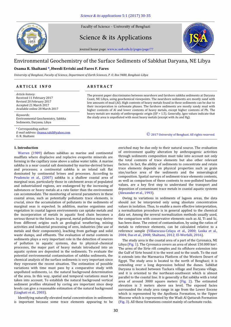
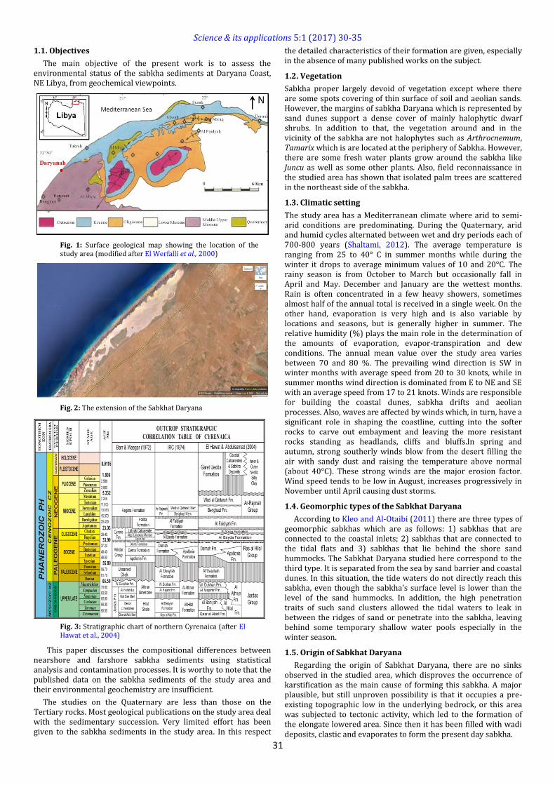
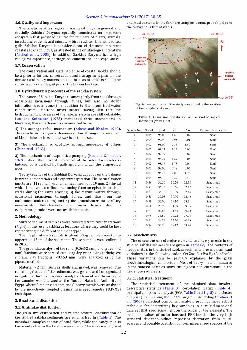
The study area is the coastal area of a part of the Cyrenaica, NE Libya (Fig. 1). The Cyrenaica covers an area of about 150.000 km2. The arms of the Sirte rift complex and its offshore extension into the Gulf of Sirte bound it to the west and to the south. To the east it extends into the Marmarica Platform of the Western Desert of Egypt. The study area is located to the north of Benghazi; it is extending over a long depression behind the dunes. Sabkhat Daryana is located between Tuckara village and Daryana village, and it is oriented to the northeast-southwest which is almost parallel to the coastal line. It is generally a flat sabkha with a total area of around 3000 square meters (Fig. 2). The estimated elevation is 3 meters above sea level. The exposed facies surrounded the study area range in age from the Lower Eocene which is represented by the Apollonia Formation, to the Upper Miocene which is represented by the Wadi Al Qattarah Formation (Fig. 3). All these formations consist mainly of carbonate rocks.
Science & its applications 5:1 (2017) 30-35
31
1.1. Objectives
The main objective of the present work is to assess the environmental status of the sabkha sediments at Daryana Coast, NE Libya, from geochemical viewpoints.
Fig. 1: Surface geological map showing the location of the study area (modified after El Werfalli et al., 2000)
Fig. 2: The extension of the Sabkhat Daryana
Fig. 3: Stratigraphic chart of northern Cyrenaica (after El Hawat et al., 2004)
This paper discusses the compositional differences between nearshore and farshore sabkha sediments using statistical analysis and contamination processes. It is worthy to note that the published data on the sabkha sediments of the study area and their environmental geochemistry are insufficient.
The studies on the Quaternary are less than those on the Tertiary rocks. Most geological publications on the study area deal with the sedimentary succession. Very limited effort has been given to the sabkha sediments in the study area. In this respect
the detailed characteristics of their formation are given, especially in the absence of many published works on the subject.
1.2. Vegetation
Sabkha proper largely devoid of vegetation except where there are some spots covering of thin surface of soil and aeolian sands. However, the margins of sabkha Daryana which is represented by sand dunes support a dense cover of mainly halophytic dwarf shrubs. In addition to that, the vegetation around and in the vicinity of the sabkha are not halophytes such as Arthrocnemum, Tamarix which is are located at the periphery of Sabkha. However, there are some fresh water plants grow around the sabkha like Juncu as well as some other plants. Also, field reconnaissance in the studied area has shown that isolated palm trees are scattered in the northeast side of the sabkha.
1.3. Climatic setting
The study area has a Mediterranean climate where arid to semi-arid conditions are predominating. During the Quaternary, arid and humid cycles alternated between wet and dry periods each of 700-800 years (Shaltami, 2012). The average temperature is ranging from 25 to 40° C in summer months while during the winter it drops to average minimum values of 10 and 20°C. The rainy season is from October to March but occasionally fall in April and May. December and January are the wettest months. Rain is often concentrated in a few heavy showers, sometimes almost half of the annual total is received in a single week. On the other hand, evaporation is very high and is also variable by locations and seasons, but is generally higher in summer. The relative humidity (%) plays the main role in the determination of the amounts of evaporation, evapor-transpiration and dew conditions. The annual mean value over the study area varies between 70 and 80 %. The prevailing wind direction is SW in winter months with average speed from 20 to 30 knots, while in summer months wind direction is dominated from E to NE and SE with an average speed from 17 to 21 knots. Winds are responsible for building the coastal dunes, sabkha drifts and aeolian processes. Also, waves are affected by winds which, in turn, have a significant role in shaping the coastline, cutting into the softer rocks to carve out embayment and leaving the more resistant rocks standing as headlands, cliffs and bluffs.In spring and autumn, strong southerly winds blow from the desert filling the air with sandy dust and raising the temperature above normal (about 40°C). These strong winds are the major erosion factor. Wind speed tends to be low in August, increases progressively in November until April causing dust storms.
1.4. Geomorphic types of the Sabkhat Daryana
According to Kleo and Al-Otaibi (2011) there are three types of geomorphic sabkhas which are as follows: 1) sabkhas that are connected to the coastal inlets; 2) sabkhas that are connected to the tidal flats and 3) sabkhas that lie behind the shore sand hummocks. The Sabkhat Daryana studied here correspond to the third type. It is separated from the sea by sand barrier and coastal dunes. In this situation, the tide waters do not directly reach this sabkha, even though the sabkha’s surface level is lower than the level of the sand hummocks. In addition, the high penetration traits of such sand clusters allowed the tidal waters to leak in between the ridges of sand or penetrate into the sabkha, leaving behind some temporary shallow water pools especially in the winter season.
1.5. Origin of Sabkhat Daryana
Regarding the origin of Sabkhat Daryana, there are no sinks observed in the studied area, which disproves the occurrence of karstification as the main cause of forming this sabkha. A major plausible, but still unproven possibility is that it occupies a pre-existing topographic low in the underlying bedrock, or this area was subjected to tectonic activity, which led to the formation of the elongate lowered area. Since then it has been filled with wadi deposits, clastic and evaporates to form the present day sabkha.
Science & its applications 5:1 (2017) 30-35
32
1.6. Quality and Importance
The coastal sabkhas region in northeast Libya in general and specially Sabkhat Daryana specially constitutes an important ecosystem that provided habitat for numbers of plants, animals, insects and endemic and migratory birds such as flamingo and sea gulls. Sabkhat Daryana is considered one of the most important coastal sabkha in Libya, as attested in the ornithological literature (Azafzaf et al., 2005). In addition Sabkhat Daryana has a high ecological importance, heritage, educational and landscape value.
1.7. Conservation
The conservation and sustainable use of coastal sabkha should be a priority for any conservation and management plan for the decision and policy makers, and all the coastal sabkhas should be considered as an integral part of the Libyan heritage.
1.8. Hydrodynamic processes of the sabkha system
The water of Sabkhat Daryana comes partly from sea (through occasional incursions through dunes, but also no doubt infiltration under dunes). In addition to that from freshwater runoff from limestone areas inland. Having said that the hydrodynamic processes of the sabkha system are still debatable. Hsu and Schneider (1973) mentioned three mechanisms in literature; these mechanisms summarized below:
1) The seepage reflux mechanism (Adams and Rhodes, 1960). This mechanism suggests downward flow through the sediment of Mg enriched brines on the way back to the sea.
2) The mechanism of capillary upward movement of brines (Shinn et al., 1965).
3) The mechanism of evaporative pumping (Hsu and Schneider, 1969) where the upward movement of the subsurface water is induced by a vertical hydraulic gradient under the evaporated area.
The hydraulics of the Sabkhat Daryana depends on the balance between alimentation and evaportranspiration. The natural water inputs are: 1) rainfall, with an annual mean of 310 mm; 2) fluvial which is uneven contributions coming from an episodic floods of wadis during the rainy seasons; 3) the marine waters through; occasional incursions through dunes, and also from the infiltration under dunes) and 4) the groundwater via capillary movements. Unfortunately the main losses due to evaportranspiration were not available to use.
2. Methodology
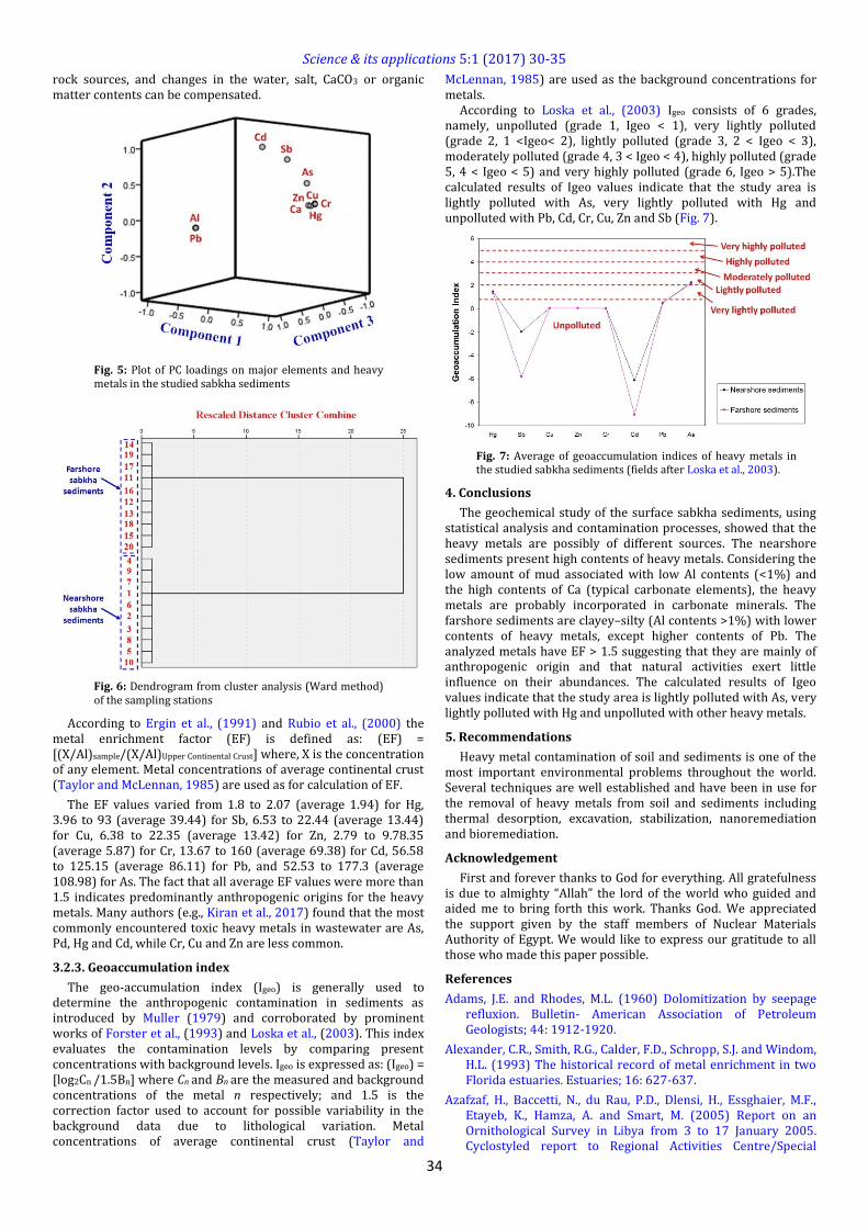
Surface sediment samples were collected from twenty stations (Fig. 4) in the recent sabkha at locations where they could be best representing the different sediment types.
The weight of each sample is about 0.5kg and represents the uppermost 15cm of the sediments. These samples were collected in 2016.
The grain size analysis of the sand (0.063-2 mm) and gravel (>2 mm) fractions were carried out using dry-wet sieving techniques; silt and clay fractions (<0.063 mm) were analyzed using the pipette method.
Material > 2 mm, such as shells and gravel, was removed. The remaining fraction of the sediments was ground and homogenized in agate mortars for chemical analysis. Element geochemistry of the samples was analyzed at the Nuclear Materials Authority of Egypt. About 2 major elements and 8 heavy metals were analyzed by the inductively coupled plasma mass spectrometry (ICP-MS) technique.
3. Results and discussion
3.1. Grain size distribution
The grain size distribution and related textural classification of the studied sabkha sediments are summarized in (Table 1). The nearshore samples consist of sand class, while the sandy mud is the mainly class in the farshore sediments. The increase in gravel
and mud contents in the farshore samples is most probably due to the terrigenous flux of wadis.
Fig. 4: Landsat image of the study area showing the location of the sampled stations
Table 1: Grain size distribution of the studied sabkha sediments (values in %)
3.2. Geochemistry
The concentrations of major elements and heavy metals in the studied sabkha sediments are given in Table (2). The contents of heavy metals in the studied sabkha sediments present significant variations in the following order: Cr>Zn> Cu>Pb>Hg>As>Sb>Cd. These variations can be partially explained by the grain size/mineralogical composition. Most of heavy metals measured in the studied samples show the highest concentrations in the nearshore sediments.
3.2.1. Statistical treatment
The statistical treatment of the obtained data involves descriptive statistics (Table 3), correlation matrix (Table 4), principal component analysis (PCA, Table 5 and Fig. 5) and cluster analysis (Fig. 6) using the SPSS© program. According to Zhou et al., (2009) principal component analysis provides more robust technique for determining key variables in a multidimensional data set that shed some light on the origin of the elements. The maximum values of major ions and REE besides the very high standard deviation values represent derivation from multi-sources and possible contribution from mineralized sources at the
Sample No. Gravel Sand Silt Clay Textural classification
1 0.05 98.00 1.88 0.07 Sand
2 0.04 99.90 0.05 0.01 Sand
3 0.02 95.90 2.28 1.80 Sand
4 0.02 98.53 1.39 0.06 Sand
5 0.04 99.77 0.10 0.09 Sand
6 0.04 98.24 1.67 0.05 Sand
7 0.02 98.16 1.78 0.04 Sand
8 0.05 99.00 0.88 0.07 Sand
9 0.02 96.23 2.00 1.75 Sand
10 0.04 98.70 0.82 0.44 Sand
11 0.86 36.50 30.26 32.38 Sandy mud
12 0.81 36.36 30.66 32.17 Sandy mud
13 0.77 36.70 30.09 32.44 Sandy mud
14 0.55 37.05 30.00 32.40 Sandy mud
15 0.79 32.00 29.10 38.11 Sandy mud
16 0.66 28.90 31.09 39.35 Sandy mud
17 0.77 28.83 31.40 39.00 Sandy mud
18 0.90 31.50 30.22 37.38 Sandy mud
19 0.95 26.36 32.50 40.19 Sandy mud
20 0.74 30.70 29.12 39.44 Sandy mud

Science & its applications 5:1 (2017) 30-35
33
hinterland in addition to enhanced anthropogenic input. The cluster analysis shows two different types of sabkha sediments. The correlation matrix indicates that:
1) Hg, Sb, Cu, Zn, Cr and As are strongly correlated with Ca, which can be explained by the incorporation of these heavy metals in carbonate minerals.
2) Pb is strongly correlated with Al. This association may express the incorporation of Pb into aluminosilicate minerals.
3) Cd does not demonstrate any confident coherence to any of the analyzed major elements and heavy metals, suggesting that it is mainly of anthropogenic source. The natural sources in the study area include wadi deposits and aeolian and marine inputs, while the most important anthropogenic sources include sewage disposal and wastewater.
Table 2: Chemical analysis data (major elements in wt%, heavy metals in ppm) of the studied sabkha sediments
Table 3: Descriptive statistics of the studied sabkha
sediments (major elements in wt%, heavy metals in ppm)
Currently, source identification of elements is mostly conducted by calculating the enrichment factor to classify natural and anthropogenic origins (Luo et al., 2015), or by means of multivariate analysis to group natural and key anthropogenic input types (Soltani et al., 2015).
We used principal component analysis (PCA) with varimax normalized rotation, an effective statistical tool for element source identification to identify the factors influencing each other and to obtain more reliable information about the relationships among metals. PCA yielded three principal components (PCs) in the study area, which described 99.81 % of total variance of data. However, the following is a short account on the geochemical associations as suggested by PCA.
The statistical analyses suggest that Al is essentially related to the terrestrial input, while the marine contribution is the main source of Ca. The heavy metals are possibly of different sources.
Table 4: Correlation matrix of the studied sabkha sediments
Table 5: Rotated component matrix for data of elements and eigenvalues, percentage of variances, and eigenvectors for the three principal components
First principal component (PC1): It is the strongest component as it accounts for 74.36% of the variables. It can be nominated as the component of the environment-sensitive elements since it shows strong loading for Hg, Sb, Cu, Zn, Cr and As. This component also displays strong loading for marine elements such as Ca, while it shows negative loading for the detrital components such as Al and related elements such as Pb.
Second principal component (PC2): It accounts for 25.21% of the total variables, where it shows positive loading for Cd. It can also be nominated as the component of the environment-sensitive elements.
Third principal component (PC3): It is the weakest where it represents only 0.23 % of the total variables. This component is practically insignificant.
3.2.2. Enrichment factor
Enrichment factor (EF) is extensively used to estimate anthropogenic impact on heavy metal concentrations in sediments. To identify possible anomalous potentially toxic metal concentrations, geochemical normalization of heavy metal concentration to a conservative element is frequently employed (Lee et al., 2009; Godwin et al., 2015). Typically, an EF value between 0.5 and 1.5 indicates that a metal in sediment is entirely from crustal contribution (e.g., weathering product), while EF values>1.5 indicate an important proportion of non-crustal materials from either natural processes (e.g., biota contributions) and/or anthropogenic influences (Xu et al., 2014). Metals such as Al, Li and Fe have been largely used as geochemical normalizers (Leopold et al., 2008).
In this work, Al was chosen as the conservative element for the normalization of the chemical elements concentration, as Al is assumed to have a uniform flux to the sediments from the crust
Sample No. Al Ca Hg Sb Cu Zn Cr Cd Pb As
1 0.53 38.77 16.36 0.83 94.22 100.11 101.26 0.70 56.25 10.37
2 0.55 38.43 16.32 0.79 94.18 100.00 101.22 0.66 56.21 10.33
3 0.51 39.00 16.24 0.71 94.10 99.96 101.14 0.58 56.13 10.25
4 0.49 37.89 16.08 0.55 93.94 99.80 100.98 0.42 55.97 10.09
5 0.47 39.11 17.00 0.46 93.85 99.71 100.89 0.33 55.88 10.00
6 0.50 38.63 16.46 0.93 94.32 100.18 101.36 0.80 56.35 10.47
7 0.60 38.12 16.20 0.67 94.06 99.92 101.10 0.54 56.09 10.21
8 0.54 39.09 16.42 0.89 94.28 100.14 101.32 0.76 56.31 10.43
9 0.53 37.97 15.98 0.45 93.84 99.70 100.88 0.32 55.87 9.99
10 0.59 39.56 16.10 0.57 93.96 99.85 101.00 0.44 56.00 10.11
11 1.39 32.23 12.70 0.49 82.65 88.43 89.69 0.57 78.63 9.40
12 1.41 31.89 12.66 0.45 82.61 88.43 89.65 0.53 78.59 9.36
13 1.37 32.46 12.58 0.37 82.53 88.43 89.57 0.45 78.51 9.28
14 1.35 31.35 12.42 0.21 82.37 88.43 89.41 0.29 78.35 9.12
15 1.33 32.57 13.34 0.12 82.28 88.43 89.32 0.20 78.26 9.03
16 1.36 32.09 12.80 0.59 82.75 88.43 89.79 0.67 78.73 9.50
17 1.46 31.58 12.54 0.33 82.49 88.43 89.53 0.41 78.47 9.24
18 1.40 32.55 12.76 0.55 82.71 88.43 89.75 0.63 78.69 9.46
19 1.39 31.43 12.32 0.11 82.27 88.43 89.31 0.19 78.25 9.00
20 1.45 33.00 12.44 0.23 82.39 88.43 89.43 0.31 78.38 9.14
Al 20 0.47 1.46 0.96 0.44
Ca 20 31.35 39.56 35.39 3.40
Hg 20 12.32 17.00 14.49 1.90
Sb 20 0.11 0.93 0.52 0.24
Cu 20 82.27 94.32 88.29 5.94
Zn 20 88.43 100.18 94.18 5.90
Cr 20 89.31 101.36 95.33 5.94
Cd 20 0.19 0.80 0.49 0.18
Pb 20 55.87 78.73 67.30 11.48
As 20 9.00 10.47 9.74 0.53
Elements NStd.
DeviationMeanMaximumMinimum
Elements Al Ca Hg Sb Cu Zn Cr Cd Pb As
Al 1.00
Ca -0.98 1.00
Hg -0.98 0.98 1.00
Sb -0.71 0.73 0.72 1.00
Cu -0.98 0.98 0.97 0.74 1.00
Zn -0.97 0.97 0.98 0.73 0.98 1.00
Cr -0.97 0.98 0.96 0.74 0.96 0.98 1.00
Cd -0.36 0.39 0.38 0.51 0.39 0.38 0.39 1.00
Pb 0.98 -0.98 -0.96 -0.71 -0.98 -0.97 -0.98 -0.35 1.00
As -0.94 0.94 0.93 0.90 0.95 0.95 0.94 0.55 -0.94 1.00
Eigenvalues 7.44 2.52 0.02
% of Variance 74.36 25.21 0.23
Cumulative % 74.36 99.57 99.81
Principal components PC1 PC2 PC3
Al -0.98 0.18 0.03
Ca 0.98 -0.14 0.11
Hg 0.98 -0.16 0.07
Sb 0.82 0.57 -0.01
Cu 0.99 -0.14 -0.03
Zn 0.99 -0.15 -0.03
Cr 0.99 -0.14 -0.03
Cd 0.52 0.86 0.01
Pb -0.98 0.18 0.03
As 0.99 0.16 -0.02
Science & its applications 5:1 (2017) 30-35
34
rock sources, and changes in the water, salt, CaCO3 or organic matter contents can be compensated.
Fig. 5: Plot of PC loadings on major elements and heavy metals in the studied sabkha sediments
Fig. 6: Dendrogram from cluster analysis (Ward method) of the sampling stations
According to Ergin et al., (1991) and Rubio et al., (2000) the metal enrichment factor (EF) is defined as: (EF) = [(X/Al)sample/(X/Al)Upper Continental Crust] where, X is the concentration of any element. Metal concentrations of average continental crust (Taylor and McLennan, 1985) are used as for calculation of EF.
The EF values varied from 1.8 to 2.07 (average 1.94) for Hg, 3.96 to 93 (average 39.44) for Sb, 6.53 to 22.44 (average 13.44) for Cu, 6.38 to 22.35 (average 13.42) for Zn, 2.79 to 9.78.35 (average 5.87) for Cr, 13.67 to 160 (average 69.38) for Cd, 56.58 to 125.15 (average 86.11) for Pb, and 52.53 to 177.3 (average 108.98) for As. The fact that all average EF values were more than 1.5 indicates predominantly anthropogenic origins for the heavy metals. Many authors (e.g., Kiran et al., 2017) found that the most commonly encountered toxic heavy metals in wastewater are As, Pd, Hg and Cd, while Cr, Cu and Zn are less common.
3.2.3. Geoaccumulation index
The geo-accumulation index (Igeo) is generally used to determine the anthropogenic contamination in sediments as introduced by Muller (1979) and corroborated by prominent works of Forster et al., (1993) and Loska et al., (2003). This index evaluates the contamination levels by comparing present concentrations with background levels. Igeo is expressed as: (Igeo) = [log2Cn /1.5Bn] where Cn and Bn are the measured and background concentrations of the metal n respectively; and 1.5 is the correction factor used to account for possible variability in the background data due to lithological variation. Metal concentrations of average continental crust (Taylor and
McLennan, 1985) are used as the background concentrations for metals.
According to Loska et al., (2003) Igeo consists of 6 grades, namely, unpolluted (grade 1, Igeo < 1), very lightly polluted (grade 2, 1 <Igeo< 2), lightly polluted (grade 3, 2 < Igeo < 3), moderately polluted (grade 4, 3 < Igeo < 4), highly polluted (grade 5, 4 < Igeo < 5) and very highly polluted (grade 6, Igeo > 5).The calculated results of Igeo values indicate that the study area is lightly polluted with As, very lightly polluted with Hg and unpolluted with Pb, Cd, Cr, Cu, Zn and Sb (Fig. 7).
Fig. 7: Average of geoaccumulation indices of heavy metals in the studied sabkha sediments (fields after Loska et al., 2003).
4. Conclusions
The geochemical study of the surface sabkha sediments, using statistical analysis and contamination processes, showed that the heavy metals are possibly of different sources. The nearshore sediments present high contents of heavy metals. Considering the low amount of mud associated with low Al contents (<1%) and the high contents of Ca (typical carbonate elements), the heavy metals are probably incorporated in carbonate minerals. The farshore sediments are clayey–silty (Al contents >1%) with lower contents of heavy metals, except higher contents of Pb. The analyzed metals have EF > 1.5 suggesting that they are mainly of anthropogenic origin and that natural activities exert little influence on their abundances. The calculated results of Igeo values indicate that the study area is lightly polluted with As, very lightly polluted with Hg and unpolluted with other heavy metals.
5. Recommendations
Heavy metal contamination of soil and sediments is one of the most important environmental problems throughout the world. Several techniques are well established and have been in use for the removal of heavy metals from soil and sediments including thermal desorption, excavation, stabilization, nanoremediation and bioremediation.
Acknowledgement
First and forever thanks to God for everything. All gratefulness is due to almighty “Allah” the lord of the world who guided and aided me to bring forth this work. Thanks God. We appreciated the support given by the staff members of Nuclear Materials Authority of Egypt. We would like to express our gratitude to all those who made this paper possible.
References
Adams, J.E. and Rhodes, M.L. (1960) Dolomitization by seepage refluxion. Bulletin- American Association of Petroleum Geologists; 44: 1912-1920.
Alexander, C.R., Smith, R.G., Calder, F.D., Schropp, S.J. and Windom, H.L. (1993) The historical record of metal enrichment in two Florida estuaries. Estuaries; 16: 627-637.
Azafzaf, H., Baccetti, N., du Rau, P.D., Dlensi, H., Essghaier, M.F., Etayeb, K., Hamza, A. and Smart, M. (2005) Report on an Ornithological Survey in Libya from 3 to 17 January 2005. Cyclostyled report to Regional Activities Centre/Special

Science & its applications 5:1 (2017) 30-35
35
Protected Areas (MAP/UNEP), Environment General Agency (Libya) and African-Eurasian Waterbird Agreement (UNEP/AEWA); volume 4.
Das, S.K., Routh, J., Roychoudhury, A.N. and Klump, J.V. (2008) Major and trace element geochemistry in Zeekoevlei, South Africa: A lacustrine record of present and past processes. Applied Geochemistry; 23: 2496-2511.
El Hawat, A.S., Barghathi, H. and Obeidi, A. (2004) Cyrenaica - Transect VII. In: W.Cavazza, W. Roure, F., Spakman, W., Stampfli, G. and Ziegler, P. (eds.), The TRANSMED Atlas: the Mediterranean Region from Crust to Mantel. CD Rom, Springer-Verlag.
El Werfalli, A.O., Muftah, A.M. and El Hawat, A.S. (2000) A Guidebook on the Geology of Al Jabal Al Akhdar, Cyrenaica, NE Libya. Gutenberg Press, Malta; 71: 6.
El-Werfalli, B.A. (2016) Mineralogy and geochemistry of the beach Sands along the coast between Al Kuwifia and Tolmeita, NE Libya. MSc Thesis, Benghazi University, Benghazi, Libya.
Ergin, M., Saydam, C., Basturk, O., Erdem, E. and Yoruk, R. (1991) Heavy metal concentrations in surface sediments from the two coastal inlets (Golden Horn Estuary and Izmit Bay) of the northeastern Sea of Marmara. Chemical Geology; 91: 269-285.
Forstner U., Ahlif, W. and Calmano, W. (1993) Sediment quality objectives and criteria development in Germany. Water Science Technology; 28: 307-316.
Godwin, A., Oghenekohwiroro, E., Funso, A. and Olaniyi, O. (2015) Using EF, PLI and Igeo for the assessment of heavy metal pollution and sediment quality of Asejire Reservoir, southwest Nigeria. International Journal of Environment and Pollution Research; 3(4): 77-90.
Hsu, K.J. and Schneider, J. (1973) Progress report on dolomitization-hydrology of Abu Dhabi sabkha, Arabian Gulf. In: The Persian Gulf (Ed. by B. H. Purser). Springer-Verlag, Berlin; pp. 409-422.
Hsu, K.J. and Siegenthaler, C. (1969) Preliminary experiments on hydrodynamic movement induced by evaporation and their bearing on the dolomite problem. Sedimentology; 12: 11-25.
Kiran, M.G., Pakshirajan, K. and Das, G. (2017) An overview of sulfidogenic biological reactors for the simultaneous treatment of sulfate and heavy metal rich wastewater. Chemical Engineering Science; 158: 606-620.
Kleo, A.A. and Al-Otaibi, O. (2011) The sustainable development of Kuwaiti Sabkhas. Domes; 20: 27-49.
Lee, B., Zhu, L.M., Tang, J.W., Zhang, F.F. and Zhang, Y. (2009) Seasonal variations in elemental composition of aerosols in Xiamen, China. Geochemical Journal; 43: 423-440.
Leopold, E.N., Jung, M.C., Auguste, O., Ngatcha, N., Georges, E. and Lape, M. (2008) Metals pollution in freshly deposited sediments from river Mingoa, main tributary to the Municipal lake of Yaounde, Cameroon. Geosciences Journal; 12(4): 337-347.
Liaghati, T., Preda, M. and Cox, M. (2003) Heavy metal distribution and controlling factors within coastal plain sediments, Bells
Creek catchment, southeast Queensland, Australia. Environment International; 29: 935-948.
Loska, K., Wiechuła, D., Barska, B., Cebula, E. and Chojnecka, A. (2003) Assessment of Arsenic Enrichment of Cultivated Soils in Southern Poland. Polish Journal of Environmental Studies; 12(2): 187-192.
Loska, K., Wiechula, D. and Korus, I. (2004) Metal contamination of farming soils affected by industry. Environment International; 30: 159-165.
Luo, X.S., Xue, Y., Wang, Y.L., Cang, L., Xu, B. and Ding, J. (2015) Source identification and apportionment of heavy metals in urban soil profiles. Chemosphere; 127: 152-157.
Muller, G. (1979) Heavy metals in the sediment of the Rhine River. Geological Journal; 79: 778-78.
Prudencio, M. I., Gonzalez, M. I., Dias, M. I., Galan, E. and Ruiz, F. (2007) Geochemistry of sediments from El Melah lagoon (NE Tunisia): A contribution for the evaluation of anthropogenic inputs. Journal of Arid Environments; 69: 285-298.
Rubio, B., Nombela, M.A. and Vilas, F. (2000) Geochemistry of major and trace elements in sediments of the Ria de Vigo (NW Spain) an assessment of metal pollution. Marine Pollution Bulletin; 40(11): 968-980.
Shaltami O.R. (2012) Mineral composition and environmental geochemistry of the beach sediments along the Mediterranean Coast from Benghazi to Bin Jawwad, Northeast Libya. PhD Thesis, Cairo University, Cairo, Egypt.
Shinn, E.A., Ginsburg, R.N. and Lloyd, R.M. (1965) Recent supratidal dolomite from Andros Island, Bahamas. Spec. Publs Soc. Econ. Palaeont. Miner. Tulsa; 13: 112-123.
Soltani, N., Keshavarzi, B., Moore, F., Tavakol, T., Lahijanzadeh, A.R., Jaafarzadeh, N. and Kermani, M. (2015) Ecological and human health hazards of heavy metals and polycyclic aromatic hydrocarbons (PAHs) in road dust of Isfahan metropolis, Iran. Science of the Total Environment; 506: 712-723.
Taylor, S. R. and McLennan, S. M. (1985) The Continental Crust: its composition and evolution. Blackwell Scientific Publishers, Oxford.
Villaescusa-Celaya, J.A., Gutierrez-Galindo, E.A. and Flores-Munoz, G. (2000) Heavy metals in the fine fraction of coastal sediments from Baja California (Mexico) and California (USA). Environmental Pollution; 108: 453-462.
Warren, J.K. (1989) Evaporite Sedimentology, Prentice Hall, New York, 285 p.
Xu, G., Liu, J., Pei, S.F., Kong, X.H. and Hu, G. (2014) Distribution and source of heavy metals in the surface sediments from the near-shore area, Jiangsu Province, China. Marine Pollution Bulletin; 83: 275-281.
Zhou, D.; Zhang, R.; Liu, L.; Gao, L. and Cai, S. (2009) A study on water resources consumption by principal component analysis in Qingtongxia irrigation areas of Yinchuan Plain. China Journal of Food, Agriculture and Environment; 7 (3-4): 734-738