enhancing model realism by incorporating landscape characteristics: topography driven rainfall...
TRANSCRIPT
Enhancing model realism by incorporating landscape characteristics: Topography driven rainfall runoff modeling (FLEX-TOPO)
IAHS 2013, 23th of July 2013
By: Shervan Gharari
Markus HrachowitzFabrizio FeniciaHongkai GaoTanja Euserand Hubert Savenije

Hunting the Hydrological Snark
Questions…How to see the hydrological Snark…?How far is the hydrological Snark…?How big is the hydrological Snark…?How does the hydrological Snark look like…?
(Andreassian et al., 2009)
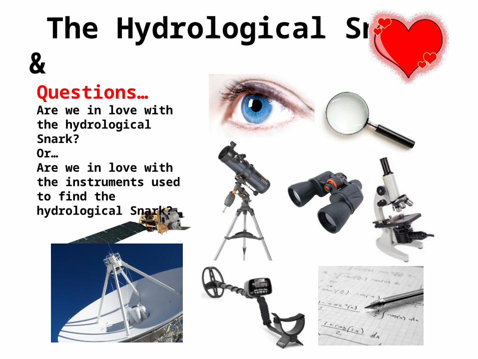
The Hydrological Snark &
Questions…Are we in love with the hydrological Snark?Or…Are we in love with the instruments used to find the hydrological Snark?
What are the objectives…
• To apply the lessons learned from case specific studies and to be able to incorporate our expert knowledge into modeling.
[Savenije (2009)]• To use topography and HRUs in model development.• To get the most out of the least knowledge available.

Wetland
HillslopePlateua
Gharari et al., (2011) HESS

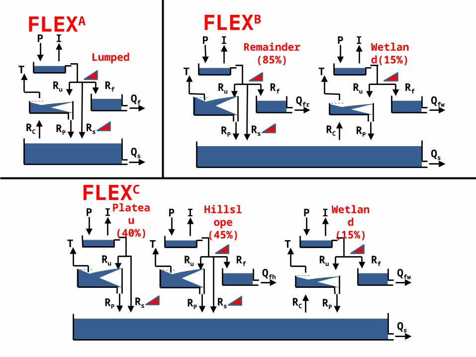
• Landscape classes for this case study are: -Wetland: water table close to the surface, saturation
overland flow
-Hillslope: steep slopes, shallow rapid subsurface flow-Plateau: modest slope, deep percolation
• Assigning dominant runoff processes to each landscape and develop the model structures accordingly.
P I
T
RC RP
Ru Rf
Qf
Rs
FLEXA
Qs
Lumped
FLEXB
P I
T
RC RP
Ru Rf
Qfw
P I
T
RP
Ru Rf
Qfr
Rs
Qs
Remainder (85%)
Wetland(15%)
FLEXC
P I
T
RC RP
Ru Rf
Qfw
P I
T
RP
Ru Rf
Qfh
Rs
Qs
P I
T
RP
Ru
Rs
Plateau (40%)
Hillslope (45%)
Wetland (15%)

Although complex …Parameter constraints:-Hillslope are mostly forested Imaxh> Imaxw & Imaxh>Imaxp-Hillslope has longer lag time compare to wetland Lagw< Lagh-Plateau has a deeper unsaturated zone compared to wetland and hillslope Sumaxp>Sumaxh & Sumaxp>Sumaxw
FLEXC
P I
T
RC RP
Ru Rf
Qfw
P I
T
RP
Ru Rf
Qfh
Rs
Qs
P I
T
RP
Ru
Rs
Plateau (40%)
Hillslope (45%)
Wetland (15%)
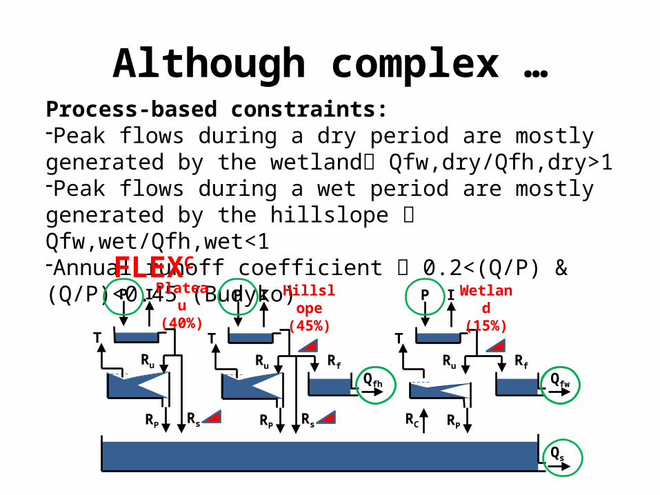
Although complex …Process-based constraints:-Peak flows during a dry period are mostly generated by the wetland Qfw,dry/Qfh,dry>1-Peak flows during a wet period are mostly generated by the hillslope Qfw,wet/Qfh,wet<1-Annual runoff coefficient 0.2<(Q/P) & (Q/P)<0.45 (Budyko)
FLEXC
P I
T
RC RP
Ru Rf
Qfw
P I
T
RP
Ru Rf
Qfh
Rs
Qs
P I
T
RP
Ru
Rs
Plateau (40%)
Hillslope (45%)
Wetland (15%)

Then how to parameterize?!Parameter space
Satisfies 1 or more constraints
Satisfies Nor more constraints! (All)
Satisfies 2or more constraints
Satisfies N-1or more constraints
Parameter space which satisfies all the constraints but is not optimal calibrated on observed hydrograph
Un-calibratedbutconstrained

NS = -0.87
NS = 0.64
NS = 0.71
Un-calibrated but constrained

Parameter space
Satisfies 1 or more constraints
Satisfies Nor more constraints! (All)
Satisfies 2or more constraints
Satisfies N-1or more constraints
Un-calibratedbutconstrained
Calibratedandconstrained
Then how to parameterize?!
Pareto optimal
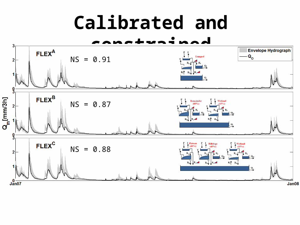
Calibrated and constrained
NS = 0.91
NS = 0.87
NS = 0.88

Validated for calibrated and constrained
NS = 0.75
NS = 0.80
NS = 0.80
Comparison & conclusion & discussion!
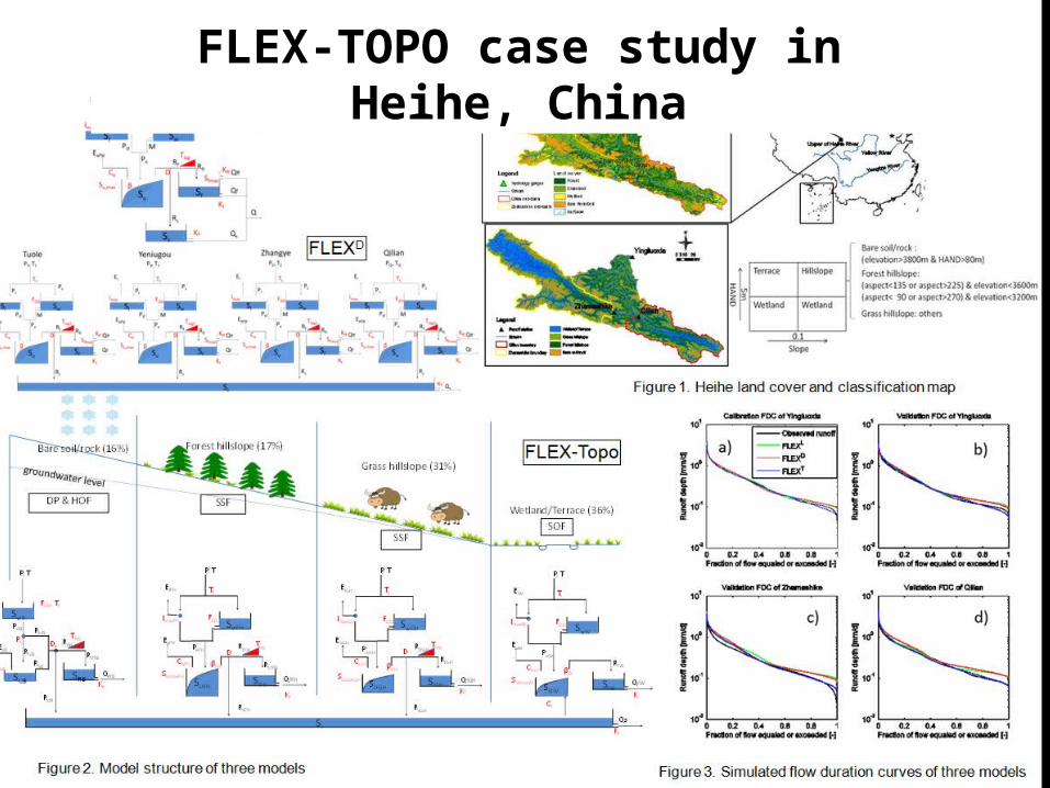
FLEX-TOPO case study in Heihe, China

But answering my research questions!
Answers…To be honest! I don’t know ...But the hydrological Snark might not be that “far away” or that “close”…It might not be that “big” or that “small”…It might not be that “ugly” or that “beautiful”…These are just my feelings!
Questions…How to see the hydrological Snark…?How far is the hydrological Snark…?How big is the hydrological Snark…?How does the hydrological Snark look like…?

But answering my research questions!
Answer…Seems dangerous to answer!
Questions…Are we in love with the hydrological Snark?Or…Are we in love with the instruments we use to find the hydrological Snark?
Thank you for Your Attention