emodnet geology - europa · geological data specification and sourcing (october 2013‐january...
TRANSCRIPT

1
EMODnet‐Geology
21st MODEG Meeting EMODnet Secretariat Office, Ostend, Belgium
19‐20 February 2014
Alan Stevenson (Project Co‐ordinator, British Geological Survey)
EMODnet‐Geology
Contract signed 16 October 2013
4.2 million euros awarded for 36 months; project ends 15 October 2016
36 partners from 30 countries including all European seas.
Building on preparatory phase, but with more detail (1:250,000 scale) and added information (e.g coastal behaviour, Quaternary geology)
2
UK. British Geological Survey – Natural Environment Research Centre (BGS‐NERC); University of Sussex; Centre for Aquaculture, Fisheries and Aquaculture Science, UK (CEFAS) Finland ‐ Geological Survey of Finland – Geologian tutkimuskeskus (GTK)Sweden ‐ Geological Survey of Sweden – Sveriges Geologiska Undersokning (SGU)Norway ‐ Geological Survey of Norway – Norges Geologiske Undersokelse (NGU)Denmark & Greenland ‐ Geological Survey of Denmark and Greenland – De Nationale Geologiske Undersogelser for Danmark or Greenland (GEUS)Faroe Islands ‐ Jardfeingi (Faroe Islands Geological Survey)Iceland ‐ Íslenskar orkurannsóknir – Iceland GeoSurveyEstonia ‐ Geological Survey of Estonia ‐ Eesti Geoloogiakeskus (GSE)Latvia ‐ Latvijas Vida Geologijas un Meteorologijas Centrs (LVGMC)Lithuania ‐ Lithuanian Geological Survey (LGS)Poland ‐ Polish Geological Insititute – National Research Institute (PGI‐NRI)Netherlands ‐ Geological Survey of the Netherlands (TNO)Belgium ‐ Royal Belgian Institute of Natural Sciences – Geological Survey of Belgium (GSB)France ‐ Bureau de Recherches Geologiques et Minieres (BRGM, France), IFREMERIreland ‐ Geological Survey of Ireland (GSI)Spain ‐ Geological Survey of Spain – Instituto Geológico de España (IGME)Potugal ‐ Instituto Portugues do Mar da Atmosfera (IPMA)Italy ‐ Istituto Superiore per la Protezione e la Ricerca Ambientale – Servizi Geologico d’Italia (ISPRA)Slovenia ‐ Geological Survey of Slovenia (GeoZs)Croatia ‐ Geological Survey of Croatia ‐ Hrvatski Geoloski Institut (HGI)Montenegro ‐ Geological Survey of Montenegro – Zavod za Geologoska Istrazivanja (GEOZAVOD)Albania ‐ Geological Survey of Albania (GSA)Greece ‐ National Center for Sustainable Development, Greece (EKBAA); Hellenic Centre for Marine Research (HCMR)Bulgaria ‐ Institute of Oceanology – Bulgarian Academy of Sciences (IO‐BAS)Romania ‐ National Research and Development Institute for Marine Geology and Geoecology, Romania (GeoEcoMar); Geological Institute of Romania (GIR)Turkey ‐ Dokuz Eylul University, TurkeyCyprus ‐ Geological Survey of CyprusMalta ‐Malta Ministry of Transport and Infrastructure, Continental Shelf DivisionRussia ‐ AP Karpinsky Russian Geological Research Institute (VSEGEII)Germany ‐ Federal Institute for Geosciences and Natural Resources – Bundesanstalt Geowissenschaften und Rohstoffe, Germany (BGR)Ukraine ‐ Prychornomorske State Regional Geological Enterprise, Ukraine
EMODnet‐Geology partners
Main deliverables at 1:250,000 scale
Sea‐bed substrate including rate of accumulation of recent sediments
the sea‐floor geology (bedrock geology) and all boundaries and faults that can be represented at the 1:250,000 compilation scale with information on the lithology and age of each geological unit
geological events and probabilities (landslides, volcanic activity, earthquake epicentres)
Minerals (including aggregates, oil and gas)
Coastal type and behaviour supplemented by information on coastal erosion or sedimentation and the rate at which it occurs.
All interpretative products will be based on primary information owned by the project partners, supplemented with other information in the public domain.
Where the most up‐to‐date geological information is held on third‐party websites, arrangements will be made for web‐mapping services to provide these data to the EMODnet‐Geology portal.
All map outputs added to One‐Geology Europe

3
Workpackages
WP1. Project Management (October 2013‐October 2016)
WP2. Geological data specification and sourcing (October 2013‐January 2014)
WP3. Sea‐bed substrate (February 2014‐October 2014). Led by GTK, Finland. Includes case study led by CEFAS, UK)
WP4. Sea‐floor geology. Led by BGR, Germany
WP5. Coastal behaviour. Led by TNO, The Netherlands
WP6. Geological events and probabilities. Led by ISPRA, Italy
WP7. Minerals. Led by GSI, Ireland
WP8. Web services and technology. Construction phase October 2013‐October 2014
WP9. Dissemination.
WP10. Liaison with EMODnet lots and other related groups/projects.
WP11. Project analysis and sustainability (July 2016‐October 2016)
WP1. Project Management

4
First bi‐monthly report delivered to Secretariat on 17 January
Kick‐off meeting held in Lisbon on 21‐22 January attended by representatives from 31 of our 36 partners. Also attended by Jacques Populus Co‐ordinator of Physical Habitats lot.
Next meeting 30 September – 1 October 2014 in Malta
Workpackage 2. Geological data
specification and sourcing
Led by BGS, United Kingdom
5
Workpackage 2
Input: Data and interpreted information for all of the geological requirements specified in the tender documents
Objectives: To prepare and provide access to information required to deliver 1:250,000 maps of sea‐bed substrates etc.
Method: Comprehensive audit and evaluation of national geological spatial datasets that can be compiled at 1:250,000 scale.
Each partner to present primary data available to the EMODnet‐Geology Project
6
Workpackage 3. Sea‐bed substrate
Led by GTK, Finland
Sea‐bed substrate
Sea‐bed substrate information/map (Scale 1:250,000 with an index map)
Confidence assessment
Quaternary geology of the sea floor
The rate of accumulation and sedimentation on the sea floor
Point source
CEFAS, Case study: Maps of seabed substrate from acoustic and ground‐truthing data.
Links with COST action SPLASHCOS to consider palaeolandscapes

7
Sea‐bed substrate
•Maps, no raw data
1. Index map(Data sourcing)
2. Harmonisati
on
3. Generalizati
on4.
Combination
5. Confidence
analysis(BGS)
Seabedsubstrate
map
1 M
Index map
Informs about metadata: • Source, year of origin... • Survey methodology, Interpretation and classification schemes

8
Harmonisation – Sediment classes
Sediment maps are interpreted according to national standards
Different classification schemes
Different grain size limits
Maps need to be ”translated” into a shared scheme
Integration with hydrographic, chemical and biological studies
Harmonisation – Sediment classes
Modified FOLK:
Habitat maps
4 substrate classes:
Mud to sandy mud
Sand to muddy sand
Coarse sediment
Mixed sediment
4 subcategories
3 additional classes
Boulder
Till/diamicton
Bedrock)
Uppermost 30 cm

9
EUSeaMapSusbtrate Finnish data
Mud to sandy mud
Mud
Clayey mud/muddy clay
Clay
Sand to muddy sandGlacial clay and silt
Secondary sand
Coarse sediment Gravel
Mixed sediment Glacioaquatic sediments
Diamicton Diamicton (till)
BouldersRock Bedrock
Harmonisation – Process
Harmonisation – Attribute table
10
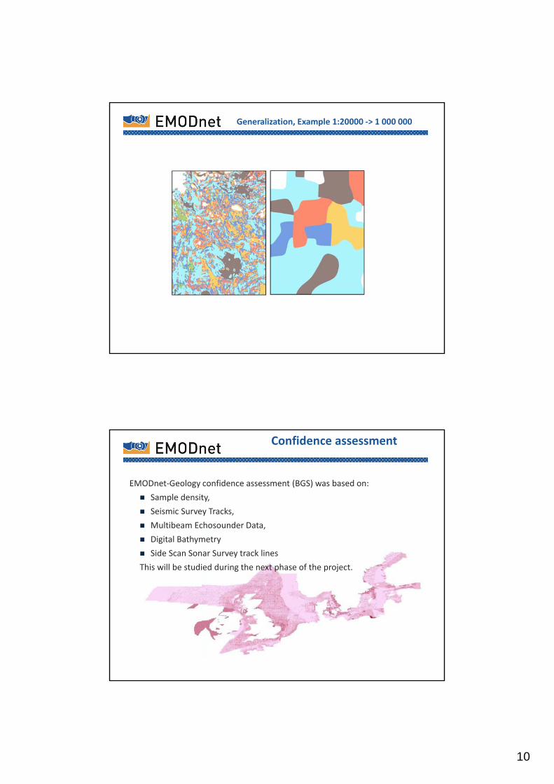
Generalization, Example 1:20000 ‐> 1 000 000
Confidence assessment
EMODnet‐Geology confidence assessment (BGS) was based on:
Sample density,
Seismic Survey Tracks,
Multibeam Echosounder Data,
Digital Bathymetry
Side Scan Sonar Survey track lines
This will be studied during the next phase of the project.

11
Sedimentation rates
Estimations of modern sediment accumulation rates (cm/year), based on e.g. the 137Cs and 210Pb dating
Project partners will deliver information on sedimentation rates available in their national waters including their EEZs.
Next phase
GTK will combine the information received into a single map.
Schedule
Background data (coastline, boundary areas) to Partners by end February 2014
Index map: March 2014
GTK will send guidelines by 5.2.2014
Harmonisation: May 2014
GTK will send guidelines by 5.3.2014
Combination & Generalization: August 2014
GTK will send guidelines by 30.5.2014
Combined Sea‐bed substrate data for checking to partners September 2014
Data delivered to the EMODnet Habitat Mapping Project by November 2014
Confidence, Quaternary, Accumulation after October 2014

12
Workpackage 4. Sea‐floor geology
Led by BGR, Germany
Input
Interpreted information on the sea‐floor geology (bedrock + Quaternary geology) including the lithology and stratigraphy of the geology of the regional seas included in
the proposal.
Objective
To compile and harmonise all available sea‐bed geology (outcrop/Quaternary?) and sub‐Quaternary) information at a scale of 1:250,000.
Workpackage 3
13
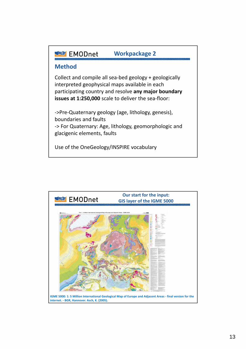
Method
Collect and compile all sea‐bed geology + geologically interpreted geophysical maps available in each participating country and resolve any major boundary issues at 1:250,000 scale to deliver the sea‐floor:
‐>Pre‐Quaternary geology (age, lithology, genesis), boundaries and faults‐> For Quaternary: Age, lithology, geomorphologic and glacigenic elements, faults
Use of the OneGeology/INSPIRE vocabulary
Workpackage 2
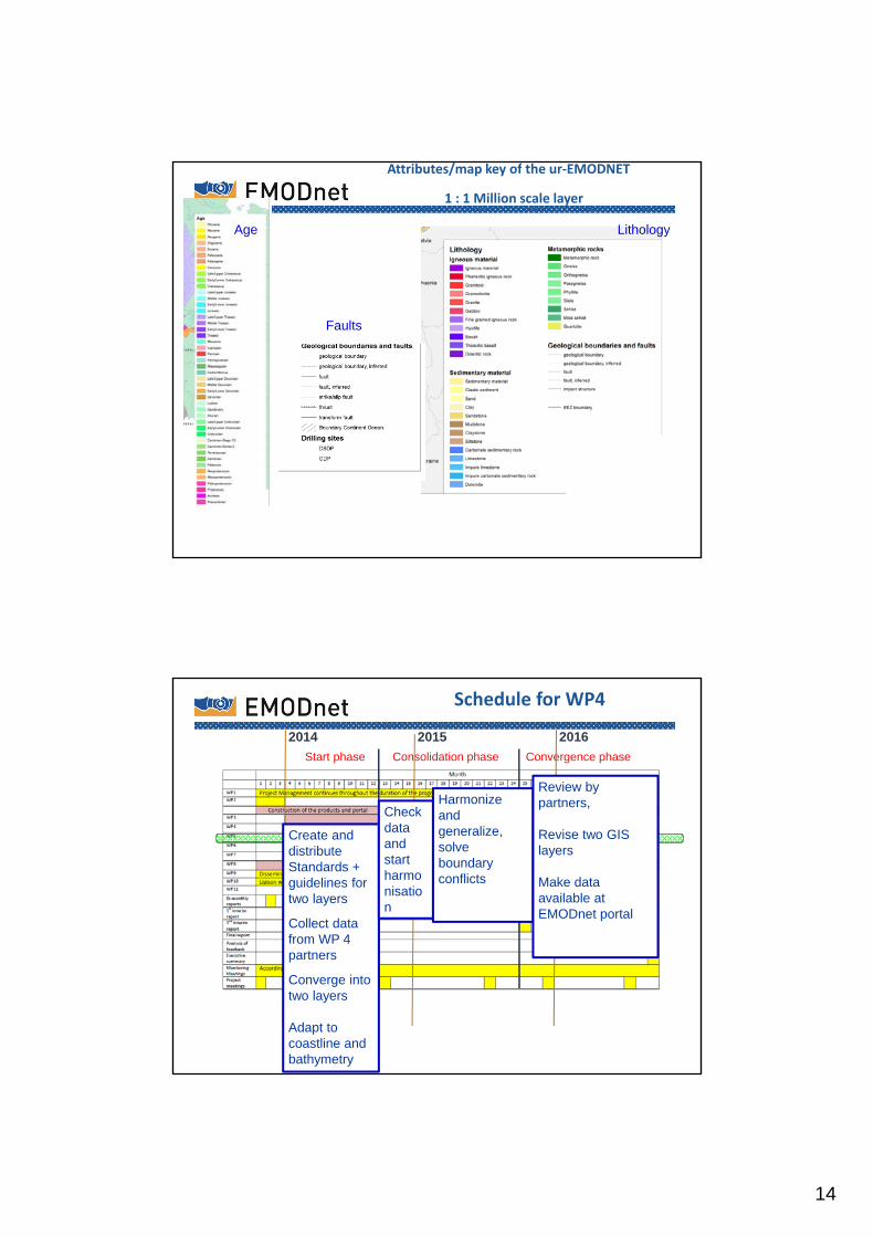
IGME 5000: 1: 5 Million International Geological Map of Europe and Adjacent Areas ‐ final version for the internet. ‐ BGR, Hannover. Asch, K. (2005).
Our start for the input:GIS layer of the IGME 5000
14
Attributes/map key of the ur‐EMODNET
1 : 1 Million scale layer
Age Lithology
Faults
Schedule for WP4
Start phase Consolidation phase Convergence phase
2014 2015 2016
Create anddistributeStandards + guidelines fortwo layers
Collect datafrom WP 4 partners
Converge intotwo layers
Adapt tocoastline andbathymetry
Check dataandstartharmonisation
Harmonizeandgeneralize, solveboundaryconflicts
Review bypartners,
Revise two GIS layers
Make dataavailable atEMODnet portal
15
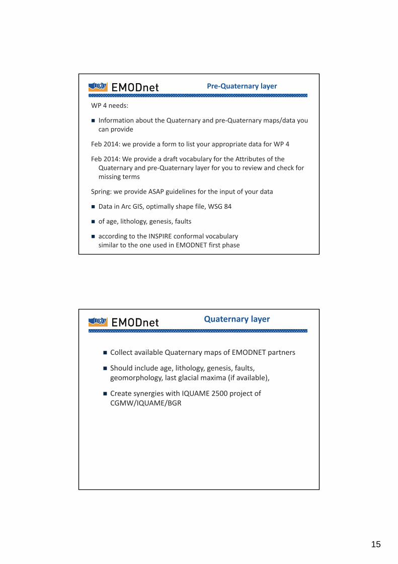
Pre‐Quaternary layer
WP 4 needs:
Information about the Quaternary and pre‐Quaternary maps/data youcan provide
Feb 2014: we provide a form to list your appropriate data for WP 4
Feb 2014: We provide a draft vocabulary for the Attributes of theQuaternary and pre‐Quaternary layer for you to review and check formissing terms
Spring: we provide ASAP guidelines for the input of your data
Data in Arc GIS, optimally shape file, WSG 84
of age, lithology, genesis, faults
according to the INSPIRE conformal vocabularysimilar to the one used in EMODNET first phase
Quaternary layer
Collect available Quaternary maps of EMODNET partners
Should include age, lithology, genesis, faults, geomorphology, last glacial maxima (if available),
Create synergies with IQUAME 2500 project of CGMW/IQUAME/BGR
16
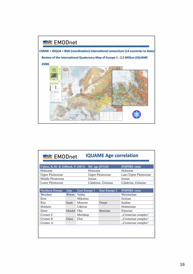
CGMW + INQUA + BGR (coordination) international consortium (14 countries to date):
Review of the International Quaternary Map of Europe 1 : 2,5 Million (IQUAME
2500)
CGMW + INQUA + BGR (coordination) international consortium (14 countries to date):
Review of the International Quaternary Map of Europe 1 : 2,5 Million (IQUAME
2500)
IQUAME Age correlationIQUAME Age correlation
Northern Europe Alps East Europe 1 East Europe 2 INSPIRE value
Weichsel Würm Valdai WeichselianEem Mikulino EemianRiss Saale Moscow Dnepr SaalianHolstein Likhvin HolsteinianElster Mindel Oka Berezina ElsterianCromer C Muchkap „Cromerian complex“Cromer B Günz Don „Cromerian complex“Cromer A „Cromerian complex“
Cohen, K.M. & Gibbard, P. (2011) ISC age (IUGS) INSPIRE value
Holocene Holocene HoloceneUpper Pleistocene Upper Pleistocene Late/Upper PleistoceneMiddle Pleistocene Ionian IonianLower Pleistocene Calabrian, Gelasian Calabrian, Gelasian

17
Workpackage 5. Coastal behaviour
Led by TNO, The Netherlands
Information on the type and behaviour of coastal landforms
fringing all European seas
18
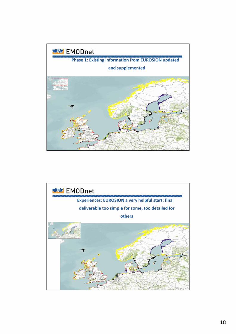
Phase 1: Existing information from EUROSION updated
and supplemented
Experiences: EUROSION a very helpful start; final
deliverable too simple for some, too detailed for
others

19
Objective: Classify the coastal behavioor and typology of each
country represented in the project partnership
Classify all coastal types in each country at 1:250,000 scale including
information on rates of sedimentation and erosion. The central
parameter in the final coastal‐behavior product is (rate of)
shore‐normal coastline migration.
Method
20
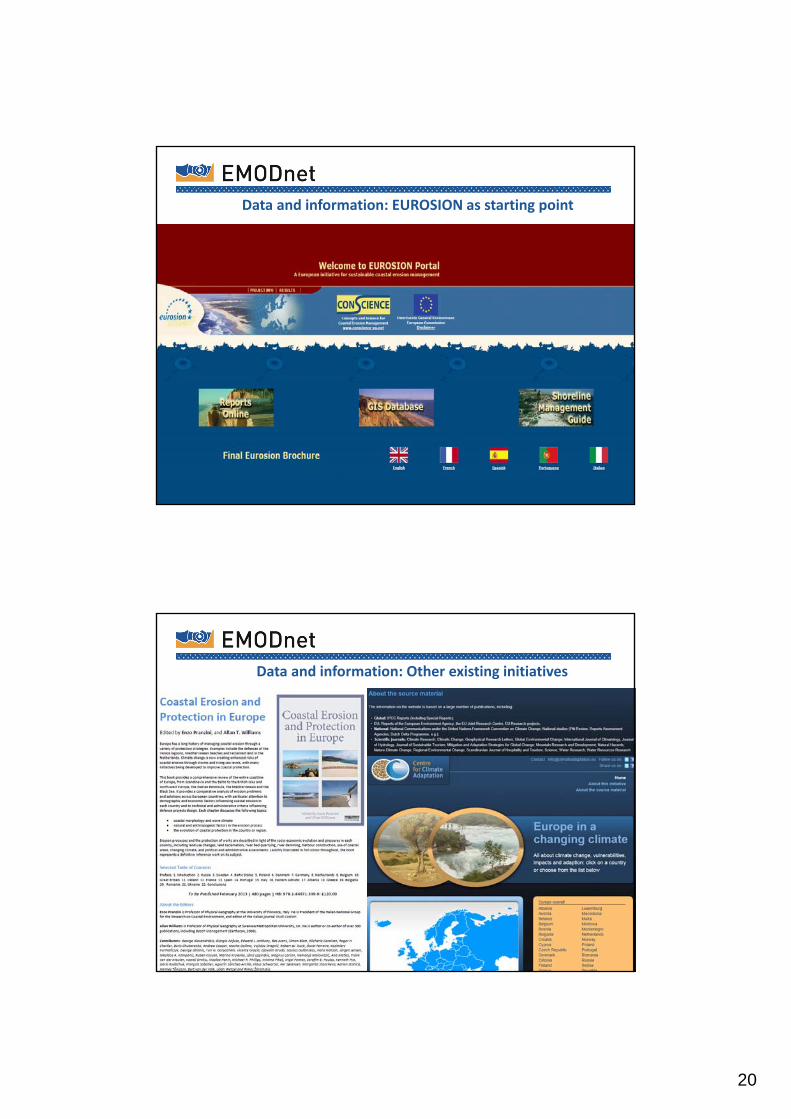
Data and information: EUROSION as starting point
Data and information: Other existing initiatives

21
Data and information: Examples of country info
Deliverables: The central parameter in the final coastal‐
behaviour product is (rate of) shore‐normal coastline migration;
to eliminate the impacts of short‐lived and/or local events,
average values over a period of 10 years are preferred
22
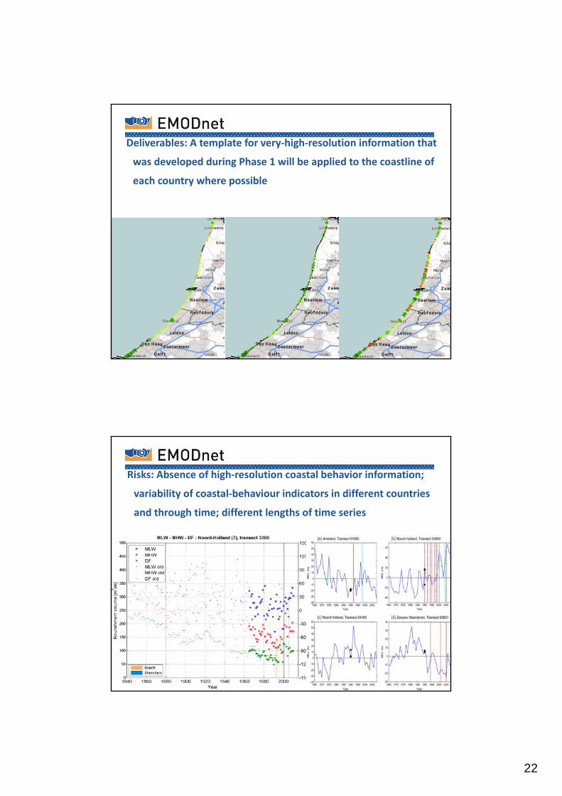
Deliverables: A template for very‐high‐resolution information that
was developed during Phase 1 will be applied to the coastline of
each country where possible
Risks: Absence of high‐resolution coastal behavior information;
variability of coastal‐behaviour indicators in different countries
and through time; different lengths of time series

23
Fully populated GIS layer of coastal typology and behaviour
information; guidance on harmonized coastal monitoring
Output and proposed steps
All: Overview of data/knowledge (+ owner) on coastal behavior/type
All: Overview of relevant “grey” literature that is difficult to find
All: Complete list of coastal types in source language and with translation into English (we want to get ideas for a full set of coastal types, leave room for (documented) national/regional differences no EUROSION straightjacket)
All: wish list what is needed to make output nationally relevant?
Cherith and Sytze: Think about coastal behavior in light of associated risk dependent on resilience and socio‐economic value
resilience degree of change that coasts are able to withstand while keeping their integrity
value areas that would suffer the most from coastal change
24
Workpackage 6. Geological events and
probabilities
Led by ISPRA, Italy
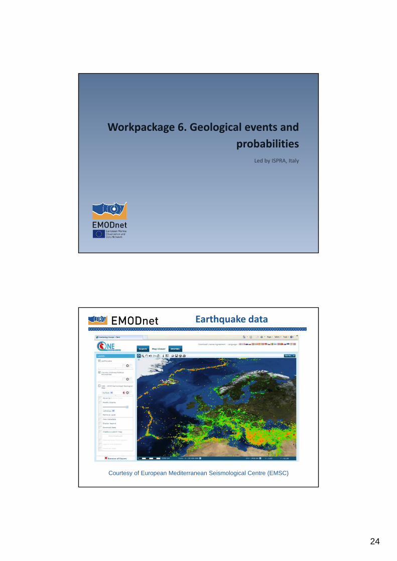
Earthquake data
Courtesy of European Mediterranean Seismological Centre (EMSC)
25
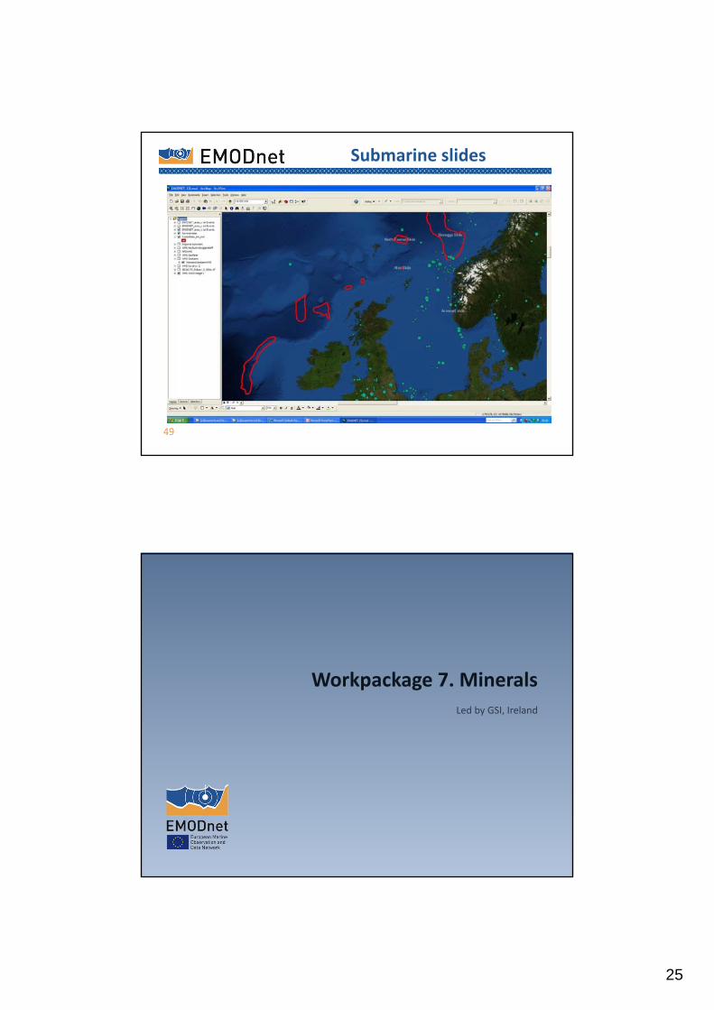
Submarine slides
49
Workpackage 7. Minerals
Led by GSI, Ireland

26
Minerals
Objectives
• To identify andmap areas of
mineral deposits in each of the
participating countries based on
information available to the
project partners
For this GSI will distribute a Task
guide with example data tables and
instructions
Description/deliverables
• Compile all mineral locations at
1:250,000 million scale
• Deliver to the GSI who will
standardise and federate all data
• A GIS layer will be delivered in the
OneGeology‐Europe portal
Requirements
• The main types of mineral deposits that occur on and beneath the seafloor, within national EEZs are:
• aggregates • hydrocarbons • gas hydrates• placer, phosphorite & evaporite deposits • polymetallic sulphides,• polymetallic nodules • cobalt rich crust.
• Information on marine minerals in the European regional seas, will include third‐party data that can be linked to EMODnet through web‐mapping services, but also including overviews of all publically available information (i.e. those not held under commercial restriction)
• WP7 is most dependent on third‐party data

27
Aggregates
countries that submitted data are highlighted
Current compilation of hydrocarbons
countries that submitted data are highlighted

28
Distribution of some Polymetallic minerals
Polymetallic Sulphide distribution
Polymetallic Nodules distribution
Cobalt-Rich Ferromanganese Crust distribution
Blue Growth
The EC “Blue Growth- opportunities for marine and maritime sustainable growth” document outlines:
”By 2020, 5% of the world’s minerals, including cobalt, copper and zinc could come from the ocean floors. This could rise to 10% by 2030.
Global annual turnover of marine mineral mining can be expected to grow from virtually nothing to 5 billion in the next 10 years and up to 10
billion by 2030”

29
MARINE MINERALSIncreased interest in marine minerals worldwide
Nautilus Ventures, polymetallic sulphides Kiribati
Deep Green Resources etc, polymetallic nodules Indian Ocean/
Atlantic Strategy EU. Specific reference to marine minerals
Horizon 2020 & EU Raw Materials initiative Specific references to mineral resources & seabed mining
Norwegian Workshop on Seabed Mining, Dec 2012
Sub Group of EGS Marine & Minerals Expert Groups – Marine Minerals
No current easy accessible web portal on this topic
WP7 can assist as “window” to data and expertise
Huge opportunity for Emodnet partners & GSO’s.
Deadlines
Guidance and format from GSI by mid February
Shapefiles and index data back by end May
First updated draft of Aggregatess & Oil/Gas by September Workshop
Gas Hydrates, Nodules, VMS etc format proposed September
Send this data by end October
First draft of additional minerals & updated aggregates etc by end 2014
Case studies and six monthly updates thereafter.

30
WP 8. Web services and technology
Led by BGS, United Kingdom
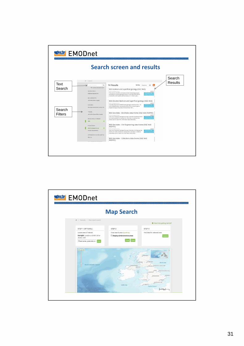
Potential platform for improvements to geological information ‐ CKAN
Open source and free data management solution
Publish & find datasets
Publish datasets via import or through a web interface. Search by keyword or filter by tags. See dataset information at a glance. Full change history lets you easily undo changes or view old versions
Store & manage data
Store the raw data and metadata. Visualise structured data with interactive tables, graphs and maps. Get statistics and usage metrics for your datasets. Search geospatial data on a map by area.
Engage with users & others
Federate networks with other CKAN nodes. Build a community with extensions that allow users to comment on and follow datasets.
Customise & extend
Use the API’s programming interface, with over 60 extensions including link checking, comments, and analytics.
31
Search screen and results
Text Search
SearchResults
SearchFilters
Map Search

32
Record details
Metadata
Dataset extent
Resourcese.g. WMS links,Downloads
Feedback
Feedbackfunctions
33
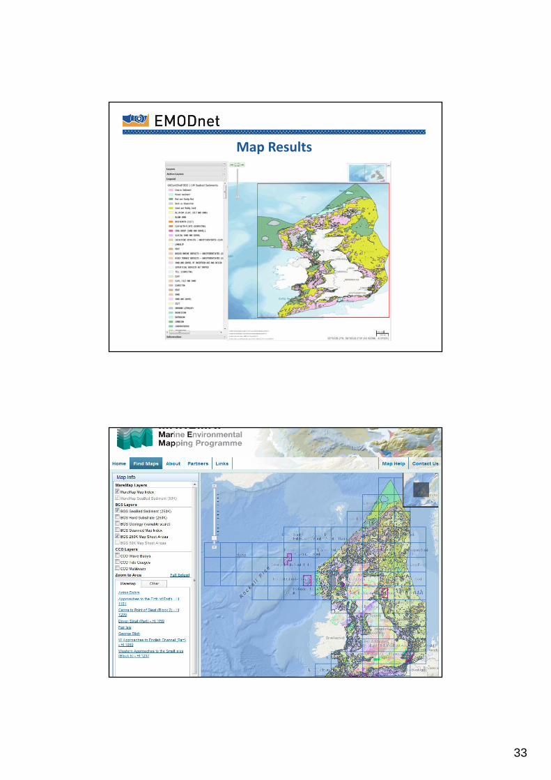
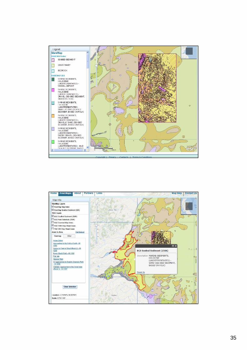
Map Results

34
35