el31/2005 stephens ivulet oger nnual eport to 23.5 · 2018-05-10 · manasia mining & metals...
TRANSCRIPT

MANASIA MINING & METALS LTD
Gateway Business Park, Unit 5, 105A Vanessa Street Kingsgrove, NSW, 2208
P.O.Box 630, Kogarah
NSW 2217
EL31/2005 STEPHENS RIVULET & ROGER RIVER ANNUAL REPORT TO 23.5.09
Volume 1 of 1
Prepared by N. J. Turner Geological Services Pty Ltd 65 Lochner St, West Hobart, Tasmania 7000
17.11.09

1
CONTENTS
Page
1 Summary 2
2 Introduction 2
3 Exploration philosophy 2
4 Geology 3
5 Exploration models and previous exploration 4
6 Future work 5
7 References 5
LIST OF FIGURES
Figure 1 Locality map
Figure 2 Regional geology
Figure 3 Total aeromagnetic intensity
Figure 4 Airborne electromagnetic survey
Figure 5 Land tenure
Figure 6 Excluded areas
Figure 7 Roger River-previous sampling

2
1 Summary
The dominant geological feature in EL31/2005 is the Roger River Fault,which has had a long history of activity including a Neoproterozoicperiod during the deposition of dolomite, basalts and volcaniclasticsthat form part of the Togari Group. Mineralising fluids may havecirculated in the fault during this Neoproterozoic period or at some latergeological time.
A narrow, three kilometre long zone of silica rocks that coincides withthe Roger River Fault at Roger River is interpreted as a relatively high,strongly leached part of an epithermal alteration system that may carrygold at depth.
Petrological work and further geochemical work on the silica rocks arestrongly recommended in order to confirm that the rocks are theproduct of epithermal alteration.
Geophysical surveying may provide a guide to mineralisation at depthand to the location of future drill holes.
Manasia Mining and Metals Ltd have foreshadowed a detailedcompilation of the results of previous mineral exploration in EL31/2005that may identify other targets for detailed work.
2 Introduction
Mineral exploration licence 31/2005 Stephens Rivulet & Roger River of 24 km2
is for metallic minerals and has an end date of 23.5.2012. It is located innorthwest Tasmania, south of Smithton. The licence area extends in a narrowcorridor for some 15 km north east from the headwaters of Stephens Rivuletto near Roger River West and there is a separate, smaller block further northat Roger River (Figure 1). Access is provided by a bitumen road fromSmithton to Roger River (20 km) then by all-weather roads along the entirelength of EL31/2005.
The categories of land tenure within the licence area (Figure 5) include StateForest, Forest Reserve and Private Land. Track cutting may be required inforested areas for sampling, drilling, etc. There are no parts of the licencearea that are excluded from exploration (Figure 6) though a small PublicReserve and a small Private Reserve at Roger River may require specialarrangements.
This report outlines Manasia Mining and Metals Ltd’s exploration philosophyfor the coming period of work in EL31/2005. The report also provides briefsummaries of the geology and of previous exploration, and identifies someareas for possible future work.
3 Exploration philosophy
Manasia Mining and Metals Ltd has stated that its proposed exploration inEL8/2006 will be based on the following themes.
1. A detailed compilation of historical open file data.

3
2. A reinterpretation of geology from airborne geophysical data.3. Delineation of field exploration targets from the data review.4. Follow up geochemical sampling and geophysical surveying (possibly
drilling) on the Whitewater North, Quarry and Church prospects.5. The primary target commodity is gold (+copper+nickel).
4 Geology
Along its entire cumulative length of 17 km EL31/2005 straddles the RogerRiver Fault (Figure 2). This fault obliquely transects the eastern limb of a northplunging synclinorium in a unit of Neoproterozoic rocks called the TogariGroup, which is underlain with mild unconformity by the Middle ProterozoicRocky Cape Group, and overlain with apparent conformity by the EarlyCambrian Salmon River Siltstone and the Middle Cambrian Scopus Group(Everard et al, 2007).
Most of EL31/2005 is occupied by formations belonging to the Togari Group.This group has a discontinuous basal formation of shallow water, quartzosesandstone and conglomerate called the Forest Conglomerate which isoverlain by the Black River Dolomite then the Kanunnah Subgroup followedby the Smithton Dolomite. The Kanunnah Subgroup includes thepredominantly volcaniclastic Keppel Creek Formation and the intercalatedCroles Hill Diamictite and basaltic Spinks Creek Volcanics (Figure 2).
Through much of EL31/2005 the Roger River Fault has juxtaposed KanunnahSubgroup, to the east, with Smithton Dolomite to the west though theSmithton Dolomite is largely obscured by residual soil and Quaternaryalluvium. Although the Roger River Fault has west-side-down displacementthe increase in thickness of the Kanunnah Subgroup and Black RiverDolomite from west to east across the fault suggests that the fault was activewith east-side-down movement during the deposition of these units (Everardet al, 2007).
In the northern block of EL31/2005 there is a belt of silica rocks that is about 3km long and up to 300 m wide. These rocks are interpreted as being part ofan alteration zone associated with the Roger River Fault (Figure 7; Turner,2003). The silica rocks are of fine to medium grainsize, strongly leached andexhibit textures that may be massive, brecciated or vughy.
In the southern part of EL31/2005 and elsewhere in the general district thereare scattered residual deposits of silica in the form of sand and silt that areknown locally as silica flour. Some of these deposits are being commerciallyexploited because of their unusually high purity. The silica flour appears tohave been derived from silicified Smithton Dolomite and contrasts with thehard, coherent silicification at Roger River. Hard, coherent silicification is alsocommon in the Black River Dolomite and the silica rocks at Roger River wereinterpreted as silicified Black River Dolomite by Lennox et al (1982).

4
5 Exploration models and previous exploration
Previous explorers including CRA Exploration (Parkinson, 1994), MorrittHoldings (Morritt, 1997) and Greenstone Resources (Davis in Turner, 2003)have put forward a variety of exploration models for the district in whichEL31/2005 is located. Mineral Resources Tasmania provides a review ofpossible exploration models in Everard et al (2007). Models that may berelevant to EL31/2005 include the following.
Iron formation gold (Homestake) or copper-gold (Selwyn/Starra). Sediment hosted copper (Kupferschiefer/White Pine) Zinc in carbonate adjacent to the Roger River Fault (Mississippi
Valley/Irish Style) Epithermal gold in, or near, the Roger River Fault (Carlin)
Pacific-Nevada Mining Pty Ltd carried out mapping, soil sampling and rockchip sampling over a hematite-magnetite-pyrite iron formation in the KeppelCreek Formation at Canadian Creek (Westbrook, 1999). This work extendedinto the northern end of the southern block of what is now EL31/2005. It wasconcluded that the general lack of gold in soils was not encouraging of thePacific-Nevada exploration models. The Pacific-Nevada stream sedimentsampling in the area corresponding to EL31/2005 did not lead to any coppertargets that were followed up.
The Smithton Dolomite is a possible host for zinc mineralisation. However,there are no known surface expressions of such mineralisation. Everard et al(2007) note that the Mississippi Valley style of deposit generally gives poorgeochemical and geophysical responses and that grid drilling has beenadvocated as an appropriate exploration technique.
Consultants to Pacific-Nevada (Ken Snyder, Franco-Nevada) and toGreenstone Resources (Geoff Davis, see Radke & Davis, 1990) advocated anepithermal origin for the silica rocks at Roger River (Turner, 2003). Bulkcomposition, textures and trace element geochemistry suggest a relativelyhigh, strongly leached level in an epithermal alteration system. Low level goldto 5 ppb is sporadically present. Arsenic is usually present at levels of up to100 ppm, but may exceed 1000 ppm in uncommon, iron-rich rocks. Consistentwith strong leaching, the base metal values are generally exceedingly low inboth the silica rocks and their derived soils.
At the Quarry Prospect near the southern end of the Roger River alterationzone a small patch of well crystallised barite with ochreous iron minerals wasfound in an otherwise pale, massive and brecciated, saccharoidal quartz rock(Figure 7- Sample Numbers 3083, 3084). Analysis of sample 3083 returned 1ppb Au, 102 ppm As, 22 ppm Sb, 5.97% Ba and 1.48 ppm Hg. Sample 3084returned similar values. Only two other samples were analysed for Hg (3075,3079) and both were anomalous.
EL31/2005 corresponds almost exactly to the initial extent of a previouslicence EL61/1994. Exploration in EL61/1994 for silica flour resulted in the

5
identification of a deposit on Blackwater No 1 Spur Road, just south of theArthur River (Turner, 2005). This deposit is now held under mining lease(Figure 6) by Tasmanian Advanced Minerals of Wynyard.
6 Future work
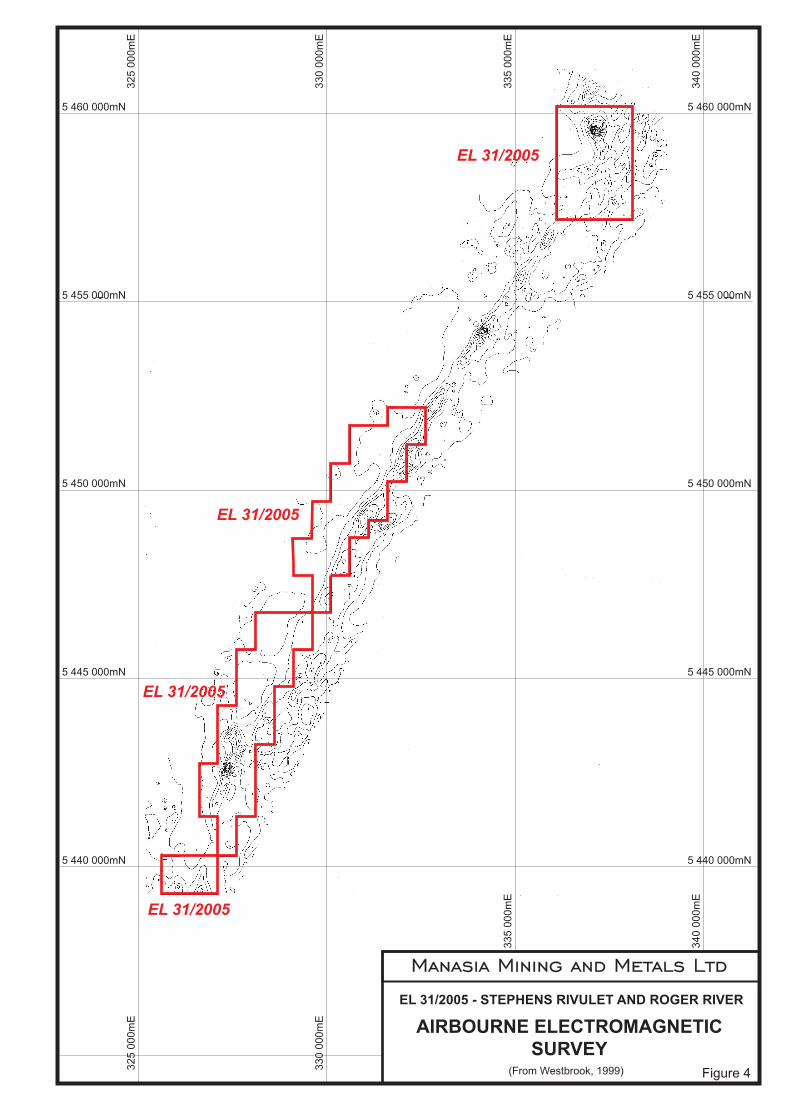
A detailed compilation of all previous mineral exploration data for EL31/2005is to be prepared by Manasia Mining and Metals Ltd. There is considerablestream sediment data, rock chip data and some soil data as well as a varietyof airborne geophysical data (Figures 3, 4). New targets for detailed follow upwork may arise from the compilation.
Further assessment of the zone of silica rocks at Roger River isrecommended. Spacing of the existing sample lines is about 400 m (Figure 7)so infill lines are desirable. Petrological work to better specify the nature of thealteration is very strongly recommended. Comparison with known epithermalsystems may provide a guide to the depth of drilling that will be required totest for economic mineralisation. Also, a review aimed at identifying the mostappropriate geophysical method to investigate the subsurface nature of thezone of silica rocks is strongly recommended.
7 References
Everard, J. L.; Seymour D. B.; Reed, A. R.; McClenaghan, M. P.; Green, D.C.; and Calver, C. R. 2007. Regional geology of the southern SmithtonSynclinorium. Explanatory report for the Roger, Sumac and Dempstergeological map sheets, far north-western Tasmania. Mineral ResourcesTasmania
Lennox, P. G.; Corbett, K. D.; Baillie, P. W.; Corbett, E. B.; Brown A. V. 1982.Geological Atlas 1:50,000 Series Sheet 21 (7916S). Smithton. Department ofMines Tasmania.
Morritt, R. F. C. 1997. Northwest Tasmania, Australia. An explorationopportunity for gold, copper and diamonds. Pacific-Nevada Mining Pty Ltd.
Parkinson, R. G. 1994. Trowutta EL19/92, Tasmania. Report on explorationfor the second year of tenure, 19/8/93 to 18/8/94, and final. CRA ExplorationPty Ltd.
Radke, A. S. and Davis, G. J. 1990. Epithermal precious metal deposits, theircharacteristics and exploration guides. A practical guidebook for the course onepithermal precious metal deposits, Western Australian School of Mines,Kalgoorlie-Boulder, Western Australia. Curtin University of Technology,Western Australian School of Mines.
Turner, N. J. 2003. ELs 11/97, 12/97, 13/97, 14/97, 61/94 & 17/01. Combinedannual report to 18.12.2002. Morritt Holdings Pty Ltd.

6
Turner, N. J. 2005. EL61/94 Arthur River. Annual report to 6.6.2005. CominexPty Ltd, Sumitomo Australia Ltd.
Westbrook, S. 1999. EL61/94 Arthur River-Roger River. Report on explorationactivity 9.6.98-9.6.99. Pacific-Nevada Mining Pty Ltd.

340,000mE335,000mE5,
445,
000m
N
5,445,000mN
340,000mE
5,440,000mN
5,44
0,00
0mN
325,000mE 330,000mE5,
455,
000m
N
5,450,000mN
5,455,000mN
5,46
0,00
0mN
5,460,000mN
330,000mE325,000mE 335,000mE
5,45
0,00
0mN
0 12.5 25
metres
50
EL 31/2005 - STEPHENS RIVULET and ROGER RIVER
LOCALITY MAPFigure 1
Arthur River
Step
hens
Riv
ulet
Duck Rive
r
Launceston
Queenstown
EL 31/2005

Manasia Mining and Metals Ltd
EL 31/2005 - STEPHENS RIVULET AND ROGER RIVER
REGIONAL GEOLOGY
(From EVERARD ET AL, 2007) Figure 2
EL 31/2005
EL 31/2005
EL 31/2005
32
5 0
00
mE
33
0 0
00
mE
33
5 0
00
mE
34
0 0
00
mE
5 455 000mN
5 450 000mN
5 445 000mN
5 440 000mN
5 460 000mN
33
0 0
00
mESCALE 1:100,000
DATUM = AGD66 AMG Zone 55
EL 31/2005

Manasia Mining and Metals Ltd
EL 31/2005 - STEPHENS RIVULET AND ROGER RIVER
TOTAL AEROMAGNETIC
(From EVERARD ET AL, 2007) Figure 3
EL 31/2005
EL 31/2005
EL 31/2005
INTENSITY
330 0
00m
E
340 0
00m
E
5 450 000mN
5 440 000mN
330 0
00m
E
5 460 000mN
SCALE 1:100,000
DATUM = AGD66 AMG Zone 55
EL 31/2005
Manasia Mining and Metals Ltd
EL 31/2005 - STEPHENS RIVULET AND ROGER RIVER
AIRBOURNE ELECTROMAGNETIC
(From Westbrook, 1999) Figure 4
SURVEY
EL 31/2005
EL 31/2005
EL 31/2005
EL 31/2005
32
5 0
00
mE
5 460 000mN
33
0 0
00
mE
33
5 0
00
mE
34
0 0
00
mE
5 455 000mN
5 450 000mN
5 445 000mN
5 440 000mN
32
5 0
00
mE
33
0 0
00
mE
33
5 0
00
mE
34
0 0
00
mE
5 460 000mN
5 455 000mN
5 450 000mN
5 445 000mN
5 440 000mN

Manasia Mining and Metals Ltd
EL 31/2005 - STEPHENS RIVULET AND ROGER RIVER
LAND TENUREMINERAL RESOURCES TASMANIA, 2009
Figure 5
SCALE 1:125,000
DATUM = GDA94 MGA Zone 55
325 000mE
5 4
60
00
0m
N
330 000mE 335 000mE 340 000mE
5 4
60
00
0m
N
5 4
55
00
0m
N
5 4
55
00
0m
N5
45
0 0
00
mN
5 4
50
00
0m
N
5 4
45
00
0m
N
5 4
45
00
0m
N
5 4
40
00
0m
N
5 4
40
00
0m
N

Manasia Mining and Metals Ltd
EL 31/2005 - STEPHENS RIVULET AND ROGER RIVER
AREAS EXCLUDED FROM
MINERAL RESOURCES TASMANIA, 2009 Figure 6
MINERAL EXPLORATIONSCALE 1:125,000
DATUM = GDA94 MGA Zone 55
325 000mE
5 4
60
00
0m
N
330 000mE 335 000mE 340 000mE
325 000mE 330 000mE 335 000mE 340 000mE5
46
0 0
00
mN
5 4
55
00
0m
N
5 4
55
00
0m
N5
45
0 0
00
mN
5 4
50
00
0m
N
5 4
45
00
0m
N
5 4
45
00
0m
N
5 4
40
00
0m
N
5 4
40
00
0m
N

White Water Creek
Duck River
Cyathea Creek
Willi
amso
ns C
reek
50
50
Trowutta Road
Trow
utta
Roa
d
Roger
Brodies Road
River
Road
Temples
Road
4221
4219
4220
4218
4227
434
4250
4251 4253
42524249
4254 43
4442
28
4229
4255
4256
4257
4258
4259
4230
4231
4232
4239
4240
4241
4238
4237
4262
4263
4264
4234
4236
4235
4343
4260
4342
4261
4274
4272
4273
4274
4233
4242
4243
4244
4265
4266
4271
4275
4341
4269
4267
4268
4270
404340
42
4044
4279
4276
4277
4278
4280
40264027
4028
4041
4340
4245
4246
4247
4248
4029
4030
4031
4032
4033
4034
4281
4282
4283
4039 40
3540
3540
3640
3740
38
4316 43
17
4318
4319
4040
4284
4315
4312
4313
431442
894290
4288
4339
4285
4286
4287
4311
433243
31
4332
4330
4327
4329
4328
4293 42
91
4292
4326
4324
4325
4308
4309
4310
4338
4323
4320
4295
4294
4306
4305
4305
4307
4321
4322
4333
4303
4304
4336
433443
3542
96
4298
3355
3334 33353335
3064
3326
3065
3327,28
3061,62,63
3076
3073
3075
3074
30673068
3070
3071
3072
3356
3344,45
3069
30183019
3020
3060
3058
3050
3051
3052
3053
3308
30593307
33093310 3311
3056
30543336
30553057
3017
3337
3077
3078
3079
3099
3080
3085
3081,82
3083,84
3057
6440400
6440524
64405257940514
7940515
7940523
7940563,64
7941060
7940562
7940517
7940520
7940516
7940522
7941541
7941542
7941543
79405187940509,10
79405197940521
7940526
7940507,08
7941033
7940511
336,
000m
E (G
DA
94)
337,
000m
E (G
DA
94)
5,457,000mN (GDA94)
5,458,000mN (GDA94)
5,459,000mN (GDA94)
5,460,000mN (GDA94)
338,
000m
E (G
DA
94)
Roger River
5,458,000mN 5,458,000mN
5,459,000mN 5,459,000mN
5,456,500mN 5,456,500mN
5,457,000mN 5,457,000mN
337,
000m
E
338,
000m
E
336,
000m
E
5,460,000mN 5,460,000mN
338,
000m
E
337,
000m
E
336,
000m
E
NORTH WHITEWATERPROSPECT
SOUTH WHITEWATERPROSPECT
QUARRYPROSPECT
CHURCHPROSPECT
Greenstone Resources Soil Sample
Greenstone Resources Rock Chip Sample
Pacific Nevada Rock Chip Sample
KEY TO ASSAYS
Widespread silicification
Minor silicification
LEGEND
7940562
3064
4229
EL 31/2005 - STEPHENS RIVULET and ROGER RIVER
ANALYTICAL RESULTS FOR
Figure 7
GREENSTONE RESOURCES NL
FOR SOILS AND ROCKSSAMPLE NUMBER and LOCATION
ROGER RIVER ALTERATION ZONE
By: Nic Turner 26/01/2002
0 12.5 25
metres
50