efficiently plan geology field trips and virtually explore
TRANSCRIPT

15 April 2021
Efficiently Plan Geology Field Trips and Virtually Explore Your Area of Interest
How Geofacets Supports Geoscience Research and Education
Dr. Sandra MertenSenior Product ManagerGeofacets
Marinus DijkstraSales Solution ManagerR&D Engineering & Geosciences

Geoscience research is a multi-step processResearch Cycle
1. Develop a Topic / Identify Research
Problem
2. Review the Literature
3. Structure an Outline / Study
Design
4. Collect Data
5. Analyze and Interpret
Data
6. Write Report and Evaluate
Research
Search & Read
Study Design &
Collect Data
Interpret & Write
“What is the late Cenozoic exhumation history of the Colorado Front Range?”
Data available in the published literature
Collect new samples?

There is a wealth of information and data buried in scientific publications
TEC
TON
OP
HY
SIC
S
Stratigraphic Columns
Photos
Tables
GraphsSeismic ProfilesMaps
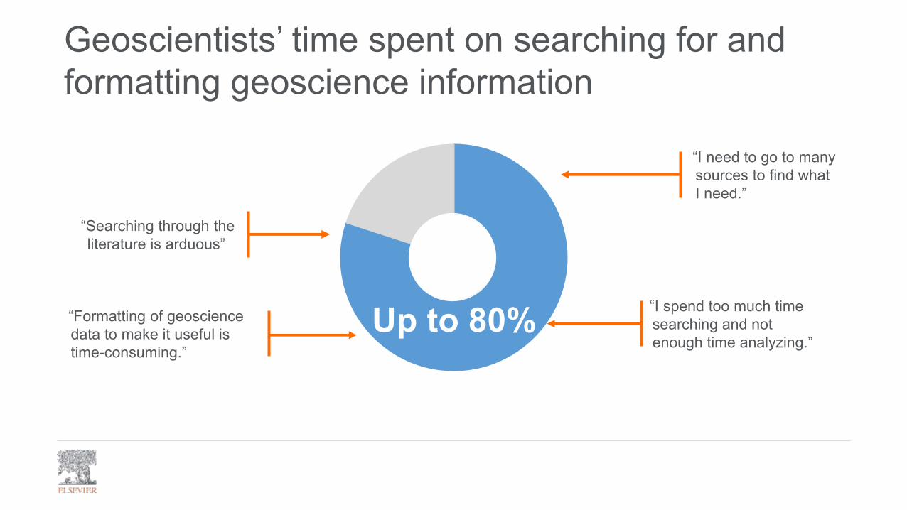
“Searching through the literature is arduous”
“I spend too much time searching and not enough time analyzing.”
“I need to go to many sources to find what I need.”
“Formatting of geoscience data to make it useful is time-consuming.”
Geoscientists’ time spent on searching for and formatting geoscience information
Up to 80%

2.4 million+maps, figures,
and tables
Content sourced from USGS
Multiple Sources in One Place: Extracted and Enriched:
What is Geofacets – Essential Knowledge

Geoscience domain based searches: • Search by region, country, basin,
subject area, location and more
Metadata enhancements:• All content is metadata-enhanced– Maps are enhanced with additional
metadata and georeferenced (for ~70% of maps)
• Location (coordinates and basin/country/region metadata)
• Content type (what type of figure)• Subject area (Geology, geophysics, etc.)
Results page
ORKeyword Search
Spatial Search
Detail page
What is Geofacets – Easy Discovery
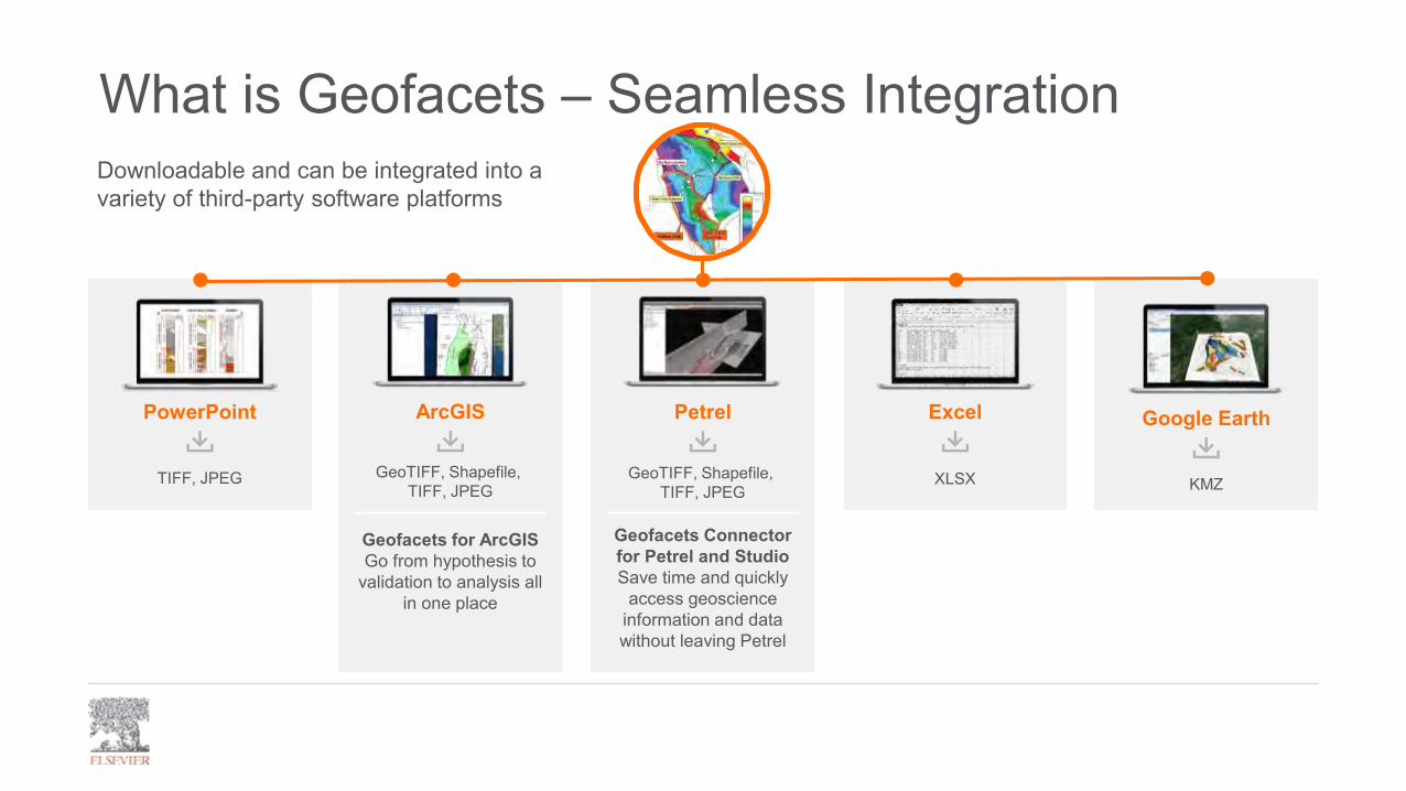
Downloadable and can be integrated into a variety of third-party software platforms
PowerPoint
TIFF, JPEG
Google Earth
KMZ
Excel
XLSX
ArcGIS
GeoTIFF, Shapefile, TIFF, JPEG
Geofacets for ArcGISGo from hypothesis to
validation to analysis all in one place
Petrel
Geofacets Connector for Petrel and StudioSave time and quickly
access geoscience information and data without leaving Petrel
GeoTIFF, Shapefile, TIFF, JPEG
What is Geofacets – Seamless Integration
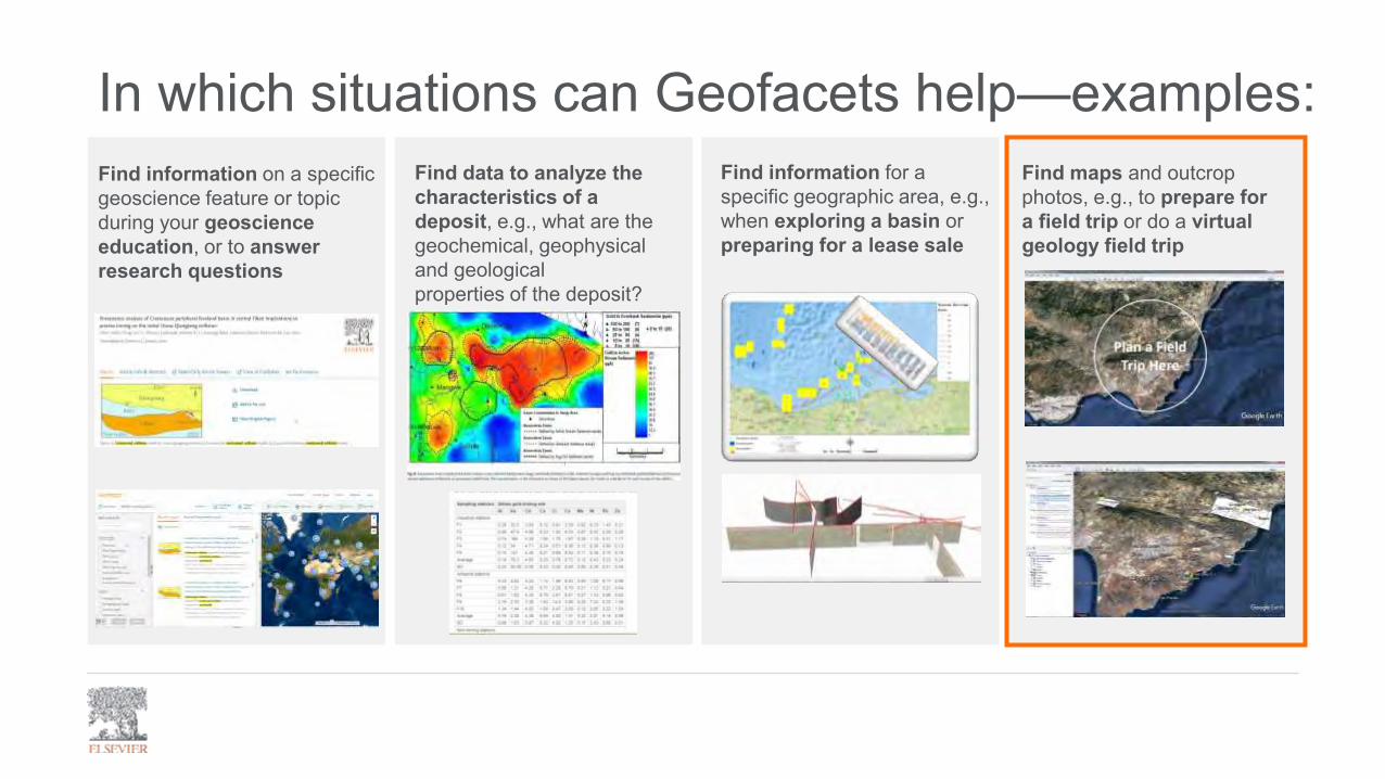
Find information for a specific geographic area, e.g., when exploring a basin or preparing for a lease sale
Find data to analyze the characteristics of a deposit, e.g., what are the geochemical, geophysical and geologicalproperties of the deposit?
Find maps and outcrop photos, e.g., to prepare for a field trip or do a virtual geology field trip
In which situations can Geofacets help—examples:Find information on a specific geoscience feature or topic during your geoscience education, or to answer research questions
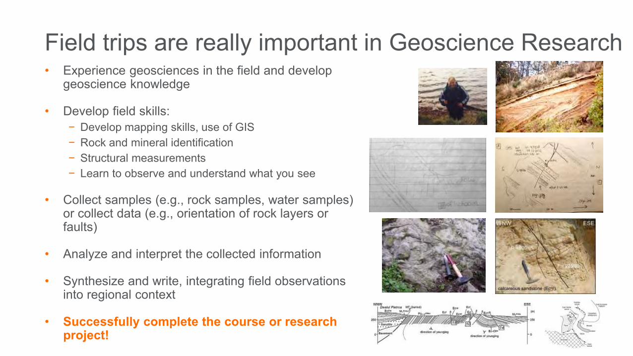
Field trips are really important in Geoscience Research• Experience geosciences in the field and develop
geoscience knowledge
• Develop field skills:− Develop mapping skills, use of GIS− Rock and mineral identification− Structural measurements− Learn to observe and understand what you see
• Collect samples (e.g., rock samples, water samples) or collect data (e.g., orientation of rock layers or faults)
• Analyze and interpret the collected information
• Synthesize and write, integrating field observations into regional context
• Successfully complete the course or research project!
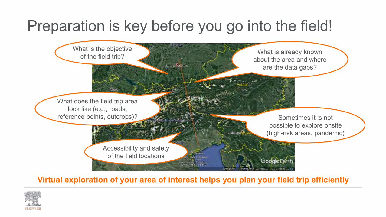
Preparation is key before you go into the field!What is the objective
of the field trip?
What does the field trip area look like (e.g., roads,
reference points, outcrops)?
What is already known about the area and where
are the data gaps?
Accessibility and safety of the field locations
Sometimes it is not possible to explore onsite
(high-risk areas, pandemic)
Virtual exploration of your area of interest helps you plan your field trip efficiently

Geofacets
For today’s virtual field trips we will use:
Google Earth
+
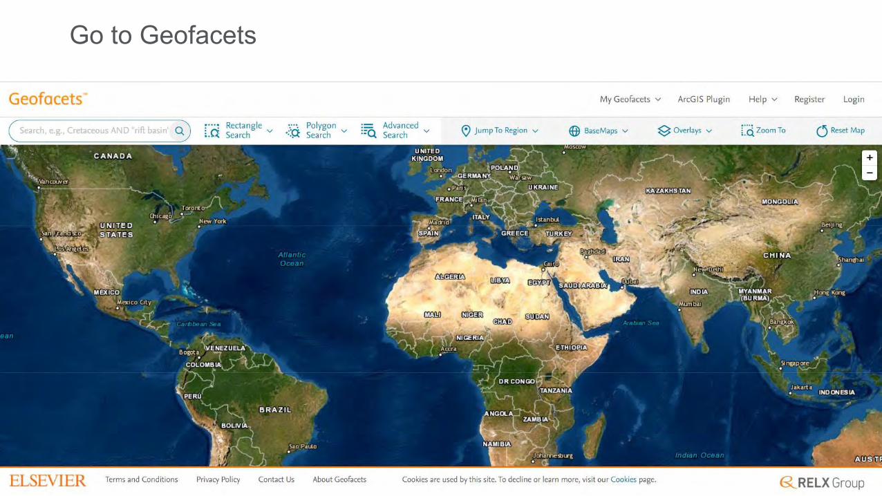
Go to Geofacets

Spatial search in the Alps (Munich-Padua)

Refine for georeferenced tectonic maps

Explore results
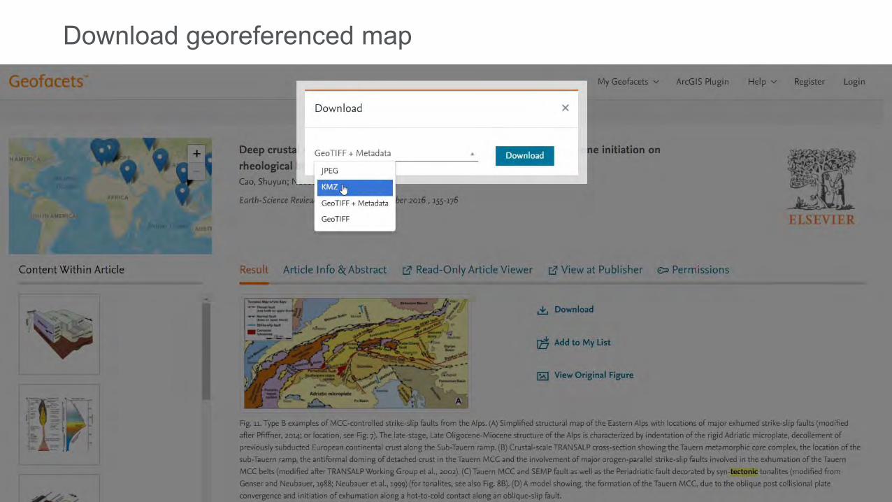
Download georeferenced map
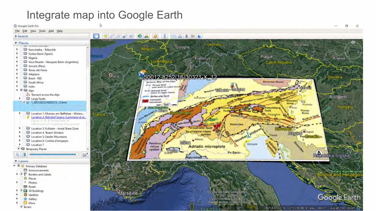
Integrate map into Google Earth
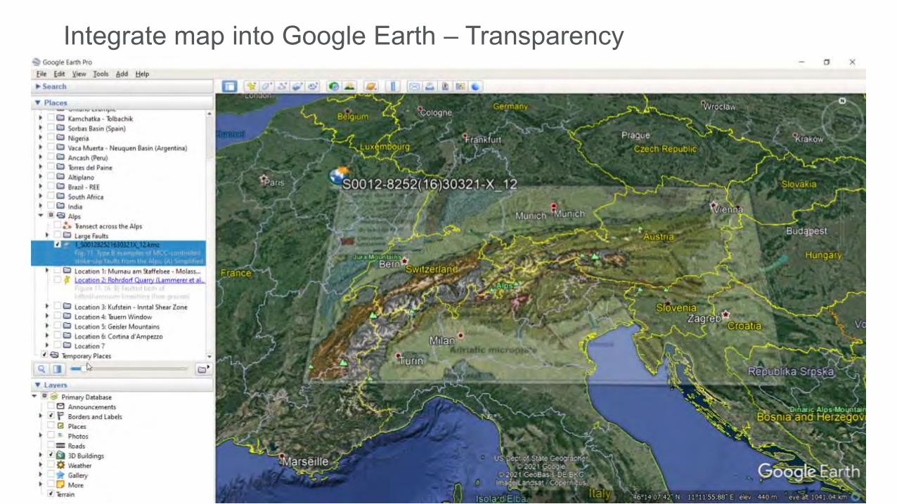
Integrate map into Google Earth – Transparency

Google Earth – Map source information

Google Earth – Create transect line

Google Earth – Elevation profile

Google Earth – Elevation profile
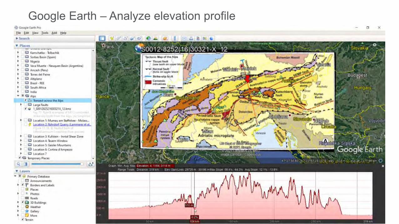
Google Earth – Analyze elevation profile

Google Earth – Digitize Major Faults

Google Earth – Digitize Major Faults

Go back to Geofacets – Remove filters and refine for Outcrop

Refine for Georeferenced Maps and Photos

Refine for Georeferenced Maps and Photos

Explore Results on Interactive Map

Explore Details – Map North Alpine Molasse Basin
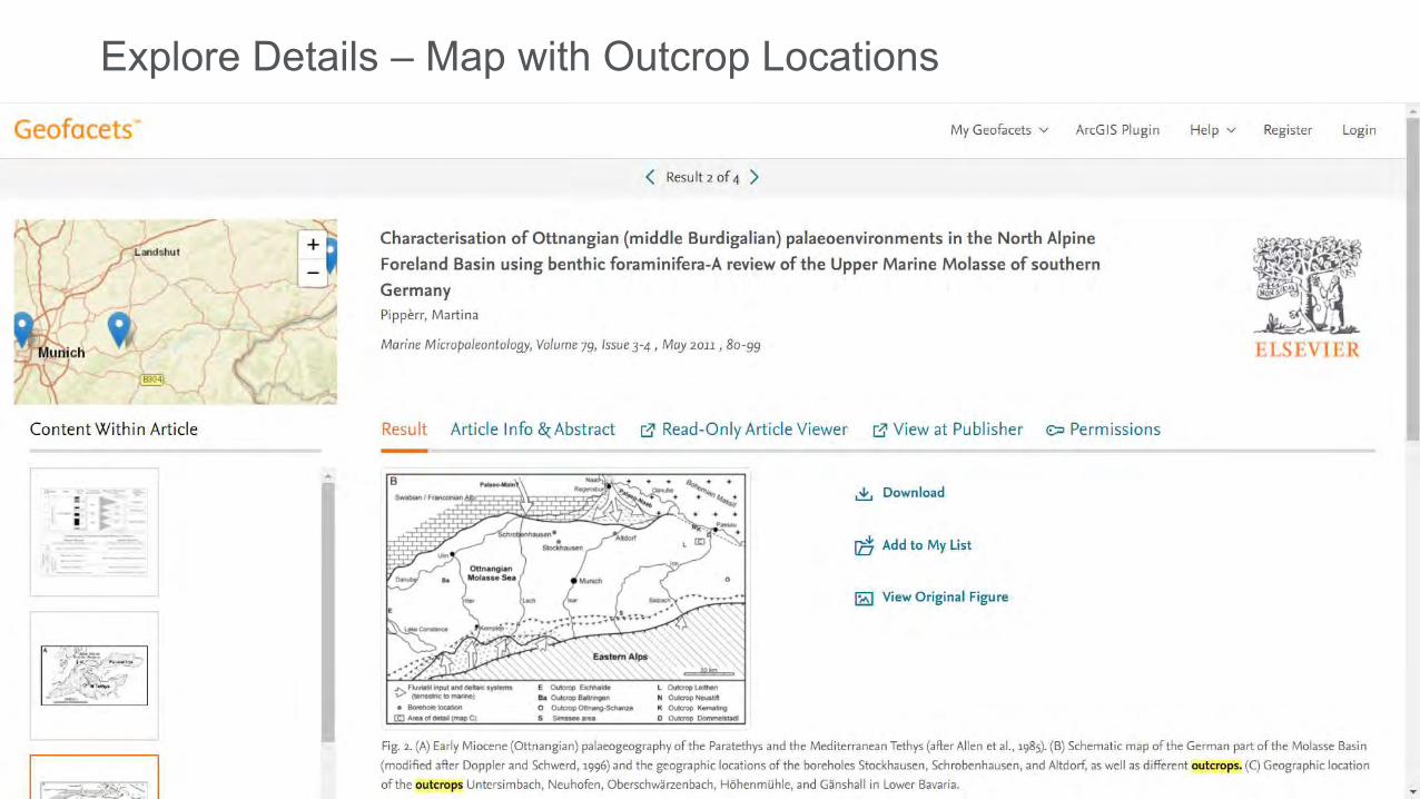
Explore Details – Map with Outcrop Locations

Explore Details – Map with Field Trip Locations

Explore Details – Check other content from same article
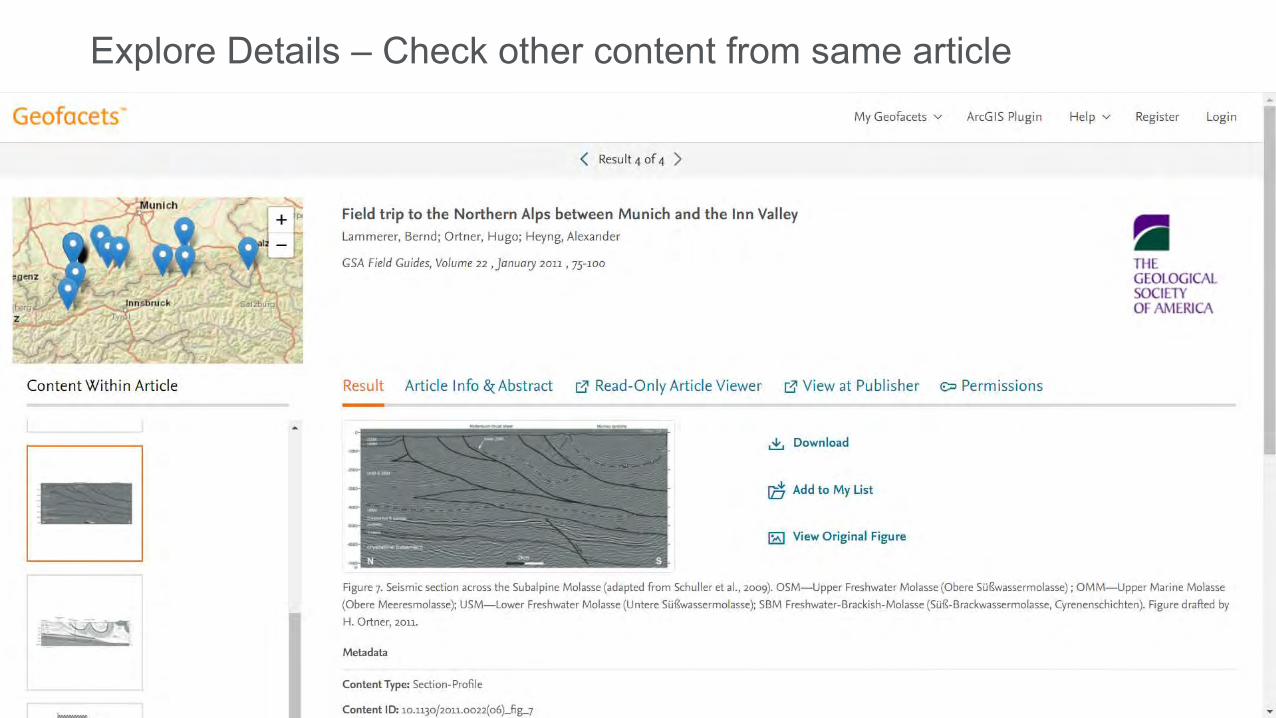
Explore Details – Check other content from same article

Explore Details – Check other content from same article

Source Article Info & Abstract

Explore Results – Link to Article
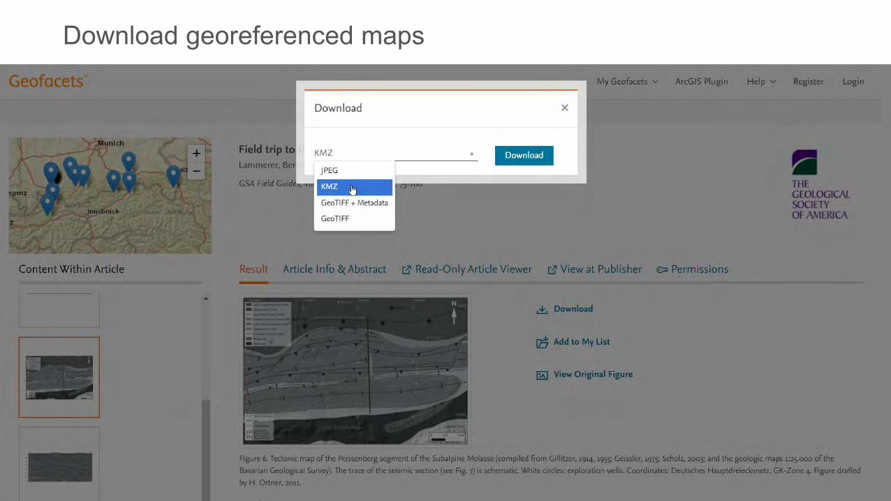
Download georeferenced maps

Download photos and other relevant images

Explore other results along the transect line

Location 1: Murnau Syncline
Fold?
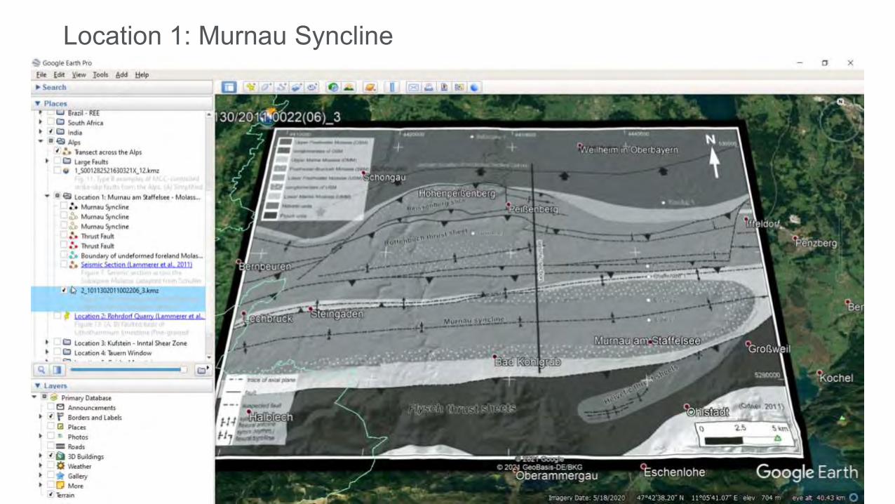
Location 1: Murnau Syncline

Location 1: Murnau Syncline
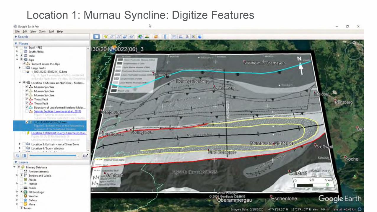
Location 1: Murnau Syncline: Digitize Features

Location 1: Murnau Syncline: Digitize Features

Location 1: Murnau Syncline: Seismic Section
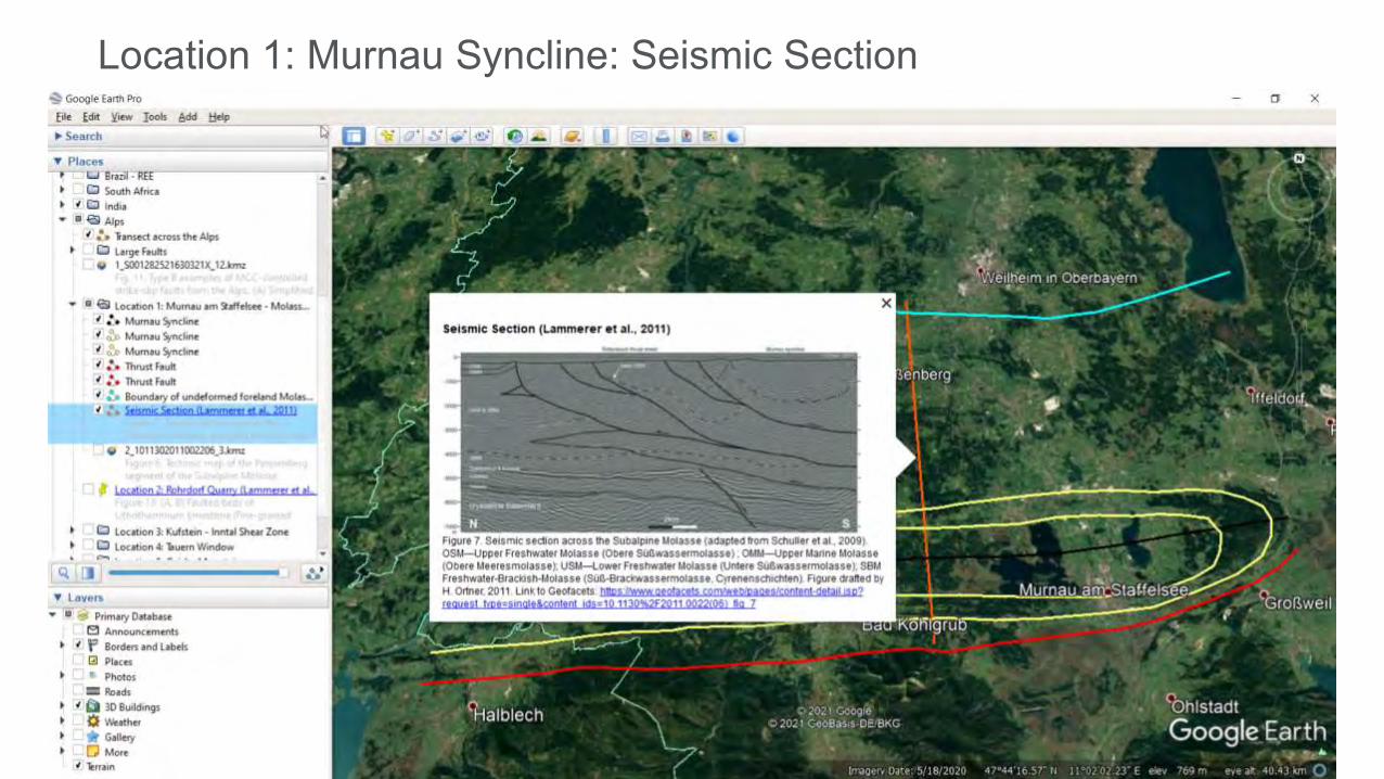
Location 1: Murnau Syncline: Seismic Section

Location 2: Rohrdorf Quarry

Location 3: Kuffstein, Inntal Shear Zone

Location 3: Kuffstein, Inntal Shear Zone

Location 3: Kuffstein, Inntal Shear Zone: Digitize Faults

Location 3: Kuffstein, Inntal Shear Zone: Street View

Location 3: Kuffstein, Inntal Shear Zone: Street View

Location 4: Tauern Window
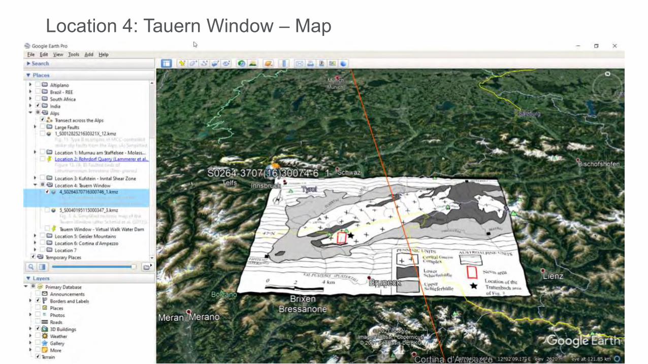
Location 4: Tauern Window – Map

Location 4: Tauern Window – Map

Location 4: Tauern Window – Virtual Walk

Location 4: Tauern Window – Virtual Walk

Location 5: Geisler Mountains

Location 5: Geisler Mountains – Map

Location 5: Geisler Mountains – Map

Location 5: Geisler Mountains – View

Location 5: Geisler Mountains – Outcrop
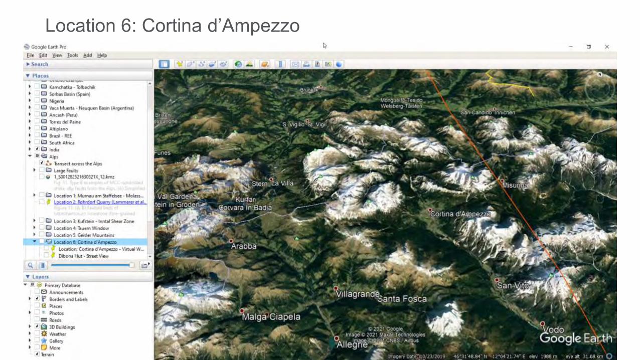
Location 6: Cortina d’Ampezzo
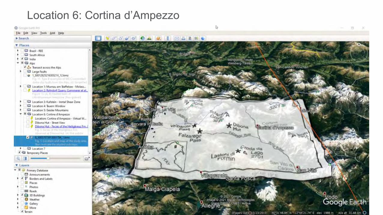
Location 6: Cortina d’Ampezzo

Location 6: Cortina d’Ampezzo – Virtual Walk

Location 6: Cortina d’Ampezzo – Virtual Walk

Location 6: Cortina d’Ampezzo – Virtual Walk

Location 6: Cortina d’Ampezzo – Dibona Hut Street View
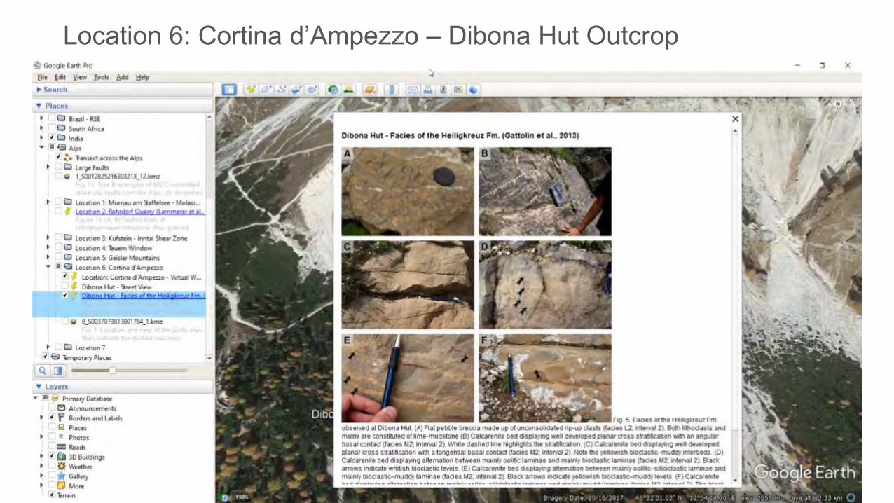
Location 6: Cortina d’Ampezzo – Dibona Hut Outcrop

Location 7: Montello Thrust

Location 7: Montello Thrust

Location 7: Montello Thrust

Location 7: Montello Thrust

Summary of the virtual transect across the Alps

Q&A
Dr. Sandra MertenSenior Product ManagerGeofacets @Elsevier
Marinus DijkstraSales Solution ManagerR&D Engineering and Geosciences @Elsevier

Thank you
ElsevierQ2 2021