effect of aridity and rainfall seasonality on vegetation in the southern tropics of east africa...
TRANSCRIPT

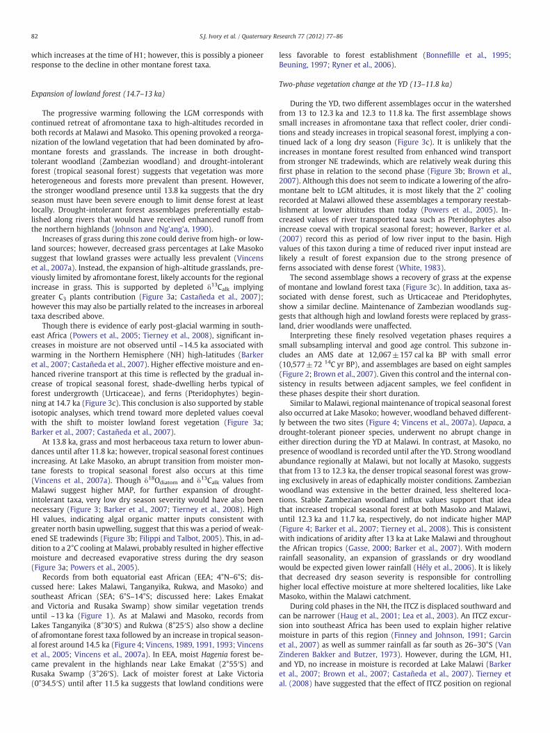
Quaternary Research 77 (2012) 77–86
Contents lists available at SciVerse ScienceDirect
Quaternary Research
j ourna l homepage: www.e lsev ie r .com/ locate /yqres
Effect of aridity and rainfall seasonality on vegetation in the southern tropics of EastAfrica during the Pleistocene/Holocene transition
Sarah J. Ivory a,⁎, Anne-Marie Lézine b, Annie Vincens c, Andrew S. Cohen a
a University of Arizona – Department of Geosciences, Tucson, AZ, USAb Laboratoire des Sciences du Climat et de l'Environnement, UMR 1572 CNRS, CEA UVSQ, Orme des Merisiers, 91191 Gif-sur-Yvette cedex, Francec CEREGE, UMR 6635 (CNRS, Université Aix-Marseille, IRD, CdF), BP 80, F-13545 Aix-en-Provence, cedex 04, France
⁎ Corresponding author. Fax: +1 520 621 2672.E-mail address: [email protected] (S.J. Ivory
0033-5894/$ – see front matter © 2011 University of Wdoi:10.1016/j.yqres.2011.11.005
a b s t r a c t
a r t i c l e i n f oArticle history:Received 3 November 2010Available online 5 December 2011
Keywords:Lake MalawiPalynologyYounger DryasDeglaciationITCZPollenTropical Africa
Fossil pollen analyses from northern Lake Malawi, southeast Africa, provide a high-resolution record ofvegetation change during the Pleistocene/Holocene transition (~18–9 ka). Recent studies of local vegetationfrom lowland sites have reported contrasting rainfall signals during the Younger Dryas (YD). The LakeMalawi record tracks regional vegetation changes and allows comparison with other tropical African recordsidentifying vegetation opening and local forest maintenance during the YD. Our record shows a gradual de-cline of afromontane vegetation at 18 ka. Around 14.5 ka, tropical seasonal forest and Zambezian miombowoodland became established. At ~13 ka, drier, more open formations gradually became prevalent. Althoughtropical seasonal forest taxa were still present in the watershed during the YD, this drought-intolerant foresttype was likely restricted to areas of favorable edaphic conditions along permanent waterways. The estab-lishment of drought-tolerant vegetation followed the reinforcement of southeasterly tradewinds resultingin a more pronounced dry winter season after ~11.8 ka. The onset of the driest, most open vegetation typewas coincident with a lake low stand at the beginning of the Holocene. This study demonstrates the impor-tance of global climate forcing and local geomorphological conditions in controlling vegetation distribution.
© 2011 University of Washington. Published by Elsevier Inc. All rights reserved.
Introduction
The African Tropics, which today play a major role in the globalhydrological cycle, have undergone tremendous changes over thelast 20,000 yr (Gasse, 2000). As the distribution of tropical Africanvegetation is largely constrained by regional hydrology, past climatechanges are often associated with reorganizations of biome distribu-tion (Gajewski et al., 2002; Gasse et al., 2008). However, vegetationresponse to climate change is poorly understood. Southeast Africanvegetation is particularly sensitive to changes in precipitation andrainfall seasonality (Hély et al., 2006) resulting from complex interac-tions between the African Monsoon, Intertropical Convergence Zone(ITCZ), and Congo Air Boundary (CAB; Figure 1; Leroux, 2001).Changes in regional vegetation recorded in high-resolution lake sedi-ment cores can serve as a useful tool for deciphering long-term as wellas abrupt seasonal changes in these important circulation patterns.
Though paleoclimate and vegetation records in tropical Africanduring the last glacial termination are in close agreement until~13 ka, changes during the Younger Dryas (YD) interval are unclearand vary regionally (Gasse et al., 2008). In much of North Africa,an abrupt return of aridity is observed resulting from a southward
).
ashington. Published by Elsevier In
ITCZ displacement, and vegetation cover was greatly reduced(Hooghiemstra, 1988; Zhao et al., 2000). In contrast, rainforestsremained significant until the early Holocene in coastal southwesternAfrica (Dupont and Behling, 2006).
Multi-proxy analysis of sediments covering the YD chronozone(13–11.8 ka) from Lake Malawi (9–14°S) have suggested a return todrier, cooler conditions and intense northeasterly (NE) tradewinds(Filippi and Talbot, 2005; Powers et al., 2005; Barker et al., 2007;Brown et al., 2007; Castañeda et al., 2007; Woltering et al., 2011).Although this points to climatic conditions in southeast Africa similarto those farther north, the vegetation record of the YD in southeastAfrica is not as straightforward. Recent studies from Lake Masoko(9°20′S; 840 m asl; Figure 1), a small maar lake within the Lake Ma-lawi watershed located less than 100 km from the northern lake-shore, document an expansion of tropical seasonal forest during theYD corresponding with a shortened dry season (Garcin et al., 2006,2007; Vincens et al., 2007a).
Because of the small size (b1 km2) and morphometry of LakeMasoko, it is difficult to differentiate local (b1 km2) from regional(>1 km2) signals in the pollen record. In order to understand thelocal increase in drought-intolerant forest given regionally drier con-ditions, comparison with a regional vegetation record is essential.However, until now Lake Masoko has provided the only continuoushigh-resolution record of vegetation capable of capturing abruptevents in southeast Africa during this climatic transition.
c. All rights reserved.

Figure 1. A) Map of Africa showing position of the Intertropical Convergence Zone (ITCZ) and the Congo Air Boundary (CAB) for January and July (top) and modern latitudinalextent of summer unimodal and bimodal rainfall regimes (bottom). The rectangle represents the East African field shown in part B. Upper part of the box shows equatorial eastAfrica (EEA) and lower part of the box shows southeast Africa (SEA). B) Map of east and southeast Africa showing sites of paleo-vegetation studies discussed in this article:1) Lake Victoria [Beuning, 1997], 2) Lake Emakat [Ryner et al., 2006], 3) Rusaka Swamp [Bonnefille et al., 1995], 4–5) Lake Tanganyika [SD14TAN and MPU12TAN; Vincens,1991; Vincens, 1993], 6) Lake Rukwa [Vincens et al., 2005], 7) Lake Masoko [Vincens et al., 2007a; Garcin et al., 2007], 8) Lake Malawi [this study]. Arrows are prevailing northeast-erly winds in the austral summer (clear heads and tails) and southeasterly winds in austral winter (solid heads and tails). Inset shows 1979–2010 NCEP/DOE Reanalysis-2 averagemonthly precipitation at Malawi versus Masoko over one annual cycle. Rectangle surrounds Lake Malawi as pictured in part C. C) Vegetation map adapted from White (1983) ofLake Malawi with location of core MAL05-2A (white dot).
78 S.J. Ivory et al. / Quaternary Research 77 (2012) 77–86
Lake Malawi drill core MAL05-2A sediments provide a continuous,high-resolution record of changing vegetation in a large watershed(65,000 km2) from 18 to 9 ka, which make this record conducive forcapturing both rapid and gradual environmental changes at a regionalscale (Brown et al., 2007). Lake Malawi is located at the modernsouthern extent of the ITCZ, rendering it climatically sensitive toshifts in atmospheric circulation observed by previous studies of theLake Malawi Scientific Drilling Project (Figure 1; Brown et al., 2007;Cohen et al., 2007; Scholz et al., 2007; Scholz et al., 2010).
Here pollen analyses are presented from the north basin of LakeMalawi in order to better understand the relationship between re-gional vegetation shifts and abrupt climatic events. The situation ofLake Masoko within the greater Malawi watershed and its proximity(~100 km) to the Malawi lakeshore ensures that both lakes are influ-enced by similar regional climatic conditions (Figure 1). In particular,the ongoing debate (Brown et al., 2007; 2008; Garcin, 2008) aboutthe effect of the YD on hydrology and vegetation distribution insoutheast Africa can be resolved by the comparison of our recordwith the signal observed at Lake Masoko.
Modern setting and implications for palynology
Lake Malawi is the southernmost lake in the East African Rift Val-ley and lies in a series of half-grabens. It is permanently stratified,with anoxic conditions below 250 m, and is drained by the ShireRiver to the south (Eccles, 1974). The watershed rises steeply fromthe lake (478 m asl) and is immediately bordered by mountains tothe north and west with elevations of 3000 m in the Rungwe High-lands and Nyika Plateau (Malawi Government, 1983).
The distribution of most vegetation in tropical Africa is controlledby rainfall and rainfall seasonality, although temperature is also aconstraint in high altitudes (Polhill, 1966; White, 1983; Hély et al.,2006). Within the Lake Malawi watershed, mean annual precipitation(MAP) ranges from 800 mm/yr in the lowlands to 2400 mm/yr on theslopes of Rungwe Highlands (Debusk, 1994). High rainfall in the high-lands feeds rivers that are an important source of pollen to the north-ern basin. A single rainy season occurs November–April whenprevailing surface winds are northeasterly (NE), marking the passageof the ITCZ (Figure 1). May–October is the dry season, dominated bystrong southeasterly (SE) tradewinds (Malawi Government, 1983).
Lowland vegetation surrounding Lake Malawi (b1500 m asl) iscomprised of both wetter and drier Zambezian woodlands, growingin areas with more or less than 1000 mm/yr, respectively (Figure 1;White, 1983). These low diversity woodlands include mainly decidu-ous species of Uapaca, Brachystegia, Isoberlinia, Julbernardia, and Com-bretaceae, all of which tolerate a long dry season (>6 months). Drierlocations display more open canopies and higher proportion ofgrasses and Combretaceae. Flooded grasslands with Cyperaceae andTypha are present at the lakeshore and along the Songwe River.Closed canopy, drought-intolerant tropical seasonal forests withtrees like Myrica, Macaranga, Ulmaceae, and Moraceae, and shade-loving herbs (Urticaceae) are not widespread but occur in the lowto mid-altitudes, in areas with moister edaphic conditions and poordrainage such as along streams (Polhill, 1966). Many species of fernare also common along rivers and streams. Above 1500 m, afromon-tane grasslands in areas north of the lake are interrupted by discon-tinuous patches of afromontane forests, whose composition varieswith rainfall. Olea capensis is typical of moister forest assemblages(1500–2000 mm/yr; 0–3 dry months) from 1500 to 2500 m, whereas

79S.J. Ivory et al. / Quaternary Research 77 (2012) 77–86
Podocarpus, Juniperus, Ericaceae and Olea africana are common above2000 m in drier sites (800–1700 mm/yr; ~4 dry months; White,1983). Grasslands are widespread at all elevations, but are concen-trated at the southern end of the lake where rainfall is lowest.
Although the watershed of the lake includes an area of65,000 km2, pollen flux is dominated by input from a smaller sourcearea. Prior taphonomic and pollen transport studies at Lake Malawihave shown that pollen is transported to the north basin throughwind or river input and is representative of the vegetation in thenorthern third of the watershed, about 20,000 km2 (DeBusk, 1997).Pollen from grassland and montane taxa are transported preferen-tially by seasonal winds whose strength varied during the late Pleis-tocene (Filippi and Talbot, 2005). Today, most wind-transportedpollen comes from the north during the austral summer when NE tra-dewinds predominate and the majority of plants flower. However,increased input from the south is possible during times of enhancedSE tradewinds. Tropical seasonal forest, aquatics, and Pteridophytesare preferentially transported by rivers draining the Rungwe High-lands and the Nyika Plateau (Songwe River and South Rukuru River,respectively; Patterson and Kachinjika, 1995; Debusk, 1997).
Methods
MAL05-2A was collected in 2005 (Figure 1; 10°1.1′S, 34°11.2′E;359 m water depth). Coring site, stratigraphy and age model detailsare provided elsewhere (Brown et al., 2007; Scholz et al., 2007). 40samples were counted from a 3-m section (6–9 m below lake floor[mblf]) chosen to bracket the YD interval, consisting mainly of diato-maceous silty clay. The age model of the upper 22 m is based on abest-fit second-order polynomial of 24 calibrated AMS 14C dates,four of which fall within our section (Figure 2; calibrated with “Fair-banks 0107” calibration curve [Fairbanks et al., 2005]). We processed1-cm3 samples using standard methods with the addition of Lycopo-dium spores and sieved at 10 μm (Faegri and Iversen, 1989). Averageresolution between samples is 208 yr but less than 100 yr from 14 to11 ka. At least 500 grains were counted per sample and no barrensamples were observed. Pollen from 215 taxa were indentified using
Figure 2. Pollen diagram of MAL05-2A percentages. Pollen sums are all taxa less aquatics, Bexaggerated 5 times. Other Montane grouping includes : Afrocrania volkensii, Anthospermumtype. Pollen zones are based on constrained cluster analysis (Grimm, 1987). AMS dates thatthe diagram.
the African Pollen Database (APD: http://medias.obs-mip.fr/apd;Vincens et al., 2007b) and atlases of pollen morphology (e.g. Maley,1970; Bonnefille, 1971a,b; Bonnefille and Riollet, 1980). Pollen per-centages were calculated against a sum of all pollen and sporesminus undeterminable grains, aquatics, and Bryophytes, which werecalculated separately (Figure 2). Pollen influx rates (grains/cm2/yr)were calculated using the concentration values and sediment accu-mulation rates. We drew pollen diagrams using Tilia 1.0.1 (Grimm,1990) and determined zonation by constrained cluster analysisusing CONISS (Figure 2; Grimm, 1987). Non-significant variationsrecorded by the most characteristic taxa were smoothed by the useof five-sample running mean of pollen influx rates (Figure 3c). Pollentaxa assemblages described here are based on biomes outlined byVincens et al. (2006) for East African vegetation and Debusk (1994;1998) for Lake Malawi. Tropical seasonal forest and Zambezian wood-land are based on the grouping used by Garcin et al. (2007) at LakeMasoko for ease of comparison. A gap in samples exists from 15.5 to14.7 ka as no sediment remained in this interval after previous sub-sampling and is excluded from the pollen zones. The pollen data iscompared with geochemical analyses from this core (Zr:Ti; Brownet al., 2007) and the adjacent, previously studied piston cores fromthe Malawi north basin (Hydrogen Index [HI], δ13Calk, δ18Odiatom,TEX86; Filippi and Talbot, 2005; Powers et al., 2005; Barker et al.,2007; Castañeda et al., 2007).
Results
Pollen preservation is excellent throughout and concentrationsare high (mean=25,333 grains/cm3). Abundance of broken/reworked grains is never more than 4.6% but typically b1%. Our pollenstratigraphy is divided into three zones based on dominant vegeta-tion assemblages and further subdivided into subzones to illustratetrends in important taxa (Figure 2). Both percentages and influxvalues for prominent pollen taxa and vegetation assemblages willbe described in order to eliminate possible transport artifacts in thepercentage data (Figures 2, 3c).
ryophytes and undeterminable grains, which are calculated separately. Gray curves are, Dodonaea viscosa-type, Hagenia abyssinica, Ilex mitis, Nuxia/Ficalhoa, Prunus africana-are part of the age model and fall within the section are presented on the right side of


81S.J. Ivory et al. / Quaternary Research 77 (2012) 77–86
Zone 1: 18.1–15.5 ka
Subzone 1a (18.1–16.4 ka) shows both percentages and influxvalues dominated by afromontane taxa (Podocarpus, Ericaceae undiff.,Juniperus-type, Olea africana-type, Olea capensis-type, Other Mon-tane). These taxa are at their peak values (27%; 450 grains/cm2/yr)and stay relatively stable throughout this subzone. A strong presenceof Poaceae (36%; 520 grains/cm2/yr) indicates that grasses werewidespread. In addition, aquatic taxa and indicators of shorelineproximity, such as Typha, are at their maximum values (5%;8.4 grains/cm2/yr) but decline at the top of the subzone.
Subzone 1b (16.4–15.5 ka) shows the first major change in therecord. Afromontane taxa begin a steady decline (20%; 250 grains/cm2/yr) coincident with the expansion of tropical seasonal foresttaxa (3–7%; 20–60 grains/cm2/yr; Macaranga-type, Moraceae,Myrianthus-type holstii, Trema-type orientalis) and Zambezian wood-land pioneers (4–7%; 50–75 grains/cm2/yr; Brachystegia, Combreta-ceae, Uapaca). The first large peak of Urticaceae (1.4%; 19 grains/cm2/yr) occurs at the beginning of this subzone, linked with theexpansion of tropical seasonal forest.
Zone 2: 14.7–11.8 ka
Subzone 2a (14.7–13 ka) is marked by abundant grass (45%;650 grains/cm2/yr). Zambezian woodland percentages show agradual increase starting at ~14.5 ka. Afromontane abundances con-tinue to decline steadily (19–7%; 250–98 grains/cm2/yr). Tropicalseasonal forest (10%; 95 grains/cm2/yr) initially expands but remainsat relatively low values.
Subzone 2b (13–11.8 ka) brackets the YD interval, and influxvalues show a two-phase change in vegetation (Figure 3c). The firstphase lasts from 13 to 12.3 ka and is characterized by maximumvalues of tropical seasonal forest (167 grains/cm2/yr) and Urticaceae(26 grains/cm2/yr). A slight increase of afromontane taxa (163–250 grains/cm2/yr) and Pteridophytes (19–65 grains/cm2/yr) is alsoobserved. This increase in both lowland and montane forest taxa isat the expense of Poaceae, which reaches its lowest flux(232 grains/cm2/yr). The second phase, from 12.3 to 11.8 ka, ismarked by the decline of all taxa that reached peak values duringthe first phase in favor of Poaceae (454 grains/cm2/yr).
Zone 3: 11.8–9.5 ka
Subzone 3a (11.8–10.7 ka) is marked by a relatively rapid increasein Poaceae and its highest percentages (54%; 691 grains/cm2/yr).Gradual increases of Zambezian woodland (9–14%; 70–116 grains/cm2/yr) continue during this subzone. Tropical seasonal (13–6%;98–24 grains/cm2/yr) and afromontane forest (11–2%; 81–17 grains/cm2/yr) percentages decline gradually, and Pteridophytes (~1%;10 grains/cm2/yr) are nearly absent by the end of the record. Subzone3b (10.7–9.5 ka) is distinguished by a small increase of Zambezianwoodland (14–19%; 116–221 grains/cm2/yr) associated with a largercontribution of Combretaceae.
Interpretation and discussion
Decline of afromontane forest (18.1–15.5 ka)
Afromontane taxa dominated this first period along with indica-tors of freshwater flow (Figure 3c). Freezing conditions at higher
Figure 3. A) TEX86 temperature (Powers et al., 2005), δ13Calk (Castañeda et al., 2007), δ 18Od
2PG. B) Hydrogen Index (HI; M98-1P; M98-2PG; Filippi and Talbot, 2005) and Zr:Ti (MAL05-with five-point running mean of Poaceae, Afromontane [Podocarpus, Ericaceae undiff., Junipe[Brachystegia, Combretaceae, Uapaca], Tropical Seasonal Forest [Celtis, Macaranga-type, MoSolid lines are zone limits and dashed lines are subzone limits. Dark gray box indicate first Ysubzones 1b and 2a is due to no samples available in this interval.
altitudes, cooler lowland temperatures, and lower pCO2 caused mon-tane taxa to grow at a lower elevation than present allowing for closerproximity to the lakeshore (Jolly and Haxeltine, 1997; Street-Perrottet al., 1997; Wu et al., 2007). Previous pollen-derived estimates oflast glacial maximum (LGM) temperature in East Africa suggestedthat the lower montane forest limit descended to 600–900 m asl (rel-ative to ~1500 m asl modern; Coetzee, 1967; Livingstone, 1967;Debusk, 1994). However, low Podocarpus percentages (~5%) at LakeMasoko (840 m asl) suggest that the limit was near but still abovethis elevation (Vincens et al., 2007a). As Masoko receives no fluviallytransported pollen, this percentage indicates that montane forestsgrew within 25 km, based on studies of aerial transport of Podocarpusgrains (Vincens, 1983). Thus, montane forest likely grew at the upperend or even above the altitude suggested by earlier estimates. Ourplacement of the lower montane forest limit near 900 m asl, ratherthan as low as 600 m asl, is consistent with more recent TEX86
from Lake Malawi yielding a −3.5°C temperature anomaly relativeto modern for this period, much less than the previous pollen-derived estimates.
Close proximity of Masoko and Malawi ensures that the wind-transported montane fraction in both lakes is largely similar, thusthe difference at Malawi represents the fluvial contribution rangingfrom 15 to 35%. Due in part to anthropogenic forest clearance, mod-ern afromontane vegetation occurs in discontinuous patches of forestsurrounded by extensive high-altitude grasslands (White, 1983). Asa result, these afromontane pollen taxa in modern sediments fromthe north basin never exceed 14% (Debusk, 1997); however, soil sam-ples from within the forest range from 26 to 30% (Vincens et al.,2006). Similar high values in Malawi sediments from 18.1 to 14.7 ka(Figure 2; 20–40% of which 15–35% is via rivers) imply a composi-tional change of upper watershed vegetation such that afromontaneforests were more extensive and less fragmented than present. A re-duction of montane grasslands relative to today is also supported byδ13Calk from Malawi, a record of C3/C4 abundance from plant leafwaxes, suggesting predominantly C4 inputs at the very beginning ofthis record (Figure 3a; Castañeda et al., 2007). This implies lowlandgrass input, possibly from the Songwe River alluvial plain(Livingstone and Clayton, 1980).
During the gradual decline of afromontane taxa at Malawi, low-land forest and woodland pioneers begin to increase between 17and 16 ka (Figure 3c). At the same time, a dramatic rise of moistermontane taxa (mainly Olea capensis-type) is observed at Lake Masokobut not accompanied by an increase of Zambezian woodland. Thissuggests that the establishment of woodland was gradual throughoutthe Malawi watershed. This transition reflects rising temperature(~1°C/ka) and episodic wetting (McGlue et al., 2008; Powers et al.,2005; Barker et al., 2007). This is consistent with declining C4 inputto the core site (~ −5%; Castañeda et al., 2007) as well as continuedretreat of the afromontane belt (Figure 3).
Interestingly, subzone 1b (16.4–15.5 ka; Figure 2) is roughly coin-cident with the timing of Heinrich Event 1 (H1; Hemming, 2004).However, rather than the abrupt cooling and aridity recorded else-where in Africa and the tropics (Stager et al., 2011), this zone is in-stead defined by gradual increases in both lowland vegetation types(Zambezian woodland and tropical seasonal forest). Similar trendsare also observed at Lakes Tanganyika and Rukwa, implying thatthis is a regional vegetation change likely related to the slow temper-ature increase seen in the TEX86 record (Figure 3a; Vincens, 1991,1993; Vincens et al., 2005; Powers et al., 2005). One exception isOlea africana-type, the only component of the drier montane forest
iatom (Barker et al., 2007) from the north basin of Lake Malawi cores M98-1P and M98-2A; Brown et al., 2007) from the north basin of Lake Malawi. C) Influx values smoothedrus-type, Olea africana-type, Olea capensis-type, Other Montane], Zambezian Woodlandraceae, Myrianthus-type holstii, Trema-type orientalis], Urticaceae, and Pteridophytes.D vegetation phase, light gray box indicates second YD vegetation phase. Gap between
82 S.J. Ivory et al. / Quaternary Research 77 (2012) 77–86
which increases at the time of H1; however, this is possibly a pioneerresponse to the decline in other montane forest taxa.
Expansion of lowland forest (14.7–13 ka)
The progressive warming following the LGM corresponds withcontinued retreat of afromontane taxa to high-altitudes recorded inboth records at Malawi and Masoko. This opening provoked a reorga-nization of the lowland vegetation that had been dominated by afro-montane forests and grasslands. The increase in both drought-tolerant woodland (Zambezian woodland) and drought-intolerantforest (tropical seasonal forest) suggests that vegetation was moreheterogeneous and forests more prevalent than present. However,the stronger woodland presence until 13.8 ka suggests that the dryseason must have been severe enough to limit dense forest at leastlocally. Drought-intolerant forest assemblages preferentially estab-lished along rivers that would have received enhanced runoff fromthe northern highlands (Johnson and Ng'ang'a, 1990).
Increases of grass during this zone could derive from high- or low-land sources; however, decreased grass percentages at Lake Masokosuggest that lowland grasses were actually less prevalent (Vincenset al., 2007a). Instead, the expansion of high-altitude grasslands, pre-viously limited by afromontane forest, likely accounts for the regionalincrease in grass. This is supported by depleted δ13Calk implyinggreater C3 plants contribution (Figure 3a; Castañeda et al., 2007);however this may also be partially related to the increases in arborealtaxa described above.
Though there is evidence of early post-glacial warming in south-east Africa (Powers et al., 2005; Tierney et al., 2008), significant in-creases in moisture are not observed until ~14.5 ka associated withwarming in the Northern Hemisphere (NH) high-latitudes (Barkeret al., 2007; Castañeda et al., 2007). Higher effective moisture and en-hanced riverine transport at this time is reflected by the gradual in-crease of tropical seasonal forest, shade-dwelling herbs typical offorest undergrowth (Urticaceae), and ferns (Pteridophytes) begin-ning at 14.7 ka (Figure 3c). This conclusion is also supported by stableisotopic analyses, which trend toward more depleted values coevalwith the shift to moister lowland forest vegetation (Figure 3a;Barker et al., 2007; Castañeda et al., 2007).
At 13.8 ka, grass and most herbaceous taxa return to lower abun-dances until after 11.8 ka; however, tropical seasonal forest continuesincreasing. At Lake Masoko, an abrupt transition from moister mon-tane forests to tropical seasonal forest also occurs at this time(Vincens et al., 2007a). Though δ18Odiatom and δ13Calk values fromMalawi suggest higher MAP, for further expansion of drought-intolerant taxa, very low dry season severity would have also beennecessary (Figure 3; Barker et al., 2007; Tierney et al., 2008). HighHI values, indicating algal organic matter inputs consistent withgreater north basin upwelling, suggest that this was a period of weak-ened SE tradewinds (Figure 3b; Filippi and Talbot, 2005). This, in ad-dition to a 2°C cooling at Malawi, probably resulted in higher effectivemoisture and decreased evaporative stress during the dry season(Figure 3a; Powers et al., 2005).
Records from both equatorial east African (EEA; 4°N–6°S; dis-cussed here: Lakes Malawi, Tanganyika, Rukwa, and Masoko) andsoutheast African (SEA; 6°S–14°S; discussed here: Lakes Emakatand Victoria and Rusaka Swamp) show similar vegetation trendsuntil ~13 ka (Figure 1). As at Malawi and Masoko, records fromLakes Tanganyika (8°30′S) and Rukwa (8°25′S) also show a declineof afromontane forest taxa followed by an increase in tropical season-al forest around 14.5 ka (Figure 4; Vincens, 1989, 1991, 1993; Vincenset al., 2005; Vincens et al., 2007a). In EEA, moist Hagenia forest be-came prevalent in the highlands near Lake Emakat (2°55′S) andRusaka Swamp (3°26′S). Lack of moister forest at Lake Victoria(0°34.5′S) until after 11.5 ka suggests that lowland conditions were
less favorable to forest establishment (Bonnefille et al., 1995;Beuning, 1997; Ryner et al., 2006).
Two-phase vegetation change at the YD (13–11.8 ka)
During the YD, two different assemblages occur in the watershedfrom 13 to 12.3 ka and 12.3 to 11.8 ka. The first assemblage showssmall increases in afromontane taxa that reflect cooler, drier condi-tions and steady increases in tropical seasonal forest, implying a con-tinued lack of a long dry season (Figure 3c). It is unlikely that theincreases in montane forest resulted from enhanced wind transportfrom stronger NE tradewinds, which are relatively weak during thisfirst phase in relation to the second phase (Figure 3b; Brown et al.,2007). Although this does not seem to indicate a lowering of the afro-montane belt to LGM altitudes, it is most likely that the 2° coolingrecorded at Malawi allowed these assemblages a temporary reestab-lishment at lower altitudes than today (Powers et al., 2005). In-creased values of river transported taxa such as Pteridophytes alsoincrease coeval with tropical seasonal forest; however, Barker et al.(2007) record this as period of low river input to the basin. Highvalues of this taxon during a time of reduced river input instead arelikely a result of forest expansion due to the strong presence offerns associated with dense forest (White, 1983).
The second assemblage shows a recovery of grass at the expenseof montane and lowland forest taxa (Figure 3c). In addition, taxa as-sociated with dense forest, such as Urticaceae and Pteridophytes,show a similar decline. Maintenance of Zambezian woodlands sug-gests that although high and lowland forests were replaced by grass-land, drier woodlands were unaffected.
Interpreting these finely resolved vegetation phases requires asmall subsampling interval and good age control. This subzone in-cludes an AMS date at 12,067±157 cal ka BP with small error(10,577±72 14C yr BP), and assemblages are based on eight samples(Figure 2; Brown et al., 2007). Given this control and the internal con-sistency in results between adjacent samples, we feel confident inthese phases despite their short duration.
Similar to Malawi, regional maintenance of tropical seasonal forestalso occurred at Lake Masoko; however, woodland behaved different-ly between the two sites (Figure 4; Vincens et al., 2007a). Uapaca, adrought-tolerant pioneer species, underwent no abrupt change ineither direction during the YD at Malawi. In contrast, at Masoko, nopresence of woodland is recorded until after the YD. Strong woodlandabundance regionally at Malawi, but not locally at Masoko, suggeststhat from 13 to 12.3 ka, the denser tropical seasonal forest was grow-ing exclusively in areas of edaphically moister conditions. Zambezianwoodland was extensive in the better drained, less sheltered loca-tions. Stable Zambezian woodland influx values support that ideathat increased tropical seasonal forest at both Masoko and Malawi,until 12.3 ka and 11.7 ka, respectively, do not indicate higher MAP(Figure 4; Barker et al., 2007; Tierney et al., 2008). This is consistentwith indications of aridity after 13 ka at Lake Malawi and throughoutthe African tropics (Gasse, 2000; Barker et al., 2007). With modernrainfall seasonality, an expansion of grasslands or dry woodlandwould be expected given lower rainfall (Hély et al., 2006). It is likelythat decreased dry season severity is responsible for controllinghigher local effective moisture at more sheltered localities, like LakeMasoko, within the Malawi catchment.
During cold phases in the NH, the ITCZ is displaced southward andcan be narrower (Haug et al., 2001; Lea et al., 2003). An ITCZ excur-sion into southeast Africa has been used to explain higher relativemoisture in parts of this region (Finney and Johnson, 1991; Garcinet al., 2007) as well as summer rainfall as far south as 26–30°S (VanZinderen Bakker and Butzer, 1973). However, during the LGM, H1,and YD, no increase in moisture is recorded at Lake Malawi (Barkeret al., 2007; Brown et al., 2007; Castañeda et al., 2007). Tierney etal. (2008) have suggested that the effect of ITCZ position on regional

Figure 4. A) Pollen percentages of drought-intolerant tropical seasonal forest from 16.5 to 9 ka for sites in southeast Africa (Vincens, 1991, 1993; Vincens et al., 2005, 2007a).Bottom panel is Zr:Ti from the north basin of Lake Malawi (Brown et al., 2007). Gray box marked ‘NE’ represents northeast tradewind reinforcement. B) Pollen percentages ofdrought-tolerant Zambezian woodland from 16.5 to 9 ka for sites in southeast Africa (Vincens, 1991, 1993; Vincens et al., 2005, 2007a). Bottom panel is Hydrogen Index (HI)from the north basin of Lake Malawi (Filippi and Talbot, 2005). Gray boxes marked ‘SE’ represents southeast tradewind reinforcement.
83S.J. Ivory et al. / Quaternary Research 77 (2012) 77–86
hydrology is secondary to other controls, such as moisture advectionand monsoon strength. Due to decreases in Indian and Atlantic SSTsduring the YD, reduced latent heat flux and weak moisture advectionto the continent are in agreement with other indications of reducedMAP (Sonzogni et al., 1998; Schefuß et al., 2005).
Zr:Ti ratios from the MAL05-2A core, recording volcanoclasticinput from the Rungwe Highlands north of the core site rich in Zr,date the beginning of stronger NE trades to ~12.7 ka (Figure 3b;Brown et al., 2007). This suggests a southward ITCZ over Malawiacted to even out rainfall seasonality. In addition, a second 2°C tem-perature decrease at the beginning of this interval coupled withweaker SE tradewinds, indicated by HI, would have reduced evapo-transpiration during the dry season (Figure 3b; Filippi and Talbot,2005; Powers et al., 2005; Schefuß et al., 2005). In summary, despitelower MAP, the resulting change in rainfall seasonality and weakwinds created edaphically favorable conditions along rivers and inareas receiving runoff from the highlands, thereby allowing the per-sistence of drought-intolerant taxa until ~12.3 ka.
The impact of effective moisture on vegetation assemblages dur-ing the YD controlled by temperature, tradewind strength, and rain-fall seasonality is further illustrated during the second vegetationphase (Figure 3; 12.3–11.8 ka). After the peak of tropical seasonal for-est and Pteridophytes at the end of the first vegetation phase, both as-semblages began to decline gradually. The opposite is observed in thegrasses, which increased until the end of the record.
The decline of the drought-intolerant forest must have beencaused by one of three controls: an increase in rainfall seasonality, afurther decrease in MAP, or higher evaporative stress. A rainfall
seasonality change seems unlikely, as records of aridity in northernAfrica and relatively moister condition in South Africa suggest thatthe ITCZ remained in a southerly position throughout both vegetationphases (13–11.8 ka; Van Zinderen Bakker and Butzer, 1973; Gasse,2000). An even further decline in MAP is also not likely given relative-ly stable values of δ18Odiatom throughout the second phase (Figure 3a;Barker et al., 2007).
The most dramatic climatic change at this time is the maximumNE tradewinds intensification from ~12.3–11.8 ka (Figure 3; Brownet al., 2007; Talbot et al., 2007). It seems likely that further evapora-tive stress caused by stronger austral summer trades could have initi-ated the degradation of the drought-intolerant forest. Strongerevaporation could also explain the slight changes in the isotopic re-cords without any further change in MAP (Figure 3a).
We propose that from 13 to 12.3 ka, a more southerly ITCZcoupled with cooler temperatures reduced dry season severity atLake Malawi. This change allowed drought-intolerant tropical season-al forest to flourish despite reduced MAP. From 12.3 to 11.8 ka, en-hanced NE tradewinds promoted slow, progressive drying of thewatershed. The increased evaporative stress, coupled with lowMAP, caused a gradual retreat of tropical seasonal forest as localedaphically moist areas, such as Lake Masoko, passed critical thresh-olds and became rarer while runoff and river input simultaneouslydecreased.
From ~13 to 11.8 ka in East Africa, a complicated pattern devel-oped that illustrates the effects of a southward ITCZ and reducedMAP throughout the region (Gasse, 2000). In EEA, moist forest devel-opment was interrupted at ~13 ka, and grasslands expanded until

84 S.J. Ivory et al. / Quaternary Research 77 (2012) 77–86
11.5 ka when moister vegetation types returned during the Early Ho-locene (Bonnefille et al., 1995; Beuning, 1997; Ryner et al., 2006). Incontrast, in SEA, woodland and tropical seasonal forest continued todevelop until ~11.8 ka (Figure 4; Vincens et al., 2005, 2007a). Twocore records from the extreme north and south ends of Lake Tangan-yika highlight the different regional responses. In Tanganyika's northbasin (4°30′S), grassland expansion during the YD is similar to thepattern in EEA, while the south basin (8°30′S) experienced a transi-tion to Zambezian woodland after the YD as seen in SEA (Vincens,1991, 1993).
Though drought-intolerant species dominated locally at LakeMasoko until 11.7 ka, records from southern Lake Tanganyikaand at Lakes Rukwa and Malawi suggests the importance ofboth drought-tolerant and intolerant vegetation types in SEA. Ona regional scale, Zambezian woodland and grasslands were wide-spread after ~14.5 ka, long before the abrupt post-YD successionto dry woodland at Masoko. The later response at Masoko is prob-ably due to hydrological buffering by groundwater (Barker et al.,2003). The gradual regional decline of forest at Lake Malawi sig-nifies that a shorter dry season allowed some areas in the water-shed to remain sufficiently moist to sustain forest until the 11.7 katermination at Lake Masoko, when establishment of the driestconditions occurred.
Two regions of spatially coherent vegetation responses occurnorth and south of ~6°S despite uniformMAP decreases. A rainfall re-gime in SEA similar to what is observed today in EEA, with a bimodalpattern rather than a long, dry season and single rainy season, likelyoccurred. (Figure 5; Garcin et al., 2006, 2007; Vincens et al., 2007a).The deterioration of moist forest in EEA during the YD implies an op-posite change in rainfall repartition resulting in a longer dry seasonexacerbated by decreased MAP. The increase of grassland highlightsthe dependence of EEA moist forest vegetation on the twice-yearlyITCZ passage.
Rise of woodland/grassland (11.8–9.5 ka)
A substantial increase of grass occurred at Lake Malawi during theearly Holocene around 11.8 ka (Figure 3c). This important change
Figure 5. A) Modern latitudinal extent of summer unimodal and bimodal rainfall zones inrainfall zones in tropical Africa during pollen subzone 2b from ~13 to 11.8 ka.
represents an opening of the vegetation that followed the progressivedecline of tropical seasonal forest, Urticaceae, and Pteridophytes. AtLake Masoko, the local, lowland vegetation change was more abruptand coincident with the reorganization of dominant surface windsover the lake (Figure 4; Filippi and Talbot, 2005).
The reinforcement of the dry season SE tradewinds, as indicatedby low HI values (Figure 3b), marked the beginning of a−100 m low-stand at Malawi from 11.8 to 10.3 ka, out of phase with other EastAfrican lakes (Gasse, 2000; Johnson et al., 2002; Barker et al., 2007).Higher rainfall north of 9°S at the beginning of the humid Early Holo-cene (DeMenocal et al., 2000; Tierney et al., 2008), suggests that theITCZ was displaced northward in response to insolation and high-latitude forcing. This extended the length of the dry season oversoutheast Africa, exacerbated by greater wind stress (Figure 3b;Filippi and Talbot, 2005; Tierney and Russell, 2007).
These conditions would have favored more drought-tolerant taxalike C4 grasses, Uapaca, and Combretaceae, a drier woodland taxonthat increases around 10.7 ka. Though C3 plant input began to in-crease during this period, it is likely that the expanding lowlandgrasses were predominantly C4 (Castañeda et al., 2007). The slow de-crease in δ13Calk is explained by increased C3 arboreal woodland taxain the lowland as well as an expansion of montane grasslands, as afro-montane forests reached their lowest abundance of the record(Figure 3).
Zambezian woodland diversified during the Early Holocenethroughout East Africa (Bonnefille et al., 1995; Ryner et al., 2006;Vincens et al., 2007a). At Malawi, δ18Odiatom and δ13Calk values be-came more depleted indicating higher MAP around 10.3 ka; how-ever, the tropical seasonal forest which characterized the deglacialinterval did not recover (Figure 3; Barker et al., 2007; Castañedaet al., 2007). The success of Zambezian woodland relative to tropicalseasonal forest in the Early Holocene supports the ideas that dryseason length rather than MAP is limiting to the later biome.Collins et al. (2011) have suggested that changes in ITCZ widthrather than mean position may not have been responsible for aridityin the tropics during northern hemisphere cold periods; however,this cannot explain the change in rainfall seasonality observedover SEA during the last deglaciation.
tropical Africa. B) Pollen-inferred latitudinal extent of summer unimodal and bimodal

85S.J. Ivory et al. / Quaternary Research 77 (2012) 77–86
Conclusions
Our vegetation record shows a regional signal of high montanetaxa abundances that diminish following the LGM. We suggest a low-ering of the tree-line to ~900 m asl, less than previously proposed.In addition, an expanded arboreal component of the afromontanebiome occurred.
This study highlights the importance of local conditions and rain-fall seasonality in maintaining vegetation. Tropical seasonal forestbegan to increase at 14.5 ka and continued to expand in SEA duringthe first part of the YD. Despite regional aridity, drought-intolerantassemblages were maintained because of reduced evaporativestress, which allowed for moister edaphic conditions in parts ofthe watershed. From 12.3 to 11.8 ka, a reinforcement of the NE trade-winds caused a slow opening of the lowland vegetation and replace-ment of drought-intolerant tropical seasonal forest by grasslandand woodland.
The local signal at Lake Masoko compared with the Malawi re-gional signal supports the notion that drought-intolerant vegetationpersisted in the midst of aridity as a result of optimal geographic loca-tion. These records suggest decreased rainfall seasonality and dryseason severity from ~14.5 to 11.8 ka. Our record shows that whereasreductions in rainfall and evaporative stress from intense windscaused a gradual forest decline beginning at ~12.3 ka affecting well-drained areas, the change in rainfall seasonality at 11.8 ka to moremodern long dry season resulted in a rapid conversion from forestto woodland of even relatively buffered moist edaphic locations.
The YD in SEA illustrates that although rainfall is a primary controlon vegetation distribution, other factors, such as wind, temperature,and local setting, all contribute to overall effective moisture on thelandscape and cannot be ignored. Clearly, the interpretation of paly-nological records, as well as predictions of future vegetation changes,should be viewed in terms of a complex system rather than simplephysiological responses to temperature or MAP. In addition, the com-parison of local versus regional records helps us to discern environ-mental responses to regional and local hydrologic thresholds.
Acknowledgments
We thank the National Science Foundation for fellowship funding(2009078688) and the Lake Malawi Drilling Project-Earth SystemHistory Program (NSF-EAR-0602404). Thanks to Jean-Pierre Cazet,Guillaume Buchet, Owen Davis, and John Logan for help with sampleprocessing and pollen identification, Michael McGlue for discussions/maps, and the National Lacustrine Core Repository (LacCore) at theUniversity of Minnesota for sub-sampling and core curation.
References
Barker, P., Leng, M.J., Gasse, F., Huang, Y., 2007. Century-to-millennial scale climaticvariability in Lake Malawi revealed by isotope records. Earth and Planetary ScienceLetters 261, 93–103.
Barker, P., Williamson, D., Gasse, F., Gibert, E., 2003. Climatic and volcanic forcingrevealed in a 50,000-year diatom record from Lake Massoko, Tanzania. QuaternaryResearch 60, 368–376.
Beuning, K.R.M., 1997. Late-glacial and holocene vegetation, climate and hydrology ofLakes Albert and Victoria, East Africa. PhD Thesis, University of Minnesota.
Bonnefille, R., 1971a. Atlas des pollens d'Ethiopie, principales espèces des forêts demontagne. Pollen et Spores 13, 15–72.
Bonnefille, R., 1971b. Atlas des pollens d'Éthiopie. Pollens actuels de la Basse Vallée del'Omo, récoltes botaniques 1968. Adansonia 2, 463–518.
Bonnefille, R., Riollet, G., 1980. Pollens des savanes d'Afrique orientale. CNRS, Paris.Bonnefille, R., Riollet, G., Buchet, G., Icole, M., LaFont, R., Arnold, M., Jolly, D., 1995.
Glacial–interglacial record from intertropical Africa, high resolution pollen andcarbon data at Rusaka, Burundi. Quaternary Science Reviews 14, 917–936.
Brown, E.T., Johnson, T.C., Scholz, C.A., Cohen, A.S., King, J.W., 2007. Abrupt change intropical African climate linked to the bipolar seesaw over the past 55,000 years.Geophysical Research Letters 34, L20702.
Brown, E.T., Johnson, T.C., Scholz, C.A., Cohen, A.S., King, J.W., 2008. Reply to commentby Yannick Garcin on “Abrupt change in tropical African climate linked to the bipo-lar seesaw over the past 55,000 years”. Geophysical Research Letters 35, L04702.
Castañeda, I.S., Werne, J.P., Johnson, T.C., 2007. Wet and arid phases in the southeastAfrican tropics since the Last Glacial Maximum. Geology 35, 823–826.
Coetzee, J.A., 1967. Pollen analytical studies in East and Southern Africa. Paleoecologyof Africa 3, 1–146.
Cohen, A.S., Stone, J.R., Beuning, K.R.M., Park, L., Reinthal, P., Dettman, D., Scholz, C.,Johnson, T., King, J., Talbot, M., Brown, E., Ivory, S., 2007. Ecological consequencesof early Late Pleistocene megadroughts in tropical Africa. Proceedings of the Na-tional Academy of Sciences 104, 16422–16427.
Collins, J., Schefuß, E., Heslop, D., Mulitza, S., Prange, M., Zabel, M., Tjallingii, R., Dokken,T., Huang, E., Mackensen, A., Schulz, M., Tian, J., Zarriess, M., Wefer, G., 2011. Inter-hemispheric symmetry of the tropical African rainbelt over the past 23,000 years.Nature Geoscience 4, 42–45.
DeBusk, G.H., 1994. Transport and stratigraphy of pollen in Lake Malawi, Africa. PhDThesis, Duke University.
DeBusk, G.H., 1997. The distribution of pollen in the surface sediments of Lake Malawi,Africa, and the transport of pollen in large lakes. Review of Palaeobotany and Pal-ynology 97, 123–153.
DeBusk, G.H., 1998. A 37,500-year pollen record from Lake Malawi and implications forthe biogeography of afromontane forests. Journal of Biogeography 25, 479–500.
DeMenocal, P., Ortiz, J., Guilderson, T., Sarnthein, M., 2000. Abrupt onset and termina-tion of the African Humid Period: rapid climate responses to gradual insolationforcing. Quaternary Science Reviews 19, 347–361.
Dupont, L., Behling, H., 2006. Land–sea linkages during deglaciation: high-resolutionrecords from the eastern Atlantic off the coast of Namibia and Angola (ODP site1078). Quaternary International 148, 19–28.
Eccles, D.H., 1974. An outline of the physical limnology of Lake Malawi (Lake Nyasa).Limnology and Oceanography 19, 730–742.
Faegri, K., Iversen, J., 1989. Textbook of Pollen Analysis. Wiley, Chichester, UK.Fairbanks, R., Mortlock, R., Chiu, T., Cao, L., Kaplan, A., Guilderson, T., Fairbanks, T.,
Bloom, A., Grootes, P., Nadeau, M., 2005. Radiocarbon calibration curve spanning0 to 50,000 years BP based on paired 230Th/234U/238U and 14C dates on pristinecorals. Quaternary Science Reviews 25, 1781–1796.
Filippi, M.L., Talbot, M.R., 2005. The palaeolimnology of northern Lake Malawi overthe last 25 ka based upon the elemental and stable isotopic composition of sedi-mentary organic matter. Quaternary Science Reviews 24, 1303–1328.
Finney, B., Johnson, T., 1991. Sedimentation in Lake Malawi (East Africa) during the last10,000 years: a continuous paleoclimatic record from the southern tropics. Palaeo-geography, Palaeoclimatology, Palaeoecology 85, 351–366.
Gajewski, K., Lézine, A.M., Vincens, A., Delestan, A., Sawada, M., & the African PollenDatabase,, 2002. Modern climate–vegetation–pollen relations in Africa and adja-cent areas. Quaternary Science Reviews 21, 1611–1631.
Garcin, Y., 2008. Comment on “Abrupt change in tropical African climate linked to thebipolar seesaw over the past 55,000 years” by E. T. Brown, T. C. Johnson, C. A.Scholz, A. S. Cohen, and J. W. King. Geophysical Research Letters 35, L04701.
Garcin, Y., Vincens, A., Williamson, D., Buchet, G., Guiot, J., 2007. Abrupt resumption ofthe African Monsoon at the Younger Dryas–Holocene climatic transition. Quater-nary Science Reviews 26, 690–704.
Garcin, Y., Vincens, A., Williamson, D., Guiot, J., Buchet, G., 2006. Wet phases in tropicalsouthern Africa during the last glacial period. Geophysical Research Letters 33,L07703.
Gasse, F., 2000. Hydrological changes in the African tropics since the Last GlacialMaximum. Quaternary Science Reviews 19, 189–211.
Gasse, F., Chalié, F., Vincens, A.,Williams,M.A.,Williamson, D., 2008. Climatic patterns inequatorial and southern Africa from 30,000 to 10,000 years ago reconstructed fromterrestrial and near-shore proxy data. Quaternary Science Reviews 27, 2316–2340.
Grimm, E.C., 1987. CONISS: a FORTRAN 77 program for stratigraphically constrainedcluster analysis by the method of incremental sum of squares. Computers andGeosciences 13, 13–35.
Grimm, E., 1990. TILIA and TILIAGRAPH: PC spreadsheet and graphic software forpollen data. INQUA Holocene Working Groups on data-handling methods. News-letter 4, 5–7.
Haug, G., Hughen, K., Sigman, D., Peterson, L., Röhl, U., 2001. Southwardmigration of theintertropical convergence zone through the Holocene. Science 293, 1304–1308.
Hély, C., Bremond, L., Alleaume, S., Smith, B., Sykes, M., Guiot, J., 2006. Sensitivity of Af-rican biomes to changes in the precipitation regime. Global Ecology and Biogeogra-phy 15, 258–270.
Hemming, S.R., 2004. Heinrich events: Massive late Pleistocene detritus layers of theNorth Atlantic and their global climate imprint. Reviews of Geophysics 42, RG1005.
Hooghiemstra, H., 1988. Changes of major wind belts and vegetation zones in NW Af-rica 20,000–5000 yr B.P., as deduced from a marine pollen record near Cap Blanc.Reviews of Palaeobotany and Palynology 55, 101–140.
Johnson, T.C., Brown, E., McManus, J., Barry, S., Barker, P., Gasse, F., 2002. A high-resolution paleoclimate record spanning the past 25,000 years in southern eastAfrica. Science 296, 113–116.
Johnson, T.C., Ng'ang'a, P., 1990. Reflections on a Rift Lake. In: Katz, B.J. (Ed.), LacustrineBasin Exploration: American Association of Petroleum Geologists Memoir, 50, pp.113–135.
Jolly, D., Haxeltine, A., 1997. Effect of low glacial atmospheric CO2 on tropical Africanmontane vegetation. Science 276, 786–788.
Lea, D., Pak, D., Peterson, L., Hughen, K., 2003. Synchroneity of tropical and high-latitude Atlantic temperatures over the last glacial termination. Science 301,1361–1364.
Leroux, M., 2001. The Meteorology and Climate of Tropical Africa. Springer, Praxis Pub-lishing, London. (New York; Chichester, UK).
Livingstone, D.A., 1967. Postglacial vegetation of the Ruwenzori Mountains in equato-rial Africa. Ecological Monographs 37, 25–52.

86 S.J. Ivory et al. / Quaternary Research 77 (2012) 77–86
Livingstone, D.A., Clayton, W., 1980. An altitudinal cline in tropical African grass florasand its paleoecological significance. Quaternary Research 13, 392–402.
Malawi Government, 1983. The National Atlas of Malawi. National Atlas Committeeand Department of Surveys of Malawi. National Atlas Committee and Departmentof Surveys, Malawi.
Maley, J., 1970. Contributions à l'étude du bassin tchadien : atlas de pollens du Tchad.Bulletin du Jardin Botanique National de Belgique 40, 29–48.
McGlue, M., Lezzar, K., Cohen, A., Russell, J., Tiercelin, J., Felton, A., Mbede, E., Nkotagu,H., 2008. Seismic records of late Pleistocene aridity in Lake Tanganyika, tropicalEast Africa. Paleolimnology 40, 635–653.
Patterson, G., Kachinjika, O., 1995. Effect of wind-induced mixing on the vertical distri-bution of nutrients and phytoplankton in Lake Malawi. In: Menz, A. (Ed.), FisheryPotential and Productivity of the Pelagic Zone of Lake Malawi/Niassa. NaturalResources Institute, Chatham, UK.
Polhill, R.M., 1966. Flora of Tropical East Africa. In: Hubbard, C.E., Milne-Redhead, E.(Eds.), Crown Agents for Oversea Governments and Administrations, London.
Powers, L.A., Johnson, T.C., Werne, J.P., Castañeda, I., Hopmans, E., Sinninghe-Damste, J.,Schouten, S., 2005. Large temperature variability in the southern African tropicssince the Last Glacial Maximum. Geophysical Research Letters 32, L08706.
Ryner, M.A., Bonnefille, R., Holmgren, K., Muzuka, A., 2006. Vegetation changes inEmpakaai Crater, northern Tanzania, at 14,800–9300 cal yr BP. Review of Palaeo-botany and Palynology 140, 163–174.
Schefuß, E., Schouten, S., Schneider, R., 2005. Climatic controls on central African hy-drology during the past 20,000 years. Nature 437, 1003–1006.
Scholz, C.A., Johnson, T.C., Cohen, A.S., King, J., Peck, J., Overpeck, J., Talbot, M., Brown, E.,Kalindekafe, L., Amoako, P., Lyons, R., Shanahan, T., Castañeda, I., Heil, C., Forman,S., McHargue, L., Beuning, K., Gomez, J., Pierson, J., 2007. East African megadroughtsbetween 135 and 75 thousand years ago and bearing on early-modern human or-igins. Proceedings of the National Academy of Sciences 104, 16416–16421.
Scholz, C.A., Cohen, A.S., Johnson, T.C., King, J., Talbot, M.R., Brown, E.T., 2010. Scientificdrilling in the Great Rift Valley: The 2005 Lake Malawi Scientific Drilling Project -An overview of the past 145,000 years of climate variability in Southern Hemi-sphere East Africa. Palaeogeography, Palaeoclimatology, Palaeoecology 303, 3–19.
Sonzogni, C., Bard, E., Rostek, F., 1998. Tropical sea-surface temperatures during the lastglacial period: a view based on alkenones in Indian Ocean sediments. QuaternaryScience Reviews 17, 1185–1201.
Stager, J., Ryves, D., Chase, B., Pausata, F., 2011. Catastrophic drought in the Afro-Asianmonsoon region during Heinrich event 1. Science 311, 1299–1302.
Street-Perrott, F.A., Huang, Y., Perrott, R.A., Eglinton, G., Barker, P., Khelifa, L.B., Harkness,D., Olago, D., 1997. Impact of lower atmospheric CO2 on tropical mountain ecosys-tems. Science 278, 1422–1426.
Talbot, M., Filippi, M., Jensen, N., Tiercelin, J.-J., 2007. An abrupt change in the African mon-soon at the end of the Younger Dryas. Geochemistry, Geophysics, Geosystems 8, Q3005.
Tierney, J.E., Russell, J.M., 2007. Abrupt climate change in southeast tropical Africainfluenced by Indian monsoon variability and ITCZ migration. GeophysicalResearch Letters 34, L15709.
Tierney, J.E., Russell, J.M., Huang, Y., Sinninghe Damsté, J., Hopmans, E., Cohen, A., 2008.Northern hemisphere controls on tropical southeast African climate during thepast 60,000 years. Science 322, 252–255.
Van Zinderen Bakker, E., Butzer, K., 1973. Quaternary environmental changes in south-ern Africa. Soil Science 116, 236–248.
Vincens, A., 1983. Palynologie, environnements actuels et plio-pleistocènes à l'Est dulac Turkana (Kenya). PhD Thesis, University of Aix-Marseille II.
Vincens, A., 1989. Paleoenvironnements du bassin Nord-Tanganyika (Zaire, Burundi,Tanzanie) au cours des 13 derniers mille ans: Apport de la palynologie. Reviewof Palaeobotany and Palynology 61, 69–88.
Vincens, A., 1991. Late quaternary vegetation history of the South-Tanganyika basin.Climatic implications in South Central Africa. Palaeogeography, Palaeoclimatology,Palaeoecology 86, 207–226.
Vincens, A., 1993. Nouvelle séquence pollinique du lac Tanganyika: 30,000 ans d'his-toire botanique et climatique du bassin Nord. Review of Palaeobotany and Palynol-ogy 78, 381–394.
Vincens, A., Bremond, L., Brewer, S., Buchet, G., Dussouillez, P., 2006. Modern pollen-based biome reconstructions in East Africa expanded to southern Tanzania.Reviews of Palaeobotany and Palynology 140, 187–212.
Vincens, A., Buchet, G., Williamson, D., Taieb, M., 2005. A 23,000 yr pollen record fromLake Rukwa (8°S, SW Tanzania): new data on vegetation dynamics and climate inCentral Eastern Africa. Review of Palaeobotany and Palynology 137, 147–162.
Vincens, A., Garcin, Y., Buchet, G., 2007a. Influence of rainfall seasonality on Africanlowland vegetation during the late Quaternary: pollen evidence from Lake Masoko,Tanzania. Journal of Biogeography 34, 1274–1288.
Vincens, A., Lezine, A.-M., Buchet, G., Lewden, D., Le Thomas, A., and contributors,2007b. African pollen database inventory of tree and shrub pollen types. Reviewof Palaeobotany and Palynology 145, 135–141.
White, F., 1983. Vegetation of Africa—a descriptive memoir to accompany the Unesco/AETFAT/UNSO vegetation map of Africa. Natural Resources Research Report XX.UNESCO, Paris, France.
Woltering, M., Johnson, T., Werne, J., Schouten, S., Sinninghe Damste, J., 2011. Late Pleis-tocene temperature history of Southeast Africa: a TEX86 temperature record fromLake Malawi. Palaeogeography, Palaeoclimatology, Palaeoecology 303, 93–102.
Wu, H., Guiot, J., Brewer, S., Guo, Z., 2007. Climatic changes in Eurasia and Africa atthe last glacial maximum and mid-Holocene: reconstruction from pollen datausing inverse vegetation modeling. Climate Dynamics 29, 211–229.
Zhao, M., Eglinton, G., Haslett, S., Jordan, R., Sarnthein, M., Zhang, Z., 2000. Marineand terrestrial biomarker records for the last 35,000 years at ODP site 658C offNW Africa. Organic Geochemistry 31, 919–930.